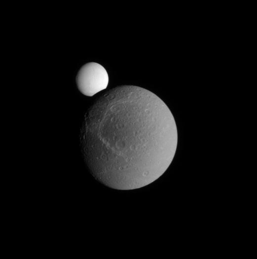
Occulting Enceladus
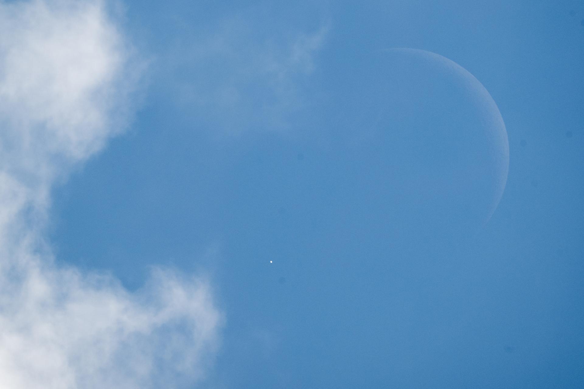
Venus is seen as disappears behind the Moon, at the start of occultation, on Wednesday, June 17, 2026, from the Mary W. Jackson NASA Headquarters building in Washington. The Moon occulted, or passed in front of, Venus for the first of three time this year. Photo Credit: (NASA/Joel Kowsky)
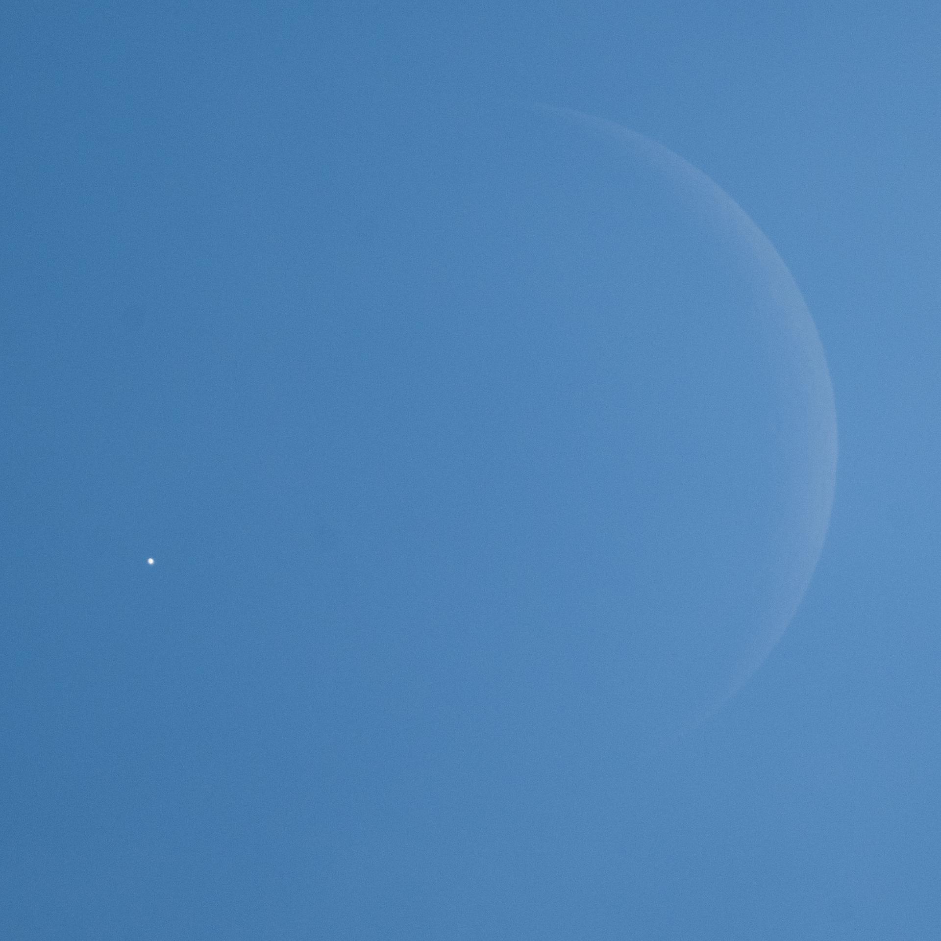
Venus is seen as disappears behind the Moon, at the start of occultation, on Wednesday, June 17, 2026, from the Mary W. Jackson NASA Headquarters building in Washington. The Moon occulted, or passed in front of, Venus for the first of three time this year. Photo Credit: (NASA/Joel Kowsky)
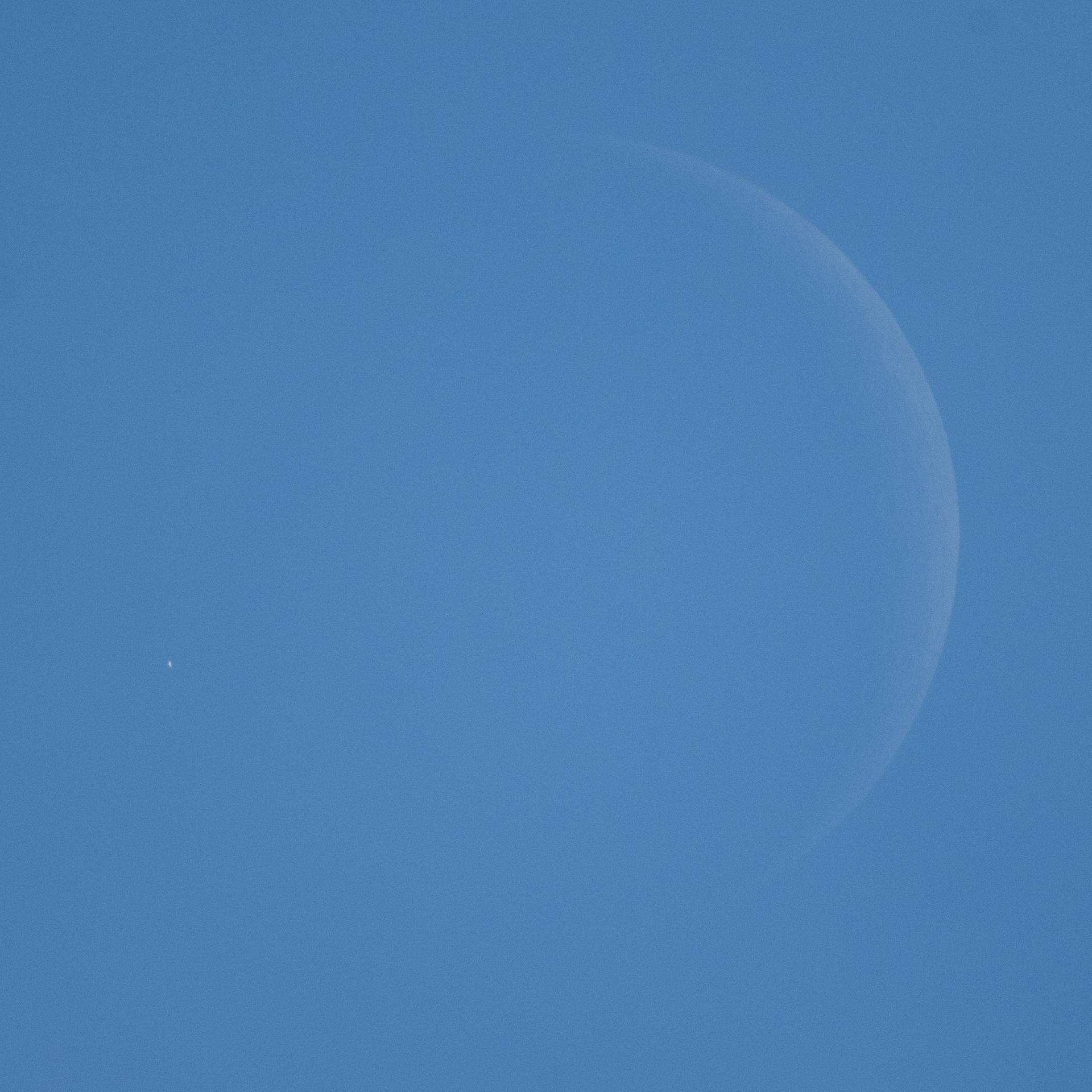
Venus is seen, during daylight, as it disappears behind the Moon, at the start of occultation, on Wednesday, June 17, 2026, from the Mary W. Jackson NASA Headquarters building in Washington. The Moon occulted, or passed in front of, Venus for the first of three time this year. Photo Credit: (NASA/Joel Kowsky)
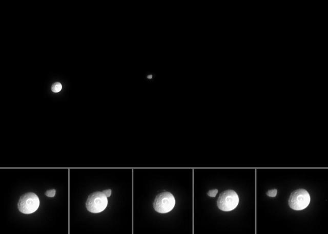
Mimas Occults Janus
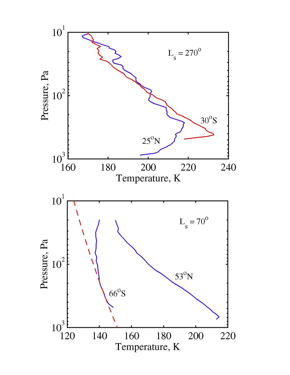
Radio-Occultation Profiles RS

Rings Occulting Titan
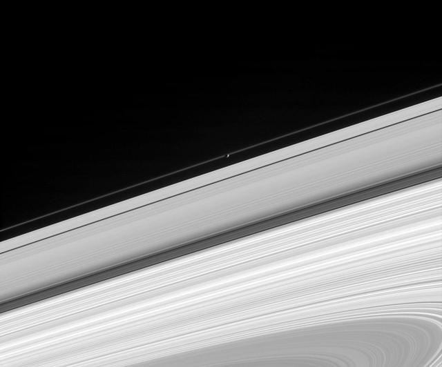
Pandora Occults the F Ring
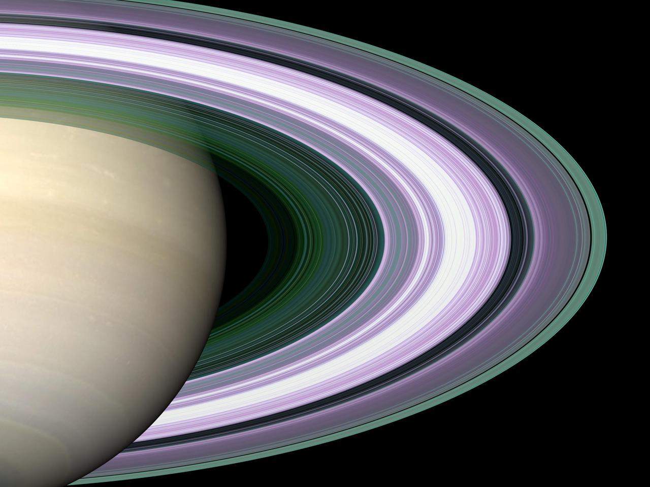
Radio Occultation: Unraveling Saturn Rings
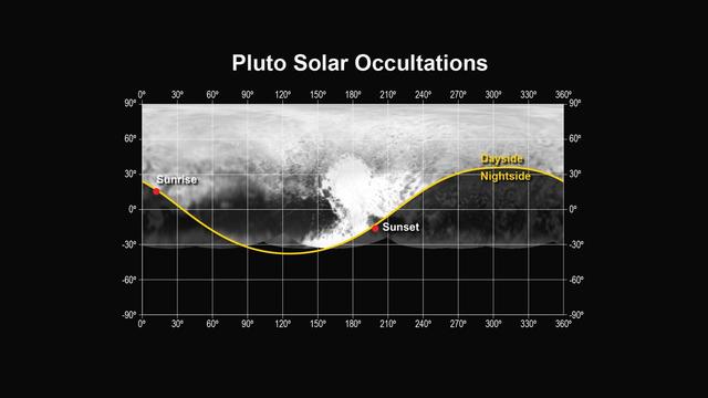
This figure shows the locations of the sunset and sunrise solar occultations observed by the Alice instrument on NASA New Horizons spacecraft.
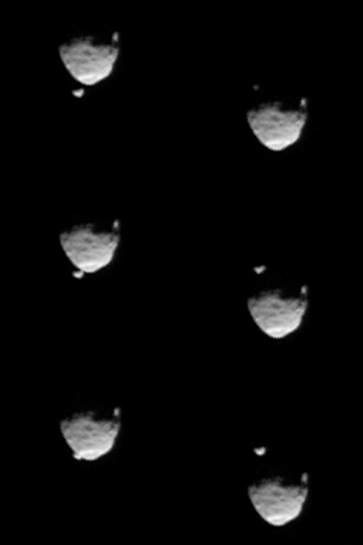
These six images from NASA Mars rover Curiosity show the two moons of Mars moments before left three and after right three the larger moon, Phobos, occulted Deimos on Aug. 1, 2013.
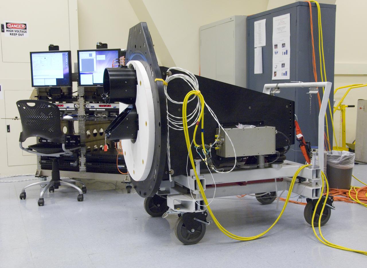
The Lowell Observatory's High-speed Imaging Photometer for Occultation rests on its dolly in the lab prior to installation on the SOFIA airborne observatory.
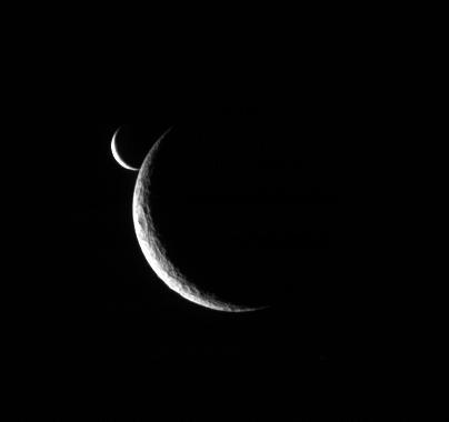
Two slim crescents smile toward the Cassini spacecraft following an occultation event
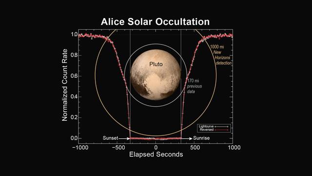
This figure shows how the Alice instrument count rate changed over time during the sunset and sunrise observations. The count rate is largest when the line of sight to the sun is outside of the atmosphere at the start and end times. Molecular nitrogen (N2) starts absorbing sunlight in the upper reaches of Pluto's atmosphere, decreasing as the spacecraft approaches the planet's shadow. As the occultation progresses, atmospheric methane and hydrocarbons can also absorb the sunlight and further decrease the count rate. When the spacecraft is totally in Pluto's shadow the count rate goes to zero. As the spacecraft emerges from Pluto's shadow into sunrise, the process is reversed. By plotting the observed count rate in the reverse time direction, it is seen that the atmospheres on opposite sides of Pluto are nearly identical. http://photojournal.jpl.nasa.gov/catalog/PIA19716
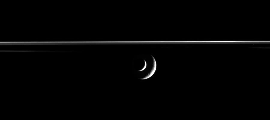
The bright crescent of Saturn moon Enceladus slides past distant Rhea in this mutual event, or occultation, movie from Cassini
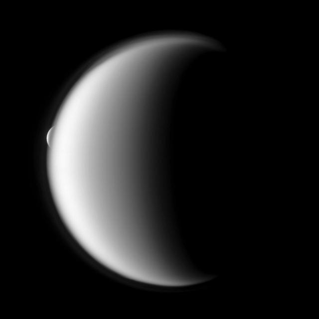
Rhea emerges after being occulted by the larger moon Titan in this image taken by NASA Cassini spacecraft.

S73-37251 (23 November 1973) --- Astronaut Bruce McCandless II, left, shows off a mock-up of the occulting disc for the T025 Coronagraph Contamination Measurement Engineering and Technology Experiment to be used by the crewmen of the third manned Skylab mission (Skylab 4), now into their eighth day in Earth orbit. On the right is flight director Neil B. Hutchinson. The men are in the Mission Operations Control Room (MOCR) of the Mission Control Center (MCC) at Johnson Space Center. Photo credit: NASA
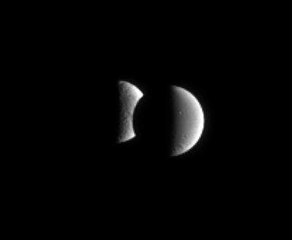
Dione steps in front of Tethys for a few minutes in an occultation, or mutual event. These events occur frequently for the Cassini spacecraft when it is orbiting close to the ringplane
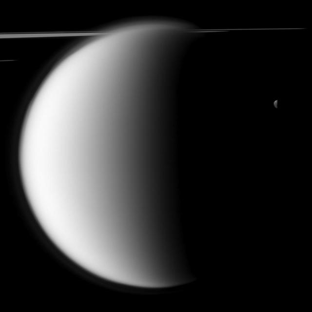
NASA Cassini spacecraft captures a mutual event between Titan and Mimas in front of a backdrop of the planet rings. This image was snapped shortly before Saturn largest moon passed in front of and occulted the small moon Mimas.
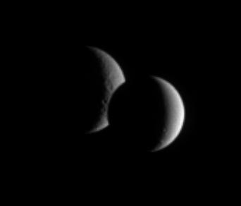
Dione and Rhea pair up for an occultation, or mutual event, as seen by Cassini. While the lit portion of each moon is but a crescent, the dark side of Dione has begun to take a bite out of its distant sibling moon
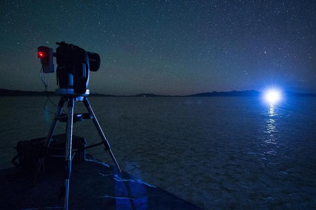
A night test of a small-scale starshade model, in a dry lake bed in central Nevada's Smith Creek by Northrup Grumman, took place in May to June 2014. A telescope points toward a bright light, which in the darkness of the desert mimics the conditions of starlight in space. Other lights, which are up to 10 million times fainter than the light source standing in for the star, represent the reflected light of planets. Telescopes searching for the relatively dim light of an exoplanet next to its much brighter star are faced with a challenge as difficult as searching from Los Angeles for a firefly in New York -- if the firefly is next to the brightness of a lighthouse. The tests by Northrup Grumman determined that a starshade, or external occulter, is capable of blocking starlight to a degree that can indeed reveal the light of a planet. http://photojournal.jpl.nasa.gov/catalog/PIA20901
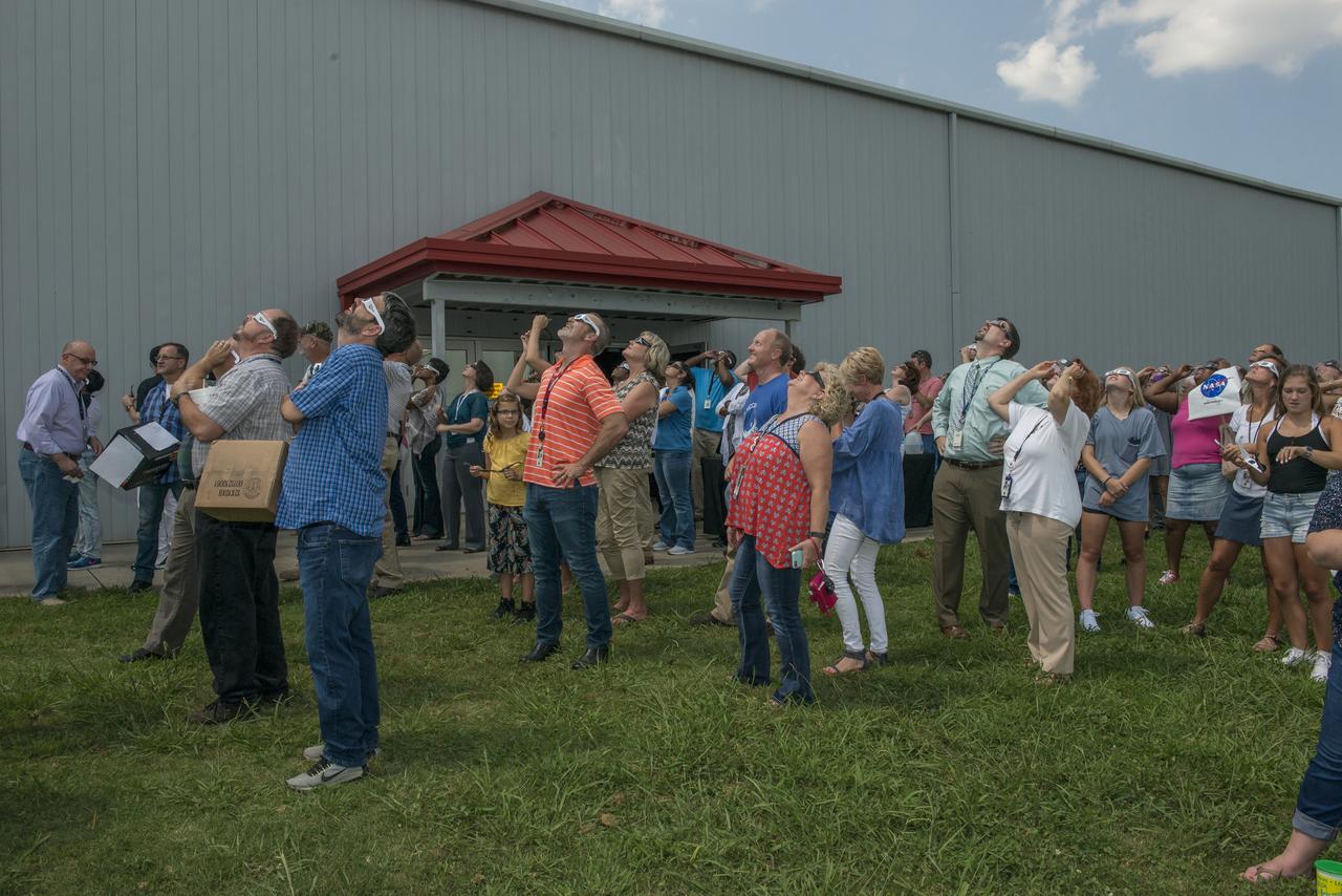
Marshall Space Flight Center employees view the August 21, 2017 solar eclipse at the center’s activities building. The Huntsville area experienced 97 percent occultation, nearly a complete blocking out of the sun by the orbit of Earth's moon. The next opportunity to view a solar eclipse in the eastern and central United States will occur in April 2024.
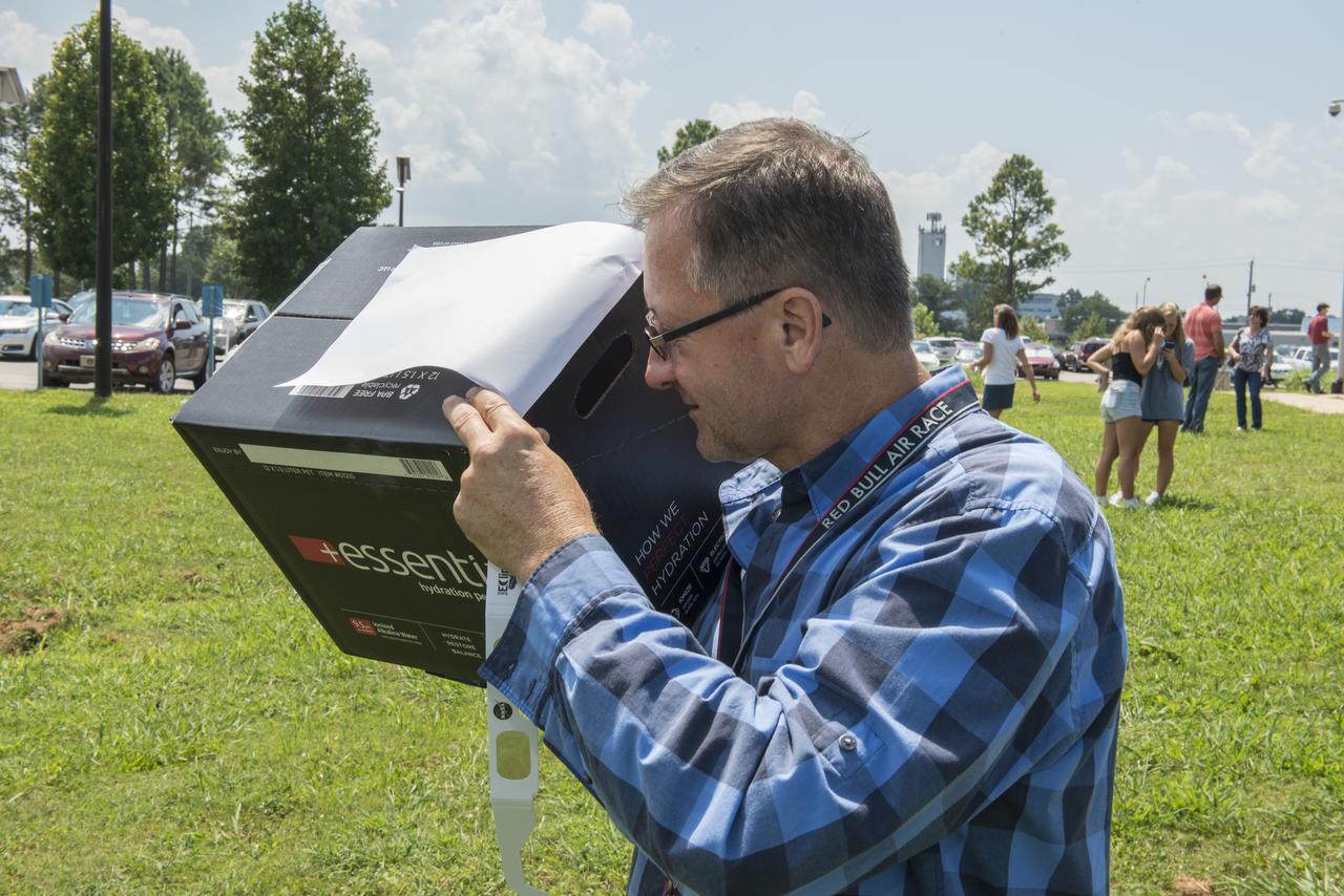
Marshall Space Flight Center employee, Phillip Domen, safely views the August 21, 2017 solar eclipse with his homemade viewing box. The Huntsville area experienced 97 percent occultation, nearly a complete blocking out of the sun by the orbit of Earth's moon. The next opportunity to view a solar eclipse in the eastern and central United States will occur in April 2024.
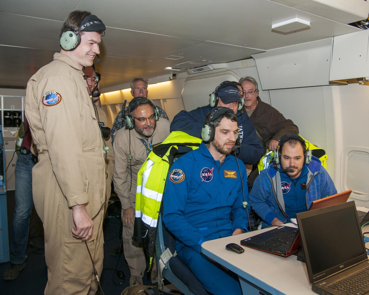
Scientists onboard SOFIA watch data come in from Pluto’s atmosphere as SOFIA flies into the shadow the dwarf planet cast on Earth’s surface during an eclipse-like event called an occultation. (Left to right standing): Holger Jakob, Thomas Roellig, (unknown who is hunched over), Jürgen Wolf, Nicholas Veronico (Left to right seated): Enrico Pfüller, Manuel Wiedemann
Brad Addona views the beginning of the August 21, 2017 at a viewing event for Marshall Space Flight Center’s activities building for Marshall employees. The Huntsville area experienced 97 percent occultation, nearly a complete blocking out of the sun by the orbit of Earth's moon. The next opportunity to view a solar eclipse in the eastern and central United States will occur in April 2024.
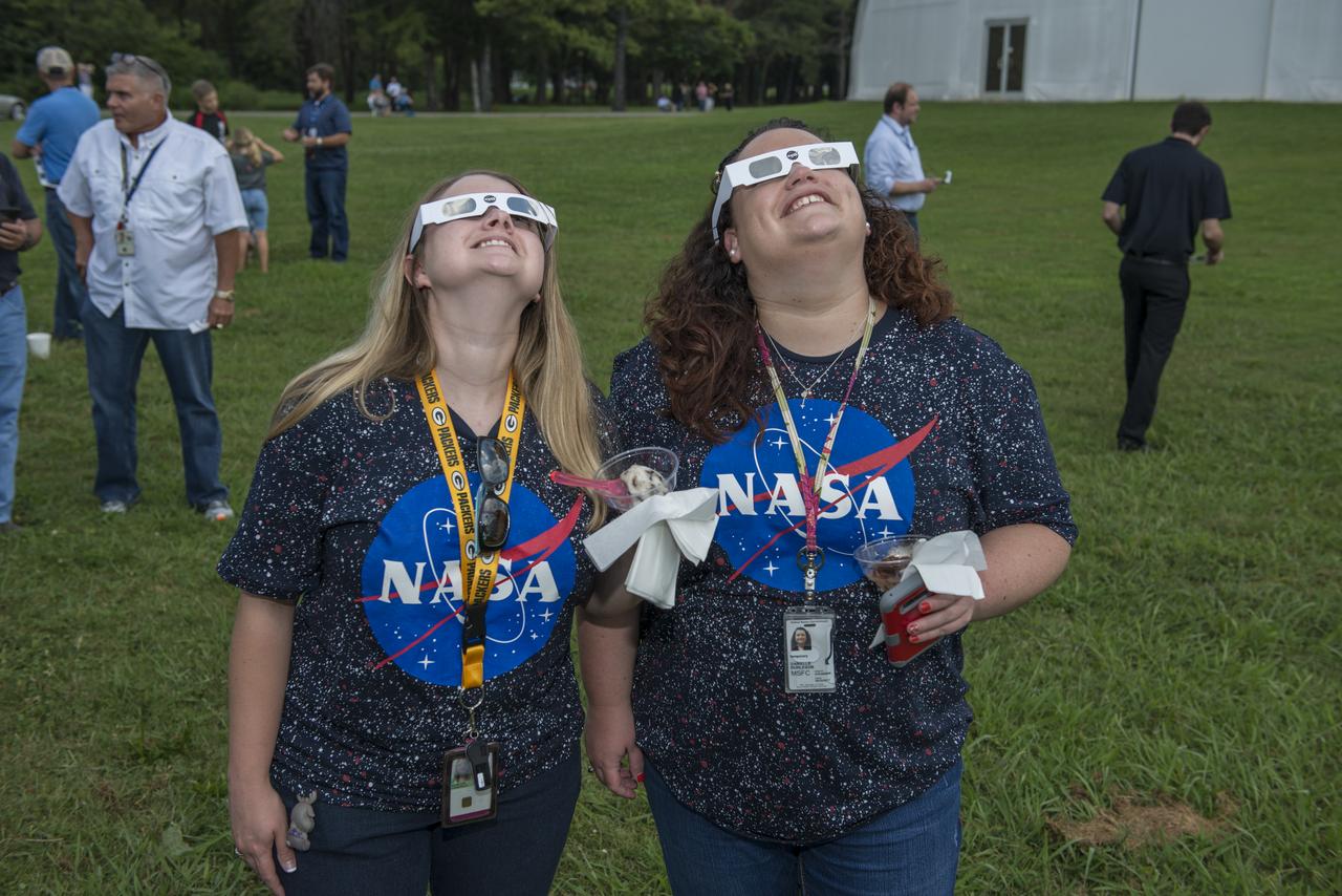
Krisdon Manecke and Danielle Burleson of the Office of the Chief Information Officer (OCIO) view the August 21, 2017 solar eclipse at the Marshall Space Flight Center’s viewing opportunity at the activities building. The Huntsville area experienced 97 percent occultation, nearly a complete blocking out of the sun by the orbit of Earth's moon. The next opportunity to view a solar eclipse in the eastern and central United States will occur in April 2024.

This 1970 photograph shows the flight unit for Skylab's White Light Coronagraph, an Apollo Telescope Mount (ATM) facility that photographed the solar corona in the visible light spectrum. A TV camera in the instrument provided real-time pictures of the occulted Sun to the astronauts at the control console and also transmitted the images to the ground. The Marshall Space Flight Center had program management responsibility for the development of Skylab hardware and experiments.
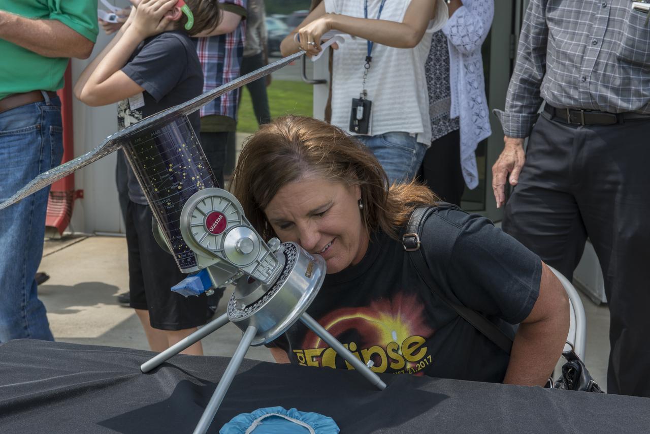
Judy Darwin of the Marshall Space Flight Center’s Office of the Chief Information Officer (CIO) views the August 21, 2017 solar eclipse through the telescope set up for Marshall employees. The Huntsville area experienced 97 percent occultation, nearly a complete blocking out of the sun by the orbit of Earth's moon. The next opportunity to view a solar eclipse in the eastern and central United States will occur in April 2024.
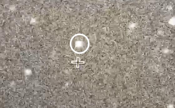
NASA's New Horizons team trained mobile telescopes on an unnamed star (circled) from a remote area of Argentina on July 17, 2017. A Kuiper Belt object 4.1 billion miles from Earth -- known as 2014 MU69 -- briefly blocked the light from the background star, in what's known as an occultation. The time difference between frames is 200 milliseconds, or 0.2 seconds. This data will help scientists better measure the shape, size and environment around the object. The New Horizons spacecraft will fly by this ancient relic of solar system formation on Jan. 1, 2019. It will be the most distant object ever explored by a spacecraft. A video is available at https://photojournal.jpl.nasa.gov/catalog/PIA21865
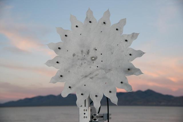
A test of a small-scale starshade model (58 cm), made from metal, in a dry lake bed in central Nevada's Smith Creek, took place from May to June 2014. Nineteen different versions of the miniaturized starshade were tested over five days. The tests revealed that a starshade, or external occulter, is capable of blocking starlight to a degree that reveals the relatively dim reflected light of a planet next to its brighter star. Like holding your hand up to block sunlight, the starshade works to block excessive starlight from the "eyes" of a space telescope like Hubble. http://photojournal.jpl.nasa.gov/catalog/PIA20902

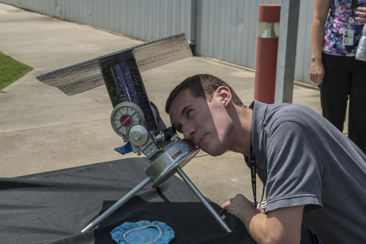
Robert Wilson of the Solar/Solar terrestrial Studies team at the National Space Science and Technology Center, a joint research and collaborative think tank partnership of the University of Alabama in Huntsville (UAH) and the Marshall Space Flight Center, adjusts his telescope which is set up as a viewing opportunity for MSFC employees prior to the August 21, 2017 solar eclipse event. The Huntsville area experienced 97 percent occultation, nearly a complete blocking out of the sun by the orbit of Earth's moon. The next opportunity to view a solar eclipse in the eastern and central United States will occur in April 2024.

Sylvester Dorsey III, avionics lead for the Europa Deorbit Stage Team in Marshall's Engineering Directorate, is joined during Marshall's eclipse-viewing event by his three children, from left, Sylvester IV, Sidney and Sakari. Though Huntsville was south of the path of totality, the Dorseys were among those awestruck by the natural phenomenon. The Huntsville area experienced 97 percent occultation, nearly a complete blocking out of the sun by the orbit of Earth's moon. The next opportunity to view a solar eclipse in the eastern and central United States will occur in April 2024.
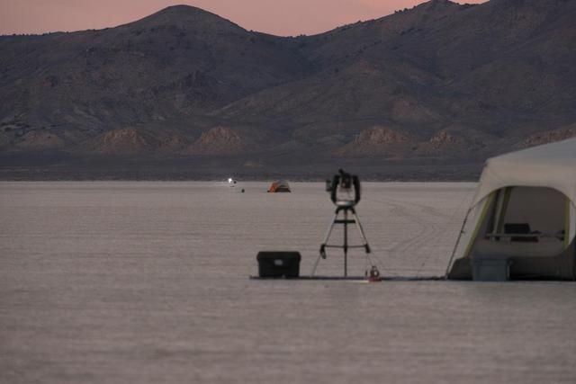
A test of a small-scale starshade model in a dry lake bed in central Nevada's Smith Creek by Northrup Grumman in May-June 2014. A telescope points toward a bright light, which mimics the conditions of starlight in space. Other lights, which are up to 10 million times fainter than the light source standing in for the star, represent the reflected light of planets. Telescopes searching for the relatively dim light of an exoplanet next to its much bright star are faced with a challenge as difficult as searching from Los Angeles for a firefly in New York– if the firefly is also beside a lighthouse. These tests determined that a starshade, or external occulter, is indeed capable of blocking starlight to a degree that reveals the light of a planet. http://photojournal.jpl.nasa.gov/catalog/PIA20908

This LASCO C2 image, taken 8 January 2002, shows a widely spreading coronal mass ejection (CME) as it blasts more than a billion tons of matter out into space at millions of kilometers per hour. The C2 image was turned 90 degrees so that the blast seems to be pointing down. An EIT 304 Angstrom image from a different day was enlarged and superimposed on the C2 image so that it filled the occulting disk for effect. Credit: NASA/GSFC/SOHO/ESA To learn more go to the SOHO website: <a href="http://sohowww.nascom.nasa.gov/home.html" rel="nofollow">sohowww.nascom.nasa.gov/home.html</a> To learn more about NASA's Sun Earth Day go here: <a href="http://sunearthday.nasa.gov/2010/index.php" rel="nofollow">sunearthday.nasa.gov/2010/index.php</a>
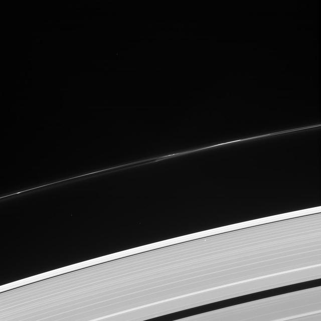
What's that bright point of light in the outer A ring? It's a star, bright enough to be visible through the ring! Quick, make a wish! This star -- seen in the lower right quadrant of the image -- was not captured by coincidence, it was part of a stellar occultation. By monitoring the brightness of stars as they pass behind the rings, scientists using this powerful observation technique can inspect detailed structures within the rings and how they vary with location. This view looks toward the sunlit side of the rings from about 44 degrees above the ringplane. The image was taken in visible light with the Cassini spacecraft narrow-angle camera on Oct. 8, 2013. The view was acquired at a distance of approximately 1.1 million miles (1.8 million kilometers) from the rings and at a Sun-Rings-Spacecraft, or phase, angle of 96 degrees. Image scale is 6.8 miles (11 kilometers) per pixel. http://photojournal.jpl.nasa.gov/catalog/PIA18297
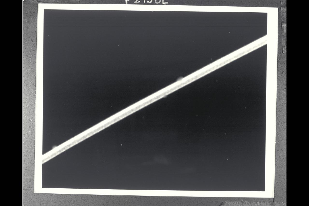
P-29506BW Range: 1.12 million kilometers (690,000 miles) This high-resolution image of the epsilon ring of Uranus is a clear-filter picture from Voyager's narrow-angle camera and has a resolution of about 10 km (6 mi). The epsilon ring, approx. 100 km (60 mi) wide at this location, clearly shows a structural variation. Visible here are a broad, bright outer component about 40 km (25 mi) wide; a darker, middle region of comparable width; and a narrow, bright inner strip about 15 km (9 mi) wide. The epsilon-ring structure seen by Voyager is similiar to that observed from the ground with stellar-occultation techniques. This frame represents the first Voyager image that resolves these features within the epsilon ring. The occasional fuzzy splotches on the outer and innerparts of the ring are artifacts left by the removal of reseau marks (used for making measurements on the image).
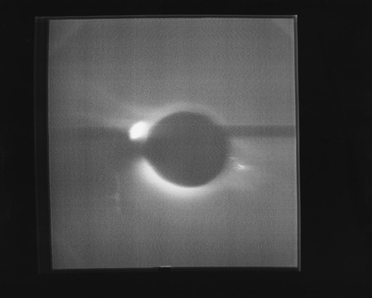
S74-15697 (17 Jan. 1974) --- The solar corona and a solar prominence as seen through the White Light Coronograph, Skylab Experiment S052, on Jan. 17, 1974. This view was reproduced from a television transmission made by a TV camera aboard the Skylab space station in Earth orbit. The bright spot is a burn in the vidicon. The solar corona is the halo around the sun which is normally visible only at the time of solar eclipse by the moon. The Skylab coronography uses an externally-mounted disk system which occults the brilliant solar surface while allowing the fainter radiation of the corona to enter an annulus and be photographed. A mirror system allows either TV viewing of the corona or photographic recording of the image. Photo credit: NASA

P-34679 Range : 2 million km. ( 1.2 million miles ) In this Voyager 2, wide-angle image, the two main rings of Neptune can be clearly seen. In the lower part of the frame, the originally-announced ring arc, consisting of three distinct features, is visible. This feature covers about 35 degrees of longitude and has yet to be radially resolved in Voyager Images. from higher resolution images it is known that this region contains much more material than the diffuse belts seen elsewhere in its orbit, which seem to encircle the planet. This is consistent with the fact that ground-based observations of stellar occultations by the rings show them to be very broken and clumpy. The more sensitive, wide-angle camera is revealing more widely distributed but fainter material. Each of these rings of material lies just outside of the orbit of a newly discovered moon. One of these moons, 1989N2, may be seen in the upper right corner. The moon is streaked by its orbital motion, whereas the stars in the frame are less smeared. the dark area around the bright moon and star are artifacts of the processing required to bring out the faint rings.

In this image from NASA's Voyager wide-angle taken on Aug. 23 1989, the two main rings of Neptune can be clearly seen. In the lower part of the frame the originally announced ring arc, consisting of three distinct features, is visible. This feature covers about 35 degrees of longitude and has yet to be radially resolved in Voyager images. From higher resolution images it is known that this region contains much more material than the diffuse belts seen elsewhere in its orbit, which seem to encircle the planet. This is consistent with the fact that ground-based observations of stellar occultations by the rings show them to be very broken and clumpy. The more sensitive wide-angle camera is revealing more widely distributed but fainter material. Each of these rings of material lies just outside of the orbit of a newly discovered moon. One of these moons, 1989N2, may be seen in the upper right corner. The moon is streaked by its orbital motion, whereas the stars in the frame are less smeared. The dark area around the bright moon and star are artifacts of the processing required to bring out the faint rings. This wide-angle image was taken from a range of 2 million kilometers (1.2 million miles), through the clear filter. http://photojournal.jpl.nasa.gov/catalog/PIA00053
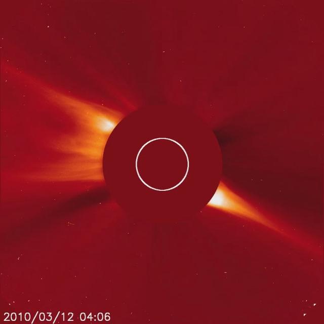
Captured March 12, 2010 The SOHO spacecraft captured a very bright, sungrazing comet as it rocketed towards the Sun (Mar. 12, 2010) and was vaporized. This comet is arguably the brightest comet that SOHO has observed since Comet McNaught in early 2007. The comet is believed to belong to the Kreutz family of comets that broke up from a much larger comet many hundreds of years ago. They are known to orbit close to the Sun. A coronal mass ejection (CME) burst away from the Sun during the bright comet’s approach. Interestingly, a much smaller comet that preceded this one can be seen about half a day earlier on just about the identical route. And another pair of small comets followed the same track into the Sun after the bright one. Such a string of comets has never been witnessed before by SOHO. SOHO's C3 coronagraph instrument blocks out the Sun with an occulting disk; the white circle represents the size of the Sun. The planet Mercury can also be seen moving from left to right just beneath the Sun. To learn more and to download the video and still images go here: <a href="http://sohowww.nascom.nasa.gov/pickoftheweek/old/15mar2010/" rel="nofollow">sohowww.nascom.nasa.gov/pickoftheweek/old/15mar2010/</a> Credit: NASA/GSFC/SOHO
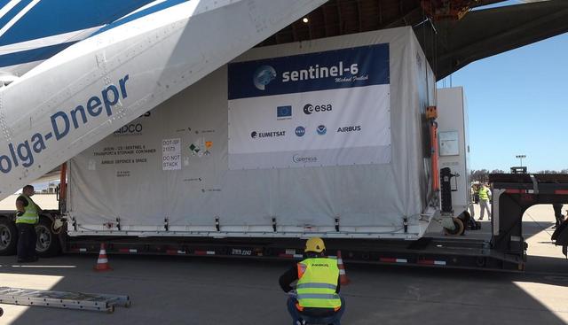
A shipping container containing the Sentinel-6 Michael Freilich satellite is removed from an Antonov 124 aircraft at Vandenberg Air Force Base in California on Sept. 24, 2020. The flight arrived at around 10:40 a.m. PDT (1:40 p.m. EDT) after a two-day journey from an IABG engineering facility near Munich, Germany. The ocean-monitoring satellite will undergo prelaunch tests before its scheduled launch on Nov. 10, 2020. Sentinel-6 Michael Freilich will begin a five-and-a-half-year mission to collect sea surface height measurements down to the centimeter for 90% of the world's oceans. The satellite is named after Dr. Michael Freilich, the former director of NASA's Earth Science Division and an instrumental figure in advancing ocean observations from space. Sentinel-6 Michael Freilich is one of two identical spacecraft that compose the Sentinel-6/Jason-CS (Continuity of Service) mission developed in partnership with ESA (the European Space Agency). ESA is developing the new Sentinel family of missions specifically to support the operational needs of the European Union's Copernicus program, the EU's Earth observation program managed by the European Commission. The spacecraft's twin, Sentinel-6B, will launch in 2025. Sentinel-6/Jason-CS is being jointly developed by ESA, the European Organisation for the Exploitation of Meteorological Satellites (EUMETSAT), NASA, and the National Oceanic and Atmospheric Administration, with funding support from the European Commission and technical support from France's National Centre for Space Studies (CNES). NASA JPL is contributing three science instruments for each Sentinel-6 satellite: the Advanced Microwave Radiometer, the Global Navigation Satellite System - Radio Occultation, and the Laser Retroreflector Array. NASA is also contributing launch services, ground systems supporting operation of the NASA science instruments, the science data processors for two of these instruments, and support for the international Ocean Surface Topography Science Team. https://photojournal.jpl.nasa.gov/catalog/PIA24103

A shipping container containing the Sentinel-6 Michael Freilich satellite is transported on a truck to the SpaceX payload processing facility at Vandenberg Air Force Base after arriving in California on Sept. 24, 2020. An Antonov aircraft carrying the spacecraft arrived at around 10:40 a.m. PDT (1:40 p.m. EDT) after a two-day journey from an IABG engineering facility near Munich, Germany. The ocean-monitoring satellite will undergo prelaunch tests before its scheduled launch on Nov. 10, 2020. Sentinel-6 Michael Freilich will begin a five-and-a-half-year mission to collect sea surface height measurements down to the centimeter for 90% of the world's oceans. The satellite is named after Dr. Michael Freilich, the former director of NASA's Earth Science Division and an instrumental figure in advancing ocean observations from space. Sentinel-6 Michael Freilich is one of two identical spacecraft that compose the Sentinel-6/Jason-CS (Continuity of Service) mission developed in partnership with ESA (the European Space Agency). ESA is developing the new Sentinel family of missions to support the operational needs of the European Union's Copernicus program, the EU's Earth observation program managed by the European Commission. The spacecraft's twin, Sentinel-6B, will launch in 2025. Sentinel-6/Jason-CS is being jointly developed by ESA, the European Organisation for the Exploitation of Meteorological Satellites (EUMETSAT), NASA, and the National Oceanic and Atmospheric Administration, with funding support from the European Commission and technical support from France's National Centre for Space Studies (CNES). JPL, a division of Caltech in Pasadena, is contributing three science instruments for each Sentinel-6 satellite: the Advanced Microwave Radiometer, the Global Navigation Satellite System - Radio Occultation, and the Laser Retroreflector Array. NASA is also contributing launch services, ground systems supporting operation of the NASA science instruments, the science data processors for two of these instruments, and support for the international Ocean Surface Topography Science Team. https://photojournal.jpl.nasa.gov/catalog/PIA24104
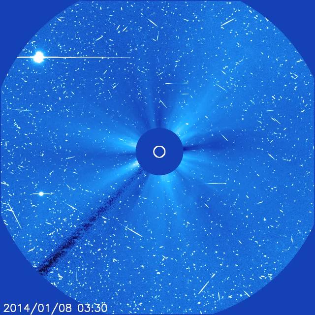
A solar magnetic active region containing the largest sunspot group of the last 10 years unleashed a large (X1.2) flare when it was facing right towards Earth. The flare was associated with a bright coronal mass ejection that emerges from the lower right (Jan. 7-8, 2014). A fast moving cloud of high-energy particles produced in the flare and at the CME front began striking the SOHO spacecraft imagers, creating the "snow" effect that went on for more than a day. SOHO is a million miles sunwards of Earth, and outside the earth's protective magnetosphere. In these coronagraph images the Sun is represented by the white circle and is blocked by an occulting disk, so we can observe fainter structures in the Sun's corona. Venus (upper left) enters the field of view during the video clip, while Mercury (lower left) is just about to leave the file of view. Credit: NASA/GSFC/SOHO <b><a href="http://www.nasa.gov/audience/formedia/features/MP_Photo_Guidelines.html" rel="nofollow">NASA image use policy.</a></b> <b><a href="http://www.nasa.gov/centers/goddard/home/index.html" rel="nofollow">NASA Goddard Space Flight Center</a></b> enables NASA’s mission through four scientific endeavors: Earth Science, Heliophysics, Solar System Exploration, and Astrophysics. Goddard plays a leading role in NASA’s accomplishments by contributing compelling scientific knowledge to advance the Agency’s mission. <b>Follow us on <a href="http://twitter.com/NASA_GoddardPix" rel="nofollow">Twitter</a></b> <b>Like us on <a href="http://www.facebook.com/pages/Greenbelt-MD/NASA-Goddard/395013845897?ref=tsd" rel="nofollow">Facebook</a></b> <b>Find us on <a href="http://instagram.com/nasagoddard?vm=grid" rel="nofollow">Instagram</a></b>
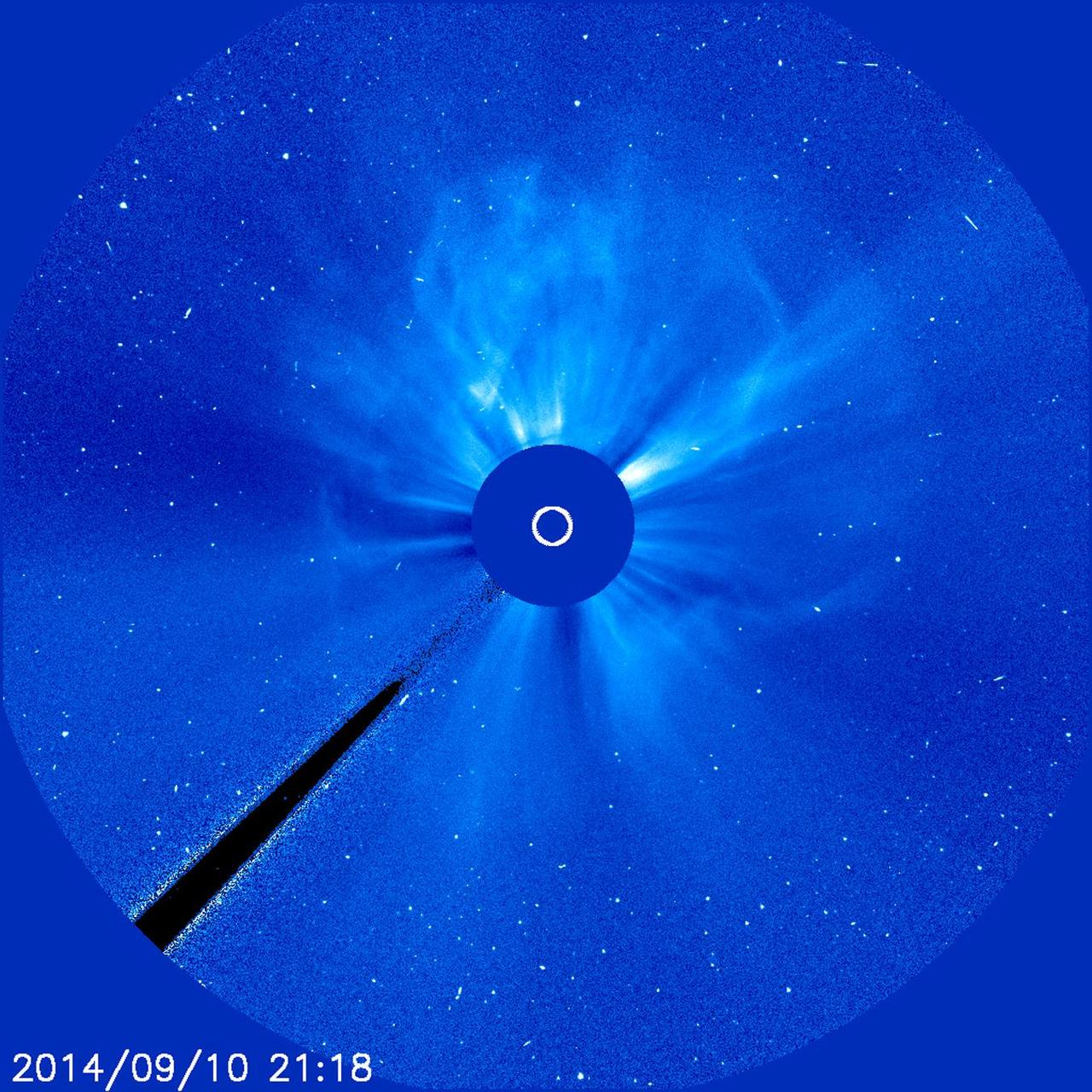
An active region just about squarely facing Earth erupted with an X 1.6 flare (largest class) as well as a coronal mass ejection (CME) on Sept. 10-11, 2014. This event featured both a long flare decay time and a storm of electrically charged, energetic particles. The particles can be seen as bright white specks scattering across the frames. The coronagraph movie shows the cloud of particles expanding in all directions as if it were creating a halo around the Sun. Data shows that the CME was heading towards Earth that could generate strong aurora displays several days later. In coronagraph images the Sun (represented by the small white circle in the center) is blocked by an occulting disk so that we can observe faint features in the corona and beyond. Credit: NASA/ESA/Goddard/SOHO <b><a href="http://www.nasa.gov/audience/formedia/features/MP_Photo_Guidelines.html" rel="nofollow">NASA image use policy.</a></b> <b><a href="http://www.nasa.gov/centers/goddard/home/index.html" rel="nofollow">NASA Goddard Space Flight Center</a></b> enables NASA’s mission through four scientific endeavors: Earth Science, Heliophysics, Solar System Exploration, and Astrophysics. Goddard plays a leading role in NASA’s accomplishments by contributing compelling scientific knowledge to advance the Agency’s mission. <b>Follow us on <a href="http://twitter.com/NASAGoddardPix" rel="nofollow">Twitter</a></b> <b>Like us on <a href="http://www.facebook.com/pages/Greenbelt-MD/NASA-Goddard/395013845897?ref=tsd" rel="nofollow">Facebook</a></b> <b>Find us on <a href="http://instagram.com/nasagoddard?vm=grid" rel="nofollow">Instagram</a></b>
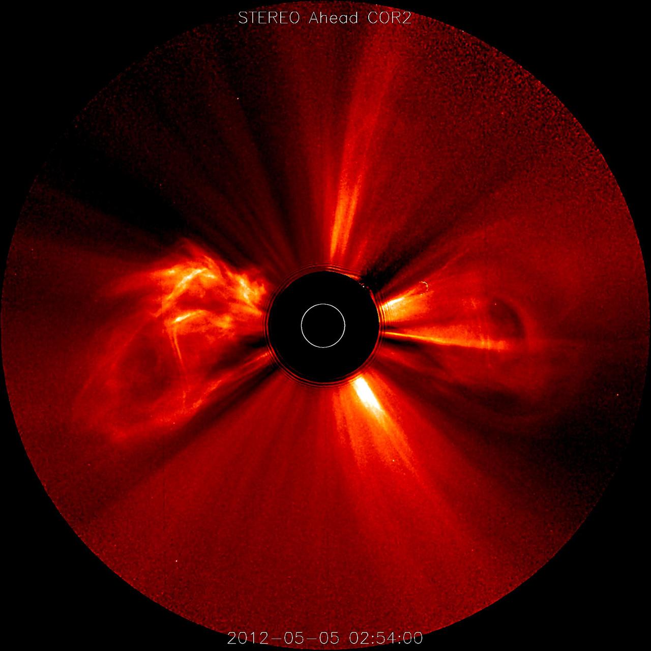
Nearly a dozen coronal mass ejections in less than four days (May 3-6, 2012) may serve as a reminder that the Sun is approaching its period of maximum activity, expected to peak next year. STEREO (Ahead) from its position over 100 degrees ahead of Earth, captured several major eruptions, with most of them heading way to the right (i.e., away from Earth). In these coronagraph images the Sun is represented by the white circle. The black occulting disk blocks out the Sun and some of the corona so that we can see the faint structures beyond that. Credit: NASA/GSFC/SOHO <b><a href="http://www.nasa.gov/audience/formedia/features/MP_Photo_Guidelines.html" rel="nofollow">NASA image use policy.</a></b> <b><a href="http://www.nasa.gov/centers/goddard/home/index.html" rel="nofollow">NASA Goddard Space Flight Center</a></b> enables NASA’s mission through four scientific endeavors: Earth Science, Heliophysics, Solar System Exploration, and Astrophysics. Goddard plays a leading role in NASA’s accomplishments by contributing compelling scientific knowledge to advance the Agency’s mission. <b>Follow us on <a href="http://twitter.com/NASA_GoddardPix" rel="nofollow">Twitter</a></b> <b>Like us on <a href="http://www.facebook.com/pages/Greenbelt-MD/NASA-Goddard/395013845897?ref=tsd" rel="nofollow">Facebook</a></b> <b>Find us on <a href="http://instagrid.me/nasagoddard/?vm=grid" rel="nofollow">Instagram</a></b>
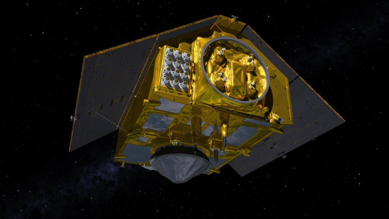
This illustration shows the rear of the Sentinel-6 Michael Freilich spacecraft in orbit above Earth with its deployable solar panels extended. As the world's latest ocean-monitoring satellite, it is launching on Nov. 10, 2020, to collect the most accurate data yet on global sea level and how our oceans are rising in response to climate change. The mission will also collect precise data of atmospheric temperature and humidity that will help improve weather forecasts and climate models. The conelike instrument on the bottom (Earth-facing side) of the spacecraft is the satellite's Poseidon-4 radar altimeter. When used with the Advanced Microwave Radiometer (AMR-C) attached to the front of the spacecraft, both instruments will be used to make precise measurements of sea surface height. The gray rectangle with 12 cones attached at the rear-left of the spacecraft is part of the Global Navigation Satellite System - Radio Occultation (GNSS-RO) instrument. Sentinel-6 Michael Freilich extends the near-30-year record of satellite measurements of sea level initiated by the U.S.-European TOPEX/Poseidon mission in 1992 and that continued with the Jason-1, 2, and 3 series of sea level observation satellites. Launched in 2016, Jason-3 is currently providing data. The satellite is named after Dr. Michael Freilich, the former director of NASA's Earth Science Division and an instrumental figure in advancing ocean observations from space. Sentinel-6 Michael Freilich is one of two identical spacecraft that compose the Sentinel-6/Jason-CS (Continuity of Service) mission developed in partnership with ESA (the European Space Agency). Other partners include the National Oceanic and Atmospheric Administration (NOAA), the intergovernmental European Organisation for the Exploitation of Meteorological Satellites (EUMETSAT), and France's National Centre for Space Studies (CNES). ESA is developing the new Sentinel family of missions to support the operational needs of the European Union's Copernicus program, the EU's Earth observation program managed by the European Commission. The spacecraft's twin, Sentinel-6B, will launch in 2025. https://photojournal.jpl.nasa.gov/catalog/PIA24107
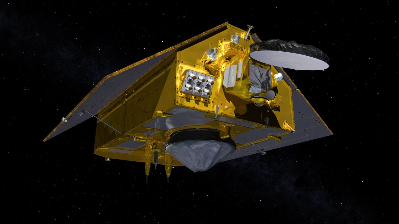
This illustration shows the front of the Sentinel-6 Michael Freilich spacecraft in orbit above Earth with its deployable solar panels extended. As the world's latest ocean-monitoring satellite, it is launching on Nov. 10, 2020, to collect the most accurate data yet on global sea level and how our oceans are rising in response to climate change. The mission will also collect precise data of atmospheric temperature and humidity that will help improve weather forecasts and climate models. The conelike instrument on the bottom (Earth-facing side) of the spacecraft is the satellite's Poseidon-4 radar altimeter. The disklike instrument at the front of the spacecraft is the Advanced Microwave Radiometer (AMR-C). Both instruments will be used together to measure ocean surface height. The gray rectangle with six cones attached at the front-left of the spacecraft is part of the Global Navigation Satellite System - Radio Occultation (GNSS-RO) instrument. Sentinel-6 Michael Freilich extends the near-30-year record of satellite measurements of sea level initiated by the U.S.-European TOPEX/Poseidon mission in 1992 and that continued with the Jason-1, 2, and 3 series of sea level observation satellites. Launched in 2016, Jason-3 is currently providing data. The satellite is named after Dr. Michael Freilich, the former director of NASA's Earth Science Division and an instrumental figure in advancing ocean observations from space. Sentinel-6 Michael Freilich is one of two identical spacecraft that compose the Sentinel-6/Jason-CS (Continuity of Service) mission developed in partnership with ESA (the European Space Agency). Other partners include the National Oceanic and Atmospheric Administration (NOAA), the intergovernmental European Organisation for the Exploitation of Meteorological Satellites (EUMETSAT), and France's National Centre for Space Studies (CNES). ESA is developing the new Sentinel family of missions to support the operational needs of the European Union's Copernicus program, the EU's Earth observation program managed by the European Commission. The spacecraft's twin, Sentinel-6B, will launch in 2025. https://photojournal.jpl.nasa.gov/catalog/PIA24106
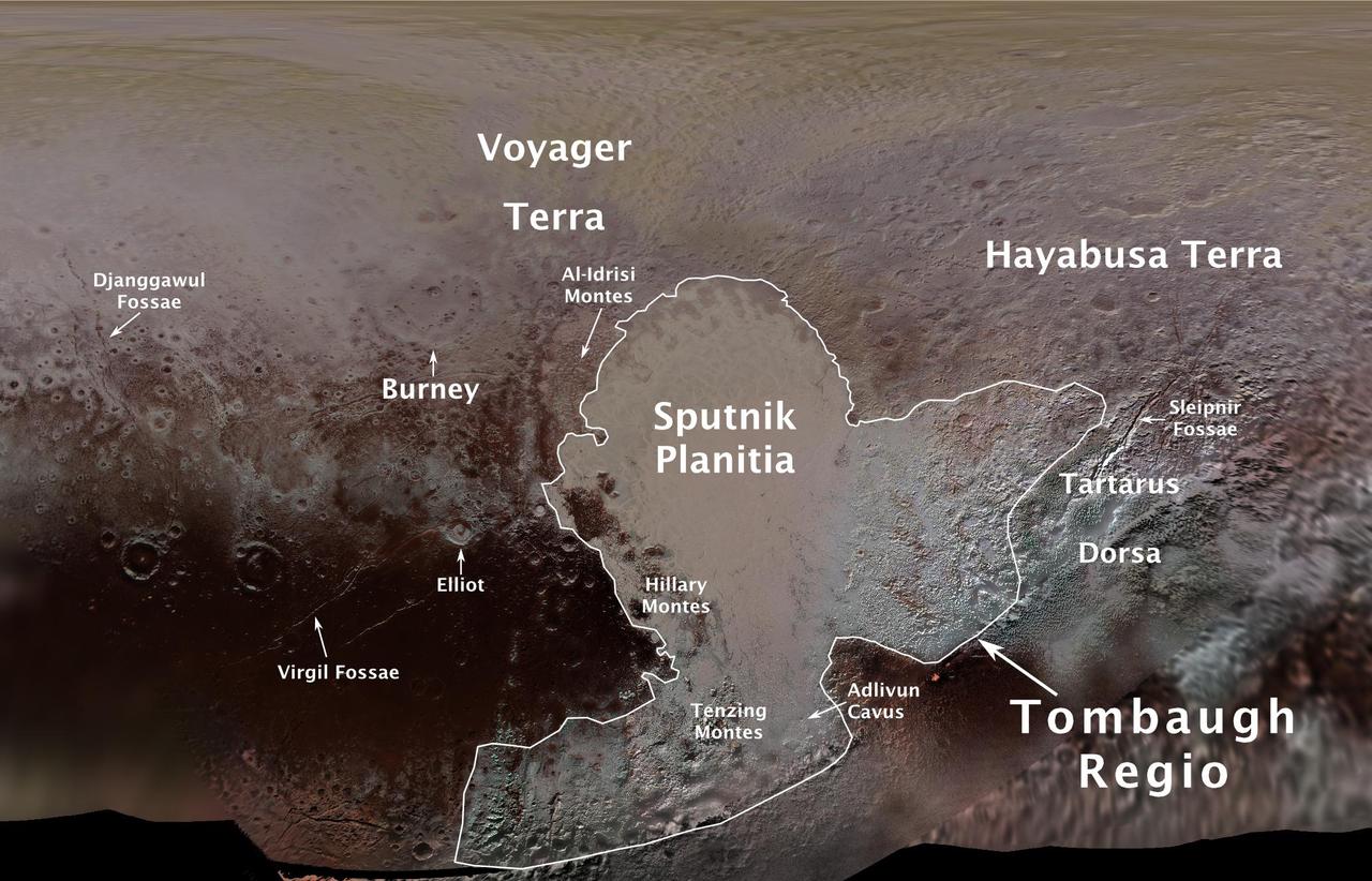
The International Astronomical Union (IAU), the internationally recognized authority for naming celestial bodies and their surface features, approved names of 14 surface features on Pluto in August 2017. The names were proposed by NASA's New Horizons team following the first reconnaissance of Pluto and its moons by the New Horizons spacecraft in 2015. The names, listed below, pay homage to the underworld mythology, pioneering space missions, historic pioneers who crossed new horizons in exploration, and scientists and engineers associated with Pluto and the Kuiper Belt. Tombaugh Regio honors Clyde Tombaugh (1906-1997), the U.S. astronomer who discovered Pluto in 1930 from Lowell Observatory in Arizona. Burney crater honors Venetia Burney (1918-2009), who as an 11-year-old schoolgirl suggested the name "Pluto" for Clyde Tombaugh's newly discovered planet. Later in life she taught mathematics and economics. Sputnik Planitia is a large plain named for Sputnik 1, the first space satellite, launched by the Soviet Union in 1957. Tenzing Montes and Hillary Montes are mountain ranges honoring Tenzing Norgay (1914-1986) and Sir Edmund Hillary (1919-2008), the Indian/Nepali Sherpa and New Zealand mountaineer were the first to reach the summit of Mount Everest and return safely. Al-Idrisi Montes honors Ash-Sharif al-Idrisi (1100-1165/66), a noted Arab mapmaker and geographer whose landmark work of medieval geography is sometimes translated as "The Pleasure of Him Who Longs to Cross the Horizons.†Djanggawul Fossae defines a network of long, narrow depressions named for the Djanggawuls, three ancestral beings in indigenous Australian mythology who traveled between the island of the dead and Australia, creating the landscape and filling it with vegetation. Sleipnir Fossa is named for the powerful, eight-legged horse of Norse mythology that carried the god Odin into the underworld. Virgil Fossae honors Virgil, one of the greatest Roman poets and Dante's fictional guide through hell and purgatory in the Divine Comedy. Adlivun Cavus is a deep depression named for Adlivun, the underworld in Inuit mythology. Hayabusa Terra is a large land mass saluting the Japanese spacecraft and mission (2003-2010) that performed the first asteroid sample return. Voyager Terra honors the pair of NASA spacecraft, launched in 1977, that performed the first "grand tour" of all four giant planets. The Voyager spacecraft are now probing the boundary between the Sun and interstellar space. Tartarus Dorsa is a ridge named for Tartarus, the deepest, darkest pit of the underworld in Greek mythology. Elliot crater recognizes James Elliot (1943-2011), an MIT researcher who pioneered the use of stellar occultations to study the solar system -- leading to discoveries such as the rings of Uranus and the first detection of Pluto's thin atmosphere. https://photojournal.jpl.nasa.gov/catalog/PIA21944
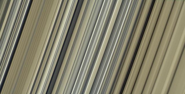
These are the highest-resolution color images of any part of Saturn's rings, to date, showing a portion of the inner-central part of the planet's B Ring. The view is a mosaic of two images that show a region that lies between 61,300 and 65,600 miles (98,600 and 105,500 kilometers) from Saturn's center. This image is a natural color composite, created using images taken with red, green and blue spectral filters. The pale tan color is generally not perceptible with the naked eye in telescope views, especially given that Saturn has a similar hue. The material responsible for bestowing this color on the rings -- which are mostly water ice and would otherwise appear white -- is a matter of intense debate among ring scientists that will hopefully be settled by new in-situ observations before the end of Cassini's mission. The different ringlets seen here are part of what is called the "irregular structure" of the B ring. Cassini radio occultations of the rings have shown that these features have extremely sharp boundaries on even smaller scales (radially, or along the direction outward from Saturn) than the camera can resolve here. Closer to Saturn, the irregular structures become fuzzier and more rounded, less opaque, and their color contrast diminishes. The narrow ringlets in the middle of this scene are each about 25 miles (40 kilometers) wide, and the broader bands at right are about 200 to 300 miles (300 to 500 kilometers) across. It remains unclear exactly what causes the variable brightness of these ringlets and bands -- the basic brightness of the ring particles themselves, shadowing on their surfaces, their absolute abundance, and how densely the particles are packed, may all play a role. The second image (Figure 1) is a color-enhanced version. Blue colors represent areas where the spectrum at visible wavelengths is less reddish (meaning the spectrum is flatter toward red wavelengths), while red colors represent areas that are spectrally redder (meaning the spectrum has a steeper spectrum toward red wavelengths). Observations from the Voyager mission and Cassini's visual and infrared mapping spectrometer previously showed these color variations at lower resolution, but it was not known that such well-defined color contrasts would be this sharply defined down to the scale (radial scale) of a couple of miles or kilometers, as seen here. Analysis of additional images from this observation, taken using infrared spectral filters sensitive to absorption of light by water ice, indicates that the areas that appear more visibly reddish in the color-enhanced version are also richer in water ice. The third image (Figure 2) is a composite of the "true" and "enhanced" color images for easy comparison. This image was taken on July 6, 2017, with the Cassini spacecraft narrow-angle camera. The image was acquired on the sunlit side of the rings from a distance of 47,000 miles (76,000 kilometers) away from the area pictured. The image scale is about 2 miles (3 kilometers) per pixel. The phase angle, or sun-ring-spacecraft angle, is 90 degrees. https://photojournal.jpl.nasa.gov/catalog/PIA21628