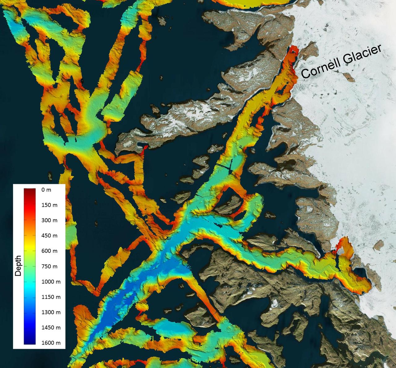
This image shows a region of the sea floor off the coast of northwest Greenland mapped as part of NASA Oceans Melting Greenland OMG mission. The data shown here will be used to understand the pathways by which warm water can reach glacier edges.
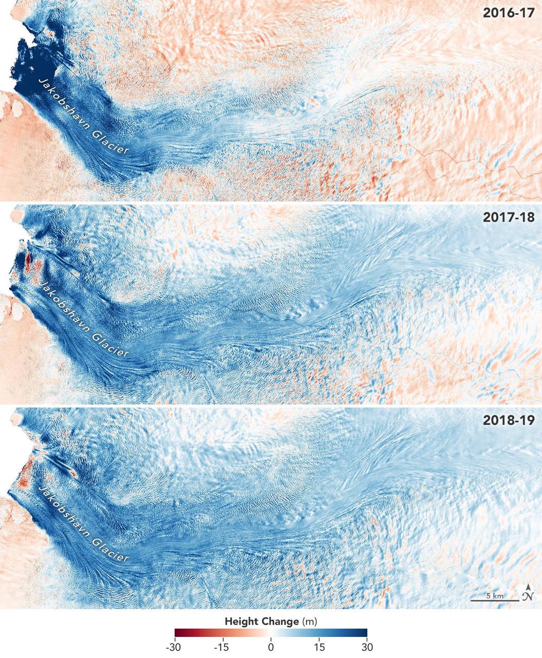
These images show the mass Greenland's Jakobshavn Glacier has gained from 2016-17, 2017-18 and 2018-19. Areas with the most growth — about 33 yards (30 meters) — are shown in dark blue. Red areas represent thinning. The images were produced using GLISTIN-A radar data as part of NASA's Ocean's Melting Greenland (OMG) mission. https://photojournal.jpl.nasa.gov/catalog/PIA23147
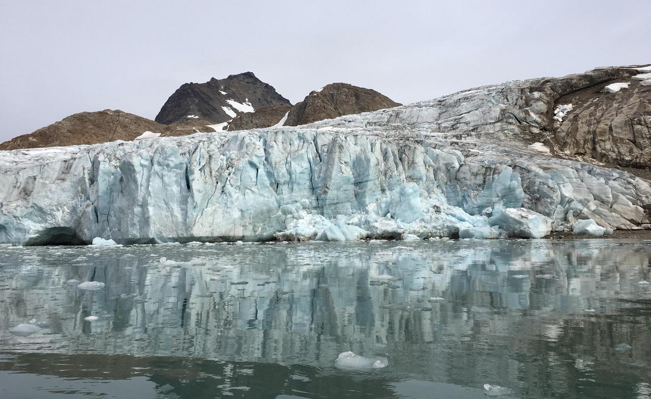
NASA's Oceans Melting Greenland airborne mission found that most of Greenland's glaciers that empty into the ocean are at greater risk of rapid ice loss than previously understood. OMG's six-year field campaign studied the ocean's role in glacial ice loss by gathering precise measurements of ocean depth, temperature, and salinity in front of more than 220 glaciers. The mission's goal was to clarify our understanding of sea level rise over the next 50 years. This photo of Apusiaajik Glacier was taken near Kulusuk, Greenland, on Aug. 26, 2018, during OMG's field operations. https://photojournal.jpl.nasa.gov/catalog/PIA24983
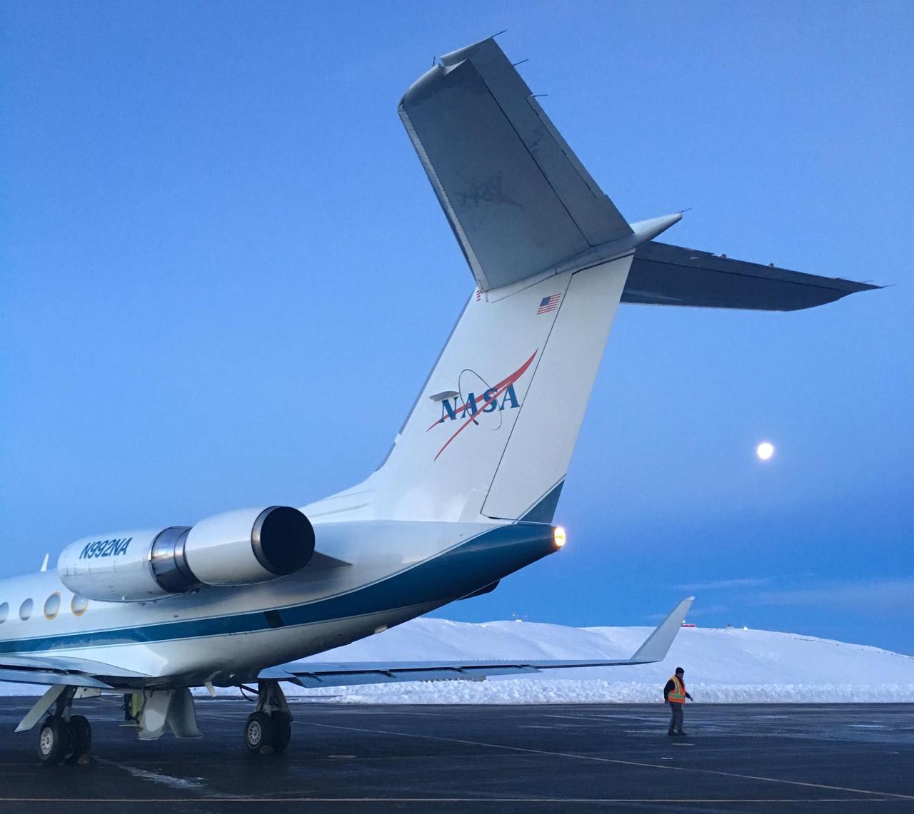
NASA's Gulfstream III was one of several research aircraft that NASA's Oceans Melting Greenland mission used during its six-year field campaign to record the temperature, salinity, and depth of the ocean around the entire island. OMG used airports in Greenland, Iceland, and Norway as bases for research flights. This image was taken at Thule Air Base, Greenland, on Sept. 18, 2016. https://photojournal.jpl.nasa.gov/catalog/PIA24984
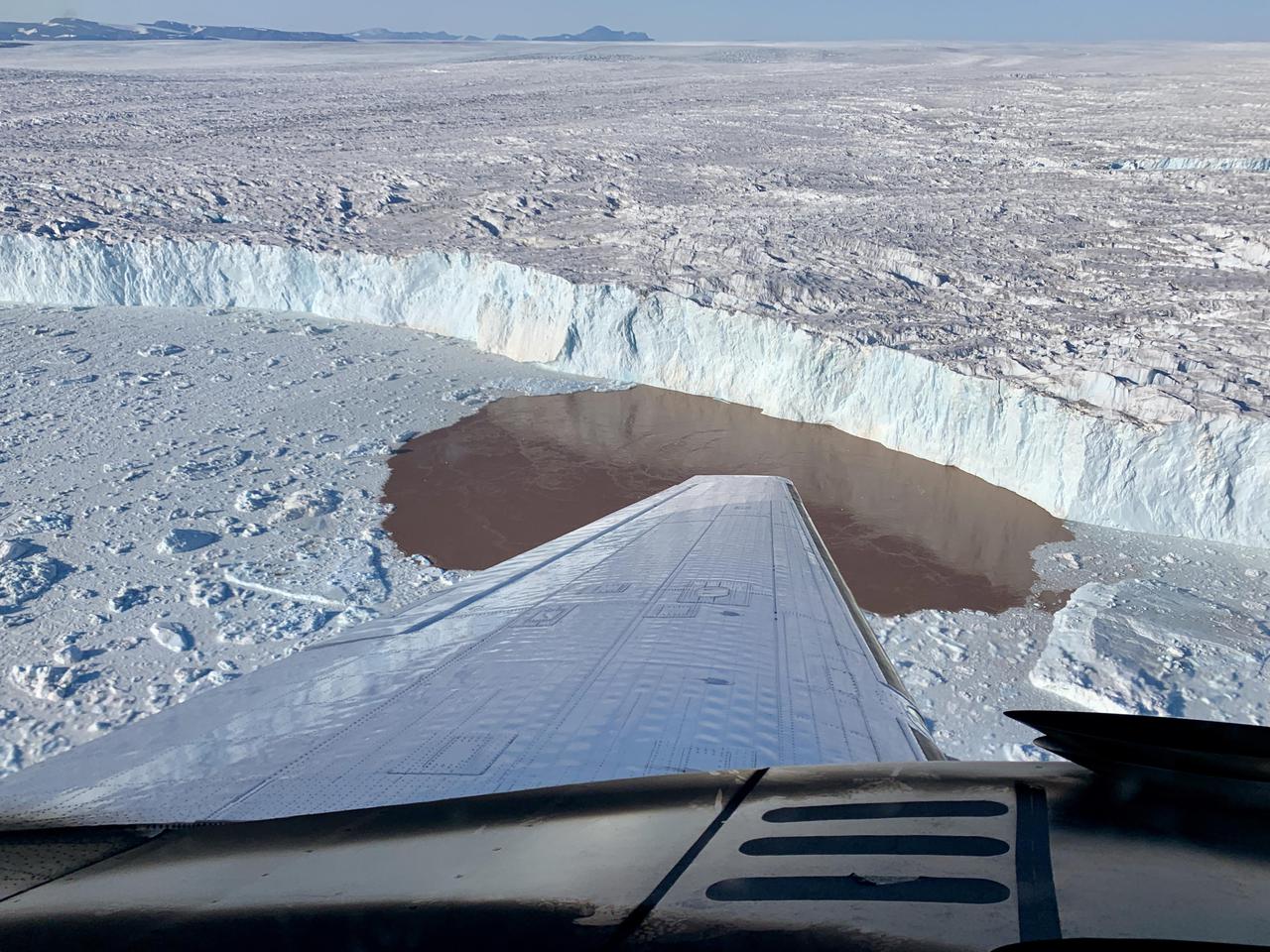
In this aerial view, a glacier along Greenland's craggy coastline is actively undergoing undercutting, a process in which meltwater flowing out from the bottom of the glacier enters the fjord. The brown water in front of the glacier is caused by sediment being dredged up from the base of the glacier by meltwater plumes reaching the surface of the fjord. Because the meltwater contains no salt, it is lighter and rises through the saltier ocean water, dragging the warm ocean water into contact with the ice at the glacier's base. The result is increased melting at the bottom of the glacier, which creates and overhanging layer of ice that breaks off (or calves) as icebergs. As the climate warms, the ocean water temperature and the amount of meltwater both increase, combining to hasten this undercutting process and speed up the ice loss from Greenland's Ice Sheet. The image was taken on Aug. 25, 2019 by a probe-dropping airplane as part of the Oceans Melting Greenland (OMG) mission. OMG has been studying glaciers that plunge into Greenland's steep-sided inlets, or fjords, for the past five years, gathering precise measurements of fjord depth and water salinity from probes dropped by plane, supplemented by measurements made by boat. The aim is to better understand how the warming ocean water around Greenland is hastening ice melt and calving of these marine-terminating glaciers. https://photojournal.jpl.nasa.gov/catalog/PIA24162