On April 20, 2010, an explosion at an oil well in the Gulf of Mexico resulted in a major oil spill. Since then, emergency response efforts have been underway to contain the growing oil slick before it reaches the southern coast of the United States. Landsat imagery, acquired by the U.S. Geological Survey on May 1 shows the extent of the oil slick. The Landsat data are being used to monitor the extent and movement of the slick. Location: LA, USA Date Taken: May 1 2010 Credit: NASA/GSFC/Landsat <b><a href="http://www.nasa.gov/centers/goddard/home/index.html" rel="nofollow">NASA Goddard Space Flight Center</a></b> enables NASA’s mission through four scientific endeavors: Earth Science, Heliophysics, Solar System Exploration, and Astrophysics. Goddard plays a leading role in NASA’s accomplishments by contributing compelling scientific knowledge to advance the Agency’s mission. <b>Follow us on <a href="http://twitter.com/NASA_GoddardPix" rel="nofollow">Twitter</a></b> <b>Join us on <a href="http://www.facebook.com/pages/Greenbelt-MD/NASA-Goddard/395013845897?ref=tsd" rel="nofollow">Facebook</a></b>
NASA Terra spacecraft captured this image of the growing oil spill in the Gulf of Mexico on May 1, 2010. On April 20, 2010, an explosion destroyed the Deepwater Horizon oil platform operating offshore in the Gulf of Mexico.

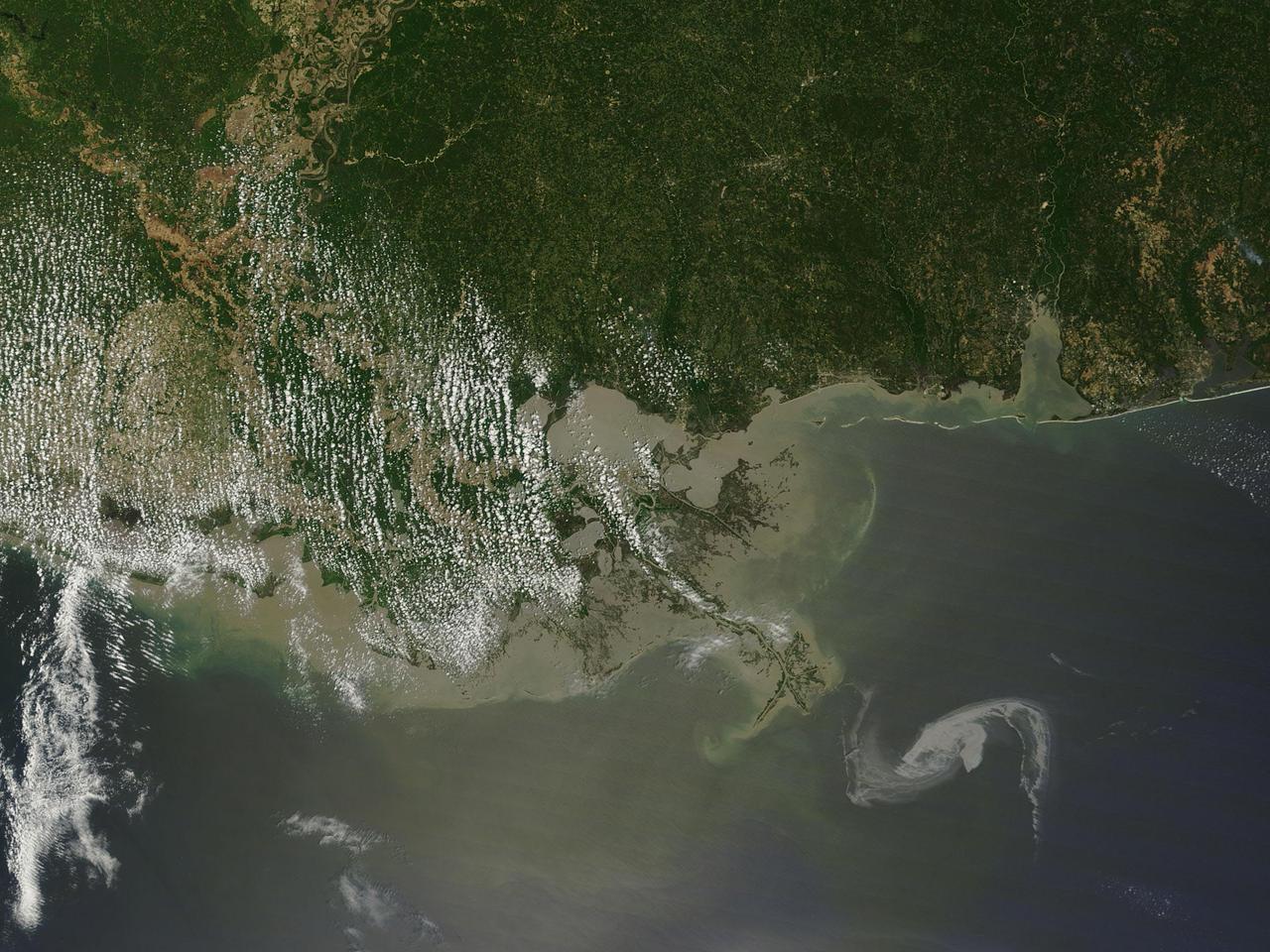
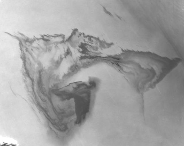
NASA Terra spacecraft captured this image of the growing oil spill in the Gulf of Mexico on May 7, 2010. The thickest parts of the oil spill appear as dark grey, filamentous masses in the southern part of the image, extending off of the bottom.
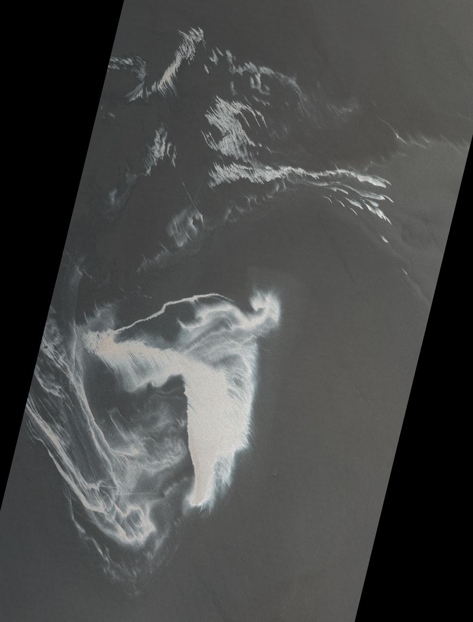
2010/119 - 04/29 at 16 :48 UTC Oil slick in the Gulf of Mexico (Input Direct Broadcast data courtesy Direct Readout Lab, NASA/GSFC) Satellite: Terra NASA/GSFC/Jeff Schmaltz/MODIS Land Rapid Response Team To learn more about MODIS go to: <a href="http://rapidfire.sci.gsfc.nasa.gov/gallery/?latest" rel="nofollow">rapidfire.sci.gsfc.nasa.gov/gallery/?latest</a> <b><a href="http://www.nasa.gov/centers/goddard/home/index.html" rel="nofollow">NASA Goddard Space Flight Center</a></b> is home to the nation's largest organization of combined scientists, engineers and technologists that build spacecraft, instruments and new technology to study the Earth, the sun, our solar system, and the universe.
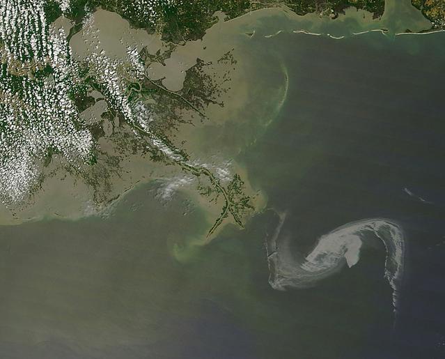
2010/119 - 04/29 at 16 :48 UTC Oil slick in the Gulf of Mexico To see a full view of this image go to: <a href="http://www.flickr.com/photos/gsfc/4563296541/">www.flickr.com/photos/gsfc/4563296541/</a> (Input Direct Broadcast data courtesy Direct Readout Lab, NASA/GSFC) Satellite: Terra NASA/GSFC/Jeff Schmaltz/MODIS Land Rapid Response Team To learn more about MODIS go to: <a href="http://rapidfire.sci.gsfc.nasa.gov/gallery/?latest" rel="nofollow">rapidfire.sci.gsfc.nasa.gov/gallery/?latest</a> <b><a href="http://www.nasa.gov/centers/goddard/home/index.html" rel="nofollow">NASA Goddard Space Flight Center</a></b> is home to the nation's largest organization of combined scientists, engineers and technologists that build spacecraft, instruments and new technology to study the Earth, the sun, our solar system, and the universe.
This image from NASA Terra satellite was acquired on May 1, 2010. The red symbol indicates the approximate position of the Deepwater Horizon platform and the source of the oil slick which resulted in a significant oil spill in the Gulf of Mexico.
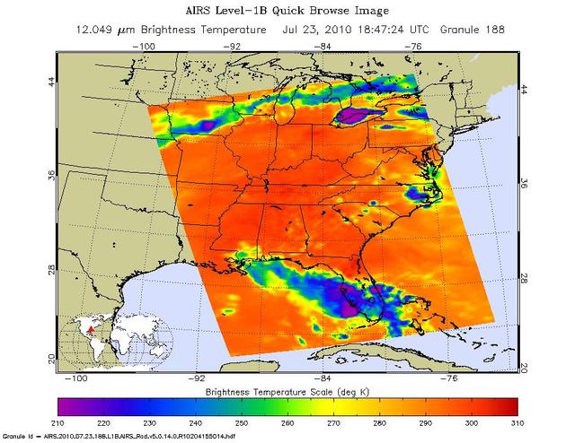
Tropical Storm Bonnie, now a depression, rakes South Florida in this infrared image from NASA Atmospheric Infrared Sounder , en route to a weekend run-in with the Gulf of Mexico and the Gulf oil spill.
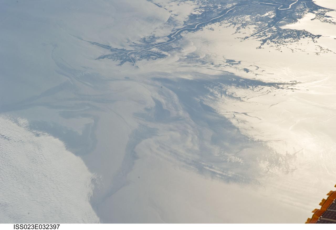
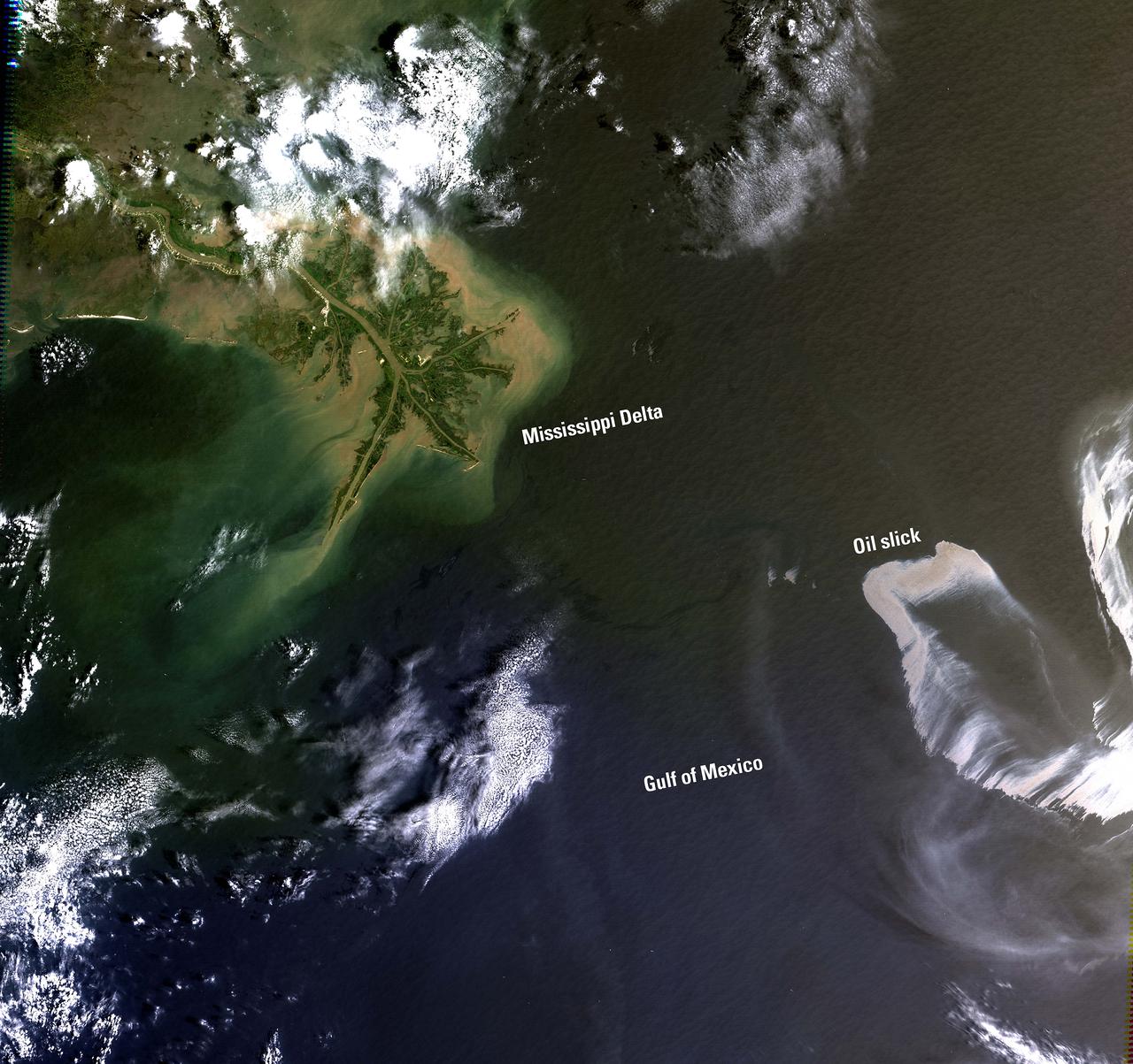
ISS023-E-032397 (4 May 2010) --- The Gulf of Mexico oil spill is featured in this image photographed by an Expedition 23 crew member on the International Space Station. On April 20, 2010 the oil rig Deepwater Horizon suffered an explosion and sank two days later. Shortly thereafter oil began leaking into the Gulf of Mexico from ruptured pipes as safety cutoff mechanisms failed to operate. Automated nadir-viewing orbital NASA sensors have been tracking the growth of the oil spill as it has spread towards the northern Gulf Coast. This detailed photograph provides a different viewing perspective on the ongoing event. The image is oblique, meaning that it was taken with a sideways viewing angle from the space station, rather than the ?straight down? or nadir view typical of automated satellite sensors. The view is towards the west; the ISS was located over the eastern edge of the Gulf of Mexico when the image was taken. The Mississippi River Delta and nearby Louisiana coast (top) appear dark in the sunglint that illuminates most of the image. This phenomenon is caused by sunlight reflecting off the water surface ? much like a mirror ? directly back towards the astronaut observer onboard the orbital complex. The sunglint improves the identification of the oil spill (colored dark to light gray) which is creating a different water texture, and therefore a contrast, between the smooth and rougher water of the reflective ocean surface (colored silver to white). Wind and water current patterns have modified the oil spill?s original shape into streamers and elongated masses. Efforts are ongoing to contain the spill and protect fragile coastal ecosystems and habitats such as the Chandeleur Islands (right center). Other features visible in the image include a solid field of low cloud cover at the lower left corner of the image. A part of one of the ISS solar arrays is visible at lower right. Wave patterns at lower right are most likely caused by tidal effects.
This image, from NASA Terra spacecraft, was acquired May 1, 2010. An explosion destroyed the Deepwater Horizon oil platform operating in the offshore in Gulf of Mexico on April 20, 2010.
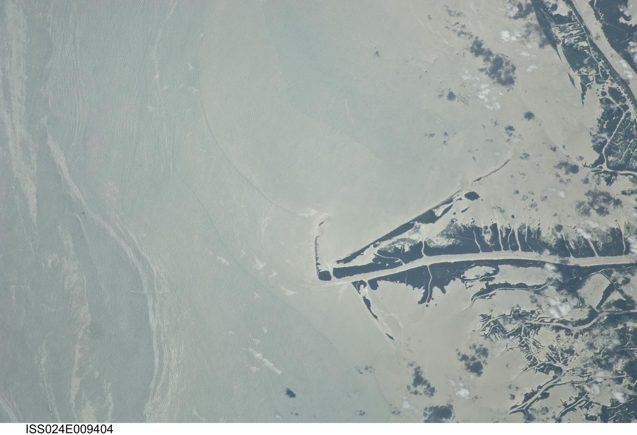
ISS024-E-009404 (23 July 2010) --- This photo taken from the International Space Station on July 23, 2010, shows the Gulf of Mexico oil spill as part of ongoing observations of the region. When this image was taken, three months after the explosion on the Deepwater Horizon oil rig, the leak had been plugged for eight days. Water surfaces appear bright and land surfaces appear dark in the image. The stark contrast is due to sun glint, in which the sun is reflected brilliantly off all water surfaces back towards the astronaut observer on board the station. The sun glint reveals various features in the Gulf of Mexico, especially sheens of oil as packets of long bright streaks seen on the left side of the image. Sediments carried by the Mississippi River have a light-yellow coloration in this image, with distinct margins between plumes that likely mark tidal pulses of river water into the Gulf of Mexico. A boat wake cuts across one of the oil packets at image lower left. Daily National Oceanic and Atmospheric Administration (NOAA) maps of oil distribution show predicted heavier and lighter oil movement near the Gulf coastline. The maps show that on the day this image was taken, the north edge of the ?oiled? zone was expected to bank up against the delta. The observed spread of the surface oil in the approximately 100 days since the explosion highlights the connectivity between the deepwater areas and coastlines of the Gulf of Mexico.
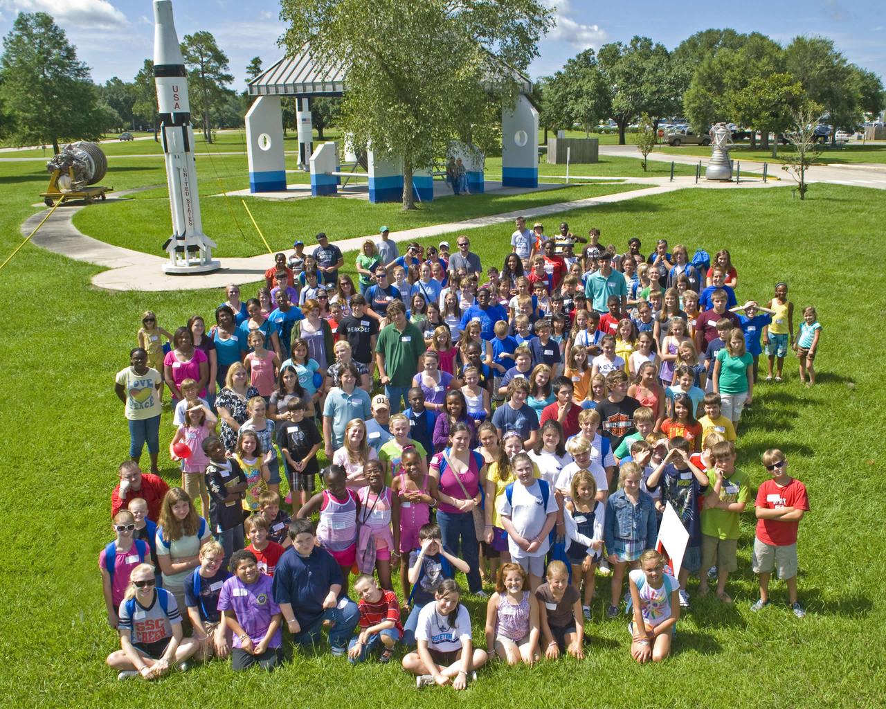
About 200 children of employees at NASA's John C. Stennis Space Center visited the facility for annual Take Our Children to Work activities July 27. Participants enjoyed a windshield tour of the rocket engine test site and various demonstrations and presentations on such topics as cryogenics, the Gulf of Mexico oil spill, computer safety and robotics. They also had an opportunity to take photos at the astronaut suit exhibit and participate in StenniSphere activities.
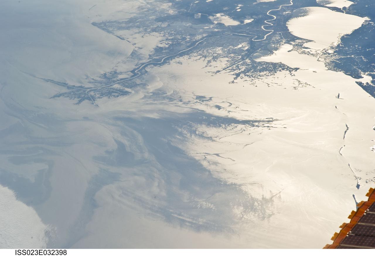
ISS023-E-032398 (4 May 2010) --- Japan Aerospace Exploration Agency (JAXA) astronaut Soichi Noguchi, Expedition 23 flight engineer, photographed the Mississippi Delta showing the oil slick in the Gulf of Mexico on May 4, 2010. Part of the river delta and nearby Louisiana coast appear dark in the sunglint. This phenomenon is caused by sunlight reflecting off the water surface, in a mirror-like manner, directly back towards the astronaut observer onboard the International Space Station (ISS). The sunglint improves the identification of the oil spill which is creating a different water texture (and therefore a contrast) between the smooth and rougher water of the reflective ocean surface. Other features which cause a change in surface roughness that can be seen in sunglint are wind gusts, naturally occurring oils that will be gathered by and take the form of water currents or wave patterns, and less windy areas behind islands.

ISS023-E-032396 (4 May 2010) --- Japan Aerospace Exploration Agency (JAXA) astronaut Soichi Noguchi, Expedition 23 flight engineer, photographed the tail end of the Mississippi Delta showing the oil slick in the Gulf of Mexico on May 4, 2010. Part of the river delta and nearby Louisiana coast appear dark in the sunglint. This phenomenon is caused by sunlight reflecting off the water surface, in a mirror-like manner, directly back towards the astronaut observer onboard the International Space Station (ISS). The sunglint improves the identification of the oil spill which is creating a different water texture (and therefore a contrast) between the smooth and rougher water of the reflective ocean surface. Other features which cause a change in surface roughness that can be seen in sunglint are wind gusts, naturally occurring oils that will be gathered by and take the form of water currents or wave patterns, and less windy areas behind islands.
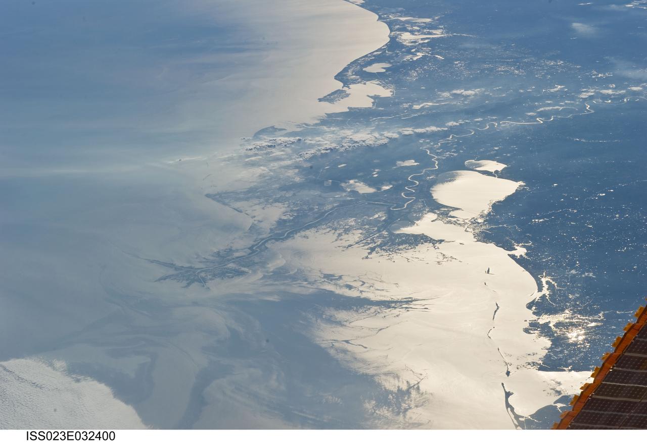
ISS023-E-032400 (4 May 2010) --- Japan Aerospace Exploration Agency (JAXA) astronaut Soichi Noguchi, Expedition 23 flight engineer, photographed the Mississippi Delta showing the oil slick in the Gulf of Mexico on May 4, 2010. Part of the river delta and nearby Louisiana coast appear dark in the sunglint. This phenomenon is caused by sunlight reflecting off the water surface, in a mirror-like manner, directly back towards the astronaut observer onboard the International Space Station (ISS). The sunglint improves the identification of the oil spill which is creating a different water texture (and therefore a contrast) between the smooth and rougher water of the reflective ocean surface. Other features which cause a change in surface roughness that can be seen in sunglint are wind gusts, naturally occurring oils that will be gathered by and take the form of water currents or wave patterns, and less windy areas behind islands.
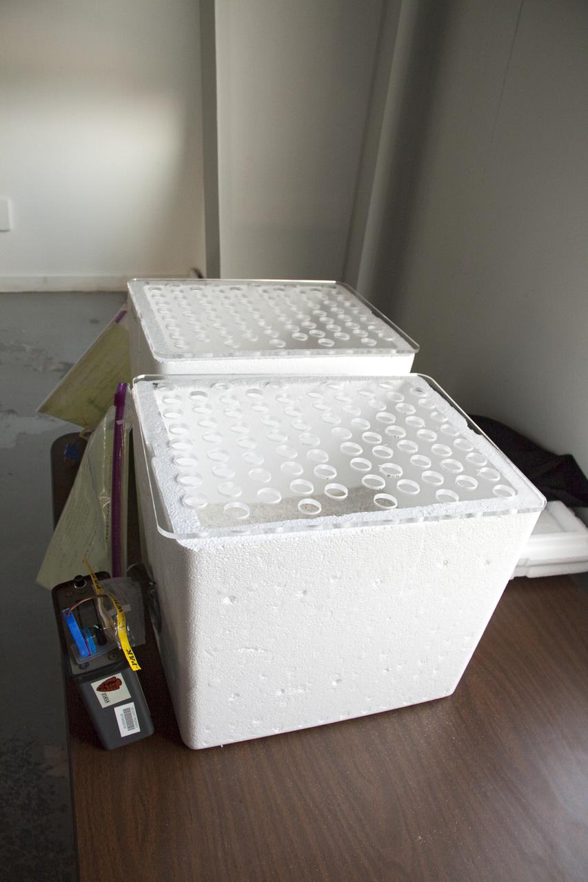
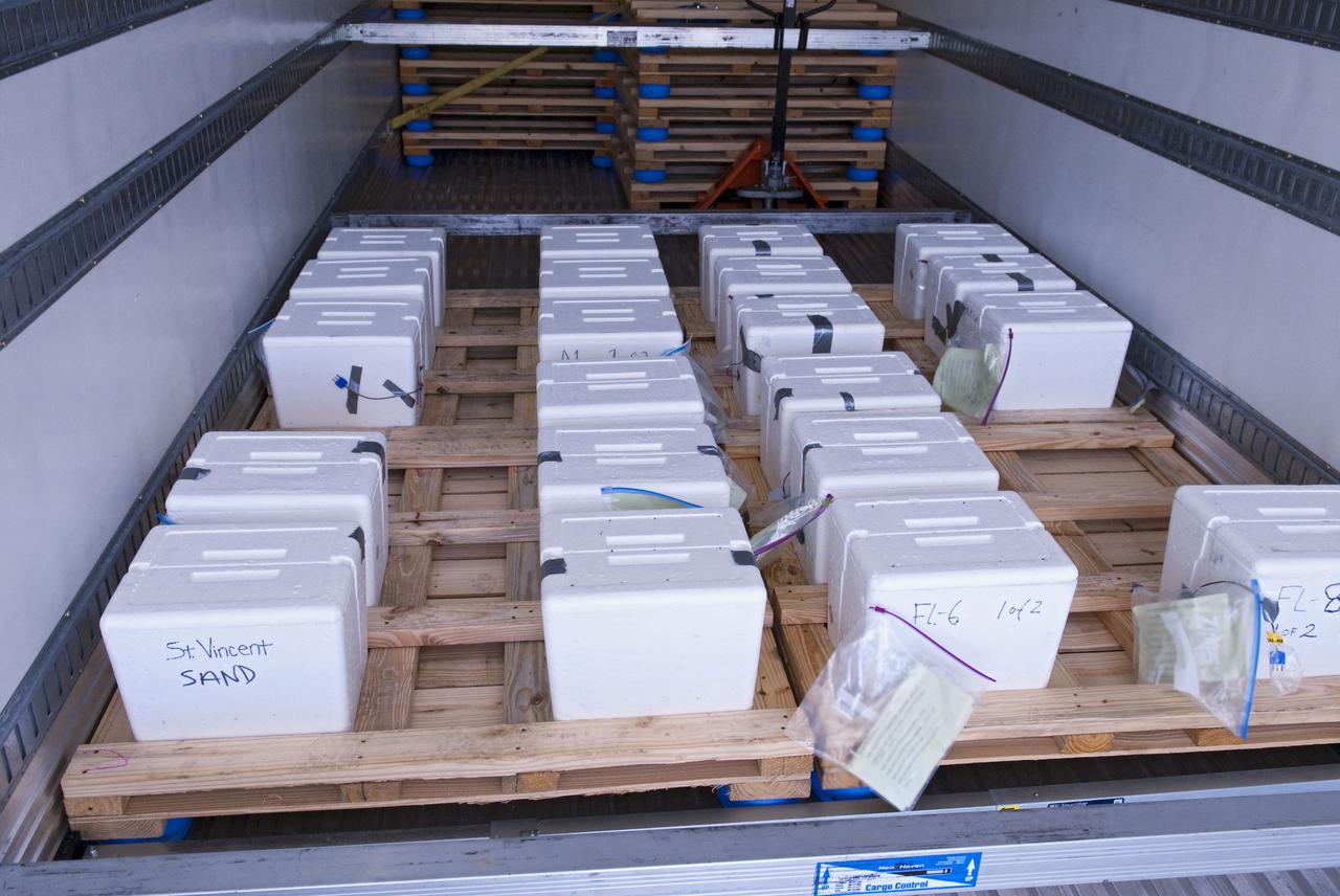
CAPE CANAVERAL, Fla. In a secure facility located at NASA's Kennedy Space Center in Florida, two Styrofoam boxes containing endangered sea turtle eggs brought from beaches along the northern U.S. Gulf Coast are being monitored in a climate-controlled room until incubation is complete. Jane Provancha, lead biologist at the hatchery is heading-up the project at Kennedy. After hatching, the turtles will be set free on a Kennedy Space Center_Canaveral National Seashore beach. The Northern Gulf Rescue Operations relocation and release work effort is supported by the U.S. Fish and Wildlife Service, the Florida Fish and Wildlife Conservation Commission, the National Park Service, NOAA, FedEx and conservationists to help minimize the risk to this year's sea turtle hatchlings from impacts of the BP Deepwater Horizon oil spill in the Gulf of Mexico. Photo credit: NASA_Troy Cryder
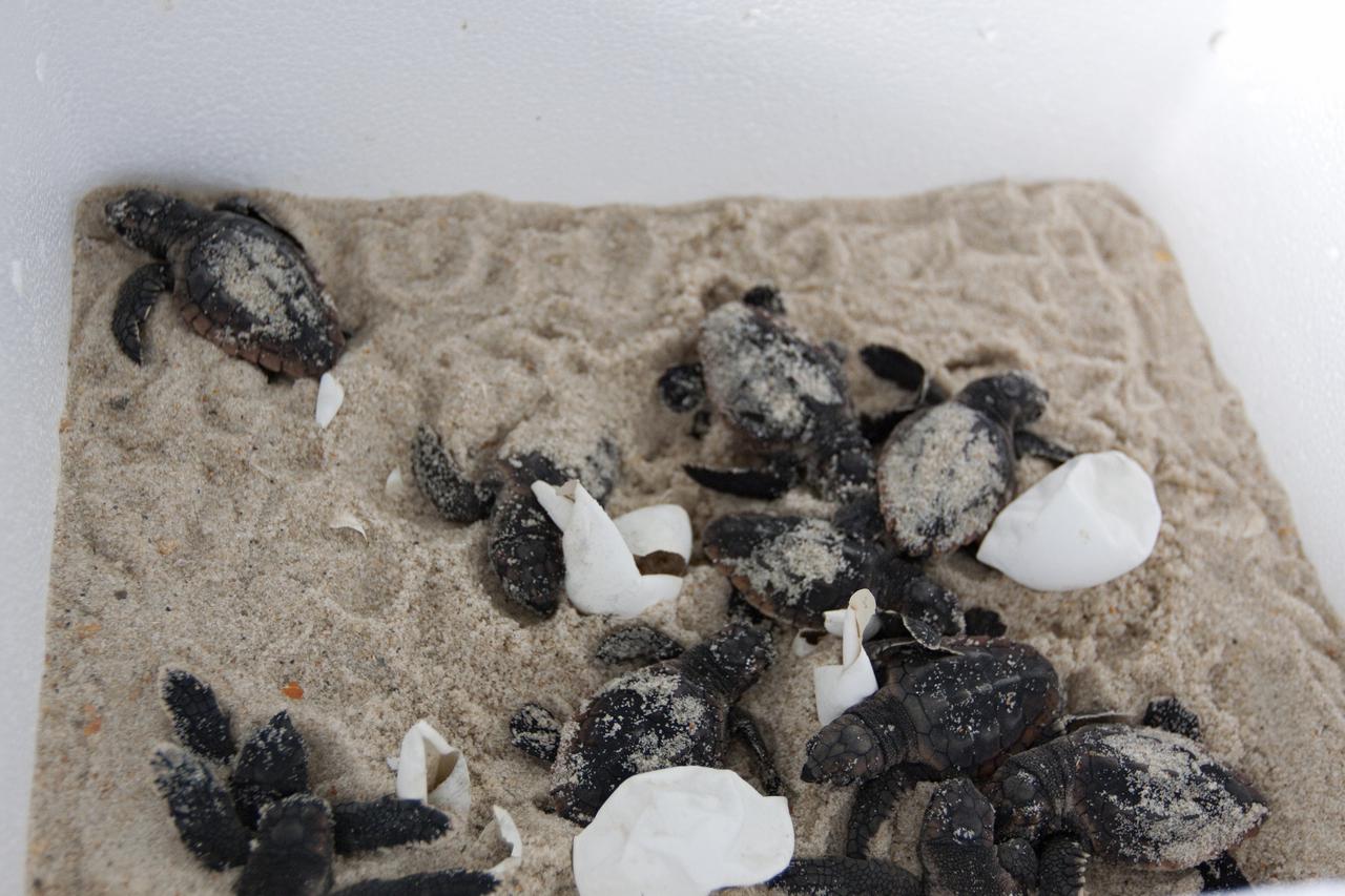
CAPE CANAVERAL, Fla. -- In a climate-controlled facility at NASA's Kennedy Space Center in Florida, newly-hatched Loggerhead turtles emerge from their eggs brought from beaches along the northern U.S. Gulf Coast. The eggs will be monitored by biologists and hatchery workers until incubation is complete. The hatchlings will be released at different points along a 100-mile stretch of the Atlantic Ocean shoreline. That includes beaches adjacent to the Merritt Island National Wildlife Refuge, which is located inside Kennedy. The release and relocation work is part of an effort by the U.S. Fish and Wildlife Service, the Florida Fish and Wildlife Conservation Commission, the National Park Service, NOAA, FedEx and conservationists to help minimize the risk to this year's sea turtle hatchlings from impacts of the BP Deepwater Horizon oil spill in the Gulf of Mexico. This plan involves carefully moving an anticipated 700 nests during the next several months. Photo credit: NASA_Troy Cryder
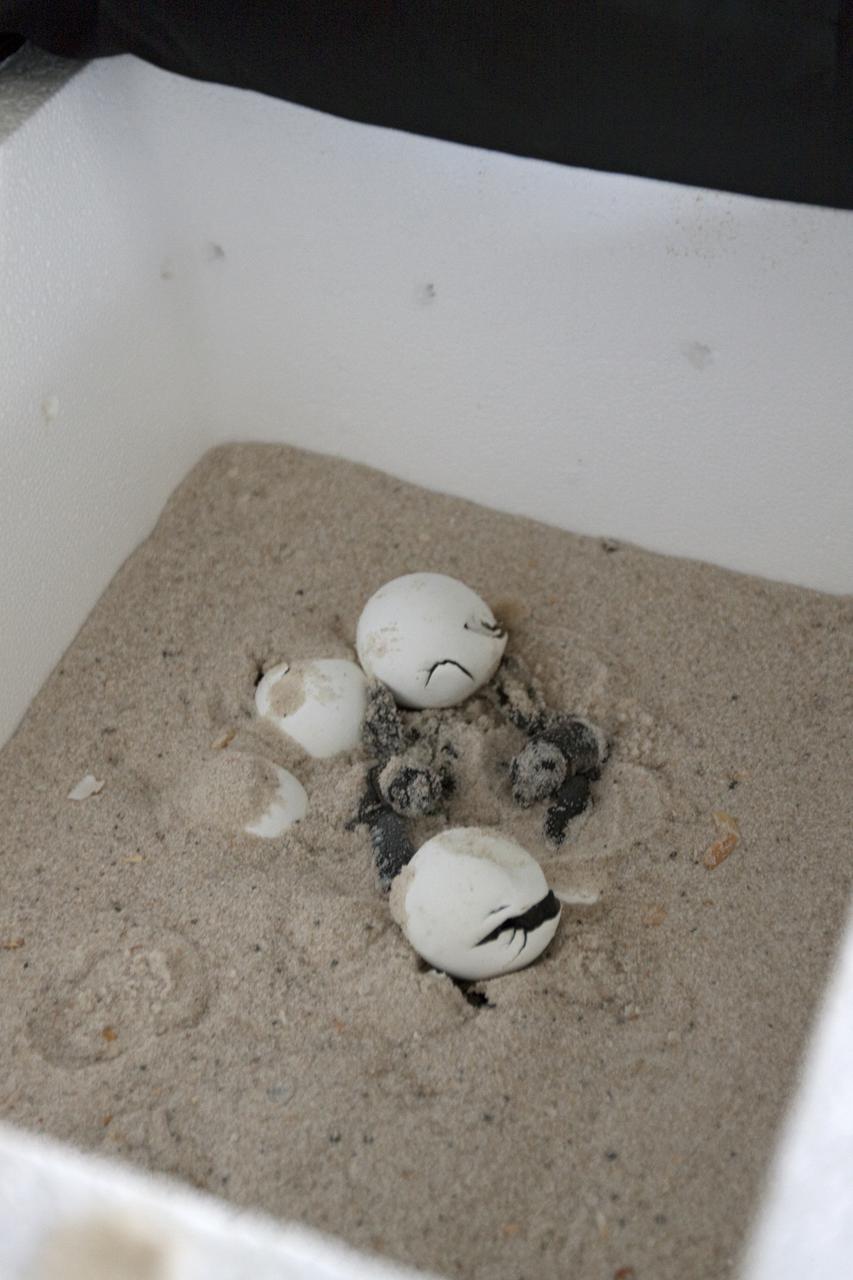
CAPE CANAVERAL, Fla. -- In a secure, climate-controlled facility at NASA's Kennedy Space Center in Florida, newly-hatched Loggerhead turtles emerge from their eggs brought from beaches along the northern U.S. Gulf Coast. The eggs will be monitored by biologists and hatchery workers until incubation is complete. The hatchlings will be released at different points along a 100-mile stretch of the Atlantic Ocean shoreline. That includes beaches adjacent to the Merritt Island National Wildlife Refuge, which is located inside Kennedy. The release and relocation work is part of an effort by the U.S. Fish and Wildlife Service, the Florida Fish and Wildlife Conservation Commission, the National Park Service, NOAA, FedEx and conservationists to help minimize the risk to this year's sea turtle hatchlings from impacts of the BP Deepwater Horizon oil spill in the Gulf of Mexico. This plan involves carefully moving an anticipated 700 nests during the next several months. Photo credit: NASA_Troy Cryder
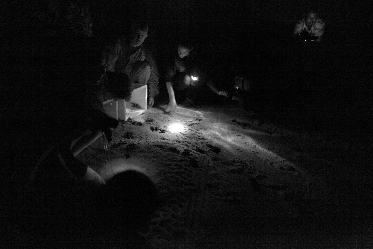
CAPE CANAVERAL, Fla. -- Hatchlings from endangered loggerhead turtle eggs, brought from beaches along the northern U.S. Gulf Coast, are being released into the Atlantic Ocean at Playalinda Beach, adjacent to the Merritt Island National Wildlife Refuge within NASA's Kennedy Space Center in Florida. The release and relocation work is part of an effort by the U.S. Fish and Wildlife Service, the Florida Fish and Wildlife Conservation Commission, the National Park Service, NOAA, FedEx and conservationists to help minimize the risk to this year's sea turtle hatchlings from impacts of the BP Deepwater Horizon oil spill in the Gulf of Mexico. This plan involves carefully moving an anticipated 700 nests deposited on Florida Panhandle and Alabama beaches during the next several months. Note: The photos were shot using an infrared filter to protect the hatchlings. Photo credit: NASA_Dimitri Gerondidakis
CAPE CANAVERAL, Fla. -- A new batch of endangered sea turtle eggs brought from beaches along the northern U.S. Gulf Coast arrive at NASA's Kennedy Space Center in Florida. Nests of Kemp’s ridley and Loggerhead turtle eggs from Gulf Shores, Ala., and various Florida Gulf Coast beaches are being transported by a specially equipped FedEx truck to a secure, climate-controlled facility at Kennedy. They will be monitored by biologists and hatchery workers until incubation is complete. The hatchlings will be released at different points along a 100-mile stretch of the Atlantic Ocean shoreline. That includes beaches adjacent to the Merritt Island National Wildlife Refuge, which is located inside Kennedy. The release and relocation work is part of an effort by the U.S. Fish and Wildlife Service, the Florida Fish and Wildlife Conservation Commission, the National Park Service, NOAA, FedEx and conservationists to help minimize the risk to this year’s sea turtle hatchlings from impacts of the BP Deepwater Horizon oil spill in the Gulf of Mexico. This plan involves carefully moving an anticipated 700 nests during the next several months. Photo credit: NASA_Ben Smegelsky

An oil slick in the Gulf of Mexico following Hurricane Ida – a high-end Category 4 when it made landfall near Port Fourchon, Louisiana, on Aug. 29, 2021 – appears as a green trail in the inset false-color graphic provided by NASA's Delta-X project, while the surrounding seawater appears orange. The National Oceanic and Atmospheric Administration (NOAA) regularly monitors U.S. coastal waters for potential spills and noticed slicks that appeared just off the coast after the hurricane. They were able to use this information from Delta-X to corroborate other data they had about oil slicks in the area (satellite image in the second inset picture). The blue-green swath crossing from the Gulf of Mexico over the Louisiana coast denotes the flight path of the Delta-X radar instrument on Sept. 1, just before 11:30 a.m. CDT. Charged with studying the Mississippi River Delta, Delta-X was gearing up to collect data on Louisiana's coastal wetlands when Hurricane Ida barreled ashore in late August. The storm damaged buildings and infrastructure alike, resulting in power outages, flooding, and oil slicks in the Gulf of Mexico. Oil tends to smooth out the bumps on the ocean's surface, which results in a distinct radar signal that the Delta-X mission was able to pick out of their data. Delta-X added flight paths to their planned schedule – with the support of NASA's Applied Science Disaster Program – in order to collect information over the gulf in areas of interest to NOAA. Delta-X is studying two wetlands – the Atchafalaya and Terrebonne Basins – by land, boat, and air to quantify water and sediment flow as well as vegetation growth. While the Atchafalaya Basin has been gaining land through sediment accumulation, Terrebonne Basin, which is right next to the Atchafalaya, has been rapidly losing land. The data collected by the project will be applied to models used to forecast which areas of the delta are likely to gain or lose land under various sea level rise, river flow, and watershed management scenarios. The mission uses several instruments to collect its data. Affixed to the bottom of a Gulfstream-III airplane, one of those instruments, the all-weather Uninhabited Aerial Vehicle Synthetic Aperture Radar (UAVSAR), bounces radar signals off of Earth's surface, forming a kind of image of a particular area. Repeated images of the same regions, captured at different times, enable researchers to detect changes in those areas, such as fluctuating water levels beneath the vegetation as the tides move in and out of these wetlands. In addition to radar measurements, teams from Caltech, Louisiana State University, Florida International University, and other collaborating institutions gather water and vegetation samples – among other data – by boat, other airborne sensors, and from instruments on the ground. Funded by NASA's Earth Venture Suborbital (EVS-3) program, Delta-X is managed by the agency's Jet Propulsion Laboratory. Caltech in Pasadena, California, manages JPL for NASA. Fall 2021 was Delta-X's last scheduled field campaign, although the five-year mission will run through the end of 2023. https://photojournal.jpl.nasa.gov/catalog/PIA24540