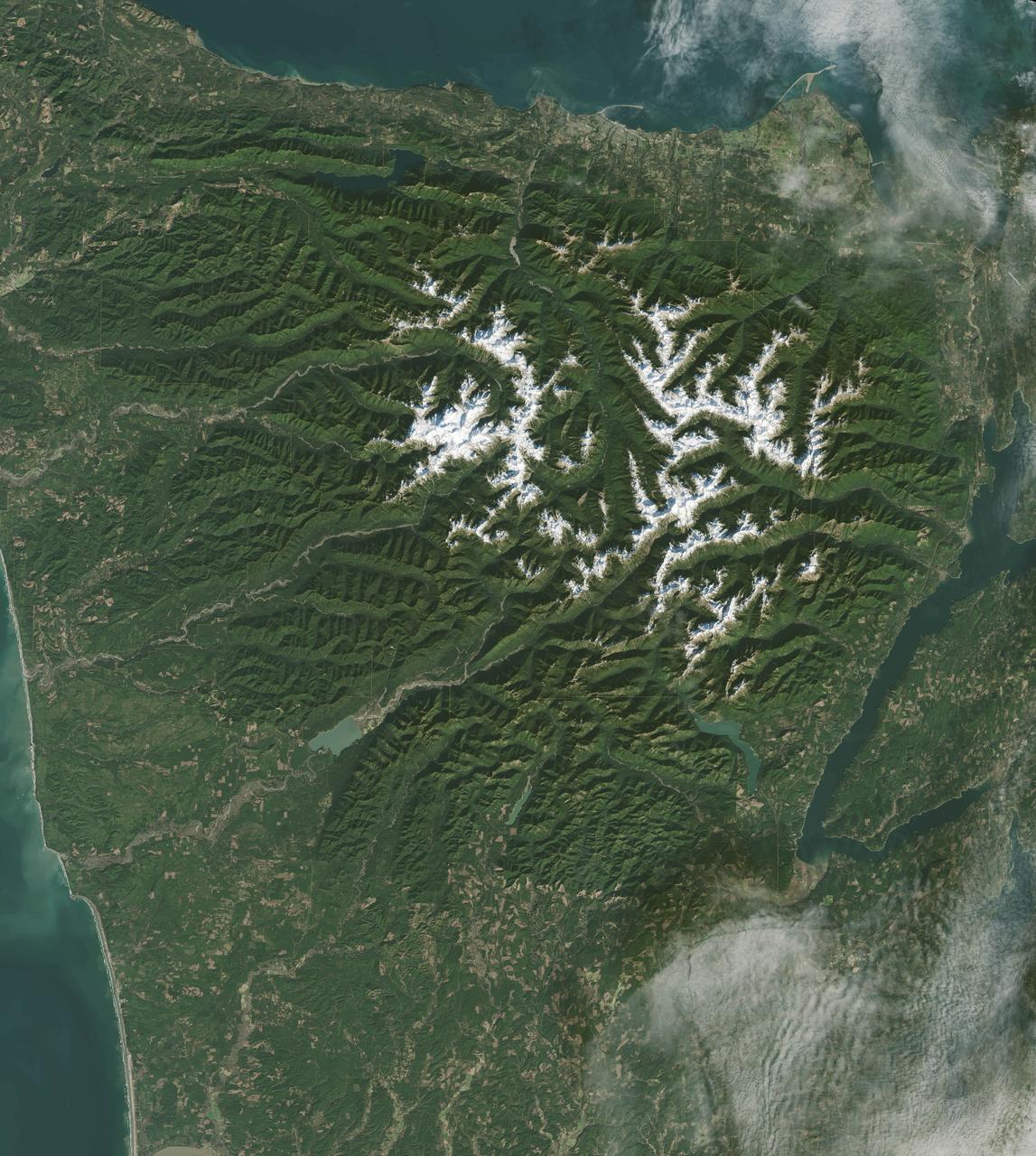
It has to be one of America’s most diverse national park landscapes. If you walked from west to east across Olympic National Park, you would start at the rocky Pacific shoreline, move into rare temperate rainforests and lush river valleys, ascend glaciers and rugged mountain peaks, and then descend into a comparatively dry rain shadow and alpine forest. From the beach to the top of Mount Olympus, you would rise 7,980 feet (2430 meters) above sea level. Situated on the Olympic Peninsula in northwestern Washington, these lands were first set aside as a national monument in 1909 by Theodore Roosevelt. Twenty-nine years later, his cousin Franklin officially established Olympic National Park. International institutions have also made a case for treasuring this land, as the area was declared an International Biosphere Reserve in 1976 and a World Heritage Site in 1981. The park encompasses nearly 923,000 acres of wild lands, including 60 named glaciers, 73 miles of coast, and 3,000 miles of rivers and streams. Read more: <a href="http://go.nasa.gov/2bRmzSJ" rel="nofollow">go.nasa.gov/2bRmzSJ</a> Credit: NASA/Landsat8 <b><a href="http://www.nasa.gov/audience/formedia/features/MP_Photo_Guidelines.html" rel="nofollow">NASA image use policy.</a></b> <b><a href="http://www.nasa.gov/centers/goddard/home/index.html" rel="nofollow">NASA Goddard Space Flight Center</a></b> enables NASA’s mission through four scientific endeavors: Earth Science, Heliophysics, Solar System Exploration, and Astrophysics. Goddard plays a leading role in NASA’s accomplishments by contributing compelling scientific knowledge to advance the Agency’s mission. <b>Follow us on <a href="http://twitter.com/NASAGoddardPix" rel="nofollow">Twitter</a></b> <b>Like us on <a href="http://www.facebook.com/pages/Greenbelt-MD/NASA-Goddard/395013845897?ref=tsd" rel="nofollow">Facebook</a></b> <b>Find us on <a href="http://instagrid.me/nasagoddard/?vm=grid" rel="nofollow">Instagram</a></b>
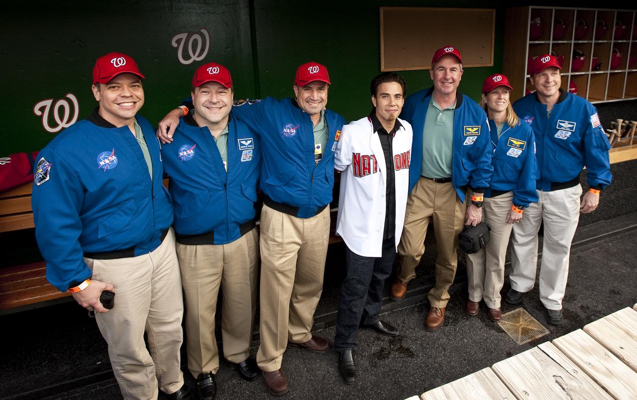
NASA STS-130 crew pose with Winter Olympics medalist Apolo Ohno, center, at Nationals Park, Tuesday, April 20, 2010, in Washington. Pictured from left are STS-130 Mission Specialist Robert Benhken, Mission Specialist Nicholas Patrick, Commander George Zamka, Apolo Ohno, Mission Specialist Stephen Robinson, Mission Specialist Kathryn Hire and Pilot Terry Virts. Photo Credit: (NASA/Carla Cioffi)
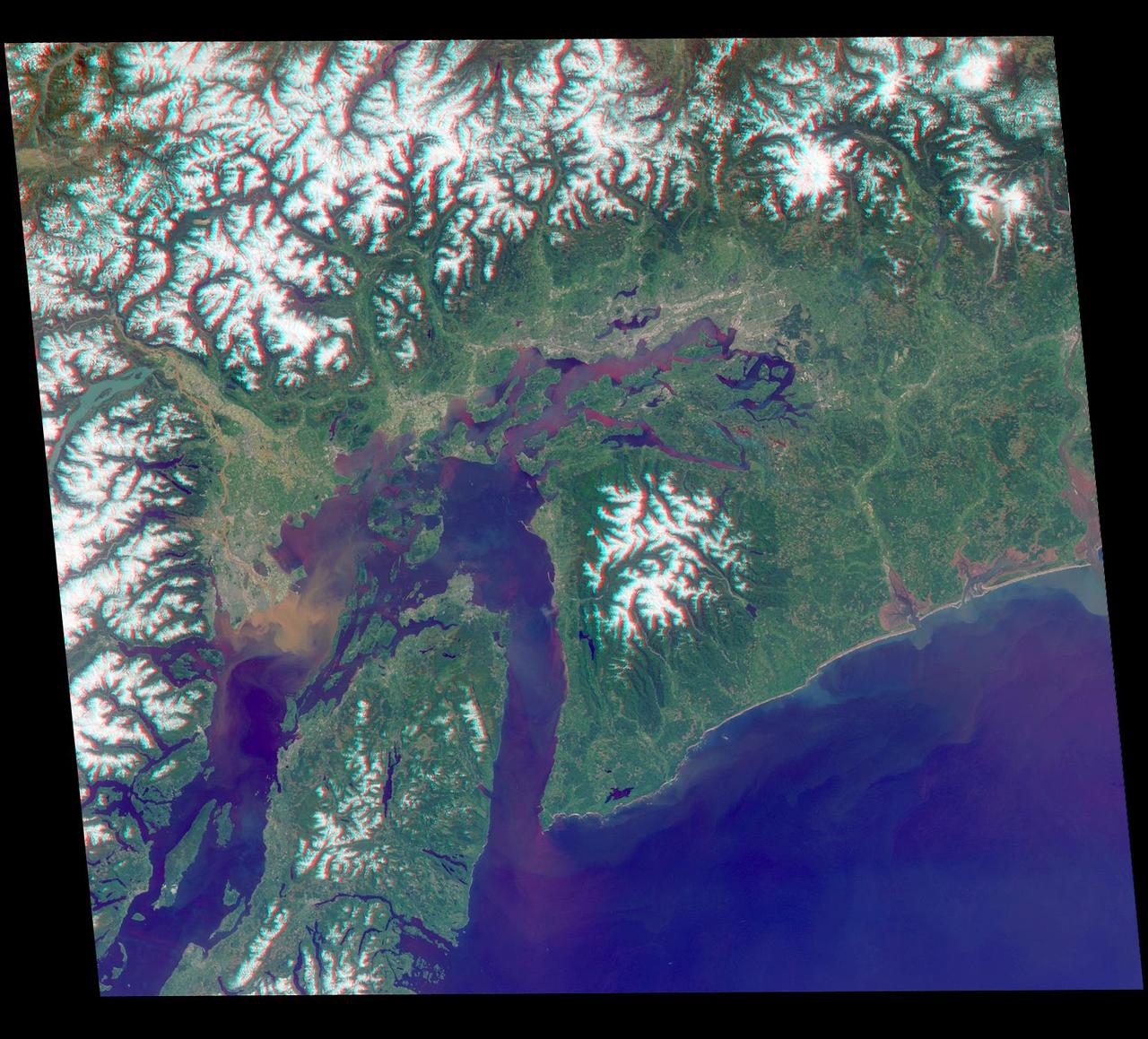
Just in time for the U.S. National Park Service's Centennial celebration on Aug. 25, NASA's Multiangle Imaging SpectroRadiometer (MISR) instrument aboard NASA's Terra satellite is releasing four new anaglyphs that showcase 33 of our nation's national parks, monuments, historical sites and recreation areas in glorious 3D. Shown in the annotated image are Lewis and Clark National Historic Park, Mt. Rainier National Park, Olympic National Park, Ebey's Landing National Historical Reserve, San Juan Island National Historic Park, North Cascades National Park, Lake Chelan National Recreation Area, and Ross Lake National Recreation Area (also Mt. St. Helens National Volcanic Monument, administered by the U.S. Forest Service) MISR views Earth with nine cameras pointed at different angles, giving it the unique capability to produce anaglyphs, stereoscopic images that allow the viewer to experience the landscape in three dimensions. The anaglyphs were made by combining data from MISR's vertical-viewing and 46-degree forward-pointing camera. You will need red-blue glasses in order to experience the 3D effect; ensure you place the red lens over your left eye. The images have been rotated so that north is to the left in order to enable 3D viewing because the Terra satellite flies from north to south. All of the images are 235 miles (378 kilometers) from west to east. These data were acquired May 12, 2012, Orbit 65960. http://photojournal.jpl.nasa.gov/catalog/PIA20891