Olympica Fossae
Olympica Fossae
Olympica Fossae
Olympica Fossae
Olympica Fossae Redux
West Olympica Fossae
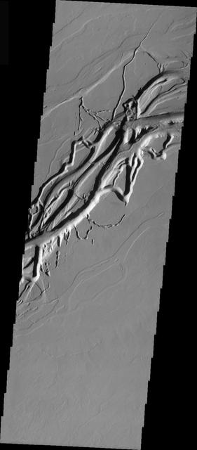
Olympica Fossae Landforms
Martian Variety Exhibited by the Olympica Fossae
This image captured by NASA 2001 Mars Odyssey spacecraft shows part of Olympica Fossae.
This image captured by NASA 2001 Mars Odyssey spacecraft shows a small portion of Olympica Fossae. Olympica Fossae is located on volcanic plains between Alba Mons and Olympus Mons. The linear margins and uniform width are controlled by faulting; this feature is called a graben. Orbit Number: 61317 Latitude: 26.0058 Longitude: 248.318 Instrument: VIS Captured: 2015-10-10 14:31 http://photojournal.jpl.nasa.gov/catalog/PIA20113
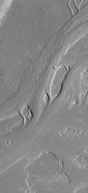
Today's VIS image shows a section of Olympica Fossae. Olympica Fossae is a complex channel located on the volcanic plains between Alba Mons and Olympus Mons. The sinuosity of the channels in the middle of the image indicates that these channels were created by liquid flow. In this case the location and other surface features point to lava rather than water as the liquid. Orbit Number: 88489 Latitude: 22.8561 Longitude: 242.996 Instrument: VIS Captured: 2021-11-25 11:51 https://photojournal.jpl.nasa.gov/catalog/PIA25198
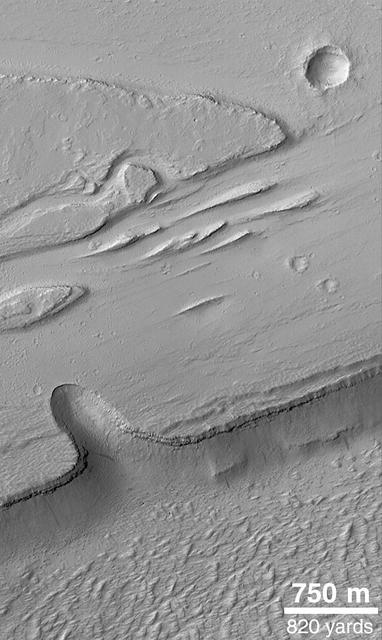
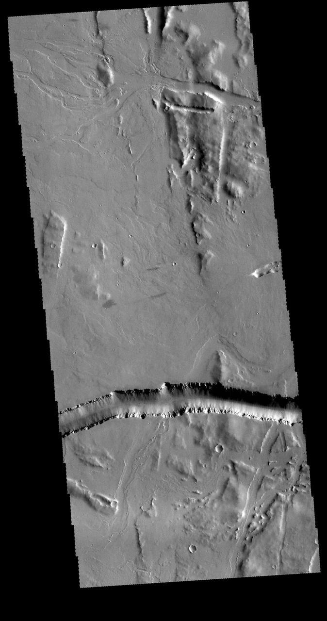
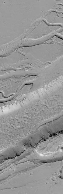
The linear channel in the bottom half of this VIS image is part of Olympica Fossae. Olympica Fossae is a complex channel form located on the Tharsis plains between Alba Mons and Olympus Mons. It was most likely created by volcanic flows, but was probably also affected by the formation of graben in the region. Graben are formed by the down-drop of material between paired faults. The collapse of the Alba Mons volcano resulted in a huge region of graben. Orbit Number: 71495 Latitude: 22.7947 Longitude: 242.683 Instrument: VIS Captured: 2018-01-26 01:24 https://photojournal.jpl.nasa.gov/catalog/PIA22396
The complex channel in this image captured by NASA 2001 Mars Odyssey spacecraft is part of Olympica Fossae, and was most likely formed by the flow of lava.
This Mars Global Surveyor MGS Mars Orbiter Camera MOC image shows a complex pattern of intersecting and overlapping troughs in the Olympica Fossae region of northern Tharsis
The complex region of channels at the top of this image, captured by NASA 2001 Mars Odyssey spacecraft, are lava channels. These channels are called Olympica Fossae.
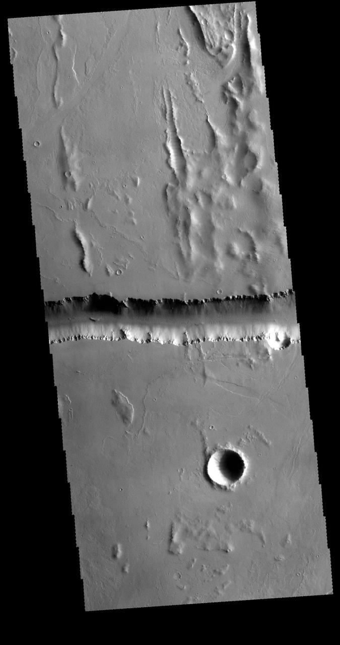
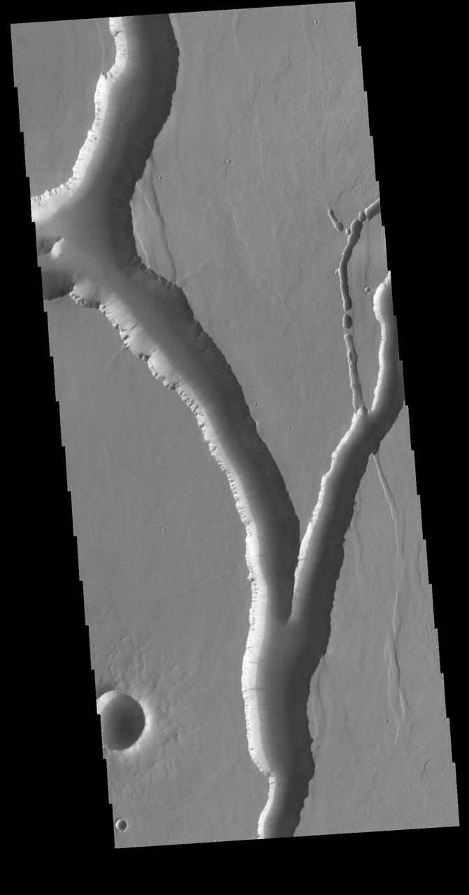
Olympica Fossae is a complex channel located on the volcanic plains between Alba Mons and Olympus Mons. It contains both linear sections that appear to be tectonic in origin and sinuous sections that were more likely created by liquid flow. Given the location it appears that lava, rather than water, was the fluid. Olympica Fossae 420km long (261 miles). Orbit Number: 88776 Latitude: 22.9121 Longitude: 243.053 Instrument: VIS Captured: 2021-12-19 03:01 https://photojournal.jpl.nasa.gov/catalog/PIA25302
Olympica Fossae is a complex channel located on the volcanic plains between Alba Mons and Olympus Mons. It contains both linear sections that appear to be tectonic in origin and sinuous sections that were more likely created by liquid flow. Given the location it appears that lava, rather than water, was the fluid. Olympica Fossae 420km long (261 miles). Orbit Number: 94828 Latitude: 24.6519 Longitude: 245.654 Instrument: VIS Captured: 2023-05-01 10:42 https://photojournal.jpl.nasa.gov/catalog/PIA26191
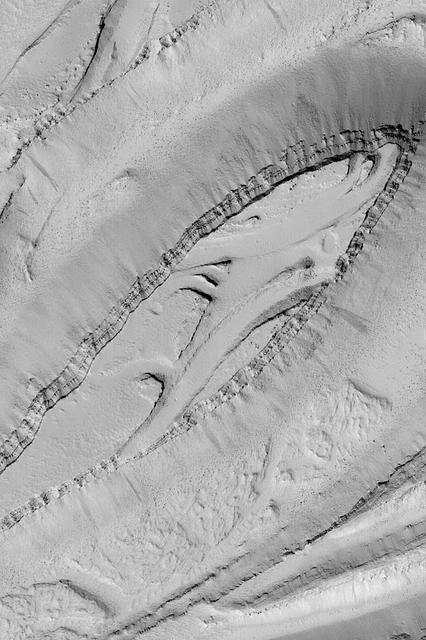
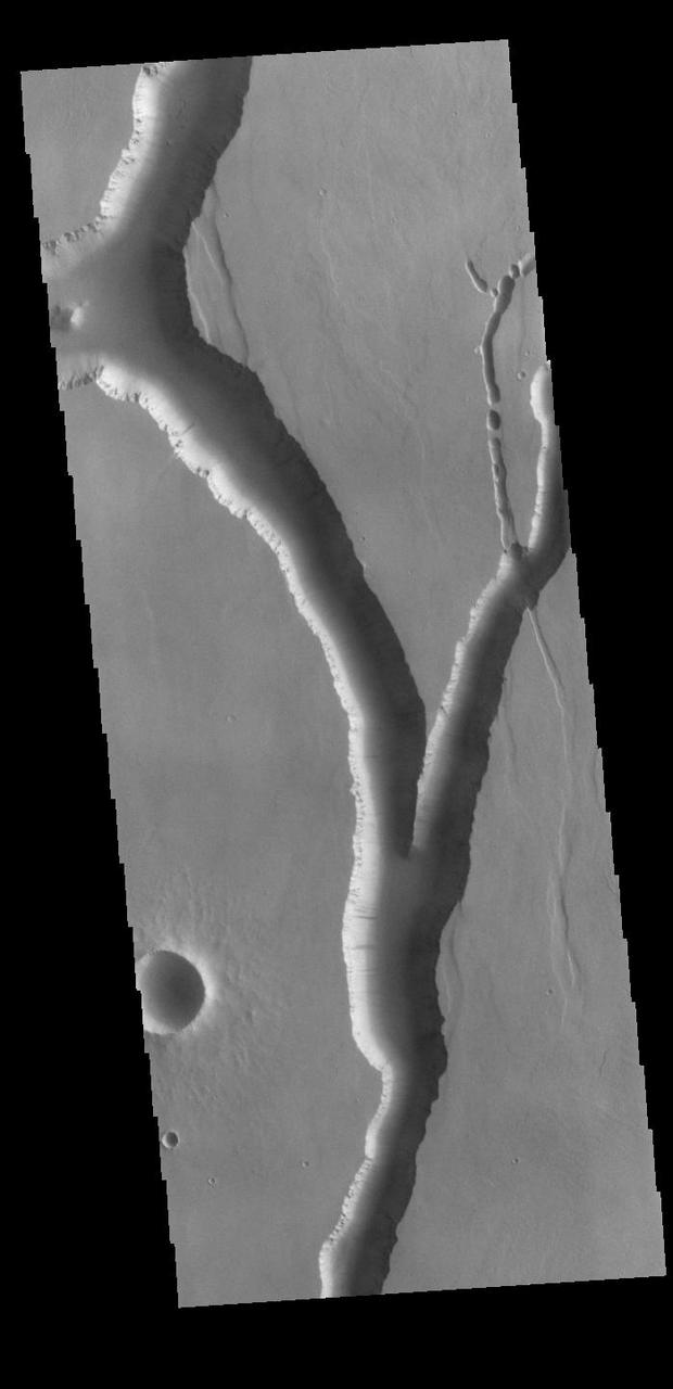
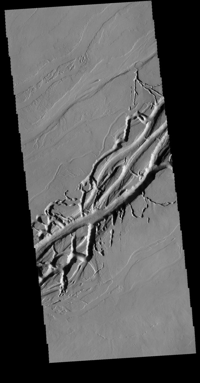
Olympica Fossae is a complex channel located on the volcanic plains between Alba Mons and Olympus Mons. It contains both linear sections that appear to be tectonic in origin and sinuous sections that were more likely created by liquid flow. There are several streamlined islands in this image, indicating a fluvial origin in this section of the fossae. Given the location it appears that lava, rather than water, was the fluid. Olympica Fossae 420km long (261 miles). Orbit Number: 95165 Latitude: 23.3032 Longitude: 243.696 Instrument: VIS Captured: 2023-05-29 04:39 https://photojournal.jpl.nasa.gov/catalog/PIA26264

This image from NASA 2001 Mars Odyssey shows a complex region of channels in Tharsis. Called Olympica Fossae, these channel forms were created by lava flows rather than water.

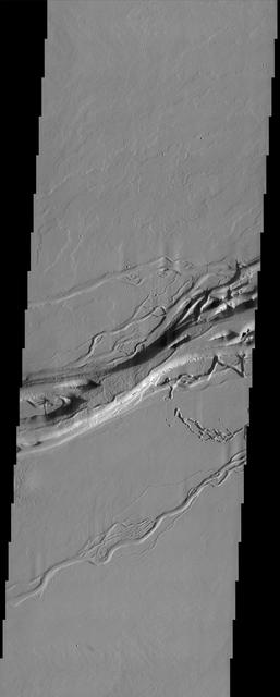
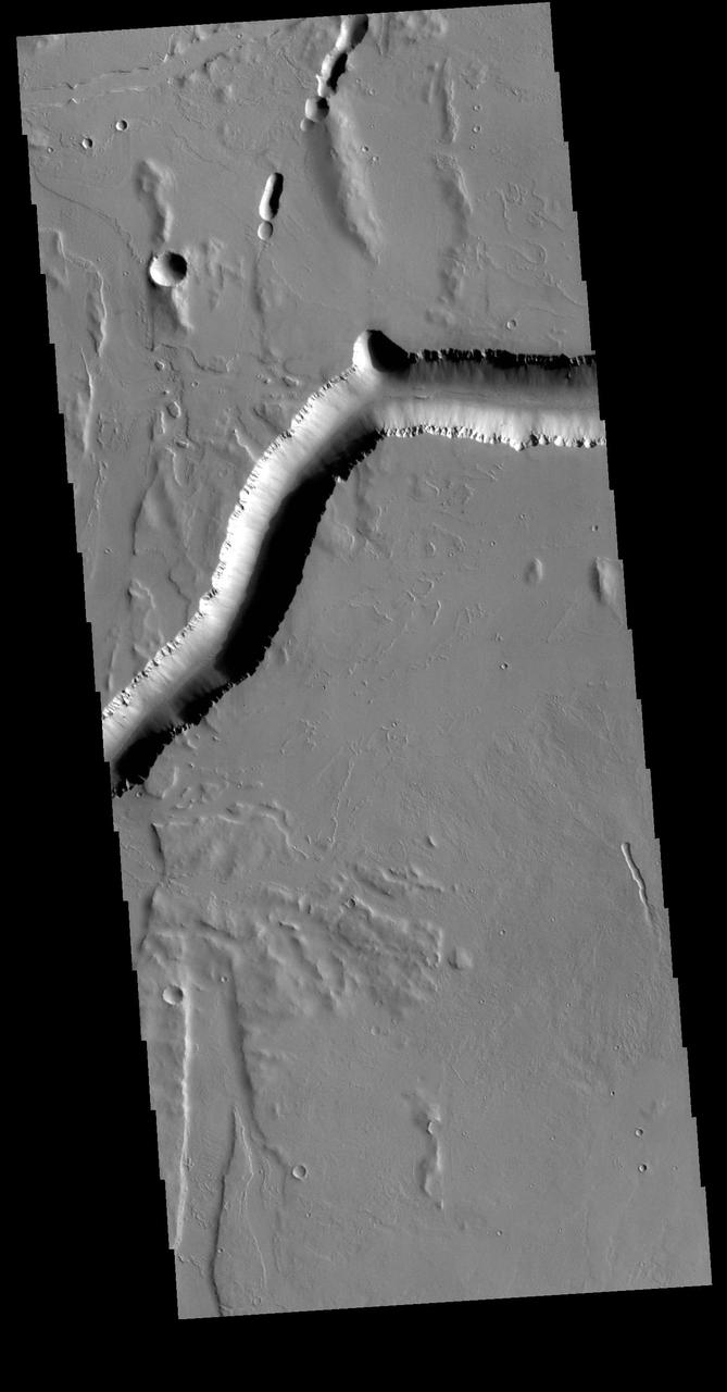
The depression crossing this VIS image is a lava channel called Olympica Fossae. It is located on lava plains between Alba Mons and Olympus Mons. Orbit Number: 60743 Latitude: 25.7077 Longitude: 247.589 Instrument: VIS Captured: 2015-08-24 08:06 http://photojournal.jpl.nasa.gov/catalog/PIA20071
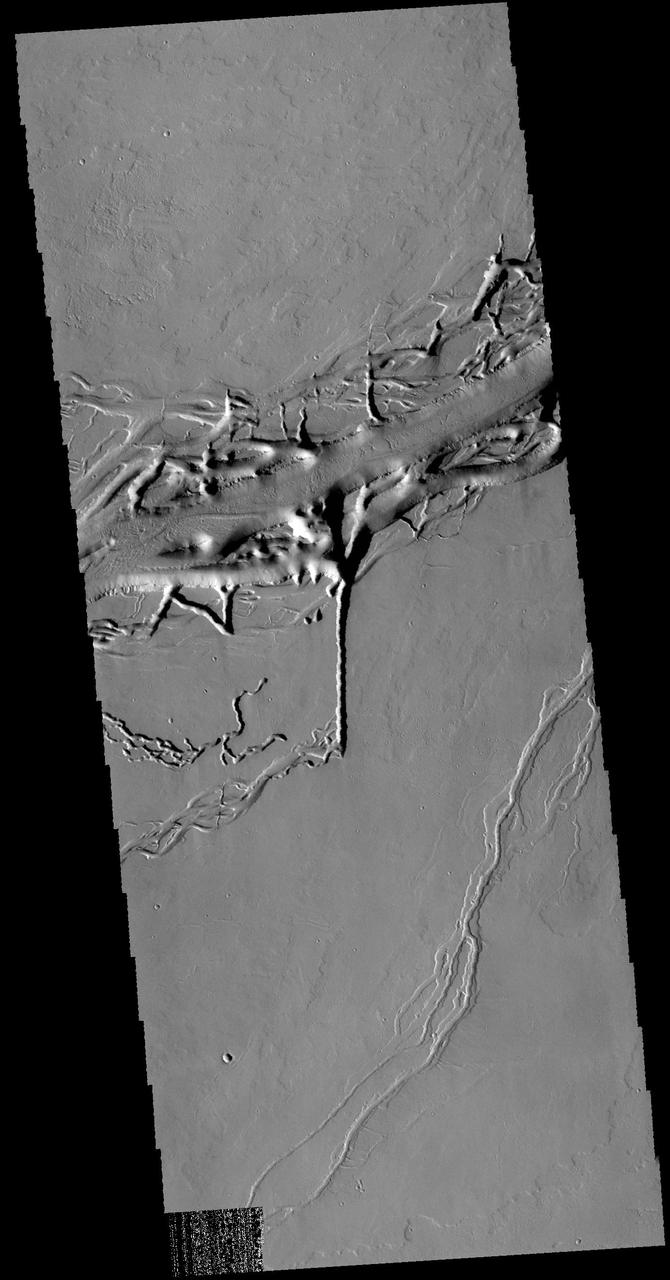
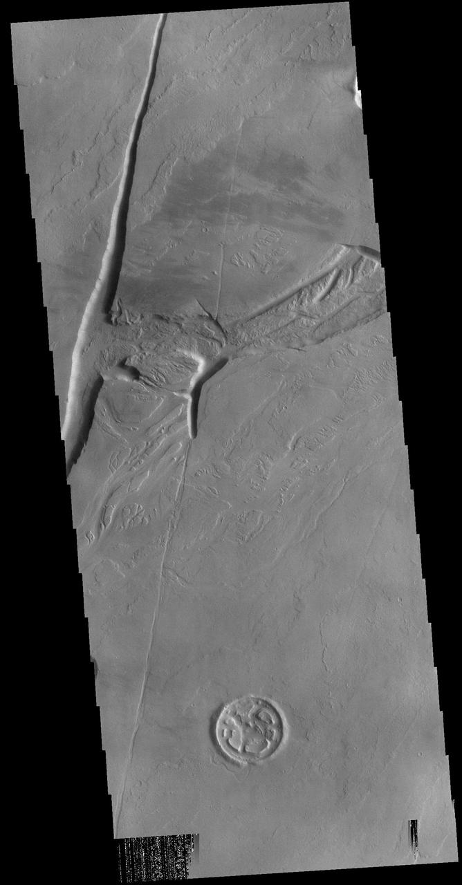
This image from NASA 2001 Mars Odyssey spacecraft shows a different part of Olympica Fossae. In this region lava channels dominate. The complex interaction of volcanic and tectonic processes is illustrated by the central feature in this image.
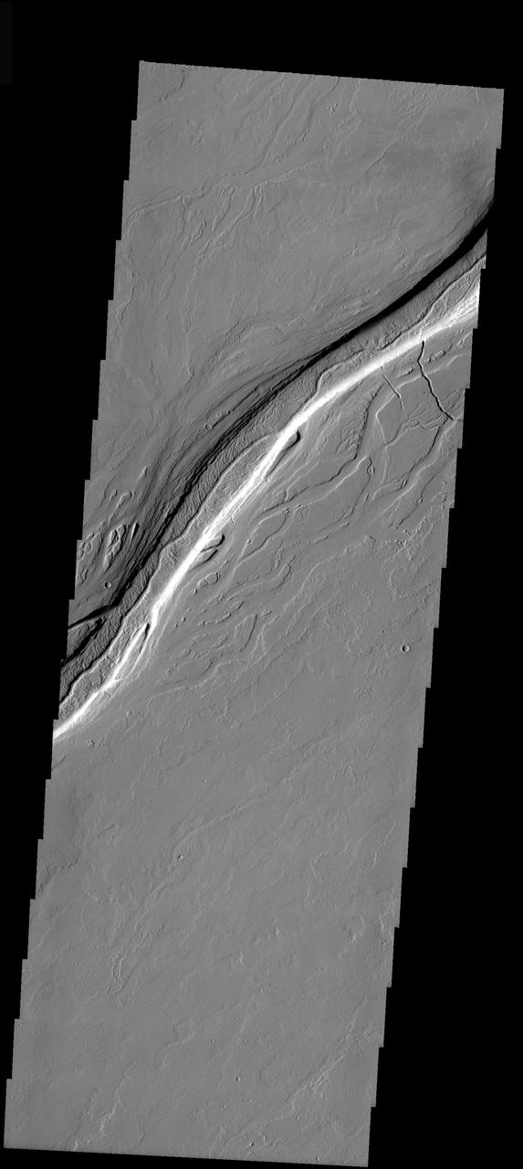
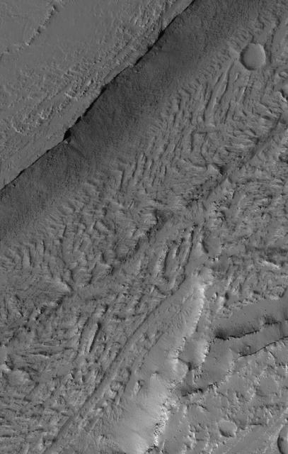
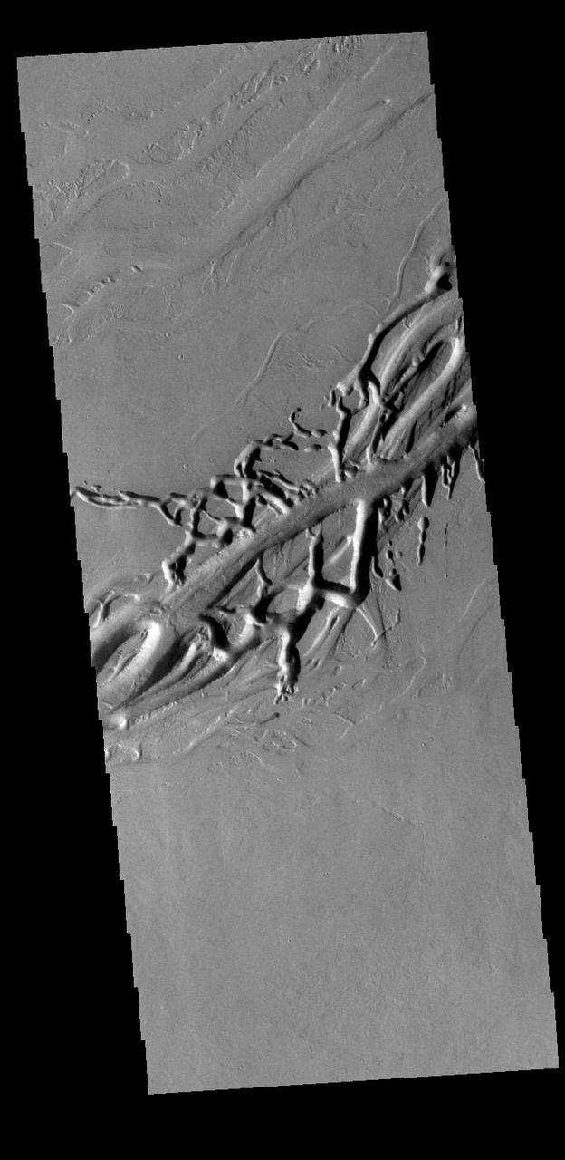
This image from NASA Mars Odyssey spacecraft shows the Olympica Fossae channel system located east of the Olympus Mons volcano in Tharsis. These anastomosing channels cut numerous lava flows indicating that the channels are younger than the lava flows.

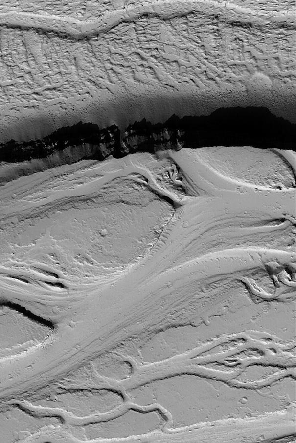
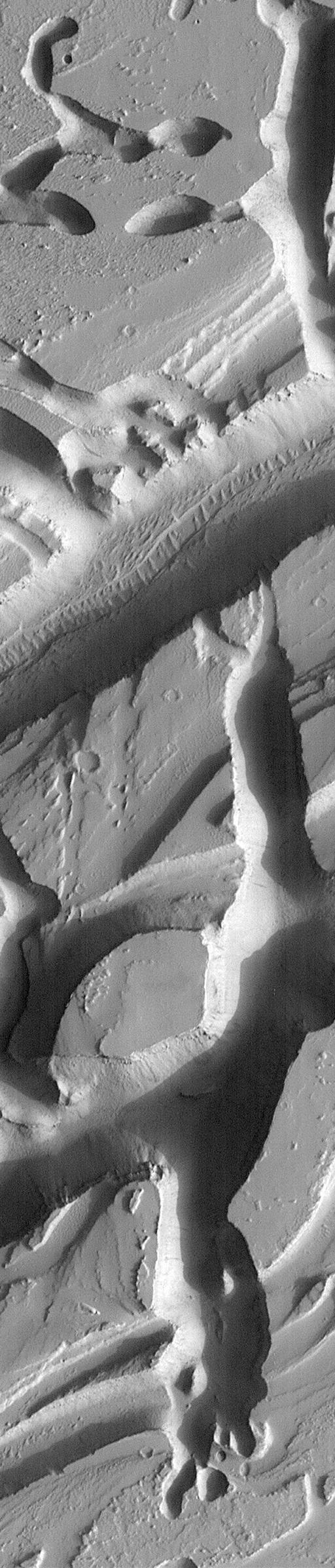
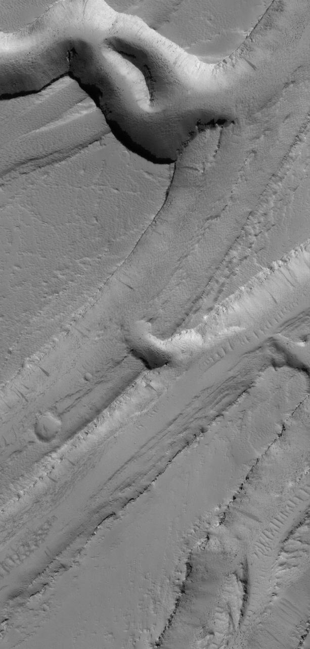
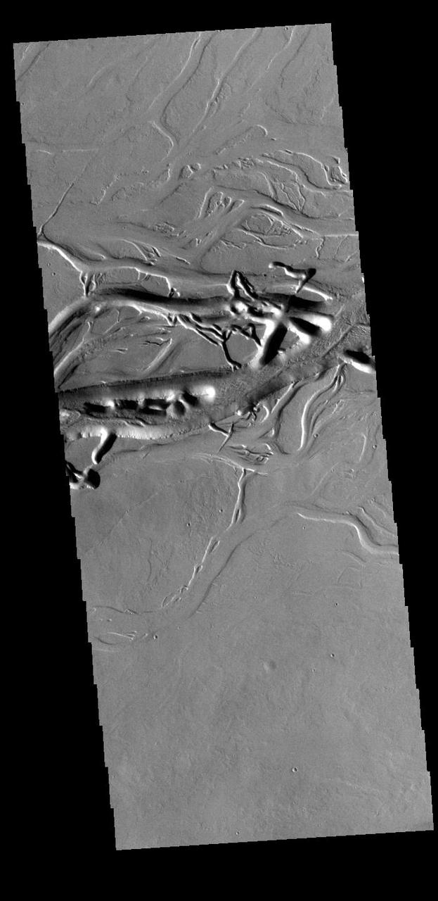
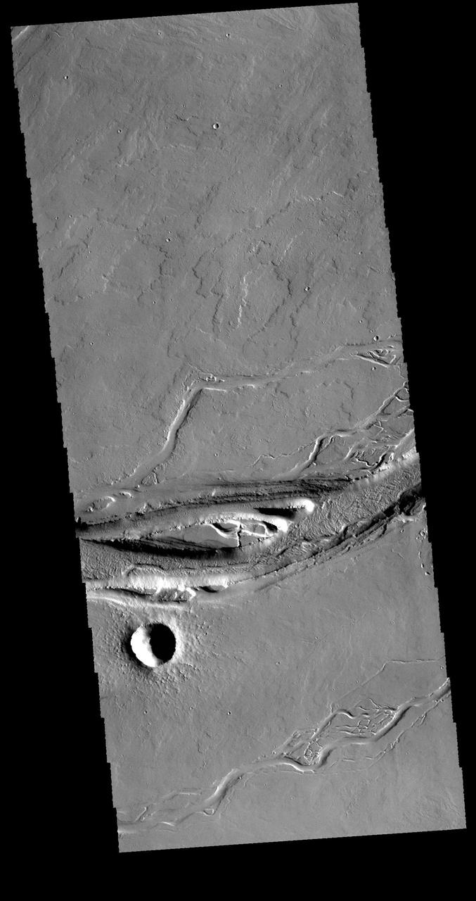
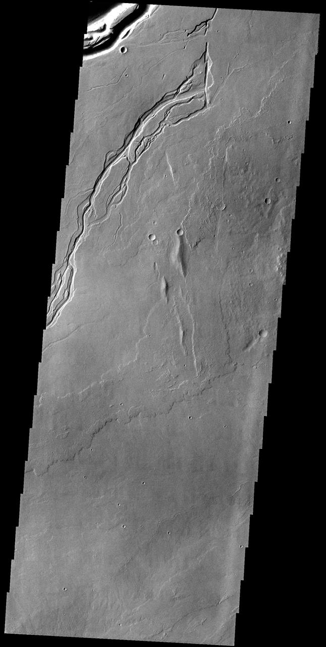
This complicated area contains various types of channels, pits and fractures. We can determine the relative ages of the pits and channels based on which features cross-cut others. Older channels appear smooth-edged and shallow. Younger channels and pits are deeper and more sharp-edged, as well as less sinuous than the shallower channels. What caused this array of various channels and intersecting pits? This region is covered in vast lava flows. The collapse pits here may be collapsed lava tubes or where overlying rock "drained" into voids created by extensional faulting. The older smoother channel that seems to source from this region may have carried an outflow of groundwater. It continues on for over 100 kilometers (62 miles). The orientation and shapes of these features make an interesting geological puzzle. http://photojournal.jpl.nasa.gov/catalog/PIA21066
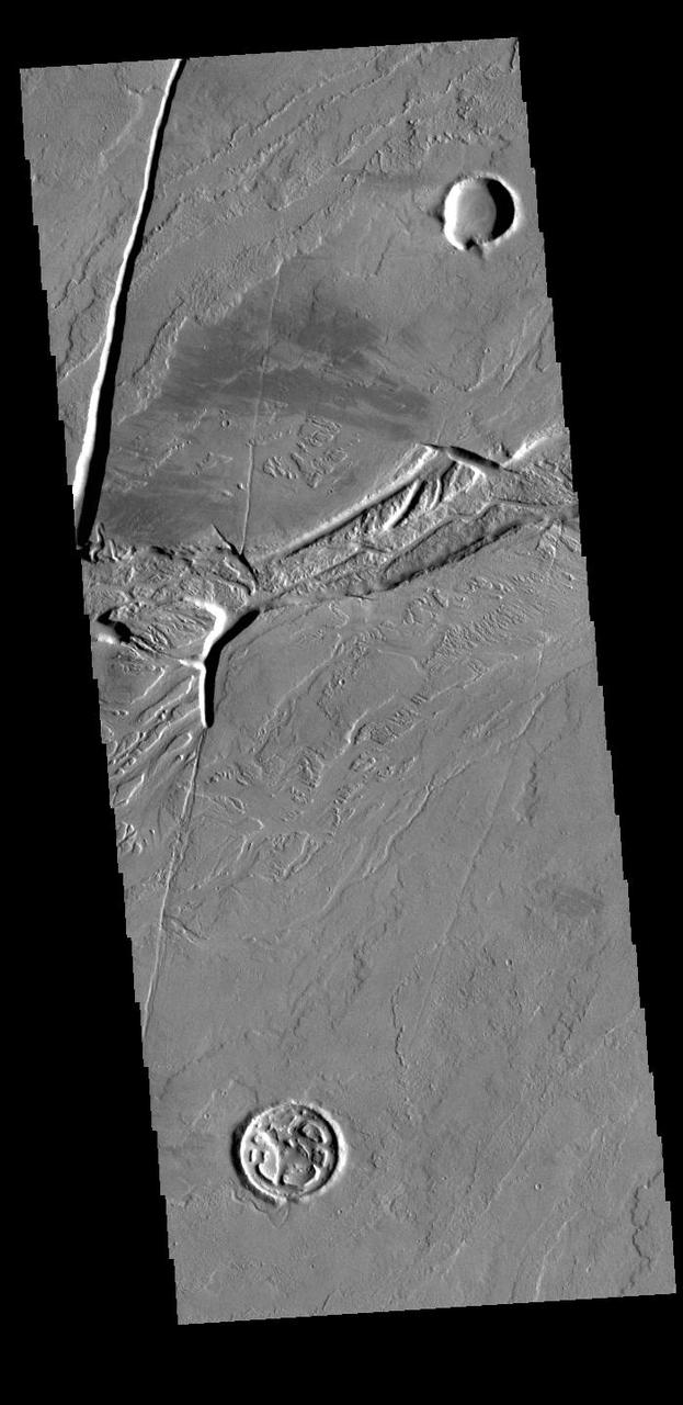
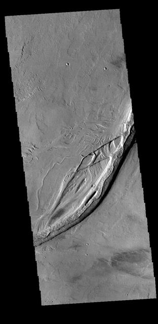
This image from NASA 2001 Mars Odyssey spacecraft shows a different portion of Olympica Fossae from yesterday image. The east/west alignment is a very uniform width, in this region the fracturing widens as the feature makes a turn to the south. http://photojournal.jpl.nasa.gov/catalog/PIA20114
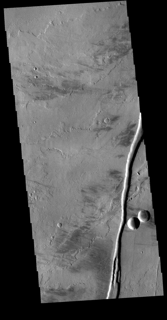
This VIS image shows a portion of Olympica Fossae. In this image several lava channels are visible, and it appears that lava has flowed in the larger depressions. The streamlined feature in the central part of the image also indicates that volcanic processes were active in this region. Orbit Number: 61654 Latitude: 24.8964 Longitude: 246.128 Instrument: VIS Captured: 2015-11-07 08:34. http://photojournal.jpl.nasa.gov/catalog/PIA20222
Olympica Fossae is a complex channel located on the volcanic plains between Alba Mons and Olympus Mons. The sinuosity of some of the channel sections in the the image indicates that liquid flow played a part creating these features. In this case the location and other surface features point to lava rather than water as the liquid. The interconnecting linear sections of depressions are most likely formed by the collapse of the surface into voids left by lava tubes. Orbit Number: 88152 Latitude: 24.3724 Longitude: 245.149 Instrument: VIS Captured: 2021-10-28 17:53 https://photojournal.jpl.nasa.gov/catalog/PIA25126
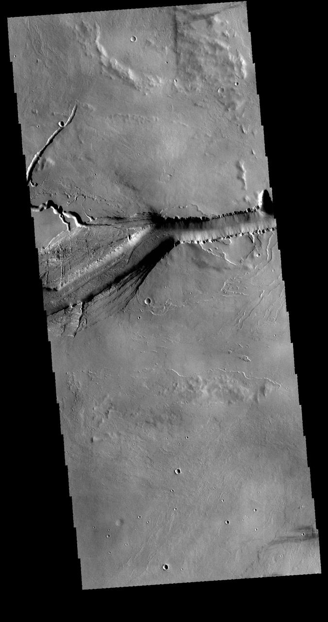
Olympica Fossae is a complex channel located on the Tharsis volcanic plains between Alba Mons and Olympus Mons. The sinuosity of the large channel in the top half of the image indicates that this is a channel created by liquid flow. In this case the location and other surface features visible in the image indicate that lava flow rather than water created the channel. The more linear depression at the bottom left side of the image is probably a tectonic feature called a graben and was formed by movement along fault lines. Orbit Number: 78693 Latitude: 25.836 Longitude: 248.007 Instrument: VIS Captured: 2019-09-10 21:41 https://photojournal.jpl.nasa.gov/catalog/PIA23501
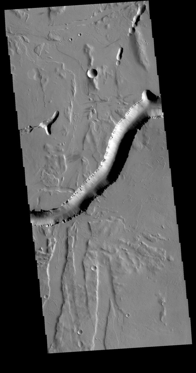
Olympica Fossae is a complex channel located on the volcanic plains between Alba Mons and Olympus Mons. The sinuosity of the large channel in the middle of the image indicates that this is a channel created by liquid flow. In this case the location and other surface features point to lava rather than water as the liquid. The more linear depressions at the bottom third of the image are possibly tectonic features called graben and formed by movement along fault lines. The Alba Mons region contains extensive faulting which formed due to collapse of the volcano. Orbit Number: 71183 Latitude: 25.8417 Longitude: 247.895 Instrument: VIS Captured: 2017-12-31 08:32 https://photojournal.jpl.nasa.gov/catalog/PIA22367
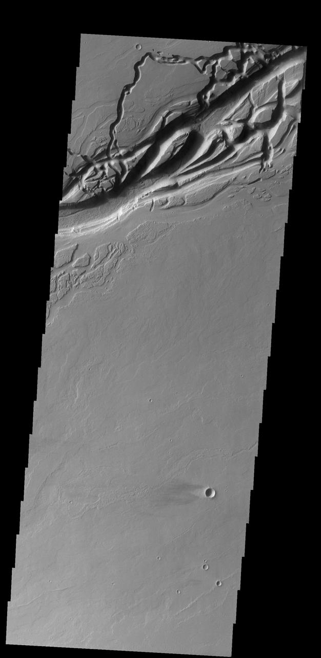
Olympica Fossae is a complex channel located on the volcanic plains between Alba Mons and Olympus Mons. The sinuosity of the large channel in the middle of the image indicates that this is a channel created by liquid flow. In this case the location and other surface features point to lava rather than water as the liquid. Subtle dark slope streaks are visible both in the channel walls and in the small crater at the bottom of the image. These features are thought to form by downslope movement of material which either reveals the darker rock beneath the dust coating, or creates the darker surface by flow of a volatile just beneath the dust coating. Orbit Number: 81875 Latitude: 25.8728 Longitude: 248.783 Instrument: VIS Captured: 2020-05-29 21:51 https://photojournal.jpl.nasa.gov/catalog/PIA24084
Olympica Fossae is a complex channel located on the volcanic plains between Alba Mons and Olympus Mons. The sinuosity of the large channel in the middle of the image indicates that this is a channel created by liquid flow. In this case the location and other surface features point to lava rather than water as the liquid. Subtle dark slope streaks are visible both in the channel walls and in the small crater at the bottom of the image. These features are thought to form by downslope movement of material which either reveals the darker rock beneath the dust coating, or creates the darker surface by flow of a volatile just beneath the dust coating. Orbit Number: 94466 Latitude: 25.8495 Longitude: 248.788 Instrument: VIS Captured: 2023-04-01 15:22 https://photojournal.jpl.nasa.gov/catalog/PIA26030
The channel at the very top of this image captured by NASA 2001 Mars Odyssey spacecraft is Olympica Fossae. That and the rest of the channels in this image are likely lava channels.
This MOC image shows a wide, flat-floored trough flanked by several smaller, branching troughs in the Olympica Fossae region of Mars. Dark- and intermediate-toned slope streaks -- created by dry avalanches of dust -- occur on the trough walls
This image captured by NASA 2001 Mars Odyssey spacecraft shows both linear and sinuous channel forms.
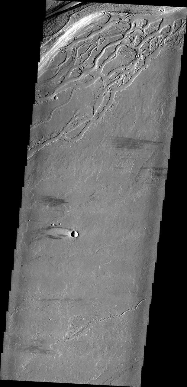
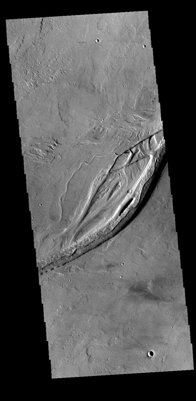
Located on the extensive lava plains between Olympus Mons and Alba Mons, this image from NASA 2001 Mars Odyssey spacecraft shows complex intersecting valleys, which were created by lava flow. Volcanic flows occurred both along the surface and in buried lava tubes. Orbit Number: 63962 Latitude: 24.4677 Longitude: 245.235 Instrument: VIS Captured: 2016-05-15 10:43 http://photojournal.jpl.nasa.gov/catalog/PIA20782