Olympus Mons
Olympus Mons
Olympus Mons
Olympus Mons
Olympus Mons
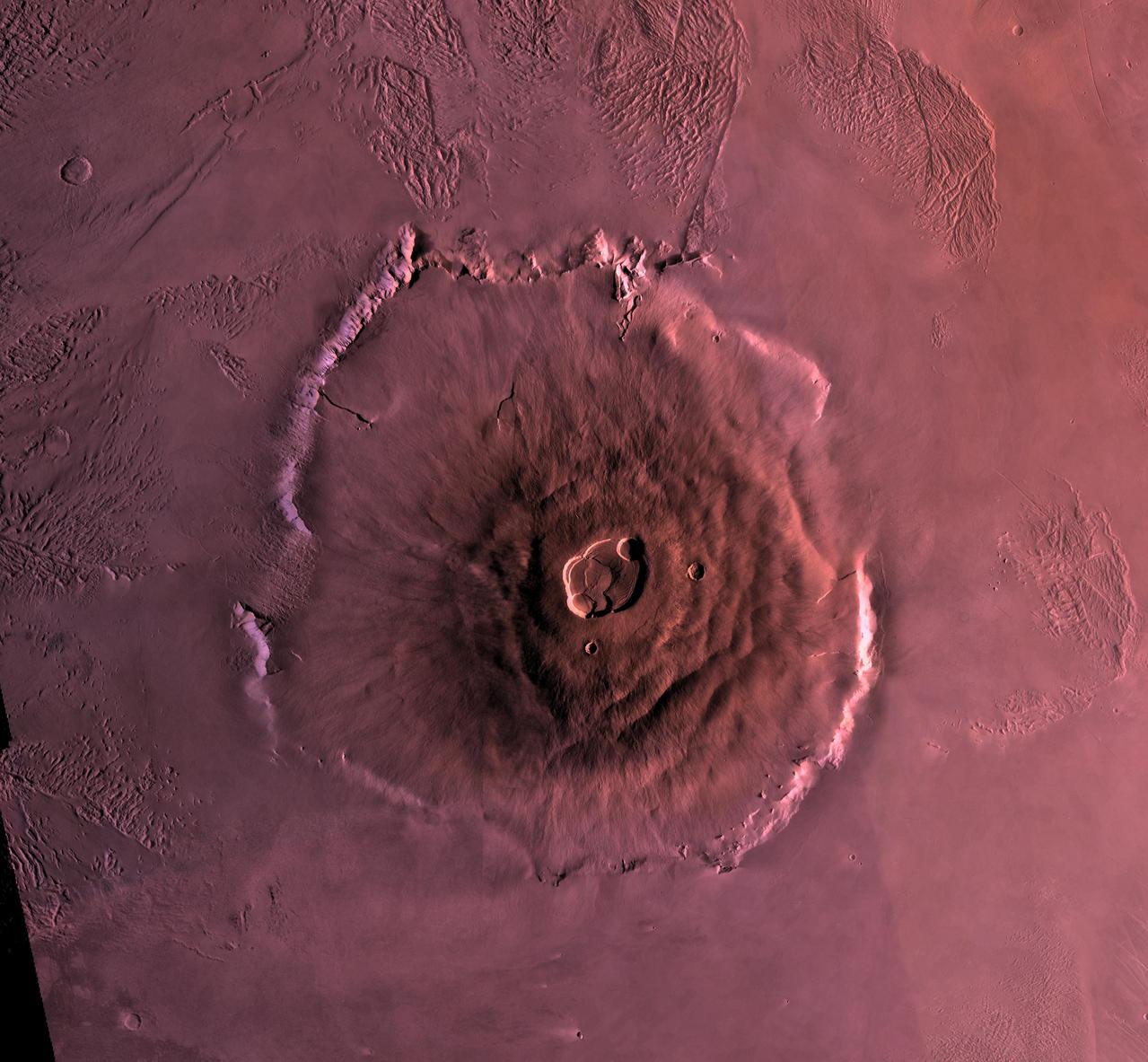
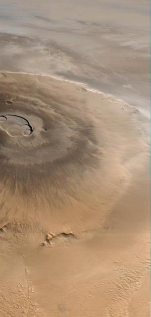
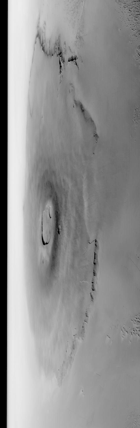
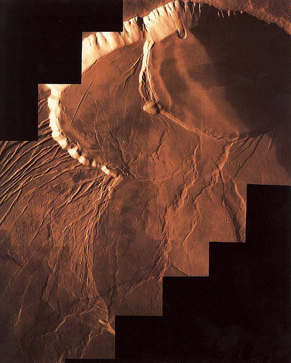
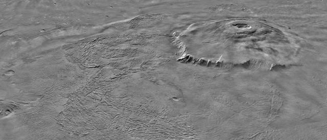
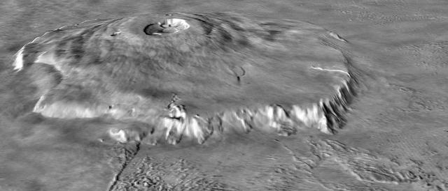
Shown here is a digital mosaic of Olympus Mons, the largest known volcano in the Solar System. It is 27 kilometers high, over 600 kilometers at the base, and is surrounded by a well-defined scarp that is up to 6 km high. Lava flows drape over the scarp in places. Much of the plains surrounding the volcano are covered by the ridged and grooved 'aureole' of Olympus Mons. The origin of the aureole is controversial, but may be related to gravity sliding off of the flanks of an ancestral volcano. The summit caldera (central depression) is almost 3 km deep and 25 km across. It probably formed from recurrent collapse following drainage of magma resulting from flank eruptions. http://photojournal.jpl.nasa.gov/catalog/PIA00300
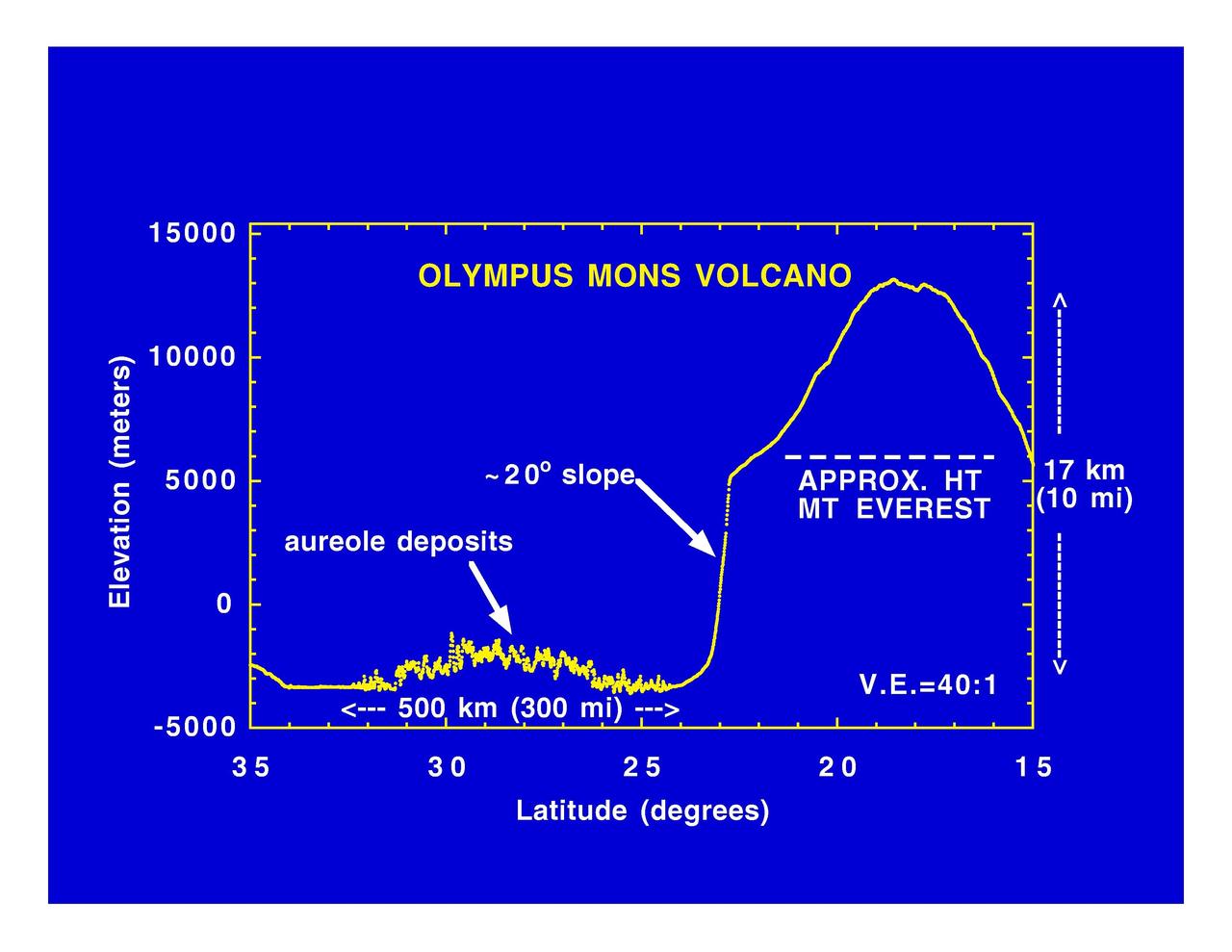
Olympus Mons Volcano
Olympus Mons at Night
Olympus Mons Lava Flows
Olympus Mons Lava Flows
Crater Karzok on Olympus Mons
Olympus Mons, 1998 Color
Oblique Olympus Mons
Top of Olympus Mons
Flows from Olympus Mons
Southeast Olympus Mons
Olympus Mons In Visible Light
Olympus Mons Windstreaks
Rugged Olympus Mons
The Summit of Olympus Mons

Olympus Mons Lava Flows
Photomosiac of Olympus Mons
Flows on Olympus Mons
Olympus Mons in Day
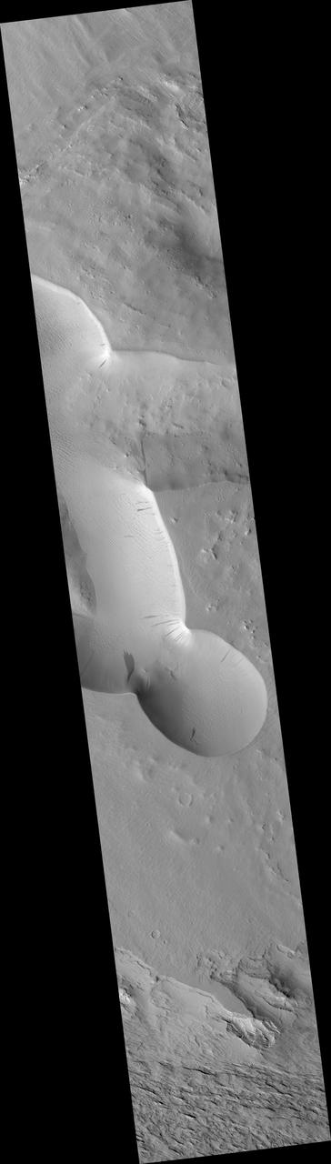
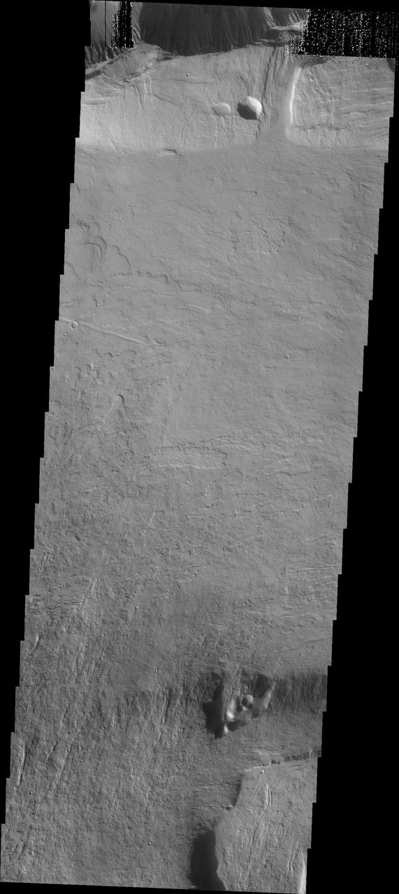
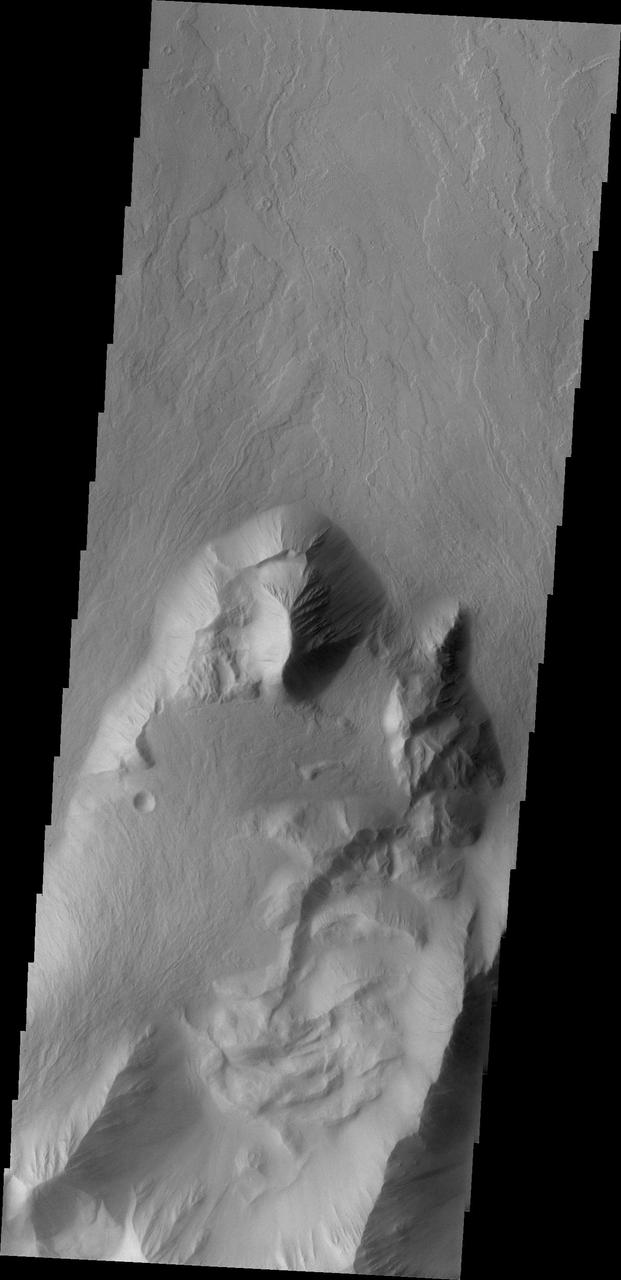
Olympus Mons Landslide
Olympus Mons Mensa
Blocks in the Olympus Mons
Edge of the Olympus Mons
Olympus Mons in Color
This image shows a portion of the summit caldera of Olympus Mons

These lava flows occur on the flank of Olympus Mons
Dust-Mantled Olympus Mons Flows
Arcuate Fractures in Olympus Mons Caldera
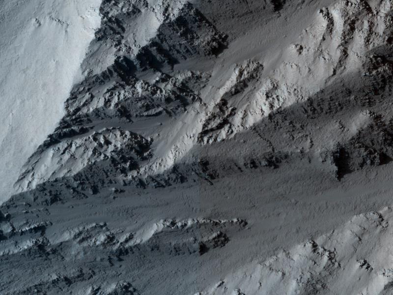
Layers in Olympus Mons Basal Scarp

A Traverse Across the Summit of Olympus Mons
Slope Streak South of Olympus Mons
This spectacular image shows part of the escarpment of the Olympus Mons volcano
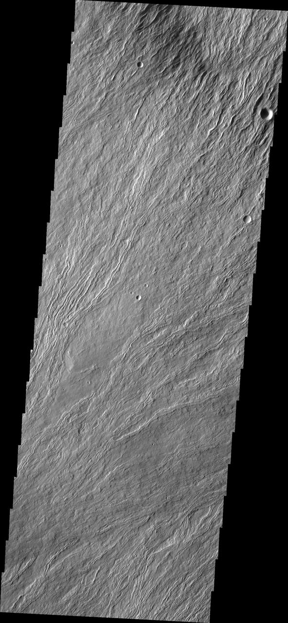
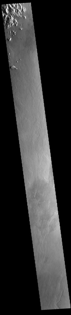
Today's VIS image is located on the upper flank of Olympus Mons. Olympus Mons is the largest volcano in the solar system, standing 14 miles high above the surrounding volcanic plains. Orbit Number: 77209 Latitude: 17.991 Longitude: 225.786 Instrument: VIS Captured: 2019-05-11 16:44 https://photojournal.jpl.nasa.gov/catalog/PIA23297
This image shows the massive Olympus Mons flows at the basal escarpment
Today's VIS image shows the upper elevations of Olympus Mons, including part of the summit caldera. Scarps and extensional features (graben) record multiple stages of caldera collapse at the summit of Olympus Mons. Olympus Mons is the largest volcano in the solar system, reaching heights over 40 km (25 miles) tall from base to summit, with the base covering an area as large as the state of Arizona. For comparison, Mauna Loa is 9 km (5.5 miles) tall measured from its base on the sea floor. Orbit Number: 90561 Latitude: 17.6564 Longitude: 226.782 Instrument: VIS Captured: 2022-05-15 02:28 https://photojournal.jpl.nasa.gov/catalog/PIA25476
Today's VIS image is located on the upper flank of Olympus Mons. Olympus Mons is the largest volcano in the solar system, reaching heights over 25 km (16 miles) tall from base to summit, with the base covering an area as large as the state of Arizona. For comparison, Mauna Loa is 9 km (5.5 miles) tall measured from its base on the sea floor. Orbit Number: 94916 Latitude: 18.4882 Longitude: 227.856 Instrument: VIS Captured: 2023-05-08 16:34 https://photojournal.jpl.nasa.gov/catalog/PIA26219
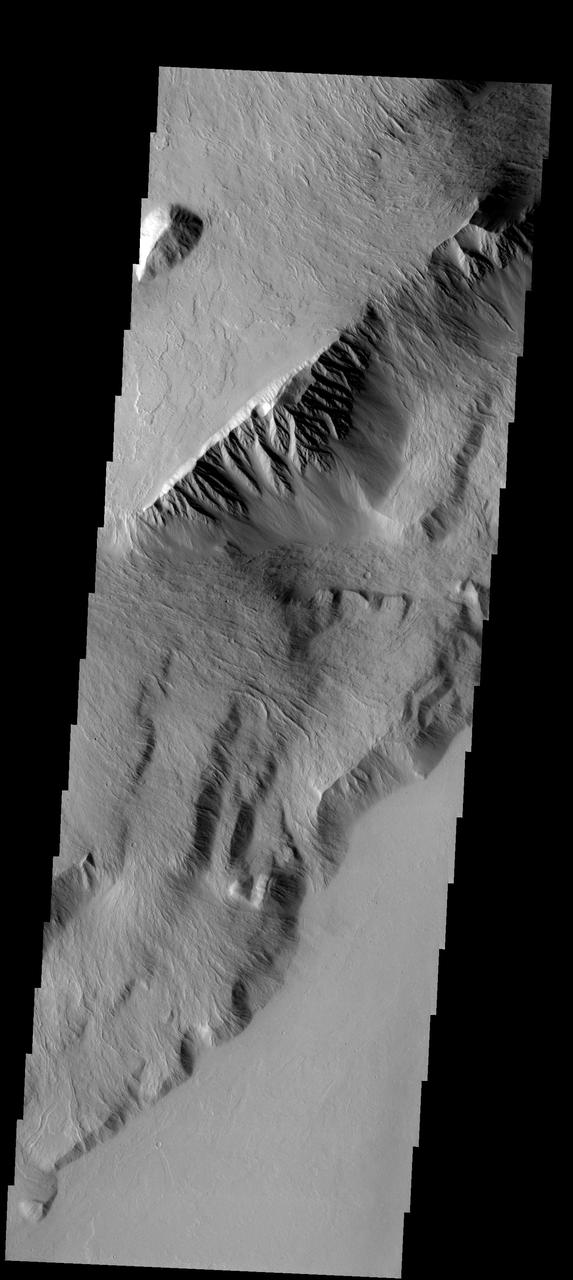
This spectacular image of the northern escarpment of Olympus Mons contains many different features. Lava flows are visible at the bottom of the frame
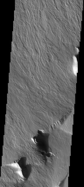
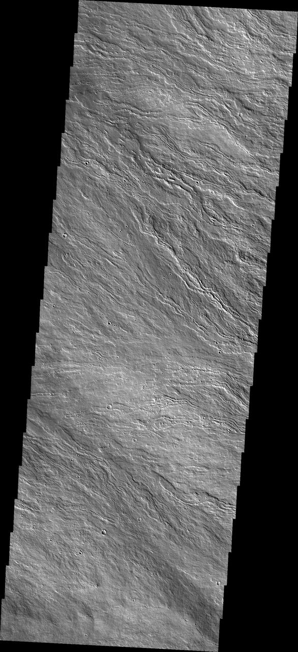
The narrow flows and channels in this image captured by NASA 2001 Mars Odyssey spacecraft are located on the northeastern margin of Olympus Mons.
This image, taken by NASA Mars Odyssey spacecraft, shows flow features on the northern flank of Olympus Mons.
The lava flows in this image captured by NASA 2001 Mars Odyssey spacecraft are located on the eastern flank of Olympus Mons.
This image captured by NASA 2001 Mars Odyssey spacecraft shows part of the caldera system on the summit of Olympus Mons.
The narrow lava flows in this image from NASA 2001 Mars Odyssey spacecraft are located on the northeastern flank of Olympus Mons.
This image captured by NASA Mars Odyssey shows one edge of the complex caldera at the summit of Olympus Mons.
Part of the summit caldera of Olympus Mons is visible at the bottom of this image as seen by NASA 2001 Mars Odyssey spacecraft.
The narrow volcanic flows in this image captured by NASA 2001 Mars Odyssey spacecraft are located on the northeastern flank of Olympus Mons.
Wind-Eroded Terrain near Olympus Mons
Valleys and Lava Flows near Olympus Mons
Major Martian Volcanoes from MOLA - Olympus Mons
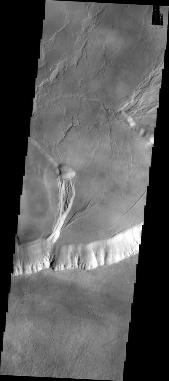
Large Lava Fan on the Northwestern Flank of Olympus Mons
Fans of Lava Flows on the Flanks of Olympus Mons
Major Martian Volcanoes from MOLA - Olympus Mons
Today's VIS image is located on the upper flank of Olympus Mons. Olympus Mons is the largest volcano in the solar system, reaching heights over 25 km (16 miles) tall from base to summit, with the base covering an area as large as the state of Arizona. For comparison, Mauna Loa is 9 km (5.5 miles) tall measured from its base on the sea floor. Orbit Number: 94966 Latitude: 18.3366 Longitude: 225.43 Instrument: VIS Captured: 2023-05-12 19:22 https://photojournal.jpl.nasa.gov/catalog/PIA26222
Today's VIS image is located on the lower flank of Olympus Mons. Olympus Mons is the largest volcano in the solar system, reaching heights over 25 km (16 miles) tall from base to summit, with the base covering an area as large as the state of Arizona. For comparison, Mauna Loa is 9 km (5.5 miles) tall measured from its base on the sea floor. Orbit Number: 85532 Latitude: 17.993 Longitude: 230.178 Instrument: VIS Captured: 2021-03-27 00:25 https://photojournal.jpl.nasa.gov/catalog/PIA24852
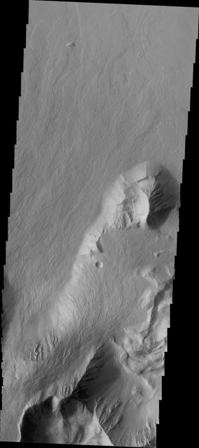
The margin of Olympus Mons consists of a cliff-like edge where elevation changes very quickly over a very small width. This edge is called Olympus Rupes. This VIS image shows part of that edge and the lava flows that spilled over the edge to flood the surrounding plains. Orbit Number: 65335 Latitude: 16.0811 Longitude: 221.373 Instrument: VIS Captured: 2016-09-05 12:58 http://photojournal.jpl.nasa.gov/catalog/PIA21155
The narrow volcanic flows in this image from NASA 2001 Mars Odyssey spacecraft are located on Olympus Mons, the largest volcano in the solar system.
Today's VIS image shows part of the summit caldera of Olympus Mons. Scarps and extensional features (graben) record multiple stages of caldera collapse at the summit of Olympus Mons. Olympus Mons is the largest volcano in the solar system, reaching heights of over 40 km (25 miles) tall from base to summit, with the base covering an area as large as the state of Arizona. For comparison, Mauna Loa is 9 km (5.5 miles) tall measured from its base on the sea floor. Orbit Number: 85894 Latitude: 18.264 Longitude: 226.925 Instrument: VIS Captured: 2021-04-25 19:46 https://photojournal.jpl.nasa.gov/catalog/PIA24885
Today's VIS image shows part of the summit caldera of Olympus Mons. Scarps and extensional features (graben) record multiple stages of caldera collapse at the summit of Olympus Mons. Olympus Mons is the largest volcano in the solar system, reaching heights over 40 km (25 miles) tall from base to summit, with the base covering an area as large as the state of Arizona. For comparison, Mauna Loa is 9 km (5.5 miles) tall measured from its base on the sea floor. Orbit Number: 87666 Latitude: 18.7403 Longitude: 226.733 Instrument: VIS Captured: 2021-09-18 17:27 https://photojournal.jpl.nasa.gov/catalog/PIA25230

Today's VIS image shows part of the summit caldera of Olympus Mons. Scarps and extensional features (graben) record multiple stages of caldera collapse at the summit of Olympus Mons. Olympus Mons is the largest volcano in the solar system, reaching heights of over 40 km (25 miles) tall from base to summit, with the base covering an area as large as the state of Arizona. For comparison, Mauna Loa is 9 km (5.5 miles) tall measured from its base on the sea floor. Orbit Number: 80291 Latitude: 18.2581 Longitude: 226.932 Instrument: VIS Captured: 2020-01-20 11:36 https://photojournal.jpl.nasa.gov/catalog/PIA23818
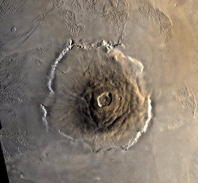
Color mosaic of Olympus Mons volcano on Mars from the Viking 1 Orbiter. The mosaic was created using images from orbit 735 taken 22 June 1978. Olympus Mons is about 600 km in diameter and the summit caldera is 24 km above the surrounding plains.
This image from NASA 2001 Mars Odyssey shows the central portion of the complex caldera at the summit of Olympus Mons.
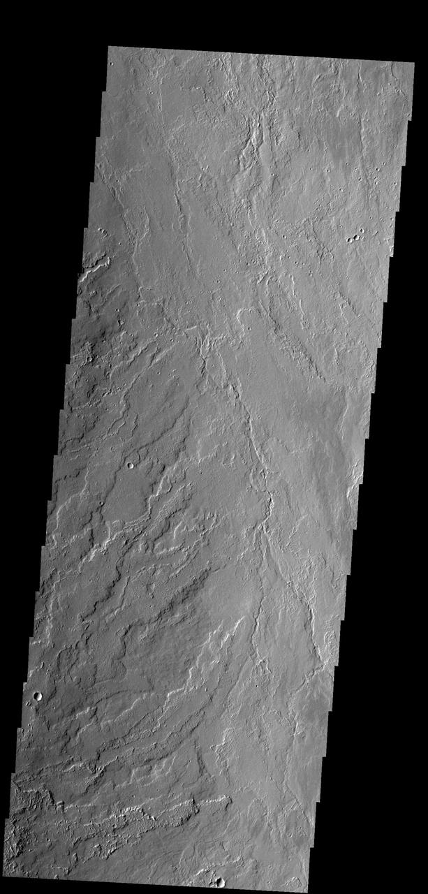
This image shows lava flows that originated at Olympus Mons as seen by NASA 2001 Mars Odyssey spacecraft.
The lava flows in this image captured by NASA 2001 Mars Odyssey spacecraft are located on Olympus Mons, the largest volcano in the solar system.
This image captured by NASA 2001 Mars Odyssey spacecraft shows the steep escarpment between Olympus Mons and the surrounding volcanic plains.
Today image shows the eastern portion of the complex caldera at the summit of Olympus Mon as seen by NASA 2001 Mars Odyssey spacecraft.
Today's VIS image shows part of the lower flank of Olympus Mons. The bright band in the image is an escarpment, where there is a large elevation change over a very short linear range – a cliff. This escarpment is called Olympus Rupes. In 2-D images it is very difficult to interpret the height component. In this case, the elevation change from the highest point (bottom of image) to the lowest point (top of image) is 7757m (25,449 feet). Olympus Mons is 21.9km (13.6 miles, 72,000 feet) tall. For comparison, Mt Everest is only 29,032 feet tall. Orbit Number: 94579 Latitude: 22.7256 Longitude: 229.336 Instrument: VIS Captured: 2023-04-10 22:38 https://photojournal.jpl.nasa.gov/catalog/PIA26055
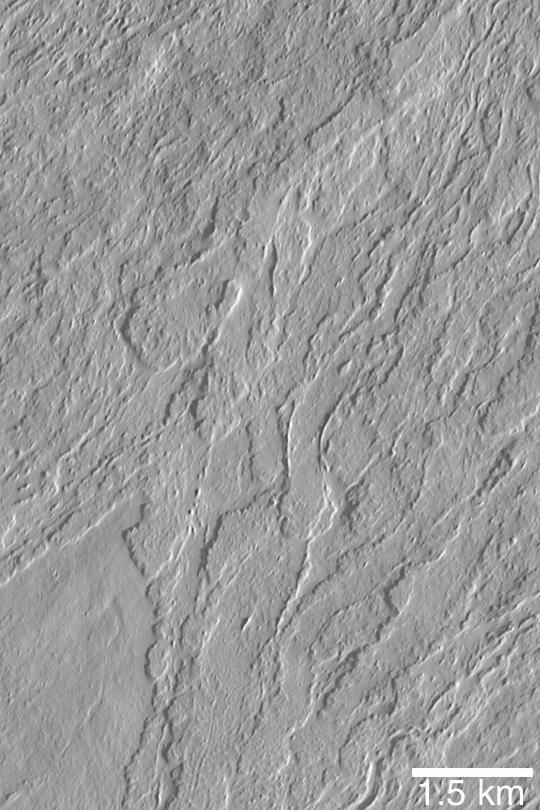
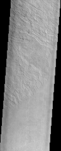
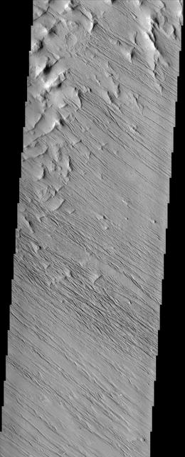
The lava flows seen in the VIS image are located on the northeastern flank of Olympus Mons. The lavas flowed from the lower left side of the image to the upper right. Orbit Number: 72356 Latitude: 19.9937 Longitude: 231.845 Instrument: VIS Captured: 2018-04-06 23:41 https://photojournal.jpl.nasa.gov/catalog/PIA22581
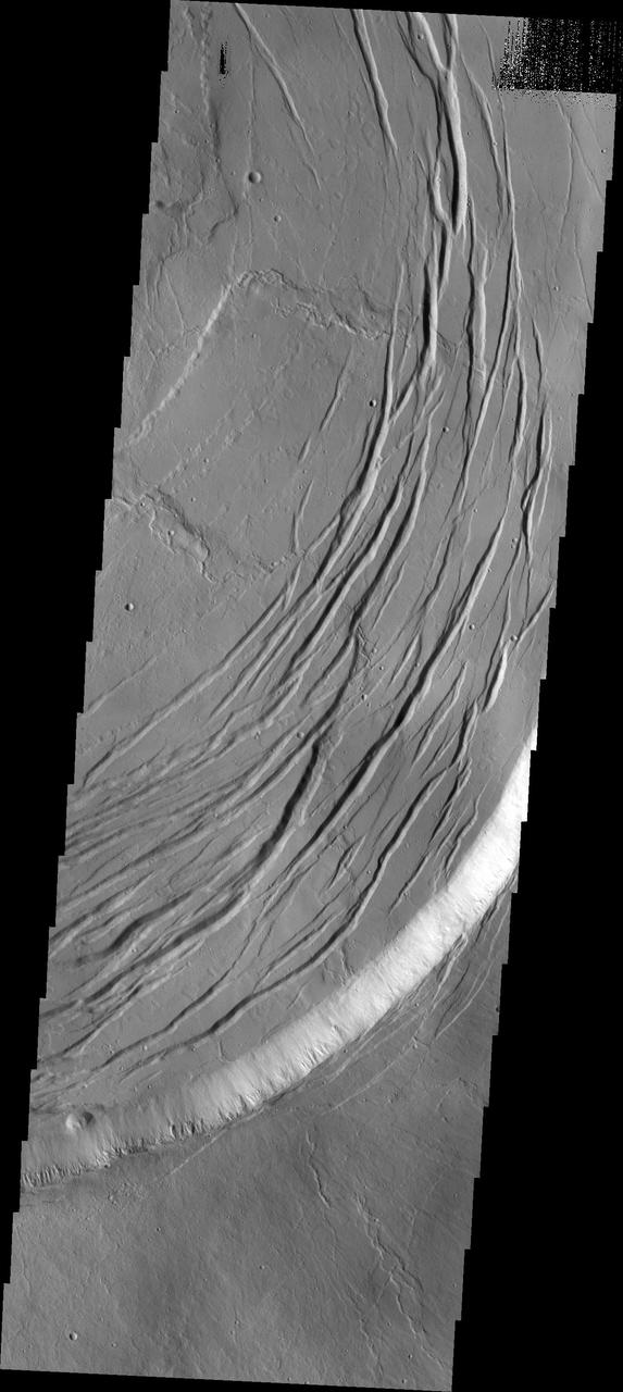
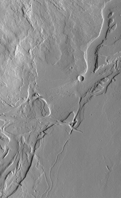
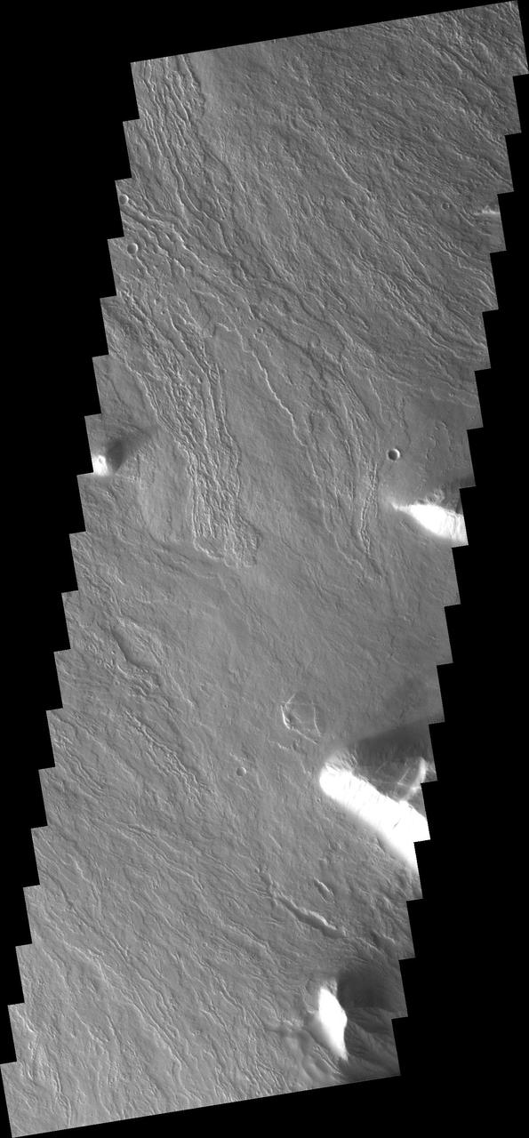
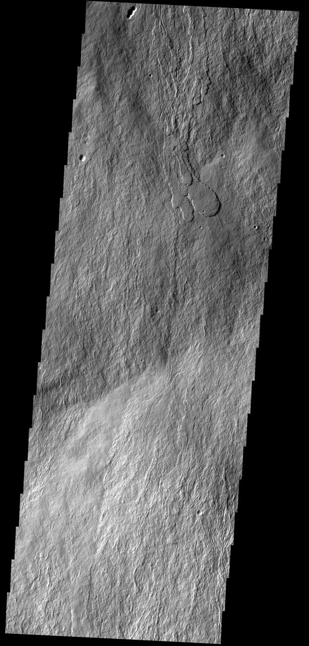
Today's VIS image shows flank flows on the east side of Olympus Mons. Olympus Mons stands 26 km (16 miles) above the surrounding plains, which is three times taller than Mt. Everest, and is the tallest volcano in the solar system. Olympus Mons is also wider (585 km, 363 miles) than the state of Arizona. Although these are impressive dimensions an astronaut would find walking these slopes easy, as they are typically only 2 to 5 degrees. This image contains numerous lava flows, leveed lava channels, and a series of round depressions thought to be where the roof of a lava tube has collapsed into the underlying void. Orbit Number: 81077 Latitude: 19.9207 Longitude: 231.287 Instrument: VIS Captured: 2020-03-25 04:51 https://photojournal.jpl.nasa.gov/catalog/PIA23928
The circular feature near the top of this VIS image is part of the summit caldera of Olympus Mons. Scarps and extensional features (graben) record multiple stages of caldera collapse at the summit of Olympus Mons. Huge lava flows poured down the side of the volcano. Olympus Mons is the largest volcano in the solar system, reaching heights over 40 km (25 miles) tall from base to summit, with the base covering an area as large as the state of Arizona. For comparison, Mauna Loa is 9 km (5.5 miles) tall measured from its base on the sea floor. Orbit Number: 85295 Latitude: 17.523 Longitude: 227.462 Instrument: VIS Captured: 2021-03-07 12:04 https://photojournal.jpl.nasa.gov/catalog/PIA24826
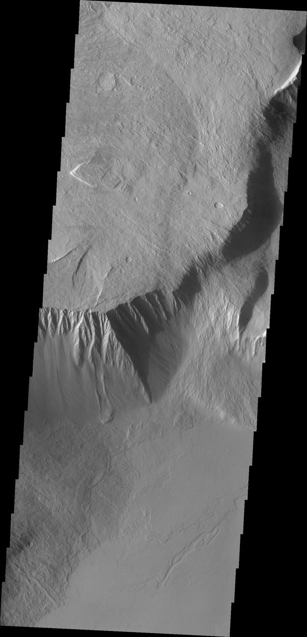
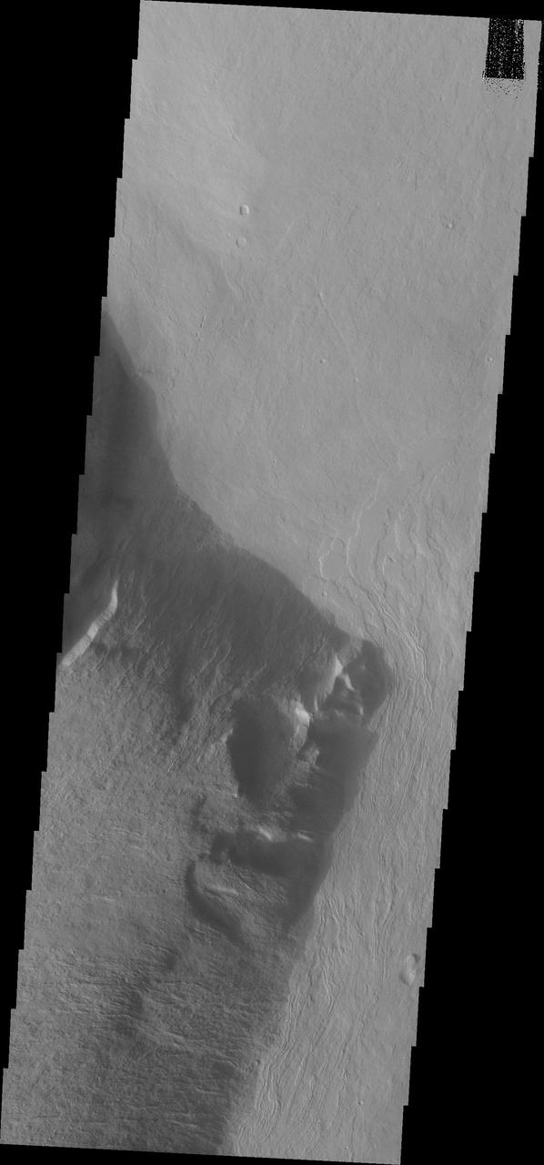
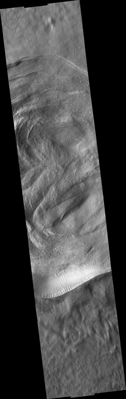
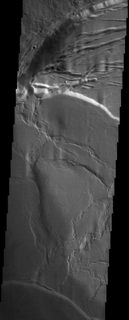
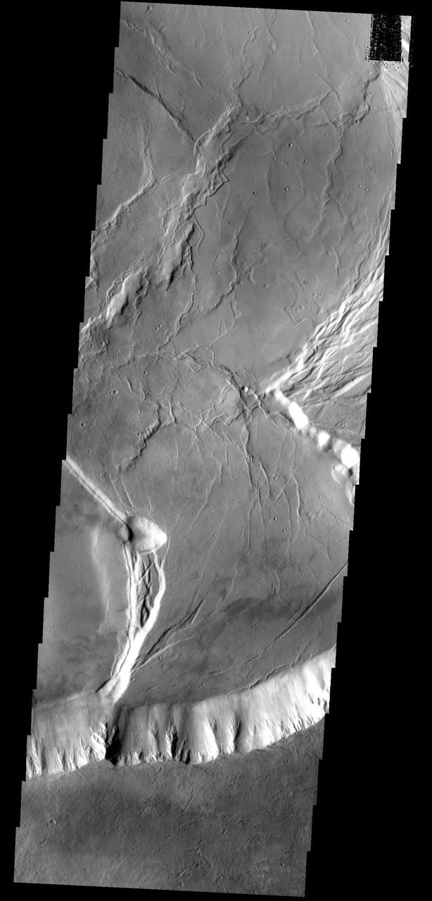
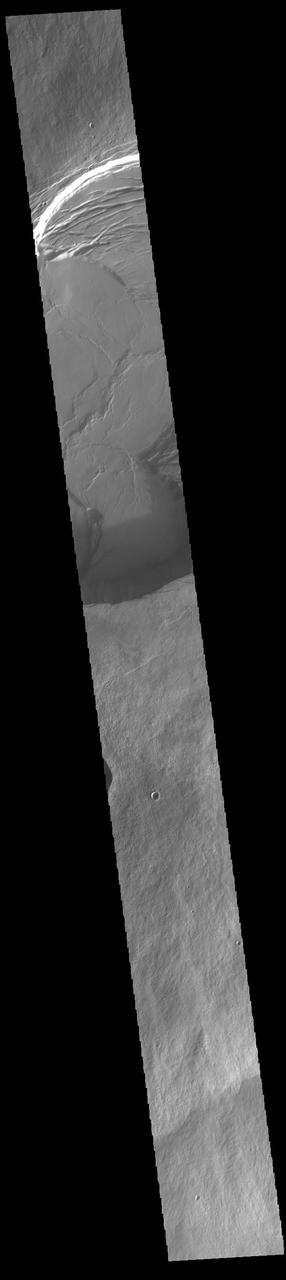
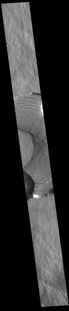
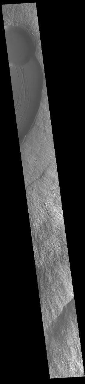
This image from NASA Mars Odyssey shows the southeast flank of Olympus Mons. This huge volcano is surrounded by an escarpment, a large cliff at the volcano margin; a landslide lies alongside the escarpment.
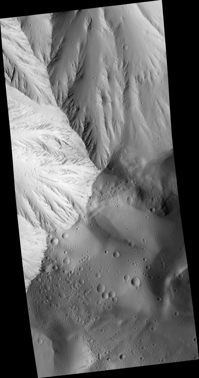
This image from NASA 2001 Mars Odyssey spacecraft shows lava flows which have plunged over the steep escarpment marking the edge of Olympus Mons into the surrounding plains.
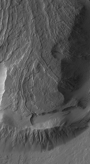
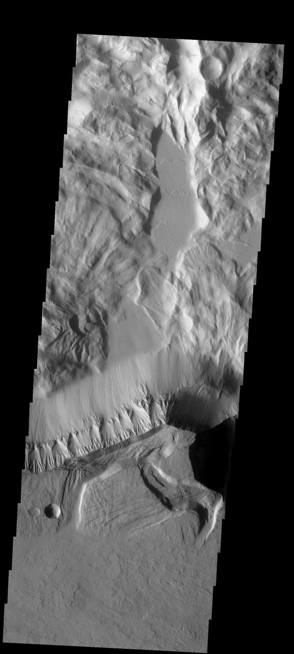
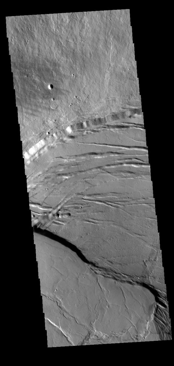
This image from NASA Mars Odyssey shows a small portion of the northern escarpment of Olympus Mons. The semi-circular deposit on the left side of the frame is a large landslide deposit.
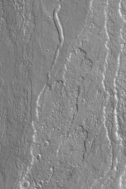
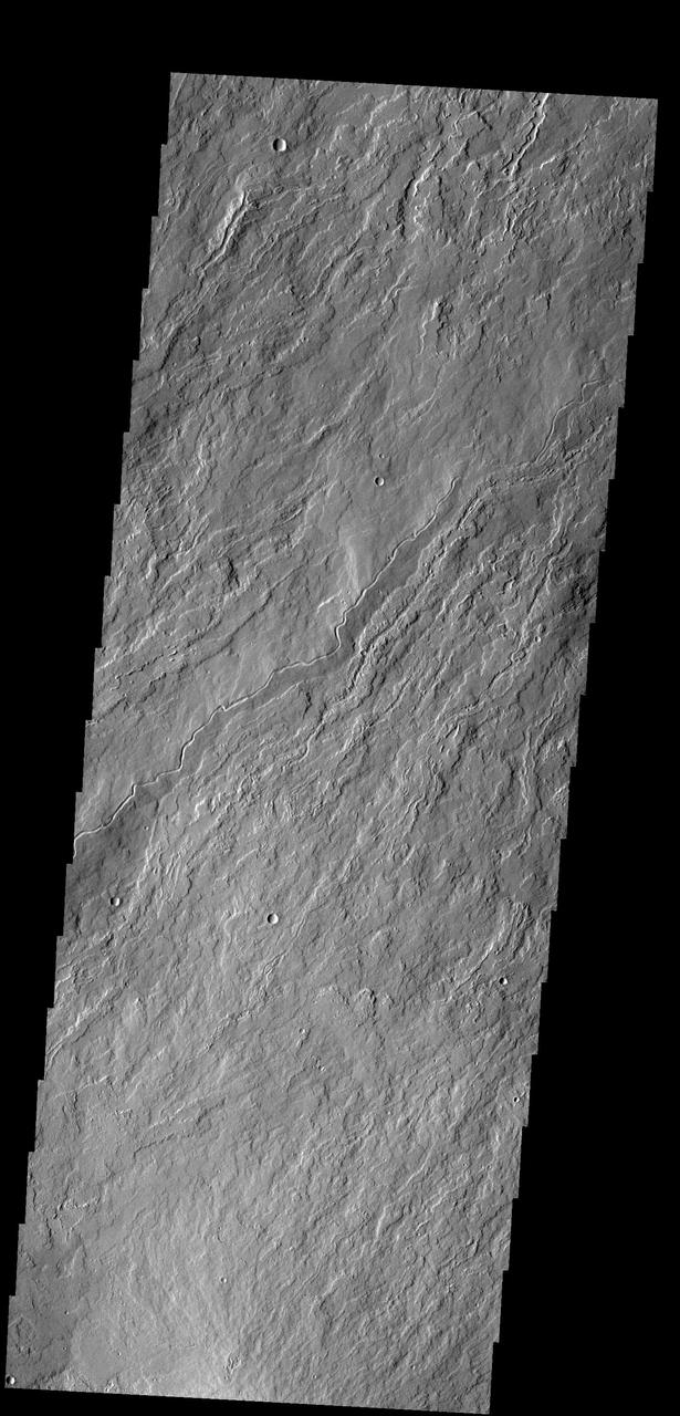
Many surface lava flows on the flanks of Olympus Mons are confined to narrow channels, like the ones in today image from NASA Mars Odyssey.
This image captured by NASA 2001 Mars Odyssey shows lava flows in the southern escarpment region of Olympus Mons, the largest known volcano in the solar system.

The movement pathways of molten rock, or lava, is demonstrated in this image from NASA Mars Odyssey spacecraft of a portion of Olympus Mons, the largest volcano in our solar system.
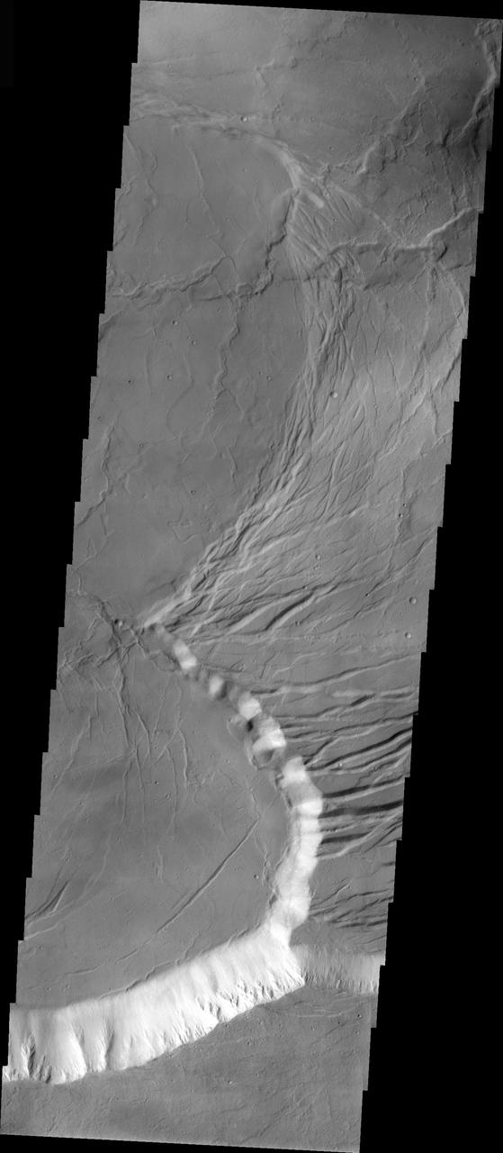
This image captured by NASA 2001 Mars Odyssey spacecraft shows part of the escarpment that encircles Olympus Mons. This image is located on the southeastern flank of the volcano.
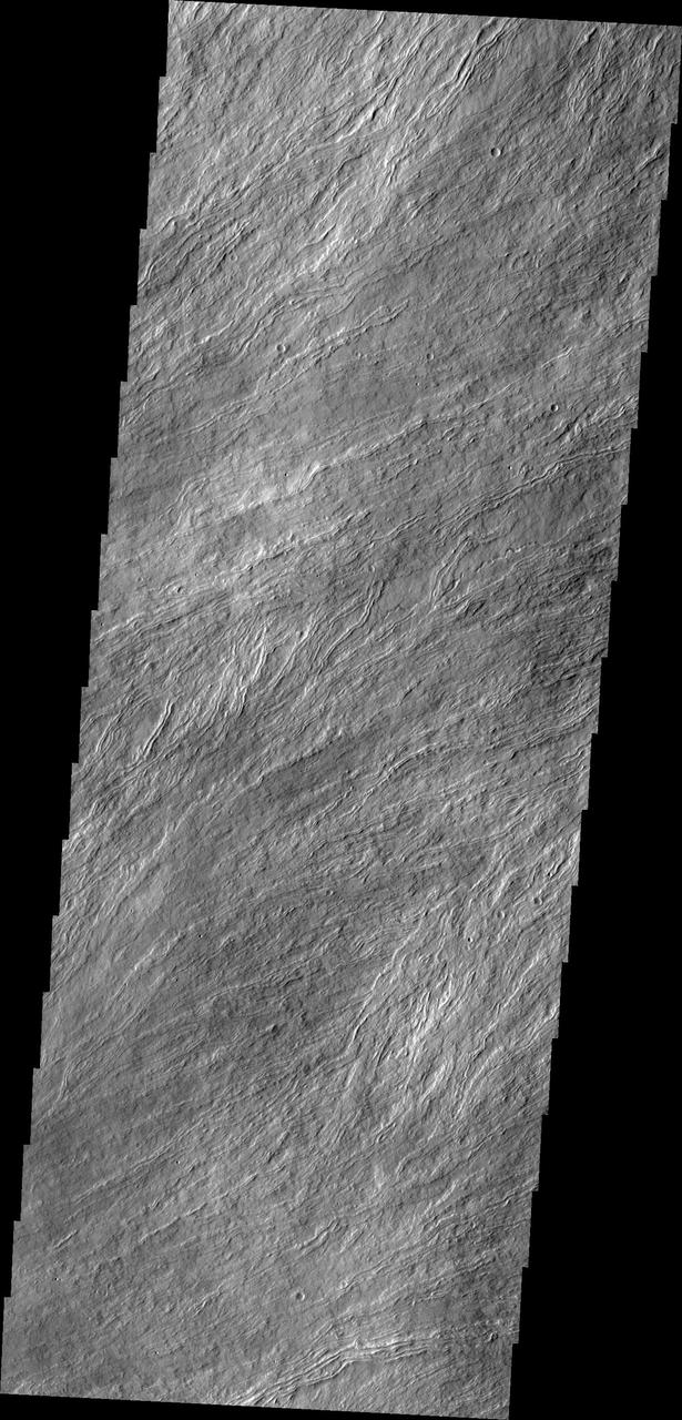
Today's VIS image is located on the upper slopes of Olympus Mons. Numerous thin lava flows are visible. The small raised channel is one mode of lava emplacement where the flow builds up cooling levees along both sides of the channel. Olympus Mons is the largest volcano in the solar system, reaching heights of over 40 km (25 miles) tall from base to summit, with the base covering an area as large as the state of Arizona. For comparison, Mauna Loa is 9 km (5.5 miles) tall measured from its base on the sea floor. Orbit Number: 87404 Latitude: 19.745 Longitude: 225.085 Instrument: VIS Captured: 2021-08-28 03:42 https://photojournal.jpl.nasa.gov/catalog/PIA25223

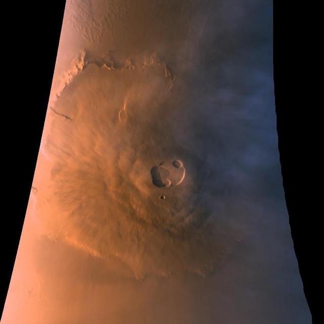
Mariner 9 views Olympus Mons standing above the Martian Dust Storm
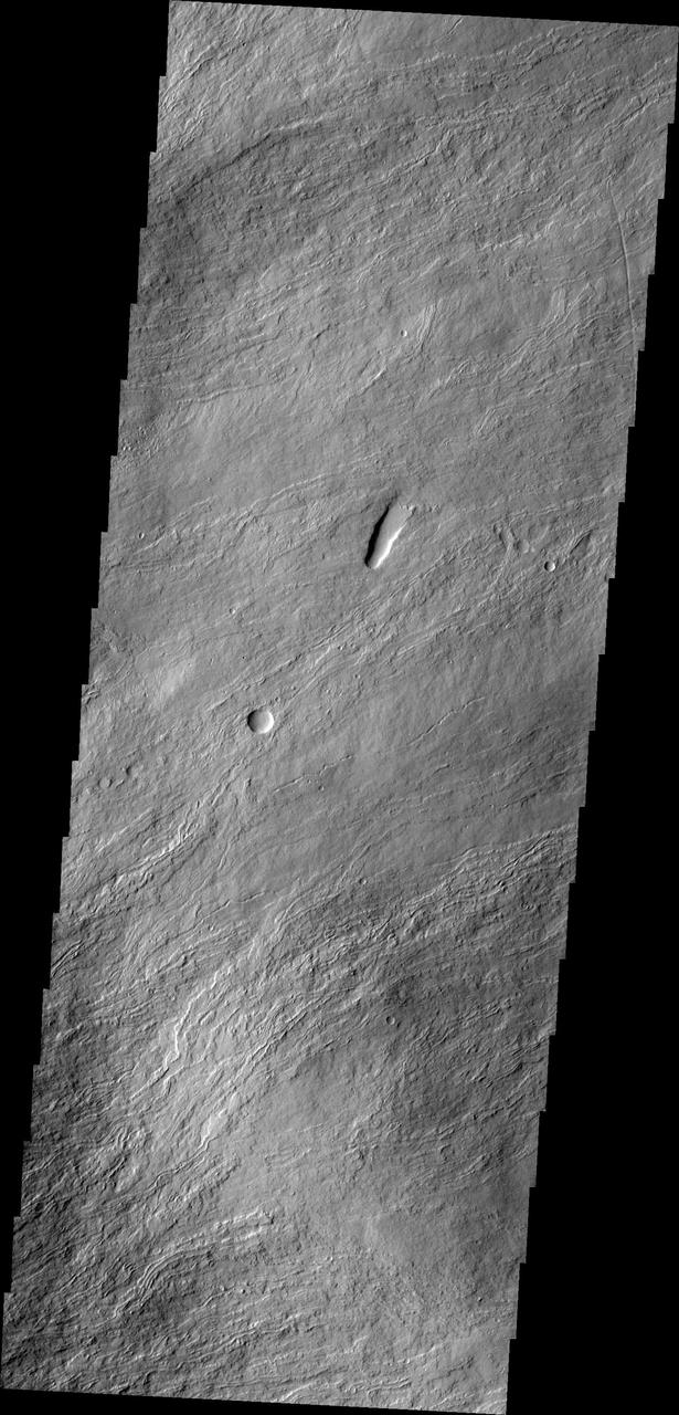
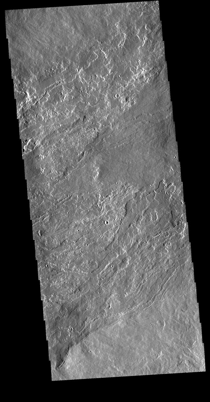
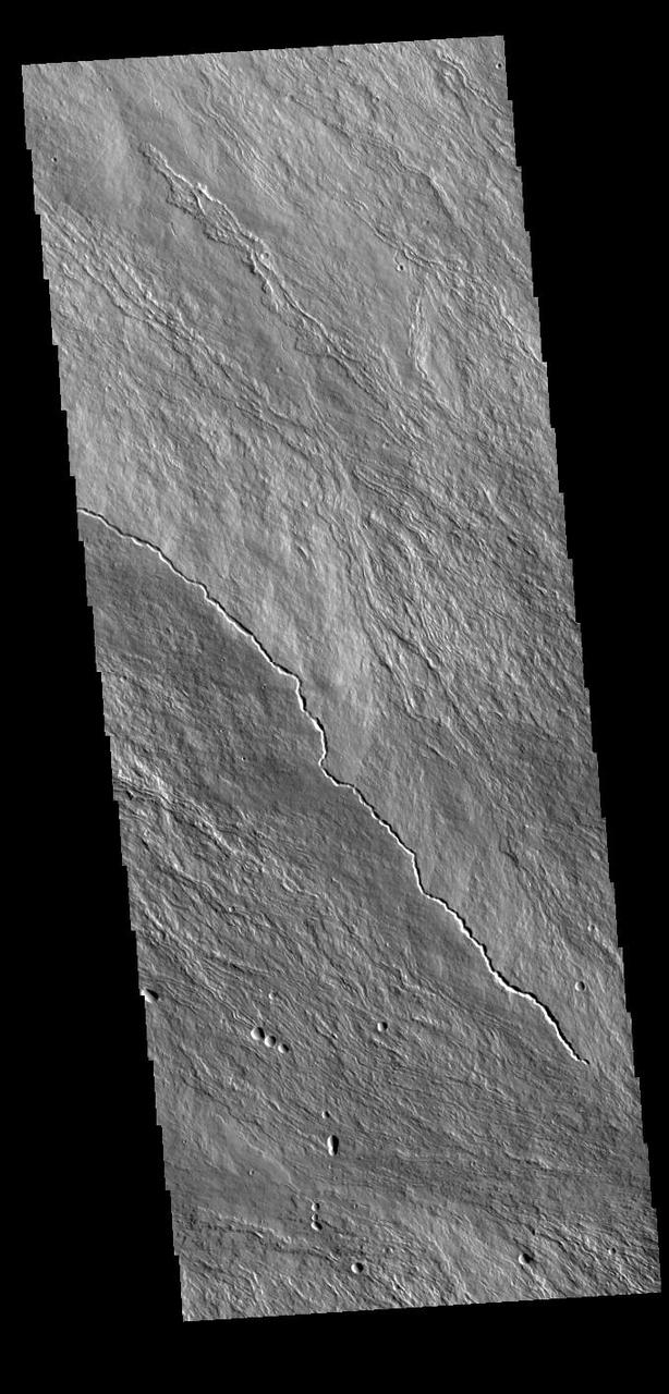
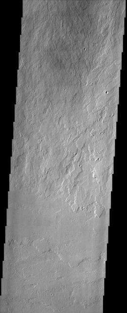
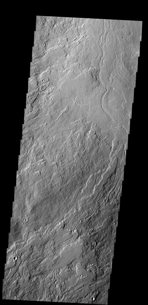
Today's VIS image is located east of Olympus Mons. The majority of the image is comprised of volcanic flows. Orbit Number: 93930 Latitude: 20.4219 Longitude: 232.562 Instrument: VIS Captured: 2023-02-16 12:08 https://photojournal.jpl.nasa.gov/catalog/PIA25928
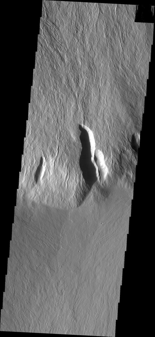
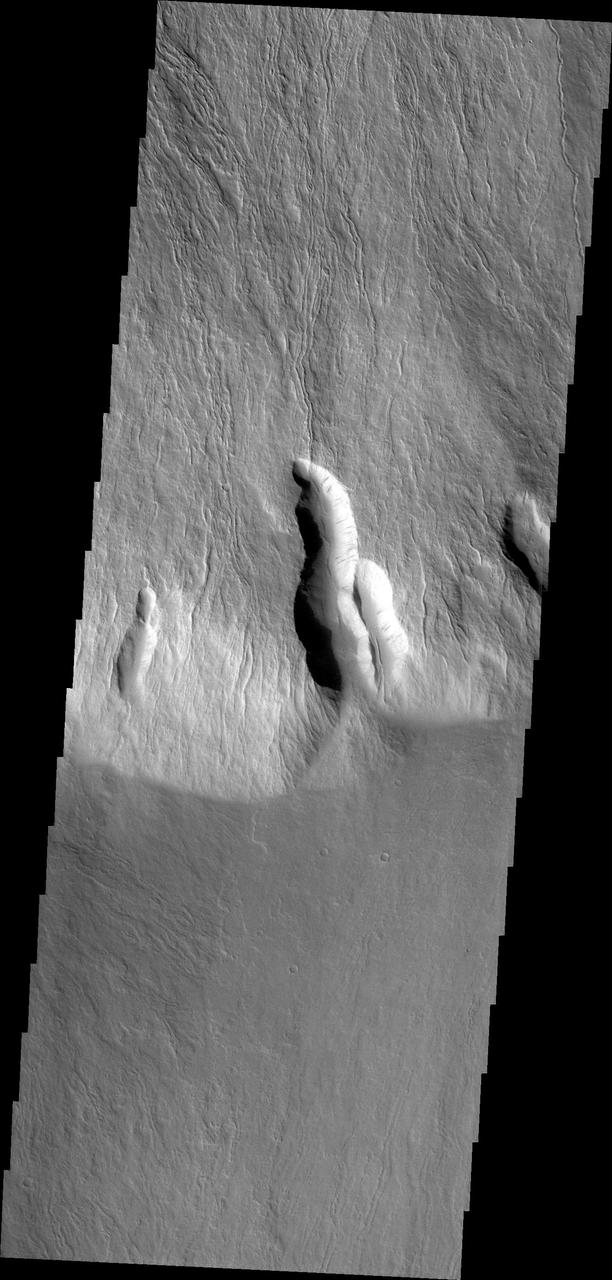
This image from NASA 2001 Mars Odyssey spacecraft shows just a small part of the eastern flank of Olympus Mons. On the far left side of the image a small volcanic cone can be seen. The shadow helps to identify this feature.
Olympus Mons, imaged here by NASA Mars Odyssey spacecraft, stands 26 km above the surrounding plains, which is three times taller than Mt. Everest, and is the tallest volcano in the solar system.
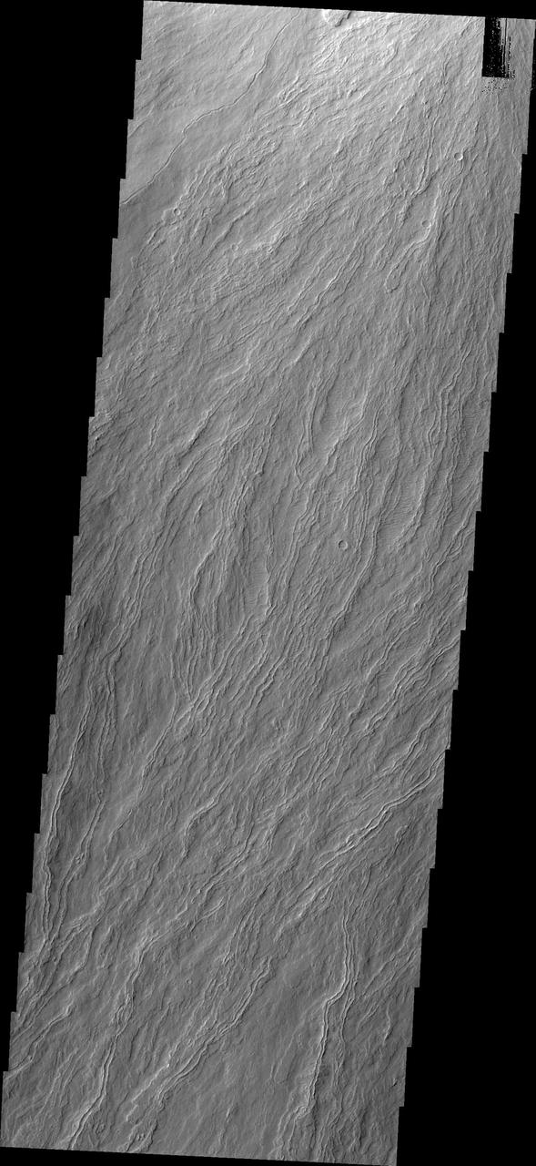
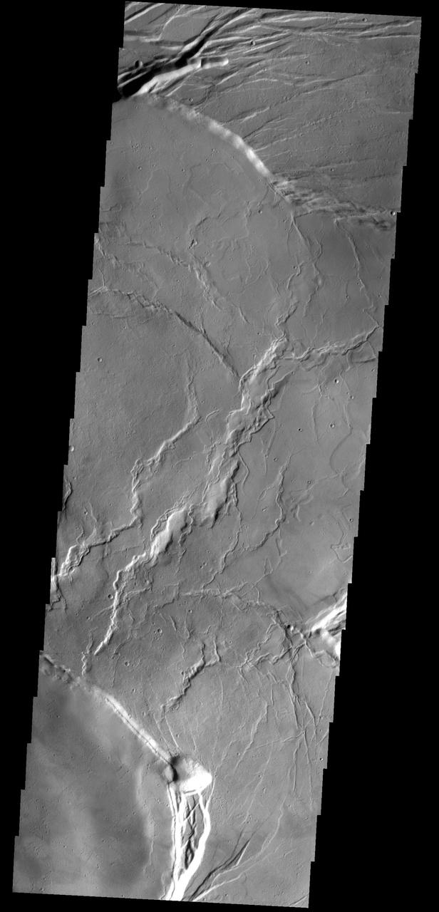
Like drippings from a candle, these lava flows on the flank of Olympus Mons volcano, seen in this image from NASA Mars Odyssey spacecraft, demonstrate how it became the largest volcano in the solar system.
This VIS image shows the region where flank flows from Olympus Mons (top of image) meet the surrounding lava plains. Orbit Number: 80678 Latitude: 12.5468 Longitude: 223.171 Instrument: VIS Captured: 2020-02-21 08:19 https://photojournal.jpl.nasa.gov/catalog/PIA23910
This image taken by NASA Mars Reconnaissance Orbiter covers the northern edge of the largest volcano in the solar system, Olympus Mons on Mars; its margin is defined by a massive cliff many kilometers several miles tall.
This image from NASA Mars Odyssey of lava flows around the large scarp of Olympus Mons reveals textures characteristic of the variable surface roughness associated with different lava flows in this region.
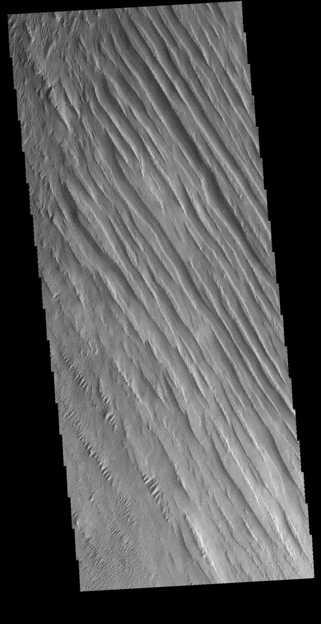
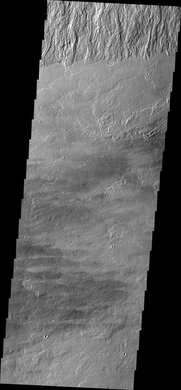
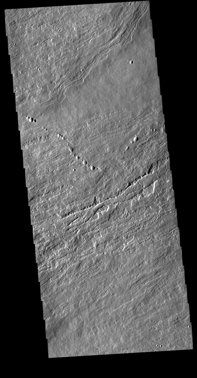
Today's VIS image shows some of the extensive wind etched terrain in Memnonia Sulci, located south west of Olympus Mons. The linear ridges are called yardangs and form by wind removal of semi-cemented material. The ridges are parallel to wind direction, so the predominate winds that created the yardangs in this image blew NW/SE. At the bottom of the image several of the ridges have been eroded into smaller ridges aligned perpendicular to the large yardangs, indicating winds at a different angle. Orbit Number: 66197 Latitude: -5.91796 Longitude: 183.886 Instrument: VIS Captured: 2016-11-15 13:08 http://photojournal.jpl.nasa.gov/catalog/PIA21283
The THEMIS VIS camera contains 5 filters. The data from different filters can be combined to create a false color image. This false color image from NASA 2001 Mars Odyssey spacecraft shows part of the caldera at the summit of Olympus Mons.
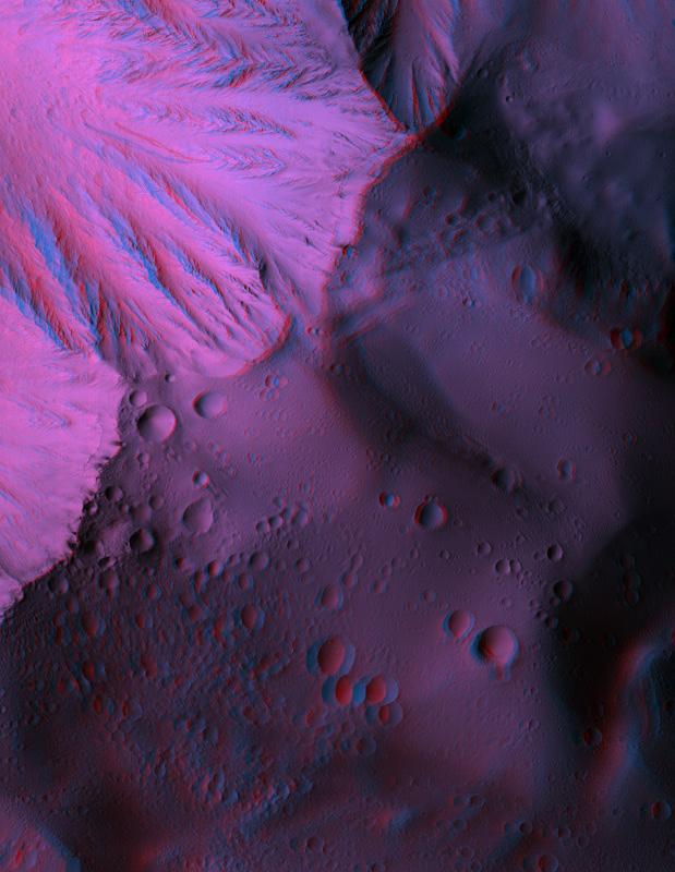
This anaglyph from NASA Mars Reconnaissance Orbiter spacecraft, shows Olympus Mons, the largest volcano in the Solar System. Constructed of lava flows, many aspects of this titanic volcano remain puzzling. 3D glasses are necessary to view this image.
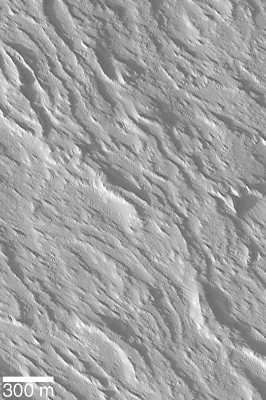
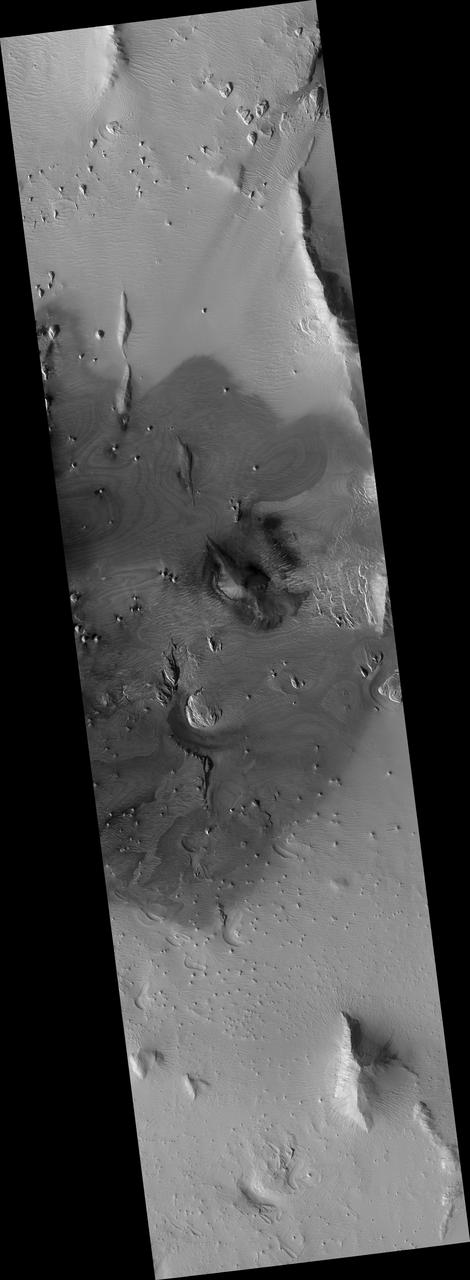
In this region of the Olympus Mons aureole, located to the SW of the volcano, the surface has been eroded by the wind into linear landforms called yardangs. These ridges generally point in direction of the prevailing winds that carved them, in this case winds from the southeast. Yardangs typically occur on surfaces that are easily erodable, such as wind-blown dust or volcanic ash. The northeast - southwest trending ridges and valleys in the northwest corner of the image are typical of the Olympus Mons aureole. The varying concentration and shape of the yardangs in this area may be controlled by the motion of winds around these topographic features. Some crater outlines are visible near the top of this image. The rims of these craters appear to have been stripped away - indicating that the wind erosion is younger than these craters. There are two round knobs in the image, one on the bottom on the right side of the image and another about midway down on the left. These may be inverted craters, formed because the impacts caused materials underneath the crater to become harder to erode than the surrounding materials. http://photojournal.jpl.nasa.gov/catalog/PIA04036
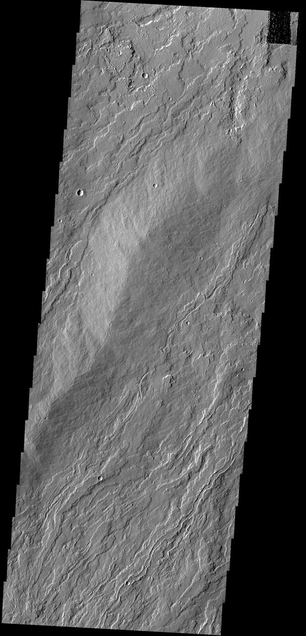
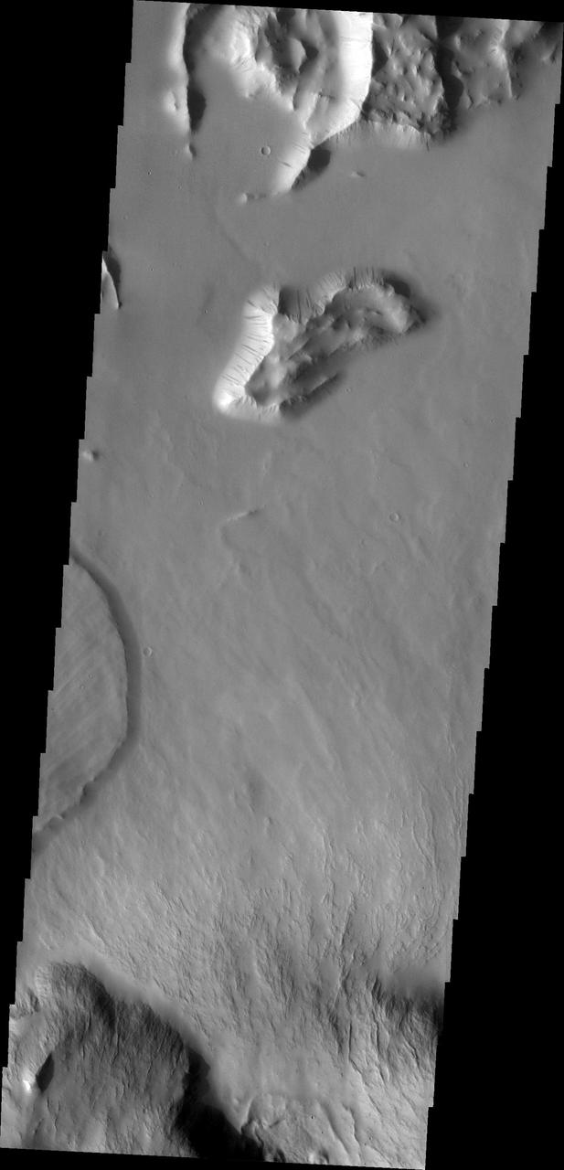
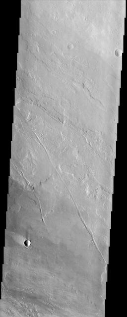
These lava flows are part of Olympus Mons
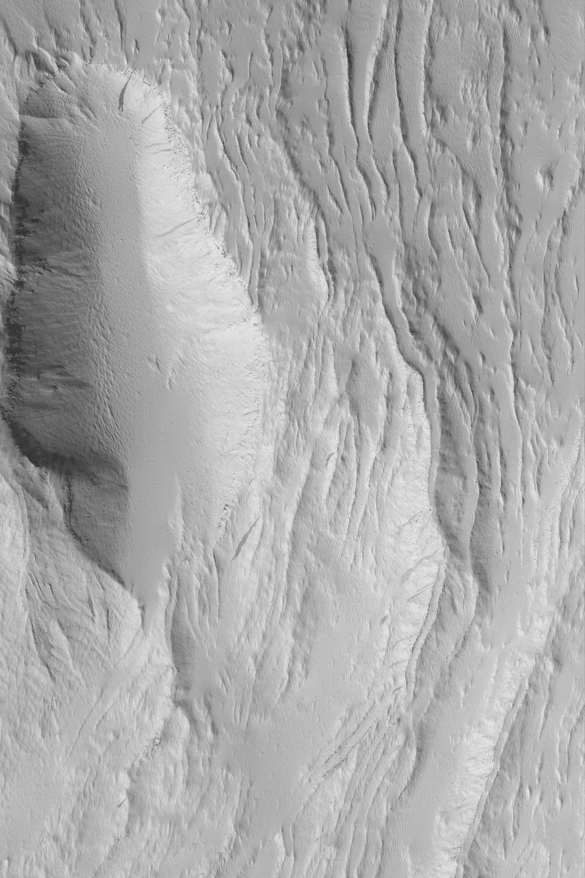
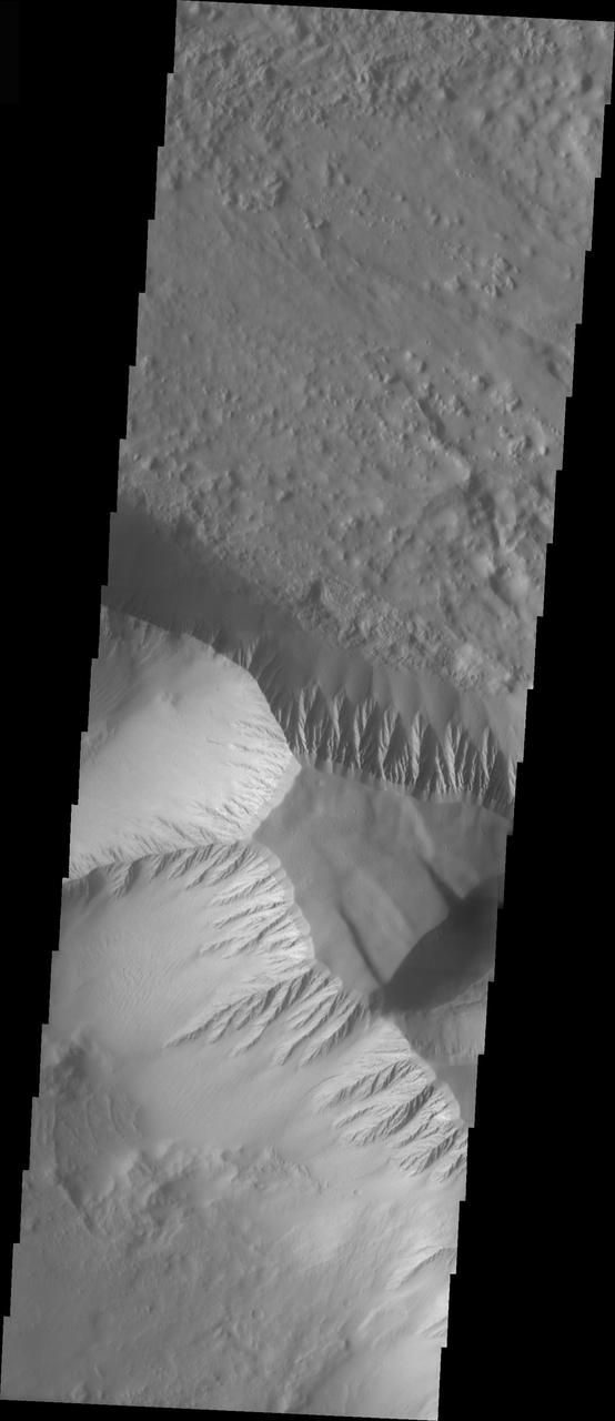
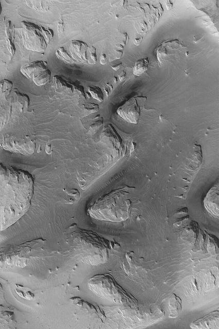
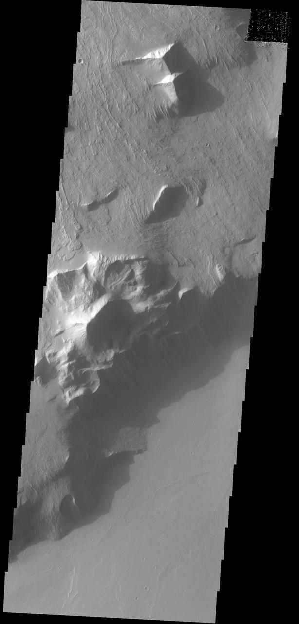
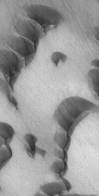
![This image from NASA's Mars Reconnaissance Orbiter (MRO) shows blocks of layered terrain within the Olympus Mons aureole. The aureole is a giant apron of chaotic material around the volcano, perhaps formed by enormous landslides off the flanks of the giant volcano. These blocks of layered material have been eroded by the wind into the scenic landscape we see here. The map is projected here at a scale of 25 centimeters (9.8 inches) per pixel. [The original image scale is 28.3 centimeters (11.1 inches) per pixel (with 1 x 1 binning); objects on the order of 85 centimeters (33.5 inches) across are resolved.] North is up. https://photojournal.jpl.nasa.gov/catalog/PIA22181](https://images-assets.nasa.gov/image/PIA22181/PIA22181~medium.jpg)
This image from NASA's Mars Reconnaissance Orbiter (MRO) shows blocks of layered terrain within the Olympus Mons aureole. The aureole is a giant apron of chaotic material around the volcano, perhaps formed by enormous landslides off the flanks of the giant volcano. These blocks of layered material have been eroded by the wind into the scenic landscape we see here. The map is projected here at a scale of 25 centimeters (9.8 inches) per pixel. [The original image scale is 28.3 centimeters (11.1 inches) per pixel (with 1 x 1 binning); objects on the order of 85 centimeters (33.5 inches) across are resolved.] North is up. https://photojournal.jpl.nasa.gov/catalog/PIA22181
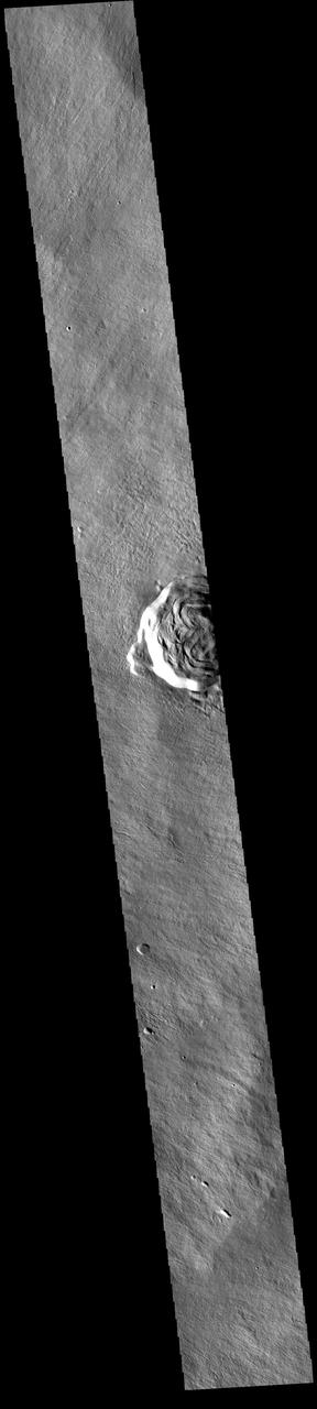
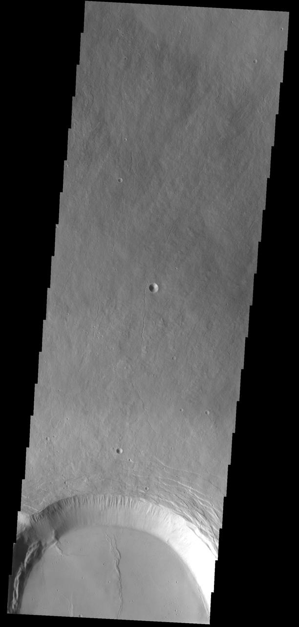
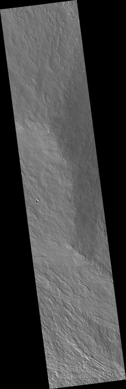
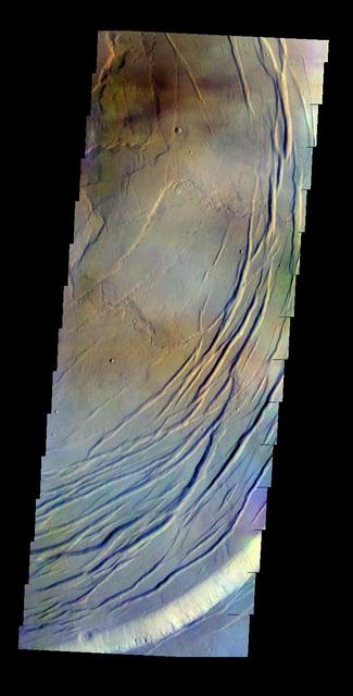
Today's VIS image shows part of Karzok Crater. This crater is one of two located on the flanks of Olympus Mons. Karzok Crater is 15.6km (9.7 mi) in diameter. Olympus Mons is the largest volcano in the solar system, reaching heights over 40 km (25 miles) tall from base to summit, with the base covering an area as large as the state of Arizona. For comparison, Mauna Loa is 9 km (5.5 miles) tall measured from its base on the sea floor. The THEMIS VIS camera is capable of capturing color images of the Martian surface using five different color filters. In this mode of operation, the spatial resolution and coverage of the image must be reduced to accommodate the additional data volume produced from using multiple filters. To make a color image, three of the five filter images (each in grayscale) are selected. Each is contrast enhanced and then converted to a red, green, or blue intensity image. These three images are then combined to produce a full color, single image. Because the THEMIS color filters don't span the full range of colors seen by the human eye, a color THEMIS image does not represent true color. Also, because each single-filter image is contrast enhanced before inclusion in the three-color image, the apparent color variation of the scene is exaggerated. Nevertheless, the color variation that does appear is representative of some change in color, however subtle, in the actual scene. Note that the long edges of THEMIS color images typically contain color artifacts that do not represent surface variation. Orbit Number: 86755 Latitude: 18.2292 Longitude: 228.192 Instrument: VIS Captured: 2021-07-05 17:12 https://photojournal.jpl.nasa.gov/catalog/PIA24993
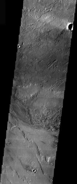
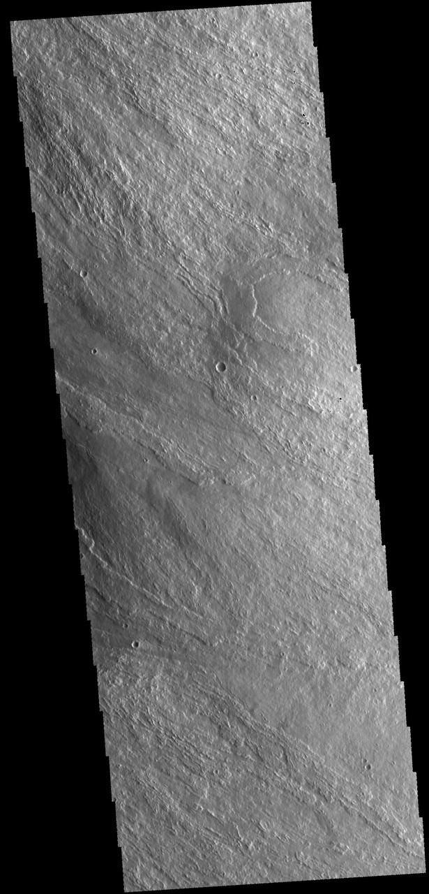
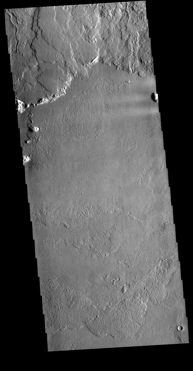
This image shows a portion of the southern flank of Olympus Mons
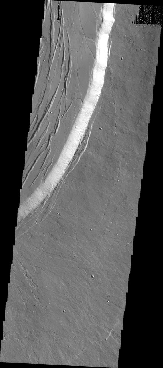
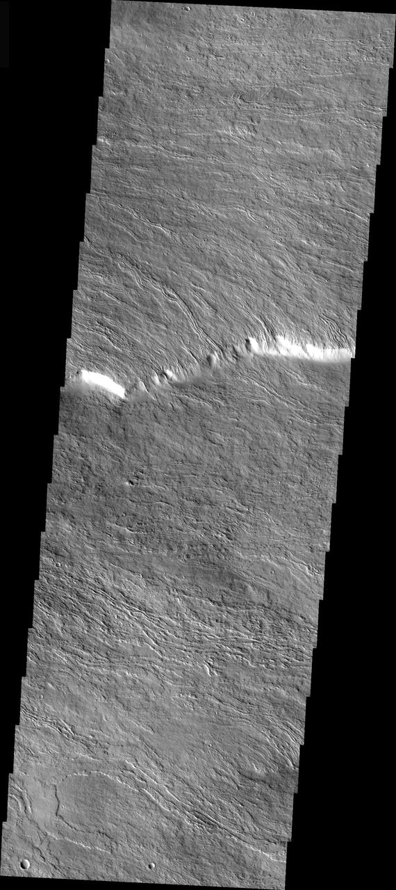
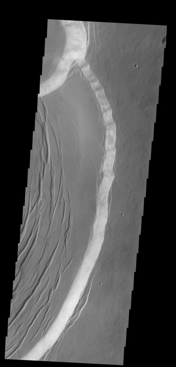
This image captured by NASA 2001 Mars Odyssey spacecraft shows Olympus Mons is surrounded by an escarpment, called Olympus Rupes, a steep cliff-face between the volcano and the surrounding lava flows on the northeastern side of Olympus Mons.
This Mars Global Surveyor (MGS) Mars Orbiter Camera (MOC) image of dunes in the martian north polar region is important because it shows one of the highest northern latitude views of streaks thought to be made by passing dust devils. The dark, thin, filamentary streaks on the dunes and on the adjacent plains were probably formed by dust devils. The dunes occur near 76.6°N, 62.7°W. Dust devil streaks are observed on Mars at very high latitudes, such as this, all the way down to the equator. They are also seen at all elevations, from the deepest parts of the Hellas Basin to the summit of Olympus Mons. This picture covers an area about 3 km (1.9 mi) wide. Sunlight illuminates the scene from the lower left. http://photojournal.jpl.nasa.gov/catalog/PIA06334
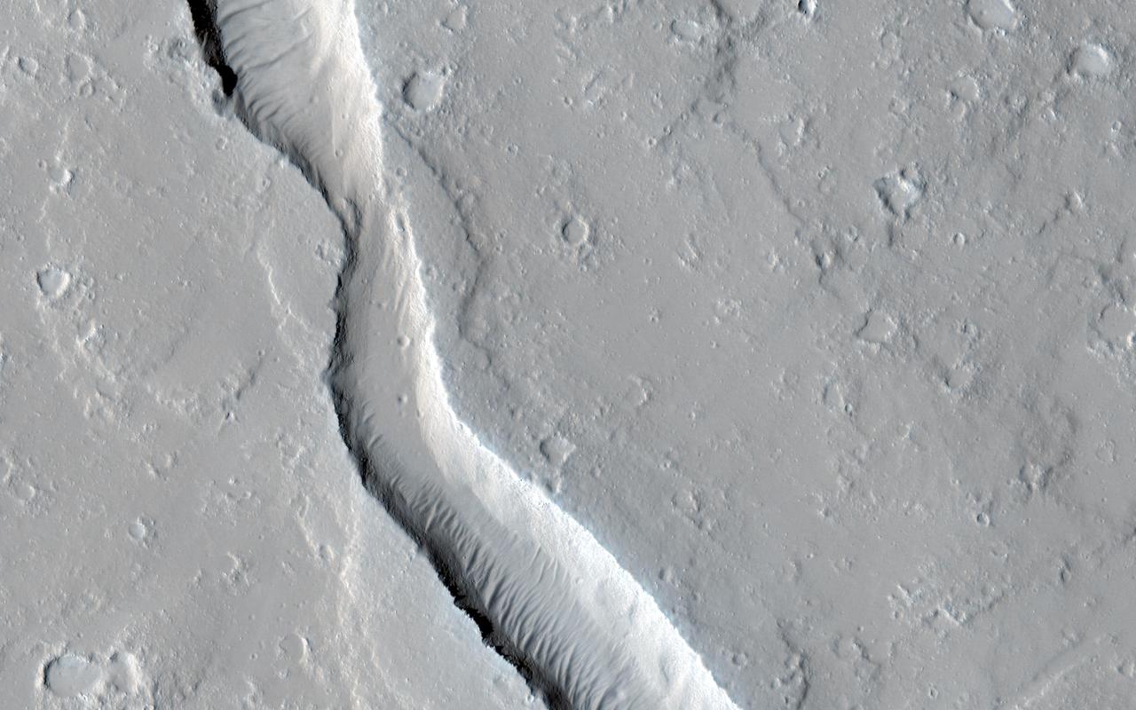
This image from NASA Mars Reconnaissance Orbiter shows a lava channel, which lies just to the east of the largest volcano in the solar system: Olympus Mons. The channel appears to be discontinuous, meaning it disappears several times throughout its length, but in fact, it is likely that the channel continues underground as a lava tube. These are relatively common features at terrestrial volcanic centers, such as the Big Island of Hawai'i. The channel appears to have been infilled with dust and sand, so that the entrance to a lava tube cave is no longer visible at this particular location; fortunately this has been observed elsewhere on Mars. http://photojournal.jpl.nasa.gov/catalog/PIA19299