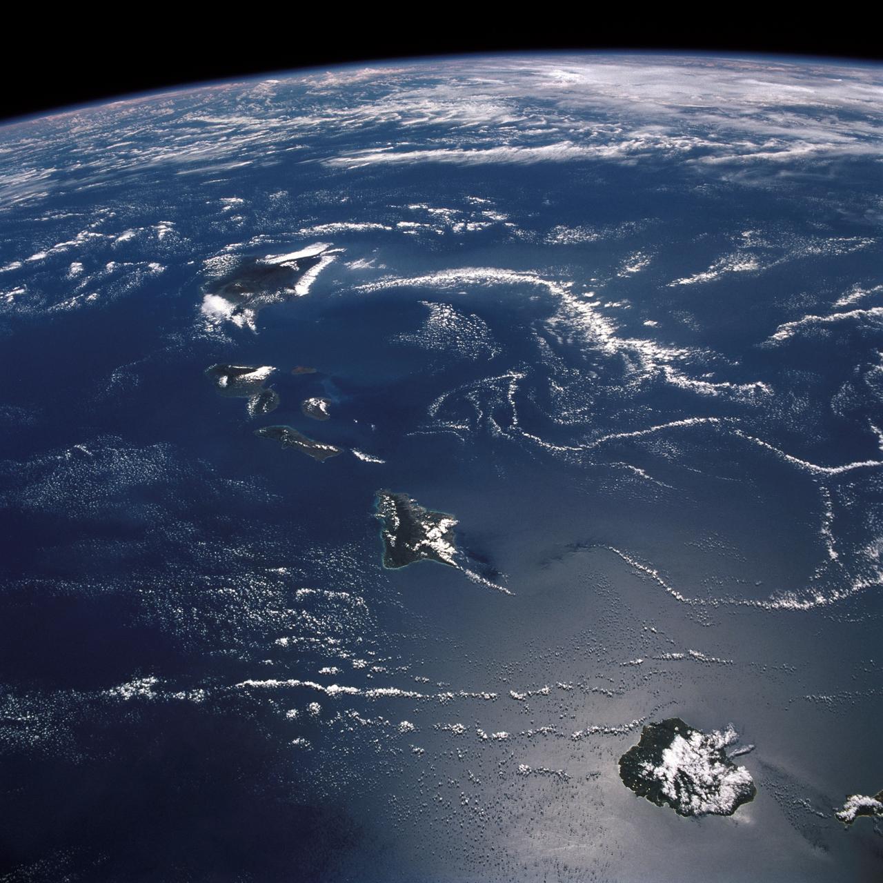
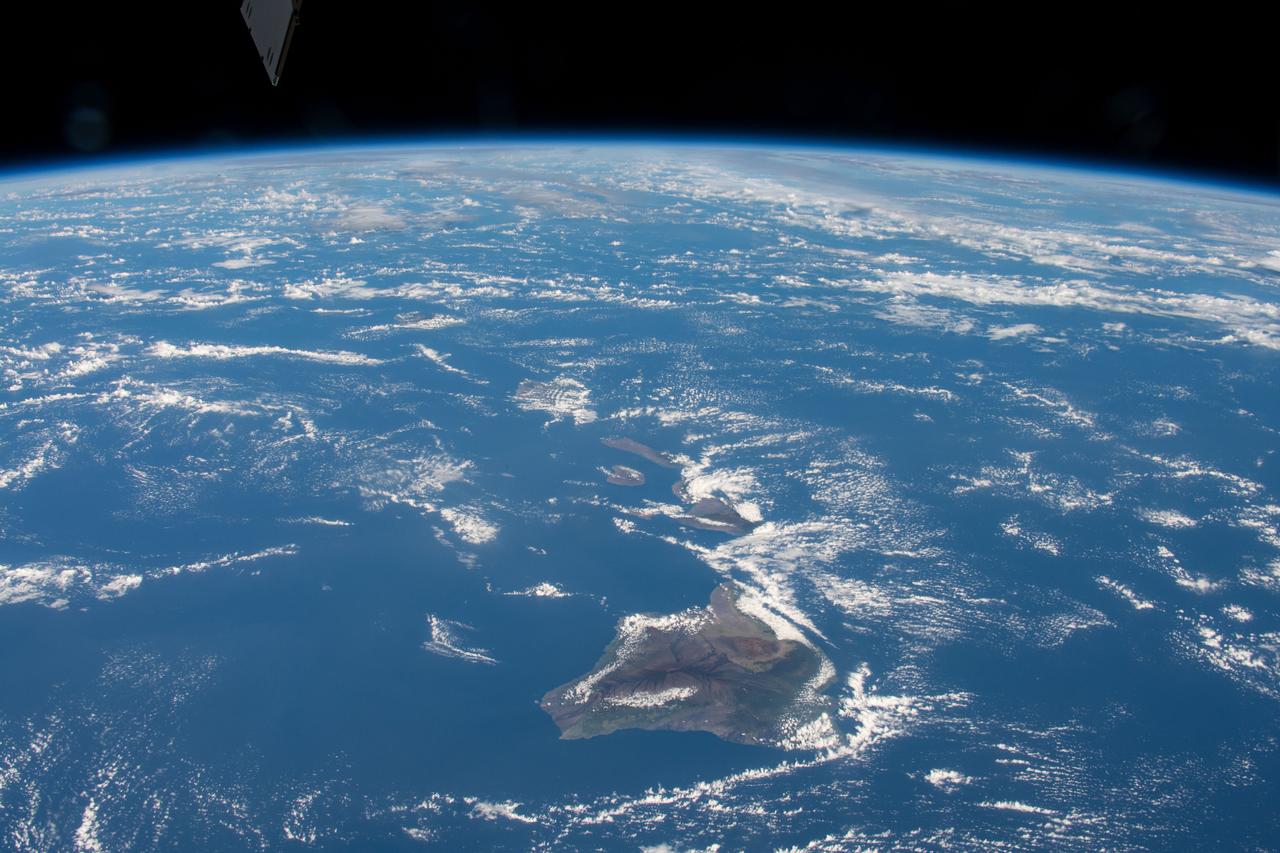
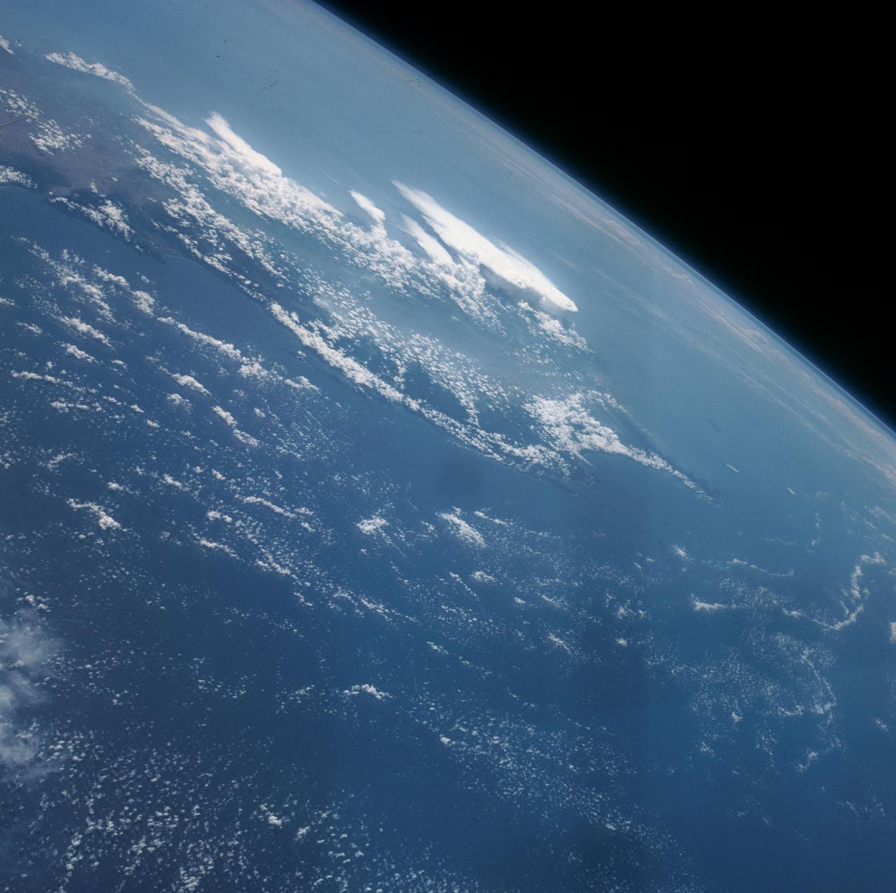
STS026-43-082 (29 Sept. - 3 Oct. 1988) --- This 70mm northerly oriented frame over the Pacific Ocean features the Hawaiian Islands chain. The islands perturb the prevailing northeasterly winds producing extensive cloud wakes in the lee of the islands. Photo experts feel that atmospheric haze in the Hawaii wake is probably a result of the continuing eruptions of Kilauea volcano on the southeast coast. From the lower right corner in a diagonal directed upward to the north are the islands of Nihau, Kauai, Oahu, Molokai, Lanai, Maui, Kahoolawe, and Hawaii. This photo was shown during the post-flight press conference on October 11, 1988 by the STS-26 astronauts, who at one time during the flight wore Hawaiian attire to pay tribute to the working staff of the Hawaii tracking station.
The island of Java (8.0S, 112.0E), perhaps better than any other, illustrates the volcanic origin of Pacific Island groups. Seen in this single view are at least a dozen once active volcano craters. Alignment of the craters even defines the linear fault line of Java as well as the other some 1500 islands of the Indonesian Archipelago. Deep blue water of the Indian Ocean to the south contrasts to the sediment laden waters of the Java Sea to the north.
AST-19-1555 (24 July 1975) --- A sunglint in the South Western Pacific Ocean, as photographed from the Apollo spacecraft in Earth orbit during the joint U.S.-USSR Apollo-Soyuz Test Project mission. The island is Bougainville of the Solomon Islands group. The horizon of Earth is in the background. The picture was taken at an altitude of 231 kilometers (143 statute miles), with a 70mm Hasselblad camera using medium-speed Ektachrome QX-807 type film.
The Sovereign Democratic Republic of the Fiji Islands, commonly known as Fiji, is an independent nation consisting of some 332 islands surrounding the Koro Sea in the South Pacific Ocean. This image shows Viti Levu, the largest island in the group.
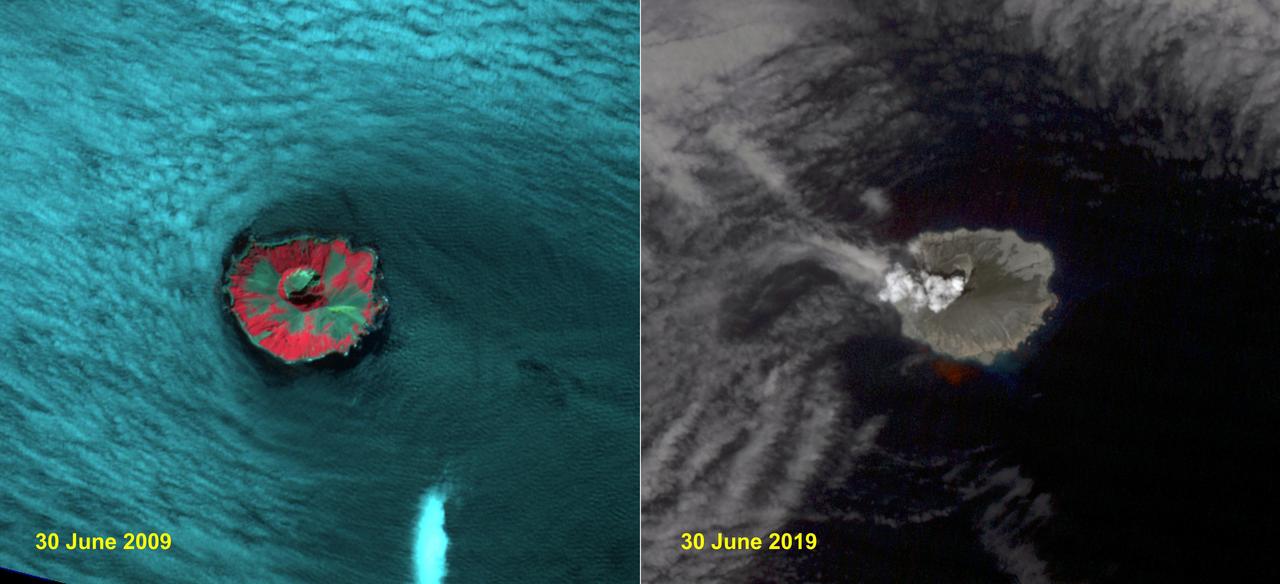
Raikoke volcanic island is near the center of the Kuril Islands in the Sea of Okhotsk in the northwest Pacific Ocean. The island is roughly circular with dimensions of 2.0 by 2.5 kilometers. On June 22, the volcano erupted with a gas and ash plume reaching 17 kilometers. The two ASTER images, acquired exactly 10 years apart on June 30, dramatically depict the changes to the island. In 2009, vegetation (red) covered most of the island. The 2019 image shows an ash and steam plume rising from the caldera. There is no trace of any vegetation, ash deposits having buried everything. The images are located at 48.3 degrees north, 153.2 degrees east. https://photojournal.jpl.nasa.gov/catalog/PIA23326
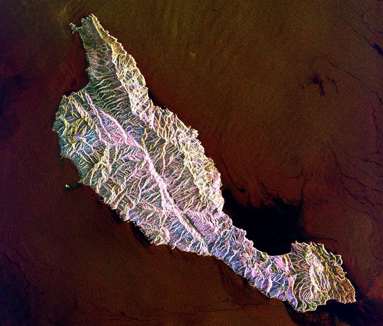
This space radar image shows the rugged topography of Santa Cruz Island, part of the Channel Islands National Park in the Pacific Ocean off the coast of Santa Barbara and Ventura, Calif.
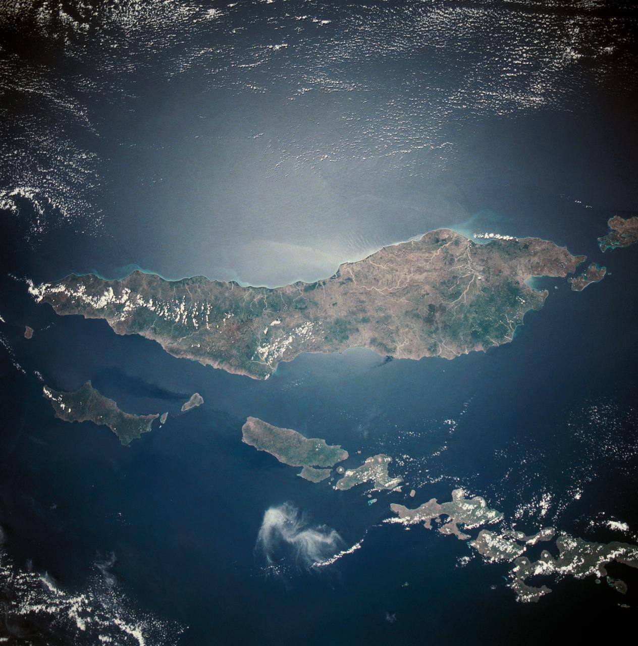
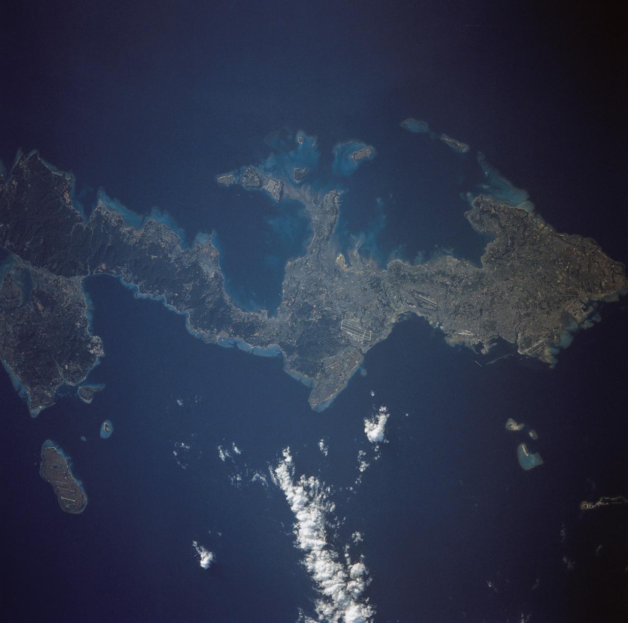
This almost totally cloud free, photo of the island of Timor, Indonesia (9.0S, 125.0E) illustrates the volcanic origin of the over 1500 islands of Indonesia. Close examination of the photo reveals several eroded volcanoes on the Island of Timor and several of the adjacent islands. The linear alignment of the volcanoes, as seen from space, indicates the edges of the tectonic plates of the Earth's crust where volcanic activity is most common.
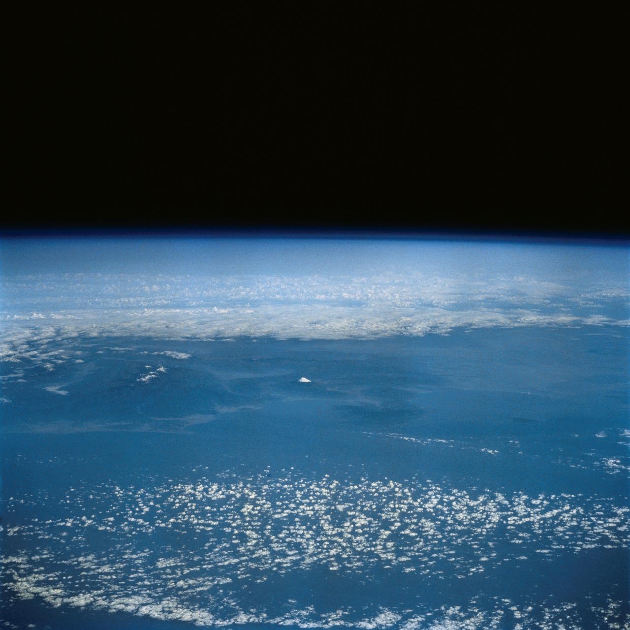
This distant view of Mt. Fuji, on the main home island of Honshu, Japan (34.0N, 139.0E) was taken from about 450 miles to the south. Evan at that great distance, the majestic and inspiring Mt. Fuji is still plainly visible and easily recognized as a world renowned symbol of Japan. The snow capped extinct volcano lies just a few miles south of Tokyo.
The southern half of the island of Okinawa, Japan (26.5N, 128.0E) can be seen in this nearly cloud free view. Okinawa is part of the Ryuku Islands which extend from Taiwan northeastward to Kyushu, southernmost of the Japanese Home Islands. The large military base at Kadena, with large runways, is visible near the center of the scene. Kadena is one of several emergency landing sites around the world for the space shuttle.
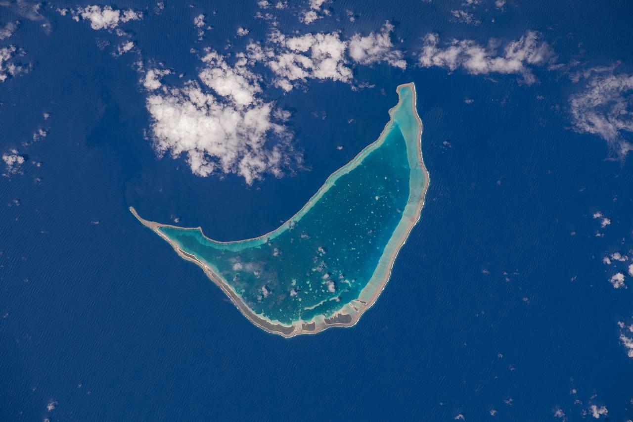
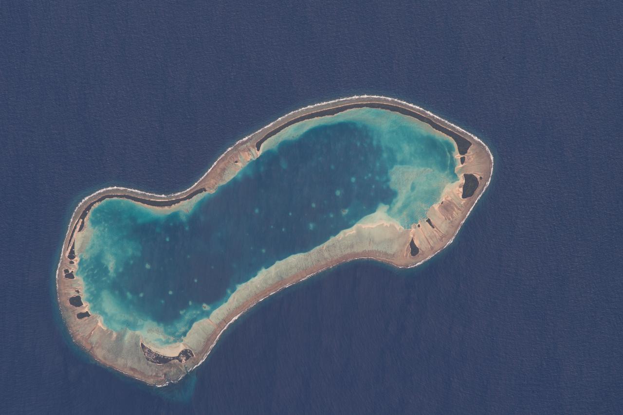
ISS033-E-007873 (27 Sept. 2012) --- Wake Island is featured in this image photographed by an Expedition 33 crew member on the International Space Station. The atoll of Wake Island is located in the central Pacific Ocean approximately 4,000 kilometers to the west-southwest of Hawaii and 2,400 kilometers to the northwest of Guam. In addition to Wake Island, the atoll includes the smaller Peale and Wilkes Island for a total land surface area of 6.5 square kilometers. Like many atolls in the Pacific, the islands and associated reefs formed around a submerged volcano. The lagoon in the center of the islands—characterized by shallow, light blue water in contrast to the surrounding darker, deeper Pacific Ocean waters—marks the approximate location of the summit crater of the volcano.
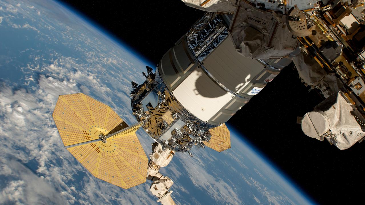
iss071e439629 (Aug. 6, 2024) --- Still in the grips of the Canadarm2 robotic arm, the Northrop Grumman Cygnus space freighter is pictured attached to the Unity module's Earth-facing port. The International Space Station was orbiting 262 miles above a cloudy Pacific Ocean halfway between the U.S. island of Hawaii and the island nation of the Republic of Kiribati at the time of this photograph.
iss063e105773 (Oct. 8, 2020) --- The Hawaiian island chain was pictured as the International Space Station orbited above the Pacific Ocean.
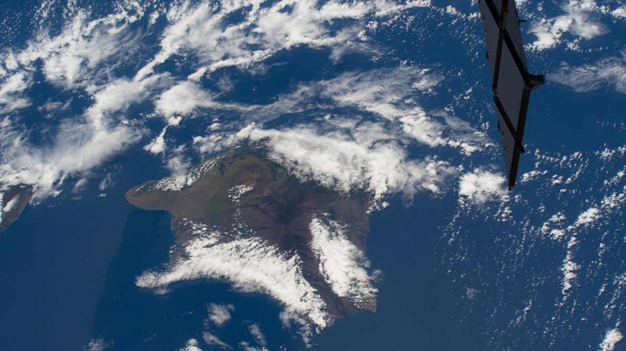
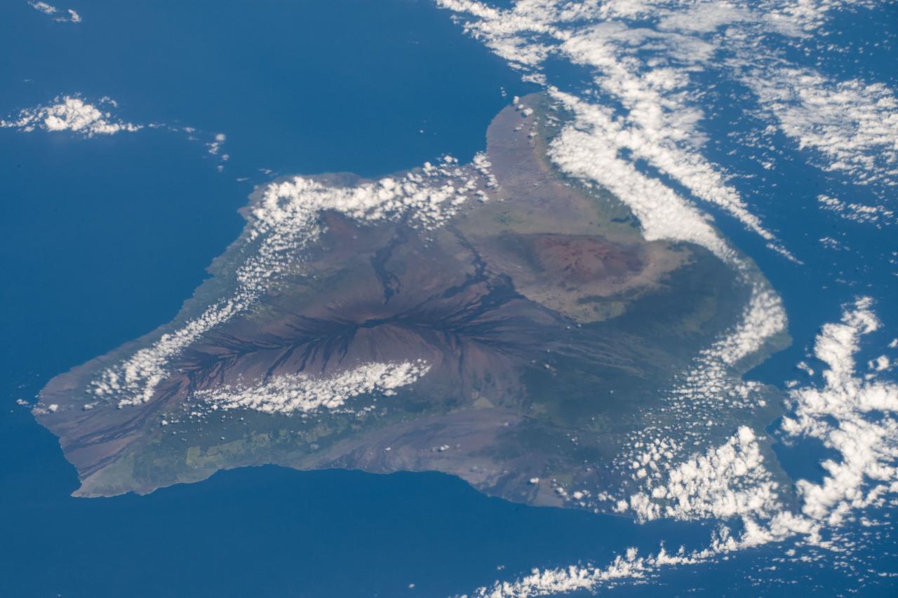
iss069e025331 (June 24, 2023) -- Clouds cover the Island of Hawaii, the youngest and largest of eight islands in the chain, as the International Space Station orbited 258 miles above the Pacific Ocean.
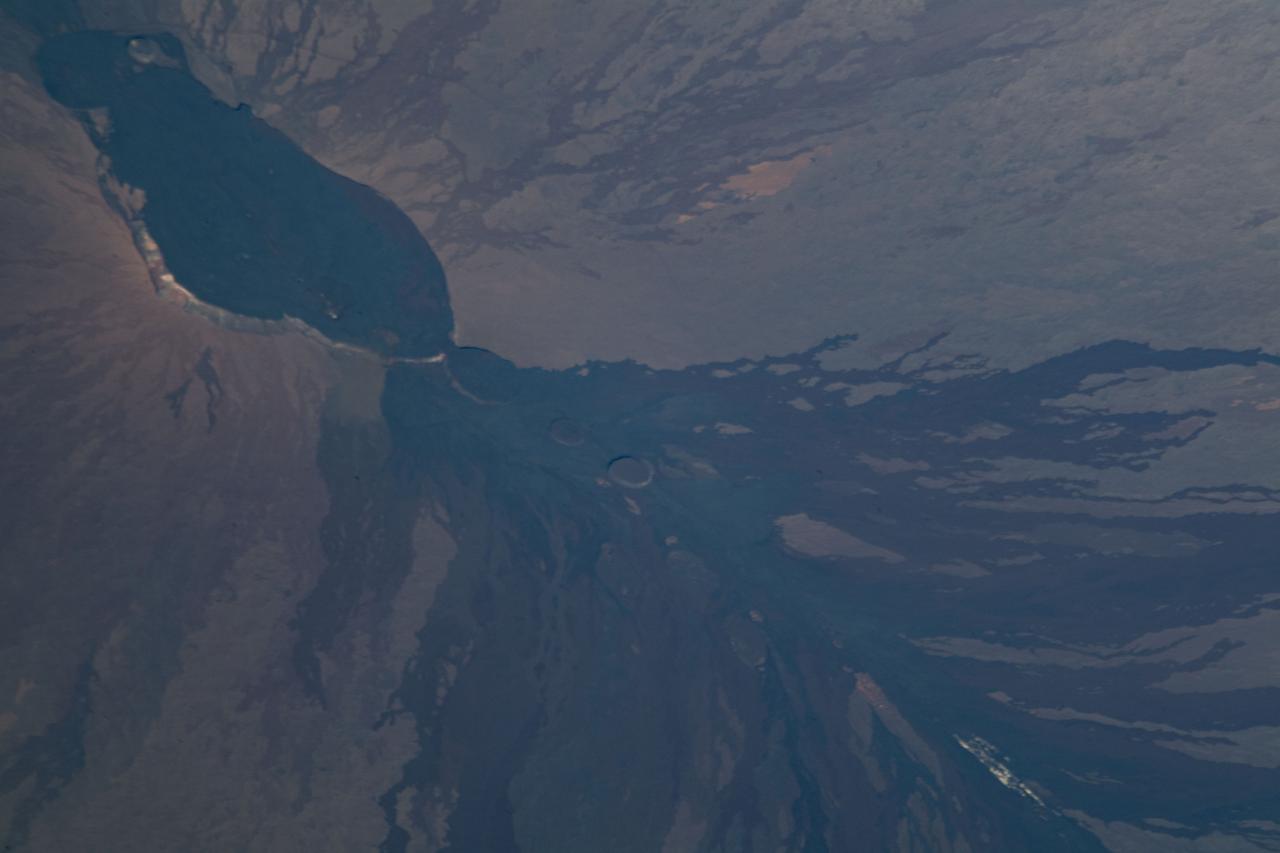
iss063e040531 (July 6, 2020) --- Mauna Loa, the world's largest active volcano, was pictured on the island of Hawaii as the International Space Station orbited above the Pacific Ocean to the northeast of the island chain.
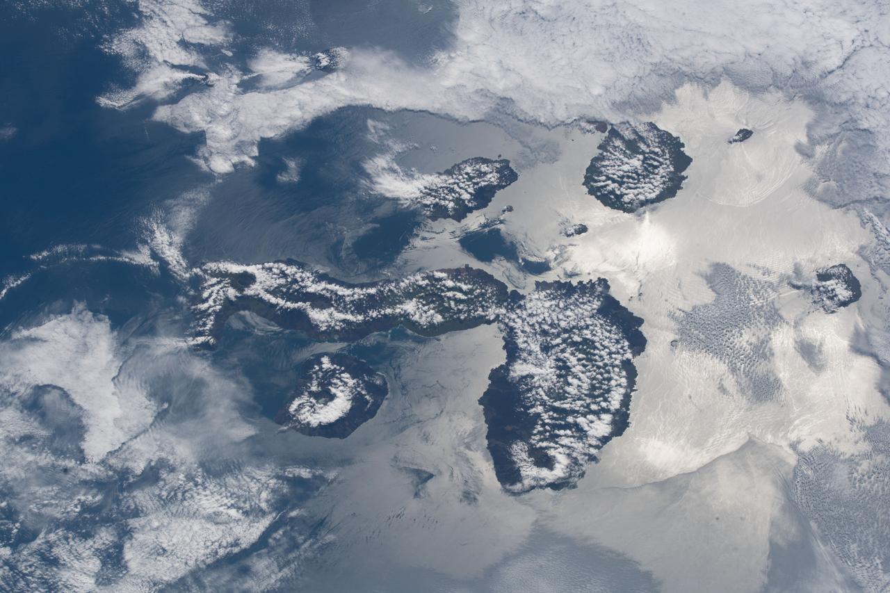
iss068e025397 (Nov. 28, 2022) --- The peak of La Cumbre Volcano on Ecuador's Fernandina Island, part of the Galapagos Islands, is surrounded by clouds in this photograph from the International Space Station as it orbited 261 miles above the Pacific Ocean.

iss053e180184 (Nov. 12, 2017) --- The islands of (from left) Abaiang, Tarawa and Maiana are part of the Gilbert Islands and make up part of the republic of Kiribati in the Pacific Ocean. Kiribati is comprised of a total of 33 coral atolls and isles.
The entire Hawaiian Island Archipelago (21.5N, 158.0W) is seen in this single view. The islands are a favorite international resort and tourist attraction drawing visitors from all over the world to enjoy the tropical climate, year round beaches and lush island flora. Being volcanic in origin, the islands' offer a rugged landscape and on the big island of Hawaii, there is still an occasional volcanic eruption of lava flows and steam vents.
iss068e006998 (Oct. 2, 2022) --- Tokyo, Japan, on the coast of the Pacific Ocean, is pictured from the International Space Station as it orbited 260 miles above the island nation.
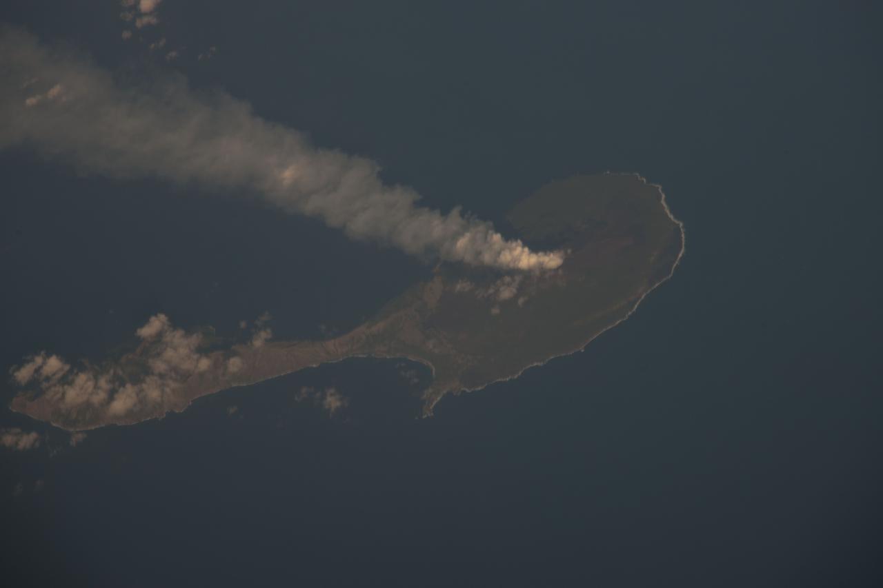
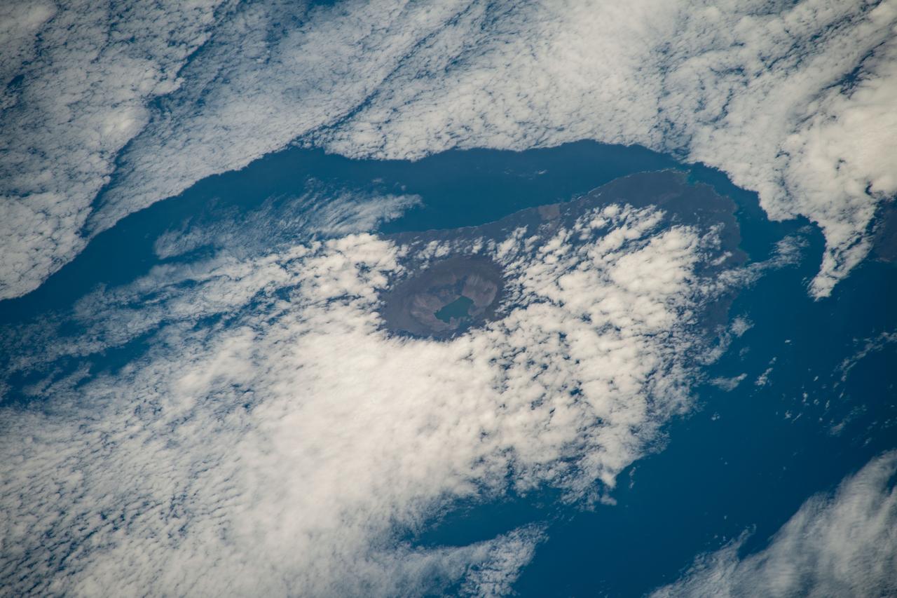
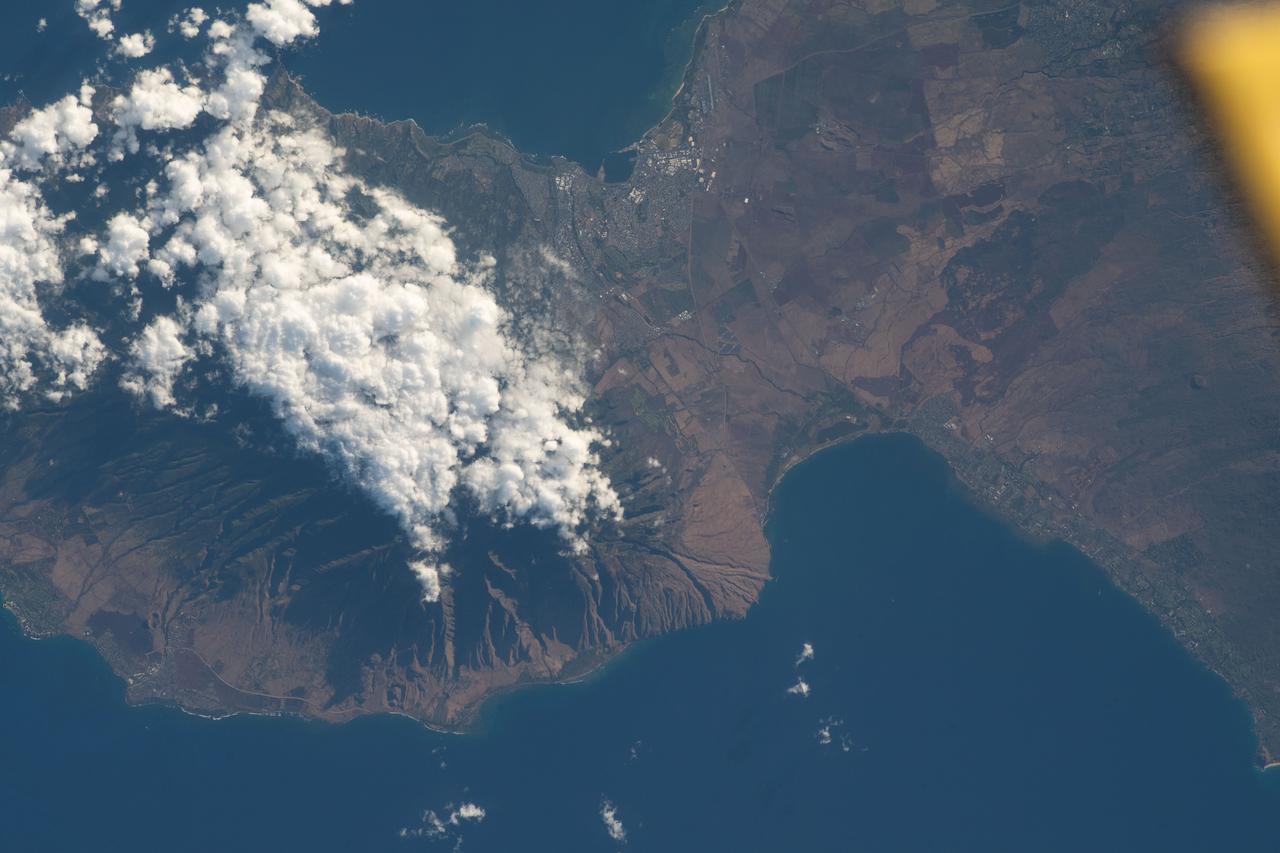
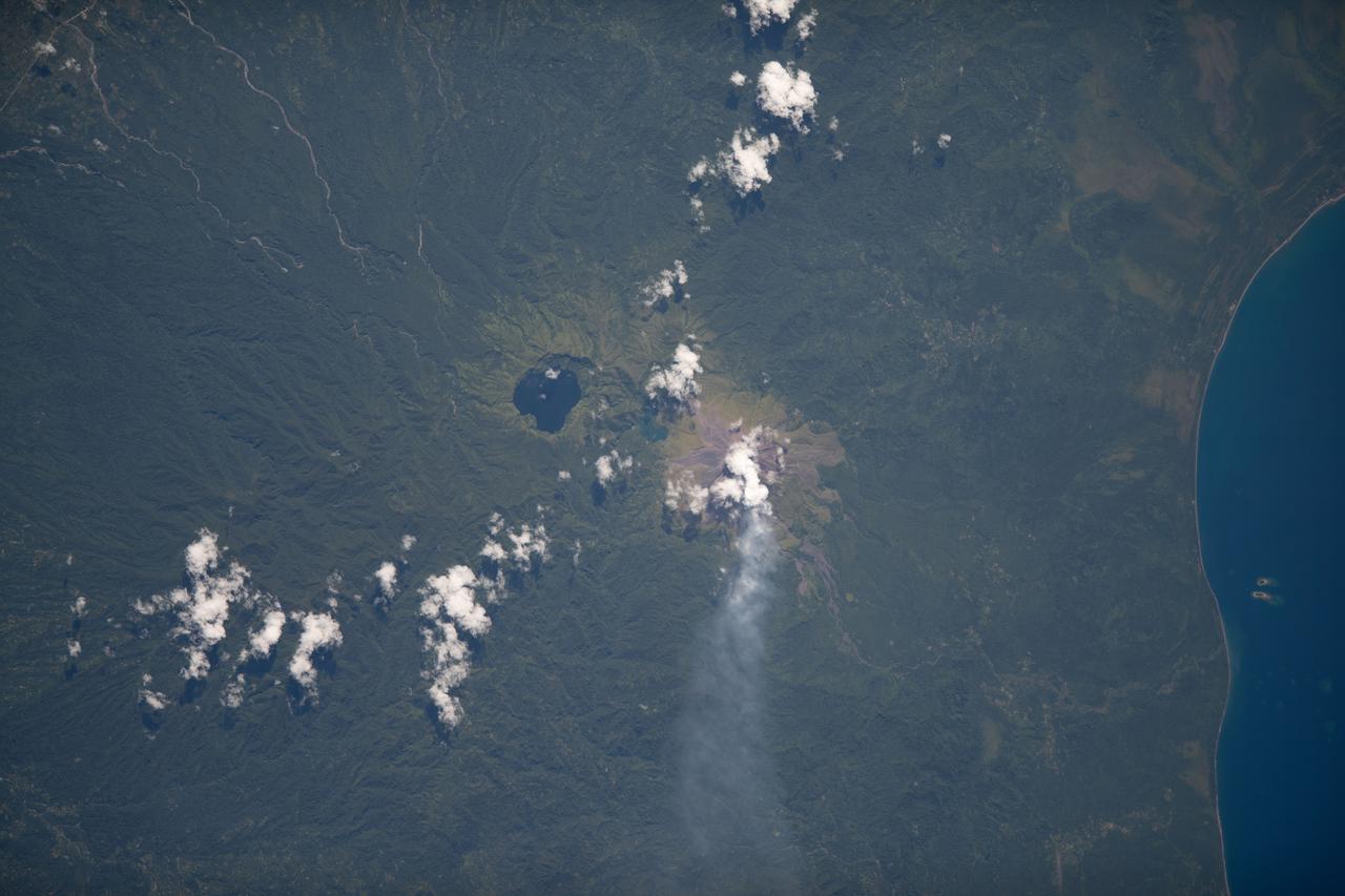
ISS030-E-122047 (6 March 2012) --- Pagan Island, Northern Marianas is featured in this image photographed by an Expedition 30 crew member on the International Space Station. A steam plume flows south from the peak of Pagan Island’s northernmost volcano in this photograph. Pagan is part of the Commonwealth of the Northern Marianas, an island chain of volcanoes that form the margin between the Pacific Ocean (to the east) and the Philippine Sea (to the west). Pagan is made up of two stratovolcanoes separated by an isthmus, and is one of the more volcanically active islands. The last eruption was in 2010, but the island was completely evacuated in 1981 when a large eruption forced the small Micronesian community to flee. According to NASA scientists, the islands themselves mark the tectonic boundary where the old, cold Pacific plate is subducted beneath the younger, less dense Philippine Sea crust at the Marianas Trench. The subduction results in substantial volcanic activity on the upper plate, forming the island arc of the Marianas. Considered to be one of the type examples for an oceanic subduction zone, the Marianas Trench includes the deepest spot in Earth’s oceans (more than 10,000 meters). The foreshortened appearance of the island is due to the viewing angle and distance from the space station, which was located over the Pacific Ocean approximately 480 kilometers to the southeast of Pagan Island when the image was taken.
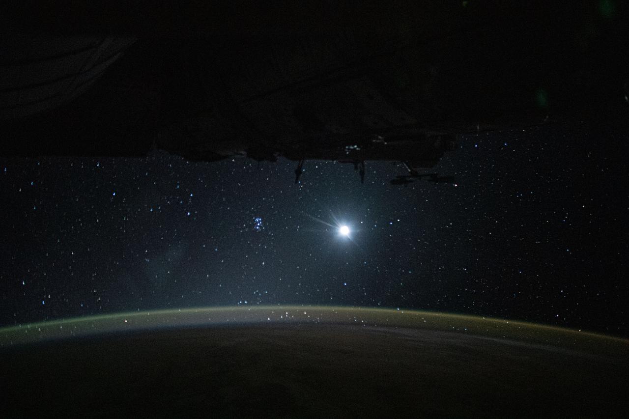
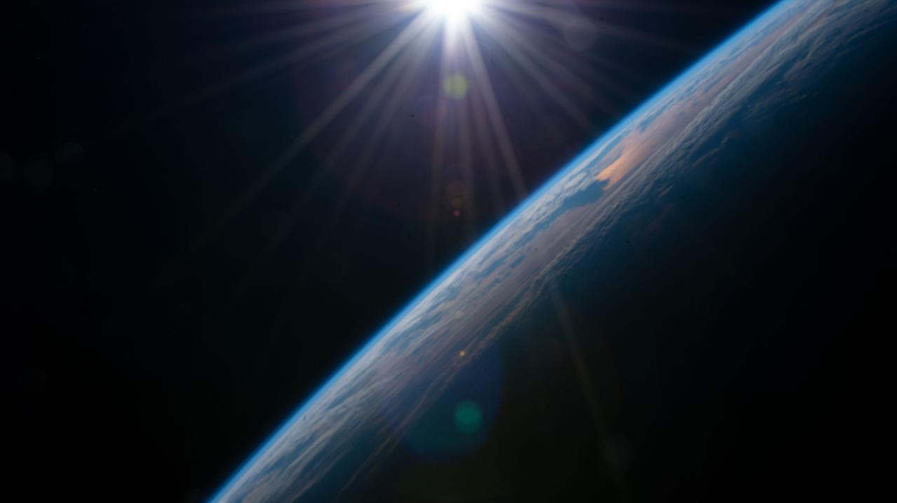
iss060e002083 (June 29, 2019) --- Earth's atmospheric glow, highlighted by the Moon and a starry orbital nighttime background, are pictured as the International Space Station orbited 256 miles above the Pacific Ocean, southeast of the Hawaiian island chain.
iss060e007130 (July 12, 2019) --- The Sun's glint beams off the blue waters of the Pacific Ocean as the International Space Station orbited 254 miles above Earth south of the Hawaiian island chain.
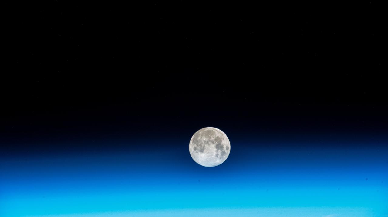
iss070e048478 (Dec. 26, 2023) --- The near Full Moon is pictured just above Earth's atmosphere in this photograph from the International Space Station as it orbited 262 miles above the north Pacific Ocean south of Alaska's Aleutian Islands.
iss064e004315 (Nov. 13, 2020) --- Cloudy seas are pictured from the International Space Station as it orbited 260 miles above the Pacific Ocean about 1,100 miles due south of the Hawaiian island chain.
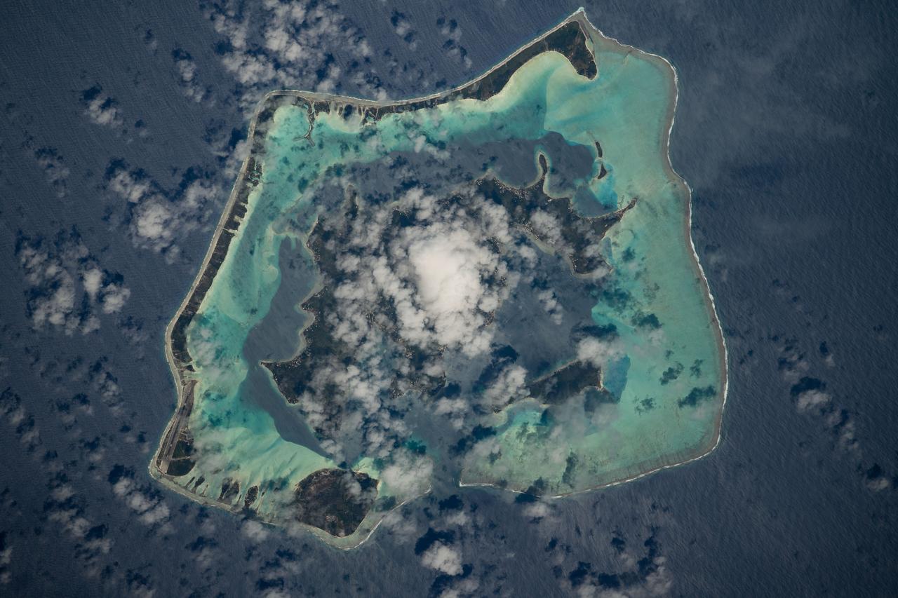
iss061e025964 (Oct. 31, 2019) --- The French Polynesian island of Bora Bora, surrounded by the Bora Main Motu Reef, is pictured as the International Space Station orbited 257 miles above the South Pacific Ocean.

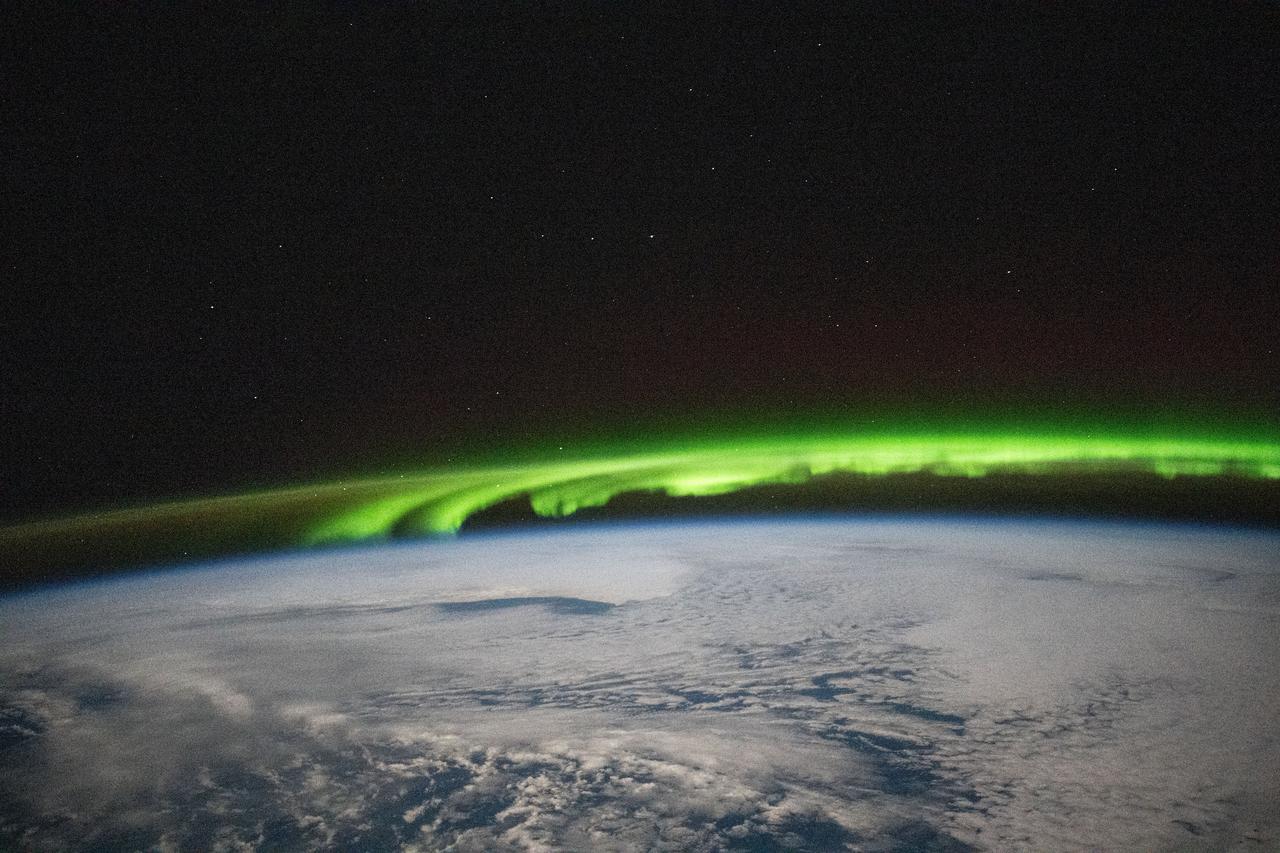
iss071e693961 (Sept. 15, 2024) --- An aurora crowns Earth's horizon in this photograph from the International Space Station as it orbited 265 miles above a cloudy Pacific Ocean southeast of the Kuril Islands.
iss066e008725 (Oct. 22, 2021) --- The airglow blankets the Earth's horizon in this photograph from the International Space Station as it orbited 262 miles above the Pacific Ocean just south of the Hawaiian island chain.
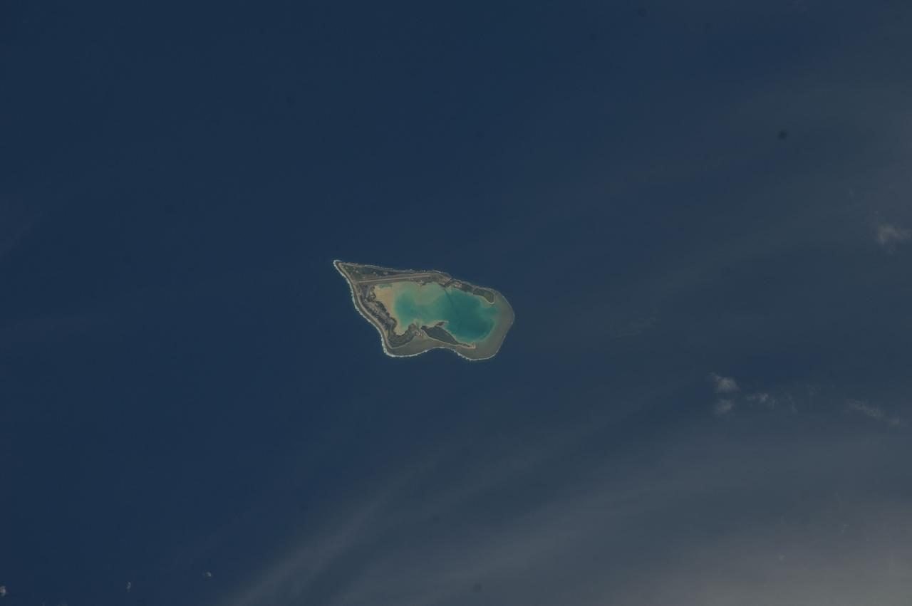
iss068e000304 (Sept. 29, 2022) --- Taongi Atoll, in the independent country of the Marshall Islands, is pictured from the International Space Station as it orbited 258 miles above the Pacific Ocean.
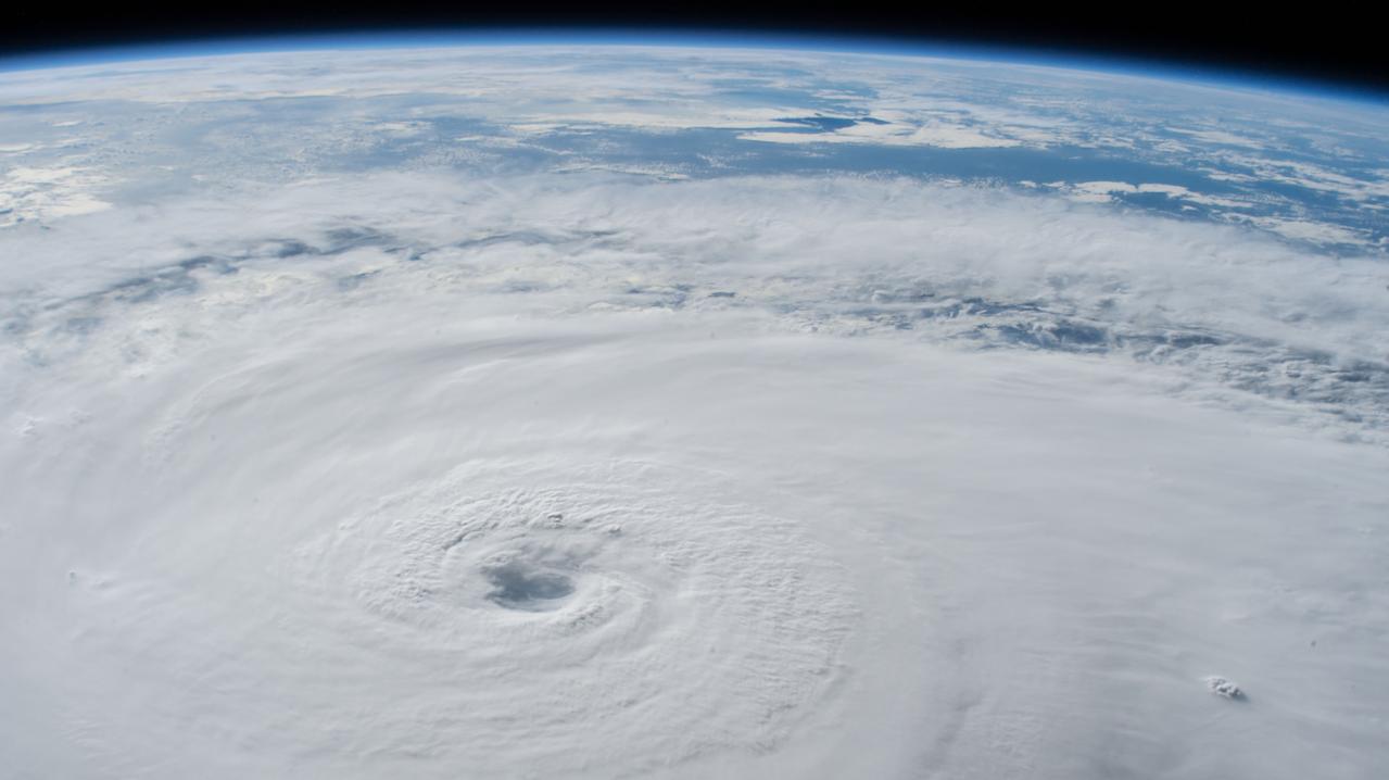
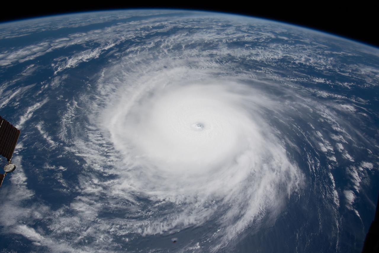
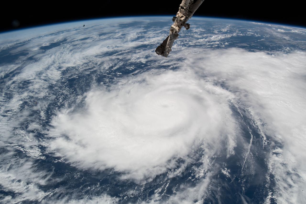
iss056e150297 (Aug. 21, 2018) --- Hurricane Lane, with its well-defined eye, was pictured as a category 4 storm southwest of the Hawaiian Islands as the International Space Station orbited almost 252 miles above the Pacific Ocean.
iss056e129968 (Aug. 3, 2018) --- Hurricane Hector was pictured by an Expedition 56 crew member as the International Space Station orbited nearly 250 miles above the Pacific Ocean east of the Hawaiian island chain.
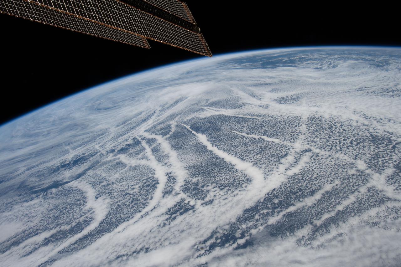
iss059e036736 (April 28, 2019) --- The International Space Station was orbiting 257 miles above the North Pacific Ocean when an Expedition 59 crewmember photographed these cloud patterns south of the Aleutian Islands.
iss067e315980 (Sept. 4, 2022) --- The Niuoku Islet, part of the island nation of Tuvalu, is pictured from the International Space Station as it orbited 259 miles above the southern Pacific Ocean.
iss064e016369 (Dec. 25, 2020) --- Mauna Loa, the world's largest active volcano, on the island of Hawaii is pictured from the International Space Station as it orbited 260 miles above the Pacific Ocean
iss060e058583 (Sept. 8, 2019) --- The north coast of Maui on the Hawaiian island chain, including the city of Kahului and its airport, is pictured as the International Space Station orbited 261 miles above the Pacific Ocean.
iss070e015686 (Nov. 2, 2023) --- The sun's glint beams across the Pacific Ocean in this photograph from the International Space Station as it orbited 259 miles above the Hawaiian island chain.
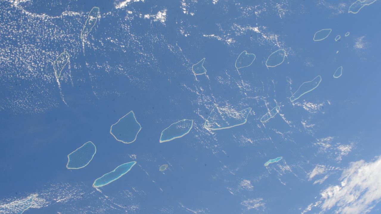
iss071e207656 (June 22, 2024) --- The Palliser Islands, atolls that are part of Fench Polynesia's Tuamotu Archipelago in the Pacific Ocean, are pictured from the International Space Station as it orbited 266 miles above.

iss069e086332 (Aug. 31, 2023) --- The Moon's image is refracted due to Earth's atmosphere in this photograph from the International Space Station as it orbited 262 miles above the Pacific Ocean south of Alaska's Aleutian islands.
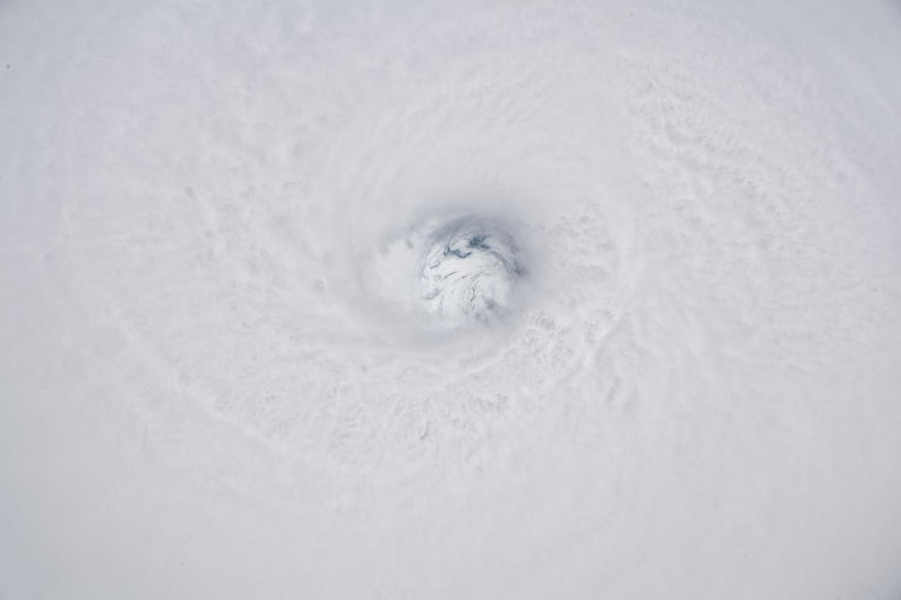
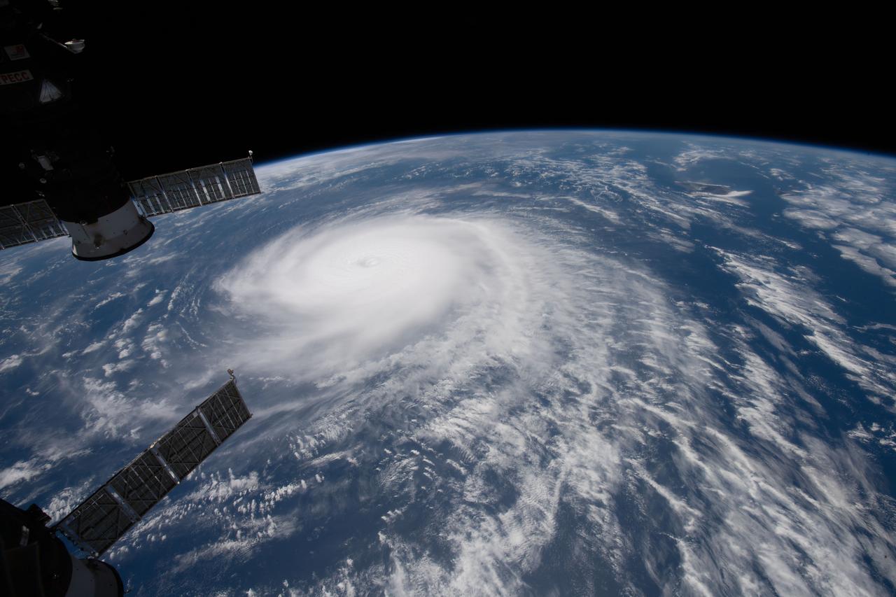
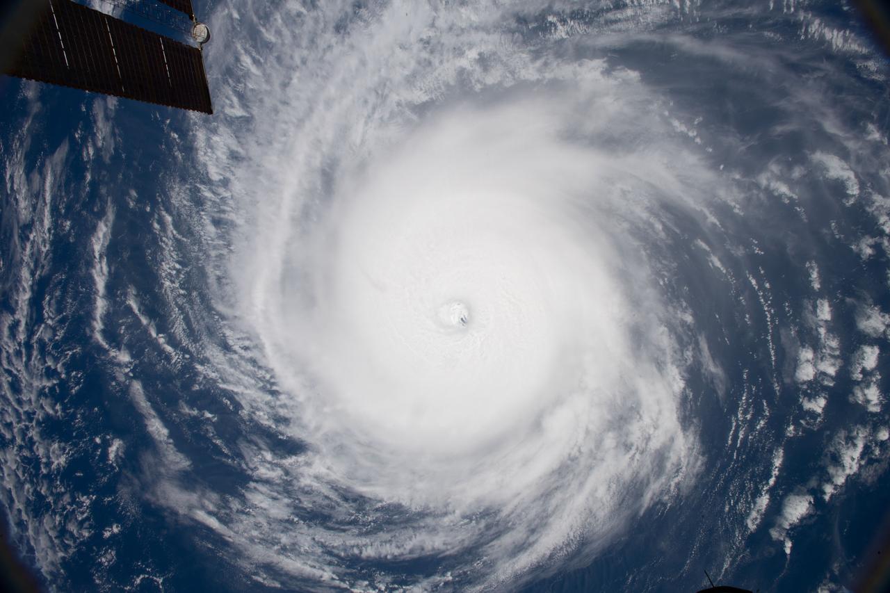
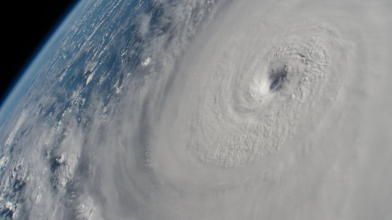
iss056e129868 (Aug. 7, 2018) --- The fully-formed eye of Hurricane Hector is clearly visible from the International Space Station as the orbital complex flew 250 miles above the Pacific Ocean southeast of the Hawaiian island chain.
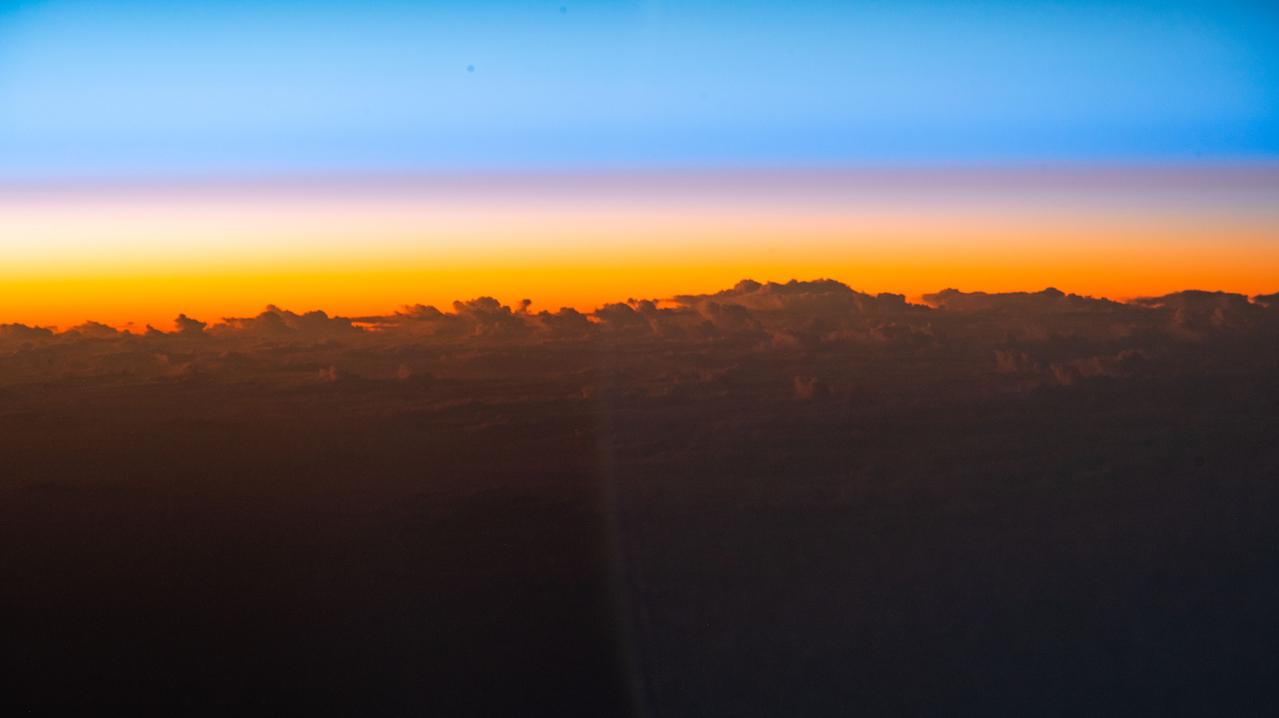
iss067e362267 (Sept. 15, 2022) --- An orbital sunrise begins to illuminate the cloud tops in this photograph from the International Space Station as it orbited 258 miles above the Pacific Ocean south of the Hawaiian island chain.
iss056e126638 (Aug. 7, 2018) --- Hurricane Hector was pictured by an Expedition 56 crew member as the International Space Station orbited nearly 250 miles above the Pacific Ocean just south of the Hawaiian island chain.

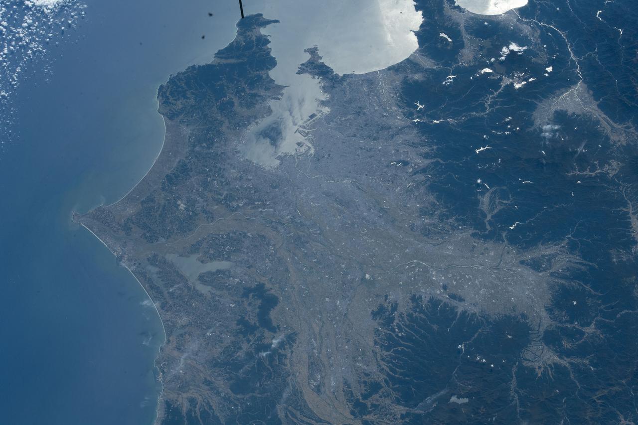
iss065e073777 (May 26, 2021) --- Japan's northernmost main island of Hokkaido is pictured from the International Space Station as it orbited east 262 miles above the Pacific Ocean.
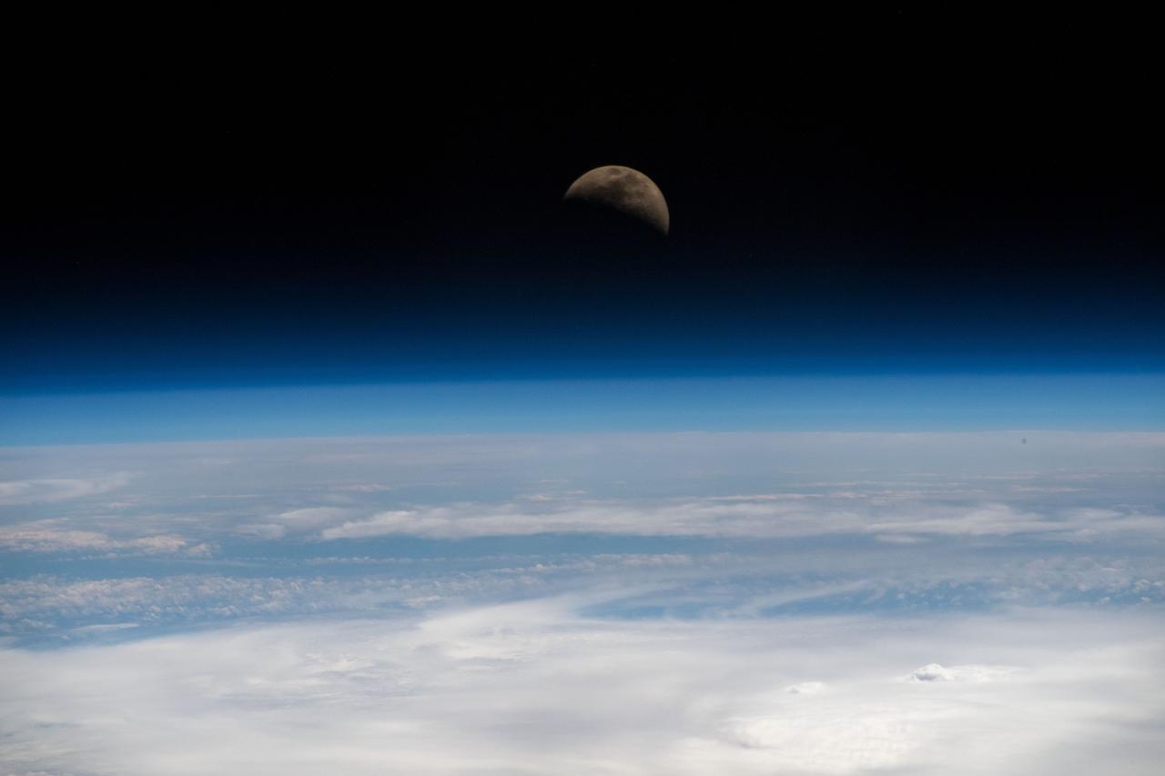
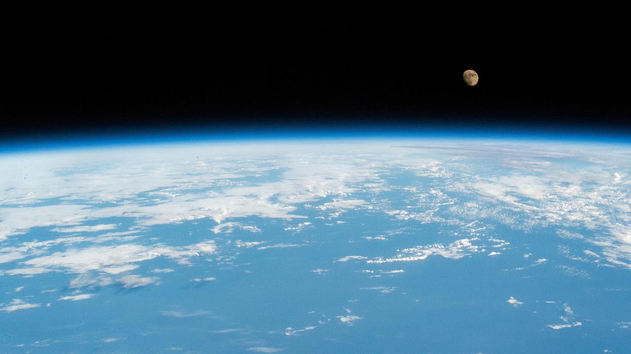
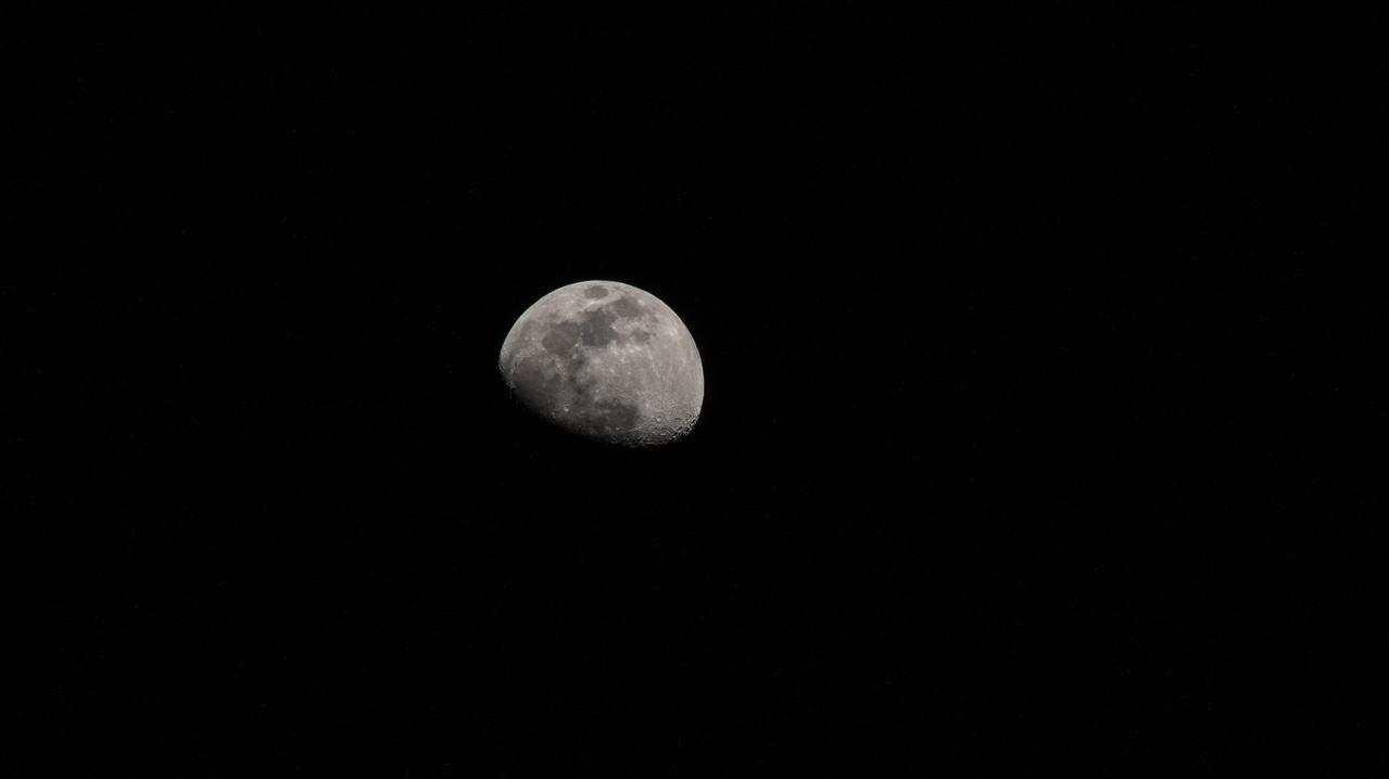
iss059e019955 (April 11, 2019) --- The moon is photographed in its first quarter phase just above the Earth's limb as the International Space Station orbited 255 miles above the Pacific Ocean south of the Hawaiian island chain.
iss066e152101 (Feb. 22, 2022) --- The Earth is illuminated shortly after an orbital sunrise in this photograph from the International Space Station as it orbited 262 above the Pacific Ocean south of Alaska's Aleutian Islands.
iss056e129954 (Aug. 7, 2018) --- Hurricane Hector was pictured by an Expedition 56 crew member as the International Space Station orbited nearly 250 miles directly above the storm in the Pacific Ocean just southeast of the Hawaiian island chain.
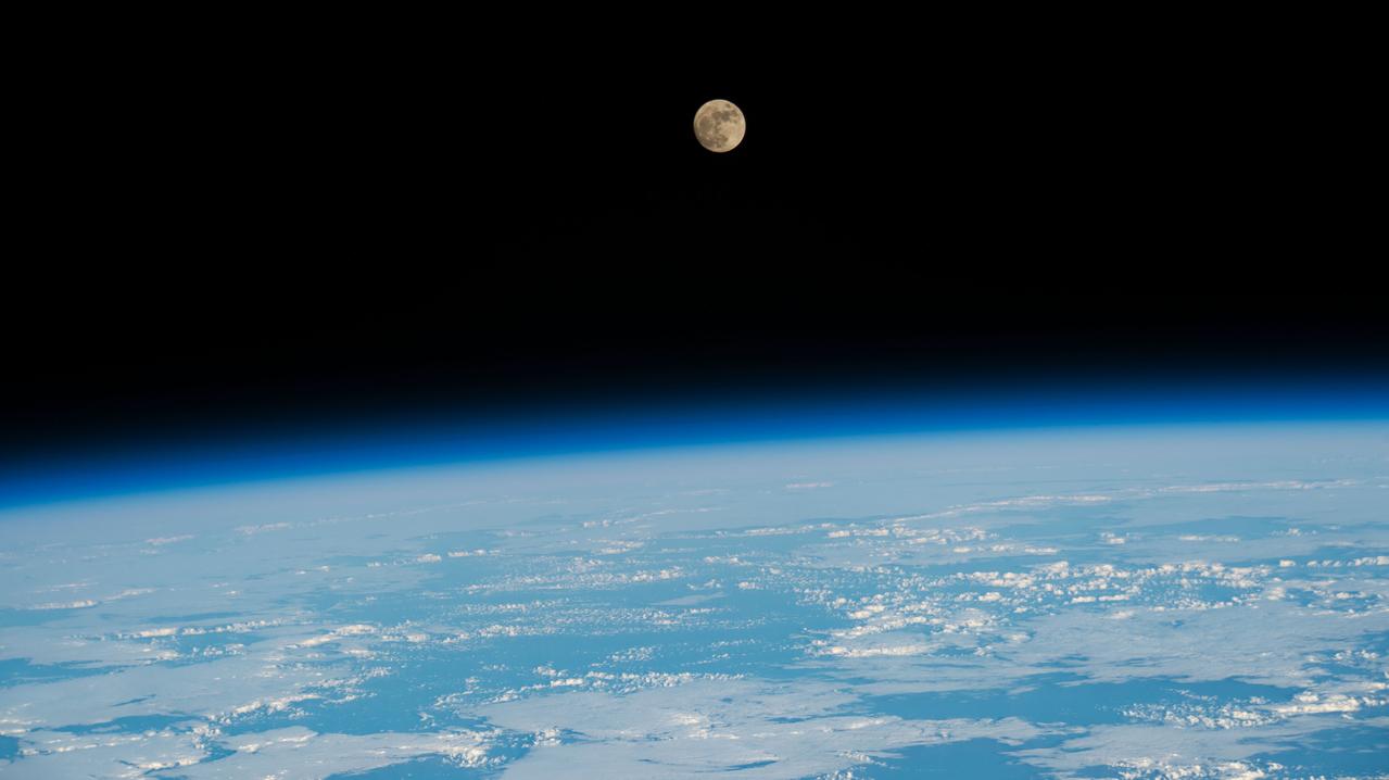
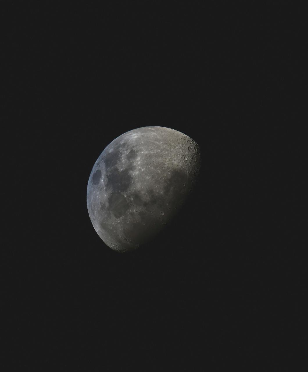
iss067e249811 (Aug. 10, 2022) --- The waxing gibbous Moon is pictured from the International Space Station as it orbited 258 miles above the Pacific Ocean north of the Hawaiian island chain.
iss056e150306 (Aug. 21, 2018) --- Hurricane Lane, with its distinct eye, was pictured as a category 4 storm as the International Space Station orbited 251 miles above the Pacific Ocean east of the Hawaiian Islands.
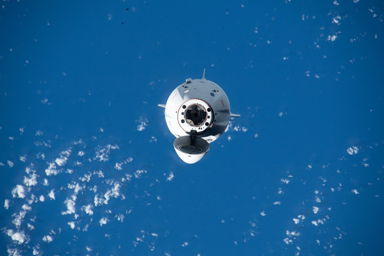
iss072e145206 (Nov. 5, 2024) --- The SpaceX Dragon cargo spacecraft is pictured approaching the International Space Station as both spacecraft were orbiting 255 miles above a cloudy Pacific Ocean southwest of Ecuador's Galápagos Islands.
iss067e249774 (Aug. 9, 2022) --- The waxing gibbous Moon is pictured from the International Space Station as it orbited 260 miles above the Pacific Ocean south of Alaska's Aleutian Islands.
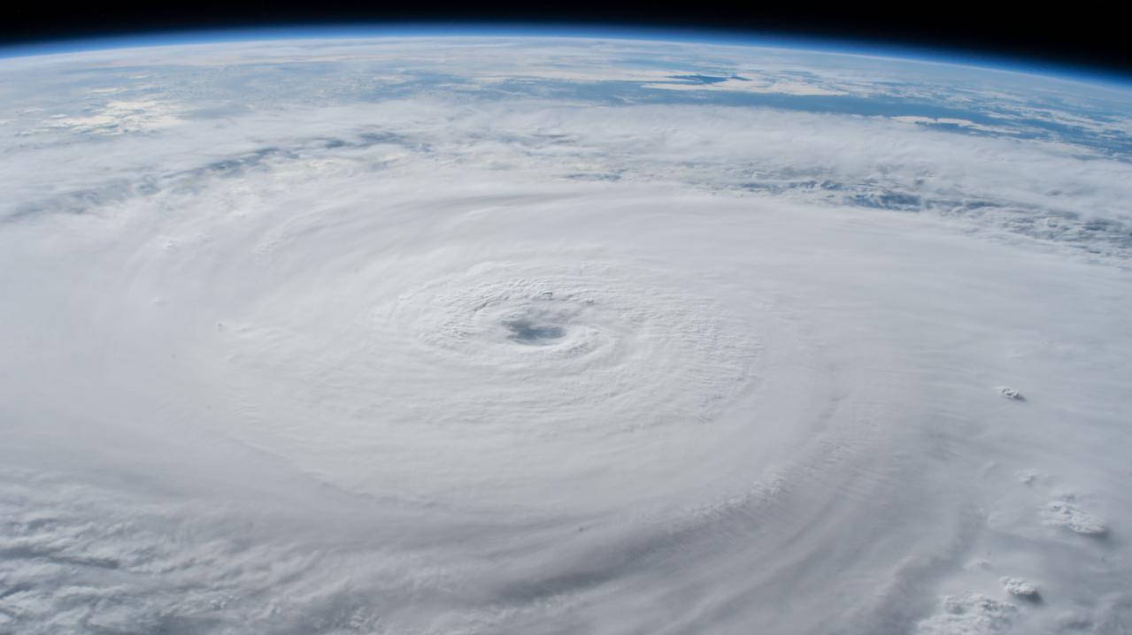
iss056e150299 (Aug. 21, 2018) --- Hurricane Lane, with its well-defined eye, was pictured as a category 4 storm southwest of the Hawaiian Islands as the International Space Station orbited almost 252 miles above the Pacific Ocean.
iss059e021191 (April 11, 2019) --- The moon is photographed in its waxing gibbous phase as the International Space Station orbited 256 miles above the North Pacific Ocean south of Alaska's Aleutian Islands.
iss064e025547 (Jan. 23, 2021) --- The waxing gibbous Moon is pictured from the International Space Station as it orbited 263 miles above the Pacific Ocean near the island state of Samoa and the U.S. territory of American Samoa. Credit: Roscosmos
iss066e152100 (Feb. 22, 2022) --- The sun rises above the horizon illuminating the Earth in this photograph from the International Space Station as it orbited 262 above the Pacific Ocean south of Alaska's Aleutian Islands.
iss055e023500 (April 13, 2018) --- The cloud-covered Galapagos Islands and the sun's glint in the waters off the coast of Ecuador are pictured as the International Space Station orbited above the Pacific Ocean.
iss072e188141 (Nov. 15, 2024) --- A bright green aurora borealis streams above Earth's surface as the International Space Station orbited 269 miles above a cloudy North Pacific Ocean south of Alaska's Aleutian Islands.
iss070e006089 (Oct. 18, 2023) --- The Canadarm2 robotic arm is pictured extending from the International Space Station while orbiting 260 miles above the Pacific Ocean near the Aleutian Islands.
iss067e221404 (July 31, 2022) --- The sun illuminates Earth's limb as the International Space station soared 271 miles above the Pacific Ocean south of the Australian island state of Tasmania.
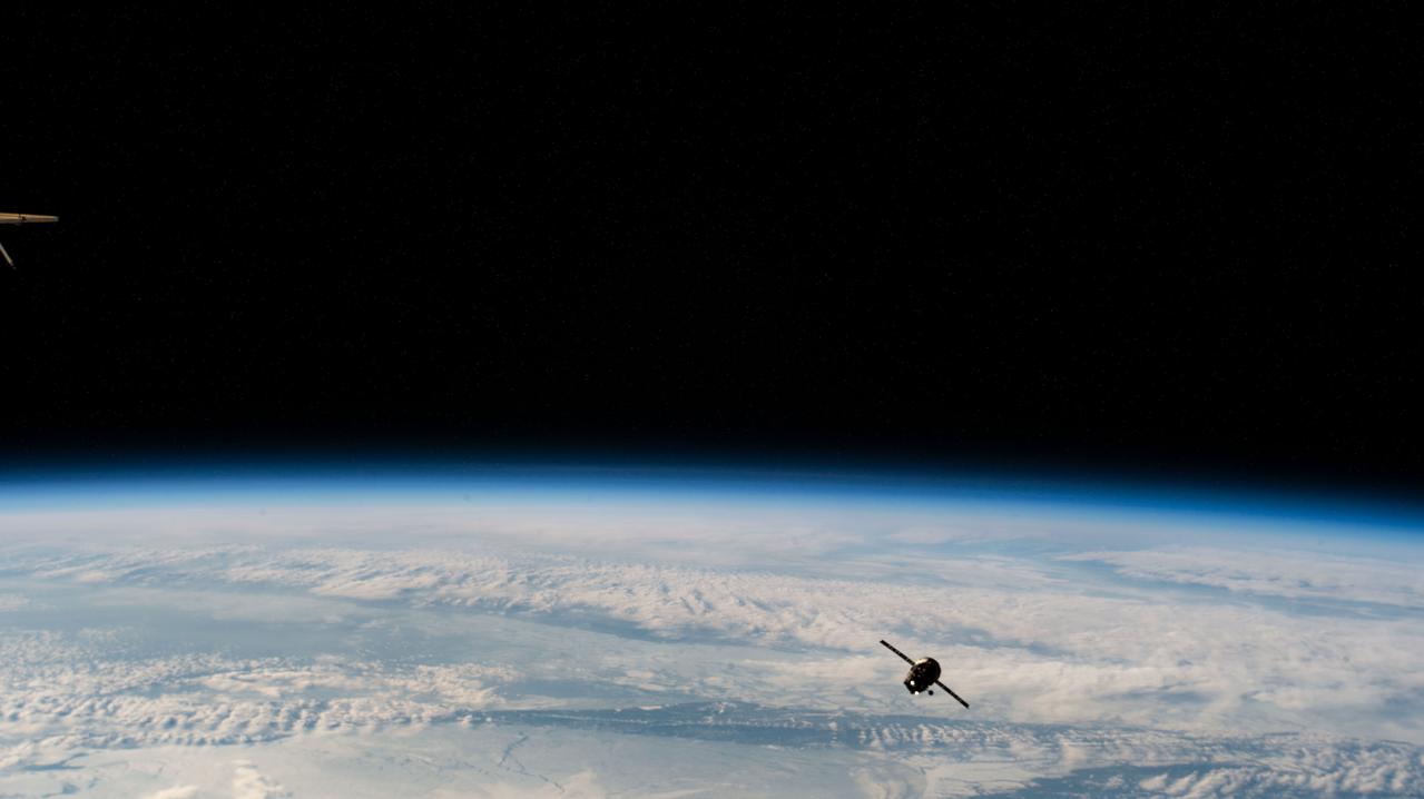
iss068e046972 (Feb. 7, 2023) --- The ISS Progress 81 resupply ship from Roscosmos is pictured 266 miles above the Pacific Ocean off the coast of the Kuril Islands after undocking from the Zvezda service module's rear port. It would later reenter the Earth's atmosphere above the Pacific Ocean for a safe demise completing an eight-month International Space Station resupply mission.
iss068e046973 (Feb. 7, 2023) --- The ISS Progress 81 resupply ship from Roscosmos is pictured 266 miles above the Pacific Ocean off the coast of the Kuril Islands- after undocking from the Zvezda service module's rear port. It would later reenter the Earth's atmosphere above the Pacific Ocean for a safe demise completing an eight-month International Space Station resupply mission.
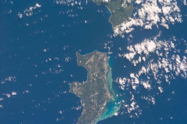
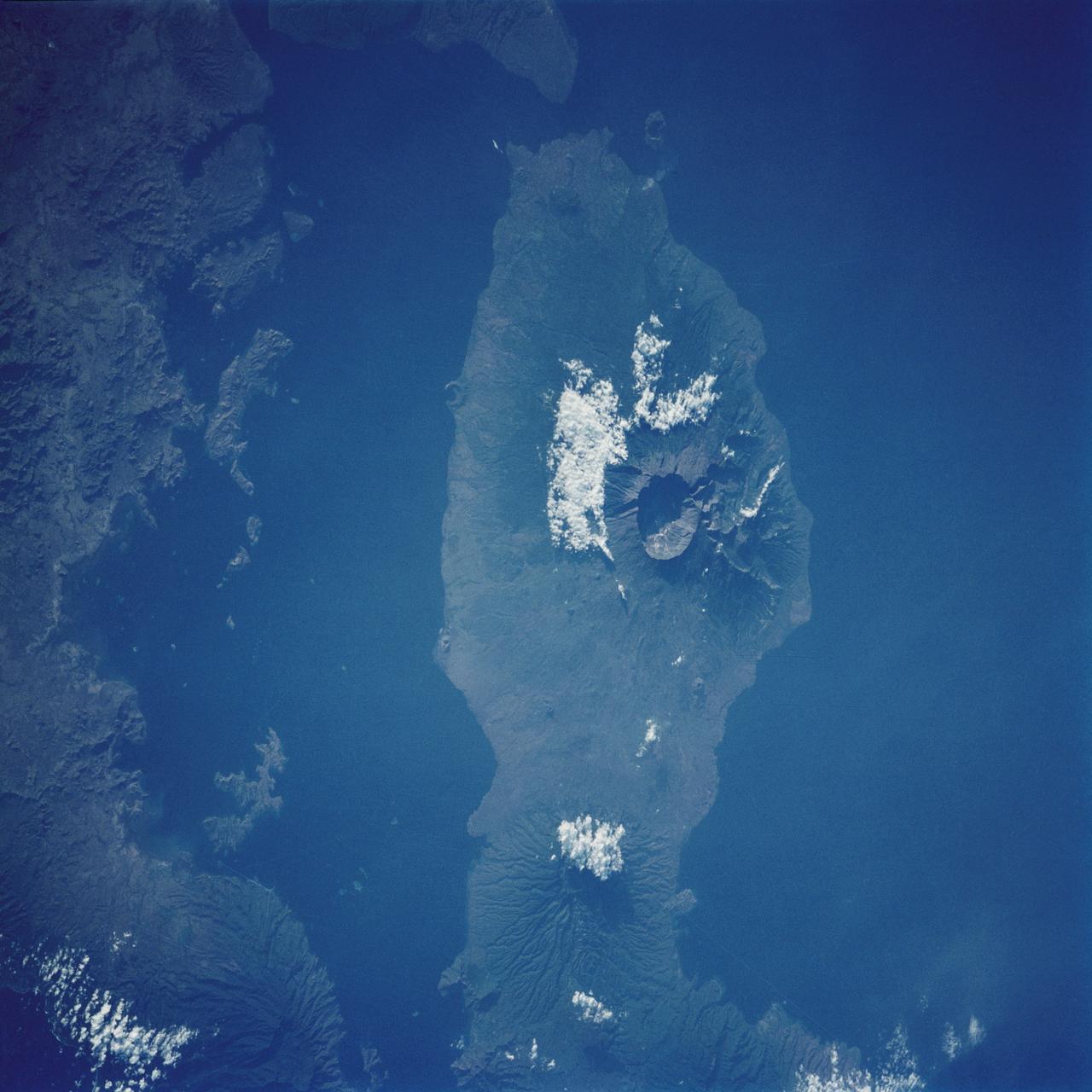
S103-E-5361 (24 December 1999) --- This vertical view from the Space Shuttle Discovery shows two small islands of the Marianas Islands (Saipan and Tinian) in Micronesia in the Pacific Ocean. The STS-103 crew recorded this electronic still image at 28:05:53 GMT, December 24, 1999.

iss056e129864 (Aug. 7, 2018) --- Hurricane Hector was pictured by an Expedition 56 crew member as the International Space Station orbited 250 miles above the Pacific Ocean almost due south of the big island of Hawaii which anchors the Hawaiian island chain.
iss055e005323 (March 25, 2018) --- The International Space Station was orbiting above the Tasman Sea when an Expedition 55 crew member took this picture of New Zealand's North Island where the city of Auckland is located. The sun's glint over the South Pacific Ocean and the Tasman Sea clearly outlines the island nation.
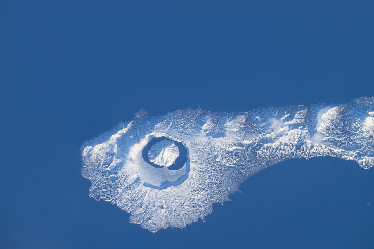
iss071e046424 (April 29, 2024) --- The snow-covered Onekotan Island, part of Russia's Kuril Islands, is home to the Tao-Rusyr Caldera stratovolcano in this photograph. Inside the caldera is the Krenitsyna Volcano peak surrounded by the partially ice-covered Kol'tsevoe Lake. The International Space Station was orbiting 259 miles above the Pacific Ocean at the time of this photograph.
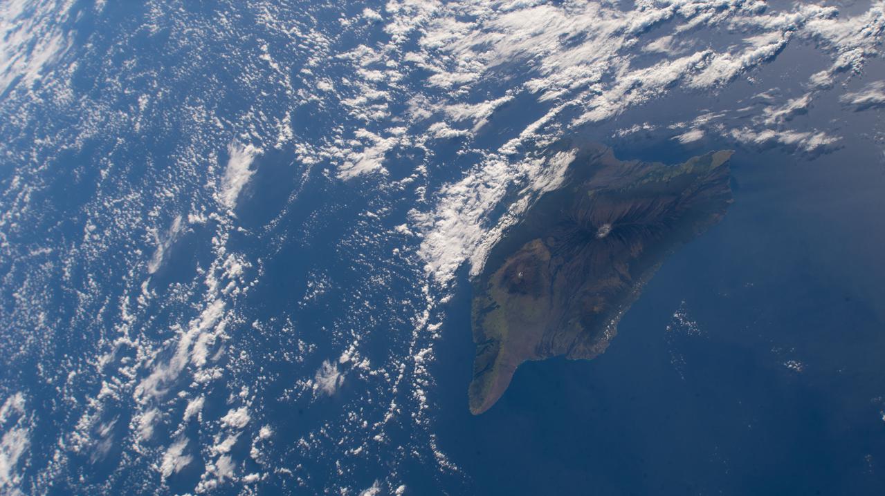
iss066e137869 (Feb. 8, 2022) --- Hawaii's big island and its two major volcanoes Mauna Kea and Mauna Loa are pictured from the International Space Station as it orbited 258 miles above the Pacific Ocean south of the Hawaiian island chain
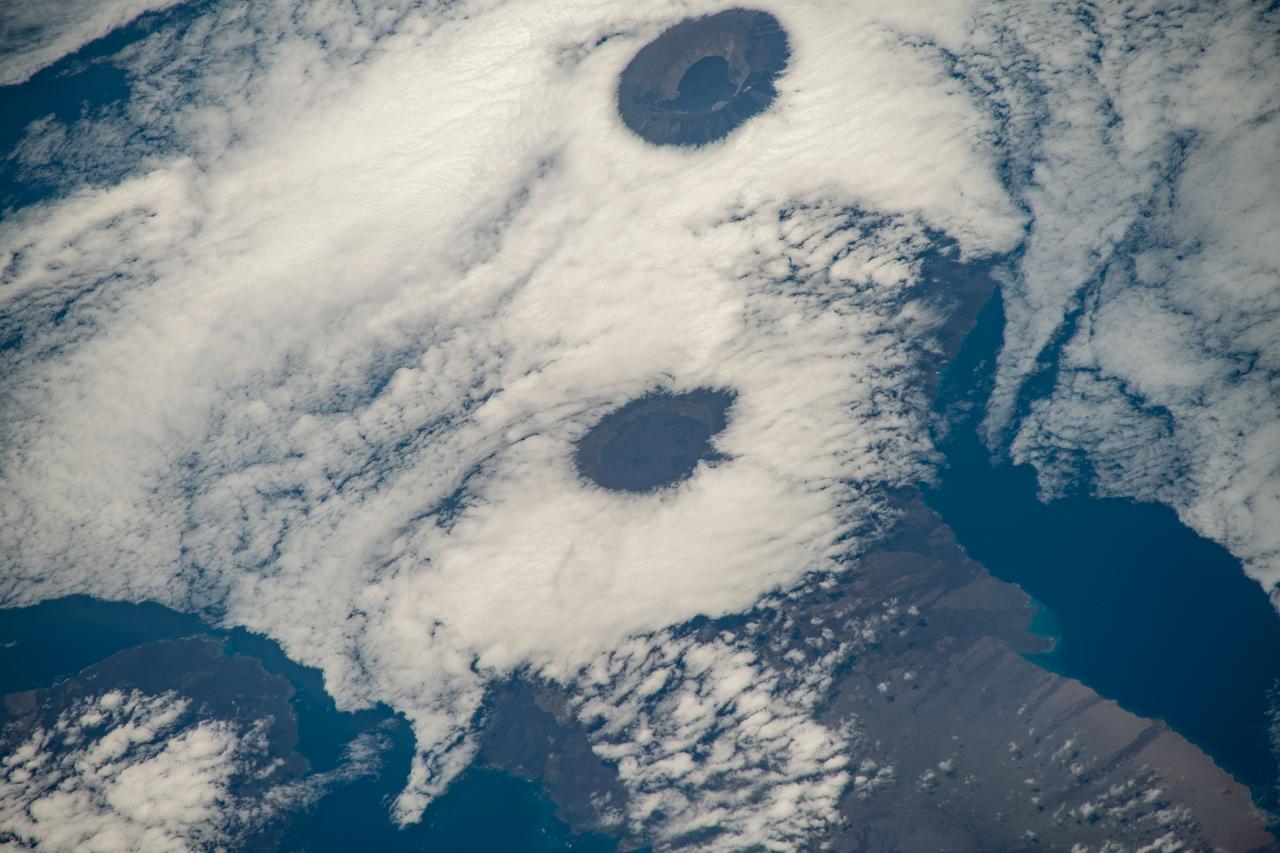
iss068e025399 (Nov. 28, 2022) --- From top, the peaks of Wolf Volcano and Darwin Volcano on Ecuador's Isabel Island, part of the Galapagos Islands, are surrounded by clouds in this photograph from the International Space Station as it orbited 261 miles above the Pacific Ocean.
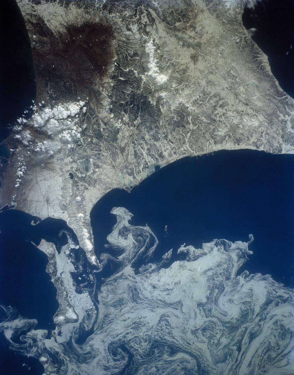
The northeast coast of Hokkaido and Kunashir Island, Japan (44.0N, 143.0E) are seen bordered by drifting sea ice. The sea ice has formed a complex pattern of eddies in response to surface water currents and winds. Photos of this kind aid researchers in describing local ocean current patterns and the effects of wind speed and direction on the drift of surface material, such as ice floes or oil. Kunashir is the southernmost of the Kuril Islands.
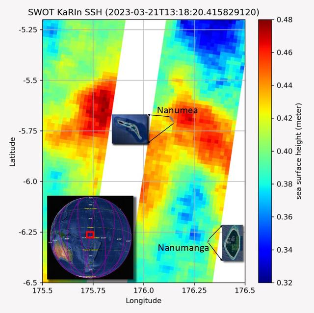
The recently launched Surface Water and Ocean Topography (SWOT) mission collected data on sea levels around two of the inhabited islands of Tuvalu, a nation in the South Pacific Ocean that has been threatened with sea level rise that substantially exceeds the global average. The image shows two areas of red that indicate higher than normal sea levels around two of Tuvalu's inhabited islands, Nanumanga and Nanumea. The higher sea levels were likely caused by internal tides or circular currents called eddies. The SWOT data illuminates for the first time these small ocean features that, when they occur on top of rising sea levels, can lead to episodic flooding along coastlines. The Tuvalu data was collected March 21, 2023. Rising seas are a direct consequence of climate change. On a global scale, the combination of warming ocean waters and ice melt from glaciers and ice sheets is leading to sea level rise that is occurring at an ever-increasing rate. The current rate of rise is more than 0.15 inches (4 millimeters) per year, an increase from 0.08 inches (2 millimeters) per year in 1993. This seemingly small increase holds great significance for coastal communities that have seen more than a century of persistent sea level rise. The gap between the average high tide and flooding conditions has narrowed, and coastal impacts driven by sea level rise have increased in frequency and severity in recent years. This is particularly true for low-lying island nations like Tuvalu, located about 620 miles (1,000 kilometers) north of Fiji. Sea level rise does not occur at the same rate everywhere across the globe, and can be exacerbated by natural ocean fluctuations that occur over time periods from years to decades. For Tuvalu, the amount of sea level rise has been substantially higher than the global average over the past three decades. The amount of rise, when coupled with Tuvalu's low land elevations, places the country increasingly under threat. In the near term, sea level rise will combine with naturally occurring ocean variability and storms to exacerbate events like coastal flooding. Monitoring and understanding sea level change is critical for Tuvalu and other low-lying island nations. Launched on Dec. 16, 2022, from Vandenberg Space Force Base in central California, SWOT collected the Tuvalu sea level data during a period of commissioning, calibration, and validation. Engineers are checking out the performance of the satellite's systems and science instruments before the planned start of science operations in summer 2023. https://photojournal.jpl.nasa.gov/catalog/PIA25777
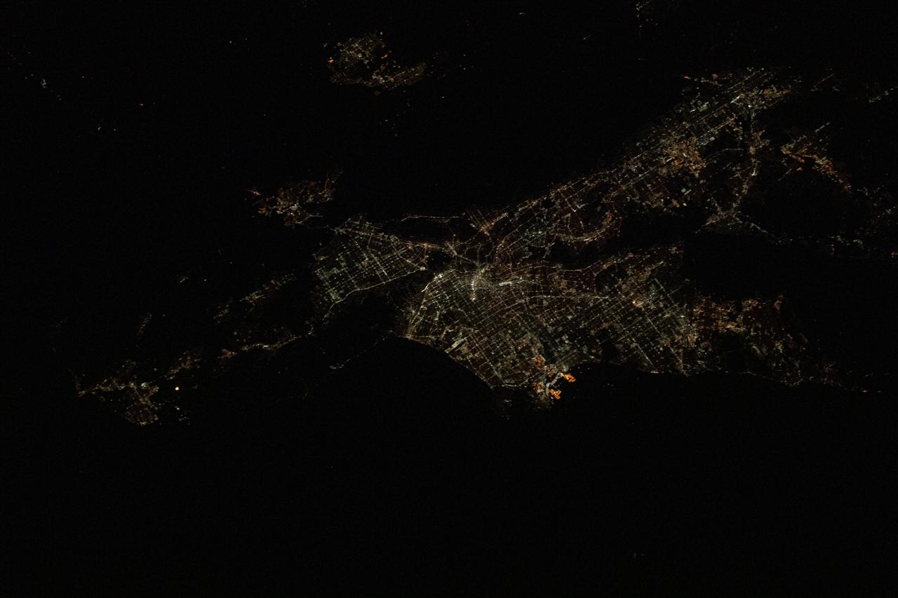
iss061e028440 (Nov. 4, 2019) --- Los Angeles, California is pictured at night as the International Space Station was orbiting 257 miles above the Pacific Ocean and about 215 miles southwest of the L.A. coastline. The bright orange lights at the center are Terminal Island and the Port of Los Angeles.
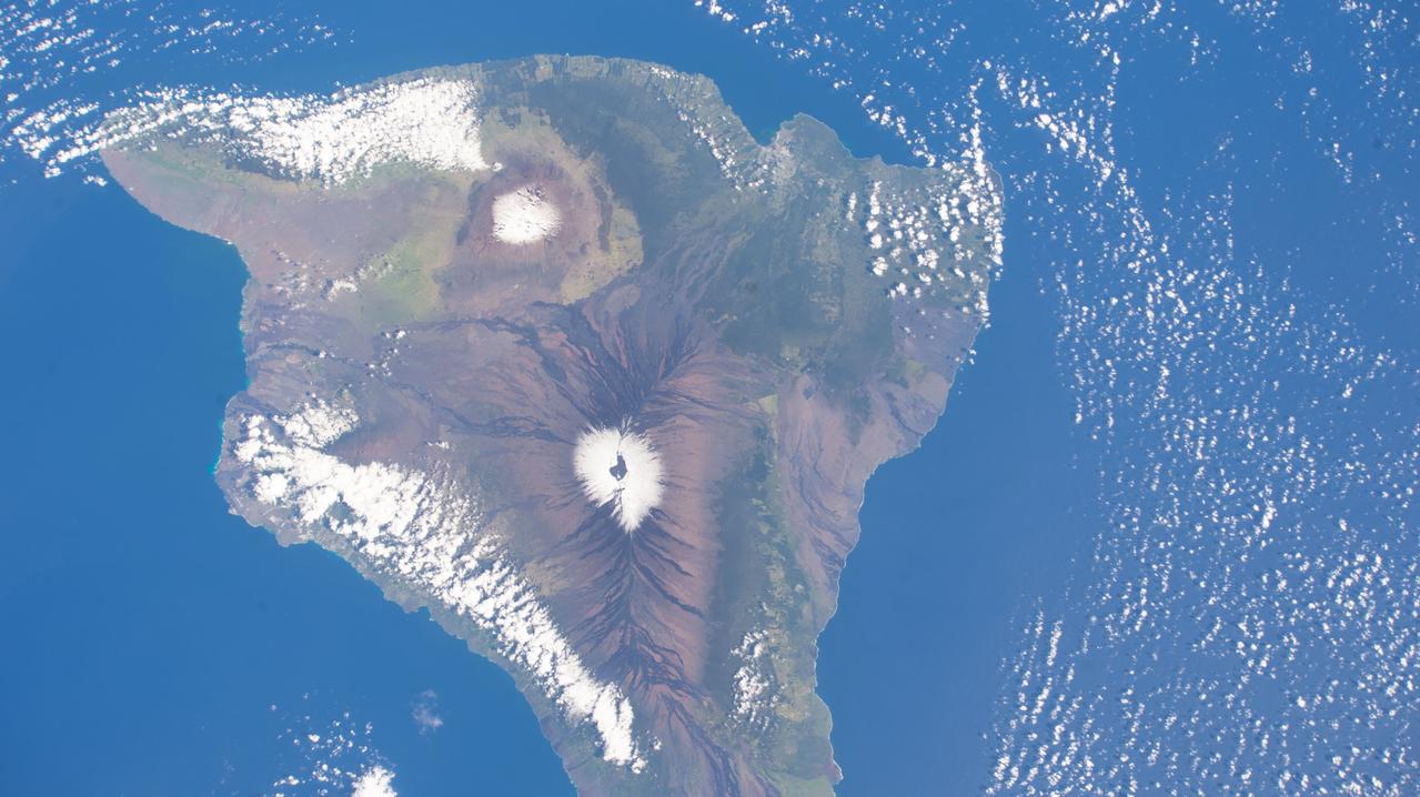
iss068e033632 (Dec. 27, 2022) --- The snow-capped peaks of two different volcanoes on the island of Hawaii, Mauna Loa, an active volcano (bottom), and Mauna Kea, a dormant volcano (top), are pictured from the International Space Station as it orbited 258 miles above the Pacific Ocean.
iss069e057179 (Aug. 12, 2023) --- The island of Maui, Hawaii, the scene of deadly wildfires and the especially hard hit coastal town of Lahaina (at lower left), is pictured from the International Space Station as it orbited 259 miles above the Pacific Ocean.
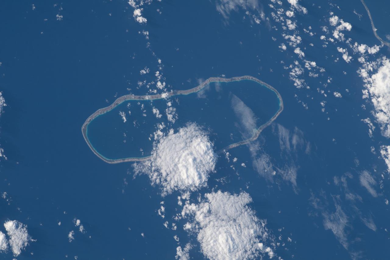
iss069e054648 (August 4, 2023) -- Amanu, a ring-shaped island—or an atoll—is roughly 560 miles (900 kilometers) from Tahiti. Only 10 miles (~15 kilometers) of its land is above water, creating a lagoon in its center. The International Space Station soared 261 miles above the Pacific Ocean as this image was taken.
S63-06437 (15-16 May 1963) --- The southern portion of the island of Taiwan (Formosa), Formosa Straight and the Pacific Ocean, looking northeast, as photographed from the Mercury-Atlas 9 (MA-9) capsule by astronaut L. Gordon Cooper Jr., during his 22-orbit MA-9 spaceflight. Photo credit: NASA
iss056e126641 (Aug. 3, 2018) --- Hurricane Hector was pictured gaining strength by an Expedition 56 crew member as the International Space Station orbited 250 miles above the Pacific Ocean about 1,500 miles southeast of the Hawaiian island chain.
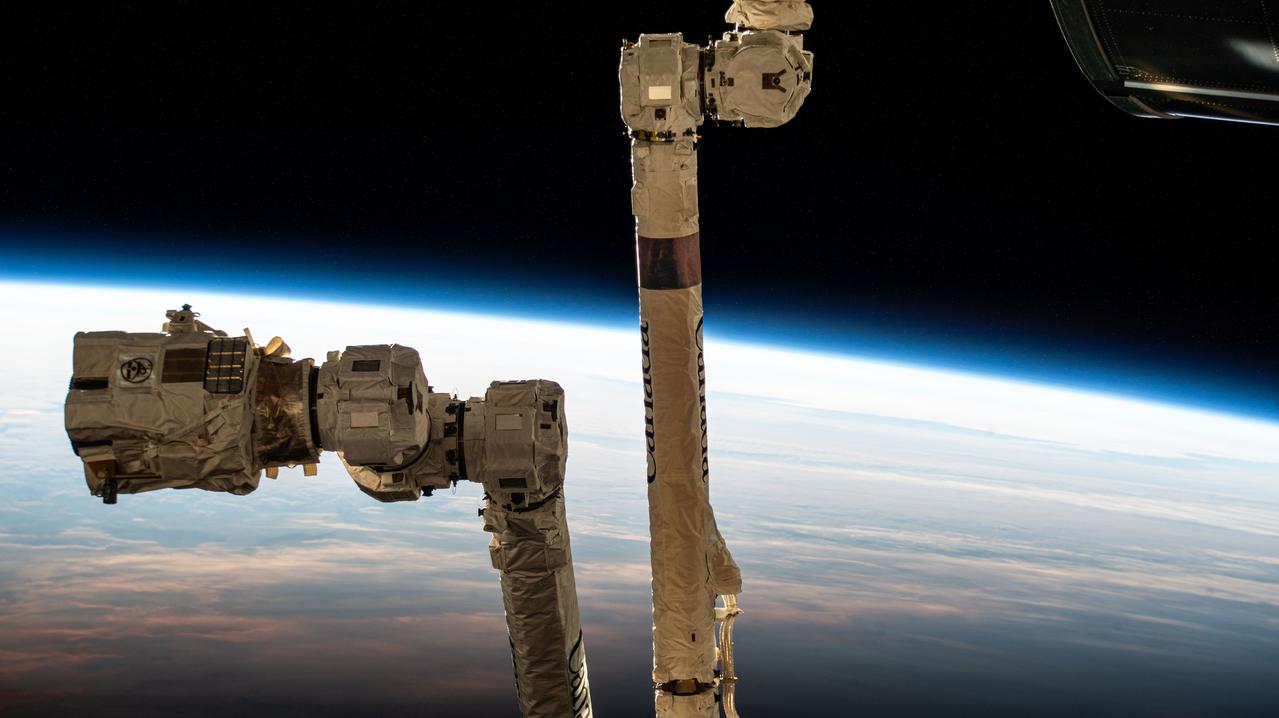
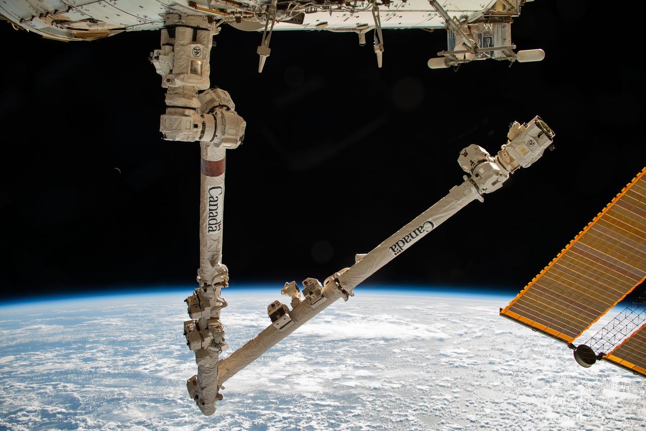
iss072e576480 (Jan. 31, 2025) --- The 57.7-foot-long Canadarm2 robotic arm with its latching end effector that can grapple spacecraft or maneuver spacewalkers is pictured as the International Space Station orbited into daylight 267 miles above the South Pacific Ocean just south of New Zealand's Auckland Islands.

iss070e103326 (Feb. 28, 2024) --- The nightime lights of the Los Angeles, California, urban area were photographed by Expedition 70 Flight Engineer Jasmin Moghbeli of NASA as the International Space Station orbited 262 miles above the Pacific Ocean near Catalina Island.
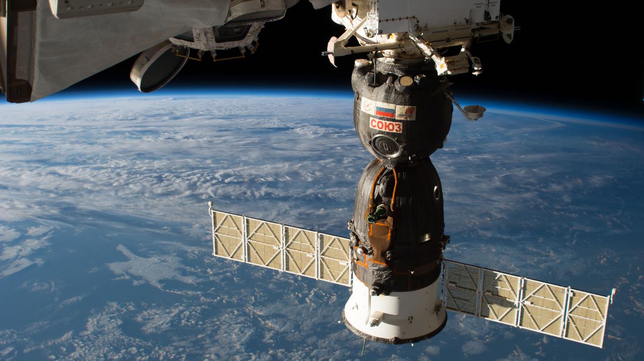
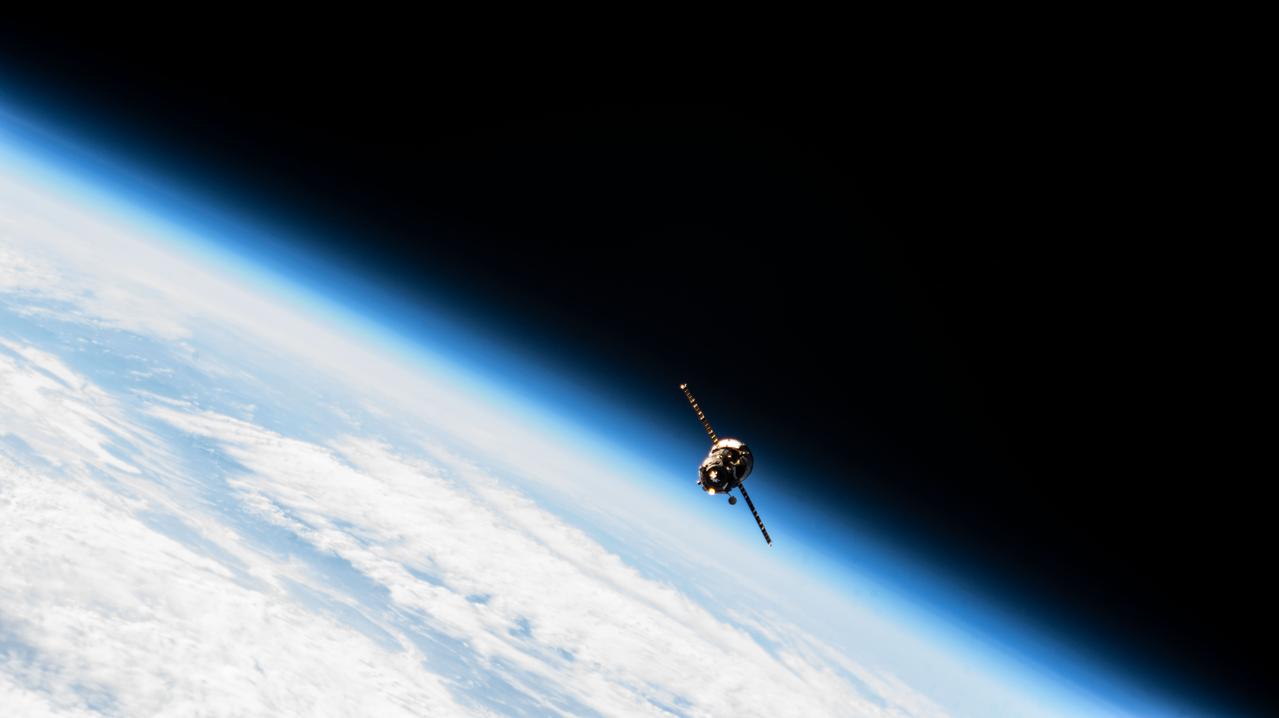
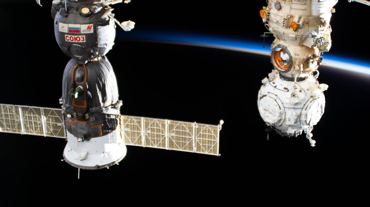
iss056e159412 (Aug. 29, 2018) --- The Soyuz MS-09 spacecraft is pictured docked to the Rassvet module on the Russian segment of the International Space Station as the orbital complex was flying 253 miles above the North Pacific Ocean south of Alaska's Aleutian Islands.
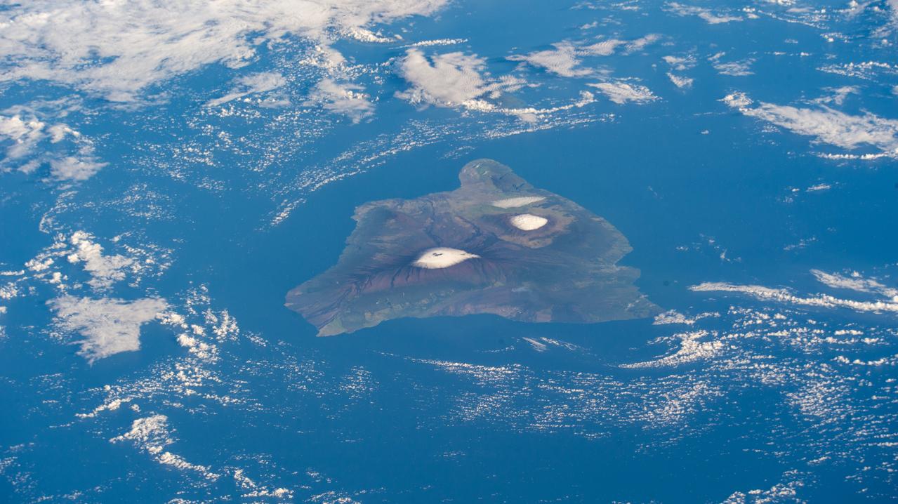
iss068e068973 (March 6, 2023) --- The big island of Hawaii and its two snow-capped volcanos, (from left) the active Mauna Loa and the dormant Mauna Kea, are pictured from the International Space Station as it orbited 260 miles above the Pacific Ocean.
iss068e007429 (Oct. 2, 2022) --- Billy Mitchell Crater Lake and the active volcano Bagana on Papua New Guinea's Bougainville Island are pictured from the International Space Station as it orbited 260 miles above the southwestern Pacific Ocean. Credit: ESA/Samantha Cristoforetti
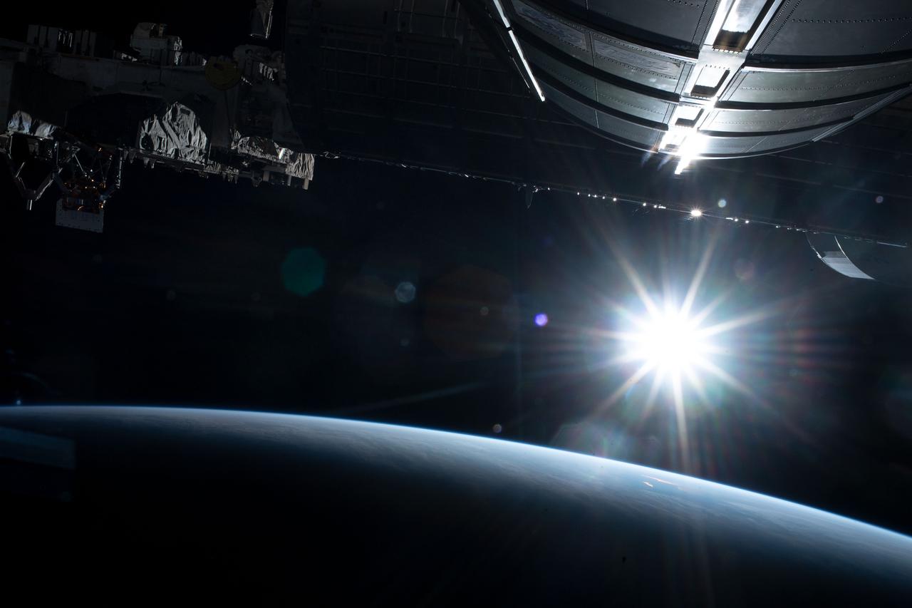
iss068e038496 (Dec. 31, 2022) --- The first rays of an orbital sunrise begin to illuminate the Earth's atmosphere and reflect off the Earth-facing portion of the International Space Station as it orbited 263 miles above the northern Pacific Ocean south of Alaska's Aleutian Island's.
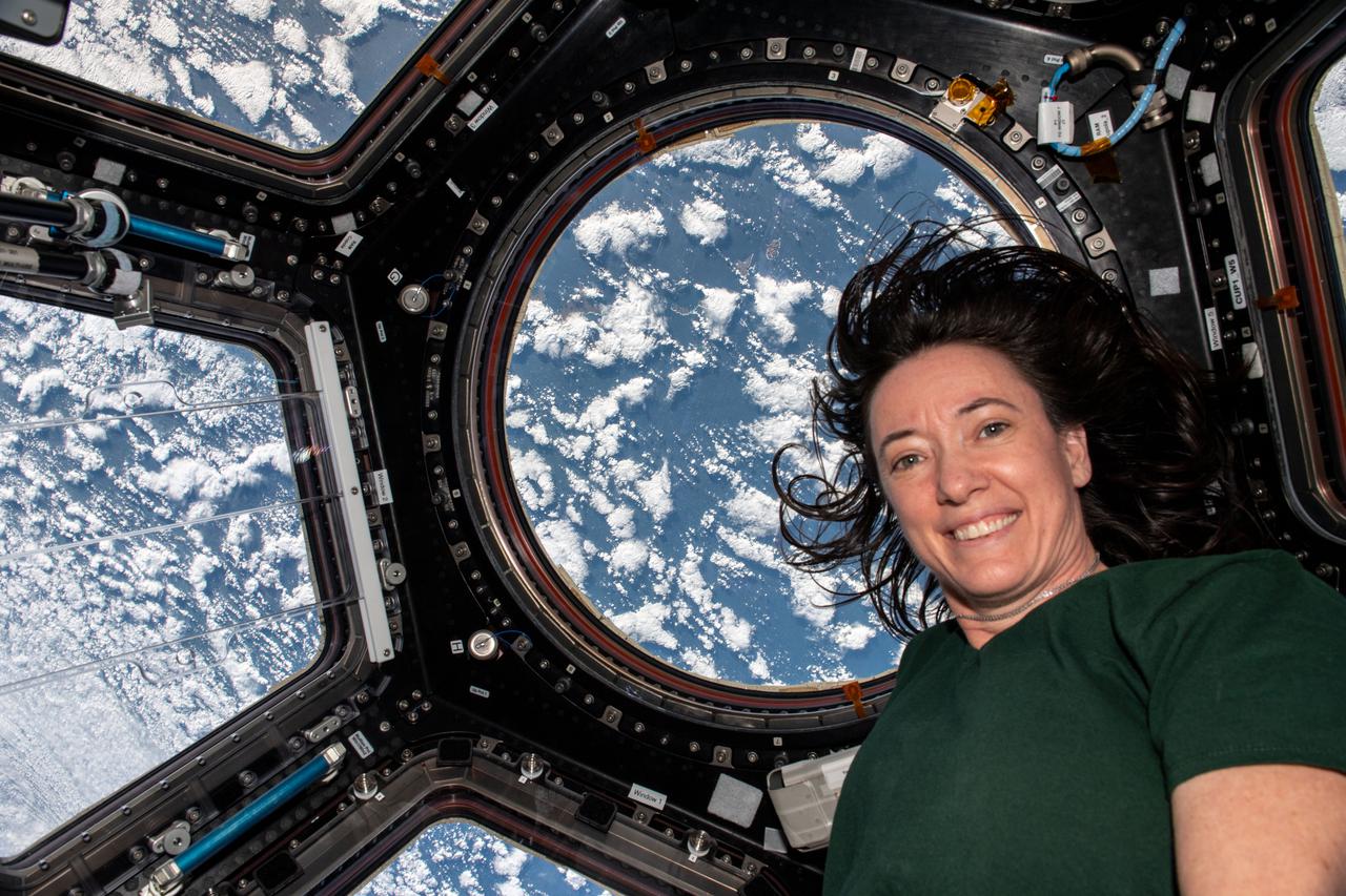
iss066e008177 (Oct. 21, 2021) --- NASA astronaut and Expedition 66 Flight Engineer Megan McArthur is pictured inside the cupola as the International Space Station orbited 263 miles above Alaska's Aleutian Islands in between the Bering Sea and the Pacific Ocean.
iss068e014159 (Oct. 6, 2022) --- The SpaceX Dragon Endurance crew ship, carrying four Crew-5 members, approaches the International Space Station 260 miles above the Pacific Ocean southwest of the Hawaiian island chain. Credit: NASA/Kjell Lindgren
iss066e125394 (Jan. 24, 2022) --- The Soyuz MS-19 crew ship and the Prichal docking module attached to the Nauka multipurpose laboratory module are pictured as the International Space Station orbited into an orbital sunset 260 miles above the Kuril Islands in between the Sea of Okhotsk and the Pacific Ocean.
iss063e105782 (Oct. 8, 2020) --- The big island of Hawaii and its two prominent mountains Mauna Loa, an active volcano, and Mauna Kea, a dormant volcano, were pictured as the International Space Station orbited about 315 miles southeast above the Pacific Ocean.
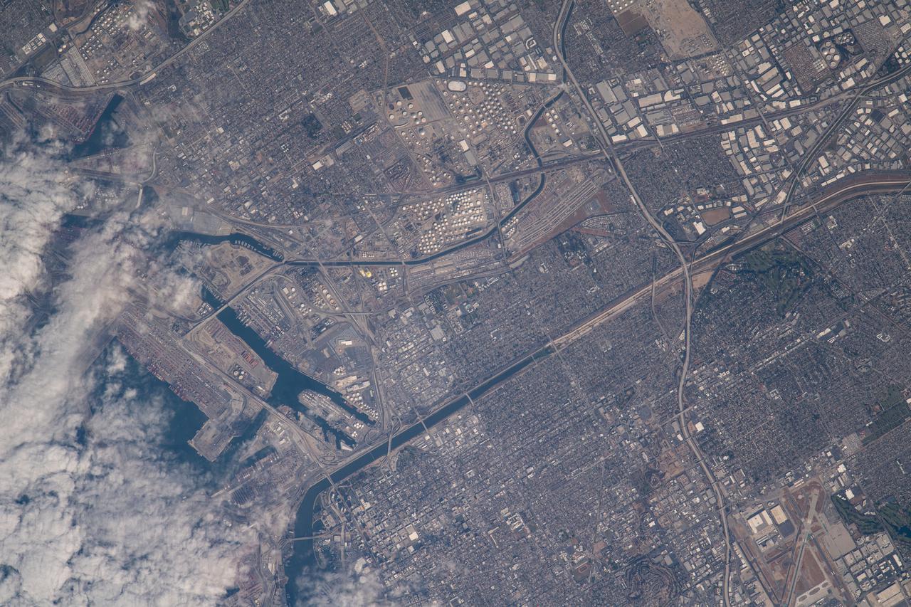
iss065e021010 (May 5, 2021) --- A cloud-covered Terminal Island and Long Beach south of Los Angeles, California, is pictured from the International Space Station as it orbited 263 miles above the Pacific Ocean off the coast of San Diego.
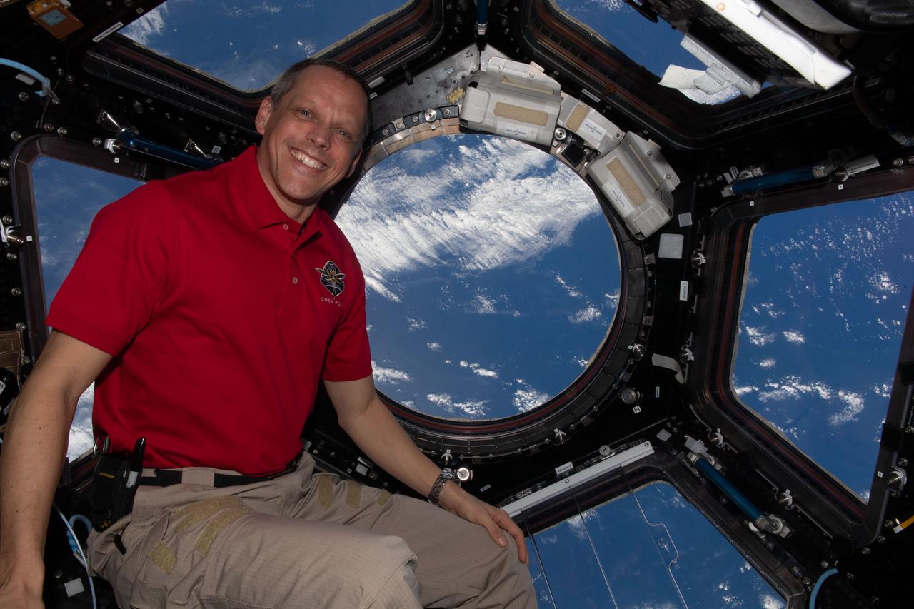
iss068e006161 (Oct. 1, 2022) --- NASA astronaut and Expedition 68 Flight Engineer Bob Hines poses for a portrait inside the cupola, the International Space Station's "window to the world," while orbiting 260 miles above the Pacific Ocean near Easter Island.
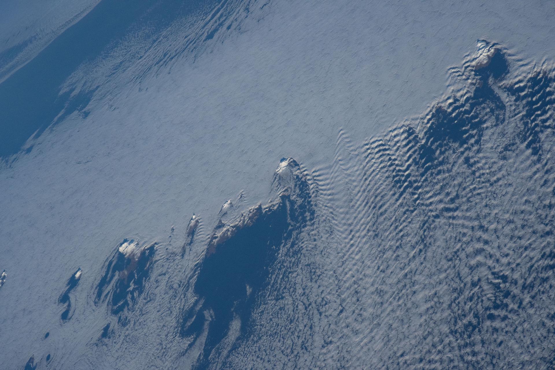
iss074e0008922 (Dec. 12, 2025) --- Snow-capped mountain tops of Alaska's Aleutian Islands pierce through the clouds, disturbing the air and creating wave-like patterns known as altocumulus clouds. This photograph was taken from the International Space Station as it orbited 264 miles above the North Pacific Ocean.
STS026-038-056 (29 Sept. - 3 Oct. 1988) --- Tambora Caldera, Sumbawa Island, Indonesia as photographed with a 70mm handheld Hasselblad camera. Tambora is a 6-kilometer-wide and 650-meter-deep Caldera formed in 1815 as a result of a huge volcanic eruption. Gases from the eruption were ejected high into Earth's atmosphere and transported around the globe. The atmospheric gases trapped part of the incoming sunglint, resulting in extremely cold weather. In New England, snow fell in June, and freezes occurred throughout the summer of 1816, which became known as "the year without a summer." This photo was shown by the STS-26 astronaut crew during its Oct. 11, l988 post-flight press conference.
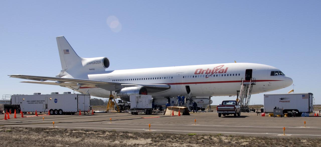
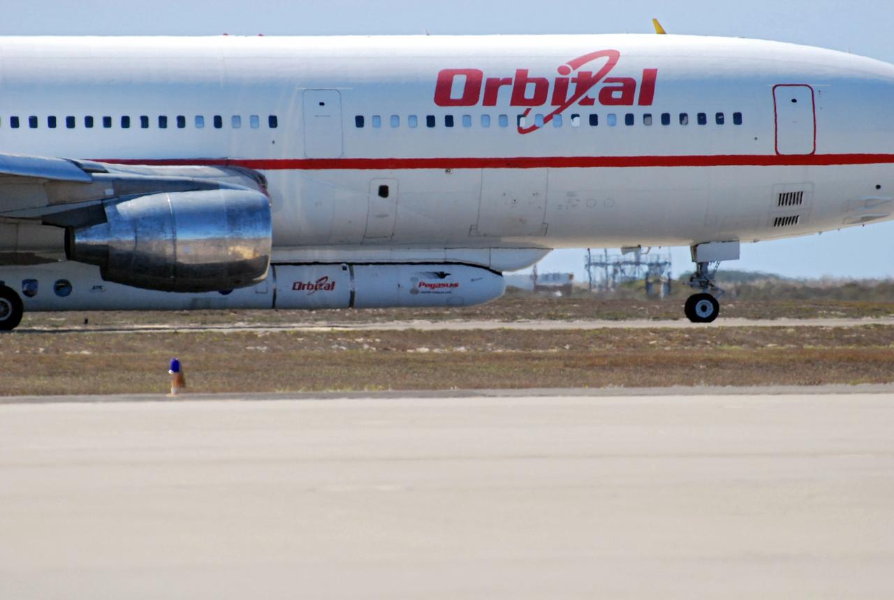
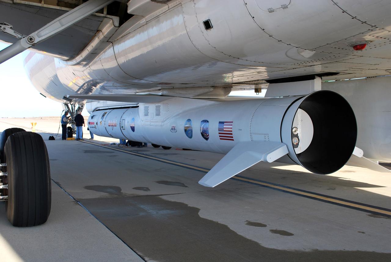
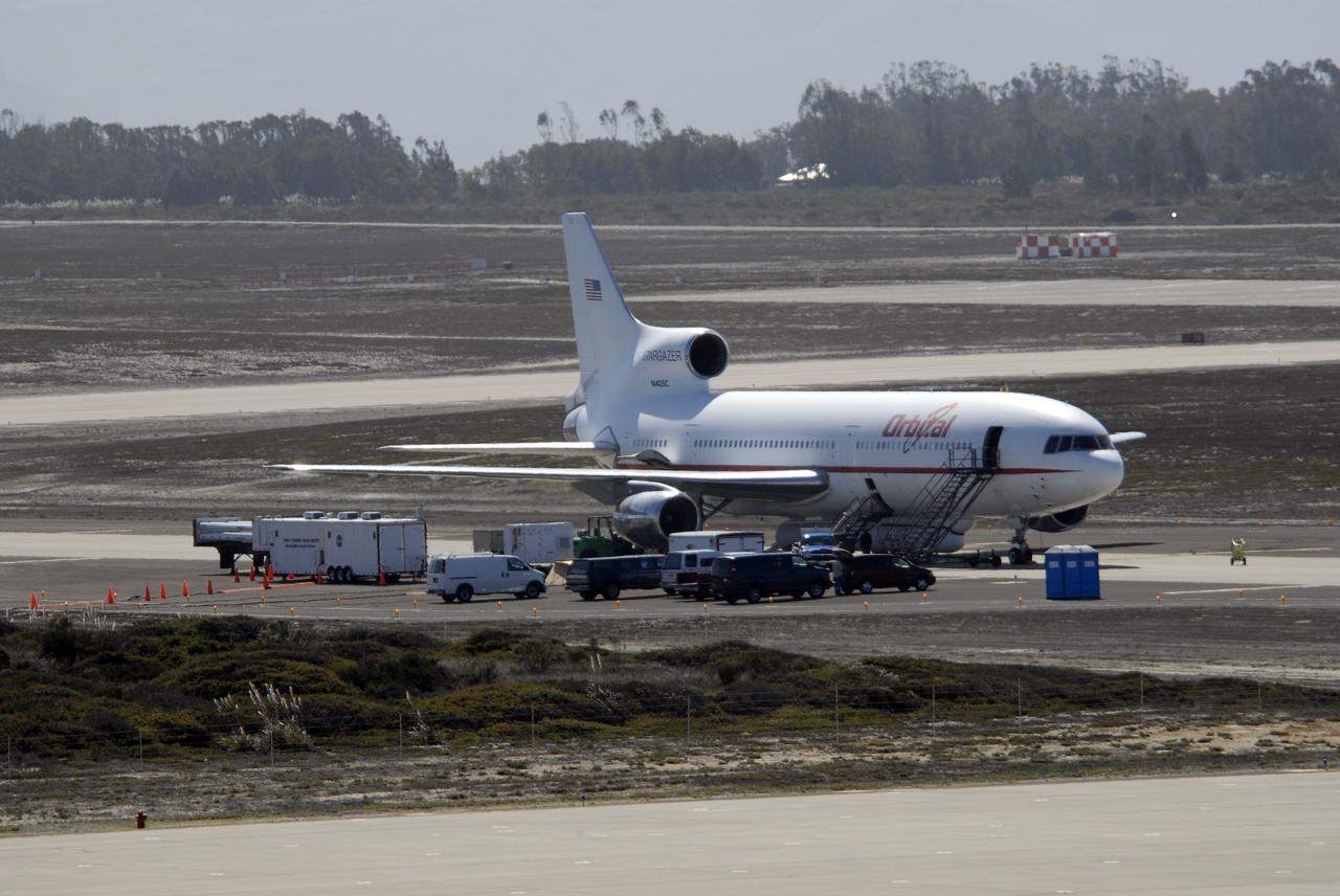
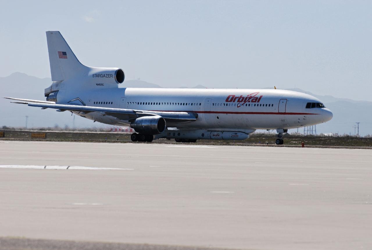
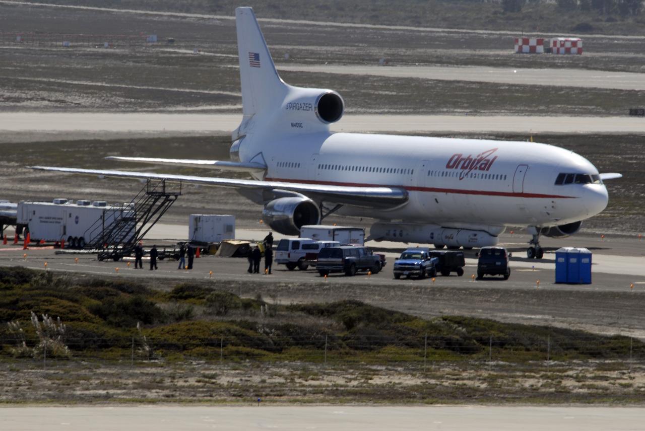
VANDENBERG AIR FORCE BASE, Fla. -- NASA’s Interstellar Boundary Explorer, or IBEX, spacecraft and mated Pegasus XL rocket are being attached to Orbital Sciences’ L-1011 aircraft for launch. IBEX is targeted for launch from the Kwajalein Atoll, a part of the Marshall Islands in the Pacific Ocean, on Oct. 19. IBEX will be launched aboard the Pegasus rocket dropped from under the wing of the L-1011 aircraft flying over the Pacific Ocean. The Pegasus will carry the spacecraft approximately 130 miles above Earth and place it in orbit. The IBEX satellite will make the first map of the boundary between the Solar System and interstellar space. Photo credit: NASA/Mark Mackley, VAFB
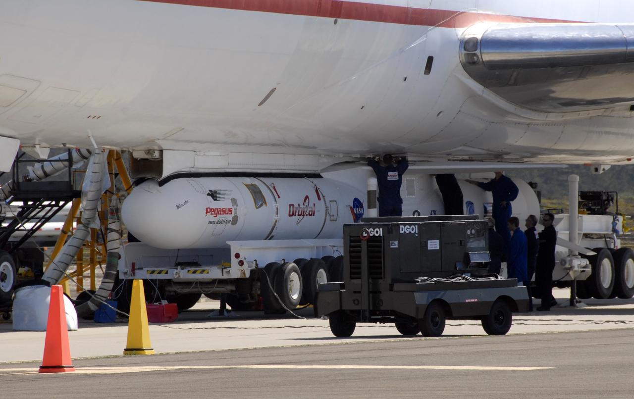
VANDENBERG AIR FORCE BASE, Fla. -- NASA’s Interstellar Boundary Explorer, or IBEX, spacecraft and mated Pegasus XL rocket are being attached to Orbital Sciences’ L-1011 aircraft for launch. IBEX is targeted for launch from the Kwajalein Atoll, a part of the Marshall Islands in the Pacific Ocean, on Oct. 19. IBEX will be launched aboard the Pegasus rocket dropped from under the wing of the L-1011 aircraft flying over the Pacific Ocean. The Pegasus will carry the spacecraft approximately 130 miles above Earth and place it in orbit. The IBEX satellite will make the first map of the boundary between the Solar System and interstellar space. Photo credit: NASA/Mark Mackley, VAFB
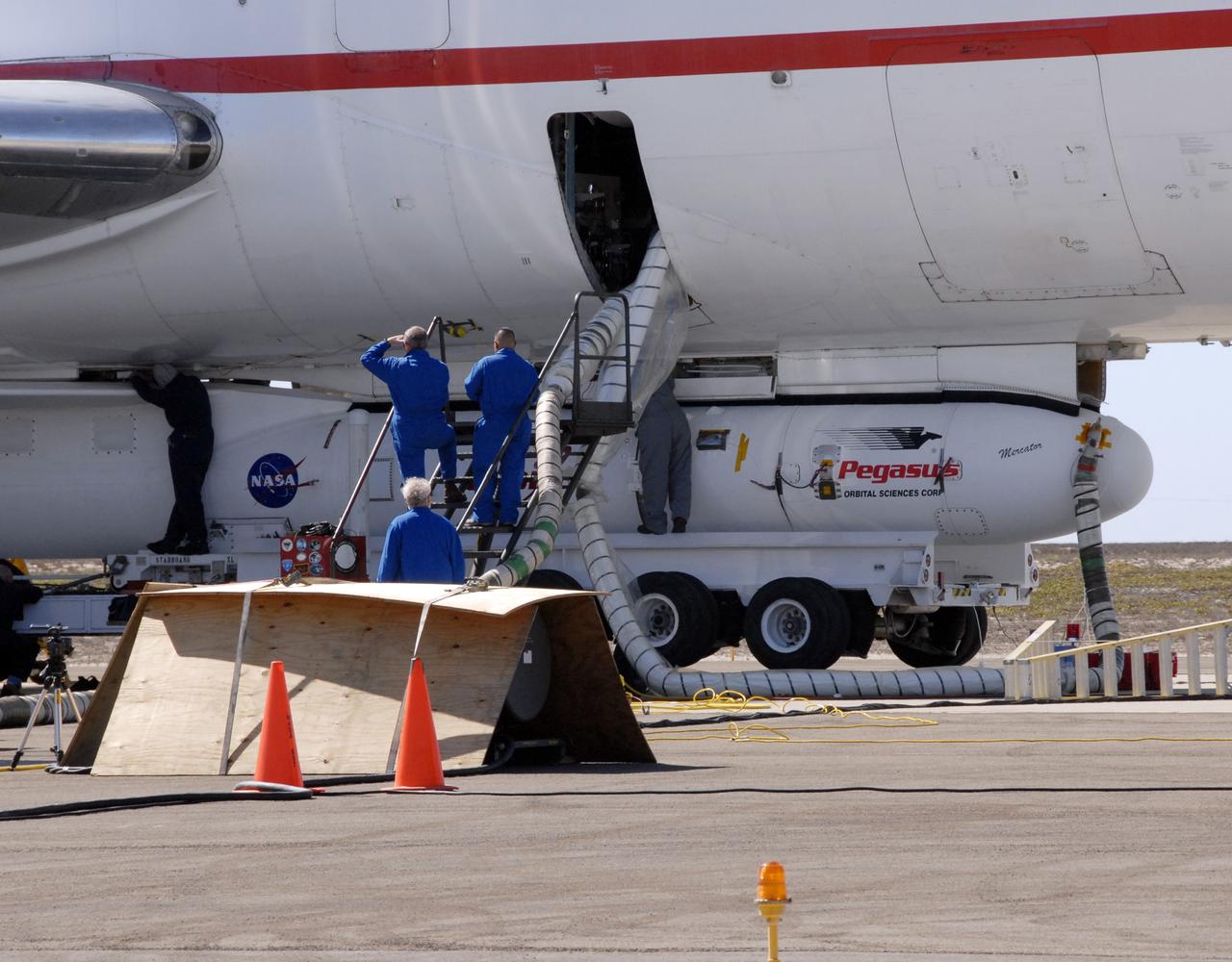
VANDENBERG AIR FORCE BASE, Fla. -- NASA’s Interstellar Boundary Explorer, or IBEX, spacecraft and mated Pegasus XL rocket are being attached to Orbital Sciences’ L-1011 aircraft for launch. IBEX is targeted for launch from the Kwajalein Atoll, a part of the Marshall Islands in the Pacific Ocean, on Oct. 19. IBEX will be launched aboard the Pegasus rocket dropped from under the wing of the L-1011 aircraft flying over the Pacific Ocean. The Pegasus will carry the spacecraft approximately 130 miles above Earth and place it in orbit. The IBEX satellite will make the first map of the boundary between the Solar System and interstellar space. Photo credit: NASA/Mark Mackley, VAFB

VANDENBERG AIR FORCE BASE, Calif. – The Interstellar Boundary Explorer, or IBEX, spacecraft leaves the Astrotech building to head for Hangar 1555 on Vandenberg Air Force Base in California. In the hangar, IBEX will be mated with the Pegasus XL rocket for launch. The IBEX satellite will make the first map of the boundary between the Solar System and interstellar space. IBEX is targeted for launch from the Kwajalein Atoll, a part of the Marshall Islands in the Pacific Ocean, on Oct. 19 aboard the Pegasus rocket dropped from under the wing of an L-1011 aircraft flying over the Pacific Ocean. The Pegasus will carry the spacecraft approximately 130 miles above Earth and place it in orbit. Photo credit: NASA/Dan Liberotti, VAFB
VANDENBERG AIR FORCE BASE, Fla. -- NASA’s Interstellar Boundary Explorer, or IBEX, spacecraft and mated Pegasus XL rocket are being attached to Orbital Sciences’ L-1011 aircraft for launch. IBEX is targeted for launch from the Kwajalein Atoll, a part of the Marshall Islands in the Pacific Ocean, on Oct. 19. IBEX will be launched aboard the Pegasus rocket dropped from under the wing of the L-1011 aircraft flying over the Pacific Ocean. The Pegasus will carry the spacecraft approximately 130 miles above Earth and place it in orbit. The IBEX satellite will make the first map of the boundary between the Solar System and interstellar space. Photo credit: NASA/Mark Mackley, VAFB
The city of Sapporo on the northernmost of the Japanese Home Island of Hokkaido (43.5N, 141.5E), host to the 1986 Winter Olympic Games is situated along the margin of a large valley which extends across the island from the Sea of Japan to the Pacific Ocean. The Valley is largely cultivated (the lighter green of the cultivated land distinguishes it from the gray urban development of Sapporo), but much of the island remains heavily forested.
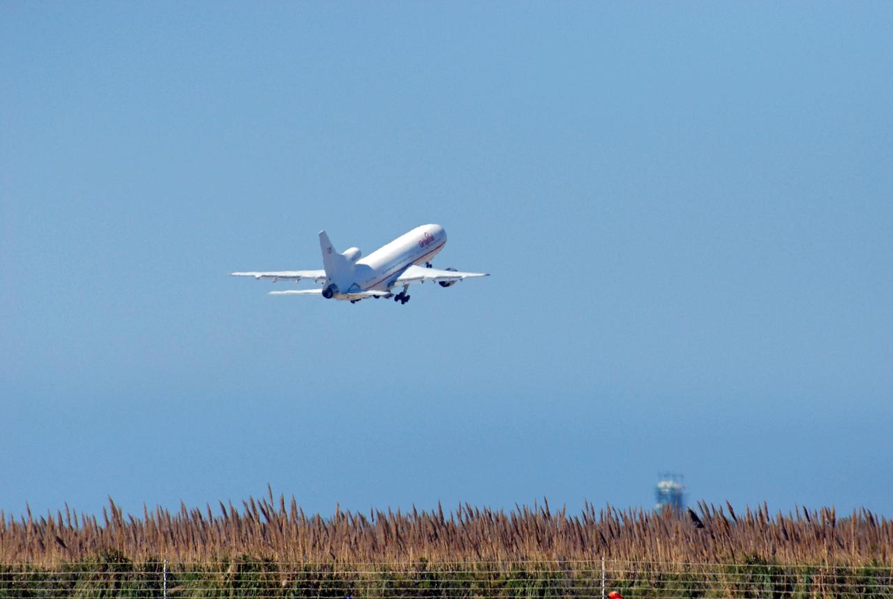
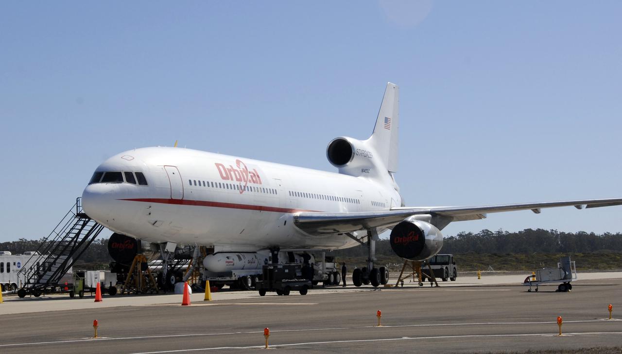
VANDENBERG AIR FORCE BASE, Calif. – Orbital Sciences’ L-1011 aircraft takes off from Vandenberg Air Force Base in California for the Kwajalein Atoll, a part of the Marshall Islands in the Pacific Ocean. Under its wing is NASA’s Interstellar Boundary Explorer, or IBEX, spacecraft and Pegasus XL rocket. Departing from Kwajalein, the Pegasus rocket will be dropped from under the wing of the L-1011 over the Pacific Ocean to carry the spacecraft approximately 130 miles above Earth and place it in orbit. Then, the spacecraft’s own engine will boost it to its final high-altitude orbit (about 200,000 miles high) — most of the way to the Moon. The IBEX satellite will make the first map of the boundary between the Solar System and interstellar space. IBEX science will be led by the Southwest Research Institute of San Antonio, Texas. IBEX is targeted for launch over the Pacific Oct. 19. Photo credit: NASA/Randy Beaudoin, VAFB
VANDENBERG AIR FORCE BASE, Calif. – Orbital Sciences’ L-1011 aircraft begins rolling for takeoff from Vandenberg Air Force Base in California to the Kwajalein Atoll, a part of the Marshall Islands in the Pacific Ocean. Under its wing is NASA’s Interstellar Boundary Explorer, or IBEX, spacecraft and Pegasus XL rocket. Departing from Kwajalein, the Pegasus rocket will be dropped from under the wing of the L-1011 over the Pacific Ocean to carry the spacecraft approximately 130 miles above Earth and place it in orbit. Then, the spacecraft’s own engine will boost it to its final high-altitude orbit (about 200,000 miles high) — most of the way to the Moon. The IBEX satellite will make the first map of the boundary between the Solar System and interstellar space. IBEX science will be led by the Southwest Research Institute of San Antonio, Texas. IBEX is targeted for launch over the Pacific Oct. 19. Photo credit: NASA/Randy Beaudoin, VAFB
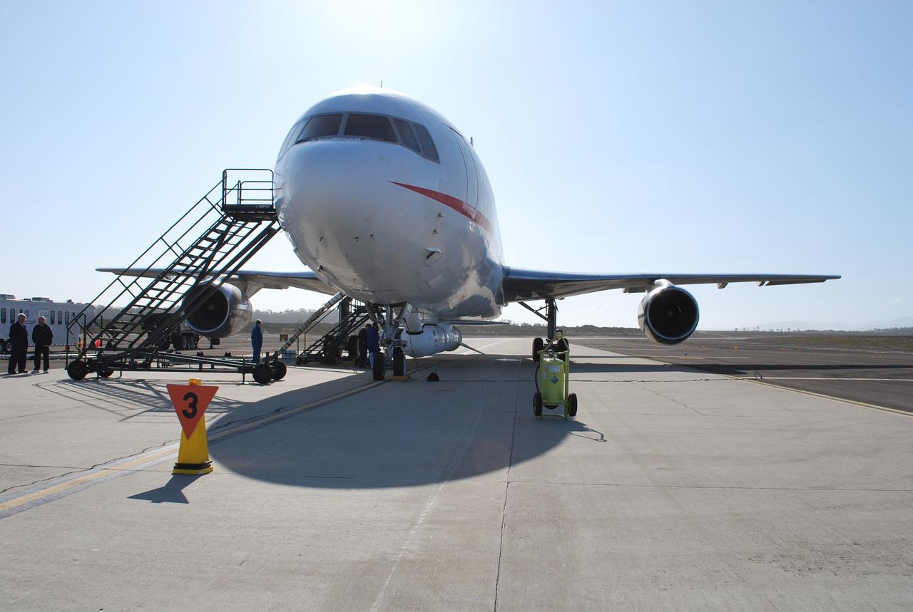
VANDENBERG AIR FORCE BASE, Calif. – On the ramp of Vandenberg Air Force Base in California, Orbital Sciences’ L-1011 aircraft awaits departure for the Kwajalein Atoll, a part of the Marshall Islands in the Pacific Ocean, with NASA’s Interstellar Boundary Explorer, or IBEX, spacecraft and Pegasus XL rocket. The Pegasus is attached under the wing of the aircraft for launch. Departing from Kwajalein, the Pegasus rocket will be dropped from under the wing of the L-1011 over the Pacific Ocean to carry the spacecraft approximately 130 miles above Earth and place it in orbit. Then, the spacecraft’s own engine will boost it to its final high-altitude orbit (about 200,000 miles high) — most of the way to the Moon. The IBEX satellite will make the first map of the boundary between the Solar System and interstellar space. IBEX science will be led by the Southwest Research Institute of San Antonio, Texas. IBEX is targeted for launch over the Pacific Oct. 19. Photo credit: NASA/Randy Beaudoin, VAFB
VANDENBERG AIR FORCE BASE, Calif. – On the ramp of Vandenberg Air Force Base in California, workers make final checks of the Pegasus XL rocket before departure for the Kwajalein Atoll, a part of the Marshall Islands in the Pacific Ocean. Mated to NASA’s Interstellar Boundary Explorer, or IBEX, spacecraft, the Pegasus is attached under the wing of the aircraft for launch. Departing from Kwajalein, the Pegasus rocket will be dropped from under the wing of the L-1011 over the Pacific Ocean to carry the spacecraft approximately 130 miles above Earth and place it in orbit. Then, the spacecraft’s own engine will boost it to its final high-altitude orbit (about 200,000 miles high) — most of the way to the Moon. The IBEX satellite will make the first map of the boundary between the Solar System and interstellar space. IBEX science will be led by the Southwest Research Institute of San Antonio, Texas. IBEX is targeted for launch over the Pacific Oct. 19. Photo credit: NASA/Randy Beaudoin, VAFB
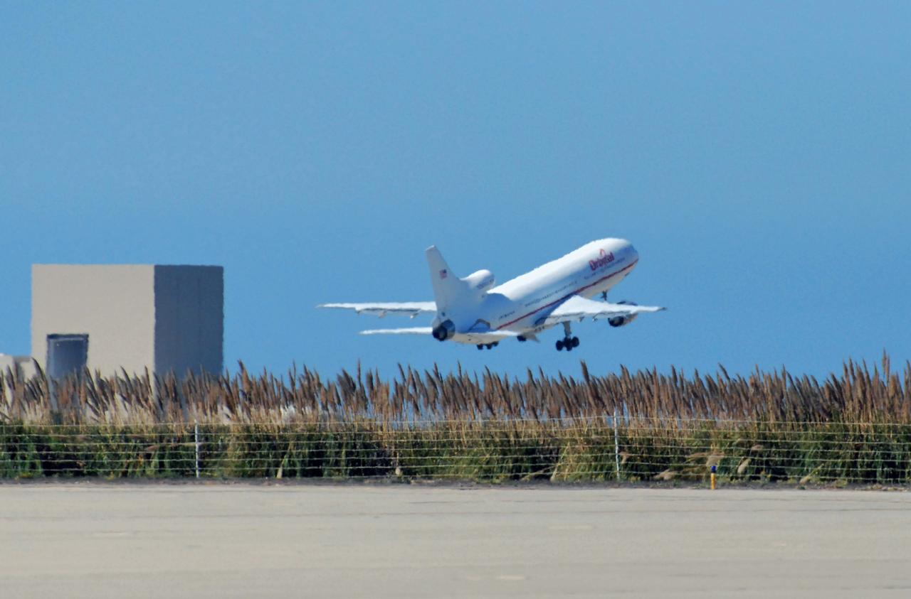
VANDENBERG AIR FORCE BASE, Calif. – Orbital Sciences’ L-1011 aircraft takes off from Vandenberg Air Force Base in California for the Kwajalein Atoll, a part of the Marshall Islands in the Pacific Ocean. Under its wing is NASA’s Interstellar Boundary Explorer, or IBEX, spacecraft and Pegasus XL rocket. Departing from Kwajalein, the Pegasus rocket will be dropped from under the wing of the L-1011 over the Pacific Ocean to carry the spacecraft approximately 130 miles above Earth and place it in orbit. Then, the spacecraft’s own engine will boost it to its final high-altitude orbit (about 200,000 miles high) — most of the way to the Moon. The IBEX satellite will make the first map of the boundary between the Solar System and interstellar space. IBEX science will be led by the Southwest Research Institute of San Antonio, Texas. IBEX is targeted for launch over the Pacific Oct. 19. Photo credit: NASA/Randy Beaudoin, VAFB
VANDENBERG AIR FORCE BASE, Calif. – On the ramp of Vandenberg Air Force Base in California, Orbital Sciences’ L-1011 aircraft awaits departure for the Kwajalein Atoll, a part of the Marshall Islands in the Pacific Ocean, with NASA’s Interstellar Boundary Explorer, or IBEX, spacecraft and Pegasus XL rocket. The Pegasus is attached under the wing of the aircraft for launch. Departing from Kwajalein, the Pegasus rocket will be dropped from under the wing of the L-1011 over the Pacific Ocean to carry the spacecraft approximately 130 miles above Earth and place it in orbit. Then, the spacecraft’s own engine will boost it to its final high-altitude orbit (about 200,000 miles high) — most of the way to the Moon. The IBEX satellite will make the first map of the boundary between the Solar System and interstellar space. IBEX science will be led by the Southwest Research Institute of San Antonio, Texas. IBEX is targeted for launch over the Pacific Oct. 19. Photo credit: NASA/CIV USAF/Daniel Liberotti
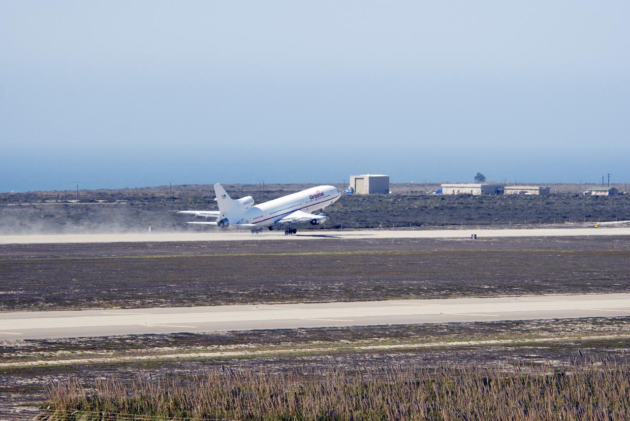
VANDENBERG AIR FORCE BASE, Calif. – Orbital Sciences’ L-1011 aircraft takes off from Vandenberg Air Force Base in California for the Kwajalein Atoll, a part of the Marshall Islands in the Pacific Ocean. Under its wing is NASA’s Interstellar Boundary Explorer, or IBEX, spacecraft and Pegasus XL rocket. Departing from Kwajalein, the Pegasus rocket will be dropped from under the wing of the L-1011 over the Pacific Ocean to carry the spacecraft approximately 130 miles above Earth and place it in orbit. Then, the spacecraft’s own engine will boost it to its final high-altitude orbit (about 200,000 miles high) — most of the way to the Moon. The IBEX satellite will make the first map of the boundary between the Solar System and interstellar space. IBEX science will be led by the Southwest Research Institute of San Antonio, Texas. IBEX is targeted for launch over the Pacific Oct. 19. Photo credit: NASA/Randy Beaudoin, VAFB
VANDENBERG AIR FORCE BASE, Calif. – Orbital Sciences’ L-1011 aircraft begins rolling for takeoff from Vandenberg Air Force Base in California to the Kwajalein Atoll, a part of the Marshall Islands in the Pacific Ocean. Under its wing is NASA’s Interstellar Boundary Explorer, or IBEX, spacecraft and Pegasus XL rocket. Departing from Kwajalein, the Pegasus rocket will be dropped from under the wing of the L-1011 over the Pacific Ocean to carry the spacecraft approximately 130 miles above Earth and place it in orbit. Then, the spacecraft’s own engine will boost it to its final high-altitude orbit (about 200,000 miles high) — most of the way to the Moon. The IBEX satellite will make the first map of the boundary between the Solar System and interstellar space. IBEX science will be led by the Southwest Research Institute of San Antonio, Texas. IBEX is targeted for launch over the Pacific Oct. 19. Photo credit: NASA/Randy Beaudoin, VAFB
VANDENBERG AIR FORCE BASE, Calif. – On the ramp of Vandenberg Air Force Base in California, Orbital Sciences’ L-1011 aircraft awaits departure for the Kwajalein Atoll, a part of the Marshall Islands in the Pacific Ocean, with NASA’s Interstellar Boundary Explorer, or IBEX, spacecraft and Pegasus XL rocket. The Pegasus is attached under the wing of the aircraft for launch. Departing from Kwajalein, the Pegasus rocket will be dropped from under the wing of the L-1011 over the Pacific Ocean to carry the spacecraft approximately 130 miles above Earth and place it in orbit. Then, the spacecraft’s own engine will boost it to its final high-altitude orbit (about 200,000 miles high) — most of the way to the Moon. The IBEX satellite will make the first map of the boundary between the Solar System and interstellar space. IBEX science will be led by the Southwest Research Institute of San Antonio, Texas. IBEX is targeted for launch over the Pacific Oct. 19. Photo credit: NASA/CIV USAF/Daniel Liberotti