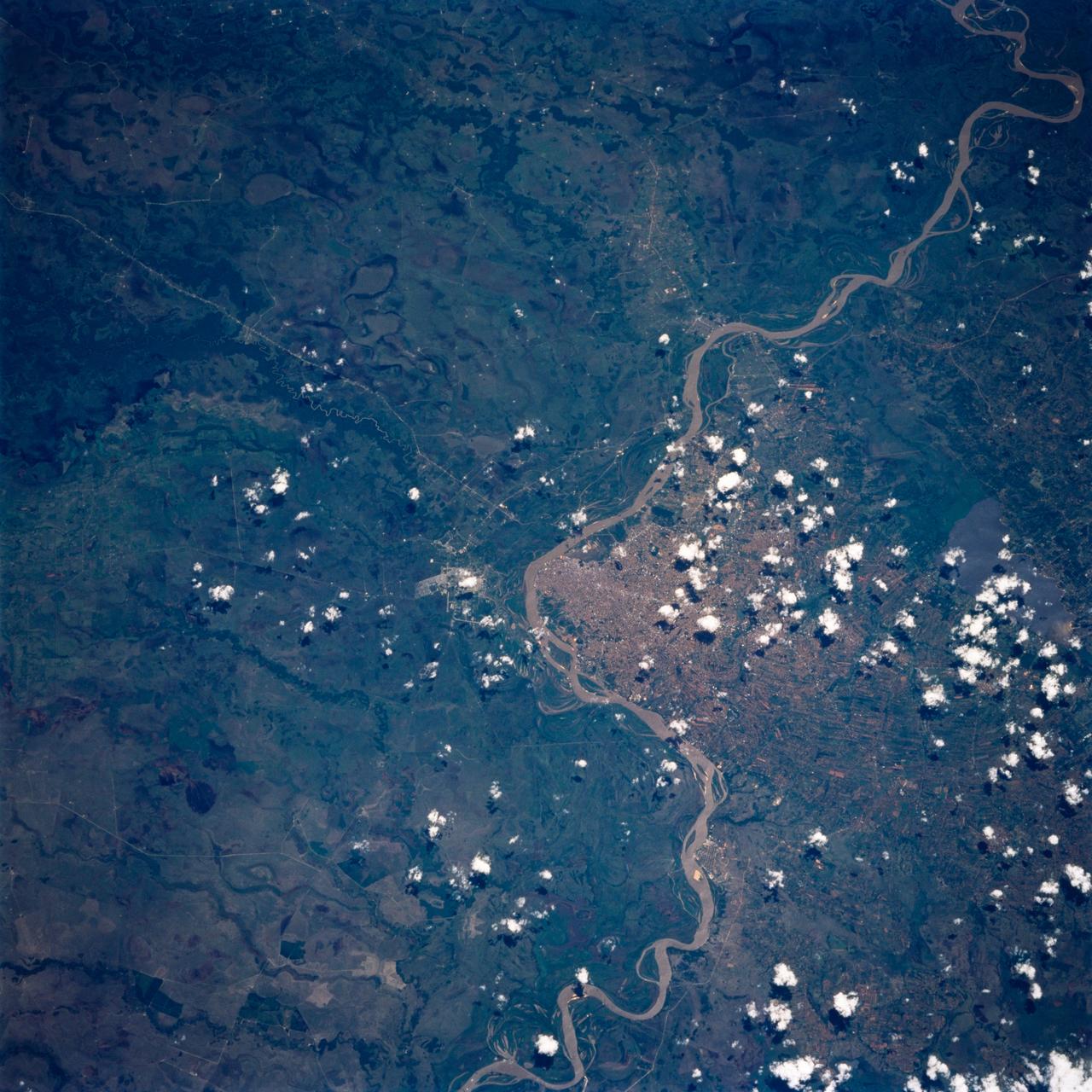
STS072-730-079 (11-20 Jan. 1996) --- Asuncion, capital city of Paraguay, South America (population 1.2 million) appears as de-vegetated countryside, in this 70mm photograph from the Space Shuttle Endeavour. The frame is focused at the downtown area next to the major bend of the Paraguay river. As the intensity of land use declines away from the center, the countryside becomes greener. Large farm plots can be seen at the bottom of the view. Lake Ypacarai (at the bottom) is a resort location surrounded by second homes for Paraguay's more affluent citizens. The top left corner of the photograph is northernmost Argentina, a remote, underdeveloped part of the country. Ships carry Paraguay's small import and export traffic down the Paraguay and Parana Rivers to Buenos Aires, the major port of the region hundreds of miles to the south (left). This may be the best shot of Asuncion so far during the Shuttle Program. The area spans 45 miles across the base of the picture. The river flows south (right to left).
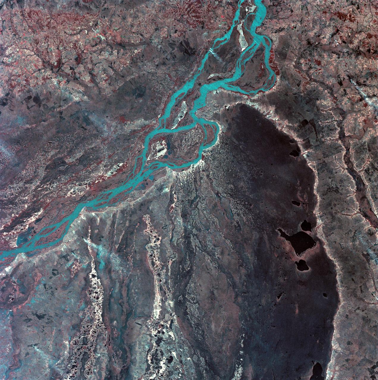
SL3-33-167 (July-September 1973) --- A vertical view of the Argentina-Paraguay border area of South America as photographed from Earth orbit by one of the six lenses of the Itek-furnished S190-A Multispectral Photographic Facility Experiment aboard the Skylab space station. This picture was taken with type 2443 infrared color film. The Parana River flows from east to west across the picture. This part of the Rio Parana is located between the towns of Posadas, Argentina, and Resistencia, Argentina. The major body of water in the large swamp area is Laguna Ibera. Note the several fires burning in this area. The largest land mass (Argentina) is south of the river. Paraguay is north of the river. Isla Apipe Grande is near the center of the photograph. The S190-A experiment is part of the Skylab Earth Resources Experiments Package. Federal agencies participating with NASA on the EREP project are the Departments of Agriculture, Commerce, Interior, the Environmental Protection Agency and the Corps of Engineers. All EREP photography is available to the public through the Department of Interior?s Earth Resources Observations Systems Data Center, Sioux Falls, South Dakota, 57198. Photo credit: NASA

iss070e026585 (Nov. 19, 2023) --- The sun's glint beams off the Paraguay River which separates a portion of the South American nations of Argentina and Paraguay in this photograph from the International Space Station as it orbited 265 miles above.

iss070e099697 (Feb., 23, 2024) --- The Paraguay River, separating the nations of Argentina and Paraguay in this photograph, and its tributaries were pictured by Expedition 70 Flight Engineer Jasmin Moghbeli as the International Space Station orbited 263 miles above.

iss071e051833 (May 6, 2024) --- Asunción, the capital city of Paraguay on the Paraguay River, and its suburbs across the border from Argentina are pictured from the International Space Station as it orbited 261 miles above South America.

iss064e010989 (Dec. 8, 2020) --- This photograph from the International Space Station looks over the Andes Mountains in Chile and across to Bolivia and Paraguay on the South American continent.
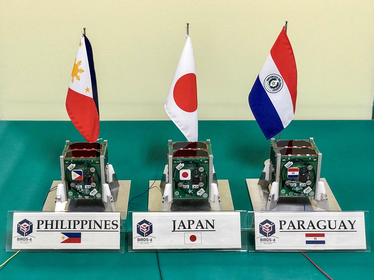
jsc2020e049619 (2/4/2020) --- A preflight view of the three BIRDS-4 Flight units inside clean room of Kyushu Insitute of Technology. The Joint Global Multi Nation Birds or BIRDS-4 Project is a constellation of three 1U CubeSats developed by Japan, Philippines and Paraguay, with Paraguay launching their first satellite. The mission of the BIRDS-4 satellites is to test commercial off-the-shelf components, as well as new technologies in space. Image Credit: Mark Angelo Purio
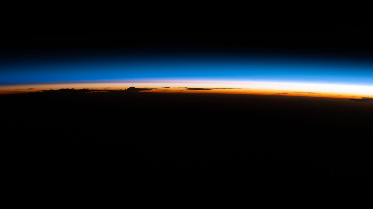
iss067e265876 (Aug. 13, 2022) --- An orbital sunrise illuminate's Earth's atmosphere silhouetting clouds as the International Space Station soared 264 miles above the Paraguay-Brazil border in South America.
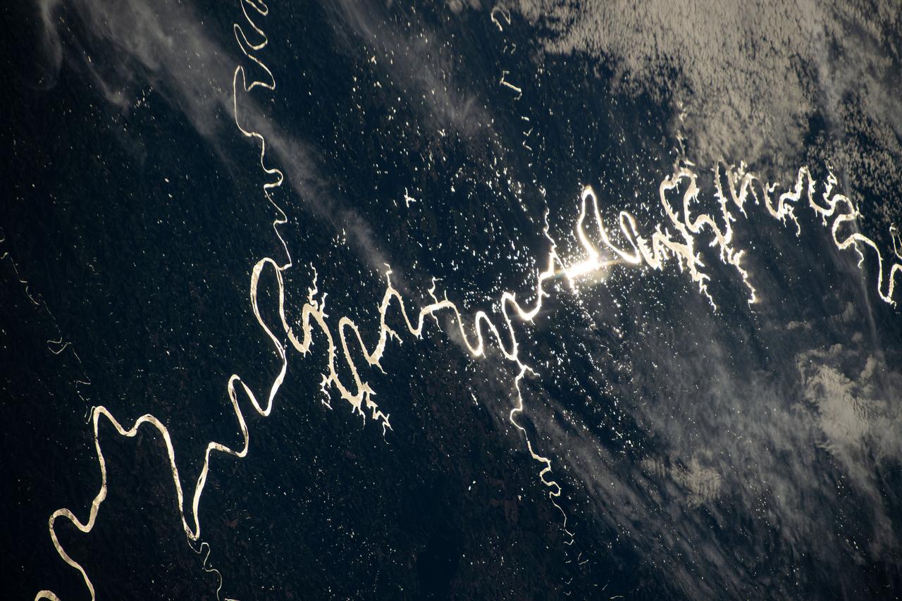
iss072e311451 (Dec. 3, 2024) --- The Sun's glint beams off one of the many rivers that snake throughout South America's fertile, low grasslands region, also known as the Pampas. The International Space Station was orbiting 261 miles above the border of Paraguay and Argentina at the time of this photograph. Credit: NASA/Don Pettit
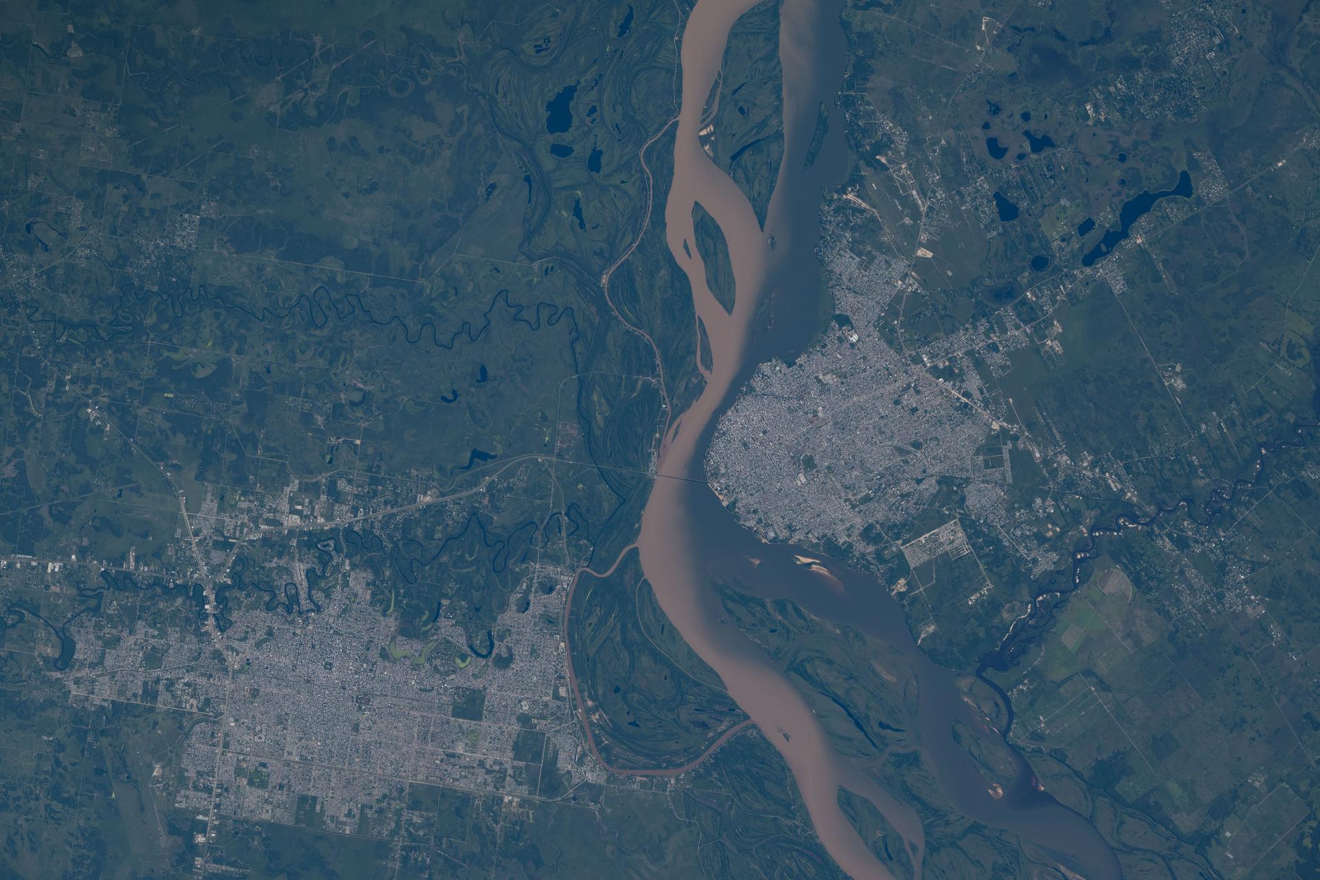
iss074e0046040 (Jan. 5, 2025) --- From left, the cities of Resistencia and Corrientes—both cultural and economic hubs with a combined population of over 888,000—are separated by the Paraná River in northeastern Argentina near the Paraguay border. The International Space Station was orbiting 268 miles above South America when this photograph was taken. Credit: NASA/Chris Williams
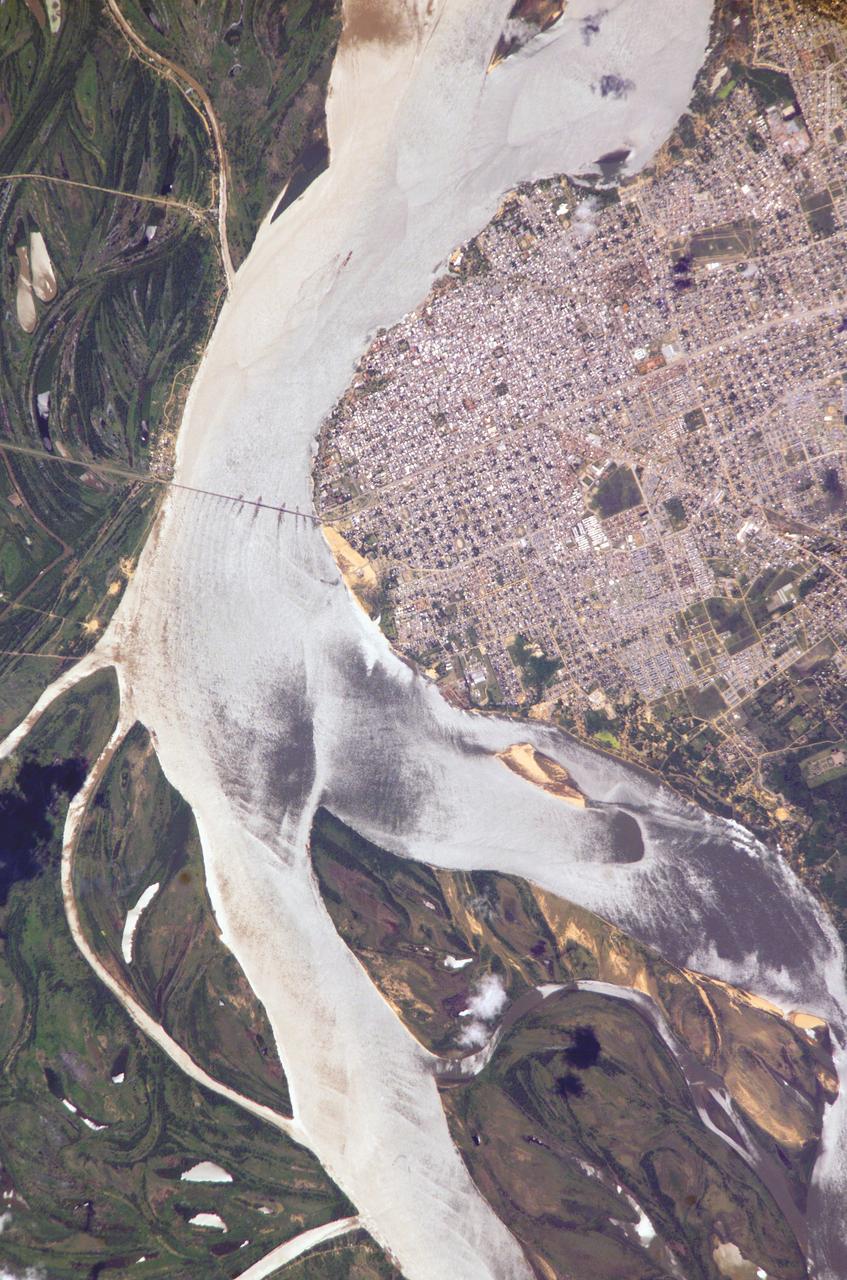
ISS010-E-05070 (25 October 2004) --- Corrientes, Argentina, and the Parana River are featured in this image photographed by an Expedition 10 crewmember on the International Space Station (ISS). Corrientes, Argentina sits on the east bank of the Parana River, South America’s third largest river (after the Negro and Amazon Rivers). From its headwaters in southeastern Brazil, the river flows southwestward around southern Paraguay, and then into Argentina. Corrientes is located just inside Argentina, across the river from the southwestern tip of Paraguay. The bridge over the Parana, built in the 1970s, connects Corrientes to its sister city, Resistencia, (beyond the left edge of image) on the western bank of the river. Sun glint on the river gives it a silvery glow and emphasizes channel islands in the river, side channels, and meander scars on the floodplain opposite the city, and even reveals the pattern of disturbed flow downstream of the bridge pylons. The old part of the city appears as a zone of smaller, more densely clustered city blocks along the river to the north of a major highway, which runs through Corrientes from the General Belgrano Bridge to the northeast (upper right of image). Larger blocks of the younger cityscape, with more green space, surround these core neighborhoods.
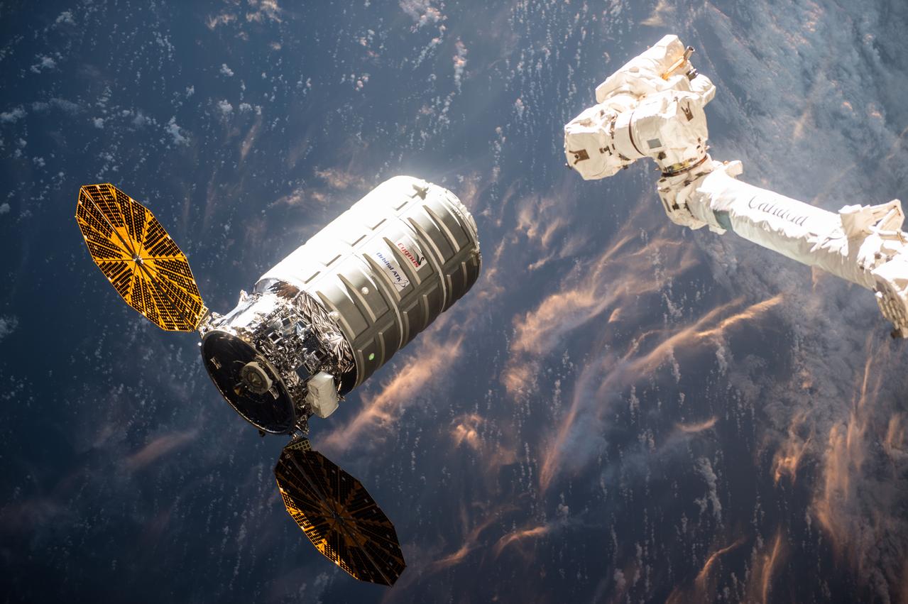
Expedition 47 robotic arm operator Tim Kopra of NASA commanded the International Space Station’s Canadarm2 robotic arm to release the Cygnus spacecraft at 9:30 a.m. EDT while the space station was flying above Paraguay. Earlier, ground controllers detached Cygnus from the station and maneuvered it into place for its departure. After Cygnus is a safe distance away, ground controllers at Glenn Research Center in Cleveland, Ohio will initiate the sequence for Saffire-1, and controllers at Orbital ATK in Dulles, Virginia, will activate the experiment. Cygnus will continue to orbit Earth for up to eight days as it transmits hi-resolution imagery and data from the Saffire experiment.

Since August 2015, heavy rains have caused rivers to overflow and forced tens of thousands from their homes in Paraguay, Argentina and Brazil. Rosario, Argentina is located 186 miles (300 kilometers) northwest of Buenos Aires, on the western shore of the Parana River. The entire Parana River floodplain for hundreds of kilometers is still under water or wet, as seen in this image from the Advanced Spaceborne Thermal Emission and Reflection Radiometer (ASTER) instrument on NASA's Terra spacecraft, acquired Jan. 6, 2016. The image covers an area of 30.8 by 33.9 miles (49.5 by 54.6 kilometers), and is located at 33 degrees south, 61 degrees west. http://photojournal.jpl.nasa.gov/catalog/PIA20295
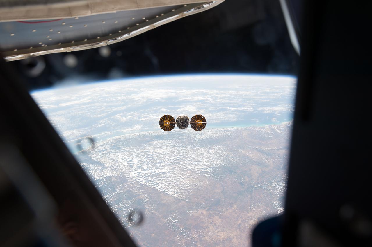
ISS047e152844 (06/14/2016) --- Expedition 47 robotic arm operator astronaut Tim Kopra of NASA commanded the International Space Station’s Canadarm2 robotic arm to release the Cygnus spacecraft at 9:30 a.m. EDT June 14, 2016 while the space station was flying above Paraguay. Earlier, ground controllers detached Cygnus from the station and maneuvered it into place for its departure. After Cygnus is a safe distance away, ground controllers at Glenn Research Center in Cleveland, Ohio will initiate the sequence for Saffire-1, and controllers at Orbital ATK in Dulles, Virginia, will activate the experiment. Cygnus will continue to orbit Earth for up to eight days as it transmits hi-resolution imagery and data from the Saffire experiment.
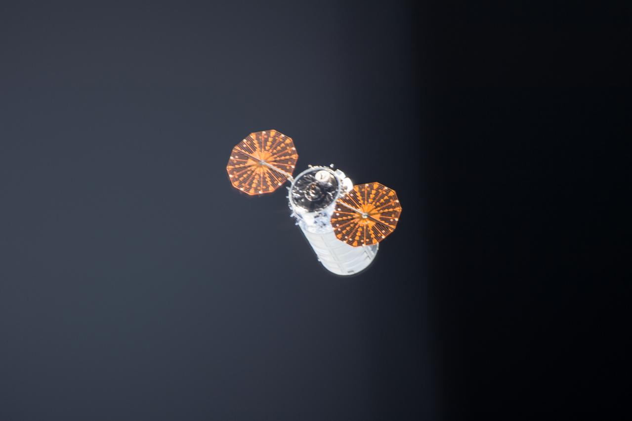
ISS047e152988 (06/14/2016) --- Cygnus Spacecraft on its way back to Earth. Expedition 47 robotic arm operator NASA astronaut Tim Kopra of NASA commanded the International Space Station’s Canadarm2 robotic arm to release the Cygnus spacecraft on 16 June 2016 while the space station was flying above Paraguay. Earlier, ground controllers detached Cygnus from the station and maneuvered it into place for its departure. After Cygnus is a safe distance away, ground controllers at Glenn Research Center in Cleveland, Ohio will initiate the sequence for Saffire-1, and controllers at Orbital ATK in Dulles, Virginia, will activate the experiment. Cygnus will continue to orbit Earth for up to eight days as it transmits hi-resolution imagery and data from the Saffire experiment.
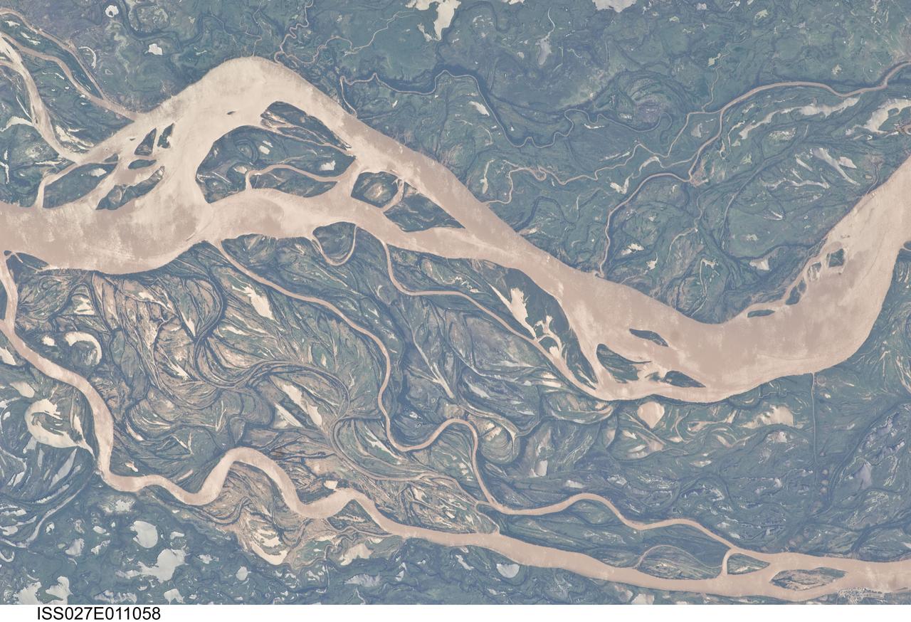
ISS027-E-011058 (9 April 2011) --- The Parana River floodplain in northern Argentina is featured in this image photographed by an Expedition 27 crew member on the International Space Station. This image shows a 29-kilometer stretch of the Parana River, South America?s second largest river, downstream of the small city of Goya (barely distinguishable as grayer surfaces in the extreme top left corner of the image). The Parana River ranges up to three kilometers wide along the reach illustrated in the image. Its strong brown color indicates that it is carrying a heavy load of muddy sediment. Smaller active side channels also carry this muddy water. Numerous lakes are typical on active floodplains, and appear here as irregular bodies of water. Some appear brown, indicating that they have been refilled during recent higher flood levels of the active channels. The main channel Parana River (top) is deep enough to allow smaller ocean-going ships to pass north of the illustrated region to the capital city of Asuncion in landlocked Paraguay, fully 1,200 kilometers inland (well out of the image). The Parana River is thus an important transportation route for landlocked cities such as Asuncion and inland cities of eastern landlocked Bolivia and inland Brazil. The Parana floodplain occupies the entire image; it is so wide?18 kilometers?that its banks are not visible. Numerous curved, or meandering past channels are the most prominent characteristic of the floodplain. These indicate prior positions of rivers. As river beds move laterally by natural processes, they leave remnants of their channels, which appear as lakes, and finally fill with mud. This is an excellent image for illustrating these meander forms. From a geological standpoint it is interesting that almost all the past channels are similar in curvature to the smaller active side rivers; almost no forms show, in any obvious way, prior positions of the main, very wide Parana channel. The reverse might be expected since the main channel is so dominant in the modern landscape.
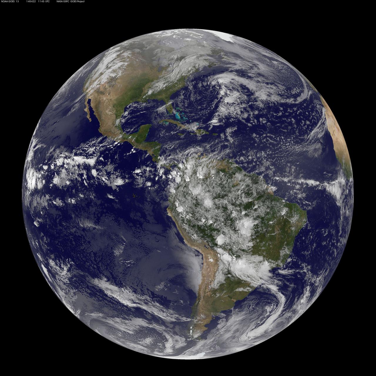
Today, April 22, 2014 is Earth Day, and what better way to celebrate than taking a look at our home planet from space. NOAA's GOES-East satellite captured this stunning view of the Americas on Earth Day, April 22, 2014 at 11:45 UTC/7:45 a.m. EDT. The data from GOES-East was made into an image by the NASA/NOAA GOES Project at NASA's Goddard Space Flight Center in Greenbelt, Md. In North America, clouds associated with a cold front stretch from Montreal, Canada, south through the Tennessee Valley, and southwest to southern Texas bringing rain east of the front today. A low pressure area in the Pacific Northwest is expected to bring rainfall in Oregon, Washington, Idaho, stretching into the upper Midwest, according to NOAA's National Weather Service. That low is also expected to bring precipitation north into the provinces of British Columbia and Alberta, Canada. Another Pacific low is moving over southern Nevada and the National Weather Service expects rain from that system to fall in central California, Nevada, and northern Utah. Near the equator, GOES imagery shows a line of pop up thunderstorms. Those thunderstorms are associated with the Intertropical Convergence Zone (ITCZ). The ITCZ encircles the Earth near the equator. In South America, convective (rapidly rising air that condenses and forms clouds) thunderstorms pepper Colombia, Venezuela, Ecuador, Peru, Bolivia, Paraguay and northwestern and southeastern Brazil. GOES satellites provide the kind of continuous monitoring necessary for intensive data analysis. Geostationary describes an orbit in which a satellite is always in the same position with respect to the rotating Earth. This allows GOES to hover continuously over one position on Earth's surface, appearing stationary. As a result, GOES provide a constant vigil for the atmospheric "triggers" for severe weather conditions such as tornadoes, flash floods, hail storms and hurricanes. For more information about GOES satellites, visit: <a href="http://www.goes.noaa.gov/" rel="nofollow">www.goes.noaa.gov/</a> or <a href="http://goes.gsfc.nasa.gov/" rel="nofollow">goes.gsfc.nasa.gov/</a> Rob Gutro NASA's Goddard Space Flight Center <b><a href="http://www.nasa.gov/audience/formedia/features/MP_Photo_Guidelines.html" rel="nofollow">NASA image use policy.</a></b> <b><a href="http://www.nasa.gov/centers/goddard/home/index.html" rel="nofollow">NASA Goddard Space Flight Center</a></b> enables NASA’s mission through four scientific endeavors: Earth Science, Heliophysics, Solar System Exploration, and Astrophysics. Goddard plays a leading role in NASA’s accomplishments by contributing compelling scientific knowledge to advance the Agency’s mission. <b>Follow us on <a href="http://twitter.com/NASAGoddardPix" rel="nofollow">Twitter</a></b> <b>Like us on <a href="http://www.facebook.com/pages/Greenbelt-MD/NASA-Goddard/395013845897?ref=tsd" rel="nofollow">Facebook</a></b> <b>Find us on <a href="http://instagram.com/nasagoddard?vm=grid" rel="nofollow">Instagram</a></b>