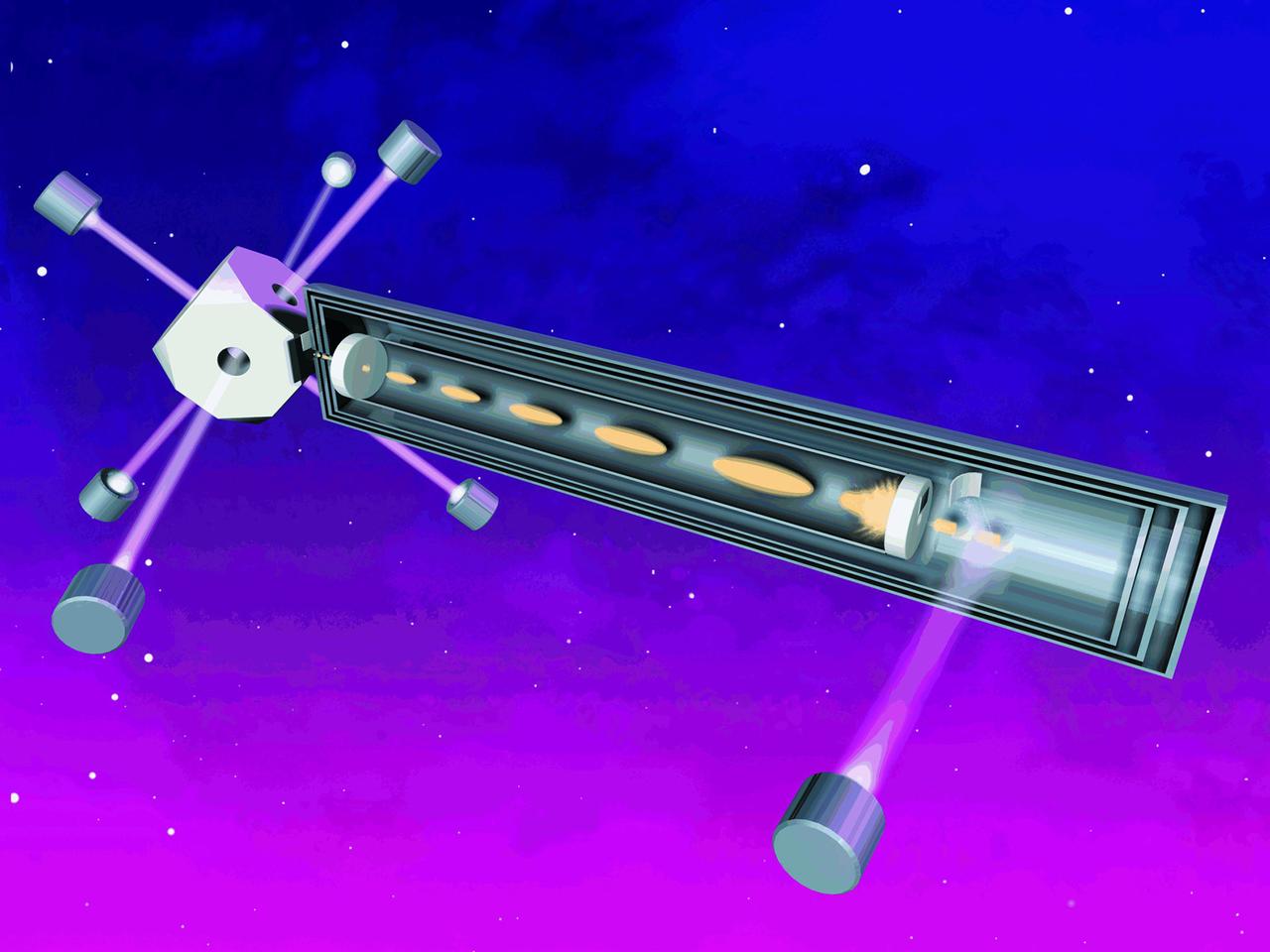
An artist's concept of the Primary Atomic Clock Reference System (PARCS) plarned to fly on the International Space Station (ISS). PARCS will make even more accurate atomic time available to everyone, from physicists testing Einstein's Theory of Relativity, to hikers using the Global Positioning System to find their way. In ground-based atomic clocks, lasers are used to cool and nearly stop atoms of cesium whose vibrations are used as the time base. The microgravity of space will allow the atoms to be suspended in the clock rather than circulated in an atomic fountain, as required on Earth. PARCS is being developed by the Jet Propulsion Laboratory with principal investigators at the National Institutes of Standards and Technology and the University of Colorado, Boulder. See also No. 0103191
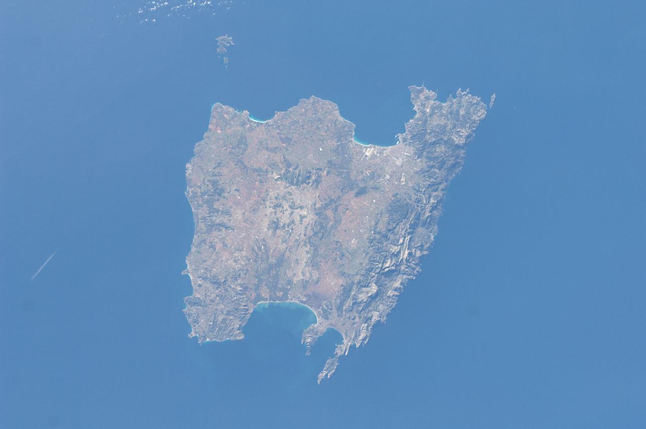
ISS030-E-030290 (31 Dec. 2011) --- Majorca in the Balearic Islands (Spain) is featured in this image photographed by an Expedition 30 crew member aboard the International Space Station. The Balearic Islands are an archipelago located to the southwest of Spain in the Mediterranean Sea. Catalan – the native tongue – and Spanish are the official languages. The islands are an autonomous community and province of Spain, located approximately midway between the southeastern coastline of Spain and the northern coastline of Algeria. This photograph highlights the large island of Majorca (approximately 5,400 square kilometers; also known as Mallorca in Spanish) on which the capital city of Palma is located (center). The small island of Cabrera to the southwest of Majorca (upper left) hosts the Parc Nacional de l’Arxipelag de Cabrera (site mainly in Spanish). Like the other Balearic Islands, Majorca is a popular holiday destination for the European community with tourism forming a major part of the island’s economy. The island’s physiography offers many recreational opportunities – mountainous regions are present along the northwest coastline and eastern third, while much of the central part of the island is flat. Diving is also a popular activity. The central region includes agricultural lands (tan, light brown, and green, center), forested patches and corridors (dark green, center), and urban centers (gray). In addition to Majorca, the other major islands of the archipelago include Ibiza, Formentera, and Minorca.
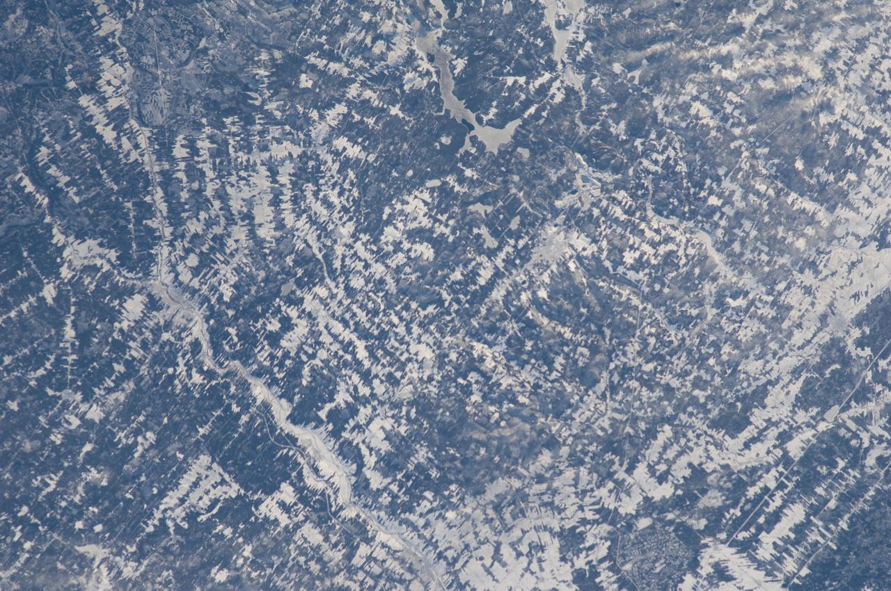
ISS030-E-019144 (29 Dec. 2011) --- Agricultural patterns in Quebec, Canada are featured in this image photographed by an Expedition 30 crew member on the International Space Station. The region shown in the image, known as the Chaudiere-Appalaches, is located midway between Quebec City (the provincial capital) and the international border with the United States (specifically, the State of Maine). Agriculture is a significant component of Quebec’s industries, with over 50 per cent of the food produced or processed consumed within the province as of 2008 (source: Agriculture and Agri-Food Canada). The tapestry-like pattern is due to the fact that the agricultural fields in the region are closely tied to access roads, with rectangular fields extending outwards perpendicular to the roadways. A similar pattern—embedded within a different social, historical, and economic context—can be seen in the Rondonia region of western Brazil. Snow cover highlights the rectangular fields interspersed with dark green forested patches. The urban area of Saint Georges (left) is visible as a light gray region along the Chaudiere River. The Parc national de Frontenac borders parts of Lac (lake) St.-Francois at upper center, providing an area for outdoor recreation within the intensive agricultural landscape.
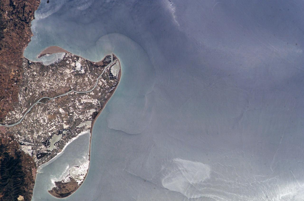
ISS009-E-09985 (3 June 2004) --- The Ebro River Delta, located along the eastern coast of Spain, is featured in this image photographed by an Expedition 9 crewmember on the International Space Station (ISS). Taken in partial sun glint, this view defines the Ebro’s fresh water lens— the water density boundary between the upper layer of fresh water issuing from the Ebro River mouth and the saltier, denser Mediterranean Sea water. According to NASA geologists studying the ISS imagery, diversion and impoundment of the Ebro River upstream has led to a decrease in water and sediment delivery to the delta. This decrease has led to increased erosion in some areas to the northeast of El Fangar Bay and along the southwestern shoreline of the delta. The Ebro River Delta is one of the largest wetland areas in the western Mediterranean region. The Ebro delta has grown rapidly—the historical rate of growth of the delta is demonstrated by the city of Amposta. This city was a seaport in the 4th Century, and is now located well inland from the current Ebro river mouth. The rounded form of the delta attests to the balance between sediment deposition by the Ebro River and removal of this material by wave erosion. The modern delta is in intensive agricultural use for rice, fruit, and vegetables. White polygonal areas to the north and south of the Ebro River are paddy fields. The Ebro delta also hosts numerous beaches, marshes, and saltpans that provide habitat for over 300 species of birds. A large part of the delta was designated as Parc Natural del Delta de l'Ebre (Ebre Delta National Park) in 1983. A network of canals and irrigation ditches constructed by both agricultural and conservation groups are helping to maintain the ecologic and economic resources of the Ebro Delta.