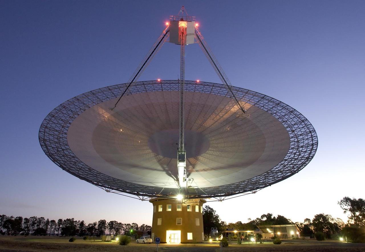
This image shows the Parkes telescope in Australia, part of the Commonwealth Scientific and Industrial Research Organization. Researchers used the telescope to detect the first population of radio bursts known to originate from beyond our galaxy.
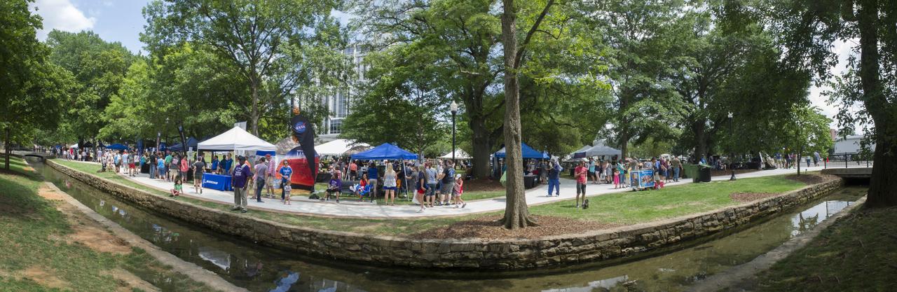
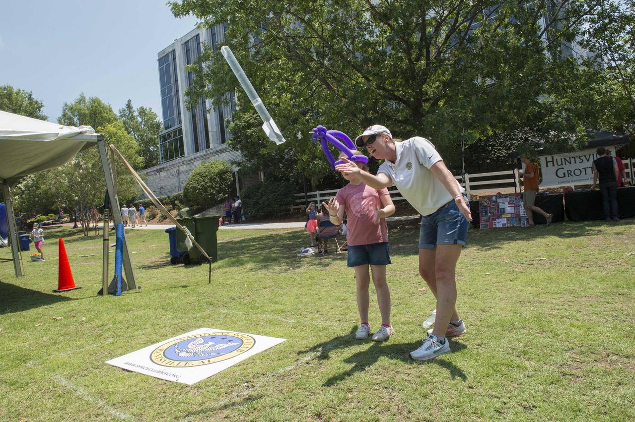
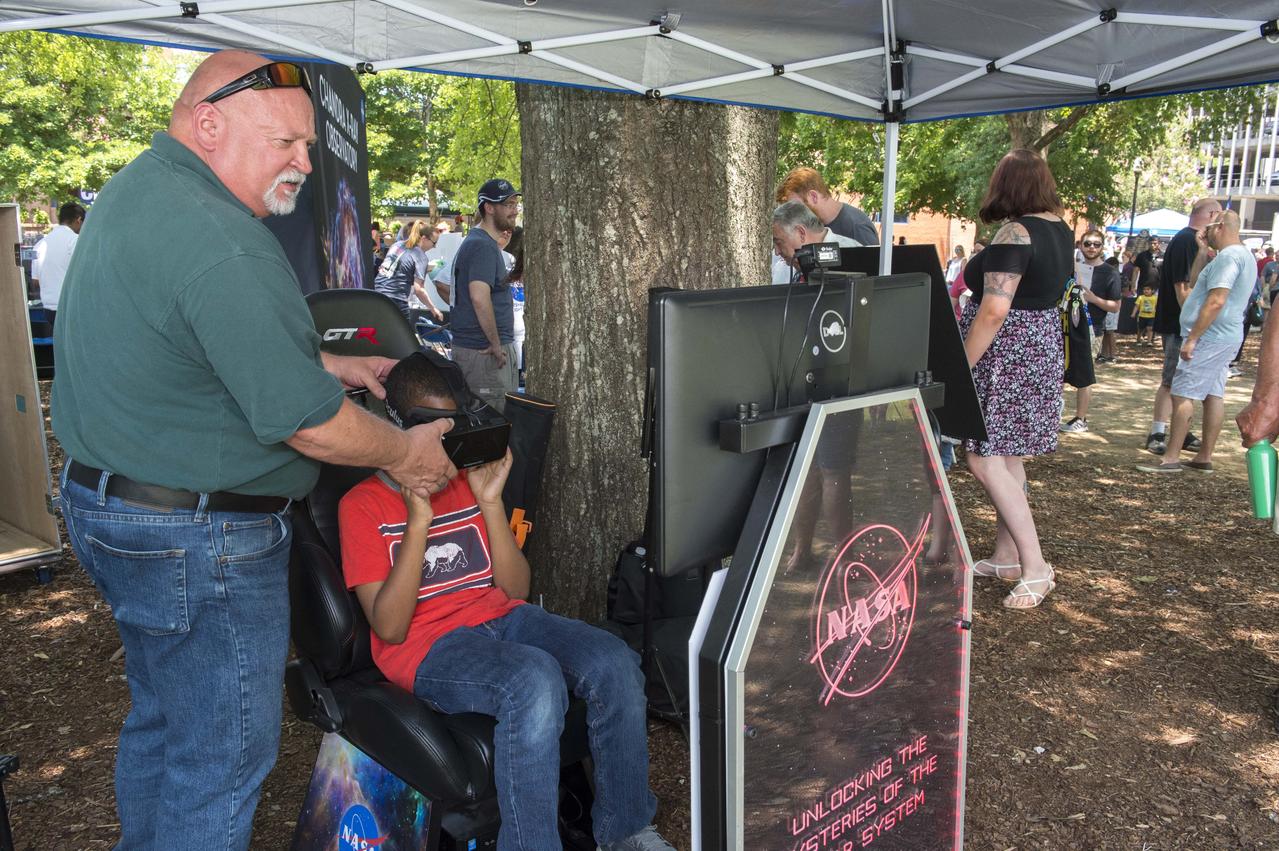
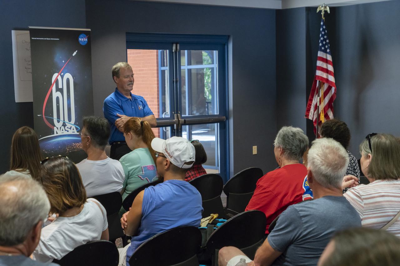
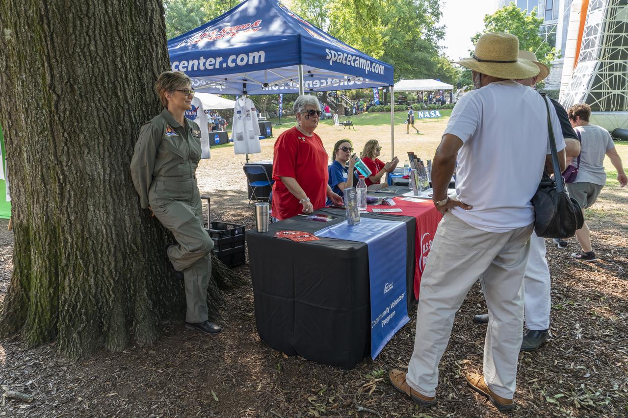
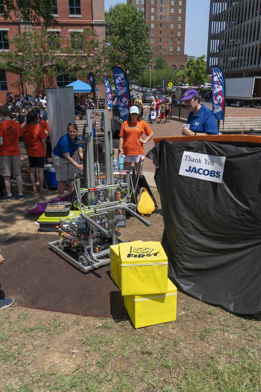
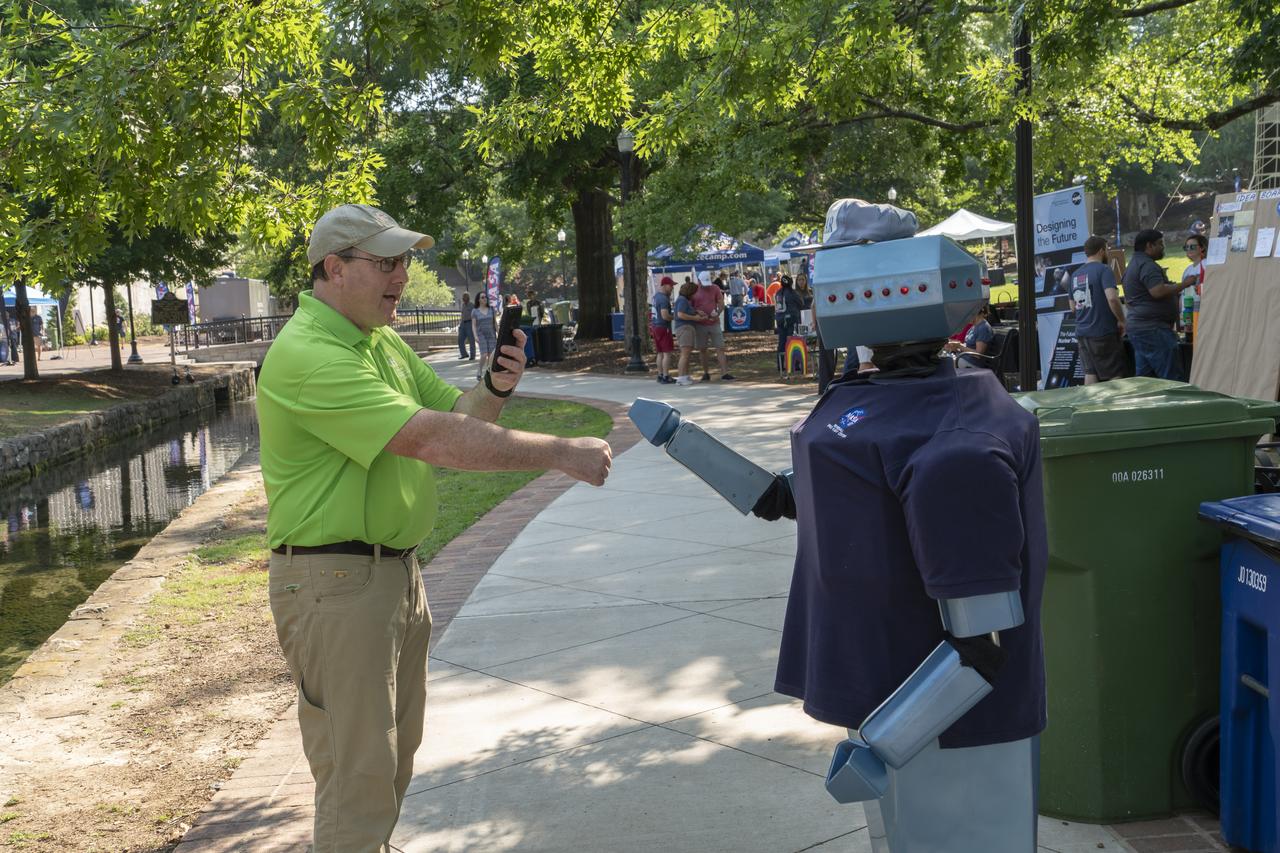
MORE THAN 7,500 PEOPLE ATTENDED NASA MARSHALL SPACE CENTER AND DOWNTOWN HUNTSVILLE, INC.’S THIRD ANNUAL CELEBRATION OF NASA AND THE COMMUNITY JUNE 18. THIS YEAR, THE EVENT MOVED TO HUNTSVILLE’S BIG SPRING PARK.

NASA STS-130 Pilot Terry Virts, right, is interviewed by Mid-Atlantic Sports Network (MASN) reporter Debbie Taylor at Nationals Park Tuesday, April 20, 2010, in Washington. Photo Credit: (NASA/Carla Cioffi)
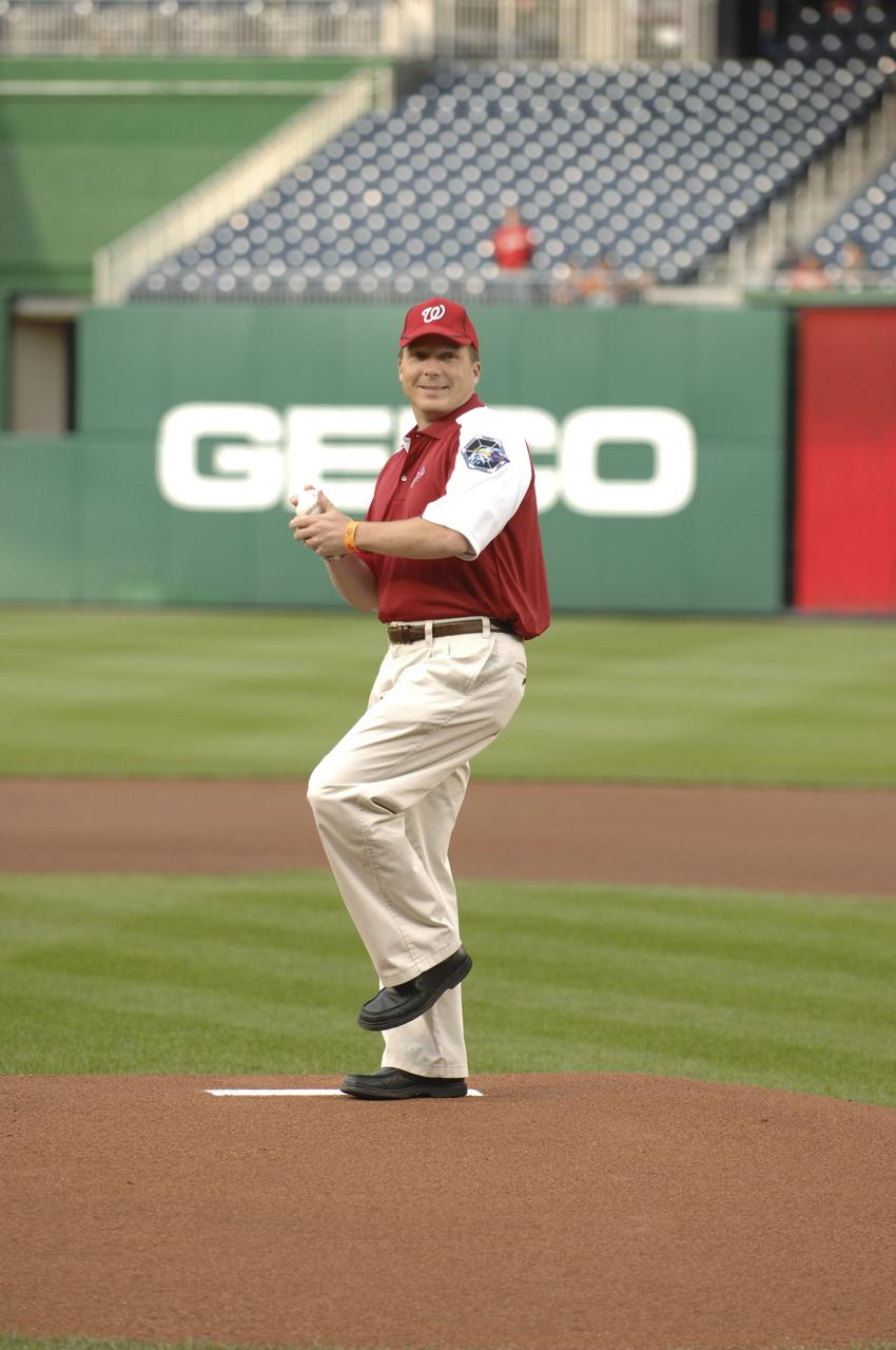
NASA STS-130 Pilot Terry Virts throws the opening pitch at Nationals Park on Tuesday, April 20, 2010, in Washington. Photo Credit: (Courtesy of the Washington Nationals)
Just in time for the U.S. National Park Service's Centennial celebration on Aug. 25, NASA's Multiangle Imaging SpectroRadiometer (MISR) instrument aboard NASA's Terra satellite is releasing four new anaglyphs that showcase 33 of our nation's national parks, monuments, historical sites and recreation areas in glorious 3D. Shown in the annotated image are Sequoia National Park, Kings Canyon National Park, Manzanar National Historic Site, Devils Postpile National Monument, Yosemite National Park, and parts of Death Valley National Park. MISR views Earth with nine cameras pointed at different angles, giving it the unique capability to produce anaglyphs, stereoscopic images that allow the viewer to experience the landscape in three dimensions. The anaglyphs were made by combining data from MISR's vertical-viewing and 46-degree forward-pointing camera. You will need red-blue glasses in order to experience the 3D effect; ensure you place the red lens over your left eye. The images have been rotated so that north is to the left in order to enable 3D viewing because the Terra satellite flies from north to south. All of the images are 235 miles (378 kilometers) from west to east. These data were acquired July 7, 2016, Orbit 88051. http://photojournal.jpl.nasa.gov/catalog/PIA20892
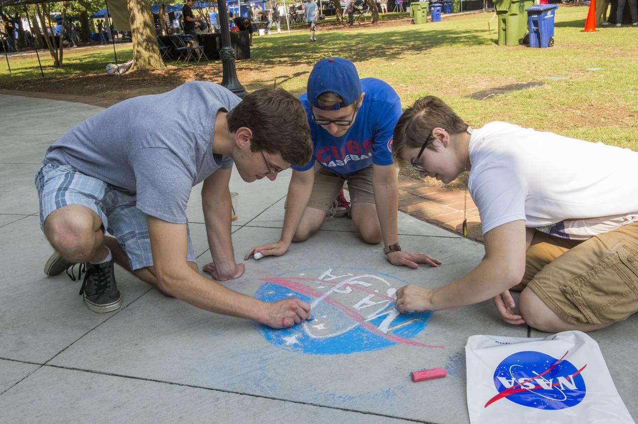
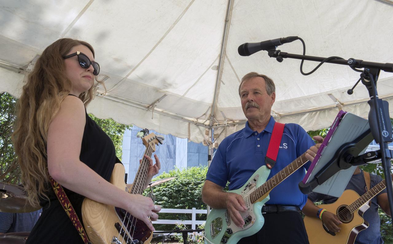
NASA in the Park on June 16 in Huntsville featured more than 60 exhibits and demonstrations by NASA experts, as well as performances by Marshall musicians, educational opportunities, games and hands-on activities for all ages. MSFC Summer Interns Eben Lenfest, Nick Bonini, and April Benedict display their artistic talents on Big Spring Park sidewalk during NASA in the Park festivities.
NASA Kennedy Space Center employees are photographed during a Safety and Health Days celebration at the Florida spaceport’s KARS Park II on March 5, 2020. Front row from left are Michele Richtmeyer and Heidi Harden, and back row from left are Phil Falk, Chris Berg, Marcus Chancery, Amber Philman-Blair, Larrin Moody and Dustin Cammack. Taking place March 2 through March 6, Safety and Health Days provides Kennedy employees with a variety of presentations to attend – all of which focus on how to maintain a safe and healthy workforce. The celebration on March 5 took place at the spaceport’s KARS Park II and was open for all employees to attend.
NASA Kennedy Space Center employees are photographed during a Safety and Health Days celebration at the Florida spaceport’s KARS Park II on March 5, 2020. Front row from left are Michele Richtmeyer and Heidi Harden, and back row from left are Phil Falk, Chris Berg, Marcus Chancery, Amber Philman-Blair, Larrin Moody and Dustin Cammack. Taking place March 2 through March 6, Safety and Health Days provides Kennedy employees with a variety of presentations to attend – all of which focus on how to maintain a safe and healthy workforce. The celebration on March 5 took place at the spaceport’s KARS Park II and was open for all employees to attend.
NASA in the Park on June 16 in Huntsville featured more than 60 exhibits and demonstrations by NASA experts, as well as performances by Marshall musicians, educational opportunities, games and hands-on activities for all ages. Astronaut Hoot Gibson and Nina Ricks of the band “Just Like Grady†entertained audiences at NASA in the Park.
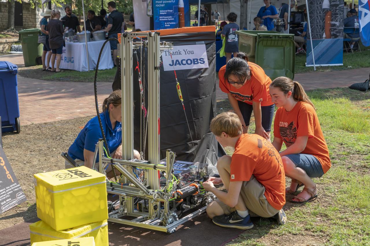
NASA in the Park on June 16 in Huntsville featured more than 60 exhibits and demonstrations by NASA experts, as well as performances by Marshall musicians, educational opportunities, games and hands-on activities for all ages. National Space Club members help demonstrate propulsion principles at NASA in the Park.
Just in time for the U.S. National Park Service's Centennial celebration on Aug. 25, NASA's Multiangle Imaging SpectroRadiometer (MISR) instrument aboard NASA's Terra satellite is releasing four new anaglyphs that showcase 33 of our nation's national parks, monuments, historical sites and recreation areas in glorious 3D. Shown in the annotated image are Walnut Canyon National Monument, Sunset Crater Volcano National Monument, Wupatki National Monument, Grand Canyon National Park, Pipe Spring National Monument, Zion National Park, Cedar Breaks National Monument, Bryce Canyon National Park, Capitol Reef National Park, Navajo National Monument, Glen Canyon National Recreation Area, Natural Bridges National Monument, Canyonlands National Park, and Arches National Park. MISR views Earth with nine cameras pointed at different angles, giving it the unique capability to produce anaglyphs, stereoscopic images that allow the viewer to experience the landscape in three dimensions. The anaglyphs were made by combining data from MISR's vertical-viewing and 46-degree forward-pointing camera. You will need red-blue glasses in order to experience the 3D effect; ensure you place the red lens over your left eye. The images have been rotated so that north is to the left in order to enable 3D viewing because the Terra satellite flies from north to south. All of the images are 235 miles (378 kilometers) from west to east. These data were acquired June 18, 2016, Orbit 87774. http://photojournal.jpl.nasa.gov/catalog/PIA20889
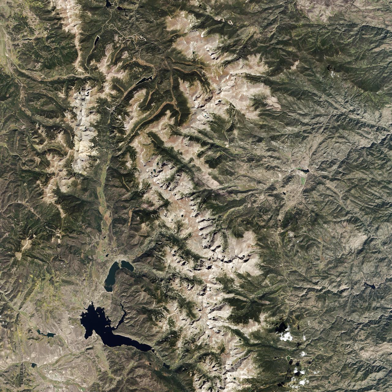
Naked peaks, sheltered valleys, snowfields, towering trees, and alpine meadows make up the varied landscape of Sequoia National Park in California. Established as a National Park by Congress on September 25, 1890, Sequoia National Park is the second-oldest U.S. National Park, after Yellowstone. This national park borders Kings Canyon National Park. The Thematic Mapper sensor on NASA’s Landsat 5 satellite captured this true-color image of Sequoia National Park, outlined in white, on October 22, 2008. Sunlight illuminates southern slopes, leaving northern faces in shadow in this autumn image. In the west, deep green conifers carpet most of the land. These forested mountains are home to the park’s most famous giant sequoia trees. Sequoia National Park sits at the southern end of the Sierra Nevada mountains. Terrain alternates between extremes, from peaks such as Mt. Whitney—the highest peak in the contiguous United States—to deep caverns. The rivers and lakes in this region are part of a watershed valuable not only to the plants and animals of the park, but also to farms and cities in California’s Central Valley. Read more: <a href="http://go.nasa.gov/2bzGOXr" rel="nofollow">go.nasa.gov/2bzGOXr</a> Credit: NASA/Landsat5 <b><a href="http://www.nasa.gov/audience/formedia/features/MP_Photo_Guidelines.html" rel="nofollow">NASA image use policy.</a></b> <b><a href="http://www.nasa.gov/centers/goddard/home/index.html" rel="nofollow">NASA Goddard Space Flight Center</a></b> enables NASA’s mission through four scientific endeavors: Earth Science, Heliophysics, Solar System Exploration, and Astrophysics. Goddard plays a leading role in NASA’s accomplishments by contributing compelling scientific knowledge to advance the Agency’s mission. <b>Follow us on <a href="http://twitter.com/NASAGoddardPix" rel="nofollow">Twitter</a></b> <b>Like us on <a href="http://www.facebook.com/pages/Greenbelt-MD/NASA-Goddard/395013845897?ref=tsd" rel="nofollow">Facebook</a></b> <b>Find us on <a href="http://instagrid.me/nasagoddard/?vm=grid" rel="nofollow">Instagram</a></b>
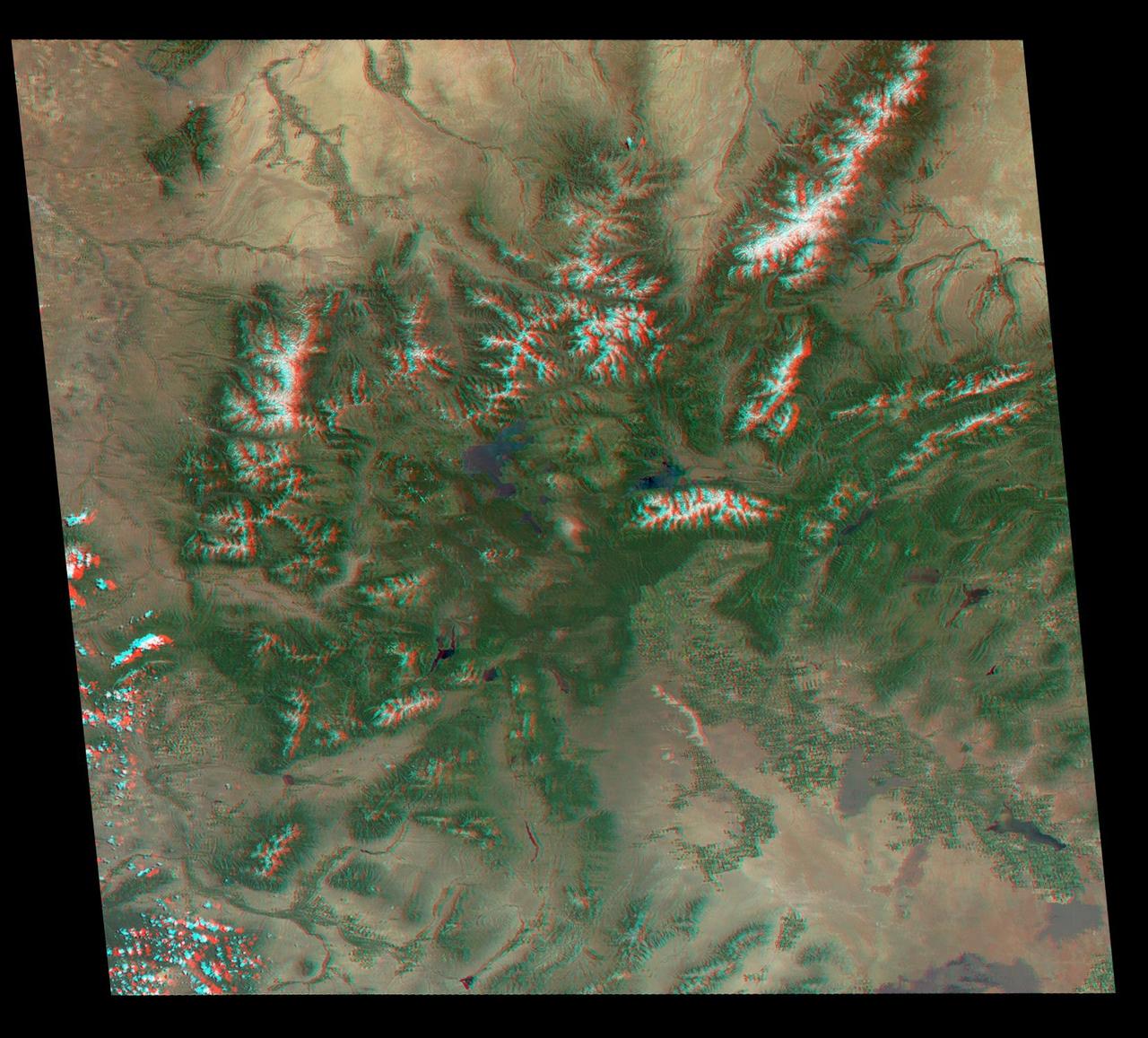
Just in time for the U.S. National Park Service's Centennial celebration on Aug. 25, NASA's Multiangle Imaging SpectroRadiometer (MISR) instrument aboard NASA's Terra satellite is releasing four new anaglyphs that showcase 33 of our nation's national parks, monuments, historical sites and recreation areas in glorious 3D. Shown in the annotated image are Lewis and Clark National Historic Park, Mt. Rainier National Park, Olympic National Park, Ebey's Landing National Historical Reserve, San Juan Island National Historic Park, North Cascades National Park, Lake Chelan National Recreation Area, and Ross Lake National Recreation Area (also Mt. St. Helens National Volcanic Monument, administered by the U.S. Forest Service) MISR views Earth with nine cameras pointed at different angles, giving it the unique capability to produce anaglyphs, stereoscopic images that allow the viewer to experience the landscape in three dimensions. The anaglyphs were made by combining data from MISR's vertical-viewing and 46-degree forward-pointing camera. You will need red-blue glasses in order to experience the 3D effect; ensure you place the red lens over your left eye. The images have been rotated so that north is to the left in order to enable 3D viewing because the Terra satellite flies from north to south. All of the images are 235 miles (378 kilometers) from west to east. These data were acquired May 12, 2012, Orbit 65960. http://photojournal.jpl.nasa.gov/catalog/PIA20891
Just in time for the U.S. National Park Service's Centennial celebration on Aug. 25, NASA's Multiangle Imaging SpectroRadiometer (MISR) instrument aboard NASA's Terra satellite is releasing four new anaglyphs that showcase 33 of our nation's national parks, monuments, historical sites and recreation areas in glorious 3D. Shown in the annotated image are Grand Teton National Park, John D. Rockefeller Memorial Parkway, Yellowstone National Park, and parts of Craters of the Moon National Monument. MISR views Earth with nine cameras pointed at different angles, giving it the unique capability to produce anaglyphs, stereoscopic images that allow the viewer to experience the landscape in three dimensions. The anaglyphs were made by combining data from MISR's vertical-viewing and 46-degree forward-pointing camera. You will need red-blue glasses in order to experience the 3D effect; ensure you place the red lens over your left eye. The images have been rotated so that north is to the left in order to enable 3D viewing because the Terra satellite flies from north to south. All of the images are 235 miles (378 kilometers) from west to east. These data were acquired June 25, 2016, Orbit 87876. http://photojournal.jpl.nasa.gov/catalog/PIA20890
Acadia National Park is one of the most visited parks in America, drawing more than 2.5 million visitors per year to the craggy, jagged coast of Maine. The park is celebrating its 100th anniversary in 2016. On September 6, 2015, the Operational Land Imager (OLI) on the Landsat 8 satellite acquired these images of Acadia National Park and its surroundings. Mountains and hills roll right up to the Atlantic Ocean in this rocky landscape carved by glaciers at the end of the last Ice Age. Since the beginning of the 20th Century, the park has been pieced together by donations and acquisitions of once-private lands, and it is still growing. Of the park’s 47,000 acres, more than 12,000 are privately owned lands under conservation agreements, while the rest is held by the National Park Service. Mount Desert Island is the focal point of the park, which also includes lands around a former naval base (Schoodic Peninsula), Isle au Haut, and several smaller islands. Read more: <a href="http://go.nasa.gov/2adyd8J" rel="nofollow">go.nasa.gov/2adyd8J</a> Credit: NASA/Landsat8 <b><a href="http://www.nasa.gov/audience/formedia/features/MP_Photo_Guidelines.html" rel="nofollow">NASA image use policy.</a></b> <b><a href="http://www.nasa.gov/centers/goddard/home/index.html" rel="nofollow">NASA Goddard Space Flight Center</a></b> enables NASA’s mission through four scientific endeavors: Earth Science, Heliophysics, Solar System Exploration, and Astrophysics. Goddard plays a leading role in NASA’s accomplishments by contributing compelling scientific knowledge to advance the Agency’s mission. <b>Follow us on <a href="http://twitter.com/NASAGoddardPix" rel="nofollow">Twitter</a></b> <b>Like us on <a href="http://www.facebook.com/pages/Greenbelt-MD/NASA-Goddard/395013845897?ref=tsd" rel="nofollow">Facebook</a></b> <b>Find us on <a href="http://instagrid.me/nasagoddard/?vm=grid" rel="nofollow">Instagram</a></b>

NASA in the Park on June 16 in Huntsville featured more than 60 exhibits and demonstrations by NASA experts, as well as performances by Marshall musicians, educational opportunities, games and hands-on activities for all ages. NASA employee Renae Scoble and her husband Ryan and son Titus enjoy the the fun and games at NASA in the Park.
NASA in the Park on June 16 in Huntsville featured more than 60 exhibits and demonstrations by NASA experts, as well as performances by Marshall musicians, educational opportunities, games and hands-on activities for all ages. Many of the exhibits at NASA in the Park were interactive.
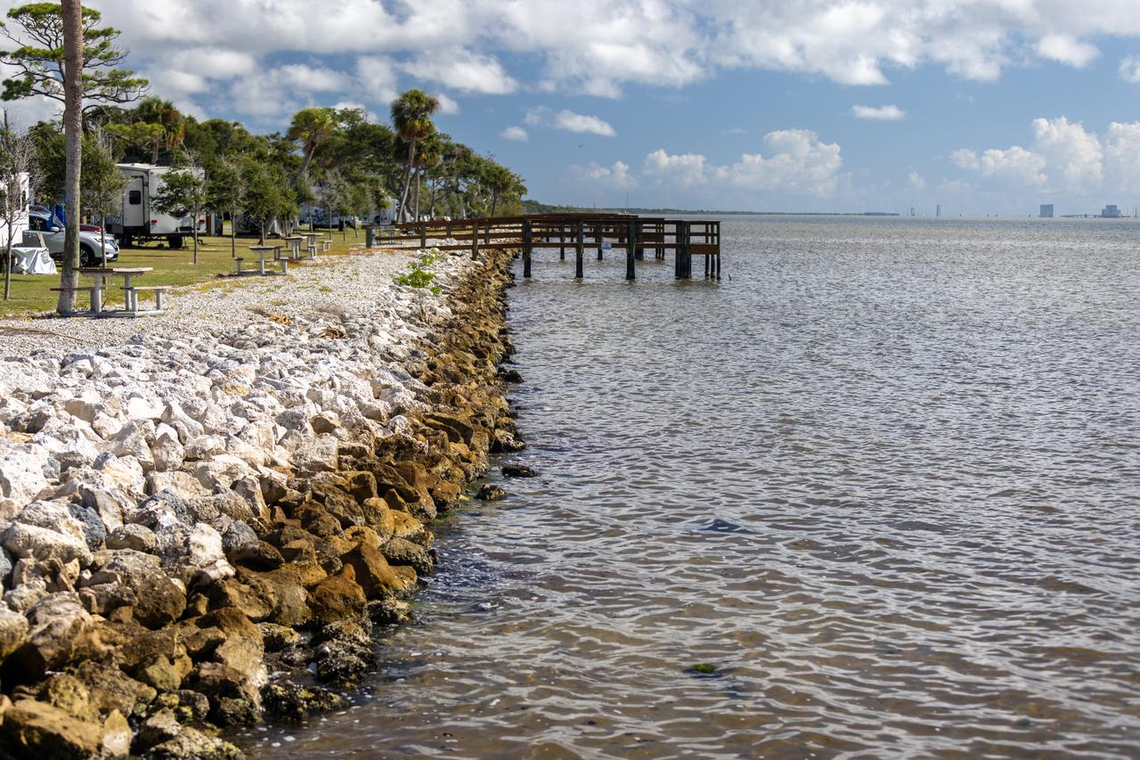
NASA Kennedy Space Center’s Spaceport Integration and Services organization is leading a restoration project at KARS Park on Hall Road in Merritt Island, Florida. As part of this project, a wavebreak is being created about 20 feet offshore to allow mangroves and other plants to propagate into the gap, providing protection for the shoreline. Shown here is the section of KARS park that was first completed during the project.
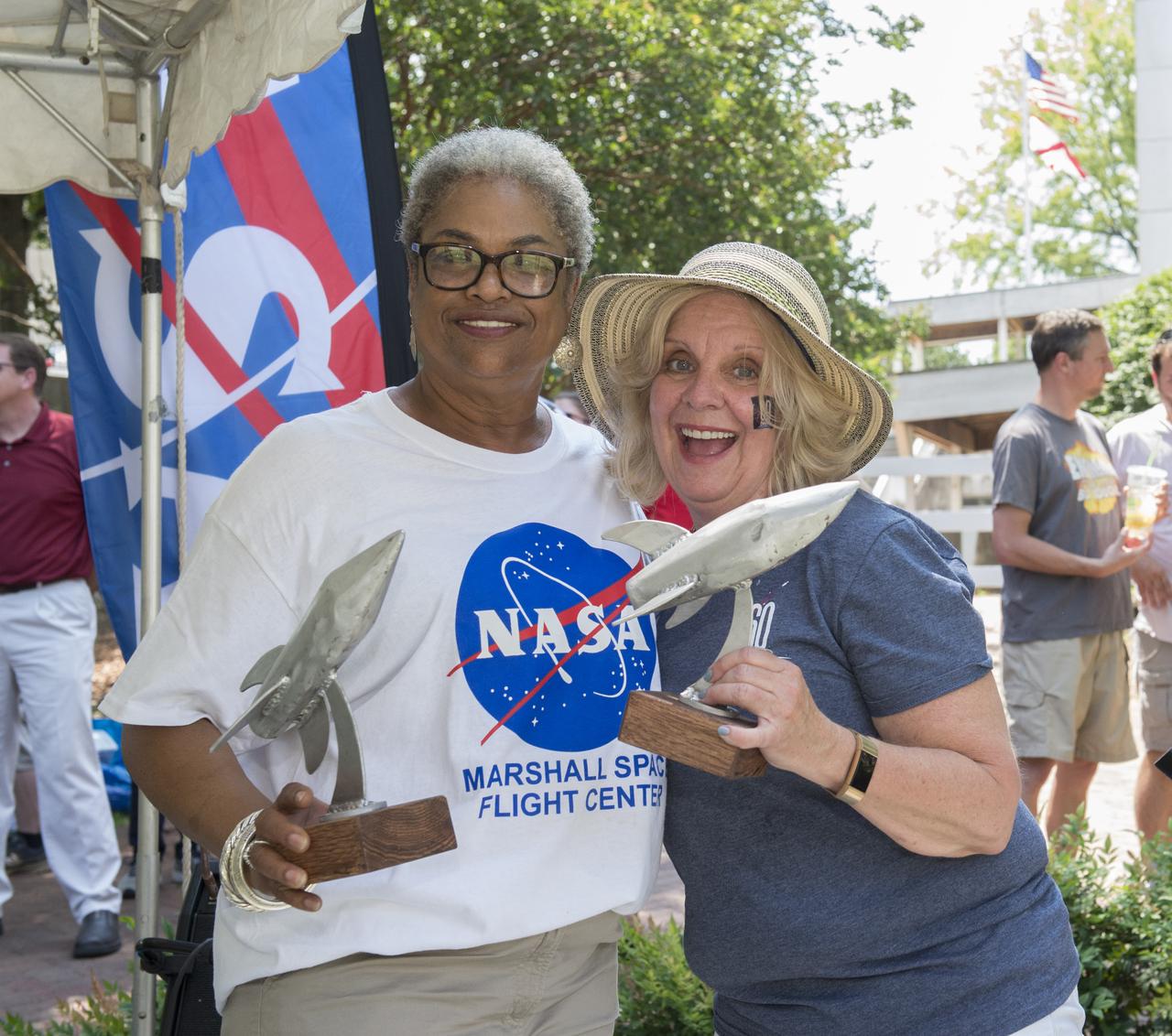
NASA in the Park on June 16 in Huntsville featured more than 60 exhibits and demonstrations by NASA experts, as well as performances by Marshall musicians, educational opportunities, games and hands-on activities for all ages. Marshall employees Ola Metcalfe (L), and Sherrie Stroud proudly display trophies awarded to them by Downtown Inc. President, Chad Emerson, in appreciation of their efforts in the five year partnership with NASA in the Park.
In 1968, after state parks had already been established in northern California, the U.S. Congress established Redwood National Park. This new park supplemented protected lands in the region, and in 1994, state and federal authorities agreed to jointly manage the area’s public lands. On February 6, 2003, the Enhanced Thamatic Mapper Plus on NASA’s Landsat 7 satellite captured this true-color image of the southern end of Redwood National Park - a thin coastal corridor connects the northern and southern ends of the park system. Along the coast, sandy beaches appear off-white, and sediments form swirls of pale blue in the darker blue sea. Inland, the park is dominated by green vegetation, with isolated patches of gray-beige rock. This image of the Redwood National Park includes two stands of trees: Lady Bird Johnson Grove and Tall Trees Grove. The first grove was dedicated to the former first lady by President Richard Nixon in August 1969. The second grove became the focus of efforts to protect the surrounding area from logging. Two waterways appear in this image: Redwood Creek and Klamath River. The more conspicuous Klamath River flows through the park system’s midsection (north of the area pictured here). Redwood Creek flows through the southern portion of the park system. Both waterways have carved gorges through the mountainous landscape. Redwood National and State Parks occupy an area considered to be the most seismically active in the United States. The frequent seismic activity has led to shifting waterways, landslides, and rapid erosion along the coastline. Read more: <a href="http://go.nasa.gov/2bRlryv" rel="nofollow">go.nasa.gov/2bRlryv</a> Credit: NASA/Landsat7 <b><a href="http://www.nasa.gov/audience/formedia/features/MP_Photo_Guidelines.html" rel="nofollow">NASA image use policy.</a></b> <b><a href="http://www.nasa.gov/centers/goddard/home/index.html" rel="nofollow">NASA Goddard Space Flight Center</a></b> enables NASA’s mission through four scientific endeavors: Earth Science, Heliophysics, Solar System Exploration, and Astrophysics. Goddard plays a leading role in NASA’s accomplishments by contributing compelling scientific knowledge to advance the Agency’s mission. <b>Follow us on <a href="http://twitter.com/NASAGoddardPix" rel="nofollow">Twitter</a></b> <b>Like us on <a href="http://www.facebook.com/pages/Greenbelt-MD/NASA-Goddard/395013845897?ref=tsd" rel="nofollow">Facebook</a></b> <b>Find us on <a href="http://instagrid.me/nasagoddard/?vm=grid" rel="nofollow">Instagram</a></b>
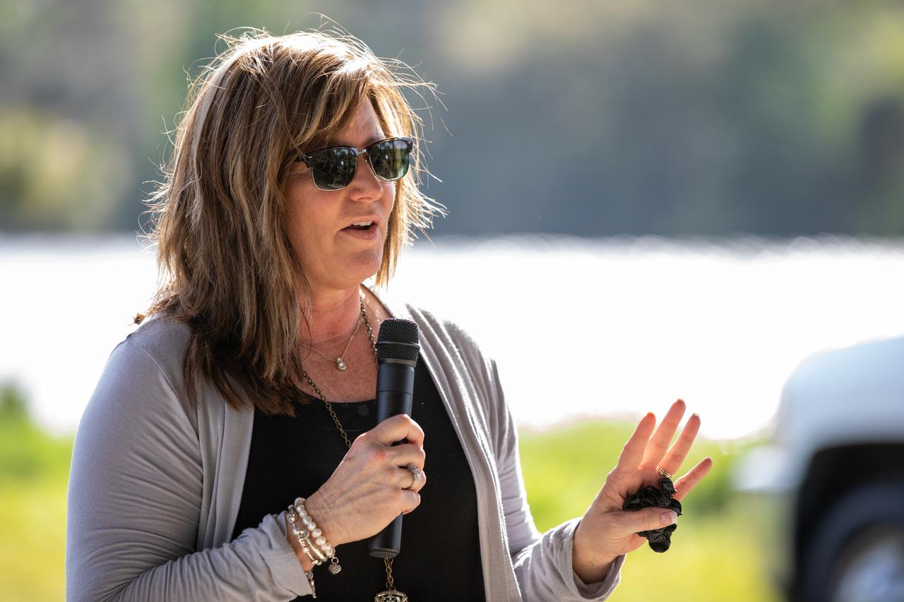
Jennifer Kunz, director of Safety and Mission Assurance at NASA’s Kennedy Space Center in Florida, speaks to Kennedy employees during a Safety and Health Days celebration on March 5, 2020. Taking place March 2 through March 6, Safety and Health Days provides Kennedy employees with a variety of presentations to attend – all of which focus on how to maintain a safe and healthy workforce. The celebration on March 5 took place at the spaceport’s KARS Park II and was open for all employees to attend.
Ronnie Rodriguez, left, deputy director of Safety and Mission Assurance at NASA’s Kennedy Space Center in Florida, serves food to Kennedy employees during a Safety and Health Days celebration on March 5, 2020. Taking place March 2 through March 6, Safety and Health Days provides Kennedy employees with a variety of presentations to attend – all of which focus on how to maintain a safe and healthy workforce. The celebration on March 5 took place at the spaceport’s KARS Park II and was open for all employees to attend.

Managers at NASA’s Kennedy Space Center in Florida serve food to Kennedy employees during a Safety and Health Days celebration on March 5, 2020. Taking place March 2 through March 6, Safety and Health Days provides Kennedy employees with a variety of presentations to attend – all of which focus on how to maintain a safe and healthy workforce. The celebration on March 5 took place at the spaceport’s KARS Park II and was open for all employees to attend.
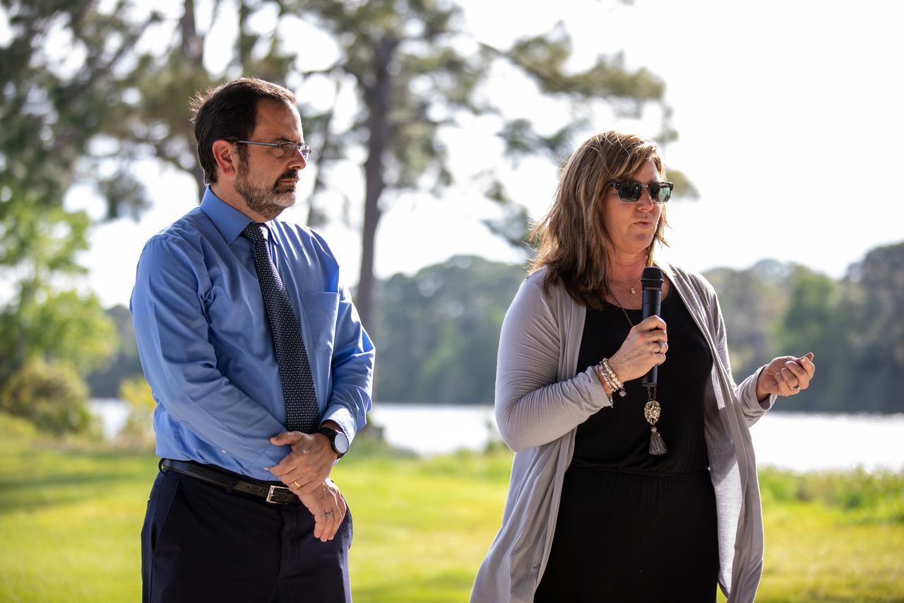
Deputy Director Ronnie Rodriguez, left, and Director Jennifer Kunz of Safety and Mission Assurance at NASA’s Kennedy Space Center in Florida, speak to Kennedy employees during a Safety and Health Days celebration on March 5, 2020. Taking place March 2 through March 6, Safety and Health Days provides Kennedy employees with a variety of presentations to attend – all of which focus on how to maintain a safe and healthy workforce. The celebration on March 5 took place at the spaceport’s KARS Park II and was open for all employees to attend.

Ronnie Rodriguez, deputy director of Safety and Mission Assurance at NASA’s Kennedy Space Center in Florida, speaks to Kennedy employees during a Safety and Health Days celebration on March 5, 2020. Taking place March 2 through March 6, Safety and Health Days provides Kennedy employees with a variety of presentations to attend – all of which focus on how to maintain a safe and healthy workforce. The celebration on March 5 took place at the spaceport’s KARS Park II and was open for all employees to attend.
Jennifer Kunz, left, director, and Ronnie Rodriguez, deputy director of Safety and Mission Assurance at NASA’s Kennedy Space Center in Florida, are photographed at a Safety and Health Days celebration on March 5, 2020. Taking place March 2 through March 6, Safety and Health Days provides Kennedy employees with a variety of presentations to attend – all of which focus on how to maintain a safe and healthy workforce. The celebration on March 5 took place at the spaceport’s KARS Park II and was open for all employees to attend.

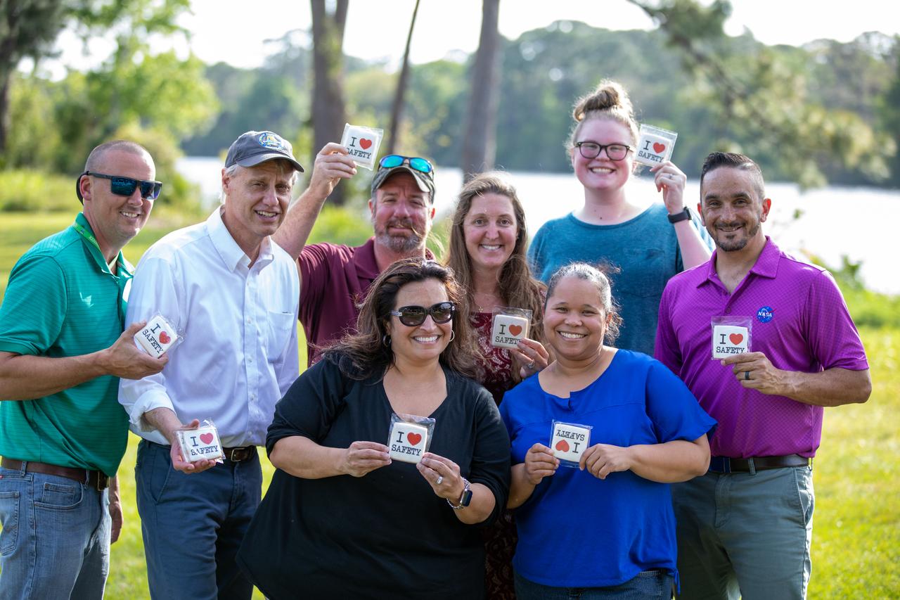
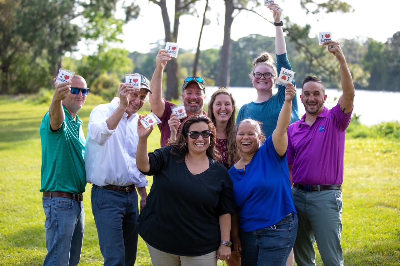
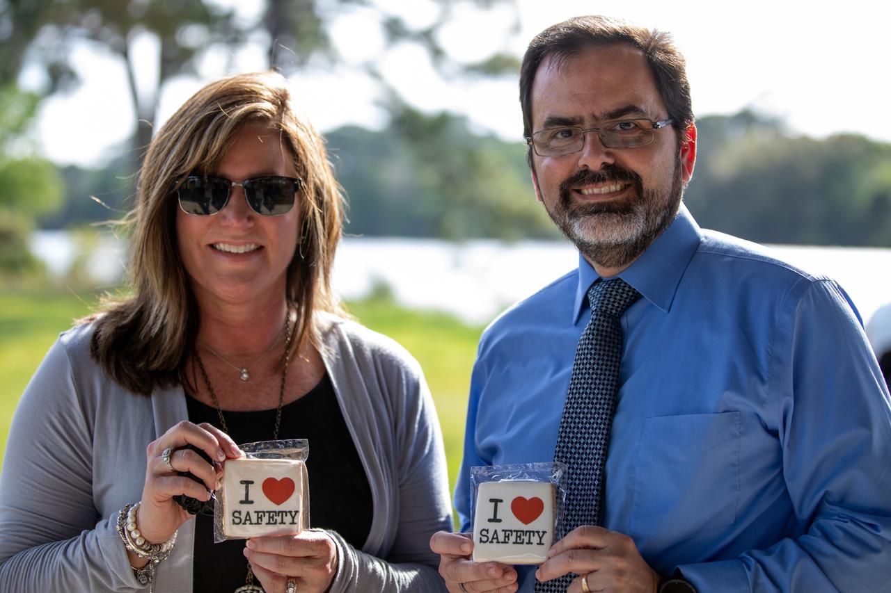
“I Love Safety” cookies are photographed at a Safety and Health Days celebration at Kennedy Space Center’s KARS Park II on March 5, 2020. Taking place March 2 through March 6, Safety and Health Days provides Kennedy employees with a variety of presentations to attend – all of which focus on how to maintain a safe and healthy workforce. The celebration on March 5 was open for all employees to attend.

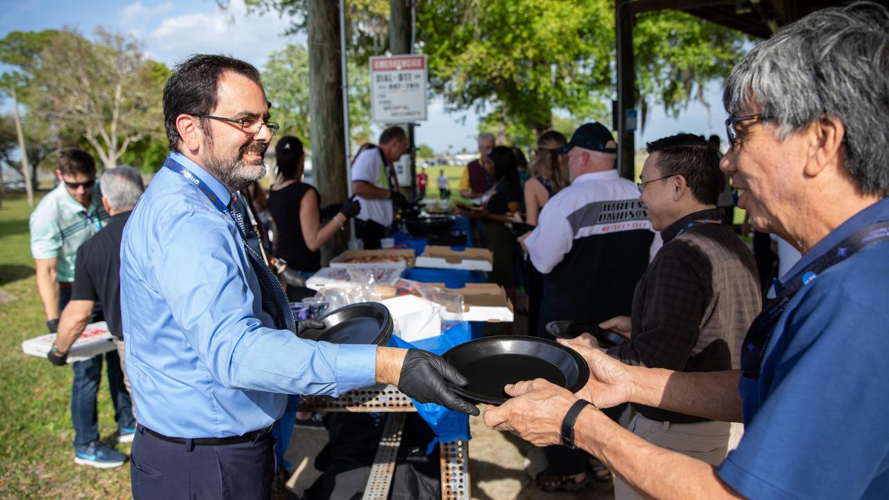
Maria Collura, deputy director of Spaceport Services and Integration at NASA’s Kennedy Space Center in Florida, is photographed serving pizza to Kennedy employees during a Safety and Health Days celebration at the spaceport’s KARS Park II on March 5, 2020. Taking place March 2 through March 6, Safety and Health Days provides Kennedy employees with a variety of presentations to attend – all of which focus on how to maintain a safe and healthy workforce.

Jennifer Kunz, director of Safety and Mission Assurance at NASA’s Kennedy Space Center in Florida, speaks to Kennedy employees during a Safety and Health Days celebration on March 5, 2020. Taking place March 2 through March 6, Safety and Health Days provides Kennedy employees with a variety of presentations to attend – all of which focus on how to maintain a safe and healthy workforce. The celebration on March 5 took place at the spaceport’s KARS Park II and was open for all employees to attend.
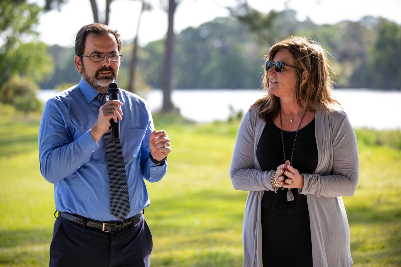
Deputy Director Ronnie Rodriguez, left, and Director Jennifer Kunz of Safety and Mission Assurance at NASA’s Kennedy Space Center in Florida, speak to Kennedy employees during a Safety and Health Days celebration on March 5, 2020. Taking place March 2 through March 6, Safety and Health Days provides Kennedy employees with a variety of presentations to attend – all of which focus on how to maintain a safe and healthy workforce. The celebration on March 5 took place at the spaceport’s KARS Park II and was open for all employees to attend.
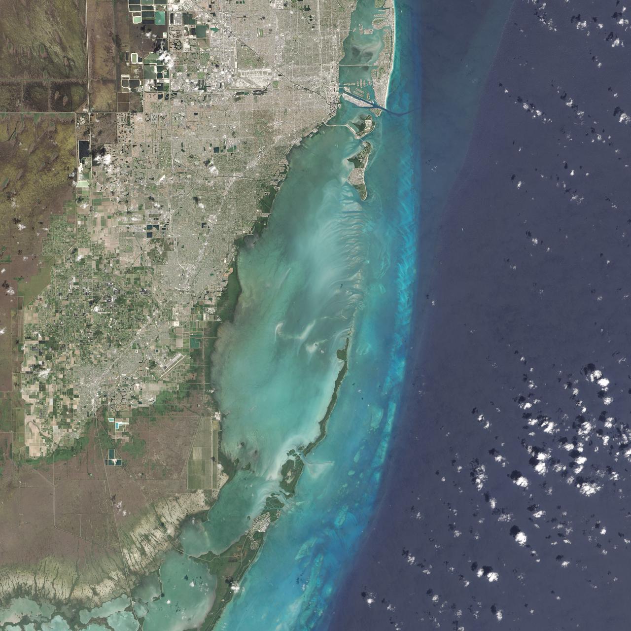
On February 25, 2016, the Operational Land Imager (OLI) on the Landsat 8 satellite acquired this natural-color image of Biscayne National Park. The park encompasses the northernmost Florida Keys, starting from Miami to just north of Key Largo. The keys run like a spine through the center of the park, with Biscayne Bay to the west and the Atlantic Ocean to the east. The water-covered areas span more than 660 square kilometers (250 square miles) of the park, making it the largest marine park in the U.S. National Park System. Biscayne protects the longest stretch of mangrove forest on the U.S. East Coast, and one of the most extensive stretches of coral reef in the world. Read more: <a href="http://go.nasa.gov/1SWs1a3" rel="nofollow">go.nasa.gov/1SWs1a3</a> Credit: NASA/Landsat8 <b><a href="http://www.nasa.gov/audience/formedia/features/MP_Photo_Guidelines.html" rel="nofollow">NASA image use policy.</a></b> <b><a href="http://www.nasa.gov/centers/goddard/home/index.html" rel="nofollow">NASA Goddard Space Flight Center</a></b> enables NASA’s mission through four scientific endeavors: Earth Science, Heliophysics, Solar System Exploration, and Astrophysics. Goddard plays a leading role in NASA’s accomplishments by contributing compelling scientific knowledge to advance the Agency’s mission. <b>Follow us on <a href="http://twitter.com/NASAGoddardPix" rel="nofollow">Twitter</a></b> <b>Like us on <a href="http://www.facebook.com/pages/Greenbelt-MD/NASA-Goddard/395013845897?ref=tsd" rel="nofollow">Facebook</a></b> <b>Find us on <a href="http://instagrid.me/nasagoddard/?vm=grid" rel="nofollow">Instagram</a></b>

NASA in the Park on June 16 in Huntsville featured more than 60 exhibits and demonstrations by NASA experts, as well as performances by Marshall musicians, educational opportunities, games and hands-on activities for all ages. MSFC Deputy Director Jody Singer welcomes soloist Alyssa Slocum who sang the National Anthem to officially open NASA in the Park activities.
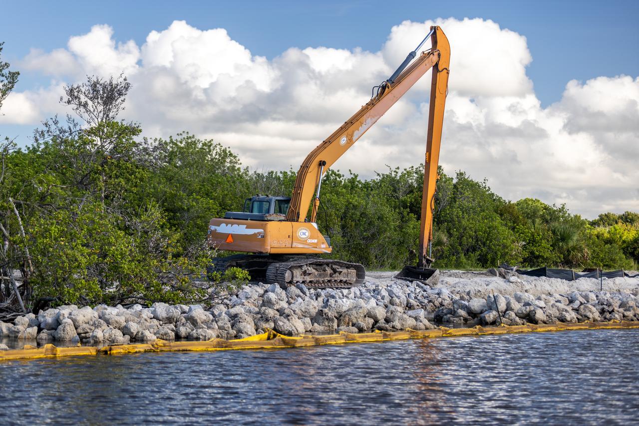
NASA Kennedy Space Center’s Spaceport Integration and Services organization is leading a restoration project at KARS Park on Hall Road in Merritt Island, Florida. As part of this project, a wavebreak is being created about 20 feet offshore to allow mangroves and other plants to propagate into the gap, providing protection for the shoreline.
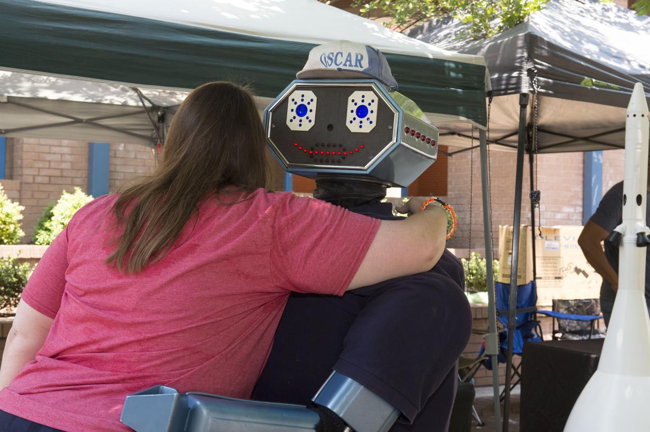
NASA in the Park on June 16 in Huntsville featured more than 60 exhibits and demonstrations by NASA experts, as well as performances by Marshall musicians, educational opportunities, games and hands-on activities for all ages. â€Oscar the Robot†gets and gives lots of hugs.
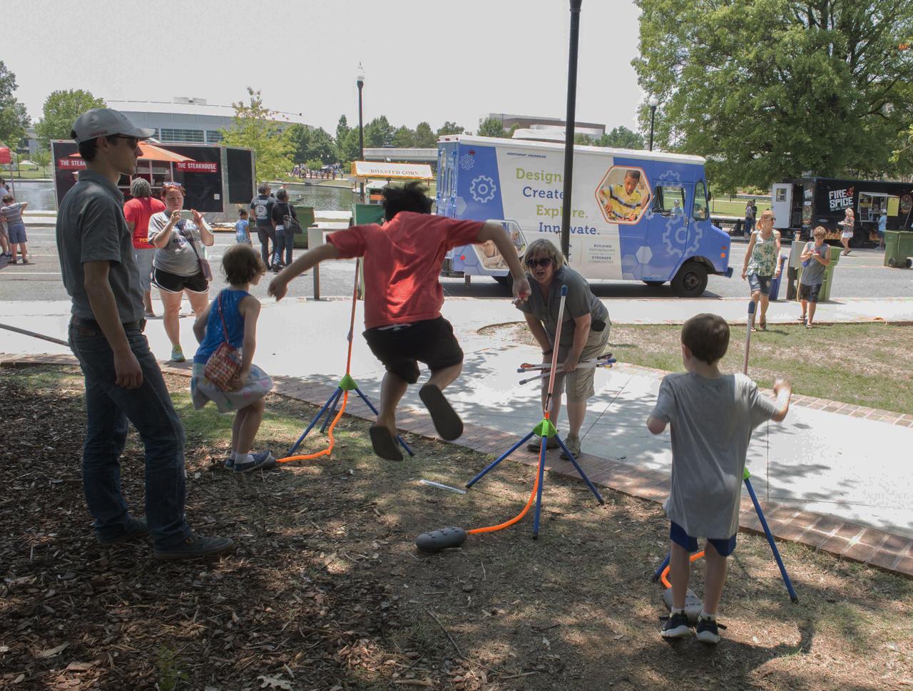
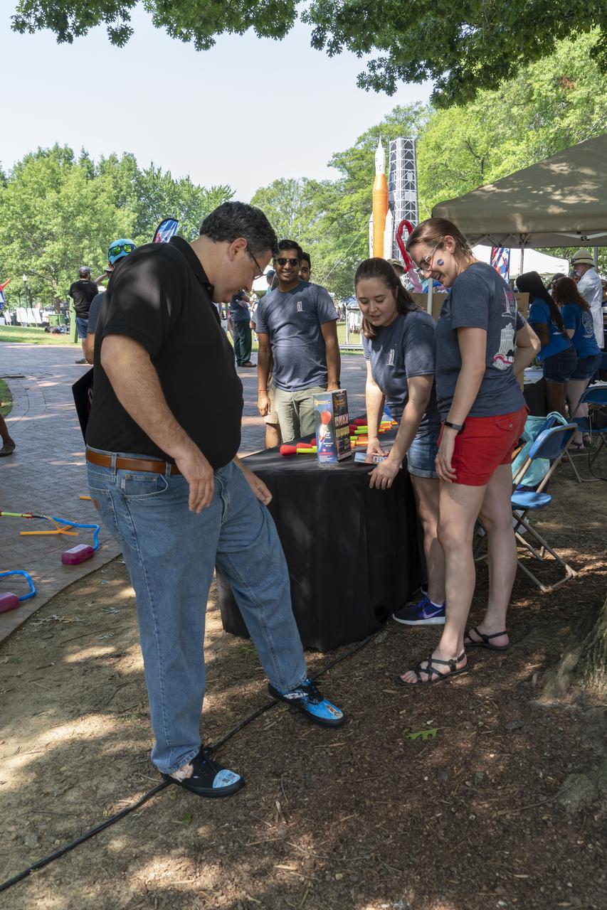
NASA in the Park on June 16 in Huntsville featured more than 60 exhibits and demonstrations by NASA experts, as well as performances by Marshall musicians, educational opportunities, games and hands-on activities for all ages. Youthful energy is exhibited in the foot rocket demonstration.
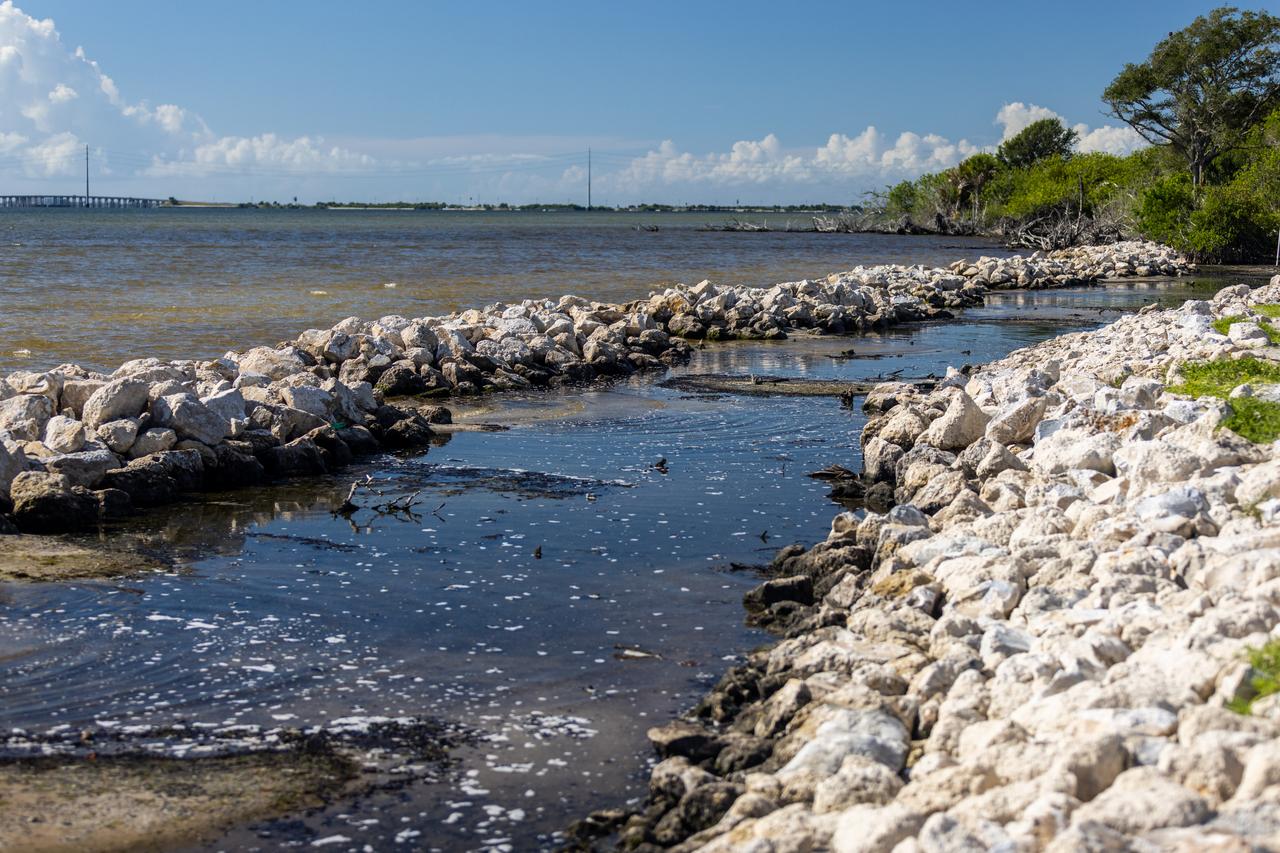
NASA Kennedy Space Center’s Spaceport Integration and Services organization is leading a restoration project at KARS Park on Hall Road in Merritt Island, Florida. As part of this project, a wavebreak is being created about 20 feet offshore to allow mangroves and other plants to propagate into the gap, providing protection for the shoreline.
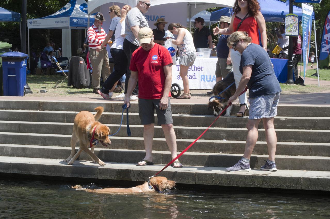
NASA in the Park on June 16 in Huntsville featured more than 60 exhibits and demonstrations by NASA experts, as well as performances by Marshall musicians, educational opportunities, games and hands-on activities for all ages. Big Spring canal is a good place to cool off in the 90 degree heat
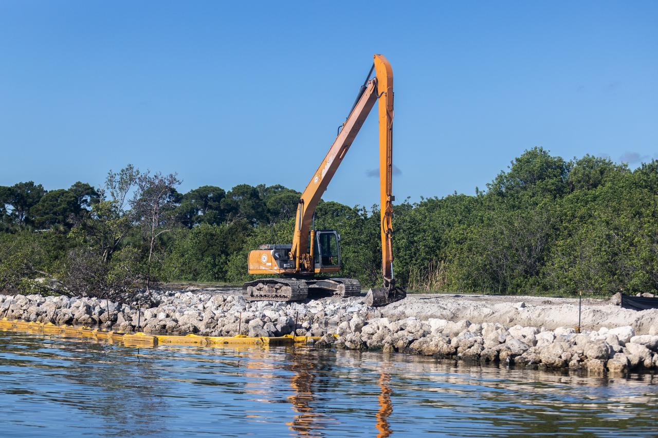
NASA Kennedy Space Center’s Spaceport Integration and Services organization is leading a restoration project at KARS Park on Hall Road in Merritt Island, Florida. As part of this project, a wavebreak is being created about 20 feet offshore to allow mangroves and other plants to propagate into the gap, providing protection for the shoreline.
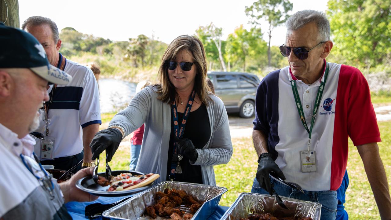
Jennifer Kunz, center, director of Safety and Mission Assurance, and Bob Mott, right, chief of the Commercial Systems Division in the Engineering Directorate at NASA’s Kennedy Space Center in Florida, serve food to Kennedy employees during a Safety and Health Days celebration on March 5, 2020. Taking place March 2 through March 6, Safety and Health Days provides Kennedy employees with a variety of presentations to attend – all of which focus on how to maintain a safe and healthy workforce. The celebration on March 5 took place at the Florida spaceport’s KARS Park II and was open for all employees to attend.
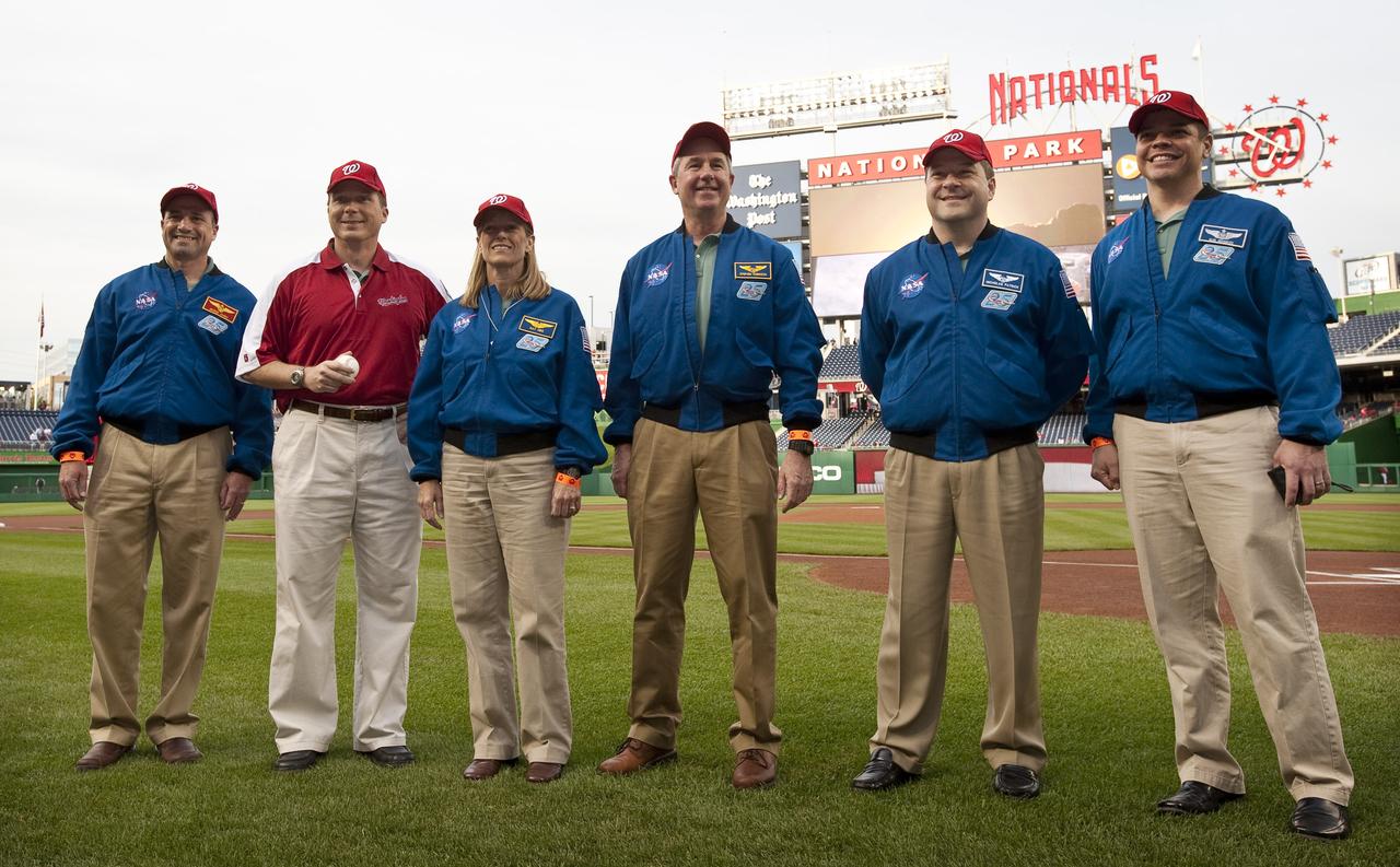
NASA STS-130 crew Commander George Zamka, far left, Pilot Terry Virts, Mission Specialists Kathryn Hire, Stephen Robinson, Nicholas Patrick and Robert Behnken, far right, pose for pictures on the field at Nationals Park, Tuesday, April 20, 2010, in Washington. Photo Credit: (NASA/Carla Cioffi)
Alternately known as a geologist’s paradise and a geologist’s nightmare, Big Bend National Park in southwestern Texas offers a multitude of rock formations. Sparse vegetation makes finding and observing the rocks easy, but they document a complicated geologic history extending back 500 million years. On May 10, 2002, the Enhanced Thematic Mapper Plus on NASA’s Landsat 7 satellite captured this natural-color image of Big Bend National Park. A black line delineates the park perimeter. The arid landscape appears in muted earth tones, some of the darkest hues associated with volcanic structures, especially the Rosillos and Chisos Mountains. Despite its bone-dry appearance, Big Bend National Park is home to some 1,200 plant species, and hosts more kinds of cacti, birds, and bats than any other U.S. national park. Read more: <a href="http://go.nasa.gov/2bzGaZU" rel="nofollow">go.nasa.gov/2bzGaZU</a> Credit: NASA/Landsat7 <b><a href="http://www.nasa.gov/audience/formedia/features/MP_Photo_Guidelines.html" rel="nofollow">NASA image use policy.</a></b> <b><a href="http://www.nasa.gov/centers/goddard/home/index.html" rel="nofollow">NASA Goddard Space Flight Center</a></b> enables NASA’s mission through four scientific endeavors: Earth Science, Heliophysics, Solar System Exploration, and Astrophysics. Goddard plays a leading role in NASA’s accomplishments by contributing compelling scientific knowledge to advance the Agency’s mission. <b>Follow us on <a href="http://twitter.com/NASAGoddardPix" rel="nofollow">Twitter</a></b> <b>Like us on <a href="http://www.facebook.com/pages/Greenbelt-MD/NASA-Goddard/395013845897?ref=tsd" rel="nofollow">Facebook</a></b> <b>Find us on <a href="http://instagrid.me/nasagoddard/?vm=grid" rel="nofollow">Instagram</a></b>
On July 3, 1936, President Franklin Delano Roosevelt stood amidst the crowd in Big Meadows and officially dedicated Shenandoah National Park in Virginia. The Thematic Mapper on the Landsat satellite captured this view of the heart of Shenandoah National Park on October 10, 2010, at the height of the fall “leaf-peeping” season. The orange and brown swath across the image highlights the hilly backbone of the park, where leaves had turned to their fall colors. The 169-kilometer (105-mile) Skyline Drive that meanders across the crest of the ridge is often jammed with tourists in autumn. The park includes more than 518 miles of hiking trails, including more than 100 miles of the Appalachian Trail. The highest peak is Hawksbill Mountain at 4,051 feet (1,235 m), but the most popular with hikers is Old Rag Mountain. A circuitous eight-mile (13 kilometer) trail leads to an exposed, rocky summit 3,291 feet (1,003 meters) above sea level. The 2,200 foot elevation change from base to summit, combined with several rock scrambles, make Old Rag not only the most popular but also the most dangerous hike. Read more: <a href="http://go.nasa.gov/2bRnFxH" rel="nofollow">go.nasa.gov/2bRnFxH</a> Credit: NASA/Landsat5 <b><a href="http://www.nasa.gov/audience/formedia/features/MP_Photo_Guidelines.html" rel="nofollow">NASA image use policy.</a></b> <b><a href="http://www.nasa.gov/centers/goddard/home/index.html" rel="nofollow">NASA Goddard Space Flight Center</a></b> enables NASA’s mission through four scientific endeavors: Earth Science, Heliophysics, Solar System Exploration, and Astrophysics. Goddard plays a leading role in NASA’s accomplishments by contributing compelling scientific knowledge to advance the Agency’s mission. <b>Follow us on <a href="http://twitter.com/NASAGoddardPix" rel="nofollow">Twitter</a></b> <b>Like us on <a href="http://www.facebook.com/pages/Greenbelt-MD/NASA-Goddard/395013845897?ref=tsd" rel="nofollow">Facebook</a></b> <b>Find us on <a href="http://instagrid.me/nasagoddard/?vm=grid" rel="nofollow">Instagram</a></b>
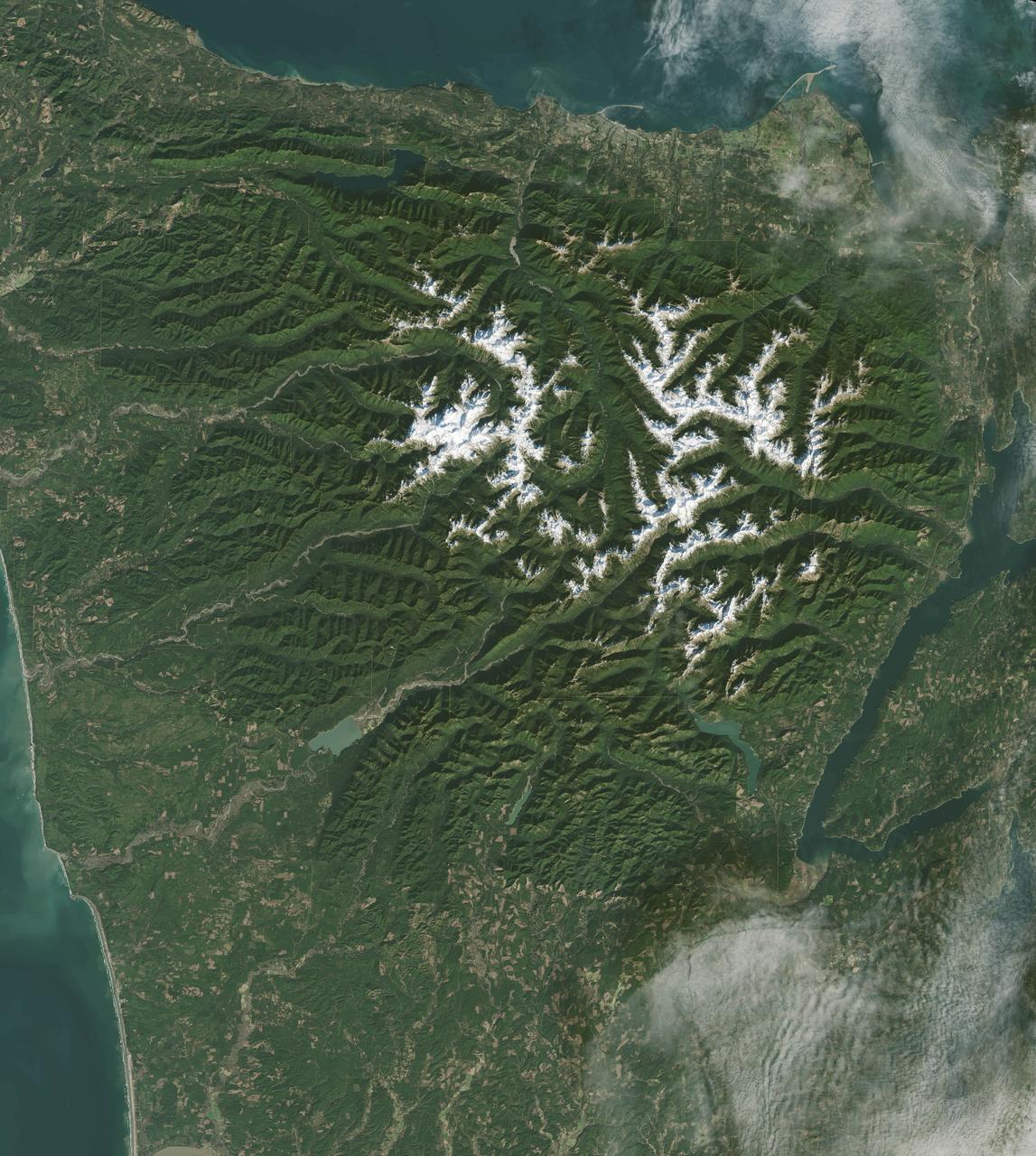
It has to be one of America’s most diverse national park landscapes. If you walked from west to east across Olympic National Park, you would start at the rocky Pacific shoreline, move into rare temperate rainforests and lush river valleys, ascend glaciers and rugged mountain peaks, and then descend into a comparatively dry rain shadow and alpine forest. From the beach to the top of Mount Olympus, you would rise 7,980 feet (2430 meters) above sea level. Situated on the Olympic Peninsula in northwestern Washington, these lands were first set aside as a national monument in 1909 by Theodore Roosevelt. Twenty-nine years later, his cousin Franklin officially established Olympic National Park. International institutions have also made a case for treasuring this land, as the area was declared an International Biosphere Reserve in 1976 and a World Heritage Site in 1981. The park encompasses nearly 923,000 acres of wild lands, including 60 named glaciers, 73 miles of coast, and 3,000 miles of rivers and streams. Read more: <a href="http://go.nasa.gov/2bRmzSJ" rel="nofollow">go.nasa.gov/2bRmzSJ</a> Credit: NASA/Landsat8 <b><a href="http://www.nasa.gov/audience/formedia/features/MP_Photo_Guidelines.html" rel="nofollow">NASA image use policy.</a></b> <b><a href="http://www.nasa.gov/centers/goddard/home/index.html" rel="nofollow">NASA Goddard Space Flight Center</a></b> enables NASA’s mission through four scientific endeavors: Earth Science, Heliophysics, Solar System Exploration, and Astrophysics. Goddard plays a leading role in NASA’s accomplishments by contributing compelling scientific knowledge to advance the Agency’s mission. <b>Follow us on <a href="http://twitter.com/NASAGoddardPix" rel="nofollow">Twitter</a></b> <b>Like us on <a href="http://www.facebook.com/pages/Greenbelt-MD/NASA-Goddard/395013845897?ref=tsd" rel="nofollow">Facebook</a></b> <b>Find us on <a href="http://instagrid.me/nasagoddard/?vm=grid" rel="nofollow">Instagram</a></b>
NASA Kennedy Space Center’s Spaceport Integration and Services organization is leading a restoration project at KARS Park on Hall Road in Merritt Island, Florida. As part of this project, a wavebreak is being created about 20 feet offshore to allow mangroves and other plants to propagate into the gap, providing protection for the shoreline. Shown here is Mark Mercadante, an environmental scientist at Kennedy.
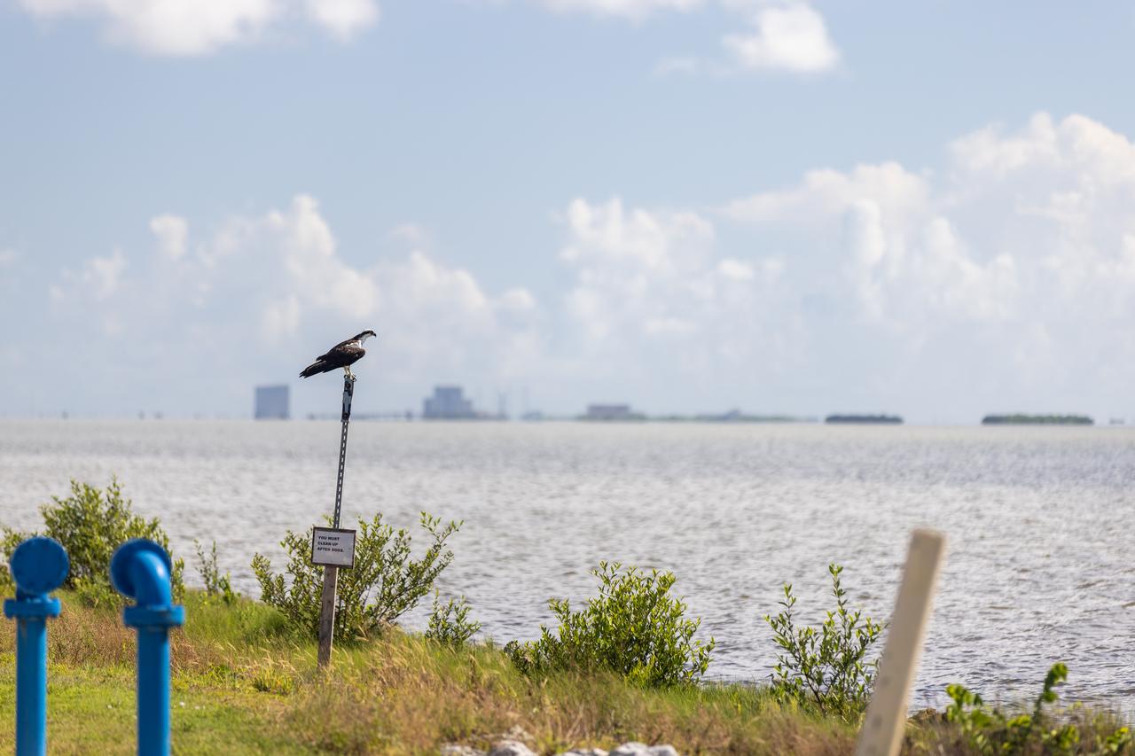
NASA Kennedy Space Center’s Spaceport Integration and Services organization is leading a restoration project at KARS Park on Hall Road in Merritt Island, Florida. As part of this project, a wavebreak is being created about 20 feet offshore to allow mangroves and other plants to propagate into the gap, providing protection for the shoreline. Shown here is an osprey overlooking the water.
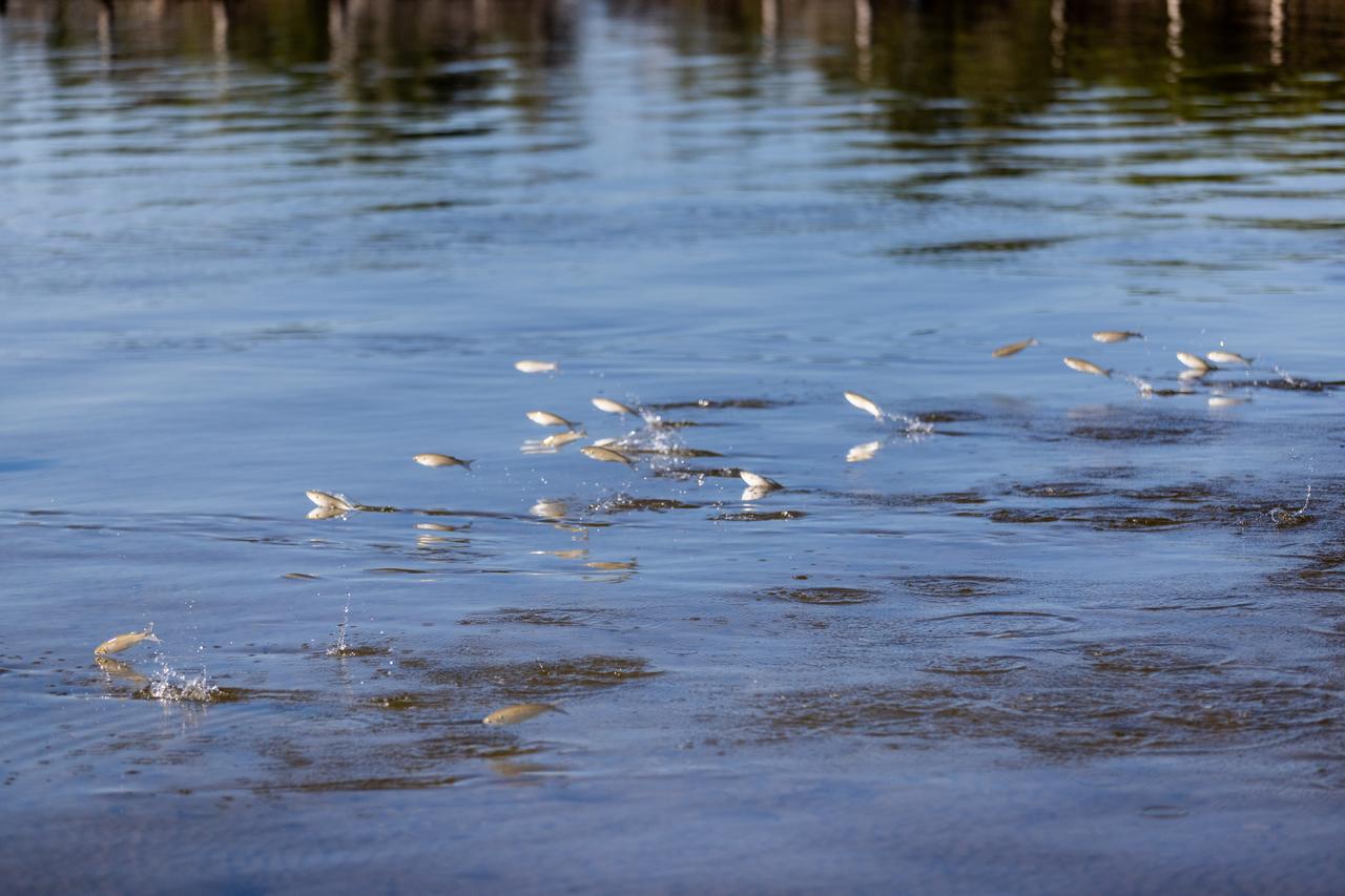
NASA Kennedy Space Center’s Spaceport Integration and Services organization is leading a restoration project at KARS Park on Hall Road in Merritt Island, Florida. As part of this project, a wavebreak is being created about 20 feet offshore to allow mangroves and other plants to propagate into the gap, providing protection for the shoreline. Shown here are mullet swimming at the location.
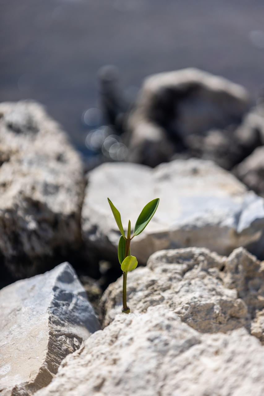
NASA Kennedy Space Center’s Spaceport Integration and Services organization is leading a restoration project at KARS Park on Hall Road in Merritt Island, Florida. As part of this project, a wavebreak is being created about 20 feet offshore to allow mangroves and other plants to propagate into the gap, providing protection for the shoreline. Shown in this photo is red mangrove starting to grow in the restoration area.
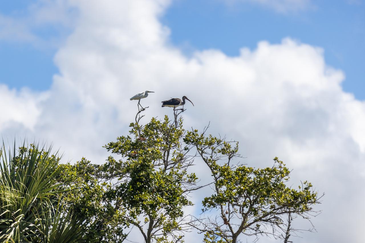
NASA Kennedy Space Center’s Spaceport Integration and Services organization is leading a restoration project at KARS Park on Hall Road in Merritt Island, Florida. As part of this project, a wavebreak is being created about 20 feet offshore to allow mangroves and other plants to propagate into the gap, providing protection for the shoreline. Show here in a tree are a snowy egret, left, and a limpkin.
NASA Kennedy Space Center’s Spaceport Integration and Services organization is leading a restoration project at KARS Park on Hall Road in Merritt Island, Florida. As part of this project, a wavebreak is being created about 20 feet offshore to allow mangroves and other plants to propagate into the gap, providing protection for the shoreline. Shown here is shoalgrass taking hold in the restoration area.
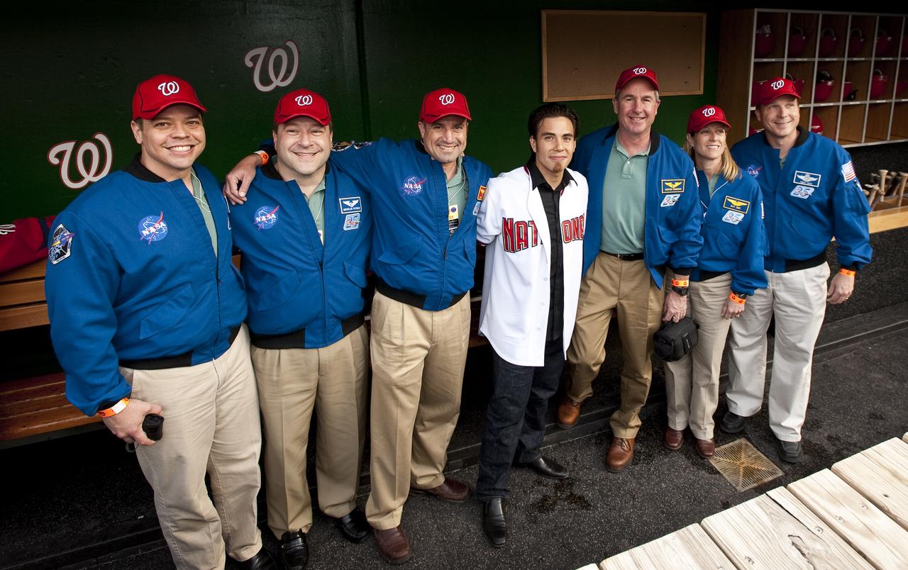
NASA STS-130 crew pose with Winter Olympics medalist Apolo Ohno, center, at Nationals Park, Tuesday, April 20, 2010, in Washington. Pictured from left are STS-130 Mission Specialist Robert Benhken, Mission Specialist Nicholas Patrick, Commander George Zamka, Apolo Ohno, Mission Specialist Stephen Robinson, Mission Specialist Kathryn Hire and Pilot Terry Virts. Photo Credit: (NASA/Carla Cioffi)
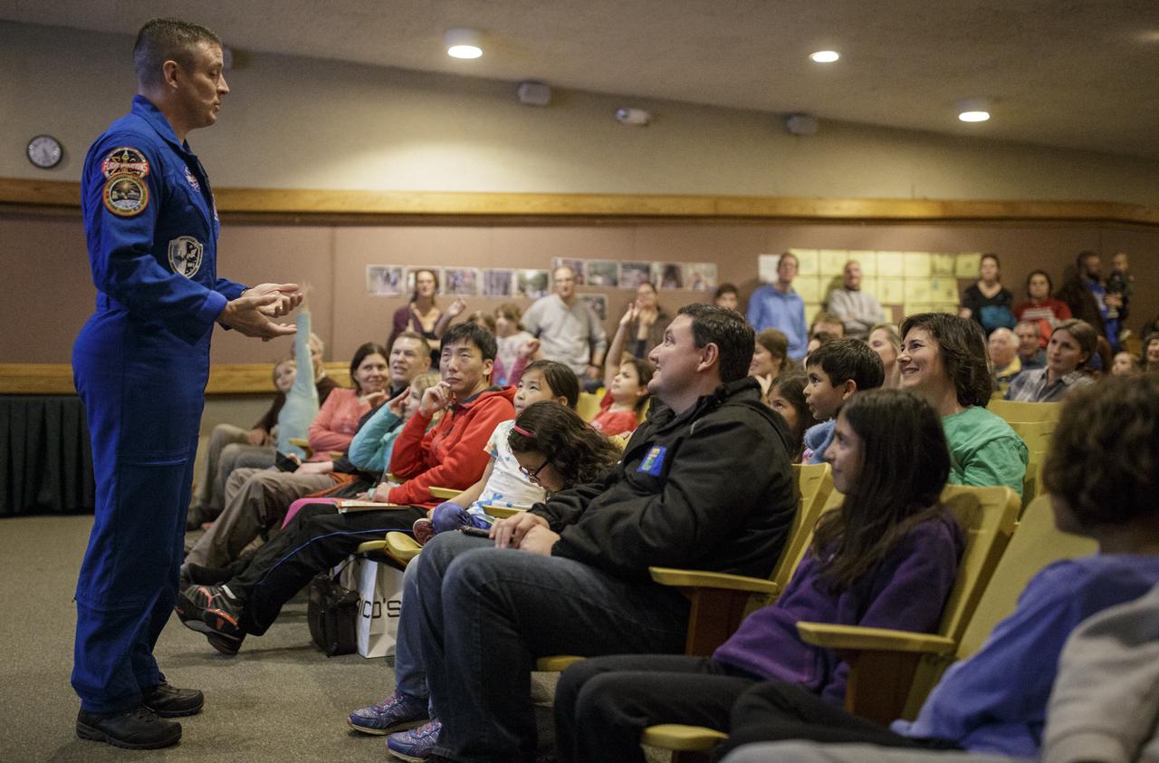
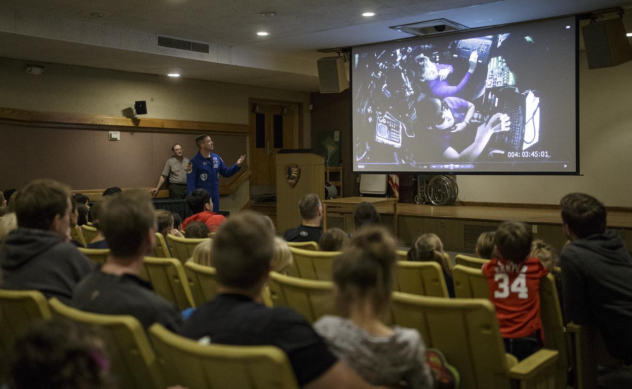
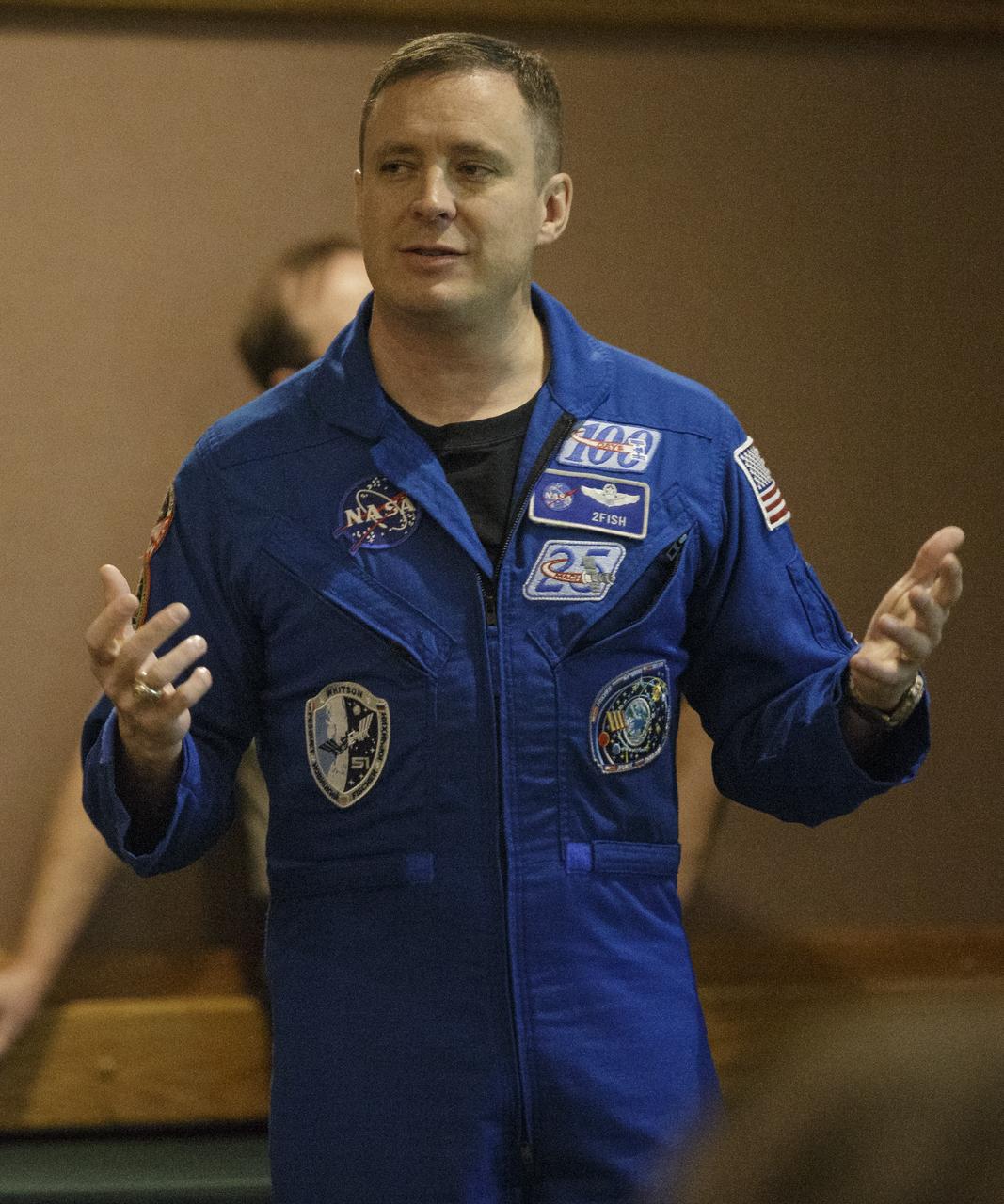
NASA astronaut Jack Fischer answers a question from the audience, Saturday, Nov. 4, 2017 at the Rock Creek Park Nature Center and Planetarium in Washington, DC. During his 136 day mission aboard the ISS, Fischer conducted two spacewalks and hundreds of scientific experiments. Photo Credit: (NASA/Joel Kowsky)

NASA's Marshall Space Flight Center showcased it's various projects for the public in Huntsville, Alabama's Big Spring Park. Exhibits were displayed by all of the various directorates of the Center with employee volunteers explaining all aspects of their projects. Adding to the festivities was the attendance of retired NASA astronaut Robert "Hoot" Gibson. A view of the canal running through the park showing a small portion of the crowd attending NASA Day in the Park.
Colorado’s Rocky Mountain National Park presents a very different landscape in summertime than in wintertime. Snow retreats and gives way to blooms of wildflowers, even at high elevations. Roads and trails become accessible, allowing visitors easier access to the rugged mountain trails and vistas. The diversity of the park’s landscape is visible in this image, acquired on September 20, 2014, with the Operational Land Imager (OLI) on the Landsat 8 satellite. Except for a few patches, seasonal snow is mostly gone. Even the “Never Summer Mountains”—a range along the park’s northwest border known to receive snow any time of year—appears to be temporarily snow-free. Read more: <a href="http://go.nasa.gov/29Rmz4Y" rel="nofollow">go.nasa.gov/29Rmz4Y</a> Credit: NASA/Landsat8 <b><a href="http://www.nasa.gov/audience/formedia/features/MP_Photo_Guidelines.html" rel="nofollow">NASA image use policy.</a></b> <b><a href="http://www.nasa.gov/centers/goddard/home/index.html" rel="nofollow">NASA Goddard Space Flight Center</a></b> enables NASA’s mission through four scientific endeavors: Earth Science, Heliophysics, Solar System Exploration, and Astrophysics. Goddard plays a leading role in NASA’s accomplishments by contributing compelling scientific knowledge to advance the Agency’s mission. <b>Follow us on <a href="http://twitter.com/NASAGoddardPix" rel="nofollow">Twitter</a></b> <b>Like us on <a href="http://www.facebook.com/pages/Greenbelt-MD/NASA-Goddard/395013845897?ref=tsd" rel="nofollow">Facebook</a></b> <b>Find us on <a href="http://instagrid.me/nasagoddard/?vm=grid" rel="nofollow">Instagram</a></b>
NASA in the Park on June 16 in Huntsville featured more than 60 exhibits and demonstrations by NASA experts, as well as performances by Marshall musicians, educational opportunities, games and hands-on activities for all ages. Brian Mitchell of Marshall’s Planetary Mission Planning Office gives attendees an opportunity to learn about Science missions managed by his office.
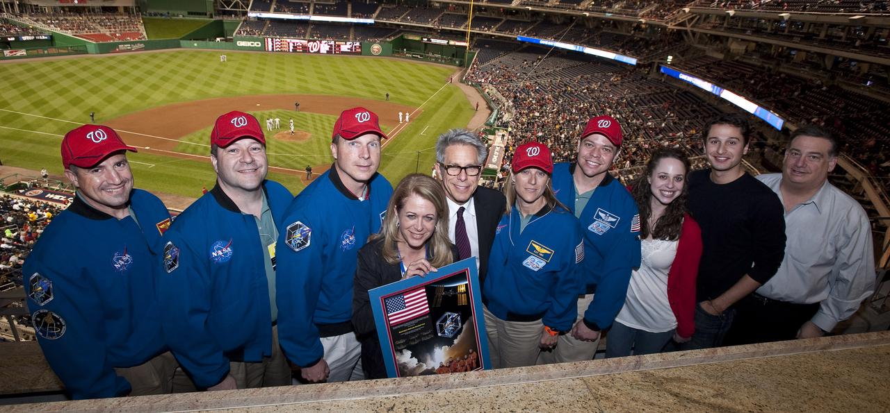
The crew of STS-130 present the principal owner of the Washington Nationals, Debra Lerner Cohen (holding montage) with a montage of their mission, Tuesday, April 20, 2010 at Nationals Park in Washington. From left are seen Commander George Zamka, Mission Specialist Nicholas Patrick, Pilot Terry Virts, Debra Lerner Cohen, Edward Cohen, Mission Specialist Kathryn Hire, Mission Specialist Robert Behnken, Lauren Lerner, Jacob Lerner and Alan Gottlieb. Photo Credit: (NASA/Carla Cioffi)
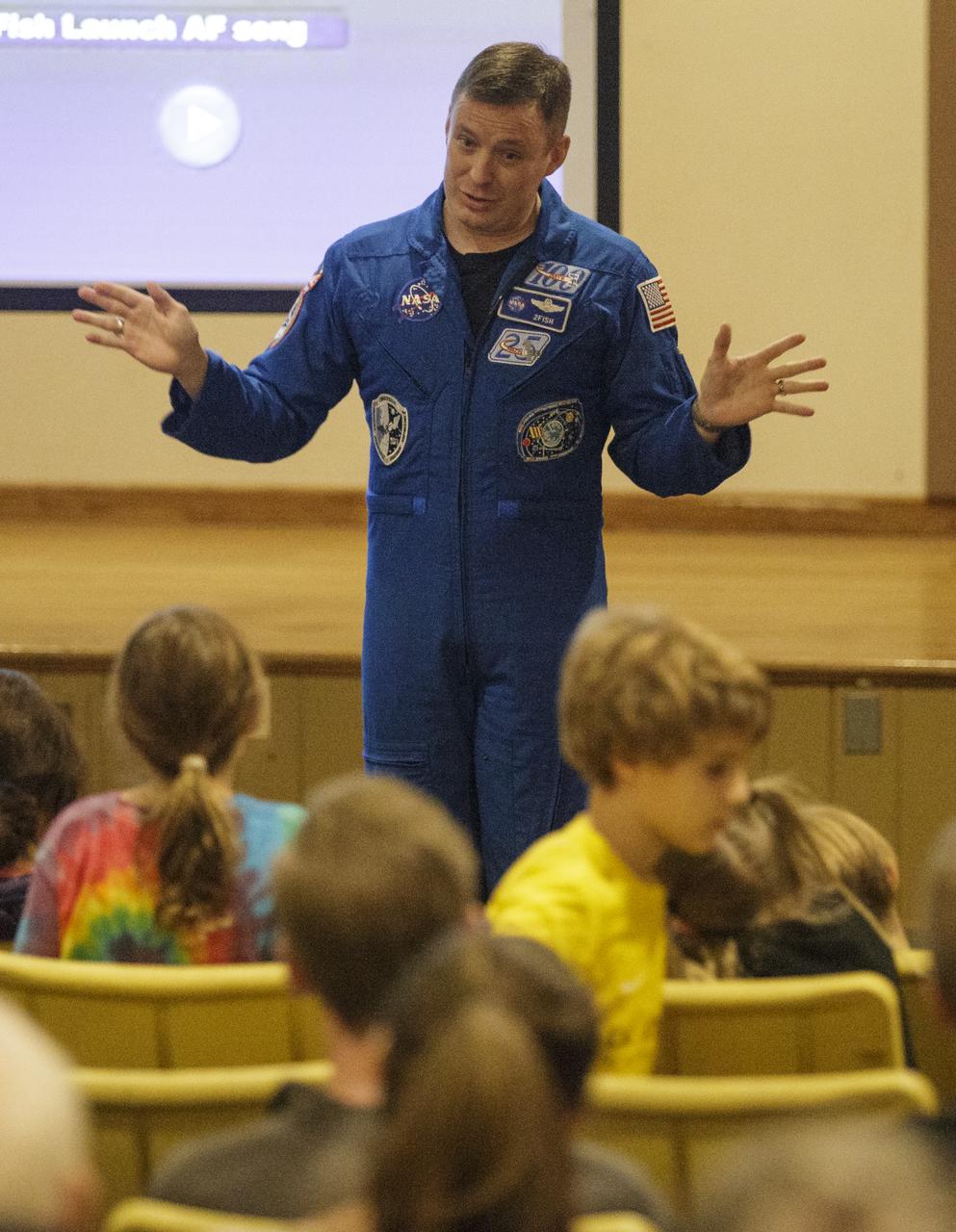
NASA astronaut Jack Fischer speaks about his time aboard the International Space Station as part of Expeditions 51 and 52, Saturday, Nov. 4, 2017 at the Rock Creek Park Nature Center and Planetarium in Washington, DC. During his 136 day mission aboard the ISS, Fischer conducted two spacewalks and hundreds of scientific experiments. Photo Credit: (NASA/Joel Kowsky)
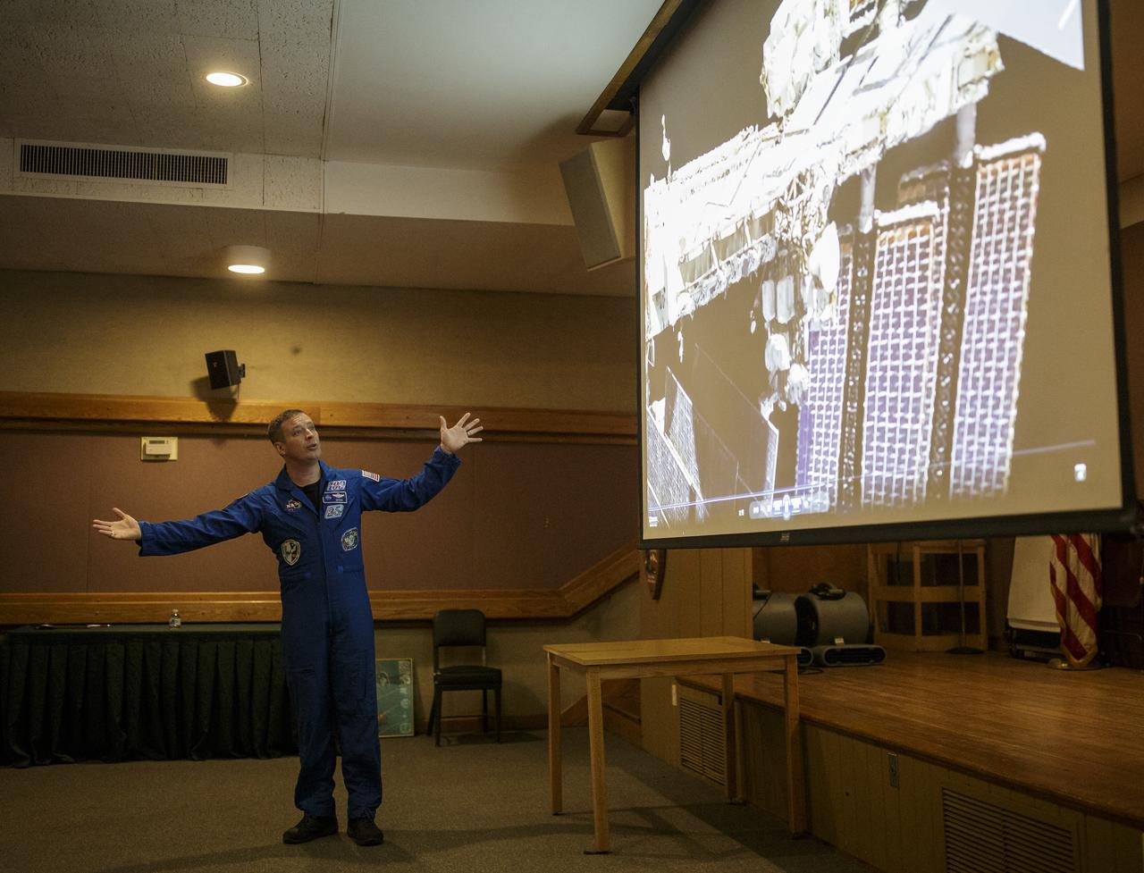
NASA astronaut Jack Fischer speaks about his time aboard the International Space Station as part of Expeditions 51 and 52, Saturday, Nov. 4, 2017 at the Rock Creek Park Nature Center and Planetarium in Washington, DC. During his 136 day mission aboard the ISS, Fischer conducted two spacewalks and hundreds of scientific experiments. Photo Credit: (NASA/Joel Kowsky)
NASA astronaut Jack Fischer speaks about his time aboard the International Space Station as part of Expeditions 51 and 52, Saturday, Nov. 4, 2017 at the Rock Creek Park Nature Center and Planetarium in Washington, DC. During his 136 day mission aboard the ISS, Fischer conducted two spacewalks and hundreds of scientific experiments. Photo Credit: (NASA/Joel Kowsky)
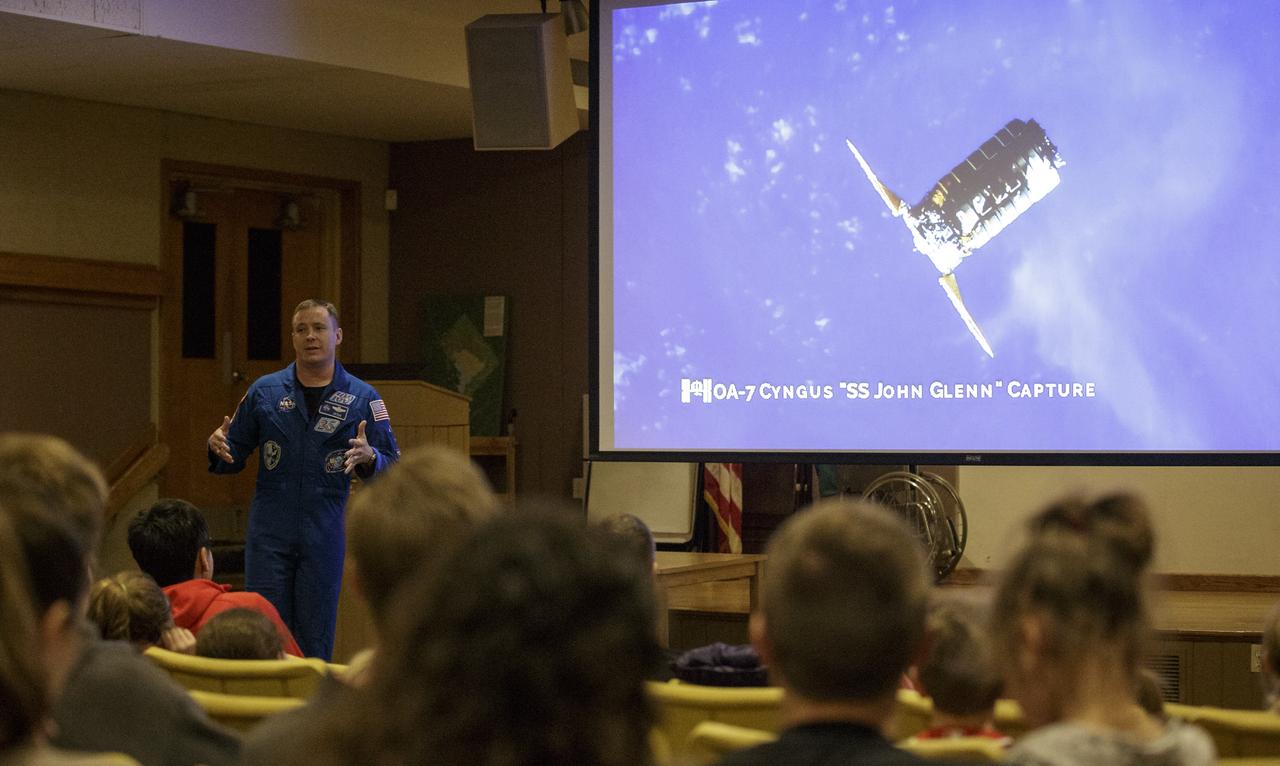
NASA astronaut Jack Fischer speaks about his time aboard the International Space Station as part of Expeditions 51 and 52, Saturday, Nov. 4, 2017 at the Rock Creek Park Nature Center and Planetarium in Washington, DC. During his 136 day mission aboard the ISS, Fischer conducted two spacewalks and hundreds of scientific experiments. Photo Credit: (NASA/Joel Kowsky)
NASA astronaut Jack Fischer speaks about his time aboard the International Space Station as part of Expeditions 51 and 52, Saturday, Nov. 4, 2017 at the Rock Creek Park Nature Center and Planetarium in Washington, DC. During his 136 day mission aboard the ISS, Fischer conducted two spacewalks and hundreds of scientific experiments. Photo Credit: (NASA/Joel Kowsky)
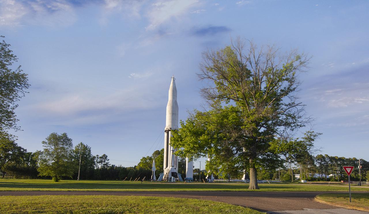
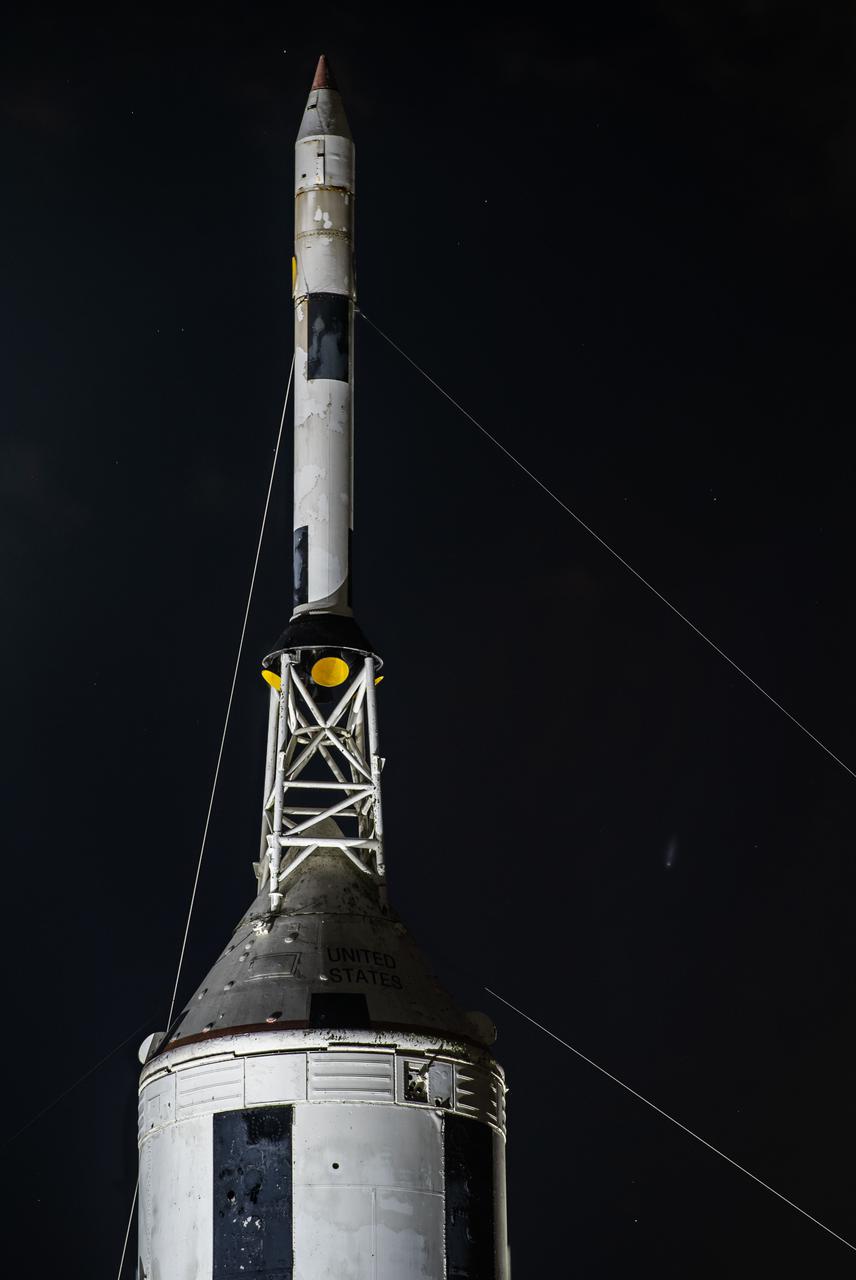
Marshall Space Flight Center’s Rocket Park, located on Redstone Arsenal, stands as a living testament to the spirit of cooperation that continues between the U.S. Army and NASA.
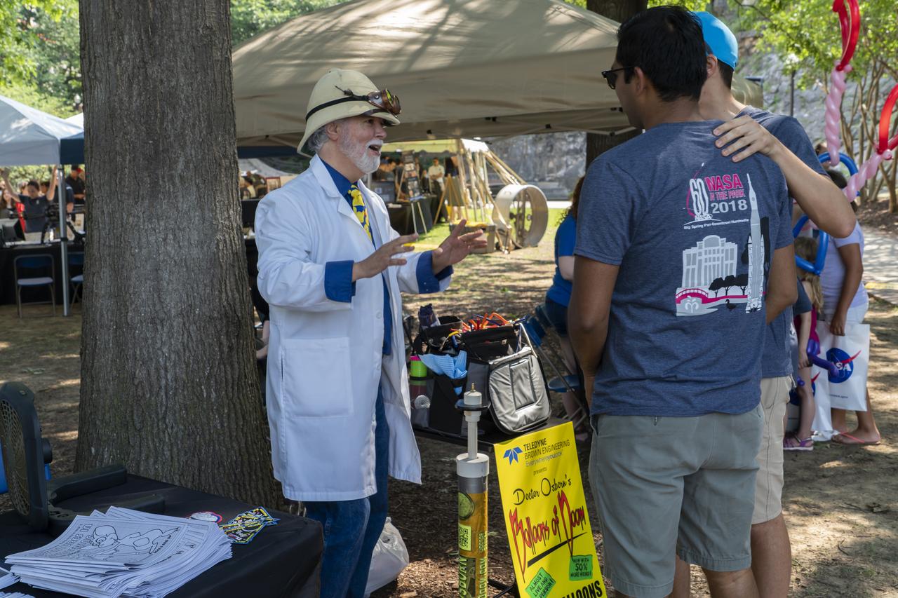
NASA's Marshall Space Flight Center showcased it's various projects for the public in Huntsville, Alabama's Big Spring Park. Exhibits were displayed by all of the various directorates of the Center with employee volunteers explaining all aspects of their projects. Adding to the festivities was the attendance of retired NASA astronaut Robert "Hoot" Gibson. Dr. Osborn, magician and balloon wizard, greets volunteers for NASA in the Park.

NASA's Marshall Space Flight Center showcased it's various projects for the public in Huntsville, Alabama's Big Spring Park. Exhibits were displayed by all of the various directorates of the Center with employee volunteers explaining all aspects of their projects. Adding to the festivities was the attendance of retired NASA astronaut Robert "Hoot" Gibson. “Hoot†Gibson reminisces about his history as an astronaut and takes questions from the audience at NASA Day in the Park.
NASA's Marshall Space Flight Center showcased it's various projects for the public in Huntsville, Alabama's Big Spring Park. Exhibits were displayed by all of the various directorates of the Center with employee volunteers explaining all aspects of their projects. Adding to the festivities was the attendance of retired NASA astronaut Robert "Hoot" Gibson. “Hoot†Gibson reminisces about his history as an astronaut and takes questions from the audience at NASA Day in the Park.

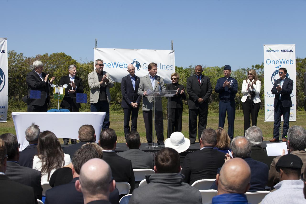
Brian Holz, CEO of OneWeb Satellites, speaks during the groundbreaking ceremony at Kennedy's Exploration Park for OneWeb. The company, in partnership with Airbus, is building a 150,000-square-foot factory to manufacture satellites that will connect all areas of the world to the Internet wirelessly. Photo credit: NASA/Kim Shiflett
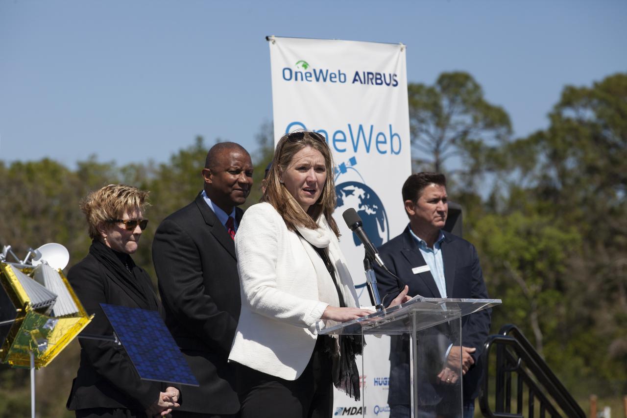
Cissy Procter, executive director of the Florida Department of Economic Activity, speaks during the groundbreaking ceremony at Kennedy's Exploration Park for OneWeb. The company, in partnership with Airbus, is building a 150,000-square-foot factory to manufacture satellites that will connect all areas of the world to the Internet wirelessly. Photo credit: NASA/Kim Shiflett
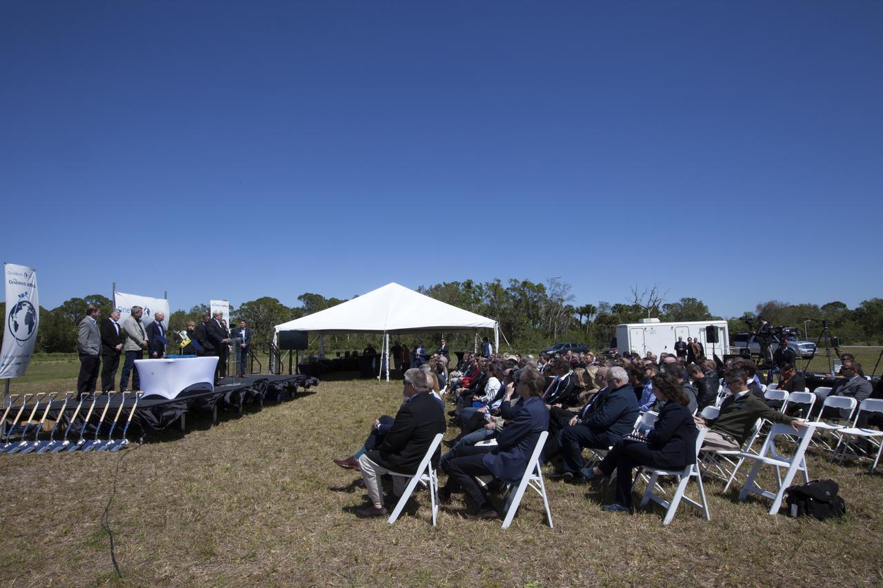
Jim Kuzma, COO of Space Florida, speaks during the groundbreaking ceremony at Kennedy's Exploration Park for OneWeb. The company, in partnership with Airbus, is building a 150,000-square-foot factory to manufacture satellites that will connect all areas of the world to the Internet wirelessly. Photo credit: NASA/Kim Shiflett
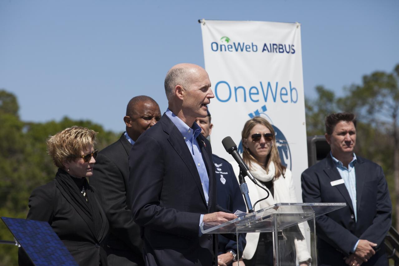
Florida Governor Rick Scott speaks during the groundbreaking ceremony at Kennedy's Exploration Park for OneWeb. The company, in partnership with Airbus, is building a 150,000-square-foot factory to manufacture satellites that will connect all areas of the world to the Internet wirelessly. Photo credit: NASA/Kim Shiflett
Comet NEOWISE passing over the Little Joe II rocket at NASA Johnson Space Center’s Rocket Park on July 22nd, 2020.
Naked summits alternate with forested lowlands in Yosemite Valley, part of California’s Yosemite National Park. During the Pleistocene Ice Age, glaciers sculpted the underlying rocks in this region, leaving behind canyons, waterfalls, rugged peaks, and granite domes. As the ice retreated, forests grew, but forests only extend as high as 2,900 meters (9,500 feet) above sea level. Above the tree line are rocky landscapes with sparse alpine vegetation. So from the sky, Yosemite Valley appears as a light-and-dark patchwork of forest, rock, and shadow. The Enhanced Thematic Mapper Plus on NASA’s Landsat 7 satellite captured this true-color image of part of Yosemite Valley on August 18, 2001. The valley runs roughly east-west, and tall granite peaks lining the valley’s southern side cast long shadows across the valley floor. On the valley’s northern side, steep slopes appear almost white. Along the valley floor, roadways form narrow, meandering lines of off-white, past parking lots, buildings, and meadows. On the north side of Yosemite Valley is El Capitan. Shooting straight up more than 915 meters (3,000 feet) above the valley floor, El Capitan is considered the largest granite monolith in the world. This granite monolith sits across the valley from Bridalveil Fall, one of the valley’s most prominent waterfalls. Read more: <a href="http://go.nasa.gov/2bzGo3d" rel="nofollow">go.nasa.gov/2bzGo3d</a> Credit: NASA/Landsat7 <b><a href="http://www.nasa.gov/audience/formedia/features/MP_Photo_Guidelines.html" rel="nofollow">NASA image use policy.</a></b> <b><a href="http://www.nasa.gov/centers/goddard/home/index.html" rel="nofollow">NASA Goddard Space Flight Center</a></b> enables NASA’s mission through four scientific endeavors: Earth Science, Heliophysics, Solar System Exploration, and Astrophysics. Goddard plays a leading role in NASA’s accomplishments by contributing compelling scientific knowledge to advance the Agency’s mission. <b>Follow us on <a href="http://twitter.com/NASAGoddardPix" rel="nofollow">Twitter</a></b> <b>Like us on <a href="http://www.facebook.com/pages/Greenbelt-MD/NASA-Goddard/395013845897?ref=tsd" rel="nofollow">Facebook</a></b> <b>Find us on <a href="http://instagrid.me/nasagoddard/?vm=grid" rel="nofollow">Instagram</a></b>
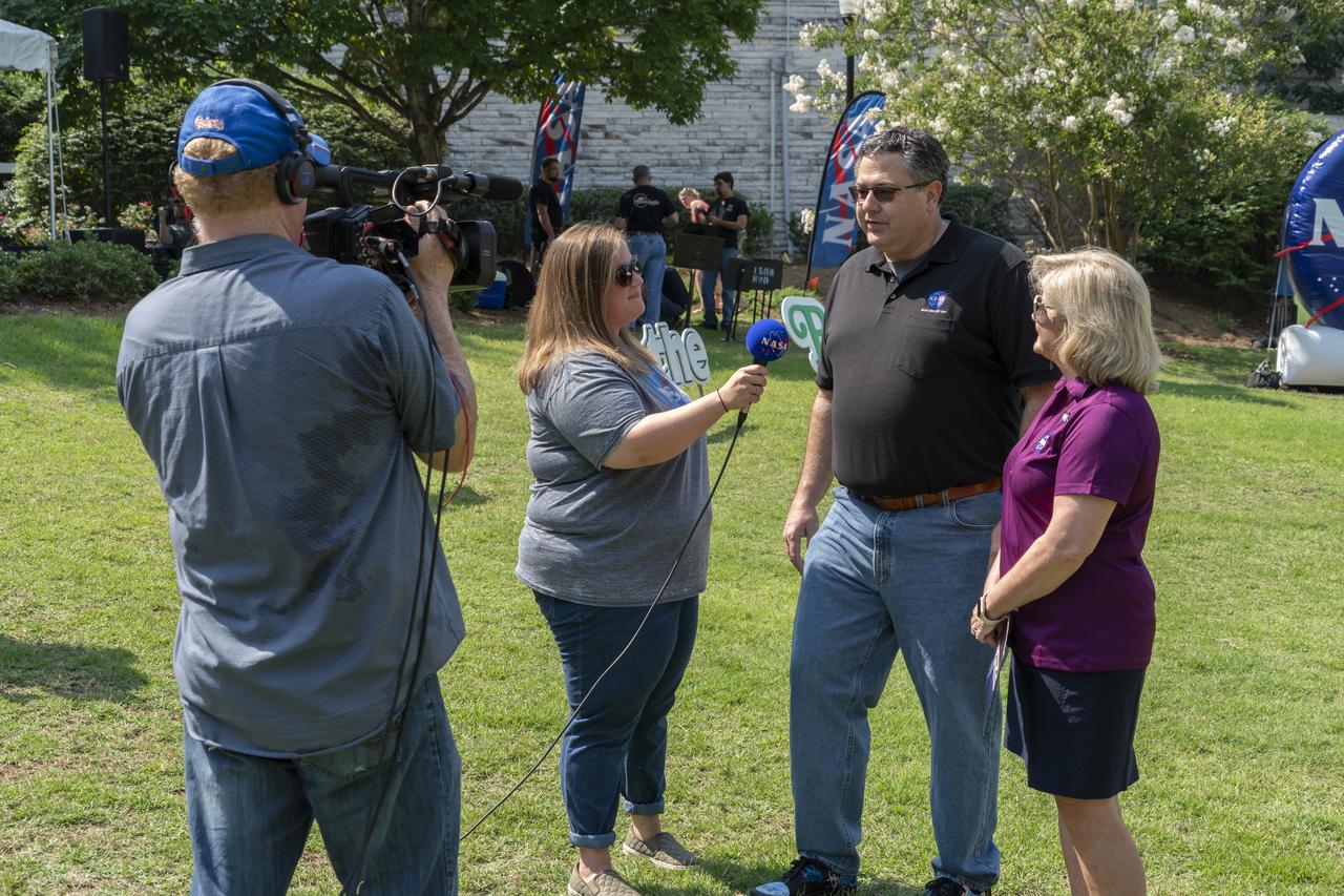
NASA's Marshall Space Flight Center showcased it's various projects for the public in Huntsville, Alabama's Big Spring Park. Exhibits were displayed by all of the various directorates of the Center with employee volunteers explaining all aspects of their projects. Adding to the festivities was the attendance of retired NASA astronaut Robert "Hoot" Gibson. NASA Public Affairs employee Jena Row interviews retired NASA Astronaut Robert “Hoot†Gibson at NASA Day in the Park.
NASA's Marshall Space Flight Center showcased it's various projects for the public in Huntsville, Alabama's Big Spring Park. Exhibits were displayed by all of the various directorates of the Center with employee volunteers explaining all aspects of their projects. Adding to the festivities was the attendance of retired NASA astronaut Robert "Hoot" Gibson. U.S. Space and Rocket Center volunteers greet visitors to NASA in the Park.
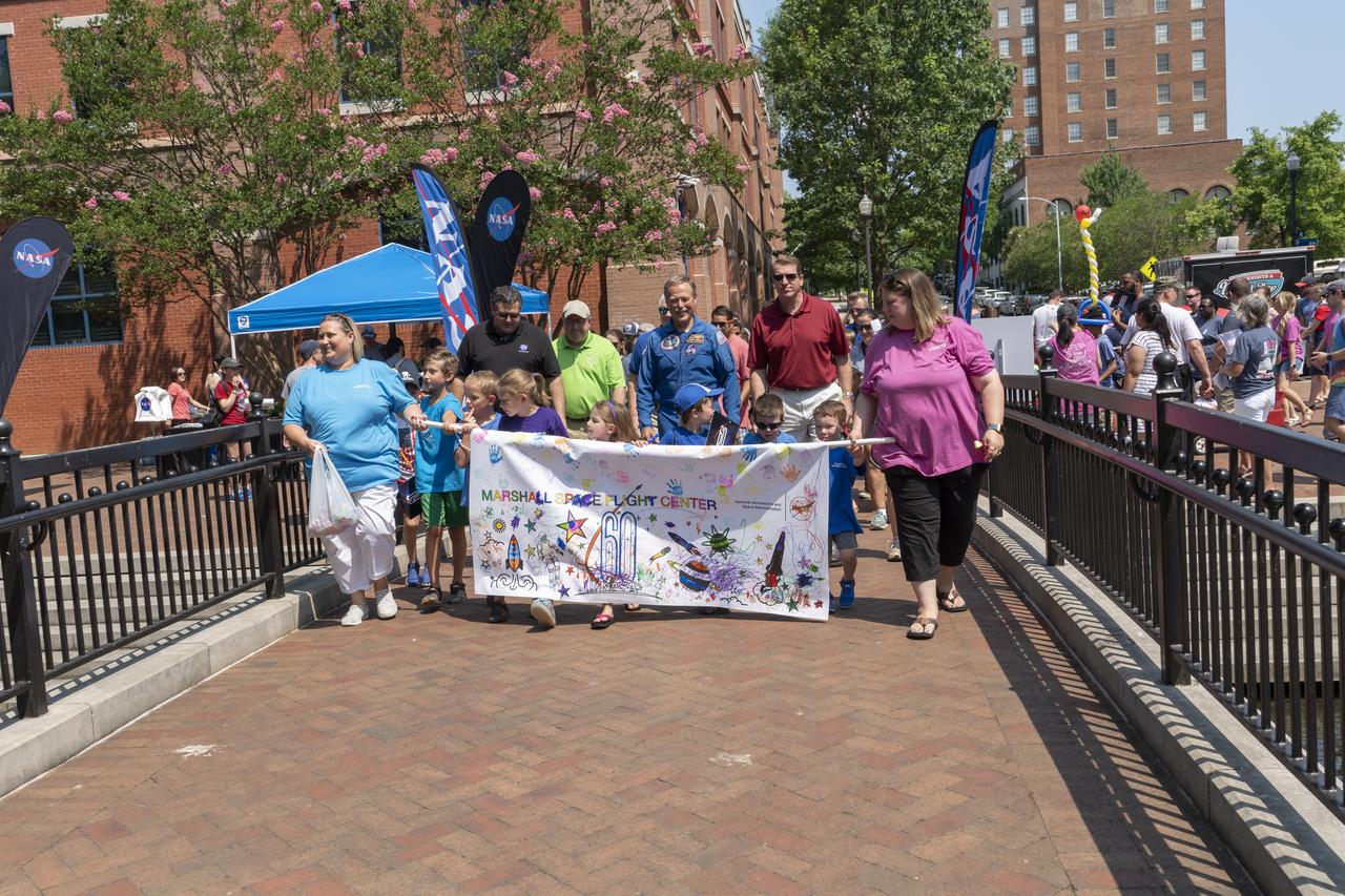
NASA's Marshall Space Flight Center showcased it's various projects for the public in Huntsville, Alabama's Big Spring Park. Exhibits were displayed by all of the various directorates of the Center with employee volunteers explaining all aspects of their projects. Adding to the festivities was the attendance of retired NASA astronaut Robert "Hoot" Gibson. The children’s parade at NASA Day in the Park is led by center director Todd May, Chad Emerson, and Retired astronaut Robert “Hoot†Gibson.
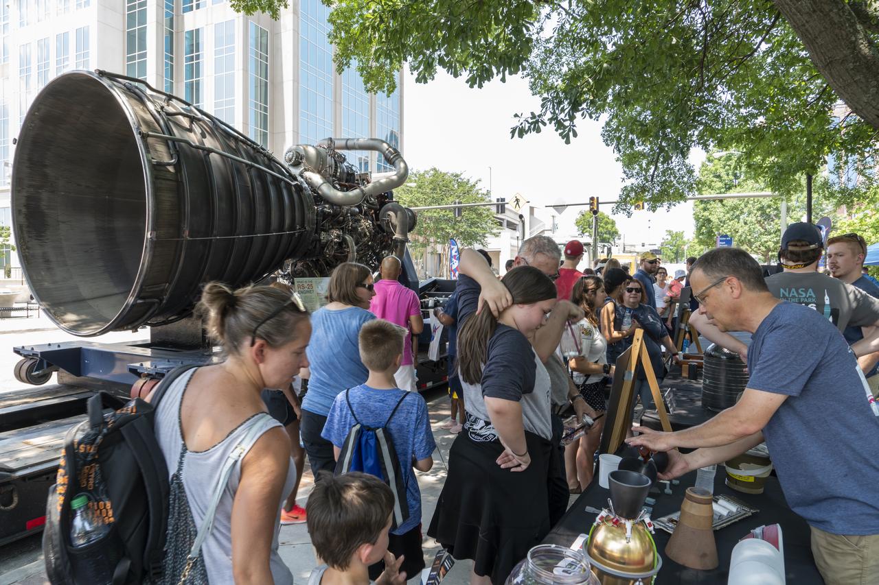
NASA's Marshall Space Flight Center showcased it's various projects for the public in Huntsville, Alabama's Big Spring Park. Exhibits were displayed by all of the various directorates of the Center with employee volunteers explaining all aspects of their projects. Adding to the festivities was the attendance of retired NASA astronaut Robert "Hoot" Gibson. With a RS-25 engine in the background, NASA employees and volunteers demonstrate NASA technology at NASA in the Park.
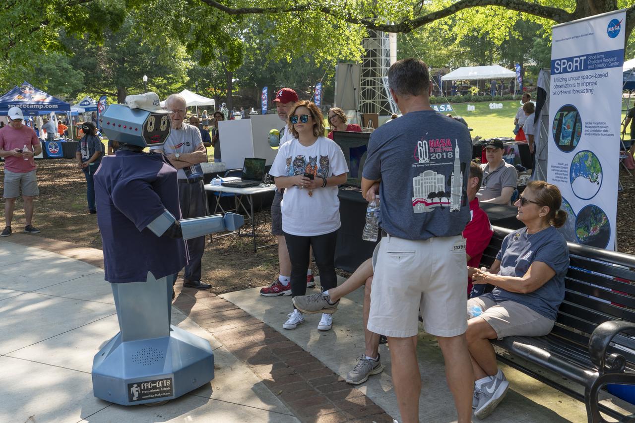
NASA's Marshall Space Flight Center showcased it's various projects for the public in Huntsville, Alabama's Big Spring Park. Exhibits were displayed by all of the various directorates of the Center with employee volunteers explaining all aspects of their projects. Adding to the festivities was the attendance of retired NASA astronaut Robert "Hoot" Gibson. Oscar the Robot greets volunteers at NASA Day in the Park.

NASA's Marshall Space Flight Center showcased it's various projects for the public in Huntsville, Alabama's Big Spring Park. Exhibits were displayed by all of the various directorates of the Center with employee volunteers explaining all aspects of their projects. Adding to the festivities was the attendance of retired NASA astronaut Robert "Hoot" Gibson. Northrup Grumman employees fire a tethered miniature rocket at NASA Day in the Park.
NASA's Marshall Space Flight Center showcased it's various projects for the public in Huntsville, Alabama's Big Spring Park. Exhibits were displayed by all of the various directorates of the Center with employee volunteers explaining all aspects of their projects. Adding to the festivities was the attendance of retired NASA astronaut Robert "Hoot" Gibson. Huntsville’s Grissom High School students demonstrate their robot at NASA Day in the Park.
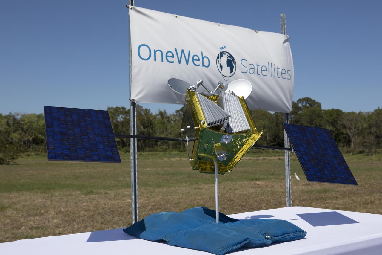
A model of a OneWeb satellite like those the company will build to will connect all areas of the world to the Internet wirelessly. The company plans to launch 2,000 of the satellites as part of its constellation. The satellites will be built at a new factory at Exploration Park at NASA's Kennedy Space Center. The company held a groundbreaking ceremony for the factory. Photo credit: NASA/Kim Shiflett
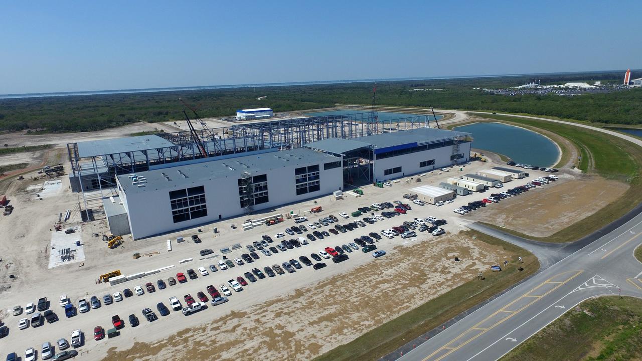
Construction is progressing on Blue Origin's 750,000-square-foot facility being built at Exploration Park on NASA Kennedy Space Center property in Florida. Blue Origin will use the factory to manufacture its two-stage super-heavy-lift New Glenn launch vehicle and launch the vehicles from Space Launch Complex 46 at Cape Canaveral Air Force Station.
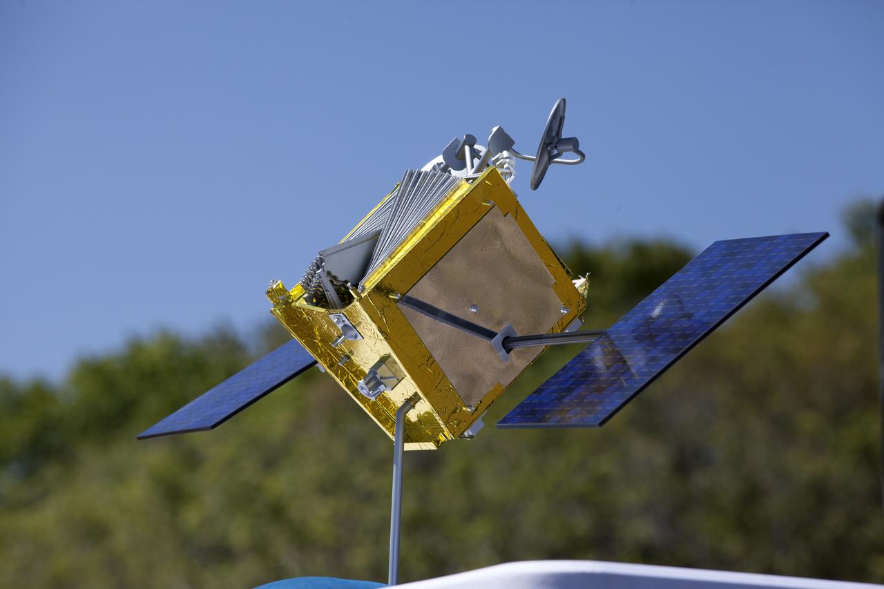
A model of a OneWeb satellite like those the company will build to will connect all areas of the world to the Internet wirelessly. The company plans to launch 2,000 of the satellites as part of its constellation. The satellites will be built at a new factory at Exploration Park at NASA's Kennedy Space Center. The company held a groundbreaking ceremony for the factory. Photo credit: NASA/Kim Shiflett
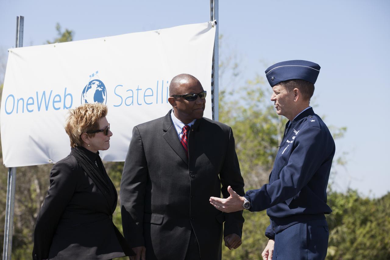
Lynda Weatherman, president and CEO of the Economic Development Council of the Space Coast, talks with Kelvin Manning, associate director of NASA's Kennedy Space Center, and Gen. Wayne Monteith, commander of the 45th Space Wing of the U.S. Air Force, prior to a groundbreaking ceremony at Kennedy's Exploration Park for OneWeb. The company, in partnership with Airbus, is building a 150,000-square-foot factory to manufacture satellites that will connect all areas of the world to the Internet wirelessly. Photo credit: NASA/Kim Shiflett

Grinding glaciers and granite peaks mingle in Chile’s Torres del Paine National Park. The Advanced Land Imager (ALI) on NASA’s Earth Observing-1 (EO-1) satellite captured this summertime image of the park on January 21, 2013. This image shows just a portion of the park, including Grey Glacier and the mountain range of Cordillera del Paine. The rivers of glacial ice in Torres del Paine National Park grind over bedrock, turning some of that rock to dust. Many of the glaciers terminate in freshwater lakes, which are rich with glacial flour that colors them brown to turquoise. Skinny rivers connect some of the lakes to each other (image upper and lower right). Cordillera del Paine rises between some of the wide glacial valleys. The compact mountain range is a combination of soaring peaks and small glaciers, most notably the Torres del Paine (Towers of Paine), three closely spaced peaks emblematic of the mountain range and the larger park. By human standards, the mountains of Cordillera del Paine are quite old. But compared to the Rocky Mountains (70 million years old), and the Appalachians (about 480 million years), the Cordillera del Paine are very young—only about 12 million years old. A study published in 2008 described how scientists used zircon crystals to estimate the age of Cordillera del Paine. The authors concluded that the mountain range was built in three pulses, creating a granite laccolith, or dome-shaped feature, more than 2,000 meters (7,000 feet) thick. NASA Earth Observatory image created by Jesse Allen and Robert Simmon, using Advanced Land Imager data from the NASA EO-1 team. Caption by Michon Scott. Instrument: EO-1 - ALI View more info: <a href="http://earthobservatory.nasa.gov/IOTD/view.php?id=80266" rel="nofollow">earthobservatory.nasa.gov/IOTD/view.php?id=80266</a> Credit: <b><a href="http://www.earthobservatory.nasa.gov/" rel="nofollow"> NASA Earth Observatory</a></b> <b><a href="http://www.nasa.gov/audience/formedia/features/MP_Photo_Guidelines.html" rel="nofollow">NASA image use policy.</a></b> <b><a href="http://www.nasa.gov/centers/goddard/home/index.html" rel="nofollow">NASA Goddard Space Flight Center</a></b> enables NASA’s mission through four scientific endeavors: Earth Science, Heliophysics, Solar System Exploration, and Astrophysics. Goddard plays a leading role in NASA’s accomplishments by contributing compelling scientific knowledge to advance the Agency’s mission. <b>Follow us on <a href="http://twitter.com/NASA_GoddardPix" rel="nofollow">Twitter</a></b> <b>Like us on <a href="http://www.facebook.com/pages/Greenbelt-MD/NASA-Goddard/395013845897?ref=tsd" rel="nofollow">Facebook</a></b> <b>Find us on <a href="http://instagrid.me/nasagoddard/?vm=grid" rel="nofollow">Instagram</a></b>
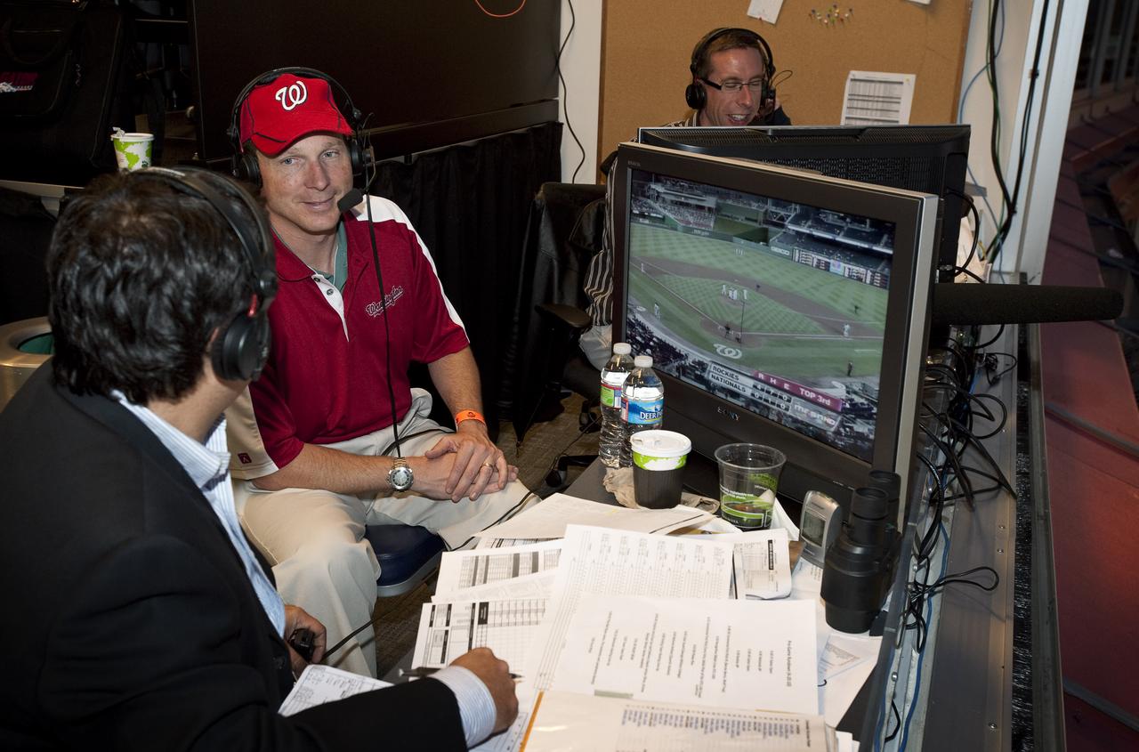
NASA STS-130 Pilot Terry Virts, center, is interviewed by Washington Nationals radio broadcasters Charlie Slowes, right, and David Jageler on Tuesday, April 20, 2010, in Washington. Photo Credit: (NASA/Carla Cioffi)
NASA's Marshall Space Flight Center showcased it's various projects for the public in Huntsville, Alabama's Big Spring Park. Exhibits were displayed by all of the various directorates of the Center with employee volunteers explaining all aspects of their projects. Adding to the festivities was the attendance of retired NASA astronaut Robert "Hoot" Gibson.
NASA's Marshall Space Flight Center showcased it's various projects for the public in Huntsville, Alabama's Big Spring Park. Exhibits were displayed by all of the various directorates of the Center with employee volunteers explaining all aspects of their projects. Adding to the festivities was the attendance of retired NASA astronaut Robert "Hoot" Gibson.
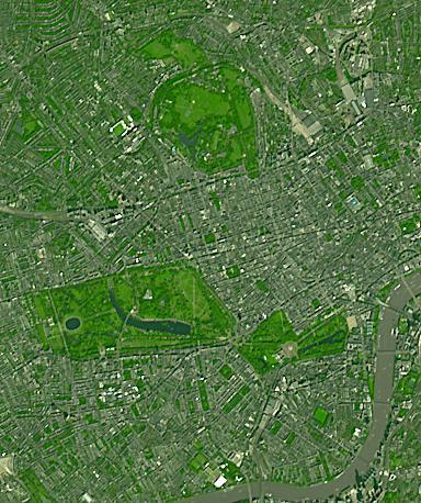
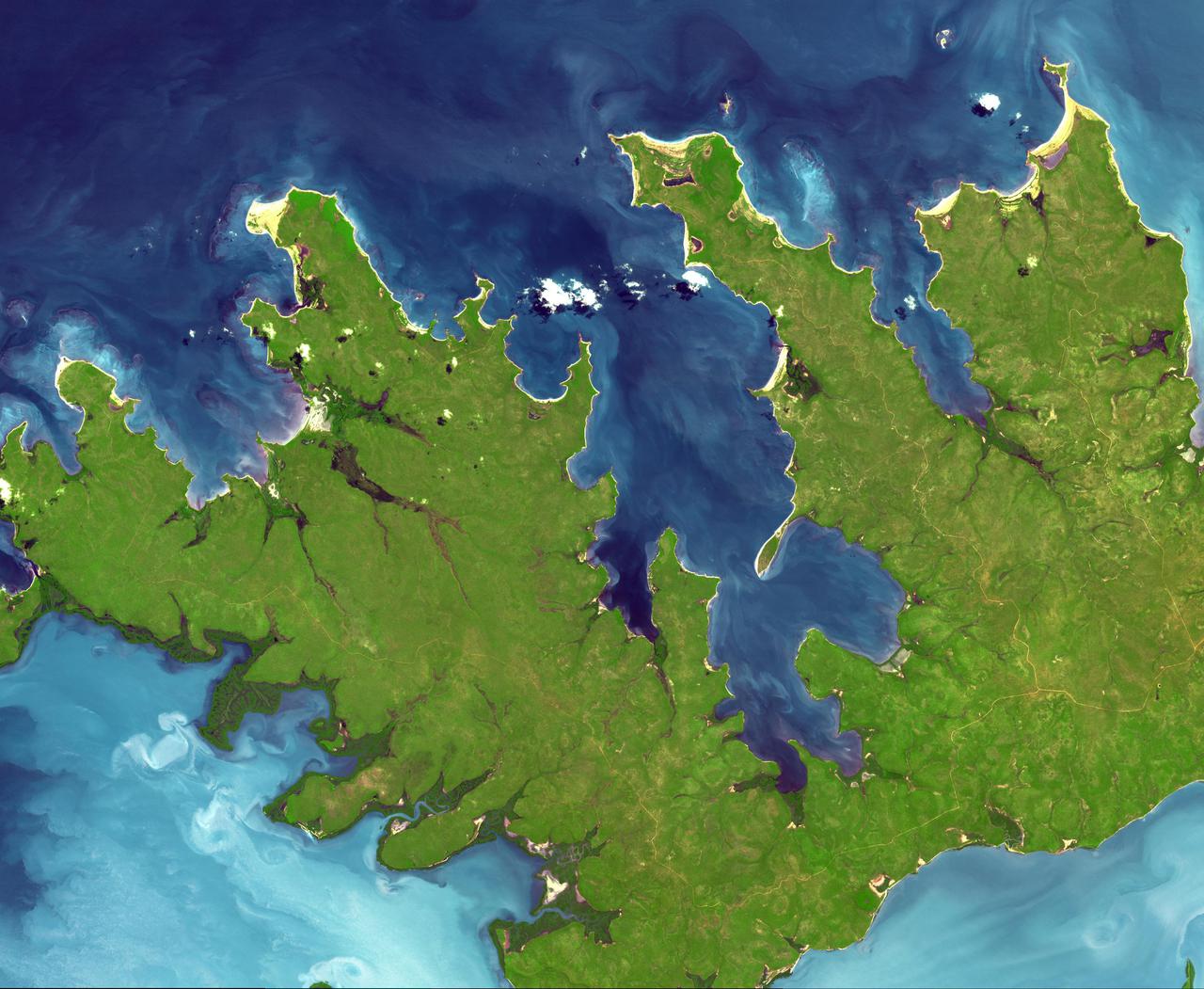
Three of London's many parks are found north of the Thames River. Regent's Park, at the top of the image, was originally a royal hunting ground; now it includes the London Zoo. Hyde Park, in the middle-left of the image, is the largest of the four royal parks, and was established by Henry VIII in 1536; it opened to the public in 1637. Buckingham Palace Garden, at the lower-right of the image, is the largest private garden in London. Today's garden was designed in 1825 under the reign of George IV. Summer garden parties see over 20,000 guests welcomed into the royal garden each summer. The image was acquired September 8, 2021. Covers an area of 5.8 by 6.9 km, and is located at 0.2 degrees west, 51.5 degrees north. https://photojournal.jpl.nasa.gov/catalog/PIA25706
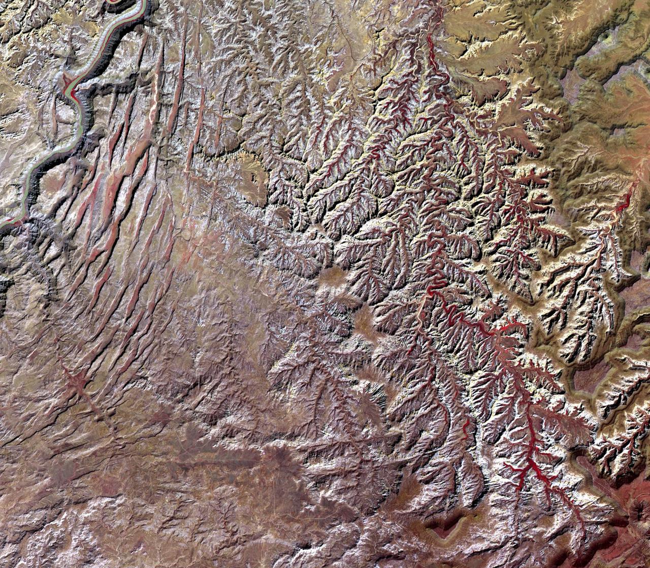
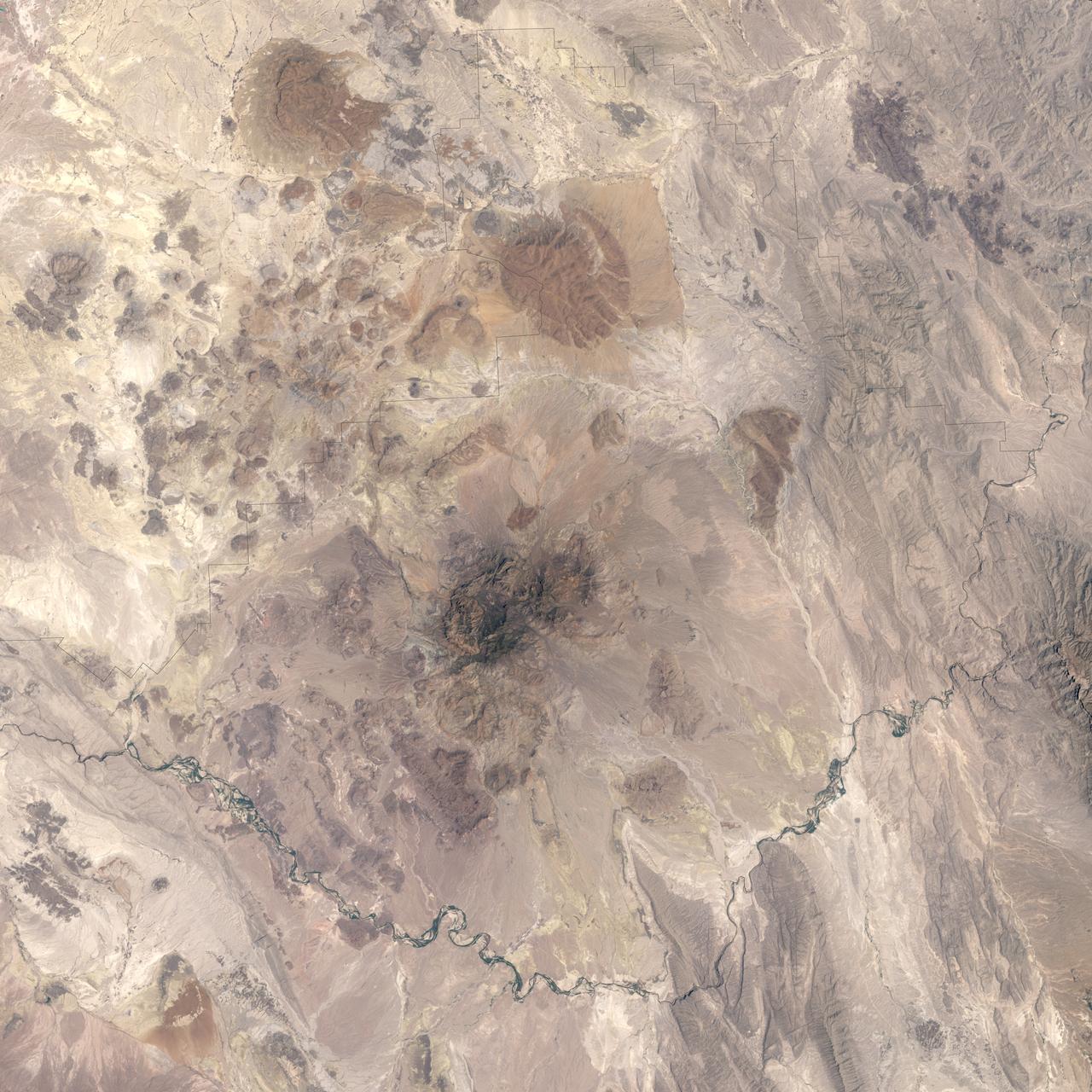
This image, acquired by NASA Terra spacecraft, is of Canyonlands National Park, Utah, a showcase of geology in the southwest desert of the United States.
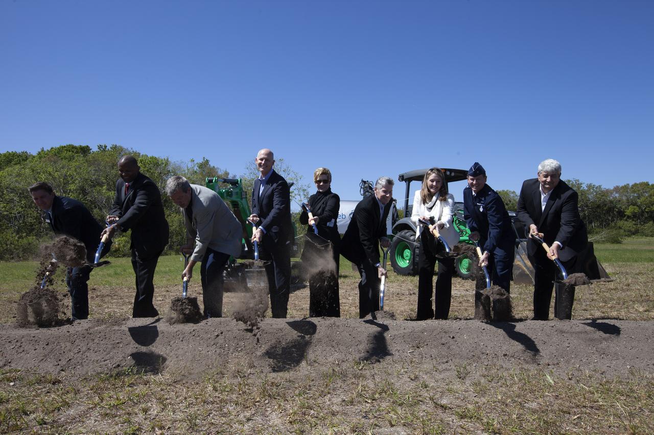
Officials break ground for a 150,000-square-foot manufacturing facility for OneWeb Satellites at Exploration Park at NASA's Kennedy Space Center. The company, in partnership with Airbus, is building a 150,000-square-foot factory to manufacture satellites that will connect all areas of the world to the Internet wirelessly. The officials are, from left, John Saul, operations manager of Hensell-Phelps; Kelvin Manning, associate director of NASA's Kennedy Space Center; Brian Holz, CEO of OneWeb Satellites; Rick Scott, governor of Florida; Lynda Weatherman, president and CEO of the Economic Development Council of the Space Coast; Mike Cosentino, president, Airbus Defense and Space; Cissy Procter, executive director of the Florida Department of Economic Activity; Gen. Wayne Monteith, commander of the 45th Space Wing of the U.S. Air Force; and Jim Kuzma, COO of Space Florida. Photo credit: NASA/Kim Shiflett
Dale Ketchum of Space Florida opens the groundbreaking ceremony at Kennedy's Exploration Park for OneWeb. The company, in partnership with Airbus, is building a 150,000-square-foot factory to manufacture satellites that will connect all areas of the world to the Internet wirelessly. Behind him are, from left, Jim Kuzma, COO of Space Florida; Mike Cosentino, president, Airbus Defense and Space; Brian Holz, CEO of OneWeb Satellites; Rick Scott, governor of Florida; Lynda Weatherman, president and CEO of the Economic Development Council of the Space Coast; Kelvin Manning, associate director of NASA's Kennedy Space Center; Gen. Wayne Monteith, commander of the 45th Space Wing of the U.S. Air Force; Cissy Procter, executive director of the Florida Department of Economic Activity; and John Saul, operations manager of Hensell-Phelps. Photo credit: NASA/Kim Shiflett
NASA's Marshall Space Flight Center showcased it's various projects for the public in Huntsville, Alabama's Big Spring Park. Exhibits were displayed by all of the various directorates of the Center with employee volunteers explaining all aspects of their projects. Adding to the festivities was the attendance of retired NASA astronaut Robert "Hoot" Gibson.Chad Emerson, President of Downtown Huntsville, Inc., fist bumps with Oscar the Robot.
NASA's Marshall Space Flight Center showcased it's various projects for the public in Huntsville, Alabama's Big Spring Park. Exhibits were displayed by all of the various directorates of the Center with employee volunteers explaining all aspects of their projects. Adding to the festivities was the attendance of retired NASA astronaut Robert "Hoot" Gibson. Students from Huntsville’s Grissom High School display their robot.
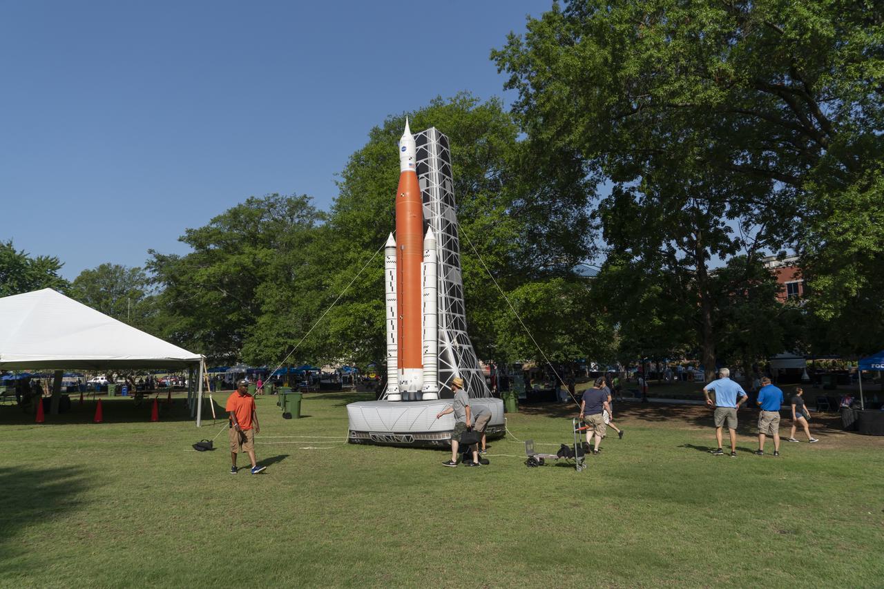
NASA's Marshall Space Flight Center showcased it's various projects for the public in Huntsville, Alabama's Big Spring Park. Exhibits were displayed by all of the various directorates of the Center with employee volunteers explaining all aspects of their projects. Adding to the festivities was the attendance of retired NASA astronaut Robert "Hoot" Gibson. Marshall Model Shop employees inflate and place the SLS model.
NASA Terra spacecraft imaged the Indonesian islands of Komodo, Rintja, Padar, and Flores in the Komodo National Park. The Komodo dragon is the world largest lizard species.
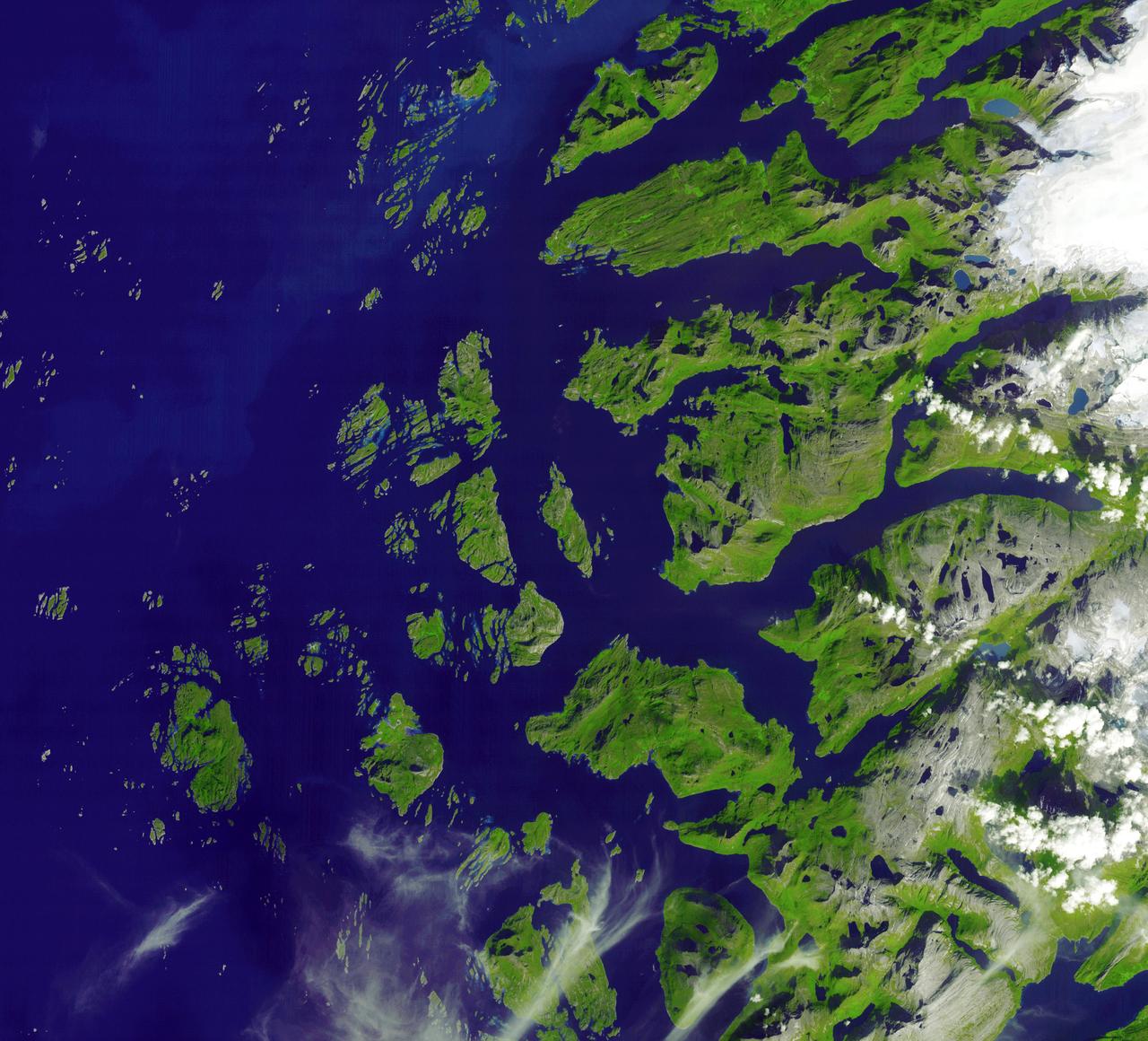
The Arctic Circle cuts through the western coast of Norway and the Saltfjellet-Svartisen National Park. This image was acquired by NASA Terra satellite on August 23, 2006.
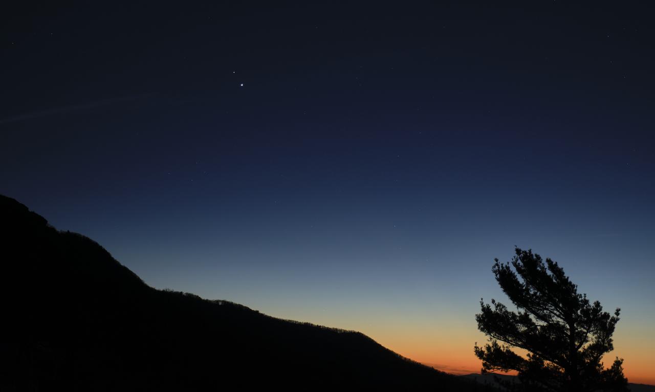
Saturn, top, and Jupiter, below, are seen after sunset from Shenandoah National Park, Sunday, Dec. 13, 2020, in Luray, Virginia. The two planets are drawing closer to each other in the sky as they head towards a “great conjunction” on December 21, where the two giant planets will appear a tenth of a degree apart. Photo Credit: (NASA/Bill Ingalls)
At the northern tip of Northern Territory, Australia, the Garig Gunak Barlu National Park spans the entire Cobourg Peninsula. Nearly the whole peninsula is Aboriginal land, and the park is managed as a sanctuary under the direction of traditional Aboriginal landowners. The first wetlands to be declared "Wetlands of International Importance" by the Ramsar Convention on Wetlands International Treaty are located in this park. The image was acquired April 12, 2016, covers an area of 48.2 by 58.6 km, and is located at 11.3 degrees south, 132.2 degrees east. https://photojournal.jpl.nasa.gov/catalog/PIA24732
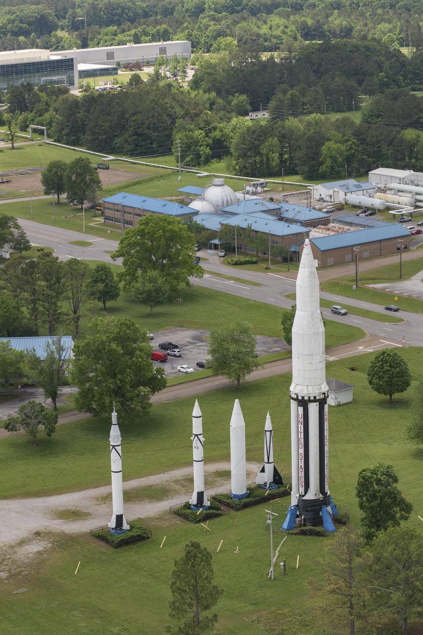
AERIAL PHOTOGRAPHS OF MSFC-ROCKET PARK
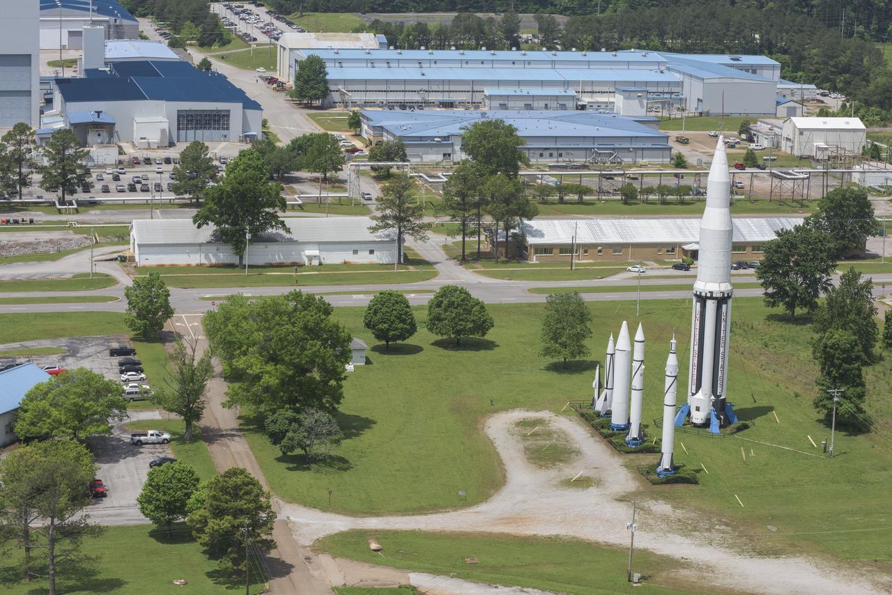
AERIAL PHOTOGRAPHS OF MSFC-ROCKET PARK

AERIAL PHOTOGRAPHS OF MSFC-ROCKET PARK

AERIAL PHOTOGRAPHS OF MSFC-ROCKET PARK