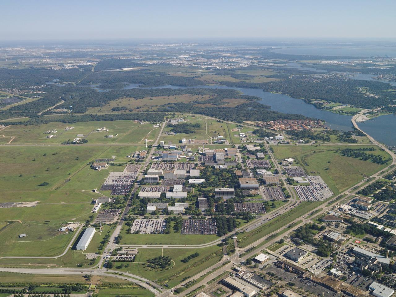
Aerial Photography of JSC. Overall view of JSC.
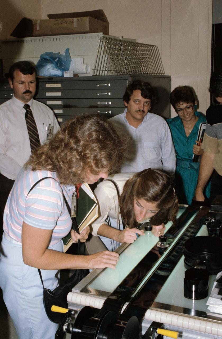
View of STS-33/51L Prime Teacher, Christa McAuliffe (left foreground) and Barbara Morgan (second left), both "Teacher in Space" Trainees, review film shot while training with Arriflex camera. 1. McAuliffe, S. Christa - Photography 2. Morgan, Barbara - Photography
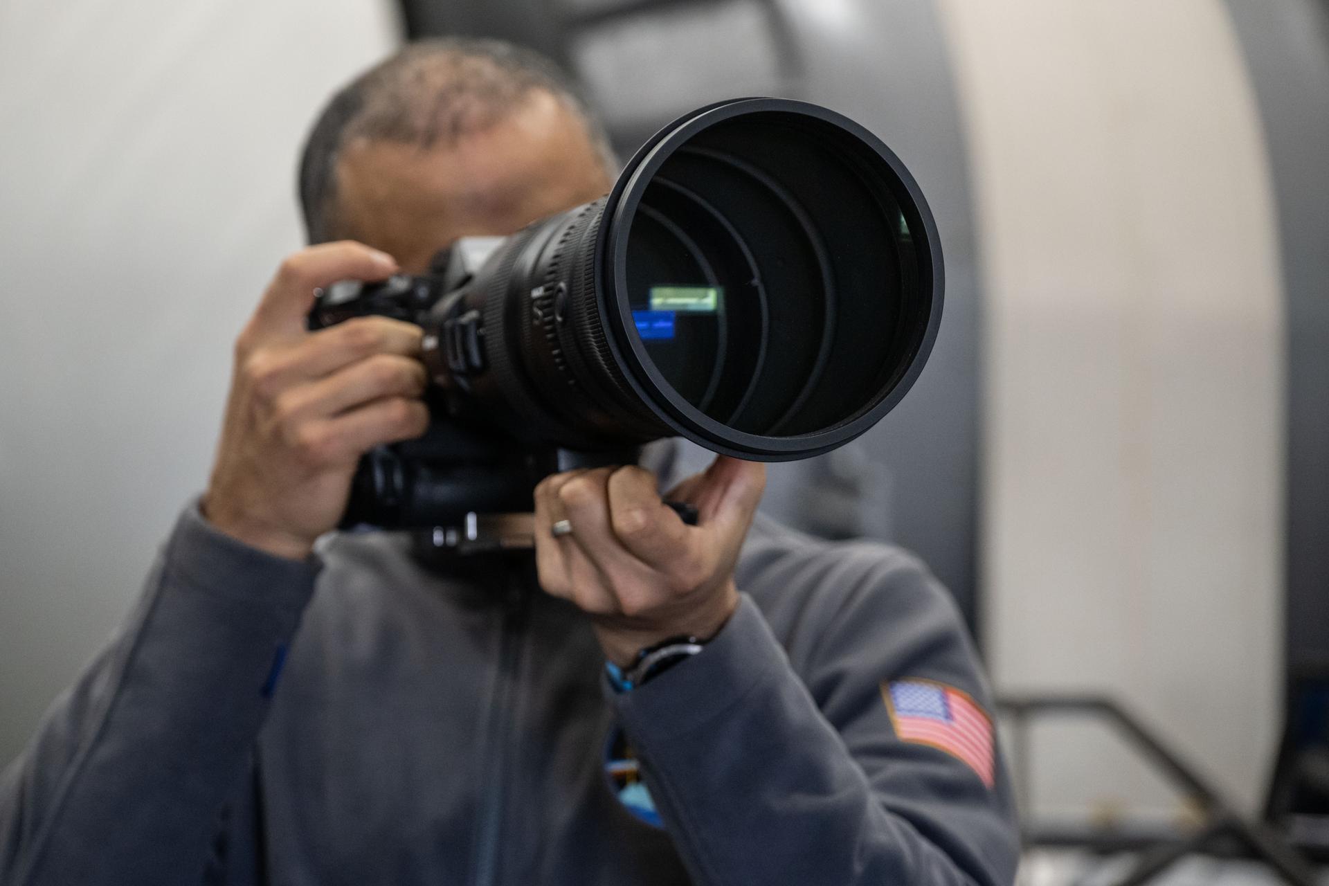
jsc2025e089120 (Dec. 8, 2025) --- NASA astronaut and Expedition 75 flight engineer Anil Menon participates in a photography training session at Johnson Space Center's Space Vehicle Mockup Facility in Houston, Texas, ahead of his upcoming mission to the International Space Station. Credit: NASA/Bill Stafford
jsc2025e089114 (Dec. 8, 2025) --- NASA astronaut and Expedition 75 flight engineer Anil Menon participates in a photography training session at Johnson Space Center's Space Vehicle Mockup Facility in Houston, Texas, ahead of his upcoming mission to the International Space Station. Credit: NASA/Bill Stafford

A super blue Moon rises above Kennedy Space Center in Florida on Monday, Aug. 18, 2024. Although not actually appearing blue, as the third full Moon in a season with four full Moons, this is called a “blue” Moon. The Moon at or near its closest point to Earth is a “super” Moon and can appear up to 14% bigger and brighter than normal full Moons. About 25% of all full Moons are super, but only 3% of full Moons are blue, with the next super blue Moons occurring as a pair in January and March 2037.
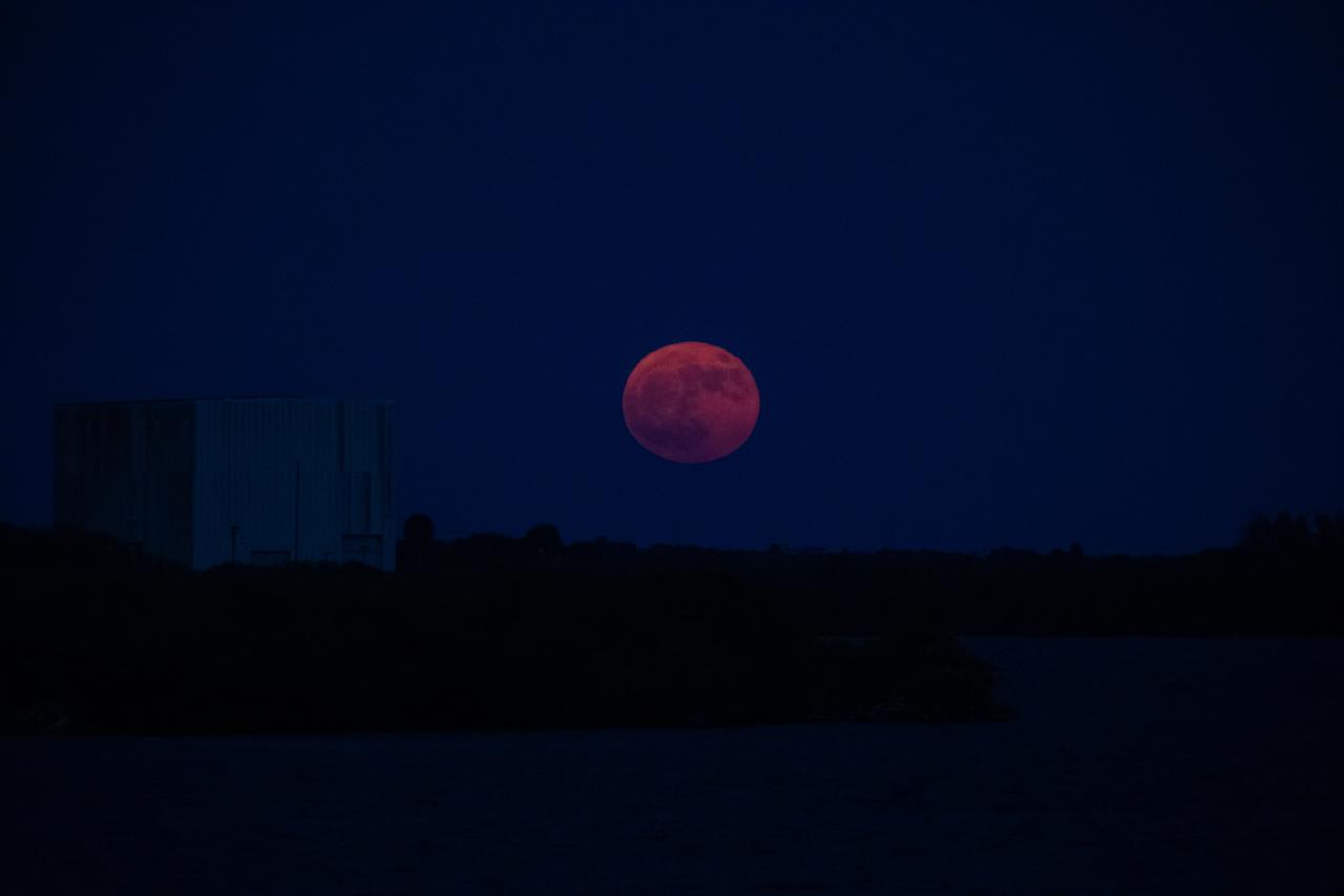
A super blue Moon rises above Kennedy Space Center in Florida on Monday, Aug. 18, 2024. Although not actually appearing blue, as the third full Moon in a season with four full Moons, this is called a “blue” Moon. The Moon at or near its closest point to Earth is a “super” Moon and can appear up to 14% bigger and brighter than normal full Moons. About 25% of all full Moons are super, but only 3% of full Moons are blue, with the next super blue Moons occurring as a pair in January and March 2037.
A super blue Moon rises above Kennedy Space Center in Florida on Monday, Aug. 18, 2024. Although not actually appearing blue, as the third full Moon in a season with four full Moons, this is called a “blue” Moon. The Moon at or near its closest point to Earth is a “super” Moon and can appear up to 14% bigger and brighter than normal full Moons. About 25% of all full Moons are super, but only 3% of full Moons are blue, with the next super blue Moons occurring as a pair in January and March 2037.
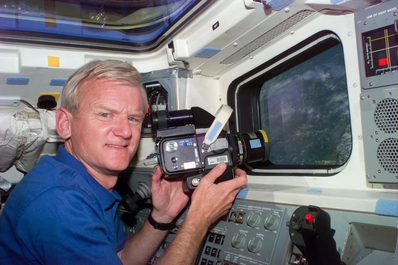
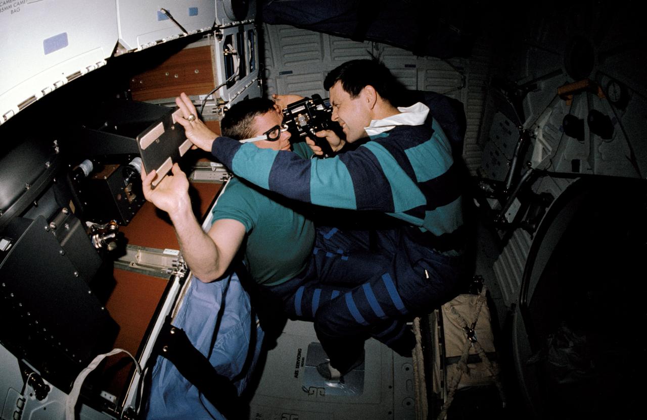
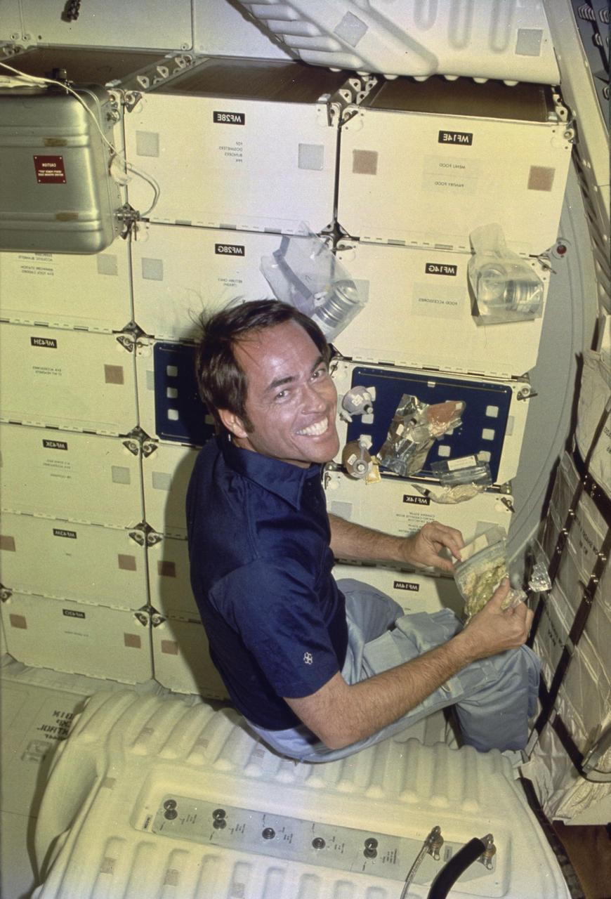
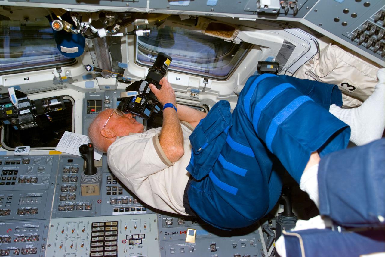
S77-E-5109 (26 May 1996) --- Astronaut John H. Casper, commander, pauses during a photography session on the aft flight deck of the Space Shuttle Endeavour. The scene was recorded with an Electronic Still Camera (ESC).
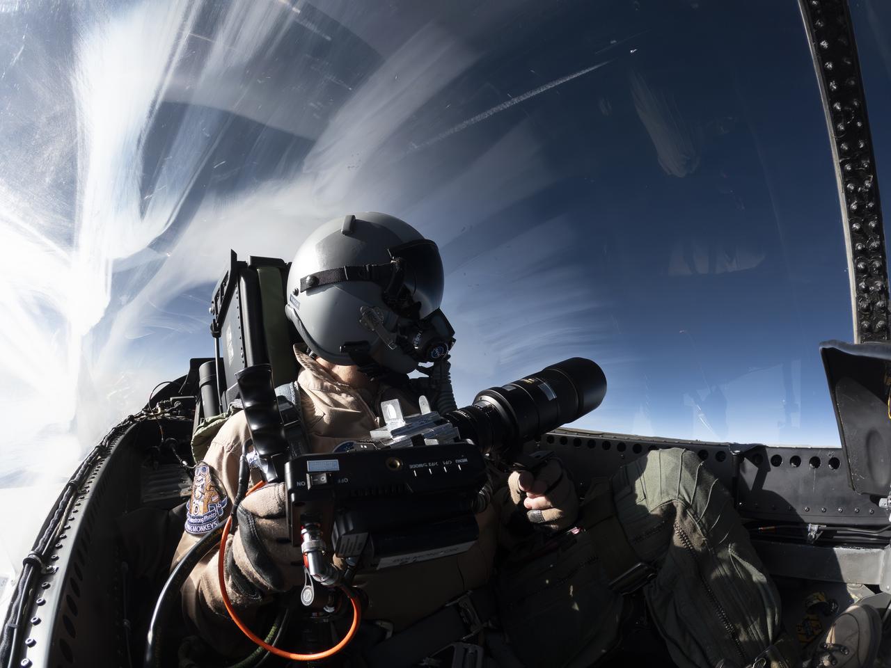
NASA Photographer Carla Thomas holds the Airborne Schlieren Photography System (ASPS), aiming it out the window in flight. The ASPS uses a photographic method called schlieren imaging, capable of visualizing changes in air density and revealing shock waves and air flow patterns around moving objects. The system is one of several tools validated during recent dual F-15 flights at NASA’s Armstrong Flight Research Center in Edwards, California, in support of NASA’s Quesst mission, ahead of the X-59’s first flight.
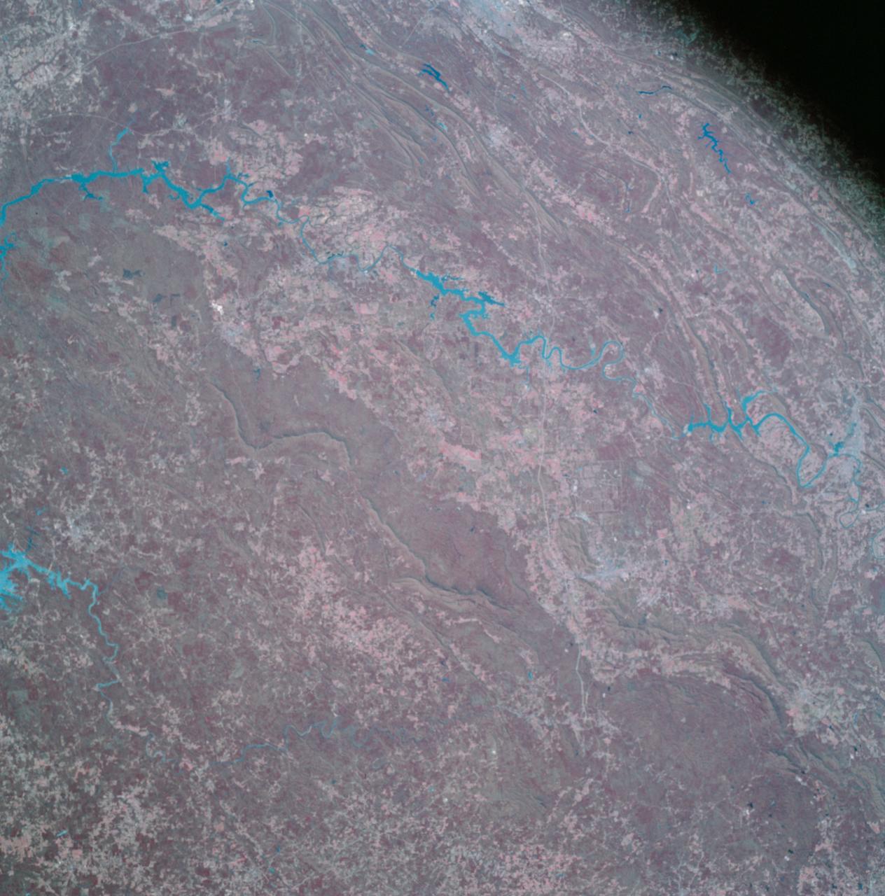
Earth Observation taken by the Apollo 9 crew. View is of Galveston and Freeport in Texas. Latitude was 28.42 N by Longitude 94.54 W, Overlap was 80%, Altitude miles were 105 and cloud cover was 5%. This imagery taken as part of the NASA S0-65 Experiment "Multispectral Terrain Photography". The experiment provides simultaneous satellite photography of the Earth's surface in three distinct spectral bands. The photography consists of four almost spatially identical photographs. The images of ground objects appear in the same coordinate positions on all four photos in the multispectral set within the opto-mechanical tolerances of the Hasselblad cameras in the Apollo 9 spacecraft. Band designation for this frame is A. Film and filter is Ektachrome SO-368,Infrared Color Wratten 15. Mean Wavelength of Sensitivity is green,red and infrared. The Nominal Bandpass is total sensitivity of all dye layers 510-900nm.
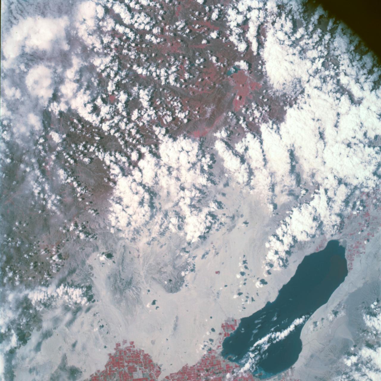
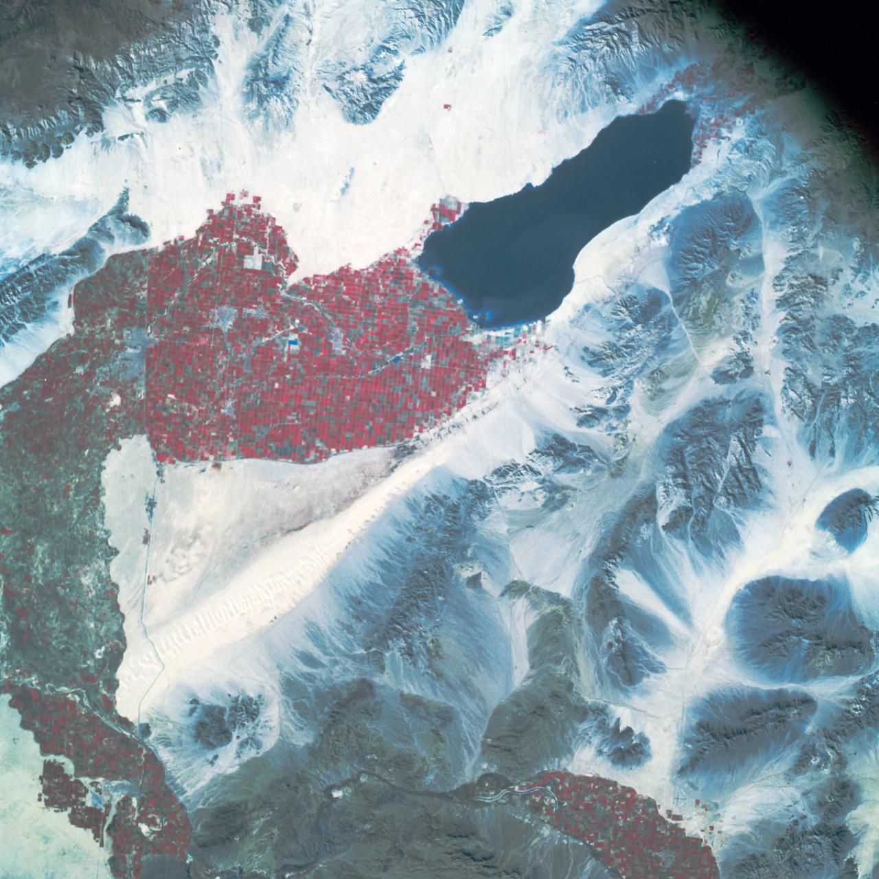
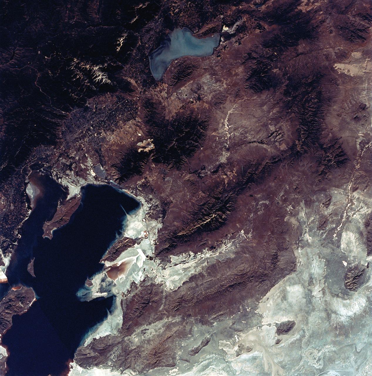
Earth Observation taken by the Apollo 9 crew. View is of Salton Sea and Imperial Valley in California. Latitude was 33.09 N by Longitude 116.14 W, Overlap was 50%, Altitude miles were 103 and cloud cover was 35%. This imagery taken as part of the NASA S0-65 Experiment "Multispectral Terrain Photography". The experiment provides simultaneous satellite photography of the Earth's surface in three distinct spectral bands. The photography consists of four almost spatially identical photographs. The images of ground objects appear in the same coordinate positions on all four photos in the multispectral set within the opto-mechanical tolerances of the Hasselblad cameras in the Apollo 9 spacecraft. Band designation for this frame is A. Film and filter is Ektachrome SO-368,Infrared Color Wratten 15. Mean Wavelength of Sensitivity is green,red and infrared. The Nominal Bandpass is total sensitivity of all dye layers 510-900nm.
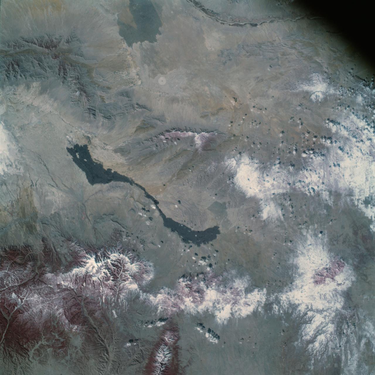
Earth Observation taken by the Apollo 9 crew. View is of Carrizozo in New Mexico and includes lava flow and snow. Latitude was 33.42 N by Longitude 106.10 W, Overlap was 7.5%, Altitude miles were 121 and cloud cover was 0%. This imagery taken as part of the NASA S0-65 Experiment "Multispectral Terrain Photography". The experiment provides simultaneous satellite photography of the Earth's surface in three distinct spectral bands. The photography consists of four almost spatially identical photographs. The images of ground objects appear in the same coordinate positions on all four photos in the multispectral set within the opto-mechanical tolerances of the Hasselblad cameras in the Apollo 9 spacecraft. Band designation for this frame is A. Film and filter is Ektachrome SO-368,Infrared Color Wratten 15. Mean Wavelength of Sensitivity is green,red and infrared. The Nominal Bandpass is total sensitivity of all dye layers 510-900nm.

This 1970 photograph shows Skylab's Ultraviolet (UV) Airglow Horizon Photography experiment. It was an astrophysics investigation designed to photograph the twilight airflow and Earth's ozone layer simultaneously in visible and UV wavelengths. These observations provided information on oxygen, nitrogen, and ozone layers in the Earth's atmosphere, and on their variation during night and day cycles. The Marshall Space Flight Center had program management responsibility for the development of Skylab hardware and experiments.
iss072e350835 (Dec. 7, 2024) --- NASA astronaut and Expedition 72 Flight Engineer Don Pettit points a camera outside a window on the International Space Station's Poisk module for a sun photography session.
AS09-26A-3768A (10 March 1969) --- Color infrared photograph of Mexico: Cerro Malinche, east end of neo-volcanic plateau, as seen from the Apollo 9 spacecraft during its 109th revolution of Earth. This picture was taken as a part of the SO65 Multispectral Terrain Photography Experiment.
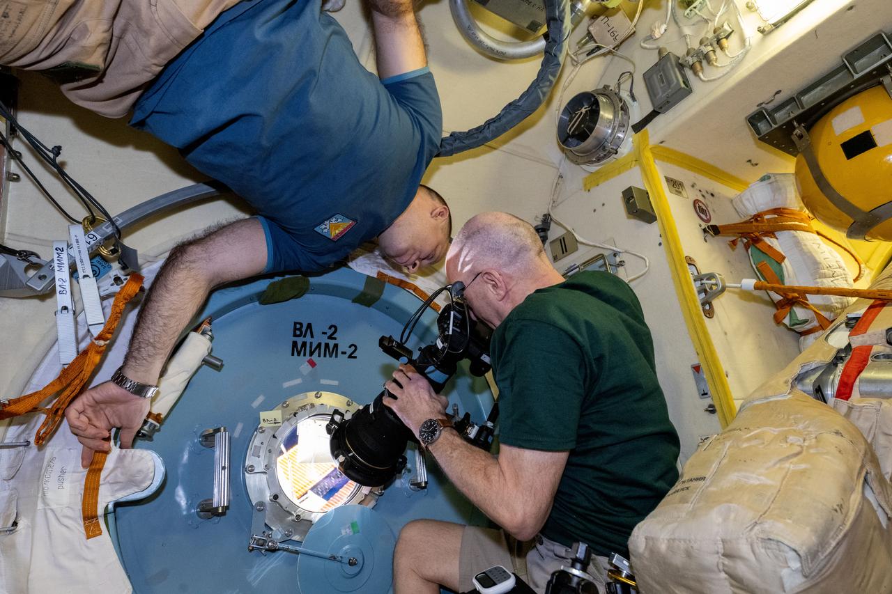
iss072e350819 (Dec. 7, 2024) --- NASA astronaut and Expedition 72 Flight Engineer Don Pettit points a camera outside a window on the International Space Station's Poisk module for a sun photography session with assistance from Roscosmos cosmonaut and Expedition 72 Flight Engineer Ivan Vagner.
jsc2024e022261_alt (March 22, 2024) --- NASA astronaut Zena Cardman poses for a portrait in a photography studio at NASA’s Johnson Space Center in Houston, Texas. Credit: NASA/Josh Valcarcel
jsc2024e022261_alt2 (March 22, 2024) --- NASA astronaut Zena Cardman poses for a portrait in a photography studio at NASA’s Johnson Space Center in Houston, Texas. Credit: NASA/Josh Valcarcel
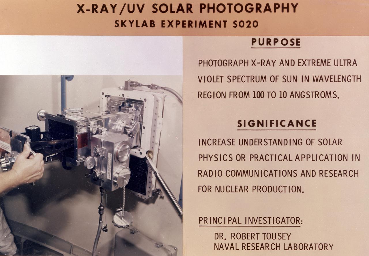
This chart details Skylab's Ultraviolet (UV) X-Ray Solar Photography experiment (S020) in an Apollo Telescope Mount facility. It was designed to photograph normal and explosive areas within the solar atmosphere in the UV and x-ray spectra. The Marshall Space Flight Center had program management responsibility for the development of Skylab hardware and experiments.
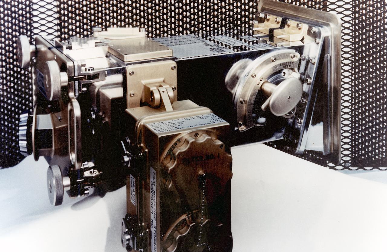
This 1970 photograph shows Skylab's Ultraviolet (UV)/X-Ray Solar Photography instrument, an Apollo Telescope Mount (ATM) facility designed to photograph normal and explosive areas in the solar atmosphere in the x-ray and UV spectra. The Marshall Space Flight Center had program management responsibility for the development of Skylab hardware and experiments.
Two payload specialists for the STS 51-D mission get in some training time in the crew compartment trainerat JSC. Charles D. Walker, left, rehearses photography of U.S. Senator E.J. (Jake) Garn in the middeck section of the trainer.
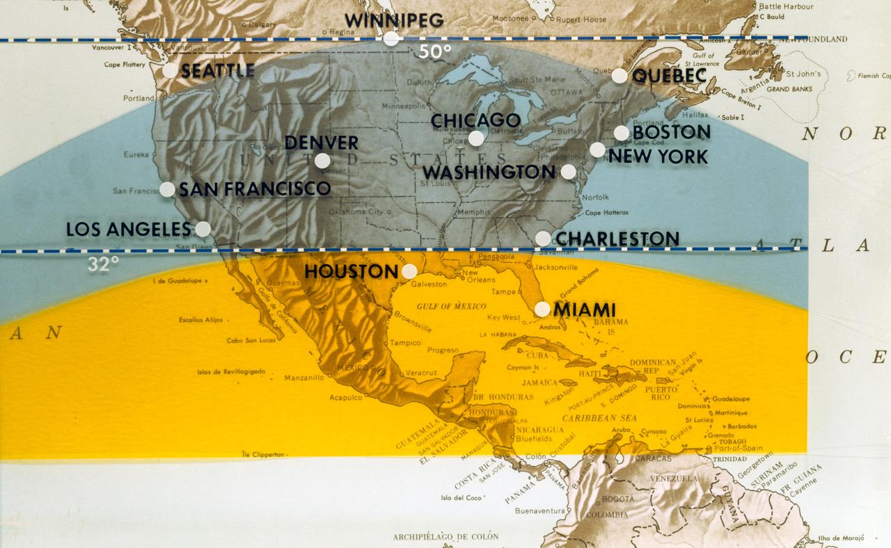
S70-06463 (June 1970) --- This map of North America has been marked to indicate areas of photographic imagery available from Apollo photography (32-degree orbits) as opposed to that imagery which will be available from a 50-degree inclined orbit. The region between the two broken lines will be in the area that can be covered by the first manned Skylab mission in 1973. Photo credit: NASA
AS09-26A-3799A (12 March 1969) --- Color infrared photograph of the Salton Sea and Imperial Valley area of Southern California as seen from the Apollo 9 spacecraft. This picture was taken as a part of the SO-65 Multispectral Terrain Photography Experiment. On the eastern edge of the picture are the Colorado River and a small portion of Arizona. Yuma, Arizona, is at the bottom right corner. The cities of El Centro, California, and Mexicali, Mexico, are at the bottom center.
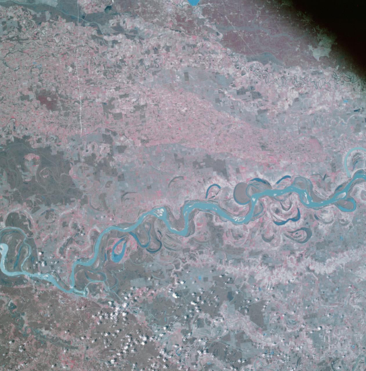
AS09-26A-3741A (9 March 1969) --- Color infrared photograph of the Mississippi River between Vicksburg and Greenville as photographed from the Apollo 9 spacecraft during its 92nd revolution of Earth. This picture was a part of the SO65 Multispectral Terrain Photography Experiment. The City of Vicksburg is located in the southeast corner of the picture. Note Interstate 20 under construction running east and west. Greenville is just out of picture at top center. All east of river is Mississippi; Louisiana is at lower left; and Arkansas is at upper left.
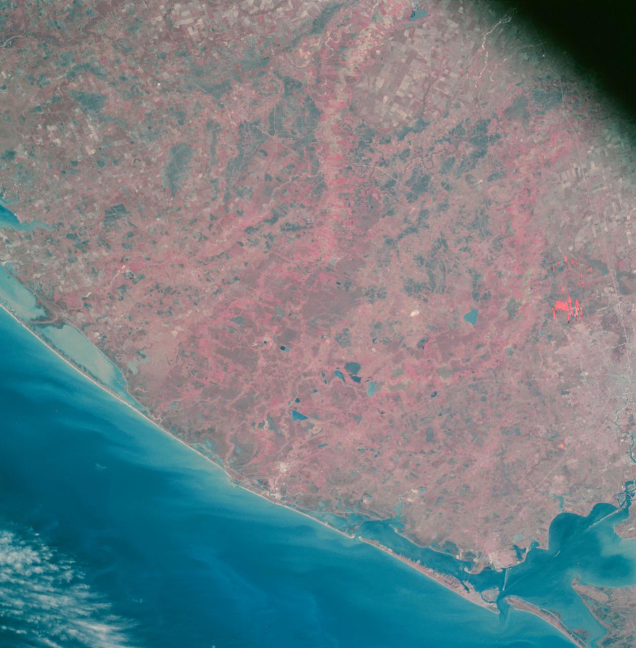
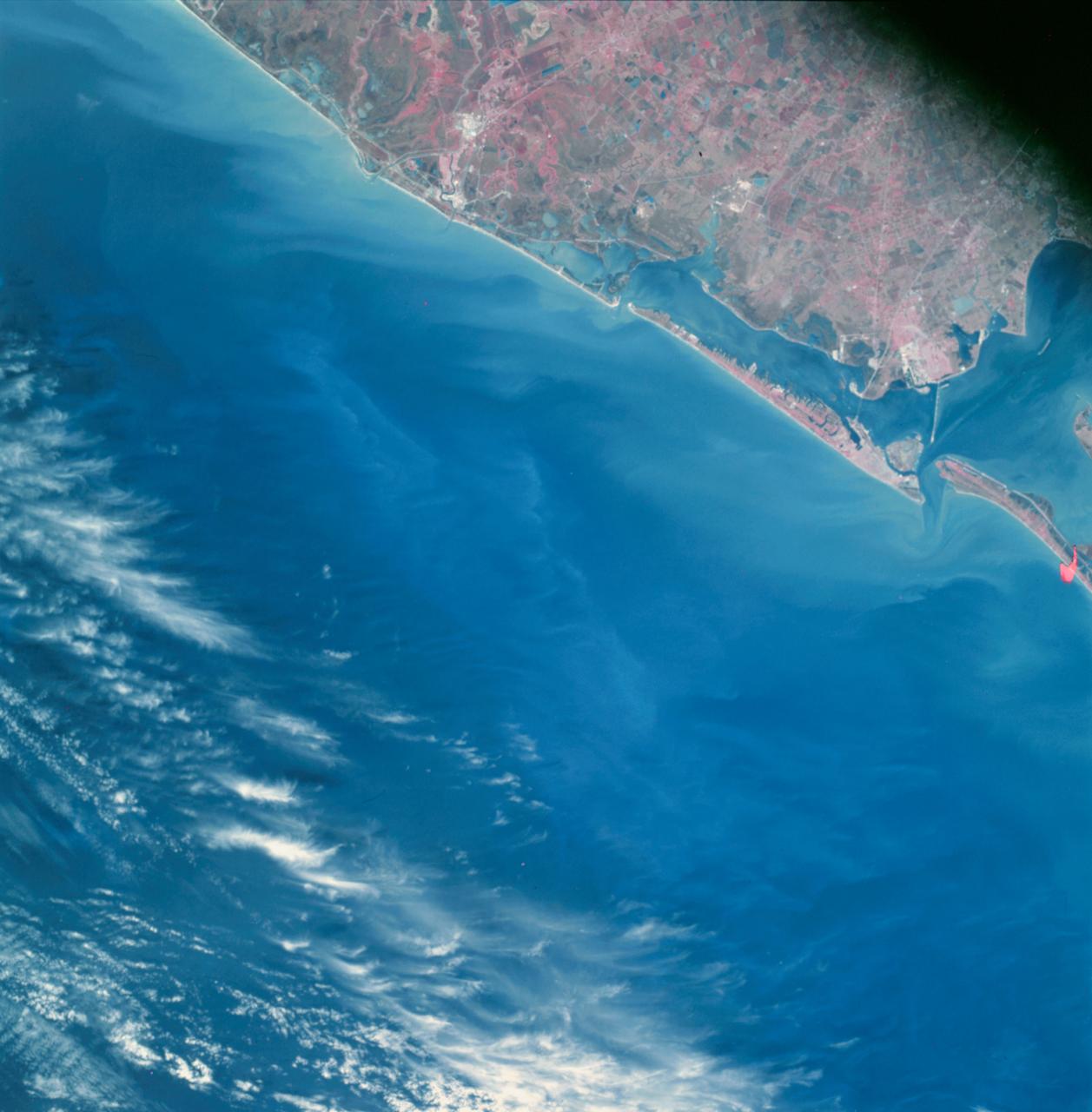
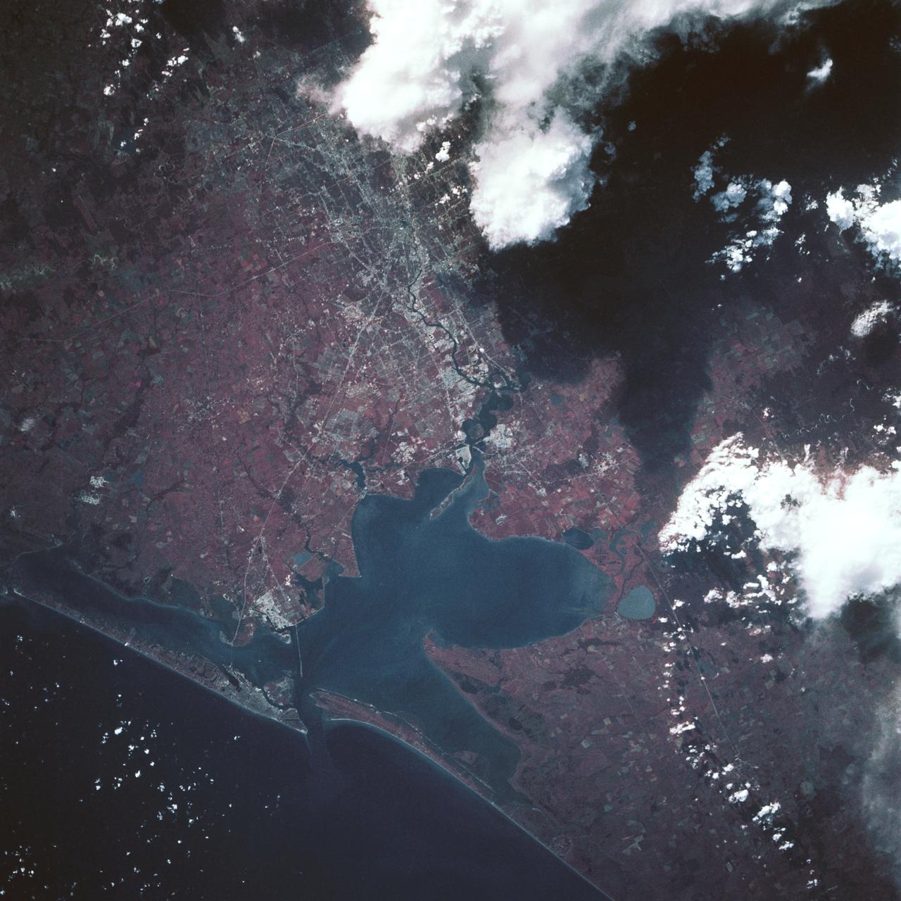
AS09-26A-3727A (8 March 1969) --- Color infrared photograph of the Texas Gulf Coast, Galveston Bay to Matagorda Bay, as seen from the Apollo 9 spacecraft during it 78th revolution of Earth. Houston is located at right center edge of photograph. Also visible are Galveston, Texas City, Manned Spacecraft Center, and Freeport. The mouth of the Colorado River is located near left center edge of picture. This picture was taken as a part of the SO65 Multispectral Terrain Photography Experiment.
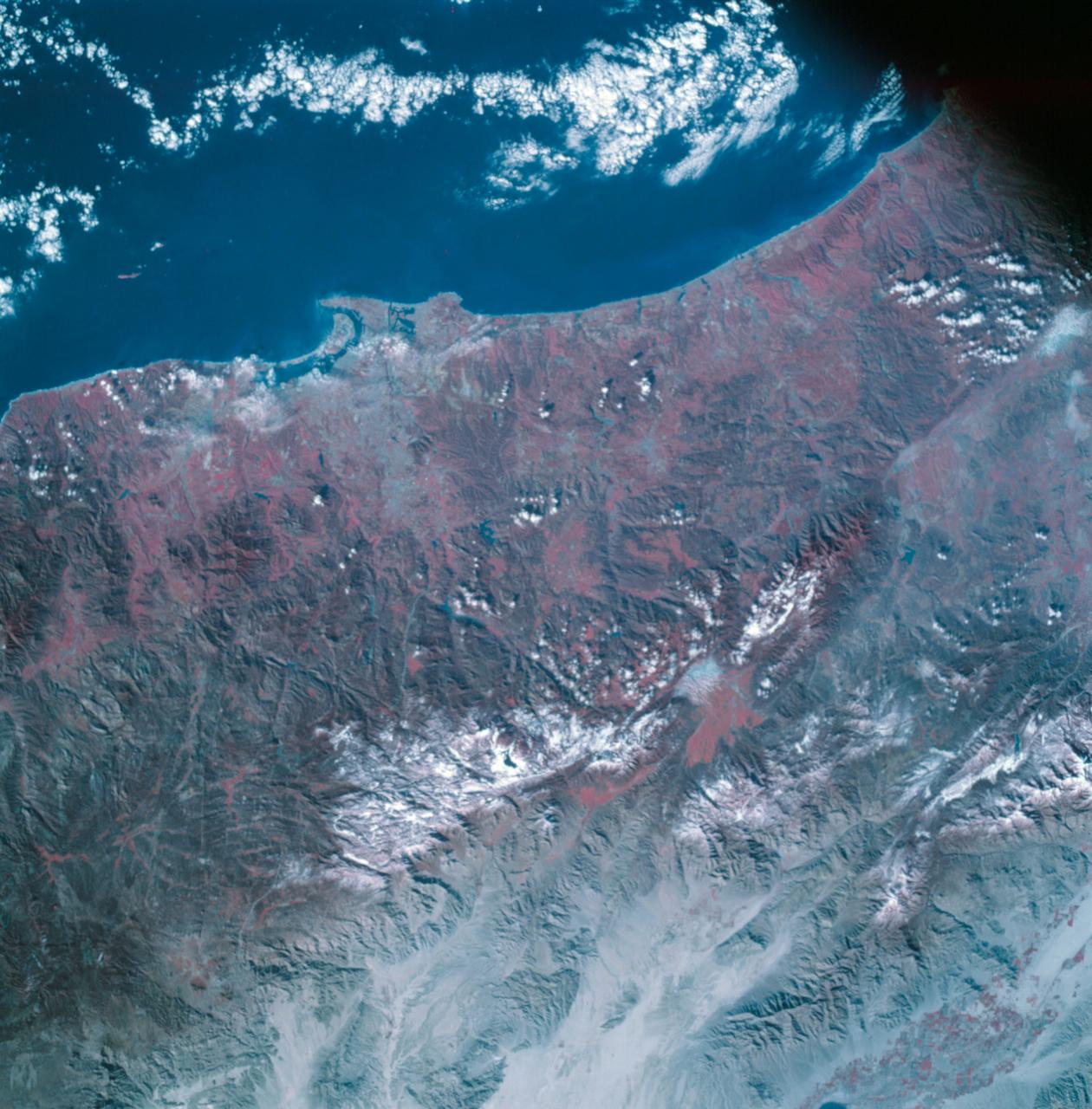
AS09-26A-3798A (12 March 1969) --- Color infrared photograph of the San Diego County and San Diego area of southern California as photographed from the Apollo 9 spacecraft during its 136th revolution of Earth. This picture was taken as a part of the SO65 Multispectral Terrain Photography Experiment. Tijuana and a portion of Baja California, Mexico, are also visible in picture.
This color infrared view of Houston (29.5N, 95.0W) was taken with a dual camera mount. Compare this scene with STS048-78-034 for an analysis of the unique properties of each film type. Comparative tests such as this aids in determining the kinds of information unique to each film system and evaluates and compares photography taken through hazy atmospheres. Infrared film is best at penetrating haze, vegetation detection and producing a sharp image.
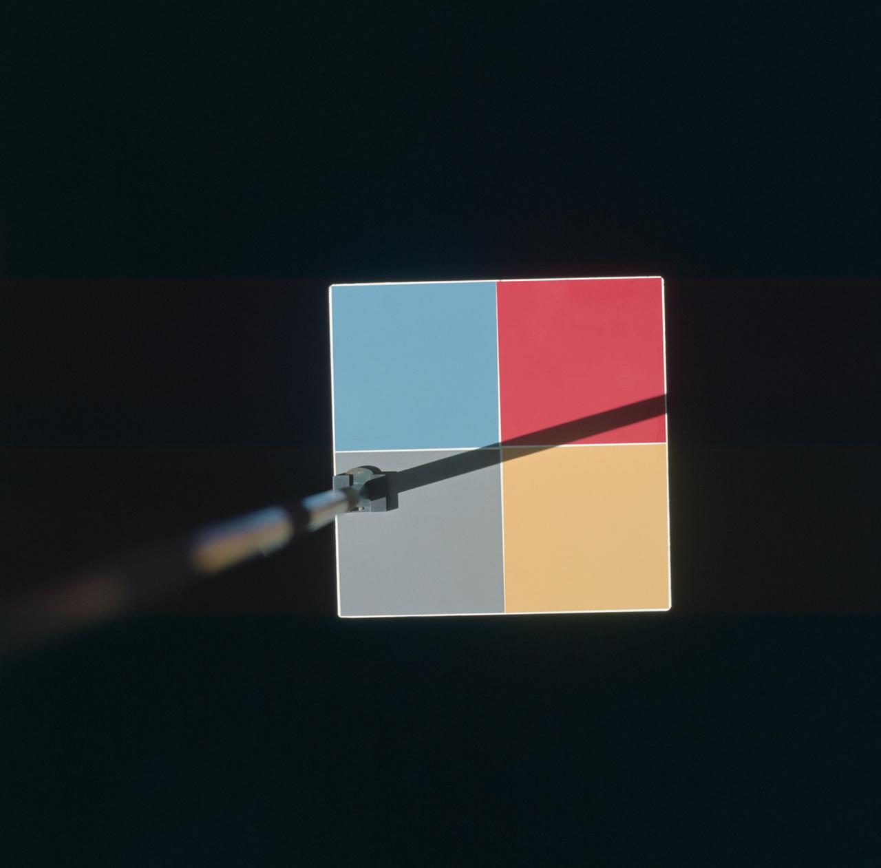
S66-46025 (18 July 1966) --- Astronaut Michael Collins, Gemini-10 pilot, photographed this MSC-8 color patch outside the spacecraft during the Gemini-10/Agena docking mission. The experiment was for the purpose of showing what effect the environment of space will have upon the color photography taken in cislunar space and on the lunar surface during an Apollo mission. Photo credit: NASA
AS09-26A-3790A (11 March 1969) --- Color infrared photograph of the Birmingham to Gadsden area of Alabama as seen from the Apollo 9 spacecraft during its 121st revolution of Earth. This picture was taken as a part of the SO65 Multispectral Terrain Photography Experiment. Birmingham is at left center edge of picture; Gadsden is near top center edge of photograph. Note folded mountains of southern Appalachian chain extending northeast-southwest. The major river in picture which runs generally southward is the Coosa River. The Tallapoosa River, which flows into Lake Martin, is in the southeast corner of picture. Interstate 20 runs from Birmingham eastward toward Atlanta. The City of Anniston is south of Gadsden on Interstate 20.
SL2-03-192 (22 June 1973) --- Lake Mead, Nevada, (36.0N, 114.5E) where the water from the Colorado River empties after it's 273 mile journey through the Grand Canyon of Arizona is the subject of this photo. Other features of interest are Hoover Dam on the south shore of Lake Mead where cheap hydroelectric power is secondary to the water resources made available in this northern desert region and the resort city of Las Vegas, just to the west of Lake Mead. In this harsh desert environment, color infrared photography readily penetrates haze, detects and portrays vegetation as shades of red. Photo credit: NASA
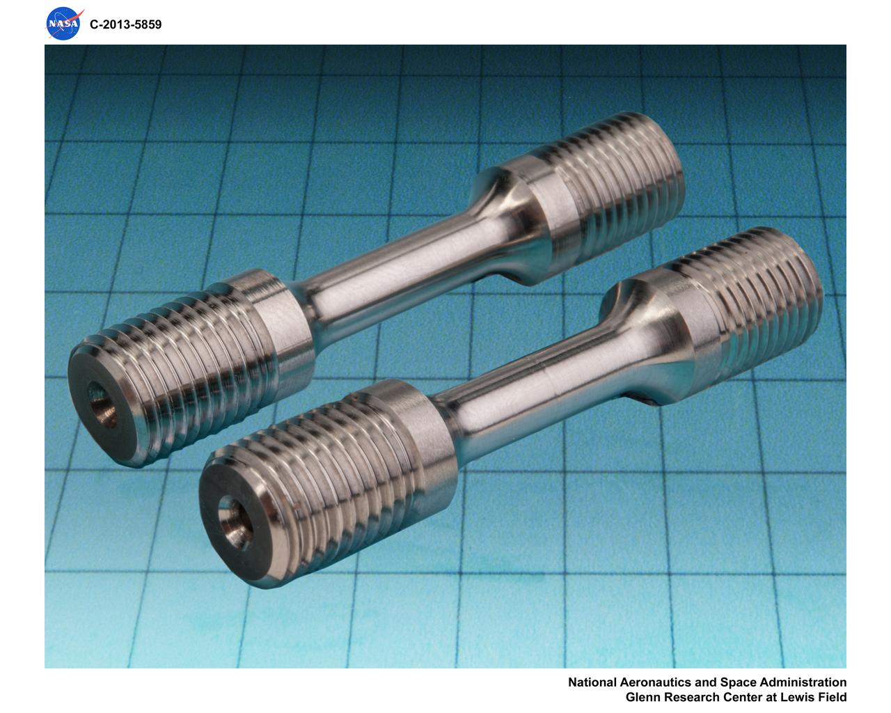
Unbrazed and Brazed Tensile Sample, photography in the lighting studio
STS041-02-015 (6-10 Oct. 1990) --- A 35mm scene showing astronauts Robert D. Cabana (right), STS-41 pilot, and Bruce E. Melnick, mission specialist, participating in a detailed supplemental objective for STS-41 involving retinal photography. The hypothesis of this experiment is that retinal photographs taken on orbit will show evidence of increased intracranial pressure (ICP) and the evidence of increased ICP and the development of Space Adaptation Syndrome (SAS) will be correlated. SAS has been a subject of on-orbit analysis since the early days of space shuttle.
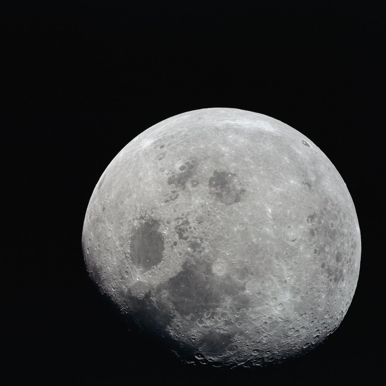
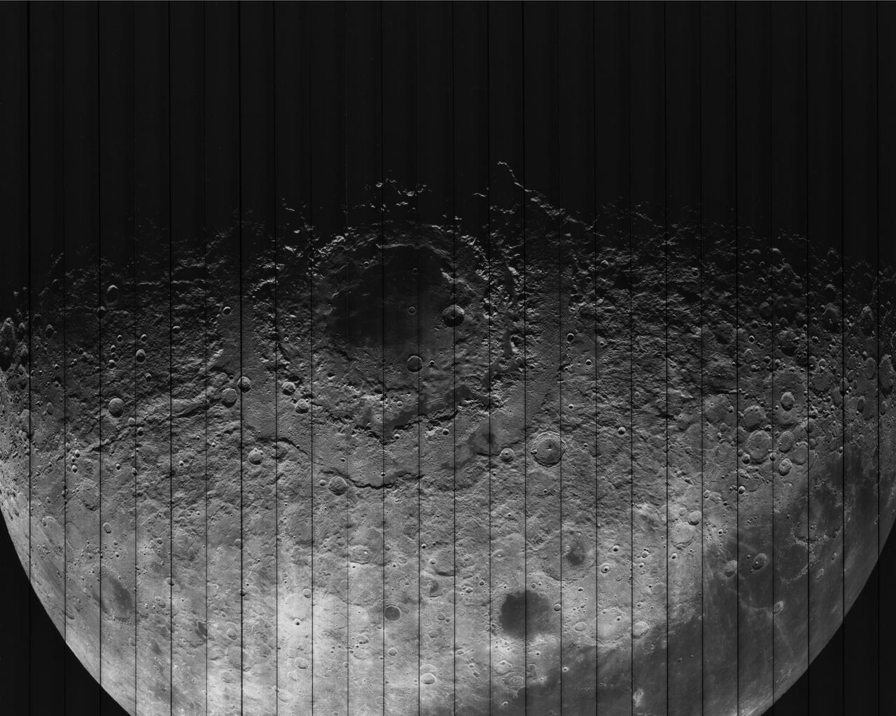
AS08-14-2506 (21-27 Dec. 1968) --- This photograph of a nearly full moon was taken from the Apollo 8 spacecraft at a point above 70 degrees east longitude. (Hold picture with moon's dark portion at left). Mare Crisium, the circular, dark-colored area near the center, is near the eastern edge of the moon as viewed from Earth. Mare Nectaris is the circular mare near the terminator. The large, irregular maira are Tranquillitatis and Fecunditatis. The terminator at left side of picture crosses Mare Tranquillitatis and highlands to the south. Lunar farside features occupy most of the right half of the picture. The large, dark-colored crater Tsiolkovsky is near the limb at the lower right. Conspicuous bright rays radiate from two large craters, one to the north of Tsiolkovsky, the other near the limb in the upper half of the picture. These rayed craters were not conspicuous in Lunar Orbiter photography due to the low sun elevations when the Lunar Orbiter photography was made. The crater Langrenus is near the center of the picture at the eastern edge of Mare Fecunditatis. The lunar surface probably has less pronounced color that indicated by this print.
SL3-27-224 (July-September 1973) --- A vertical view of the western portion of the Republic of Panama on the Isthmus of Panama as photographed from Earth orbit by one of the six lenses of the Itek-furnished S190-A Multispectral Photographic Facility Experiment aboard the Skylab space station. This picture was taken with 2443 infrared color film. The large, clear body of water on the north side of the isthmus is Golfo de los Mosquitos, an extension of the Caribbean Sea. The large, partly cloud-covered body of water on the south side of the isthmus is Golfo de Chiriqui, an extension of the Pacific Ocean. Federal agencies participating with NASA on the EREP project are the Department of Agriculture, Commerce, Interior, the Environmental Protection Agency and the Corps of Engineers. All EREP photography is available to the public through the Department of Interior?s Earth Resources Observation Systems Data Center, Sioux Falls, South Dakota, 57198. Photo credit: NASA

SL4-93-167 (February 1974) --- A vertical view of the Kennedy Space Center and the Florida Atlantic coast area is seen in this Skylab 4 Earth Resources Experiments Package S190-B (five-inch earth terrain camera) infrared photography taken from the Skylab space station in Earth orbit. This photograph shows the major land-ocean features of the Florida coast near Vero Beach northward to Cape Canaveral and the KSC complex. The launch pads for the Skylab missions are clearly visible. Identification of living vegetation is possible through the use of the color infrared film. Various shades of red portray differences in the vegetation such as shown in the patterns in the agricultural area near Vero Beach. In the Kennedy Space Center, the nearly continuous and uniform red color shows that most of the land areas are heavily vegetated. The white coastal beach areas are strongly contrasted to the red land and the blue Atlantic Ocean. Old dunal areas in KSC are visible on Merritt Island which is separated from the Launch areas by the Banana River and the mainland by the Indian River. Federal and state highways and numerous causeways over the rivers are easily identified. The Florida mainland is partly shadowed by small white clouds which cast a pronounced shadow to the east of each cloud indicated the Sun is west of solar noon. Federal agencies participating with NASA on the EREP project are the Departments of Agriculture, Commerce, Interior, the Environmental Protection Agency and the Core of Engineers. All EREP photography is available to the public through the Department of Interior's Earth Resources Observations Systems Data Center, Sioux Falls, South Dakota, 57198. Photo credit: NASA
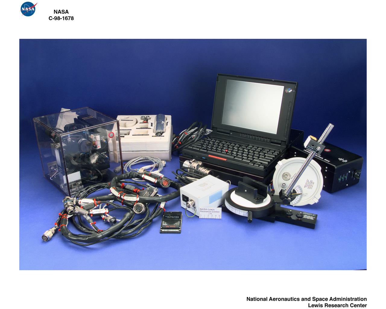
DIGITAL PHOTOGRAPHY OF COLLOIDAL GELATION AND COLLOIDAL DISORDER - ORDER TRANSITION
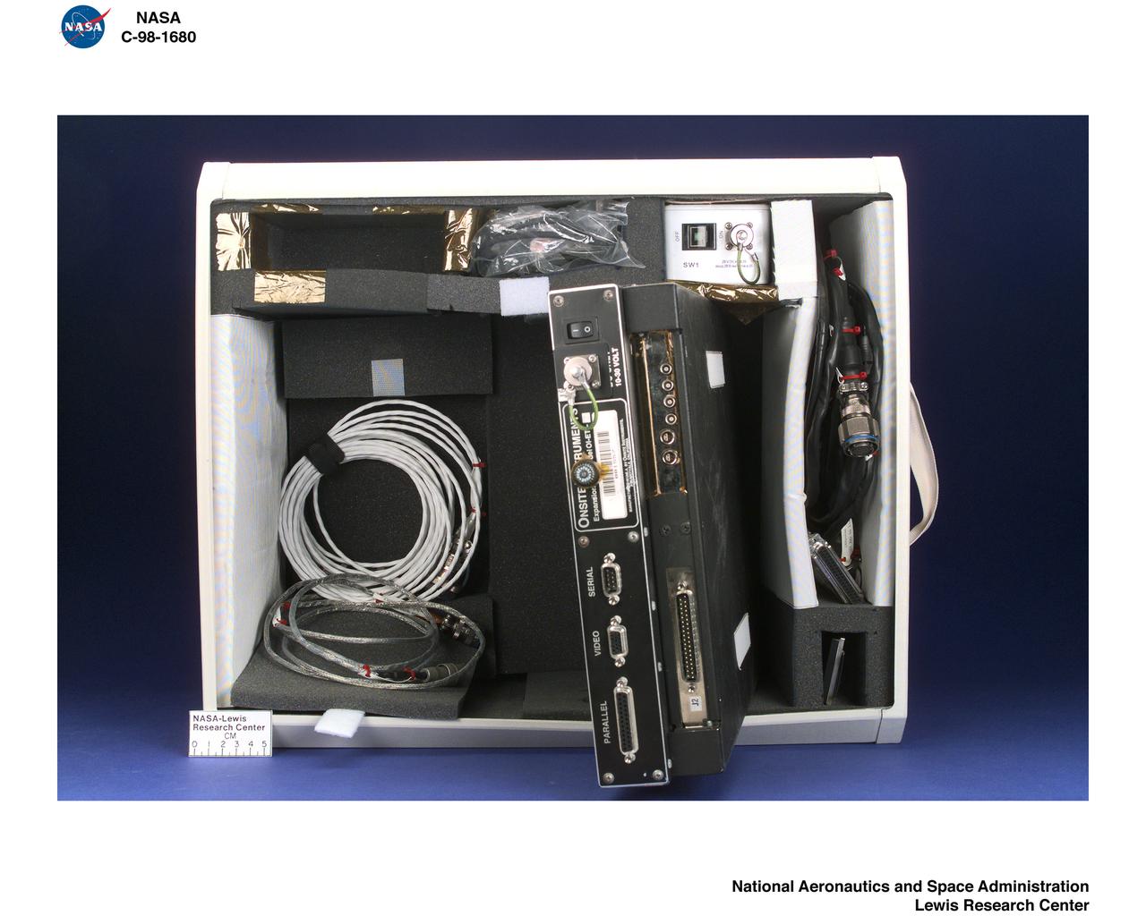
DIGITAL PHOTOGRAPHY OF COLLOIDAL GELATION AND COLLOIDAL DISORDER - ORDER TRANSITION
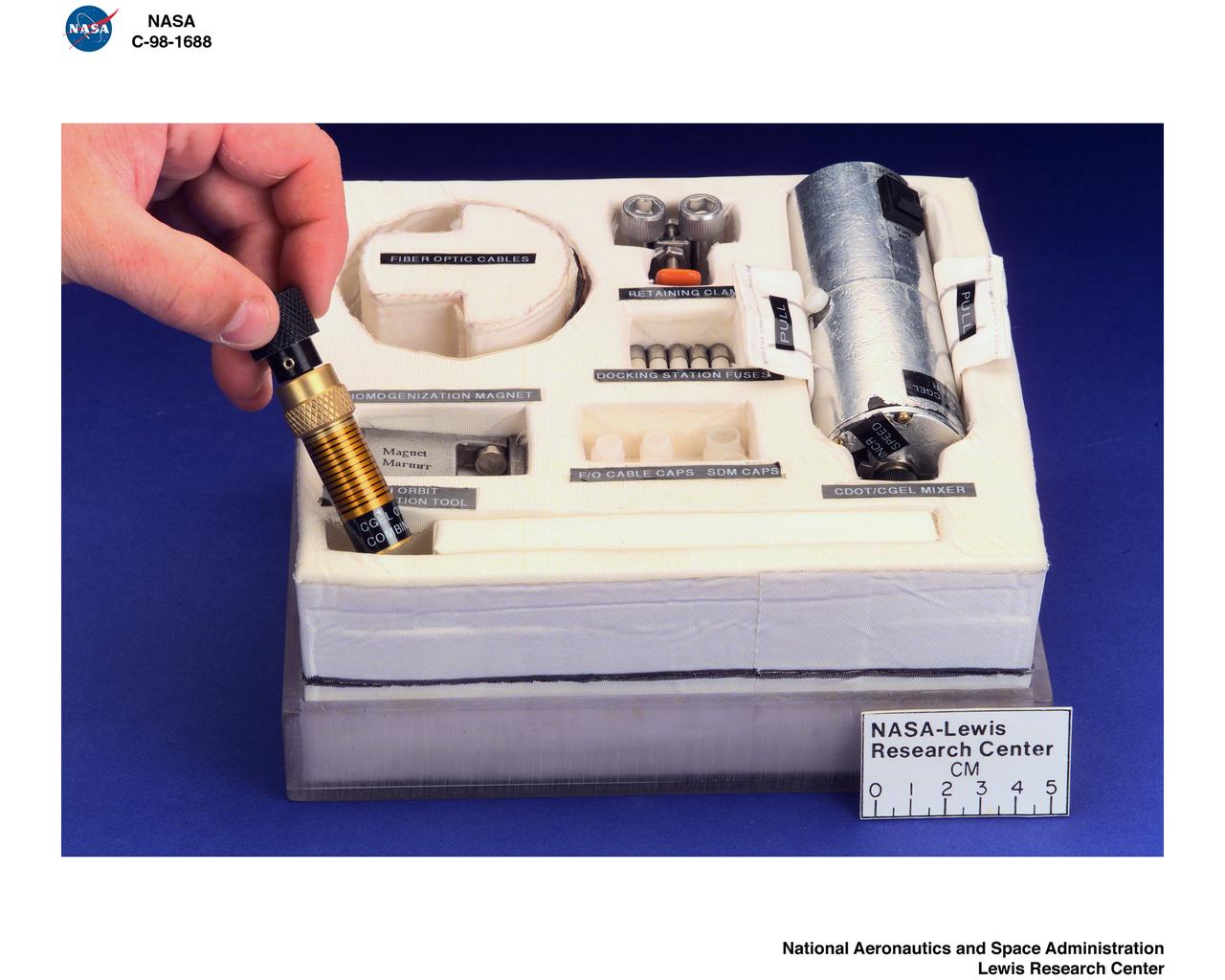
DIGITAL PHOTOGRAPHY OF COLLOIDAL GELATION AND COLLOIDAL DISORDER - ORDER TRANSITION

DIGITAL PHOTOGRAPHY OF COLLOIDAL GELATION AND COLLOIDAL DISORDER - ORDER TRANSITION
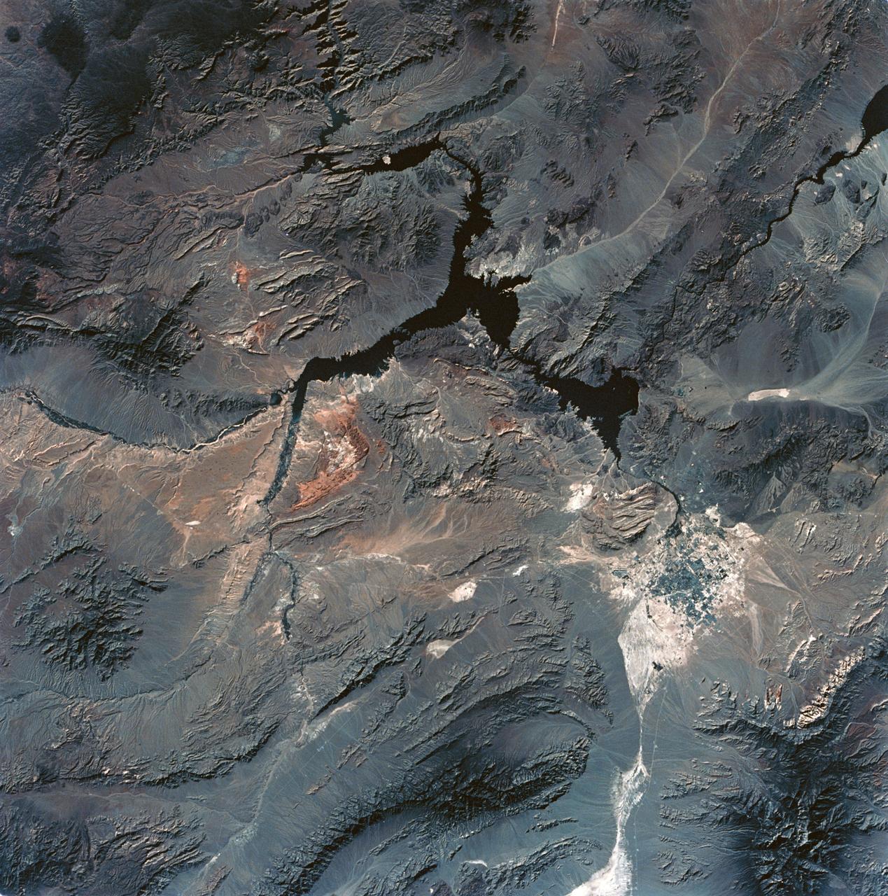
SL3-28-059 (July-September 1973) --- A vertical view of the Lake Mead and Las Vegas, Nevada area as photographed from Earth orbit by one of the six lenses of the Itek-furnished S190-A Multispectral Photographic Facility Experiment aboard the Skylab space station. Lake Mead is water of the Colorado River impounded by Hoover Dam. Most of the land in the picture is Nevada. However, a part of the northwest corner of Arizona can be seen. Federal agencies participating with NASA on the EREP project are the Departments of Agriculture, Commerce, Interior, the Environmental Protection Agency and the Corps of Engineers. All EREP photography is available to the public through the Department of Interior?s Earth Resources Observations Systems Data Center, Sioux Falls, South Dakota, 57198. Photo credit: NASA
STS-1 ONBOARD PHOTOGRAPHY - STS-1-7-0502: STS-1 Pilot Robert Crippen at lunch.
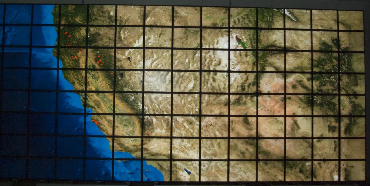
NASA Ames Hyperwall II showing fires world wide Photo taken by Summer Photography Intern Nick Tran

NASA’s C-20A with Generation Orbit’s hypersonic testbed attached is chased by the agency’s F-18 jet for safety and photography.
SL3-45-020 (July-September 1973) --- A vertical view of the Virginia-Tennessee-Kentucky border area as photographed from Earth orbit by one of the six lenses of the Itek-furnished S190-A Multispectral Photographic Facility Experiment aboard the Skylab space station. This picture was taken with type 2443 infrared color film. The S190-A experiment is part of the Skylab Earth Resources Experiments Package. The long, narrow ridge is Pine Mountain; and it is crossed by U.S. 25E at Pineville near its southernmost end. Some 25 miles south of Pineville U.S. 25E passes through the famed Cumberland Gap which at 1,600 feet elevation crosses Cumberland Mountain. Kingsport, Tennessee is located east of Cumberland Gap near the center of the picture. Bristol, Tennessee-Virginia is further east. Greenville and Elizabethton, Tennessee can also be seen in this photograph. The clouds across the southeast edge of the picture are over the Blue Ridge Mountains. Federal agencies participating with NASA on the EREP project are the Departments of Agriculture, Commerce, Interior, the Environmental Protection Agency and the Corps of Engineers. All EREP photography is available to the public through the Department of Interior?s Earth Resources Observations Systems Data Center, Sioux Falls, 57198. Photo credit: NASA
SL3-33-167 (July-September 1973) --- A vertical view of the Argentina-Paraguay border area of South America as photographed from Earth orbit by one of the six lenses of the Itek-furnished S190-A Multispectral Photographic Facility Experiment aboard the Skylab space station. This picture was taken with type 2443 infrared color film. The Parana River flows from east to west across the picture. This part of the Rio Parana is located between the towns of Posadas, Argentina, and Resistencia, Argentina. The major body of water in the large swamp area is Laguna Ibera. Note the several fires burning in this area. The largest land mass (Argentina) is south of the river. Paraguay is north of the river. Isla Apipe Grande is near the center of the photograph. The S190-A experiment is part of the Skylab Earth Resources Experiments Package. Federal agencies participating with NASA on the EREP project are the Departments of Agriculture, Commerce, Interior, the Environmental Protection Agency and the Corps of Engineers. All EREP photography is available to the public through the Department of Interior?s Earth Resources Observations Systems Data Center, Sioux Falls, South Dakota, 57198. Photo credit: NASA

Photography from Shuttle ALT FF-5. S77-30393: ALT Fr. 3258, a higher-up shot of the Enterprise approaching runway for landing. EAFB, CA
This photo was taken by Lunar Orbiter IV. In it's mission to photograph areas on the new and far side of the Moon and supplemental photography of suggested Apollo landing sites.

A view of the TAGSAM (Touch and Go Sample Acquisition Mechanism) from above, showing the Mylar flap with a pile of asteroid material resting on it. This image was created using manual high-resolution precision photography and semi-automated focus stacking procedure. Created using manual high-resolution precision photography and semi-automated focus stacking procedure. Credit: NASA/Erika Blumenfeld & Joseph Aebersold
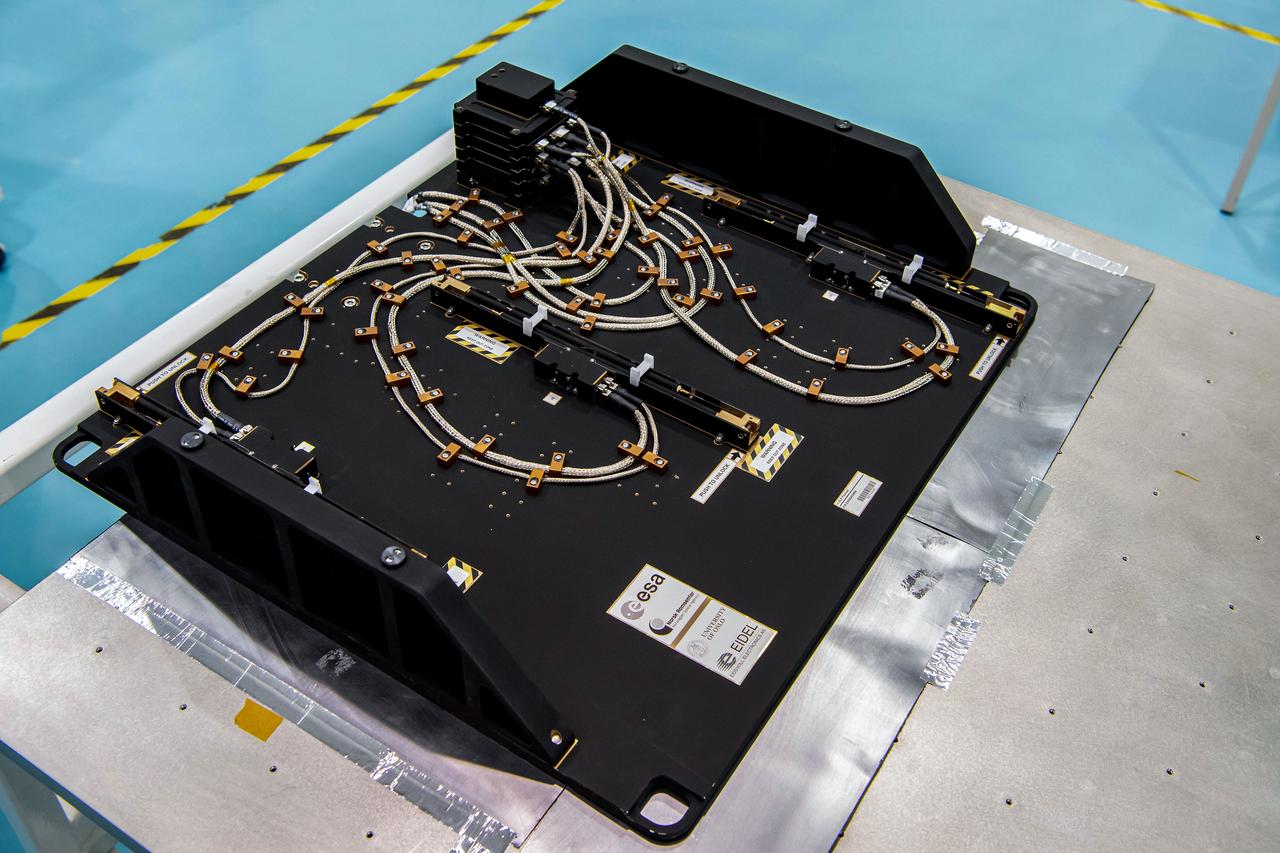
jsc2023e046371 (12/02/2022) --- The Multi-Needle Langmuir Probe (m-NLP) is seen at European Test Services (ETS) before thermal vacuum testing. The Langmuir Probe measures contents of the ionosphere from station's unique vantage point. Measurements of small-scale changes could allow for discovery that prevents degradation in global navigation systems. Image courtesy of ESA/Estec, Kensa Benamar.

SL3-22-0214 (July-September 1973) --- A vertical view of southeastern Washington State as photographed from Earth orbit by one of the six lenses of the Itek-furnished S190-A Multispectral Photographic Facility Experiment aboard the Skylab space station. The Snake River flows into the Columbia River in the most southerly corner of the picture. The Wallula Lake is below the junction of the two rivers. The Yakima Valley is at the southwestern edge of the photograph. The Columbia Basin is in the center of the picture. The Cascade Range extends across the northwest corner of the photograph. This picture was taken with type SO-356 regular color film. The S190-A experiment is part of the Earth Resources Experiments Package. Federal agencies participating with NASA on the EREP project are the Departments of Agriculture, Commerce, Interior, the Environmental Protection Agency and the Corps of Engineers. All EREP photography is available to the public through the Department of Interior?s Earth Resources Observations Systems Data Center, Sioux Falls, South Dakota, 57198. Photo credit: NASA

SL3-40-077 (July-September 1973) --- A vertical view of the Mediterranean coastal area of southeastern France as photographed from Earth orbit by one of the six lenses of the Itek-furnished S190-A Multispectral Photographic Facility Experiment aboard the Skylab space station. This view of the coast extends from the eastern outskirts of Marseilles easterly to Cannes, and includes the city of Toulon. The S190-A experiment is part of the Skylab Earth Resources Experiments Package. Federal agencies participating with NASA on the EREP project are the Departments of Agriculture, Commerce, Interior, the Environmental Protection Agency and the Corps of Engineers. All EREP photography is available to the public through the Department of Interior?s Earth Resources Observations Systems Data Center, Sioux Falls, South Dakota, 57198. Photo credit: NASA
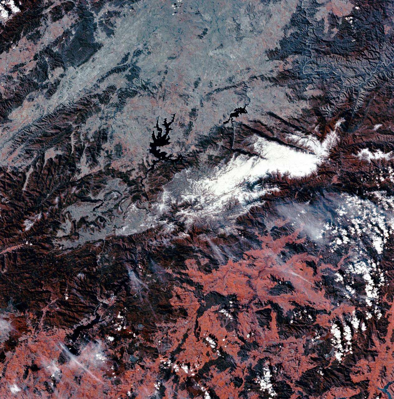
SL3-22-0322 (July-September 1973) --- An oblique view of the Salt Lake City, Utah area as photographed from Earth orbit by one of the six lenses of the Itek-furnished S190-A Multispectral Photographic Facility Experiment aboard the Skylab space station. Approximately two-thirds of the Great Salt Lake is in view. The smaller body of water south of Salt Lake City is Utah Lake. The Wasatch Range is on the east side of the Great Salt Lake. Federal agencies participating with NASA on the EREP project are the Departments of Agriculture, Commerce, Interior, the Environmental Protection Agency and the Corps of Engineers. All EREP photography is available to the public through the Department of Interior?s Earth Resources Observations Systems Data Center, Sioux Falls, South Dakota, 57198. Photo credit: NASA
SL3-27-180 (July-September 1973) --- A vertical view of the Snowy Mountains area of Australian Alps in the States of Victoria and New South Wales, Australia, as photographed from Earth orbit by one of the six lenses of the Itek-furnished S190-A Multispectral Photographic Facility Experiment aboard the Skylab space station. This picture was taken with type 2443 infrared color film. The lake near the center of the picture is the Eucumbene Reservoir. This area is located immediately south-southwest of the capital city of Canberra. Federal agencies participating with NASA on the EREP project are the Departments of Agriculture, Commerce, Interior, the Environmental Protection Agency and the Corps of Engineers. All EREP photography is available to the public through the Department of Interior?s Earth Resources Observations Systems Data Center, Sioux Falls, South Dakota, 57198. Photo credit: NASA
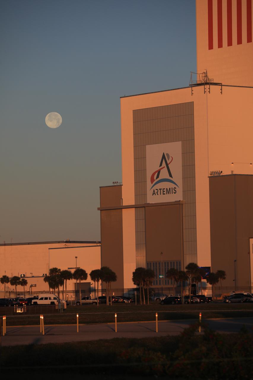
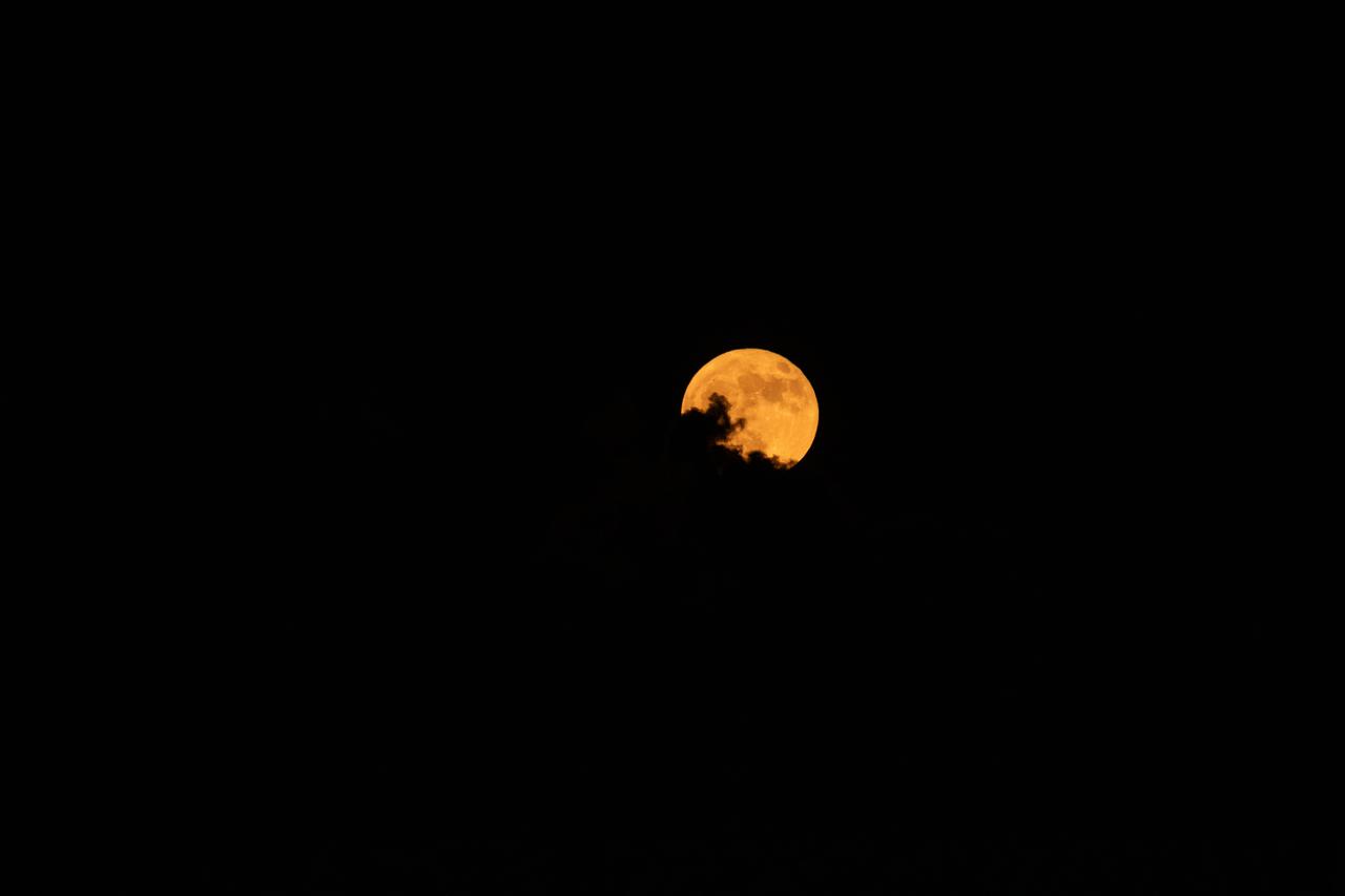
A brilliant Moon serves as the backdrop in this view of the low bay entrance to the Vehicle Assembly Building at NASA’s Kennedy Space Center in Florida on Jan. 18, 2020. An Artemis banner is positioned over the entrance.
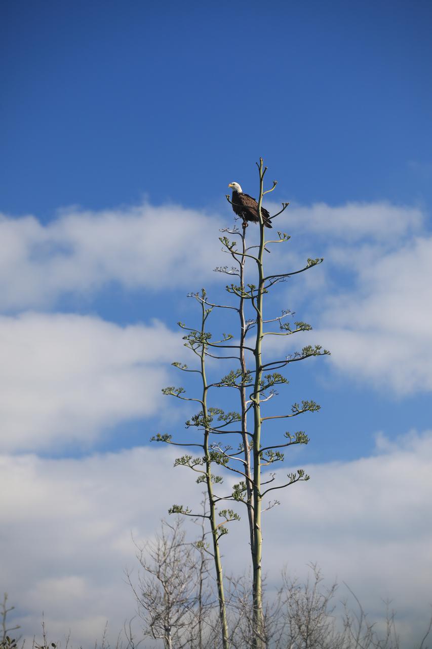
An American Bald Eagle perches majestically in a tree at NASA’s Kennedy Space Center in Florida on Jan. 18, 2022. The center shares a border with the Merritt Island National Wildlife Refuge. More than 330 native and migratory bird species call Kennedy and the wildlife refuge home.

iss065e110749 (June 14, 2021) --- Expedition 65 Commander Akihiko Hoshide of the Japan Aerospace Exploration Agency (JAXA) is pictured inside the cupola, the International Space Station's "window to the world," during Earth photography activities.
iss071e513872 (Aug. 10, 2024) --- NASA astronaut and Expedition 71 Flight Engineer Matthew Dominick smiles for a portrait during photography duties aboard the International Space Station's Destiny laboratory.
iss065e208553 (July 28, 2021) --- Roscosmos cosmonaut and Expedition 65 Flight Engineer Oleg Novitskiy is pictured during photography activities inside the International Space Station's Zvezda service module.
iss065e144343 (June 23, 2021) --- Expedition 65 Commander Akihiko Hoshide of the Japan Aerospace Exploration Agency is pictured during photography activities aboard the International Space Station.
1996 MCP (Multimedia Curriculum Project) summer students practice techniques with Ames Documentation Technology Branch Video Groups' Patty Viajar and Adam Souza (photography student)
iss065e389253 (Sept. 19, 2021) --- Expedition 65 Flight Engineer Thomas Pesquet of ESA (European Space Agency) is pictured during Earth photography activities inside the seven-windowed cupola, the International Space Station's "window to the world."
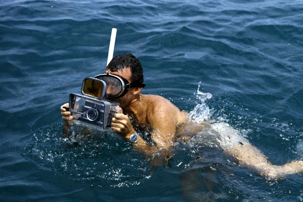
S62-05161 (1962) --- Astronaut L. Gordon Cooper Jr. participates in Mercury water egress training. He is wearing a snorkel and holding a camera for underwater photography. Photo credit: NASA
Behind the Scenes photography of Video Production Shoot for "What's Behind This Door". Photo Date: August 7, 2023. Location: Building 32, Chamber A. Photographer: Robert Markowitz
iss062e141186 (March 10, 2020) ---NASA astronauts and Expedition 62 Flight Engineers Andrew Morgan and Jessica Meir participate in Earth photography activities inside the Destiny laboratory module's Window Observation Research Facility.
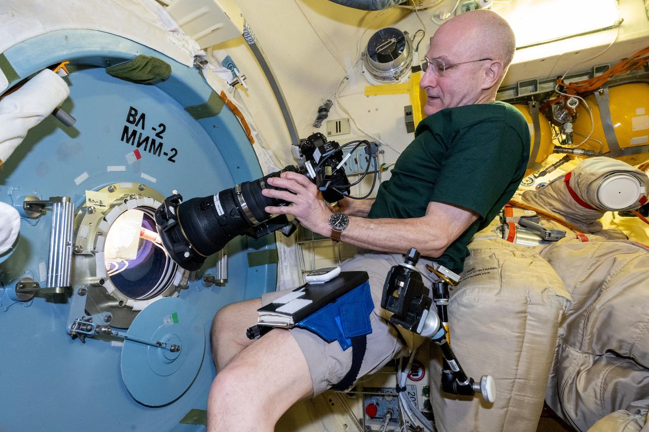
iss072e350812 (Dec. 7, 2024) --- NASA astronaut and Expedition 72 Flight Engineer Don Pettit points a camera outside a window on the International Space Station's Poisk module for a sun photography session.
iss068e021032 (Nov. 7, 2022) --- Roscosmos cosmonaut and Expedition 68 Flight Engineer Anna Kikina prepares camera equipment for an Earth photography session through a hatch window on the International Space Station's Harmony module.
Lockheed Martin Photography By Garry Tice 1011 Lockheed Way, Palmdale, Ca. 93599 Event: NASA Payload Pallet XVS Mock-Up Date: 7/01/2020 Additional Info:
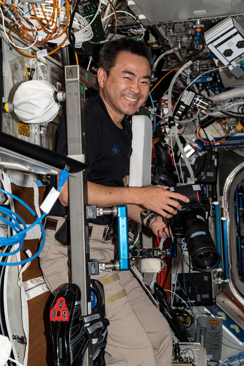
iss070e128588 (March 23, 2024) --- Expedition 70 Flight Engineer and NASA astronaut Matthew Dominick smiles for a portrait during photography duties aboard the International Space Station.

NASA astronaut Loral O'Hara brings a fresh perspective to portrait photography with a hair flip that seems to defy gravity at the NASA Johnson Space Center photo studio. Photographer: Josh Valcarcel – Johnson Space Center
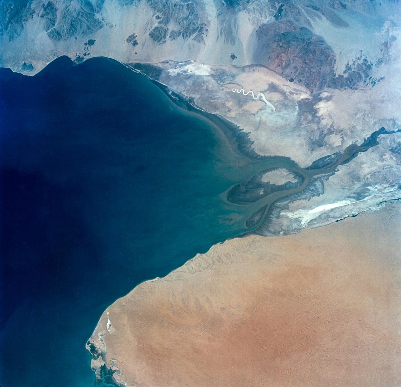
S65-34673 (3-7 June 1965) --- This photograph shows the north end of the Gulf of California at the mouth of the Colorado River as it was seen from the Gemini-4 spacecraft during orbital flight June 3-7, 1965. This picture was part of the Synoptic Terrain Photography experiments conducted during the flight to obtain high quality photographs of large land areas already mapped by aerial photography. In charge of these experiments was Dr. Paul D. Lowman Jr., NASA geologist from Goddard Space Flight Center, Greenbelt, Md. This picture was taken with a modified 70mm Hasselblad camera using Eastman color film, ASA 64 at a lens setting of 250th of a second at f/11.
iss058e002448 (Jan. 9, 2019) --- Expedition 58 Commander Oleg Kononenko of Roscosmos is pictured inside the Pirs docking compartment during operations to install gear for the VIZIR earth observation experiment. The study tests the technology of automated coordinate referencing of images of the Earth’s surface, and space, taken by crew members using “free-floating” photography equipment in weightlessness. Credit: Roscosmos

AS11-44-6667 (21 July 1969) --- This outstanding view of the whole full moon was photographed from the Apollo 11 spacecraft during its trans-Earth journey homeward. When this picture was taken, the spacecraft was already 10,000 nautical miles away. Onboard Apollo 11 were astronauts Neil A. Armstrong, commander; Michael Collins, command module pilot; and Edwin E. Aldrin Jr., lunar module pilot. While astronauts Armstrong and Aldrin descended in the Lunar Module (LM) "Eagle" to explore the moon, astronaut Collins remained with the Command and Service Modules (CSM) "Columbia" in lunar orbit.

Two NASA F-15 aircraft sit on the ramp at NASA's Armstrong Flight Research Center, in Edwards, California, ahead of dual F-15 flights that validated the integration of three tools – the Airborne Schlieren Photography System (ASPS), the Airborne Location Integrating Geospatial Navigation System (ALIGNS), and shock-sensing probe. Together these tools will measure and visualize the shock waves generated by NASA's X-59.
SL3-87-299 (July-September 1973) --- A vertical view of southeastern New York State is seen in this Skylab 3 Earth Resources Experiments Package S190-B (five-inch Earth terrain camera) infrared photograph taken from the Skylab space station in Earth orbit. An 18-inch, 450mm lens and type 2443 infrared Ektachrome film was used. This picture covers the northern part of New Jersey, a part of northwestern Pennsylvania, and the western tip of Connecticut. The body of water is Long Island Sound. The wide Hudson River flows southward across a corner of the photograph. The New York City metropolitan area occupies part of the picture. Federal agencies participating with NASA on the EREP project are the Departments of Agriculture, Commerce, Interior, the Environmental Protection Agency and the Corps of Engineers. All EREP photography is available to the public through the Department of Interior?s Earth Resources Observations Systems Data Center, Sioux Falls, South Dakota, 57198. Photo credit: NASA

SL3-33-156 (July-September 1973) --- A near vertical view of the Florence, Italy area as photographed from Earth orbit by one of the Itek-furnished S190-A Multispectral Photographic Facility Experiment aboard the Skylab space station. The view extends from the Ligurian Sea, an extension of the Mediterranean Sea, across the Apennine Mountains to the Po River Valley. Florence (Firenze) is near the center of the land mass. The mouth of the Arno River is at the center of the coastline. The city of Leghorn (Livorno) is on the coast just south of the Arno River. This picture was taken with type 2443 infrared color film. The S190-A experiment is part of the Skylab Earth Resources Experiments Package. Federal agencies participating with NASA on the EREP project are the Department of Agriculture, Commerce, Interior, the Environmental Protection Agency and the Corps of Engineers. All EREP photography is available to the public through the Department of Interior?s Earth Resources Observations Systems Data Center, Sioux Falls, South Dakota, 57198. Photo credit: NASA

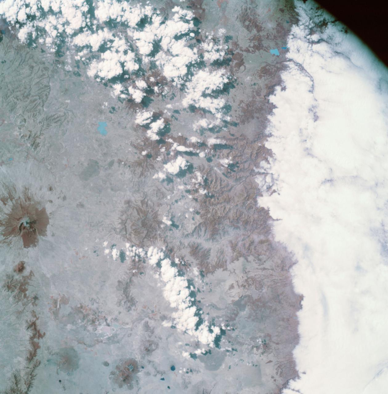
STS060-87-087 (3-11 Feb 1994) --- Lake Baikal, in southeastern Siberia, is the largest freshwater lake in the world by volume, holding nearly 20 per cent of the world's fresh water. Lake Baikal is a biospheric reserve of high international interest to the global scientific community. It is home to some 600 endemic species, many found in no other location. This view shows the northern end of the lake, and was taken in the early morning with low sun highlighting the mountain ranges rimming the lake basin. Pristine forests surround the lake, although heavy logging is evident in other photography of the central and southern portions of the lake. Another unique aspect of Lake Baikal is the existence of the world's only known freshwater hydrothermal springs. The fault system which bounds the lake allows fluids to circulate deep into the Earth and resurface as hot springs around and in the lake. Russian and American scientists are using the Shuttle photography to examine the relationship of the lake's ice cover to areas of known hydrothermal activity. Thus Lake Baikal has been and continues to be a high-priority site for photography from space from both the Space Shuttle and the Russian Space Station MIR.
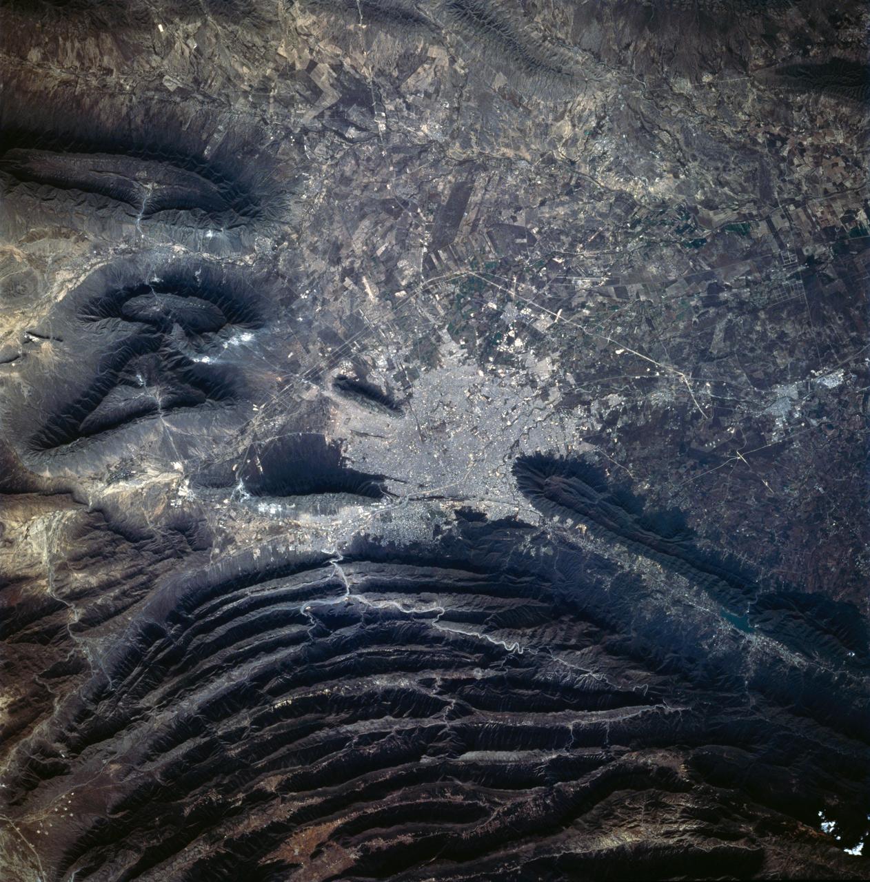
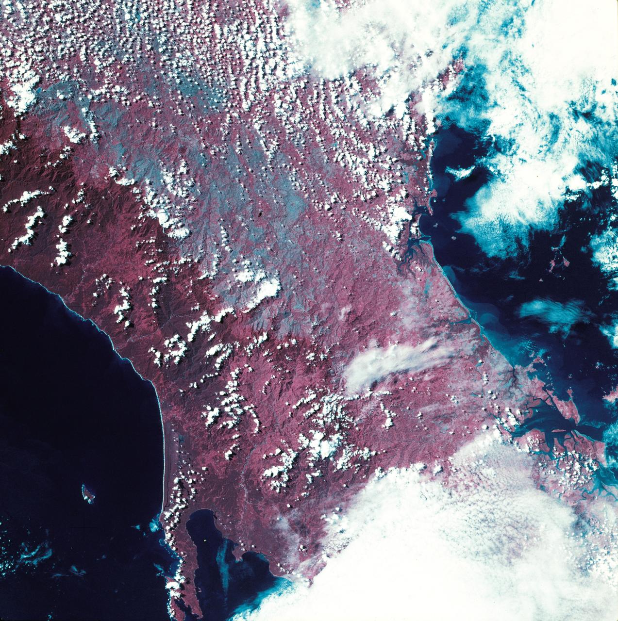
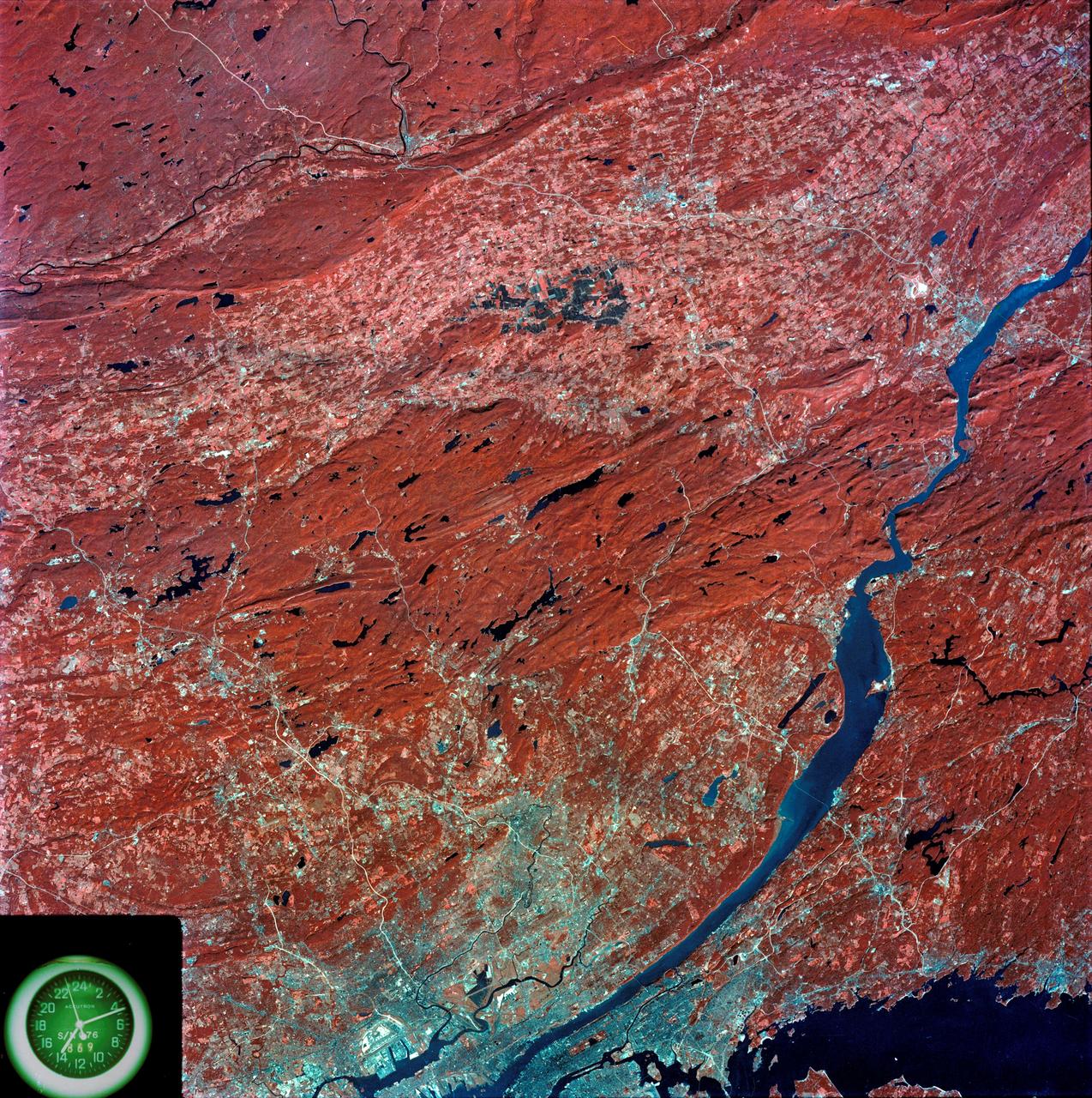
STS060-83-041 (3-11 Feb 1994) --- The large city of Monterrey, in northeastern Mexico, was founded at the edge between the Sierra Madre Oriental and the Rio Grande Embayment portion of the Gulf Coastal Plain. This location is analogous to the Fall Line along the United States eastern seaboard, but instead of lying along a stream at the head of navigation, Monterrey lies at the boundary between a well-watered mountain range and a semi-arid plain where irrigation is often necessary for successful agriculture. The mountains themselves are formed from folded limestone and shale beds; to the south of the city, beds are crumpled into tight folds. Around and north of the city, more open folds gradually give way to nearly flat-lying beds of the coastal plain. Because of the water and other resources such as shale and limestone to quarry and burn for cement, Monterrey early became a thriving industrial center. It is now one of Mexico's largest cities with a population of approximately 5 million. According to NASA geologists, the STS-60 photography of this area is the best that has been acquired during the past 32 years of space photography by the United States. Monterrey remains an area of high interest for future photography in order to assess the impact of urbanization in this area.
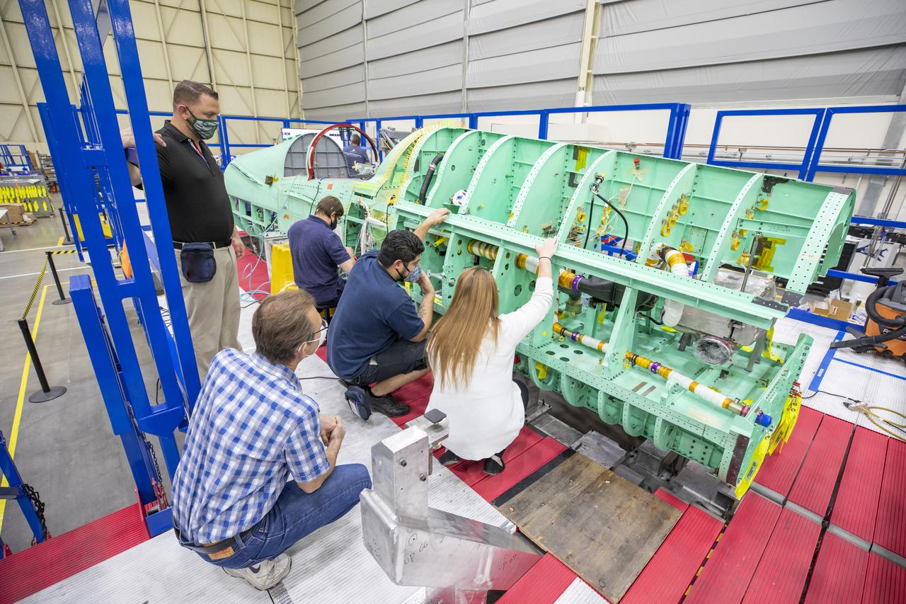
Technicians are shown here working on the X-59 fuselage section of the aircraft. The fuselage contains the cockpit and helps define the distinct shape of the X-59. Lockheed Martin Photography By Garry Tice 1011 Lockheed Way, Palmdale, Ca. 93599 Event: SEG 210 Forebody-Subsystems Date: 5/12/2021

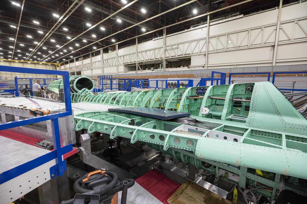
Pictured here is an overhead view of the X-59 as it comes together for the major assembly merger in summer 2021. Lockheed Martin Photography By Garry Tice 1011 Lockheed Way, Palmdale, Ca. 93599 Event: Manufacturing Area From Above Date: 5/26/2021
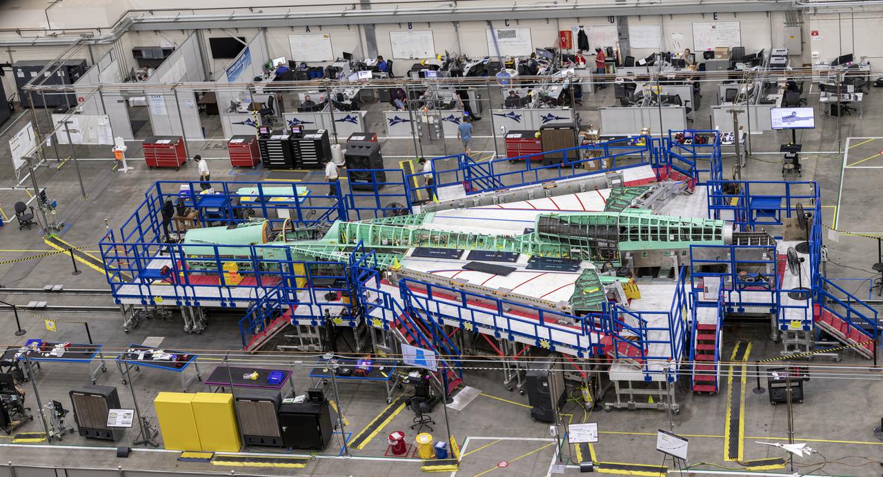
Pictured is an overhead view of the X-59 as it comes together for the major assembly merger in summer 2021. Lockheed Martin Photography By Garry Tice 1011 Lockheed Way, Palmdale, Ca. 93599 Event: Manufacturing Area From Above Date: 5/26/2021
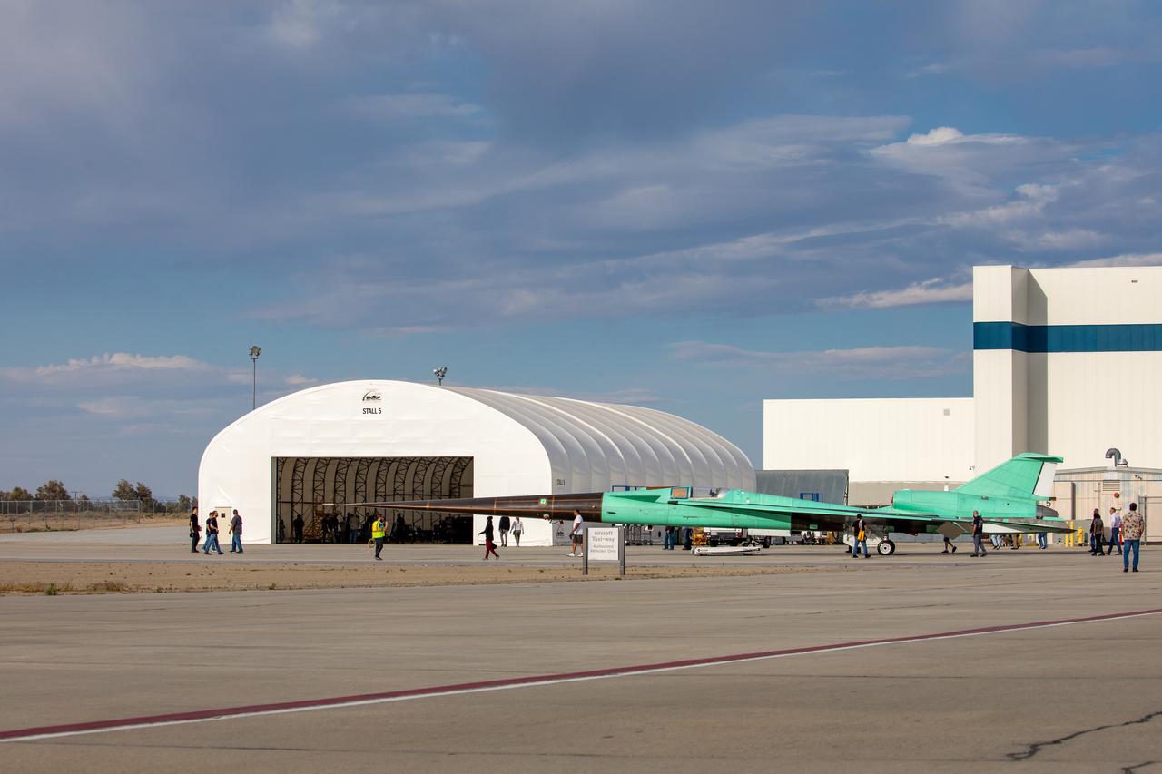
Technicians check out the X-59 aircraft as it sits near the runway at Lockheed Martin Skunk Works in Palmdale, California, on June 19, 2023. Lockheed Martin Photography By Garry Tice 1011 Lockheed Way, Palmdale, Ca. 93599 Event: Move to Run Stall 5 Date: 6/19/2023 Additional Info:
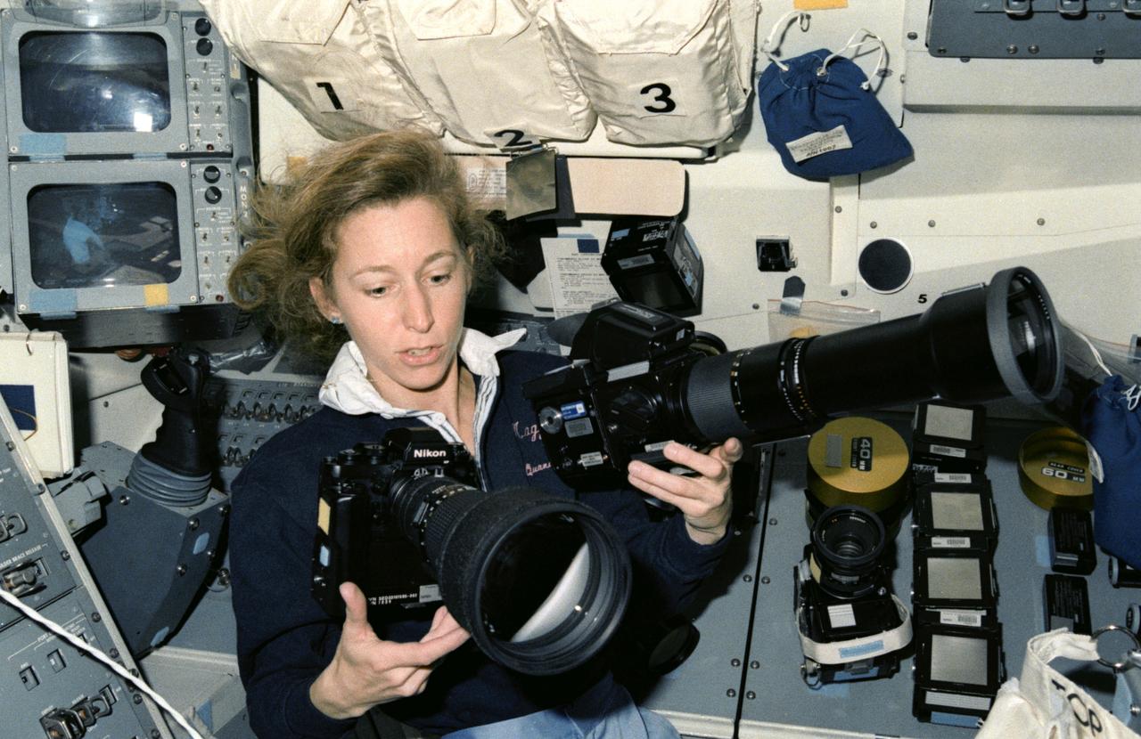
STS032-15-022 (9-20 Jan 1990) --- A 35mm scene of Astronaut Marsha S. Ivins with 35mm and 70mm cameras and accessories on Columbia's aft flight deck. The photo depicts the role photography played on the record-setting 11-day STS-32 mission.
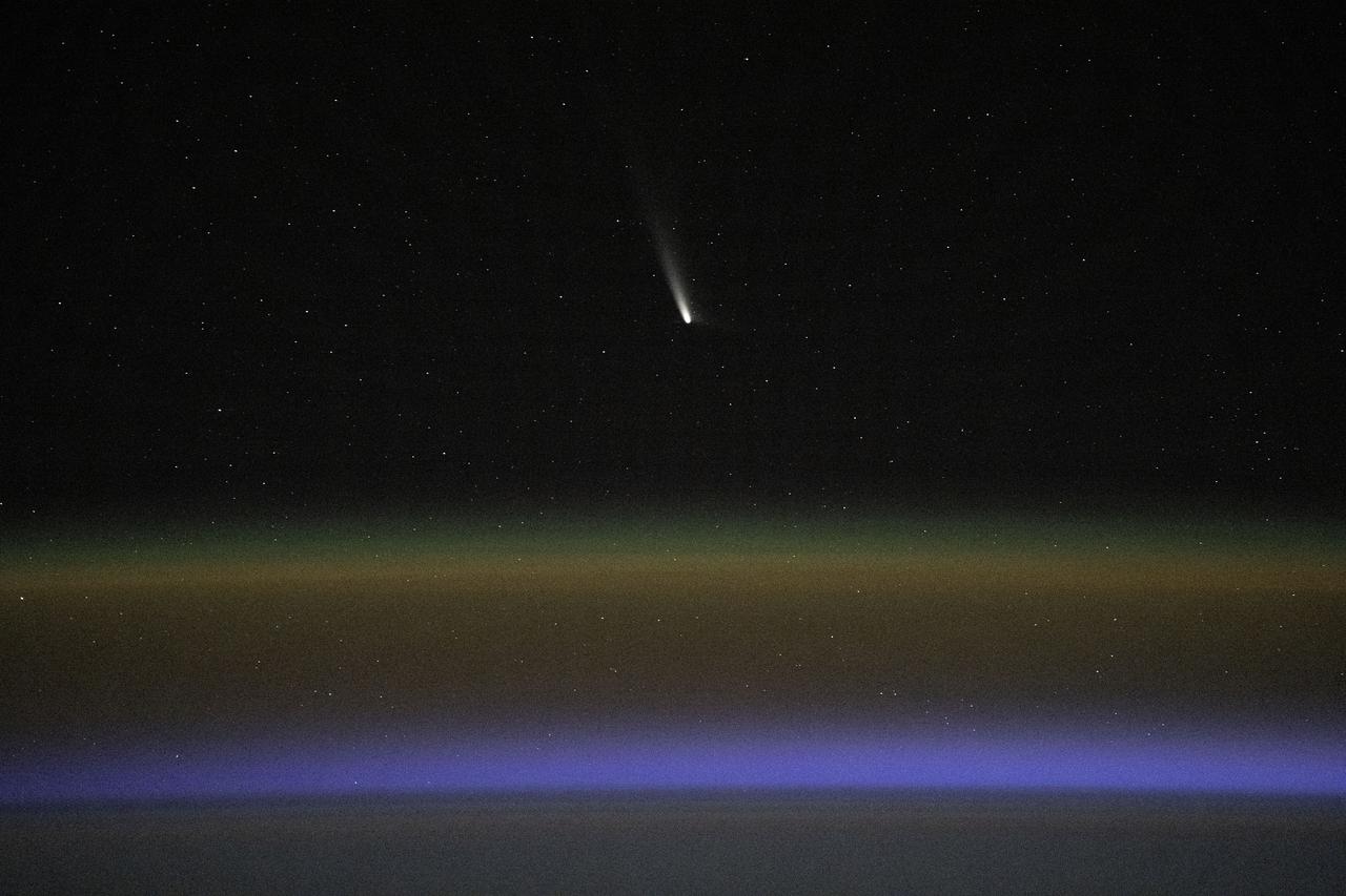
iss071e700447 (Sept. 22, 2024) --- Comet C2023-A3, or Tsuchinshan-ATLAS, was pictured about 99.4 million miles away from Earth by NASA astronaut Matthew Dominick using long-duration photography on a camera programmed for high sensitivity aboard the International Space Station
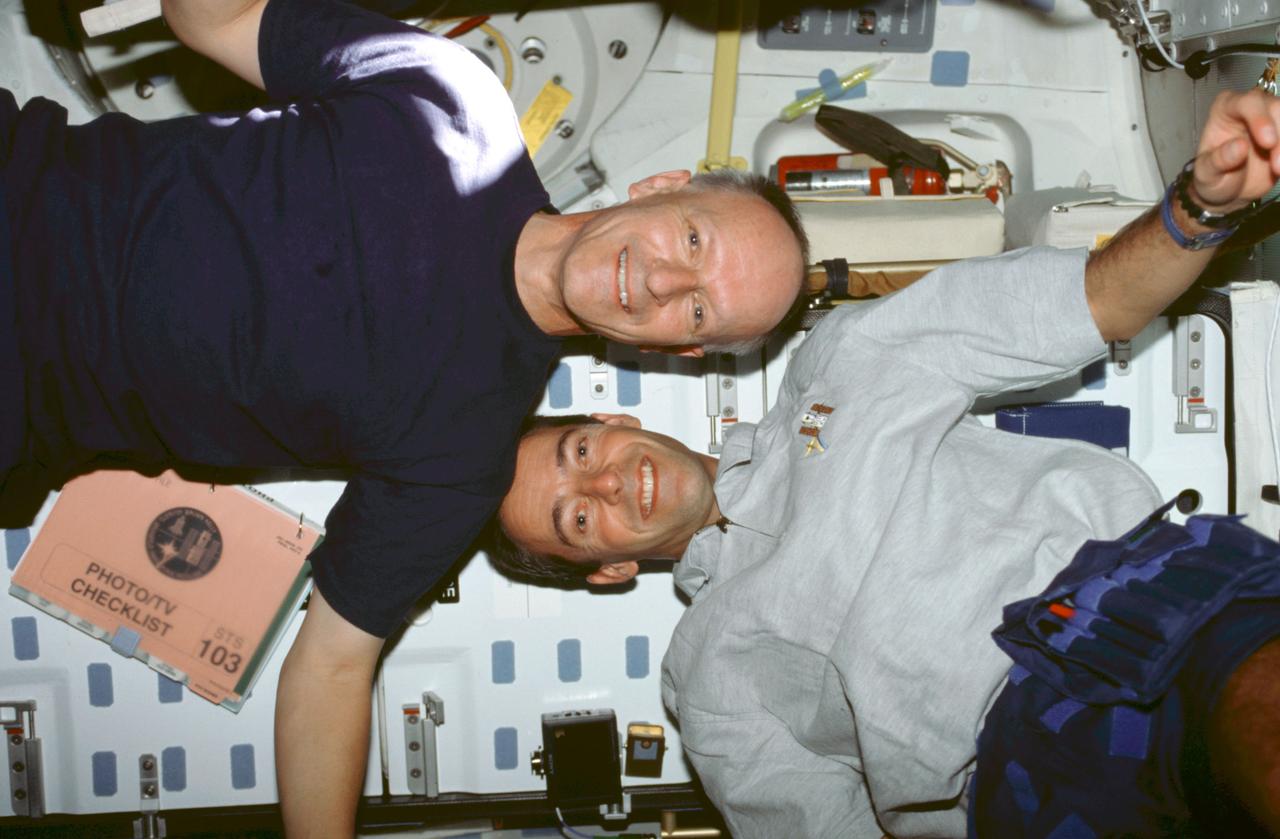
STS103-378-005 (19-27 December 1999) ---.Astronauts Claude Nicollier (left) and.Jean-Francois Clervoy, mission specialists representing the European Space Agency (ESA), move about on Discovery's mid deck in a manner they could not duplicate in Earth-bound training. A photography/television checklist floats nearby.
Lockheed Martin Photography By Garry Tice 1011 Lockheed Way, Palmdale, Ca. 93599 Event: SEG 410 Main Wing, COBRA Drillng Machine, Drilling Lower Wing Skins Date: 1/07/20 Additional Info:

Lockheed Martin Photography By Garry Tice 1011 Lockheed Way, Palmdale, Ca. 93599 Event: SEG 410 Main Wing, COBRA Drillng Machine, Drilling Lower Wing Skins Date: 1/07/20 Additional Info:
ISS038-E-010916 (2 Dec. 2013) --- At a window in the International Space Station?s Zvezda Service Module, Russian cosmonaut Oleg Kotov, Expedition 38 commander, uses a digital camera photospectral system during a session for the Seiner ocean photography experiment.
iss072e350829 (Dec. 7, 2024) --- NASA astronaut and Expedition 72 Flight Engineer Don Pettit points a camera outside a window on the International Space Station's Poisk module for a sun photography session with assistance from Roscosmos cosmonaut and Expedition 72 Flight Engineer Ivan Vagner.
STS095-E-5190 (31 Oct. 1998) --- U.S. Sen. John H. Glenn Jr., STS-95 payload specialist, focuses in on a target of opportunity as he participates in earth observations photography. The photo was taken with an electronic still camera (ESC) at 02:21:14 GMT, Oct. 31. Photo credit: NASA
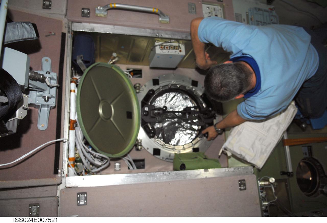
ISS024-E-007521 (8 July 2010) --- In the International Space Station’s Zvezda Service Module, Russian cosmonaut Fyodor Yurchikhin, Expedition 24 flight engineer, prepares to conduct a session for Russia's Environmental Safety Agency (EKON), making observations and taking KPT-3 aerial photography of environmental conditions on Earth.

Lockheed Martin Photography By Garry Tice 1011 Lockheed Way, Palmdale, Ca. 93599 Event: SEG 410 Main Wing, COBRA Drillng Machine, Drilling Lower Wing Skins Date: 1/07/20 Additional Info:

Lockheed Martin Photography By Garry Tice 1011 Lockheed Way, Palmdale, Ca. 93599 Event: SEG 410 Main Wing, COBRA Drillng Machine, Drilling Lower Wing Skins Date: 1/07/20 Additional Info:
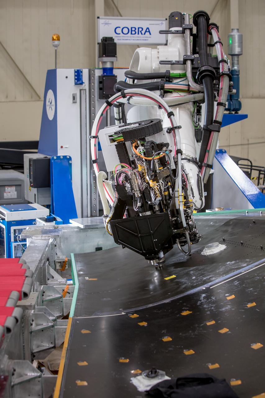
Lockheed Martin Photography By Garry Tice 1011 Lockheed Way, Palmdale, Ca. 93599 Event: SEG 410 Main Wing, COBRA Drillng Machine, Drilling Lower Wing Skins Date: 12/23/19 Additional Info:
Lockheed Martin Photography By Garry Tice 1011 Lockheed Way, Palmdale, Ca. 93599 Event: SEG 410 Main Wing, COBRA Drillng Machine, Drilling Lower Wing Skins Date: 1/07/20 Additional Info:
ISS038-E-010911 (2 Dec. 2013) --- At a window in the International Space Station?s Zvezda Service Module, Russian cosmonaut Oleg Kotov, Expedition 38 commander, uses a digital camera photospectral system during a session for the Seiner ocean photography experiment.

Lockheed Martin Photography By Garry Tice 1011 Lockheed Way, Palmdale, Ca. 93599 Event: SEG 410 Main Wing, COBRA Drillng Machine, Drilling Lower Wing Skins Date: 1/07/20 Additional Info:
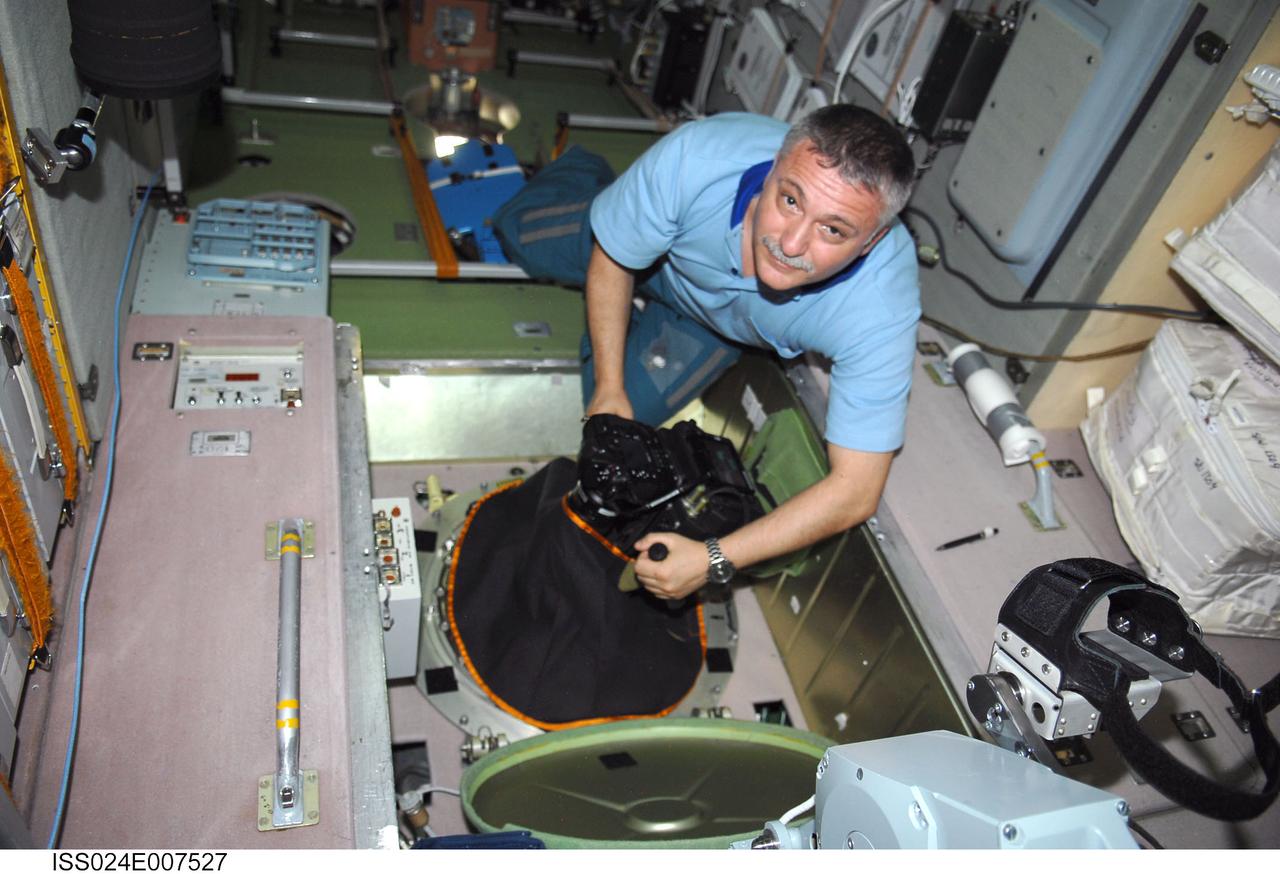
ISS024-E-007527 (8 July 2010) --- In the International Space Station’s Zvezda Service Module, Russian cosmonaut Fyodor Yurchikhin, Expedition 24 flight engineer, conducts a session for Russia's Environmental Safety Agency (EKON), making observations and taking KPT-3 aerial photography of environmental conditions on Earth.
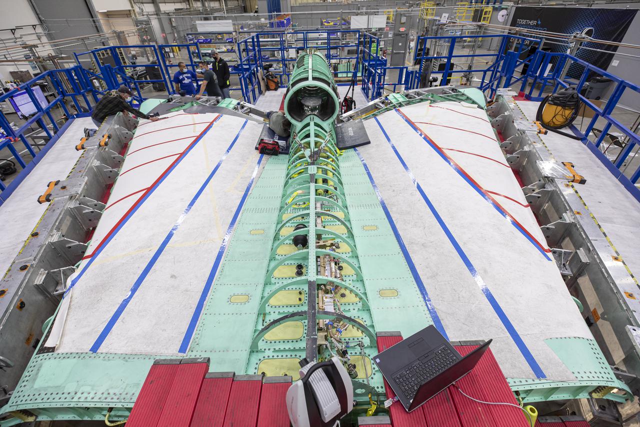
Lockheed Martin Photography By Garry Tice 1011 Lockheed Way, Palmdale, Ca. 93599 Event: SEG 400 Main Wing Assembly, SEG 430 Spine, SEG 500 Empennage Date: 4/28/2021 Additional Info:
Pictured here is a side view of the X-59 spine and engine inlet during assembly. Lockheed Martin Photography By Garry Tice 1011 Lockheed Way, Palmdale, Ca. 93599 Event: SEG 210 Forebody, SEG 430 Spine, SEG 500 Empennage Date: 6/08/2021
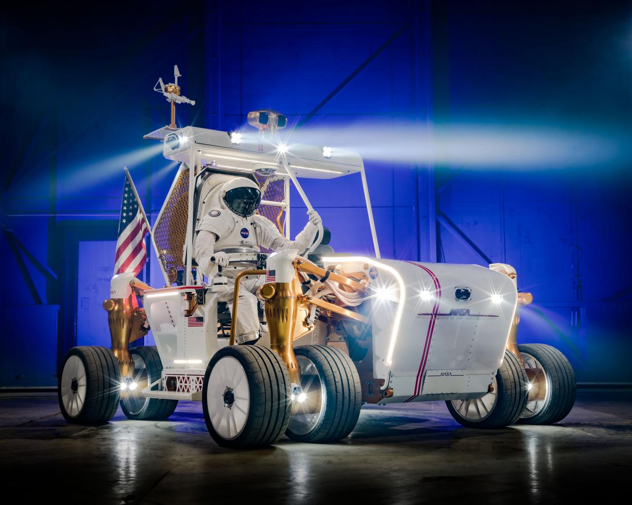
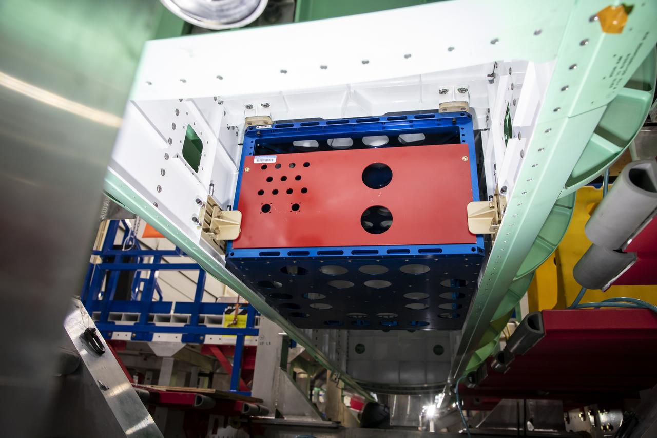
PHOTO DATE: 11-22-24 LOCATION: Bldg. 49 - West High Bay Tower SUBJECT: Production Photography of Lunar Terrain Vehicle Ground Test Unit PHOTO CREDIT: NASA / BILL STAFFORD AND HELEN ARASE VARGAS