
AS04-01-750 (9 Nov. 1967) --- Atlantic Ocean, Antarctica, looking west, as photographed from the Earth-orbital Apollo 4 (Spacecraft 017/Saturn 501) unmanned space mission. This picture was taken when the Spacecraft 017 and the Saturn S-IVB (third) stage was orbiting Earth at an altitude of 8,628 nautical miles.
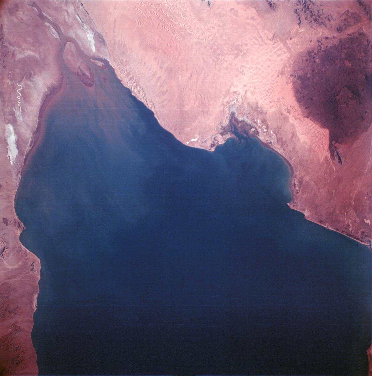
AS06-02-1436 (4 April 1968) --- View of the mouth of the Colorado River and the Gulf of California in northwestern Mexico as photographed from the unmanned Apollo 6 (Spacecraft 020/Saturn 502) space mission. Altitude of the spacecraft at the time picture was taken was 120 nautical miles. NORTH IS TOWARD LEFT SIDE OF PICTURE. At bottom edge of photograph is Baja California. In the upper left corner is the Mexican state of Sonora showing the Sonoran Desert and the Pinacate Mountains. This photograph was made three hours and seven minutes after liftoff using Eastman Kodak SO-121 high resolution aerial Ektachrome film (exposure setting was f/5.6 at 1/500 second) in a J.A. Maurer model 2200 camera.

AS04-01-580 (9 Nov. 1967) --- Earth as viewed from 10,000 miles. In 1969, the Apollo 4 (Spacecraft 017/Saturn 501) unmanned test flight made a great ellipse around Earth as a test of the translunar motors and of the high speed entry required of a manned flight returning from the moon. A 70mm camera was programmed to look out a window toward Earth, and take a series of photographs from "high apogee". Coastal Brazil, Atlantic Ocean, West Africa, Antarctica, looking west. This photograph was made when the Apollo 4 spacecraft, still attached to the S-IVB (third) stage, was orbiting Earth at an altitude of 9,544 miles.

AS04-01-410 (9 Nov. 1967) --- Coastal Brazil, Atlantic Ocean, West Africa, Sahara, Antarctica, looking west, as photographed from the Apollo 4 (Spacecraft 017/Saturn 501) unmanned, Earth-orbital space mission. This picture was taken when the Spacecraft 017 and Saturn S-IVB (third) stage were orbiting Earth at an altitude of 9,745 nautical miles.