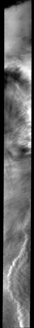
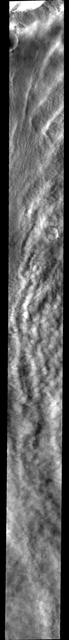
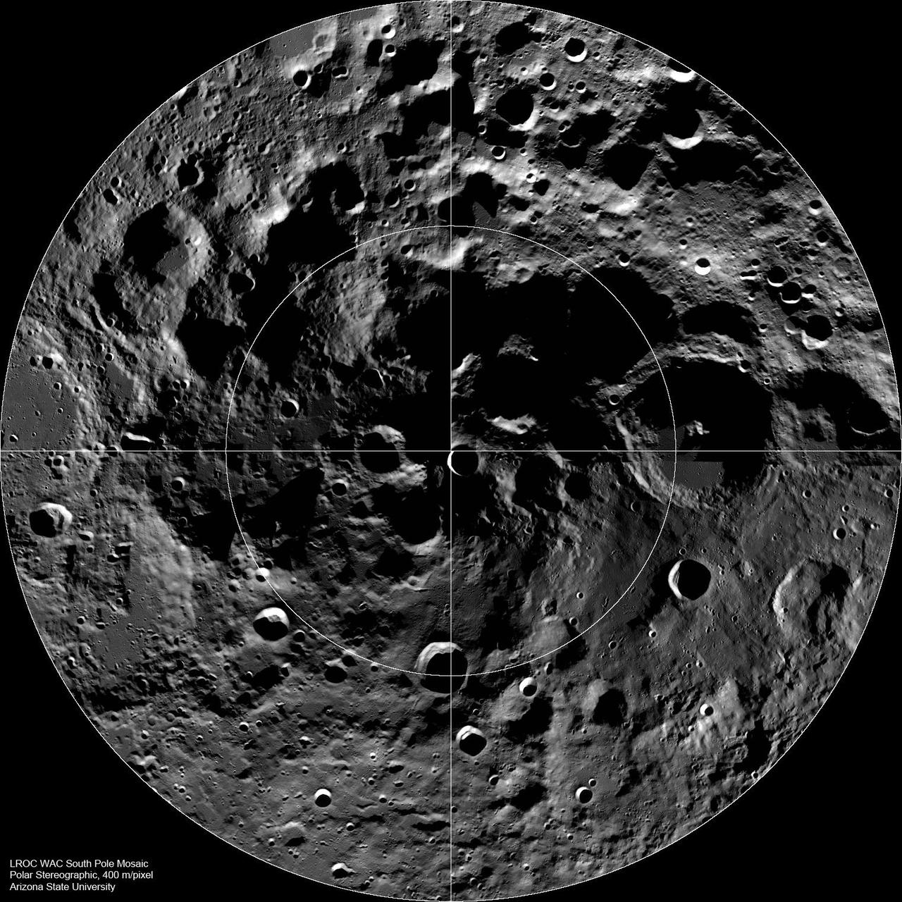
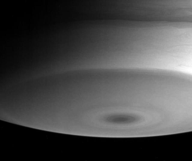
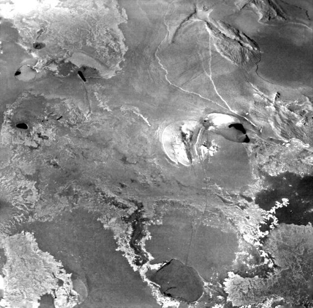
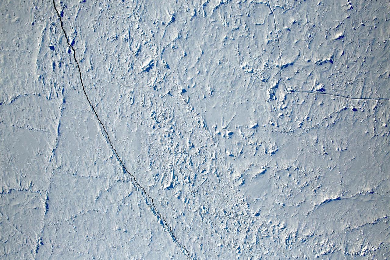
Stormy Pole
Stormy Pole
Vanishing Pole
Vanishing Pole
Cloudy Pole
Cloudy Pole
Cloudy Pole
Cloudy Pole
Squashed Pole
Squashed Pole
Perspective on the Pole
ErosNorth Pole
ErosNorth Pole
The Hole at the Pole
South Pole
South Pole
North Pole Mosaics
North Pole Mosaics
Conquest of the South Pole
Movie of Mercury South Pole
South Pole on Saturn
Clouds Over the North Pole
Infrared South Pole
Infrared South Pole
Close Look at the Pole
The Lunar South Pole
Titan Murky South Pole
Monitoring Mercury South Pole
Mercury Globe: South Pole
Mercury Globe: North Pole
South Pole in Ultraviolet
South Pole - Take 15
The Lunar North Pole
South Pole - Take 71
Ultraviolet South Pole
North Pole Tidings
North Pole Tidings
Moon North Pole
Moon North Pole
Above Rhea South Pole
Io - South Pole
Io - South Pole
Janus Pole Crater
Janus Pole Crater
South Pole Illumination Map
Sunlight Near the North Pole
Infrared South Pole
Infrared South Pole
South-Pole Swiss Cheese
Infrared Images of Saturn Poles
Peeking Over the Pole
Want to know what the North Pole looked like yesterday afternoon?   Well, our friends from NASA Operation IceBridge brought us this view from 500 meters about the North Pole.  So what are you seeing? That's sea ice, with a few ridges and a bit of snow cover, and with a few small cracks, almost leads in the ice.  Credit: NASA/Goddard/Operation IceBridge/Eric Fraim
View of the North Pole
As spring progresses at the south pole, the surface reacts to the change of season. This image from NASA 2001 Mars Odyssey spacecraft shows a region of the south pole that is monitored throughout spring, summer, and fall at the south pole.
South Pole
Norwegian explorer Roald Amundsen became the first man to reach the South Pole in December 1911. More than 100 years later, an international team of scientists that includes a NASA researcher has proven that air pollution from industrial activities arrived to the planet’s southern pole long before any human.  Using data from 16 ice cores collected from widely spaced locations around the Antarctic continent, including the South Pole, a group led by Joe McConnell of the Desert Research Institute (DRI) in Reno, Nevada, created the most accurate and precise reconstruction to date of lead pollution over Earth’s southernmost continent. The new record, described in an article published today in the online edition of the Nature Publishing Group’s journal Scientific Reports, spans a 410-year period from 1600 to 2010.  More here: <a href="http://1.usa.gov/1oB4p9U" rel="nofollow">1.usa.gov/1oB4p9U</a>  <b><a href="http://www.nasa.gov/audience/formedia/features/MP_Photo_Guidelines.html" rel="nofollow">NASA image use policy.</a></b>   <b><a href="http://www.nasa.gov/centers/goddard/home/index.html" rel="nofollow">NASA Goddard Space Flight Center</a></b> enables NASA’s mission through four scientific endeavors: Earth Science, Heliophysics, Solar System Exploration, and Astrophysics. Goddard plays a leading role in NASA’s accomplishments by contributing compelling scientific knowledge to advance the Agency’s mission.   <b>Follow us on <a href="http://twitter.com/NASAGoddardPix" rel="nofollow">Twitter</a></b>   <b>Like us on <a href="http://www.facebook.com/pages/Greenbelt-MD/NASA-Goddard/395013845897?ref=tsd" rel="nofollow">Facebook</a></b>   <b>Find us on <a href="http://instagrid.me/nasagoddard/?vm=grid" rel="nofollow">Instagram</a></b>
Pollution Beat Explorers to South Pole
Looking Toward Mercury North Pole
Radar Images Titan South Pole
Illumination Map of Mercury South Pole
Orbital Mosaic of Mercury North Pole
Craters Near the South Pole of Callisto
MLA Reflectivity near the North Pole
Radar Image of Mercury North Pole
Cold Hole Over Jupiter Pole
Permanent Shadows at Mercury South Pole
Seasons Conceal South Pole Storm
NASA image release September 7, 2011  The Earth's moon has been an endless source of fascination for humanity for thousands of years. When at last Apollo 11 landed on the moon's surface in 1969, the crew found a desolate, lifeless orb, but one which still fascinates scientist and non-scientist alike.  This image of the moon's north polar region was taken by the Lunar Reconnaissance Orbiter Camera, or LROC. One of the primary scientific objectives of LROC is to identify regions of permanent shadow and near-permanent illumination. Since the start of the mission, LROC has acquired thousands of Wide Angle Camera images approaching the north pole. From these images, scientists produced this mosaic, which is composed of 983 images taken over a one month period during northern summer. This mosaic shows the pole when it is best illuminated, regions that are in shadow are candidates for permanent shadow.   Image Credit: NASA/GSFC/Arizona State University  <b><a href="http://www.nasa.gov/centers/goddard/home/index.html" rel="nofollow">NASA Goddard Space Flight Center</a></b> enables NASA’s mission through four scientific endeavors: Earth Science, Heliophysics, Solar System Exploration, and Astrophysics. Goddard plays a leading role in NASA’s accomplishments by contributing compelling scientific knowledge to advance the Agency’s mission.  <b>Follow us on <a href="http://twitter.com/NASA_GoddardPix" rel="nofollow">Twitter</a></b>  <b>Like us on <a href="http://www.facebook.com/pages/Greenbelt-MD/NASA-Goddard/395013845897?ref=tsd" rel="nofollow">Facebook</a></b>  <b>Find us on <a href="http://instagrid.me/nasagoddard/?vm=grid" rel="nofollow">Instagram</a></b>
The Moon's North Pole
The north pole of Saturn, in the fresh light of spring, is revealed in this color image from NASA Cassini spacecraft. The north pole was previously hidden from the gaze of Cassini.
Spring at the North Pole
Mercury south pole was photographed by one of NASA Mariner 10 TV cameras; the pole is located inside the large crater on Mercury limb lower center.
Mercury South Pole
This image mosaic of Vesta south pole is generated from dozens of individual images from the framing camera aboard NASA Dawn spacecraft. This view is centered on the asteroid south pole, which is surrounded by several large impact craters.
Map of Vesta South Pole
Press Site countdown clock and Flag Pole
KSC-20120209-PH-PR_pressSite_FL-8-11-N-7
Press Site countdown clock and Flag Pole
KSC-20120209-PH-PR_pressSite_FL-8-11-N-9
Press Site countdown clock and Flag Pole
KSC-20120209-PH-PR_pressSite_FL-8-11-N-8
Maximum Surface Temperature near the North Pole
South Pole as viewed by Mariner 9 on Mars Approach
Mass Wasting in Craters near the South Pole of Callisto
Radar-bright Deposits near Mercury North Pole
Early Spring Dust Storms at the North Pole of Mars
Springtime Dust Storm Swirls at Martian North Pole
Head of Chasma Boreale Near Mars North Pole
Terrain near Io South Pole, in Color
Saturn North Pole Hot Spot and Hexagon
Heavy Cratering near Callisto South Pole
Lambert Equal-Area Projection of Pole-to-Equator
A First Look at Terrain Near Mercury North Pole
Launch of STS-27, December 2, 1988. Note how the shuttle is framed by the Flag Pole (left) and the Clock (right)
KSC-20120209-PH-UK_pressSite_FigureA-6
This montage of images from NASA Cassini orbiter shows the precise location of the north pole on Saturn icy moon Enceladus.
Enceladus North Pole Montage
All was well at the North Pole this summer, when Santa and his elves were busily making toys and taking orders for this Christmas. NASA's Terra satellite was able to piece together a number of images it took to give us a complete look at the North Pole, which is usually very difficult to see by satellites, so Santa can keep his exact location secret.   On June 30, 2011 the Moderate Resolution Imaging Spectroradiometer (MODIS) aboard NASA’s Terra satellite made multiple passes over the Arctic from its orbit in space, capturing a true-color image of the summer lands and sea-ice near the North Pole on each pass. Individual images were then pieced together to create a large mosaic of the area, which gives a broader view that would not be possible with individual images.  In this mosaic of the Arctic, the polar ice cap appears blue-white, while the ice covering land appears bright white. The ice of Greenland, in the lower left (southwest), is especially bright. Clouds also appear bright white, and can be difficult to separate from ice in true-color images. Most of the clouds in this image appear in billowing swirls, while ice tends to be smoother. This can only be confirmed in the false-color images that were also generated by MODIS that same day.  The North Pole is found northeast off the coast of Greenland, in the middle of the ice-covered Arctic Ocean and roughly near the center of this image. This is the northernmost point on Earth. From the North Pole, all directions are south. Santa will be leaving from here on the night of the 24th and circling the globe.  Credit: NASA/GSFC/Jeff Schmaltz/MODIS Land Rapid Response Team  <b><a href="http://www.nasa.gov/centers/goddard/home/index.html" rel="nofollow">NASA Goddard Space Flight Center</a></b> enables NASA’s mission through four scientific endeavors: Earth Science, Heliophysics, Solar System Exploration, and Astrophysics. Goddard plays a leading role in NASA’s accomplishments by contributing compelling scientific knowledge to advance the Agency’s mission.  <b>Follow us on <a href="http://twitter.com/NASA_GoddardPix" rel="nofollow">Twitter</a></b>  <b>Like us on <a href="http://www.facebook.com/pages/Greenbelt-MD/NASA-Goddard/395013845897?ref=tsd" rel="nofollow">Facebook</a></b>  <b>Find us on <a href="http://web.stagram.com/n/nasagoddard/?vm=grid" rel="nofollow">Instagram</a></b>
NASA Satellites See Santa's North Pole
This artist rendering shows NASA Juno spacecraft above the north pole of Jupiter.
Juno Above Jupiter Pole Artist Concept
The sun has now risen over the south pole of Mars. The polar surface is defrosting. This captured by NASA 2001 Mars Odyssey spacecraft image shows layering near the margin of the south polar cap.
South Pole
View of Space Shuttle Discovery, framed by Flag Pole and Clock, on its way to LC39B for the second Return to Flight, April 6, 2005. (The flag is at half-mast in remembrance of Pope John Paul II.)
KSC-20120209-PH-UK_pressSite_FigureA-11
This nighttime view of Saturn north pole reveals a dynamic, active planet at least 75 kilometers 47 miles below the normal cloud tops seen in visible light. Clearly revealed is the bizarre six-sided hexagon feature present at the north pole
Saturn North Pole Hexagon and Aurora
This illustration depicts NASA's Juno spacecraft soaring over Jupiter's south pole.  https://photojournal.jpl.nasa.gov/catalog/PIA21771
Juno Over Jupiter's South Pole (Illustration)
The deep blue colors on this map of the south pole of Mars from NASA Mars Odyssey spacecraft show where a low intensity of epithermal neutrons is found.
South Pole Neutron View
Cassini visual and infrared mapping spectrometer has imaged a huge cloud system covering the north pole of Titan
Titan Giant North Pole Cloud
Dr. von Braun, Director of the Marshall Space Flight Center (MSFC), at the South Pole Antarctica. January 7, 1967.
Wernher von Braun
The north pole of Ganymede can be seen in center of this annotated image taken by the JIRAM infrared imager aboard NASA's Juno spacecraft on Dec. 26, 2019. Longitudinal lines appear every 30-degrees. The thick line is 0-degrees longitude. At the time the data for this image was captured, Juno was flying in the proximity of the north pole of the Jovian moon.  https://photojournal.jpl.nasa.gov/catalog/PIA23987
Ganymede's North Pole with Gridlines
Laser Provides First 3-D View of Mars North Pole
Interpreting Radar View near Mars South Pole, Orbit 1334
Interpreting Radar View near Mars South Pole, Orbit 1360
Interpreting Radar View near Mars South Pole, Orbit 1334
Radar View of Layering near Mars South Pole, Orbit 1360
Layered Ice Deposits near North Pole of Mars False Color
Interpreting Radar View near Mars North Pole, Orbit 1512
Radar View of Layering near Mars South Pole, Orbit 1360
The south pole of the giant asteroid Vesta reveals cliffs that are several miles or kilometers high, deep grooves, and craters. This oblique view is from NASA Dawn spacecraft.
High Cliffs at Vesta South Pole
This view of the Moon north pole is a mosaic assembled from 18 images taken by NASA's Galileo imaging system through a green filter as the spacecraft flew by on December 7, 1992.  http://photojournal.jpl.nasa.gov/catalog/PIA00130
Moon - North Pole Mosaic
This is a polar stereographic map of gravity of the north polar region of the moon from the Gravity Recovery and Interior Laboratory GRAIL mission. The map displays the region from latitude 60 north to the pole.
Gravity at the Moon North Pole
These thermal images show a hot south pole on the planet Neptune. These warmer temperatures provide an avenue for methane to escape out of the deep atmosphere. The images were obtained with the Very Large Telescope in Chile Sept. 1 and 2, 2006.
Neptune Hot South Pole
This image obtained by the framing camera on NASA Dawn spacecraft shows the south pole of the giant asteroid Vesta. Scientists are discussing whether the circular structure that covers most of this image originated by a collision with another asteroid.
Viewing the South Pole of Vesta
NASA Dawn spacecraft obtained this image of a central mound in a large structure at the south pole of asteroid Vesta with its framing camera on August 12, 2011. This image was taken through the camera clear filter.
Central Mound at the South Pole
On July 4th the Narrow Angle Camera onboard NASA Lunar Reconnaissance Orbiter scanned its way towards the north pole at an altitude of 187 km, brushing past the crater Rozhdestvenskiy W.
Scanning Towards the North Pole
This graphic shows the distribution of the organic molecule acetylene at the north and south poles of Jupiter, based on data obtained by NASA Cassini spacecraft in early January 2001. Movie is available at the Photojournal.
Acetylene around Jupiter Poles