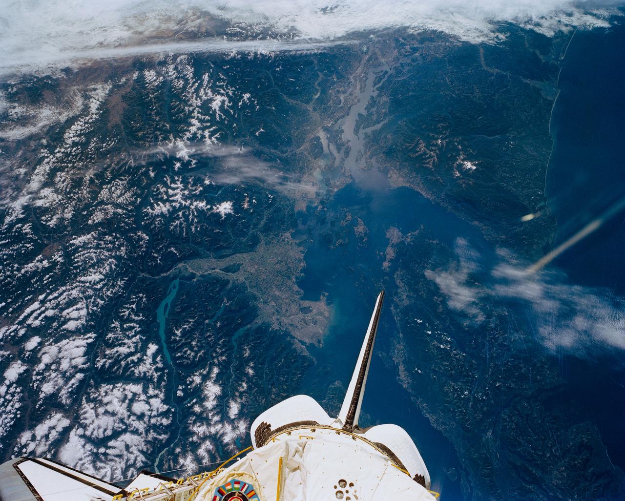
STS047-151-488 (12 - 20 Sept 1992) --- In this large format camera image, the forested Cascade Range appears along the left side; the Pacific Ocean, on the right. The frame was photographed as the Space Shuttle Endeavour flew north to south over Vancouver and Seattle. Many peaks in the Cascades reach altitudes greater than 9,000 feet and remain snowcapped even in mid-summer. The Strait of Juan de Fuca separates the Olympic Peninsula (top right) from Vancouver Island (bottom right). Snowcapped Mt. Olympus (7,965 feet) is one of the wettest places in the continental United States, with rainfall in excess of 120 inches per year. The port cities of Seattle and Tacoma occupy the heavily indented coastline of Puget Sound (top center). They appear as light-colored areas on the left side of the Sound. The angular street pattern of Tacoma is visible at the top of the picture. The international boundary between Canada and the United States of America runs across the middle of the view. The city of Victoria (center) is the light patch on the tip of Vancouver Island. Canada's Fraser River Delta provides flat topography on which the cities of Vancouver, Burnaby, and New Westminster were built. These cities appear as the light-colored area just left of center. The Fraser River can be seen snaking its way out of the mountains at the apex of the delta. Numerous ski resorts dot the slopes of the mountains (bottom left) that rise immediately to the north of Vancouver. In the same area the blue water of Harrison and other, smaller lakes fills some of the valleys that were excavated by glaciers in the "recent" geological past, according to NASA scientists studying the photography. A Linhof camera was used to expose the frame.
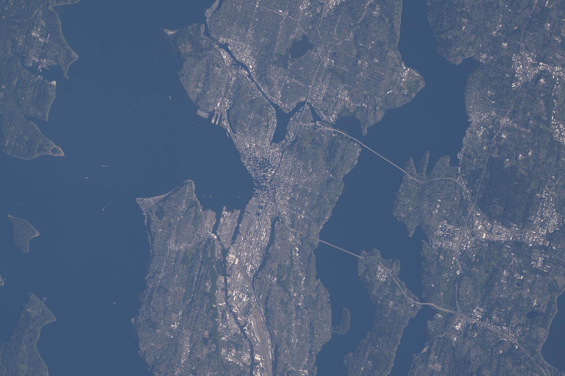
iss074e0723716 (June 16, 2026) --- Seattle, Washington, with a metropolitan population of over 4.15 million, sits between Puget Sound and Lake Washington and is also known as the "Emerald City" due to the lush evergreen forests surrounding it. Two famous landmarks in Seattle include Pike Place Market, America's oldest continuously operating farmers market since 1907, and the Space Needle, built for the 1962 World's Fair. The International Space Station was orbiting 265 miles above the U.S.–Canadian border at the time of this photograph. Credit: NASA/Chris Williams
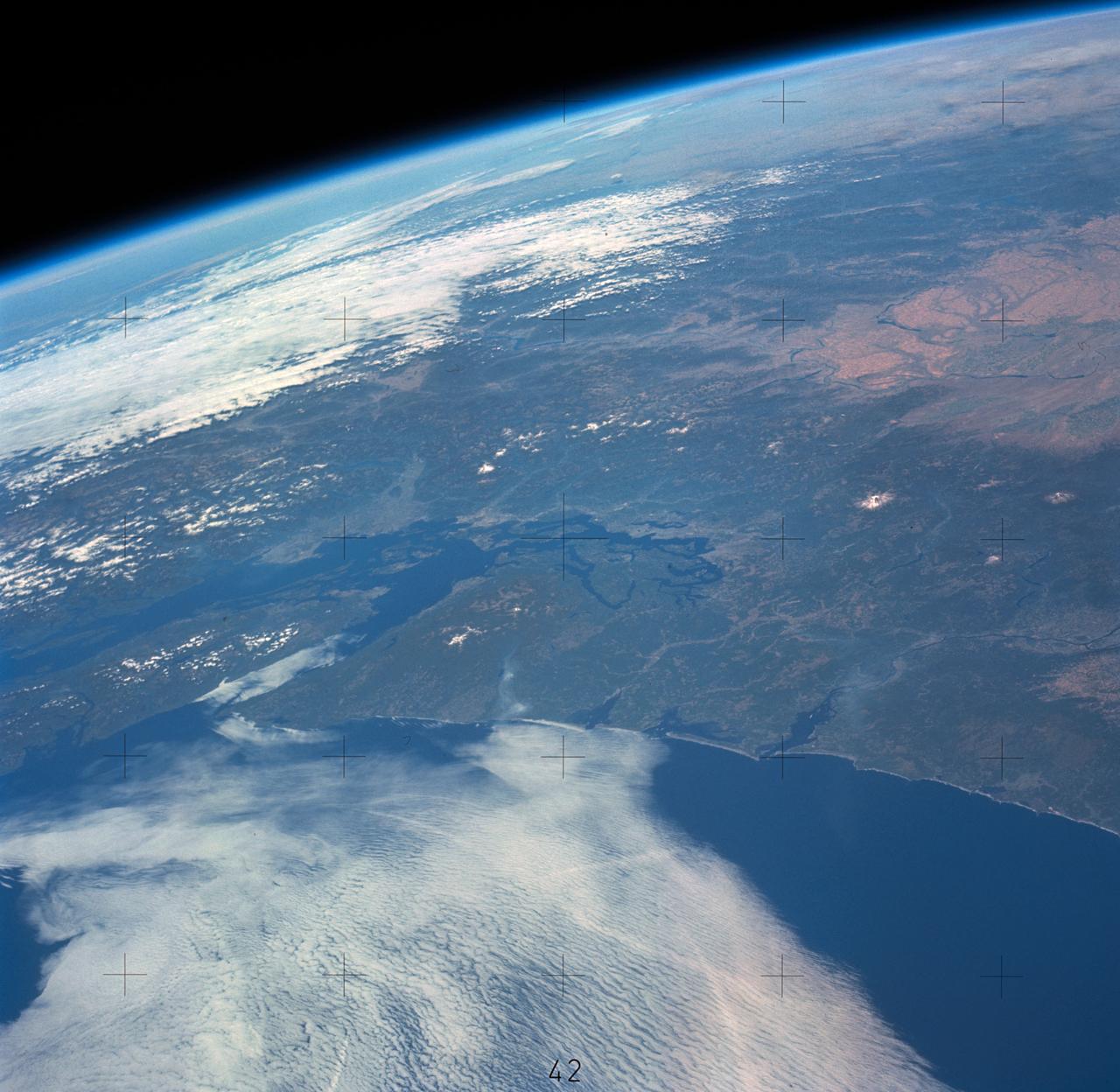
SL3-121-2410 (July-September 1973) --- Skylab 3 Earth view of Washington, British Columbia, Vancouver Island and Puget Sound. Photo credit: NASA
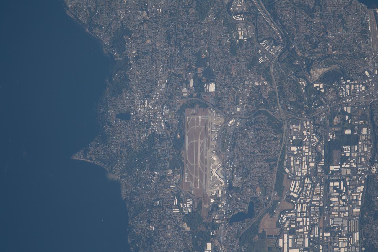
iss069e061160 (Aug. 16, 2023) --- Seattle-Tacoma International Airport near the Puget Sound in northwest Washington is pictured from the International Space Station as it orbited 264 miles above the Evergreen State.
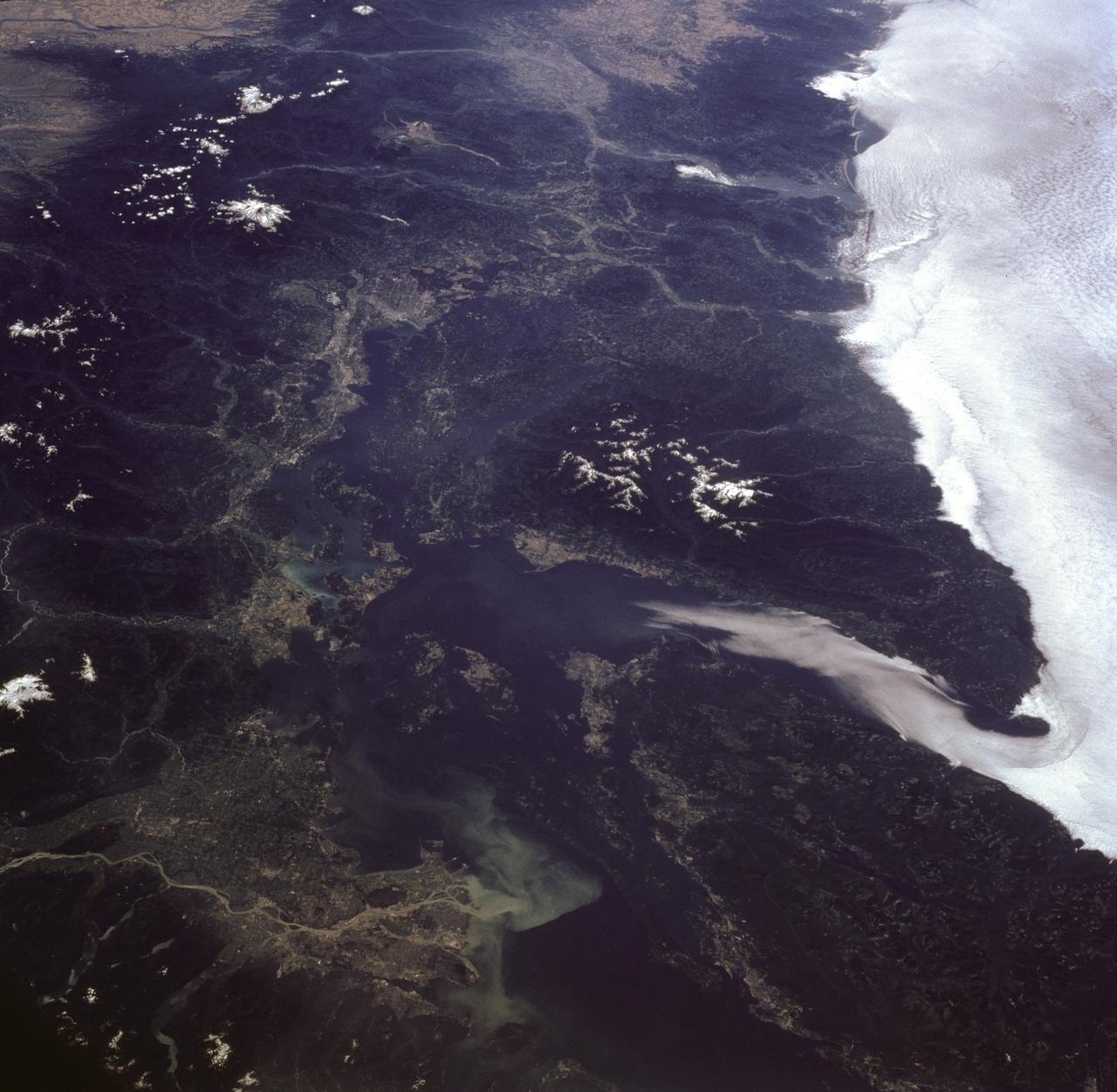
STS085-716-081 (7-19 August 1997) --- This photograph provides a southerly view from Vancouver, B. C. in the foreground, to Portland, Oregon near the top. Coastal stratus, a common occurrence, hugs the Pacific coastline and laps into Puget sound. The silty Fraser River cuts through Vancouver and empties into Puget Sound with a large, milky plume of sediment (bottom). Near the top of the image, the Columbia River runs across the Cascades (between Mt. Adams and Mt. Hood) and the Coast Ranges to the Pacific Ocean. Snow caps the highest peaks of the Olympic Mountains (near center), and the Cascade volcanoes of Rainier (closest to Seattle), Adams and Hood (top). The smaller, gray mountain just south (above and right) of Rainier is Mt. St. Helens.
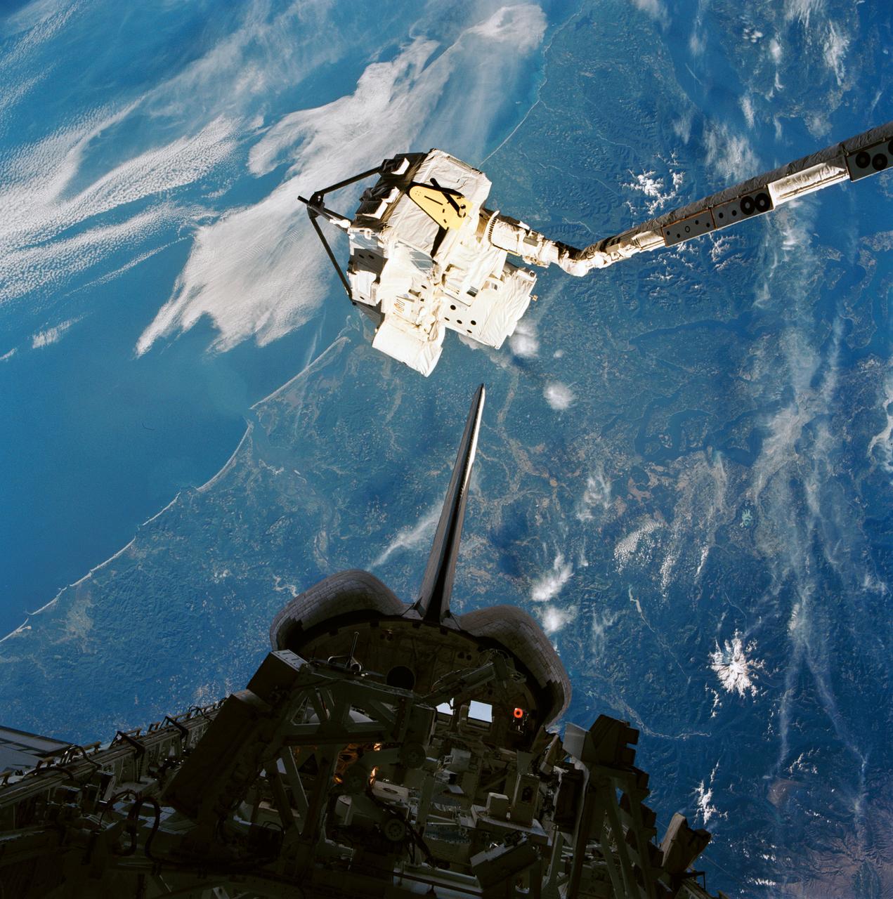
STS085-722-087 (7 - 19 August 1997) --- The Cryogenic Infrared Spectrometers and Telescopes for the Atmosphere-Shuttle Pallet Satellite-2 (CRISTA-SPAS-2) having just been grappled by the Space Shuttle Discovery's Remote Manipulator System (RMS), is backdropped against Puget Sound and the Seattle, Washington area. A short while later, the satellite was re-berthed in the cargo bay, silhouetted in this 70mm frame. This image was exposed through the aft flight deck windows of Discovery.
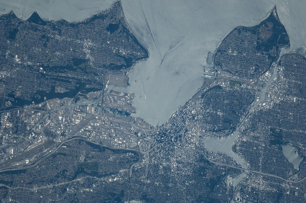
ISS040-E-124198 (6 Sept. 2014) --- Puget Sound is partly reflecting the sun in this detailed image taken by an Expedition 40 crew member on the International Space Station. Patterns of boat wakes are prominent in the sun’s partial reflection zone. The difference between the boat wakes in this view relates to the speed of the boat and the particular patterns (of several) that happen to be captured in the specific light reflection angles at the time the image was taken. The land areas show parts of Seattle. The darkest areas with rectangular grids are suburbs richly covered with trees. The broadly gray zones of the central city (bottom center) are brighter where structures are lower, as in the harbor zone (Harbor Island), and darker where the shadows of high-rise buildings downtown cast black shadows. Interstate Highway 5 bisects downtown.