
NASA Administrator Jim Bridenstine, left, General Paul Selva, vice chairman, Joint Chiefs of Staff, center, and Dr. William Happer, deputy assistant to the president, National Security Council, listen as Vice President Mike Pence delivers opening remarks during the National Space Council meeting titled, Moon, Mars, and Worlds Beyond, Winning the Next Frontier, Tuesday, Oct. 23, 2018 at the National War College at Fort Lesley J. McNair in Washington. Chaired by the Vice President, the council's role is to advise the President regarding national space policy and strategy, and review the nation's long-range goals for space activities.Photo Credit: (NASA/Aubrey Gemignani)
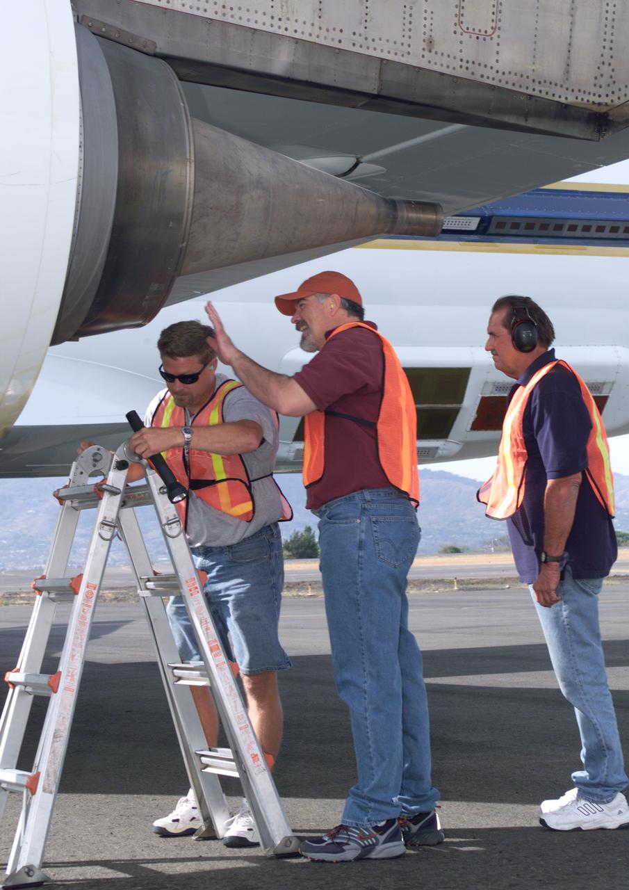
NASA Dryden DC-8 maintenance crew members inspect the aircraft prior to take-off. L-R; Scott Silver, Paul Ristrim and Mike Lakowski. AirSAR 2004 Mesoamerica is a three-week expedition by an international team of scientists that uses an all-weather imaging tool, called the Airborne Synthetic Aperture Radar (AirSAR) which is located onboard NASA's DC-8 airborne laboratory. Scientists from many parts of the world including NASA's Jet Propulsion Laboratory are combining ground research done in several areas in Central America with NASA's AirSAR technology to improve and expand on the quality of research they are able to conduct. The radar, developed by NASA's Jet Propulsion Laboratory, can penetrate clouds and also collect data at night. Its high-resolution sensors operate at multiple wavelengths and modes, allowing AirSAR to see beneath treetops, through thin sand, and dry snow pack. AirSAR's 2004 campaign is a collaboration of many U.S. and Central American institutions and scientists, including NASA; the National Science Foundation; the Smithsonian Institution; National Geographic; Conservation International; the Organization of Tropical Studies; the Central American Commission for Environment and Development; and the Inter-American Development Bank.
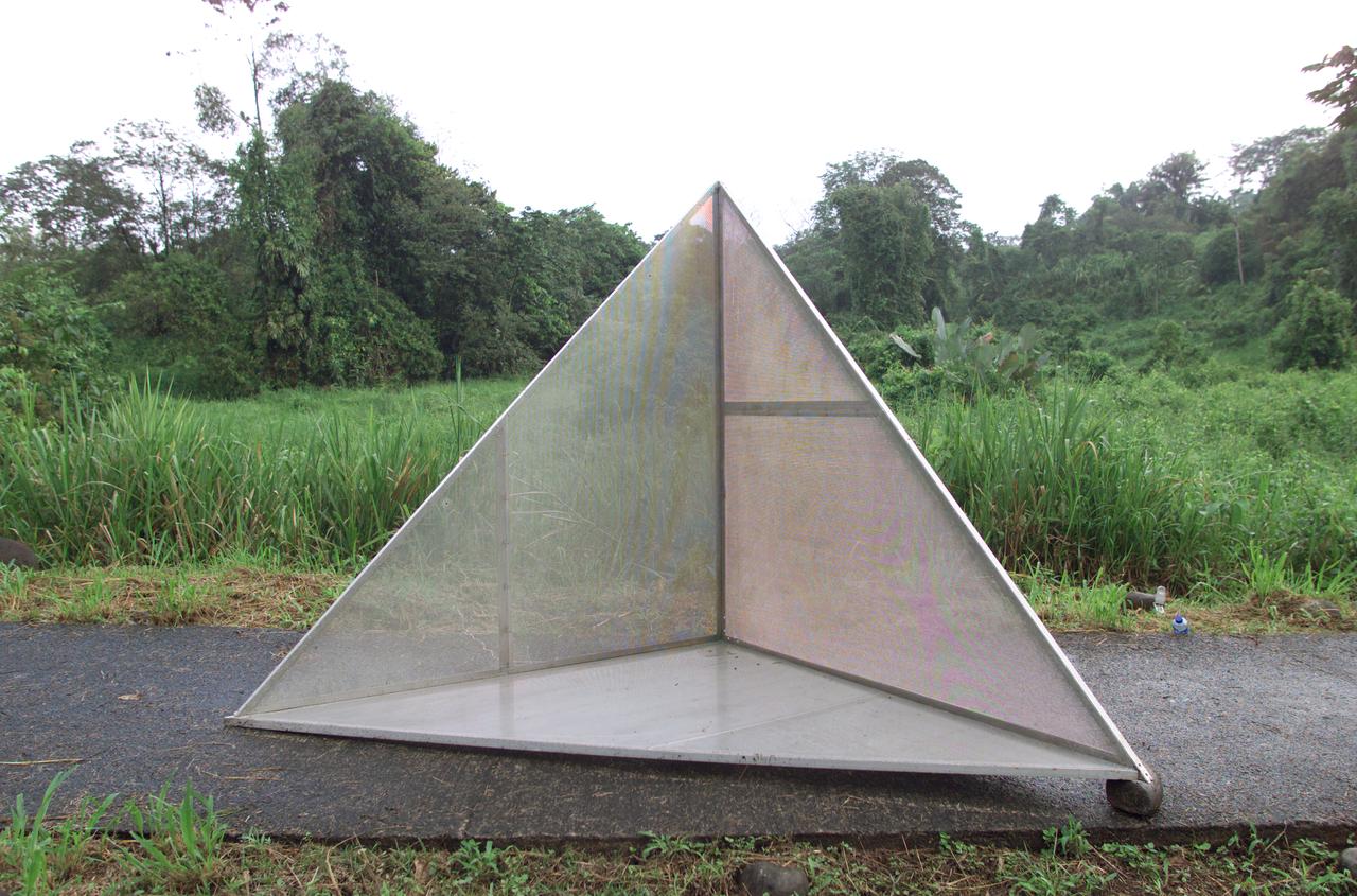
Reflectors setup in the La Selva region of the Costa Rican rain forest by scientist Paul Siqueira from NASA’s Jet Propulsion Lab. These reflectors are used by JPL scientists onboard Dryden's DC-8 aircraft to calibrate the Airborne Synthetic Aperture Radar (AirSAR) system. Scientists place these reflectors at known points on the ground, allowing researchers onboard the aircraft to verify their data. AirSAR 2004 Mesoamerica is a three-week expedition by an international team of scientists that uses an all-weather imaging tool, called the Airborne Synthetic Aperture Radar (AirSAR) which is located onboard NASA's DC-8 airborne laboratory. Scientists from many parts of the world including NASA's Jet Propulsion Laboratory are combining ground research done in several areas in Central America with NASA's AirSAR technology to improve and expand on the quality of research they are able to conduct. The radar, developed by NASA's Jet Propulsion Laboratory, can penetrate clouds and also collect data at night. Its high-resolution sensors operate at multiple wavelengths and modes, allowing AirSAR to see beneath treetops, through thin sand, and dry snow pack. AirSAR's 2004 campaign is a collaboration of many U.S. and Central American institutions and scientists, including NASA; the National Science Foundation; the Smithsonian Institution; National Geographic; Conservation International; the Organization of Tropical Studies; the Central American Commission for Environment and Development; and the Inter-American Development Bank.
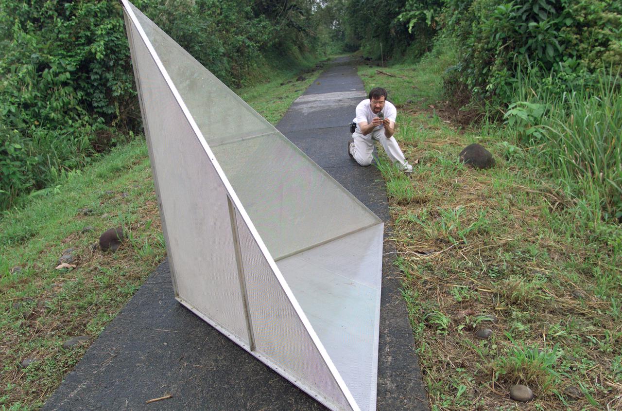
Reflectors setup in the La Selva region of the Costa Rican rain forest by scientist Paul Siqueira from NASA’s Jet Propulsion Lab. These reflectors are used by JPL scientists onboard Dryden's DC-8 aircraft to calibrate the Airborne Synthetic Aperture Radar (AirSAR) system. Scientists place these reflectors at known points on the ground, allowing researchers onboard the aircraft to verify their data. AirSAR 2004 Mesoamerica is a three-week expedition by an international team of scientists that uses an all-weather imaging tool, called the Airborne Synthetic Aperture Radar (AirSAR) which is located onboard NASA's DC-8 airborne laboratory. Scientists from many parts of the world including NASA's Jet Propulsion Laboratory are combining ground research done in several areas in Central America with NASA's AirSAR technology to improve and expand on the quality of research they are able to conduct. The radar, developed by NASA's Jet Propulsion Laboratory, can penetrate clouds and also collect data at night. Its high-resolution sensors operate at multiple wavelengths and modes, allowing AirSAR to see beneath treetops, through thin sand, and dry snow pack. AirSAR's 2004 campaign is a collaboration of many U.S. and Central American institutions and scientists, including NASA; the National Science Foundation; the Smithsonian Institution; National Geographic; Conservation International; the Organization of Tropical Studies; the Central American Commission for Environment and Development; and the Inter-American Development Bank.

NASA Administrator Jim Bridenstine speaks during the National Space Council meeting titled, Moon, Mars, and Worlds Beyond, Winning the Next Frontier, Tuesday, Oct. 23, 2018 at the National War College at Fort Lesley J. McNair in Washington. Chaired by the Vice President, the council's role is to advise the President regarding national space policy and strategy, and review the nation's long-range goals for space activities.Photo Credit: (NASA/Aubrey Gemignani)

NASA Administrator Jim Bridenstine, third from right, applauds as Vice President Mike Pence delivers opening remarks during the National Space Council meeting titled, Moon, Mars, and Worlds Beyond, Winning the Next Frontier, Tuesday, Oct. 23, 2018 at the National War College at Fort Lesley J. McNair in Washington. Chaired by the Vice President, the council's role is to advise the President regarding national space policy and strategy, and review the nation's long-range goals for space activities.Photo Credit: (NASA/Aubrey Gemignani)