
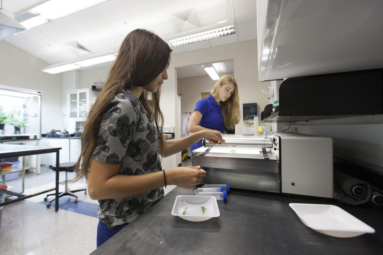
Horticulture scientist Blake Costine adjusts moisture sensors for the Advanced Plant Imaging project at NASA’s Kennedy Space Center on April 17, 2023. In this project, hyperspectral cameras are used to assess plant health. The activity is taking place inside the Plant Production Area at the Florida spaceport’s Space Station Processing Facility.

Shown here are moisture sensors for the Advanced Plant Imaging project at NASA’s Kennedy Space Center on April 17, 2023. In this project, hyperspectral cameras are used to assess plant health. The activity is taking place inside the Plant Production Area at the Florida spaceport’s Space Station Processing Facility.

Horticulture scientist Blake Costine adjusts moisture sensors for the Advanced Plant Imaging project at NASA’s Kennedy Space Center on April 17, 2023. In this project, hyperspectral cameras are used to assess plant health. The activity is taking place inside the Plant Production Area at the Florida spaceport’s Space Station Processing Facility.

Horticulturalists study the use of 3D printed materials as media to grow plants at NASA’s Kennedy Space Center on April 17, 2023. The activity is taking place inside the Plant Production Area at the Florida spaceport’s Space Station Processing Facility.

Lead horticulturist LaShelle Spencer studies the use of 3D printed materials as media to grow plants at NASA’s Kennedy Space Center on April 17, 2023. The activity is taking place inside the Plant Production Area at the Florida spaceport’s Space Station Processing Facility.

Cucumbers are grown in a controlled environment chamber at NASA’s Kennedy Space Center on April 17, 2023. The activity is taking place inside the Plant Production Area at the Florida spaceport’s Space Station Processing Facility.

Melons are grown in a controlled environment chamber at NASA’s Kennedy Space Center on April 17, 2023. The activity is taking place inside the Plant Production Area at the Florida spaceport’s Space Station Processing Facility.

Shown here are microgreens – a quick-growing, highly nutritious crop – inside the Plant Production Area at NASA’s Kennedy Space Center’s Space Station Processing Facility in Florida on April 17, 2023. The microgreens will be used to make mixes to create complex flavors to help with menu fatigue in space.
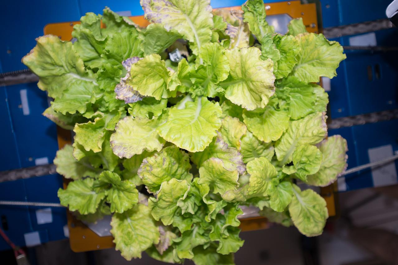
View of cabbage plants in the Vegetable Production System (Veggie) bellows, with the bellows secured to the Maintenance Work Area (MWA) in the Harmony Node 2. Image was taken during final harvesting operations (OPS) for the Veg-03 experiment.
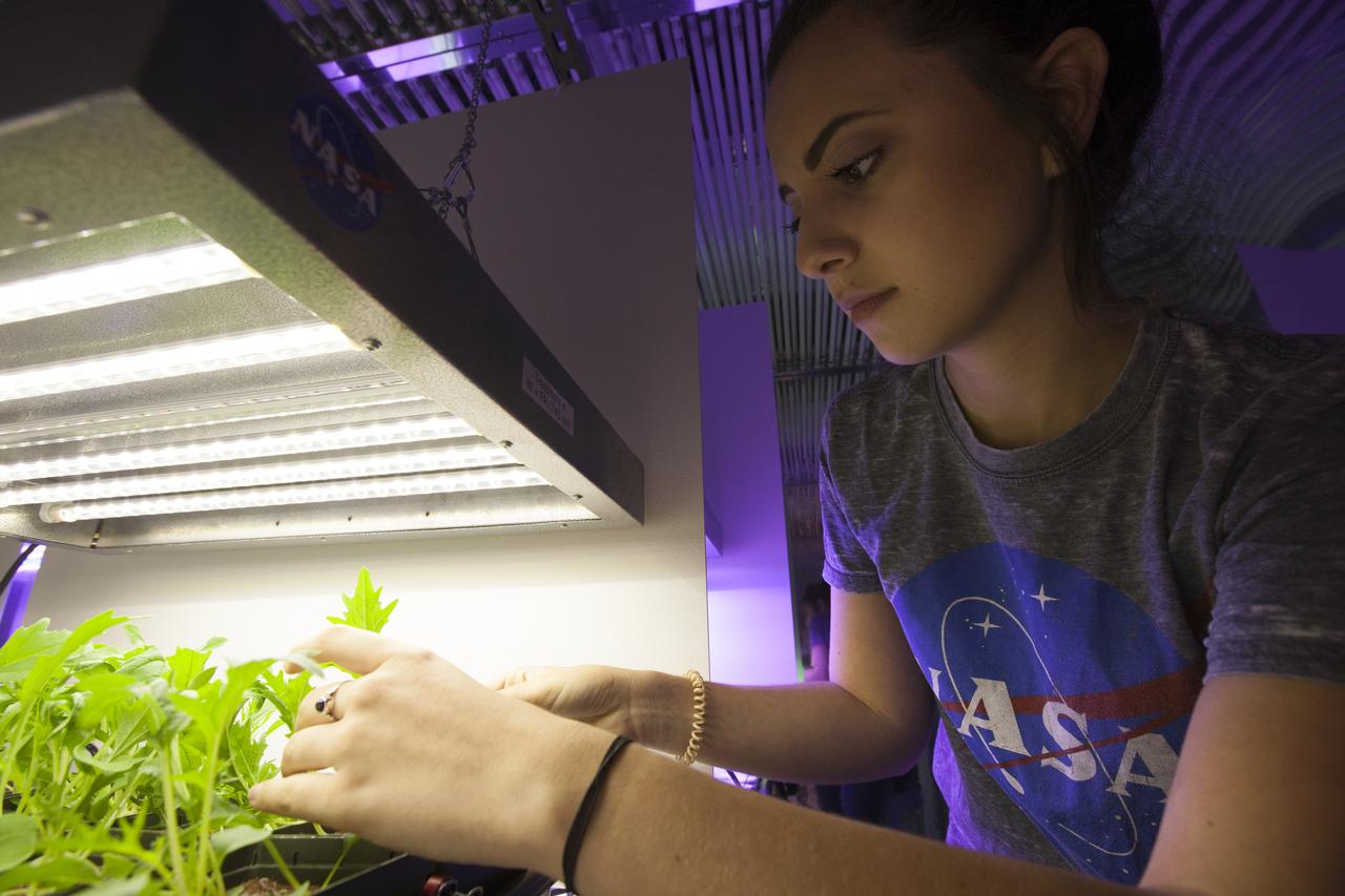
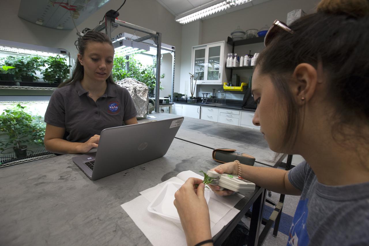
In the Space Life Sciences Laboratory at NASA's Kennedy Space Center in Florida, student interns are joining agency scientists, contributing in the area of plant growth research for food production in space. The agency attracts its future workforce through the NASA Internship, Fellowships and Scholarships, or NIFS, Program.

In the Space Life Sciences Laboratory at NASA's Kennedy Space Center in Florida, student interns are joining agency scientists, contributing in the area of plant growth research for food production in space. The agency attracts its future workforce through the NASA Internship, Fellowships and Scholarships, or NIFS, Program.

In the Space Life Sciences Laboratory at NASA's Kennedy Space Center in Florida, student interns are joining agency scientists, contributing in the area of plant growth research for food production in space. The agency attracts its future workforce through the NASA Internship, Fellowships and Scholarships, or NIFS, Program.
In the Space Life Sciences Laboratory at NASA's Kennedy Space Center in Florida, student interns such as Payton Barnwell are joining agency scientists, contributing in the area of plant growth research for food production in space. Barnwell is a mechanical engineering and nanotechnology major at Florida Polytechnic University. The agency attracts its future workforce through the NASA Internship, Fellowships and Scholarships, or NIFS, Program.
In the Space Life Sciences Laboratory at NASA's Kennedy Space Center in Florida, student interns such as Alex Litvin are joining agency scientists, contributing in the area of plant growth research for food production in space. Litvin is pursuing doctorate in horticulture at Iowa State University. The agency attracts its future workforce through the NASA Internship, Fellowships and Scholarships, or NIFS, Program.
In the Space Life Sciences Laboratory at NASA's Kennedy Space Center in Florida, student interns such as Emma Boehm, left, and Jessica Scotten are joining agency scientists, contributing in the area of plant growth research for food production in space. Boehm is pursuing a degree in ecology and evolution at the University of Minnesota. Scotten is majoring in microbiology at Oregon State University. The agency attracts its future workforce through the NASA Internship, Fellowships and Scholarships, or NIFS, Program.
In the Space Life Sciences Laboratory at NASA's Kennedy Space Center in Florida, student interns such as Ayla Grandpre, left, and Payton Barnwell are joining agency scientists, contributing in the area of plant growth research for food production in space. Grandpre is pursuing a degree in computer science and chemistry at Rocky Mountain College in Billings, Montana. Barnwell is a mechanical engineering and nanotechnology major at Florida Polytechnic University. The agency attracts its future workforce through the NASA Internship, Fellowships and Scholarships, or NIFS, Program.
In the Space Life Sciences Laboratory at NASA's Kennedy Space Center in Florida, student interns such as Ayla Grandpre are joining agency scientists, contributing in the area of plant growth research for food production in space. Grandpre is majoring in computer science and chemistry at Rocky Mountain College in Billings, Montana. The agency attracts its future workforce through the NASA Internship, Fellowships and Scholarships, or NIFS, Program.
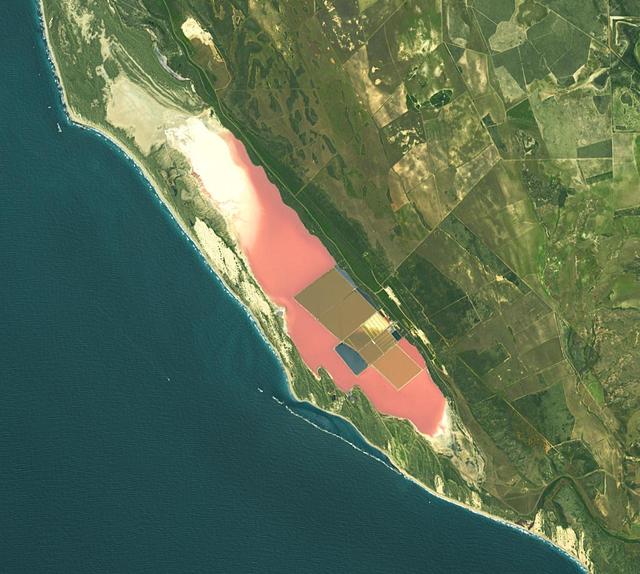
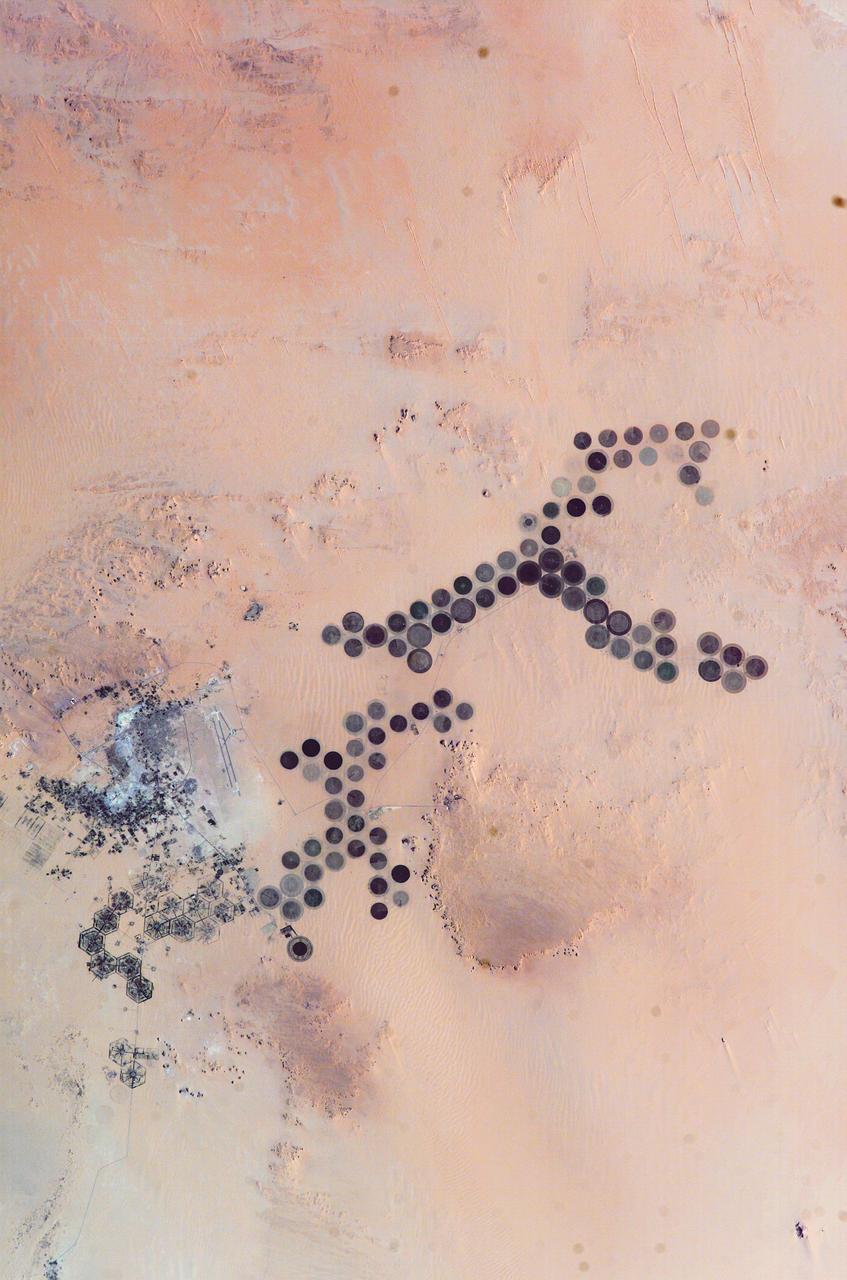
Hutt Lagoon is an elongate lake, located in a dune swale adjacent to the coast of the Indian Ocean, in the mid west region of Western Australia. Port Gregory is located between the ocean and the lake's southern shore. Hutt Lagoon is a pink lake, due to the presence of an algae that produces beta-carotene. A microalgae production plant is the world's largest. The image was acquired September 30, 2012, covers an area of 16.5 by 18.3 km, and is locate at 28.1 degrees south, 114.2 degrees east. https://photojournal.jpl.nasa.gov/catalog/PIA26510
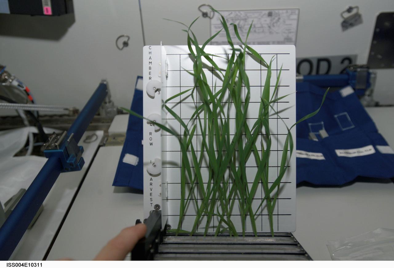
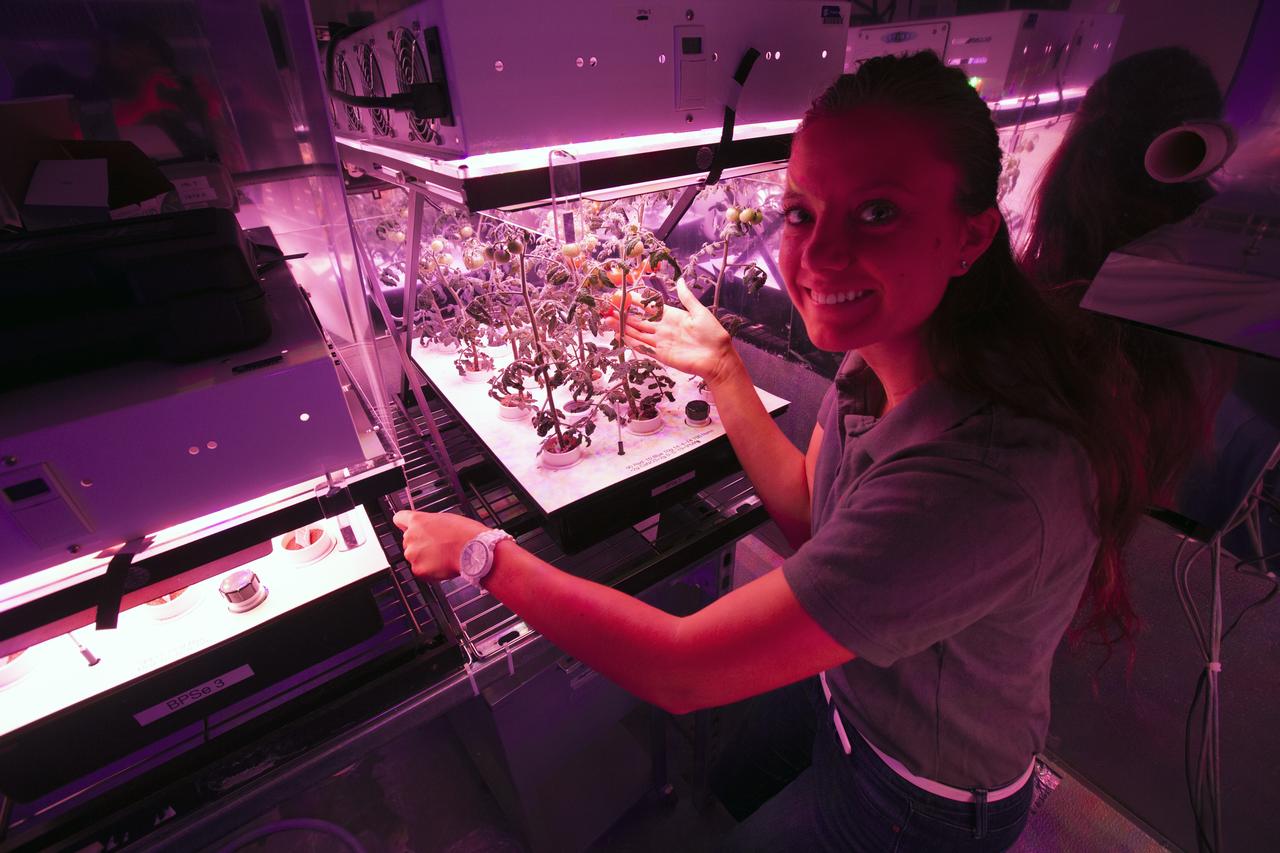
Dwarf wheat were photographed aboard the International Space Station in April 2002. Lessons from on-orbit research on plants will have applications to terrestrial agriculture as well as for long-term space missions. Alternative agricultural systems that can efficiently produce greater quantities of high-quality crops in a small area are important for future space expeditions. Also regenerative life-support systems that include plants will be an important component of long-term space missions. Data from the Biomass Production System (BPS) and the Photosynthesis Experiment and System Testing and Operations (PESTO) will advance controlled-environment agricultural systems and will help farmers produce better, healthier crops in a small area. This same knowledge is critical to closed-loop life support systems for spacecraft. The BPS comprises a miniature environmental control system for four plant growth chambers, all in the volume of two space shuttle lockers. The experience with the BPS on orbit is providing valuable design and operational lessons that will be incorporated into the Plant Growth Units. The objective of PESTO was to flight verify the BPS hardware and to determine how the microgravity environment affects the photosynthesis and metabolic function of Super Dwarf wheat and Brassica rapa (a member of the mustard family).
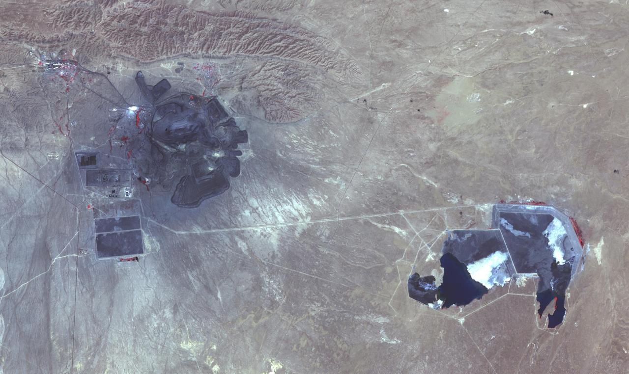
The Muruntau mine in Uzbekistan is the largest gold mine in the world in terms of production. In a single year, Muruntau produces over 2 million ounces of gold. Located in the Qizilqum Desert of Uzbekistan, it is the world's biggest open pit mine. The mine itself is roughly 3.3 km long, 3 km wide and 600 m deep, with its large heap-leach processing plant to the east. Within this huge mine, there is believed to be reserves of over 170 million ounces of gold. The image was acquired July 11, 2021, covers an area of 22.5 by 38.2 km, and is located at 41.5 degrees north, 64.6 degrees east. https://photojournal.jpl.nasa.gov/catalog/PIA25445
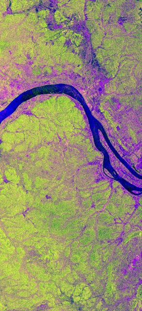
This is an X-band image showing seasonal changes at the hydrological test site of Bebedouro in Brazil. The image is centered at 9 degrees south latitude and 40.2 degrees west longitude. This image was acquired by the Spaceborne Imaging Radar-C and X-band Synthetic Aperture Radar (SIR-C/X-SAR) aboard the space shuttle Endeavour on April 10, 1994, during the first flight of the radar system, and on October 1, 1994, during the second mission. The swath width is approximately 16.5 kilometers (10.5 miles) wide. The image channels have the following color assignments: red represents data acquired on April 10; green represents data acquired on October 1; blue corresponds to the ratio of the two data sets. Agriculture plays an important economic and social role in Brazil. One of the major problems related to Brazilian agriculture is estimating the size of planting areas and their productivity. Due to cloud cover and the rainy season, which occurs from November through April, optical and infrared Earth observations are seldom used to survey the region. An additional goal of monitoring this region is to watch the floodplains of rivers like Rio Sao Francisco in order to determine suitable locations for additional agricultural fields. This area belongs to the semi-arid northeastern region of Brazil, where estimates have suggested that about 10 times more land could be used for agriculture, including some locations which could be used for irrigation projects. Monitoring of soil moisture during the important summer crop season is of high priority for the future development and productivity of this region. In April the area was covered with vegetation because of the moisture of the soil and only small differences could be seen in X-band data. In October the run-off channels of this hilly region stand out quite clearly because the greenish areas indicated much less soil moisture and water content in plants. http://photojournal.jpl.nasa.gov/catalog/PIA01733
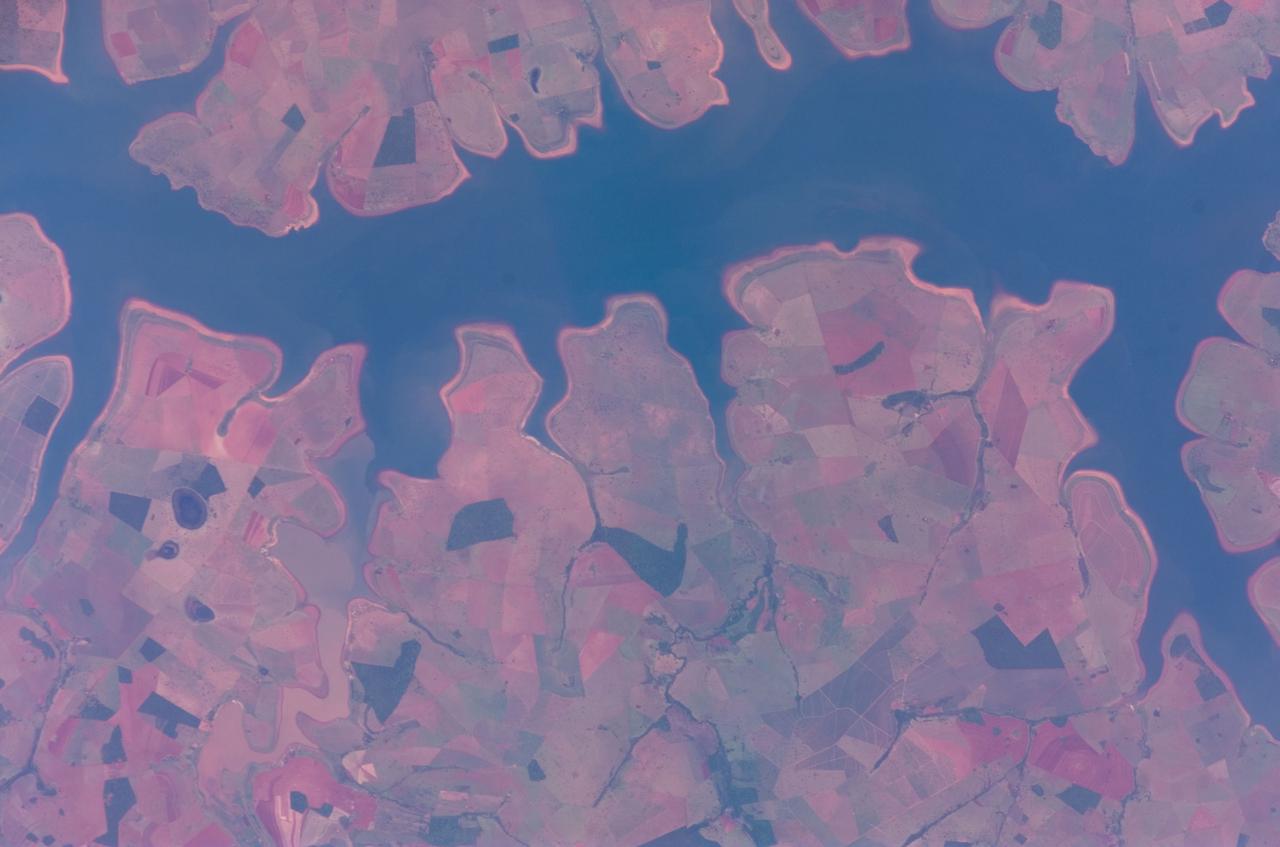
ISS016-E-011999 (22 Nov. 2007) --- Sao Simao Reservoir, Brazil is featured in this image photographed by an Expedition 16 crewmember on the International Space Station (ISS). The Sao Simao reservoir, near the confluence of the Rio Paranaiba and Rio Verde in Brazil, is the featured subject in a milestone image of Earth. This colorful, patchwork image is the 300,000th image of Earth downlinked from the space station. There are now over 745,000 images of Earth taken by astronaut crews, beginning with the Mercury missions in 1961 and continuing to the present day on the ISS. The Sao Simao reservoir is located on the border between the states of Goias and Minas Gerais (near the geographic coordinates of 18.7S 50.4W). Though the town of Sao Simao was founded around 1935, major growth occurred when the hydroelectric power plant and dam were built - forming the reservoir -- in 1975. The reservoir is part of a major navigation link that allows transport of goods and commerce between central Brazil, the Prata River and the South Atlantic. With 600,000 square kilometers of surface area, the reservoir also serves as a tourist destination for fishing, swimming and boating. In addition to hydroelectric power production, the economy of the region is based in agribusiness. The image highlights agricultural fields of various kinds and in different stages of cultivation. The major commodities include corn, soybeans, sesame seeds, sugarcane, beans, manioc, coffee and meat production.
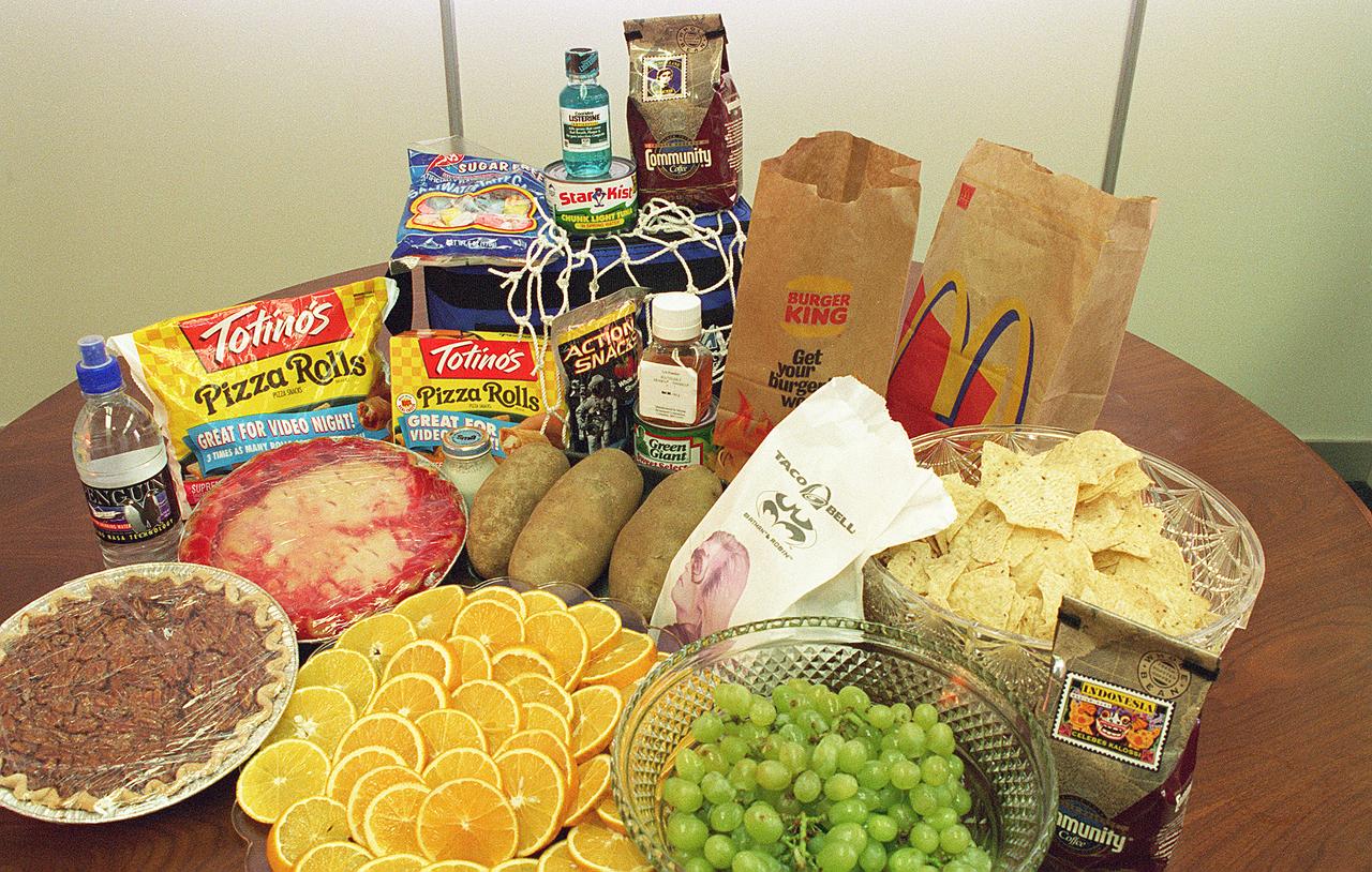
When NASA started plarning for manned space travel in 1959, the myriad challenges of sustaining life in space included a seemingly mundane but vitally important problem: How and what do you feed an astronaut? There were two main concerns: preventing food crumbs from contaminating the spacecraft's atmosphere or floating into sensitive instruments, and ensuring complete freedom from potentially catastrophic disease-producing bacteria, viruses, and toxins. To solve these concerns, NASA enlisted the help of the Pillsbury Company. Pillsbury quickly solved the first problem by coating bite-size foods to prevent crumbling. They developed the hazard analysis and critical control point (HACCP) concept to ensure against bacterial contamination. Hazard analysis is a systematic study of product, its ingredients, processing conditions, handling, storage, packing, distribution, and directions for consumer use to identify sensitive areas that might prove hazardous. Hazard analysis provides a basis for blueprinting the Critical Control Points (CCPs) to be monitored. CCPs are points in the chain from raw materials to the finished product where loss of control could result in unacceptable food safety risks. In early 1970, Pillsbury plants were following HACCP in production of food for Earthbound consumers. Pillsbury's subsequent training courses for Food and Drug Administration (FDA) personnel led to the incorporation of HACCP in the FDA's Low Acid Canned Foods Regulations, set down in the mid-1970s to ensure the safety of all canned food products in the U.S.
STS060-93-081 (3-11 Feb 1994)--- The Imperial Valley was documented using three films - color visible (seen here), the American infrared film (Kodak Aerochrome 2443), and the Russian panchromatic infrared film (SN-10). Results of this test still await detailed science analysis. However it does appear that good data was acquired of the region, and this data will be complemented by photography acquired by the Mir cosmonauts. In this frame, the U.S.-Mexico border goes from the upper left to the middle right. It is discernible as a vegetation line between Calexico, California and Mexicali, Mexico. The darker vegetation north of that line is due to different agricultural practices, heavier uses of fertilizers and pesticides, and lined (tiled) agricultural fields allowing subterraneean runoff of saline irrigation runoff. South of the line, the more polluted water draining out of the U.S. agricultural areas into the Mexican area has resulted in higher soil salinities and a consequent reduction in agricultural productivity. At the center of the frame, a large settling and desalinization plant has been built to attempt to purify, to some degree, the polluted irrigation waters draining south out of California. The All-American Canal, which brings in water from the Colorado River (off the frame, to the right), is located in the middle right hand portion of the frame. To the upper left is the normally dry Laguna Salada.
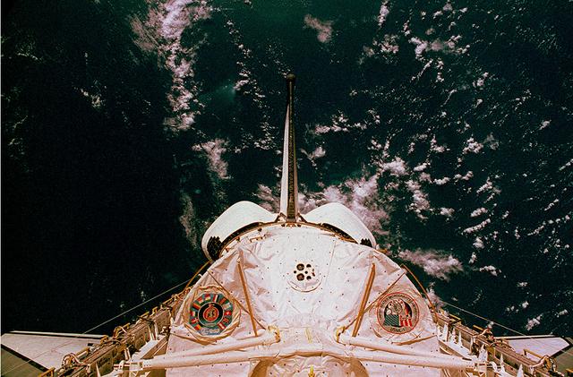
This is a photograph of the Spacelab module for the first United States Microgravity Laboratory (USML-1) mission, showing logos of the Spacelab mission on the left and the USML-1 mission on the right. The USML-1 was one part of a science and technology program that opened NASA's next great era of discovery and established the United States' leadership in space. From investigations designed to gather fundamental knowledge in a variety of areas to demonstrations of new equipment, USML-1 forged the way for future USML missions and helped prepare for advanced microgravity research and processing aboard the Space Station. Thirty-one investigations comprised the payload of the first USML-1 mission. The experiments aboard USML-1 covered five basic areas: fluid dynamics, the study of how liquids and gases respond to the application or absence of differing forces; crystal growth, the production of inorganic and organic crystals; combustion science, the study of the processes and phenomena of burning; biological science, the study of plant and animal life; and technology demonstrations. The USML-1 was managed by the Marshall Space Flight Center and launched aboard the Space Shuttle Orbiter Columbia (STS-50) on June 25, 1992.
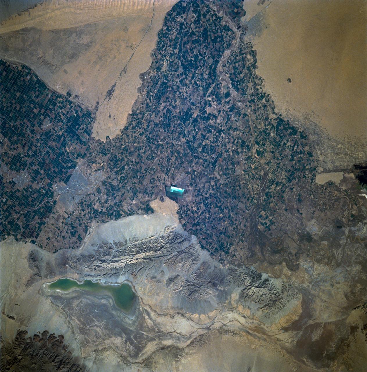
ISS010-E-05266 (28 October 2004) --- The Al Khufrah Oasis is featured in this image photographed by an Expedition 10 crewmember on the International Space Station (ISS). Green circles in the desert frequently indicate tracts of agriculture supported by center-pivot irrigation. The Al Khufrah Oasis in southeastern Libya (near the Egyptian border) is one of Libya’s largest agricultural projects, and is an easy-to-recognize landmark for orbiting crewmembers aboard the Station. The center-pivot irrigation system pumps water under pressure into a gantry or tubular arm from a central source. Anchored by a central pivot, the gantry slowly rotates over the area to be irrigated, thereby producing the circular patterns. Although the field diameters vary, these fields are approximately 0.6 mile (1 kilometer) in diameter. Darker colors indicate fields where such crops as wheat and alfalfa are grown. Lighter colors can indicate a variety of agricultural processes: fields that have been harvested recently; fields that are lying fallow; fields that have just been planted; or fields that have been taken out of production.
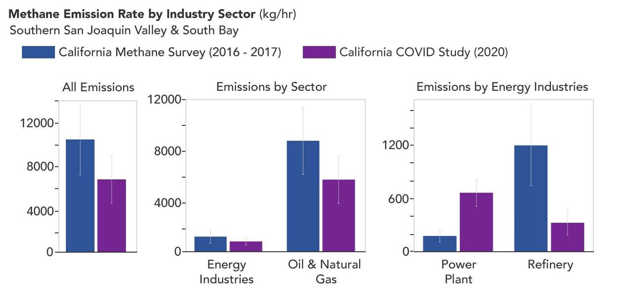
A March 2023 study by researchers at NASA's Jet Propulsion Laboratory in Southern California compared emissions from a belt of oil refineries across the South Bay area of Los Angeles during the first summer of the COVID-19 pandemic to those observed three years earlier. Using data from a NASA airborne instrument, researchers saw that most of the facilities they identified as methane sources in 2016-17 were no longer emitting the greenhouse gas in 2020, leading to a 73% reduction in measured emissions. The study uses measurements made by an imaging spectrometer called AVIRIS-NG (Airborne Visible/Infrared Imaging Spectrometer-Next Generation). Attached to the bottom of an aircraft, the instrument can detect greenhouse gas emissions from individual facilities or even pieces of equipment by looking at how the gases absorb sunlight. In 2016 and 2017, AVIRIS-NG was flown over 22,000 square miles (57,000 square kilometers) of the state as part of the California Methane Survey. From July to September 2020, researchers retraced some of those flight paths over refineries and power plants in Los Angeles County and over oil fields in central California's San Joaquin Valley. The flights were funded by NASA's Earth Science Division, the California Air Resources Board, and the California Energy Commission. The 2020 surveys over Los Angeles identified only 11 plumes from five refinery sources, with a total emissions rate of about 712 pounds (323 kilograms) methane per hour. The 2016 and 2017 flights had found 48 plumes from 33 sources, with a total emissions rate of roughly 2,639 pounds (1,197 kilograms) methane per hour. The drop correlates with an 18% decrease in monthly production in Southern California refineries between the two flight campaigns, the scientists noted, citing data from the California Energy Commission. The study also found that emissions from oil fields in and around the city of Bakersfield in central California fell 34.2%, correlating with a 24.2% drop in oil production. Reduced production during the pandemic due to lower demand for fuel and lower gas prices could have led to the drop in methane emissions, as oil fields and refineries emitted less methane as part of operations. However, researchers said, improved equipment maintenance and mitigation efforts at those facilities between 2016 and 2020 can't be ruled out as a factor. https://photojournal.jpl.nasa.gov/catalog/PIA25864
ISS012-E-16633 (28 Jan. 2006) --- Savannah River Site, South Carolina is featured in this image photographed by an Expedition 12 crew member on the International Space Station. Situated between the South Carolina piedmont and the Atlantic Ocean, the Savannah River Site is an important part of the US Department of Energy’s nuclear program. Construction of the site – originally called the Savannah River Plant – began in 1951 for the purpose of generating radioactive materials, primarily the hydrogen isotope tritium and plutonium-239, necessary for nuclear weapons production during the Cold War. A total of five nuclear reactors occupy the central portion of the site and operated throughout 1953-1992. Following the end of the Cold War in 1991 activities at the Savannah River Site are now focused on disposal of nuclear wastes, environmental cleanup of the site itself, and development of advanced remediation technologies. The Savannah River Site is located in the Sand Hills region of South Carolina and includes an area of 800 square kilometers (300 square miles). The southern half of the Site (building clusters with reflective white rooftops) is shown. The nearby Savannah River and its tributary creeks provided a ready source of water for the nuclear reactors; to this end, two artificial lakes (“L” Lake and Par Pond) were constructed. The meandering channel of the River and its floodplain, characterized by grey-brown sediments, extends from northwest to southeast across the left portion of the image. The proximity of the River, and the permeable nature of the geological materials under laying the site (sand, clay, gravel, and carbonate rocks), necessitate extensive and ongoing environmental monitoring and cleanup efforts to reduce potential contamination of local water sources. According to NASA scientists, final remediation of wastes posing threats to surface and groundwater is scheduled to occur by 2025.