
A Toast to Dear Old Poe
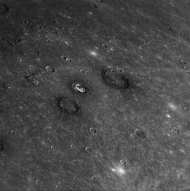
Sander, Munch, and Poe are a trio of impact craters within the Caloris impact basin. Munch and Poe were recently named, while Sander received its name in the first set of feature names after MESSENGER’s first Mercury flyby.

NASA astronaut and commander of the agency’s Artemis II mission, Reid Wiseman, a Baltimore native, holds Rise, the zero gravity indicator from the Artemis II mission, as he poses for a photograph with Baltimore Ravens mascot Poe at an NFL game between the New Orleans Saints and the Baltimore Ravens at M&T Bank Stadium, Sunday, Sept. 20, 2026, in Baltimore. NASA’s engagement at NFL games is part of the agency's Inspiration Tour, aimed at strengthening connections between NASA and its partners and showcasing innovation in air and space in the lead up to the MAX POWER aerospace technology expo and airshow at the agency's Kennedy Space Center in early November. Photo Credit: (NASA/Bill Ingalls)

A crated National Oceanic and Atmospheric Administration (NOAA-L) satellite is moved inside the B16-10 spacecraft processing hangar at Vandenberg Air Force Base, Calif. NOAA-L is part of the Polar-Orbiting Operational Environmental Satellite (POES) program that provides atmospheric measurements of temperature, humidity, ozone and cloud images, tracking weather patterns that affect the global weather and climate. The launch of the NOAA-L satellite is scheduled no earlier than Sept. 12 aboard a Lockheed Martin Titan II rocket
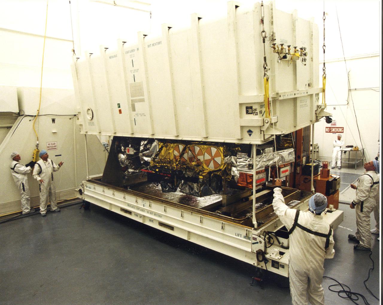
Inside the B16-10 spacecraft processing hangar at Vandenberg Air Force Base, Calif., workers oversee the uncrating of the National Oceanic and Atmospheric Administration (NOAA-L) satellite. NOAA-L is part of the Polar-Orbiting Operational Environmental Satellite (POES) program that provides atmospheric measurements of temperature, humidity, ozone and cloud images, tracking weather patterns that affect the global weather and climate. The launch of the NOAA-L satellite is scheduled no earlier than Sept. 12 aboard a Lockheed Martin Titan II rocket
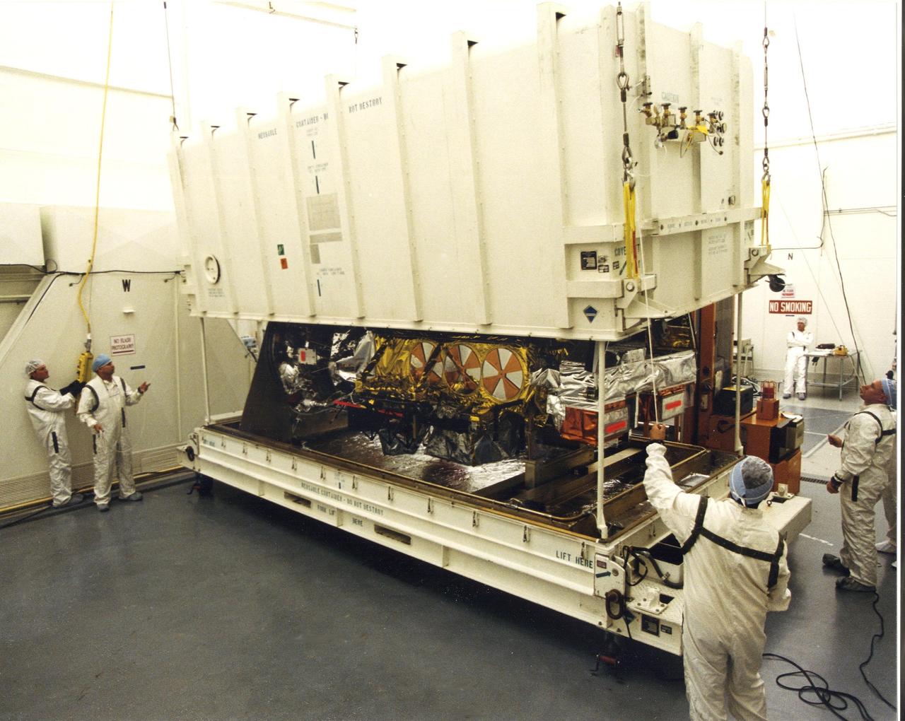
Inside the B16-10 spacecraft processing hangar at Vandenberg Air Force Base, Calif., workers oversee the uncrating of the National Oceanic and Atmospheric Administration (NOAA-L) satellite. NOAA-L is part of the Polar-Orbiting Operational Environmental Satellite (POES) program that provides atmospheric measurements of temperature, humidity, ozone and cloud images, tracking weather patterns that affect the global weather and climate. The launch of the NOAA-L satellite is scheduled no earlier than Sept. 12 aboard a Lockheed Martin Titan II rocket

Baltimore Ravens mascot Poe is seen during a pregame show at an NFL game between the New Orleans Saints and the Baltimore Ravens at M&T Bank Stadium, Sunday, Sept. 20, 2026, in Baltimore. NASA’s engagement at NFL games is part of the agency's Inspiration Tour, aimed at strengthening connections between NASA and its partners and showcasing innovation in air and space in the lead up to the MAX POWER aerospace technology expo and airshow at the agency's Kennedy Space Center in early November. Photo Credit: (NASA/Bill Ingalls)

A crated National Oceanic and Atmospheric Administration (NOAA-L) satellite is moved inside the B16-10 spacecraft processing hangar at Vandenberg Air Force Base, Calif. NOAA-L is part of the Polar-Orbiting Operational Environmental Satellite (POES) program that provides atmospheric measurements of temperature, humidity, ozone and cloud images, tracking weather patterns that affect the global weather and climate. The launch of the NOAA-L satellite is scheduled no earlier than Sept. 12 aboard a Lockheed Martin Titan II rocket
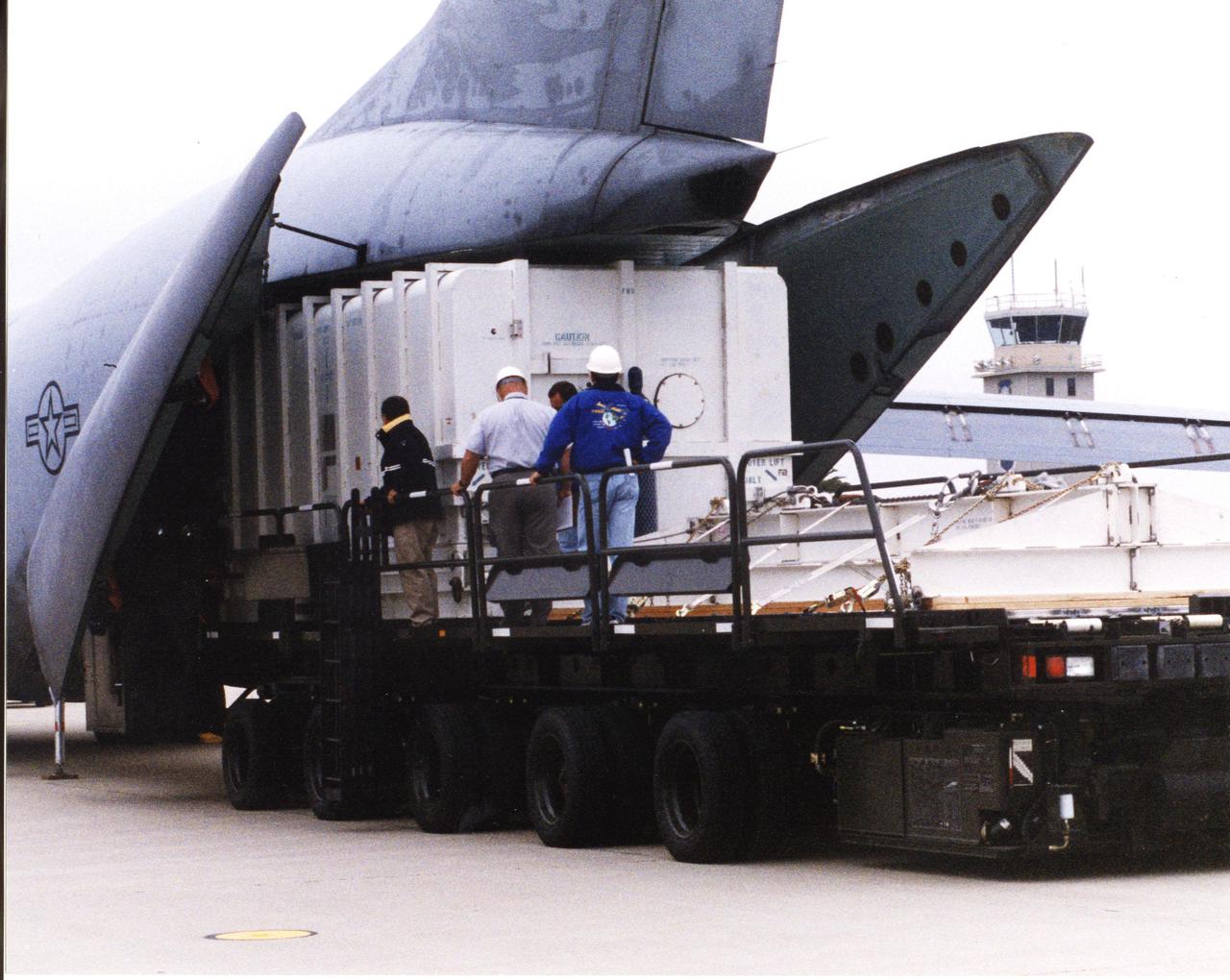
A crated National Oceanic and Atmospheric Administration (NOAA-L) satellite arrives at Vandenberg Air Force Base, Calif.; It is part of the Polar-Orbiting Operational Environmental Satellite (POES) program that provides atmospheric measurements of temperature, humidity, ozone and cloud images, tracking weather patterns that affect the global weather and climate. The launch of the NOAA-L satellite is scheduled no earlier than Sept. 12 aboard a Lockheed Martin Titan II rocket
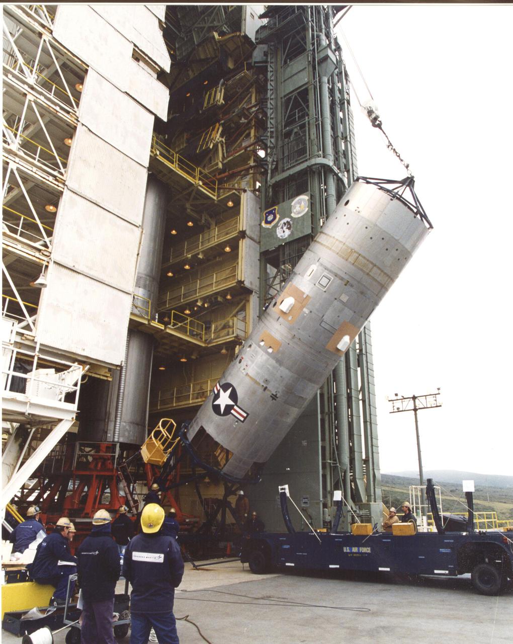
At the launch tower, Vandenberg Air Force Base, Calif., the second stage of a Titan II rocket is lifted to vertical. The Titan will power the launch of a National Oceanic and Atmospheric Administration (NOAA-L) satellite scheduled no earlier than Sept. 12. NOAA-L is part of the Polar-Orbiting Operational Environmental Satellite (POES) program that provides atmospheric measurements of temperature, humidity, ozone and cloud images, tracking weather patterns that affect the global weather and climate
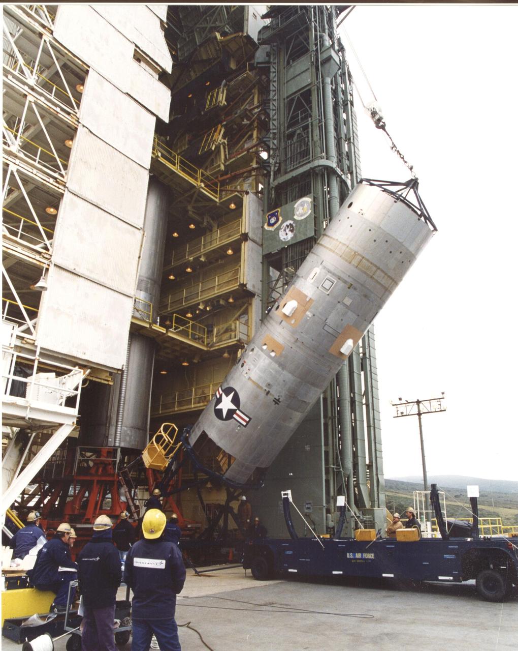
At the launch tower, Vandenberg Air Force Base, Calif., the second stage of a Titan II rocket is lifted to vertical. The Titan will power the launch of a National Oceanic and Atmospheric Administration (NOAA-L) satellite scheduled no earlier than Sept. 12. NOAA-L is part of the Polar-Orbiting Operational Environmental Satellite (POES) program that provides atmospheric measurements of temperature, humidity, ozone and cloud images, tracking weather patterns that affect the global weather and climate
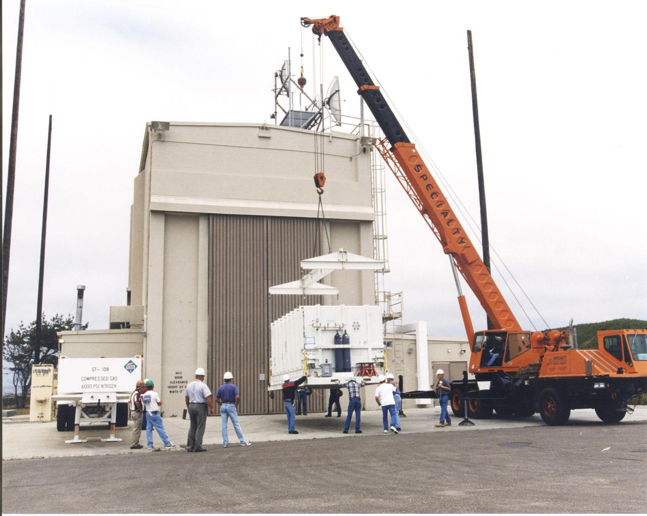
Outside the B16-10 spacecraft processing hangar at Vandenberg Air Force Base, Calif., a crated National Oceanic and Atmospheric Administration (NOAA-L) satellite is lowered to the ground before being moved inside. NOAA-L is part of the Polar-Orbiting Operational Environmental Satellite (POES) program that provides atmospheric measurements of temperature, humidity, ozone and cloud images, tracking weather patterns that affect the global weather and climate. The launch of the NOAA-L satellite is scheduled no earlier than Sept. 12 aboard a Lockheed Martin Titan II rocket
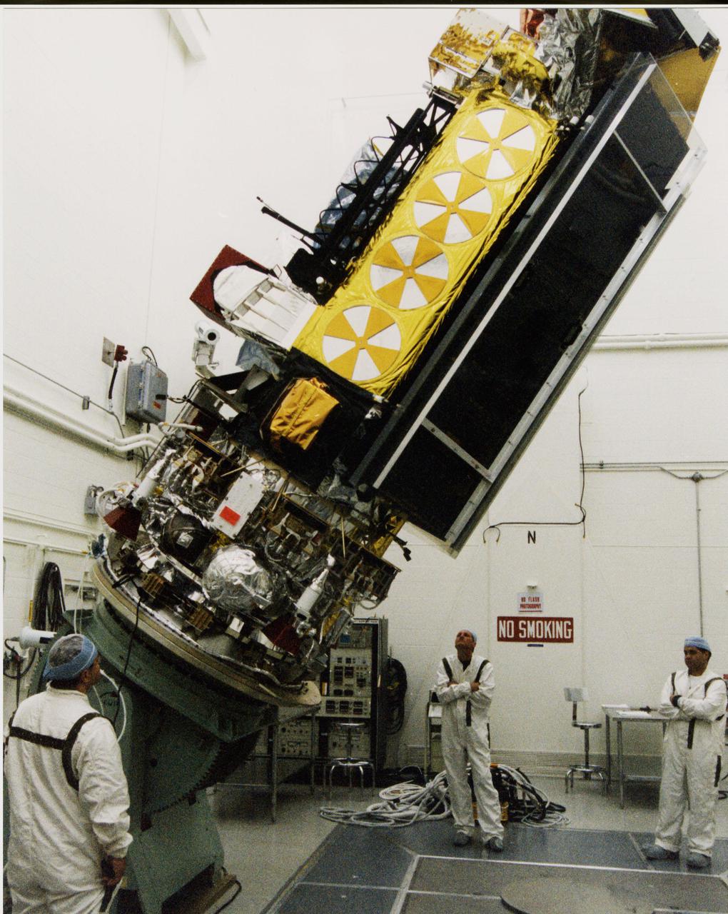
Inside the B16-10 spacecraft processing hangar at Vandenberg Air Force Base, Calif., workers oversee the lifting and rotating of the National Oceanic and Atmospheric Administration (NOAA-L) satellite to allow for mating of the Apogee Kick Motor (AKM). NOAA-L is part of the Polar-Orbiting Operational Environmental Satellite (POES) program that provides atmospheric measurements of temperature, humidity, ozone and cloud images, tracking weather patterns that affect the global weather and climate. The launch of the NOAA-L satellite is scheduled no earlier than Sept. 12 aboard a Lockheed Martin Titan II rocket
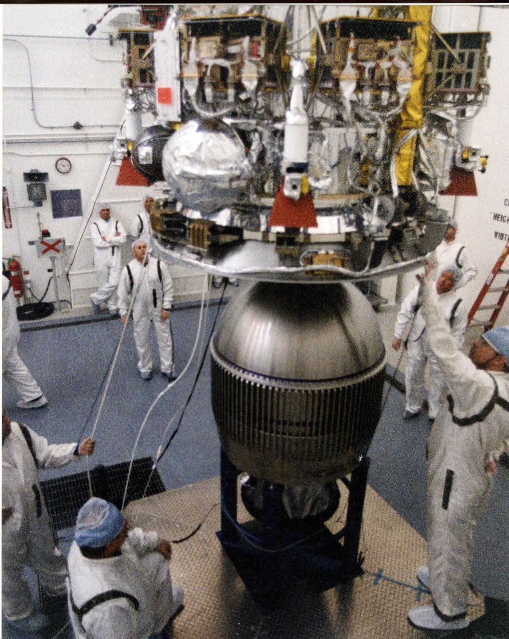
Inside the B16-10 spacecraft processing hangar at Vandenberg Air Force Base, Calif., workers oversee the mating of the Apogee Kick Motor (below) to the National Oceanic and Atmospheric Administration (NOAA-L) satellite above. NOAA-L is part of the Polar-Orbiting Operational Environmental Satellite (POES) program that provides atmospheric measurements of temperature, humidity, ozone and cloud images, tracking weather patterns that affect the global weather and climate. The launch of the NOAA-L satellite is scheduled no earlier than Sept. 12 aboard a Lockheed Martin Titan II rocket
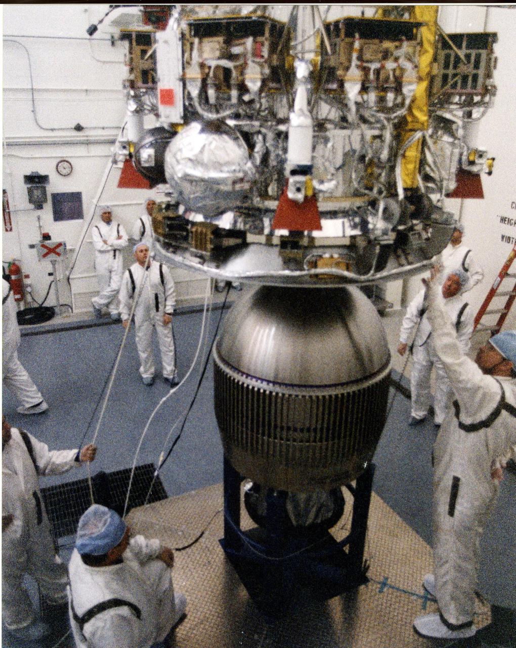
Inside the B16-10 spacecraft processing hangar at Vandenberg Air Force Base, Calif., workers oversee the mating of the Apogee Kick Motor (below) to the National Oceanic and Atmospheric Administration (NOAA-L) satellite above. NOAA-L is part of the Polar-Orbiting Operational Environmental Satellite (POES) program that provides atmospheric measurements of temperature, humidity, ozone and cloud images, tracking weather patterns that affect the global weather and climate. The launch of the NOAA-L satellite is scheduled no earlier than Sept. 12 aboard a Lockheed Martin Titan II rocket

Inside the B16-10 spacecraft processing hangar at Vandenberg Air Force Base, Calif., workers oversee the lifting and rotating of the National Oceanic and Atmospheric Administration (NOAA-L) satellite to allow for mating of the Apogee Kick Motor (AKM). NOAA-L is part of the Polar-Orbiting Operational Environmental Satellite (POES) program that provides atmospheric measurements of temperature, humidity, ozone and cloud images, tracking weather patterns that affect the global weather and climate. The launch of the NOAA-L satellite is scheduled no earlier than Sept. 12 aboard a Lockheed Martin Titan II rocket
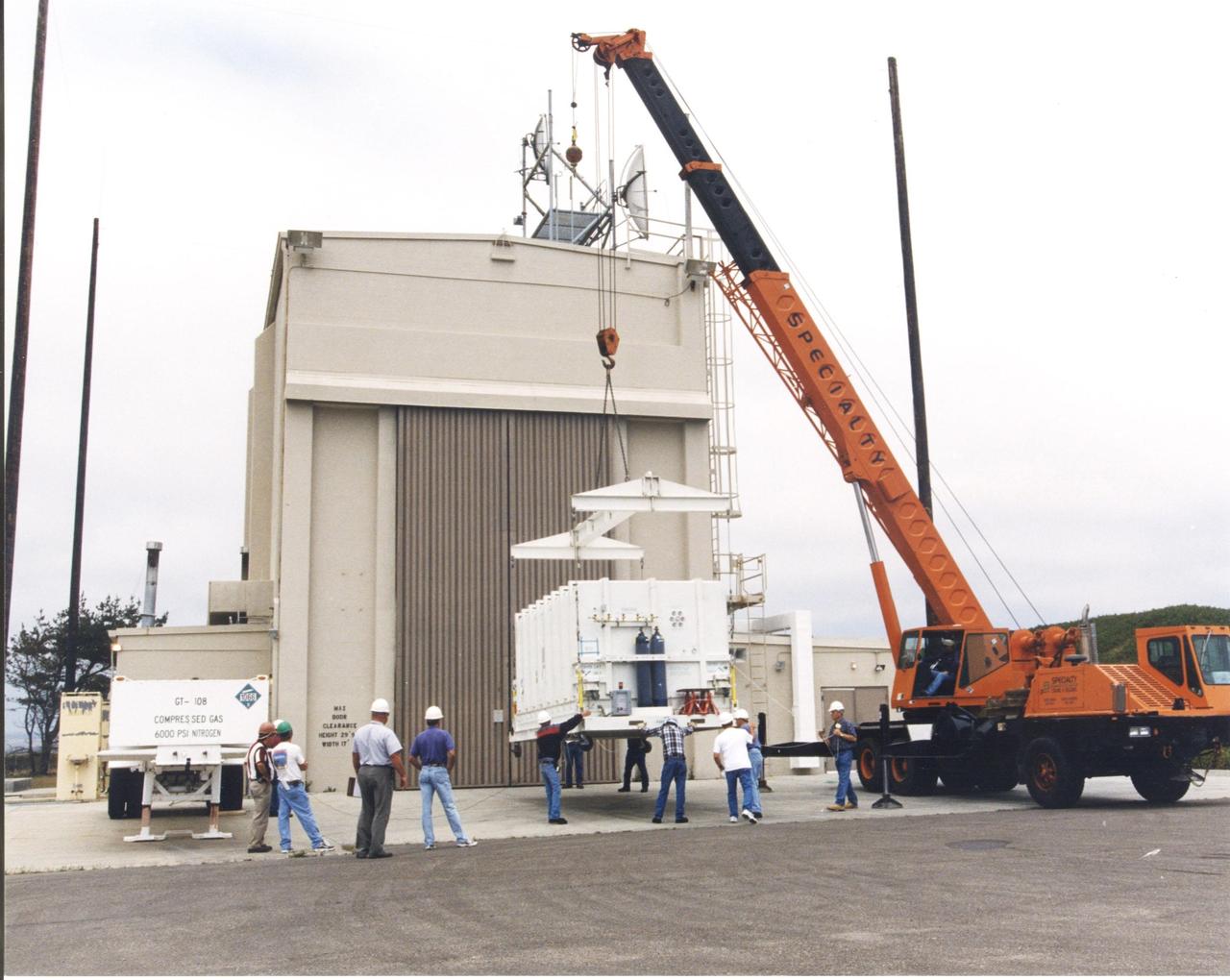
Outside the B16-10 spacecraft processing hangar at Vandenberg Air Force Base, Calif., a crated National Oceanic and Atmospheric Administration (NOAA-L) satellite is lowered to the ground before being moved inside. NOAA-L is part of the Polar-Orbiting Operational Environmental Satellite (POES) program that provides atmospheric measurements of temperature, humidity, ozone and cloud images, tracking weather patterns that affect the global weather and climate. The launch of the NOAA-L satellite is scheduled no earlier than Sept. 12 aboard a Lockheed Martin Titan II rocket
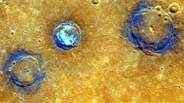
Measurements from NASA MESSENGER MLA instrument during the spacecraft greater than four-year orbital mission have mapped the topography of Mercury northern hemisphere in great detail. This enhanced color mosaic shows (from left to right) Munch (61 km/38 mi.), Sander (52 km/32 mi.), and Poe (81 km/50 mi.) craters, which lie in the northwest portion of the Caloris basin. The smooth volcanic plains that fill the Caloris basin appear orange in this image. All three craters are superposed on these volcanic plains and have excavated low-reflectance material, which appears blue in this image, from the subsurface. Hollows, typically associated with low-reflectance material, dot the rims of Munch and Poe and cover the floor of Sander. These images were acquired as high-resolution targeted color observations. Targeted color observations are images of a small area on Mercury's surface at resolutions higher than the 1-kilometer/pixel 8-color base map. During MESSENGER's one-year primary mission, hundreds of targeted color observations were obtained. During MESSENGER's extended mission, high-resolution targeted color observations are more rare, as the 3-color base map is covering Mercury's northern hemisphere with the highest-resolution color images that are possible. Date acquired: July 03, 2011, July 04, 2011 Image Mission Elapsed Time (MET): 218204186, 218204190, 218204194, 218246487, 218246491, 218246495 Image ID: 458397, 458398, 458399, 460433, 460434, 460435 Instrument: Wide Angle Camera (WAC) of the Mercury Dual Imaging System (MDIS) Center Latitude: 42° N Center Longitude: 154° E Projection: Equirectangular Resolution: 239 meters/pixel Scale: Munch crater is approximately 61 km (38 mi.) in diameter Incidence Angle: 43°, 42° Emission Angle: 35°, 13° Phase Angle: 79°, 55° http://photojournal.jpl.nasa.gov/catalog/PIA19421