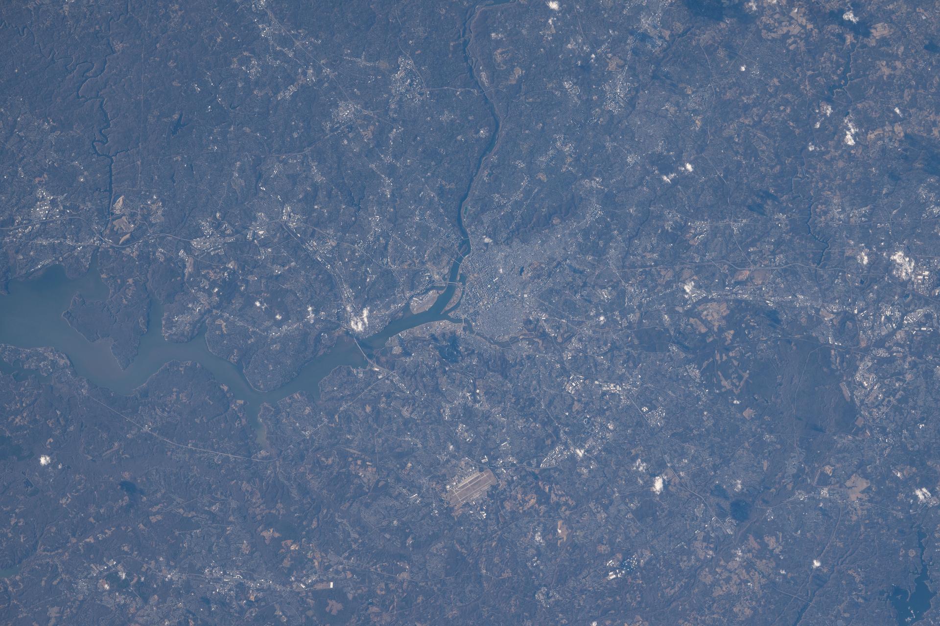
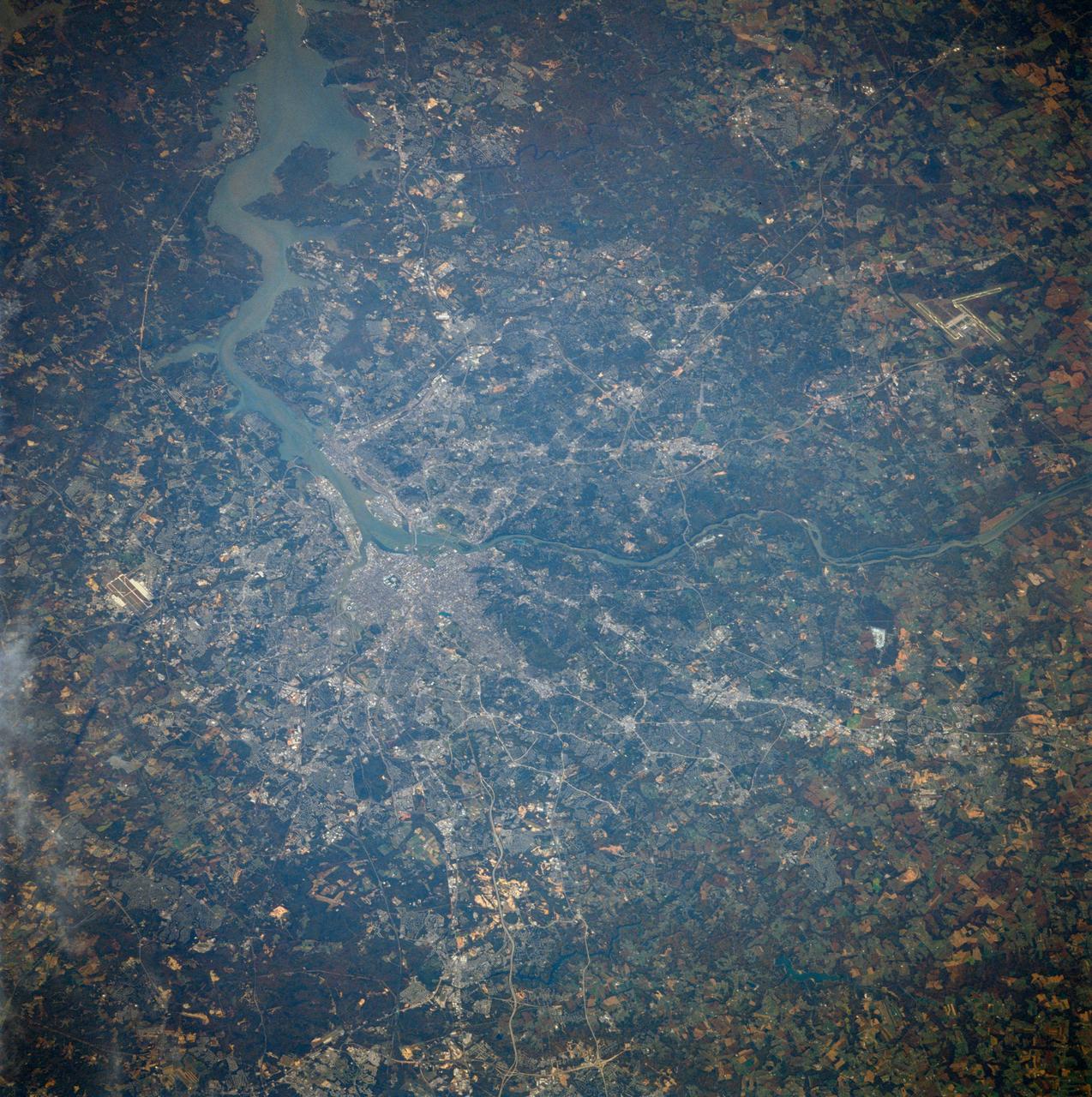
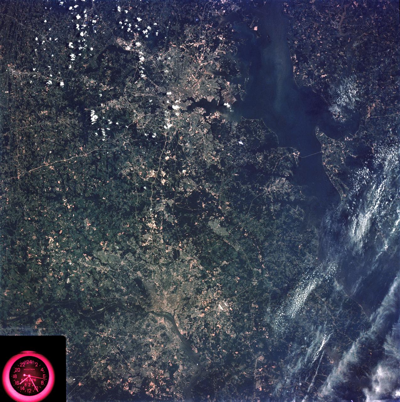
SL2-05-393 (22 June 1973) --- The nation's capital lies astride the Potomac River (38.5N, 77.5W) at the head of the Potomac Estuary. Baltimore, MD, also in the scene, is connected to Washington by the Baltimore-Washington Parkway. The suburbs of both cities tend to cluster around the Washington and Baltimore Beltways. Most of the countryside in the eastern two-thirds of this scene is either heavily forested or is in farming, dairy operations or poultry production. Photo credit: NASA
iss074e0150475 (Jan. 19, 2026) --- Washington, D.C., located across the Potomac River from Arlington, Virginia, is the capital of the United States and home to over 700,000 residents. The metropolitan area, which includes portions of Maryland, Virginia, and West Virginia, has approximately 6.3 million residents. The International Space Station was orbiting 259 miles above Earth when this photograph was taken.
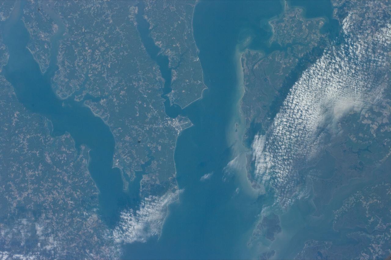
STS073-E-5096 (30 Oct. 1995) --- Central Chesapeake Bay. The lower Potomac River and Patuxent River join the Bay, whose eastern side is muddy from sediment eroded from the shoreline. The image is centered on the Patuxent River Naval Air Station. The frame was exposed with the Electronic Still Camera (ESC).
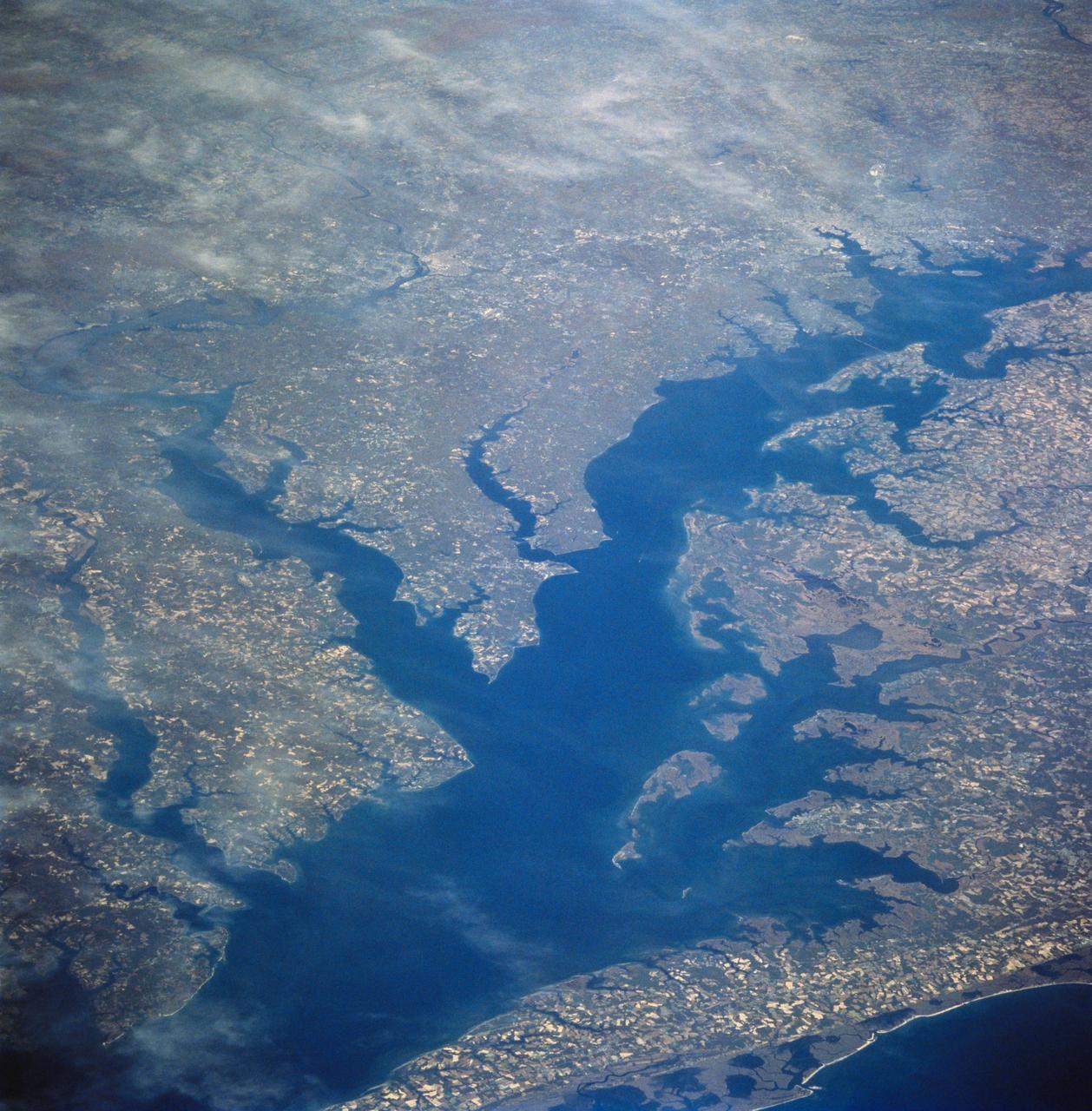
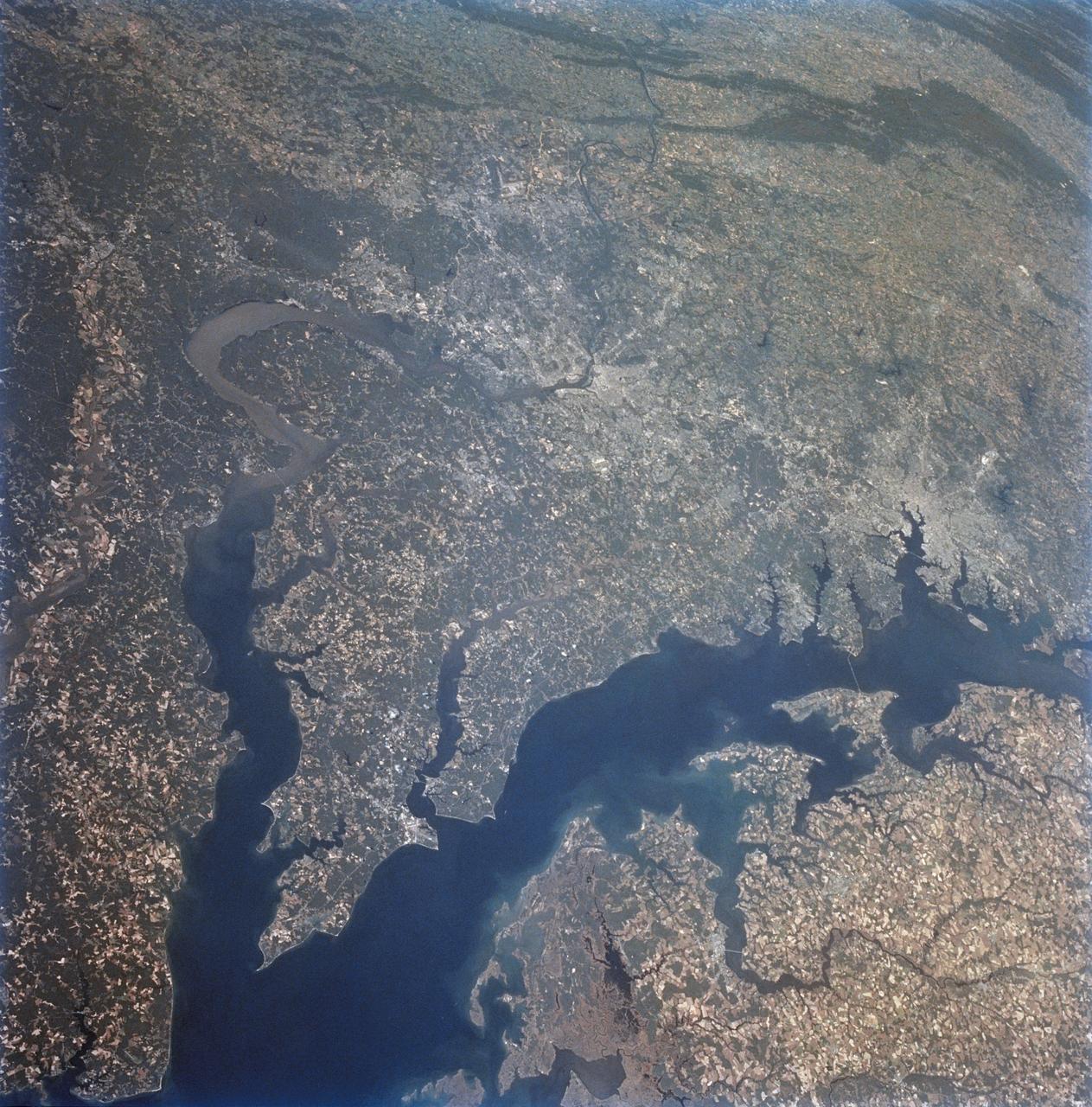
STS058-81-049 (18 Oct-1 Nov 1993) --- This view encompasses most of the large estuarine system of the Chesapeake Bay. The farmland and marshes of eastern shores of the Chesapeake (eastern Maryland and Virginia) are the foreground. The largest tributary flowing into the Bay is the Potomac River; Washington, D.C. is visible where the river bends to the northwest. The urban-suburban corridor between Washington, D.C. and Baltimore to the north (toward the right on this view) shows well as the gray zone which extends from left (D.C. on the Potomac) to right (Baltimore on the Patapsco River embayment on the Chesapeake, near the upper right).
41G-40-071 (5-13 Oct. 1984) --- Washington, D.C. -- the nation's capital -- is at right center in this phtograph from the Earth-orbiting space shuttle Challenger. J.F. Dulles Airport at lower left. Andrews Air Force Base is at right center edge. The Potomac River enters at left center, flows past Washington and as a tidal estuary at lower right. Also visible are the Great Falls of the Potomac. Photo credit: NASA
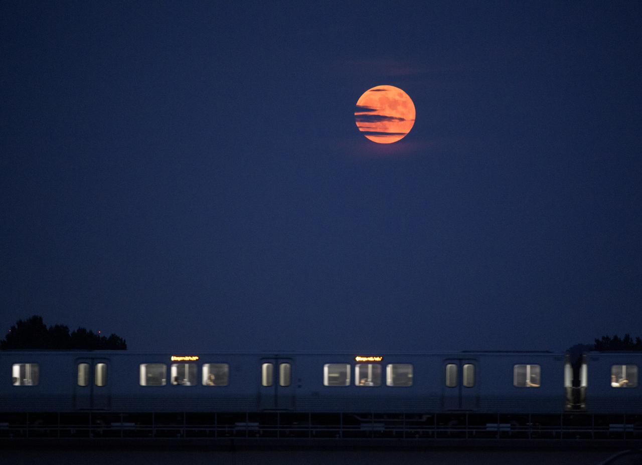
The Moon rises as a Metrorail car crosses the Potomac river in Washington 50 years to the day after astronauts Neil Armstrong, Michael Collins, and Buzz Aldrin launched on Apollo 11, the first mission to land astronauts on the Moon, Tuesday, July 16, 2019. Photo Credit: (NASA/Bill Ingalls)

ISS013-E-13549 (2 May 2006) --- Washington, DC is featured in this image photographed by an Expedition 13 crewmember on the International Space Station. When the image was exposed, the orbital outpost was located over the western border of Maryland and West Virginia. The resolution and extent of the true-color, handheld image is similar to the 15-meter/pixel data obtained by sensors onboard the unmanned Landsat-7 and Terra satellites. This resolution is sufficient to capture the sunglint off the Capitol Building's dome. Other major landmarks that are visible include the Washington Monument, the Pentagon (bottom left, southwest of the Potomac River), and the Lincoln Memorial, along the northwest bank of the Potomac.
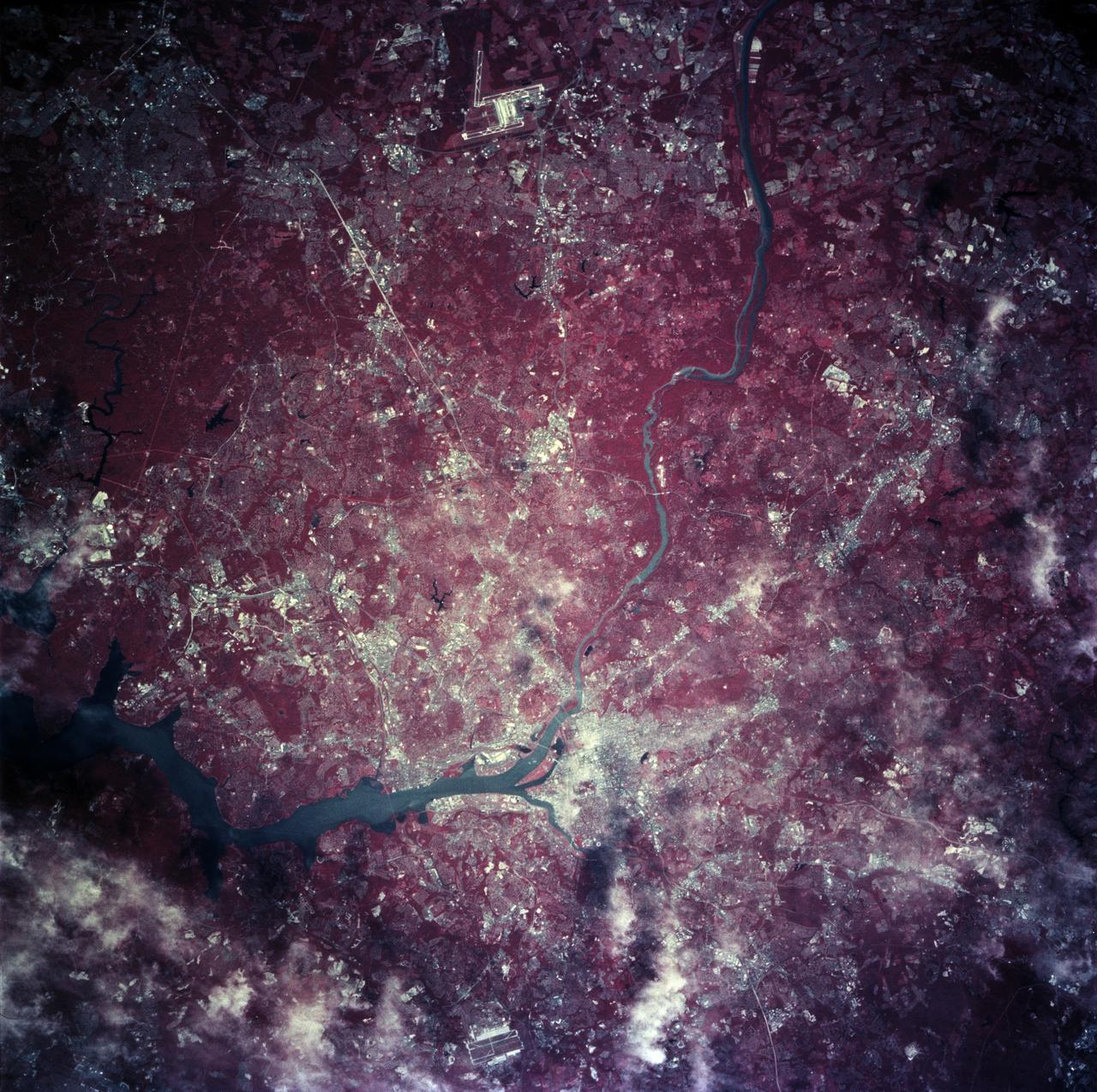
STS078-760-010 (20 June - 7 July 1996) --- As photographed with color infrared film by the crew of the Space Shuttle Columbia, the capital of the United States of America (the right of center) is located at the head of the navigable portion of the Potomac River. The Potomac separates the capital from Virginia to the southwest. It covers an area of 68-square-mile (177-square-kilometers). Andrews Air Force Base is seen east southwest of Washington D.C. at the right edge of the photo. Dulles International Airport is located west of the city on the left edge of the photo. Green vegetation shows up as red in the color infrared image.
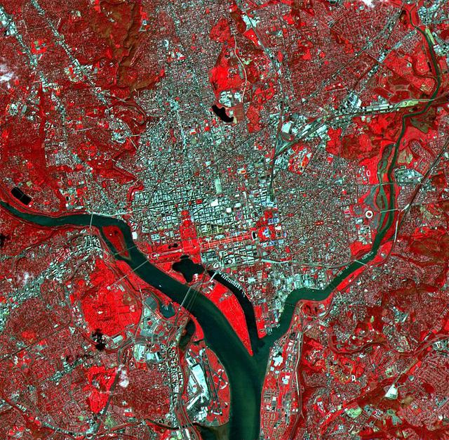
The White House, the Jefferson Memorial, and the Washington Monument with its shadow are all visible in this image of Washington, D.C. With its 15-meter spatial resolution, ASTER can see individual buildings. Taken on June 1, 2000, this image covers an area 14 kilometers (8.5 miles) wide and 13.7 kilometers (8.2 miles) long in three bands of the reflected visible and infrared wavelength region. The combination of visible and near infrared bands displays vegetation in red and water in dark grays. The Potomac River flows from the middle left to the bottom center. The large red area west of the river is Arlington National Cemetery. http://photojournal.jpl.nasa.gov/catalog/PIA02655
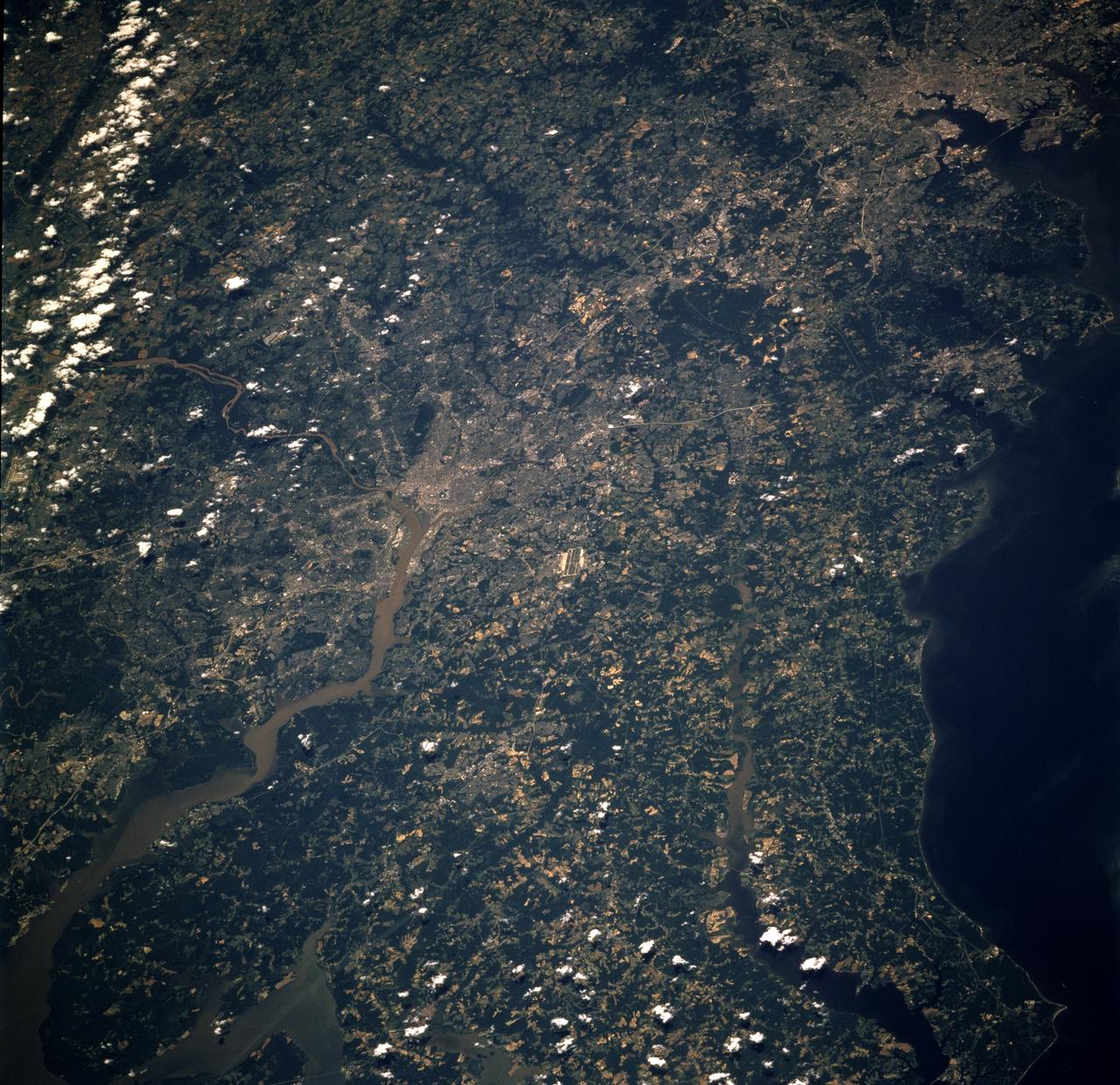
STS068-234-044 (30 September-11 October 1994) --- From the wetlands in Maryland to the nation's capital and onto Baltimore, this 70mm photograph from the Space Shuttle Endeavour shows some details of the historic Chesapeake Bay and Potomac River area. With the rather low altitude of Endeavour at 115 nautical miles, features as small as Kennedy Memorial Stadium and Andrews Air Force Base are clearly seen.
STS078-726-014 (20 June - 7 July 1996) --- Washington D.C., located in the center of the photo, was photographed in both regular color (here) and infrared (STS078-760-010) by the Life and Microgravity Spacelab (LMS-1) crew members. The city of Washington is coextensive with the District of Columbia, whose site was agreed upon by Congress in 1790 as the permanent seat of government for the new nation. It is located at the head of the navigable portion of the Potomac River, which separates it from Virginia to the southwest. It covers an area of 68-square-mile (177-square-kilometers). Andrews Air Force Base is seen east southeast of Washington D.C. Baltimore, Maryland, surrounding the Patapsco River mouth into Chesapeake Bay is located northeast of Washington D. C. or in upper right.
A NASA T-38 training jet is seen as it flies at 1500 feet over Washington, DC, Thursday, April 5, 2012. NASA, in cooperation with the Federal Aviation Administration, conducted training and photographic flights over the DC metropolitan area. T-38 aircraft have been used for astronaut training for more than 30 years as they allow pilots and mission specialists to think quickly in changing situations, mental experiences the astronauts say are critical to practicing for the rigors of spaceflight. Photo Credit: (NASA/Carla Cioffi)
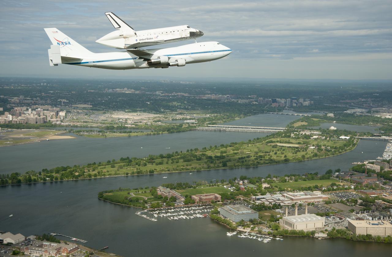
Space shuttle Discovery, mounted atop a NASA 747 Shuttle Carrier Aircraft (SCA), flies over the Washington skyline as seen from a NASA T-38 aircraft, Tuesday, April 17, 2012. Discovery, the first orbiter retired from NASA’s shuttle fleet, completed 39 missions, spent 365 days in space, orbited the Earth 5,830 times, and traveled 148,221,675 miles. NASA will transfer Discovery to the National Air and Space Museum to begin its new mission to commemorate past achievements in space and to educate and inspire future generations of explorers. Photo Credit: (NASA/Robert Markowitz)
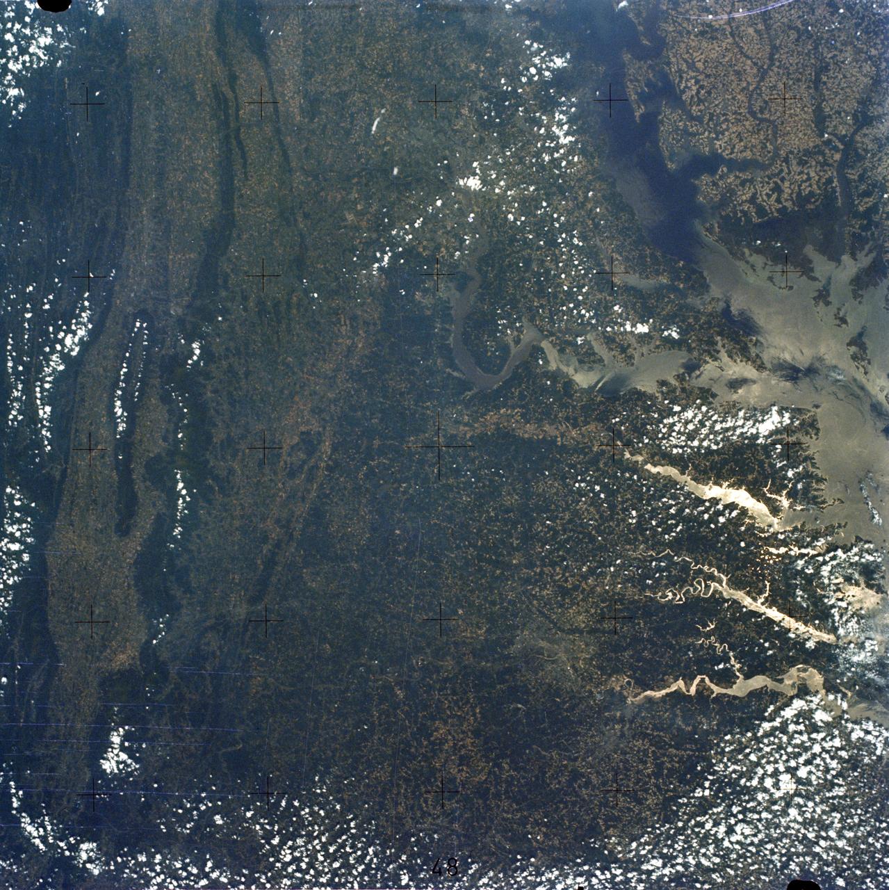
SL3-83-166 (July-September 1973) --- A vertical view of the Washington D.C. and the Baltimore, Maryland area is seen in the Skylab 3 Earth Resources Experiments Package S190-B (five-inch Earth terrain camera) photograph taken from the Skylab space station in Earth orbit. The Chesapeake Bay is on the right (east) side of the picture. The Potomac River flows through the Washington area in the lower left (southwest) corner of the photograph. Several transportation routes and major highways stand out very distinctly. Especially conspicuous are the beltways around the cities, Interstate 95 between Baltimore and the nation?s capitol and Interstate 70N leading west from Baltimore. The tunnel and harbor facilities in Baltimore show clearly, also. Identifiable features in the Washington area include the Capitol Building, the Mall area, Robert F. Kennedy Stadium (white circle), the five bridges across the Potomac, Andrews Air Force Base (on east loop), and the smaller Anacostia River. The extent of the urbanization in this area is dramatically illustrated in this picture. The photograph has sufficient resolution that the housing patterns for individual suburban areas are clearly defined with the houses shown as pink gray, wooded areas as dark green and cleared areas light green. Chesapeake Bay circulation patterns are indicated by contrast of dark and light blue. Sediment plumes (red) are seen entering the bay north and east of Baltimore. The bay bridge stands out white against the blue water. The detailed information contained in this one photograph will be of direct use to several EREP investigator teams in land use analysis, sedimentation and circulation patterns in the bay, and resource surveys of Maryland. All EREP photography is available to the public through the Department of Interior?s Earth Resources Observations Systems Data Center, Sioux Falls, South Dakota, 57198. Photo credit: NASA
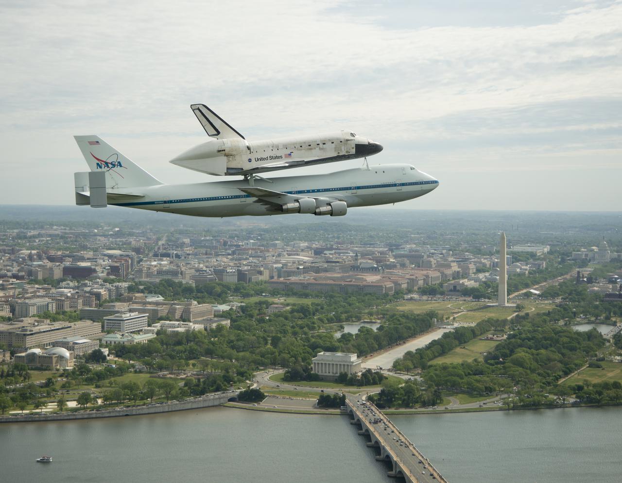
Space shuttle Discovery, mounted atop a NASA 747 Shuttle Carrier Aircraft (SCA), flies over the Washington skyline as seen from a NASA T-38 aircraft, Tuesday, April 17, 2012. Discovery, the first orbiter retired from NASA’s shuttle fleet, completed 39 missions, spent 365 days in space, orbited the Earth 5,830 times, and traveled 148,221,675 miles. NASA will transfer Discovery to the National Air and Space Museum to begin its new mission to commemorate past achievements in space and to educate and inspire future generations of explorers. Photo Credit: (NASA/Robert Markowitz)
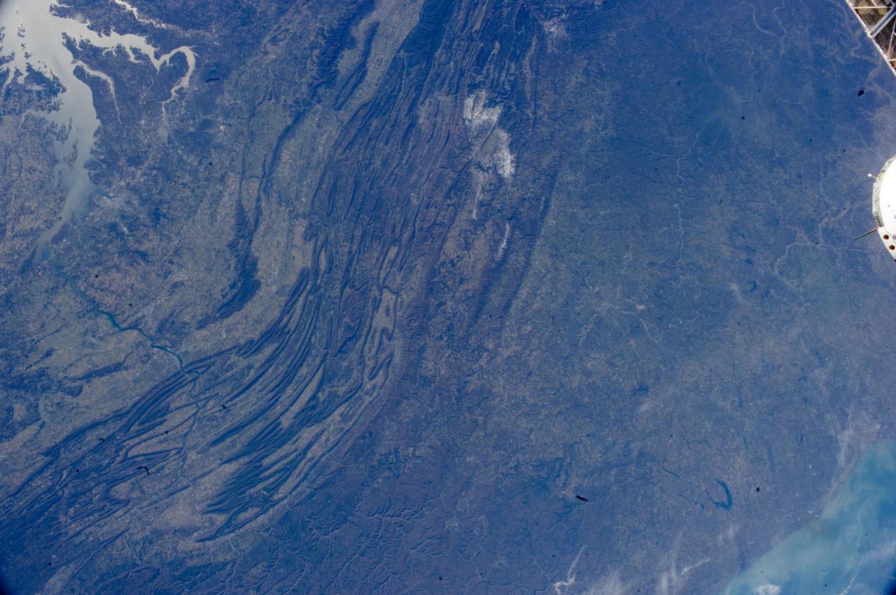
ISS033-E-022378 (17 Nov. 2012) --- The Appalachian Mountains in the eastern Unites States are featured in this image photographed by an Expedition 33 crew member on the International Space Station. This regional view shows the striking visual effect of the valley-and-ridge topography of the Appalachian Mountains as viewed from orbit. The view shows more than 300 miles (500 kilometers) of this low mountain chain, from northeast Pennsylvania (lower left) to southern West Virginia, where a dusting of snow can be seen (top center). Sunglint reflections reveal detail of Chesapeake Bay and the great bend of the Potomac River. Cities are difficult to detect from space during daylight hours, so the sickle-shaped bend of the river is a good visual guide for station crew members trying to photograph the nation?s capital, Washington D.C. (upper left). The farm-dominated Piedmont Plateau is the light-toned area between the mountains and the bay. The Appalachian Mountains appear striped because the ridges are forested; providing a dense and dark canopy cover, while the valleys are farmed with crops that generally appear as lighter-toned areas. Geologically the valleys are the softer, more erodible rock layers, much the preferred places for human settlement. Not only do the larger rivers occupy the valley floors, but all the larger rivers flow in them, soils are thicker, slopes are gentle, and valleys are better protected from winter winds. According to scientists, rocks that form the valley-and-ridge province, as it is known, are relatively old (540-300 million years old), and were laid down in horizontal layers when North America was attached to Europe as the ancient supercontinent of Laurasia. During this time Gondwanaland ? an ancient supercontinent that included present-day Africa, India, South America, Australia and Antarctica - was approaching Laurasia under the influence of plate tectonics. The northwest coastline of modern Africa was the section of Gondwanaland that ?bumped up? against modern North America over a long period (320 ? 260 million years ago), according to scientists. The net result of the tectonic collision was the building of a major mountain chain, much higher than the present Appalachian range?in the process of which the flat-lying rock layers were crumpled up into a series of tight folds, at right angles to the advance of Gondwanaland. The collision also formed the singular supercontinent of Pangaea. The scientists say that, over the following 200 million years, Pangaea broke apart; the modern Atlantic Ocean formed; and erosion wore down the high mountains. What is left to see are the coastline of North America, and the eroded stumps of the mountain chain as the relatively low, but visually striking present-day Appalachian Mountains.