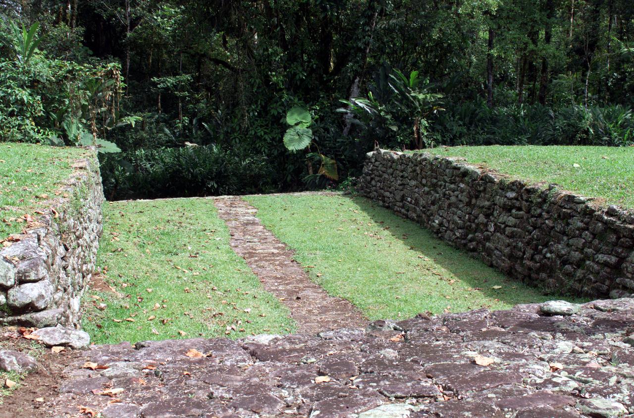
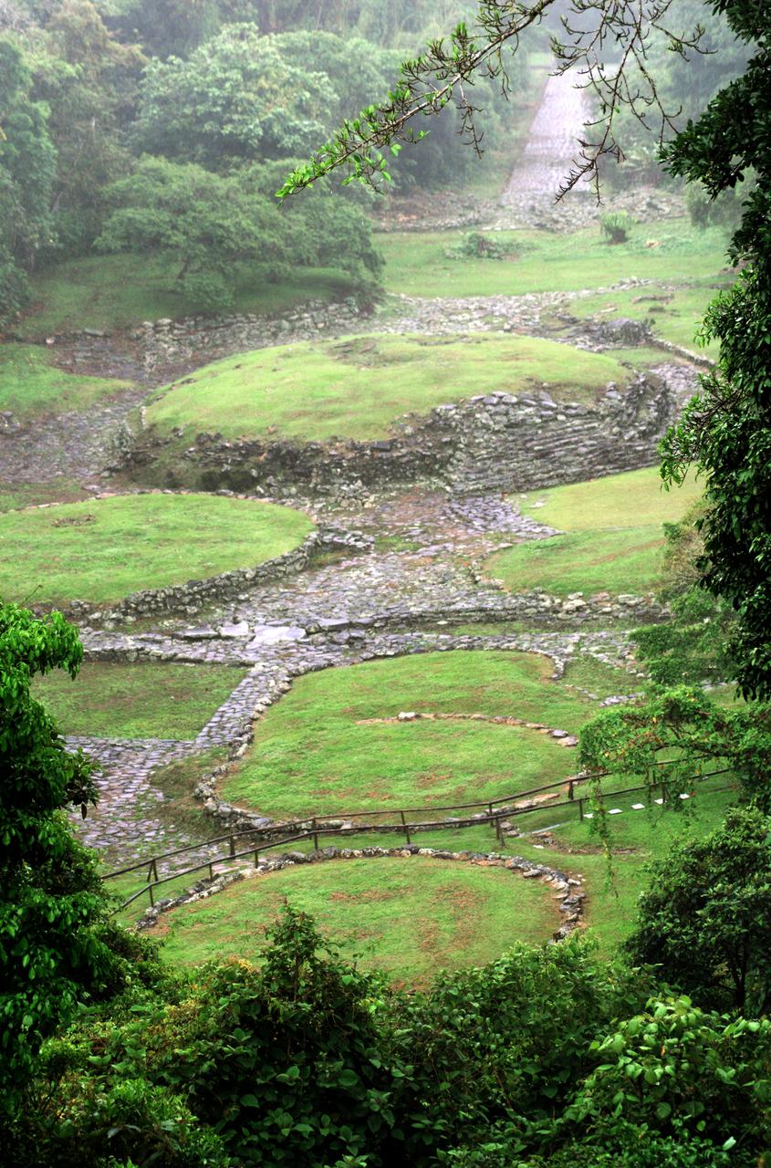
Pre-Columbian archaeological ruins are revealed through Costa Rican rain forest in this photo taken during NASA's AirSAR 2004 Mesoamerica campaign. AirSAR 2004 Mesoamerica is a three-week expedition by an international team of scientists that uses an all-weather imaging tool, called the Airborne Synthetic Aperture Radar (AirSAR) which is located onboard NASA's DC-8 airborne laboratory. The radar, developed by NASA's Jet Propulsion Laboratory, can penetrate clouds and also collect data at night. Its high-resolution sensors operate at multiple wavelengths and modes, allowing AirSAR to see beneath treetops, through thin sand, and dry snow pack. Much of the archaeological evidence needed to understand Pre-Columbian societies in Central America comes from features on the landscape. Difficult terrain and logistics have limited ground data collection. AirSAR helped to detect signs of ancient civilizations hidden beneath the forest. Its images will shed insights into the way modern humans interact with their landscape, and how ancient peoples lived and what became of their civilizations.
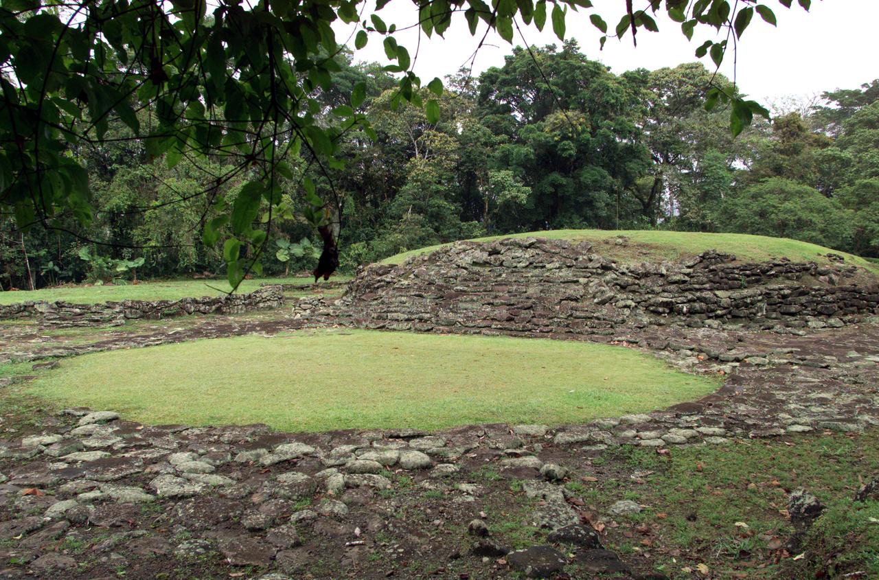
Pre-Columbian archaeological ruins are revealed through Costa Rican rain forest in this photo taken during NASA's AirSAR 2004 Mesoamerica campaign. AirSAR 2004 Mesoamerica is a three-week expedition by an international team of scientists that uses an all-weather imaging tool, called the Airborne Synthetic Aperture Radar (AirSAR) which is located onboard NASA's DC-8 airborne laboratory. The radar, developed by NASA's Jet Propulsion Laboratory, can penetrate clouds and also collect data at night. Its high-resolution sensors operate at multiple wavelengths and modes, allowing AirSAR to see beneath treetops, through thin sand, and dry snow pack. Much of the archaeological evidence needed to understand Pre-Columbian societies in Central America comes from features on the landscape. Difficult terrain and logistics have limited ground data collection. AirSAR helped to detect signs of ancient civilizations hidden beneath the forest. Its images will shed insights into the way modern humans interact with their landscape, and how ancient peoples lived and what became of their civilizations.
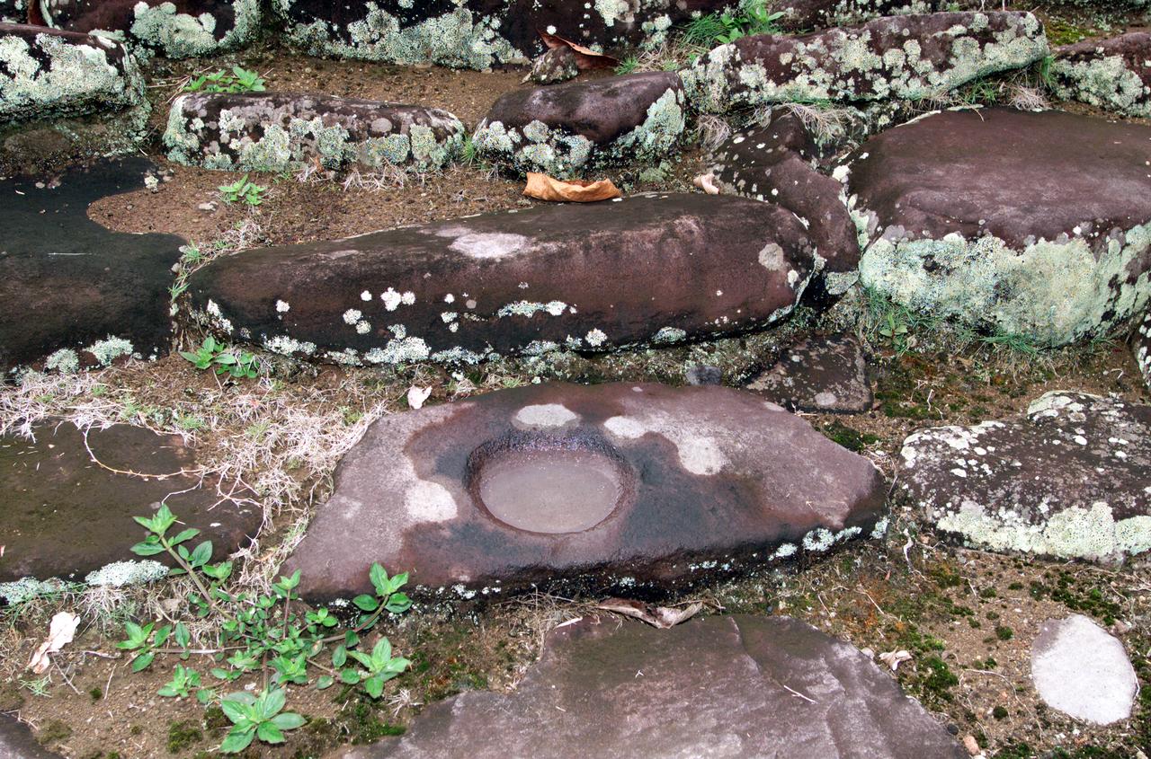
Pre-Columbian archaeological ruins are revealed through Costa Rican rain forest in this photo taken during NASA's AirSAR 2004 Mesoamerica campaign. AirSAR 2004 Mesoamerica is a three-week expedition by an international team of scientists that uses an all-weather imaging tool, called the Airborne Synthetic Aperture Radar (AirSAR) which is located onboard NASA's DC-8 airborne laboratory. The radar, developed by NASA's Jet Propulsion Laboratory, can penetrate clouds and also collect data at night. Its high-resolution sensors operate at multiple wavelengths and modes, allowing AirSAR to see beneath treetops, through thin sand, and dry snow pack. Much of the archaeological evidence needed to understand Pre-Columbian societies in Central America comes from features on the landscape. Difficult terrain and logistics have limited ground data collection. AirSAR helped to detect signs of ancient civilizations hidden beneath the forest. Its images will shed insights into the way modern humans interact with their landscape, and how ancient peoples lived and what became of their civilizations.
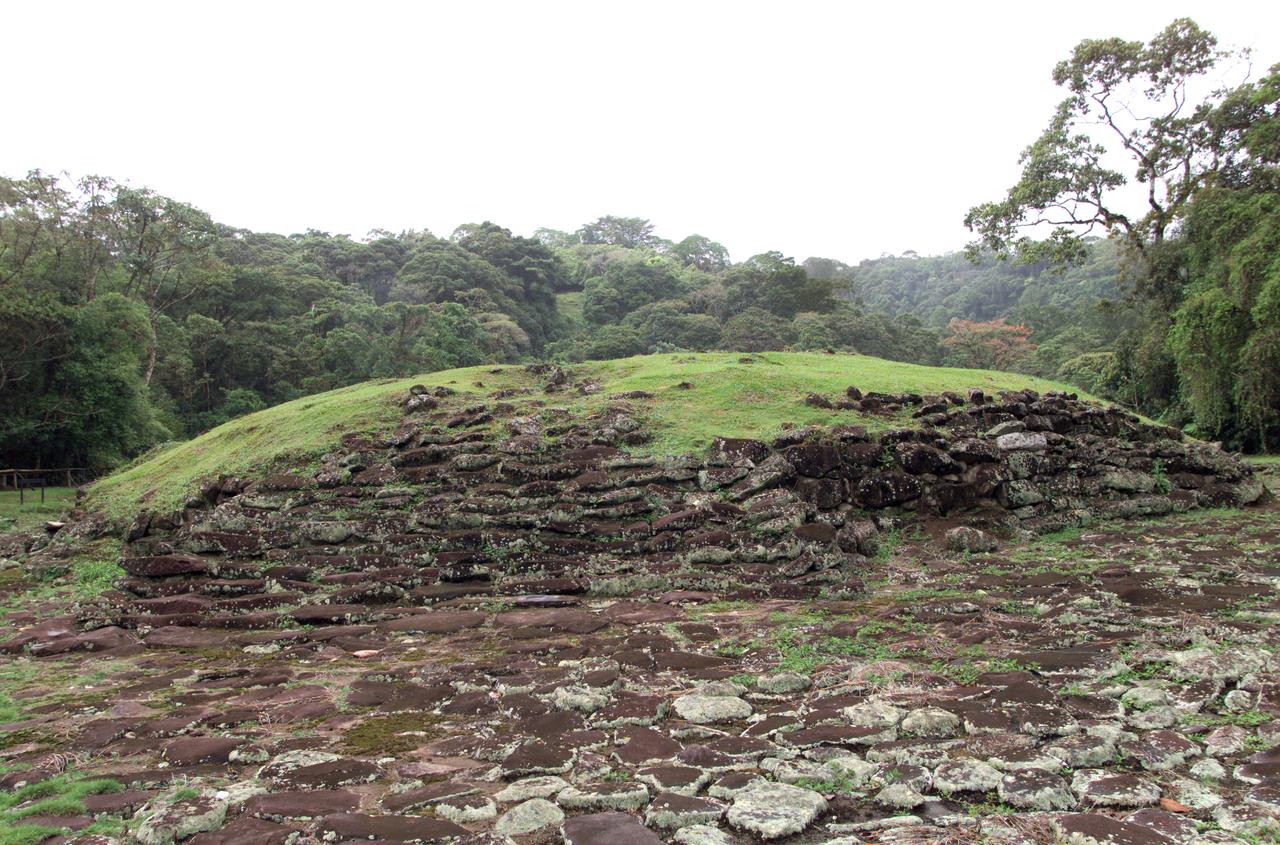
Pre-Columbian archaeological ruins are revealed through Costa Rican rain forest in this photo taken during NASA's AirSAR 2004 Mesoamerica campaign. AirSAR 2004 Mesoamerica is a three-week expedition by an international team of scientists that uses an all-weather imaging tool, called the Airborne Synthetic Aperture Radar (AirSAR) which is located onboard NASA's DC-8 airborne laboratory. The radar, developed by NASA's Jet Propulsion Laboratory, can penetrate clouds and also collect data at night. Its high-resolution sensors operate at multiple wavelengths and modes, allowing AirSAR to see beneath treetops, through thin sand, and dry snow pack. Much of the archaeological evidence needed to understand Pre-Columbian societies in Central America comes from features on the landscape. Difficult terrain and logistics have limited ground data collection. AirSAR helped to detect signs of ancient civilizations hidden beneath the forest. Its images will shed insights into the way modern humans interact with their landscape, and how ancient peoples lived and what became of their civilizations.
Pre-Columbian archaeological ruins are revealed through Costa Rican rain forest in this photo taken during NASA's AirSAR 2004 Mesoamerica campaign. AirSAR 2004 Mesoamerica is a three-week expedition by an international team of scientists that uses an all-weather imaging tool, called the Airborne Synthetic Aperture Radar (AirSAR) which is located onboard NASA's DC-8 airborne laboratory. The radar, developed by NASA's Jet Propulsion Laboratory, can penetrate clouds and also collect data at night. Its high-resolution sensors operate at multiple wavelengths and modes, allowing AirSAR to see beneath treetops, through thin sand, and dry snow pack. Much of the archaeological evidence needed to understand Pre-Columbian societies in Central America comes from features on the landscape. Difficult terrain and logistics have limited ground data collection. AirSAR helped to detect signs of ancient civilizations hidden beneath the forest. Its images will shed insights into the way modern humans interact with their landscape, and how ancient peoples lived and what became of their civilizations.
Pre-Columbian archaeological ruins are revealed through Costa Rican rain forest in this photo taken during NASA's AirSAR 2004 Mesoamerica campaign. AirSAR 2004 Mesoamerica is a three-week expedition by an international team of scientists that uses an all-weather imaging tool, called the Airborne Synthetic Aperture Radar (AirSAR) which is located onboard NASA's DC-8 airborne laboratory. The radar, developed by NASA's Jet Propulsion Laboratory, can penetrate clouds and also collect data at night. Its high-resolution sensors operate at multiple wavelengths and modes, allowing AirSAR to see beneath treetops, through thin sand, and dry snow pack. Much of the archaeological evidence needed to understand Pre-Columbian societies in Central America comes from features on the landscape. Difficult terrain and logistics have limited ground data collection. AirSAR helped to detect signs of ancient civilizations hidden beneath the forest. Its images will shed insights into the way modern humans interact with their landscape, and how ancient peoples lived and what became of their civilizations.
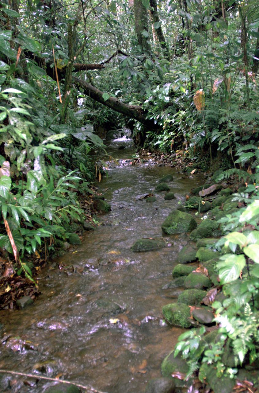
This photograph shows a stream in the La Selva region of the Costa Rican rain forest, taken during NASA's AirSAR 2004 campaign. AirSAR 2004 Mesoamerica is a three-week expedition by an international team of scientists that uses an all-weather imaging tool, called the Airborne Synthetic Aperture Radar (AirSAR) which is located onboard NASA's DC-8 airborne laboratory. Scientists from many parts of the world including NASA's Jet Propulsion Laboratory are combining ground research done in several areas in Central America with NASA's AirSAR technology to improve and expand on the quality of research they are able to conduct. The radar, developed by NASA's Jet Propulsion Laboratory, can penetrate clouds and also collect data at night. Its high-resolution sensors operate at multiple wavelengths and modes, allowing AirSAR to see beneath treetops, through thin sand, and dry snow pack. AirSAR's 2004 campaign is a collaboration of many U.S. and Central American institutions and scientists, including NASA; the National Science Foundation; the Smithsonian Institution; National Geographic; Conservation International; the Organization of Tropical Studies; the Central American Commission for Environment and Development; and the Inter-American Development Bank.