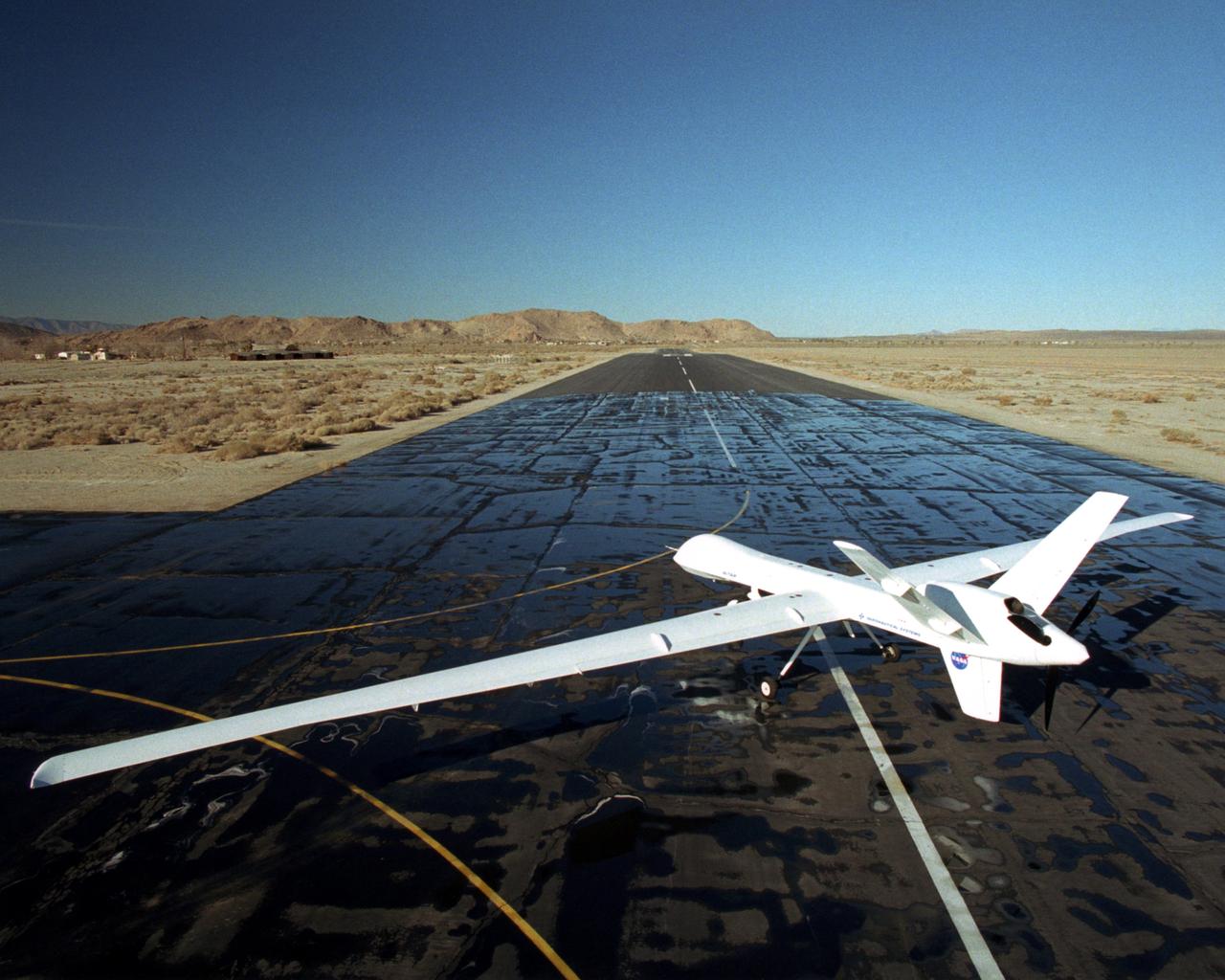
NASA's Ikhana, a civil variant of General Atomics' Predator B unmanned aircraft, takes to the sky for a morning checkout flight from the Grey Butte airfield.
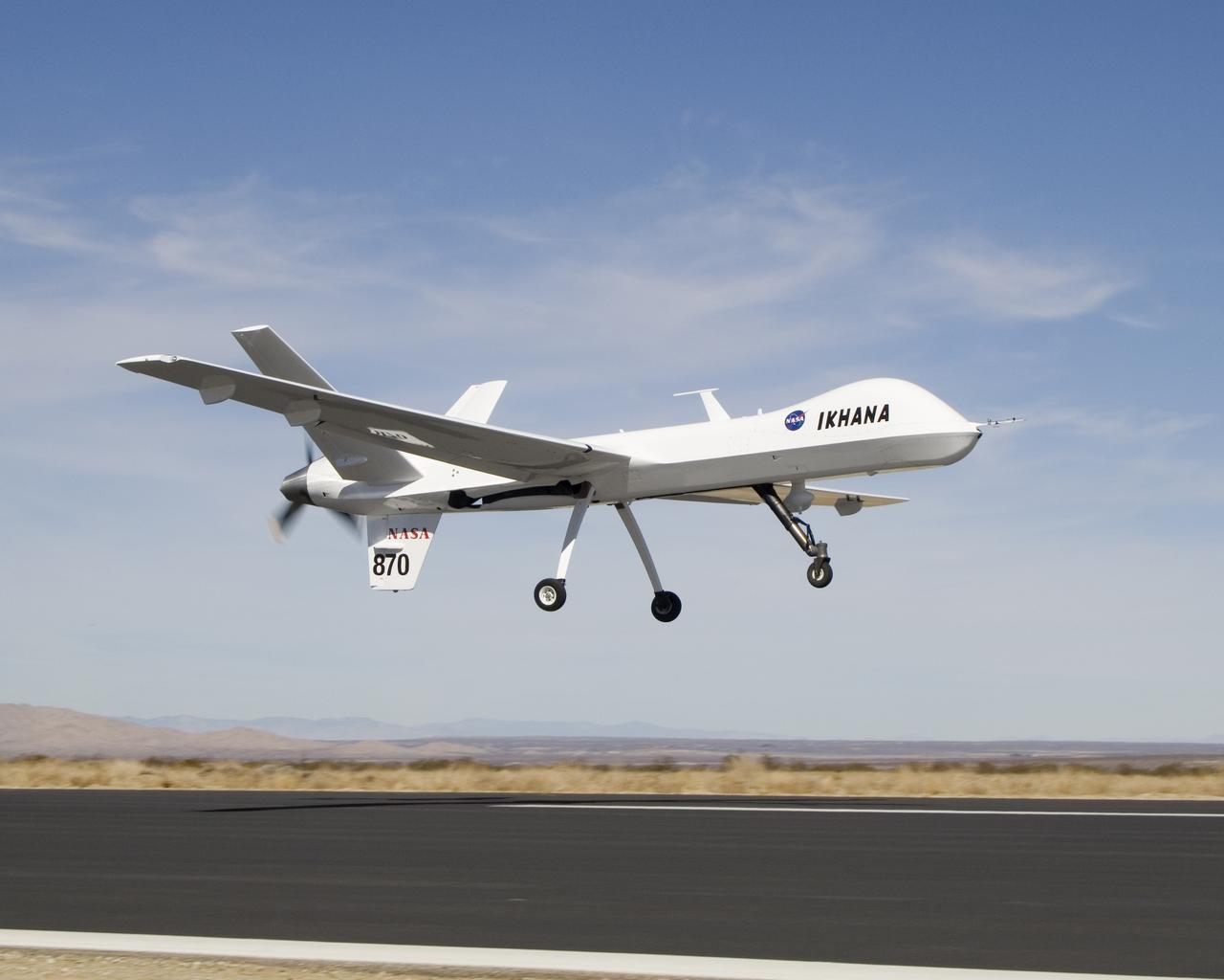
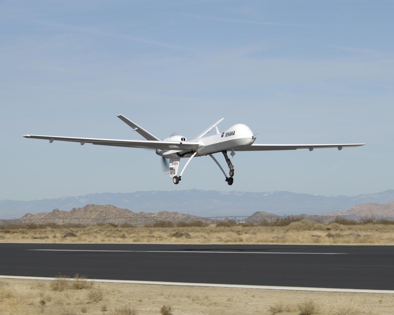
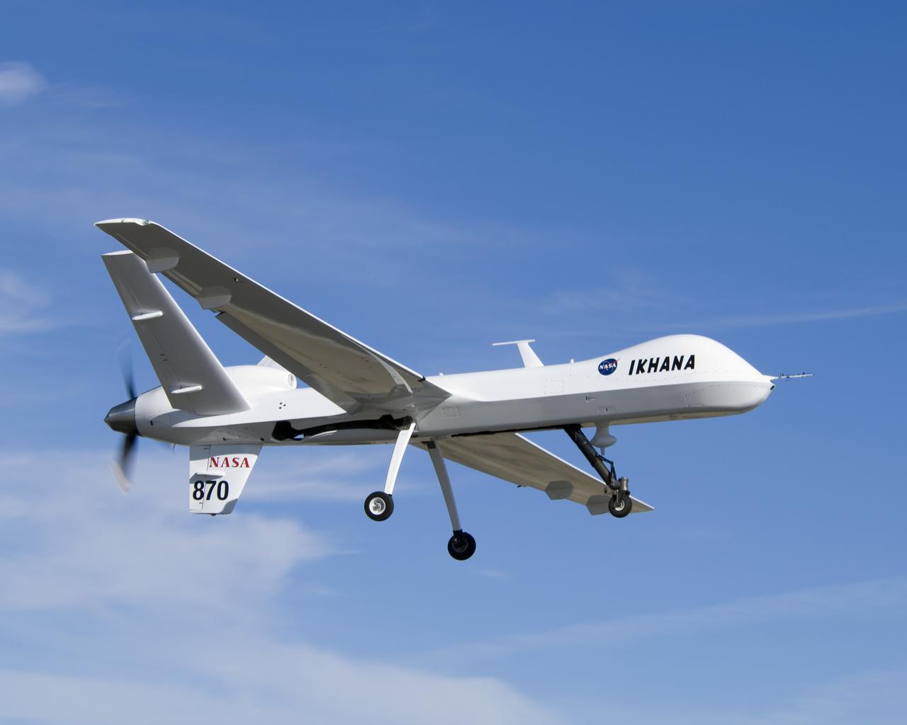
NASA's Ikhana unmanned science demonstration aircraft, a civil variant of General Atomics' Predator B, lifts off from Grey Butte airfield in Southern California.
NASA's Ikhana unmanned science demonstration aircraft, a civil variant of General Atomics' Predator B, lifts off from Grey Butte airfield in Southern California.
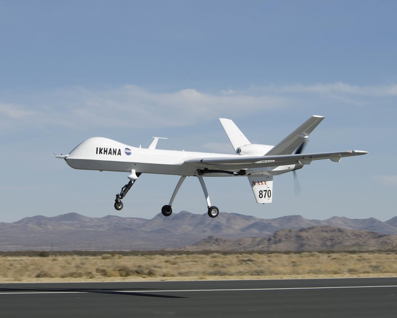
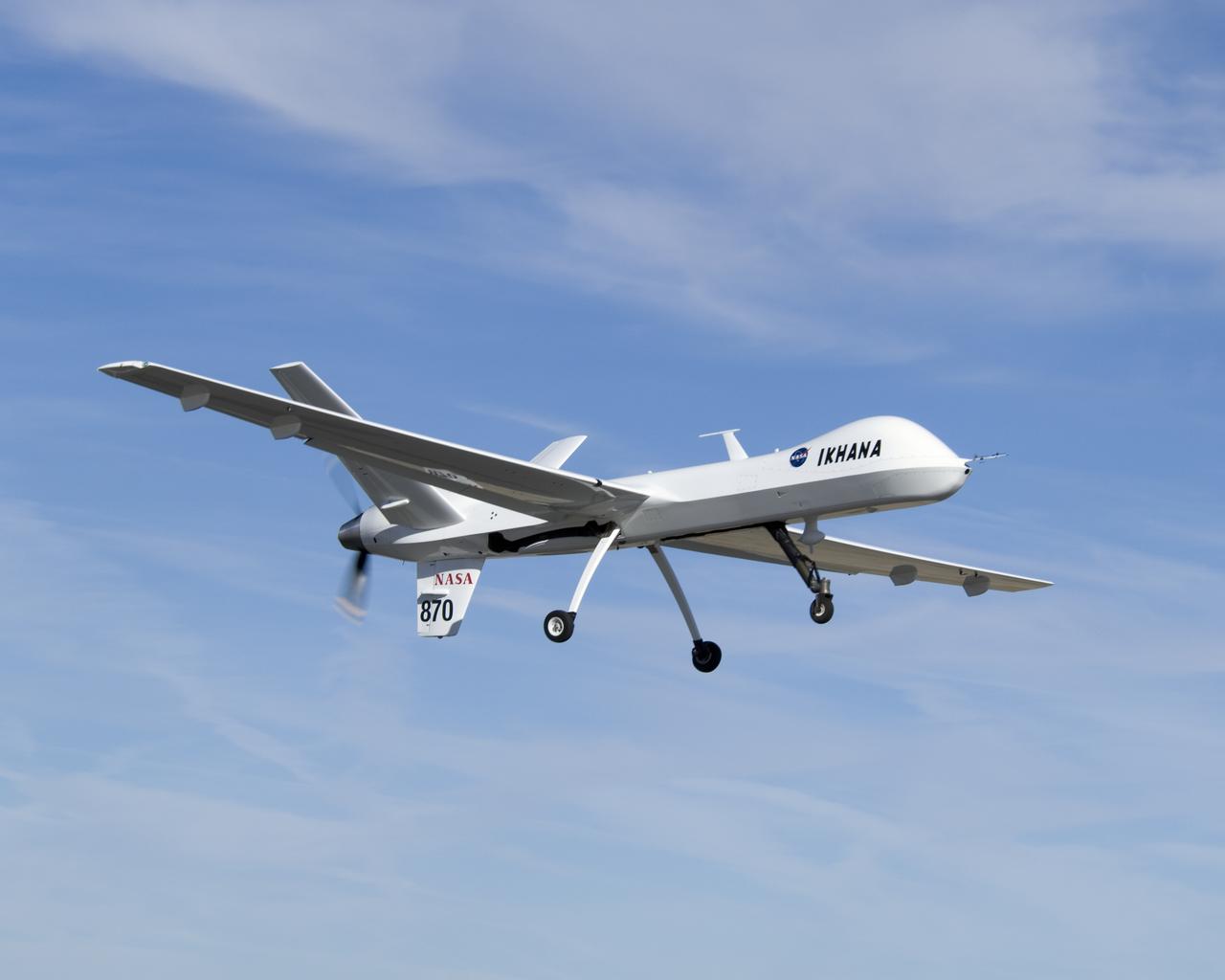
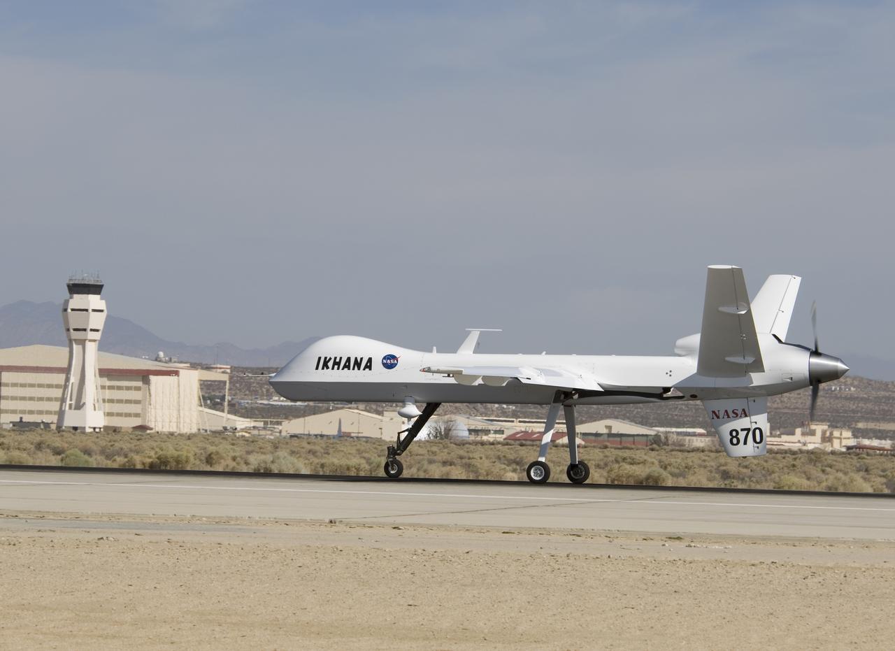
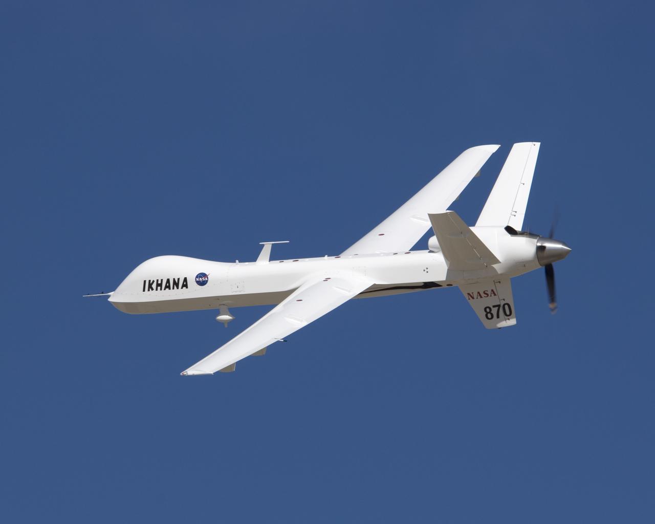
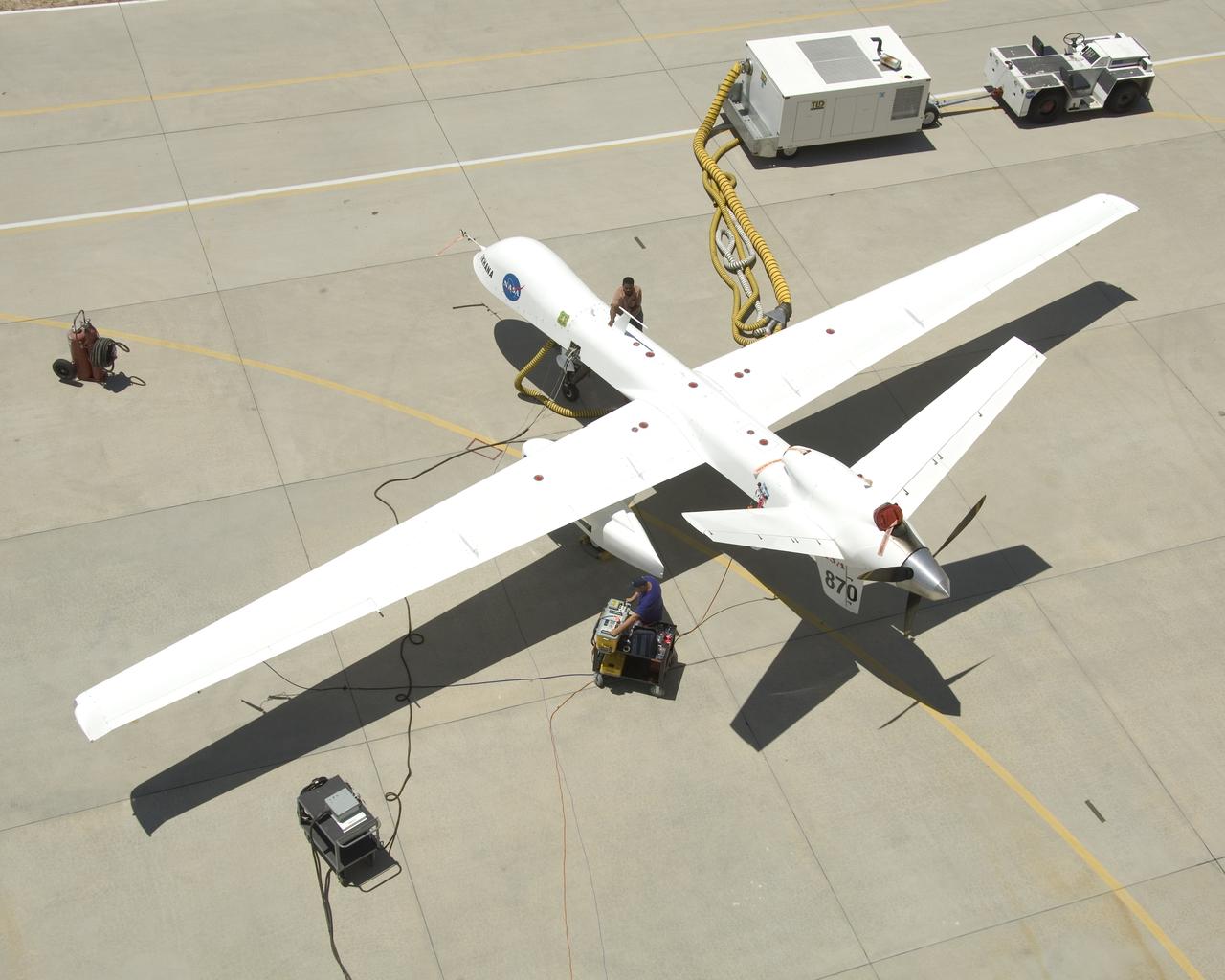
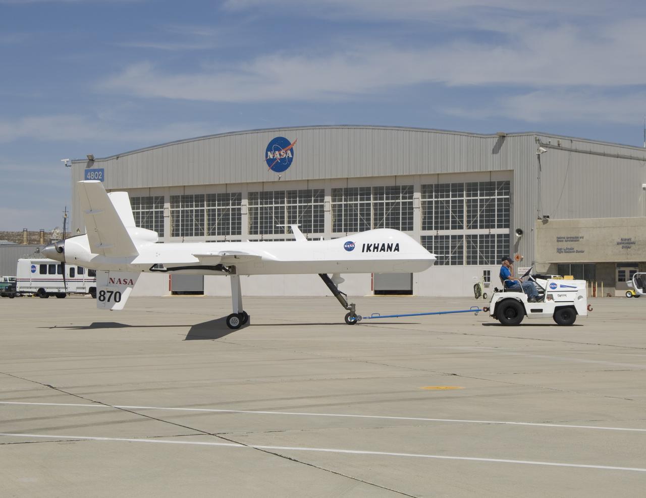
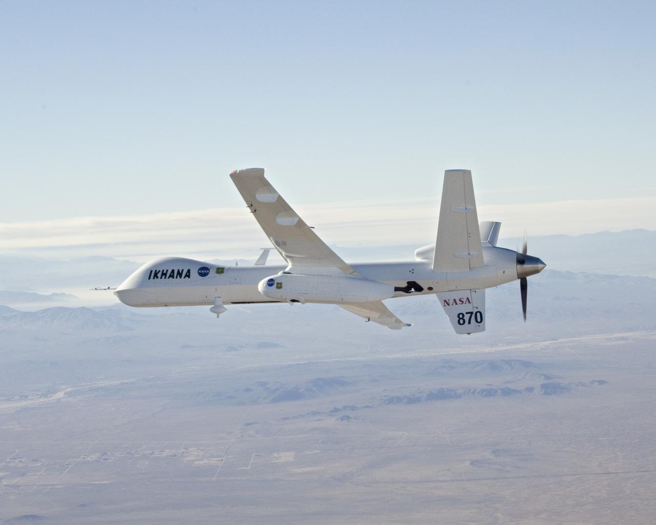
Bearing NASA tail number 870, NASA's Ikhana unmanned aircraft is a civil version of the Predator B designed for high-altitude, long-endurance science flights.
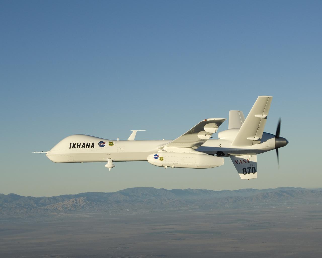
NASA's Ikhana unmanned long-endurance science aircraft, a civil variant of General Atomics' Predator B, takes to the sky over Southern California's high desert.
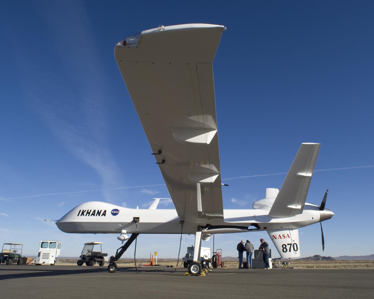
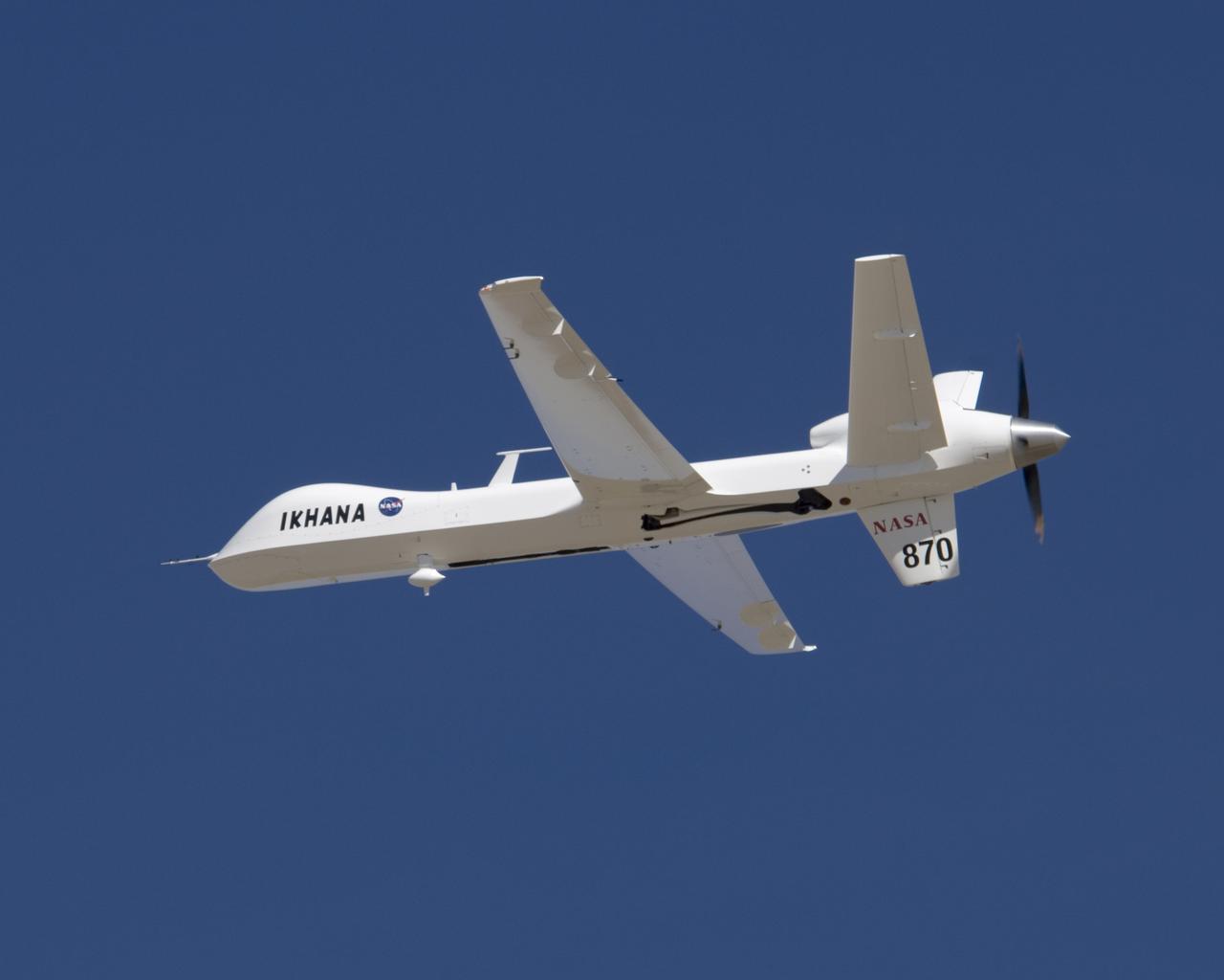
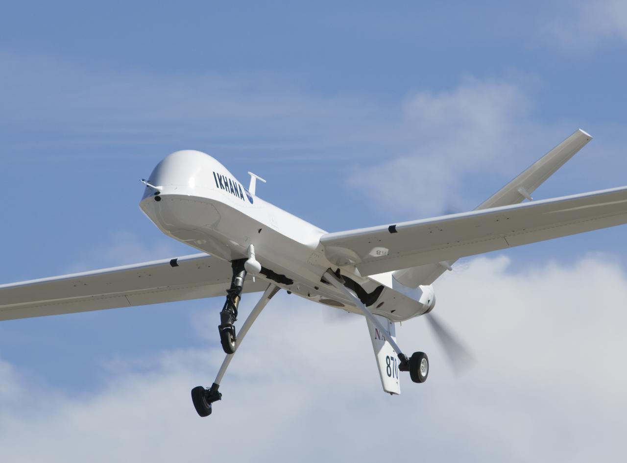
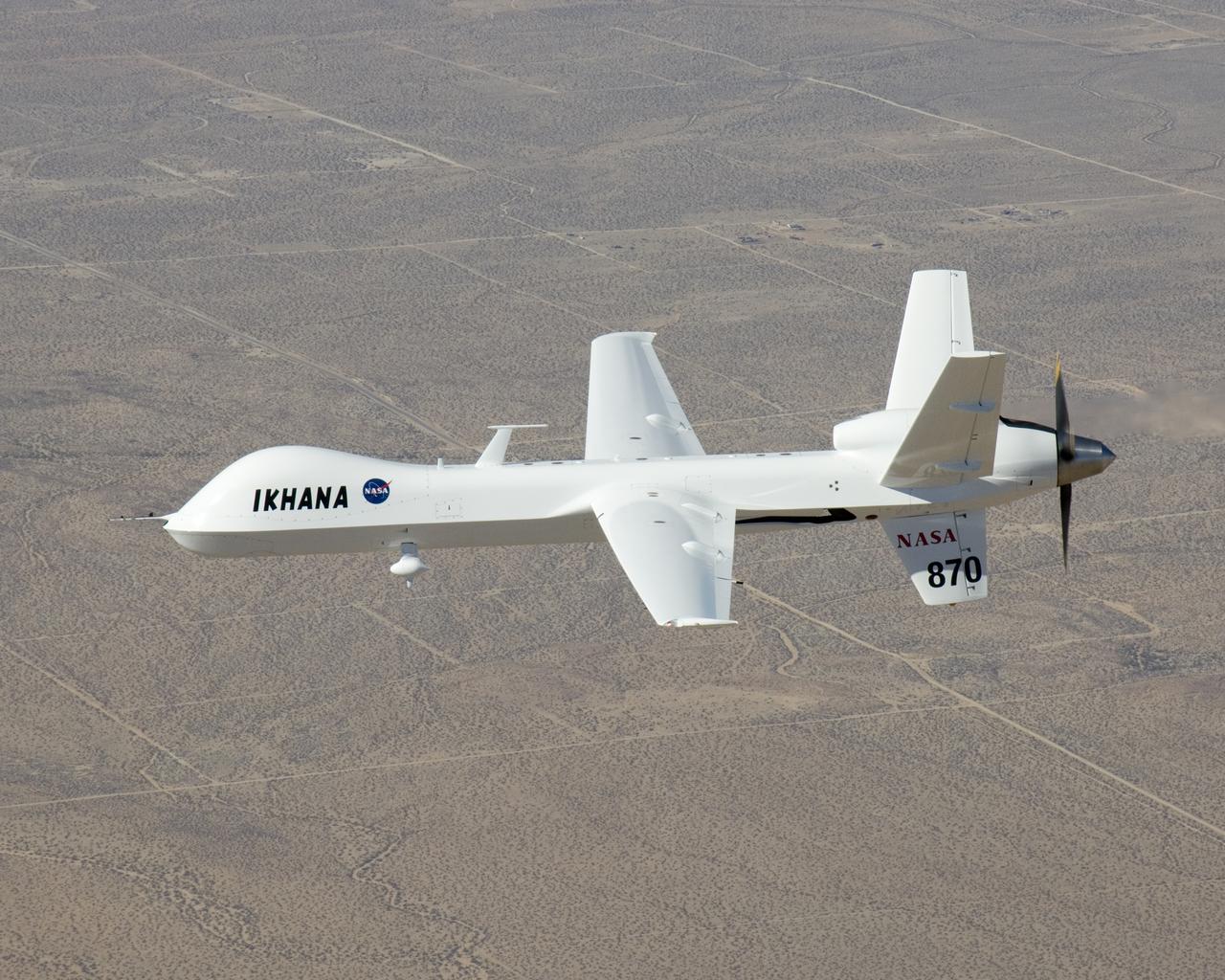
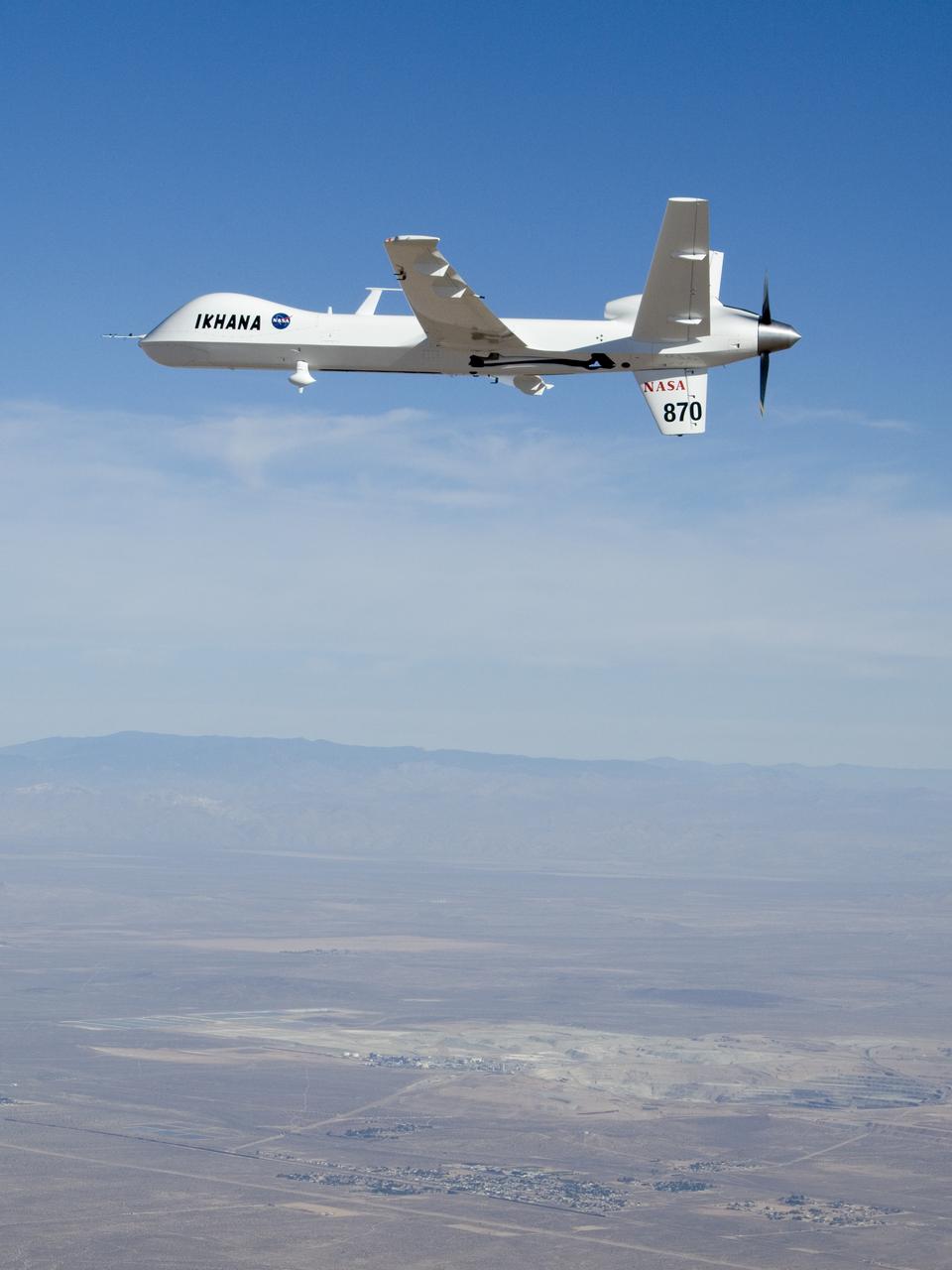
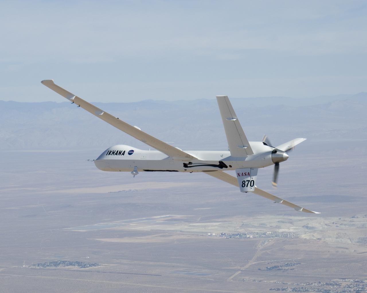
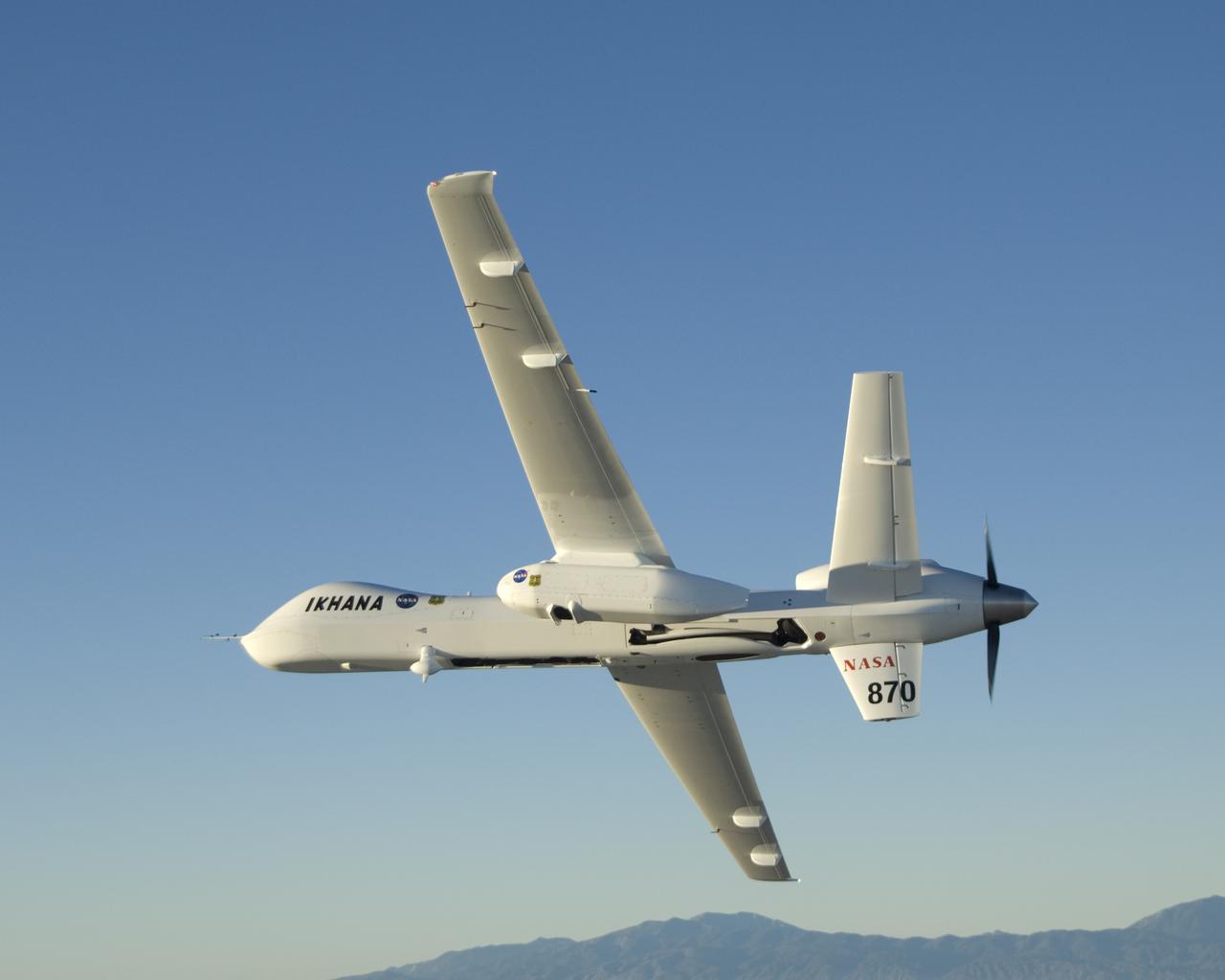
Straight wings, a Y-tail and a pusher propeller distinguish NASA's Ikhana, a civil version of General Atomics Aeronautical system's Predator B unmanned aircraft.
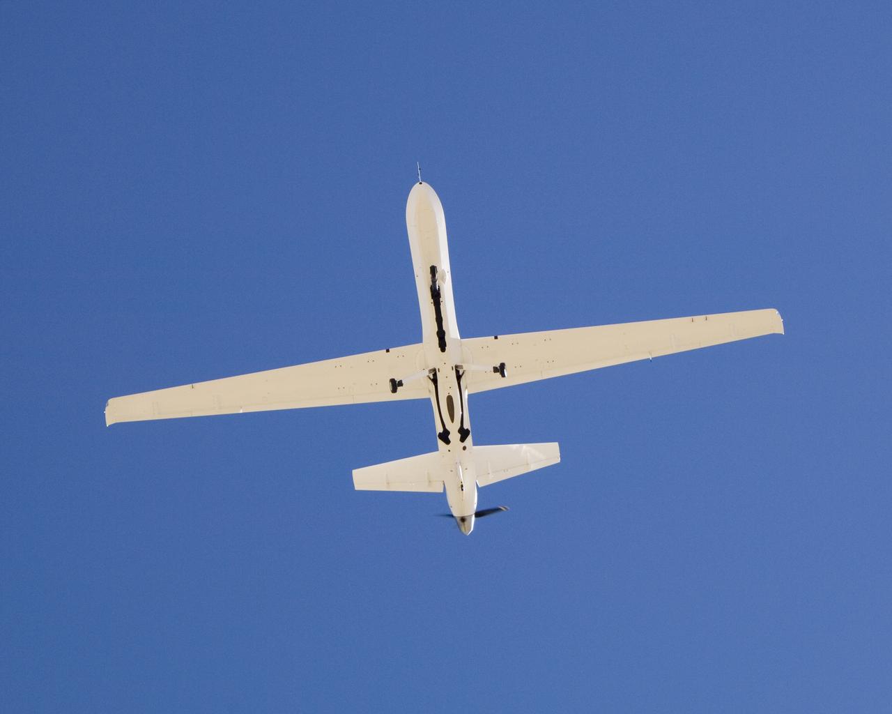
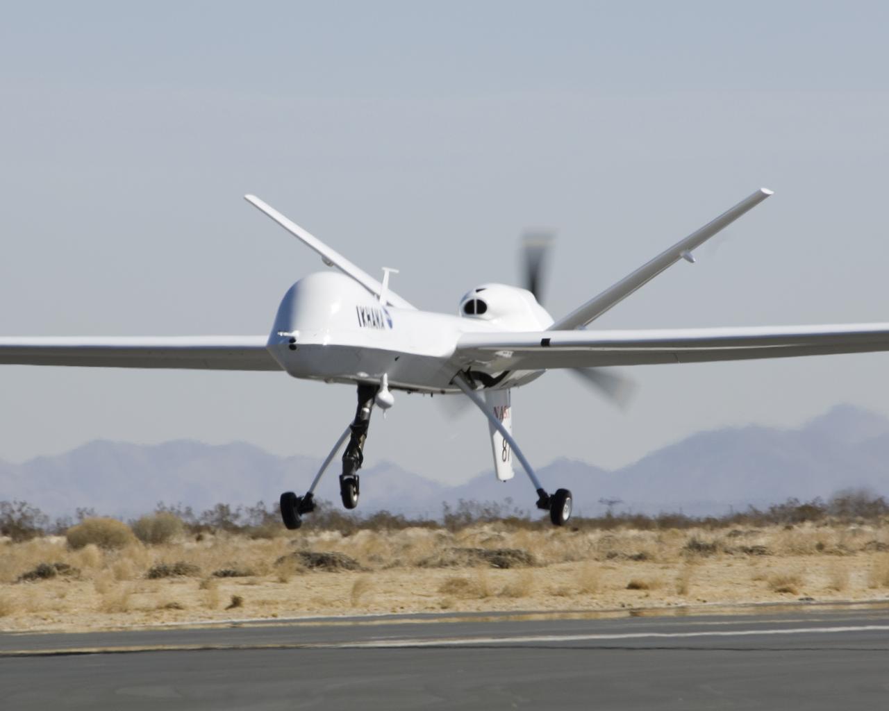
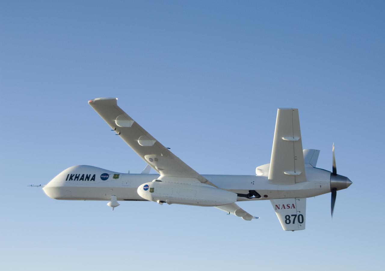
The narrow fuselage of NASA'S Ikhana unmanned science aircraft, a civil version of General Atomics' Predator B, is evident in this view from underneath.
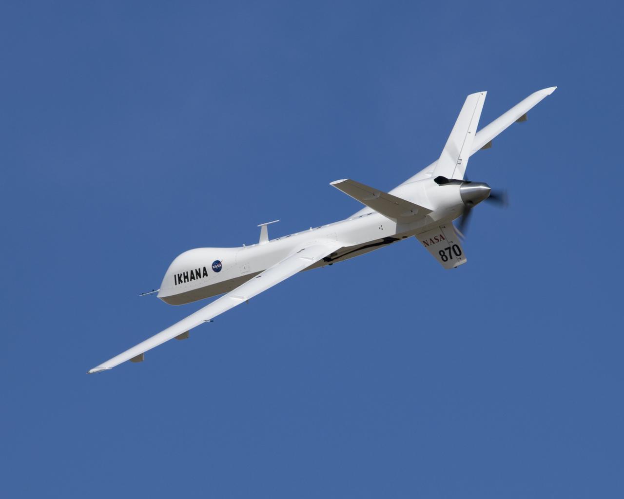
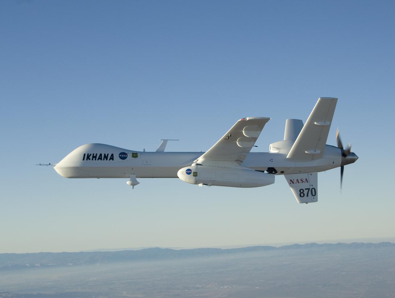
Narrow wings, a Y-tail and rear engine layout distinguish NASA's Ikhana science aircraft, a civil variant of General Atomics' Predator B unmanned aircraft system.
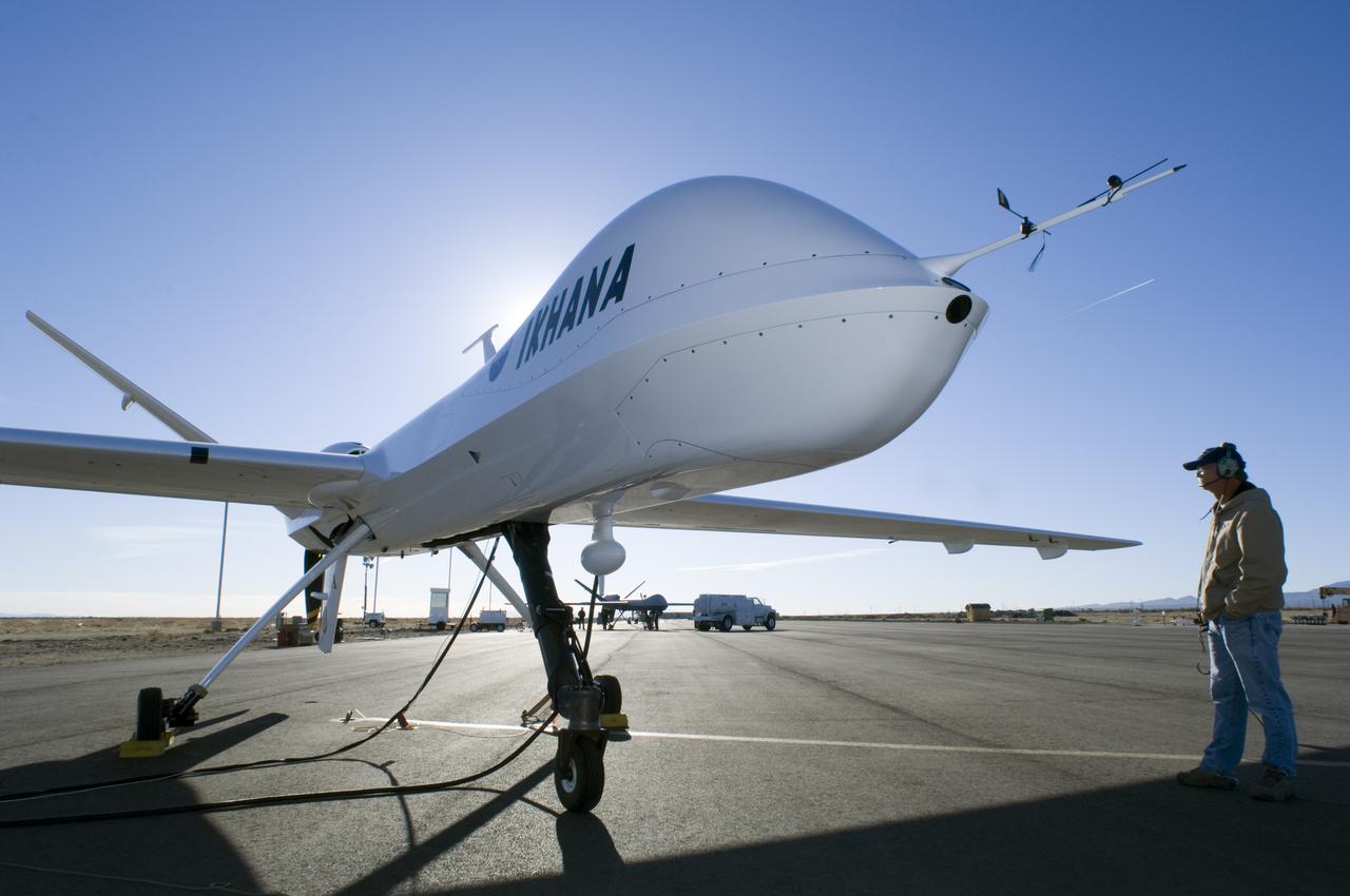
Silhouetted by the morning sun, NASA's Ikhana, a civil version of the Predator B unmanned aircraft, is readied for flight By NASA Dryden crew chief Joe Kinn.
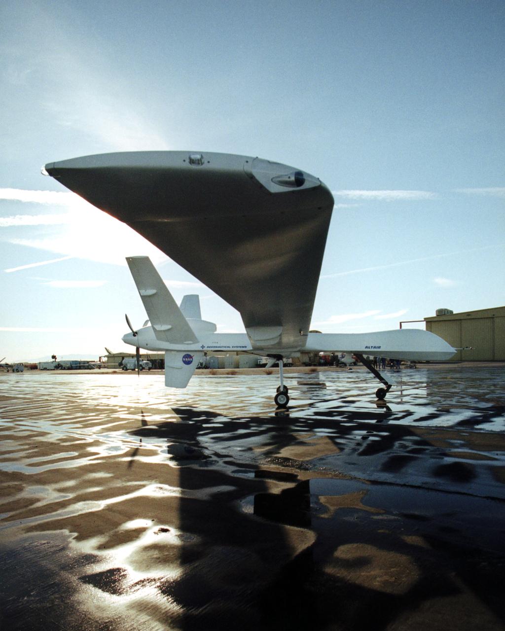
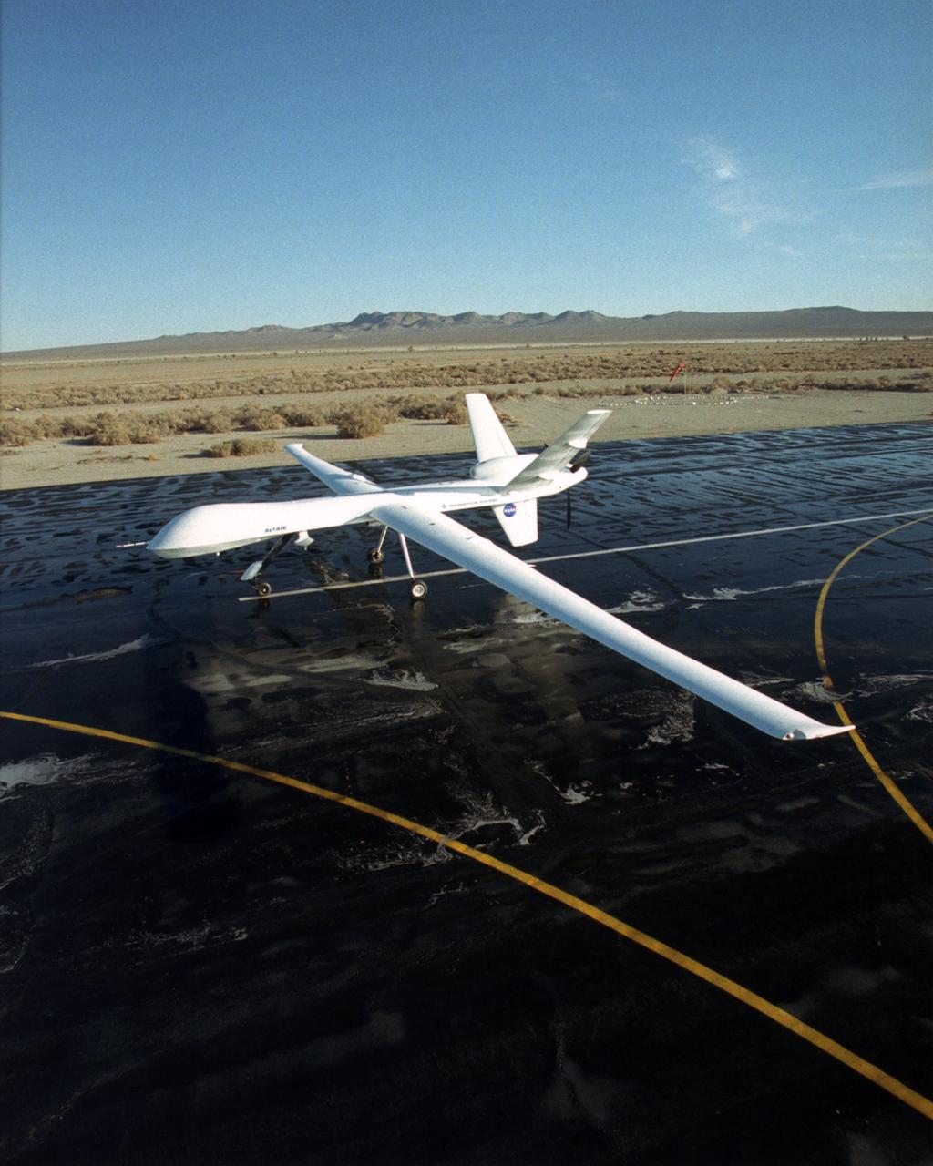
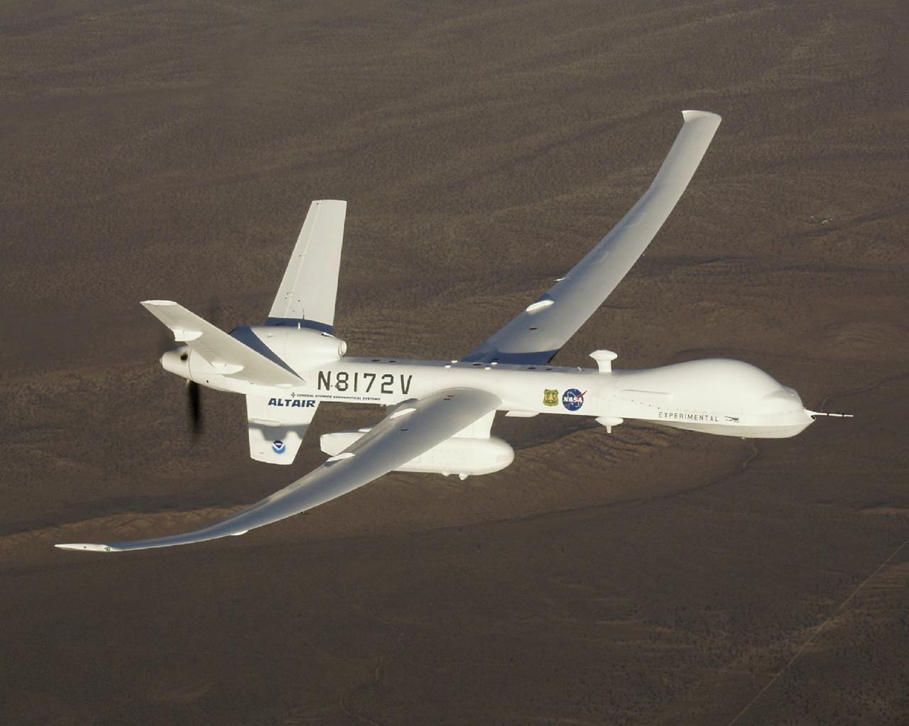
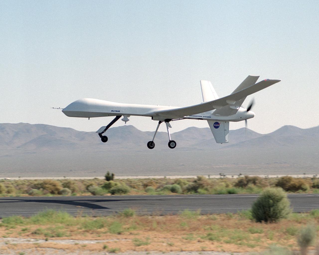
The Altair, a civil variant of the QM-9 Predator B unmanned aerial vehicle (UAV), shows off its lengthy high-aspect ratio wing while on the ramp at General Atomics Aeronautical Systems' flight test facility at El Mirage, California.
NASA Dryden crew chief Joe Kinn gives final checks to NASA's Ikhana, a civil version of the Predator B unmanned aircraft, prior to a morning checkout flight.
NASA's Ikhana unmanned science demonstration aircraft, a civil variant of General Atomics' Predator B, on the runway at Edwards Air Force Base after its ferry flight to NASA's Dryden Flight Research Center. NASA took possession of the new aircraft in November, 2006, and it arrived at the NASA center at Edwards Air Force Base, Calif., on June 23, 2007.
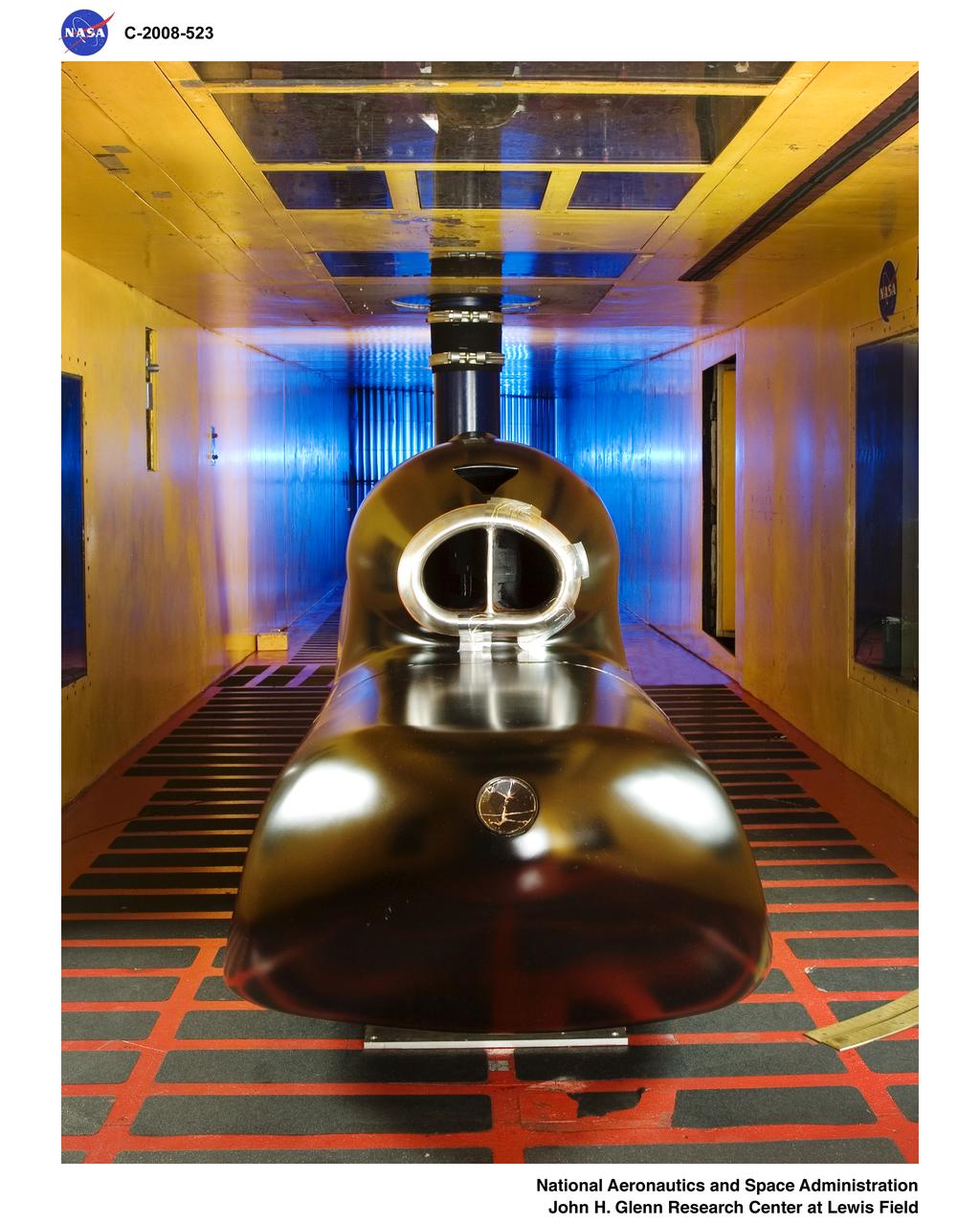
General Atomics - Predator B Inlet Model in the Icing Research Tunnel
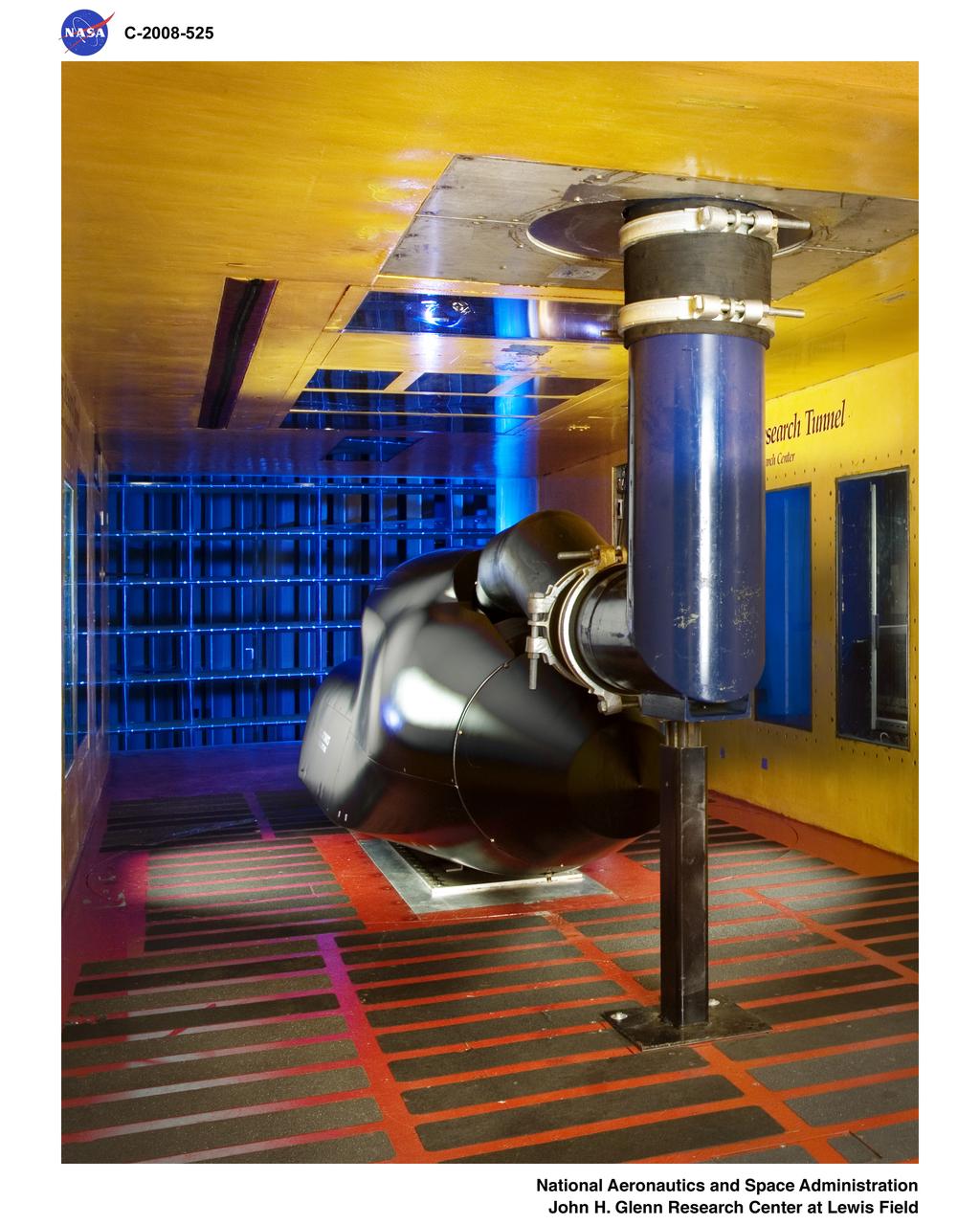
General Atomics - Predator B Inlet Model in the Icing Research Tunnel
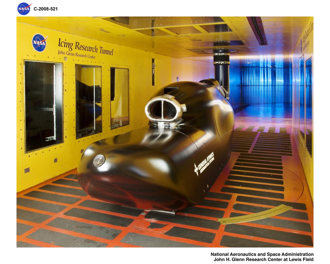
General Atomics - Predator B Inlet Model in the Icing Research Tunnel
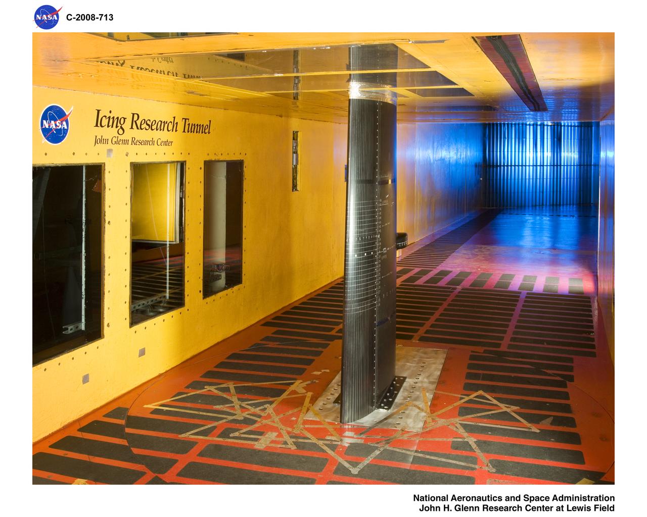
Leading Edge De-Icing Evaluation Test of the General Atomics Predator B Wing Section using Electro-Expulsive De-Icing System (EEDS) Testing conducted in cooperation with Wichita State University

The greens and blues of the ocean color from NASA satellite data have provided new insights into how climate and ecosystem processes affect the growth cycles of phytoplankton—microscopic aquatic plants important for fish populations and Earth’s carbon cycle. At the bottom of the ocean’s food chain, phytoplankton account for roughly half of the net photosynthesis on Earth. Their photosynthesis consumes carbon dioxide and plays a key role in transferring carbon from the atmosphere to the ocean. Unlike the plant ecosystems on land, the amount of phytoplankton in the ocean is always followed closely by the abundance of organisms that eat phytoplankton, creating a perpetual dance between predators and prey. This new analysis shows how tiny imbalances in this predator-prey relationship, caused by environmental variability, give rise to massive phytoplankton blooms, having huge impacts on ocean productivity, fisheries and carbon cycling. The study was released Thursday, Sept. 25, in the journal Nature Climate Change. “The continuous year-in and year-out measurements provided by NASA’s ocean color satellites have dramatically changed our understanding of phytoplankton dynamics on the Earth,” said Mike Behrenfeld, author of the study and phytoplankton ecologist at Oregon State University, Corvallis, Oregon. “What we now see is a closely linked system of phytoplankton cell division and consumption lying at the heart of the plant’s annual cycle.” Behrenfeld calls this close predator-prey relationship the “Dance of the Plankton.” This view is different from previous perspectives that have simply focused on environmental resources used by phytoplankton to grow, such as nutrients and light. The new view is important because it reveals that tiny imbalances can greatly impact Earth’s ecology. Read more: <a href="http://1.usa.gov/ZkVMHG" rel="nofollow">1.usa.gov/ZkVMHG</a> Credit: NASA's Goddard Space Flight Center, Norman Kuring; USGS <b><a href="http://www.nasa.gov/audience/formedia/features/MP_Photo_Guidelines.html" rel="nofollow">NASA image use policy.</a></b> <b><a href="http://www.nasa.gov/centers/goddard/home/index.html" rel="nofollow">NASA Goddard Space Flight Center</a></b> enables NASA’s mission through four scientific endeavors: Earth Science, Heliophysics, Solar System Exploration, and Astrophysics. Goddard plays a leading role in NASA’s accomplishments by contributing compelling scientific knowledge to advance the Agency’s mission. <b>Follow us on <a href="http://twitter.com/NASAGoddardPix" rel="nofollow">Twitter</a></b> <b>Like us on <a href="http://www.facebook.com/pages/Greenbelt-MD/NASA-Goddard/395013845897?ref=tsd" rel="nofollow">Facebook</a></b> <b>Find us on <a href="http://instagram.com/nasagoddard?vm=grid" rel="nofollow">Instagram</a></b>

Technician Shawn Warren carefully smoothes out the composite skin of an instrument fairing<br>atop the upper fuselage of the Altair unmanned aerial vehicle (UAV) at General Atomics Aeronautical Systems, Inc., facility at Adelanto, Calif.

The left wing of NASA's Altair unmanned aerial vehicle (UAV) rests in a jig during construction at General Atomics Aeronautical Systems, Inc., (GA-ASI) facility at Adelanto, Calif.

Technicians at General Atomics Aeronautical Systems, Inc., (GA-ASI) facility at Adelanto, Calif., carefully install a turboprop engine to the rear fuselage of NASA's Altair aircraft during final assembly operations.

Technician Dave Brown installs a drilling template during construction of the all-composite left wing of NASA's Altair aircraft at General Atomics Aeronautical Systems, Inc., (GA-ASI) facility at Adelanto, Calif.

Technicians at General Atomics Aeronautical Systems, Inc., (GA-ASI) facility at Adelanto, Calif., carefully thread control lines through a bulkhead during engine installation on NASA's Altair aircraft.
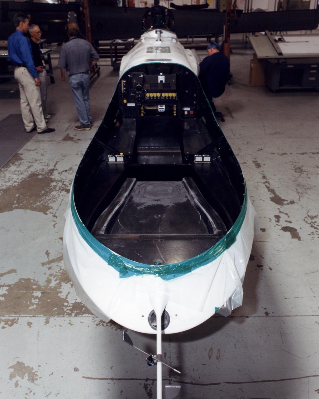
The payload bay in the nose of NASA's Altair unmanned aerial vehicle (UAV) will be able to carry up to 700 lbs. of sensors, imaging equipment and other instruments for Earth science missions.
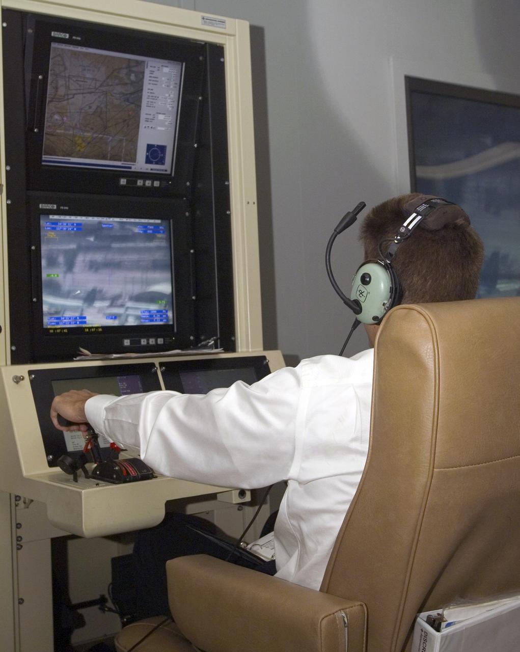
A pilot for General Atomics guides the Altair remotely operated aircraft from a ground control station using both visual and telemetered data.
An ocean color senor, a passive microwave vertical sounder and an electro-optical sensor were mounted on the Altair UAV for the NOAA-NASA flight demonstration.

Terrence Hertz, Deputy Associate Administrator for Technology, NASA Aeronautics Research Mission Directorate, at the NOAA/NASA Altair flight demo kickoff.
A satellite antenna, electro-optical/infrared and ocean color sensors (front) were among payloads installed on the Altair for the NOAA-NASA flight demonstration
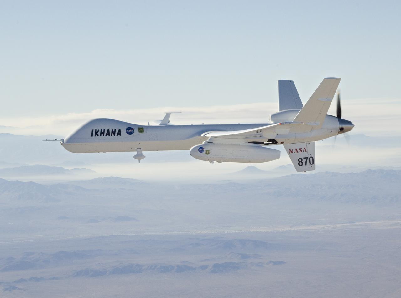
An efficient turboprop engine and large fuel capacity enable NASA's Ikhana unmanned aircraft to remain aloft for up to 30 hours on science or technology flights.
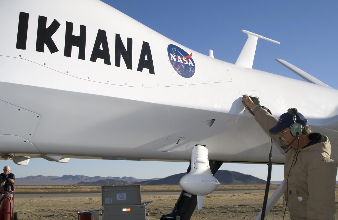
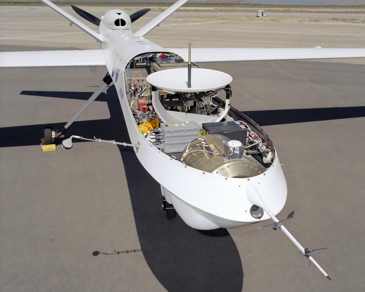
The bulging fairing atop the forward fuselage of NASA's Ikhana unmanned aircraft covers a variety of navigation, communications and science instruments.
A ground crewman unplugs electrical connections during pre-flight checks of NASA's Ikhana research aircraft. Ikhana's payload pod is mounted on the left wing.
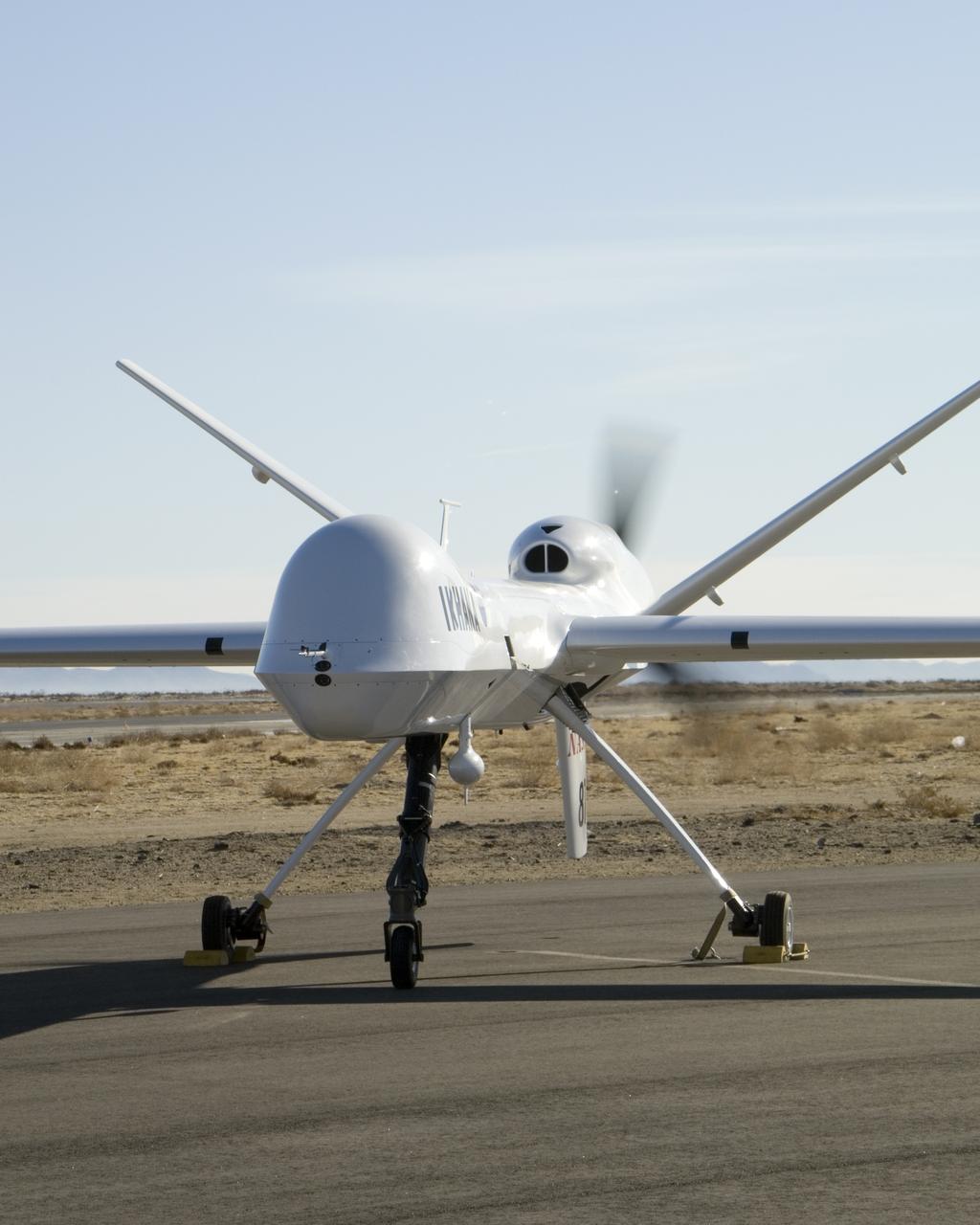
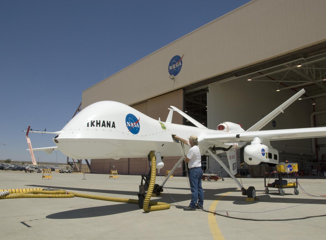
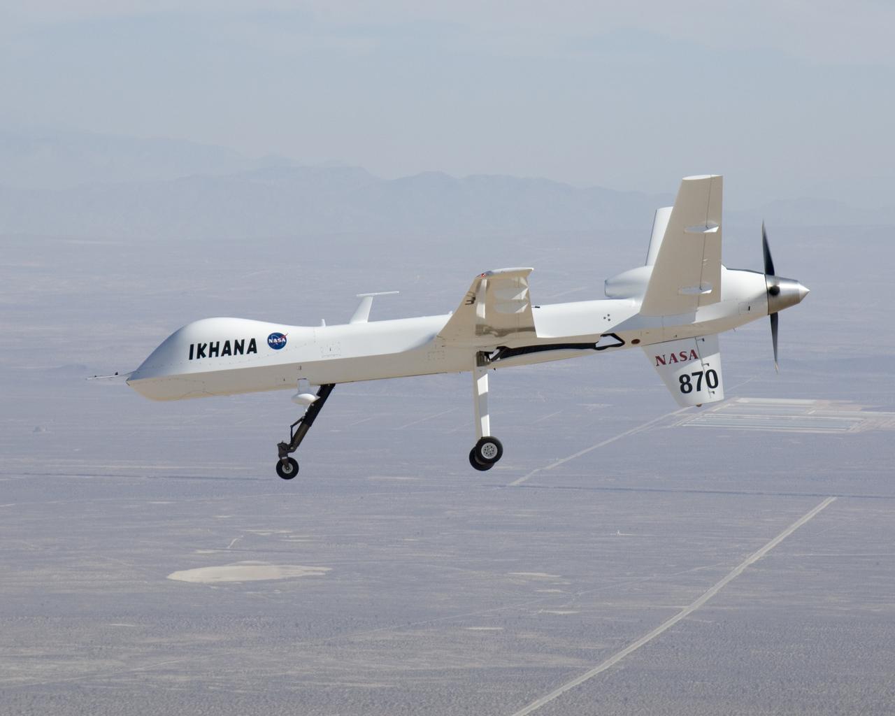
Distinguished by its large nose payload bay, NASA's Ikhana unmanned aircraft does an engine run prior to takeoff from General Atomics' Grey Butte airfield.
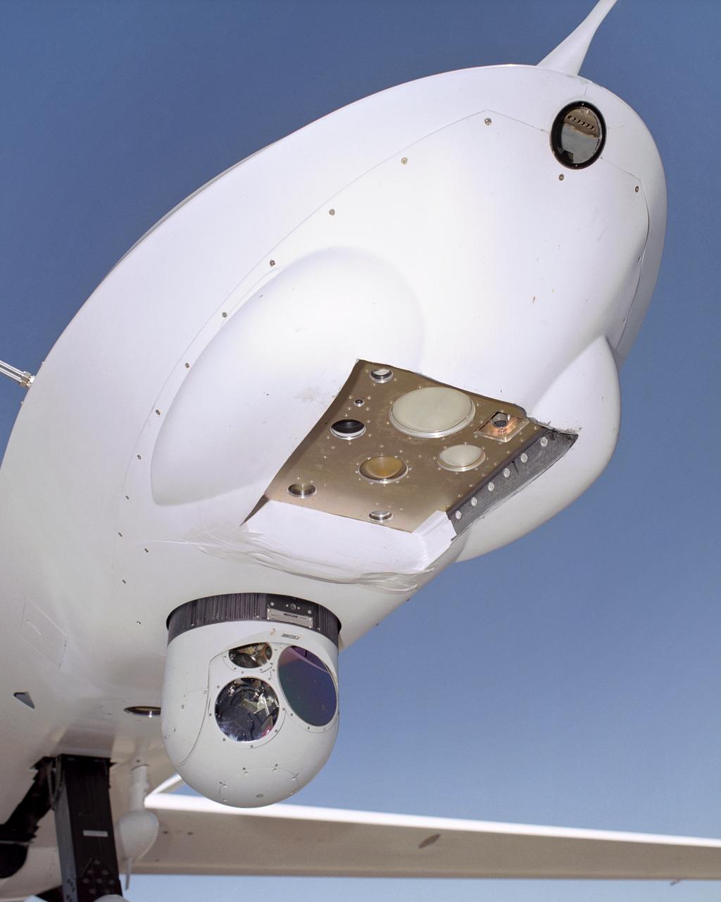
A small nose-mounted television camera enables pilots of NASA's Ikhana unmanned science aircraft to view the flight path ahead.
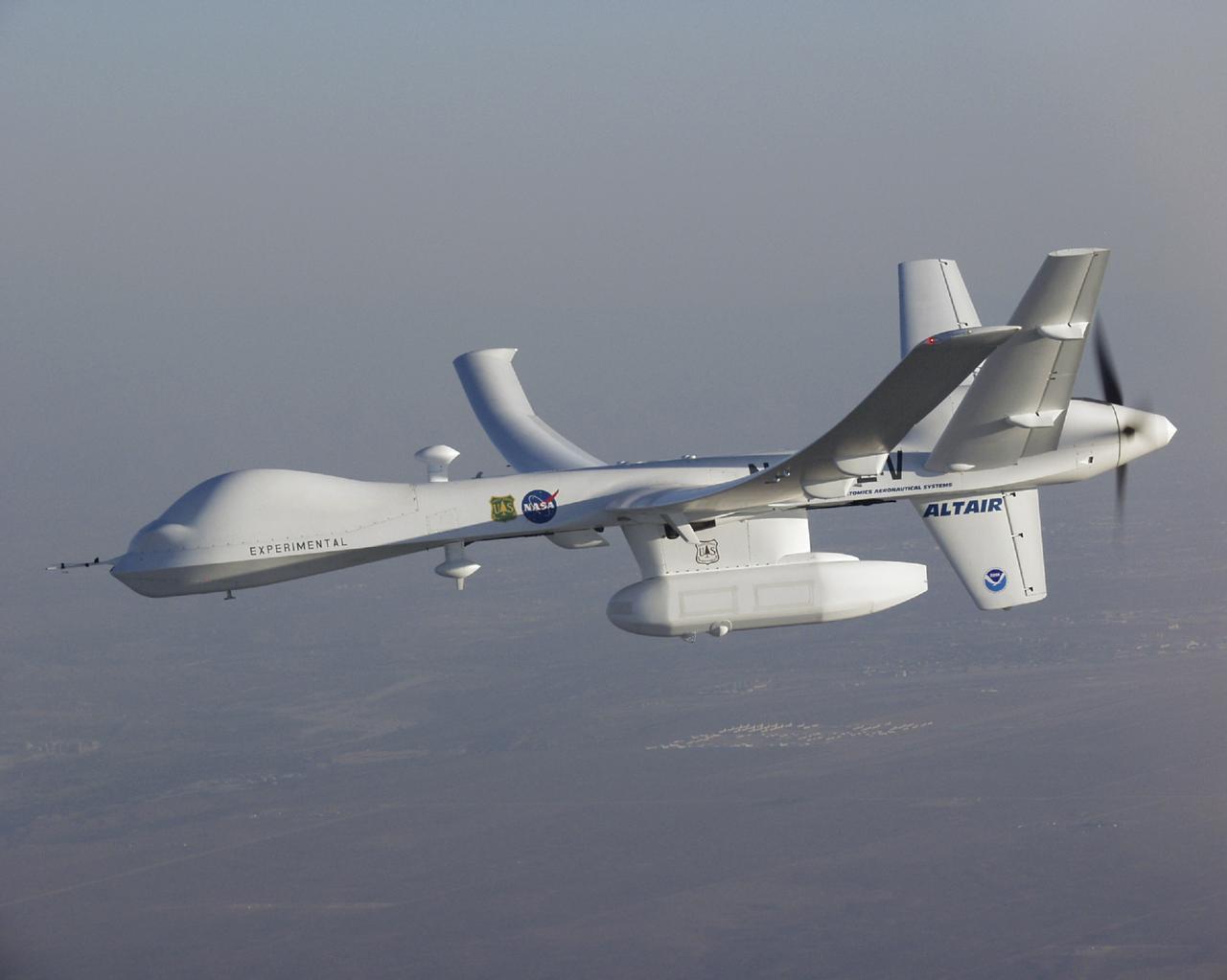
The Altair unmanned aerial vehicle (UAV), built by General Atomics Aeronautical Systems, Inc. for NASA, is poised for flight at GA-ASI's flight test facility at El Mirage, California.

The long wings of General Atomics Altair UAV are in evidence during a series of environmental monitoring missions for NOAA and NASA in the spring of 2005.
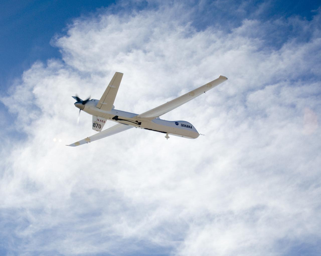
Its white surfaces in contrast with the deep blue sky, NASA's Ikhana unmanned science and technology development aircraft soars over California's high desert.
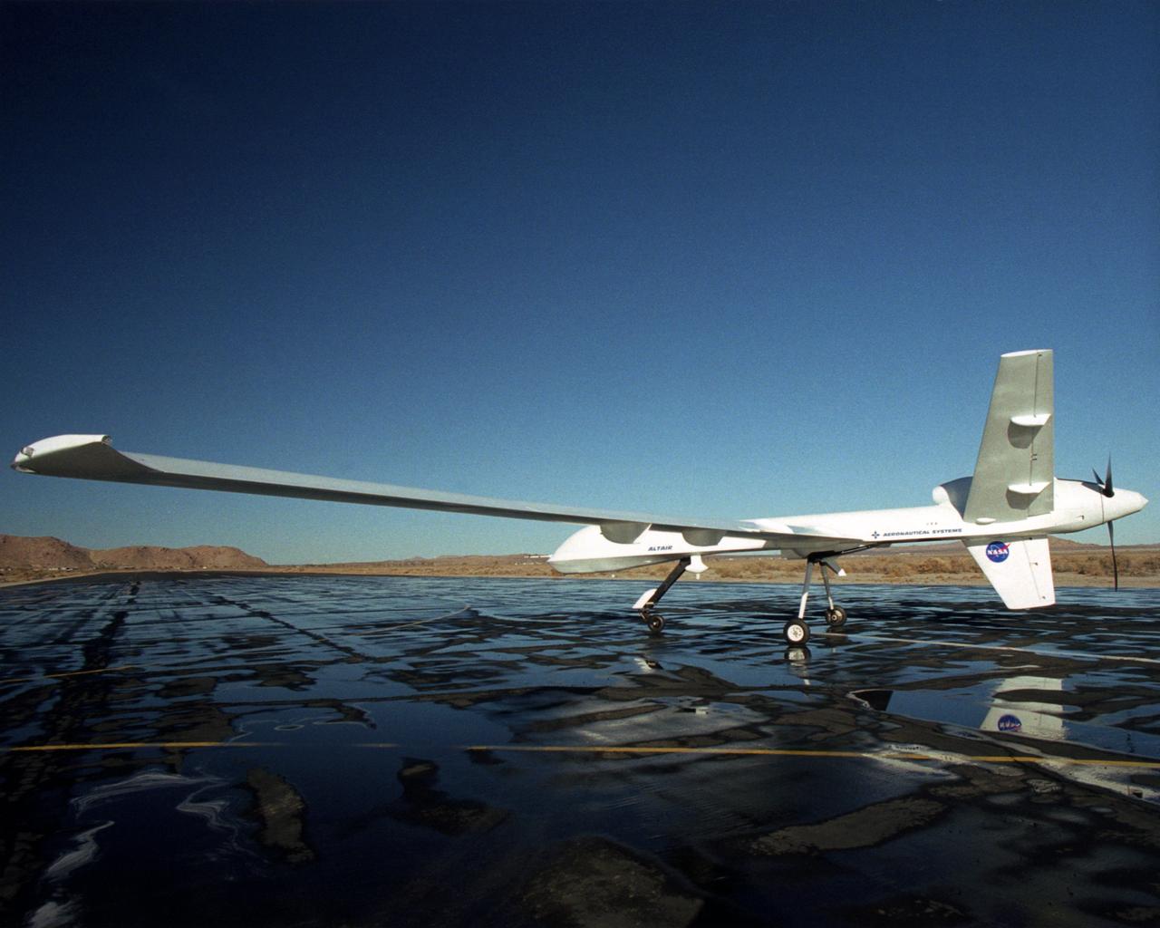
Long wings, a V-tail with a ventral fin and a rear-mounted engine distinguish the Altair, an unmanned aerial vehicle built for NASA by General Atomics Aeronautical Systems, Inc.
Ground crewmen prepare NASA's Ikhana remotely piloted research aircraft for another flight. Ikhana's infrared imaging sensor pod is visible under the left wing.
The long, narrow wings of NASA's Altair are designed to allow the unmanned aerial vehicle (UAV) to maintain long-duration flight at high altitudes.

NASA image acquired May 10, 2001 In July 2008, the United Nations Educational, Scientific, and Cultural Organization (UNESCO) added 27 new areas to its list of World Heritage sites. One of those areas included the lagoons of New Caledonia. Some 1,200 kilometers (750 miles) east of Australia, this French-governed archipelago contains the world’s third-largest coral reef structure. The coral reefs enclose the waters near the islands in shallow lagoons of impressive biodiversity. On May 10, 2001, the Enhanced Thematic Mapper Plus on NASA’s Landsat 7 satellite captured this image of Île Balabio, off the northern tip of Grande Terra, New Caledonia’s main island. In this natural-color image, the islands appear in shades of green and brown—mixtures of vegetation and bare ground. The surrounding waters range in color from pale aquamarine to deep blue, and the color differences result from varying depths. Over coral reef ridges and sand bars, the water is shallowest and palest in color. Darker shades of blue characterize deeper waters. Reef-enclosed, shallow waters surround Île Balabio, and a larger, semi-enclosed lagoon appears immediately east of that island. Immediately north of Grande Terra, unenclosed, deeper waters predominate. The coral reefs around New Caledonia support an unusual diversity of species, including large numbers of predators and big fish, turtles, and the world’s third-largest dugong population. NASA image created by Jesse Allen, using Landsat data provided by the United States Geological Survey. Caption by Michon Scott. Instrument: Landsat 7 - ETM+ Credit: NASA/GSFC/Landsat <b><a href="http://www.nasa.gov/centers/goddard/home/index.html" rel="nofollow">NASA Goddard Space Flight Center</a></b> enables NASA’s mission through four scientific endeavors: Earth Science, Heliophysics, Solar System Exploration, and Astrophysics. Goddard plays a leading role in NASA’s accomplishments by contributing compelling scientific knowledge to advance the Agency’s mission. <b>Follow us on <a href="http://twitter.com/NASA_GoddardPix" rel="nofollow">Twitter</a></b> <b>Join us on <a href="http://www.facebook.com/pages/Greenbelt-MD/NASA-Goddard/395013845897?ref=tsd" rel="nofollow">Facebook</a></b>
Equipped with a pod-mounted infrared imaging sensor, the Altair UAS aided fire mapping efforts over wildfires in central and southern California in late 2006.
A high-tech infrared imaging sensor in its underbelly pod, the Altair UAS flew repeated passes over the Esperanza fire to aid firefighting efforts.
NASA's Ikhana unmanned science demonstration aircraft over Southern California's high desert during the ferry flight to its new home at the Dryden Flight Research Center. NASA took possession of the new aircraft in November, 2006, and it arrived at DFRC at Edwards Air Force Base, Calif., on June 23, 2007.
NASA's Ikhana unmanned science demonstration aircraft in flight during the ferry flight to its new home at the Dryden Flight Research Center. NASA took possession of the new aircraft in November, 2006, and it arrived at the NASA center at Edwards Air Force Base, Calif., on June 23, 2007.
NASA's Ikhana unmanned science demonstration aircraft prepares for landing as it arrives at Edwards Air Force Base, Calif. NASA took possession of the new aircraft in November, 2006, and it arrived at its new home at NASA's Dryden Flight Reseach Center at Edwards AFB, on June 23, 2007.
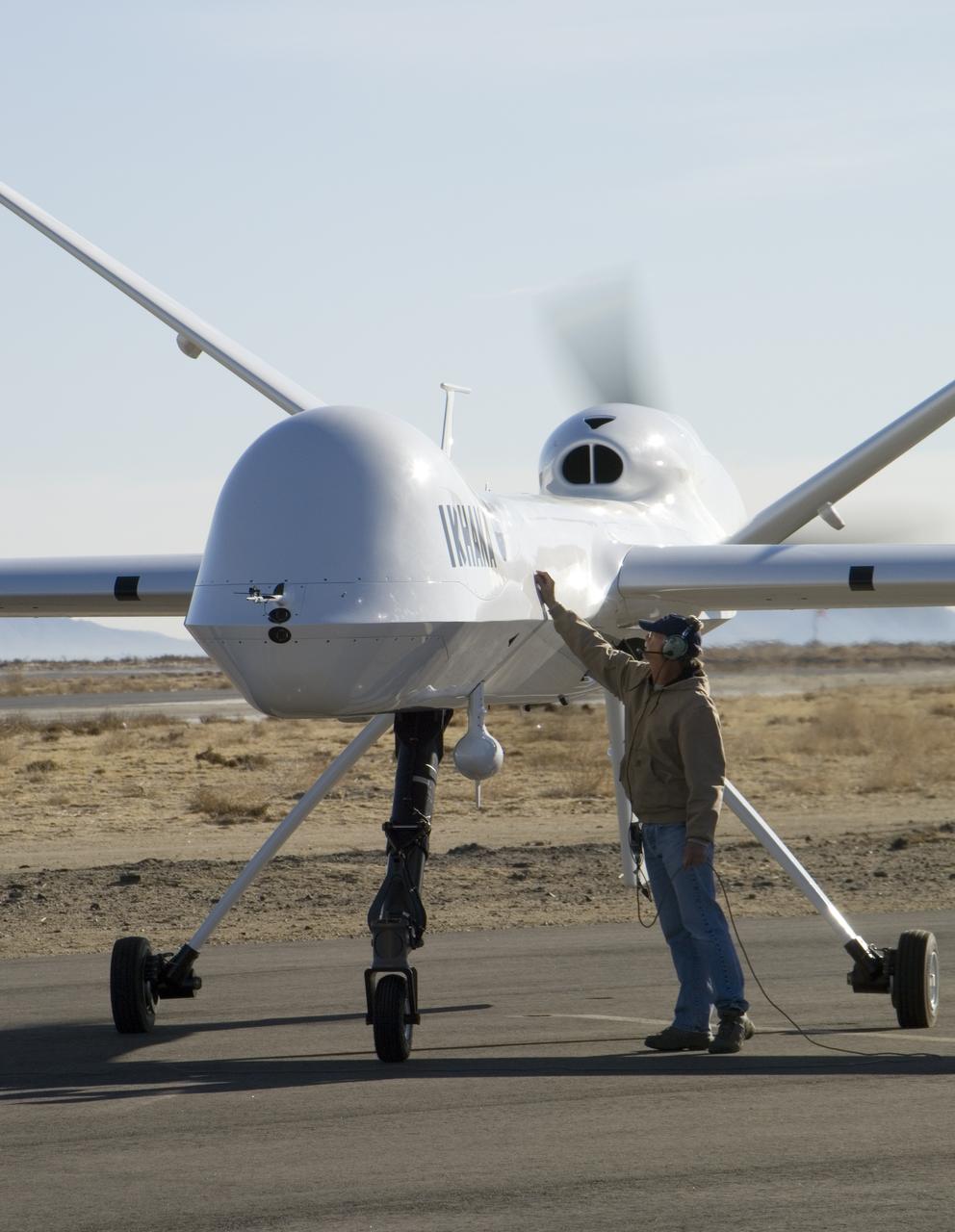
Crew chief Joe Kinn gives NASA's Ikhana unmanned aircraft a final check during engine run-up prior to takeoff at General Atomics Aeronautical Systems' airfield.
NASA's Ikhana unmanned science demonstration aircraft over the U.S. Borax mine, Boron, California, near the Dryden/Edwards Air Force Base complex. NASA took possession of the new aircraft in November, 2006, and it arrived at the NASA Dryden Flight Research Center at Edwards AFB, Calif., on June 23, 2007.
After arriving via a ferry flight on June 23, 2007, NASA's Ikhana unmanned science demonstration aircraft is towed to a hangar at its new home, the Dryden Flight Research Center in Southern California.
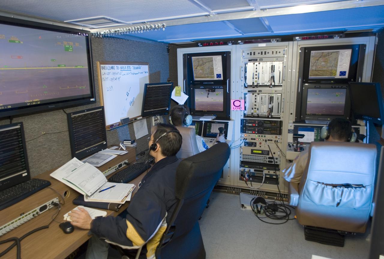
NASA's Ikhana unmanned science aircraft ground control station includes consoles for two pilots and positions for scientists and engineers along the side.
NASA's Ikhana unmanned science demonstration aircraft over the U.S. Borax mine, Boron, California, near the Dryden/Edwards Air Force Base complex. NASA took possession of the new aircraft in November, 2006, and it arrived at the NASA center at Edwards Air Force Base, Calif., on June 23, 2007.
The remotely-piloted Altair unmanned aerial vehicle (UAV) took to the air on its first checkout flight on June 9, 2003 at El Mirage, California.

Mark Pestana is a research pilot and project manager at the NASA Dryden Flight Research Center, Edwards, Calif. He is a pilot for the Beech B200 King Air, the T-34C and the Predator B. He flies the F-18 Hornet as a co-pilot and flight test engineer. Pestana has accumulated more than 4,000 hours of military and civilian flight experience. He was also a flight engineer on the NASA DC-8 flying laboratory. Pestana was the project manager and pilot for the Hi–rate Wireless Airborne Network Demonstration flown on the NASA B200 research aircraft. He flew B200 research missions for the X-38 Space Integrated Inertial Navigation Global Positioning System experiment. Pestana also participated in several deployments of the DC-8, including Earth science expeditions ranging from hurricane research over the Caribbean Sea to ozone studies over the North Pole, atmospheric chemistry over the South Pacific, rain forest health in Central America, Rocky Mountain ice pack assessment, and volcanic and tectonic activity around the Pacific Rim. He came to Dryden as a DC-8 mission manager in June 1998 from NASA Johnson Space Center, Houston, where he served as the Earth and Space Science discipline manager for the International Space Station Program at Johnson. Pestana also served as a flight crew operations engineer in the Astronaut Office, developing the controls, displays, tools, crew accommodations and procedures for on-orbit assembly, test, and checkout of the International Space Station. He led the analysis and technical negotiations for modification of the Russian Soyuz spacecraft as an emergency crew return vehicle for space station crews. He joined the U.S. Air Force Reserve in 1991 and held various positions as a research and development engineer, intelligence analyst, and Delta II launch vehicle systems engineer. He retired from the U.S. Air Force Reserve with the rank of colonel in 2005. Prior to 1990, Pestana was on active duty with the U.S. Air Force as the director of mi

Kelly Latimer is a research pilot in the Flight Crew Branch of NASA's Dryden Flight Research Center, Edwards, Calif. Latimer joined NASA in March 2007 and will fly the T38, T-34, G-III, C-17 and the "Ikhana" Predator B. Latimer is Dryden's first female research test pilot. Prior to joining NASA, Latimer was on active duty with the U.S. Air Force. She has accumulated more than 5,000 hours of military and civilian flight experience in 30 aircraft. Latimer's first association with NASA was while attending graduate school at George Washington University, Washington, D.C. Her studies included work with the Joint Institute for the Advancement of Flight Sciences at NASA's Langley Research Center, Hampton, Va. She flew an Air Force C-17 during a 2005 NASA study to reduce aircraft noise. A team of California Polytechnic State University students and Northrop Grumman personnel were stationed on Rogers Dry Lake located at Edwards Air Force Base, Calif., to record the noise footprint of the aircraft as it made various landing approaches to Edwards' runway. Latimer completed undergraduate pilot training at Reese Air Force Base, Texas, in 1990. She remained at Reese as a T-38 instructor pilot until 1993. She was assigned as a C-141 aircraft commander at McCord Air Force Base, Tacoma, Wash., until 1996. Latimer graduated from the U.S. Air Force Test Pilot School at Edwards in Class 96B. She served as a C-17 and C-141 experimental test pilot at Edwards until 2000. She then became the chief of the Performance Branch and a T-38 instructor pilot at The Air Force Test Pilot School. She returned to McCord in 2002, where she was a C-17 aircraft commander and the operations officer for the 62nd Operations Support Squadron. In 2004, Latimer became the commander of Edwards' 418th Flight Test Squadron and director of the Global Reach Combined Test Force. Following that assignment, she deployed to Iraq as an advisor to the Iraqi Air Force. Her last active duty tour was as an instructor a
With its sensor pod under its left wing, NASA's remotely piloted Ikhana unmanned aircraft cruises over California during the Western States Fire Mission.
With its thermal-infared sensor pod under its left wing, NASA's Ikhana unmanned aircraft cruises over California during the Western States Fire Mission.
NASA's Ikhana remotely piloted aircraft soars over smoky terrain during a wildfire imaging demonstration mission in the late summer of 2007.
Carrying its sensor pod, NASA's remotely piloted Ikhana unmanned aircraft banks away during a checkout flight in the Western States Fire Mission.
NASA Dryden's Ikhana ground crewmen Gus Carreno and James Smith load the thermal-infrared imaging scanner pallet into the Ikhana's underwing payload pod.
With smoke from the Lake Arrowhead area fires streaming in the background, NASA's Ikhana unmanned aircraft heads out on a Southern California wildfires imaging mission.
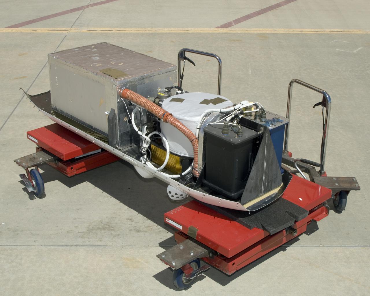
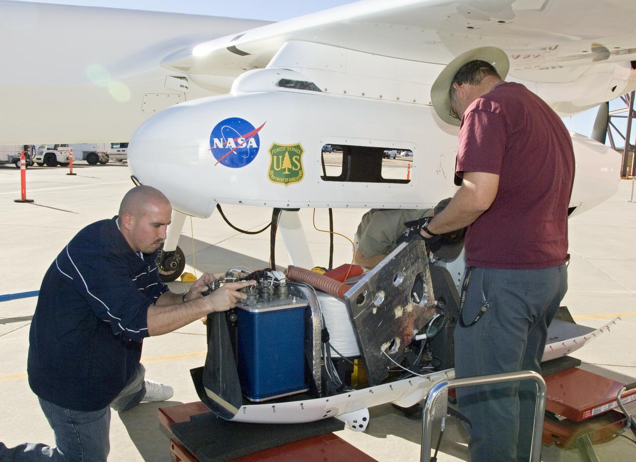
The instruments that make up the Ames Autonomous Module Scanner (AMS) that provided precise thermal-infrared imaging during the Western States Fire Mission in 2007 are detailed in this photo of the AMS as mounted on Ikhana's pod tray. The large foil-covered foam-insulated box at left covers the pressure vessel containing the data system computers and other electronics. The round white-topped assembly is the scan head, including the scan mirror, folded telescope, blackbody references, spectrometer and detectors. Two pressure boxes visible at the forward end of the tray contain the Applanix POS/AV precision navigation subsystem (black) and the power distributor including circuit breakers and ancillary wiring, scan motor controller and the blackbody reference temperature controller (blue).
With smoke from the Lake Arrowhead area fires streaming in the background, NASA's Ikhana unmanned aircraft heads out on a Southern California wildfires imaging mission.
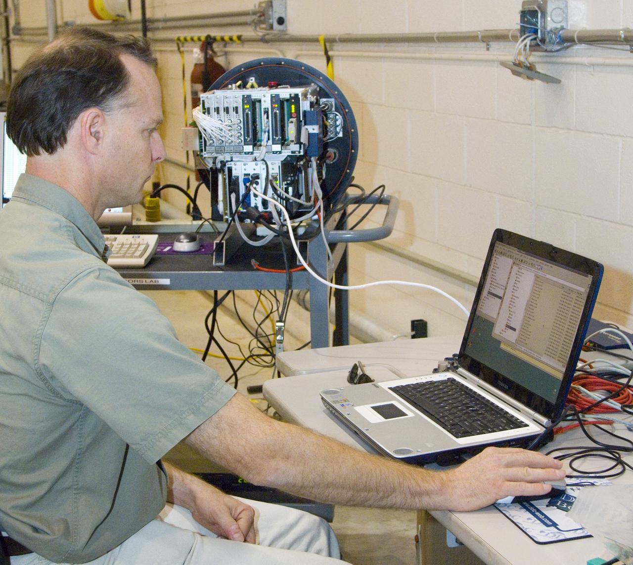
NASA Ames engineer Ted Hildum checks out the thermal-infrared scanner computer before it is loaded on NASA's Ikhana unmanned aircraft.