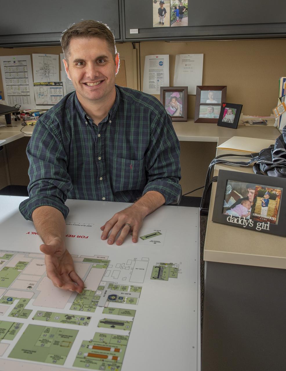
Brian Steinert, Deputy Element Discipline Lead Engineer, highlights production floor work areas at Michoud Assembly Facility where Stages hardware is being integrated and assembled.
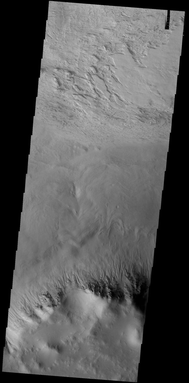
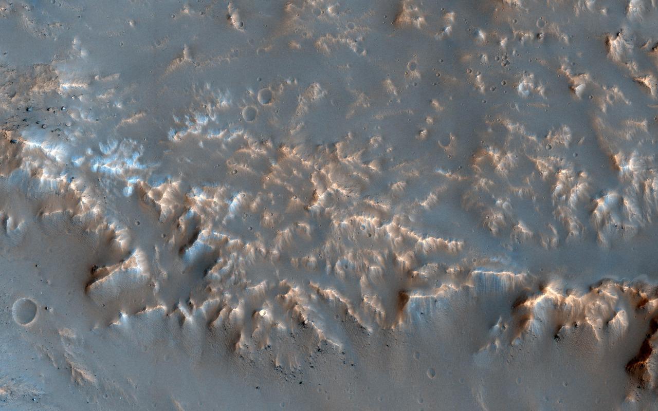
This VIS image shows a small portion of the floor of Galle Crater. This large crater is located on the eastern side of Argyre Planitia. The floor of Galle Crater contains many different features, including fluvial, glacial and aeolian derived products. The steep crater rim is toward the bottom of the image. The incised, flat laying materials at the top of the image are probably eroded layered deposits. Orbit Number: 74804 Latitude: -52.1339 Longitude: 329.267 Instrument: VIS Captured: 2018-10-25 14:28 https://photojournal.jpl.nasa.gov/catalog/PIA22884
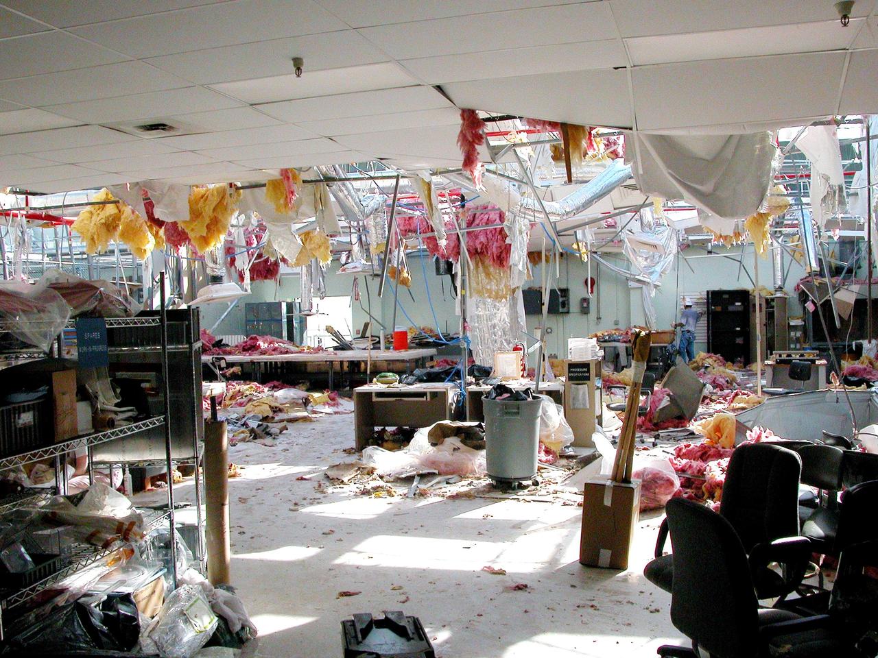
KENNEDY SPACE CENTER, FLA. - The second floor of the Thermal Protection System Facility sustained significant damage from Hurricane Frances. The storm's path over Florida took it through Cape Canaveral and KSC property during Labor Day weekend. Located in Launch Complex 39, the facility is used to manufacture both internal and external insulation products for the Space Shuttle orbiters.
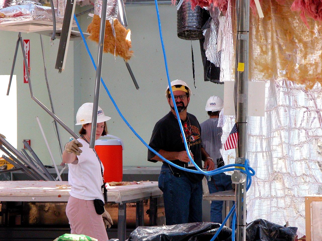
KENNEDY SPACE CENTER, FLA. - KSC employees clean up inside the second floor of the Thermal Protection System Facility damaged by Hurricane Frances. The storm's path over Florida took it through Cape Canaveral and KSC property during Labor Day weekend. Located in Launch Complex 39, the facility is used to manufacture both internal and external insulation products for the Space Shuttle orbiters.
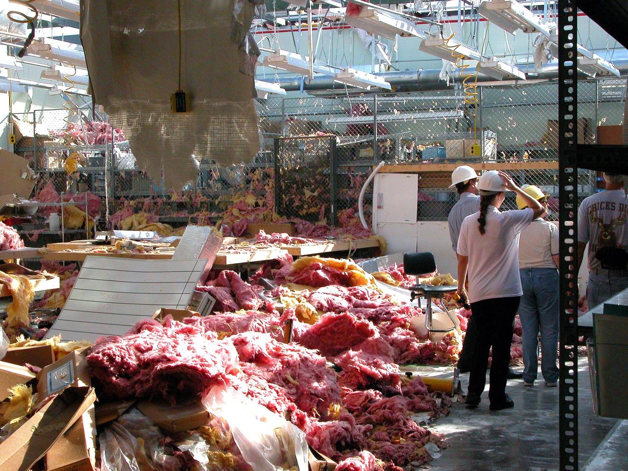
KENNEDY SPACE CENTER, FLA. - KSC workers survey the considerable damage sustained by the second floor of the Thermal Protection System Facility from Hurricane Frances. The storm's path over Florida took it through Cape Canaveral and KSC property during Labor Day weekend. Located in Launch Complex 39, the facility is used to manufacture both internal and external insulation products for the Space Shuttle orbiters.
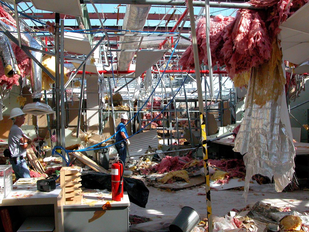
KENNEDY SPACE CENTER, FLA. - KSC employees clean up inside the second floor of the Thermal Protection System Facility damaged by Hurricane Frances. The storm's path over Florida took it through Cape Canaveral and KSC property during Labor Day weekend. Located in Launch Complex 39, the facility is used to manufacture both internal and external insulation products for the Space Shuttle orbiters.
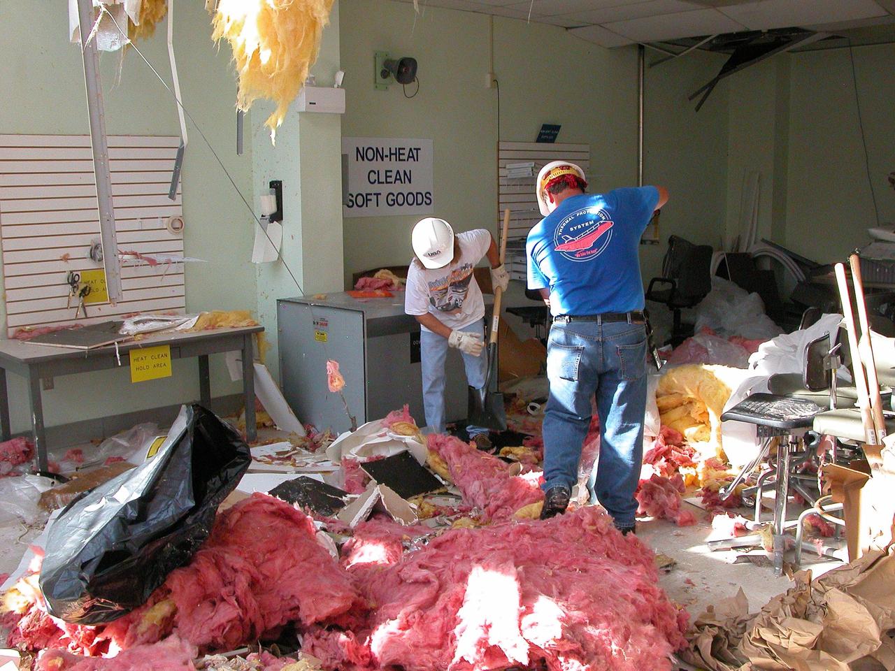
KENNEDY SPACE CENTER, FLA. - KSC employees clean up inside the second floor of the Thermal Protection System Facility damaged by Hurricane Frances. The storm's path over Florida took it through Cape Canaveral and KSC property during Labor Day weekend. Located in Launch Complex 39, the facility is used to manufacture both internal and external insulation products for the Space Shuttle orbiters.
VANDENBERG AIR FORCE BASE, CALIF. - Inside the NASA spacecraft processing hangar 1610 located on North Vandenberg Air Force Base in California, Lockheed Martin workers maneuver the Boeing Delta II payload attach fitting onto a connecting ring on the floor. The National Oceanic and Atmospheric Administration (NOAA-N) spacecraft, in the background, will then be mated to the payload attach fitting. Launch of NOAA-N aboard the Boeing Delta II rocket is currently scheduled for May 11, 2005. NOAA-N is the fourth in the series of support dedicated microwave instruments for the generation of temperature, moisture, surface, and hydrological products in cloudy regions where visible and infrared (IR) instruments have decreased capability.
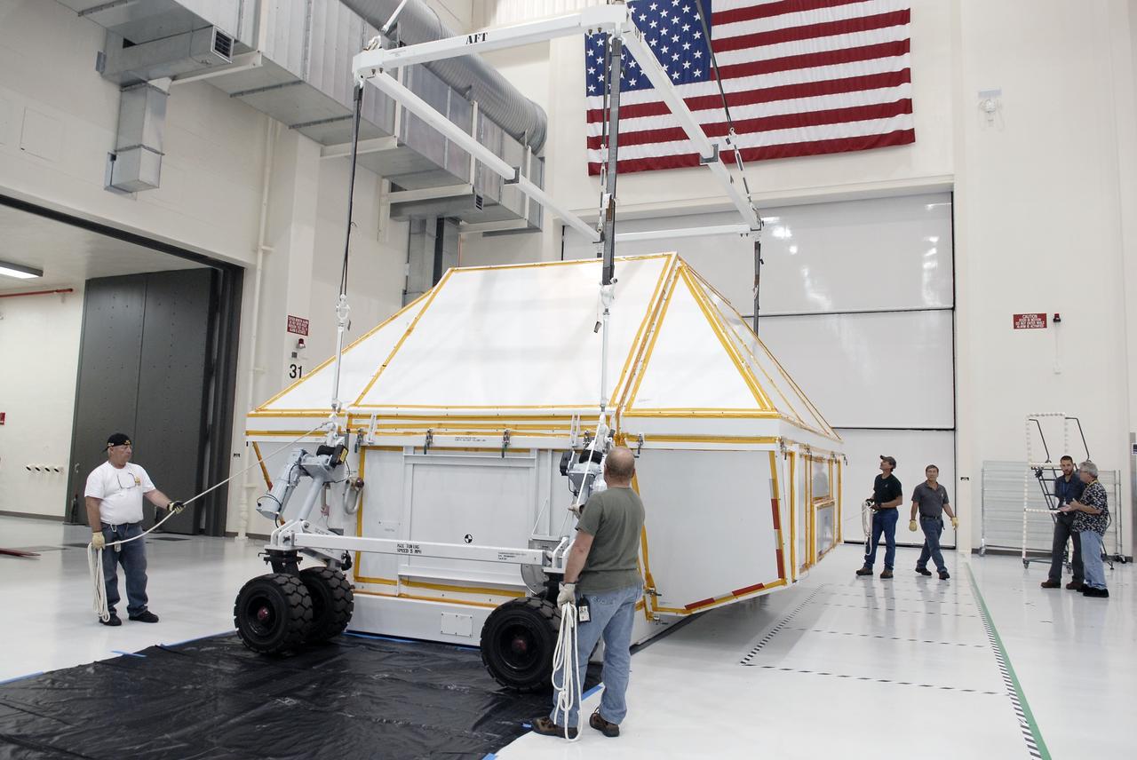
CAPE CANAVERAL, Fla. - The transportation canister holding the Orion crew module is lowered onto the floor of the Operations and Checkout Building high bay at NASA's Kennedy Space Center in Florida. Slated for Exploration Flight Test-1, an uncrewed mission planned for 2014, the capsule will travel farther into space than any human spacecraft has gone in more than 40 years. NASA's Michoud Assembly Facility in New Orleans built the crew module pressure vessel. The Orion production team will prepare the module for flight by installing heat-shielding thermal protection systems, avionics and other subsystems. For more information, visit http://www.nasa.gov/orion. Photo credit: NASA/Charisse Nahser
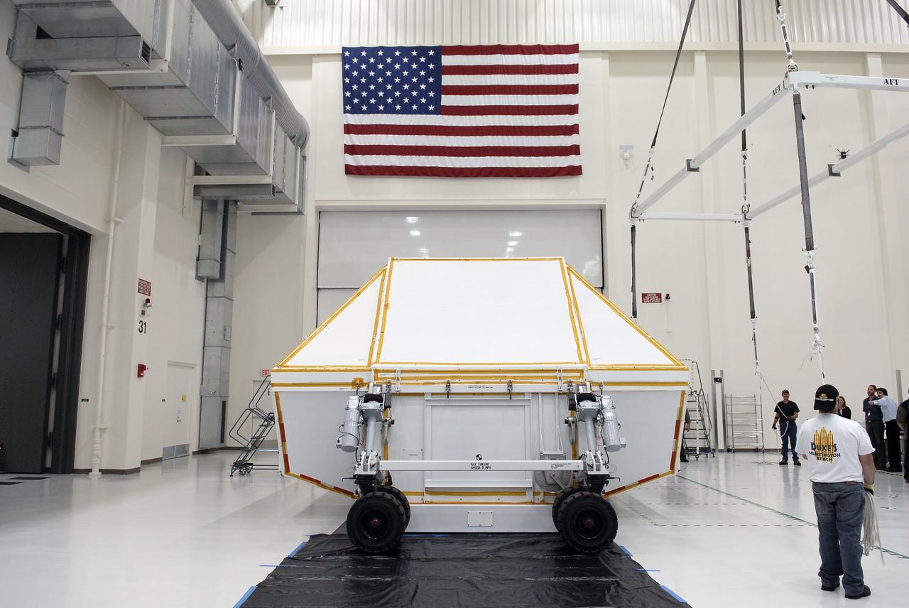
CAPE CANAVERAL, Fla. - The transportation canister holding the Orion crew module rests on the floor of the Operations and Checkout Building high bay at NASA's Kennedy Space Center in Florida. Slated for Exploration Flight Test-1, an uncrewed mission planned for 2014, the capsule will travel farther into space than any human spacecraft has gone in more than 40 years. NASA's Michoud Assembly Facility in New Orleans built the crew module pressure vessel. The Orion production team will prepare the module for flight by installing heat-shielding thermal protection systems, avionics and other subsystems. For more information, visit http://www.nasa.gov/orion. Photo credit: NASA/Charisse Nahser
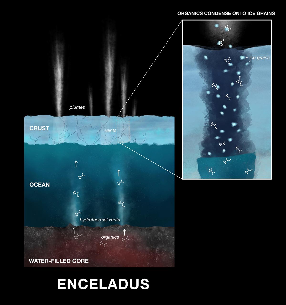
This illustration shows how newly discovered organic compounds — the ingredients of amino acids — were detected by NASA's Cassini spacecraft in the ice grains emitted from Saturn's moon Enceladus. Powerful hydrothermal vents eject material from Enceladus' core into the moon's massive subsurface ocean. After mixing with the water, the material is released into space as water vapor and ice grains. Condensed onto the ice grains are nitrogen- and oxygen-bearing organic compounds. On Earth hydrothermal vents on the ocean floor provide the energy that fuels reactions that produce amino acids, the building blocks of life. Scientists believe Enceladus' hydrothermal vents may operate in the same way, supplying energy that leads to the production of amino acids. https://photojournal.jpl.nasa.gov/catalog/PIA23173
This image from the High Resolution Imaging Science Experiment (HiRISE) camera on NASA's Mars Reconnaissance Orbiter shows a location on Mars associated with the best-selling novel and Hollywood movie, "The Martian." It is the science-fiction tale's planned landing site for the Ares 4 mission. The novel placed the Ares 4 site on the floor of a very shallow crater in the southwestern corner of Schiaparelli Crater. This HiRISE image shows a flat region there entirely mantled by bright Martian dust. There are no color variations, just uniform reddish dust. A pervasive, pitted texture visible at full resolution is characteristic of many dust deposits on Mars. No boulders are visible, so the dust is probably at least a meter thick. Past Martian rover and lander missions from NASA have avoided such pervasively dust-covered regions for two reasons. First, the dust has a low thermal inertia, meaning that it gets extra warm in the daytime and extra cold at night, a thermal challenge to survival of the landers and rovers (and people). Second, the dust hides the bedrock, so little is known about the bedrock composition and whether it is of scientific interest. This view is one image product from HiRISE observation ESP_042014_1760, taken July 14, 2015, at 3.9 degrees south latitude, 15.2 degrees east longitude. http://photojournal.jpl.nasa.gov/catalog/PIA19914
This image of a well-preserved unnamed elliptical crater in Terra Sabaea, is illustrative of the complexity of ejecta deposits forming as a by-product of the impact process that shapes much of the surface of Mars. Here we see a portion of the western ejecta deposits emanating from a 10-kilometer impact crater that occurs within the wall of a larger, 60-kilometer-wide crater. In the central part is a lobe-shaped portion of the ejecta blanket from the smaller crater. The crater is elliptical not because of an angled (oblique) impact, but because it occurred on the steep slopes of the wall of a larger crater. This caused it to be truncated along the slope and elongated perpendicular to the slope. As a result, any impact melt from the smaller crater would have preferentially deposited down slope and towards the floor of the larger crater (towards the west). Within this deposit, we can see fine-scale morphological features in the form of a dense network of small ridges and pits. These crater-related pitted materials are consistent with volatile-rich impact melt-bearing deposits seen in some of the best-preserved craters on Mars (e.g., Zumba, Zunil, etc.). These deposits formed immediately after the impact event, and their discernible presence relate to the preservation state of the crater. This image is an attempt to visualize the complex formation and emplacement history of these enigmatic deposits formed by this elliptical crater and to understand its degradation history. http://photojournal.jpl.nasa.gov/catalog/PIA13078
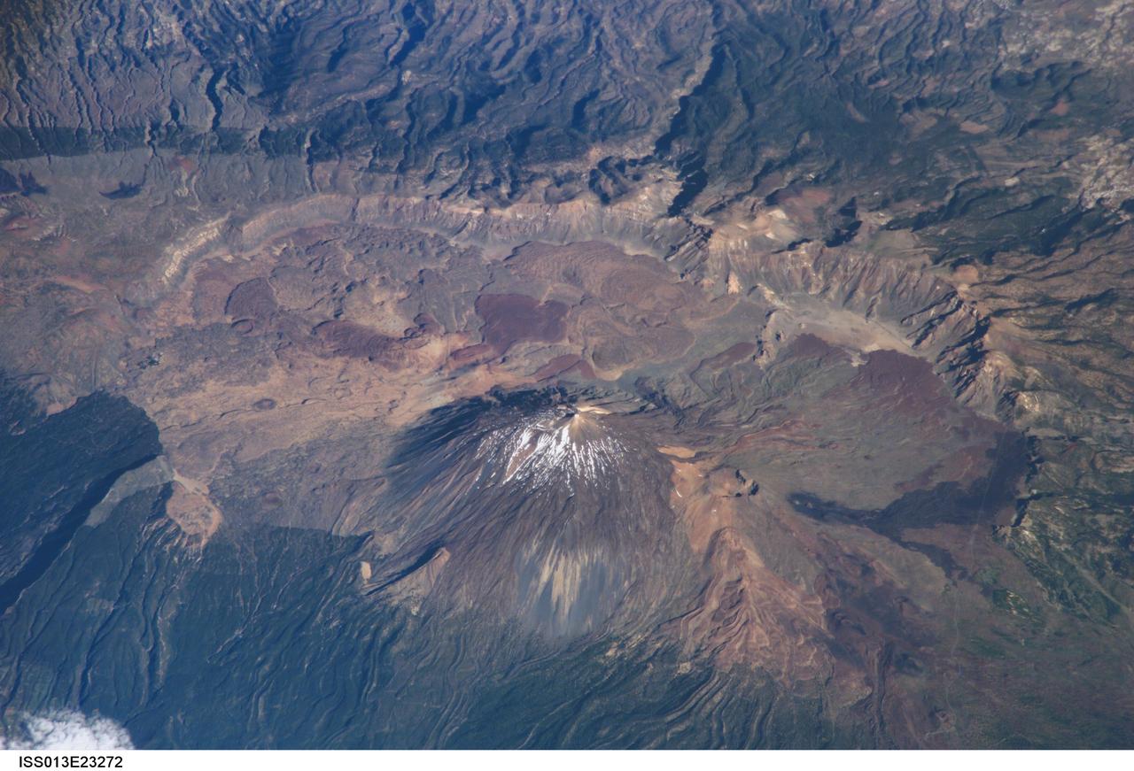
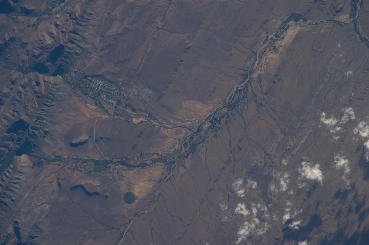
ISS013-E-23272 (8 June 2006) --- Tenerife Island, Spain is featured in this image photographed by an Expedition 13 crewmember on the International Space Station. Tenerife is the largest of the Canary Islands, a Spanish possession located off the northwestern coast of Africa. According to scientists, the islands in the chain could have been produced by eruptions of basaltic shield volcanoes as the African tectonic plate moved over a stationary "hot spot" much like the formation of the Hawaiian Islands. A different hypothesis relates the Canary Islands to magma rise along underwater faults during the uplift of the Atlas Mountains in northern Africa. The island of Tenerife exhibits many excellent volcanic features. The central feature of this image is the elliptical depression of the Las Ca?adas caldera that measures 170 square kilometers in area. A caldera is typically formed when the magma chamber underneath a volcano is completely emptied (usually following a massive eruptive event), and the overlying materials collapse into the newly formed void beneath the surface. A large landslide may have also contributed to (or been the primary cause of) formation of the caldera structure. In this model, part of the original shield volcano forming the bedrock of the island collapsed onto the adjacent sea floor, forming the large depression of the caldera. According to scientists, following formation of the caldera approximately 0.17 million years ago, the composite volcanoes of Mount Teide and Pico Viejo formed. Teide is the highest peak in the Atlantic Ocean with a summit elevation of 3,715 meters. This type of volcano is formed by alternating layers of dense lava flows and more fragmented explosive eruption products, and can build high cones. Many linear flow levees are visible along the flanks of Teide volcano extending from the summit to the base, while a large circular explosion crater marks the summit of Pico Viejo. The floor of the Las Ca?adas caldera is covered with tan, red-brown, and black irregularly-lobed lava flows, the eruptions of which have been observed by settlers and seamen since 1402. The most recent eruption occurred in 1909. The island of Tenerife is actively monitored for further activity.
This image is illuminated by sunlight from the upper left. Martian Dairy Products? If parts of the south polar cap can look like swiss cheese (see "Martian "Swiss Cheese""), then parts of the north polar cap might as well look like some kind of cheese, too. This picture shows a cottage cheese-like texture on the surface of a part of the residual--summertime--north polar cap. The north polar cap surface is mostly covered by pits, cracks, small bumps and knobs. In this image, the cap surface appears bright and the floors of pits look dark. Based upon observations made by the Mariner 9 and Viking orbiters in the 1970s, the north polar residual cap is thought to contain mostly water ice because its summertime temperature is usually near the freezing point of water and water vapor was observed by the Vikings to be coming off the cap during summer. The south residual cap is different--its temperatures in summer remain cold enough to freeze carbon dioxide, and very little to no water vapor has been observed to come off the south cap in summer. The pits that have developed on the north polar cap surface are closely-spaced relative to the very different depressions in the south polar cap. The pits are estimated from the length of shadows cast in them to be less than about 2 meters (5.5 feet) deep. These pits probably develop slowly over thousands of years of successive spring and summer seasons. This picture was taken by the Mars Global Surveyor (MGS) Mars Orbiter Camera (MOC) during northern summer on April 5, 1999. The picture is located near 82.1°N, 329.6°W and covers an area 1.5 km wide by 3 km long (0.9 x 1.8 miles) at a resolution of 3 meters (10 ft) per pixel. http://photojournal.jpl.nasa.gov/catalog/PIA02369
KENNEDY SPACE CENTER, FLA. - Looking at damage on the second floor of the hurricane-ravaged Thermal Protection System Facility (TPSF) are (from left) Kevin Harrington, manager of Soft Goods Production, TPSF ; Martin Wilson, manager of Thermal Protection System operations for USA; Scott Kerr, KSC director of Spaceport Services; and James Kennedy, Center director. The TPSF, which creates the TPS tiles, blankets and all the internal thermal control systems for the Space Shuttles, is almost totally unserviceable at this time after losing approximately 35 percent of its roof during Hurricane Frances, which blew across Central Florida Sept. 4-5. Undamaged equipment was removed from the TPSF and stored in the RLV hangar. NASA Administrator Sean O’Keefe and NASA Associate Administrator of Space Operations Mission Directorate William Readdy are visiting KSC to survey the damage sustained by KSC facilities from the hurricane. The Labor Day storm also caused significant damage to the Vehicle Assembly Building and Processing Control Center. Additionally, the Operations and Checkout Building, Vertical Processing Facility, Hangar AE, Hangar S and Hangar AF Small Parts Facility each received substantial damage. However, well-protected and unharmed were NASA’s three Space Shuttle orbiters - Discovery, Atlantis and Endeavour - along with the Shuttle launch pads, all of the critical flight hardware for the orbiters and the International Space Station, and NASA’s Swift spacecraft that is awaiting launch in October.
ISS038-E-039032 (30 Jan. 2014) --- Prince Albert, South Africa is featured in this image photographed by an Expedition 38 crew member on the International Space Station. Space station crews sometimes take detailed images with an 800mm lens, such as this view of the small town of Prince Albert (population just more than 7,000). The town lies at the foot of the mountains known as the Great Swartberg in southern South Africa, about 220 miles (355 kilometers) east of Cape Town. Prince Albert, named after Queen Victoria's husband, appears as a cluster of whitewashed buildings (left) at the foot of the mountains, larger dwellings nearer the steep mountain front and smaller dwellings further away. Despite its small size, the dry climate and the water supply from gorges immediately upstream (a small reservoir appears extreme left) have made it well-known as a productive point in the Karroo semidesert. Olive groves especially, with other crops, flourish on the valleys floors, surrounded by sheep and ostrich ranches. Founded 250 years ago, this small town retains more than a dozen registered historic buildings in the Victorian and Cape Dutch styles. Based on this and other small Karroo towns as get-aways from South Africa's large, crowded cities, tourism has developed significantly in the last 20 years. Swartberg means Black Mountain in Afrikaans, and winter snow (not visible in this image) along the mountain tops (4,500-6,500 feet; 1,370-1,980 meters, above the town) makes for spectacular scenery. The mountains are part of the ancient Cape Fold Mountain Belt. Gorges through the mountains provide impressive side-on views of tightly folded and broken rock layers associated with the mountain-building episode.
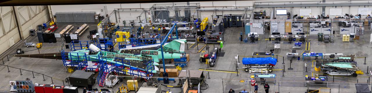
Here is an overhead view of the X-59 aircraft (left) prior to the installation of the General Electric F414 engine (center, located under the blue cover). After the engine is installed, the lower empennage (right), the last remaining major aircraft component, will be installed in preparation for integrated system checkouts. The X-59 is the centerpiece of the Quesst mission which plans to help enable commercial supersonic air travel over land.
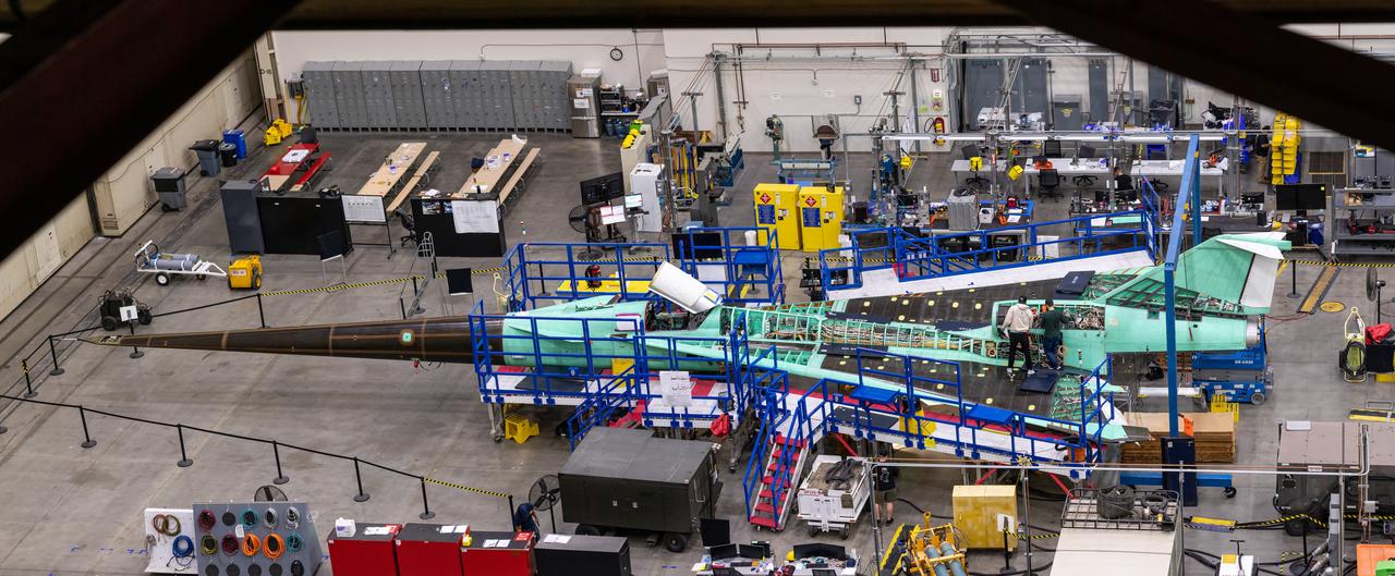
This is an overhead view of the X-59 aircraft at Lockheed Martin Skunk Works in Palmdale, California. The nose was installed, and the plane awaits engine installation. Technicians continue to wire the aircraft as the team preforms several system checkouts to ensure the safety of the aircraft. The X-59 aircraft will demonstrate the ability to fly supersonic while reducing the loud sonic boom to a quiet sonic thump and help enable commercial supersonic air travel over land.
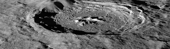
Space travel is difficult and expensive – it would cost thousands of dollars to launch a bottle of water to the moon. The recent discovery of hydrogen-bearing molecules, possibly including water, on the moon has explorers excited because these deposits could be mined if they are sufficiently abundant, sparing the considerable expense of bringing water from Earth. Lunar water could be used for drinking or its components – hydrogen and oxygen – could be used to manufacture important products on the surface that future visitors to the moon will need, like rocket fuel and breathable air. Recent observations by NASA's Lunar Reconnaissance Orbiter (LRO) spacecraft indicate these deposits may be slightly more abundant on crater slopes in the southern hemisphere that face the lunar South Pole. "There’s an average of about 23 parts-per-million-by-weight (ppmw) more hydrogen on Pole-Facing Slopes (PFS) than on Equator-Facing Slopes (EFS)," said Timothy McClanahan of NASA's Goddard Space Flight Center in Greenbelt, Maryland. This is the first time a widespread geochemical difference in hydrogen abundance between PFS and EFS on the moon has been detected. It is equal to a one-percent difference in the neutron signal detected by LRO's Lunar Exploration Neutron Detector (LEND) instrument. McClanahan is lead author of a paper about this research published online October 19 in the journal Icarus. Read more: <a href="http://1.usa.gov/1uaa8s2" rel="nofollow">1.usa.gov/1uaa8s2</a> Photo caption: LRO image of the moon's Hayn Crater, located just northeast of Mare Humboldtianum, dramatically illuminated by the low Sun casting long shadows across the crater floor. Image Credit: NASA/GSFC/Arizona State University <b><a href="http://www.nasa.gov/audience/formedia/features/MP_Photo_Guidelines.html" rel="nofollow">NASA image use policy.</a></b> <b><a href="http://www.nasa.gov/centers/goddard/home/index.html" rel="nofollow">NASA Goddard Space Flight Center</a></b> enables NASA’s mission through four scientific endeavors: Earth Science, Heliophysics, Solar System Exploration, and Astrophysics. Goddard plays a leading role in NASA’s accomplishments by contributing compelling scientific knowledge to advance the Agency’s mission. <b>Follow us on <a href="http://twitter.com/NASAGoddardPix" rel="nofollow">Twitter</a></b> <b>Like us on <a href="http://www.facebook.com/pages/Greenbelt-MD/NASA-Goddard/395013845897?ref=tsd" rel="nofollow">Facebook</a></b> <b>Find us on <a href="http://instagram.com/nasagoddard?vm=grid" rel="nofollow">Instagram</a></b>