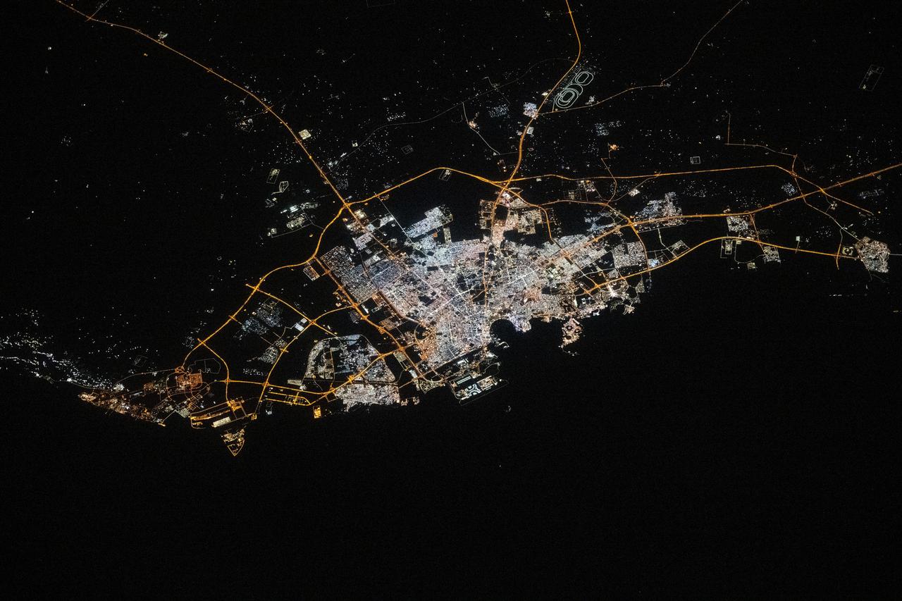
iss072e519924 (Jan. 23, 2025) --- The city lights of Doha, Qatar, the Middle Eastern nation's capital with a population of about 1.2 million, are pictured at approximately 9:51 p.m. local time from the International Space Station as it orbited 258 miles above. Some prominent landmarks include the Shahaniyah Camel Race Track (top right), Hamad International Airport, and the artificial Pearl Island (both at center and on the Persian Gulf Coast).
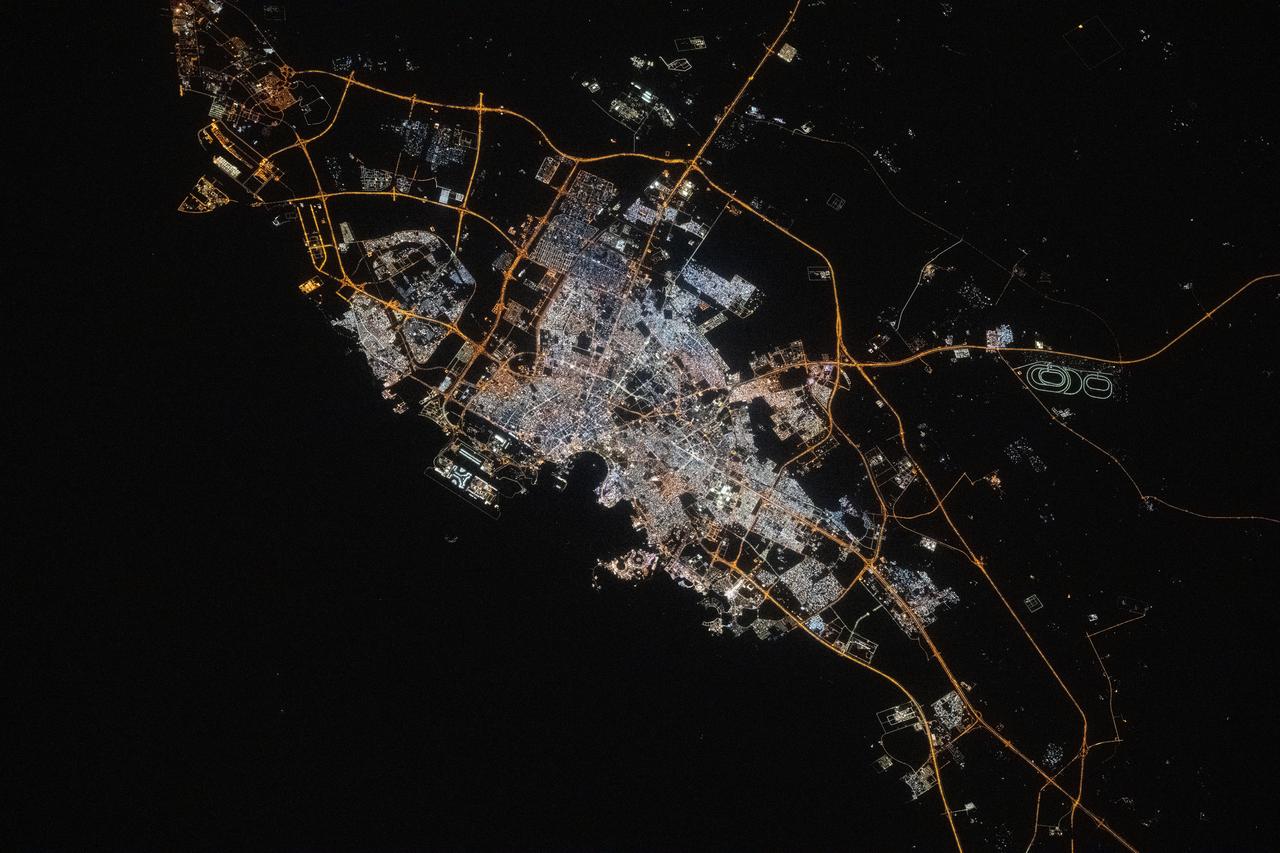
iss074e0150095 (Jan. 18, 2026) --- Doha, the capital and financial hub of Qatar with a population of about 2.4 million, is pictured at approximately 11:18 p.m. local time from the International Space Station as it orbited 262 miles above the Persian Gulf. At bottom left, is Hamad International Airport, featuring some of the longest runways in the world, built to accommodate next-generation aircraft such as the Airbus A380. Credit: NASA/Chris Williams
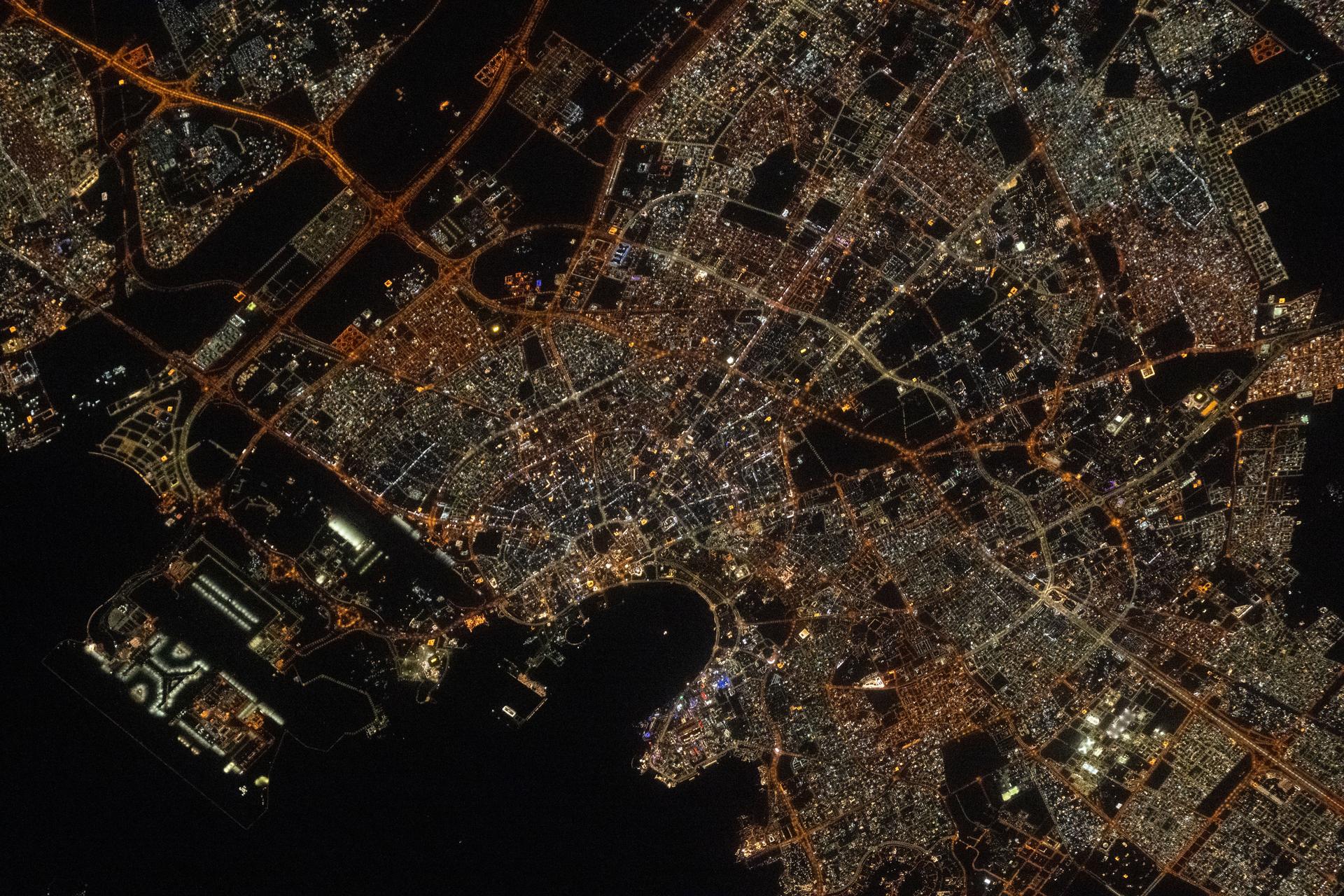
iss073e0134569 (May 22, 2025) --- Doha, the capital and largest city of Qatar with a population of about 1.9 million, is pictured at approximatelt 10:44 p.m. local time from the International Space Station as it orbited 259 miles above the Persian Gulf. Landmarks include Hamad International Airport (center left) and the artificial Pearl Island (lower center).
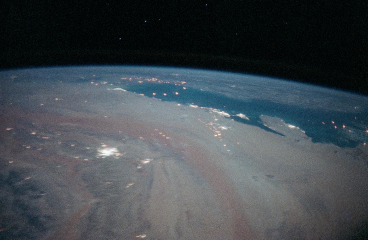
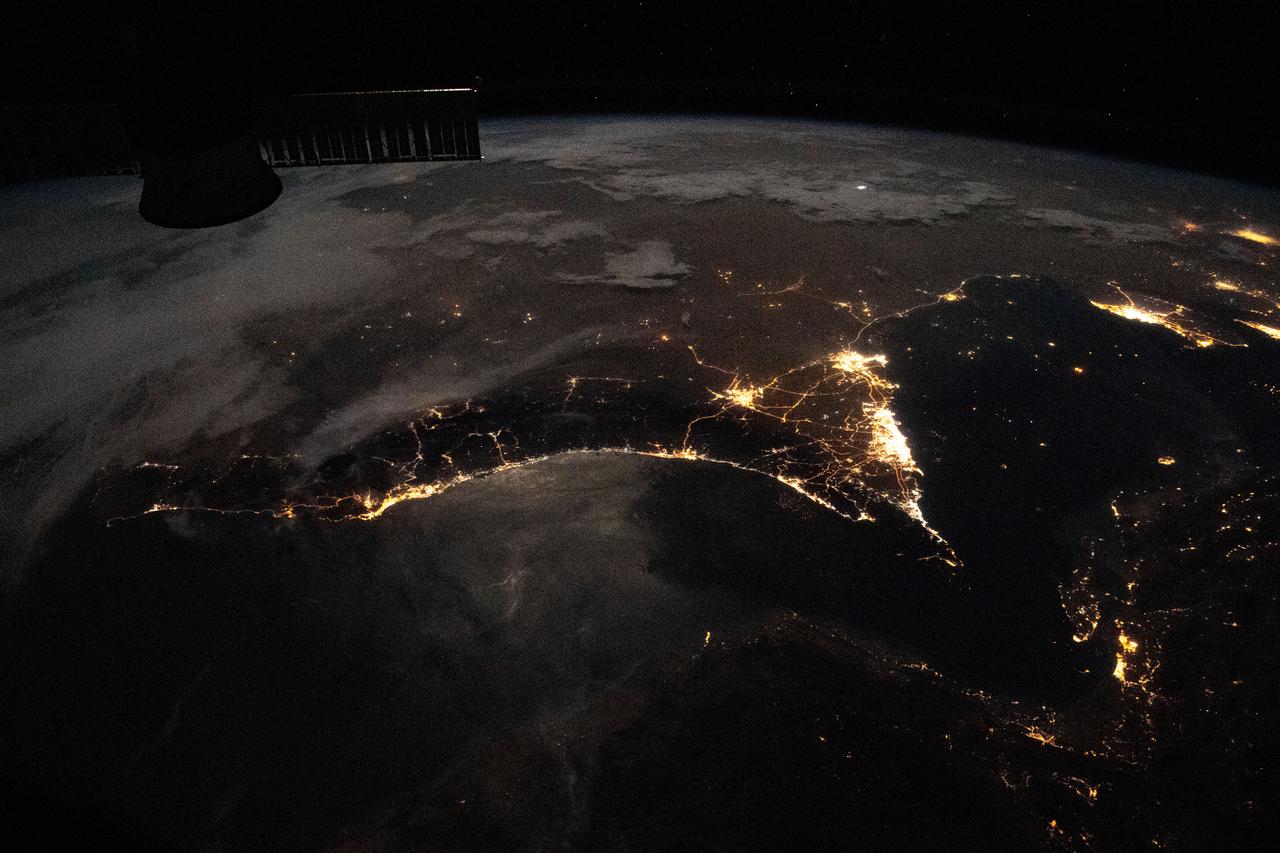
STS-35 Earth observation taken aboard Columbia, Orbiter Vehicle (OV) 102, is of the Persian Gulf area. Major cities and oilfields of the countries of Saudi Arabia (foreground), Iraq (top left), Iran (top center and top right), Kuwait, Bahrain, Qatar, and a portion of the United Arab Emirates are visible in this scene. The cities are the large whitish areas of city lights. Flares characteristic of the Mid-East oil field practices are visible both onshore and offshore throughout the scene. Major cities identifiable are in Iraq - Baghdad, Basra, and Faw; in Qatar - Ab Dawhah; in Kuwait - Kuwait City; in Saudi Arabia - Riyadh, Al Jubayl, Dharan, Al Huf, Ad Dilam and Al Hariq; and Bahrain and its associated causeway to the mainland.
iss064e039348 (Feb. 26, 2021) --- Doha, Qatar, is pictured from the International Space Station as it orbited 261 miles above the United Arab Emirates. Credit: Roscosmos

iss068e043827 (Jan. 30, 2023) --- The city lights of Doha, Qatar, are pictured from the International Space Station as it orbited 261 miles above the Arabian Peninsula.
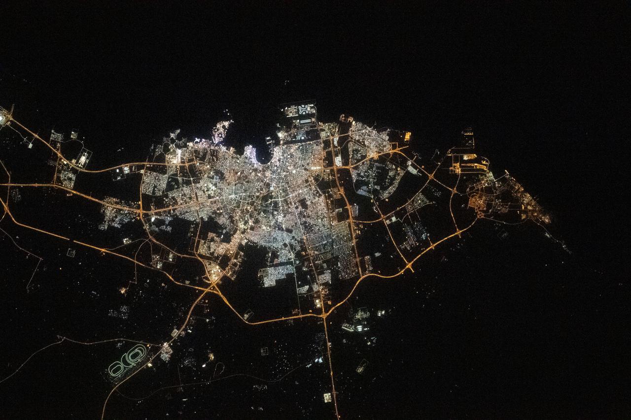
iss068e026585 (Dec. 4, 2022) --- The city lights of Doha, Qatar, are pictured on the coast of the Persian Gulf as the International Space Station orbited 258 miles above.
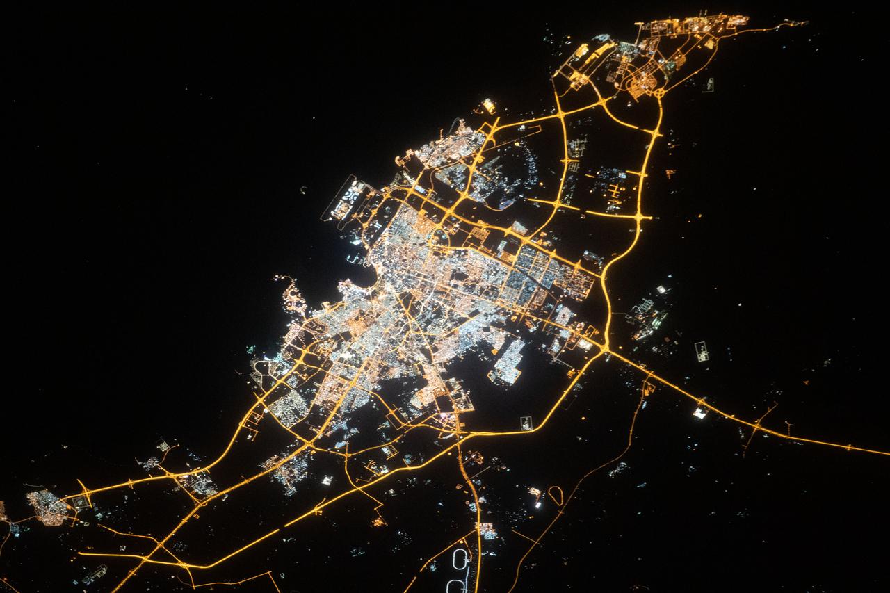
iss062e112843 (March 25, 2020) --- Doha, the capital city of Qatar, is pictured from the International Space Station as it orbited above the Arabian peninsula.
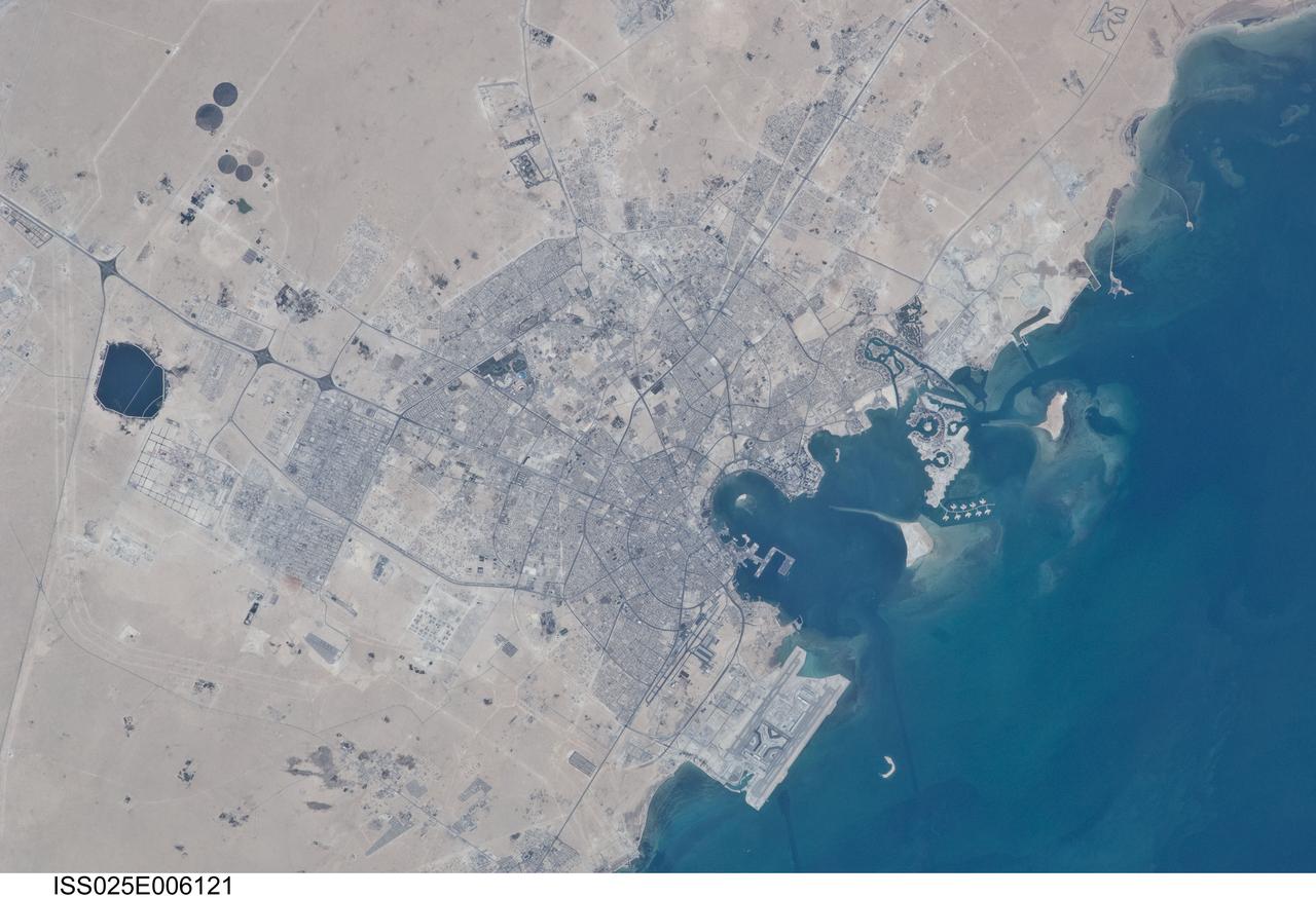
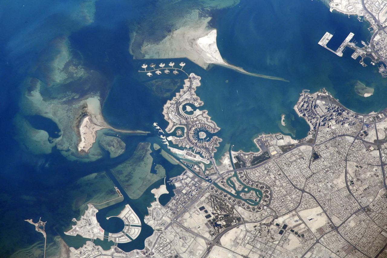
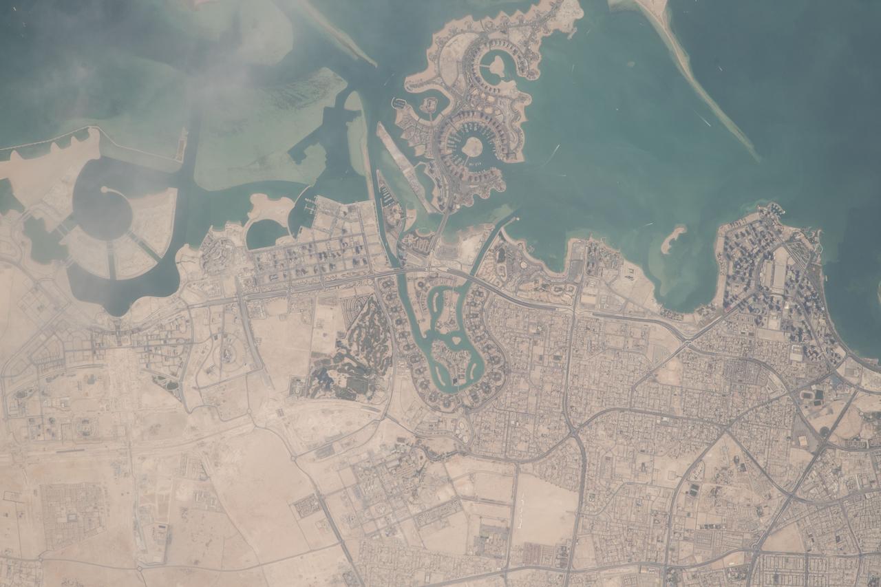
ISS025-E-006121 (5 Oct. 2010) --- Doha City, Doha Bay, State of Qatar and the Persian Gulf are featured in this image photographed by an Expedition 25 crew member on the International Space Station. The old and new zones of Doha, the capital city of the Persian Gulf state of Qatar, are visible in this photograph. The old city comprises the ancient bazaar, or Souq, near the dhow harbor (a dhow is a traditional Arab sailing vessel) which is still used today. Subsequent developments have taken place progressively further from the ancient center, with successive ring roads concentrically arranged around it. Modern port facilities can be seen immediately to the east of the Souq. The diplomatic quarter is reached via the Corniche promenade north of the old city. Yet further away an extensive marina complex known as West Bay Lagoon, with boating access to the Persian Gulf, stands out. Qatar’s new artificial island, known as the Pearl-Qatar, is under construction with 32 kilometers of new coastline, just offshore of West Bay Lagoon. This vast development is intended mainly as a residential zone with themes based on Arabic, Mediterranean and European cultures. The Pearl-Qatar complex is named for the fact that the new island is being built on one of Qatar’s major historical pearl diving sites. A string of small islands built along the outer margin of the complex is intended to recall the pearl-diving culture of the nation’s past.
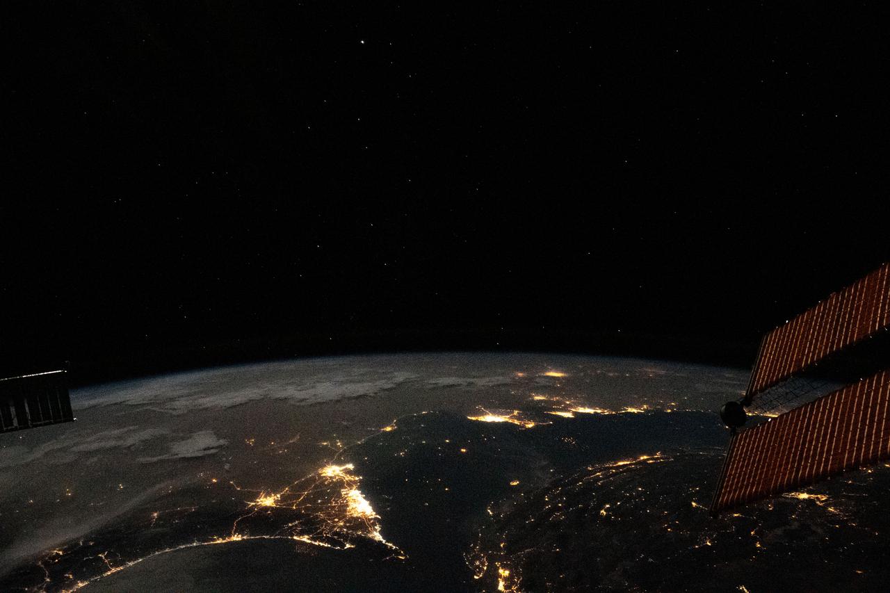
iss063e081369 (Aug. 31, 2020) --- Photographed from the International Space Station at night, the well-lit United Arab Emirates (lower center) is situated at the northeast end of the Arabian Peninsula, with Qatar and Bahrain to the north on the coast of the Persian Gulf.
iss055e012532 (April 7, 2018) --- Doha, the capital city of Qatar, was photographed by an Expedition 55 crew member aboard the International Space Station as it orbited over the northeastern coast of the Arabian Peninsula.
iss068e024291 (Nov. 24, 2022) --- Qatar, the island Kingdom of Bahrain, and the eastern coast of Saudi Arabia on the Persian Gulf are pictured from the International Space Station as it orbited 258 miles above the Arabian Peninsula.
ISS008-E-16355 (15 February 2004) --- A massive sandstorm over the Persian Gulf state of Qatar blows southward toward southeastern Saudi Arabia and the United Arab Emirates in this image photographed by an Expedition 8 crewmember onboard the International Space Station (ISS).
iss063e081357 (Aug. 31, 2020) --- Photographed from the International Space Station at night, the well-lit United Arab Emirates (center right) is situated at the northeast end of the Arabian Peninsula in the southern Persian Gulf, with Qatar and Bahrain (far right) to the north.
iss067e270600 (Aug. 18, 2022) --- The Strait of Hormuz connects the Gulf of Oman (left) with the Persian Gulf (right). The waterway also separates the Middle Eastern nation of Iran (bottom) from the Arabian Peninsula nations of Oman, United Arab Emirates, and Qatar (top left to right).
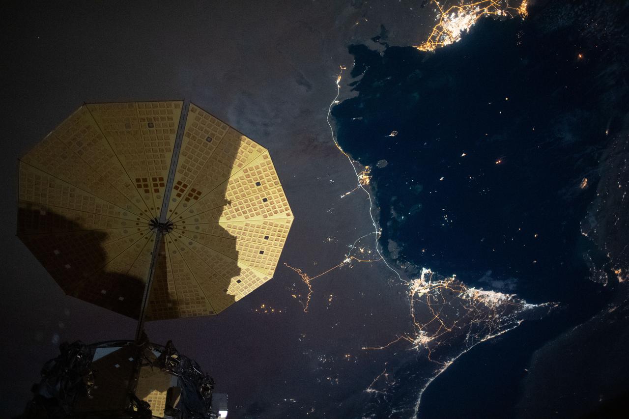
iss063e006718 (May 5, 2020) --- This nighttime image from the International Space Station shows the Persian Gulf city of Doha, Qatar (top right) and the United Arab Emirates cities (bottom right) of Abu Dhabi, Dubai and Ali Ain. In the foreground, is one of the cymbal-shaped UltraFLex solar arrays that powers the Cygnus space freighter from Northrop Grumman.
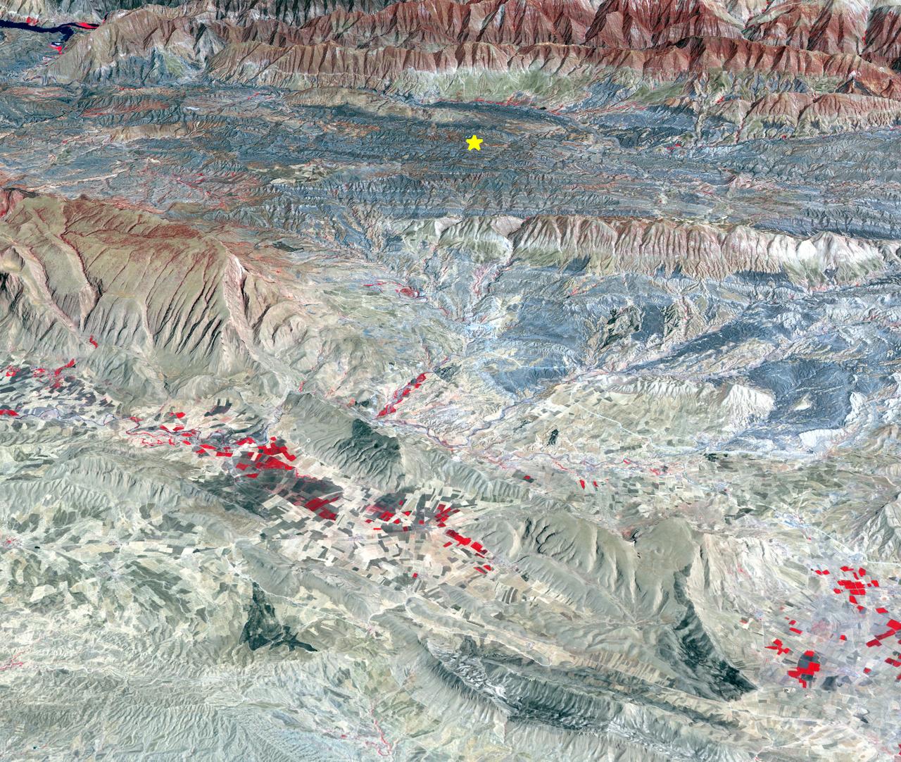
On Sunday, Nov. 12, 2017, a magnitude 7.3 earthquake struck along the Iran-Iraq border near Halabjah, Iraq. The earthquake was felt as far away as Kuwait, Qatar, Turkey, Lebanon and Israel. Extensive damage and numerous casualties were reported in the area near the epicenter (yellow star on image). The earthquake occurred along the boundary between the Arabian and Eurasian tectonic plates. This is an earthquake-prone area, and has experienced many deadly earthquakes in the past. In this perspective-view image, bright red areas are crops in fields, pale red on mountain ridges are shrubs and trees, dark gray areas are traces of earlier brush fires, and gray and tan colors are different rock types. The image was acquired Sept. 8, 2017, and the star marks the earthquake epicenter at 34.9 degrees north, 45.9 degrees east. https://photojournal.jpl.nasa.gov/catalog/PIA22112
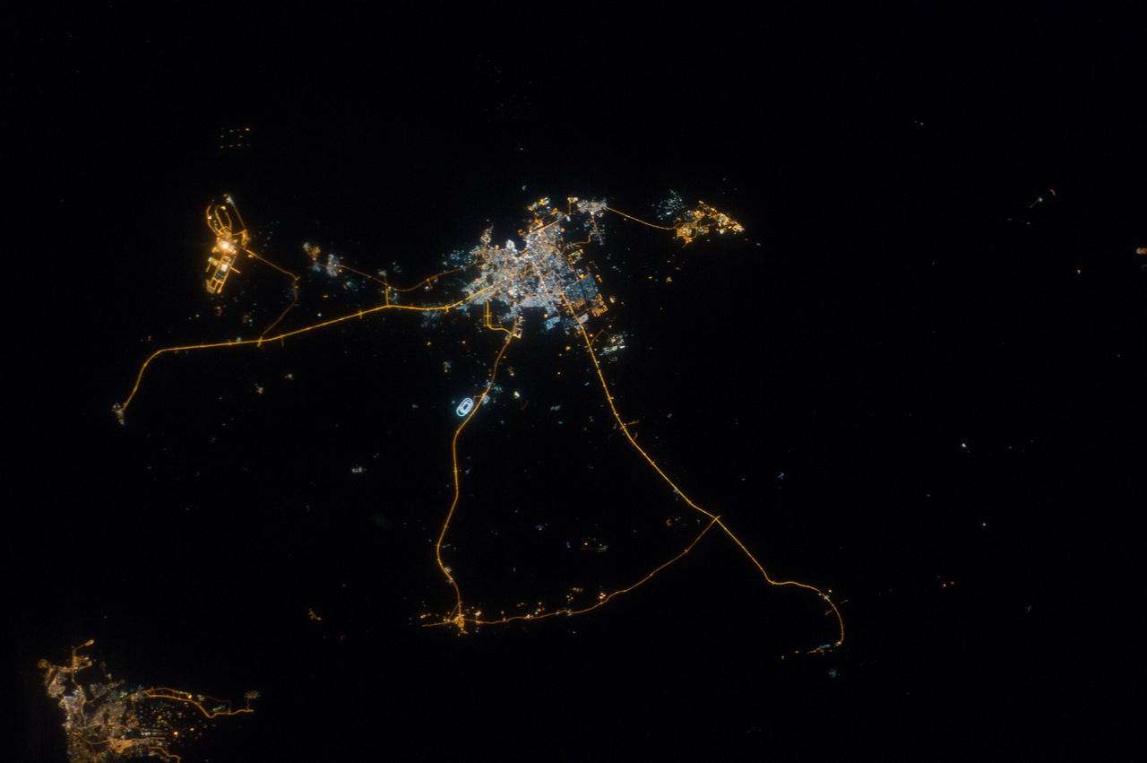
ISS033-E-014856 (13 Oct. 2012) --- A nighttime view of Qatar is featured in this image photographed by an Expedition 33 crew member on the International Space Station. Night lights can be very revealing regarding the distribution of people on the landscape. Here the lights of Qatar show the precise demographic geography of the country. The brightest group at center shows the capital city Doha with the neighboring smaller ports of Ad-Dahira and Umm Sa?id to the north and south, respectively. Even highways and their relative importance can be discerned. Highways are clearly visible leading from the capital west to the Dukhan oil fields, to Saudi Arabia, and to the north of the country--where, judging by the lack of night lights, the population is very low. The relatively low-traffic coast road between the oil fields and the Saudi frontier also stands out. This kind of highly informative human geographic detail is very difficult to discern in daylight images, in which even larger cities, especially in deserts, are hard to see. Almost the entire island nation of Bahrain appears at lower left, with its capital city Manama nearly as bright as the lights of Doha. The difference in light intensity reflects a difference in population?Doha has 1.45 million inhabitants, while the very dense Manama metro area has a population of 1.2 million. While some night views are highly informative about a landscape, they can also be difficult and confusing to identify. Astronauts learn to recognize where they are at night by flying over populated places repeatedly, even though coastlines?one of their best geographic indicators?are generally lost to view because water surfaces and unpopulated land surfaces look the same without illumination (such as from a full moon). Thus the thumb-shaped Qatari peninsula, so well-known in Middle Eastern geography, cannot be discerned at all in this night image. The inset at top right overlays the coastline as seen in daylight onto the night patterns of the image. It shows the Qatari peninsula, with the long arm of the Gulf of Bahrain separating it from Saudi Arabia.
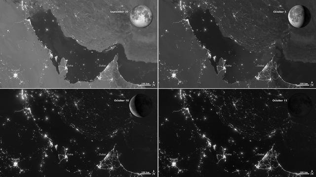
NASA images acquired October 15, 2012 The Visible Infrared Imaging Radiometer Suite (VIIRS) on the Suomi NPP satellite captured these nighttime views of the Persian Gulf region on September 30, October 5, October 10, and October 15, 2012. The images are from the VIIRS “day-night band,” which detects light in a range of wavelengths from green to near-infrared and uses filtering techniques to observe signals such as gas flares, auroras, wildfires, city lights, and reflected moonlight. Each image includes an inset of the Moon in four different phases. September 30 shows the Persian Gulf by the light of the full Moon; October 15 shows the effects of a new Moon. As the amount of moonlight decreases, some land surface features become harder to detect, but the lights from cities and ships become more obvious. Urbanization is most apparent along the northeastern coast of Saudi Arabia, in Qatar, and in the United Arab Emirates (UAE). In Qatar and UAE, major highways can even be discerned by nighttime lights. In eighteenth-century England, a small group of entrepreneurs, inventors and free thinkers—James Watt and Charles Darwin’s grandfathers among them—started a club. They named it the Lunar Society, and the “lunaticks” scheduled their dinner meetings on evenings of the full Moon. The timing wasn’t based on any kind of superstition, it was based on practicality. In the days before electricity, seeing one’s way home after dark was far easier by the light of a full Moon. In the early twenty-first century, electricity has banished the need for such careful scheduling, but the light of the full Moon still makes a difference. NASA Earth Observatory image by Jesse Allen and Robert Simmon, using VIIRS day-night band data from the Suomi National Polar-orbiting Partnership. Suomi NPP is the result of a partnership between NASA, the National Oceanic and Atmospheric Administration, and the Department of Defense. Caption by Michon Scott. Instrument: Suomi NPP - VIIRS Credit: <b><a href="http://www.earthobservatory.nasa.gov/" rel="nofollow"> NASA Earth Observatory</a></b> <b>Click here to view all of the <a href="http://earthobservatory.nasa.gov/Features/NightLights/" rel="nofollow"> Earth at Night 2012 images </a></b> <b>Click here to <a href="http://earthobservatory.nasa.gov/NaturalHazards/view.php?id=79834" rel="nofollow"> read more </a> about this image </b> <b><a href="http://www.nasa.gov/audience/formedia/features/MP_Photo_Guidelines.html" rel="nofollow">NASA image use policy.</a></b> <b><a href="http://www.nasa.gov/centers/goddard/home/index.html" rel="nofollow">NASA Goddard Space Flight Center</a></b> enables NASA’s mission through four scientific endeavors: Earth Science, Heliophysics, Solar System Exploration, and Astrophysics. Goddard plays a leading role in NASA’s accomplishments by contributing compelling scientific knowledge to advance the Agency’s mission. <b>Follow us on <a href="http://twitter.com/NASA_GoddardPix" rel="nofollow">Twitter</a></b> <b>Like us on <a href="http://www.facebook.com/pages/Greenbelt-MD/NASA-Goddard/395013845897?ref=tsd" rel="nofollow">Facebook</a></b> <b>Find us on <a href="http://instagram.com/nasagoddard?vm=grid" rel="nofollow">Instagram</a></b>