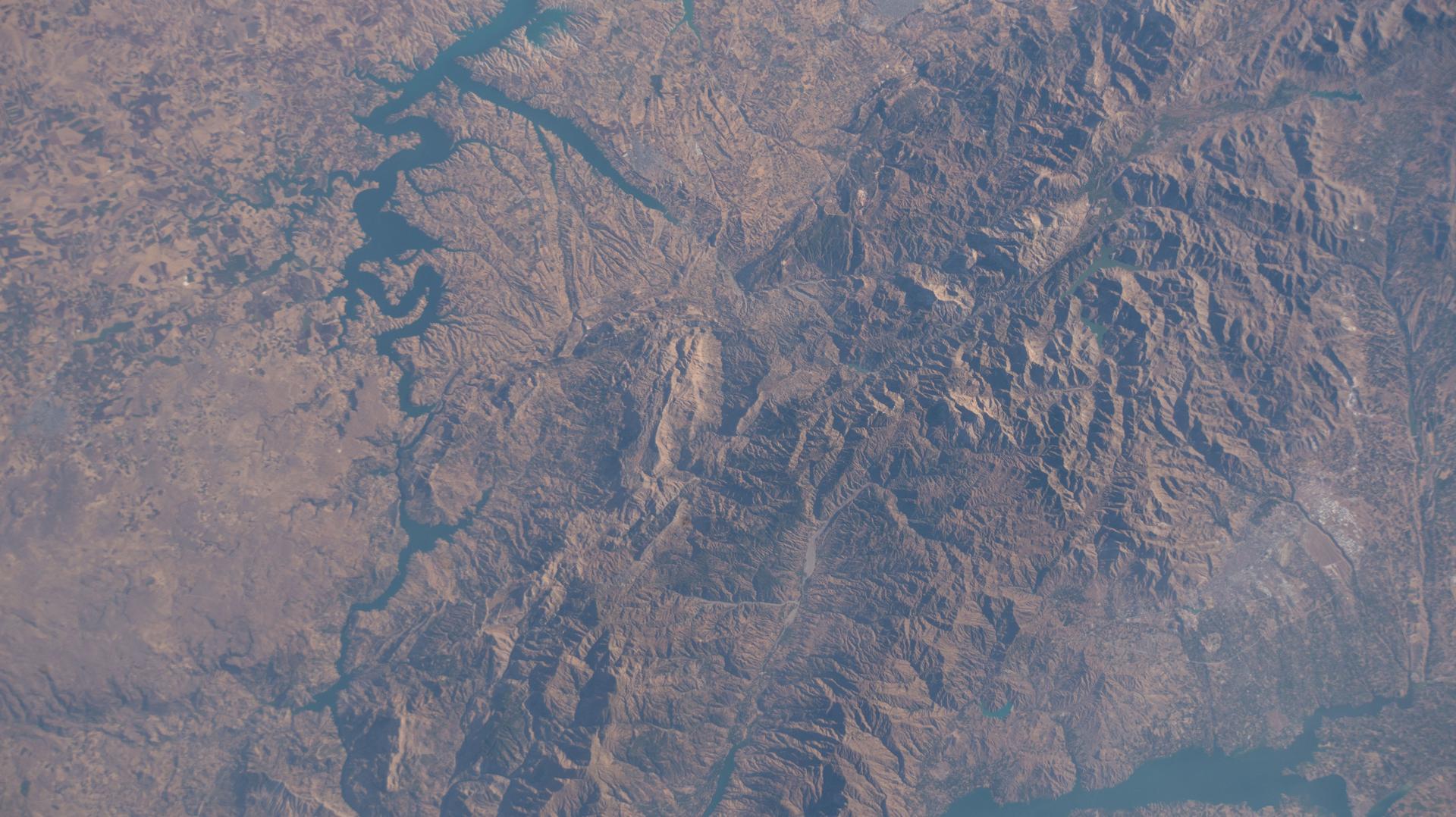
iss075e0002070 (Aug. 1, 2026) --- Atatürk Reservoir in Türkiye, located on the Euphrates River near the Southeastern Taurus Mountains, was created by the Atatürk Dam, the world’s fourth largest. The reservoir provides the region with drinking water, irrigation for cotton farming, and commercial and recreational fishing opportunities. Credit: NASA
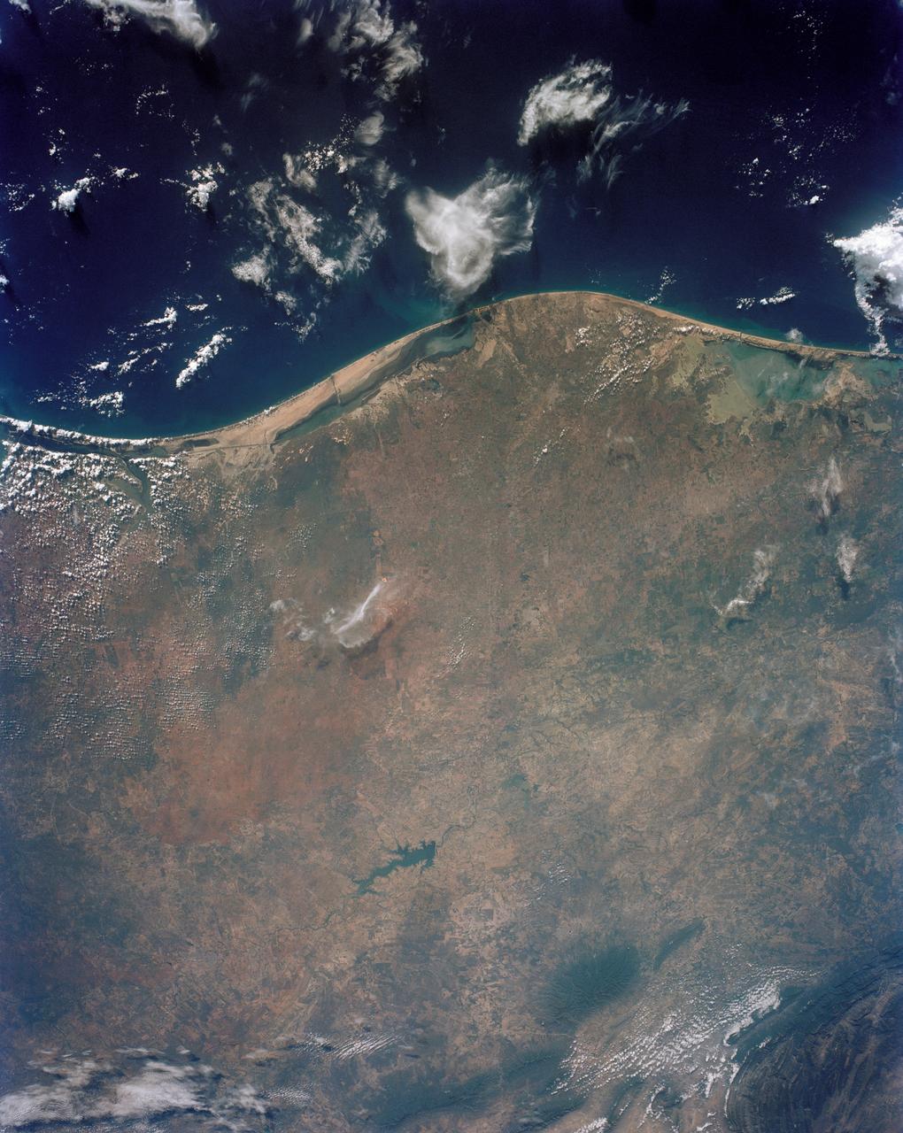
STS043-151-043 (8 August 1991) --- The Rio Grande extends across the center of this photograph from Falcon Reservoir to its bulging delta, joining the Gulf of Mexico. Sediment brought down by the river is spread northward and southward by alongshore currents to form the barrier chain of Padre Island and its protected Laguna Madre Speckled agricultural land use patterns in the river valley contrast with range land northward from the white cloud, and with closed canopy forest on hills in Mexico. A Linhof camera with a 90mm lens, was used to expose the frame at 14:43 GMT, Aug. 8, 1991.
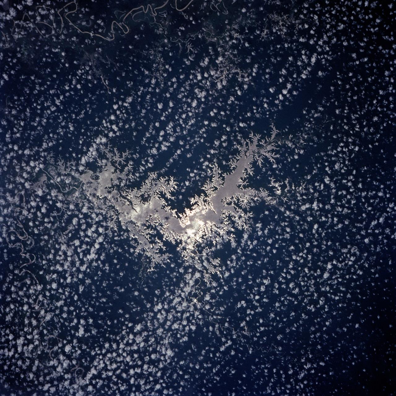
Lake Murray, a manmade reservoir, lies between the Fly and Strickland River Basins, Papua, New Guinea (7.0S, 141.5E). The region, photographed in sunglint, shows the water level in the reservoir and the full extent of the drainage basins of both river systems as the rivers meander through wide alluvial floodplains. Some forest clearing can be seen in places throughout the region, but most of the area remains in closed canopy forest.
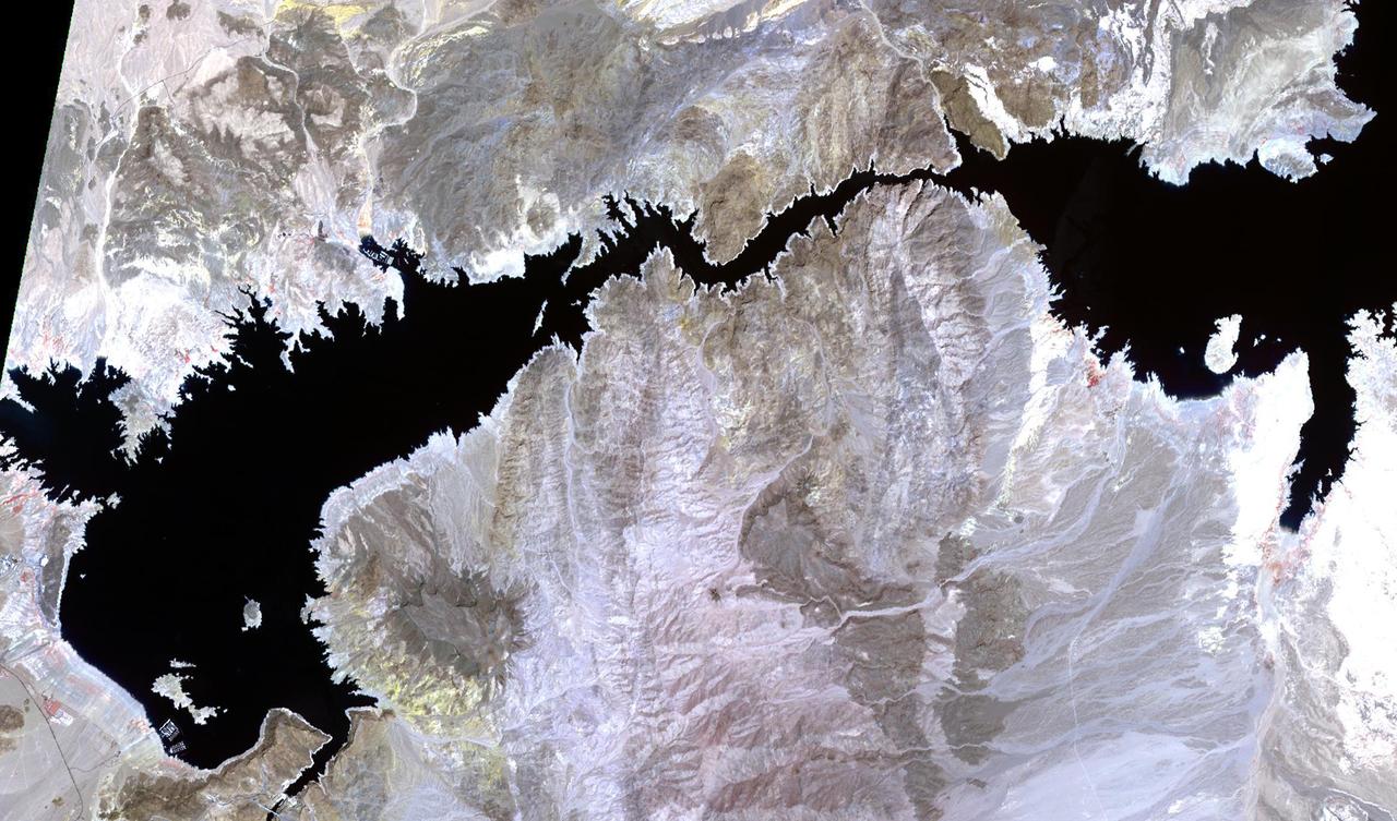
Lake Mead, America's largest reservoir, on the Colorado River between Nevada and Arizona, has shrunk to historic lows, dropping to about 30% of its capacity. The reservoir provides water to 25 million people in California, Arizona, Nevada, and Mexico. The water level has fallen from 1204 feet in 2000, to an all-time low of 1049" yesterday. The images were acquired May 19, 2000 and May 25 2022, cover an area of 20.5 by 34.9 km, and are located at 36.1 degrees north, 114.6 degrees west. https://photojournal.jpl.nasa.gov/catalog/PIA25279
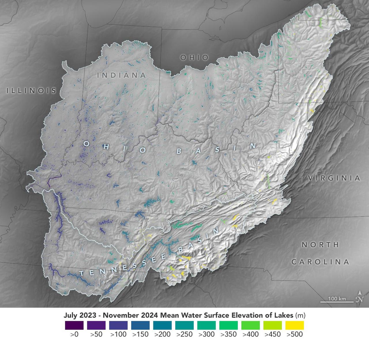
This visualization based on data from the Surface Water and Ocean Topography (SWOT) satellite shows the average water level for lakes and reservoirs in the Ohio River Basin from July 2023 to November 2024. Yellow indicates values greater than 1,600 feet (500 meters) above sea level, and dark purple represents water levels less than 330 feet (100 meters). Comparing how such levels change can help hydrologists measure water availability over time in a local area or across a watershed. Since early 2023, SWOT has been measuring the height of nearly all water on Earth's surface – including oceans, lakes, reservoirs, and rivers – covering nearly the entire globe at least once every 21 days. The satellite also measures the horizontal extent of water in freshwater bodies. Earlier this year, the SWOT mission started making validated data (processed measurements that have been checked for accuracy) publicly available. https://photojournal.jpl.nasa.gov/catalog/PIA26188
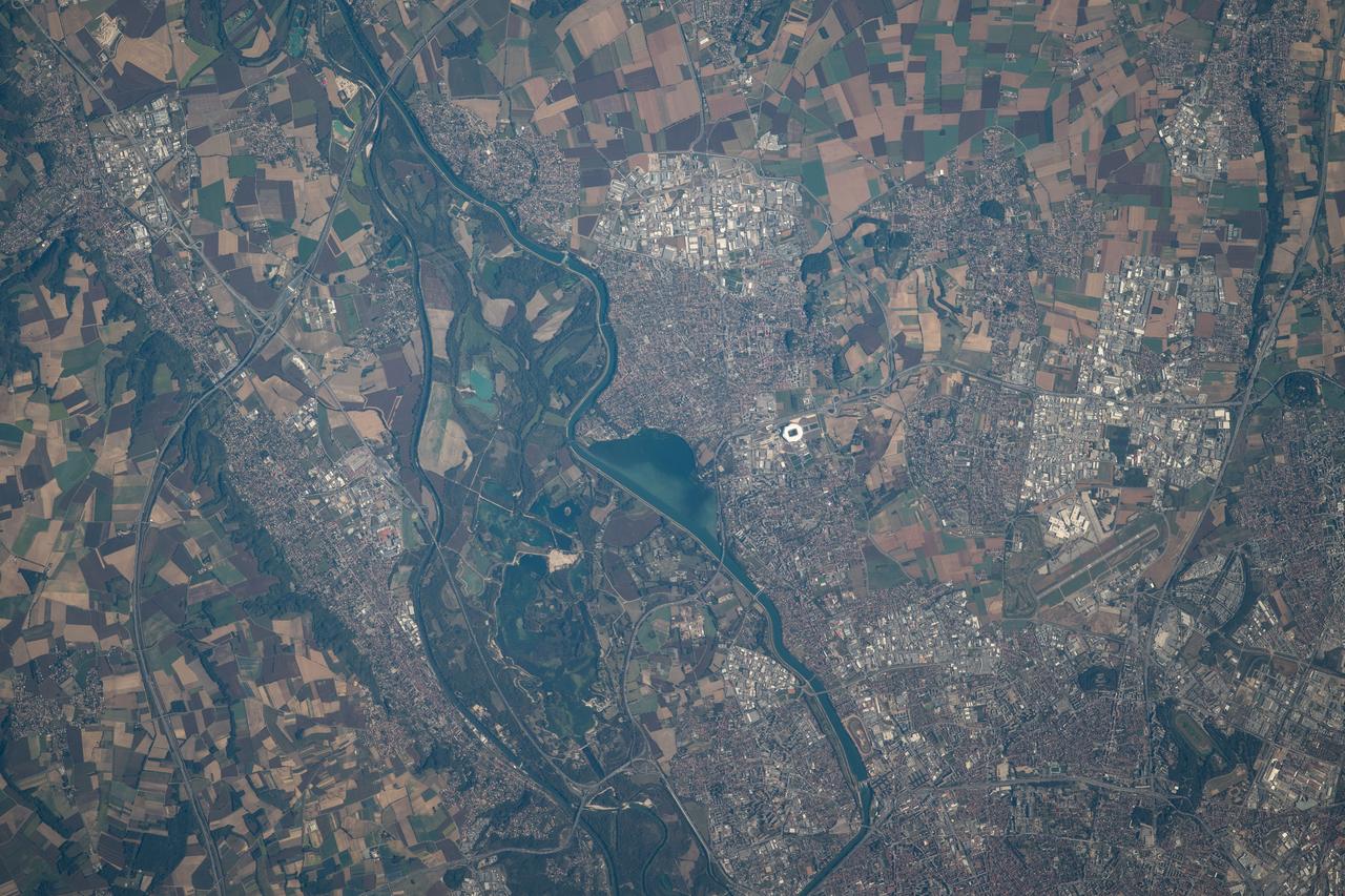
iss061e004461 (Oct. 8, 2019) --- The Rhône river, Réservoir du Grande-Large and the Groupama Stadium are pictured just east of the French city of Lyon as the International Space Station orbited 253 miles above the European nation.

iss072e069220 (Oct. 16, 2024) --- The Jebba Dam (lower left) impounds the Niger River creating a reservoir in Nigeria in this photograph from the International Space Station as it orbited 259 miles above the African nation.
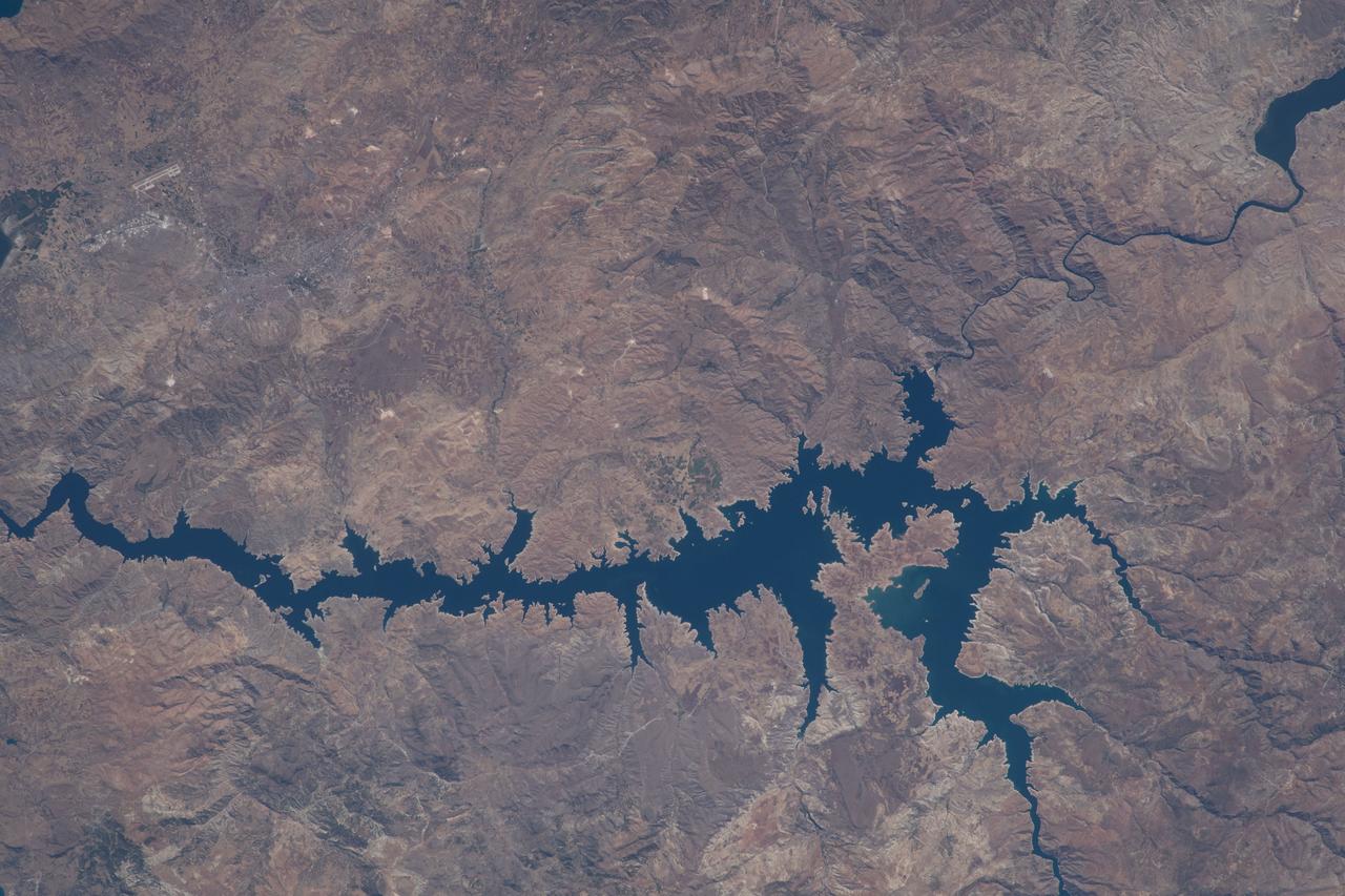
iss068e006715 (Oct. 1, 2022) --- This portion of the Euphrates River, containing the Keban Dam Reservoir created by the Keban Dam, is pictured in eastern Turkey from the International Space Station as it orbited 260 miles above.
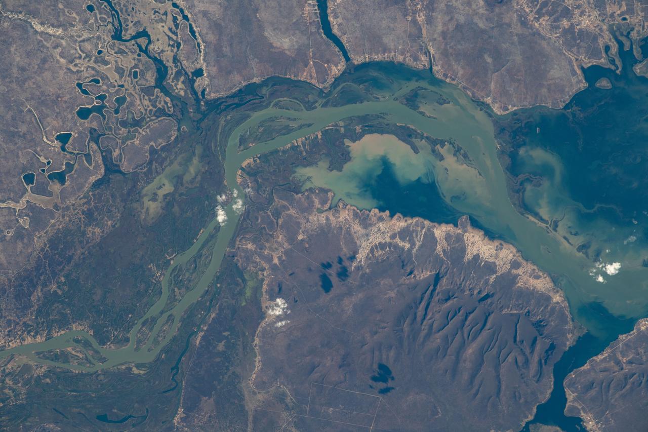
iss070e004962 (Oct. 17, 2023) --- The São Francisco River passes through the Sobradinho Reservoir in Brazil in this photograph from the International Space Station as it orbited 259 miles above the South American nation.
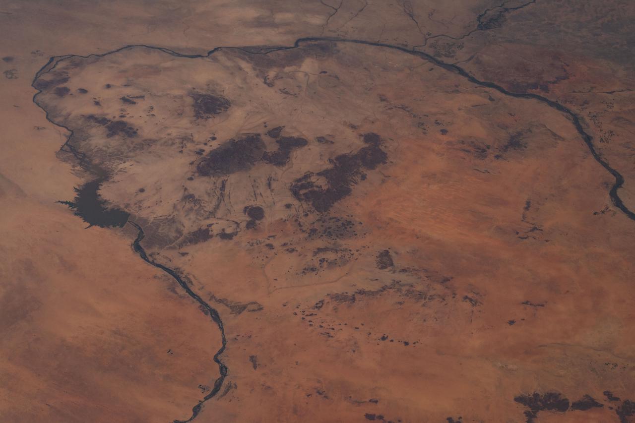
iss066e091596 (Nov. 30, 2021) --- The Merowe Reservoir (center left) on the river Nile is pictured from the International Space Station as it orbited 262 miles above the African nation of Sudan.

iss060e004214 (July 4, 2019) --- Lake Isabella in California, pictured as the International Space Station orbited 256 miles above the Golden State, is a reservoir formed in 1953 when the Kern River was dammed by the U.S. Army Corps of Engineers.

iss071e130671 (May 26, 2024) --- Ute Reservoir in Utah, created by Ute Dam in New Mexico and filled by the Canadian River, is pictured frm the International Space Station as it orbited 262 miles above the southwestern United States.
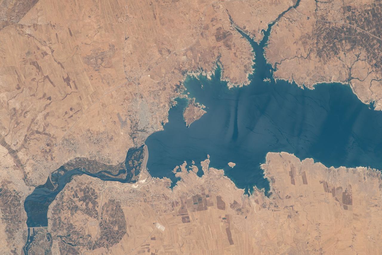
iss069e015083 (May 31, 2023) --- Lake Assad in Syria, a reservoir on the Euphrates River, is pictured from the International Space Station as it orbited 258 miles above the Middle East nation.

ISS008-E-12372 (10 January 2004) --- The Biobio River in Chile was featured in this image photographed by an Expedition 8 crewmember onboard the International Space Station (ISS). The river flows northwestward from the high Cordillera of the Andes to the Pacific Ocean near Concepcion, about 450 kilometers south of Santiago. This image shows a section of the river that skirts around Antuco volcano in the Andes, and features the Pangue dam and reservoir filling a narrow, meandering segment of the Biobio River valley. Upstream from the Pangue Reservoir (right frame), the cleared areas associated with earth moving and construction of the Ralco Dam are visible. The straight white lines in cleared forest between the two dams probably represent power transmission lines.

ISS019-E-007720 (15 April 2009) --- Three Gorges Dam in China is featured in this image photographed by an Expedition 19 crew member on the International Space Station. A new reservoir is filling in central China. The Three Gorges Dam on the Yangtze River - the world?s largest dam ? was completed in 2006, and the river is filling up its valley behind the dam to form a narrow reservoir extending more than 600 kilometers. This image is one of the first images documenting the flooding behind the dam. The main objective for the dam is to supply water for the largest hydroelectric plant in the world and help control the devastating floods that plague the lowlands downstream from the dam.
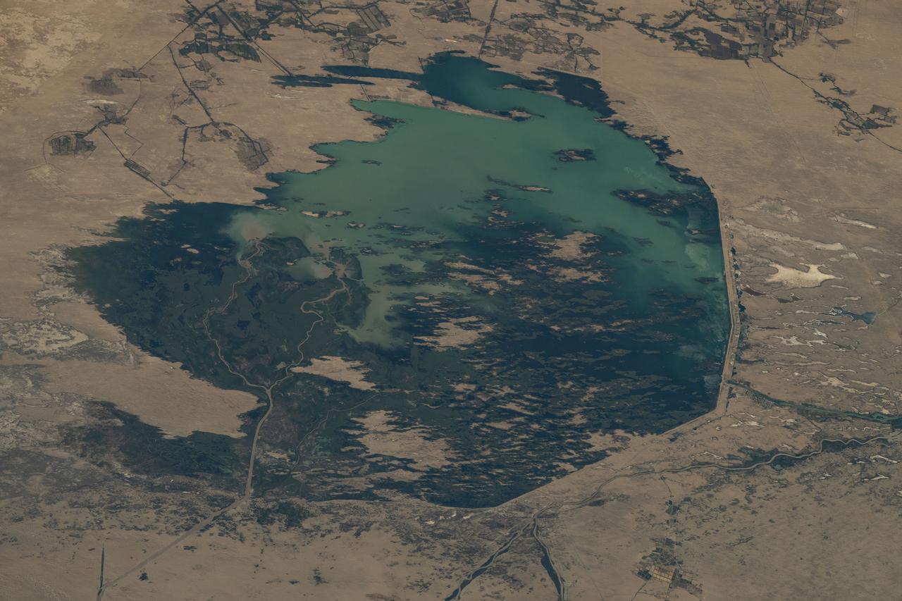
iss073e0423962 (Aug. 7, 2025) --- The Zeid Reservoir in Turkmenistan is pictured from the International Space Station as it orbited 260 miles above Central Asia. The reservoir was designed to capture some of the sand and sediment flowing in from the nearby Amu Darya River and the Karakum Canal. This helps keep the water cleaner and protects the canal system from getting clogged.
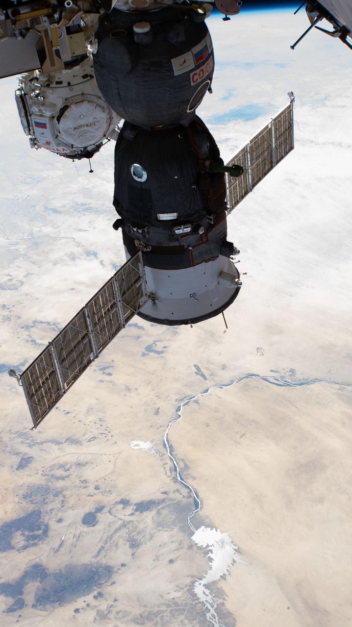
iss066e125408 (Jan. 24, 2022) --- The Soyuz MS-19 crew ship and the Prichal docking module (in the background), with the river Nile and the Menowe Reservoir below, are pictured as the International Space Station orbited 258 miles above the African nation of Sudan.
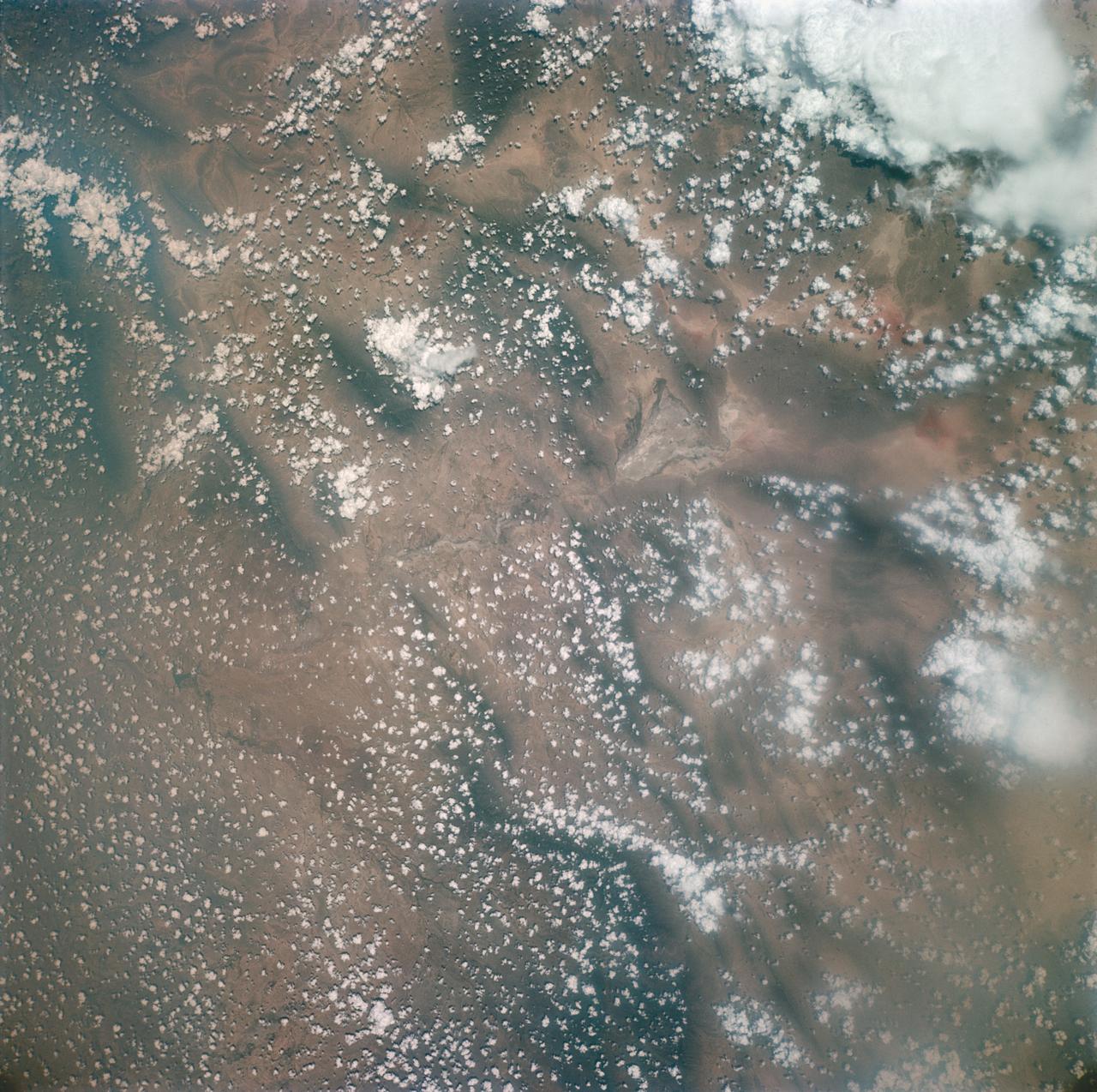
S66-45763 (18-21 July 1966) --- Don Martin Reservoir and Sabinas River Valley area of the States of Coahuila and Nuevo Leon, Mexico, as seen from the Gemini-10 spacecraft. Taken with a J. A. Maurer 70mm camera, using Eastman Kodak, Ektachrome, MS (S.O. 217) color film. Photo credit: NASA
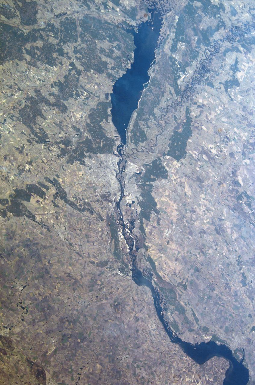
ISS008-E-20656 (4 April 2004) --- This image featuring the Ukrainian city of Kiev on a reservoir on the Dnepr River was taken by an Expedition 8 crewmember on the International Space Station (ISS). Kiev is the capital of Ukraine and home to nearly three million people and rich in the history of western civilization.
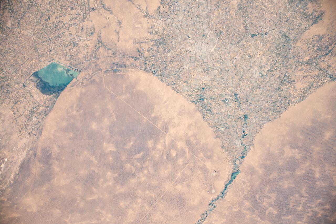
iss060e000604 (June 26, 2019) --- The Murghab river flows into the oasis city of Mary in the Karakum Desert in Turkmenistan. At left, is the Hanhowuz Reservoir which plays an important role in agriculture in southeastern Turkmenistan. The International Space Station was orbiting 256 miles above the Central Asian nation when this photograph was taken.
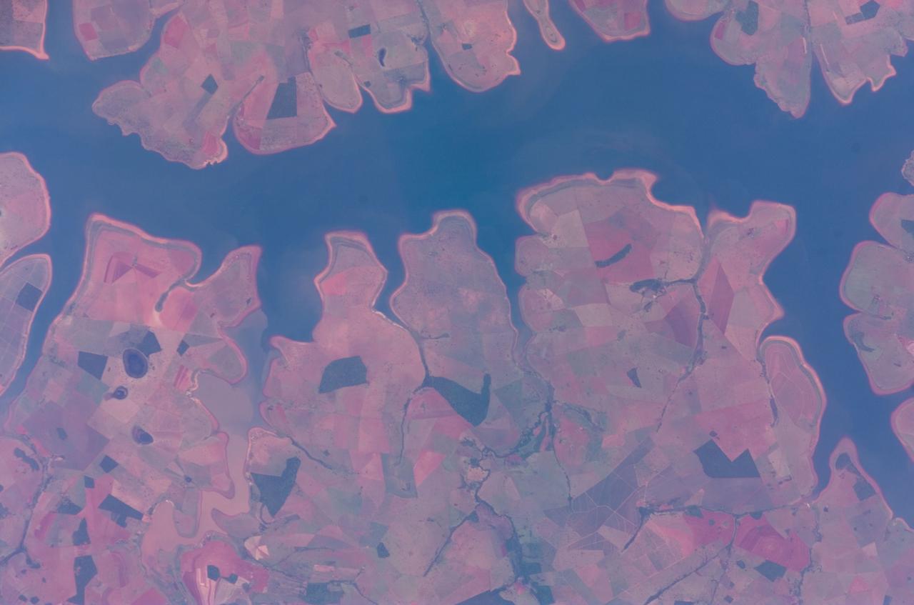
ISS016-E-011999 (22 Nov. 2007) --- Sao Simao Reservoir, Brazil is featured in this image photographed by an Expedition 16 crewmember on the International Space Station (ISS). The Sao Simao reservoir, near the confluence of the Rio Paranaiba and Rio Verde in Brazil, is the featured subject in a milestone image of Earth. This colorful, patchwork image is the 300,000th image of Earth downlinked from the space station. There are now over 745,000 images of Earth taken by astronaut crews, beginning with the Mercury missions in 1961 and continuing to the present day on the ISS. The Sao Simao reservoir is located on the border between the states of Goias and Minas Gerais (near the geographic coordinates of 18.7S 50.4W). Though the town of Sao Simao was founded around 1935, major growth occurred when the hydroelectric power plant and dam were built - forming the reservoir -- in 1975. The reservoir is part of a major navigation link that allows transport of goods and commerce between central Brazil, the Prata River and the South Atlantic. With 600,000 square kilometers of surface area, the reservoir also serves as a tourist destination for fishing, swimming and boating. In addition to hydroelectric power production, the economy of the region is based in agribusiness. The image highlights agricultural fields of various kinds and in different stages of cultivation. The major commodities include corn, soybeans, sesame seeds, sugarcane, beans, manioc, coffee and meat production.
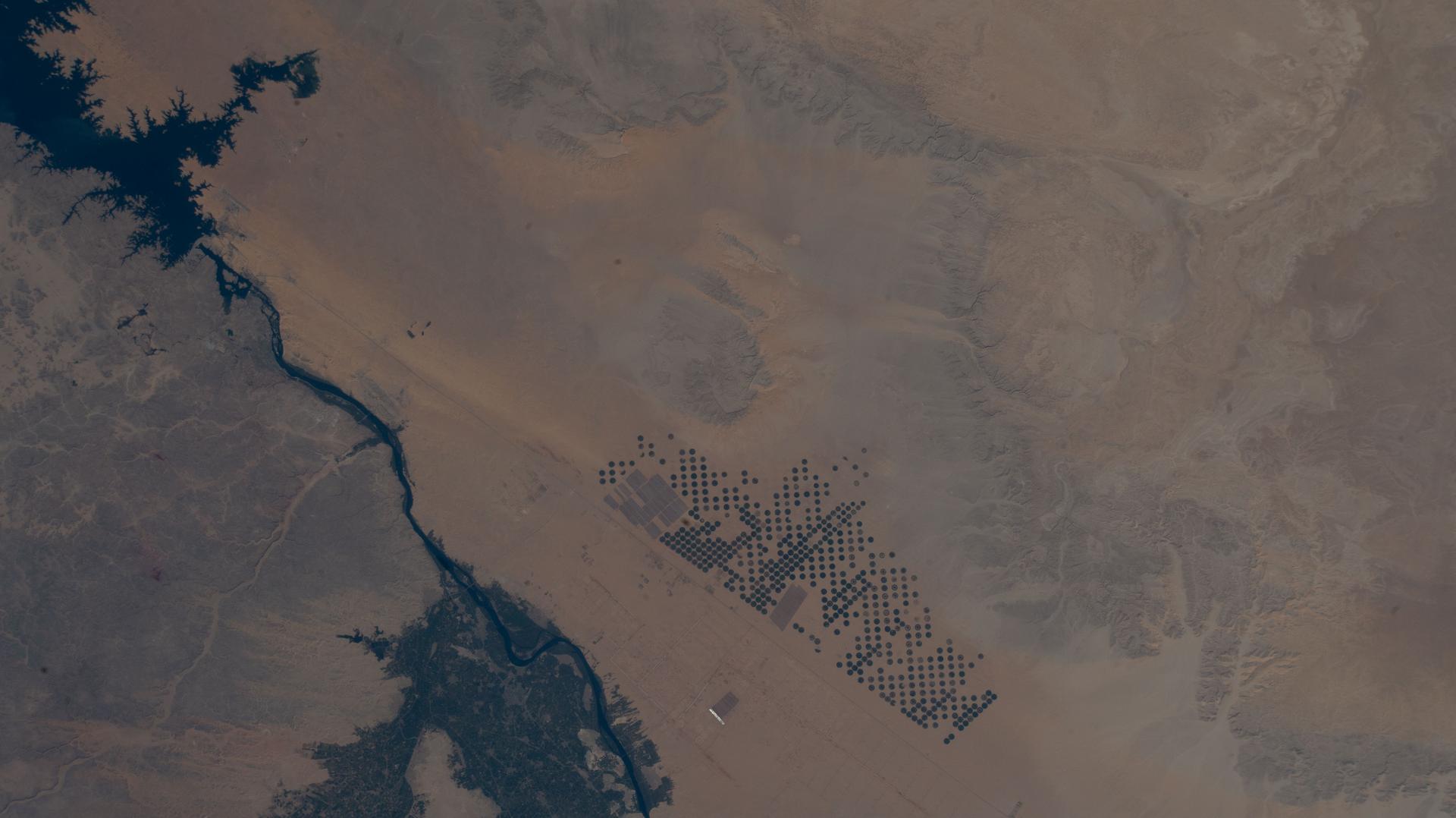
iss074e0315952 (Feb. 16, 2026) --- Egypt’s Nile River turns into Lake Nasser (upper left) at the Aswan High Dam, where the water spreads into a vast artificial reservoir that controls the river’s flow, prevents flooding, and generates hydroelectric power. Center‑pivot irrigation systems appear near the center bottom, forming perfect circles of crops such as potatoes and wheat. The International Space Station was orbiting 258 miles above the African nation at the time of this photograph. Credit: NASA
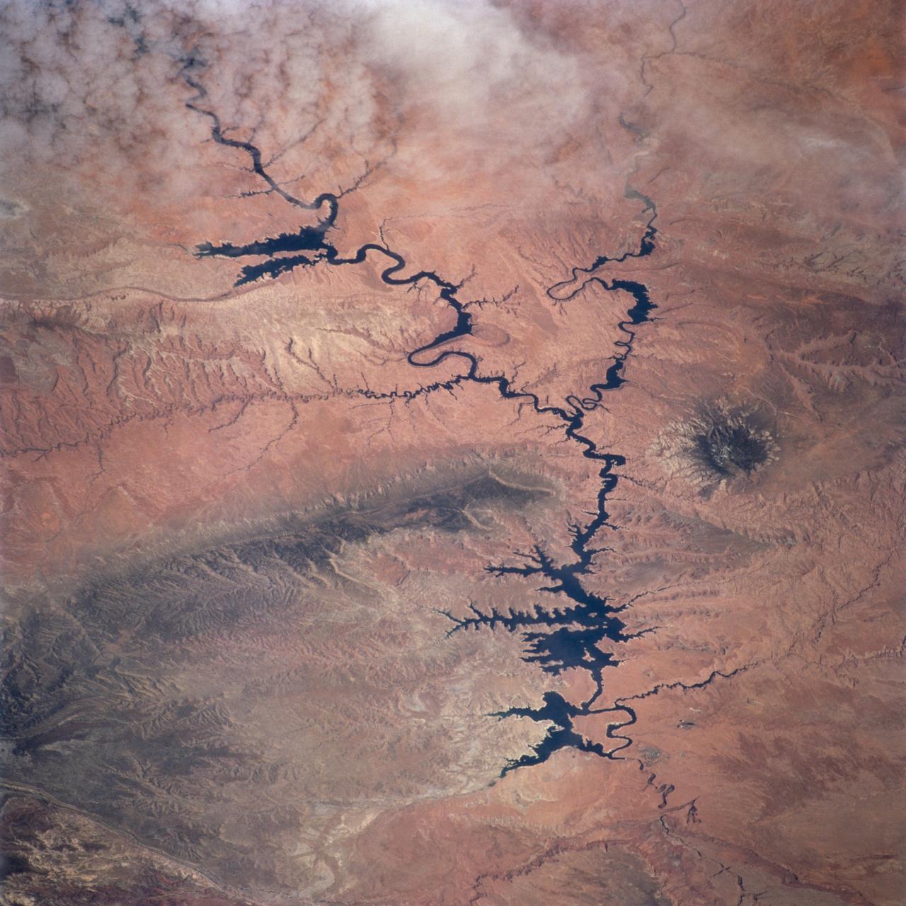
STS100-716-176 (19 April-1 May 2001) --- The deeply entrenched, meandering Colorado River is distinctively dark as the river winds its way across the arid terrain of southeast Utah in this 70mm frame photographed from the Earth-orbiting Space Shuttle Endeavour. While Glen Canyon Dam (bottom of image) is located in northern Arizona, the reservoir of Lake Powell is in Utah. The Escalante and San Juan Rivers, two major tributaries that flow into Lake Powell (from the northwest and east respectively) are also discernable. The darker-looking, elongated and elevated feature north of Lake Powell is the Kaiparowits Plateau. Navajo Mountain is the darker circular feature to the south (to the right) of the lake.
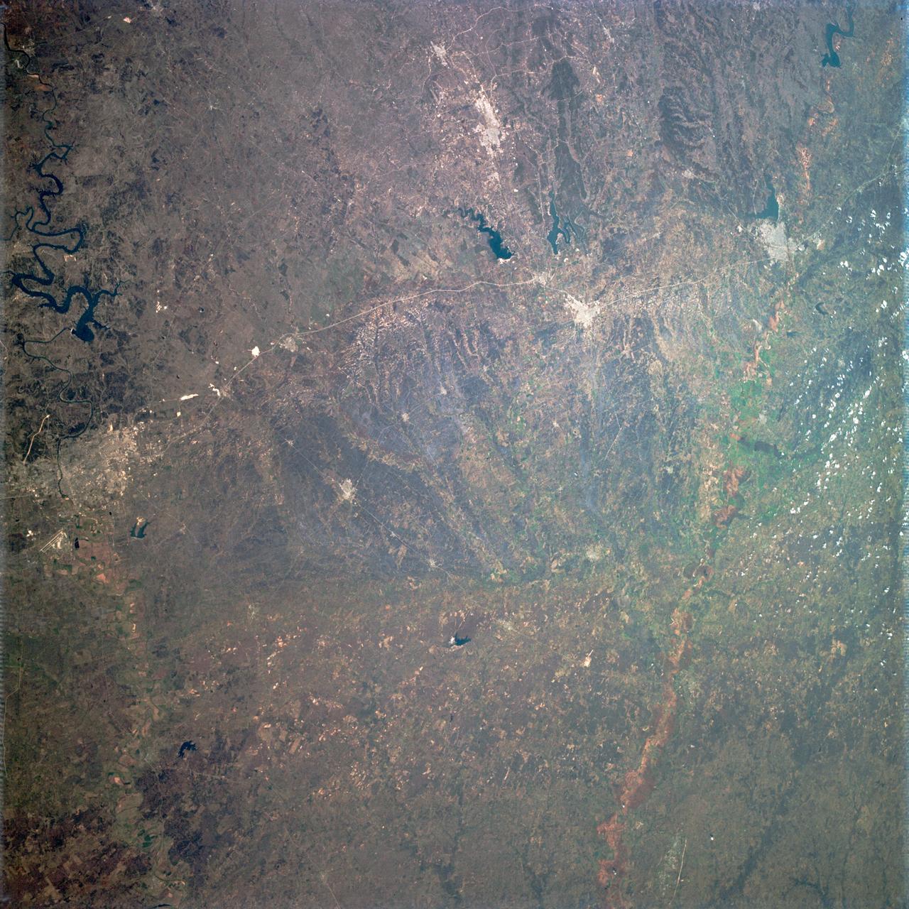
AS09-22-3341 (3-13 March 1969) --- Central Texas area as photographed from the Apollo 9 spacecraft during its Earth-orbital mission. Interstate 35 runs from Austin (right center edge of picture) to Waco (near bottom left corner). Also visible are the cities of Georgetown, Taylor, Temple and Killeen. The Colorado River runs through Austin. The Brazos River flows through Waco. Lake Travis is upstream from Austin. Lake Whitney is at bottom left corner of picture. The Belton Reservoir is near bottom center. The lake formed by the dam on the Lampasas River near Belton is also clearly visible.

AS06-02-1462 (4 April 1968) --- View of the Dallas-Fort Worth, Texas, area as photographed from the unmanned Apollo 6 (Spacecraft 020/Saturn 502) space mission. The highway and expressway system in and around both cities is clearly visible. North is toward left side of picture. Grapevine Reservoir and Garza-Little Elm Reservoir are to the north-west of Dallas. The city of Denton can be seen in left center of picture at conjunction of highways leading to both Fort Worth and Dallas. The Brazos River is in lower right corner. This photograph was made three hours and nine minutes after liftoff of the Apollo 6 space flight.

ISS031-E-006398 (30 April 2012) --- Lake Powell and the Rincon in Utah are featured in this image photographed by an Expedition 31 crew member on the International Space Station. This photograph highlights part of Lake Powell; the lake extends across southeastern Utah and northeastern Arizona. Lake Powell started filling in 1963 when the Glen Canyon Dam on the Colorado River in Arizona was completed, and Glen Canyon flooded. The serpentine water surface of the reservoir-highlighted by gray regions of sunglint-follows the incised course of the canyon. Today Lake Powell is part of the Glen Canyon National Recreation Area which extends for more than 186 miles along the shoreline and side canyons. The primary intended use of Lake Powell?s water is support of agricultural production, with a small portion allocated to urban use in Arizona, Nevada, and California. The reservoir did not reach its maximum capacity of 27 million acre-feet until 1980. More recently, extended drought conditions in the southwestern United States over the past decade have resulted in a significant lowering of the Lake water level and emergence of parts of Glen Canyon. Should average precipitation in the Colorado River watershed lessen (as predicted by regional climate change models), that could result in further lowering of the Lake Powell water level and changes to the current water management plans. Fluctuations in water levels and change of river courses are a common occurrence seen in the geologic record of rivers. Looking somewhat like a donut or automobile tire from the vantage point of the space station, the Rincon (center) is an entrenched and abandoned meander, or loop, of the Colorado River, thought to have formed several thousand years ago when the river cut straight across the ends of the loop and shortened its course by six miles. The resulting canyon and 600 ? 750 feet-high central mesa indicate where the river used to flow. The term ?Rincon? also is used by geomorphologists to describe similar ancient river features observed elsewhere. The Goosenecks of the San Juan River are an example of an active entrenched meander.
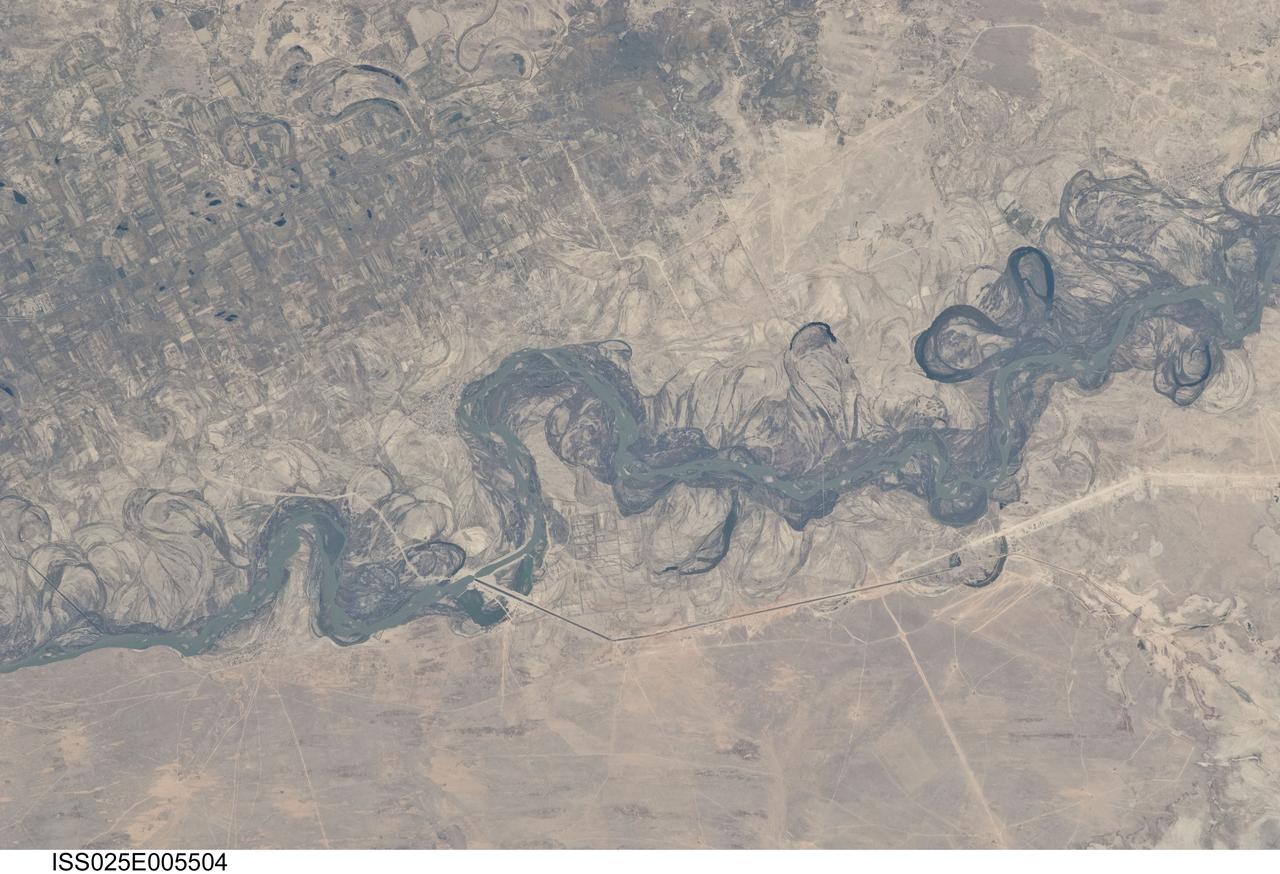
ISS025-E-005504 (30 Sept. 2010) --- Syr Dar’ya River floodplain in Kazakhstan, central Asia is featured in this image photographed by an Expedition 25 crew member on the International Space Station. Central Asia’s most important cotton-growing region is concentrated in the floodplain of the Syr Dar’ya, and is irrigated by water from the river. The floodplain is shown here as a tangle of twisting meanders and loops (center). The darkest areas are brushy vegetation along the present course (filled with blue-green water); wisps of vegetation are also visible along flanking swampy depressions, or sloughs. An older floodplain appears as an area of more diffuse dark vegetation (upper left), where a pattern of relict meander bends is overlain by a rectangular pattern of cotton fields. The straight channel of a new diversion canal—one of sixteen from this point downstream—can be seen along the east bank of the river. The older floodplain area is fed from the Chardara Reservoir immediately upstream (not shown). Half the river flow is controlled from reservoirs, and half from direct water take-off from canals. By contrast with the intensive agricultural use of water shown here, upstream water control in the mountain valleys is oriented more toward power generation. The river flows for a total distance of 2,200 kilometers from the Tien Shan Mountains westward and northwestward to the Aral Sea—the dying waterbody at the low point of the basin far to the northwest. Withdrawals of water from the river for agriculture have continued for many decades. Although the Syr Dar’ya is the second largest river flowing into the sea, its discharge is not very large. As such, it has been easily depleted, with none of its water today reaching the Aral Sea. Control of the river is vested in the Syr Dar’ya Basin Water Organization run by nations with territory in the Syr Dar’ya basin. Some of the organization’s main efforts are accurate gauging of water use along the river course, and repair of canals to reduce widespread water loss by leakage.
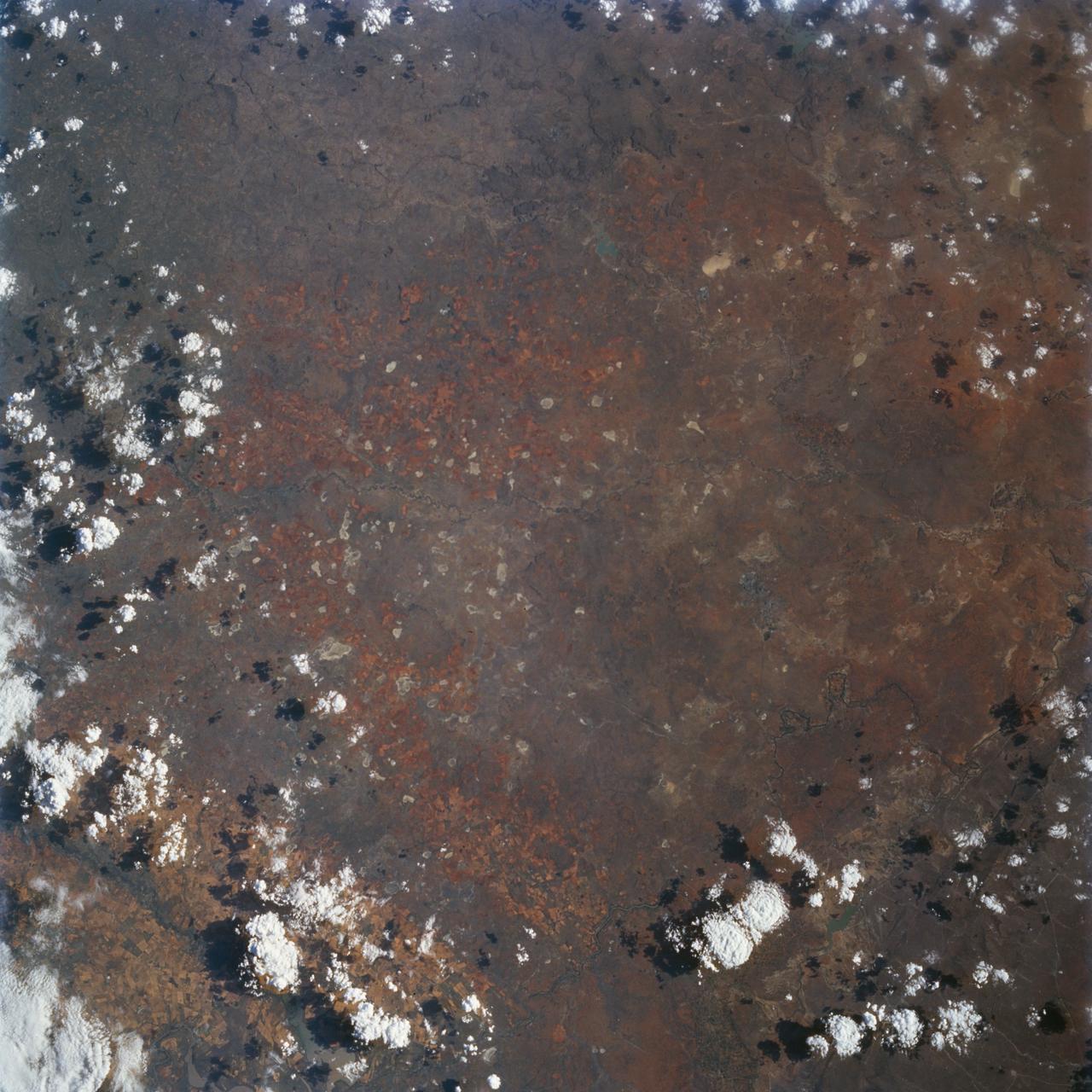
STS072-727-059 (11-20 Jan. 1996) --- Plains of the Orange Free State, South Africa are featured in this 70mm frame exposed from the Space Shuttle Endeavour. If the photograph is oriented with the largest clouds at the top edge, so that the cloud shadows fall to the upper right of each cloud, then north is to the top. The Vaal River flows along the top and through the upper left of the photograph; the reservoir of the Bloemhofdam on the Sand River can be seen between clouds at the upper right of the photograph. Kimberley can be seen as a gray smudge southeast of a contorted set of bends in the Vaal river (upper left center). With high magnification four dark dots, large open-pit mine shafts, can be seen within the gray smudge of the city. Kimberley, the capital of Northern Cape Province, was founded in 1878 after the discovery of diamonds in 1969 - 71, and reached by railway in 1885. Diamond mining and gem cutting remain prominent in the economy. The reddish soil and scattered salt pans (playa lakes) across the plateau suggest the semi-arid climate, suitable for cattle ranching. Reservoirs on most streams now provide water for the towns as well as irrigation for agriculture.
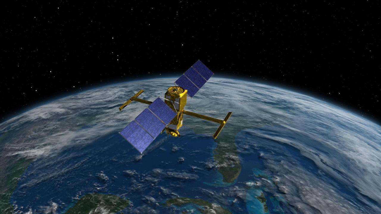
This illustration depicts the Surface Water and Ocean Topography (SWOT) satellite, a mission led by NASA and the French space agency Centre National d'Études Spatiales (CNES). The scientific heart of the SWOT satellite is the Ka-band Radar Interferometer (KaRIn) instrument, which will measure the height of water in Earth's lakes, rivers, reservoirs, and ocean. To do that, KaRIn will transmit radar pulses to Earth's surface and use two antennas – seen to the left and right of the spacecraft bus – to triangulate the return signals that bounce back. Mounted at the ends of a boom 33 feet (10 meters) long, the antennas will collect data over two swaths of Earth's surface at a time, each of them 30 miles (50 kilometers) wide and located on either side of the satellite. KaRIn will operate in two modes: A lower-resolution mode over the ocean will involve significant onboard processing of the data to reduce the volume of information sent during downlinks to Earth; a higher-resolution mode will be used mainly over land. https://photojournal.jpl.nasa.gov/catalog/PIA25621
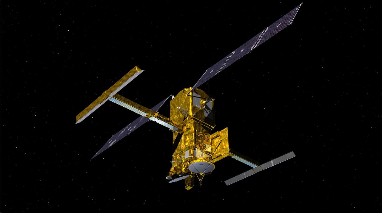
This illustration depicts the Surface Water and Ocean Topography satellite, a mission led by NASA and the French space agency Centre National d'Études Spatiales (CNES). The scientific heart of the SWOT satellite is the Ka-band Radar Interferometer (KaRIn) instrument, which will measure the height of water in Earth's lakes, rivers, reservoirs, and ocean. To do that, KaRIn will transmit radar pulses to Earth's surface and use two antennas – seen to the left and right of the spacecraft bus – to triangulate the return signals that bounce back. Mounted at the ends of a boom 33 feet (10 meters) long, the antennas will collect data over two swaths of Earth's surface at a time, each of them 30 miles (50 kilometers) wide and located on either side of the satellite. KaRIn will operate in two modes: A lower-resolution mode over the ocean will involve significant onboard processing of the data to reduce the volume of information sent during downlinks to Earth; a higher-resolution mode will be used mainly over land. https://photojournal.jpl.nasa.gov/catalog/PIA24530
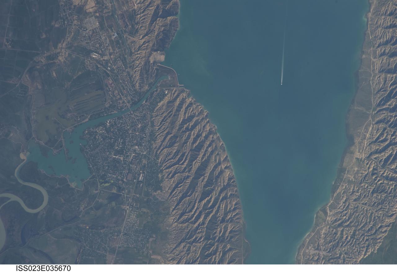
ISS023-E-035670 (8 May 2010) --- Mingachevir Reservoir, Azerbaijan is featured in this image photographed by an Expedition 23 crew member on the International Space Station. This detailed photograph highlights the southern Mingachevir Reservoir located in north-central Azerbaijan. The Mingachevir Reservoir occupies part of the Kura Basin, a topographic depression located between the Greater Caucasus Mountains to the northeast and the Lesser Caucasus Mountains to the southwest. According to scientists, folded layers of relatively young (less than 5.3 million years old) sedimentary rock, explosive volcanic products (ash and tuff), and unconsolidated sediments form the gray hills along the northern and southern shorelines of the reservoir (center and right). Afternoon sun highlights distinctive parallel patterns in the hills that are the result of water and wind erosion of different stratigraphic layers exposed at the surface. The nearby city of Mingachevir (left) is split by the Kur River after it passes through the dam and hydroelectric power station complex at top center. The current city was built in support of the hydroelectric power station constructed as part of the then Soviet Union?s energy infrastructure for the region. Today, Mingachevir is the fourth largest city in Azerbaijan (by population) and has become a cultural and economic center of the country. The reservoir held approximately 15 billion cubic meters of water at the time this image was taken, with a total engineered capacity of 16 billion cubic meters. The width of the reservoir illustrated here is approximately 8 kilometers; a jet flying over the reservoir and its contrail are visible midway between the opposing shorelines.

AS09-26A-3743A (9 March 1969) --- Color infrared photograph of the Yazoo River Valley, Pearl River, Pearl River Reservoir, and Jackson, Mississippi, area, taken on March 9, 1969, by one of the four synchronized cameras of the Apollo 9 Earth Resources Survey SO65 Experiment. At 1:08 p.m. (EST) when this photograph was made the Apollo 9 spacecraft was at an altitude of 105 nautical miles, and the sun elevation was at 55 degrees above the horizon. The location of the point on Earth's surface at which the four-camera combination was aimed was 32 degrees 34 minutes north latitude, and 89 degrees 57 minutes west longitude. The other three cameras used: (B) black and white film with a red filter; (C) black and white infrared film; and (D) black and white film with a green filter.
The Surface Water and Ocean Topography (SWOT) satellite arrives at Vandenberg Space Force Base in California on Oct. 16, 2022. SWOT is the first mission that will observe nearly all water on Earth’s surface, measuring the height of water in the planet’s lakes, rivers, reservoirs, and the ocean. The satellite is set to launch aboard a SpaceX Falcon 9 rocket in December from Vandenberg’s Space Launch Center-4 East. NASA’s Launch Services Program, based at the agency’s Kennedy Space Center in Florida, is managing the launch service.
By August, 2024, the four dams blocking the flow of the Klamath River in California and Oregon were removed. After more than 100 years, nearly 640 km of salmon habitat were restored. Two of the dams and their reservoirs, Copco 1 and Copco 2 in northern California, are shown before and after removal. The images were acquired July 18, 2024 and August 15, 2020, cover an area of 16.5 by 22.5 km, and are located at 42.1 degrees north, 122.2 degrees west. https://photojournal.jpl.nasa.gov/catalog/PIA26448
The ground service equipment for the Surface Water and Ocean Topography (SWOT) satellite arrives at Vandenberg Space Force Base in California on Oct. 13, 2022. SWOT is the first mission that will observe nearly all water on Earth’s surface, measuring the height of water in the planet’s lakes, rivers, reservoirs, and the ocean. The satellite is set to launch aboard a SpaceX Falcon 9 rocket in December from Vandenberg’s Space Launch Center-4 East. NASA’s Launch Services Program, based at the agency’s Kennedy Space Center in Florida, is managing the launch service.
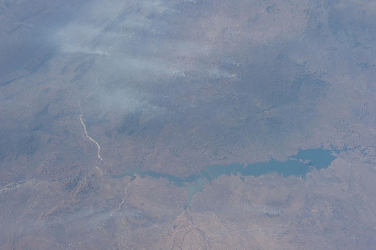
ISS028-E-018657 (23 July 2011) --? One of the Expedition 28 crew members aboard the International Space Station photographed this northward looking view featuring the reservoir of Cahora Bassa in extreme western Mozambique, formed by damming the Zambezi River. Also visible are numerous plumes from fires in the wooded plateau region north of the lake on the Mozambique-Zambia frontier.
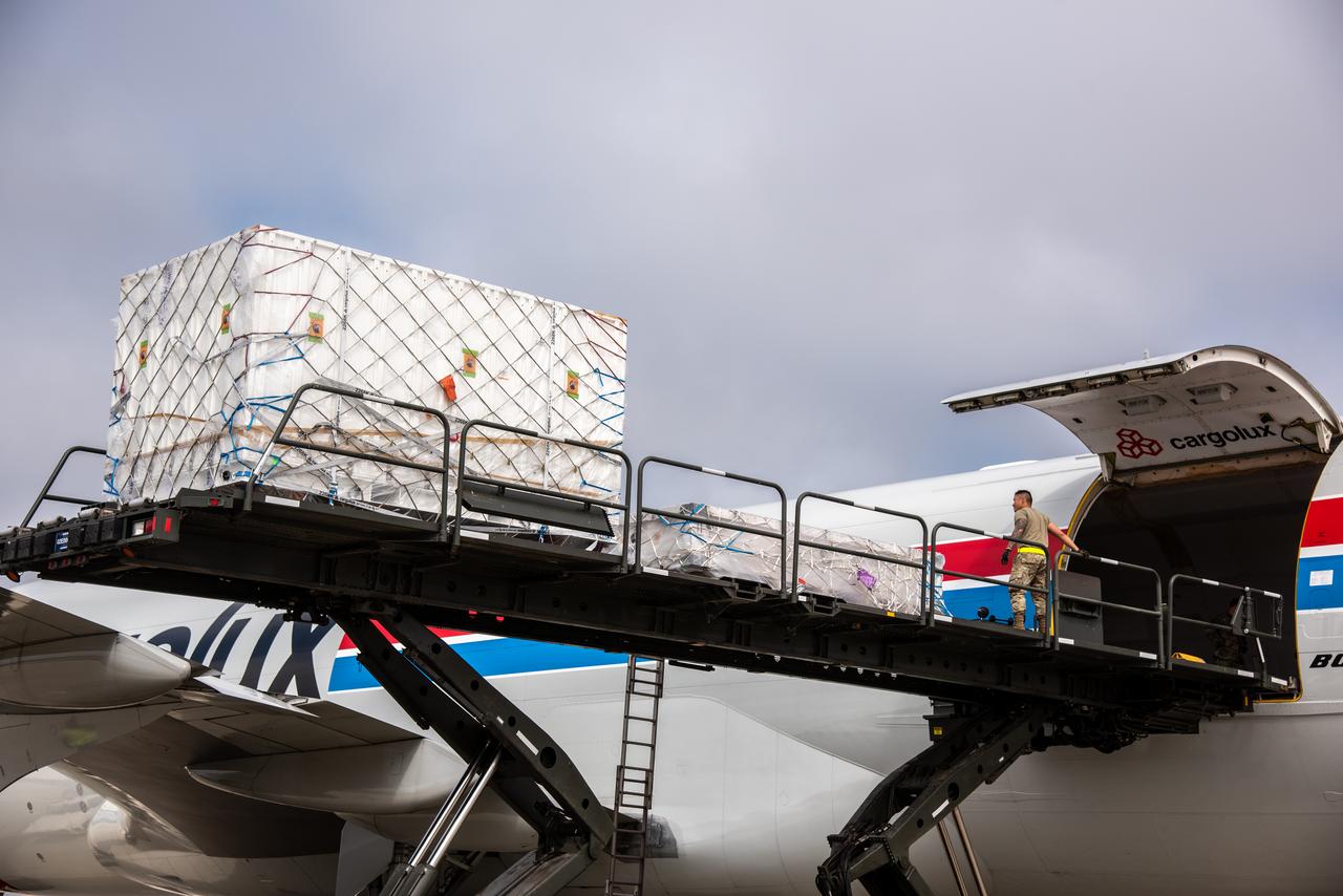
The ground service equipment for the Surface Water and Ocean Topography (SWOT) satellite arrives at Vandenberg Space Force Base in California on Oct. 13, 2022. SWOT is the first mission that will observe nearly all water on Earth’s surface, measuring the height of water in the planet’s lakes, rivers, reservoirs, and the ocean. The satellite is set to launch aboard a SpaceX Falcon 9 rocket in December from Vandenberg’s Space Launch Center-4 East. NASA’s Launch Services Program, based at the agency’s Kennedy Space Center in Florida, is managing the launch service.
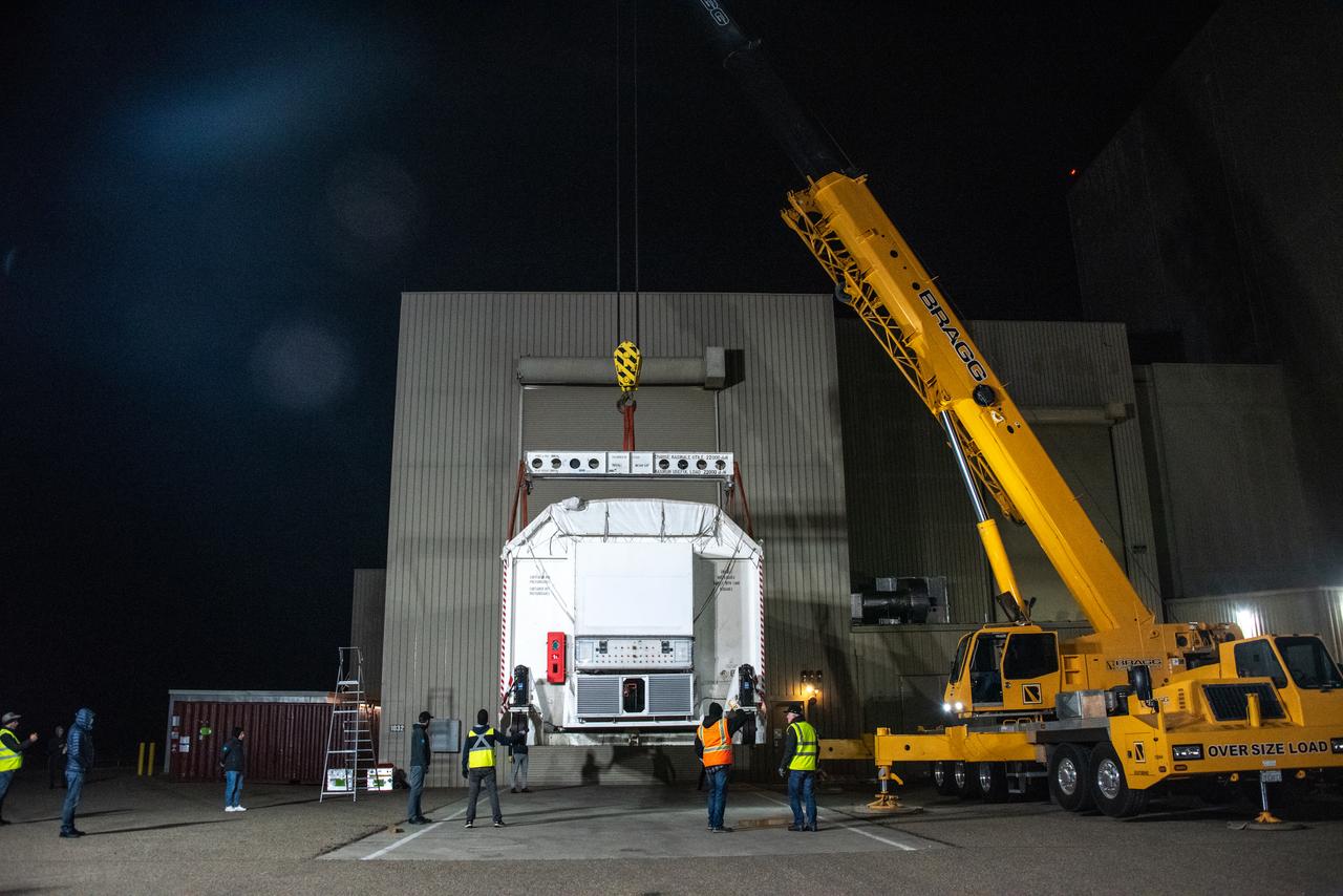
The Surface Water and Ocean Topography (SWOT) satellite arrives at Vandenberg Space Force Base in California on Oct. 16, 2022. SWOT is the first mission that will observe nearly all water on Earth’s surface, measuring the height of water in the planet’s lakes, rivers, reservoirs, and the ocean. The satellite is set to launch aboard a SpaceX Falcon 9 rocket in December from Vandenberg’s Space Launch Center-4 East. NASA’s Launch Services Program, based at the agency’s Kennedy Space Center in Florida, is managing the launch service.
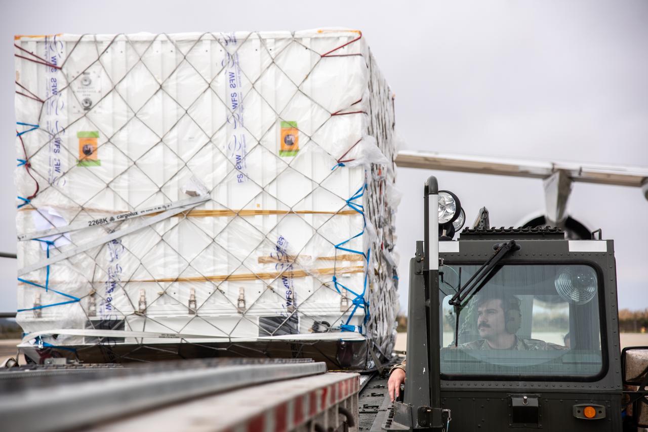
The ground service equipment for the Surface Water and Ocean Topography (SWOT) satellite arrives at Vandenberg Space Force Base in California on Oct. 13, 2022. SWOT is the first mission that will observe nearly all water on Earth’s surface, measuring the height of water in the planet’s lakes, rivers, reservoirs, and the ocean. The satellite is set to launch aboard a SpaceX Falcon 9 rocket in December from Vandenberg’s Space Launch Center-4 East. NASA’s Launch Services Program, based at the agency’s Kennedy Space Center in Florida, is managing the launch service.
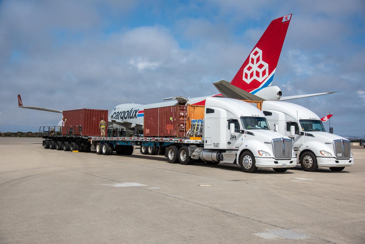
The ground service equipment for the Surface Water and Ocean Topography (SWOT) satellite arrives at Vandenberg Space Force Base in California on Oct. 13, 2022. SWOT is the first mission that will observe nearly all water on Earth’s surface, measuring the height of water in the planet’s lakes, rivers, reservoirs, and the ocean. The satellite is set to launch aboard a SpaceX Falcon 9 rocket in December from Vandenberg’s Space Launch Center-4 East. NASA’s Launch Services Program, based at the agency’s Kennedy Space Center in Florida, is managing the launch service.

The Surface Water and Ocean Topography (SWOT) satellite arrives at Vandenberg Space Force Base in California on Oct. 16, 2022. SWOT is the first mission that will observe nearly all water on Earth’s surface, measuring the height of water in the planet’s lakes, rivers, reservoirs, and the ocean. The satellite is set to launch aboard a SpaceX Falcon 9 rocket in December from Vandenberg’s Space Launch Center-4 East. NASA’s Launch Services Program, based at the agency’s Kennedy Space Center in Florida, is managing the launch service.
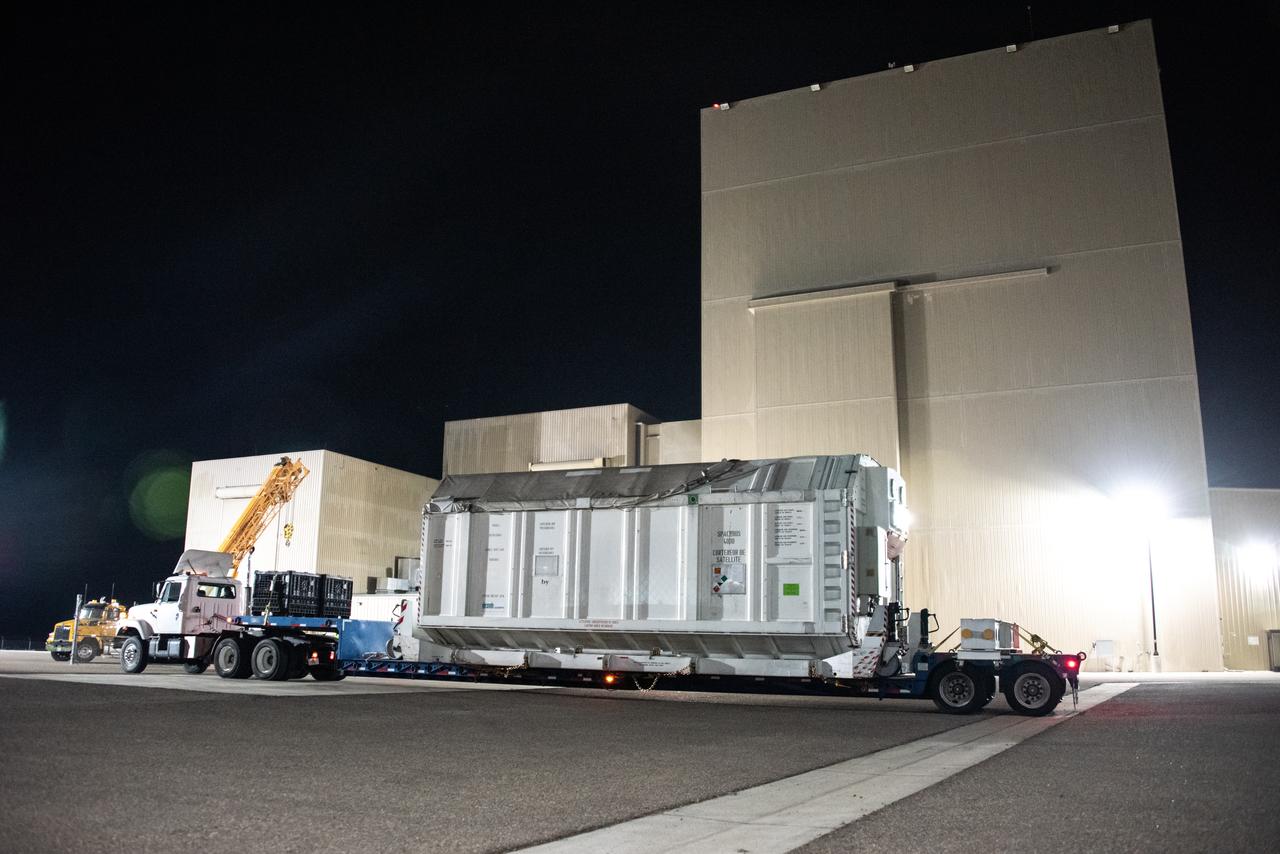
The ground service equipment for the Surface Water and Ocean Topography (SWOT) satellite arrives at Vandenberg Space Force Base in California on Oct. 13, 2022. SWOT is the first mission that will observe nearly all water on Earth’s surface, measuring the height of water in the planet’s lakes, rivers, reservoirs, and the ocean. The satellite is set to launch aboard a SpaceX Falcon 9 rocket in December from Vandenberg’s Space Launch Center-4 East. NASA’s Launch Services Program, based at the agency’s Kennedy Space Center in Florida, is managing the launch service.
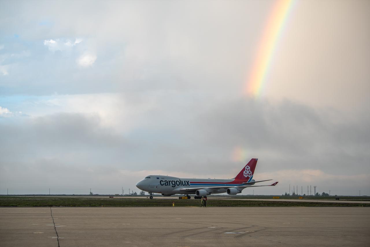
The Surface Water and Ocean Topography (SWOT) satellite arrives at Vandenberg Space Force Base in California on Oct. 16, 2022. SWOT is the first mission that will observe nearly all water on Earth’s surface, measuring the height of water in the planet’s lakes, rivers, reservoirs, and the ocean. The satellite is set to launch aboard a SpaceX Falcon 9 rocket in December from Vandenberg’s Space Launch Center-4 East. NASA’s Launch Services Program, based at the agency’s Kennedy Space Center in Florida, is managing the launch service.
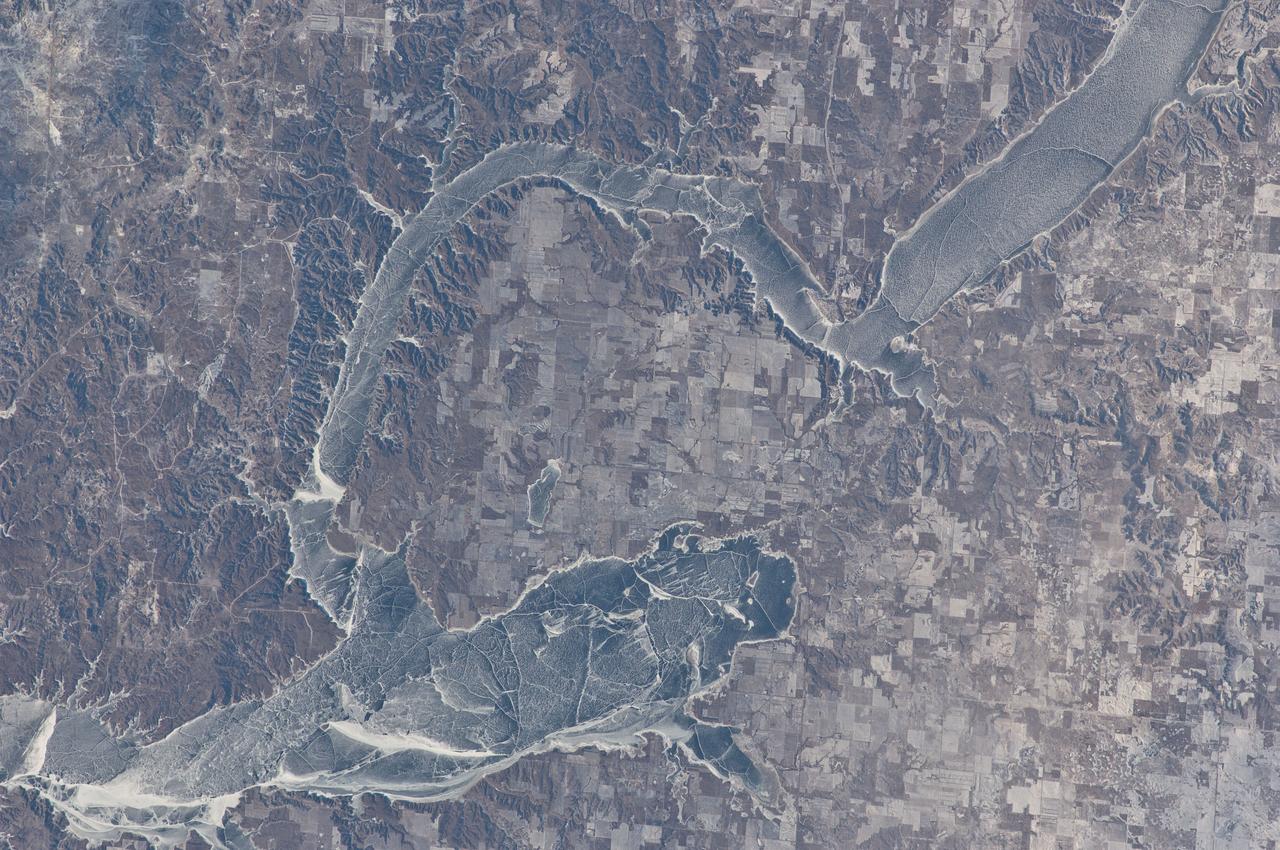
ISS030-E-059433 (19 Jan. 2012) --- Ice cover on Lake Sakakawea in North Dakota is featured in this image photographed by an Expedition 30 crew member on the International Space Station. This striking photograph illustrates the harsh winter conditions frequently experienced in North Dakota. Ice covers the surface of northwestern Lake Sakakawea, a reservoir on the Missouri River in west-central North Dakota. A local weather station near New Town, ND reported an air temperature of approximately -24 °C (-11 °F), with a wind chill of approximately -32 °C (-25 °F) at 10:36 local time – six minutes before the image was taken. In addition to the grey ice on the lake, a dusting of white snow highlights agricultural fields to the north and northeast, as well as fissures and irregularities in the ice surfaces. For a sense of scale, the arms of the lake to either side of New Town are approximately 10 kilometers (6 miles) apart. Lake Sakakawea is named—in the Hidatsa language—for the Shoshone woman generally known as Sacagawea, or “Bird Woman”. She accompanied the Lewis and Clark Expedition in 1805–1806 as an interpreter and guide. The lake was created following the completion of Garrison Dam (not shown) on the Missouri River in 1954. With a surface area of approximately 148,924 hectares (368,000 acres) and length of 286 kilometers (178 miles), Lake Sakakawea is one of the largest artificial reservoirs in the USA.
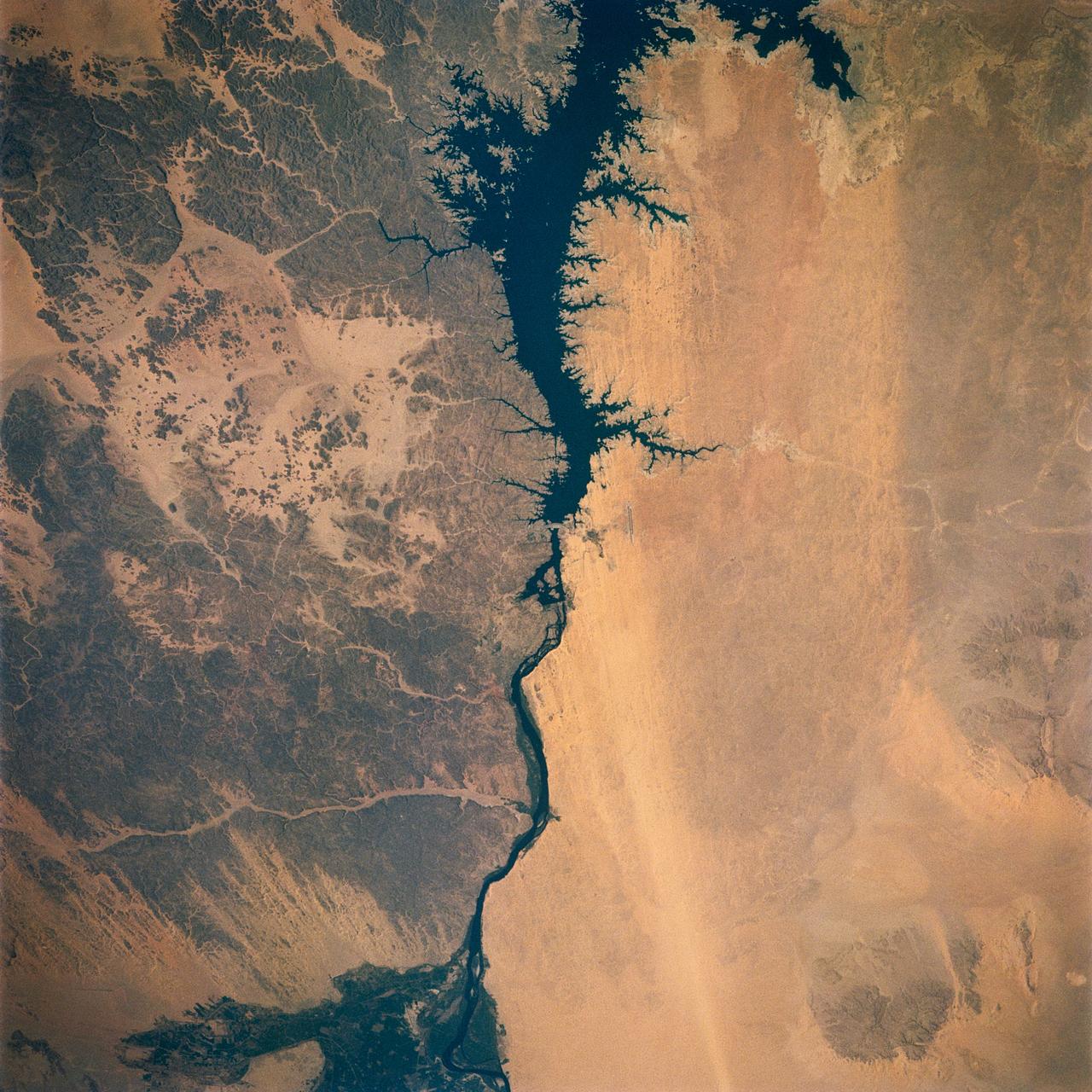
Egypt's High Aswan Dam on the Nile River at the first cataracts, Nile River, (24.0N, 33.0E) was completed in 1971 to provide cheap hydroelectric power and to regulate the historically uneven flow of the Nile River. The contrast between the largely base rock desert east of the Nile versus the sand covered desert west of the river and the ancient irrigated floodplain downstream from the damsite is clearly shown.
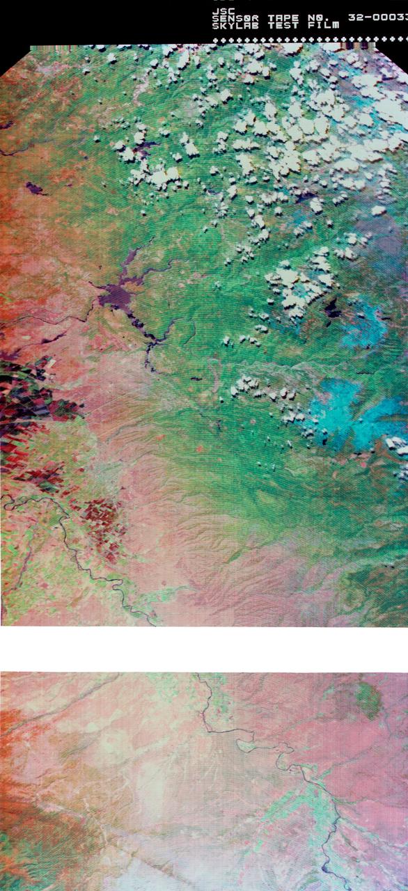
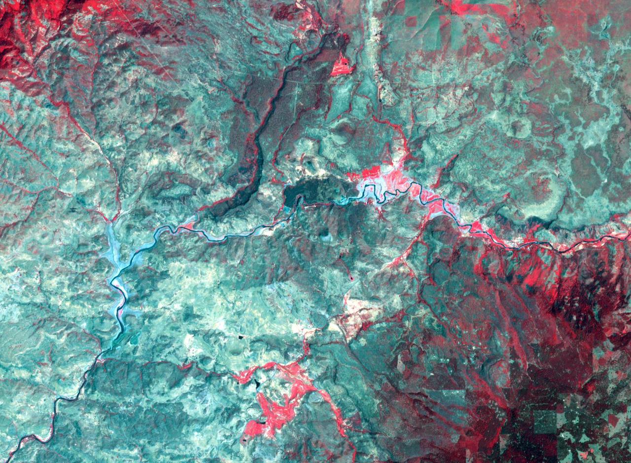
S73-34295A (June 1973) --- A vertical view of a portion of northern California reproduced from data taken from the Skylab Multispectral Scanner, experiment S192, in the Skylab space station in Earth orbit. This view is the most westerly one-third of Frame No. 001, Roll No. 518, S192, Skylab 2. Frame No. 001 extends from the Pacific coast at the Eureka area southeasterly 175 nautical miles to the Feather River drainage basin. Included in this view are Sacramento River Valley, Oroville Reservoir, Oroville and Chico. This non-photographic image is a color composite of channels 2 (visible), 7 and 12 (infrared) from the Earth Resources Experiments Package (EREP) S192 scanner. The scanner techniques assist with spectral signature identification and mapping of ground truth targets in agriculture, forestry, geology, hydrology and oceanography. Photo credit: NASA

ISS038-E-023651 (26 Dec. 2013) --- Lake Sharpe near Lower Brule, South Dakota is featured in this image photographed by an Expedition 38 crew member on the International Space Station. The Missouri River rises in the Rocky Mountains of western Montana, and flows generally to the southeast for approximately 3,767 kilometers (2,341 miles) to its confluence with the Mississippi River north of St. Louis, Missouri -- making it the longest river in North America. The river does not follow a straight southeasterly course along this distance, but includes may meander bends such as illustrated in this photograph. This particular bend is occupied by Lake Sharpe, an approximately 130-kilometer (80 miles) long reservoir formed behind the Big Bend Dam on the Missouri River. The lake surface is frozen and covered with snow, presenting a uniform white appearance in the image. As meander bends develop, they tend to assume a distinctive U-shape when viewed from above. Over time, the river channel can continue to cut into the ends of the "U", eventually bringing them so close together that the river then cuts across the gap to achieve a shorter flow path, essentially short-circuiting or cutting off the meander bend. When this happens and the meander ceases to be part of the active river channel, it may become an oxbow lake. The distance across the narrow neck of land (lower right) associated with this meander near Lower Brule, South Dakota is approximately one kilometer (0.62 miles); however, as the river flow is controlled by the Big Bend Dam downstream, the natural process of meander cutoff has been significantly slowed. The snow cover also highlights circular agricultural fields on the small peninsula within the meander bend. This type of field indicates center-pivot irrigation, where water is distributed from a central point radially outwards using sprinklers to cover the field area. Crops grown here include corn and soybeans according to data from the US Department of Agriculture's CropScape database.
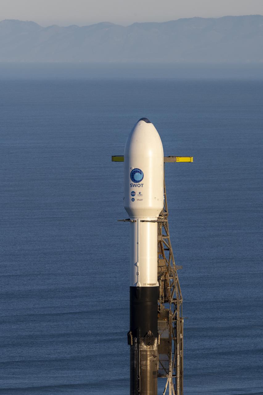
A SpaceX Falcon 9 rocket with the Surface Water and Ocean Topography (SWOT) spacecraft onboard is seen as preparations for launch continue, Wednesday, Dec. 14, 2022, at Space Launch Complex 4E at Vandenberg Space Force Base in California. Jointly developed by NASA and Centre National D'Etudes Spatiales (CNES), with contributions from the Canadian Space Agency (CSA) and United Kingdom Space Agency, SWOT is the first satellite mission that will observe nearly all water on Earth’s surface, measuring the height of water in the planet’s lakes, rivers, reservoirs, and the ocean. Photo Credit: (NASA/Keegan Barber)
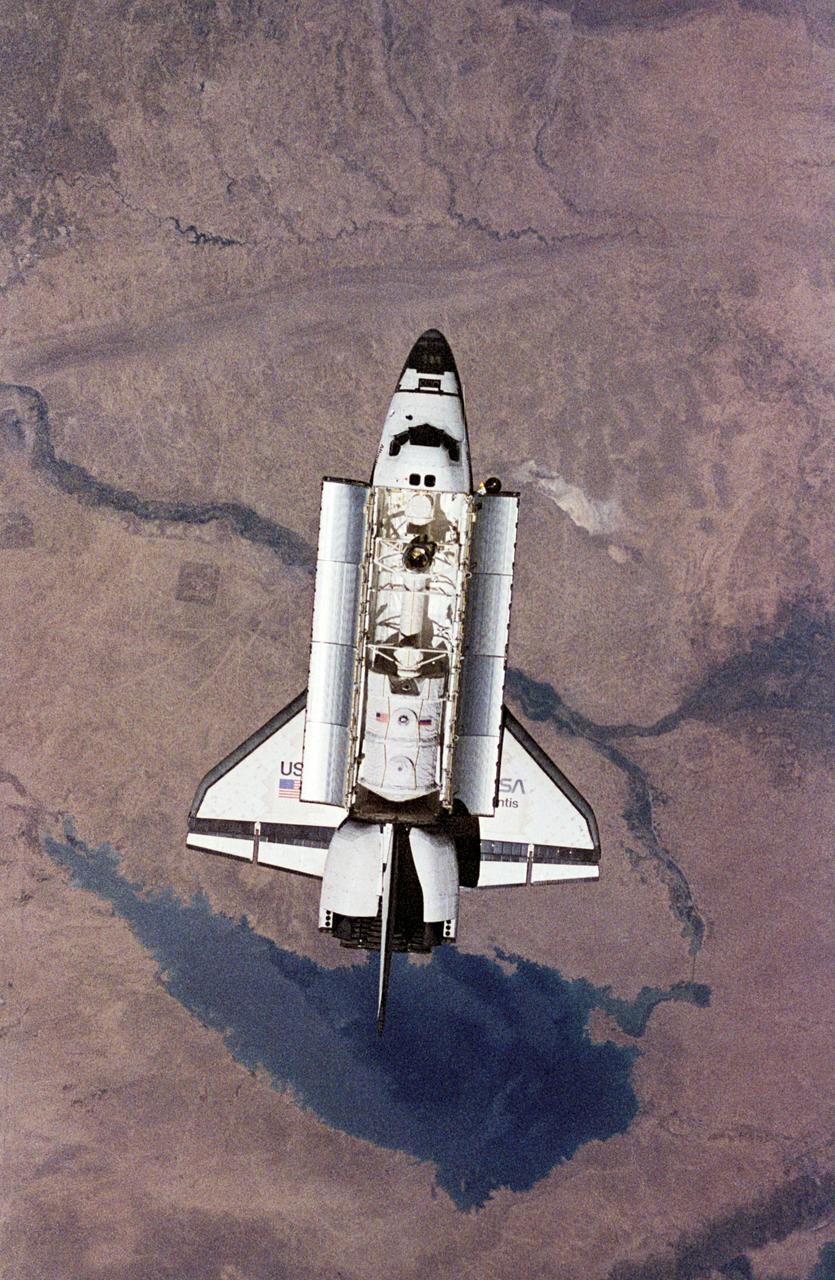
NM18-309-018 (28 June 1995) --- The Space Shuttle Atlantis orbits Earth at a point above Iraq as photographed by one of the Mir-18 crew members aboard Russia's Mir Space Station. The image was photographed prior to rendezvous and docking of the two spacecraft. The Spacelab science module and the tunnel connecting it to the crew cabin, as well as the added mechanism for interface with the Mir's docking system can be easily seen. The geography pictured is 60 miles northwest of Baghdad. The Buhayrat Ath Tharthar (reservoir) is the widest body of water visible. Also seen are the Tigris and Euphrates Rivers.
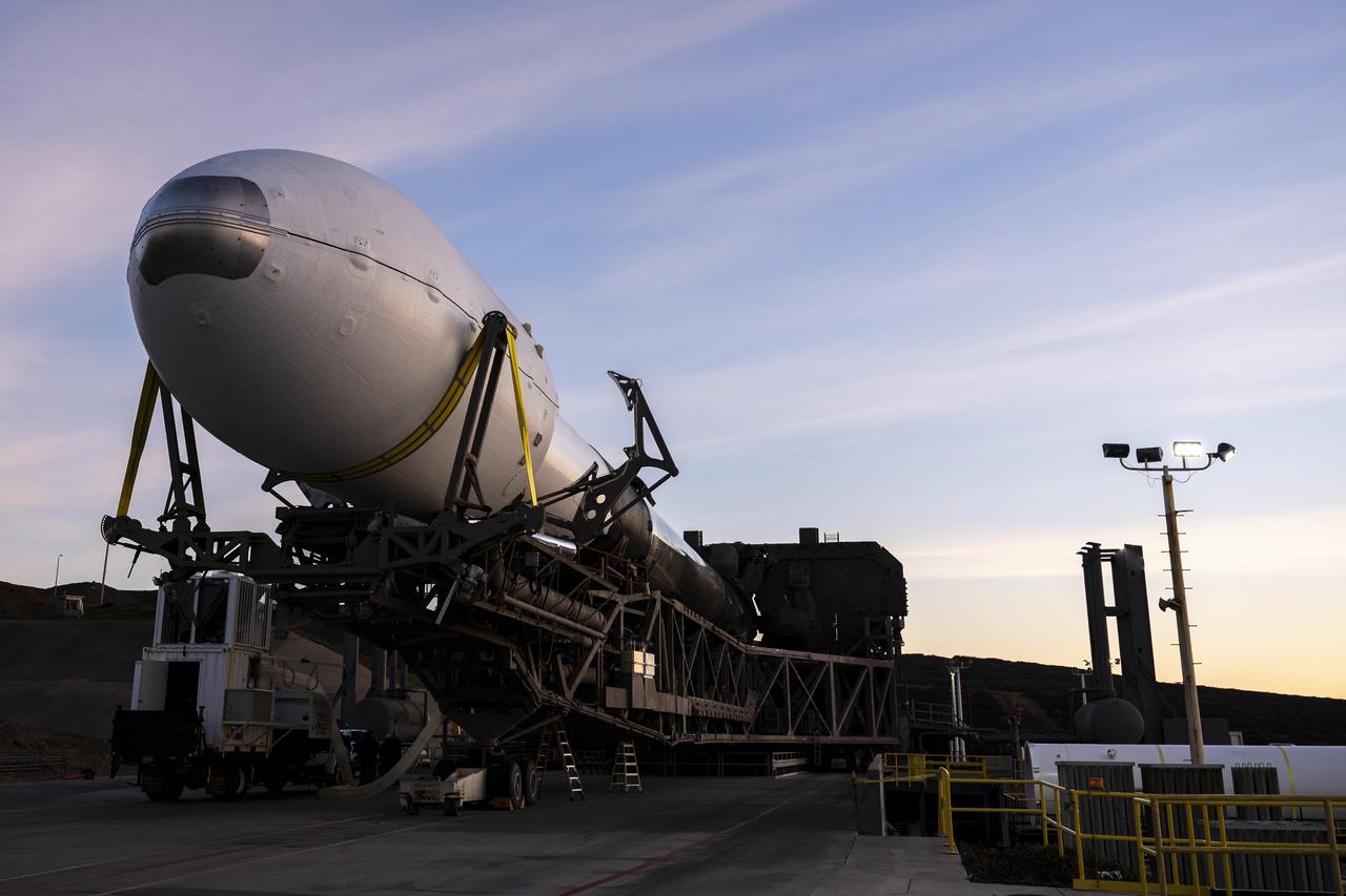
A SpaceX Falcon 9 rocket with the Surface Water and Ocean Topography (SWOT) spacecraft onboard is seen as it rolls out to the pad, Tuesday, Dec. 13, 2022, at Space Launch Complex 4E at Vandenberg Space Force Base in California. Jointly developed by NASA and Centre National D'Etudes Spatiales (CNES), with contributions from the Canadian Space Agency (CSA) and United Kingdom Space Agency, SWOT is the first satellite mission that will observe nearly all water on Earth’s surface, measuring the height of water in the planet’s lakes, rivers, reservoirs, and the ocean. Photo Credit: (NASA/Keegan Barber)
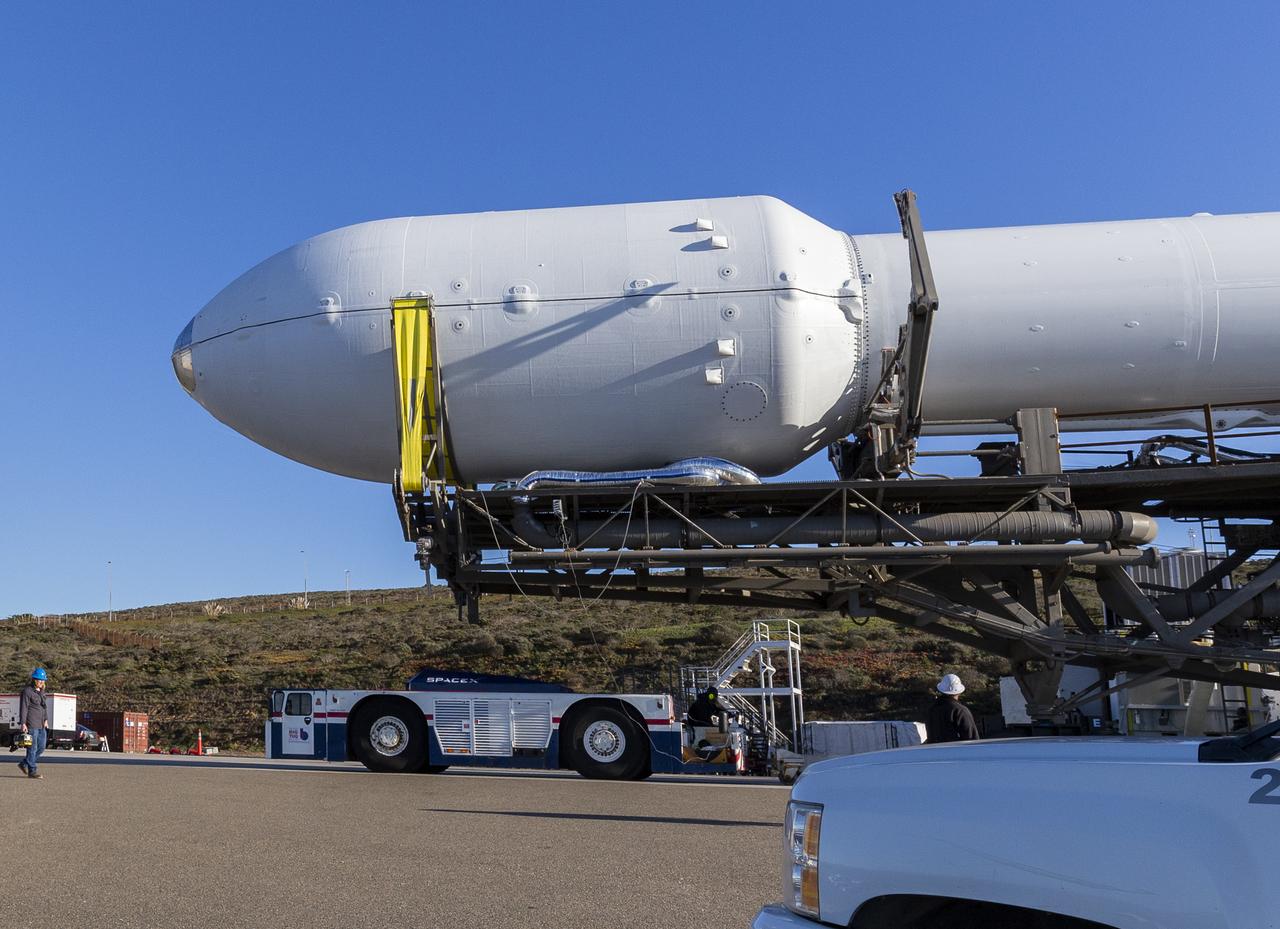
A SpaceX Falcon 9 rocket with the Surface Water and Ocean Topography (SWOT) spacecraft onboard is seen as it rolls out to the pad, Tuesday, Dec. 13, 2022, at Space Launch Complex 4E at Vandenberg Space Force Base in California. Jointly developed by NASA and Centre National D'Etudes Spatiales (CNES), with contributions from the Canadian Space Agency (CSA) and United Kingdom Space Agency, SWOT is the first satellite mission that will observe nearly all water on Earth’s surface, measuring the height of water in the planet’s lakes, rivers, reservoirs, and the ocean. Photo Credit: (NASA/Keegan Barber)
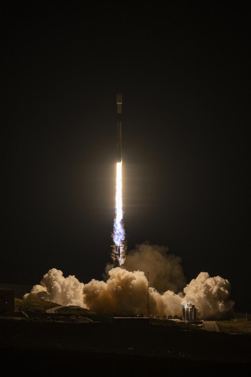
A SpaceX Falcon 9 rocket launches with the Surface Water and Ocean Topography (SWOT) spacecraft onboard, Friday, Dec. 16, 2022, from Space Launch Complex 4E at Vandenberg Space Force Base in California. Jointly developed by NASA and Centre National D'Etudes Spatiales (CNES), with contributions from the Canadian Space Agency (CSA) and United Kingdom Space Agency, SWOT is the first satellite mission that will observe nearly all water on Earth’s surface, measuring the height of water in the planet’s lakes, rivers, reservoirs, and the ocean. Photo Credit: (NASA/Keegan Barber)
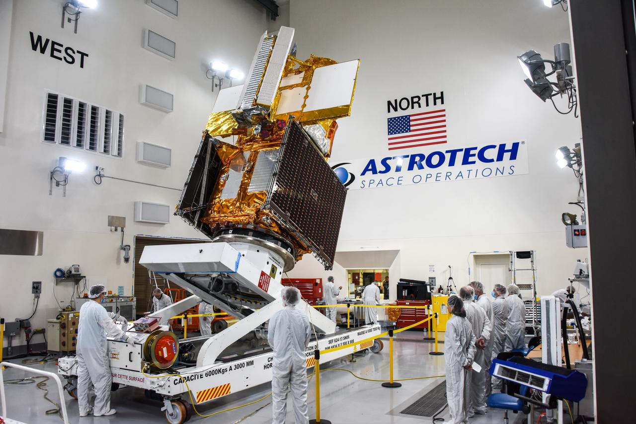
The Surface Water and Ocean Topography (SWOT) spacecraft is moved into a transport container inside the Astrotech facility at Vandenberg Space Force Base in California on Nov. 18, 2022. The satellite will be transported to the SpaceX facility at Vandenberg. SWOT is the first mission that will observe nearly all water on Earth’s surface, measuring the height of water in the planet’s lakes, rivers, reservoirs, and the ocean. It is set to launch aboard a SpaceX Falcon 9 rocket in December from Vandenberg’s Space Launch Center-4 East. NASA’s Launch Services Program, based at the agency’s Kennedy Space Center in Florida, is managing the launch service.
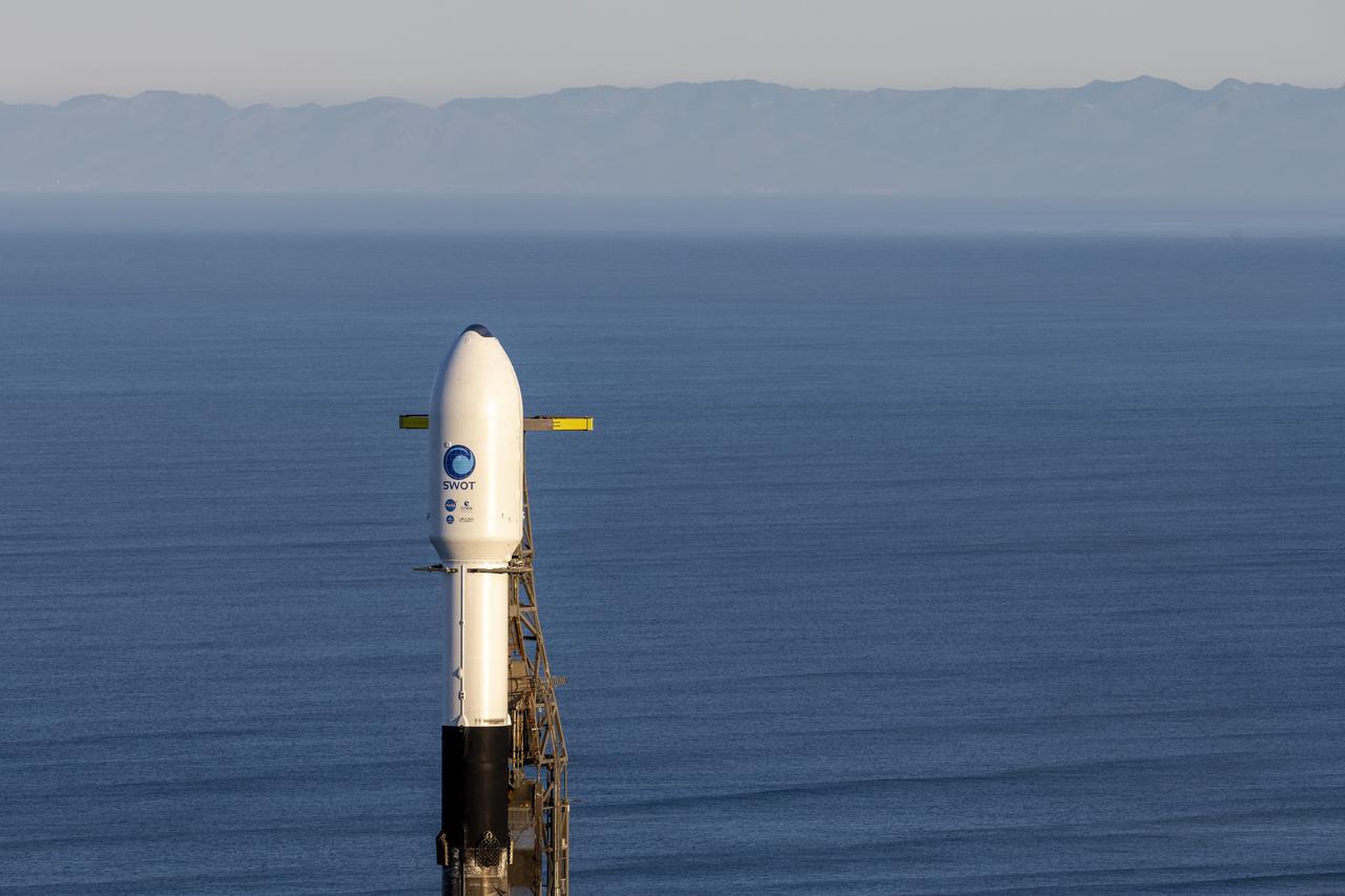
A SpaceX Falcon 9 rocket with the Surface Water and Ocean Topography (SWOT) spacecraft onboard is seen as preparations for launch continue, Wednesday, Dec. 14, 2022, at Space Launch Complex 4E at Vandenberg Space Force Base in California. Jointly developed by NASA and Centre National D'Etudes Spatiales (CNES), with contributions from the Canadian Space Agency (CSA) and United Kingdom Space Agency, SWOT is the first satellite mission that will observe nearly all water on Earth’s surface, measuring the height of water in the planet’s lakes, rivers, reservoirs, and the ocean. Photo Credit: (NASA/Keegan Barber)
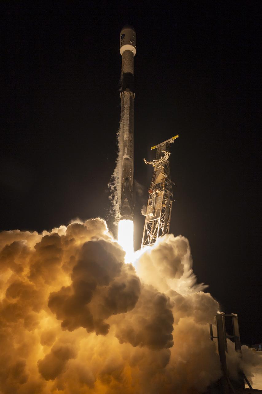
A SpaceX Falcon 9 rocket launches with the Surface Water and Ocean Topography (SWOT) spacecraft onboard, Friday, Dec. 16, 2022, from Space Launch Complex 4E at Vandenberg Space Force Base in California. Jointly developed by NASA and Centre National D'Etudes Spatiales (CNES), with contributions from the Canadian Space Agency (CSA) and United Kingdom Space Agency, SWOT is the first satellite mission that will observe nearly all water on Earth’s surface, measuring the height of water in the planet’s lakes, rivers, reservoirs, and the ocean. Photo Credit: (NASA/Keegan Barber)
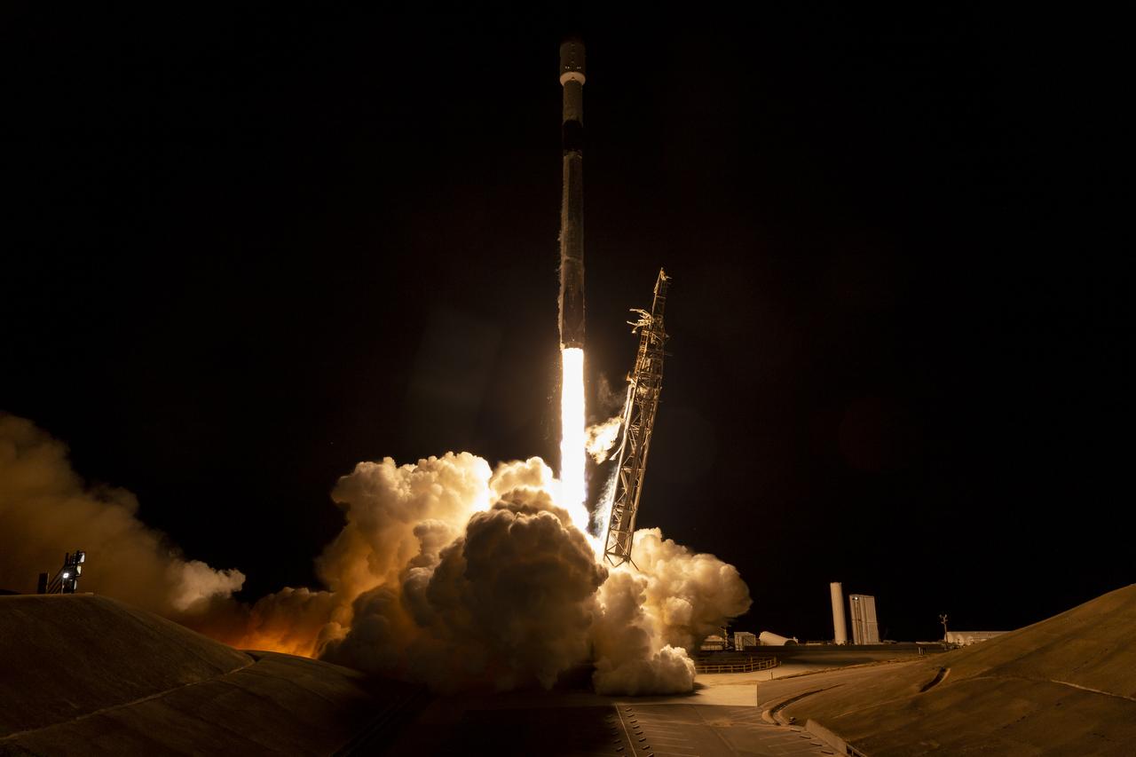
A SpaceX Falcon 9 rocket launches with the Surface Water and Ocean Topography (SWOT) spacecraft onboard, Friday, Dec. 16, 2022, from Space Launch Complex 4E at Vandenberg Space Force Base in California. Jointly developed by NASA and Centre National D'Etudes Spatiales (CNES), with contributions from the Canadian Space Agency (CSA) and United Kingdom Space Agency, SWOT is the first satellite mission that will observe nearly all water on Earth’s surface, measuring the height of water in the planet’s lakes, rivers, reservoirs, and the ocean. Photo Credit: (NASA/Keegan Barber)
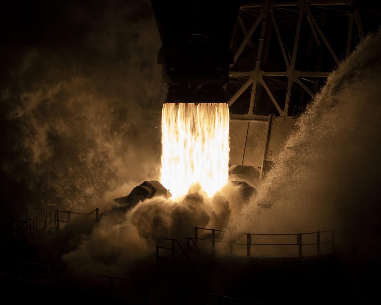
A SpaceX Falcon 9 rocket launches with the Surface Water and Ocean Topography (SWOT) spacecraft onboard, Friday, Dec. 16, 2022, from Space Launch Complex 4E at Vandenberg Space Force Base in California. Jointly developed by NASA and Centre National D'Etudes Spatiales (CNES), with contributions from the Canadian Space Agency (CSA) and United Kingdom Space Agency, SWOT is the first satellite mission that will observe nearly all water on Earth’s surface, measuring the height of water in the planet’s lakes, rivers, reservoirs, and the ocean. Photo Credit: (NASA/Keegan Barber)
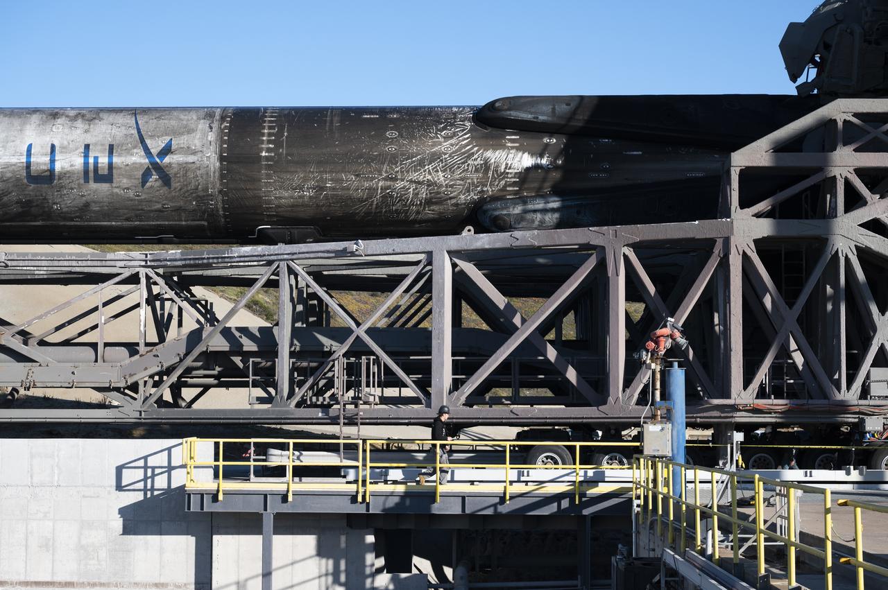
A SpaceX Falcon 9 rocket with the Surface Water and Ocean Topography (SWOT) spacecraft onboard is seen as it rolls out to the pad, Tuesday, Dec. 13, 2022, at Space Launch Complex 4E at Vandenberg Space Force Base in California. Jointly developed by NASA and Centre National D'Etudes Spatiales (CNES), with contributions from the Canadian Space Agency (CSA) and United Kingdom Space Agency, SWOT is the first satellite mission that will observe nearly all water on Earth’s surface, measuring the height of water in the planet’s lakes, rivers, reservoirs, and the ocean. Photo Credit: (NASA/Keegan Barber)
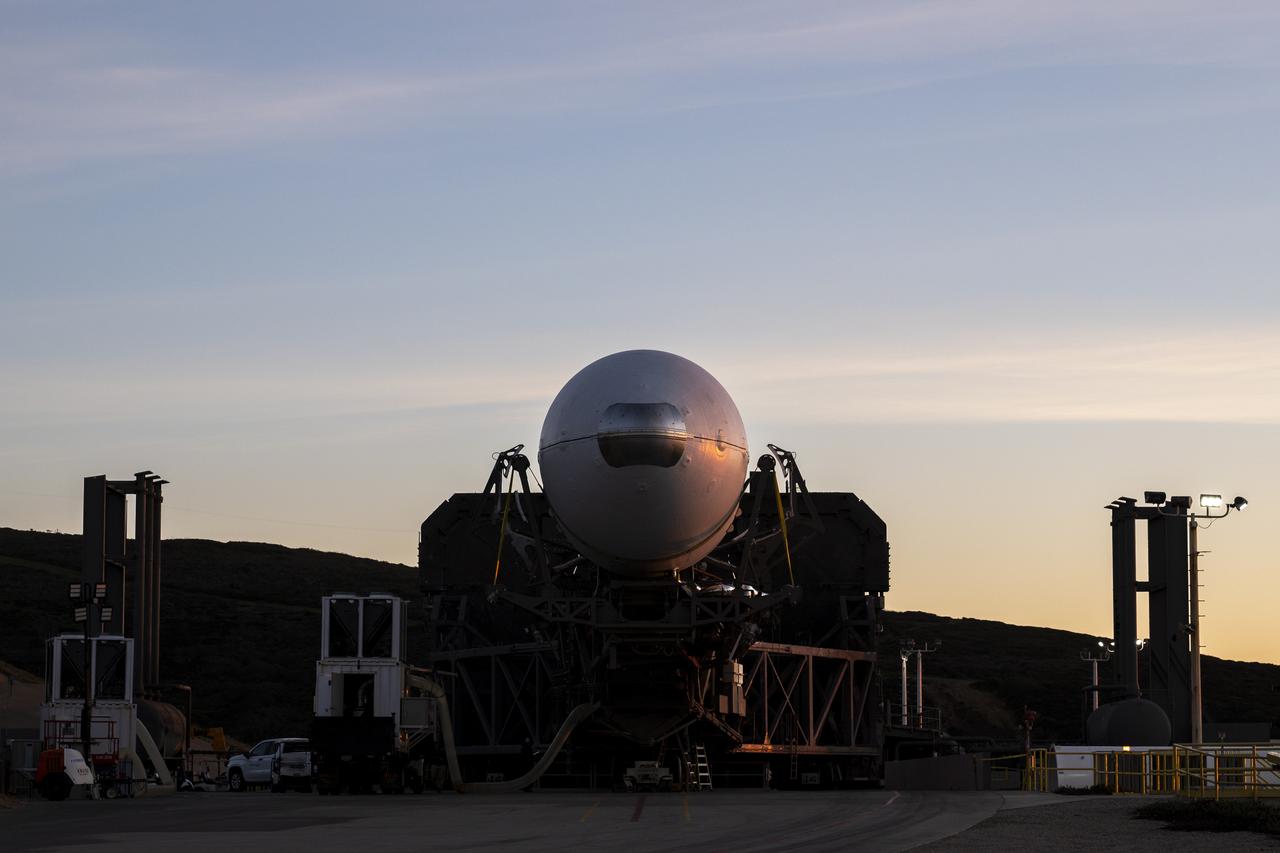
A SpaceX Falcon 9 rocket with the Surface Water and Ocean Topography (SWOT) spacecraft onboard is seen as it rolls out to the pad, Tuesday, Dec. 13, 2022, at Space Launch Complex 4E at Vandenberg Space Force Base in California. Jointly developed by NASA and Centre National D'Etudes Spatiales (CNES), with contributions from the Canadian Space Agency (CSA) and United Kingdom Space Agency, SWOT is the first satellite mission that will observe nearly all water on Earth’s surface, measuring the height of water in the planet’s lakes, rivers, reservoirs, and the ocean. Photo Credit: (NASA/Keegan Barber)

A container, with the Surface Water and Ocean Topography (SWOT) spacecraft inside, is moved to a trailer at the Astrotech facility at Vandenberg Space Force Base in California on Nov. 19, 2022. The satellite will be transported to the SpaceX facility at Vandenberg. SWOT is the first mission that will observe nearly all water on Earth’s surface, measuring the height of water in the planet’s lakes, rivers, reservoirs, and the ocean. It is set to launch aboard a SpaceX Falcon 9 rocket in December from Vandenberg’s Space Launch Center-4 East. NASA’s Launch Services Program, based at the agency’s Kennedy Space Center in Florida, is managing the launch service.
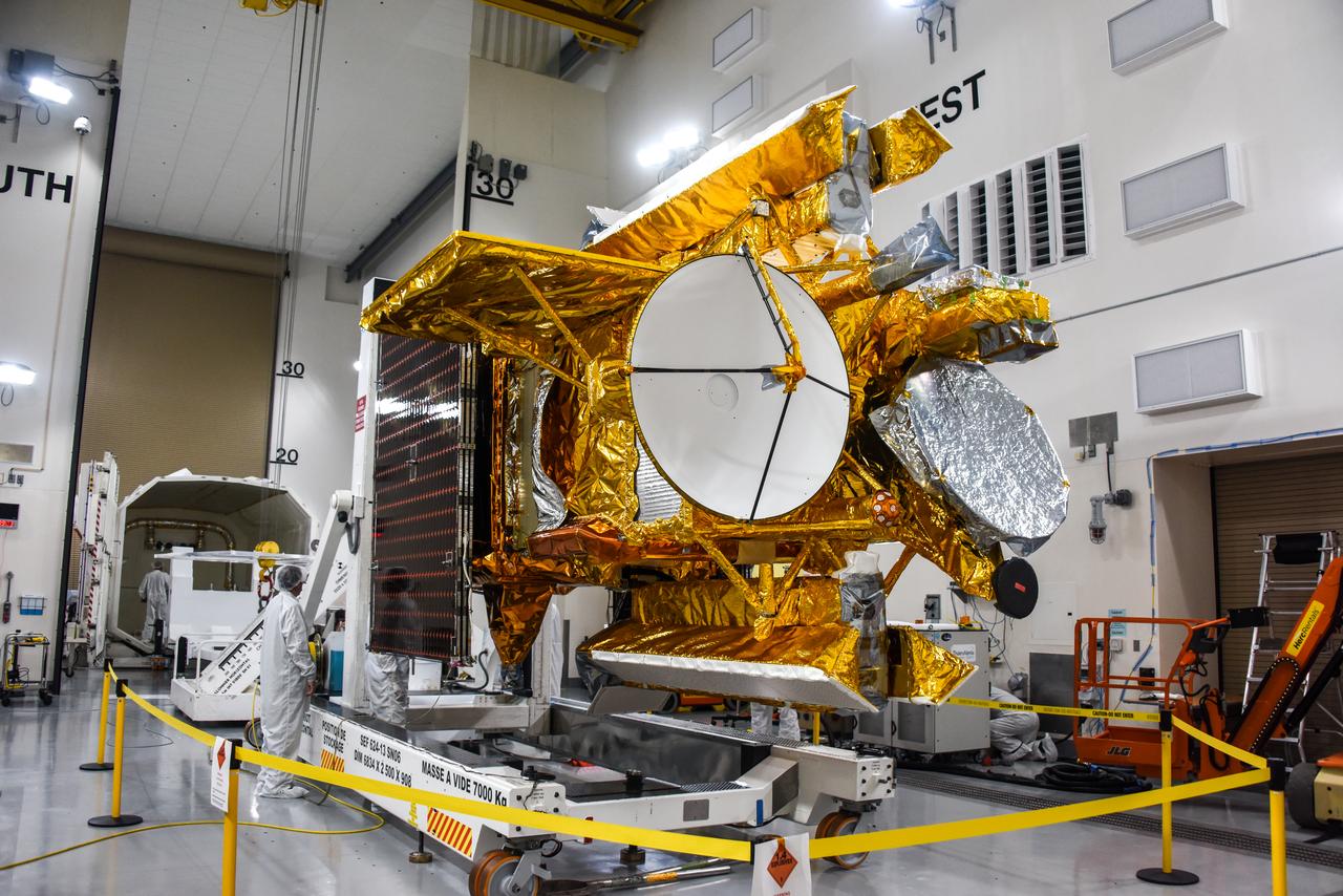
The Surface Water and Ocean Topography (SWOT) spacecraft is moved into a transport container inside the Astrotech facility at Vandenberg Space Force Base in California on Nov. 18, 2022. The satellite will be transported to the SpaceX facility at Vandenberg. SWOT is the first mission that will observe nearly all water on Earth’s surface, measuring the height of water in the planet’s lakes, rivers, reservoirs, and the ocean. It is set to launch aboard a SpaceX Falcon 9 rocket in December from Vandenberg’s Space Launch Center-4 East. NASA’s Launch Services Program, based at the agency’s Kennedy Space Center in Florida, is managing the launch service.

The Surface Water and Ocean Topography (SWOT) spacecraft is transported from Astrotech to the SpaceX facility at Vandenberg Space Force Base in California on Nov. 21, 2022. SWOT is the first mission that will observe nearly all water on Earth’s surface, measuring the height of water in the planet’s lakes, rivers, reservoirs, and the ocean. The satellite is set to launch aboard a SpaceX Falcon 9 rocket in December from Vandenberg’s Space Launch Center-4 East. NASA’s Launch Services Program, based at the agency’s Kennedy Space Center in Florida, is managing the launch service.
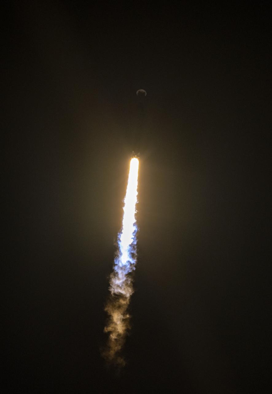
A SpaceX Falcon 9 rocket launches with the Surface Water and Ocean Topography (SWOT) spacecraft onboard, Friday, Dec. 16, 2022, from Space Launch Complex 4E at Vandenberg Space Force Base in California. Jointly developed by NASA and Centre National D'Etudes Spatiales (CNES), with contributions from the Canadian Space Agency (CSA) and United Kingdom Space Agency, SWOT is the first satellite mission that will observe nearly all water on Earth’s surface, measuring the height of water in the planet’s lakes, rivers, reservoirs, and the ocean. Photo Credit: (NASA/Keegan Barber)
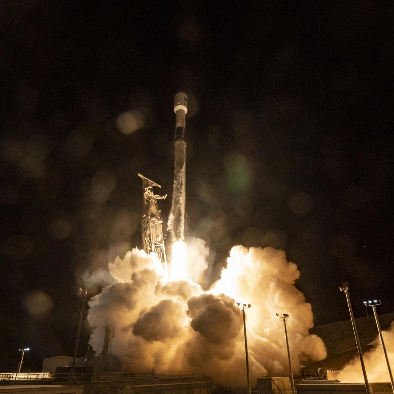
A SpaceX Falcon 9 rocket launches with the Surface Water and Ocean Topography (SWOT) spacecraft onboard, Friday, Dec. 16, 2022, from Space Launch Complex 4E at Vandenberg Space Force Base in California. Jointly developed by NASA and Centre National D'Etudes Spatiales (CNES), with contributions from the Canadian Space Agency (CSA) and United Kingdom Space Agency, SWOT is the first satellite mission that will observe nearly all water on Earth’s surface, measuring the height of water in the planet’s lakes, rivers, reservoirs, and the ocean. Photo Credit: (NASA/Keegan Barber)
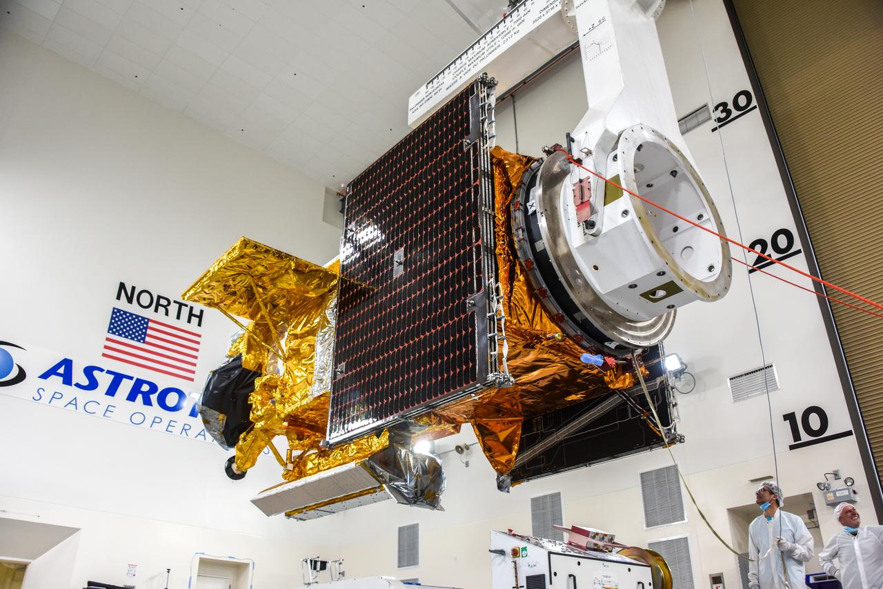
The Surface Water and Ocean Topography (SWOT) spacecraft is moved into a transport container inside the Astrotech facility at Vandenberg Space Force Base in California on Nov. 18, 2022. The satellite will be transported to the SpaceX facility at Vandenberg. SWOT is the first mission that will observe nearly all water on Earth’s surface, measuring the height of water in the planet’s lakes, rivers, reservoirs, and the ocean. It is set to launch aboard a SpaceX Falcon 9 rocket in December from Vandenberg’s Space Launch Center-4 East. NASA’s Launch Services Program, based at the agency’s Kennedy Space Center in Florida, is managing the launch service.
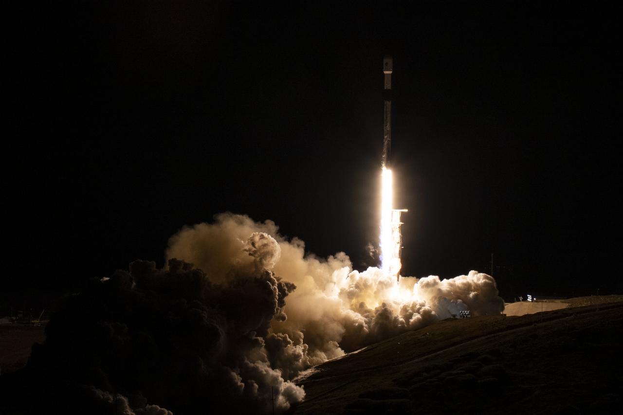
A SpaceX Falcon 9 rocket launches with the Surface Water and Ocean Topography (SWOT) spacecraft onboard, Friday, Dec. 16, 2022, from Space Launch Complex 4E at Vandenberg Space Force Base in California. Jointly developed by NASA and Centre National D'Etudes Spatiales (CNES), with contributions from the Canadian Space Agency (CSA) and United Kingdom Space Agency, SWOT is the first satellite mission that will observe nearly all water on Earth’s surface, measuring the height of water in the planet’s lakes, rivers, reservoirs, and the ocean. Photo Credit: (NASA/Keegan Barber)
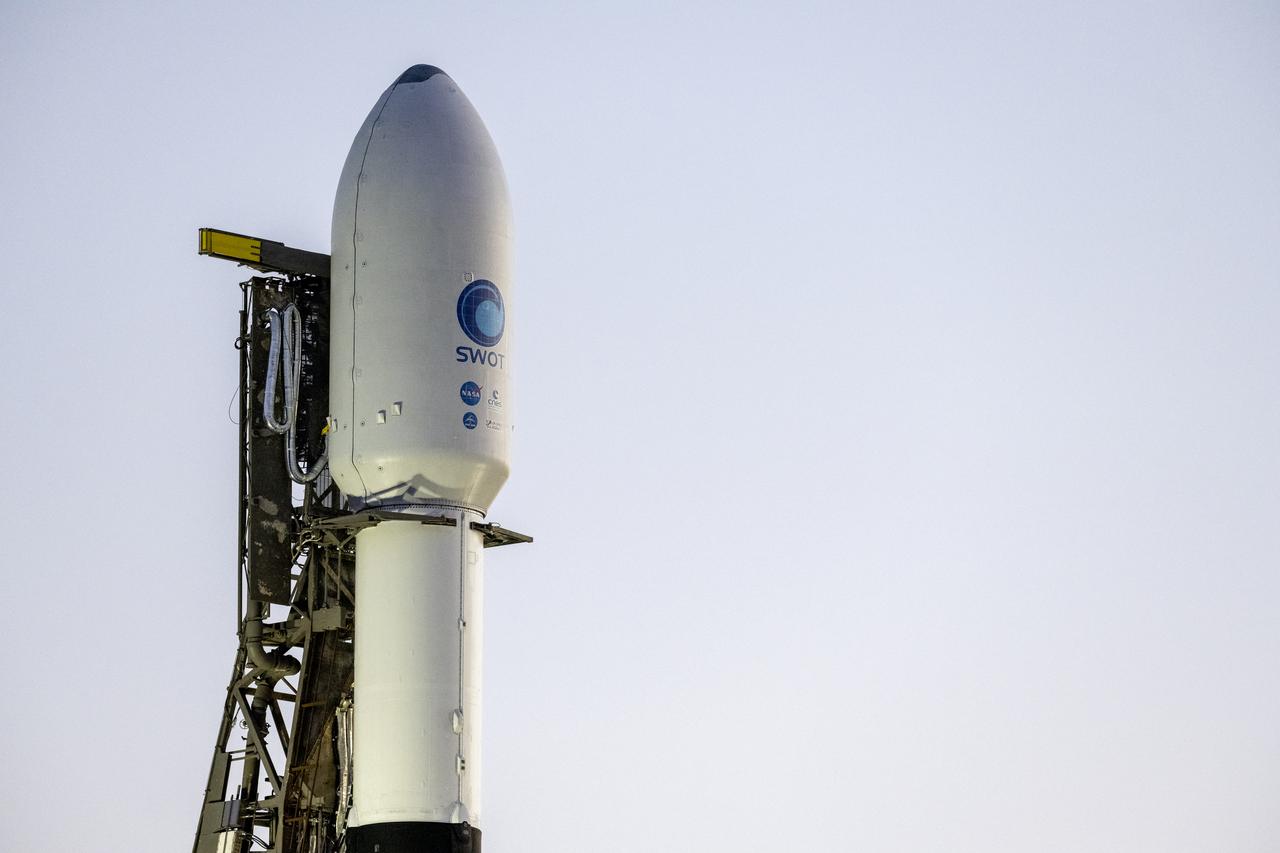
A SpaceX Falcon 9 rocket with the Surface Water and Ocean Topography (SWOT) spacecraft onboard is seen as preparations for launch continue, Wednesday, Dec. 14, 2022, at Space Launch Complex 4E at Vandenberg Space Force Base in California. Jointly developed by NASA and Centre National D'Etudes Spatiales (CNES), with contributions from the Canadian Space Agency (CSA) and United Kingdom Space Agency, SWOT is the first satellite mission that will observe nearly all water on Earth’s surface, measuring the height of water in the planet’s lakes, rivers, reservoirs, and the ocean. Photo Credit: (NASA/Keegan Barber)
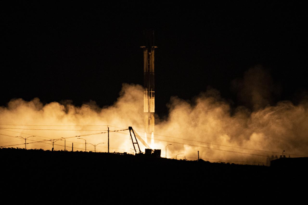
A SpaceX Falcon 9 first-stage booster returns to the landing pad following the launch of the Surface Water and Ocean Topography (SWOT) spacecraft, Friday, Dec. 16, 2022, from Space Launch Complex 4E at Vandenberg Space Force Base in California. Jointly developed by NASA and Centre National D'Etudes Spatiales (CNES), with contributions from the Canadian Space Agency (CSA) and United Kingdom Space Agency, SWOT is the first satellite mission that will observe nearly all water on Earth’s surface, measuring the height of water in the planet’s lakes, rivers, reservoirs, and the ocean. Photo Credit: (NASA/Keegan Barber)
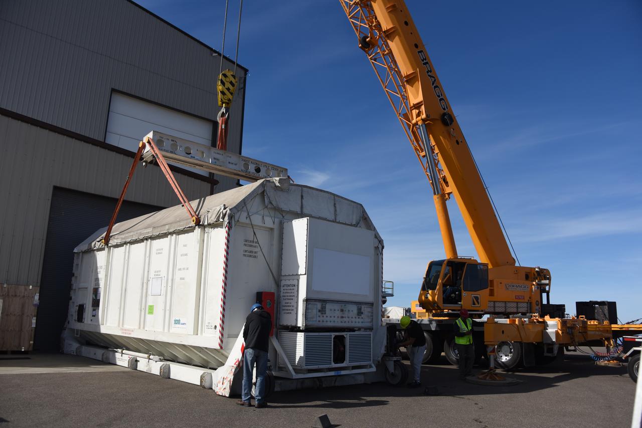
The Surface Water and Ocean Topography (SWOT) spacecraft is transported from Astrotech to the SpaceX facility at Vandenberg Space Force Base in California on Nov. 21, 2022. SWOT is the first mission that will observe nearly all water on Earth’s surface, measuring the height of water in the planet’s lakes, rivers, reservoirs, and the ocean. The satellite is set to launch aboard a SpaceX Falcon 9 rocket in December from Vandenberg’s Space Launch Center-4 East. NASA’s Launch Services Program, based at the agency’s Kennedy Space Center in Florida, is managing the launch service.
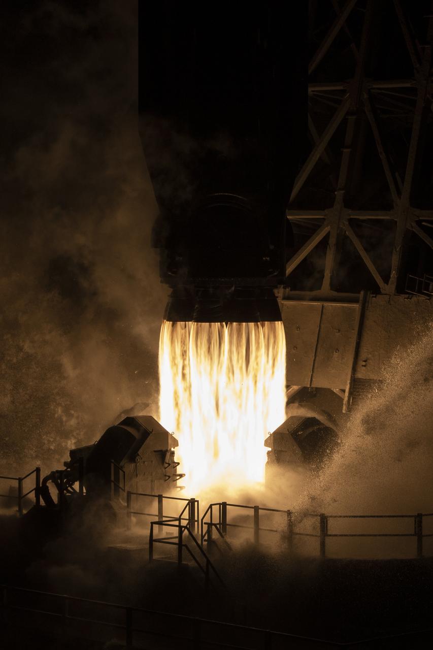
A SpaceX Falcon 9 rocket launches with the Surface Water and Ocean Topography (SWOT) spacecraft onboard, Friday, Dec. 16, 2022, from Space Launch Complex 4E at Vandenberg Space Force Base in California. Jointly developed by NASA and Centre National D'Etudes Spatiales (CNES), with contributions from the Canadian Space Agency (CSA) and United Kingdom Space Agency, SWOT is the first satellite mission that will observe nearly all water on Earth’s surface, measuring the height of water in the planet’s lakes, rivers, reservoirs, and the ocean. Photo Credit: (NASA/Keegan Barber)
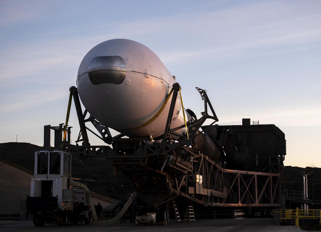
A SpaceX Falcon 9 rocket with the Surface Water and Ocean Topography (SWOT) spacecraft onboard is seen as it rolls out to the pad, Tuesday, Dec. 13, 2022, at Space Launch Complex 4E at Vandenberg Space Force Base in California. Jointly developed by NASA and Centre National D'Etudes Spatiales (CNES), with contributions from the Canadian Space Agency (CSA) and United Kingdom Space Agency, SWOT is the first satellite mission that will observe nearly all water on Earth’s surface, measuring the height of water in the planet’s lakes, rivers, reservoirs, and the ocean. Photo Credit: (NASA/Keegan Barber)
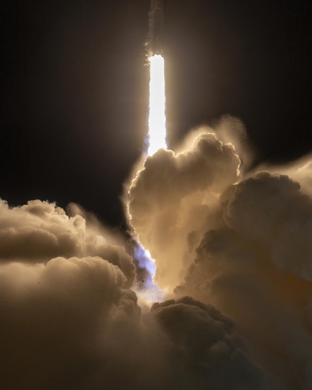
A SpaceX Falcon 9 rocket launches with the Surface Water and Ocean Topography (SWOT) spacecraft onboard, Friday, Dec. 16, 2022, from Space Launch Complex 4E at Vandenberg Space Force Base in California. Jointly developed by NASA and Centre National D'Etudes Spatiales (CNES), with contributions from the Canadian Space Agency (CSA) and United Kingdom Space Agency, SWOT is the first satellite mission that will observe nearly all water on Earth’s surface, measuring the height of water in the planet’s lakes, rivers, reservoirs, and the ocean. Photo Credit: (NASA/Keegan Barber)
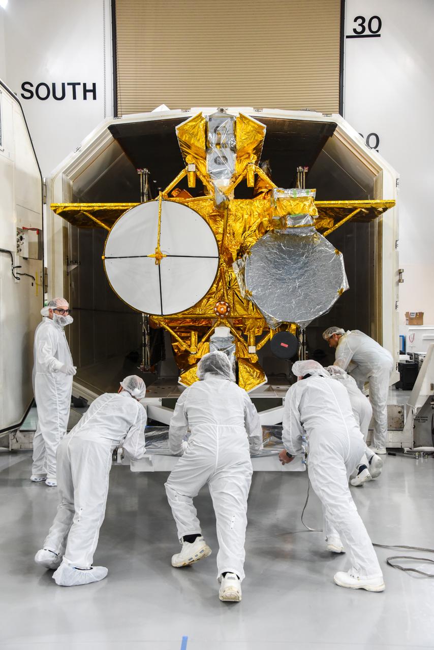
The Surface Water and Ocean Topography (SWOT) spacecraft is moved into a transport container inside the Astrotech facility at Vandenberg Space Force Base in California on Nov. 18, 2022. The satellite will be transported to the SpaceX facility at Vandenberg. SWOT is the first mission that will observe nearly all water on Earth’s surface, measuring the height of water in the planet’s lakes, rivers, reservoirs, and the ocean. It is set to launch aboard a SpaceX Falcon 9 rocket in December from Vandenberg’s Space Launch Center-4 East. NASA’s Launch Services Program, based at the agency’s Kennedy Space Center in Florida, is managing the launch service.

A container, with the Surface Water and Ocean Topography (SWOT) spacecraft inside, is moved to a trailer at the Astrotech facility at Vandenberg Space Force Base in California on Nov. 19, 2022. The satellite will be transported to the SpaceX facility at Vandenberg. SWOT is the first mission that will observe nearly all water on Earth’s surface, measuring the height of water in the planet’s lakes, rivers, reservoirs, and the ocean. It is set to launch aboard a SpaceX Falcon 9 rocket in December from Vandenberg’s Space Launch Center-4 East. NASA’s Launch Services Program, based at the agency’s Kennedy Space Center in Florida, is managing the launch service.
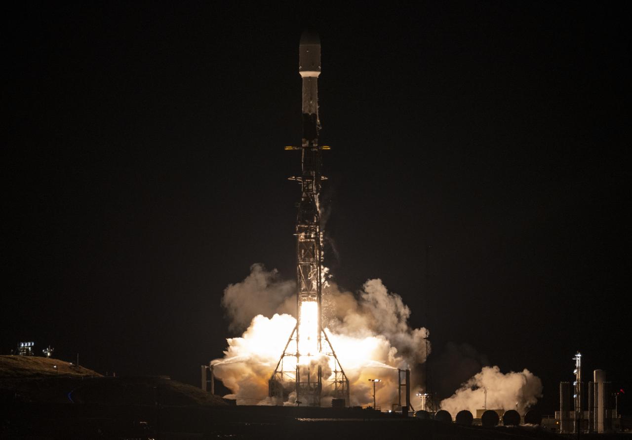
A SpaceX Falcon 9 rocket launches with the Surface Water and Ocean Topography (SWOT) spacecraft onboard, Friday, Dec. 16, 2022, from Space Launch Complex 4E at Vandenberg Space Force Base in California. Jointly developed by NASA and Centre National D'Etudes Spatiales (CNES), with contributions from the Canadian Space Agency (CSA) and United Kingdom Space Agency, SWOT is the first satellite mission that will observe nearly all water on Earth’s surface, measuring the height of water in the planet’s lakes, rivers, reservoirs, and the ocean. Photo Credit: (NASA/Keegan Barber)
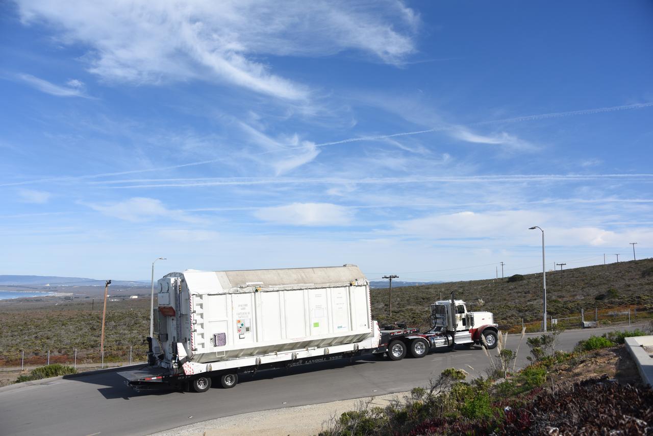
The Surface Water and Ocean Topography (SWOT) spacecraft is transported from Astrotech to the SpaceX facility at Vandenberg Space Force Base in California on Nov. 21, 2022. SWOT is the first mission that will observe nearly all water on Earth’s surface, measuring the height of water in the planet’s lakes, rivers, reservoirs, and the ocean. The satellite is set to launch aboard a SpaceX Falcon 9 rocket in December from Vandenberg’s Space Launch Center-4 East. NASA’s Launch Services Program, based at the agency’s Kennedy Space Center in Florida, is managing the launch service.
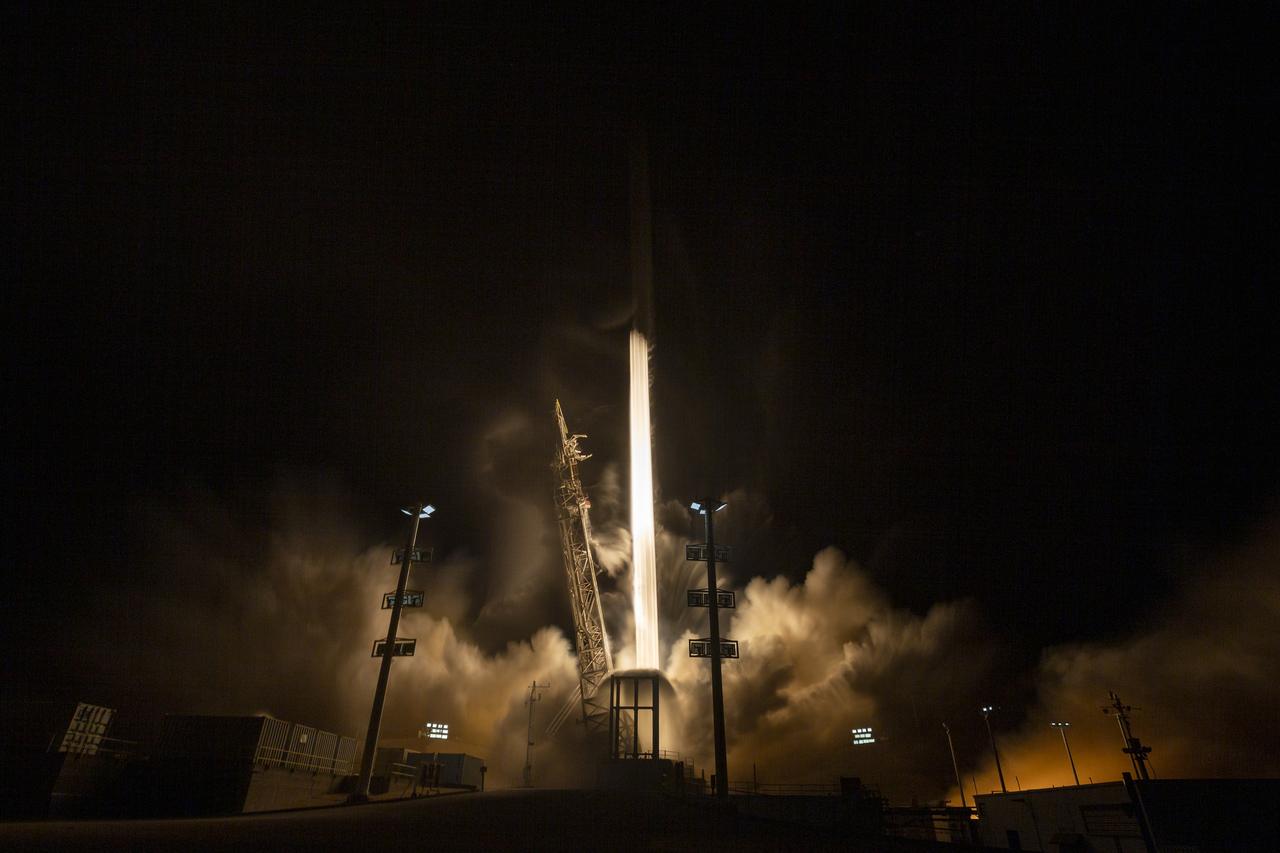
In this 30 second exposure, A SpaceX Falcon 9 rocket launches with the Surface Water and Ocean Topography (SWOT) spacecraft onboard, Friday, Dec. 16, 2022, from Space Launch Complex 4E at Vandenberg Space Force Base in California. Jointly developed by NASA and Centre National D'Etudes Spatiales (CNES), with contributions from the Canadian Space Agency (CSA) and United Kingdom Space Agency, SWOT is the first satellite mission that will observe nearly all water on Earth’s surface, measuring the height of water in the planet’s lakes, rivers, reservoirs, and the ocean. Photo Credit: (NASA/Keegan Barber)
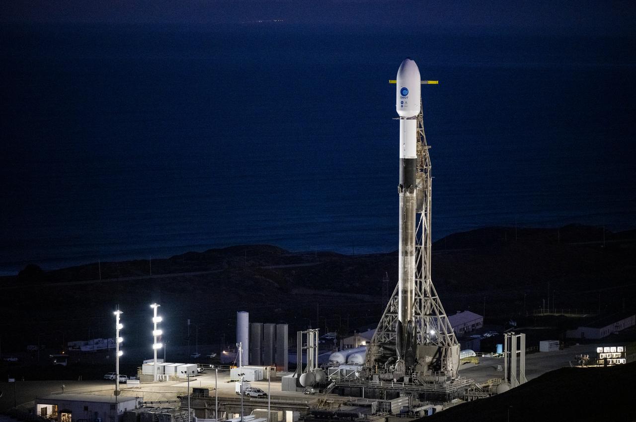
A SpaceX Falcon 9 rocket with the Surface Water and Ocean Topography (SWOT) spacecraft onboard is seen as preparations for launch continue, Wednesday, Dec. 14, 2022, at Space Launch Complex 4E at Vandenberg Space Force Base in California. Jointly developed by NASA and Centre National D'Etudes Spatiales (CNES), with contributions from the Canadian Space Agency (CSA) and United Kingdom Space Agency, SWOT is the first satellite mission that will observe nearly all water on Earth’s surface, measuring the height of water in the planet’s lakes, rivers, reservoirs, and the ocean. Photo Credit: (NASA/Keegan Barber)
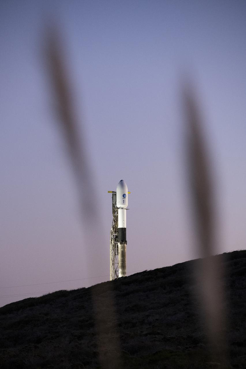
A SpaceX Falcon 9 rocket with the Surface Water and Ocean Topography (SWOT) spacecraft onboard is seen as preparations for launch continue, Wednesday, Dec. 14, 2022, at Space Launch Complex 4E at Vandenberg Space Force Base in California. Jointly developed by NASA and Centre National D'Etudes Spatiales (CNES), with contributions from the Canadian Space Agency (CSA) and United Kingdom Space Agency, SWOT is the first satellite mission that will observe nearly all water on Earth’s surface, measuring the height of water in the planet’s lakes, rivers, reservoirs, and the ocean. Photo Credit: (NASA/Keegan Barber)
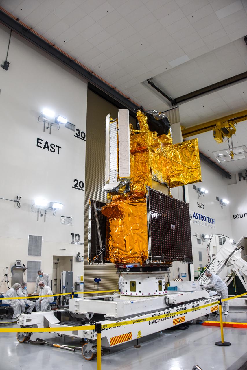
The Surface Water and Ocean Topography (SWOT) spacecraft is moved into a transport container inside the Astrotech facility at Vandenberg Space Force Base in California on Nov. 18, 2022. The satellite will be transported to the SpaceX facility at Vandenberg. SWOT is the first mission that will observe nearly all water on Earth’s surface, measuring the height of water in the planet’s lakes, rivers, reservoirs, and the ocean. It is set to launch aboard a SpaceX Falcon 9 rocket in December from Vandenberg’s Space Launch Center-4 East. NASA’s Launch Services Program, based at the agency’s Kennedy Space Center in Florida, is managing the launch service.

The Surface Water and Ocean Topography (SWOT) spacecraft is transported from Astrotech to the SpaceX facility at Vandenberg Space Force Base in California on Nov. 21, 2022. SWOT is the first mission that will observe nearly all water on Earth’s surface, measuring the height of water in the planet’s lakes, rivers, reservoirs, and the ocean. The satellite is set to launch aboard a SpaceX Falcon 9 rocket in December from Vandenberg’s Space Launch Center-4 East. NASA’s Launch Services Program, based at the agency’s Kennedy Space Center in Florida, is managing the launch service.
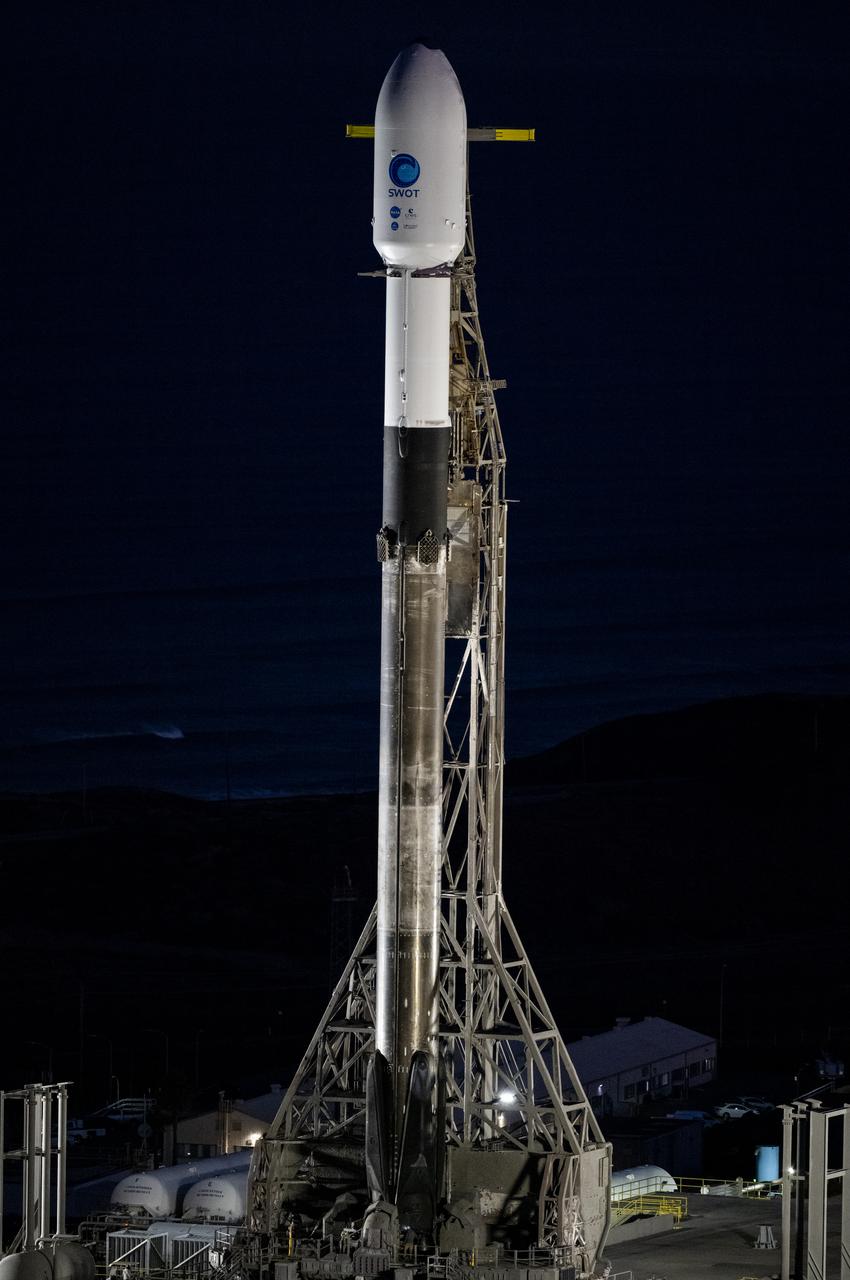
A SpaceX Falcon 9 rocket with the Surface Water and Ocean Topography (SWOT) spacecraft onboard is seen as preparations for launch continue, Wednesday, Dec. 14, 2022, at Space Launch Complex 4E at Vandenberg Space Force Base in California. Jointly developed by NASA and Centre National D'Etudes Spatiales (CNES), with contributions from the Canadian Space Agency (CSA) and United Kingdom Space Agency, SWOT is the first satellite mission that will observe nearly all water on Earth’s surface, measuring the height of water in the planet’s lakes, rivers, reservoirs, and the ocean. Photo Credit: (NASA/Keegan Barber)
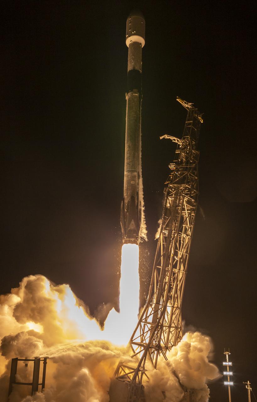
A SpaceX Falcon 9 rocket launches with the Surface Water and Ocean Topography (SWOT) spacecraft onboard, Friday, Dec. 16, 2022, from Space Launch Complex 4E at Vandenberg Space Force Base in California. Jointly developed by NASA and Centre National D'Etudes Spatiales (CNES), with contributions from the Canadian Space Agency (CSA) and United Kingdom Space Agency, SWOT is the first satellite mission that will observe nearly all water on Earth’s surface, measuring the height of water in the planet’s lakes, rivers, reservoirs, and the ocean. Photo Credit: (NASA/Keegan Barber)
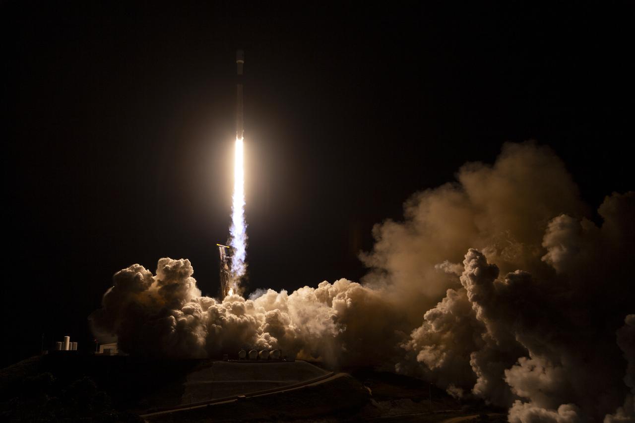
A SpaceX Falcon 9 rocket launches with the Surface Water and Ocean Topography (SWOT) spacecraft onboard, Friday, Dec. 16, 2022, from Space Launch Complex 4E at Vandenberg Space Force Base in California. Jointly developed by NASA and Centre National D'Etudes Spatiales (CNES), with contributions from the Canadian Space Agency (CSA) and United Kingdom Space Agency, SWOT is the first satellite mission that will observe nearly all water on Earth’s surface, measuring the height of water in the planet’s lakes, rivers, reservoirs, and the ocean. Photo Credit: (NASA/Keegan Barber)
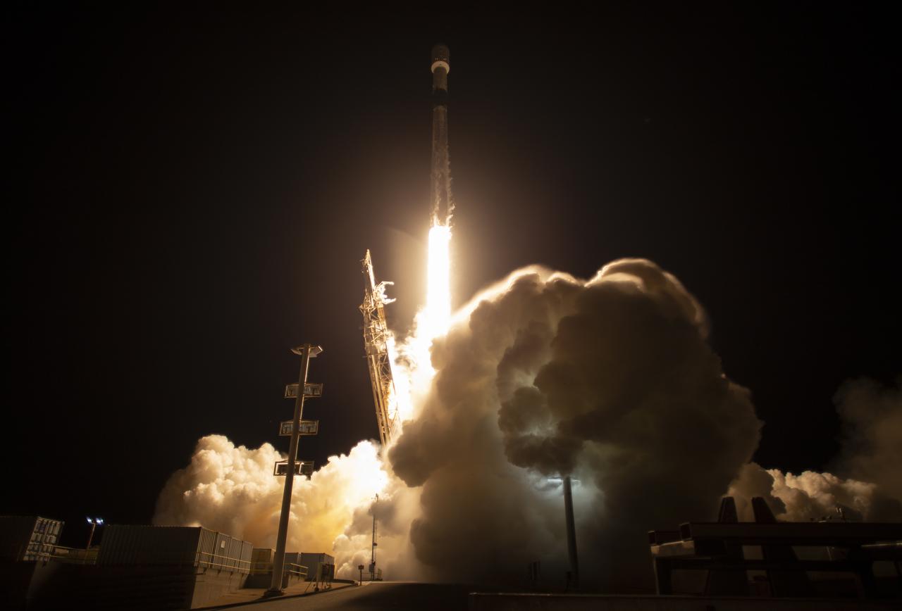
A SpaceX Falcon 9 rocket launches with the Surface Water and Ocean Topography (SWOT) spacecraft onboard, Friday, Dec. 16, 2022, from Space Launch Complex 4E at Vandenberg Space Force Base in California. Jointly developed by NASA and Centre National D'Etudes Spatiales (CNES), with contributions from the Canadian Space Agency (CSA) and United Kingdom Space Agency, SWOT is the first satellite mission that will observe nearly all water on Earth’s surface, measuring the height of water in the planet’s lakes, rivers, reservoirs, and the ocean. Photo Credit: (NASA/Keegan Barber)
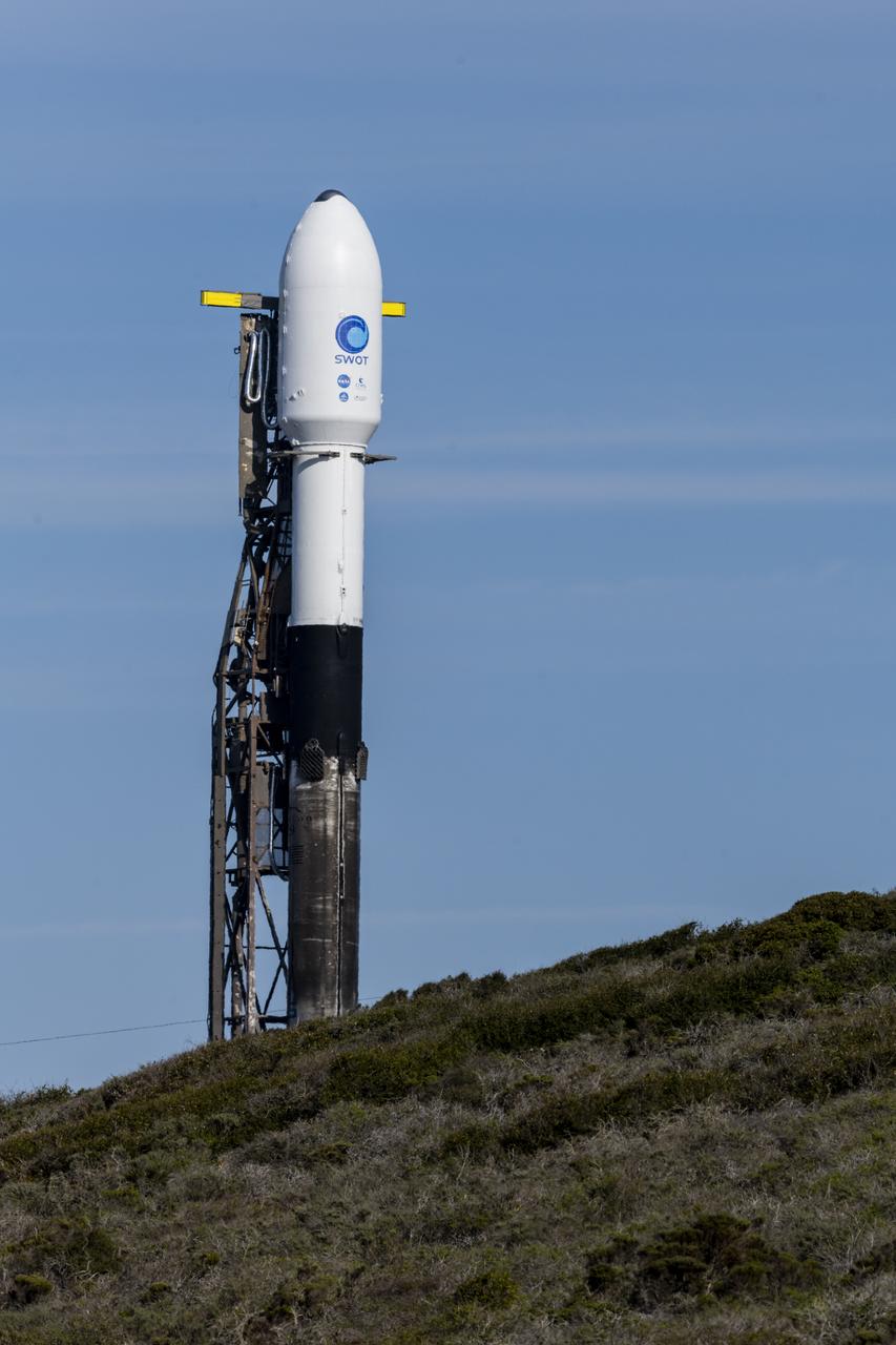
A SpaceX Falcon 9 rocket with the Surface Water and Ocean Topography (SWOT) spacecraft onboard is seen as preparations for launch continue, Wednesday, Dec. 14, 2022, at Space Launch Complex 4E at Vandenberg Space Force Base in California. Jointly developed by NASA and Centre National D'Etudes Spatiales (CNES), with contributions from the Canadian Space Agency (CSA) and United Kingdom Space Agency, SWOT is the first satellite mission that will observe nearly all water on Earth’s surface, measuring the height of water in the planet’s lakes, rivers, reservoirs, and the ocean. Photo Credit: (NASA/Keegan Barber)
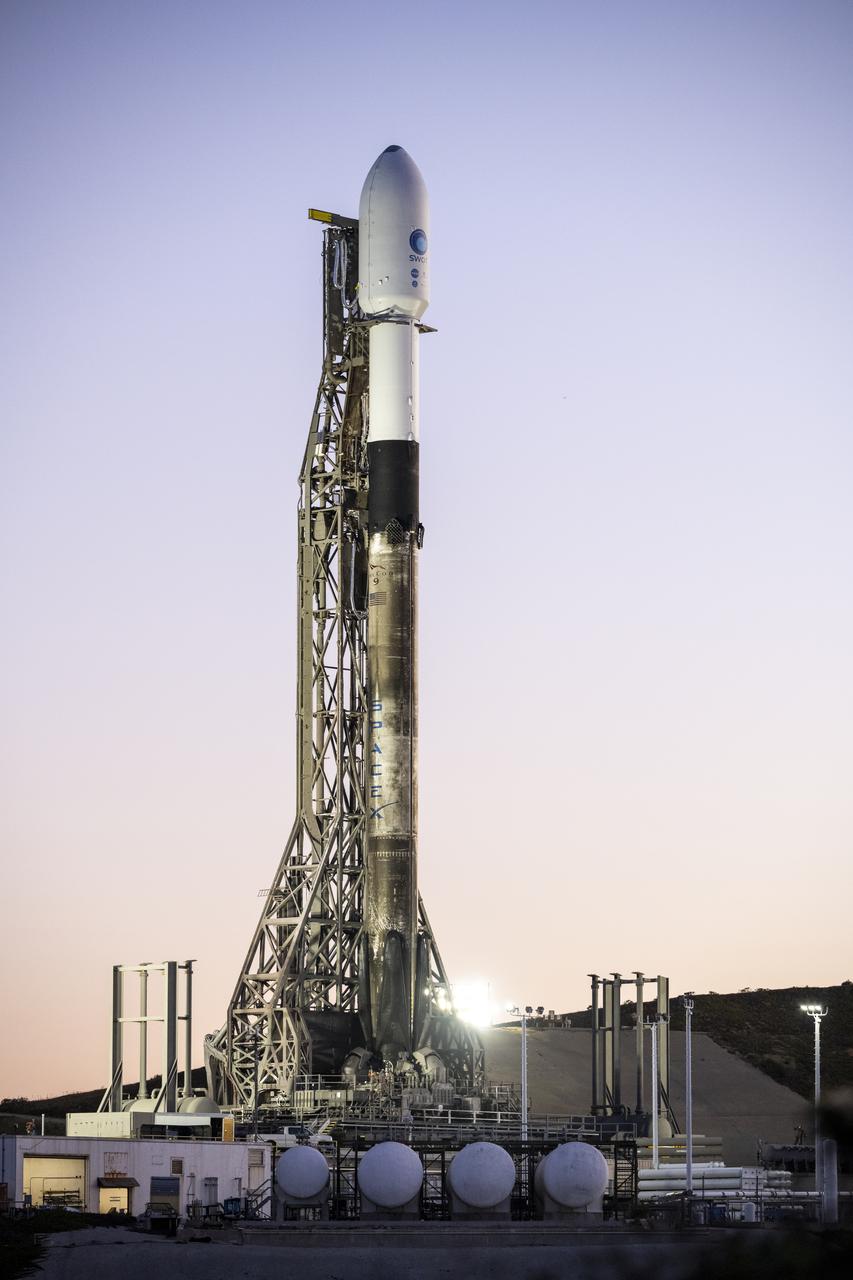
A SpaceX Falcon 9 rocket with the Surface Water and Ocean Topography (SWOT) spacecraft onboard is seen as preparations for launch continue, Wednesday, Dec. 14, 2022, at Space Launch Complex 4E at Vandenberg Space Force Base in California. Jointly developed by NASA and Centre National D'Etudes Spatiales (CNES), with contributions from the Canadian Space Agency (CSA) and United Kingdom Space Agency, SWOT is the first satellite mission that will observe nearly all water on Earth’s surface, measuring the height of water in the planet’s lakes, rivers, reservoirs, and the ocean. Photo Credit: (NASA/Keegan Barber)
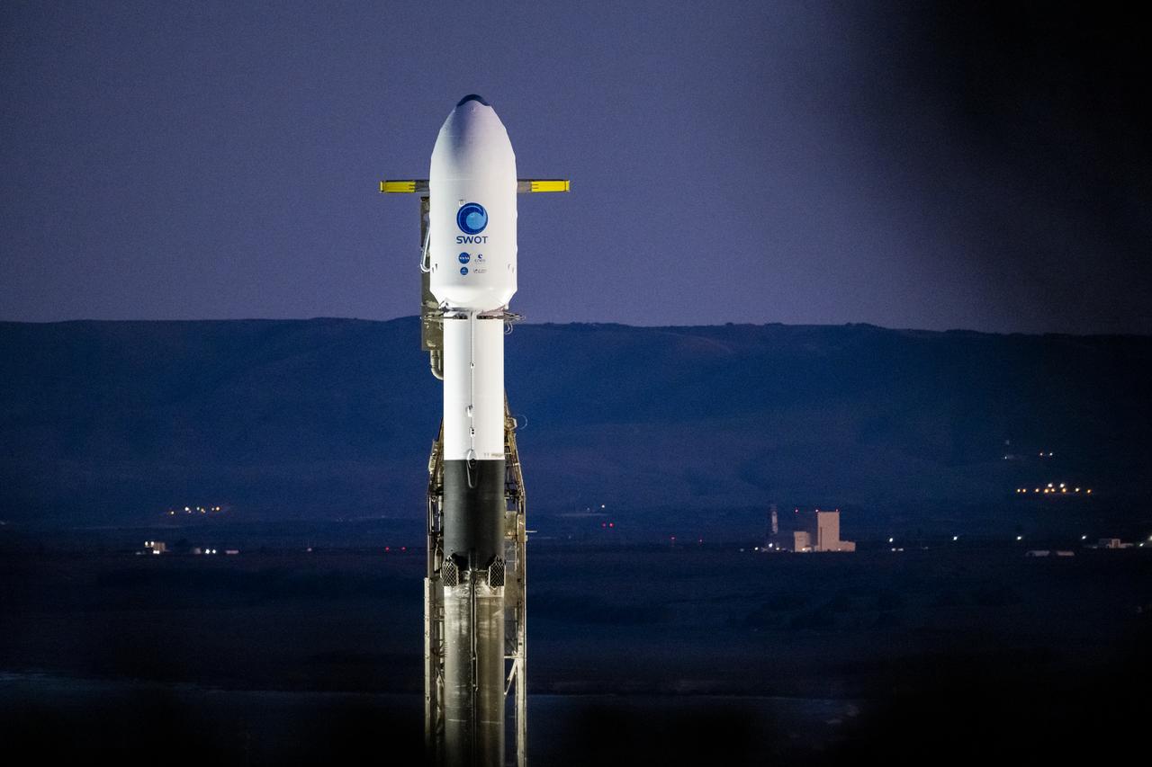
A SpaceX Falcon 9 rocket with the Surface Water and Ocean Topography (SWOT) spacecraft onboard is seen as preparations for launch continue, Wednesday, Dec. 14, 2022, at Space Launch Complex 4E at Vandenberg Space Force Base in California. Jointly developed by NASA and Centre National D'Etudes Spatiales (CNES), with contributions from the Canadian Space Agency (CSA) and United Kingdom Space Agency, SWOT is the first satellite mission that will observe nearly all water on Earth’s surface, measuring the height of water in the planet’s lakes, rivers, reservoirs, and the ocean. Photo Credit: (NASA/Keegan Barber)
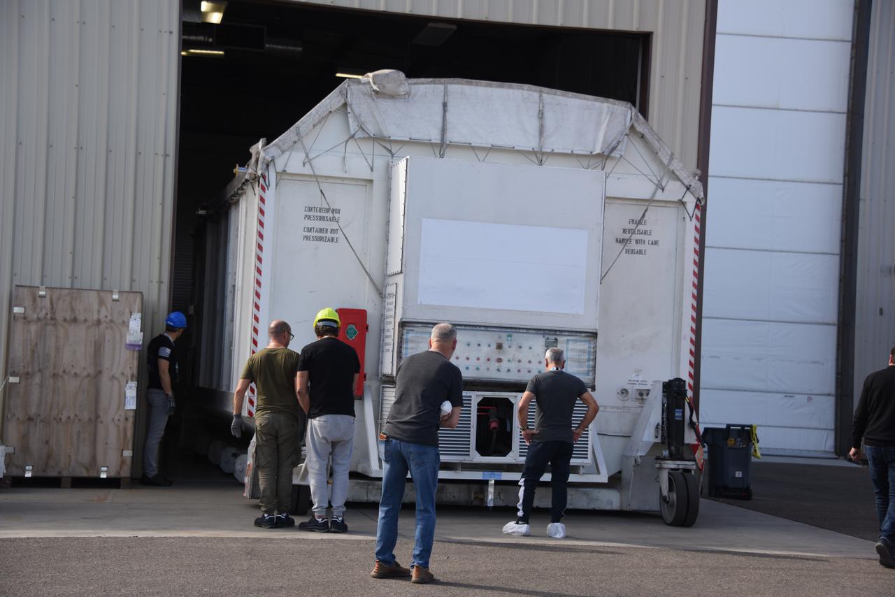
The Surface Water and Ocean Topography (SWOT) spacecraft is transported from Astrotech to the SpaceX facility at Vandenberg Space Force Base in California on Nov. 21, 2022. SWOT is the first mission that will observe nearly all water on Earth’s surface, measuring the height of water in the planet’s lakes, rivers, reservoirs, and the ocean. The satellite is set to launch aboard a SpaceX Falcon 9 rocket in December from Vandenberg’s Space Launch Center-4 East. NASA’s Launch Services Program, based at the agency’s Kennedy Space Center in Florida, is managing the launch service.
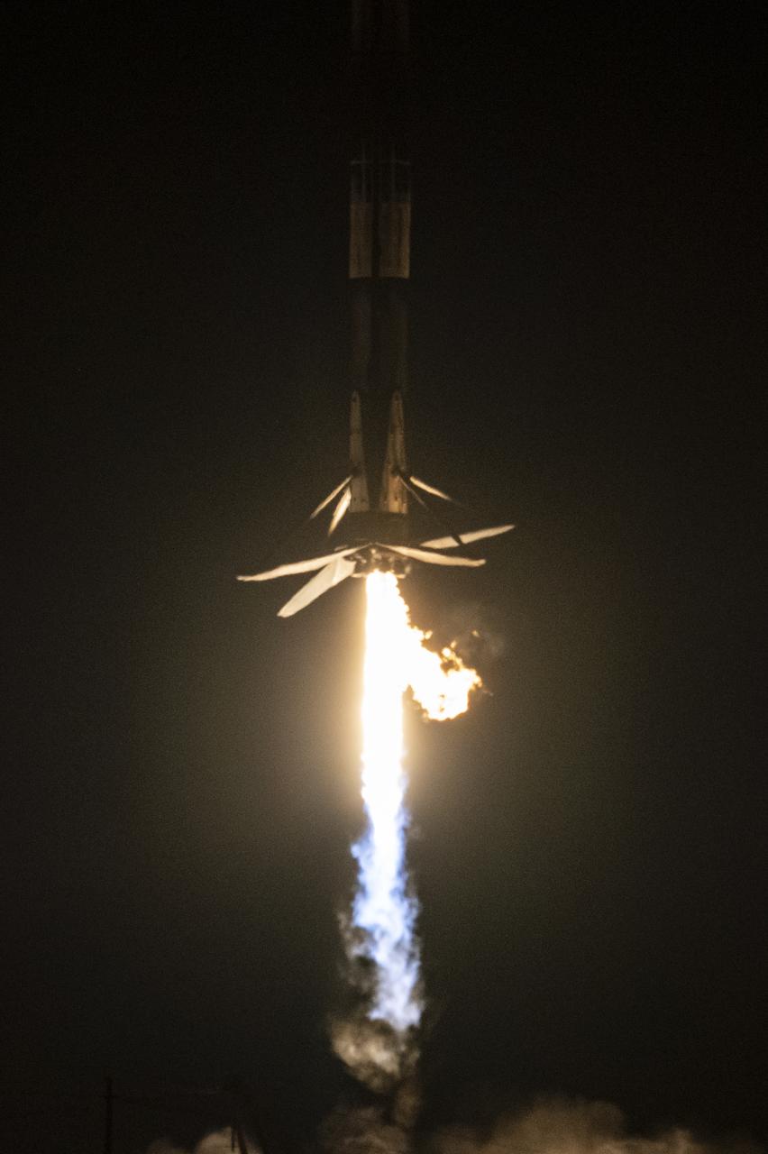
A SpaceX Falcon 9 first-stage booster returns to the landing pad following the launch of the Surface Water and Ocean Topography (SWOT) spacecraft, Friday, Dec. 16, 2022, from Space Launch Complex 4E at Vandenberg Space Force Base in California. Jointly developed by NASA and Centre National D'Etudes Spatiales (CNES), with contributions from the Canadian Space Agency (CSA) and United Kingdom Space Agency, SWOT is the first satellite mission that will observe nearly all water on Earth’s surface, measuring the height of water in the planet’s lakes, rivers, reservoirs, and the ocean. Photo Credit: (NASA/Keegan Barber)
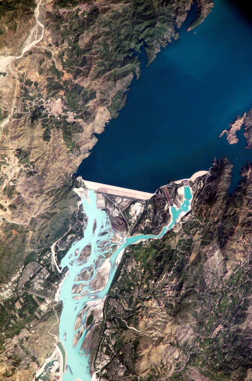
ISS005-E-12804 (6 September 2002) --- Tarbela Dam, Pakistan is featured in this image photographed by an Expedition 5 crewmember on the International Space Station (ISS). The Indus River basin extends from the Himalaya mountain ranges forming the northeastern boundary of Pakistan, to the alluvial plains of Sindh near the Arabian Sea coastline. Tarbela Dam is part of the Indus Basin Project that resulted from a water treaty signed in 1960 between India and Pakistan. This treaty guaranteed Pakistan water supplies independent of upstream control by India. Designed primarily for water storage rather than power generation, the dam was completed in 1977. Turquoise waters of the Indus River (to the south of the dam) reflect the high proportion of silt and clay suspended in waters released by the spillways (chutes on either of side of the main dam). With a volume of 142,000,000 cubic meters, the Tarbela Dam is the largest earth and rockfill dam in the world and stands 147 meters above the Indus riverbed. Its reservoir occupies an area of 37 square kilometers. While the dam has fulfilled its purpose in storing water for agricultural use in Pakistan, there have been environmental consequences to the Indus river delta, according to NASA scientists who are studying the Space Station photography. Reduction of seasonal flooding and reduced water flows to the delta have resulted in decrease of mangrove stands and abundance of some fish species.
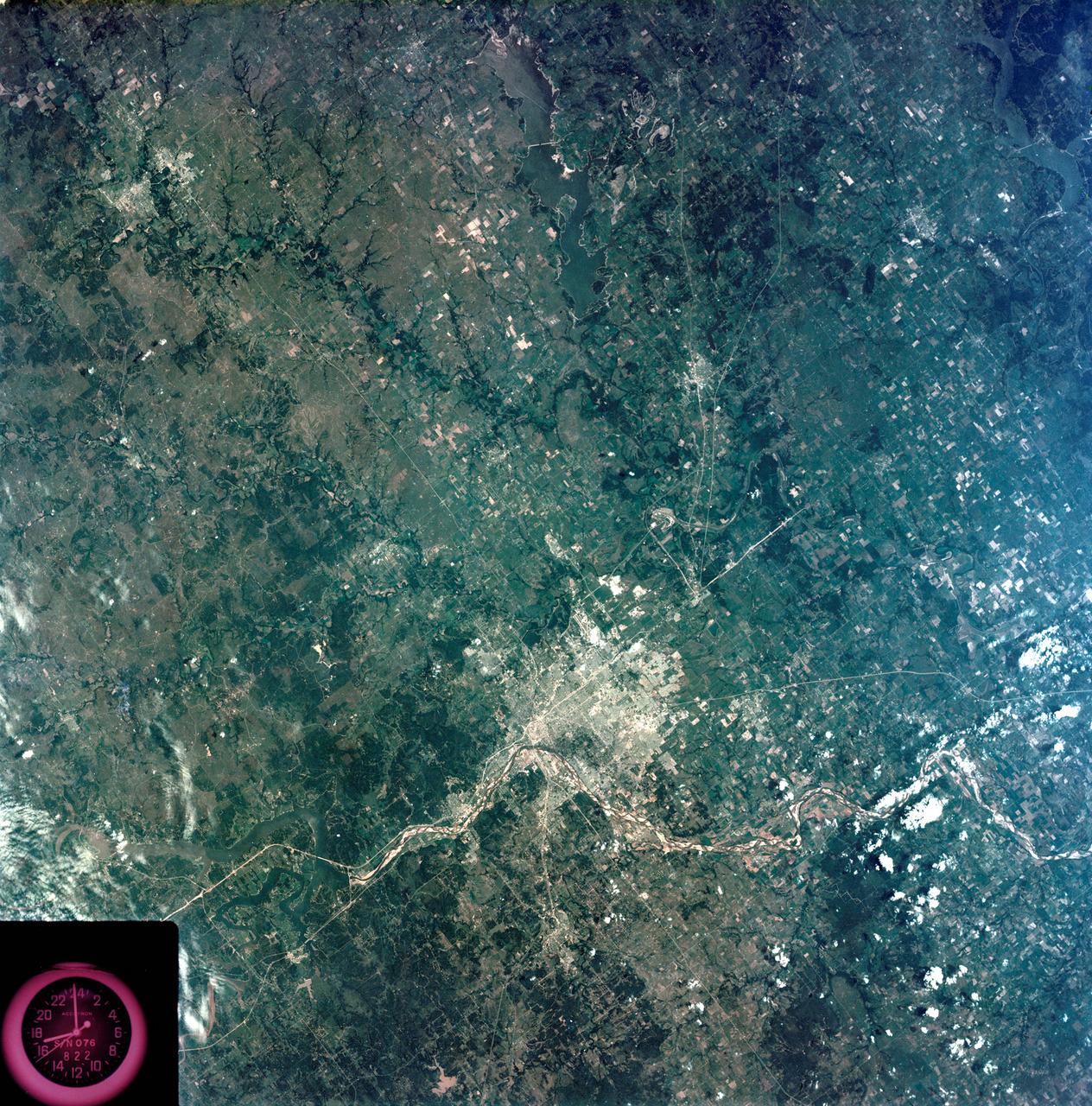
S73-35080 (July-September 1973) --- A vertical view of northeast Oklahoma and the metropolitan Tulsa area is seen in this Skylab 3 Earth Resources Experiments Package S190-B (five-inch Earth terrain camera) photograph taken from the Skylab space station in Earth orbit. THE PICTURE SHOULD BE HELD WITH THE CLOCK ON THE LEFT AND THE LAKE IN THE CORNER ON THE RIGHT. THE LONG STRETCH OF HIGHWAY (U.S. 75) RUNS STRAIGHT NORTH FROM TULSA. Tulsa, a rapidly expanding city in the heart of the mid-continent oil field, has a population of approximately 330,000. The Arkansas River meanders across the southern (lower) portion of the photograph passing through Tulsa as it flows southeastward. Oologah Reservoir, the long body of water, is located northeast of Tulsa. Lake Hudson is the body of water in the right corner of the picture. Keystone Reservoir is to the west and upstream from Tulsa. Westward from Tulsa U.S. 64 makes a 45 degree bend as it turns northwest to cross the Keystone Reservoir. The thin white line over the Oologah Reservoir is a highway bridge. Bartlesville is on U.S. 75 near the north (top) corner of the picture. The Tulsa International Airport is immediately northeast of downtown Tulsa. Several smaller airfields are visible in the surrounding area. The toll roads and other major highways are clearly visible in the picture. Claremore is northeast of Tulsa on U.S. 66 with the Will Rogers Turnpike passing nearby. Sapulpa is southwest of Tulsa on the Turner Turnpike which leads toward Oklahoma City. The detailed information contained in this photograph can be extracted by direct observation and applied to updating land use and cultural maps of Tulsa and to numerous surrounding satellite cities. All EREP photography is available to the public through the Department of Interior?s Earth Resources Observations Systems Data Center, Sioux Falls, South Dakota, 57198. (Alternate number SL3-83-206) Photo credit: NASA
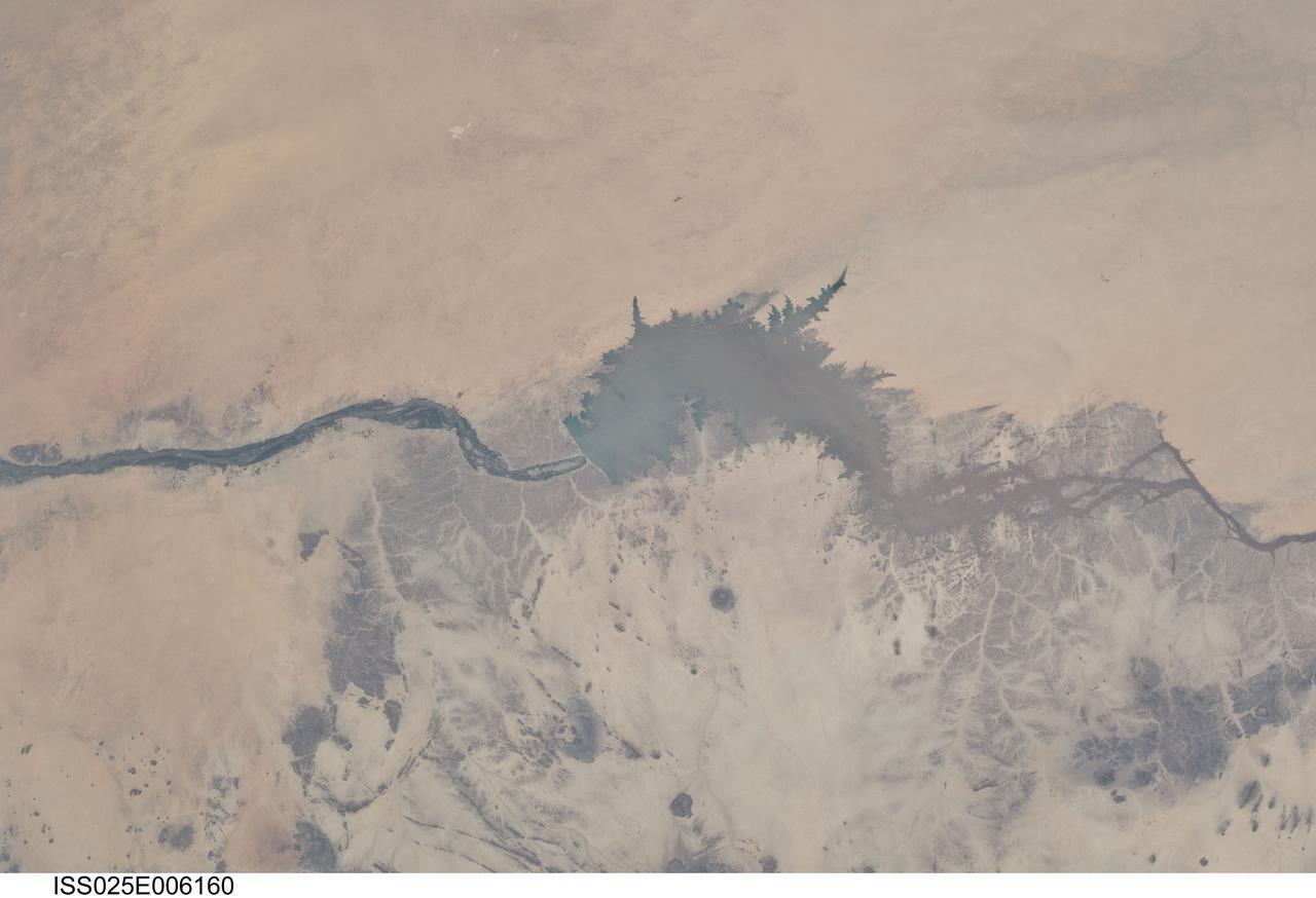
ISS025-E-006160 (5 Oct. 2010) --- Merowe Dam, Nile River and the Republic of the Sudan are featured in this image photographed by an Expedition 25 crew member on the International Space Station. The Merowe Dam is located near the 4th cataract of the Nile River, in the Nubian Desert of the northeastern Republic of the Sudan (also known as Sudan). The dam was built to generate hydroelectric power—electricity intended to further industrial and agricultural development of the country. This photograph illustrates the current extent of the reservoir filling behind the dam; the final spill gate was closed in 2008. The Merowe Dam is located approximately 350 kilometers (215 miles) to the northwest of Sudan’s capital, Khartoum. The nearest settlement downstream of the dam is Karima. Following Sudan’s independence from Egypt and the United Kingdom in 1956, allocation and control of Nile River water was divided between Egypt and Sudan by the Nile Waters Treaty signed in 1959. Today, other countries within the Nile basin—including Ethiopia, Kenya, Rwanda, Tanzania, and Uganda—are seeking more equitable allocation and utilization of the water and recently (2010) signed a new water use pact challenging the 1959 treaty. Beyond the issues of water rights, several local tribes will be displaced by the planned 170 kilometer-long reservoir, and the flooded region contains significant but little-studied archeological sites. The Sudanese government has a resettlement program in place for the tribes. A variety of international institutions have been conducting “salvage” or “rescue” archeological surveys since 1999. Such rescue surveys seek to preserve as much information as possible from sites that will be destroyed or otherwise made inaccessible (in this case by flooding).
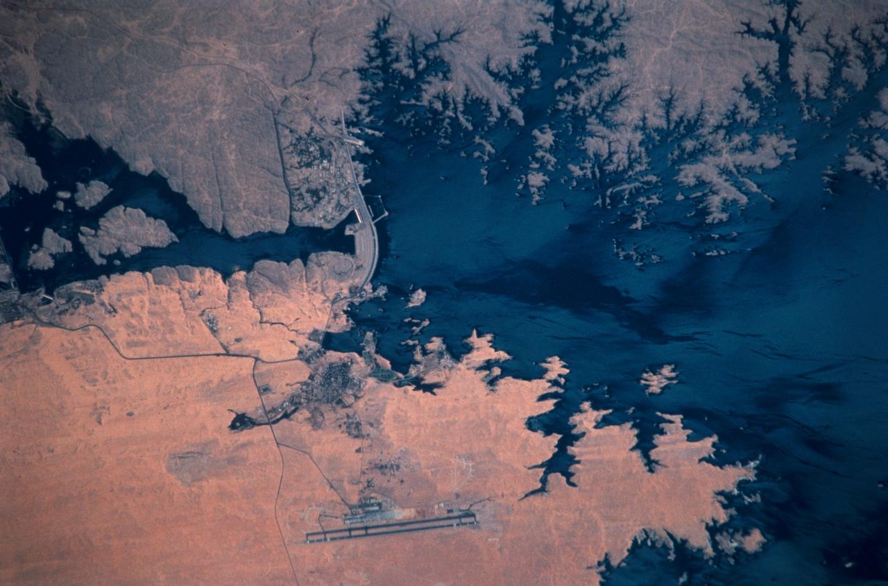
STS102-303-017 (8-21 March 2001)--- The STS-102 crew members used a 35mm camera on the flight deck of the Space Shuttle Discovery to record this image of the Aswan High Dam. The structure was completed in 1970 and is one of the largest earthen embankment dams in the world. It is 364 feet (111 meters) tall, 12,565 feet (3,830 meters) long and nearly 3,281 feet (1,000 meters) wide. When it was built the new reservoir required relocation of nearly 100,000 residents and some archaeological sites. Although the reservoir has benefited Egypt by providing power and controlling floods, according to NASA scientists, it has also had detrimental effects on the Nile system. Before the dam, an estimated 110 million tons of silt was deposited by the annual flood of the Nile, enriching agricultural lands and maintaining the land of the Nile delta. Now this sediment is trapped behind the dam, requiring artificial fertilization of agricultural lands and leading to erosion and saltwater intrusion where the Nile river meets the Mediterranean Sea.
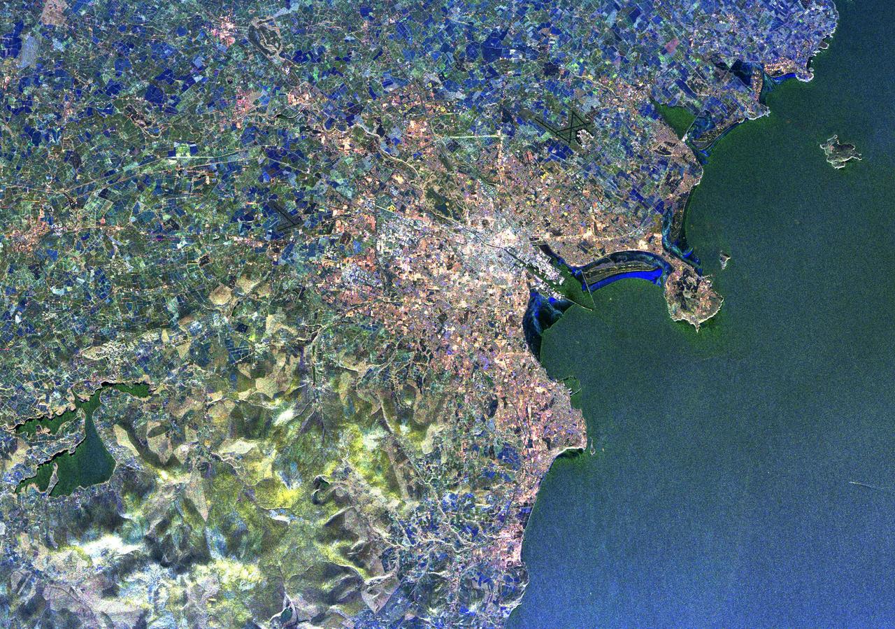
Visualization Date 1994-04-11 This radar image of Dublin, Ireland, shows how the radar distingishes between densely populated urban areas and nearby areas that are relatively unsettled. In the center of the image is the city's natural harbor along the Irish Sea. The pinkish areas in the center are the densely populated parts of the city and the blue/green areas are the suburbs. The two ends of the Dublin Bay are Howth Point, the circular peninsula near the upper right side of the image, and Dun Laoghaire, the point to the south. The small island just north of Howth is called "Ireland's Eye," and the larger island, near the upper right corner of the image is Lambay Island. The yellow/green mountains in the lower left of the image (south) are the Wicklow Mountains. The large lake in the lower left, nestled within these mountains, is the Poulaphouca Reservoir along River Liffey. The River Liffey, the River Dodder and the Tolka River are the three rivers that flow into Dublin. The straight features west of the city are the Grand Canal and the three rivers are the faint lines above and below these structures. The dark X-shaped feature just to the north of the city is the Dublin International Airport. The image was acquired by the Spaceborne Imaging Radar-C/X-band Synthetic Aperture (SIR-C/X-SAR) when it flew aboard the space shuttle Endeavour on April 11, 1994. This area is centered at 53.3 degrees north latitude, 6.2 degrees west longitude. The area shown is approximately 55 kilometers by 42 kilometers (34 miles by 26 miles). The colors are assigned to different frequencies and polarizations of the radar as follows: Red is L-band horizontally transmitted, horizontally received; green is L-band vertically transmitted, vertically received; and blue is C-band vertically transmitted, vertically received. SIR-C/X-SAR, a joint mission of the German, Italian, and the United States space agencies, is part of NASA's Mission to Planet Earth. Credit: NASA/GSFC For more information go to: <a href="http://visibleearth.nasa.gov/view_rec.php?id=467" rel="nofollow">visibleearth.nasa.gov/view_rec.php?id=467</a>

The mighty Yukon River and nearby lakes appear in red in this image produced using data recorded on June 18, 2023, by the international Surface Water and Ocean Topography (SWOT) satellite as it passed over Alaska. The satellite measures the height of nearly all the water on Earth's surface, providing one of the most detailed, comprehensive views yet of the planet's ocean and fresh water. The mission is a collaboration between NASA and the French space agency, CNES (Centre National d'Études Spatiales). SWOT will address some of the most pressing climate change questions of our time, offering insights into areas including how a warming world is accelerating Earth's water cycle, leading to more volatile precipitation patterns. SWOT will also help researchers better understand how climate change affects water storage in lakes, rivers, and reservoirs, and how communities can better manage water resources and prepare for floods and other disasters. SWOT passed over the Yukon River and recorded this data during a period called calibration and validation, when the mission confirms the accuracy of its data. Calibration involved ensuring SWOT's software and hardware – including its main scientific instrument, the Ka-band Radar Interferometer (KaRIn) and its antenna – operate as designed. During validation activities, dozens of research teams headed into the field to measure water levels and the slope of rivers, including the Yukon. Mission scientists then compared field measurements to the data taken by the satellite to ensure SWOT's accuracy. In mid-June, the team of freshwater researchers tasked with gathering data on the Yukon drifted down the waterway around midnight – the same time as SWOT passed overhead, collecting its own data on the river. Launched on Dec. 16, 2022, from Vandenberg Space Force Base in central California, SWOT is now in its operations phase, collecting data that will be used for research and other purposes. https://photojournal.jpl.nasa.gov/catalog/PIA25780
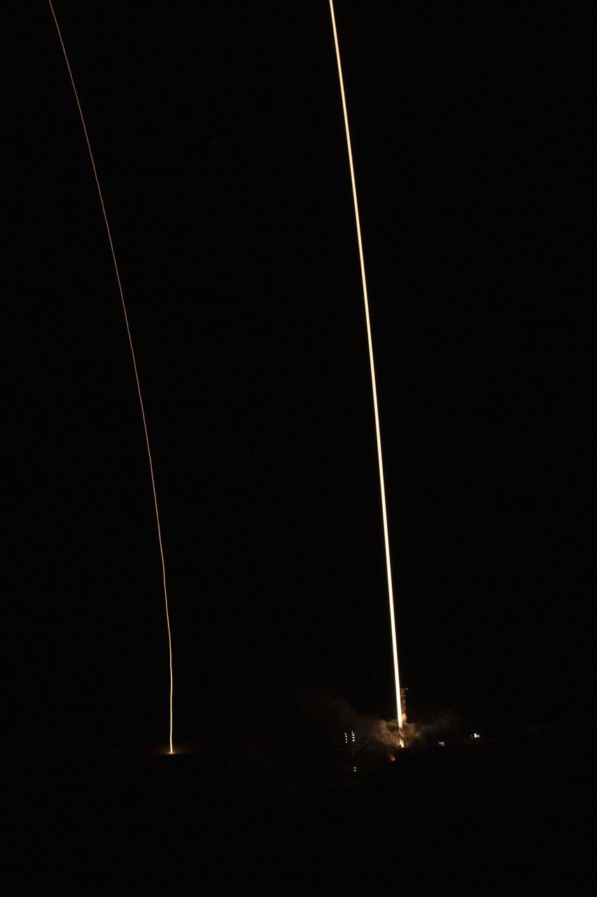
In this 8 minute exposure, A SpaceX Falcon 9 rocket launches with the Surface Water and Ocean Topography (SWOT) spacecraft onboard, right, Friday, Dec. 16, 2022, from Space Launch Complex 4E at Vandenberg Space Force Base in California. The SpaceX Falcon 9 first-stage booster is also seen, left, as it returns to the landing pad following the launch. Jointly developed by NASA and Centre National D'Etudes Spatiales (CNES), with contributions from the Canadian Space Agency (CSA) and United Kingdom Space Agency, SWOT is the first satellite mission that will observe nearly all water on Earth’s surface, measuring the height of water in the planet’s lakes, rivers, reservoirs, and the ocean. Photo Credit: (NASA/Keegan Barber)
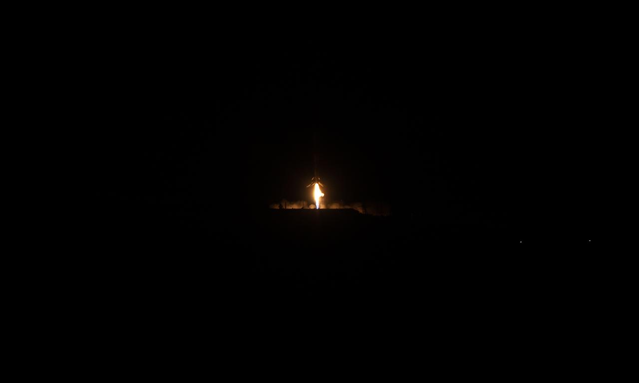
The first stage of the SpaceX Falcon 9 rocket lands at Vandenberg Space Force Base's landing zone 4 following the successful launch of the Surface Water and Ocean Topography (SWOT) satellite on Dec. 16, 2022. A collaboration between NASA and the French space agency Centre National d’Études Spatiales (CNES), with contributions from the Canadian Space Agency and the UK Space Agency, SWOT will be the first satellite to survey nearly all water on Earth’s surface. The satellite will help researchers understand how much water flows in and out of Earth’s freshwater bodies and will provide insight into the ocean’s role in climate change. The instruments onboard will measure the height of water in lakes, rivers, reservoirs, and the ocean, and will observe ocean features in higher definition than ever before. NASA’s Launch Services Program, based at the agency’s Kennedy Space Center in Florida, is managing the launch service.
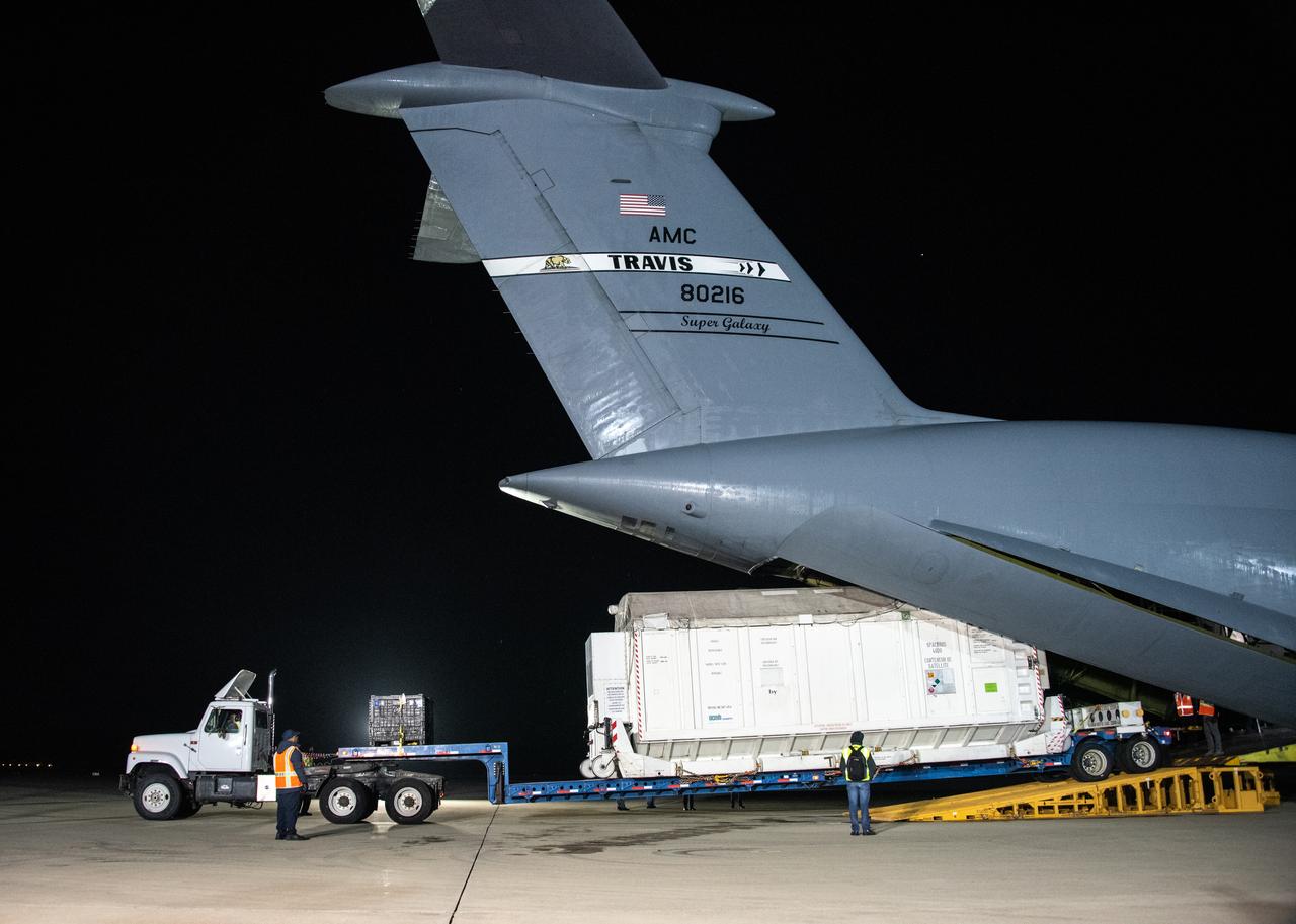
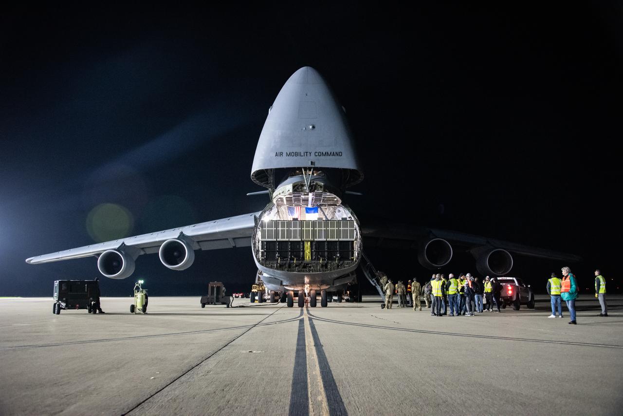
NASA’s Surface Water and Ocean Topography (SWOT) satellite arrives from France aboard a U.S. Air Force C-5 Galaxy aircraft at Vandenberg Space Force Base in California, on Oct. 16, 2022. Teams will transport the satellite to Astrotech Space Operations facility to begin final preparations for the spacecraft’s December launch atop a SpaceX Falcon 9 rocket from Vandenberg’s Space Launch Center-4 East. Jointly developed by NASA and Centre National D'Etudes Spatiales, with contributions from the Canadian Space Agency (CSA) and United Kingdom Space Agency, SWOT is the first satellite mission that will observe nearly all water on Earth’s surface, measuring the height of water in the planet’s lakes, rivers, reservoirs, and the ocean.
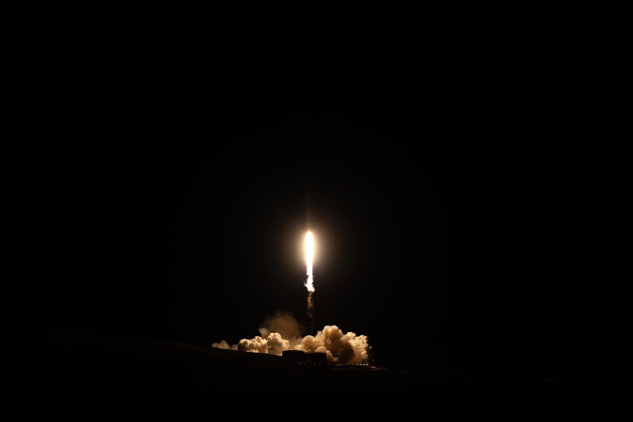
The SpaceX Falcon 9 rocket, carrying the Surface Water and Ocean Topography (SWOT) satellite, lifts off from Space Launch Complex-4 East at Vandenberg Space Force Base in California on Dec. 16, 2022, at 3:46 a.m. PST. A collaboration between NASA and the French space agency Centre National d’Études Spatiales (CNES), with contributions from the Canadian Space Agency and the UK Space Agency, SWOT will be the first satellite to survey nearly all water on Earth’s surface. The satellite will help researchers understand how much water flows in and out of Earth’s freshwater bodies and will provide insight into the ocean’s role in climate change. The instruments onboard will measure the height of water in lakes, rivers, reservoirs, and the ocean, and will observe ocean features in higher definition than ever before. NASA’s Launch Services Program, based at the agency’s Kennedy Space Center in Florida, is managing the launch service.