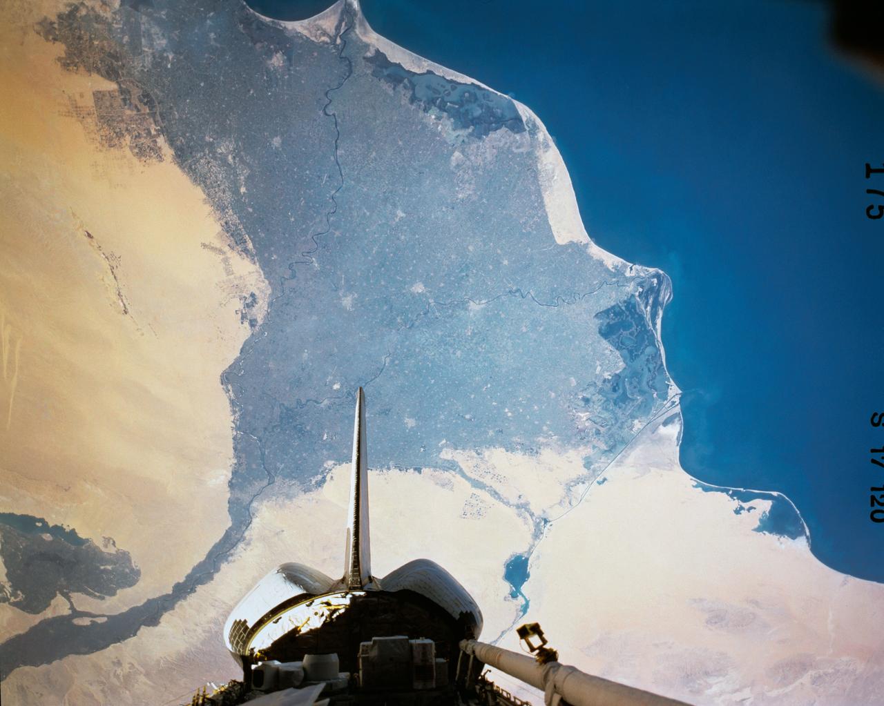
The Nile River Delta of Egypt (30.0N, 31.0E) irrigated by the Nile River and its many distributaries, is some of the richest farm land in the world and home to some 45 million people, over half of Egypt's population. The capital city of Cairo is at the apex of the delta. Just across the river from Cairo can be seen the ancient three big pyramids and sphinx at Giza and the Suez Canal is just to the right of the delta.
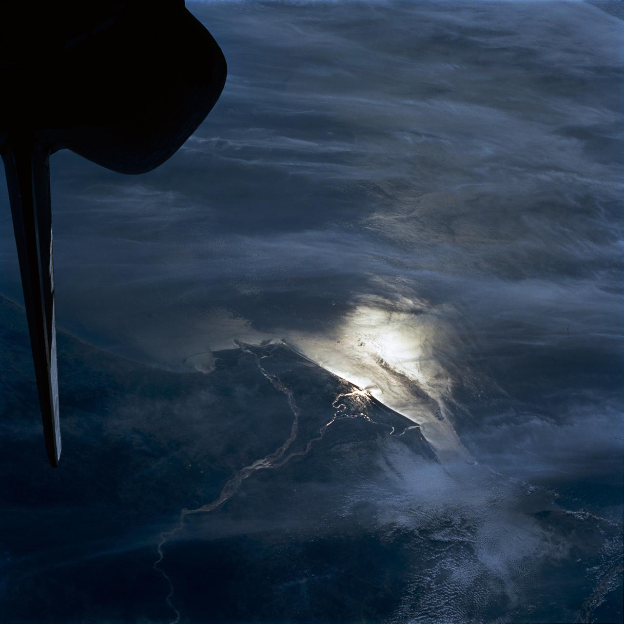
STS054-80-024 (13-19 Jan 1993) --- As the Shuttle was passing southeast over the coast of India, approaching the Bay of Bengal, Endeavour's crew took this picture of the Godavari River Delta. The sun glint pattern was centered directly over the delta and highlighted well the intricate drainage pattern. Offshore, water features associated with current boundaries and river plumes are readily visible. The line of clouds along the coast south of the delta suggest that surface winds are blowing onshore from the Bay of Bengal. As the air passes over the warmer coastal water and land, it is warmed and begins to rise. The moisture in the air condenses, forming a line of low-level clouds.
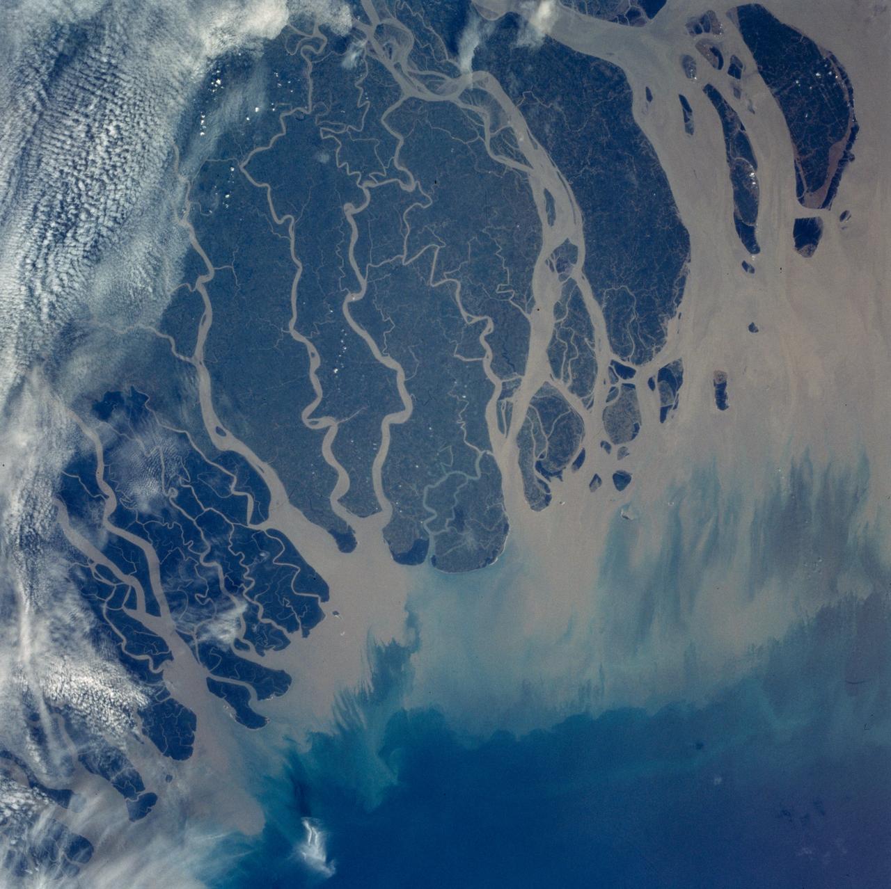
The Ganges River Delta is the largest inter-tidal delta in the world. With its extensive mangrove mud flats, swamp vegetation and sand dunes, it is characteristic of many tropical and subtropical coasts. As seen in this photograph, the tributaries and distributaries of the Ganges and Brahmaputra Rivers deposit huge amounts of silt and clay that create a shifting maze of waterways and islands in the Bay of Bengal.
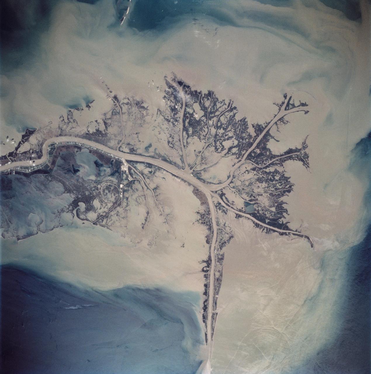
STS062-85-021 (4-18 March 1994) --- The Mississippi River is the largest river system in North America. Its delta is a typical example of the bird's foot class of river deltas. It drains nearly 3 1/2 million square kilometers of real estate and is estimated to carry 2.4 billion kilograms (more than 500 million tons) of sand, silt, and clay to the Gulf of Mexico annually. Most of this sediment is deposited as a delta at the mouth of the river where the velocity of the river water is slowed and its ability to transport sediment is accordingly diminished. Continued deposition at such a site progrades the delta or extends it seaward into the Gulf as much as 150 meters each year until such time as a flooding episode finds a shorter more efficient channel to deliver sediment-laden river waters to the Gulf. At that time the old delta is abandoned and the river begins to build a new delta. In time, compaction of the sediment in the old delta causes it to subside forming first marshes, then bays. This and the modifying effects of coastal waves eventually allow the sea to reclaim much of the temporary land area of the delta. This sequence has repeated itself over and over again at the Mississippi Delta. In this photograph, the present day active Balize delta is shown. According to NASA scientists it is the youngest of the recent delta lobes having begun its seaward pro-gradation only some 600 - 800 years ago. The main channel of the river is 2 kilometers wide and 30 - 40 meters deep. Natural levees here are almost 1 kilometer wide and 3 to 4 meters above sea level. Along the active distributaries of the lower delta, natural levees are less than 100 meters wide and generally less than 0.5 meters above sea level. The bird's foot appearance of deltas such as this is characteristic of low coastal energy conditions - that is, low levels of tidal fluctuation and generally low wave energy. The interdistributary bays are extremely shallow, usually less than a few meters, and contain brackish to normal marine waters except during times of flooding, when fresh water fills the bays. Sedimentation within the bays is very slow, occurring only during flood periods. Along the west side of the river, a highway has been built southeastward to Venice.
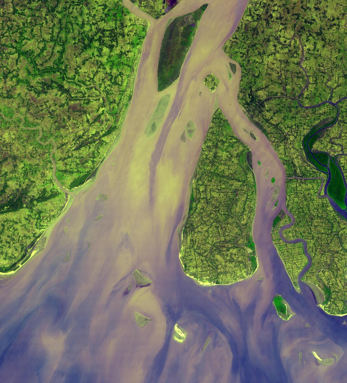
The western-most part of the Ganges Delta is seen in this 54.5 by 60 km ASTER sub-scene acquired on January 6, 2005. The Hugli River branches off from the Ganges River 300 km to the north, and flows by the city of Calcutta before emptying into the Bay of Bengal. High sediment load is evident by the light tan colors in the water, particularly downstream from off-shore islands. The deep green colors of some of these islands are mangrove swamps. The image is centered at 21.9 degrees north latitude, 88 degrees east longitude. http://photojournal.jpl.nasa.gov/catalog/PIA11158
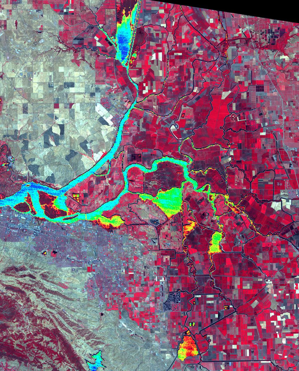
The Sacramento-San Joaquin River Delta, CA (or California Delta) has an area of about 3000 km2, and provides a large fraction of all the water used in California. The Delta drains about 50% of the water coming from the Sierra Nevada Mountains, and channels it through San Francisco's Golden Gate to the Pacific Ocean. Thousands of miles of levees now carefully control the Delta's flow, to maximize water use. The image combines a false color infrared composite (with vegetation depicted in red) with a colorized thermal infrared band to show the water temperature for the larger water bodies. Warmer temperatures are red and yellow, cooler water temperatures are blue and green. The image was acquired July 3, 2012, covers an area of 46.5 by 57.5 km, and is located at 38.1 degrees north, 121.3 degrees west. https://photojournal.jpl.nasa.gov/catalog/PIA24691
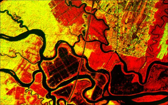
This radar image acquired by NASA Airborne Synthetic Aperture Radar AIRSAR in 2001, shows the Altamaha River Delta in the Georgia Sea Islands.
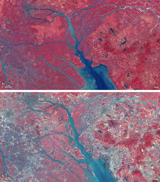
In 1979, China established two special economic zones around the Pearl River Delta, north of Hong Kong. This image, taken by Landsat 3 on October 19, 1973, shows that the region was rural when the zone was established. Plant-covered land, which is red in this false-color image, dominates the scene. Square grids are agriculture. By January 10, 2003, when Landsat 7 took this image, the Pearl River Delta was a densely populated urban corridor with several large cities. The urban areas are gray in this image. The region is a major manufacturing center with an economy the size of Taiwan’s. As of 2010, the Pearl River Economic Zone had a population of 36 million people. ---- NASA and the U.S. Department of the Interior through the U.S. Geological Survey (USGS) jointly manage Landsat, and the USGS preserves a 40-year archive of Landsat images that is freely available over the Internet. The next Landsat satellite, now known as the Landsat Data Continuity Mission (LDCM) and later to be called Landsat 8, is scheduled for launch in 2013. In honor of Landsat’s 40th anniversary in July 2012, the USGS released the LandsatLook viewer – a quick, simple way to go forward and backward in time, pulling images of anywhere in the world out of the Landsat archive. <b><a href="http://www.nasa.gov/audience/formedia/features/MP_Photo_Guidelines.html" rel="nofollow">NASA image use policy.</a></b> <b><a href="http://www.nasa.gov/centers/goddard/home/index.html" rel="nofollow">NASA Goddard Space Flight Center</a></b> enables NASA’s mission through four scientific endeavors: Earth Science, Heliophysics, Solar System Exploration, and Astrophysics. Goddard plays a leading role in NASA’s accomplishments by contributing compelling scientific knowledge to advance the Agency’s mission. <b>Follow us on <a href="http://twitter.com/NASA_GoddardPix" rel="nofollow">Twitter</a></b> <b>Like us on <a href="http://www.facebook.com/pages/Greenbelt-MD/NASA-Goddard/395013845897?ref=tsd" rel="nofollow">Facebook</a></b> <b>Find us on <a href="http://instagrid.me/nasagoddard/?vm=grid" rel="nofollow">Instagram</a></b>
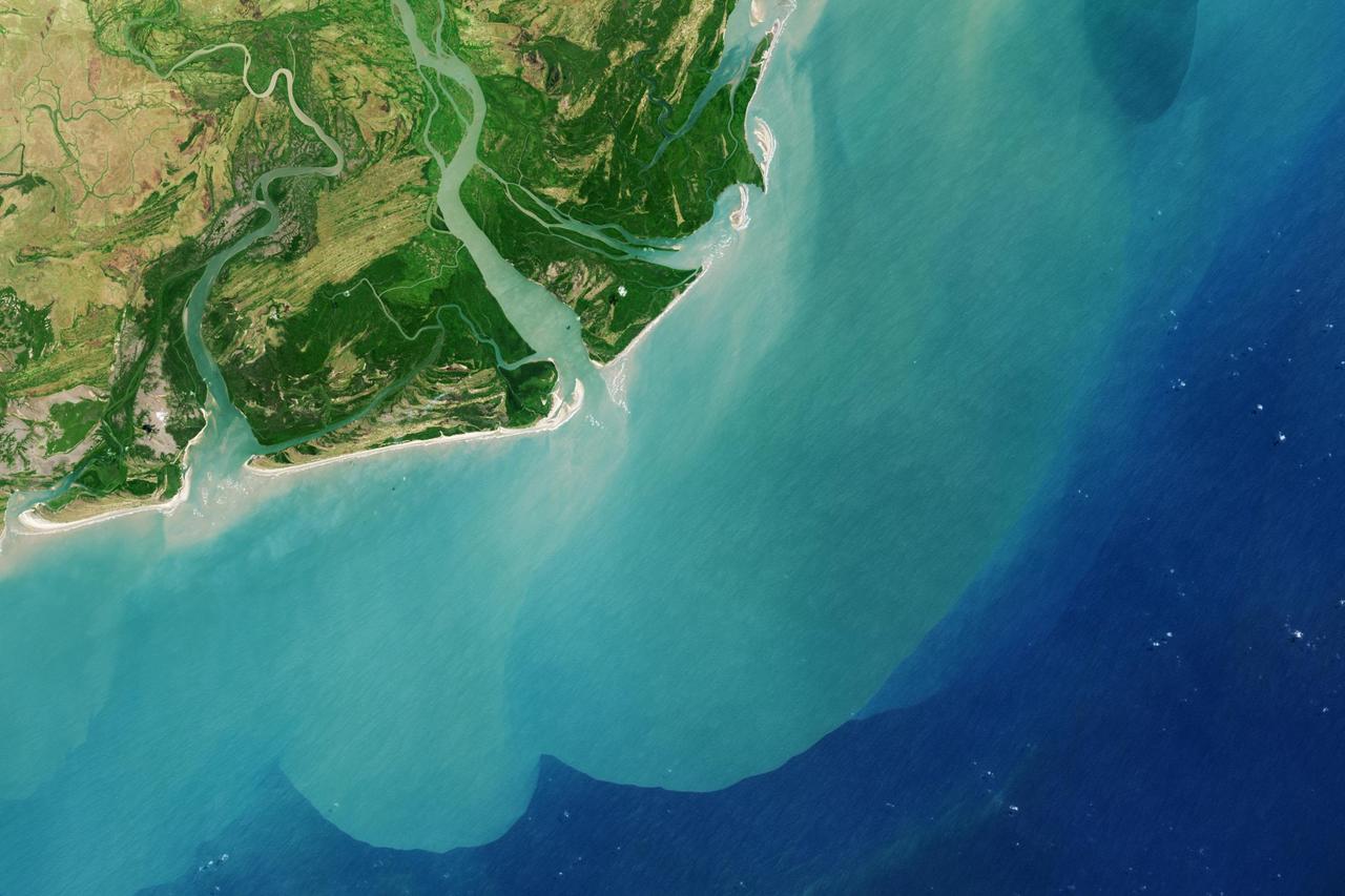
It drains a watershed that spans eight countries and nearly 1.6 million square kilometers 600,000 square miles. The Zambezi also Zambeze is the fourth largest river in Africa, and the largest east-flowing waterway. The Operational Land Imager on the Landsat 8 satellite acquired this natural-color image of the Zambezi Delta on August 29, 2013. Sandbars and barrier spits stretch across the mouths of the delta, and suspended sediment extends tens of kilometers out into the sea. The sandy outflow turns the coastal waters to a milky blue-green compared to the deep blue of open water in the Indian Ocean. The Zambezi Delta includes 230 kilometers of coastline fronting 18,000 square kilometers (7,00 square miles) of swamps, floodplains, and even savannahs (inland). The area has long been prized by subsistence fishermen and farmers, who find fertile ground for crops like sugar and fertile waters for prawns and fish. Two species of endangered cranes and one of the largest concentration of buffalo in Africa -- among many other species of wildlife -- have found a haven in this internationally recognized wetland. However, the past six decades have brought great changes to the Zambezi Delta, which used to pour more water and sediment off of the continent. Hydropower dams upstream-most prominently, the Kariba and the Cahora Bassa-greatly reduce river flows during the wet season; they also trap sediments that would otherwise flow downstream. The result has been less water reaching the delta and the floodplains, which rely on pulses of nutrients and sediments from annual (and mostly benign) natural flooding. The change in the flow of the river affects freshwater availability and quality in the delta. Strong flows push fresh water further out into the sea and naturally keep most of a delta full of fresh (or mostly fresh) water. When that fresh flow eases, the wetlands become drier and more prone to fire. Salt water from the Indian Ocean also can penetrate further into the marsh, upsetting the ecological balance for aquatic plant and animal species. Researchers have found that the freshwater table in the delta has dropped as much as five meters in the 50 years since dams were placed on the river. Less river flow also affects the shape and extent of the delta. Today there is less sediment replenishing the marshes and beaches as they are scoured by ocean waves and tides. "What strikes me in this image is the suspended sediment offshore," said Liviu Giosan, a delta geologist at the Woods Hole Oceanographic Institution. "Sediment appears to be transferred from the delta offshore in plumes that not only originate in active river mouths but also from deactivated former mouths, now tidal channels. This shows the power of tidal scouring contributing to the slow but relentless erosion of the delta." http://photojournal.jpl.nasa.gov/catalog/PIA18155
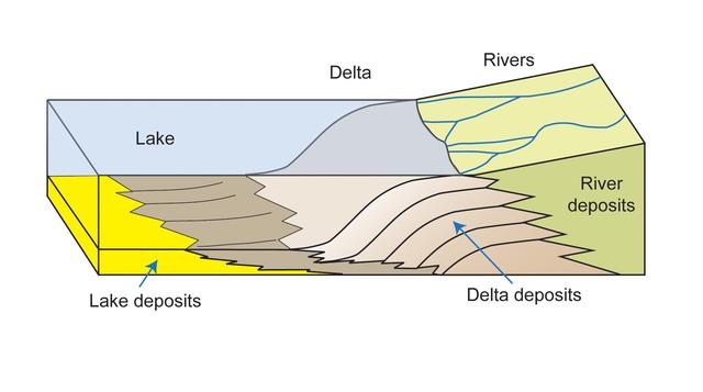
This diagram depicts rivers entering a lake. Where the water flow decelerates, sediments drop out, and a delta forms, depositing a prism of sediment that tapers out toward the lake interior.
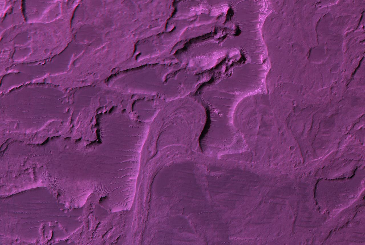
This anaglyph from NASA Mars Reconnaissance Orbiter spacecraft, shows that Eberswalde Delta contains river meanders, which indicate that flowing water was present for an extended period of time. 3D glasses are necessary to view this image.
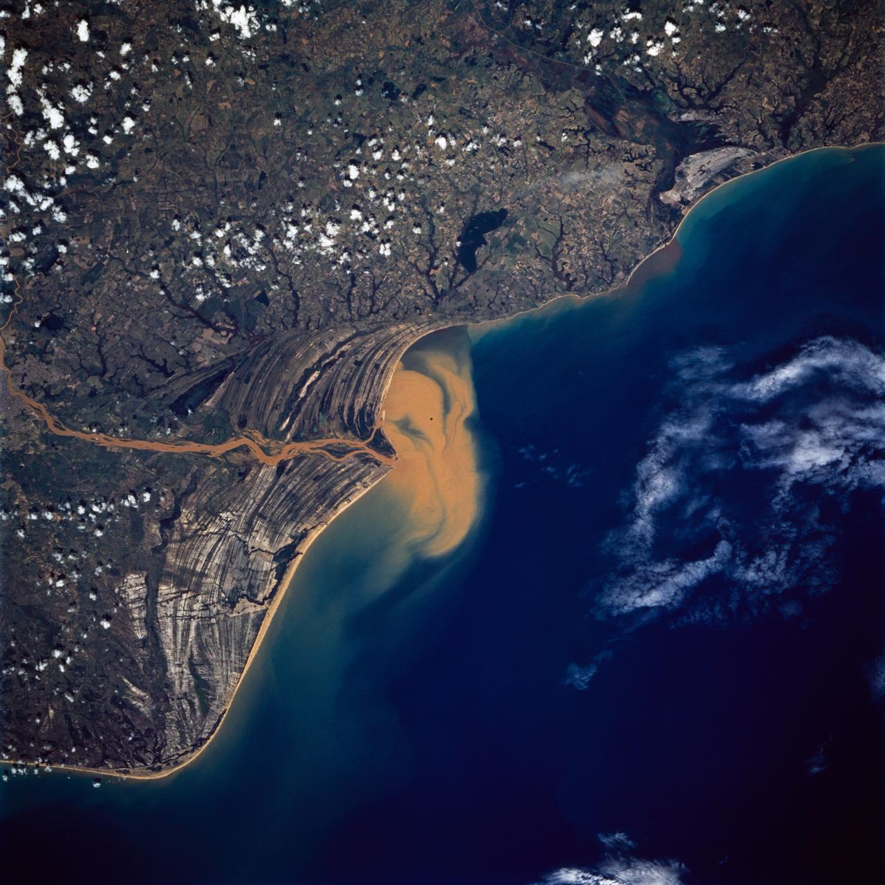
STS072-738-019 (11-20 Jan. 1996) --- The Delta of the Paraiba do Sul River, northeast of Rio de Janeiro, Brazil, stands out in this 70mm frame exposed from the Earth-orbiting Space Shuttle Endeavour. The brown color of the river water and offshore sediment plume show that the river is in flood stage. This delta attracts much attention from orbit because of its prominent beach ridges either side of the river mouth. River sediment from inland supplies the material which is redistributed by coastal currents to form the parallel beach ridges. The lower 20 miles of the river appear in this scene. The river flows into the Atlantic in an easterly direction.
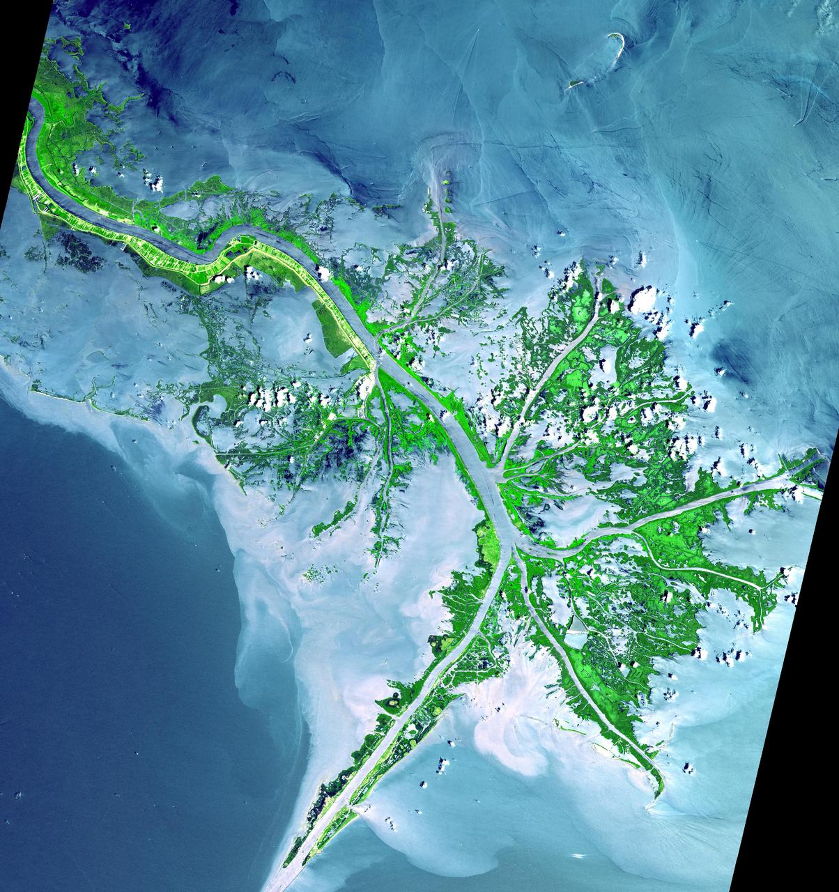
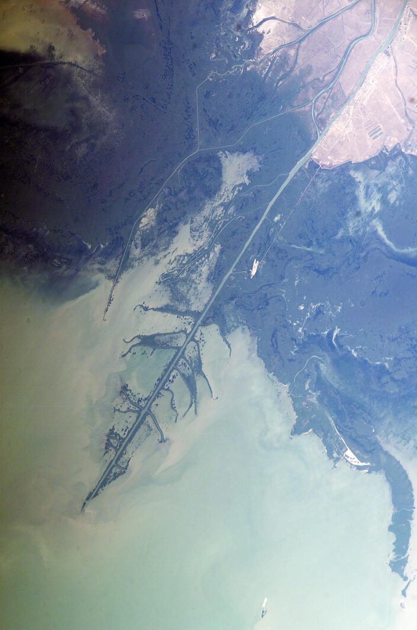
As the Mississippi River enters the Gulf of Mexico, it loses energy and dumps its load of sediment that it has carried on its journey through the mid continent. This pile of sediment, or mud, accumulates over the years building up the delta front. As one part of the delta becomes clogged with sediment, the delta front will migrate in search of new areas to grow. The area shown on this image is the currently active delta front of the Mississippi. The migratory nature of the delta forms natural traps for oil. Most of the land in the image consists of mud flats and marsh lands. There is little human settlement in this area due to the instability of the sediments. The main shipping channel of the Mississippi River is the broad stripe running northwest to southeast. This image was acquired on May 24, 2001 by the Advanced Spaceborne Thermal Emission and Reflection Radiometer (ASTER) on NASA's Terra satellite. With its 14 spectral bands from the visible to the thermal infrared wavelength region, and its high spatial resolution of 15 to 90 meters (about 50 to 300 feet), ASTER will image Earth for the next 6 years to map and monitor the changing surface of our planet. http://photojournal.jpl.nasa.gov/catalog/PIA03497

This image from NASA EarthKAM is of the northern end of the Persian Gulf and the broad delta complex of the Tigris, Euphrates, Shatt al Arab, and Karun rivers has captured the arid-looking wetlands of northeast Kuwait Bubiyan Island,
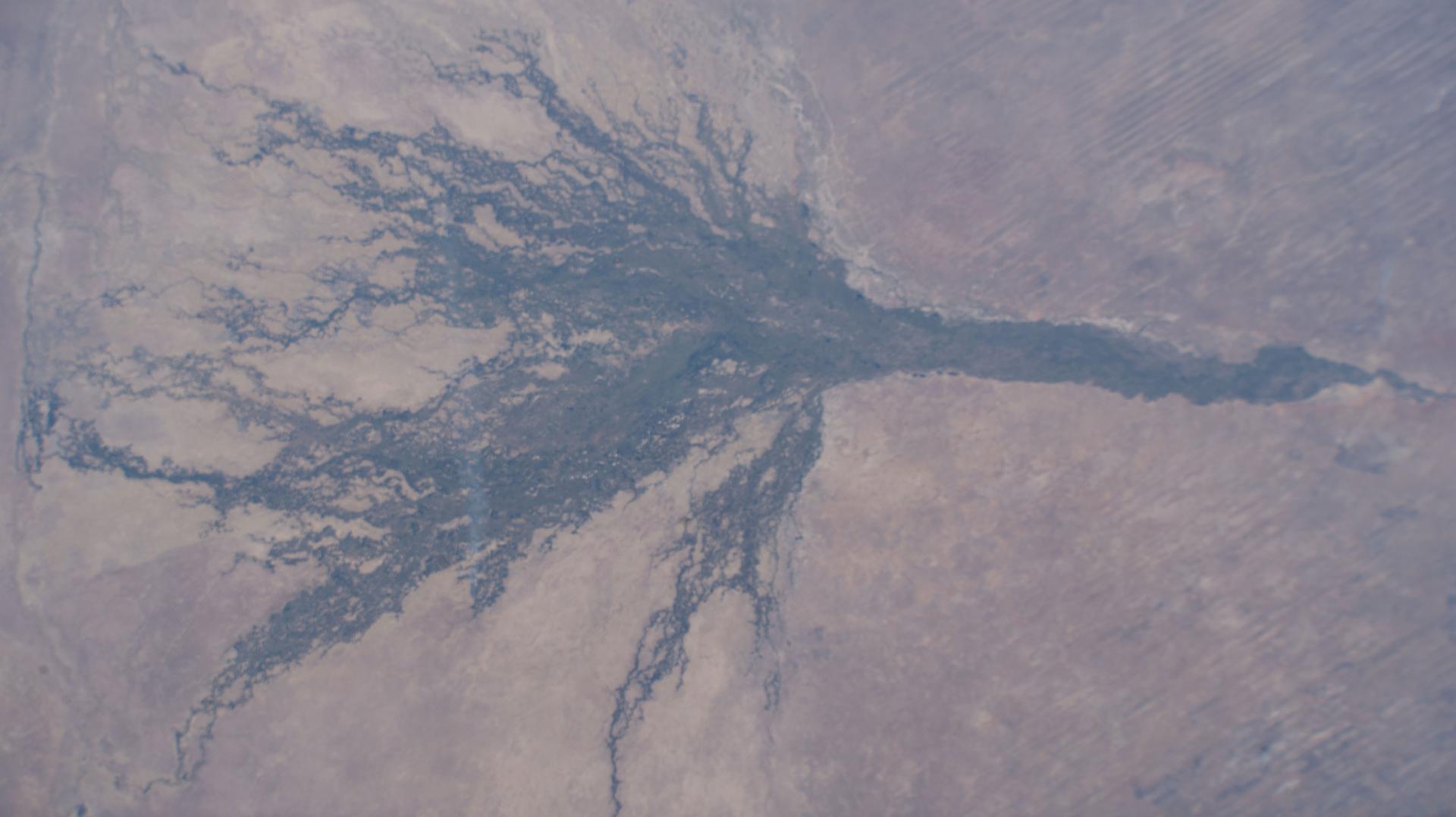
iss073e0604445 (Aug. 30, 2025) --- The Okavango Delta, part of the Moremi Game Reserve in Botswana, is formed by the Okavango River flowing in from Angola. Instead of reaching the sea, the river empties into the Kalahari Desert, creating a lush, seasonally flooded wetland that supports one of the most biodiverse ecosystems in Africa. This photograph was taken from the International Space Station as it orbited 261 miles above the African continent.
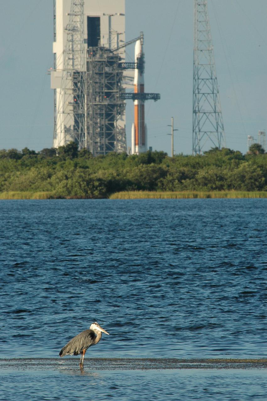
KENNEDY SPACE CENTER, FLA. - On Launch Complex 37 at Cape Canaveral Air Force Station in Florida, the Delta IV rocket and GOES-N satellite are being safed after the launch was scrubbed due to technical issues and postponed to a later date. In the foreground is a heron, wading in shallow water in the Indian River Lagoon. GOES-N is the latest in a series of Geostationary Operational Environmental Satellites providing continuous monitoring necessary for intensive data analysis.
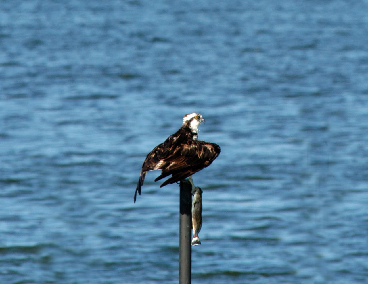
KENNEDY SPACE CENTER, FLA. - Perching on a pole in the Indian River Lagoon, an osprey clutches his most recent catch. The site is near Launch Complex 37 at Cape Canaveral Air Force Station in Florida, where the Delta IV rocket with the GOES-N satellite was poised for launch. The GOES-N is the latest in a series of Geostationary Operational Environmental Satellites providing continuous monitoring necessary for intensive data analysis. The GOES-N launch was delayed due to last minute technical issues and postponed to a later date.
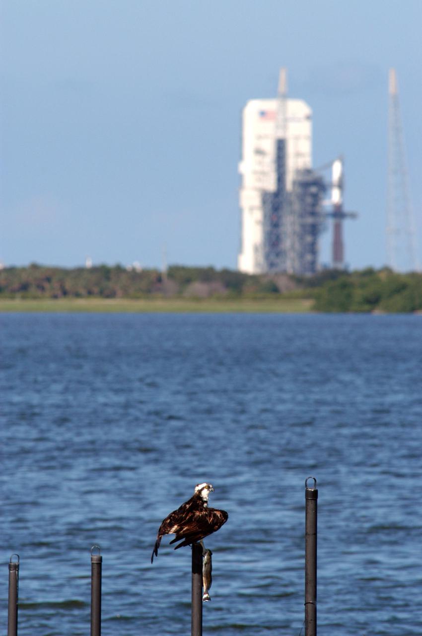
KENNEDY SPACE CENTER, FLA. - Perching on a pole in the Indian River Lagoon, an osprey clutches his most recent catch. In the background is Launch Complex 37 at Cape Canaveral Air Force Station in Florida, where the Delta IV rocket with the GOES-N satellite is poised for launch. The GOES-N is the latest in a series of Geostationary Operational Environmental Satellites providing continuous monitoring necessary for intensive data analysis. The GOES-N launch was delayed due to last minute technical issues and postponed to a later date.
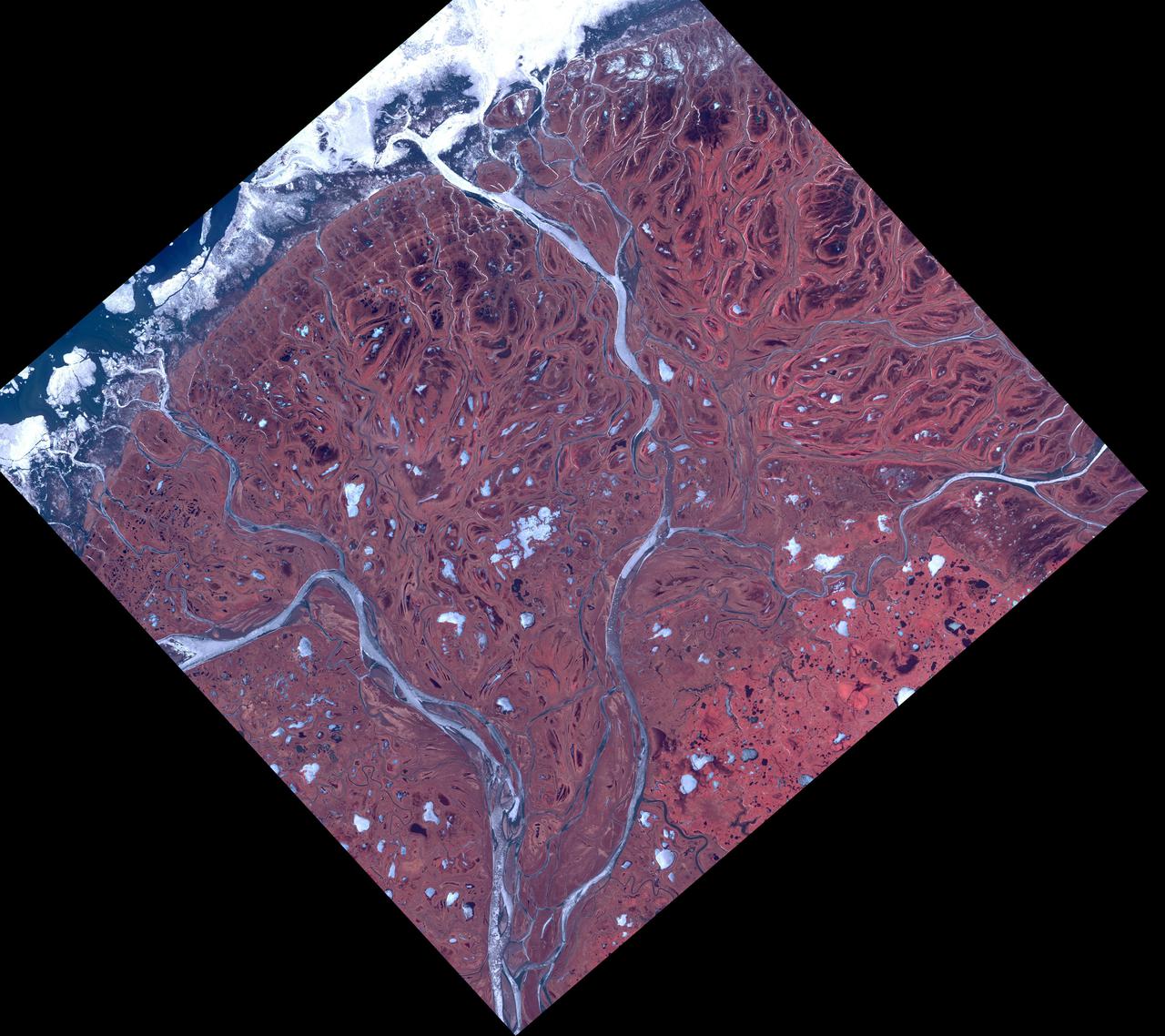
The Yukon River Delta (along with the Kuskokwim River) is one of the largest in the world. Emptying into the Bering Sea on the west coast of Alaska, it is over 130,000 square kilometers in size. The combined delta has about 25,000 Alaska Native residents. The image was acquired May 10, 2017, covers an area of 60 by 60 km, and is located at 62.9 degrees north, 164.3 degrees east. https://photojournal.jpl.nasa.gov/catalog/PIA25124
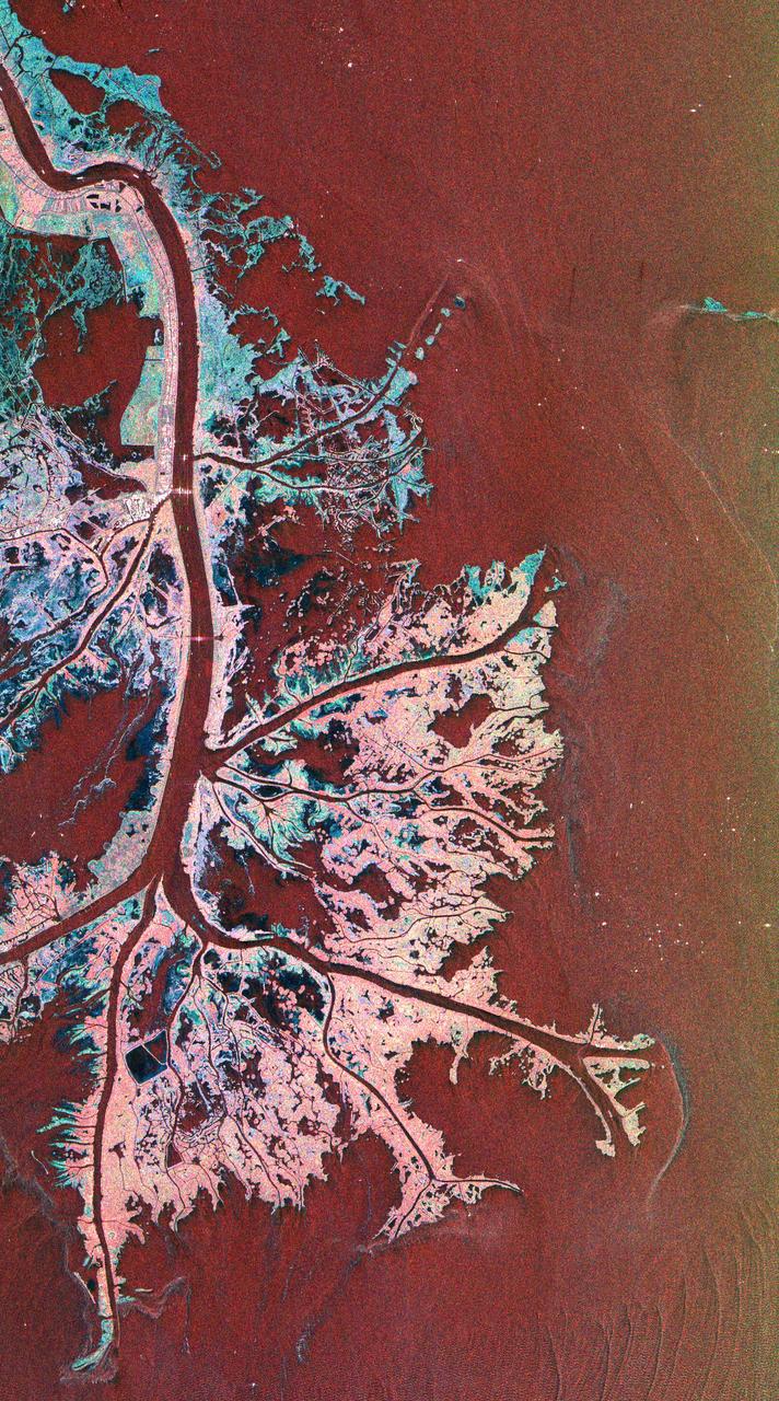
This is a radar image of the Mississippi River Delta where the river enters into the Gulf of Mexico along the coast of Louisiana. This multi-frequency image demonstrates the capability of the radar to distinguish different types of wetlands surfaces in river deltas. This image was acquired by the Spaceborne Imaging Radar-C/X-Band Synthetic Aperture Radar (SIR-C/X-SAR) aboard the space shuttle Endeavour on October 2, 1995. The image is centered on latitude 29.3 degrees North latitude and 89.28 degrees West longitude. The area shown is approximately 63 kilometers by 43 kilometers (39 miles by 26 miles). North is towards the upper right of the image. As the river enters the Gulf of Mexico, it loses energy and dumps its load of sediment that it has carried on its journey through the mid-continent. This pile of sediment, or mud, accumulates over the years building up the delta front. As one part of the delta becomes clogged with sediment, the delta front will migrate in search of new areas to grow. The area shown on this image is the currently active delta front of the Mississippi. The migratory nature of the delta forms natural traps for oil and the numerous bright spots along the outside of the delta are drilling platforms. Most of the land in the image consists of mud flats and marsh lands. There is little human settlement in this area due to the instability of the sediments. The main shipping channel of the Mississippi River is the broad red stripe running northwest to southeast down the left side of the image. The bright spots within the channel are ships. The colors in the image are assigned to different frequencies and polarizations of the radar as follows: red is L-band vertically transmitted, vertically received; green is C-band vertically transmitted, vertically received; blue is X-band vertically transmitted, vertically received. http://photojournal.jpl.nasa.gov/catalog/PIA01784
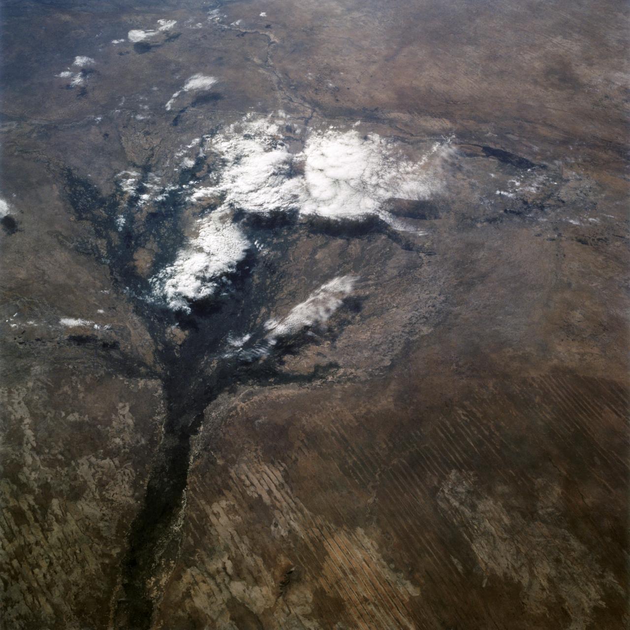
STS066-122-091 (3-14 Nov. 1994) --- This November 1994 view looking south-southeast shows clouds over the Okavango Delta area of northern Botswana. The Okavango is one of the wilder, less spoiled regions of Africa. The area still supports great herds of wild animals such as elephant, zebra and the cape buffalo. Despite conservation efforts from the stable government of Botswana, delta habitats are pressured. The Okavango River (lower left of view) brings water from the high, wet plateaus of Angola into the Kalahari Desert, and enormous inland basin. As a result of a series of small faults (upper center of the view) related to the African Rift System, the river is dammed up in the form of swampy inland delta. Here, water is consumed by evaporation, infiltration, and the swamp forests. Late summer floods take six months to slowly penetrate the 160 kilometer (95 miles) to the other end of the Delta. The visual patterns of the area are strongly linear: straight sand dunes occur in many places and can be seen across the bottom portion of the photograph. Numerous brush-fire scars produce a complex, straight-edged pattern over much of the lower portion of this view. Lake Ngami (upper right of view) was once permanently full as late as the middle 1800's. Changes in the climate of the area over the last 100 years has changed the size and shape of the inland delta.
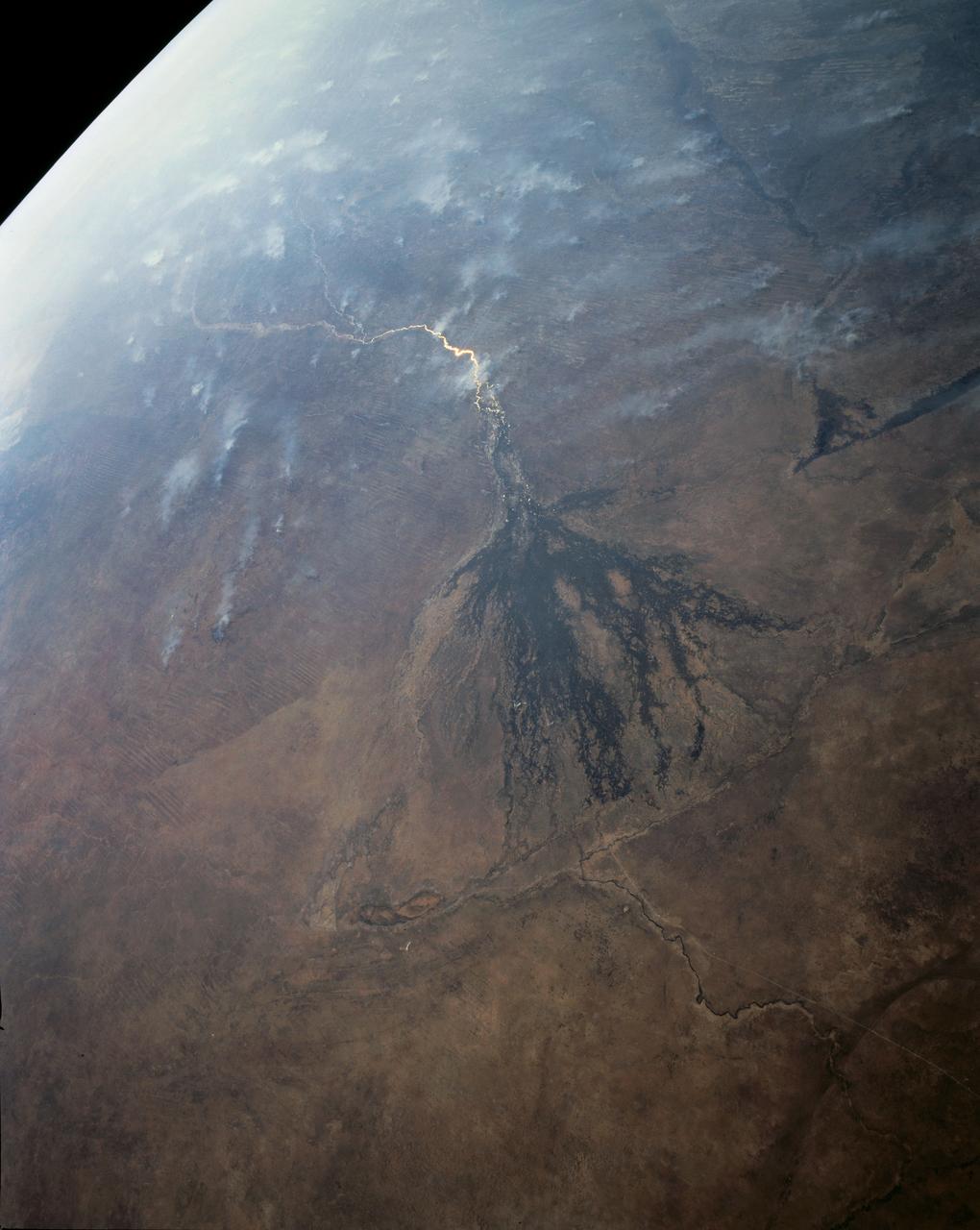
In this panoramic view of the Okavango Swamp, Botswana, (19.0S, 22.0E), the Okavango River, seen in sunglint, flows into a topographic trough to form an inland delta. Water, trapped in the meandering delta distributaries is evaporated or transpired by vegetation. In Angola to the north, the many fires of the seasonal burning of savannah vegetation for land clearing, in preparation for agriculture, has filled the atmosphere with haze and smoke.
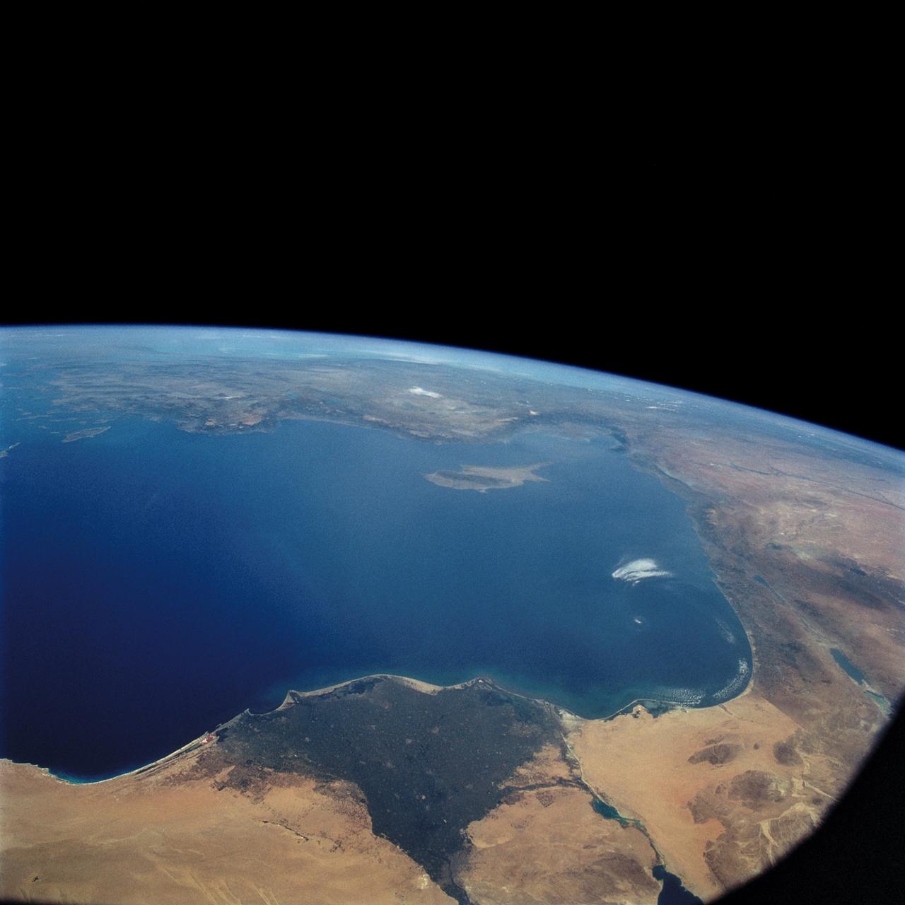
STS057-73-075 (21 June-1 July 1993) --- Eastern Mediterranean from an unusually high vantage point over the Nile River, this north-looking view shows not only the eastern Mediterranean but also the entire landmass of Asia Minor, with the Black Sea dimly visible at the horizon. Many of the Greek islands can be seen in the Aegean Sea (top left), off the coast of Asia Minor. Cyprus is visible under atmospheric dust in the northeast corner of the Mediterranean. The dust cloud covers the east end of the Mediterranean, its western edge demarcated by a line that cuts the center of the Nile Delta. This dust cloud originated far to the west, in Algeria, and moved northeast over Sicily, southern Italy, and Greece. Part of the cloud then moved on over the Black Sea, but another part swerved southward back towards Egypt. A gyre of clouds in the southeast corner of the Mediterranean indicates a complementary counterclockwise (cyclonic) circulation of air. The Euphrates River appears as a thin green line (upper right) in the yellow Syrian Desert just south of the blue-green mountains of Turkey. The Dead Sea (lower right) lies in a rift valley which extends north into Turkey and south thousands of miles down the Gulf of Aqaba, the Red Sea, and on through East Africa. The straight international boundary between Israel and Egypt (where the coastline angles) is particularly clear in this view, marked by the thicker vegetation on the Israeli side of the border. The green delta of the Nile River appears in the foreground, with the great conurbation of Cairo seen as a gray area at the apex of the triangle. Most of Egypt's 52 million inhabitants live in the delta. On the east side of the delta, the Suez Canal is visible. On the western corner of the delta lies the ancient city of Alexandria, beside the orange and white salt pans. The World War II battlesite El Alamein lies on the coast.
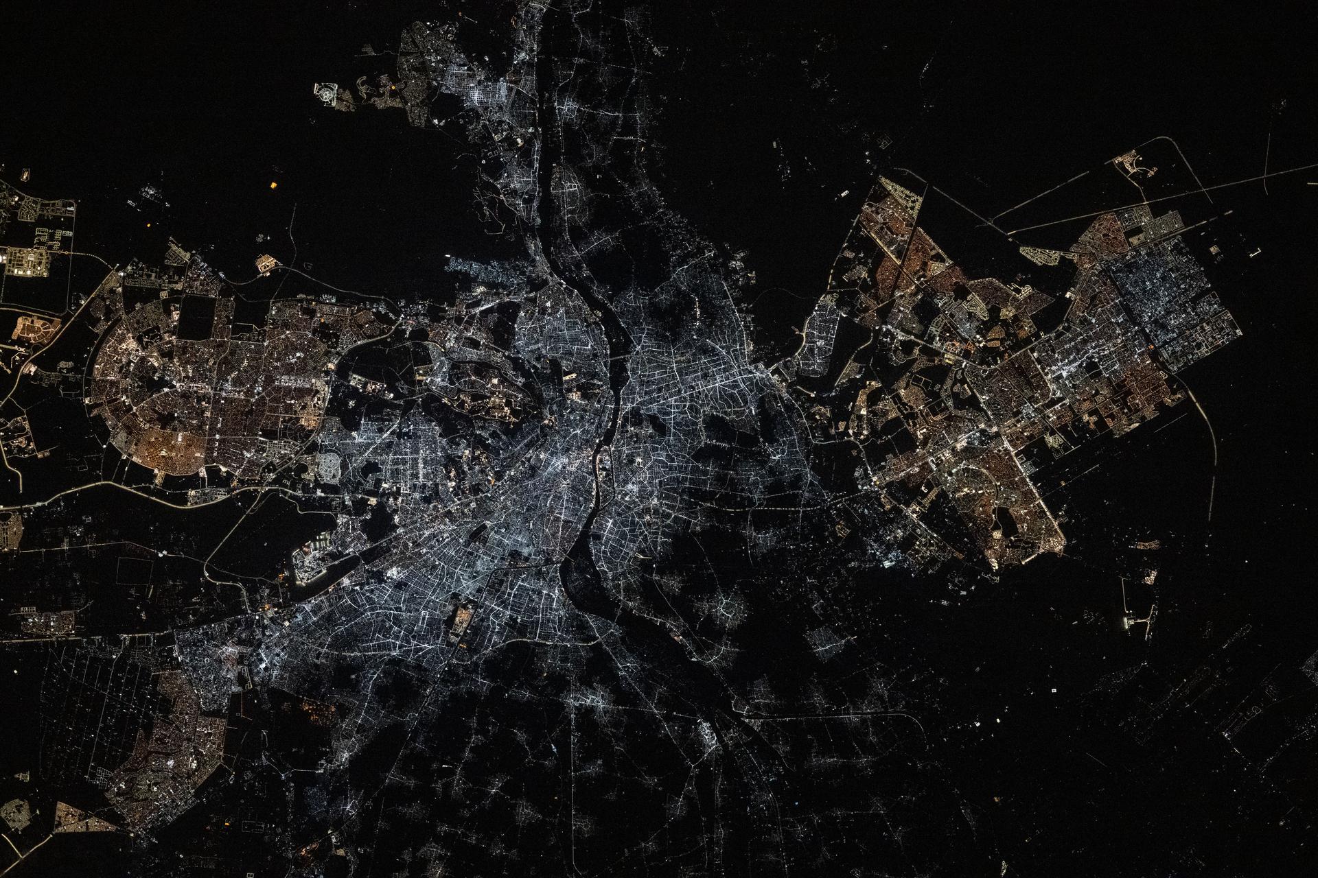
iss074e0043697 (Jan. 3, 2026) --- Egypt’s Cairo metropolitan area, with a population of about 22 million, is split by the Nile River and sits at the southern edge of the Nile Delta. At its center, Cairo and its major urban districts have undergone lighting upgrades, replacing older lamps with LED fixtures that emit bright white light. In contrast, Cairo’s suburban areas still use high-pressure sodium (HPS) lamps, which produce a warm amber glow. The International Space Station was orbiting 260 miles above Earth at approximately 9:09 p.m. local time when this photograph was taken. Credit: JAXA/Kimiya Yui
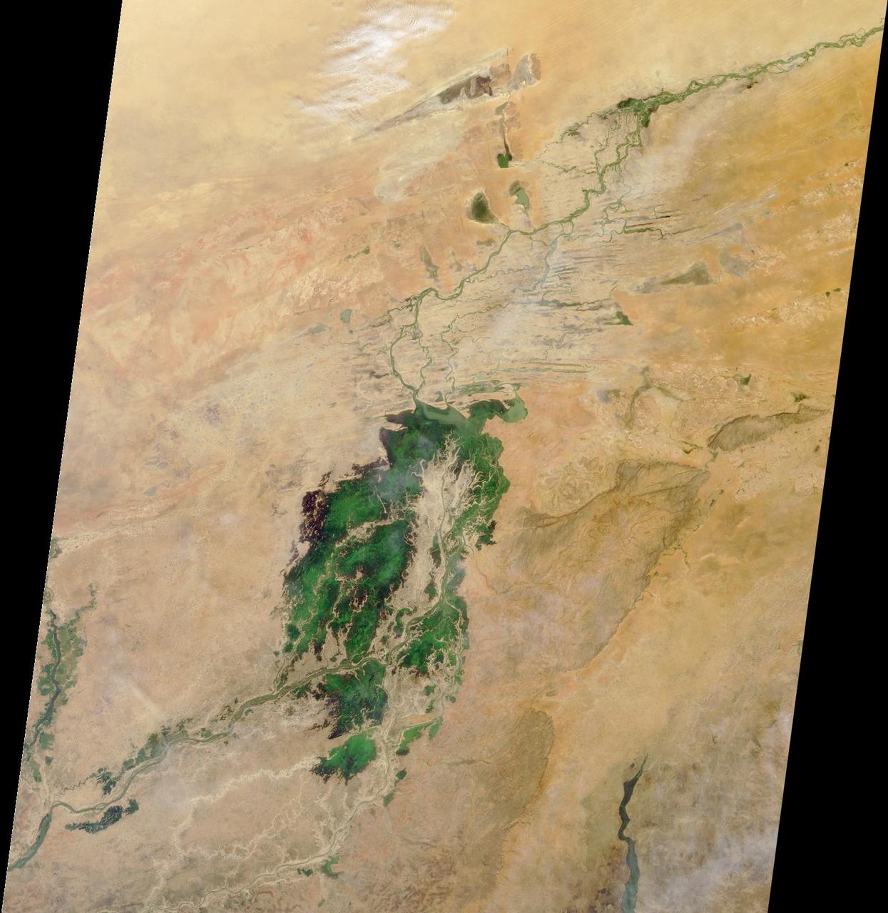
The third largest river in Africa, the Niger, forms an inland delta in central Mali. This image is from NASA Terra satellite is MISR Mystery Image Quiz #3.
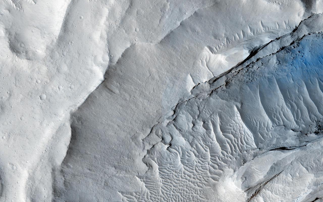
A delta is a pile of sediment dumped by a river where it enters a standing body of water. Evidence for deltas that formed billions of years ago on Mars has been mounting in recent years. One line of evidence not yet investigated is to search for what are called clinoforms. In geology, a clinoform refers to a steep slope of sediment on the outer margin of a delta. This image seeks to test whether those features are visible and help confirm that Mars in ancient times had a standing body of water in this location. http://photojournal.jpl.nasa.gov/catalog/PIA19848
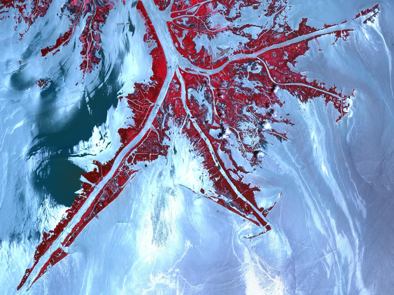
Oil from the Deepwater Horizon spill laps around the mouth of the Mississippi River Delta in this May 24, 2010, image from NASA Terra spacecraft. The oil appears silver, while vegetation is red.
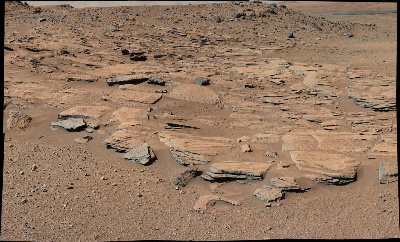
This image from Curiosity Mastcam shows inclined beds of sandstone interpreted as the deposits of small deltas fed by rivers flowing down from the Gale Crater rim and building out into a lake where Mount Sharp is now.
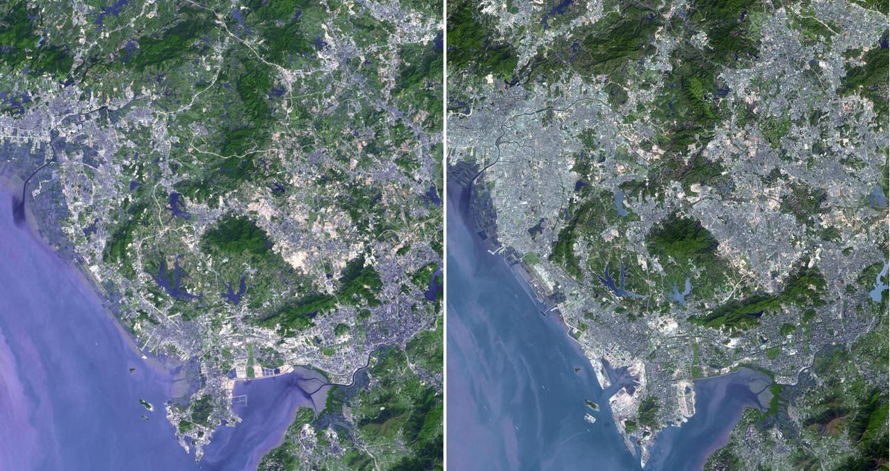
Shenzhen is a city of sub-provincial administrative status in southern China Guangdong province, immediately north of Hong Kong, and located in the Pearl River Delta. This image was acquired by NASA Terra spacecraft.
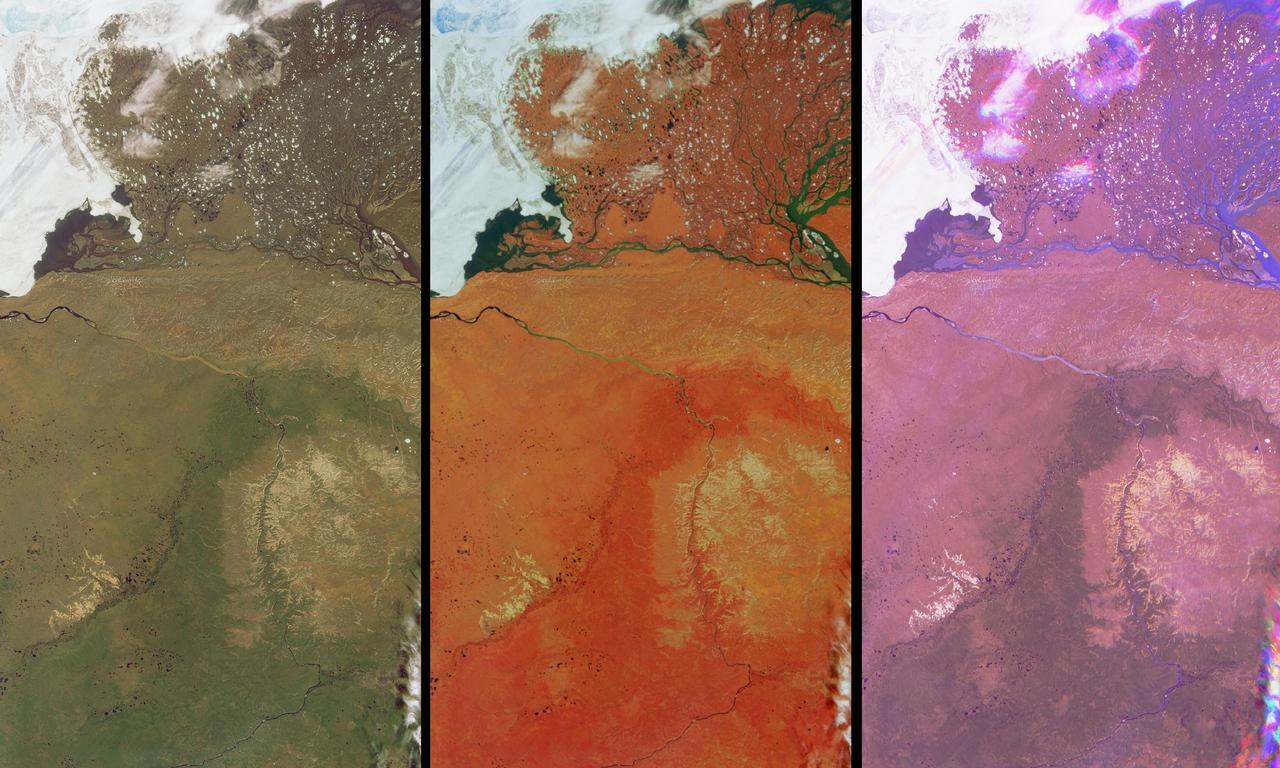
These views of the Russian Arctic were acquired by NASA Terra spacecraft on July 11, 2004, when the brief arctic summer had transformed the frozen tundra and the thousands of lakes, channels, and rivers of the Lena Delta into a fertile wetland.
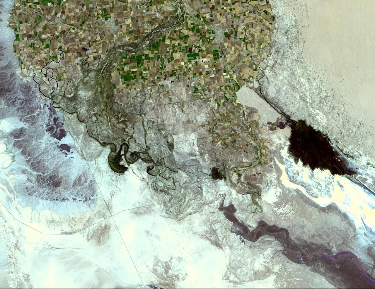
The Colorado River ends its 2330 km journey in the Gulf of Mexico in Baja California. NASA Terra spacecraft acquired this image on May 29, 2006.
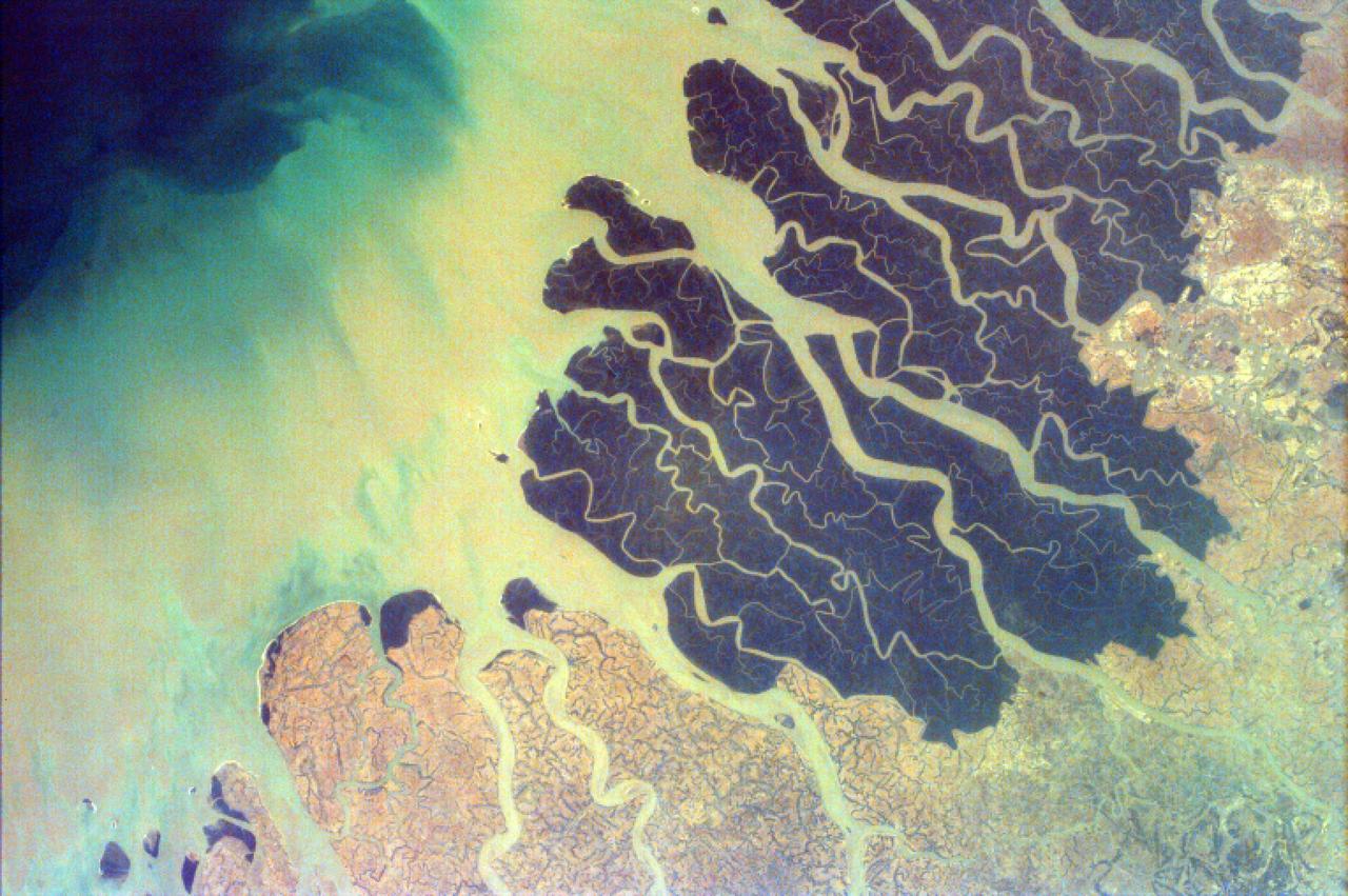
Parts of the vast Ganges delta, in fact the world largest, lie in both Bangladesh and the State of West Bengal, India as seen by NASA EarthKAM.
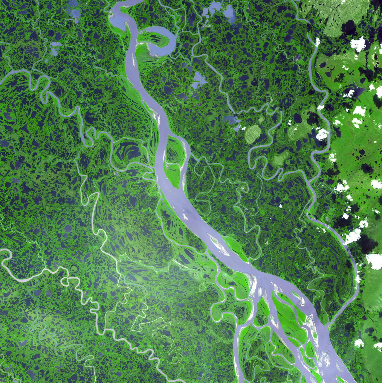
The Mackenzie River in the Northwest Territories, Canada, with its headstreams the Peace and Finley, is the longest river in North America. This image was acquired by NASA Terra satellite on August 4, 2005.
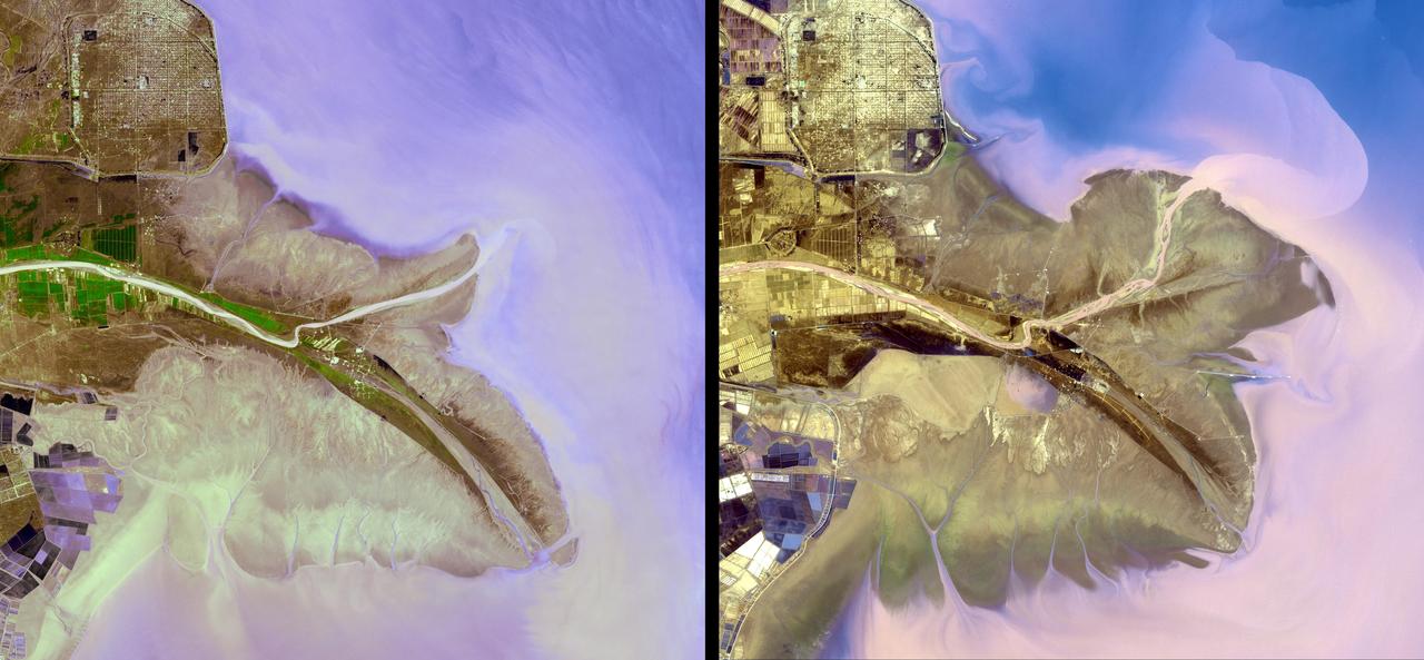
The Yellow River is the second-longest river in China, and the sixth longest in the world and makes many dramatic shifts over time. This image was taken with the ASTER instrument aboard NASA Terra spacecraft in 2009.
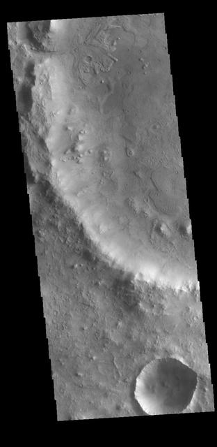
At the top of today's VIS image is a delta deposit that was created by the flow from the rim channel into the crater. Deltas form when sediments settle out due to a decrease in speed of a river system. Deltas often form where large rivers flow into the ocean, like the Mississippi and Nile deltas. This can also occur where rivers flow into large lakes, such as the Great Salt Lake and Lake St. Clair river deltas. It is believed that the Jezero Crater delta formed this way. The delta in Jezero Crater has been chosen as the location for the Mars 2020 mission. Orbit Number: 77838 Latitude: 18.1853 Longitude: 77.4252 Instrument: VIS Captured: 2019-07-02 11:53 https://photojournal.jpl.nasa.gov/catalog/PIA23386
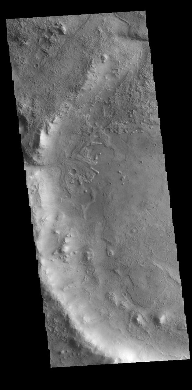
On the left side of today's VIS image is the Jezero Crater delta deposit. This feature was created by the flow from the rim channel into the crater. Deltas form when sediments settle out due to a decrease in speed of a river system. Deltas often form where large rivers flow into the ocean, like the Mississippi and Nile deltas. This can also occur where rivers flow into large lakes, such as the Great Salt Lake and Lake St. Clair river deltas. It is believed that the Jezero Crater delta formed this way. Jezero Crater is the home of the Mars 2020 rover – Perseverance – and its little helicopter buddy – Ingenuity. The Mars 2020 mission is focused on the delta, and the information it holds about a time when Mars was much wetter. Orbit Number: 95046 Latitude: 18.449 Longitude: 77.436 Instrument: VIS Captured: 2023-05-19 09:28 https://photojournal.jpl.nasa.gov/catalog/PIA26252
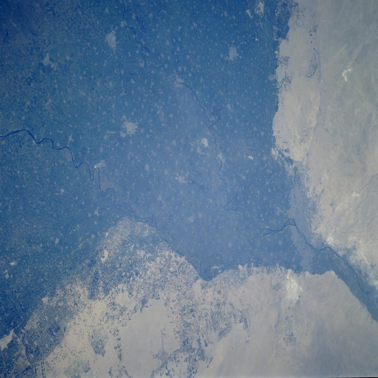
STS106-701-025 (8-20 September 2000) --- One of the STS-106 crew members on board the Space Shuttle Atlantis used a handheld 70mm camera to photograph this image of Cairo, Egypt, the largest city in Africa. Its population is nearly 16 million, a figure which translates to approximately 130,000 people per square mile. Metropolitan Cairo shows as a gray area in the green of the Nile River valley at the apex of the Delta. The shadows of the three major pyramids at Giza on the Western edge of the city are visible. They are right below the bright new road construction. This side of the metropolitan area is experiencing rapid growth. According to geologists who have been studying shuttle-to-Earth imagery for many years, this photograph documents some of the many changes in land use in the Western Desert.
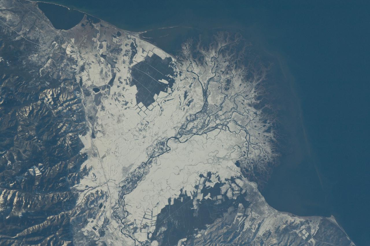
ISS029-E-037915 (3 Nov. 2011) --- Snowfall on the Selenga River Delta, Russian Federation is featured in this image photographed by an Expedition 29 crew member on the International Space Station. This photograph illustrates the Selenga River Delta built out into Lake Baikal in Russia. The Selenga River delta (center) is lobate in form, with an intricate network of distributary channels and levees surrounded by marshlands building out into Lake Baikal. This suggests that development of the delta is governed by the sediment load carried by the river, and any modifications of form due to lake tides or waves are relatively minor. Further out, dark brown depositional bars are visible forming a rough arc marking the edge of the delta. Snow cover on the river floodplain highlights numerous secondary channels, as well as channels previously occupied by the river but now abandoned. The regular outlines of agricultural fields to the southwest and northeast of the river are also highlighted by the snow cover. Lake Baikal is a World Heritage Site. The Selenga River is the major contributor of water to Lake Baikal; it occupies approximately 82 per cent of the watershed area for the lake. The wetlands of the Selenga River delta are designated as a RAMSAR site and provide valuable habitat for more than 170 species of birds, including many that are migrating. Like Baikal, the Selenga Delta is home to unique ecosystems, including more than 70 rare or endangered species of plants and animals. Waters of the Selenga River serve many (and differing) uses in both Mongolia and Russia, including support of agriculture, provision of drinking water, light industry, mining, recreation, and tourism. These uses also contribute to degradation of the river water quality, downstream availability of water, and ecological impacts. For example, a pulp and paper plant in the city of Selenginsk (lower left) has been tied to high levels of pollution in the river. International efforts to integrate management of the Selenga River basin for both ecological and economic sustainability are ongoing.
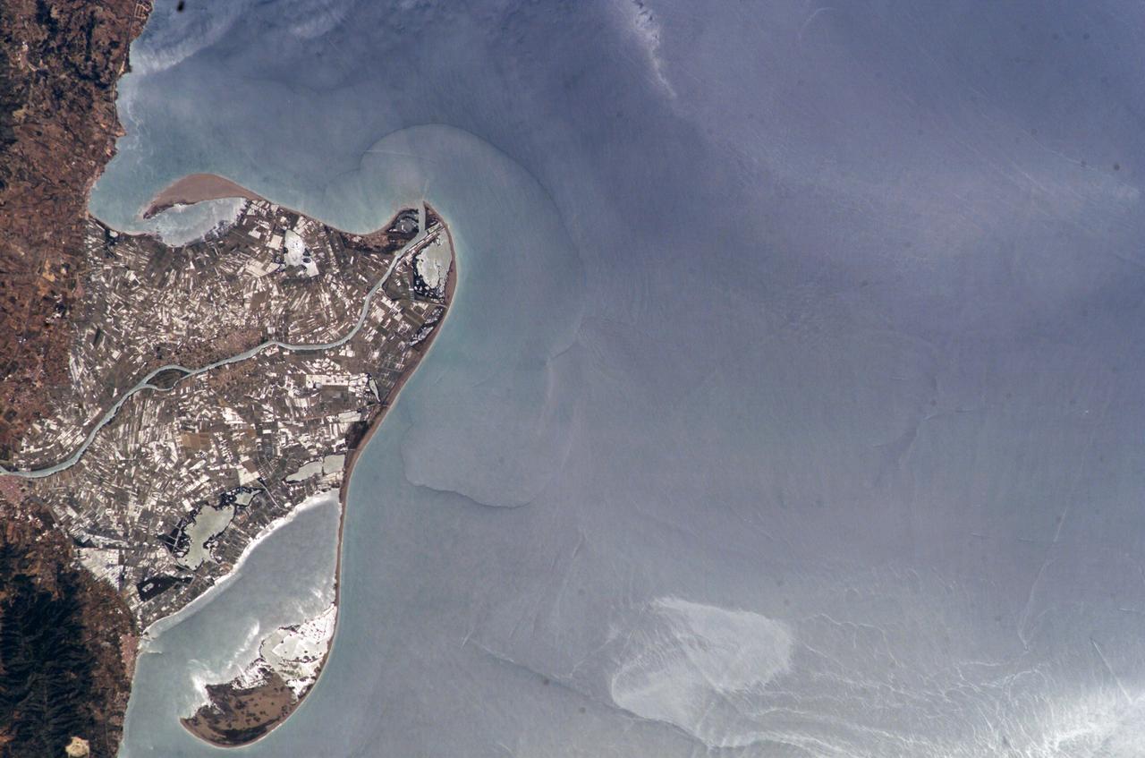
ISS009-E-09985 (3 June 2004) --- The Ebro River Delta, located along the eastern coast of Spain, is featured in this image photographed by an Expedition 9 crewmember on the International Space Station (ISS). Taken in partial sun glint, this view defines the Ebro’s fresh water lens— the water density boundary between the upper layer of fresh water issuing from the Ebro River mouth and the saltier, denser Mediterranean Sea water. According to NASA geologists studying the ISS imagery, diversion and impoundment of the Ebro River upstream has led to a decrease in water and sediment delivery to the delta. This decrease has led to increased erosion in some areas to the northeast of El Fangar Bay and along the southwestern shoreline of the delta. The Ebro River Delta is one of the largest wetland areas in the western Mediterranean region. The Ebro delta has grown rapidly—the historical rate of growth of the delta is demonstrated by the city of Amposta. This city was a seaport in the 4th Century, and is now located well inland from the current Ebro river mouth. The rounded form of the delta attests to the balance between sediment deposition by the Ebro River and removal of this material by wave erosion. The modern delta is in intensive agricultural use for rice, fruit, and vegetables. White polygonal areas to the north and south of the Ebro River are paddy fields. The Ebro delta also hosts numerous beaches, marshes, and saltpans that provide habitat for over 300 species of birds. A large part of the delta was designated as Parc Natural del Delta de l'Ebre (Ebre Delta National Park) in 1983. A network of canals and irrigation ditches constructed by both agricultural and conservation groups are helping to maintain the ecologic and economic resources of the Ebro Delta.
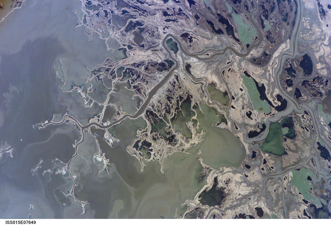
ISS015-E-07649 (11 May 2007) --- Saskatchewan River Delta, Manitoba, Canada is featured in this image photographed by an Expedition 15 crewmember on the International Space Station. This image highlights a portion of the Saskatchewan River delta extending into Cedar Lake in the Province of Manitoba. The Saskatchewan River watershed extends from the Rocky Mountains of Alberta through the plains of Saskatchewan and Manitoba. The construction of the Grand Rapids Dam to the southeast (not shown) in the 1960s flooded the Cedar Lake basin. This has resulted in the formation of numerous shallow, muddy lakes and bogs (dark green to dark grey irregular areas and at upper right) in and around the Saskatchewan River delta. The level of saturation in these bogs is such that peat (semiconsolidated plant and organic matter) deposits have formed; over long periods of time and under the right geological conditions, such deposits can become coal. The velocity of Saskatchewan River water slows significantly as it enters Cedar Lake; as the flow velocity drops, entrained sediment comprised of silt, clay, sand, and gravel is deposited at the river mouth. These deposits, called alluvium by geologists, account for much of the light tan to grey materials bordering the active channels visible in the image (Saskatchewan River, Summerberry River). According to scientists, fossil-bearing amber -- originating from Late Cretaceous (approximately 65-99 million years ago) coal deposits over a thousand kilometers to the west of Cedar Lake -- is also found in the deltaic sediments. As the deposits accumulate, old channels are abandoned and new channels are formed, as the river seeks more favorable flow paths into the lake, this process (known as avulsion) builds out the river delta over time. A typical "birds foot" delta form is currently being constructed at the mouth of the Saskatchewan River (lower left). The birds foot structure is approximately 13 kilometers wide. The Mississippi River's active delta, while having the same general form, is much larger by comparison -- it is approximately 50 kilometers wide.
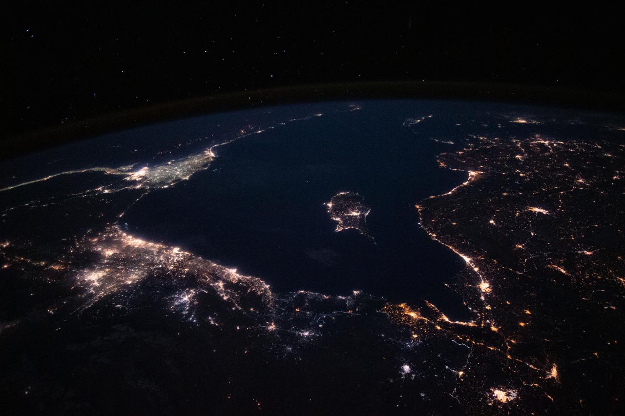
Night Earth Observations taken by Expedition 63 crew. Folder indicates: Nile River delta taken with 24mm lens.
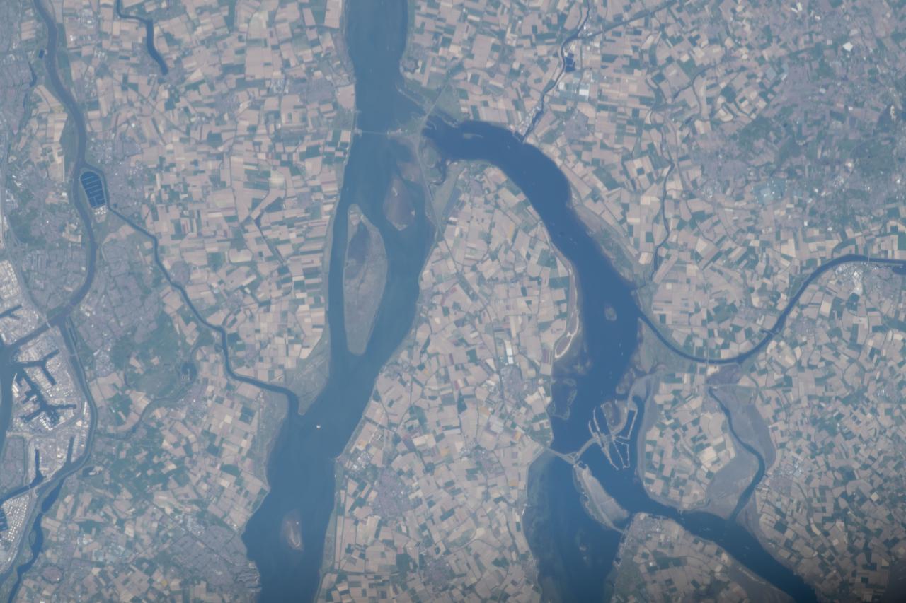
iss063e002750 (April 23, 2020) --- The Rhine–Meuse–Scheldt delta, a river delta in the Netherlands, is pictured from the International Space Station as it orbited off the east coast of England.
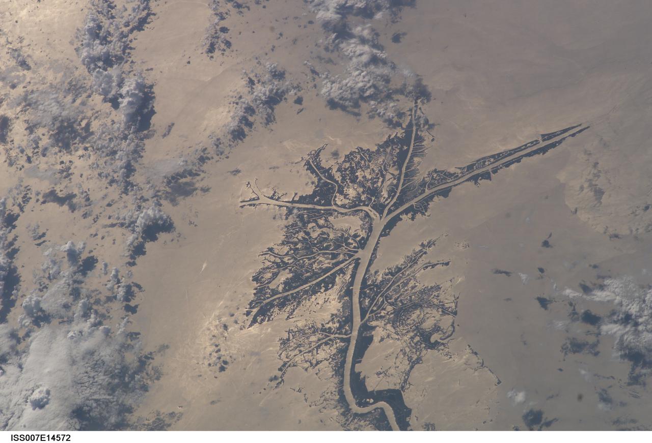
ISS007-E-14572 (8 September 2003) --- This view of the Mississippi River Delta on the Gulf of Mexico was taken by an Expedition 7 crewmember onboard the International Space Station (ISS). This delta area is often referred to as the "crow's foot."
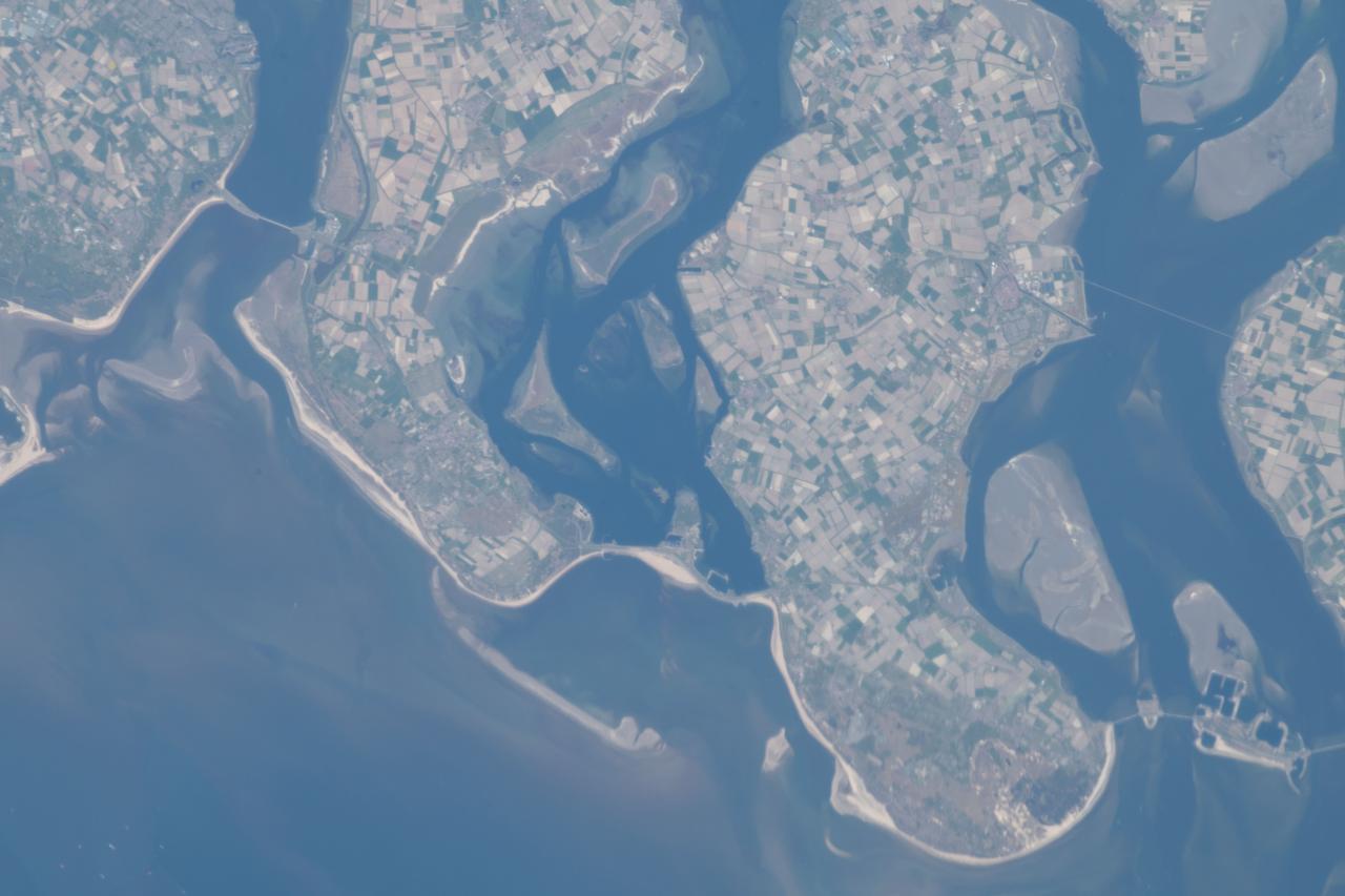
iss063e002730 (April 23, 2020) --- The Rhine–Meuse–Scheldt delta, a river delta in the Netherlands, is pictured from the International Space Station as it orbited off the east coast of England.
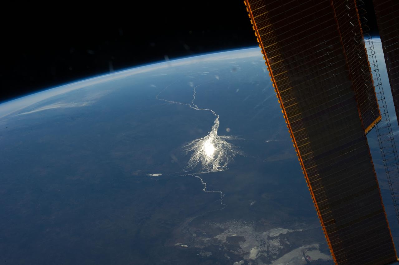
ISS040-E-008209 (6 June 2014) --- Okavango inland delta in northern Botswana is featured in this image photographed by an Expedition 40 crew member on the International Space Station. The great Okavango delta in the Kalahari Desert is illuminated in the sun?s reflection point in this panorama. Using this sun glint technique, crew members can image fine detail of water bodies. Here the bright line of the Okavango River shows the annual summer flood advancing from the well-watered Angolan Highlands (upper margin) to the delta. Then the flood water slowly seeps across the 150 kilometer-long delta, supplying forests and wetlands, finally reaching the fault-bounded lower margin of the delta in the middle of winter. Most of the water of this large river is used up by the forests, or evaporates in the dry air. Only two percent of the river?s water actually exits the delta. The wetland supports high biodiversity in the middle of the otherwise semiarid Kalahari Desert, and is now one of the most famous tourist sites in Africa. This view also shows the small quantity of water in the Boteti River. Okavango water only reaches the dry lake floors (lower right) in the wettest years. Part of one of the station?s solar arrays is visible at right.
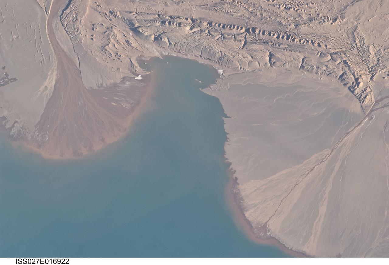
ISS027-E-016922 (25 April 2011) --- River deltas and Lake Ayakum in China (Tibet) are featured in this image photographed by an Expedition 27 crew member on the International Space Station. The Tibetan Plateau contains numerous lakes that dot an otherwise arid landscape. Lake Ayakum is located near the northern boundary of the Plateau to the southeast of the Kunlun Mountains. While many of the small glacier- and snowmelt-fed streams that cross the Tibetan Plateau eventually give rise to major Southeast Asian rivers including the Mekong and Yangtze, some empty into saline lakes such as Lake Ayakum. This detailed photograph highlights two river deltas (upper left and lower right) formed along the southwestern shoreline of the lake. When sediments build up to the point that a river can no longer flow over them, it will jump to a new channel position and begin the process anew. Scientists have noted that, over geologic time, the channels tend to sweep back and forth ? similar to the motion of an automobile windshield wiper ? to form the typical semi-circular or fan shape of the delta. Gray to tan surfaces of both deltas indicate prior positions of their respective river channels; the uniform coloration and smooth texture suggest that they are relatively old and are now inactive. In contrast, the younger and currently active delta surfaces can be recognized by reddish-brown sediment and clearly visible river channels. Lateral channel migration is particularly evident in the approximately eight-kilometer-wide active delta area at upper left. The reddish coloration of the actively depositing sediment may indicate a change from the sources that formed the older parts of the deltas (or indicate weathering and soil formation on the older deposits), or an episodic input of dust or other material to the river catchments.

NASA's Perseverance Mars rover looks out at the expanse of Jezero Crater's river delta on April 11, 2022, the 406th Martian day, or sol, of the mission. This panorama is made up of 64 individual images from the rover's Mastcam-Z camera system and stitched together after the files were sent back from Mars. The color bands of the image have been processed to improve visual contrast and accentuate color differences. The sky would not actually look blue to a human explorer on the Red Planet. The delta formed billions of years ago from sediment that an ancient river carried to the mouth of the lake that once existed in the crater. Aeolian bedforms (sand dunes) can be seen running along the base of the delta. The hills visible on the distant horizon to the far left of the image – about 3.8 miles (6.2 kilometers) away from the rover – are actually part of the rim of Jezero Crater. The peak of the delta remnant to the right center of the image is about 920 feet (260 meters) away and the peak of the hill camera right is about 950 feet (280 meters) away. The portion of the delta farthest left in this image (visible directly below the crater wall) is the area where "Cape Nukshak" and "Hawksbill Gap" channels can be found. The rover is expected to ascend to the top of the delta via one of these two channels. A key objective for Perseverance's mission on Mars is astrobiology, including the search for signs of ancient microbial life. The rover will characterize the planet's geology and past climate, pave the way for human exploration of the Red Planet, and be the first mission to collect and cache Martian rock and regolith (broken rock and dust). Subsequent NASA missions, in cooperation with ESA (European Space Agency), would send spacecraft to Mars to collect these sealed samples from the surface and return them to Earth for in-depth analysis. The Mars 2020 Perseverance mission is part of NASA's Moon to Mars exploration approach, which includes Artemis missions to the Moon that will help prepare for human exploration of the Red Planet. https://photojournal.jpl.nasa.gov/catalog/PIA25212
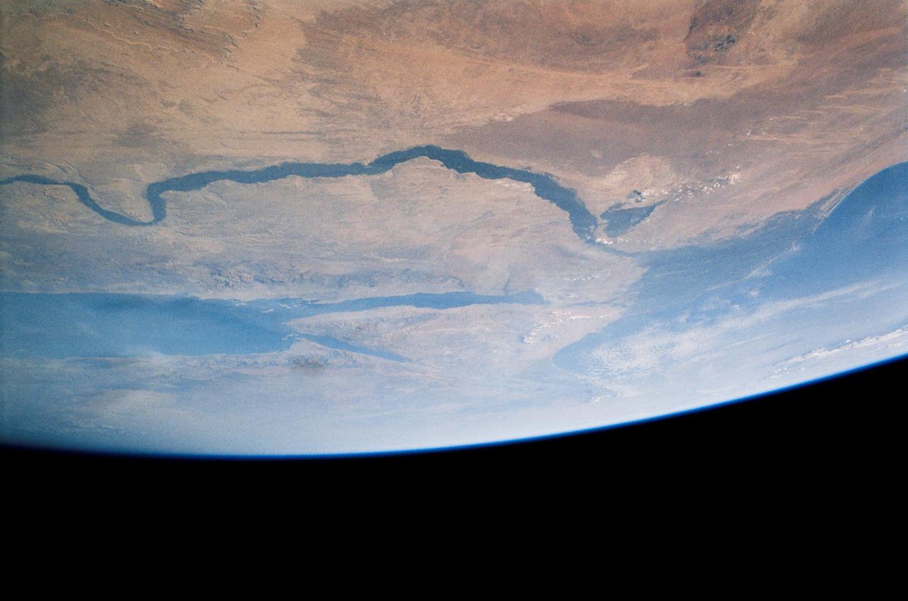
STS121-334-026 (4-17 July 2006) --- This photo, featuring an easterly view of the Nile River, the Nile River Delta, Sinai Peninsula, the Suez Canal, Red Sea and part of the Mediterranean Sea, was taken by one of the STS-121 crewmembers aboard the Space Shuttle Discovery. Cairo, Egypt, can be seen at far right.

iss060e000602 (June 26, 2019) --- The Volga River is the longest river in Europe and runs through Russia with its delta flowing into the Caspian Sea just south of the Kazakhstan border. The International Space Station was orbiting above the Caspian Sea at an altitude of 256 miles when this photograph was taken during Expedition 60.
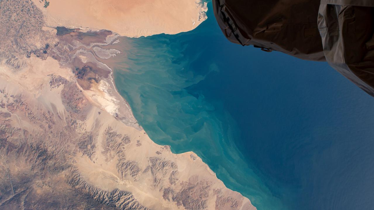
iss064e002258 (Oct. 28, 2020) --- The upper Gulf of California and Colorado River Delta Biosphere Reserve in Mexico is pictured from the International Space Station.
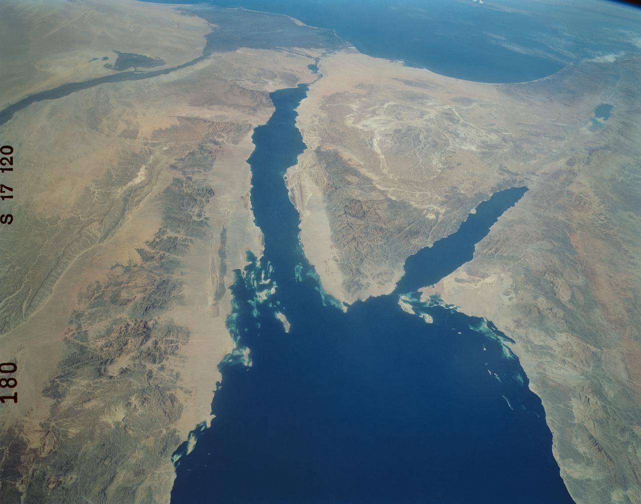
An excellent panoramic view of the entire Sinai Peninsula (29.0N, 34.0E) and the nearby Nile River Delta and eastern Mediterranean coastal region. The Suez Canal, at the top of the scene just to the right of the Delta, connects the Mediterranean Sea with the Gulf of Suez on the west side of the Sinai Peninsula and the Gulf of Aqaba is on the west where they both flow into the Red Sea. At upper right, is the Dead Sea, Jordan River and Lake Tiberius.
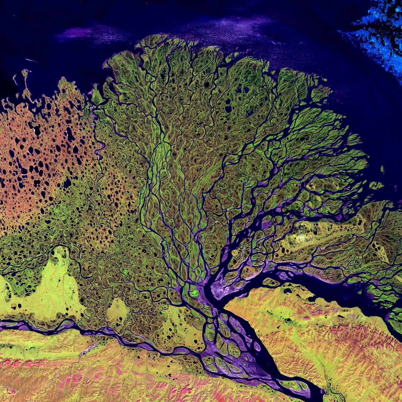
Image taken 7/27/2000: The Lena River, some 2,800 miles (4,400 km) long, is one of the largest rivers in the world. The Lena Delta Reserve is the most extensive protected wilderness area in Russia. It is an important refuge and breeding grounds for many species of Siberian wildlife. The Lena Delta can be found on Landsat 7 WRS Path 131 Row 8/9, center: 72.21, 126.15. To learn more about the Landsat satellite go to: <a href="http://landsat.gsfc.nasa.gov/" rel="nofollow">landsat.gsfc.nasa.gov/</a>
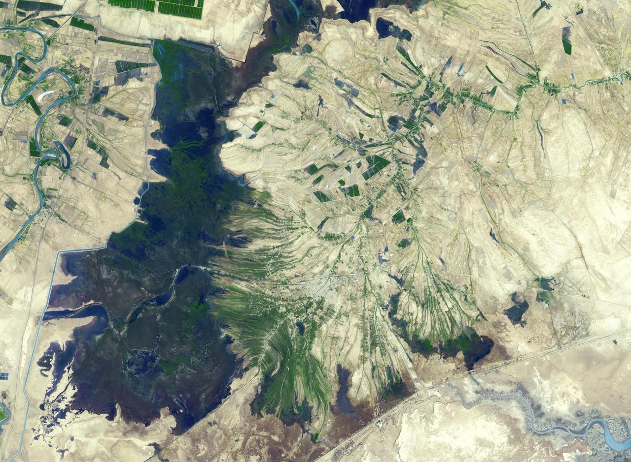
The town of Shadegan, Iran is northeast of where the Tigris and Euphrates Rivers enter the Persian Gulf. It sits near a wetland and upon land that was once part of an inland river delta. The long, linear orchards follow the topography created by the delta. The image was acquired September 3, 2012, covers an area of 40.6 by 55.3 km, and is located at 30.6 degrees north, 48.6 degrees east. http://photojournal.jpl.nasa.gov/catalog/PIA21170
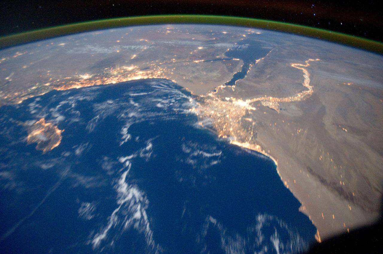
ISS029-E-031157 (15 Oct. 2011) --- One of the Expedition 29 crew members aboard the International Space Station recorded this oblique view showing the Mediterranean Sea area, including the Nile River and the river's delta, and the Sinai Peninsula, on Oct. 15, 2011. Cyprus is visible at left. At first look, the image appears to have been photographed in daylight, but actually it was taken at 01:01:08 GMT. Some areas of the photo like the river and river delta appear as the brightest areas because of either man-made lighting (mostly incandescent) or man-made lighting reflected off nearby surfaces. The other areas appear to be illuminated naturally by moonlight, starlight, or back-scattered light from the atmosphere. A 20-mm focal length was used to record the image.
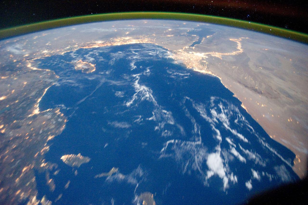
ISS029-E-031143 (15 Oct. 2011) --- One of the Expedition 29 crew members aboard the International Space Station recorded this oblique view showing the Mediterranean Sea area, including parts of Turkey, the Nile River and the river's delta, and the Sinai Peninsula, on Oct. 15, 2011. At first look, the image appears to have been photographed in daylight, but actually it was taken at 01:01:26 GMT. Some areas of the photo like the river and river delta appear as the brightest areas because of either man-made lighting (mostly incandescent) or man-made lighting reflected off nearby surfaces. The other areas appear to be illuminated naturally by moonlight, starlight, or back-scattered light from the atmosphere. A 20-mm focal length was used to record the image.
ISS009-E-18679 (17 August 2004) --- Ural River Delta, Kazakhstan is featured in this image photographed by an Expedition 9 crewmember on the International Space Station (ISS). The Ural River is one of two major rivers (the other river is the Volga) that empty into the northern coast of the Caspian Sea, creating extensive wetlands. This image shows details of the Ural's tree-like (or “digitate”) delta. According to NASA scientists studying the Space Station imagery, this type of delta forms when wave action is low and sediment content in the river is high. New distributary channels form in the delta when the river breaches natural levees formed by sediment deposition. The dark regions running along the coast are the wetlands that support high biodiversity due to the unique environment and relative isolation of the Caspian Sea. The coastal wetlands are especially important to migrating birds as an important stop-over along the Asian flyway. The Ural River's trek to the Caspian is long — roughly 2400 kilometers (1500 miles) from the Ural Mountains in Russia south to empty into the northern Caspian Sea in Kazakhstan. Although the current sea level of the Caspian is more than 26 meters below global mean sea level the water levels have risen roughly 2 meters since 1980. This has lead to flooding of much of the coastal region, including the Ural delta, and endangers these coastal wetland environments. The coastal flooding has also impacted the oil exploration infrastructure bordering the Caspian coastline, scientists report.
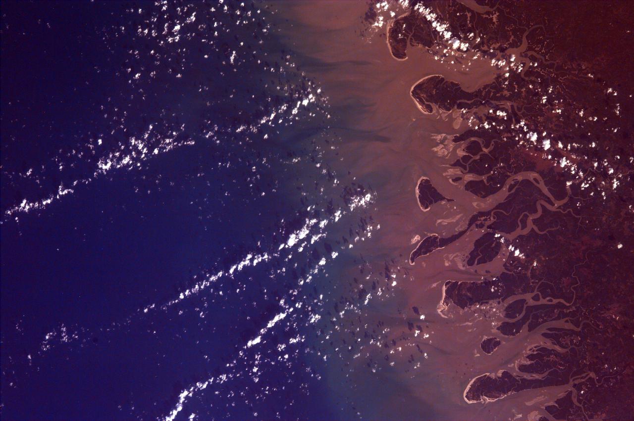
This is an image from NASA EarthKAM of the Rio Gurupi in the Brazilian state of Maranhao and its delta. It is the only open sea delta in the Americas and has more than 70 islands of various sizes.
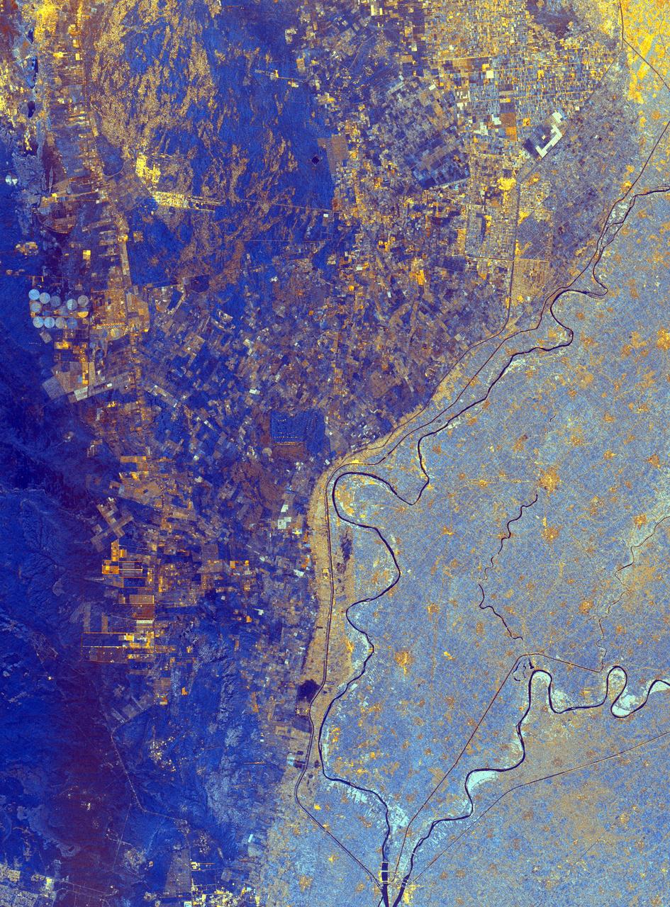
This spaceborne radar image shows the area just north of the city of Cairo, Egypt, where the Nile River splits into two main branches.
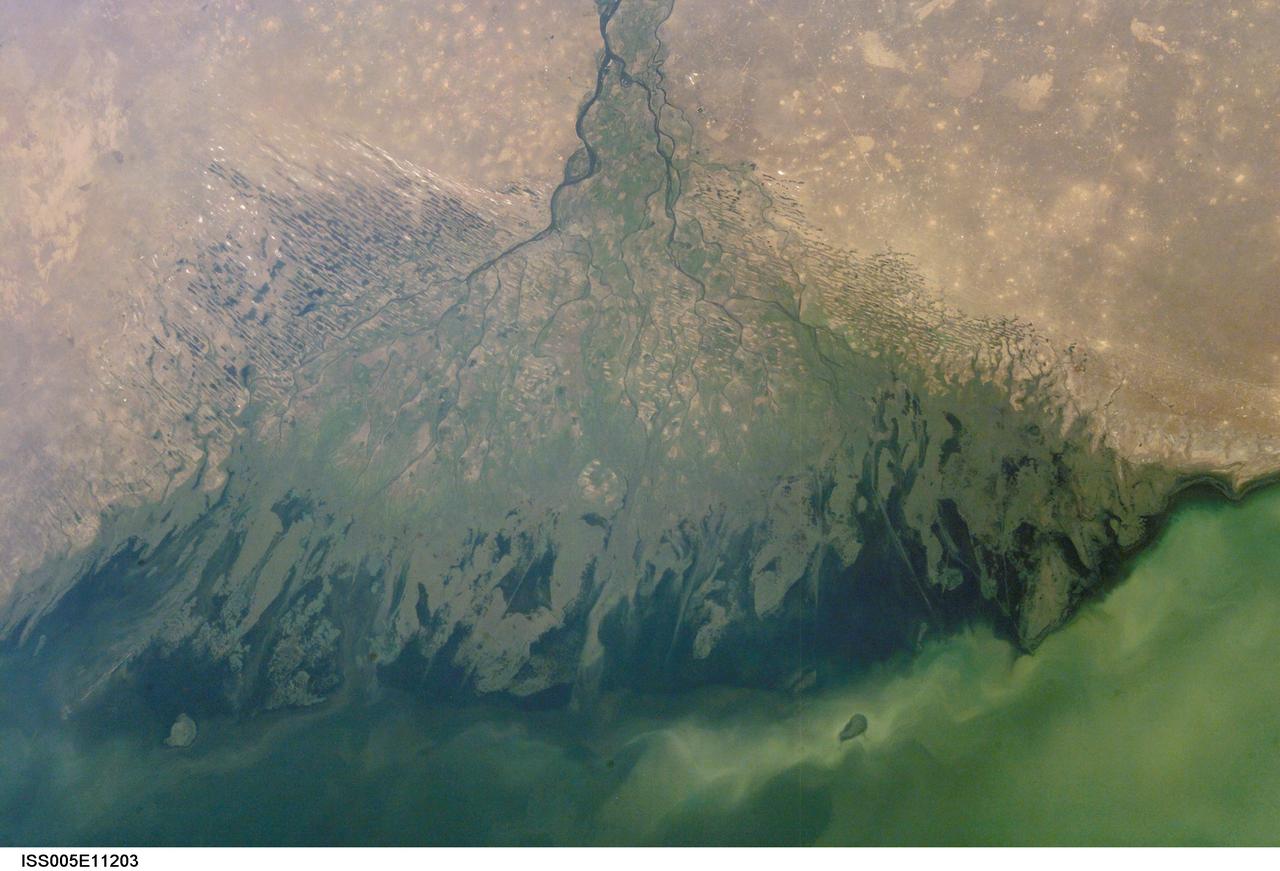
ISS005-E-11203 (25 Aug. 2002) --- The Volga Delta, Russia is featured in this image photographed by an Expedition Five crewmember on the International Space Station. The Volga River drains much of western Russia's industrial region and travels southward to empty into the Caspian Sea. According to scientists, over thousands of years, the river has built out a tremendous delta that forms the northwestern shoreline of the Caspian Sea. The Volga Delta is many things: the delta channels provide transportation access between the heartland of Russia and the oil-rich Caspian Sea. The Volga's extensive distributaries harbor habitat and rich fishing grounds for Russia's famous beluga sturgeon -- better known as the source of beluga caviar. The delta's wetlands, parts of which are designated as the Astrakhanskiy Biosphere Reserve, are important stopping points and breeding grounds for migrating water birds.
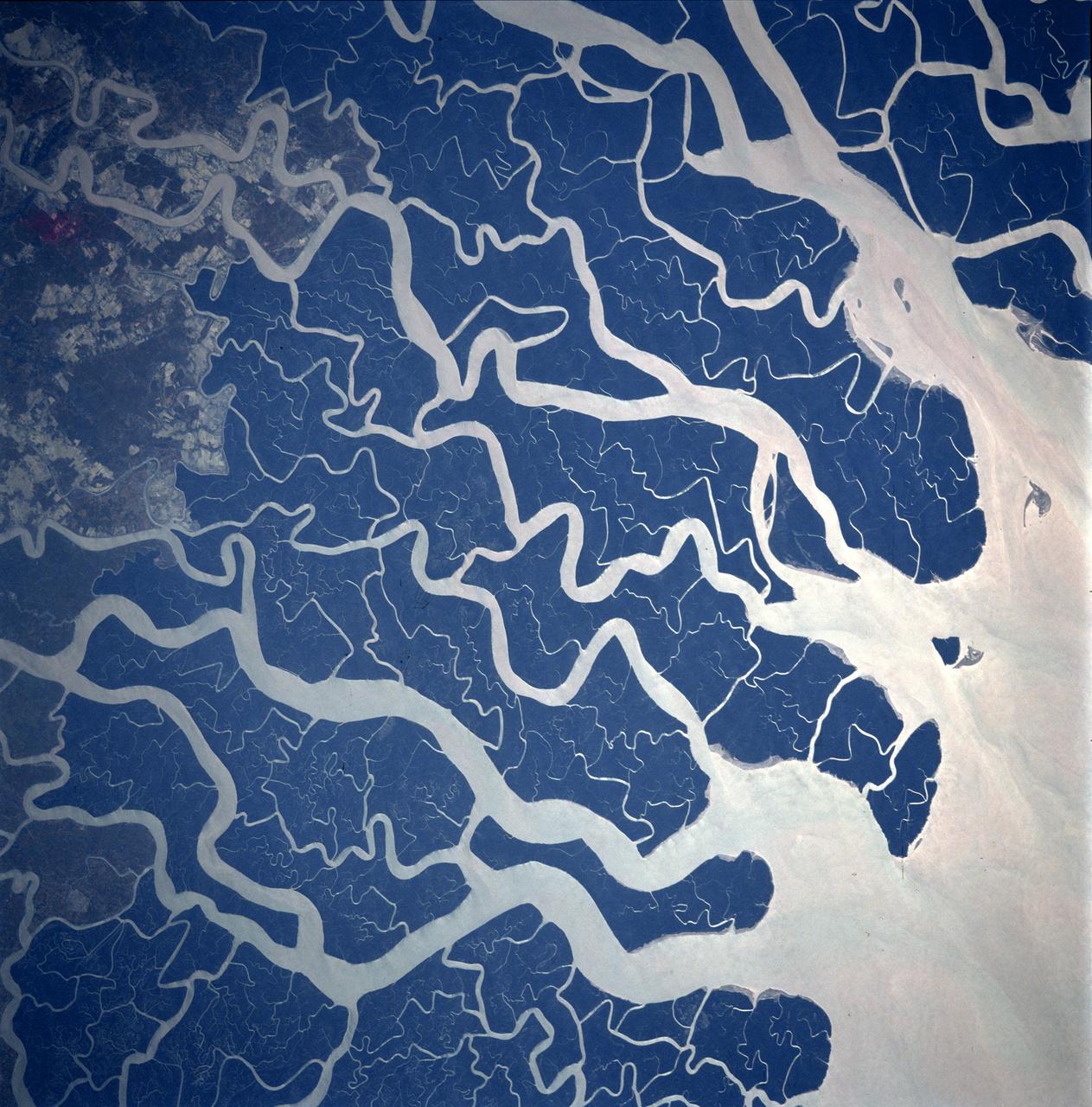
STS087-707-092 (19 November – 5 December 1997) --- Featured in this view is the Ganges River delta. A glacier at about 22,100 feet in the Himalayas is the source of the Ganges River. Hundreds of miles later and joined by other tributaries the Ganges delta enters the Bay of Bengal. The delta, at 200 miles wide (320 kilometers) is one of the most fertile and densely populated regions of the world. The eastern side of the delta changes rapidly and forms new land because of rapid sedimentation. The southern part of the delta has a darker appearance because of tidal forests, swampland, and mangroves. The Sundarbans is the name of this forested area and it is the site of a tiger preservation project for the governments of India and Bangladesh. This picture is one of the 70mm Earth observations visuals used by the crew at its post flight presentation events.
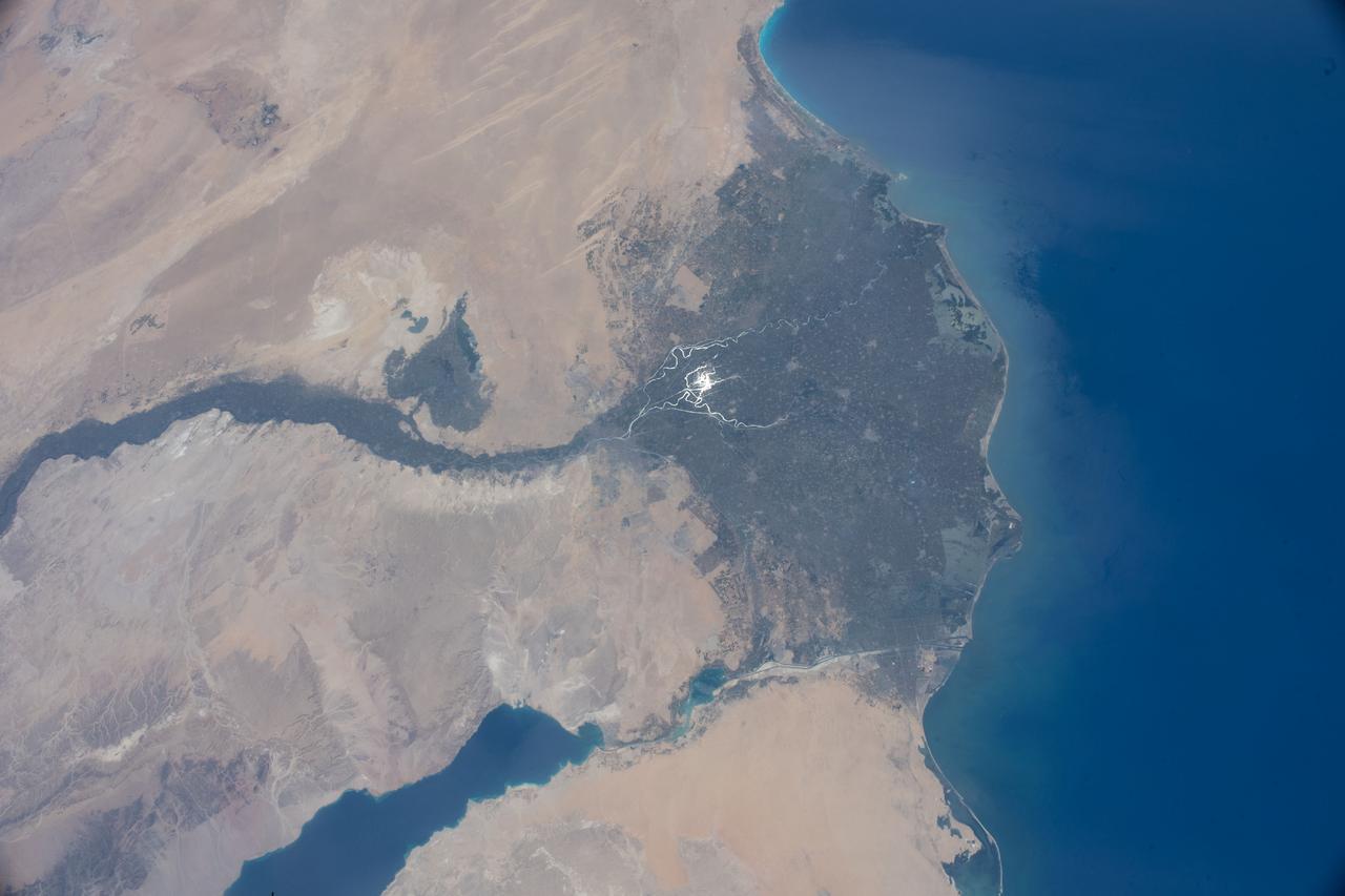
iss067e090312 (May 29, 2022) --- The Nile Delta is pictured from the International Space Station at an altitude of 262 miles above the Mediterranean Sea off the coast of Israel. The sun's glint beams off the Rosetta and the Damietta branches of the Nile River at the base of the Nile Delta.
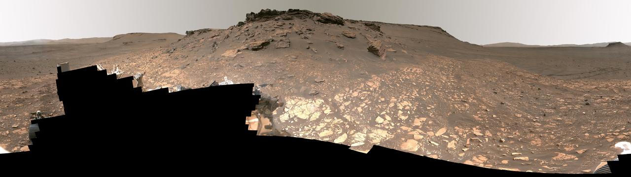
Intriguing Martian rocks surround NASA's Perseverance rover in this panorama showing an ancient river delta, made from images captured by the Mastcam-Z camera system. This 2.5-billion-pixel mosaic, which combines 1,118 individual frames, is the most detailed landscape panorama ever returned from Mars. The delta in Mars' Jezero Crater is an area where scientists surmise that, billions of years ago, a river once flowed into a lake and deposited rocks and sediments in a fan shape. Deltas are believed to be the best places on Mars to search for potential signs of ancient microbial life. Arrival at the Jezero delta has been a primary goal of the Perseverance mission since the rover landed in the crater in February 2021. The panorama shows sedimentary rocks of great interest to scientists. The Perseverance rover has abraded the surface of several rocks in this area and acquired compositional information. It also has collected rock samples that the Mars Sample Return campaign could bring back to Earth in the future, enabling detailed laboratory studies as part of a search for signs of ancient life. In this enhanced-color view, the color bands of the image have been processed to improve visual contrast and accentuate color differences. Figure A shows the same panorama using a natural-color view. A guided tour of the panorama is available at https://images.nasa.gov/details-JPL-20220906-Perseverance_Explores_Jezero_Crater_Delta_UHD. These images were taken in 2022 on June 12, 13, 16, 17, and 20 (the 466th, 467th, 470th, 471st, and 474th Martian days, or sols, of Perseverance's mission). A key objective for Perseverance's mission on Mars is astrobiology, including the search for signs of ancient microbial life. The rover will characterize the planet's geology and past climate, pave the way for human exploration of the Red Planet, and be the first mission to collect and cache Martian rock and regolith (broken rock and dust). Subsequent NASA missions, in cooperation with ESA (European Space Agency), would send spacecraft to Mars to collect these sealed samples from the surface and return them to Earth for in-depth analysis. The Mars 2020 Perseverance mission is part of NASA's Moon to Mars exploration approach, which includes Artemis missions to the Moon that will help prepare for human exploration of the Red Planet. https://photojournal.jpl.nasa.gov/catalog/PIA24921
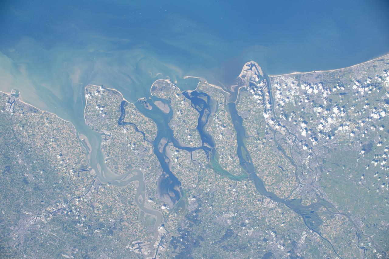
iss071e488058 (Aug. 11, 2024) --- The Hague and Rotterdam, cities next to the Rhine–Meuse–Scheldt river delta in Netherlands on the coast of the North Sea, are pictured from the International Space Station as it orbited 263 miles above Northern Europe.
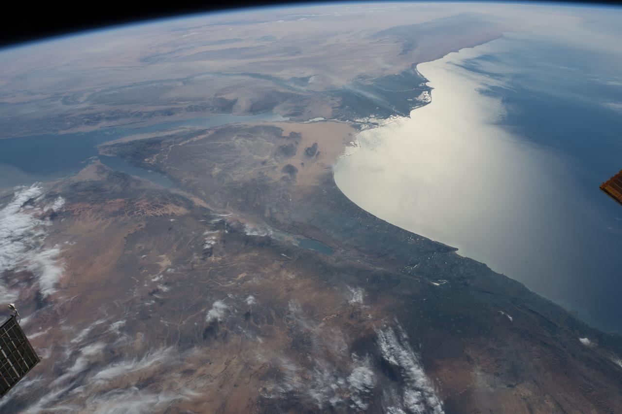
iss055e007948 (April 1, 2018) --- This view looking southwest over the Egyptian delta, the Nile River and the Mediterranean sea was taken from the International Space Station as it was orbiting above the Middle Eastern nation of Jordan.
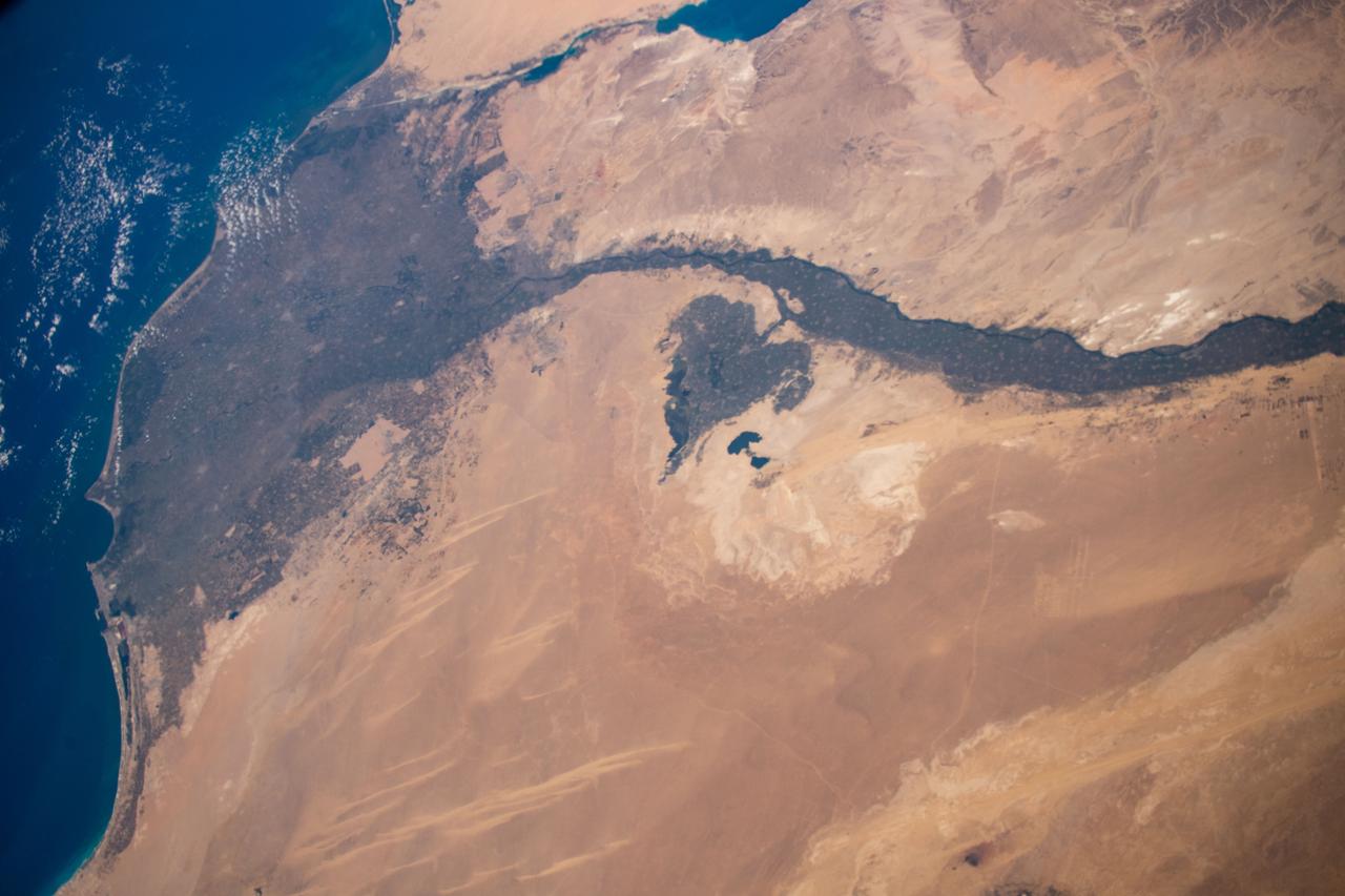
iss061e004613 (Oct. 9, 2019) --- Looking like a leaf on a vine, the Faiyum Oasis extends west of the Nile River and south of Cairo, Egypt. The fertile area at the left of the photograph is the Nile Delta opening up into the Mediterranean Sea.
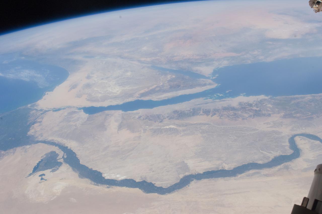
ISS028-E-014970 (10 July 2011) --- One of the crewmembers aboard the International Space Station recorded this oblique view showing the Nile River Delta and the Sinai Peninsula, with a 28 millimeter lens. The Mediterranean Coast is at far left.
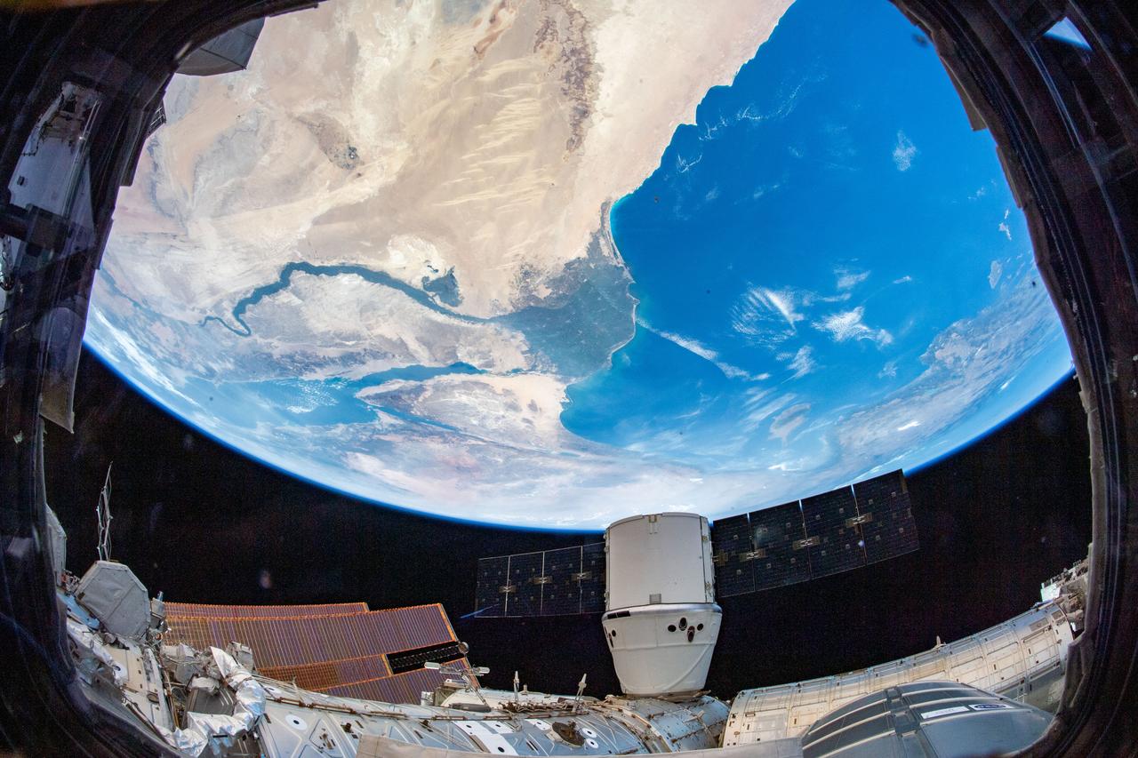
iss060e035437 (Aug. 13, 2019) -- The SpaceX Dragon resupply ship is pictured attached to the International Space Station's Harmony module as the orbital complex flew 260 miles above the Nile River Delta in Egypt.
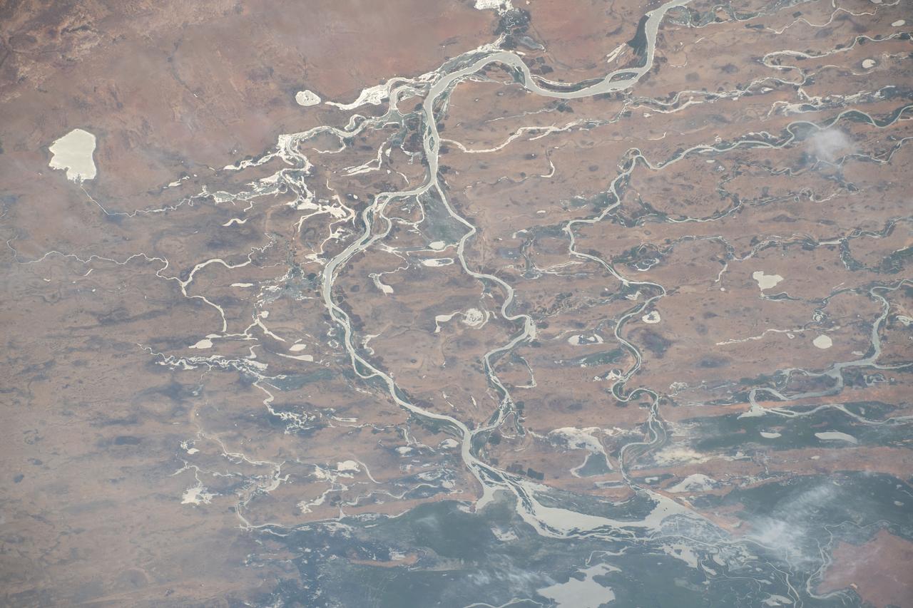
iss070e030773 (Nov. 26, 2023) --- The Niger River flows through Mali creating an inland delta in this photograph from the International Space Station as it orbited 259 miles above the African nation.
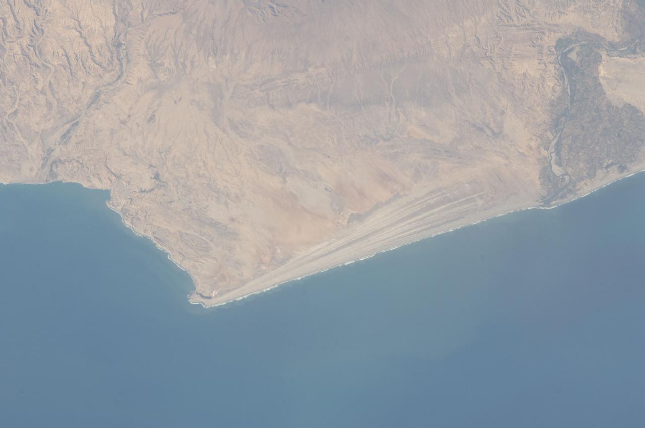
ISS032-E-016579 (11 Aug. 2012) --- A strandplain on coastal Peru is featured in this image photographed by an Expedition 32 crew member on the International Space Station. The scale and orientation of landscape features that are difficult to see on the ground often become readily visible from orbit. Numerous subparallel lines (center) along the arid, northern coast of Peru (about five degrees south of the Equator) are close-packed beach ridges, known collectively as a strandplain (for scale, the strandplain is 30 kilometers long). Each ridge shows the position of a prior shoreline. The Chira River delta appears at right, with dark green agricultural fields occupying the delta of the river. A smaller river reaches the sea, without forming a delta, at extreme left. The prominent cape at lower left is Punta Balcones, a region with many oil wells. Strandplains are built by successive additions of beach sand usually from some nearby source. Currents on this coast of South America come from the south, suggesting to scientists that the Chira River delta (right) is the source of the sand. The newest beach is being formed today by the waves?which appear as the thin ragged white line along the strandplain?supplied by the north-flowing current. The regularity of the spacing of the beaches suggests that some episodic influx of sediment controls beach formation. This influx may be determined by floods coming down the Chira River, possibly controlled by the heavy rains of El Nino events which occur irregularly every few years. Two other sets of faint parallel lines can be seen on higher ground inland (between arrows, center and top right), the upper set stretching all the way from the Chira river floodplain. Seen in many places along the coast of Peru, scientists believe these may also be strandplains (i.e. formed at sea level) generated when the land surface was at a lower altitude; both also may have been produced by sand from the Chira River. The land surface is known to be rising along this coast with the rise of the Andes Mts. (outside the top of the image), explaining why the upper shorelines now lie 120 meters above sea level.

This mosaic featuring several of the escarpments, or scarps – long, steep slopes – of Jezero Crater's river delta was taken by the Mastcam-Z instrument aboard NASA's Perseverance rover on Apr. 17, 2021. The delta formed billions of years ago from sediment that an ancient river carried to the mouth of the lake that once existed in the crater. The images that stitched together to create the mosaic were taken from a distance of about 1.2 miles (2.2 kilometers). An annotated version of this image (Figure 1) indicates the location of four prominent scarps in the delta. The Mastcam-Z investigation is led and operated by Arizona State University in Tempe, working in collaboration with Malin Space Science Systems in San Diego, California, on the design, fabrication, testing, and operation of the cameras, and in collaboration with the Neils Bohr Institute of the University of Copenhagen on the design, fabrication, and testing of the calibration targets. A key objective for Perseverance's mission on Mars is astrobiology, including the search for signs of ancient microbial life. The rover will characterize the planet's geology and past climate, pave the way for human exploration of the Red Planet, and be the first mission to collect and cache Martian rock and regolith (broken rock and dust). Subsequent NASA missions, in cooperation with ESA (European Space Agency), would send spacecraft to Mars to collect these sealed samples from the surface and return them to Earth for in-depth analysis. The Mars 2020 Perseverance mission is part of NASA's Moon to Mars exploration approach, which includes Artemis missions to the Moon that will help prepare for human exploration of the Red Planet. https://photojournal.jpl.nasa.gov/catalog/PIA24815
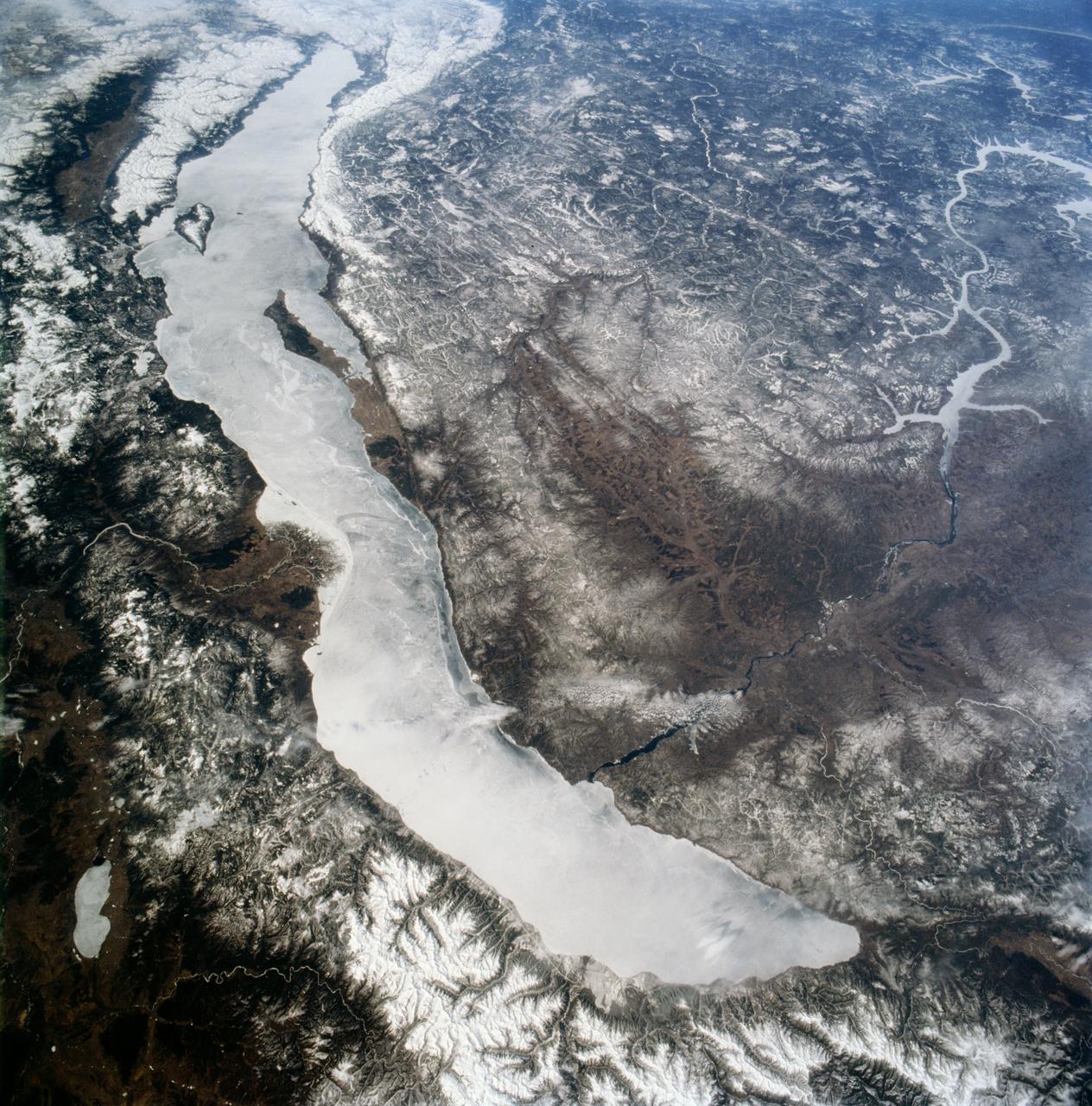
STS059-90-098 (9-20 April 1994) --- Ice-covered Lake Baikal, in Siberia, is about 400 miles long within a major rift valley. The water surface is 455 meters above sea level, but the bottom is 1,295 meters below sea level; the lake represents the largest body of fresh water in the world, except for the Antarctic and Greenland ice sheets. A tributary, the Senusi River, has built a delta on the east side. The Angara River exits the lake to the northwest; the city of Irkutsk is under the small, rippled cloud bank that crosses the river. Hasselblad camera.
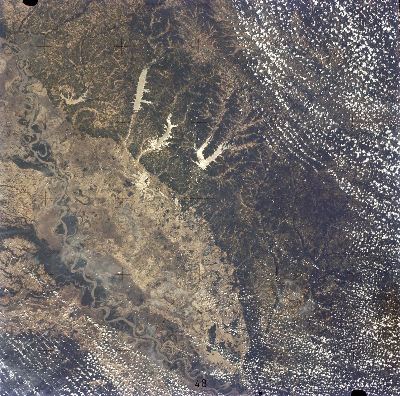
SL2-05-422 (22 June 1973) --- This section of the lower Mississippi River (34.0N, 90.0W) known as the Yazoo Basin, is characterized by a wide expanse of rich river bottomland with many oxbow lakes, the remains of the many changes in the riverbed over the course of many thousands of years. This soil is very fertile and productive but the region is prone to flooding. In this view, some of the back areas around the Delta National Forest show the effects of heavy spring rains. Photo credit: NASA

STS083-709-030 (4-8 April 1997) --- Panorama over the Nile River, Sinai Peninsula and the Red Sea. Looking past the Orbiter's tail, this view extends from central Egypt eastward to Saudi Arabia on the horizon. Two major water systems, seen in this view, the Nile River and the Red Sea are used for world commerce and transportation in this region. The Nile is flanked immediately by agriculture then beyond by desert. This emphasizes the importance of the river waters to sustain a thriving local population. The Nile River delta is north under the clouds on the upper left-hand corner of the photo. Geologically, the Red Sea is a spreading center between the Arabian and the African Plates, and will continue to widen slowly over a long period of time.
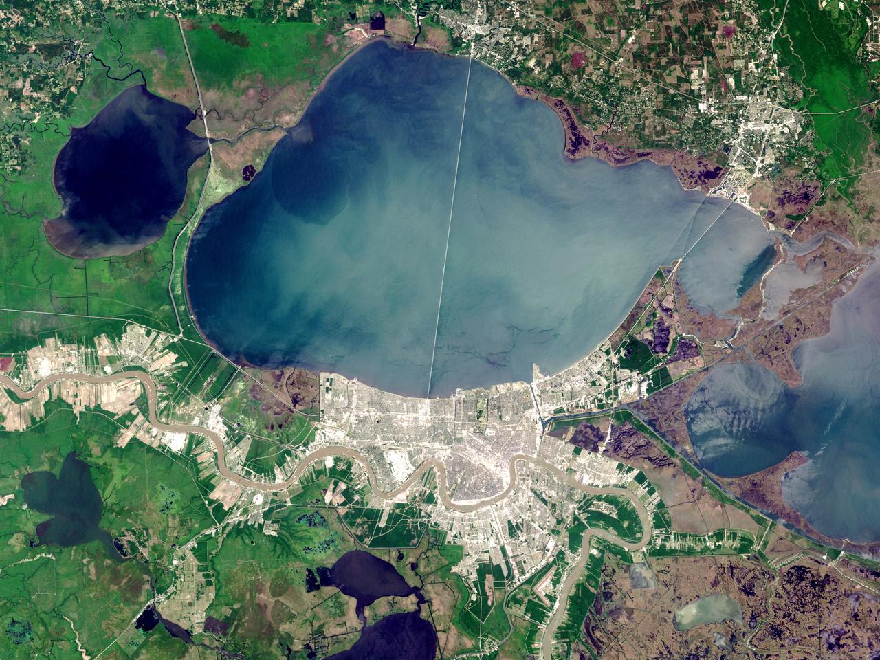
On Sunday, February 3, roughly 800 million eyes from all over the world focused on the Louisiana Superdome in New Orleans as the New England Patriots battled the St. Louis Rams for the NFL Championship in Super Bowl XXXVI. This true color image of New Orleans was acquired on April 26, 2000, by the Enhanced Thematic Mapper plus (ETM+), flying aboard the Landsat 7 satellite. Lake Pontchartrain borders the city to the north. The big river winding its way east to west through the image is the Mississippi. The Louisiana Superdome, built in 1975, sits just inside the rightmost portion of the big river bend that cradles downtown New Orleans. The city, however, may not be around to hold a Super Bowl in 2102. New Orleans is slowly sinking into the Gulf of Mexico. The construction of flood walls and dams north of New Orleans over the past century have prevented sediments carried by the Mississippi River from reaching New Orleans and the Mississippi River Delta. Before the dams were built, river sediments would empty out onto the delta adding layer upon layer of new soil each year. The additional soil prevented the Gulf from subsuming the delta. Unless drastic measures are taken, the city and the delta could be awash in seawater by the end of this century. Image by Robert Simmon, based on data provided by the Landsat 7 Science Team Credit: NASA/GSFC/Landsat <b><a href="http://www.nasa.gov/centers/goddard/home/index.html" rel="nofollow">NASA Goddard Space Flight Center</a></b> enables NASA’s mission through four scientific endeavors: Earth Science, Heliophysics, Solar System Exploration, and Astrophysics. Goddard plays a leading role in NASA’s accomplishments by contributing compelling scientific knowledge to advance the Agency’s mission. <b>Follow us on <a href="http://twitter.com/NASA_GoddardPix" rel="nofollow">Twitter</a></b> <b>Join us on <a href="http://www.facebook.com/pages/Greenbelt-MD/NASA-Goddard/395013845897?ref=tsd" rel="nofollow">Facebook</a></b>
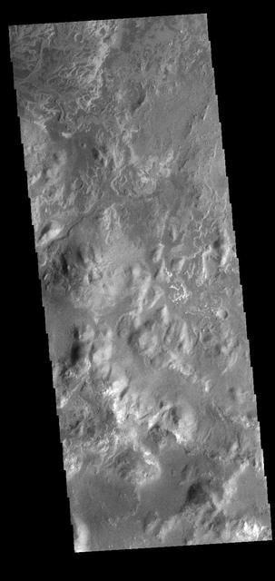
At the top of today's VIS image is the delta deposit on the floor of Eberswalde Crater. Deltas are formed when sediment laden rivers slow down — either due to a flattening of topography, or entering a standing body of water. The reduction in velocity causes the sediments to be deposited. The main channel often diverges into numerous smaller channel that spread apart to form the typical fan shape of a delta. The Eberswalde Crater delta is one of the best preserved on Mars. Orbit Number: 82771 Latitude: -24.1614 Longitude: 326.528 Instrument: VIS Captured: 2020-08-11 16:12 https://photojournal.jpl.nasa.gov/catalog/PIA24157
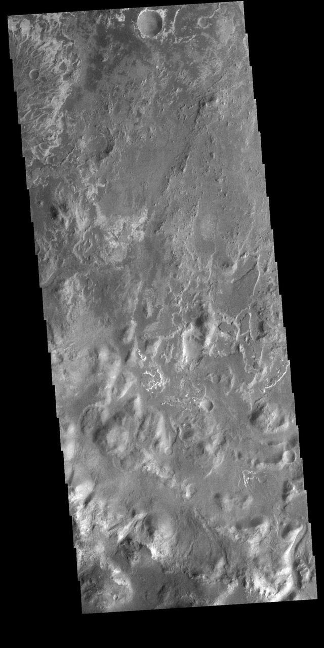
At the top left corner of today's VIS image is the delta deposit located on the floor of Eberswalde Crater. Deltas are formed when sediment laden rivers slow down – either due to a flattening of topography, or entering a standing body of water. The reduction in velocity causes the sediments to be deposited. The main channel often diverges into numerous smaller channel that spread apart to form the typical fan shape of a delta. The Eberswalde Crater delta is one of the best preserved on Mars. Orbit Number: 90982 Latitude: -24.1271 Longitude: 326.604 Instrument: VIS Captured: 2022-06-18 18:13 https://photojournal.jpl.nasa.gov/catalog/PIA25520
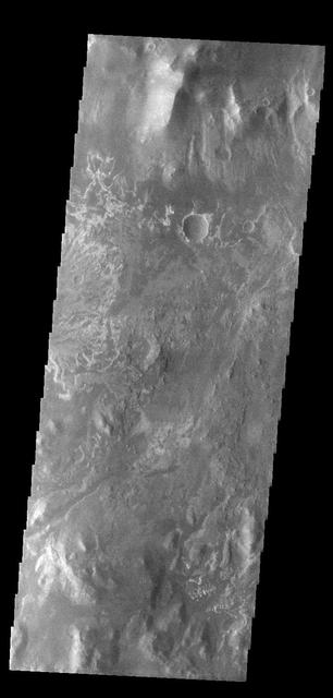
At the top of today's VIS image is the delta deposit on the floor of Eberswalde Crater. Deltas are formed when sediment laden rivers slow down — either due to a flattening of topography, or entering a standing body of water. The reduction in velocity causes the sediments to be deposited. The main channel often diverges into numerous smaller channel that spread apart to form the typical fan shape of a delta. The Eberswalde Crater delta is one of the best preserved on Mars. Orbit Number: 84562 Latitude: -23.9124 Longitude: 326.56 Instrument: VIS Captured: 2021-01-06 02:41 https://photojournal.jpl.nasa.gov/catalog/PIA24362
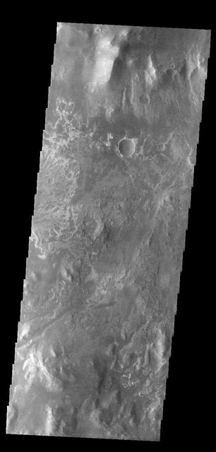
On the left side of today's VIS image is part of the delta deposit on the floor of Eberswalde Crater. Deltas are formed when sediment laden rivers slow down – either due to a flattening of topography, or entering a standing body of water. The reduction in velocity causes the sediments to be deposited. The main channel often diverges into numerous smaller channel that spread apart to form the typical fan shape of a delta. The Eberswalde Crater delta is one of the best preserved on Mars. Orbit Number: 84562 Latitude: -23.912 Longitude: 326.56 Instrument: VIS Captured: 2021-01-06 02:41 https://photojournal.jpl.nasa.gov/catalog/PIA24718
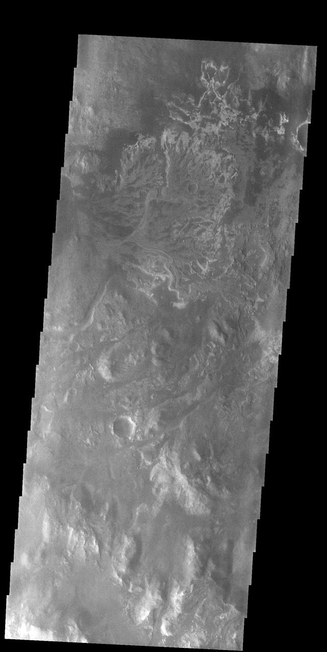
In the top half of today's VIS image is the delta deposit on the floor of Eberswalde Crater. Deltas are formed when sediment laden rivers slow down – either due to a flattening of topography, or entering a standing body of water. The reduction in velocity causes the sediments to be deposited. The main channel often diverges into numerous smaller channel that spread apart to form the typical fan shape of a delta. The Eberswalde Crater delta is one of the best preserved on Mars. Orbit Number: 91288 Latitude: -23.9644 Longitude: 326.398 Instrument: VIS Captured: 2022-07-13 22:12 https://photojournal.jpl.nasa.gov/catalog/PIA25543
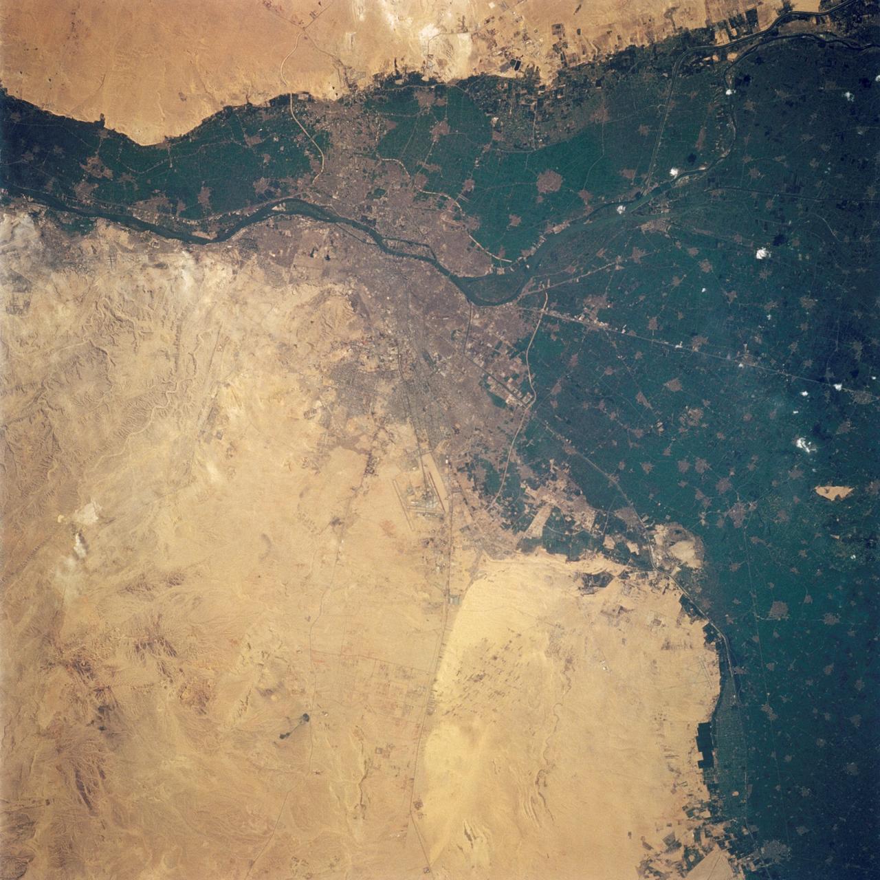
STS062-108-058 (4-18 March 1994) --- Cairo lies at the apex of the great delta of the Nile: the delta is marked by the strong greens of cultivated lands, Cairo by the gray sprawl along the river and the eastern delta apex as it develops in the direction of the airports and Suez. The city of El Giza lies on the west side of the Nile with the Giza pyramids in the desert just beyond the cultivated lands. Several major canals lead water to parts of the delta more distant from the Nile; generally these can be recognized as straighter, more engineered waterways. Towards the top left, the bifurcation of the Rosetta and Damietta branches of the Nile can be seen. These are the two major present-day veins of the Nile as it approaches the Mediterranean.
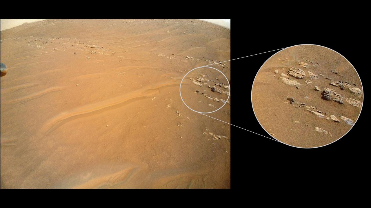
NASA's Ingenuity Mars Helicopter recently surveyed a ridgeline near the ancient river delta in Mars' Jezero Crater at request of the Perseverance rover's science team. On the left is the full image Ingenuity acquired of the ridgeline on April 23, 2022, during its 27th flight. The science team calls the line of rocky outcrops running from the upper left to middle right of the main image "Fortun Ridge." Enlarged at right is a close-up of one of the ridgeline's rocky outcrops. This portion of Jezero Crater is of interest to the science team because of the clear exposure of the rocky outcrops that define the boundary between two abutting crater floor geologic units, "Séítah" and "Máaz." The geology of both units is thought to be of igneous (volcanic) origin. https://photojournal.jpl.nasa.gov/catalog/PIA25220
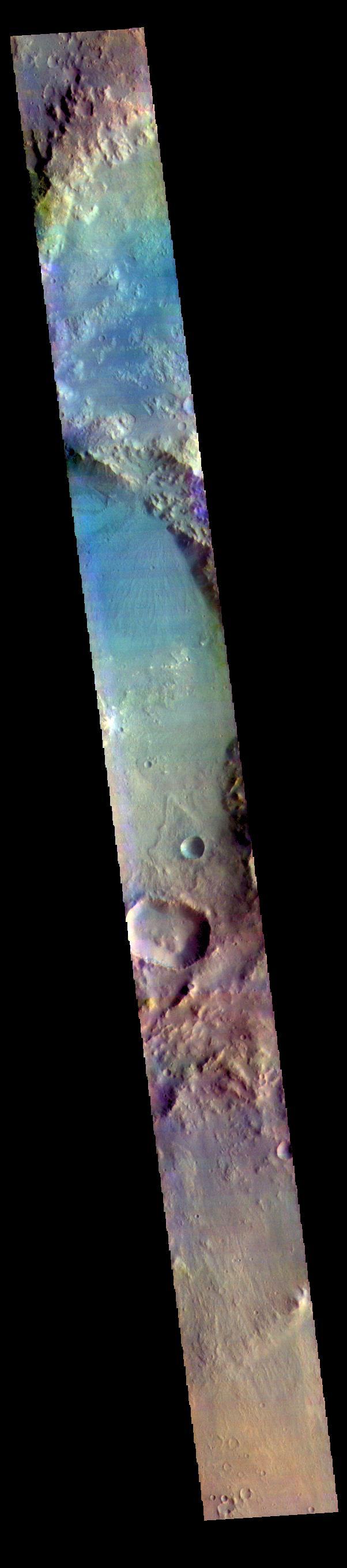
This false color image shows part of Harris crater (center of image) and an unnamed crater (top of image). These craters are located north of Hellas Planitia. At the upper right part of the Harris Crater rim, there is a fan shaped form. Fans can be created by different processes. Delta deposit fans are created under water, when a river flow slows down and drops sediments from the water column. These sediments are typically fine grained silts. Deltas form over time and can take many shapes as the river changes channels. The Mississippi River delta is formed this way. Alluvial fans are created in dry climates with short fluid seasons. In this case a single stream hits a topographic opening (think ravine) and sheds the rocks and sand down hill. The alluvial fan shape is created from the single opening. Either way, fans form by the action of a fluid. The THEMIS VIS camera contains 5 filters. The data from different filters can be combined in multiple ways to create a false color image. These false color images may reveal subtle variations of the surface not easily identified in a single band image. Orbit Number: 64642 Latitude: -21.9957 Longitude: 67.2664 Instrument: VIS Captured: 2016-07-10 10:43 https://photojournal.jpl.nasa.gov/catalog/PIA23611
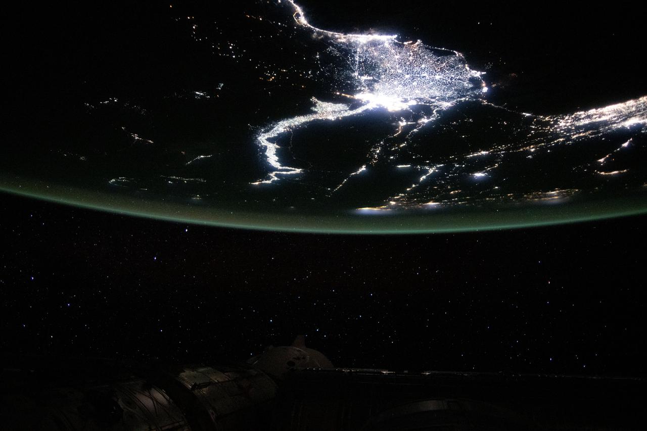
iss072e905240 (March 22, 2025) --- Egypt's Nile Delta region, home to about 39 million people and where the Nile, Africa's longest river, drains into the Mediterranean Sea, is pictured from the International Space Station at 11:01 p.m. local time as it orbited 261 miles above.
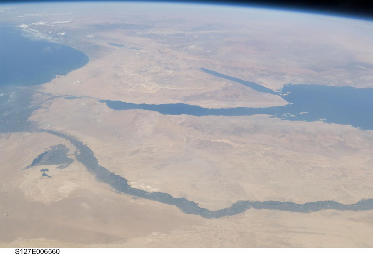
S127-E-006560 (17 July 2009) -- The Nile River and its delta in Egypt and the Sinai Peninsula and part of the Mediterranean Sea and Red Sea are just a few of the geographic features recognizable in this photograph, taken from an aft window on the Earth-orbiting Space Shuttle Endeavour.
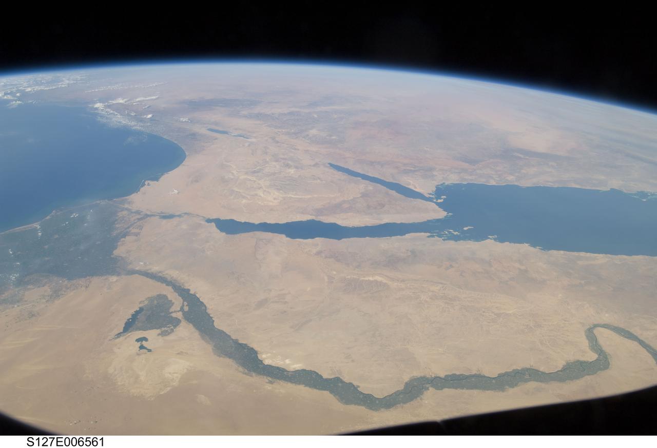
S127-E-006561 (17 July 2009) -- The Nile River and its delta in Egypt and the Sinai Peninsula and part of the Mediterranean Sea and Red Sea are just a few of the geographic features recognizable in this photograph, taken from an aft window on the Earth-orbiting Space Shuttle Endeavour.
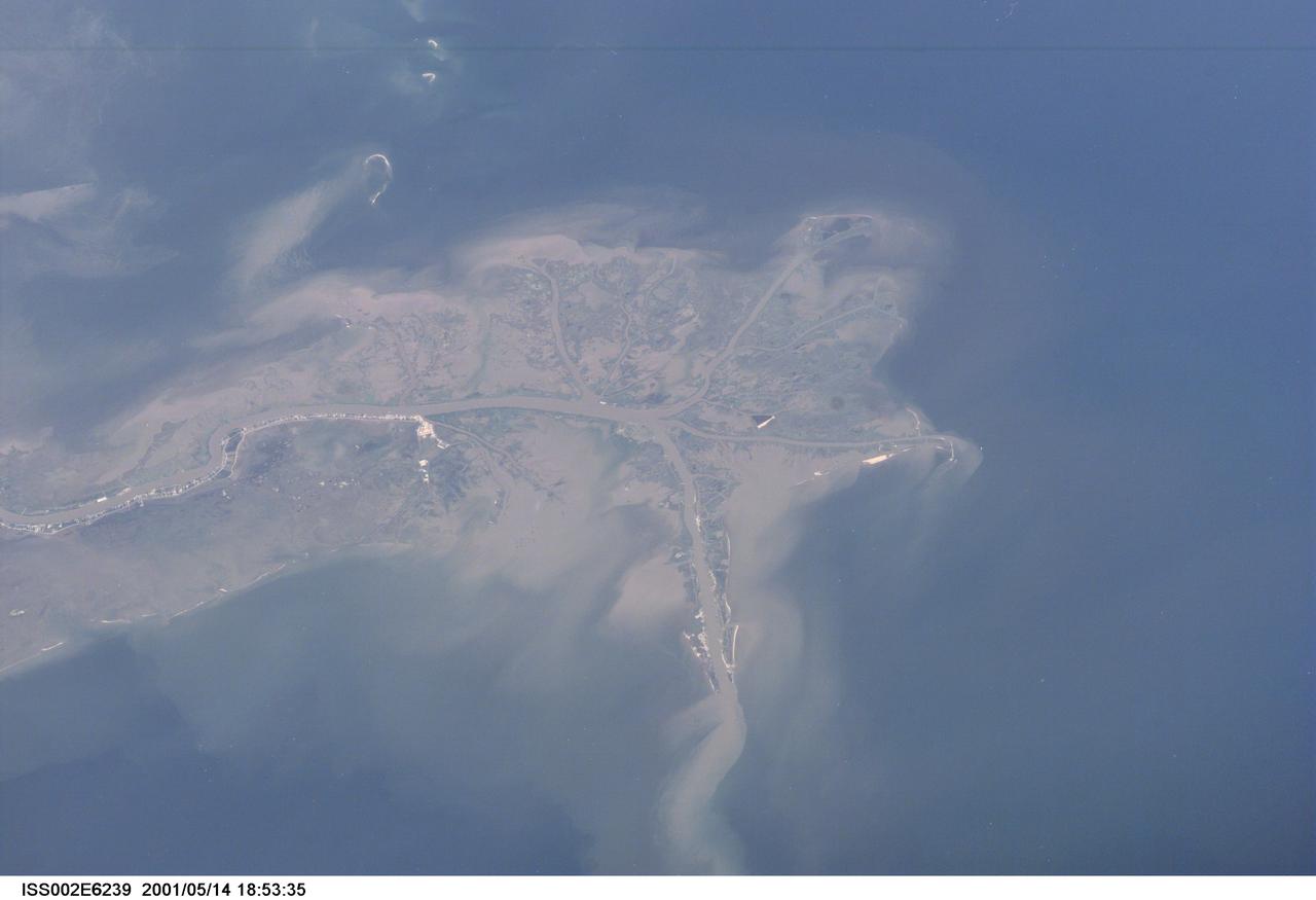
ISS002-E-6239 (14 May 2001) --- This digital still camera's image, recorded by one of the Expedition Two crew members aboard the International Space Station, features the mouth of the Mississippi River. The distribution of riverborne sediments is clearly evident in the Gulf of Mexico. This delta area is often referred to as the "crow's foot."
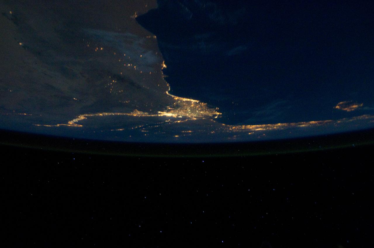
ISS028-E-033108 (18 Aug. 2011) --- The Nile River Delta and part of the Mediterranean Sea can be seen in this night time photo captured by one of the Expedition 28 crew members aboard the International Space Station, flying at an altitude of approximately 220 miles. A 38-mm focal length was used to record the image.
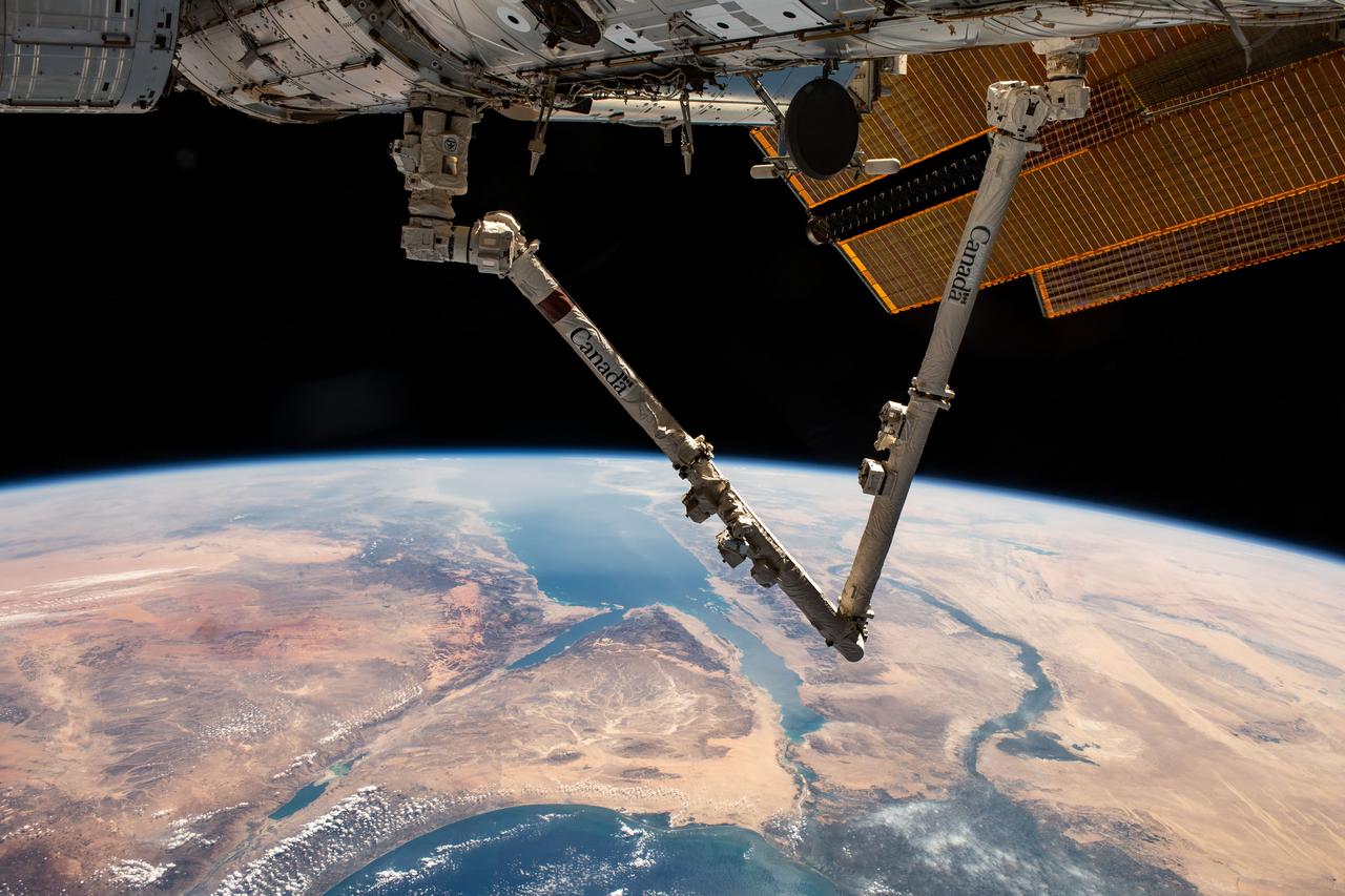
iss070e007599 (Oct. 20, 2023) --- The Canadarm2 robotic arm extends from the International Space Station as it orbited 261 miles above Turkey. Below, the Sinai Peninsula, the Red Sea, and the Nile River Delta are pictured leading toward the Mediterranean Sea at bottom.
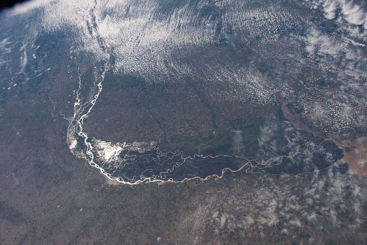
iss067e034812 (May 5, 2022) --- The Paraná River, pictured from the International Space Station at an altitude of 269 miles, leads into the Paraná Delta and empties into the Rio de la Plata which separates Argentina from Uruguay on South America's Atlantic coast. The fertile lowlands region is also known as the Pampas.
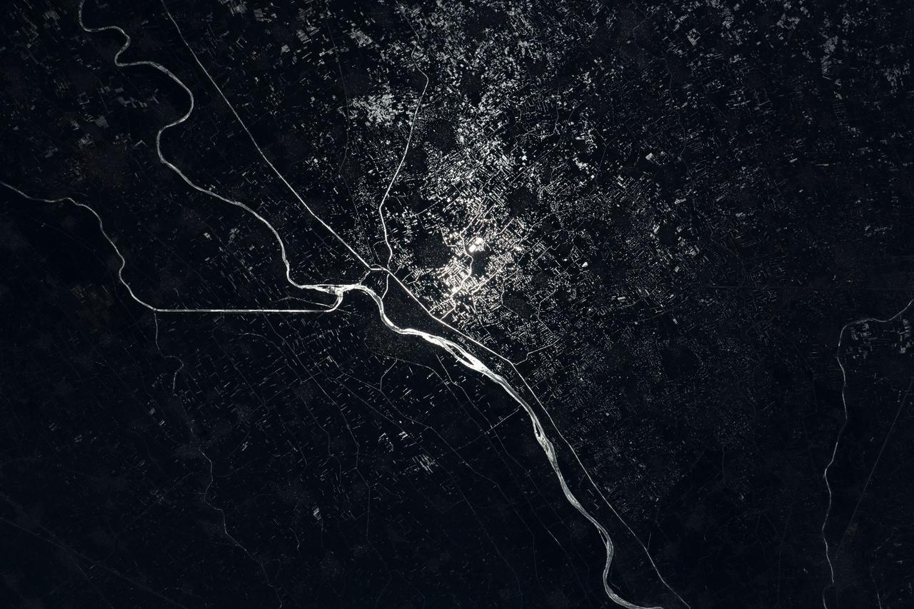
iss067e089285 (May 29, 2022) --- The Damietta Branch of the Nile River splits into canals in the central portion of the Nile Delta in Egypt. Lights from several cities surrounding the Egyptian waterways are pictured in this nighttime photograph from the International Space Station as it orbited 262 miles above the Mediterranean Sea off the coast of the Sinai Peninsula.
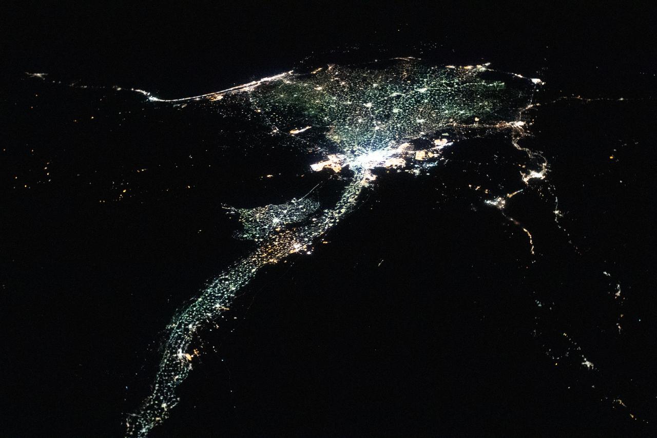
iss060e056082 (Sept. 2, 2019) --- The International Space Station was flying 255 miles above the border between Sudan and Egypt near 1 a.m. local time when an Expedition 60 crewmember photographed this oblique view of the Nile River and its delta.
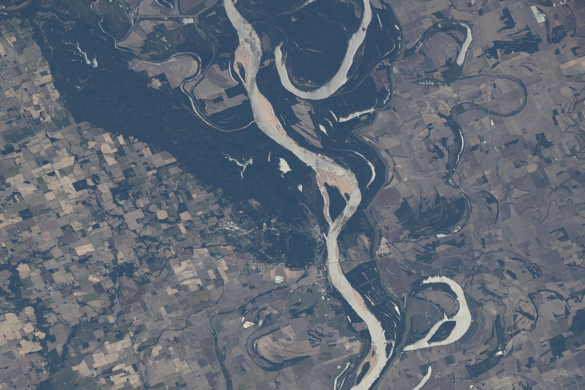
iss073e0880658 (Oct. 15, 2025) --- The Mississippi River separates Arkansas (left) from Mississippi in this view, with the St. Francis National Forest visible on the Arkansas side. Although not a true delta, the Mississippi Delta is a broad floodplain stretching from southern Illinois to Louisiana, with deep cultural roots in northern Mississippi. The International Space Station was orbiting 261 miles above Earth when this photograph was taken.
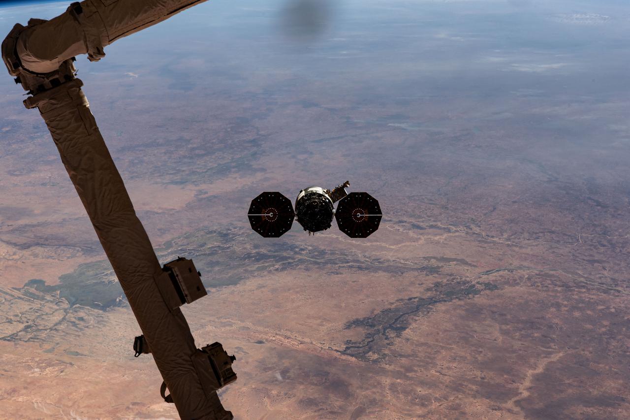
iss070e044314 (Dec. 22, 2023) --- Northrop Grumman's Cygnus space freighter is pictured departing the International Space Station after it was released from the grip of the Canadarm2 robotic arm. The orbital complex was soaring 258 miles above the African nation of Mauritania at the time of this photograph. The major land feature toward the center left, is the Inner Niger Delta, an inland delta created by the Niger River in the central portion of Mali.
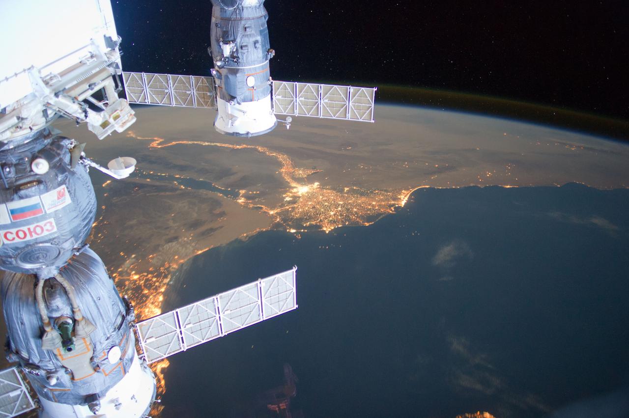
ISS031-E-095276 (4 June 2012) --- Much of the Middle East is seen in this night time image photographed by one of the Expedition 31 crew members aboard the International Space Station as it flew some 240 miles above the Mediterranean Sea on June 4, 2012. The Nile River Delta is easily recognizable in center frame, and city lights make it easy to see both Cairo and Alexandria, Egypt near the Delta. Two Russian spacecraft -- a Soyuz (left) and a Progress -- appear in the frame while they are docked to the station.
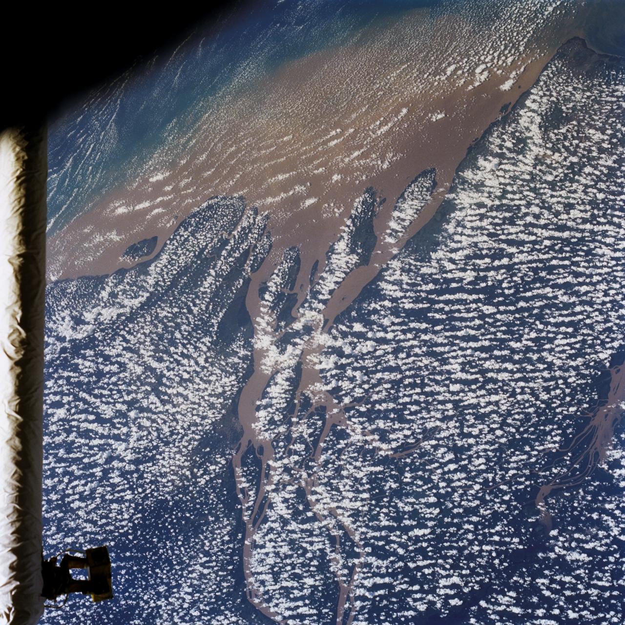
STS046-80-009 (31 July-8 Aug. 1992) --- A view of the mouth of the Amazon River and the Amazon Delta shows a large sediment plume expanding outward into the Atlantic Ocean. The sediment plume can be seen hugging the coast north of the Delta. This is caused by the west-northwest flowing Guyana Current. The large island of Marajo is partially visible through the clouds.

Today's VIS image shows two unnamed channels on the western edge of Claritas Fossae. The small channel joins the larger one close the the crater rim. The main channel has formed a delta in the crater. Deltas are formed when sediment laden rivers slow down – either due to a flattening of topography, or entering a standing body of water. The reduction in velocity causes the sediments to be deposited. The main channel often diverges into numerous smaller channel that spread apart to form the typical fan shape of a delta. Orbit Number: 92145 Latitude: -39.0947 Longitude: 256.903 Instrument: VIS Captured: 2022-09-22 12:24 https://photojournal.jpl.nasa.gov/catalog/PIA25747
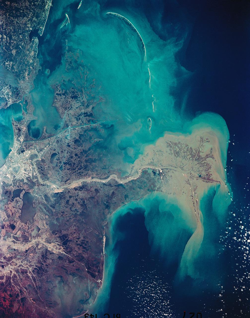
51C-143-027 (24-27 Jan 1985) --- This near-vertical photograph taken in January, 1985, shows the distribution pattern of muddy fresh water from the Mississippi River as it flows into the Gulf of Mexico. New Orleans, with its surrounding urban area, is highly reflective and appears at the top center. Light colored streaks of developed land extend on natural levees along the ancient La Fourche Delta to the west located at the top left of the view. The Chandeleur Islands, to the east of the present Mississippi Delta (center right), are remnants of the older delta lobe.
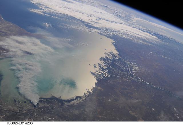
ISS024-E-014233 (11 Sept. 2010) --- A smoke plume near the northern Caspian Sea, Kazakhstan is featured in this image photographed by an Expedition 24 crew member on the International Space Station. This broad view of the north coast of the Caspian Sea shows a smoke plume (left) and two river deltas (bottom and lower right). The larger delta is that of the Volga River which appears prominently here in sunglint (light reflected off a water surface back towards the observer), and the smaller less prominent delta is that of the Ural River. Wide angle, oblique views ? taken looking outward at an angle, rather than straight down towards Earth ? such as this give an excellent impression of how crew members onboard the space station view Earth. For a sense of scale, the Caucasus Mts. (across the Caspian, top right) are approximately 1,100 kilometers to the southwest of the International Space Station?s nadir point location ? the point on Earth directly underneath the spacecraft ? at the time this image was taken. The smoke plume appears to be sourced in the dark-toned coastal marsh vegetation along the outer fringe of the Ural River delta, rather than in a city or at some oil storage facility. Although even small fires produce plumes that are long and bright and thus easily visible from space, the density of the smoke in this plume, and its 350-kilometer length across the entire north lobe of the Caspian Sea, suggest it was a significant fire. The smoke was thick enough nearer the source to cast shadows on the sea surface below. Lines mark three separate pulses of smoke, the most recent, nearest the source, extending directly south away from the coastline (lower left). With time, plumes become progressively more diffuse. The oldest pulse appears to be the thinnest, casting no obvious shadows (center left).
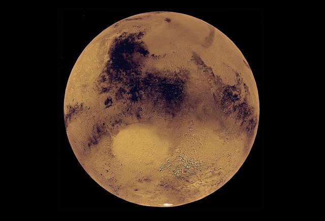
This animation, constructed using stereo imaging data from the High Resolution Imaging Science Experiment (HiRISE) camera on NASA's Mars Reconnaissance Orbiter, provides an airborne perspective of the Mars 2020 landing site and its exploration area at Jezero Crater. Mars 2020 is expected to land to the southeast of an ancient river delta, a fan-shaped feature inside the northeast rim of Jezero Crater that provides solid evidence of a river and lake system active in and around the crater billions of years ago. The solid white line on the surface indicates a path the rover could take during its prime mission. Animation available at https://photojournal.jpl.nasa.gov/catalog/PIA22905
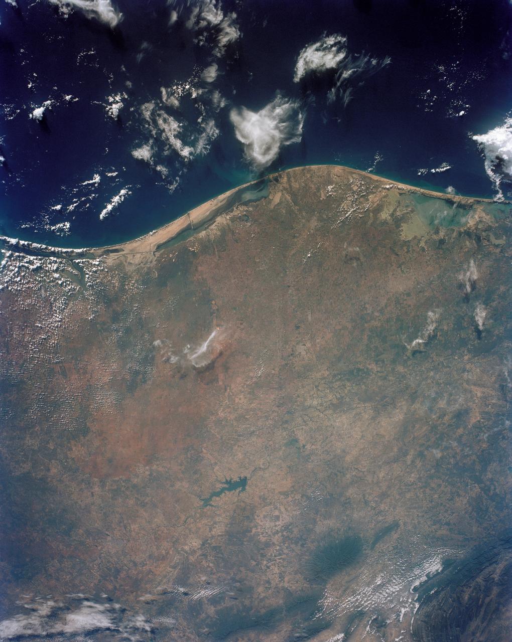
STS043-151-043 (8 August 1991) --- The Rio Grande extends across the center of this photograph from Falcon Reservoir to its bulging delta, joining the Gulf of Mexico. Sediment brought down by the river is spread northward and southward by alongshore currents to form the barrier chain of Padre Island and its protected Laguna Madre Speckled agricultural land use patterns in the river valley contrast with range land northward from the white cloud, and with closed canopy forest on hills in Mexico. A Linhof camera with a 90mm lens, was used to expose the frame at 14:43 GMT, Aug. 8, 1991.