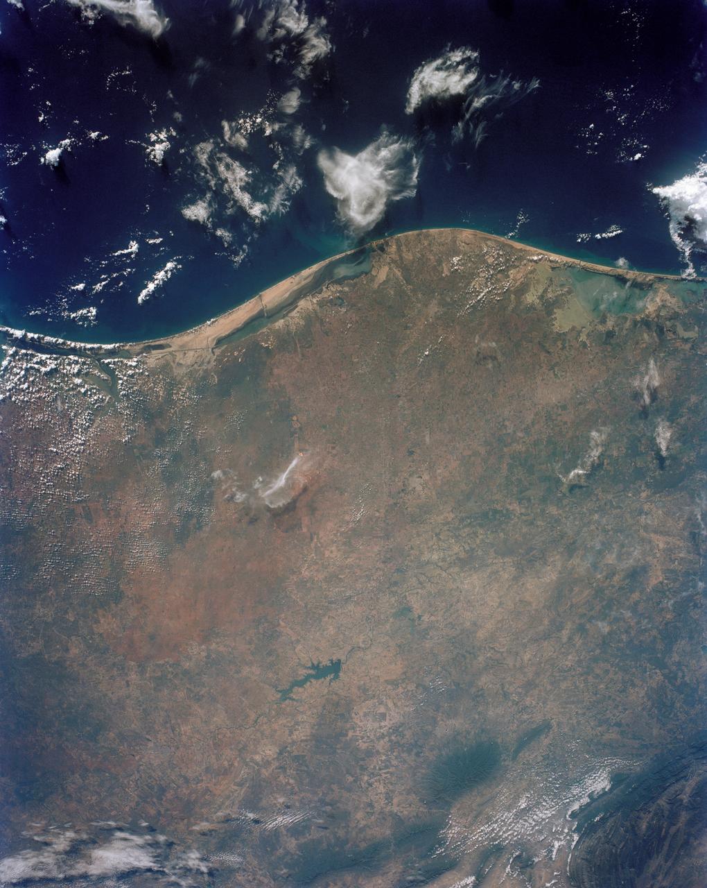
STS043-151-043 (8 August 1991) --- The Rio Grande extends across the center of this photograph from Falcon Reservoir to its bulging delta, joining the Gulf of Mexico. Sediment brought down by the river is spread northward and southward by alongshore currents to form the barrier chain of Padre Island and its protected Laguna Madre Speckled agricultural land use patterns in the river valley contrast with range land northward from the white cloud, and with closed canopy forest on hills in Mexico. A Linhof camera with a 90mm lens, was used to expose the frame at 14:43 GMT, Aug. 8, 1991.
In this panoramic view of the Okavango Swamp, Botswana, (19.0S, 22.0E), the Okavango River, seen in sunglint, flows into a topographic trough to form an inland delta. Water, trapped in the meandering delta distributaries is evaporated or transpired by vegetation. In Angola to the north, the many fires of the seasonal burning of savannah vegetation for land clearing, in preparation for agriculture, has filled the atmosphere with haze and smoke.
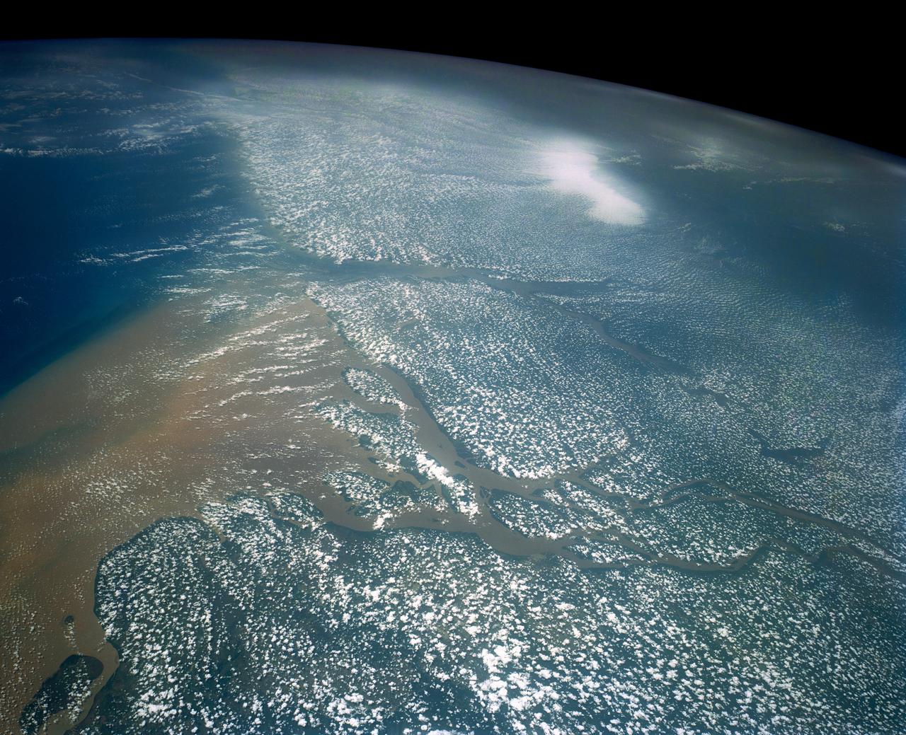
Huge sediment loads from the interior of the country flow through the Mouths of the Amazon River, Brazil (0.5S, 50.0W). The river current carries hundreds of tons of sediment through the multiple outlets of the great river over 100 miles from shore before it is carried northward by oceanic currents. The characteristic "fair weather cumulus" pattern of low clouds over the land but not over water may be observed in this scene.
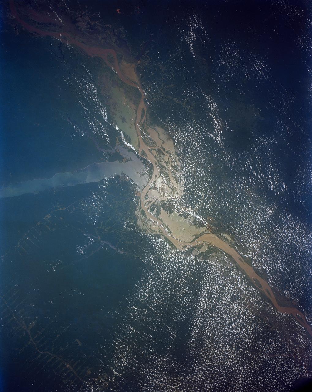
This view shows the confluence of the Amazon and the Topajos Rivers at Santarem, Brazil (2.0S, 55.0W). The Am,azon flows from lower left to upper right of the photo. Below the river juncture of the Amazon and Tapajos, there is considerable deforestation activity along the Trans-Amazon Highway.
CAPE CANAVERAL, Fla. – Seen from the Banana River Viewing Site at NASA's Kennedy Space Center in Florida, space shuttle Discovery emulates a rising sun as it heads for space on the STS-119 mission. Liftoff from Launch Pad 39A was on time at 7:43 p.m. EDT. The STS-119 mission is the 28th to the space station and Discovery's 36th flight. Discovery will deliver the final pair of power-generating solar array wings and the S6 truss segment. Installation of S6 will signal the station's readiness to house a six-member crew for conducting increased science. Photo credit: NASA/Chris Lynch

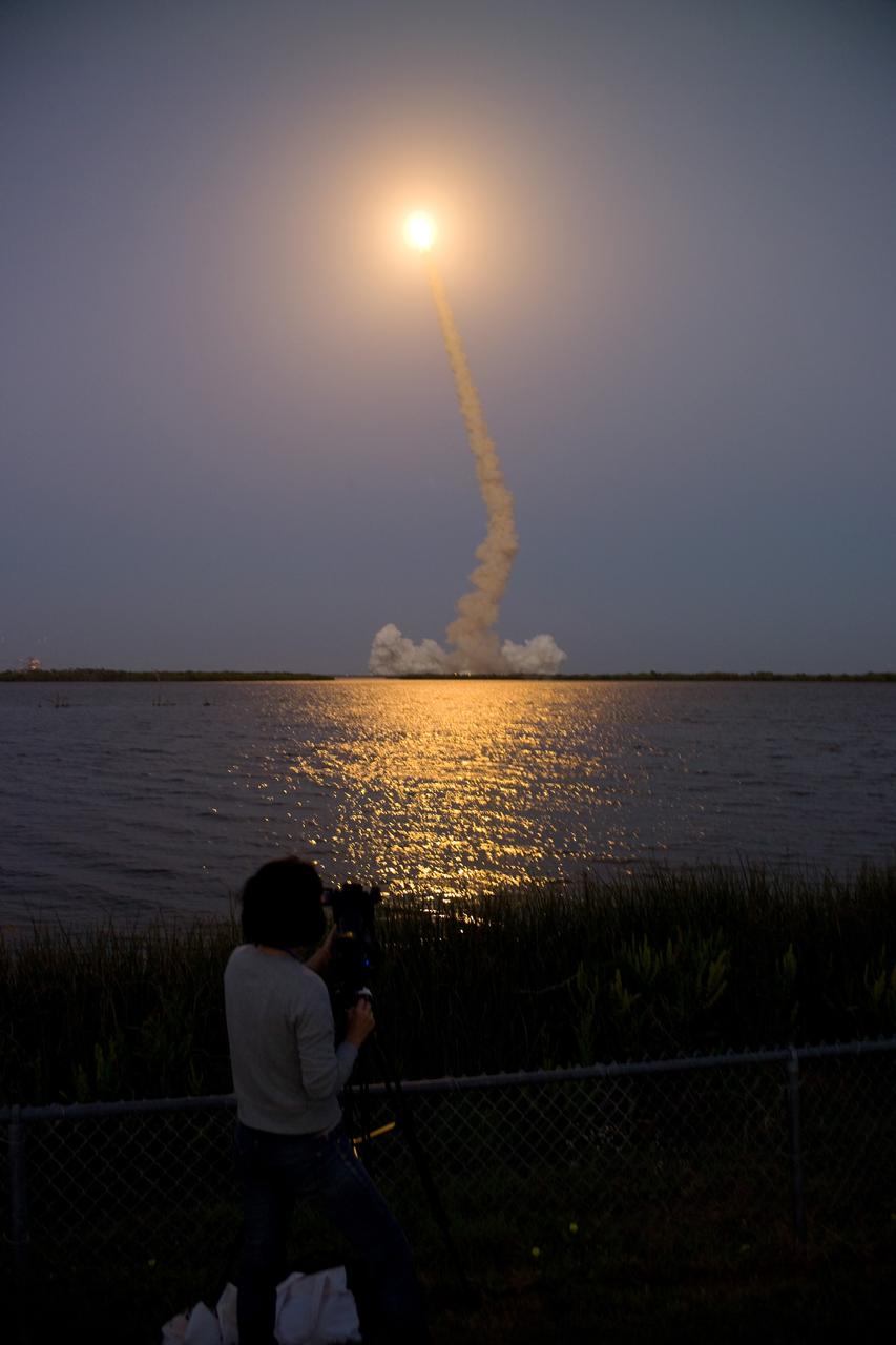
CAPE CANAVERAL, Fla. – Spectators at the Banana River Viewing Site at NASA's Kennedy Space Center in Florida focus on the brilliant launch of space shuttle Discovery across the water. Liftoff from Launch Pad 39A was on time at 7:43 p.m. EDT. The STS-119 mission is the 28th to the space station and Discovery's 36th flight. Discovery will deliver the final pair of power-generating solar array wings and the S6 truss segment. Installation of S6 will signal the station's readiness to house a six-member crew for conducting increased science. Photo credit: NASA/Chris Lynch
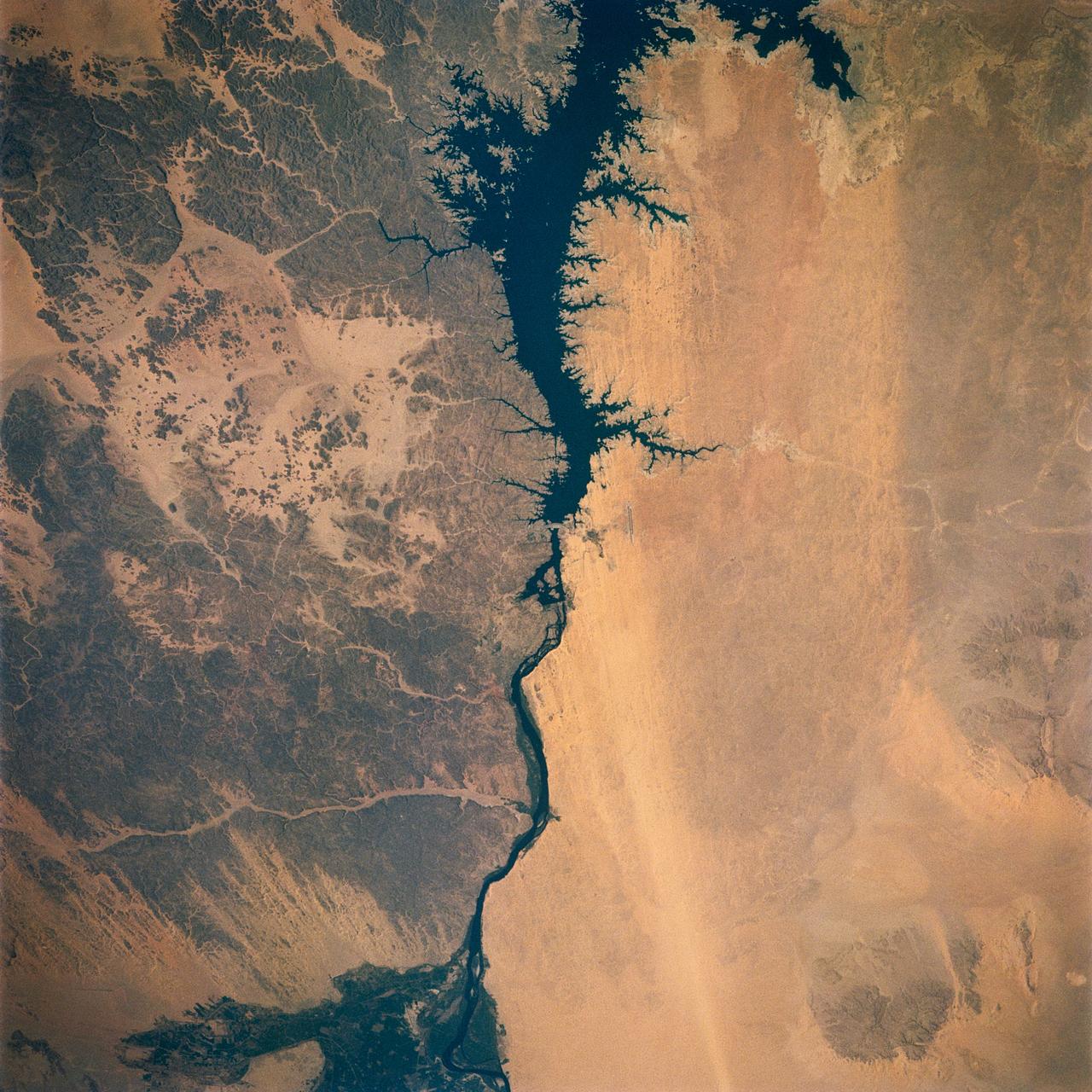
Egypt's High Aswan Dam on the Nile River at the first cataracts, Nile River, (24.0N, 33.0E) was completed in 1971 to provide cheap hydroelectric power and to regulate the historically uneven flow of the Nile River. The contrast between the largely base rock desert east of the Nile versus the sand covered desert west of the river and the ancient irrigated floodplain downstream from the damsite is clearly shown.
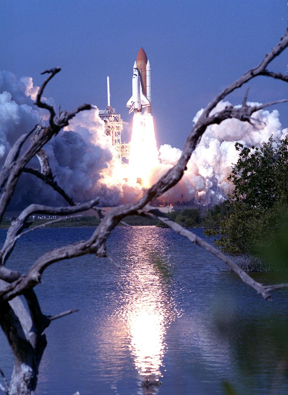
KENNEDY SPACE CENTER, Fla. -- The launch of Space Shuttle Endeavour seems to be fired from below the water in this view, framed by winter-bared branches. Clouds of steam and smoke roll away from Launch Pad 39A as the Shuttle lifts off at 12:43:40 p.m. EST into a clear blue Florida sky on mission STS-99. The launch pad lies close to the waters of the Banana River on the south, as well as the Atlantic Ocean to the east. Known as the Shuttle Radar Topography Mission (SRTM), STS-99 will chart a new course to produce unrivaled 3-D images of the Earth's surface. The result of the SRTM could be close to 1 trillion measurements of the Earth's topography. The mission is expected to last 11days, with Endeavour landing at KSC Tuesday, Feb. 22, at 4:36 p.m. EST. This is the 97th Shuttle flight and 14th for Shuttle Endeavour

KENNEDY SPACE CENTER, Fla. -- The launch of Space Shuttle Endeavour seems to be fired from below the water in this view, framed by winter-bared branches. Clouds of steam and smoke roll away from Launch Pad 39A as the Shuttle lifts off at 12:43:40 p.m. EST into a clear blue Florida sky on mission STS-99. The launch pad lies close to the waters of the Banana River on the south, as well as the Atlantic Ocean to the east. Known as the Shuttle Radar Topography Mission (SRTM), STS-99 will chart a new course to produce unrivaled 3-D images of the Earth's surface. The result of the SRTM could be close to 1 trillion measurements of the Earth's topography. The mission is expected to last 11days, with Endeavour landing at KSC Tuesday, Feb. 22, at 4:36 p.m. EST. This is the 97th Shuttle flight and 14th for Shuttle Endeavour
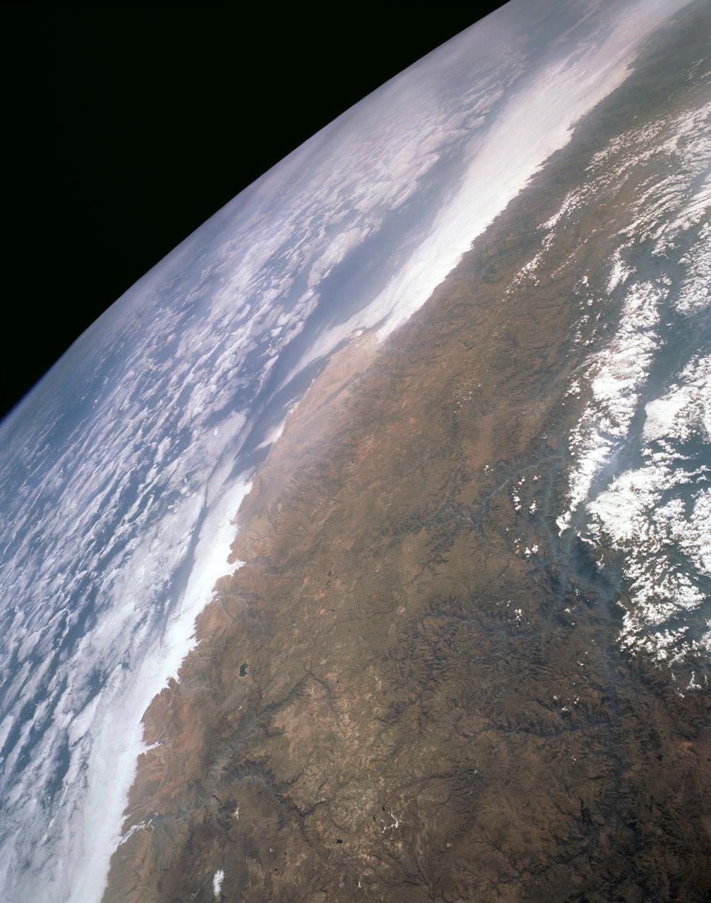
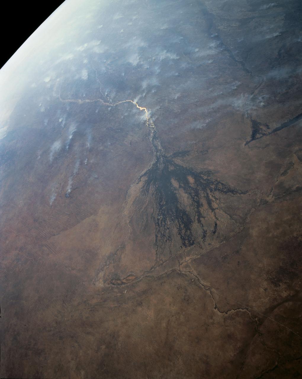
STS043-151-159 (2-11 August 1991) --- This photograph looks westward over the high plateau of the southern Peruvian Andes west and north of Lake Titicaca (not in field of view). Lima, Peru lies under the clouds just north of the clear coastal area. Because the high Andes have been uplifted 10,000 to 13,000 feet during the past 20 million years, the rivers which cut down to the Pacific Ocean have gorges almost that deep, such as the Rio Ocona at the bottom of the photograph. The eastern slopes of the Andes are heavily forested, forming the headwaters of the Amazon system. Smoke from burning in the Amazon basin fills river valleys on the right side of the photograph. A Linhof camera was used to take this view.