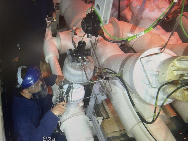
Members of the “red crew” perform work at the mobile launcher during the launch countdown for Artemis I at NASA’s Kennedy Space Center in Florida on Nov. 15, 2022. The team of technicians are part of the personnel specially trained to conduct operations at the launch pad during cryogenic loading operations. Prior to the launch of Artemis I, the red crew entered the zero deck, or base, of the mobile launcher and tightened several bolts to troubleshoot a valve used to replenish the core stage with liquid hydrogen which showed a leak with readings above limits. NASA has historically sent teams to the pad to conduct inspections during active launch operations as needed. Artemis I launched successfully at 1:47 a.m. on Nov. 16, from Kennedy’s Launch Pad 39B.

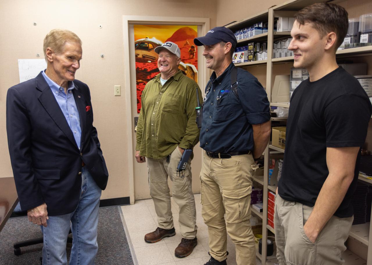
NASA Administrator Bill Nelson (second from right) meets with members of the “red crew” after the launch of Artemis I at NASA’s Kennedy Space Center in Florida on Nov. 16, 2022. Members of the red crew include Jacobs/TOSC ERC employees Billy Cairns, cryogenic engineering technician (left); Chad Garrett (second from left), safety engineer; and Trent Annis (right), cryogenic engineering technician. The team of technicians are part of the personnel specially trained to conduct operations at the launch pad during cryogenic loading operations at the launch pad. Prior to the launch of Artemis I, the red crew entered the zero deck, or base, of the mobile launcher and tightened several bolts to troubleshoot a valve used to replenish the core stage with liquid hydrogen which showed a leak with readings above limits. NASA has historically sent teams to the pad to conduct inspections during active launch operations as needed. Artemis I launch successfully at 1:47 a.m. EST on Nov. 16, from Kennedy’s Launch Pad 39B.
NASA Administrator Bill Nelson (left) meets with members of the “red crew,” Jacobs/TOSC ERC employees Billy Cairns (second from left), cryogenic engineering technician; Chad Garrett (second from right), safety engineer; and Trent Annis (right), cryogenic engineering technician, after the launch of Artemis I at NASA’s Kennedy Space Center in Florida on Nov. 16, 2022. The team of technicians are part of the personnel specially trained to conduct operations at the launch pad during cryogenic loading operations at the launch pad. Prior to the launch of Artemis I, the red crew entered the zero deck, or base, of the mobile launcher and tightened several bolts to troubleshoot a valve used to replenish the core stage with liquid hydrogen which showed a leak with readings above limits. NASA has historically sent teams to the pad to conduct inspections during active launch operations as needed. Artemis I launch successfully at 1:47 a.m. EST on Nov. 16, from Kennedy’s Launch Pad 39B.

Members of the SOFIA infrared observatory support team gather around Apollo 11 astronaut Buzz Aldrin (in red shirt) during Aldrin's tour of NASA Dryden.

Kennedy Space Center Janet Petro recognizes the Red Crew/High Crew for their support of the Artemis I test flight.
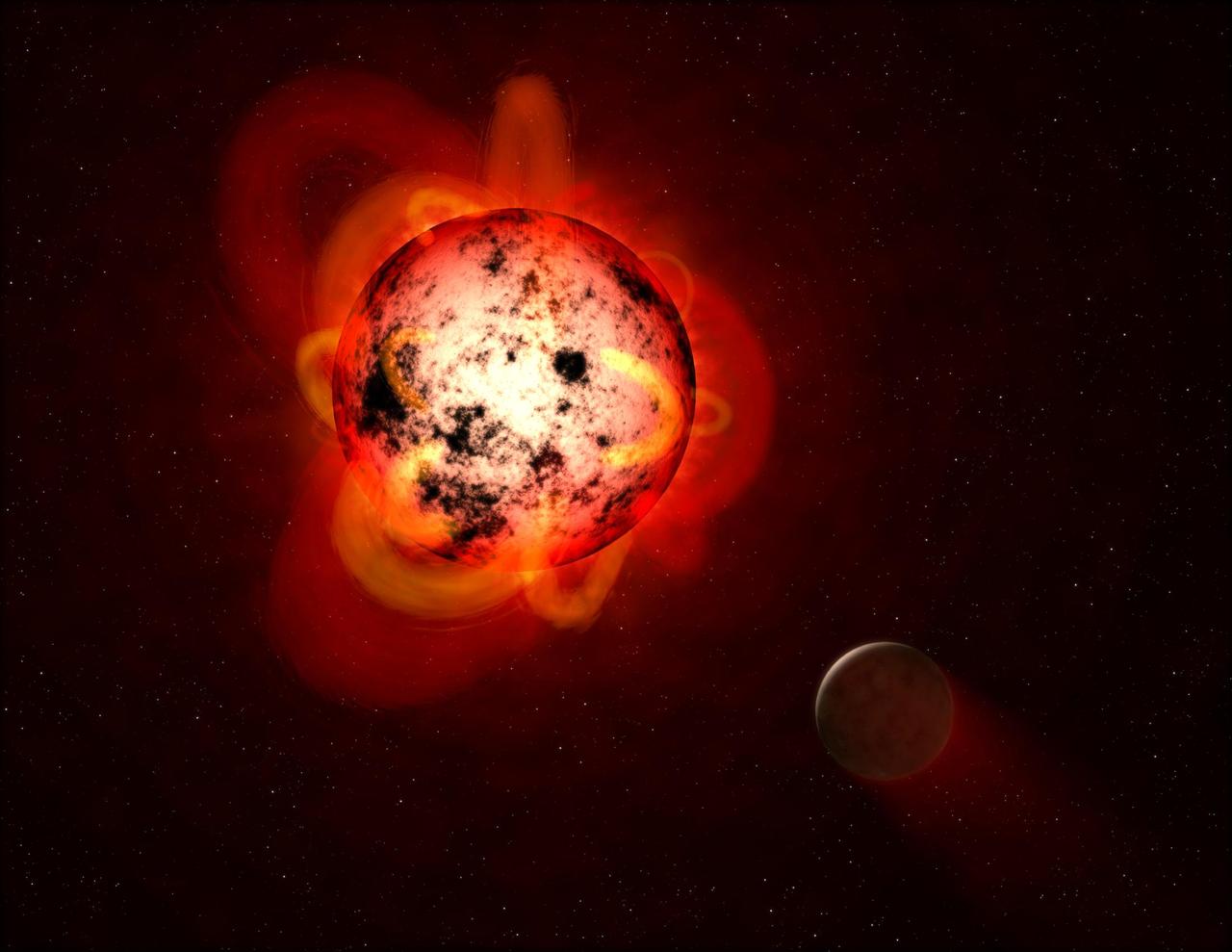
This illustration shows a red dwarf star orbited by a hypothetical exoplanet. Red dwarfs tend to be magnetically active, displaying gigantic arcing prominences and a wealth of dark sunspots. Red dwarfs also erupt with intense flares that could strip a nearby planet's atmosphere over time, or make the surface inhospitable to life as we know it. By mining data from the Galaxy Evolution Explorer (GALEX) spacecraft, a team of astronomers identified dozens of flares at a range of durations and strengths. The team measured events with less total energy than many previously detected flares from red dwarfs. This is important because, although individually less energetic and therefore less hostile to life, smaller flares might be much more frequent and add up over time to produce a cumulative effect on an orbiting planet. https://photojournal.jpl.nasa.gov/catalog/PIA21473
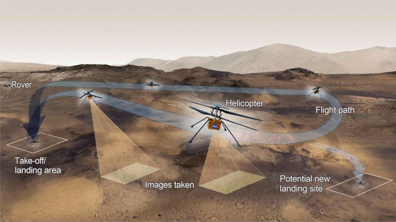
This graphic shows the general activities the team behind NASA's Ingenuity Mars Helicopter hopes to accomplish on a given test flight on the Red Planet. The helicopter will have 31 Earth days (30 sols, or Martian days) for its test flight program. https://photojournal.jpl.nasa.gov/catalog/PIA24496
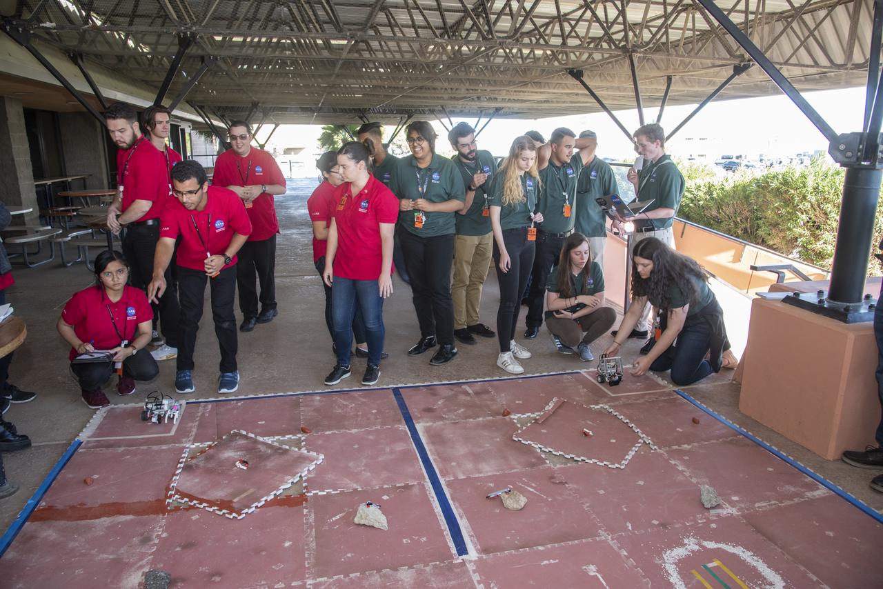
Four student teams: Blue, Gold, Green and Red built, designed and tested a LEGO robotic Martian rover prototype at NASA's Armstrong Flight Research Center. The teams competed against each other during a four-day workshop coordinated by the NASA Community College Aerospace Scholars. Each team prepared a marketing package to "sell" their design to NASA based on the performance of its Martian rover.
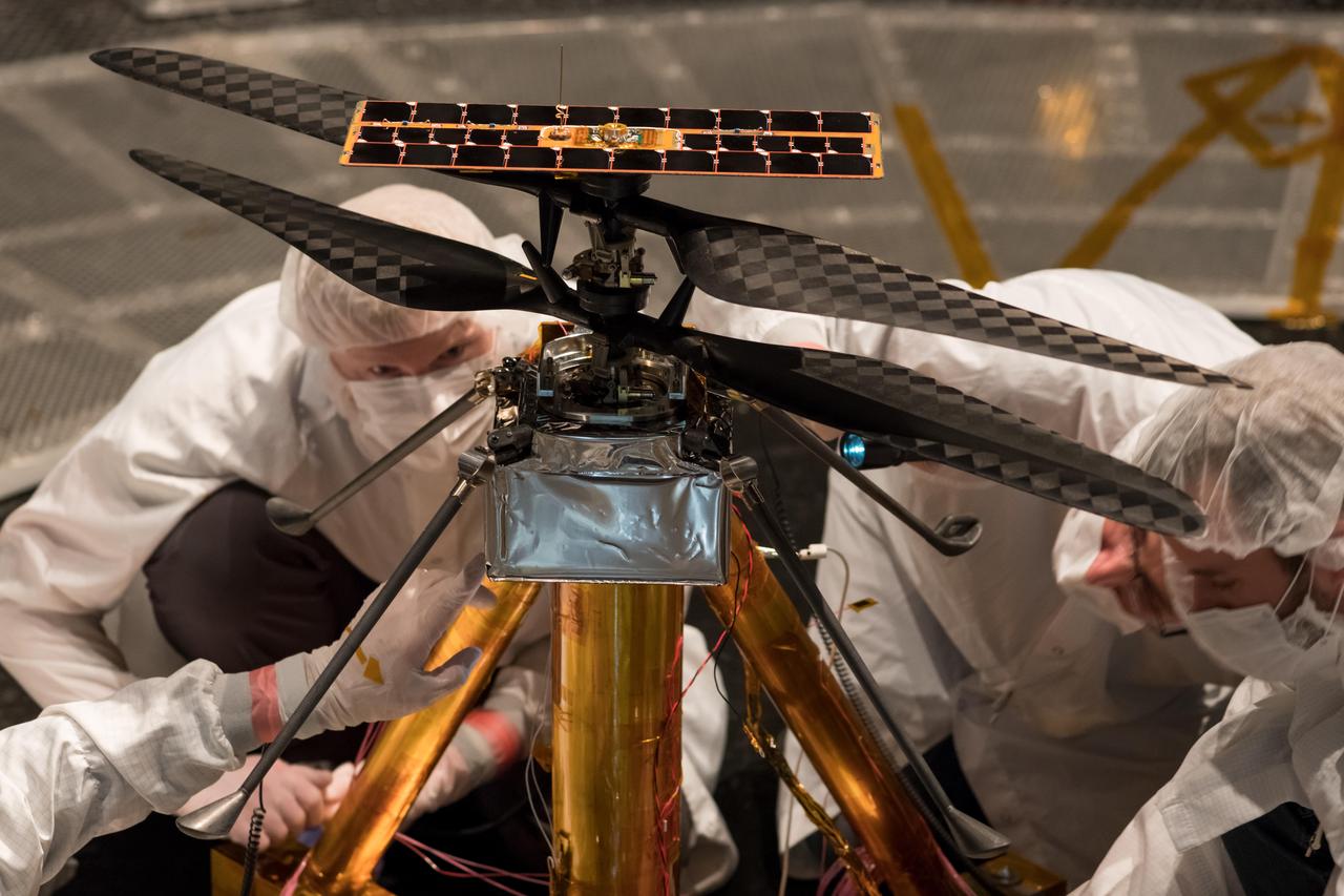
Members of the NASA Mars Helicopter team inspect the flight model (the actual vehicle going to the Red Planet), inside the Space Simulator, a 25-foot-wide (7.62-meter-wide) vacuum chamber at NASA's Jet Propulsion Laboratory in Pasadena, California, on Feb. 1, 2019. https://photojournal.jpl.nasa.gov/catalog/PIA23155
STS-133 ET-137 Tanking Test - Red Team (ICE Team) Preps - Firing Room Activities

STS-133 ET-137 Tanking Test - Red Team (ICE Team) Preps - Firing Room Activities
STS-133 ET-137 Tanking Test - Red Team (ICE Team) Preps - Firing Room Activities

STS-133 ET-137 Tanking Test - Red Team (ICE Team) Preps - Firing Room Activities

STS-133 ET-137 Tanking Test - Red Team (ICE Team) Preps - Firing Room Activities

STS-133 ET-137 Tanking Test - Red Team (ICE Team) Preps - Firing Room Activities

STS-133 ET-137 Tanking Test - Red Team (ICE Team) Preps - Firing Room Activities
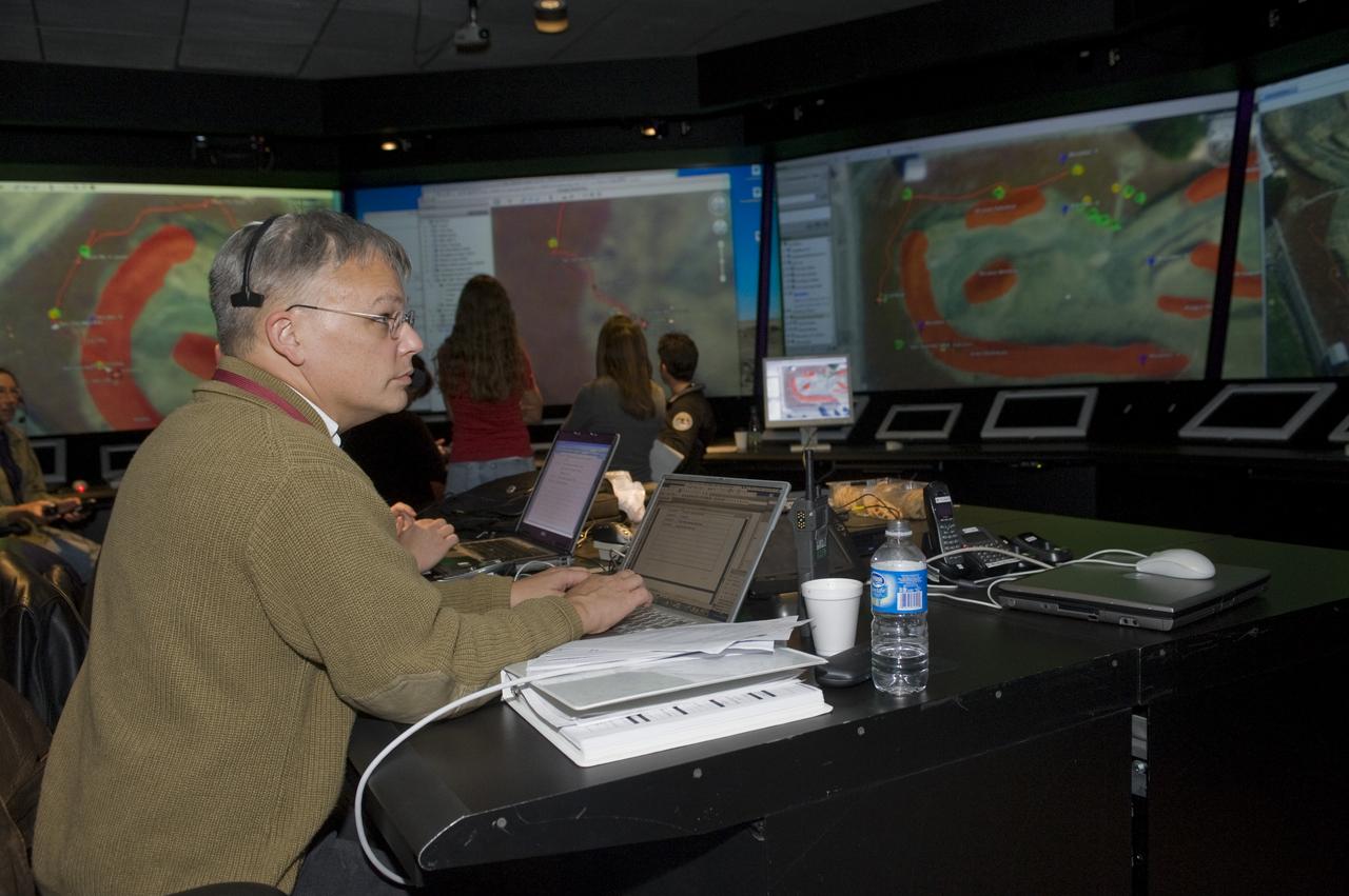
K-10 (red) plaentary rover at Marscape (Ames Mars Yard): with prototype flight control team remotely operating K-10 'Red' from Ames Future Flight Centeral (FFC) Simulator. With Rob Landis
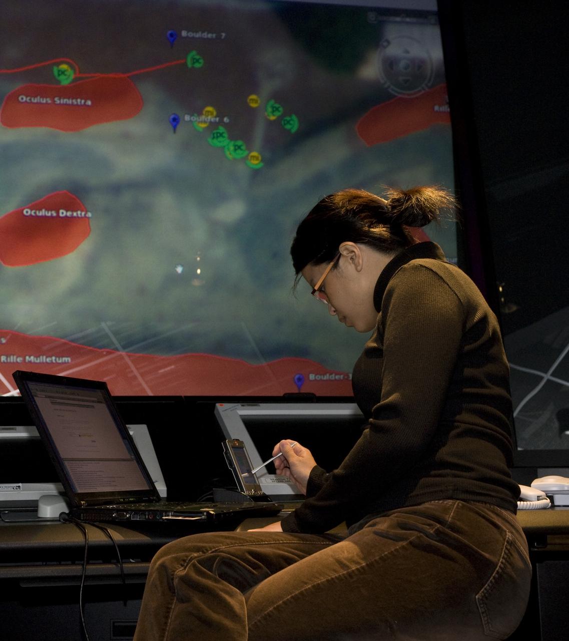
K-10 (red) plaentary rover at Marscape (Ames Mars Yard): with prototype flight control team remotely operating K-10 'Red' from Ames Future Flight Centeral (FFC) Simulator, with Estrellina Pacis.
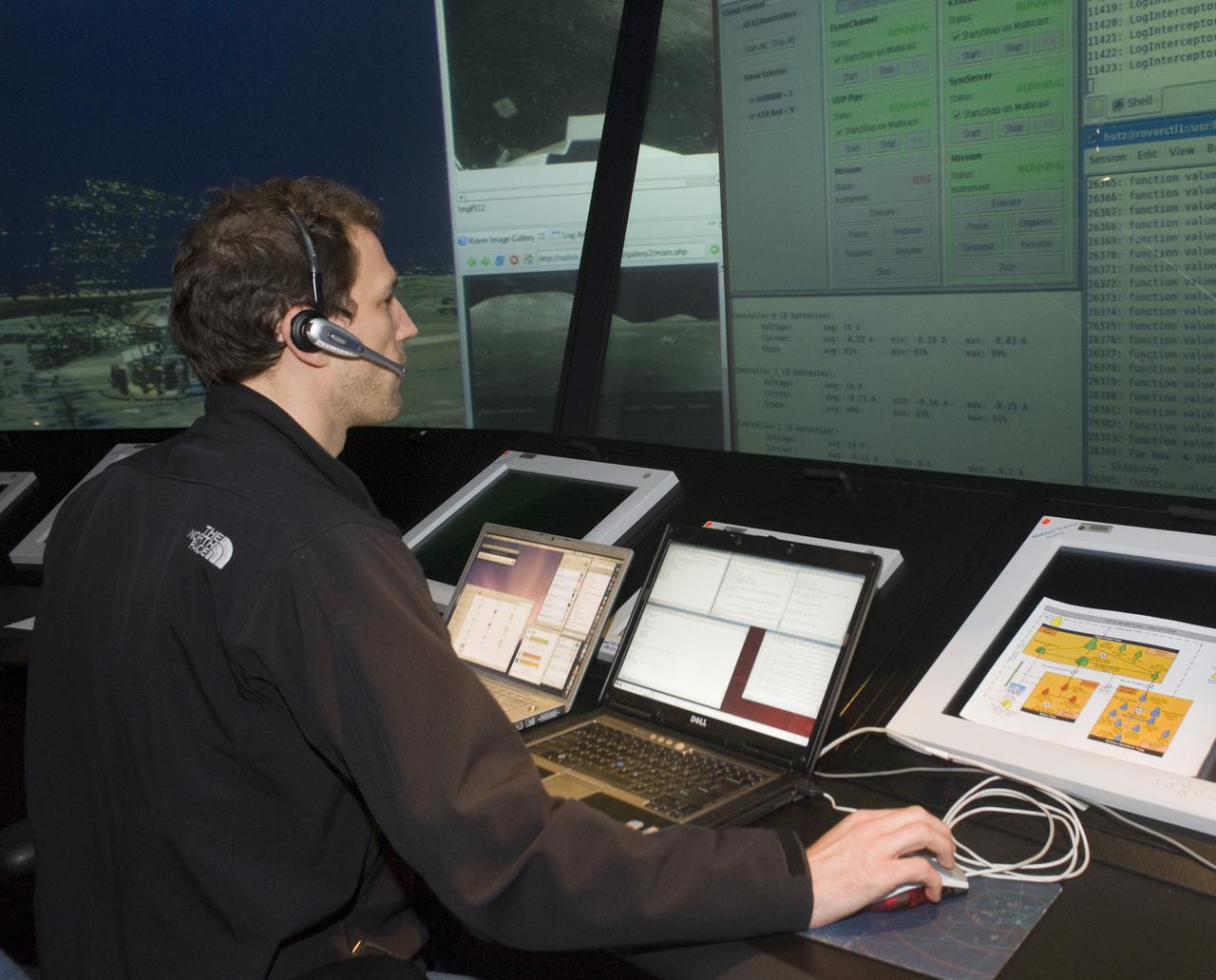
K-10 (red) plaentary rover at Marscape (Ames Mars Yard): with prototype flight control team remotely operating K-10 'Red' from Ames Future Flight Centeral (FFC) Simulator, with Hans Utz.
The WHAATRR team from NASA Armstrong includes, from left, Derek Abramson Dave Berger, John Bodylski, Robert “Red” Jensen, Scott Wiley, Al Bowers, Justin Hall, Luke Bard, Hussein Nasr and Samantha Ingersoll.

K-10 (red) plaentary rover at Marscape (Ames Mars Yard): with prototype flight control team remotely operating K-10 'Red' from Ames Future Flight Centeral (FFC) Simulator, L-R; Pascal Lee, Melissa Rice, David Lees, Trey Smith
K-10 (red) plaentary rover at Marscape (Ames Mars Yard): with prototype flight control team remotely operating K-10 'Red' from Ames Future Flight Centeral (FFC) Simulator, L-R Eric Park, Debra Schreckenghost, Rob Landis, Tod Milam, Steve Riley, Estrellina Pacis
K-10 (red) plaentary rover at Marscape (Ames Mars Yard): with prototype flight control team remotely operating K-10 'Red' from Ames Future Flight Centeral (FFC) Simulator, with Rob Landis and Steve Riley.

K-10 (red) plaentary rover at Marscape (Ames Mars Yard): with prototype flight control team remotely operating K-10 'Red' from Ames Future Flight Centeral (FFC) Simulator. L-R; Jeff Tripp, David Lees, Trey Smith, Mark Helper, Simon Rutishauser
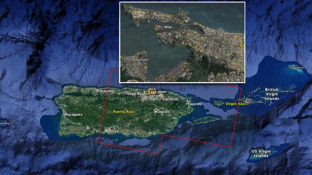
The Advanced Rapid Imaging and Analysis (ARIA) team at NASA's Jet Propulsion Laboratory in Pasadena, California, and Caltech, also in Pasadena, created this Damage Proxy Map (DPM) depicting areas of Eastern Puerto Rico that are likely damaged (shown by red and yellow pixels) as a result of Hurricane Maria (a Category 4 hurricane at landfall in Puerto Rico on Sept. 20, 2017). The map is derived from synthetic aperture radar (SAR) images from the Copernicus Sentinel-1A and Sentinel-1B satellites, operated by the European Space Agency (ESA). The images were taken before (March 25, 2017) and after (Sept. 21, 2017) the storm's landfall. The map was delivered to responding agencies, including the Federal Emergency Management Agency (FEMA), on Sept. 22, 2017. FEMA combined the map with building infrastructure data to estimate a damage density map, which was sent to its Urban Search and Rescue teams in the field in Puerto Rico. The map covers an area of 105 by 60 miles (169 by 96 kilometers), shown by the large red polygon in the figure. The inset, denoted by the orange rectangle, shows the extent of damage in and around the capital city of San Juan. Each pixel measures about 98 feet (30 meters) across. The color variation from yellow to red indicates increasingly more significant ground surface change. Preliminary validation was done by comparing the map with anecdotal reports of damage. This damage proxy map should be used as guidance to identify damaged areas, and may be less reliable over vegetated and flooded areas. Sentinel-1 data were accessed through the Copernicus Open Access Hub. The image contains modified Copernicus Sentinel data (2017), processed by ESA and analyzed by the NASA-JPL/Caltech ARIA team. This research was carried out at JPL under a contract with NASA. https://photojournal.jpl.nasa.gov/catalog/PIA21964
Members of NASA's Ingenuity Mars Helicopter team at the agency's Jet Propulsion Laboratory react to data showing that the helicopter completed its second flight on the Red Planet on April 22, 2021. The Ingenuity Mars Helicopter was built by JPL, which also manages this technology demonstration project for NASA Headquarters. It is supported by NASA's Science Mission Directorate, Aeronautics Research Mission Directorate, and Space Technology Mission Directorate. NASA's Ames Research Center and Langley Research Center provided significant flight performance analysis and technical assistance during Ingenuity's development. A key objective for Perseverance's mission on Mars is astrobiology, including the search for signs of ancient microbial life. The rover will characterize the planet's geology and past climate, pave the way for human exploration of the Red Planet, and be the first mission to collect and cache Martian rock and regolith (broken rock and dust). Subsequent NASA missions, in cooperation with ESA (European Space Agency), would send spacecraft to Mars to collect these sealed samples from the surface and return them to Earth for in-depth analysis. The Mars 2020 Perseverance mission is part of NASA's Moon to Mars exploration approach, which includes Artemis missions to the Moon that will help prepare for human exploration of the Red Planet. https://photojournal.jpl.nasa.gov/catalog/PIA24597
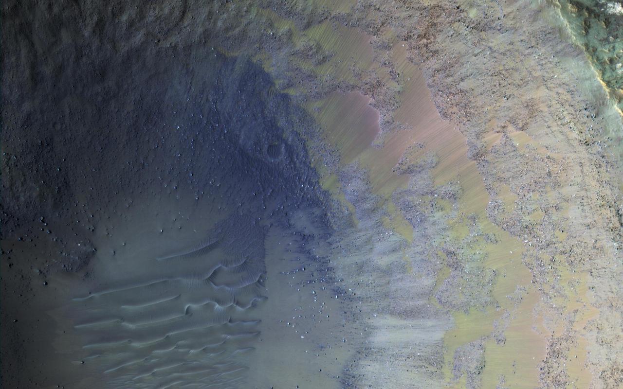
Some regions of Mars are not very colorful, but we can be surprised by local features. This image of an impact crater in the south Syrtis Major region was acquired as a "ride-along" with a CRISM observation, which targeted this location because that instrument's team expected a distinct composition. Our enhanced image reveals colors ranging from red to green to blue. These are infra-red shifted colors (infrared-red-blue) so it's different than what we would see with our eyes. https://photojournal.jpl.nasa.gov/catalog/PIA22727
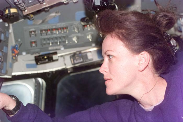
S99-E-5538 (16 February 2000) --- Astronaut Janet L. Kavandi, mission specialist, supports the Shuttle Radar Topography Mission (SRTM) during Red Team duties on Endeavour's aft flight deck.
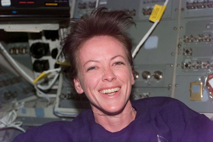
S99-E-5540 (16 February 2000) --- Astronaut Janet L. Kavandi, mission specialist, appears to enjoy her Red Team duties on Endeavour's flight deck.

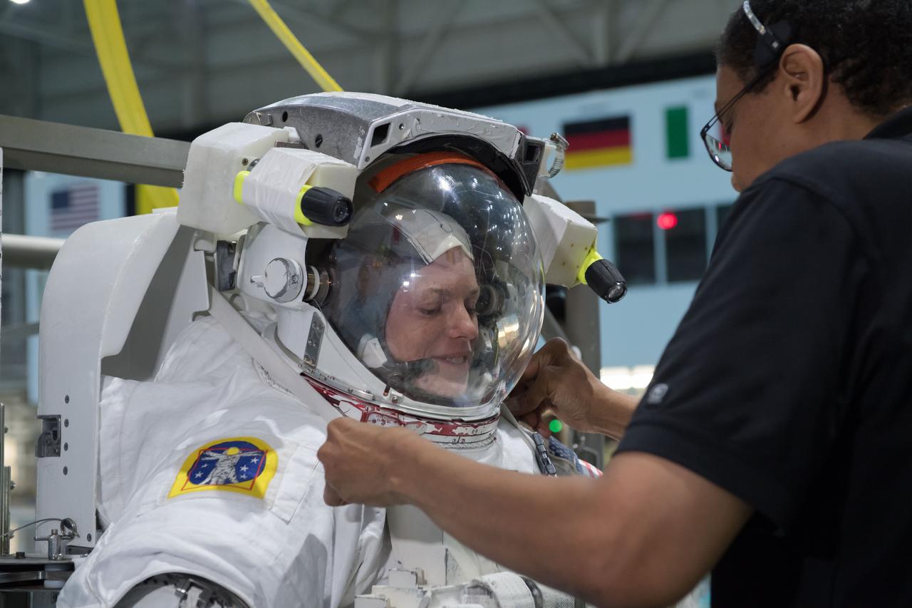
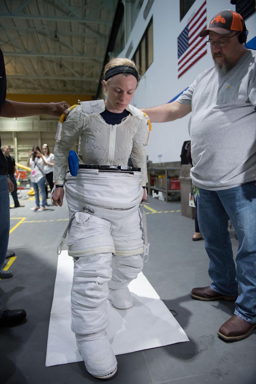
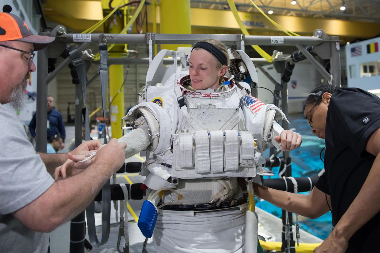
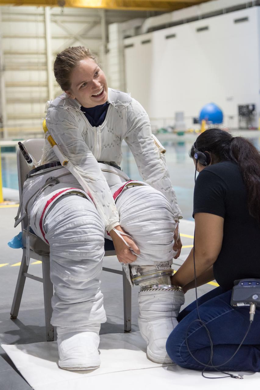
jsc2018e035917 (April 11, 2018) ---2017 NASA astronaut candidate Matthew Dominick wears a spacesuit prior to underwater spacewalk training at NASA Johnson Space Center’s Neutral Buoyancy Laboratory. Photo Credit: (NASA/Josh Valcarcel)

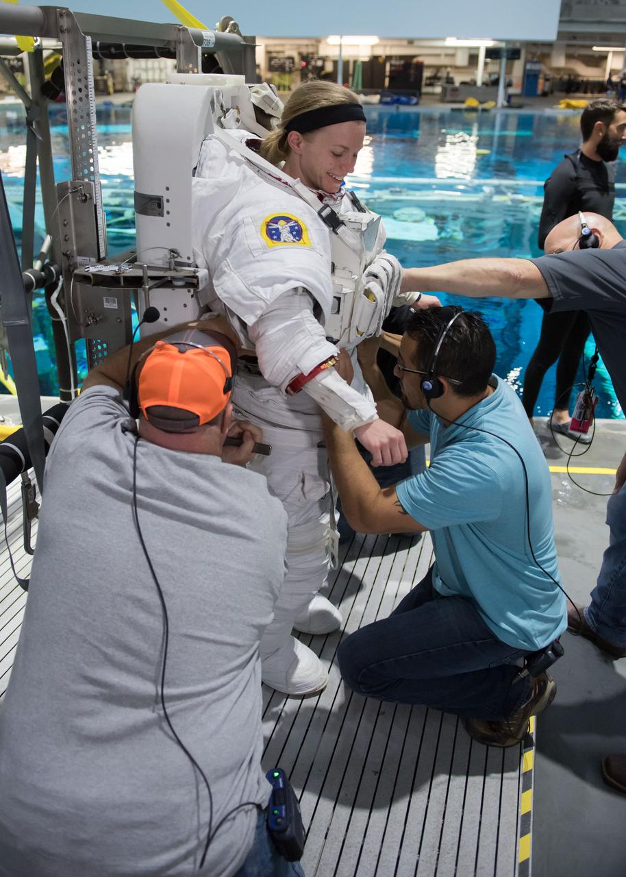
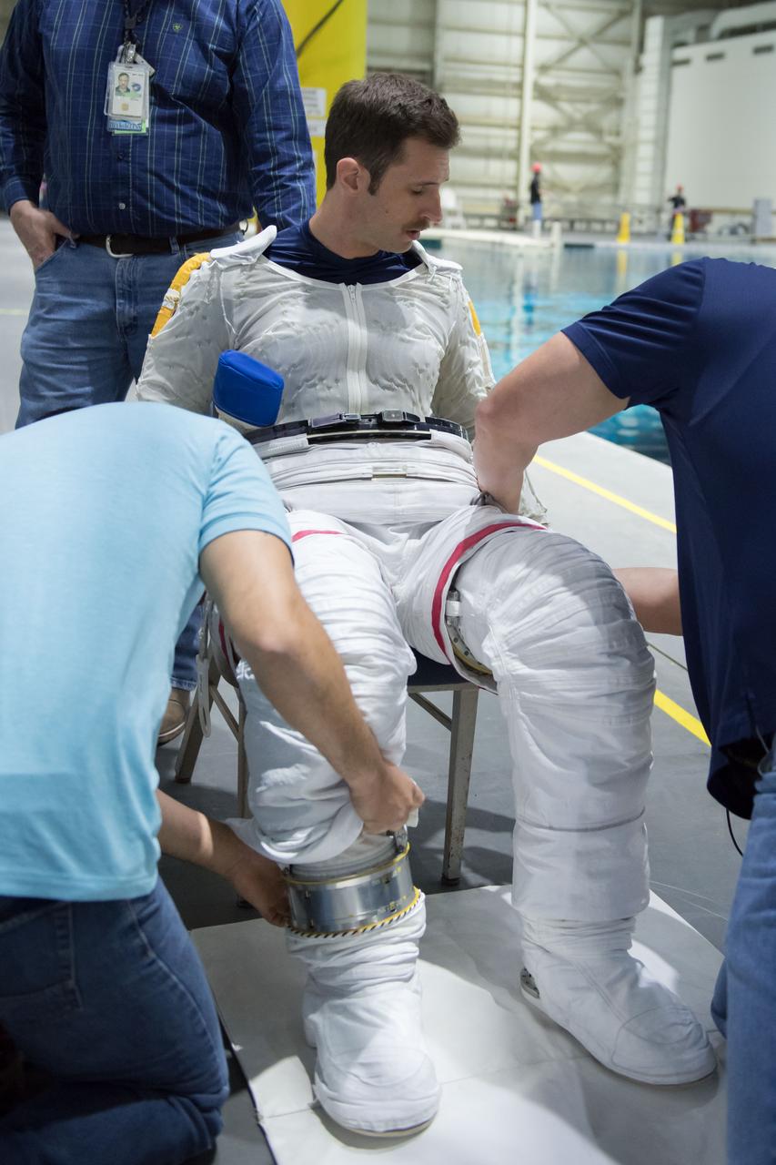
jsc2018e065023 (July 19, 2018) --- 2017 NASA astronaut candidate Frank Rubio is being helped into a spacesuit prior to underwater spacewalk training at NASA Johnson Space Center’s Neutral Buoyancy Laboratory in Houston. Photo Credit: (NASA/Josh Valcarcel)

jsc2018e035916 (April 11, 2018) --- 2017 NASA astronaut candidate Jasmin Moghbeli is helped into a spacesuit prior to underwater spacewalk training at NASA Johnson Space Center’s Neutral Buoyancy Laboratory. Photo Credit: (NASA/Josh Valcarcel)

jsc2018e035904 (April 11, 2018) --- 2017 NASA astronaut candidate Matthew Dominick wears a spacesuit prior to underwater spacewalk training at NASA Johnson Space Center’s Neutral Buoyancy Laboratory. Photo Credit: (NASA/Josh Valcarcel)
jsc2018e035765 (04-12-2018) --- 2017 Canadian Space Agency astronaut candidate Joshua Kutryk suits up in a spacesuit for underwater spacewalk training at NASA Johnson Space Center’s Neutral Buoyancy Laboratory. Photo Credit: (NASA/David DeHoyos)
jsc2018e035771 (04-12-2018) --- NASA astronaut candidate Zena Cardman is being helped into a spacesuit prior to underwater spacewalk training at NASA Johnson Space Center’s Neutral Buoyancy Laboratory. Photo Credit: (NASA/David DeHoyos)

jsc2018e064795 (07/18/2018) --- 2017 NASA astronaut candidate Bob Hines is being helped into a spacesuit prior to underwater spacewalk training at NASA Johnson Space Center’s Neutral Buoyancy Laboratory in Houston. Photo Credit: (NASA/Norah Moran)

jsc2018e035892 (April 11, 2018) --- NASA astronaut candidate Jasmin Moghbeli wears a Liquid Cooling and Ventilation Garment prior to underwater spacewalk training at NASA Johnson Space Center’s Neutral Buoyancy Laboratory. The cooling garment runs water throughout the suit to keep her cool during training. Photo Credit: (NASA/Josh Valcarcel)
jsc2018e065029 (July 19, 2018) --- 2017 NASA astronaut candidate Frank Rubio is being helped into a spacesuit prior to underwater spacewalk training at NASA Johnson Space Center’s Neutral Buoyancy Laboratory in Houston. Photo Credit: (NASA/Josh Valcarcel)

jsc2018e035922 (April 11, 2018) --- 2017 NASA astronaut candidate Jasmin Moghbeli wears a spacesuit prior to underwater spacewalk training at NASA Johnson Space Center’s Neutral Buoyancy Laboratory. Photo Credit: (NASA/Josh Valcarcel)

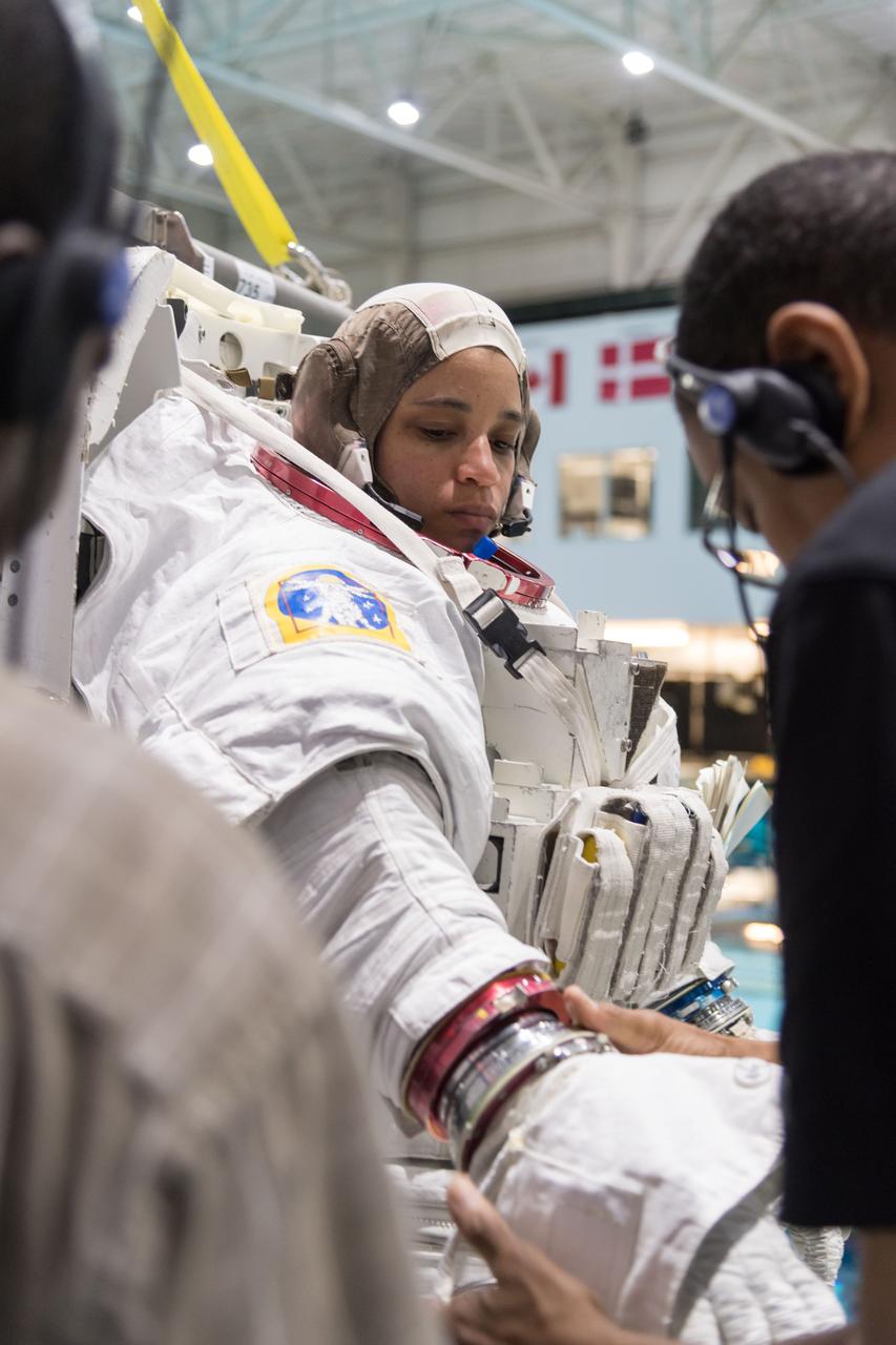
jsc2018e065033 (July 19, 2018) --- Canadian Space Agency astronaut candidate Jennifer Sidey-Gibbons is in a spacesuit prior to underwater spacewalk training at NASA Johnson Space Center’s Neutral Buoyancy Laboratory in Houston. Photo Credit: (NASA/Josh Valcarcel)
jsc2018e064829 (07/18/2018) --- 2017 NASA astronaut candidate Jessica Watkins prepares to be submerged in the water for underwater spacewalk training at NASA Johnson Space Center’s Neutral Buoyancy Laboratory in Houston. Photo Credit: (NASA/Norah Moran)
jsc2018e065038 (July 19, 2018) --- 2017 NASA astronaut candidate Frank Rubio is being helped into a spacesuit prior to underwater spacewalk training at NASA Johnson Space Center’s Neutral Buoyancy Laboratory in Houston. Photo Credit: (NASA/Josh Valcarcel)

jsc2018e065022 (07/19/2018) --- Canadian Space Agency astronaut candidate Jennifer Sidey-Gibbons in a spacesuit prior to underwater spacewalk training at NASA Johnson Space Center’s Neutral Buoyancy Laboratory in Houston. Photo Credit: (NASA/Josh Valcarcel)

jsc2018e065024 (July 19, 2018) --- 2017 NASA astronaut candidate Frank Rubio is being helped into a spacesuit prior to underwater spacewalk training at NASA Johnson Space Center’s Neutral Buoyancy Laboratory in Houston. Photo Credit: (NASA/Josh Valcarcel)

jsc2018e064842 (07/18/2018) --- 2017 NASA astronaut candidate Bob Hines in a spacesuit prior to underwater spacewalk training at NASA Johnson Space Center’s Neutral Buoyancy Laboratory in Houston. Photo Credit: (NASA/Norah Moran)
jsc2018e035783 (04-12-2018) --- NASA astronaut candidate Zena Cardman is being helped into a spacesuit for underwater spacewalk training at NASA Johnson Space Center’s Neutral Buoyancy Laboratory. Photo Credit: (NASA/David DeHoyos)
jsc2018e035752 (04-12-2018) --- 2017 NASA astronaut candidate Zena Cardman in a Liquid Cooling and Ventilation Garment and being helped into a spacesuit prior to underwater spacewalk training at NASA Johnson Space Center’s Neutral Buoyancy Laboratory. The cooling garment distributes water throughout to help keep her cool while training underwater in the spacesuit. Photo Credit: (NASA/David DeHoyos)
jsc2018e035760 (04-12-2018) --- 2017 NASA astronaut candidate Zena Cardman is being helped into a spacesuit prior to underwater training at NASA Johnson Space Center’s Neutral Buoyancy Laboratory. Photo Credit: (NASA/David DeHoyos)
jsc2018e065018 (July 19, 2018) --- Canadian Space Agency astronaut candidate Jennifer Sidey-Gibbons in a Liquid Cooling and Ventilation Garment and being helped into a spacesuit prior to underwater spacewalk training at NASA Johnson Space Center’s Neutral Buoyancy Laboratory in Houston. The cooling garment distributes water throughout to help keep her cool while training underwater. Photo Credit: (NASA/Josh Valcarcel)

jsc2018e065037 (July 19, 2018) --- 2017 NASA astronaut candidate Frank Rubio wears a spacesuit prior to underwater spacewalk training at NASA Johnson Space Center’s Neutral Buoyancy Laboratory in Houston. Photo Credit: (NASA/Josh Valcarcel)

jsc2018e064835 (07/18/2018) --- 2017 NASA astronaut candidate Bob Hines in a spacesuit prior to underwater spacewalk training at NASA Johnson Space Center’s Neutral Buoyancy Laboratory in Houston. Photo Credit: (NASA/Norah Moran)

jsc2018e065043 (July 19, 2018) --- NASA astronaut candidate Frank Rubio is lowered into the training pool at NASA Johnson Space Center’s Neutral Buoyancy Laboratory in Houston. Photo Credit: (NASA/Josh Valcarcel)

jsc2018e035796 (04-12-2018) --- NASA astronaut candidate Zena Cardman in a spacesuit is lowered into the training pool at NASA Johnson Space Center’s Neutral Buoyancy Laboratory. Photo Credit: (NASA/David DeHoyos)
jsc2018e035900 (April 11, 2018) --- 2017 NASA astronaut candidate Matthew Dominick in a Liquid Cooling and Ventilation Garment helps himself into a spacesuit prior to underwater spacewalk training at NASA Johnson Space Center’s Neutral Buoyancy Laboratory. Photo Credit: (NASA/Josh Valcarcel)
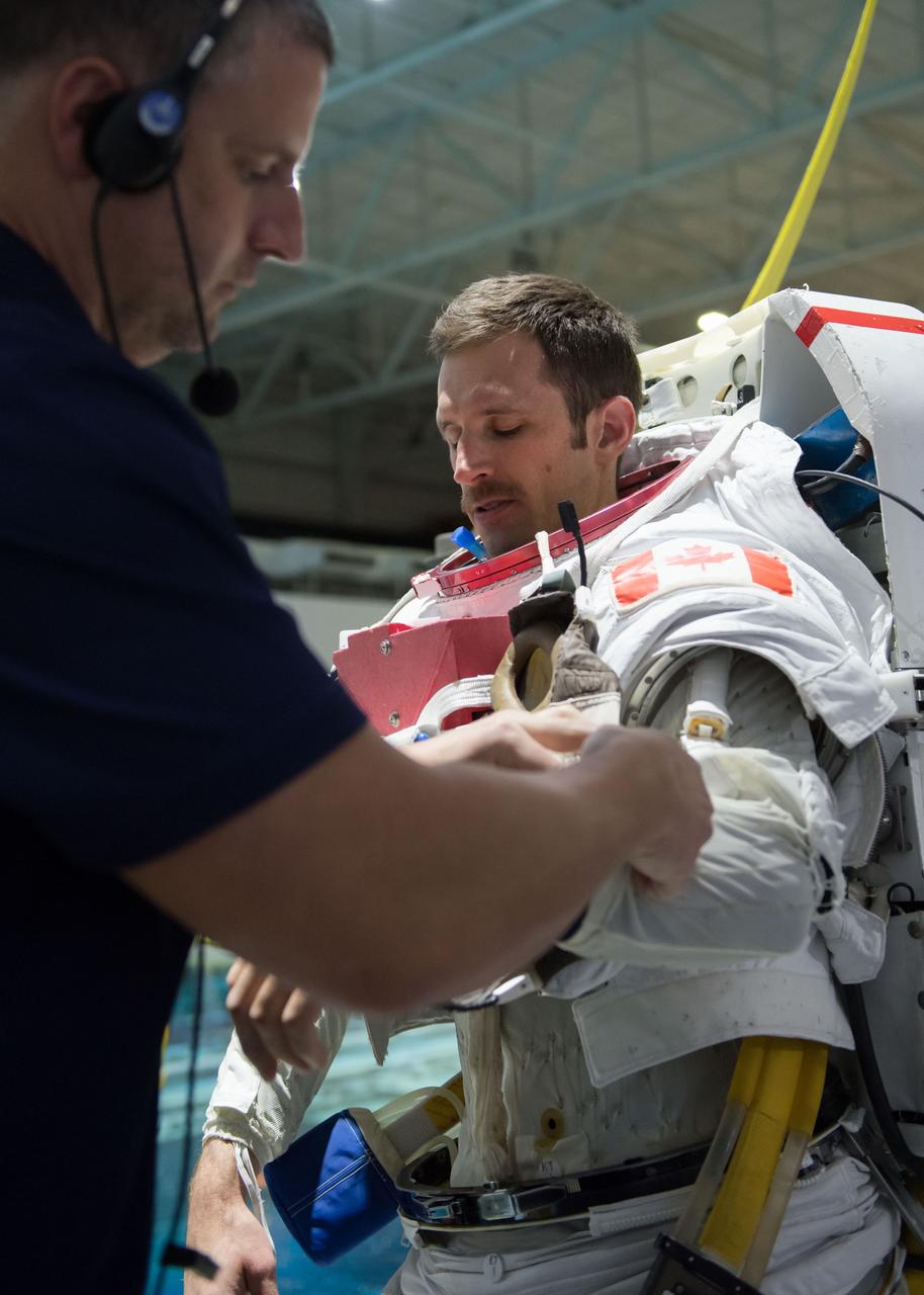
jsc2018e035767 (04-12-2018) --- 2017 Canadian Space Agency astronaut candidate Joshua Kutryk is being helped into a spacesuit prior to underwater spacewalk training at NASA Johnson Space Center’s Neutral Buoyancy Laboratory. Photo Credit: (NASA/David DeHoyos)

jsc2018e035773 (04-12-2018) --- NASA astronaut candidate Zena Cardman is being helped into a spacesuit prior to underwater spacewalk training at NASA Johnson Space Center’s Neutral Buoyancy Laboratory. Photo Credit: (NASA/David DeHoyos)

jsc2018e035762 (04-12-2018) --- NASA astronaut candidate Zena Cardman prepares for underwater spacewalk training at NASA Johnson Space Center’s Neutral Buoyancy Laboratory. Photo Credit: (NASA/David DeHoyos)

jsc2018e064837 (07/18/2018) --- 2017 NASA astronaut candidate Jessica Watkins in a spacesuit prior to underwater spacewalk training at NASA Johnson Space Center’s Neutral Buoyancy Laboratory in Houston. Photo Credit: (NASA/Norah Moran)
jsc2018e035780 (04-12-20180 --- Canadian Space Agency astronaut candidate Joshua Kutryk is being helped into a spacesuit prior to underwater spacewalk training at NASA Johnson Space Center’s Neutral Buoyancy Laboratory. Photo Credit: (NASA/David DeHoyos)

jsc2018e035893 (April 11, 2018) --- 2017 NASA astronaut candidate Matthew Dominick wears a Liquid Cooling and Ventilation Garment prior to underwater spacewalk training at NASA Johnson Space Center’s Neutral Buoyancy Laboratory. The cooling garment runs water throughout the suit to keep him cool during training. Photo Credit: (NASA/Josh Valcarcel)

jsc2018e035910 (April 11, 2018) --- 2017 NASA astronaut candidate Jasmin Moghbeli wears a spacesuit prior to underwater spacewalk training at NASA’s Johnson Space Center Neutral Buoyancy Laboratory. Photo Credit: (NASA/Josh Valcarcel)
jsc2018e035915 (April 11, 2018) --- 2017 NASA astronaut candidate Jasmin Moghbeli is helped into a spacesuit prior to underwater spacewalk training at NASA Johnson Space Center’s Neutral Buoyancy Laboratory. Photo Credit: (NASA/Josh Valcarcel)

jsc2018e064787 (07/18/2018) --- 2017 NASA astronaut candidate Bob Hines is in a Liquid Cooling and Ventilation Garment and being helped into a spacesuit prior to underwater spacewalk training at NASA’s Johnson Space Center Neutral Buoyancy Laboratory in Houston. The cooling garment distributes water throughout to help keep him cool while training underwater in the spacesuit. Photo Credit: (NASA/Norah Moran)

jsc2018e035788 (04-12-2018) --- Canadian Space Agency astronaut candidate Joshua Kutryk is in a spacesuit prior to underwater spacewalk training at NASA Johnson Space Center’s Neutral Buoyancy Laboratory. NASA astronaut candidate Zena Cardman is being helped into a spacesuit for underwater spacewalk training at NASA Johnson Space Center’s Neutral Buoyancy Laboratory.
jsc2018e035757 (04-12-2018) --- 2017 Canadian Space Agency astronaut candidate Joshua Kutryk in a Liquid Cooling and Ventilation Garment and being helped into a spacesuit prior to underwater spacewalk training at NASA Johnson Space Center’s Neutral Buoyancy Laboratory. The cooling garment distributes water throughout to help keep him cool while training underwater in the spacesuit. Photo Credit: (NASA/David DeHoyos)
jsc2018e064818 (07/18/2018) --- 2017 NASA astronaut candidate Jessica Watkins being helped into a spacesuit prior to underwater spacewalk training at NASA Johnson Space Center’s Neutral Buoyancy Laboratory in Houston. Photo Credit: (NASA/Norah Moran)
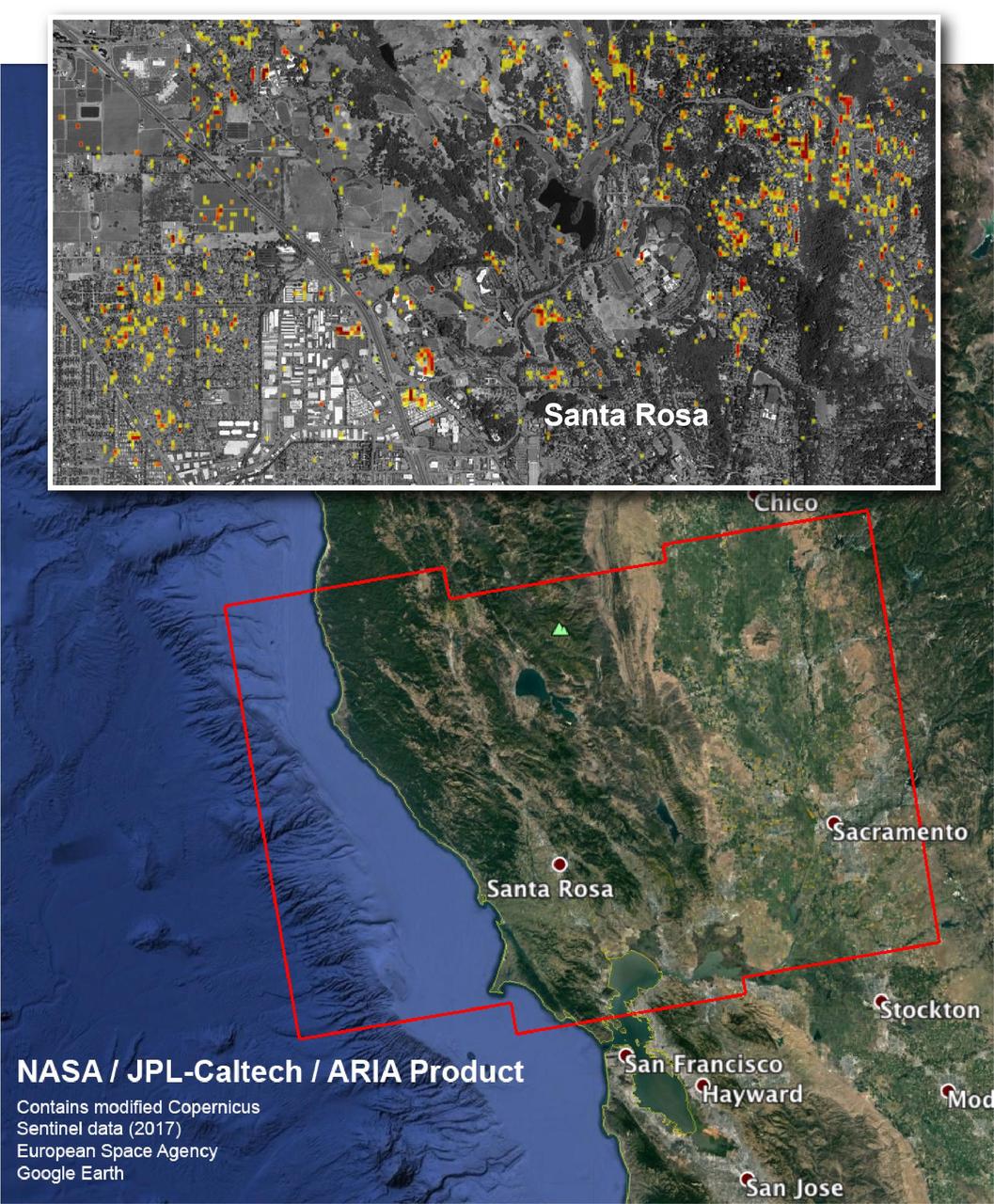
The Advanced Rapid Imaging and Analysis (ARIA) team at NASA's Jet Propulsion Laboratory in Pasadena, California, and Caltech, also in Pasadena, created this Damage Proxy Map depicting areas in Northern California that are likely damaged (shown by red and yellow pixels) as a result of the region's current outbreak of wildfires. The map is derived from synthetic aperture radar (SAR) images from the Copernicus Sentinel-1 satellites, operated by the European Space Agency (ESA). The images were taken before (Sep. 27, 2017, 7 p.m. PDT) and after (Oct. 9, 2017, 7 p.m. PDT) the onset of the fires. The map has been provided to various agencies to aid in the wildfire response. The map covers the area within the large red polygon, and measures 155 by 106 miles (250 by 170 kilometers). The illustrative figure from the map depicted in the inset shows damage in the city of Santa Rosa. Each pixel in the Damage Proxy Map measures about 98 feet (30 meters) across. The color variation from yellow to red indicates increasingly more significant ground surface change. Preliminary validation was done by comparing to optical satellite imagery from DigitalGlobe. This Damage Proxy Map should be used as guidance to identify damaged areas, and may be less reliable over vegetated areas. Sentinel-1 data were accessed through the Copernicus Open Access Hub. The image contains modified Copernicus Sentinel data (2017), processed by ESA and analyzed by the NASA-JPL/Caltech ARIA team. This research was carried out at JPL under a contract with NASA. https://photojournal.jpl.nasa.gov/catalog/PIA22048
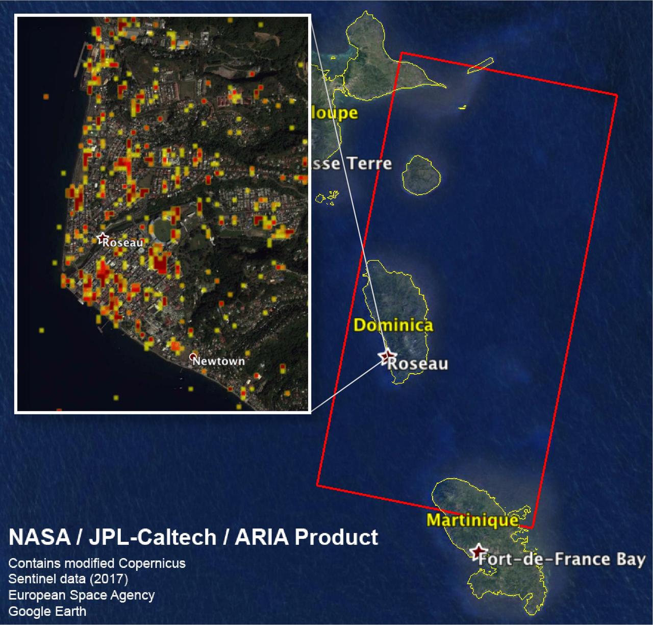
The Advanced Rapid Imaging and Analysis (ARIA) team at NASA's Jet Propulsion Laboratory in Pasadena, California, and Caltech, also in Pasadena, created this Damage Proxy Map (DPM) depicting areas including the Commonwealth of Dominica, that are likely damaged (shown by red and yellow pixels) as a result of Hurricane Maria (a Category 5 storm at landfall in Dominica on Sept. 18, 2017). The map is derived from synthetic aperture radar (SAR) images from the Copernicus Sentinel-1 satellites, operated by the European Space Agency (ESA). The images were taken before (March 27, 2017) and after (Sept. 23, 2017) the landfall of the storm. The map covers the area within the large red polygon, which measures 53 by 106 miles (85 by 170 kilometers). Each pixel measures about 98 feet (30 meters) across. The color variation from yellow to red indicates increasingly more significant ground surface change. Preliminary validation was done by comparing the data to a crowdsourced map by Clemson Center for Geospatial Technologies and optical satellite imagery feom DigitalGlobe. This damage proxy map should be used as guidance to identify damaged areas, and may be less reliable over vegetated areas. Sentinel-1 data were accessed through the Copernicus Open Access Hub. The image contains modified Copernicus Sentinel data (2017), processed by ESA and analyzed by the NASA/JPL-Caltech ARIA team. This research was carried out at JPL under a contract with NASA. https://photojournal.jpl.nasa.gov/catalog/PIA22037

Over the past 30 years, global average sea level has risen a total of 3.6 inches (9.1 centimeters), as indicated in this graphic, which is based on sea level measurements (in blue) from five successive satellites starting with the U.S.-French TOPEX/Poseidon mission in 1993. The solid red line shows the trajectory of sea level rise from 1993 to 2022, while the dotted red line shows the increase sea level into the future. Researchers can take the solid red line and calculate the rate of sea level rise, which was 0.08 inches (0.20 centimeters) per year in 1993 and doubled to 0.17 inches (0.44 centimeters) per year by 2022. The dotted red line shows that by 2040, sea levels may rise by an additional 3.66 inches (9.3 cm) above 2022 levels. The trajectory shown in the solid and dotted red line is based on work by the NASA Sea Level Change Team and the Ocean Surface Topography Science Team. https://photojournal.jpl.nasa.gov/catalog/PIA25775
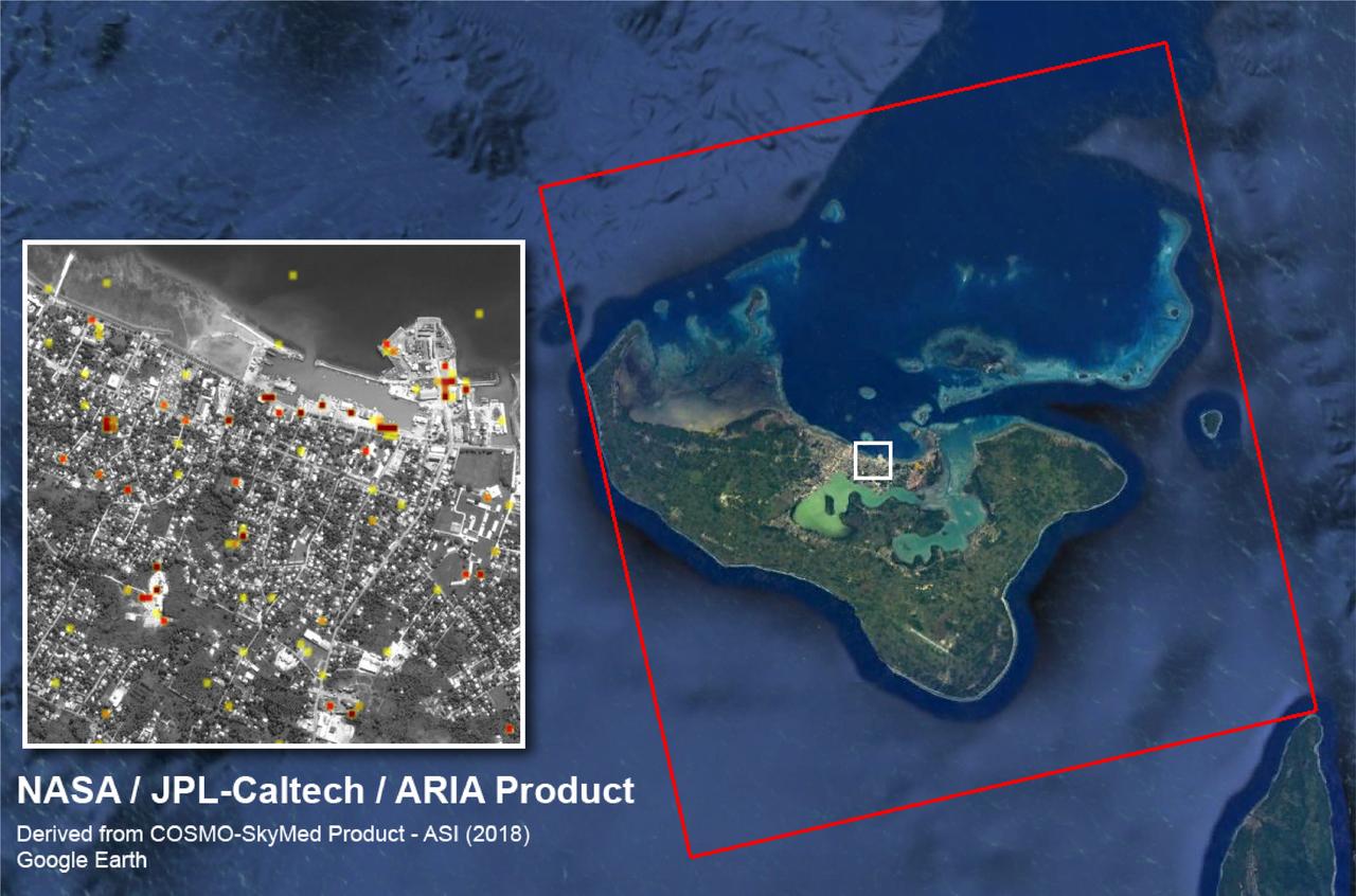
The Advanced Rapid Imaging and Analysis (ARIA) team at NASA's Jet Propulsion Laboratory created this Damage Proxy Map (DPM) of Tongatapu, the main island of Tonga, following the landfall of Cyclone Gita, a Category 4 storm that hit Tonga on Feb. 12-13, 2018. The map depicts areas that are likely damaged from the storm, shown by red and yellow pixels. The map was produced by comparing two pairs of interferometric synthetic aperture radar (InSAR) images from the COSMO-SkyMed satellites, operated by the Italian Space Agency (ASI). The pre- and post-cyclone images were acquired on Jan. 19 and Feb. 13, 2018, respectively. The later image was acquired just 4-1/2 hours after the peak damage by the cyclone. The map covers the entire island of Tongatapu (the 25-by-25-mile, or 40-by-40 kilometer SAR image footprint indicated with the large red polygon). Each pixel measures about 98 feet (30 meters) across. The color variation from yellow to red indicates increasingly more significant ground surface change. Preliminary validation of the SAR data was done by comparing them with high-resolution optical imagery acquired by DigitalGlobe. This Damage Proxy Map should be used as guidance to identify damaged areas and may be less reliable over vegetated and flooded areas. https://photojournal.jpl.nasa.gov/catalog/PIA22257

K-10 (red) plaentary rover at Marscape (Ames Mars Yard): with prototype flight control team remotely operating K-10 'Red' from Ames Future Flight Centeral (FFC) Simulator, L-R; Kip Hodges, Mark Helper, Marwan Hussein, Pascal Lee, Melissa Rice, Trey Smith, David Lees

STS099-305-012 (11-22 February 2000) --- Astronaut Gerhard P.J. Thiele, mission specialist, records Earth imagery from Endeavour's aft flight deck. Thiele, a Red Team member supporting the SRTM flight's 24-hour coverage, represents the European Space Agency (ESA).
S99-E-5734 (18 February 2000) --- Astronaut Gerhard P.J. Thiele, mission specialist representing the European Space Agency, takes a meal break from Red Team Shuttle Radar Topography Mission (SRTM) duties onboard the Space Shuttle Endeavour.
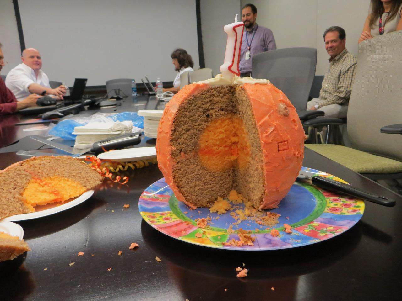
NASA's InSight lander team enjoyed this Mars-shaped cake on the first anniversary of the spacecraft's Nov. 26, 2018, landing. The cake came complete with its own inner layers – just like the Red Planet. https://photojournal.jpl.nasa.gov/catalog/PIA25283
STS099-327-003 (11-22 February 2000) --- Astronauts Gerhard P.J. Thiele and Janet L. Kavandi of the Red Team check Shuttle Radar Topography Mission (SRTM) data takes on the flight deck of the Space Shuttle Endeavour. Both are mission specialists, with Thiele representing the European Space Agency (ESA).
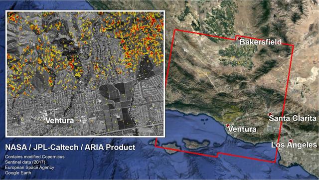
The Advanced Rapid Imaging and Analysis (ARIA) team at NASA's Jet Propulsion Laboratory in Pasadena, California, and Caltech, also in Pasadena, created a Damage Proxy Map (DPM) depicting areas in Southern California that are likely damaged (shown by red and yellow pixels) as a result of recent wildfires, including the Thomas Fire in Ventura and Santa Barbara Counties, highlighted in the attached image taken from the DPM. The map is derived from synthetic aperture radar (SAR) images from the Copernicus Sentinel-1 satellites, operated by the European Space Agency (ESA). The images were taken before (Nov. 28, 2017, 6 a.m. PST) and after (Dec. 10, 2017, 6 a.m. PST) the onset of the fires. The map covers an area of 107 by 107 miles (172 by 172 kilometers), shown by the large red polygon. Each pixel measures about 33 yards (30 meters) across. The color variation from yellow to red indicates increasingly more significant ground surface change. Preliminary validation was done by comparing the map to optical satellite imagery from DigitalGlobe. This damage proxy map should be used as guidance to identify damaged areas, and may be less reliable over vegetated areas. For example, the colored pixels seen over mountainous areas may seem a little scattered even though the reality could be that the contiguous areas were burned. Patches of farmland can also appear as signals due to plowing or irrigation. The full map is available to download from https://aria-share.jpl.nasa.gov/events/20171210-SoCal_Fire/. https://photojournal.jpl.nasa.gov/catalog/PIA22191
S65-62062 (12 Dec. 1965) --- Discussing the scrubbing of the planned National Aeronautics and Space Administration?s Gemini-6 spaceflight are (from left) William C. Schneider (standing), deputy director, Gemini Program Office of Manned Spaceflight, NASA Headquarters, Washington, D.C.; Eugene F. Kranz (seated), white team flight director; Christopher C. Kraft Jr., red team flight director; and John D. Hodge, blue team flight director. The Gemini-6 mission has been rescheduled for Dec. 15, 1965. Photo credit: NASA or National Aeronautics and Space Administration

On Dec. 1, 2014, Milt Heflin briefs the Orion recovery team on board the U.S. Navy's USS Anchorage, which will be used to retrieve Orion after it splashes down in the Pacific Ocean following Exploration Flight Test-1 (EFT-1) on Dec. 4. Heflin began his 46-year-long NASA career as part of the team that recovered the Apollo capsules from the Pacific. Now retired from NASA, he is acting as a consultant for the Orion team through Red Canyon Software, Inc. Part of Batch image transfer from Flickr.
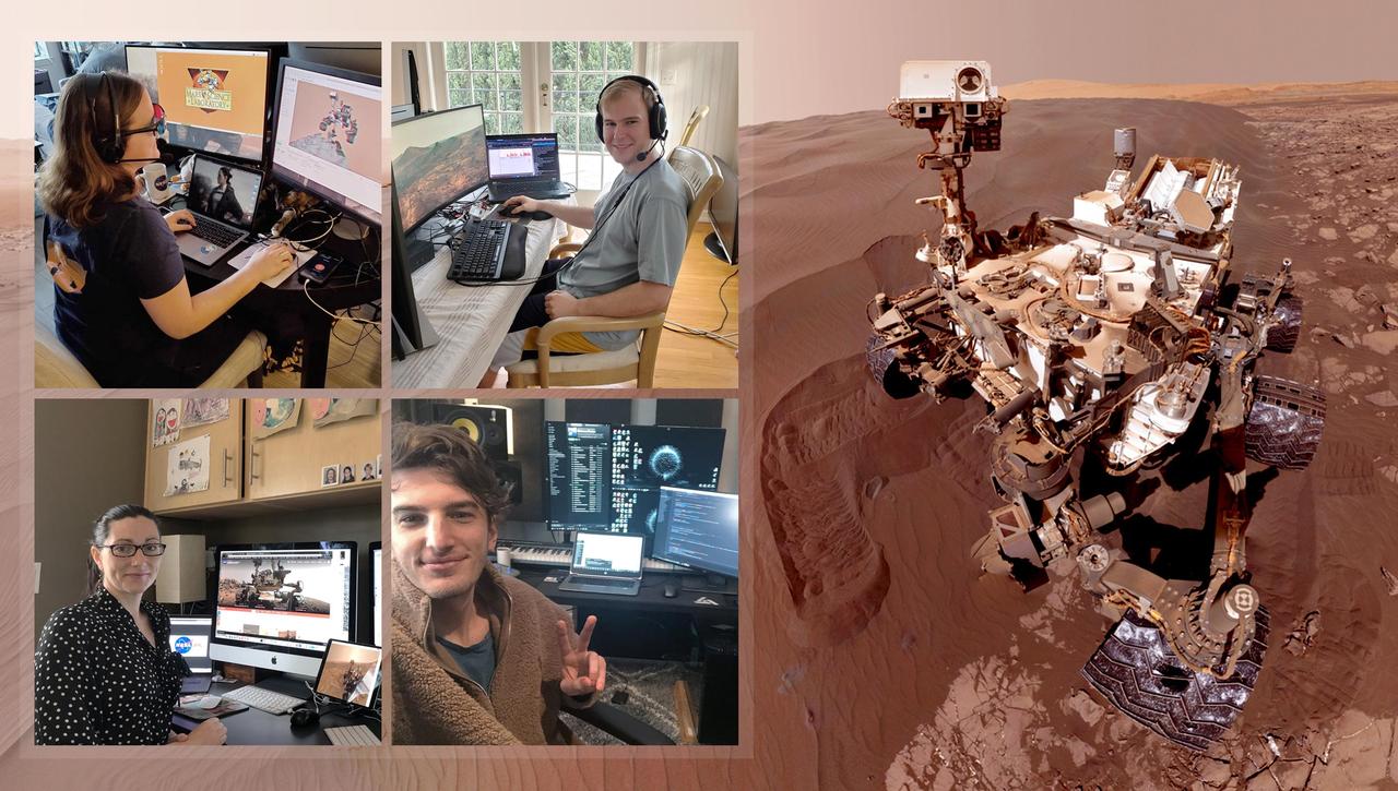
Members of NASA's Curiosity Mars rover mission team took pictures of themselves from their home offices on March 20, 2020, the first day the entire mission team worked remotely. Rover planning usually happens at NASA's Jet Propulsion Laboratory in Southern California. Clockwise from upper left: Rover planner Keri Bean, wearing red-blue 3D glasses; rover planner Camden Miller; tactical uplink lead Jack Quade; and Science Operations Team Chief Carrie Bridge. https://photojournal.jpl.nasa.gov/catalog/PIA23773

The Advanced Rapid Imaging and Analysis (ARIA) team at NASA's Jet Propulsion Laboratory in Pasadena, California, created this map depicting areas that are likely damaged as a result of the recent major earthquakes in Southern California. The color variation from yellow to red indicates increasingly more significant surface change, or damage. The map covers an area of 155 by 186 miles (250 by 300 kilometers), shown by the large red polygon. Each pixel measures about 33 yards (30 meters) across. To make the map, the team used synthetic aperture radar (SAR) images from the European Space Agency's Copernicus Sentinel-1 satellites from before and after the sequence of quakes — July 4, 2019 and July 10, 2019 respectively. The map may be less reliable over vegetated areas but can provide useful guidance in identifying damaged areas. https://photojournal.jpl.nasa.gov/catalog/PIA23354
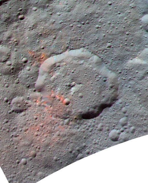
This enhanced color composite image, made with data from the framing camera aboard NASA's Dawn spacecraft, shows the area around Ernutet crater. The bright red portions appear redder with respect to the rest of Ceres. In a 2017 study in the journal Science, researchers from the Dawn science team found that these red areas around Ernutet are associated with evidence of organic material. Images taken using blue (440 nanometers), green (750 nanometers) and infrared (960 nanometers) spectral filters were combined to create the view. Ernutet Crater measures about 32 miles (52 kilometers) in diameter and is located in the northern hemisphere. http://photojournal.jpl.nasa.gov/catalog/PIA21419
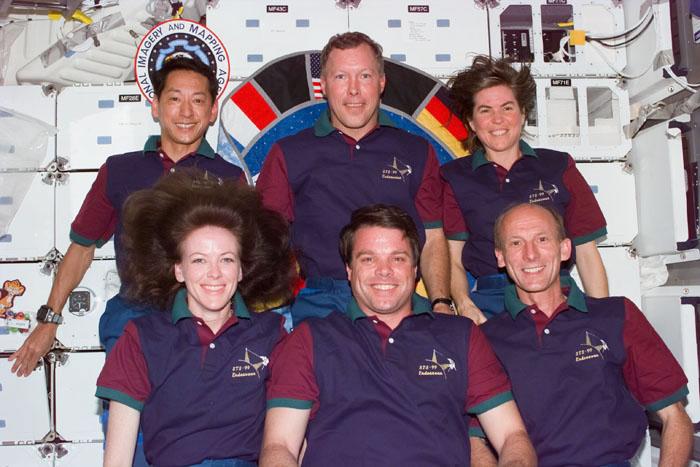
S99-E-5731 (18 February 2000) --- Not often seen together on the STS-99 flight which provides around-the-clock coverage for the Shuttle Radar Topography Mission (SRTM), the six astronauts pose for one of the traditional inflight crew portraits on Endeavour's mid deck. In the rear are the Blue Team members (from left), Mamoru Mohri, Dominic L. Gorie and Janice Voss. In front are Red Team members Janet L. Kavandi, Kevin R. Kregel and Gerhard P.J. Thiele. Mohri is with Japan's National Space Development Agency (NASDA) and Thiele represents the European Space Agency (ESA).
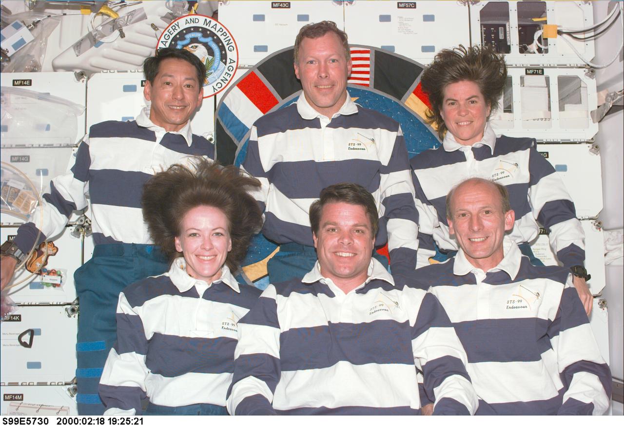
S99-E-5730 (18 February 2000) --- Not often seen together on the STS-99 flight which provides around-the-clock coverage for the Shuttle Radar Topography Mission (SRTM), the six astronauts pose for the traditional inflight crew portrait on Endeavour's mid deck. In the rear are the Blue Team members (from left), Mamoru Mohri, Dominic L. Gorie and Janice Voss. In front are Red Team members Janet L. Kavandi, Kevin R. Kregel and Gerhard P.J. Thiele. Mohri is with Japan's National Space Development Agency (NASDA) and Thiele represents the European Space Agency (ESA).
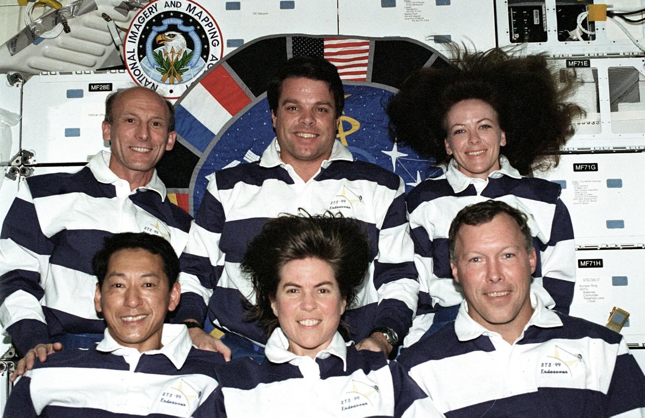
STS099-318-003 (11-22 February 2000) --- The six flight crew members for the Shuttle Radar Topography Mission (SRTM) pose for the traditional inflight crew portrait on Endeavour's mid deck. Blue Team members in front are (from the left), astronauts Mamoru Mohri, Janice Voss and Dominic L. Gorie. Red Team members are (from left, rear) astronauts Gerhard P.J. Thiele, Kevin R. Kregel and Janet L. Kavandi. Mohri is with Japan's National Space Development Agency (NASDA) and Thiele represents the European Space Agency (ESA).
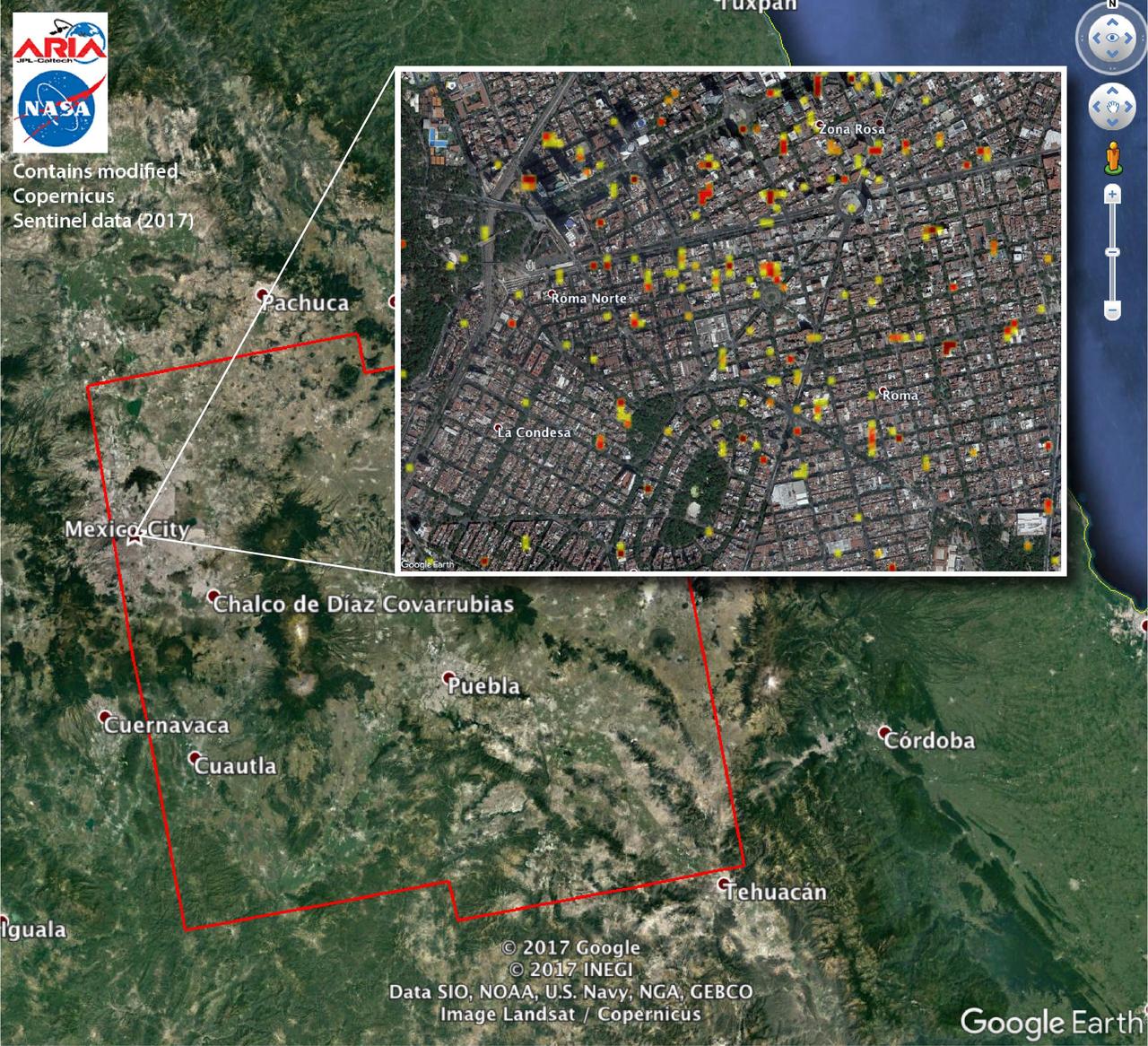
The Advanced Rapid Imaging and Analysis (ARIA) team at NASA's Jet Propulsion Laboratory in Pasadena, California, and Caltech, also in Pasadena, created this Damage Proxy Map (DPM) depicting areas of Central Mexico, including Mexico City, that are likely damaged (shown by red and yellow pixels) from the magnitude 7.1 Raboso earthquake of Sept. 19, 2017 (local time). The map is derived from synthetic aperture radar (SAR) images from the Copernicus Sentinel-1A and Sentinel-1B satellites, operated by the European Space Agency (ESA). The images were taken before (Sept. 8, 2017) and after (Sept. 20, 2017) the earthquake. The map covers an area of 109 by 106 miles (175 by 170 kilometers). Each pixel measures about 33 yards (30 meters) across. The color variation from yellow to red indicates increasingly more significant ground and building surface change. Preliminary validation was done by comparing the DPM to a crowd-sourced Google Map (https://www.google.com/maps/d/u/0/viewer?mid=1_-V97lbdgLFHpx-CtqhLWlJAnYY&ll=19.41452166501326%2C-99.16498240436704&z=16). This damage proxy map should be used as guidance to identify damaged areas, and may be less reliable over vegetated areas. Sentinel-1 data were accessed through the Copernicus Open Access Hub. The image contains modified Copernicus Sentinel data (2017), processed by ESA and analyzed by the NASA-JPL/Caltech ARIA team. This research was carried out at JPL under contract with NASA. https://photojournal.jpl.nasa.gov/catalog/PIA21963
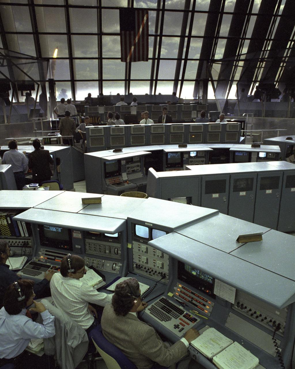
Through the large window panes of Firing Room 1, KSC launch team members reap the rewards of their work with a glimpse of the space shuttle Discovery soaring into the sky. Discovery was launched for the tenth time at 8:34 a.m. EDT on April 24 beginning the five-day STS-31 mission to deploy the Hubble Space Telescope. A ray of morning sunlight highlights the red and white stripes of Old Glory hanging high in the Firing Room. Launch team members overcame a last minute challenge in the STS-31 countdown when software detected a main propulsion system valve was out of position. The situation was quickly corrected and verified by the team from consoles in the Firing Room and the countdown was returned in a matter of minutes. Photo credit: NASA
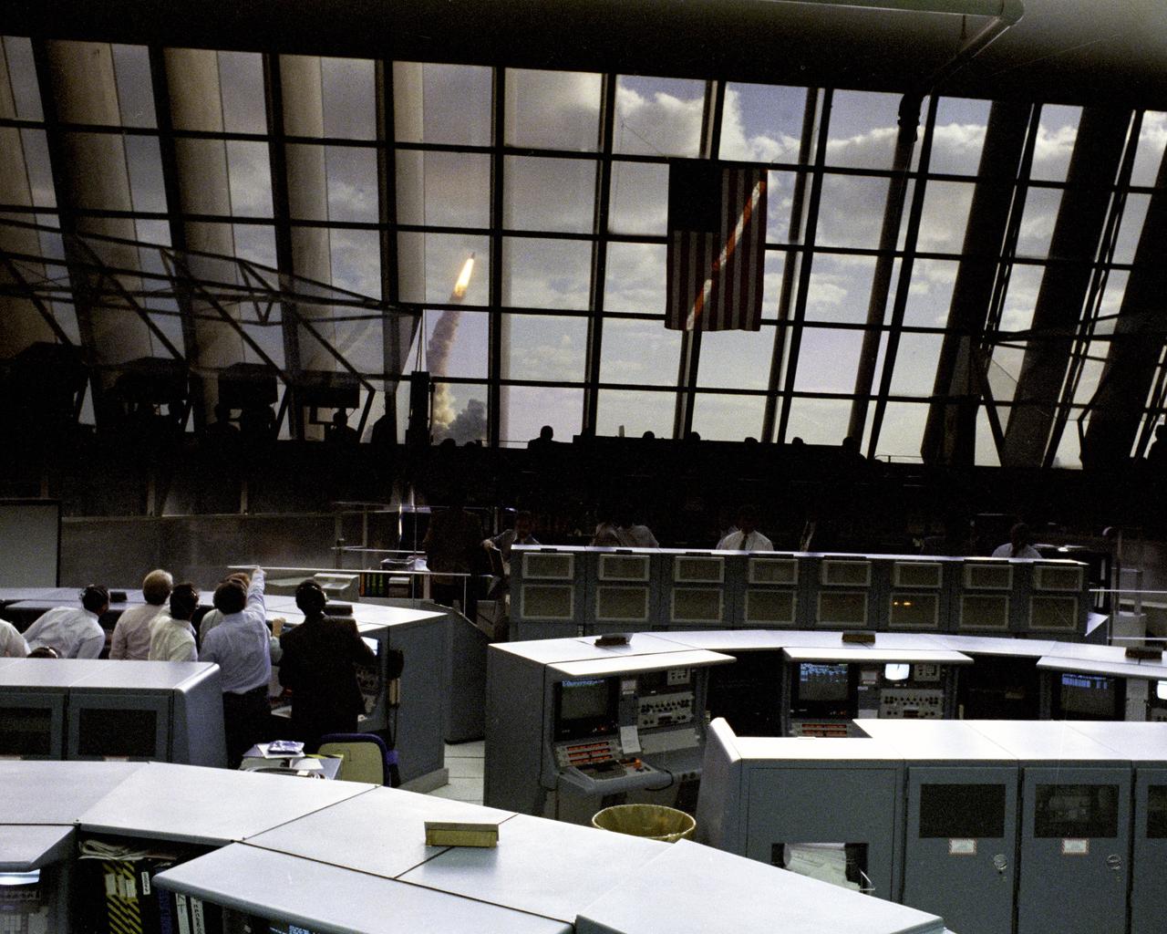
Through the large window panes of Firing Room 1, KSC launch team members reap the rewards of their work with a glimpse of the space shuttle Discovery soaring into the sky. Discovery was launched for the tenth time at 8:34 a.m. EDT on April 24 beginning the five-day STS-31 mission to deploy the Hubble Space Telescope. A ray of morning sunlight highlights the red and white stripes of Old Glory hanging high in the Firing Room. Launch team members overcame a last minute challenge in the STS-31 countdown when software detected a main propulsion system valve was out of position. The situation was quickly corrected and verified by the team from consoles in the Firing Room and the countdown was returned in a matter of minutes. Photo credit: NASA
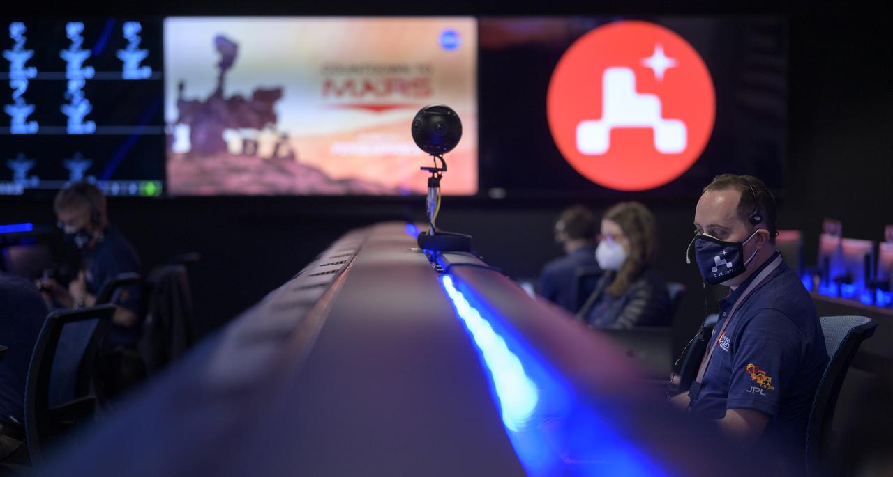
Members of NASA’s Perseverance Mars rover team study data on monitors in mission control, Thursday, Feb. 18, 2021, at NASA's Jet Propulsion Laboratory in Pasadena, California. A key objective for Perseverance’s mission on Mars is astrobiology, including the search for signs of ancient microbial life. The rover will characterize the planet’s geology and past climate, pave the way for human exploration of the Red Planet, and be the first mission to collect and cache Martian rock and regolith. Photo Credit: (NASA/Bill Ingalls)
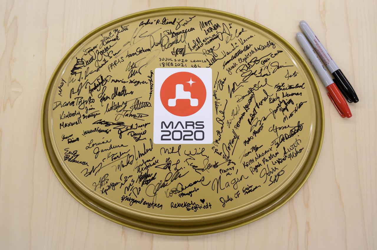
A serving tray with signatures from the NASA Perseverance Mars rover team is seen in mission control, Thursday, Feb. 18, 2021, at NASA's Jet Propulsion Laboratory in Pasadena, California. A key objective for Perseverance’s mission on Mars is astrobiology, including the search for signs of ancient microbial life. The rover will characterize the planet’s geology and past climate, pave the way for human exploration of the Red Planet, and be the first mission to collect and cache Martian rock and regolith. Photo Credit: (NASA/Bill Ingalls)

NASA's ARIA team, in collaboration with the Earth Observatory of Singapore, used satellite data to map the extent of likely damage following a massive explosion in Beirut. Dark red pixels represent the most severe damage. Areas in orange are moderately damaged, and areas in yellow are likely to have sustained somewhat less damage. Each colored pixel represents an area of 30 meters (33 yards). https://photojournal.jpl.nasa.gov/catalog/PIA23692
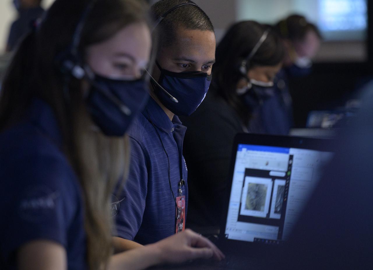
Members of NASA’s Perseverance Mars rover team study data on monitors in mission control, Thursday, Feb. 18, 2021, at NASA's Jet Propulsion Laboratory in Pasadena, California. A key objective for Perseverance’s mission on Mars is astrobiology, including the search for signs of ancient microbial life. The rover will characterize the planet’s geology and past climate, pave the way for human exploration of the Red Planet, and be the first mission to collect and cache Martian rock and regolith. Photo Credit: (NASA/Bill Ingalls)
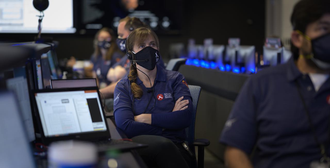
Members of NASA’s Perseverance Mars rover team study data on monitors in mission control, Thursday, Feb. 18, 2021, at NASA's Jet Propulsion Laboratory in Pasadena, California. A key objective for Perseverance’s mission on Mars is astrobiology, including the search for signs of ancient microbial life. The rover will characterize the planet’s geology and past climate, pave the way for human exploration of the Red Planet, and be the first mission to collect and cache Martian rock and regolith. Photo Credit: (NASA/Bill Ingalls)
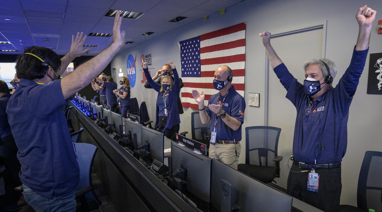
Members of NASA’s Perseverance rover team react in mission control after receiving confirmation the spacecraft successfully touched down on Mars, Thursday, Feb. 18, 2021, at NASA's Jet Propulsion Laboratory in Pasadena, California. A key objective for Perseverance’s mission on Mars is astrobiology, including the search for signs of ancient microbial life. The rover will characterize the planet’s geology and past climate, pave the way for human exploration of the Red Planet, and be the first mission to collect and cache Martian rock and regolith. Photo Credit: (NASA/Bill Ingalls)
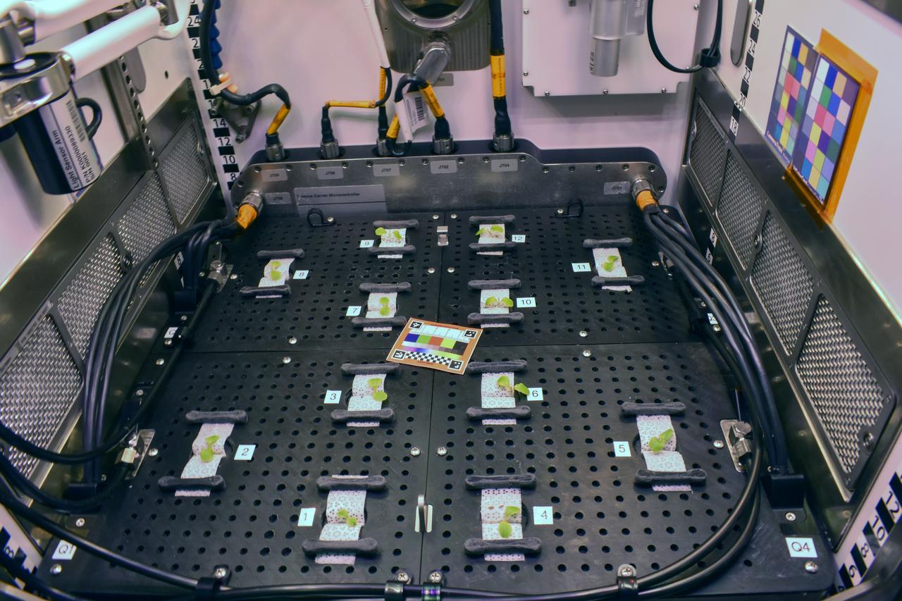
jsc2025e047407 (2/6/2024) --- ‘Outredgeous’ red romaine lettuce seedlings after thinning on Day 7 as part of a ground experiment for Spaceflight Microbiome of a Food Crop Grown Using Different Substrate Moisture Levels (Plant Habitat-07). This investigation studies how plants, and their communities of microorganisms respond to different levels of water. Results could support development of systems for growing food crops on future missions. Image courtesy of the PH-07 Team.
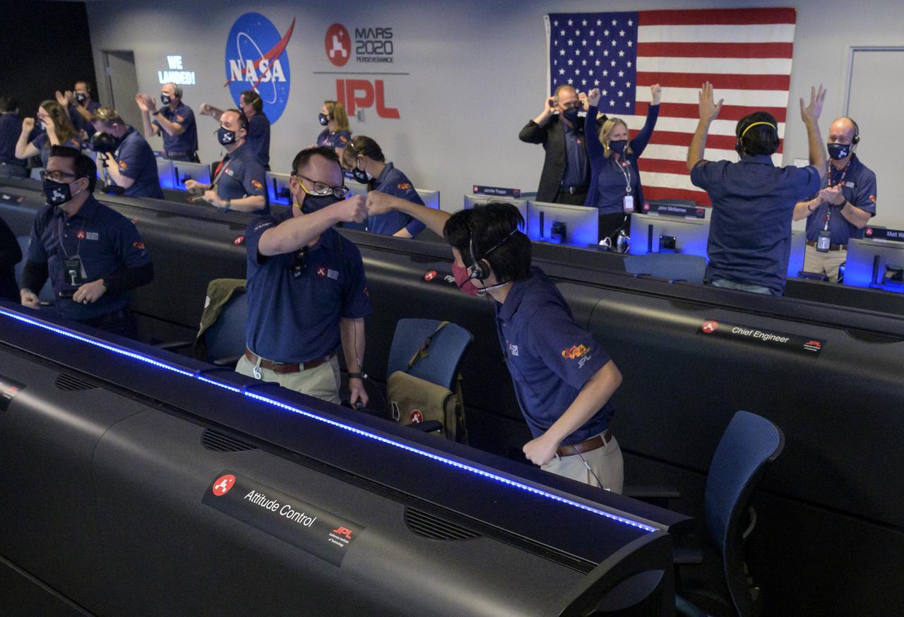
Members of NASA’s Perseverance rover team react in mission control after receiving confirmation the spacecraft successfully touched down on Mars, Thursday, Feb. 18, 2021, at NASA's Jet Propulsion Laboratory in Pasadena, California. A key objective for Perseverance’s mission on Mars is astrobiology, including the search for signs of ancient microbial life. The rover will characterize the planet’s geology and past climate, pave the way for human exploration of the Red Planet, and be the first mission to collect and cache Martian rock and regolith. Photo Credit: (NASA/Bill Ingalls)
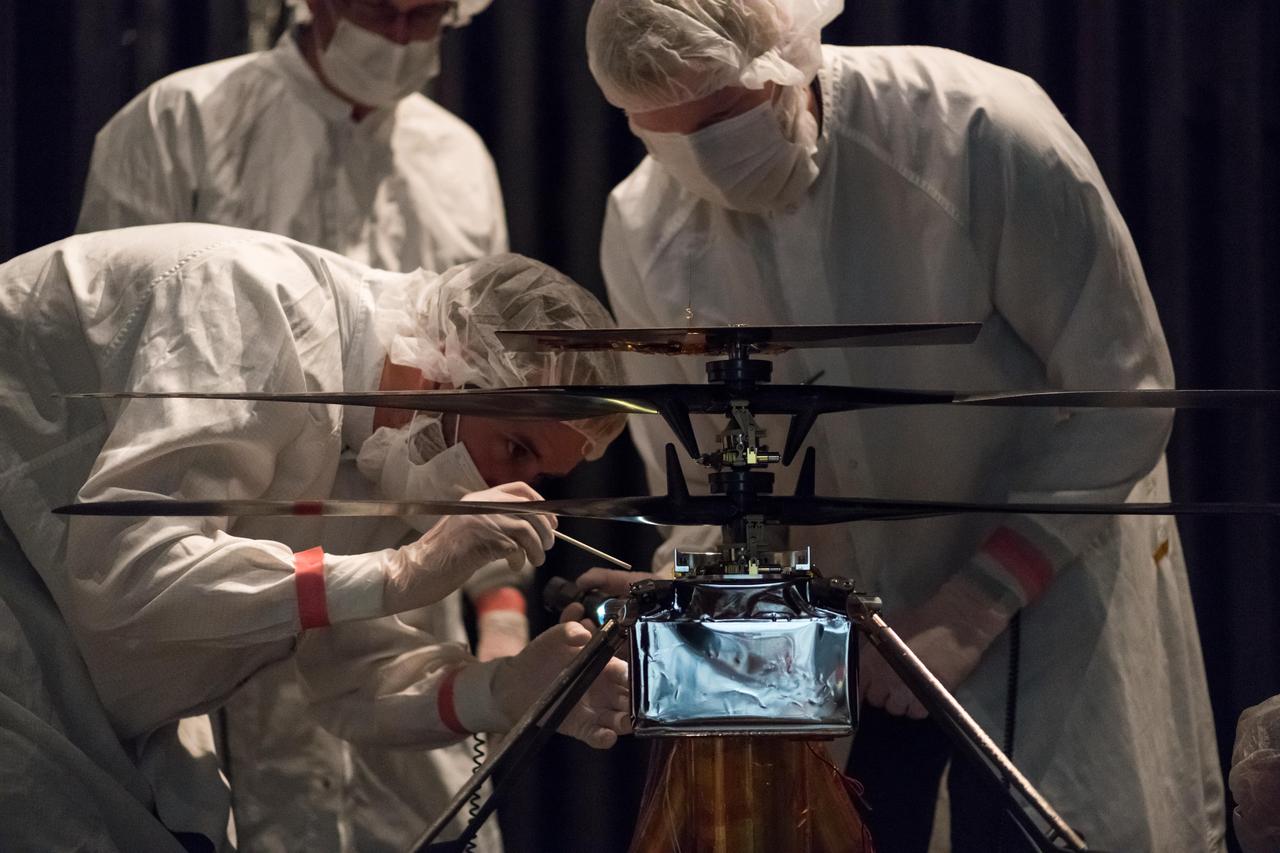
Members of NASA's Mars Helicopter team attach a thermal film enclosure to the fuselage of the flight model (the actual vehicle going to the Red Planet). The image was taken on Feb. 1, 2019, inside the Space Simulator, a 25-foot-wide (7.62-meter-wide) vacuum chamber at NASA's Jet Propulsion Laboratory in Pasadena, California. https://photojournal.jpl.nasa.gov/catalog/PIA23157
STS082-744-060 (11-21 Feb. 1997) --- Astronauts Joseph R. Tanner (left-with red and white stripes) and Gregory J. Harbaugh (partially obscured) team up to replace the Solar Drive Electronics (SADE) on the temporarily captured Hubble Space Telescope (HST) in the Space Shuttle Discovery's cargo bay. The Extravehicular Activity (EVA) took place on Flight Day 7, during the fourth of five total EVA's utilized to service HST.
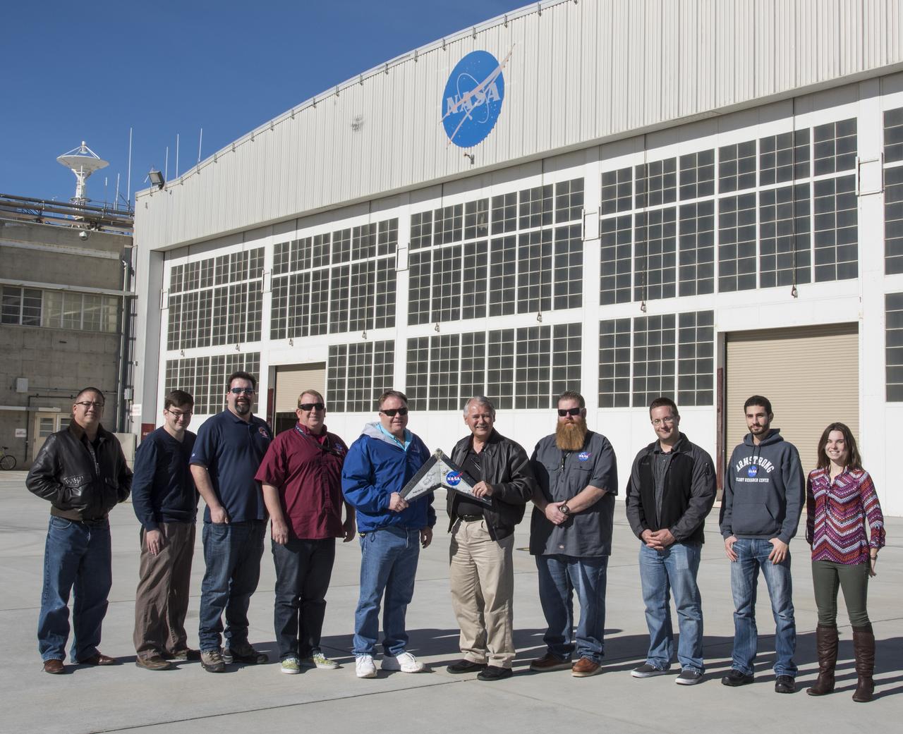
A Preliminary Research Aerodynamic Design to Land on Mars, or Prandtl-M, glider was air launched Sept. 7 using a magnetic release mechanism mounted on a Carbon-Z Cub. The team, based at NASA's Armstrong Flight Research Center in Edwards, California, includes, from left, Paul Bean, Justin Hall, Red Jensen, Justin Link, and Nathan Allaire.
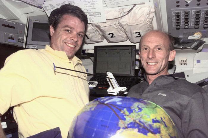
S99-E-5259 (13 February 2000) --- Astronauts Kevin R. Kregel (left), mission commander, and Gerhard P.J. Thiele demonstrate mapping techniques for the Space Radar Topography Mission (SRTM) using a payload-equipped model and a globe on Endeavour's flight deck. The two are joined by astronaut Janet L. Kavandi, mission specialist, on the SRTM's Red Team. Thiele is a mission specialist representing the European Space Agency (ESA).

Members of NASA’s Perseverance rover team react in mission control after receiving confirmation the spacecraft successfully touched down on Mars, Thursday, Feb. 18, 2021, at NASA's Jet Propulsion Laboratory in Pasadena, California. A key objective for Perseverance’s mission on Mars is astrobiology, including the search for signs of ancient microbial life. The rover will characterize the planet’s geology and past climate, pave the way for human exploration of the Red Planet, and be the first mission to collect and cache Martian rock and regolith. Photo Credit: (NASA/Bill Ingalls)