
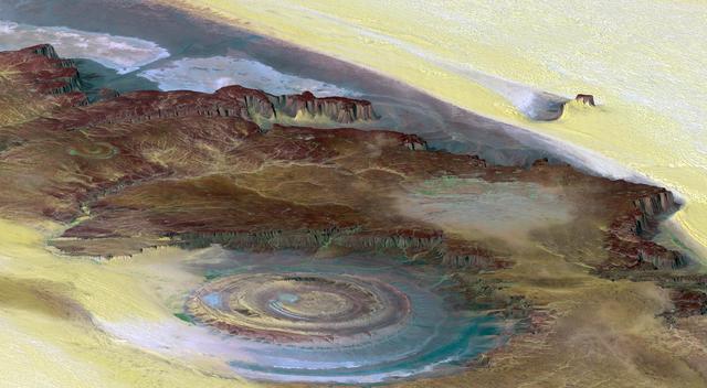
Image taken 1/11/2001: The so-called Richat Structure is a geological formation in the Maur Adrar Desert in the African country of Mauritania. Although it resembles an impact crater, the Richat Structure formed when a volcanic dome hardened and gradually eroded, exposing the onion-like layers of rock. The Richat Structure can be found on Landsat 7 WRS Path 203 Row 45, center: 21.68, -11.94. To learn more about the Landsat satellite go to: <a href="http://landsat.gsfc.nasa.gov/" rel="nofollow">landsat.gsfc.nasa.gov/</a> Credit: NASA/GSFC/Landsat 7/USGS
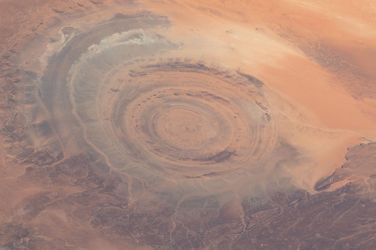
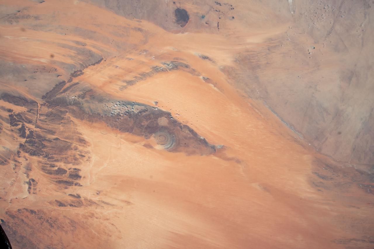
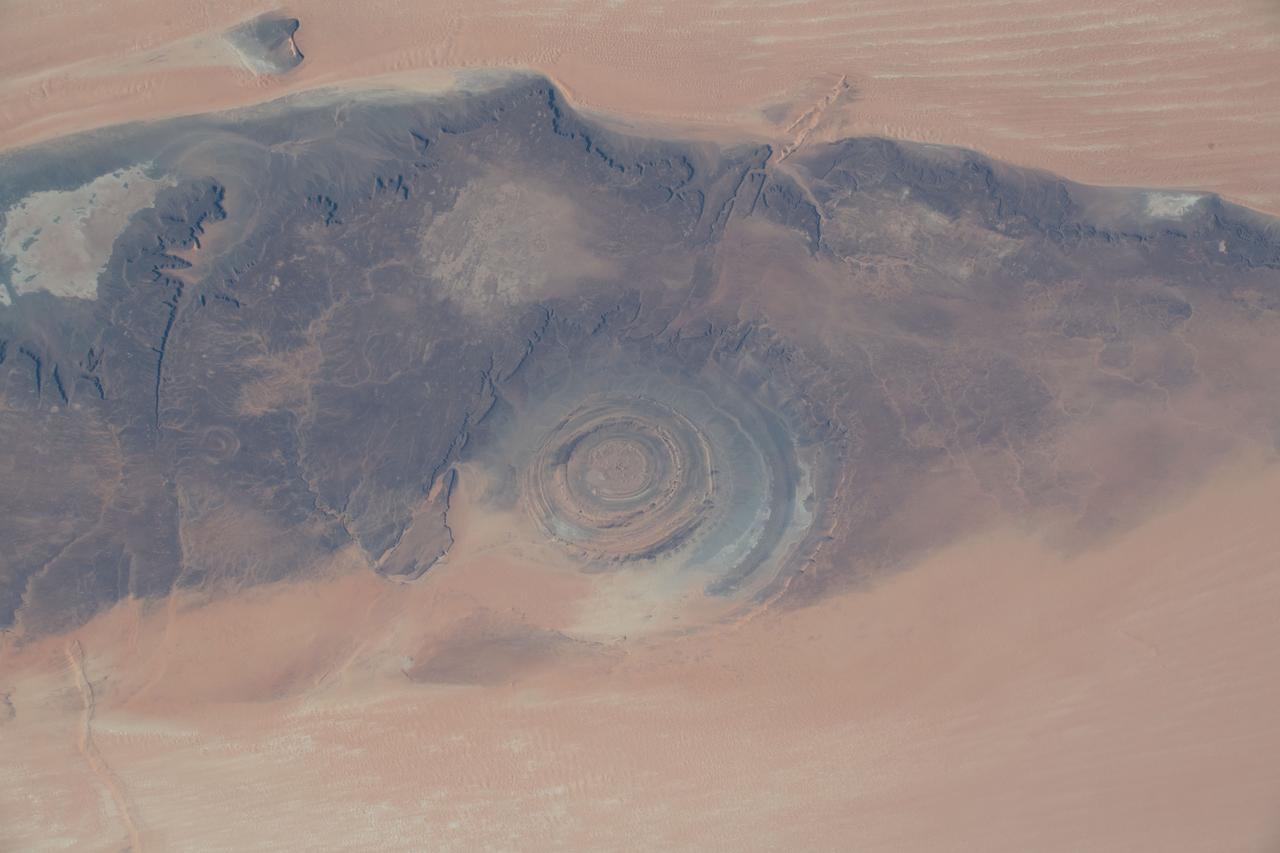
This prominent circular feature, known as the Richat Structure, in the Sahara desert of Mauritania is often noted by astronauts because it forms a conspicuous bull-eye on the otherwise rather featureless expanse of the desert.
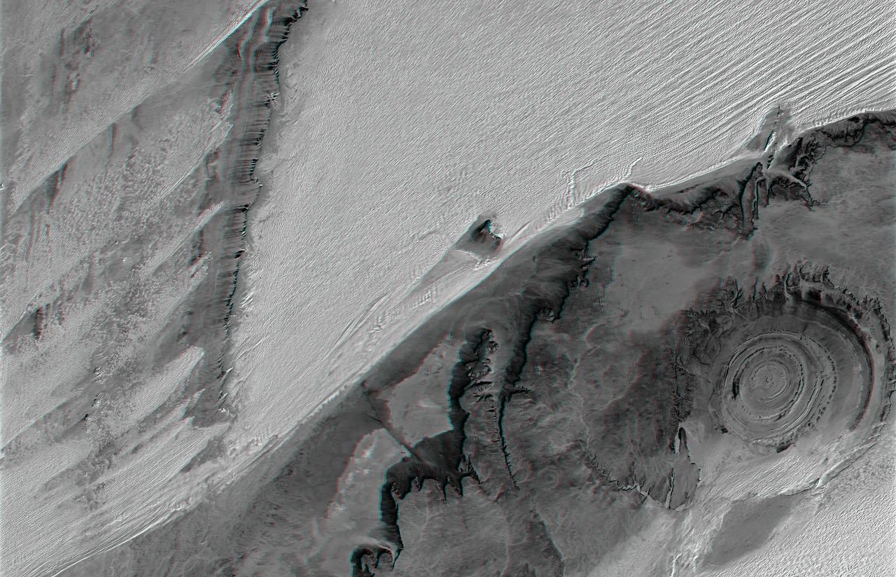
The prominent circular feature seen here is known as the Richat Structure, in the Sahara desert of Mauritania. This anaglyph is from NASA Shuttle Radar Topography Mission. 3D glasses are necessary to view this image.

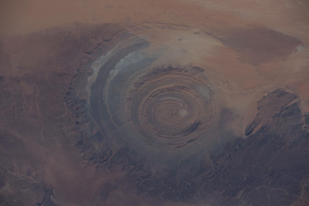
ISS002-E-5457 (13 April 2001) --- The "bull's-eye" of the Richat Structure adds interest to the barren Gres de Chinguetti Plateau in central Mauritania in northwest Africa. It represents domally uplifted, layered (sedimentary) rocks that have been eroded by water and wind into the present shape. The 25-mile-wide structure is a 300-foot-deep landmark that has caught the eye of many an astronaut in Earth orbit. Image number ISS002-E-5693 shows the same feature six days later. The image was recorded with a digital still camera.
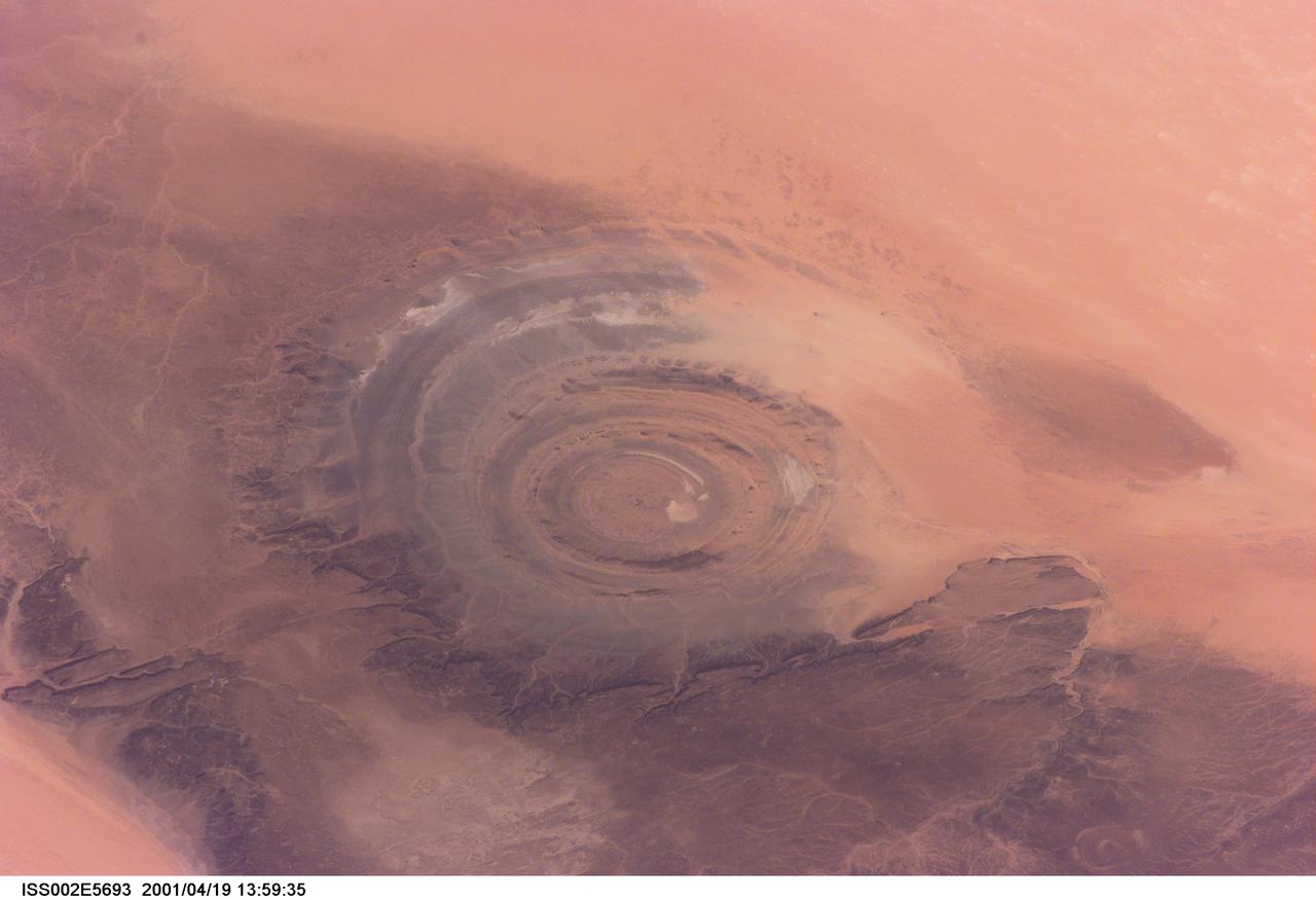
ISS002-E-5693 (19 April 2001) --- The "bull's-eye" of the Richat Structure adds interest to the barren Gres de Chinguetti Plateau in central Mauritania in northwest Africa. It represents domally uplifted, layered (sedimentary) rocks that have been eroded by water and wind into the present shape. The 25-mile-wide structure is a 300-foot-deep landmark that has caught the eye of many an astronaut in Earth orbit. Image number ISS002-E-5457 shows the same feature six days earlier. The image was recorded with a digital still camera.
iss069e005471 (April 26, 2023) --- The Richat Structure, also known as the "Eye of the Sahara," an eroded geological dome in the nation of Mauritania, is pictured from the International Space Station as it orbited 259 miles above the African continent.
iss069e005526 (April 26, 2023) --- The Richat Structure, also known as the "Eye of the Sahara," an eroded geological dome in the nation of Mauritania, is pictured from the International Space Station as it orbited 259 miles above the African continent.
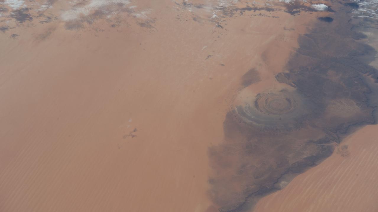
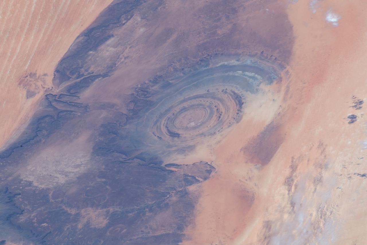
iss068e025663 (Nov. 30, 2022) --- The Richat Structure, or the "Eye of the Sahara," in northwestern Mauritania is pictured from the International Space Station as it orbited 259 miles above the African continent.
iss066e102086 (Dec. 31, 2021) --- The Richat structure, an eroded geological dome, located in the African nation of Mauritania, is pictured from the International Space Station as it orbited 262 miles above Earth.
iss067e286458 (Aug. 21, 2022) --- The Richat Structure, also known as the "Eye of the Sahara," an eroded geological dome in the nation of Mauritania, is pictured from the International Space Station as it orbited 256 miles above northwestern Africa.
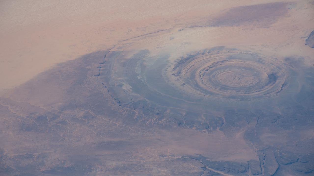
iss061e012458 (Oct. 20, 2019) --- Known as the “Eye of the Sahara," the Richat Structure in northwestern Mauritania is a circular geologic feature thought to be caused by an uplifted dome—geologists would classify it as a domed anticline—that has been eroded to expose the originally flat rock layers.
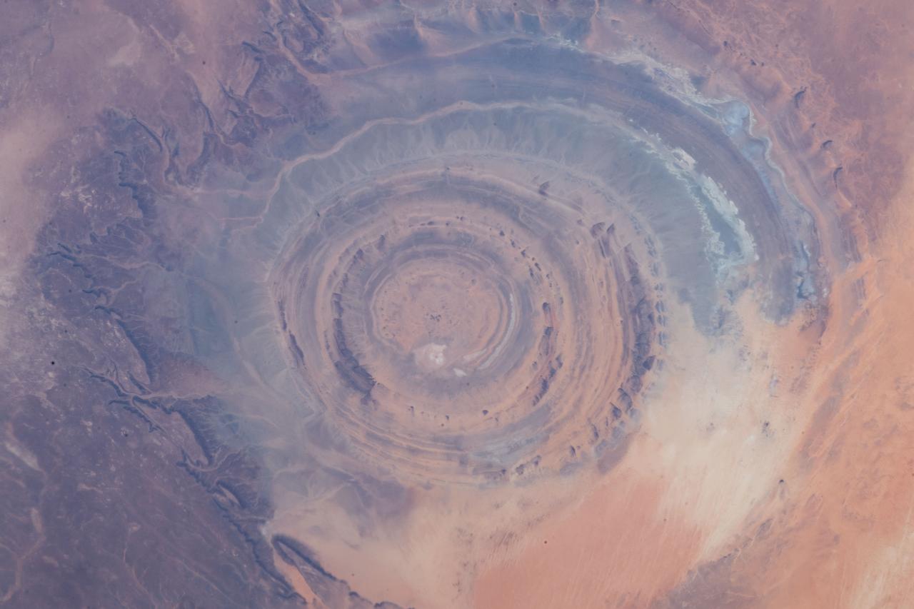
iss059e013137 (March 5, 2019) --- From an altitude of 255 miles, an Expedition 59 crewmember photographed the Richat Structure, or the "Eye of the Sahara," in northwestern Mauritania. The circular geologic feature is thought to be caused by an uplifted dome—geologists would classify it as a domed anticline—that has been eroded to expose the originally flat rock layers.
iss059e013142 (April 5, 2019) --- From an altitude of 255 miles, an Expedition 59 crewmember photographed the Richat Structure, or the "Eye of the Sahara," in northwestern Mauritania. The circular geologic feature is thought to be caused by an uplifted dome—geologists would classify it as a domed anticline—that has been eroded to expose the originally flat rock layers.
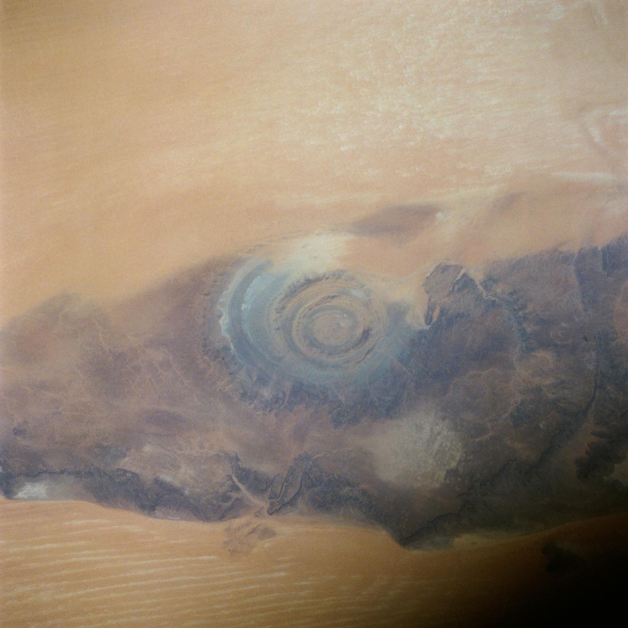
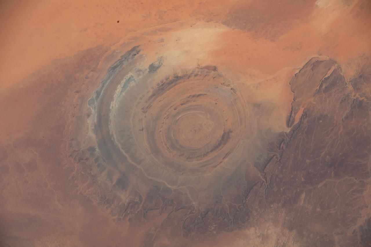
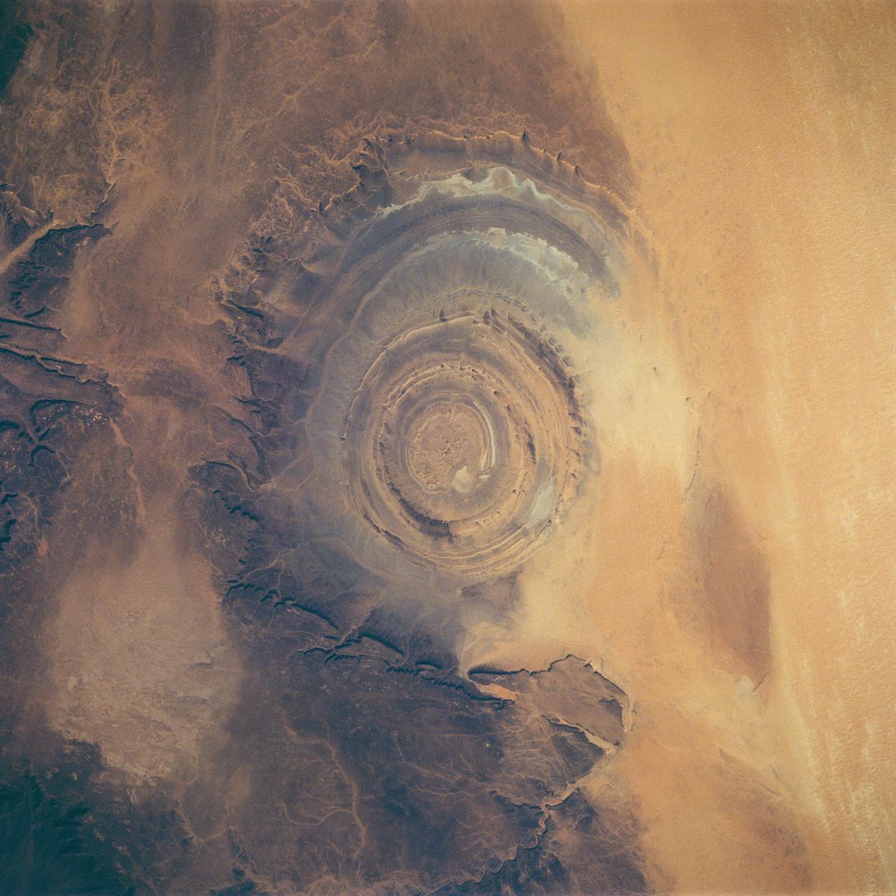
41C-39-1973 (6-13 April 1984) --- Though photographed on previous manned spaceflights, the Richat Structure in Western Mauritania has seldom if ever been able to be seen more clearly and studied more completely than in this 41-C 70mm frame, according to geologists. The structure is actually a 25-mile wide, 1,000-ft. deep hole in the Earth, the result of heavy wind erosion. This frame was one of the visuals used by the 41-C astronauts at their April 24, 1984 post-flight press conference.
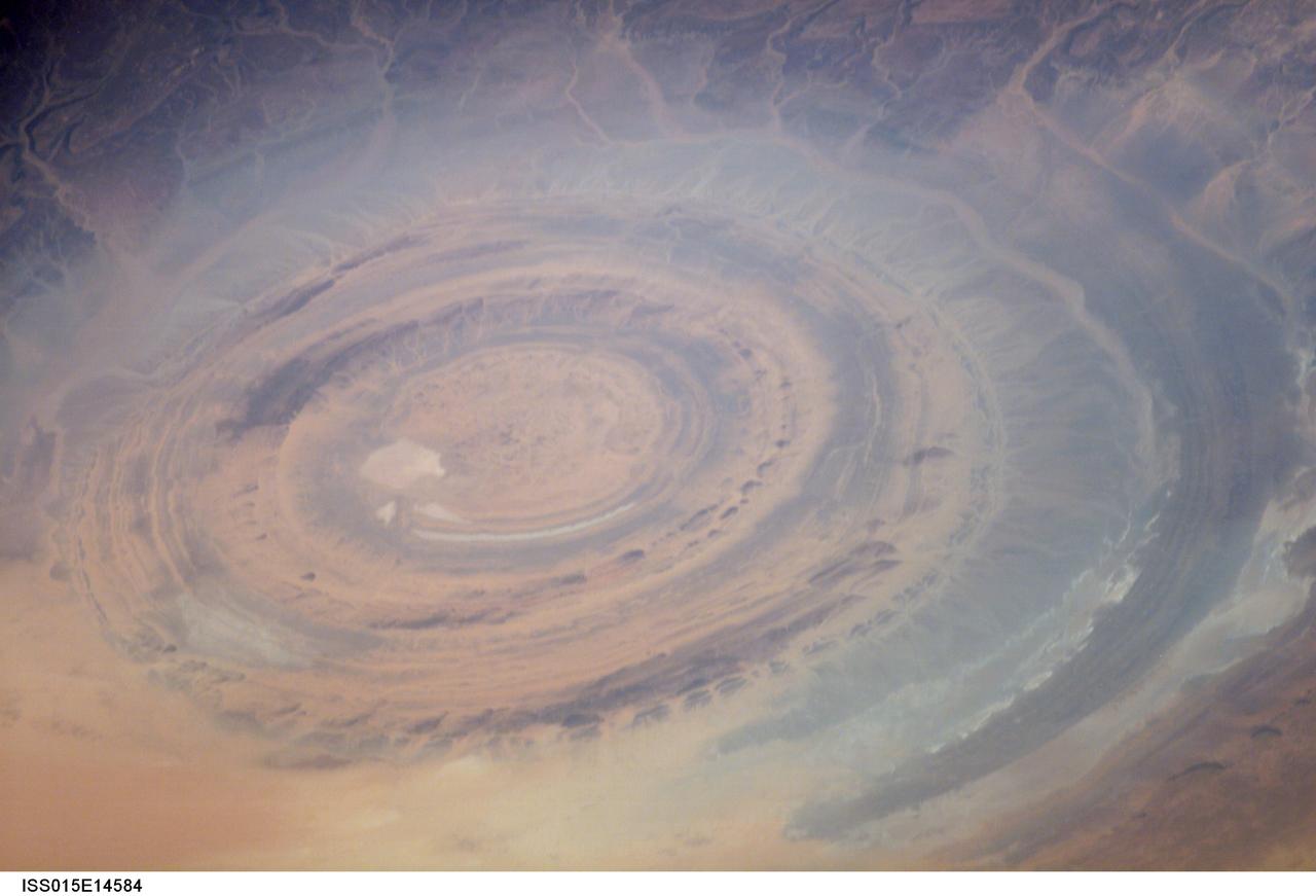
ISS015-E-14584 (26 June 2007) --- The "bull's-eye" of the Richat Structure in the barren Gres de Chinguetti Plateau, central Mauritania in northwest Africa is featured in this image photographed by an Expedition 15 crewmember on the International Space Station. It represents domally uplifted, layered (sedimentary) rocks that have been eroded by water and wind into the present shape. The 25-mile-wide structure is a 300-foot-deep landmark that has caught the eye of many an astronaut in Earth orbit.

iss069e005536 (April 26, 2023) --- The Richat Structure, also known as the "Eye of the Sahara," an eroded geological dome in the nation of Mauritania, is pictured from the International Space Station as it orbited 259 miles above the African continent. At left, from top to bottom, are the Nauka multipurpose laboratory module's forward port, the Prichal docking module, and the Soyuz MS-23 crew ship.
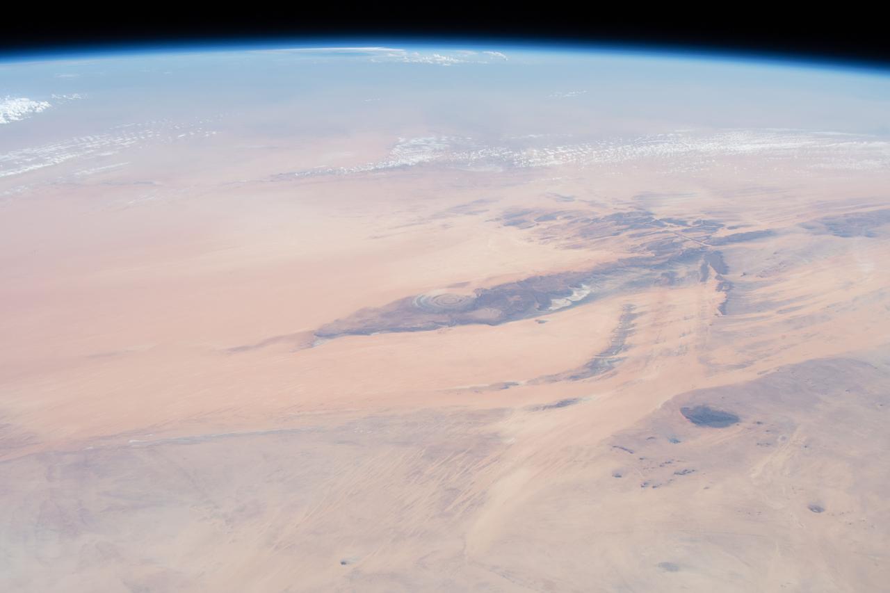
iss059e027887 (April 21, 2019) --- This oblique view from 255 miles above northwest Africa, looking from north to south, shows the "Eye of Sahara" in Mauritania. The circular geologic feature, also known as the Richat Structure, is thought to be caused by an uplifted dome—geologists would classify it as a domed anticline—that has been eroded to expose the originally flat rock layers.
STS058-88-017 (18 Oct-1 Nov 1993) --- The eye-catching "bullseye" of the Richat Structure adds interest to the barren Gres de Chinguetti Plateau in central Mauretania, northwest Africa. It represents domally uplifted, layered (sedimentary) rocks that have been eroded by water and wind into the present shape. Desert sands have invaded the feature from the south. The origin of the structure is unknown. It is not an impact structure, because field work showed that strata are undisturbed and flat-lying in the middle of the feature, and no shock-altered rock could be found. There is no evidence for a salt dome or shale diapir, nor is there any geophysical evidence for an underlying dome of dense igneous rock having about the same density as the sedimentary layers.
ISS042E007131 (11/22/2014) — Astronauts aboard the International Space Station captured this image of a huge crater in Africa on Nov. 22, 2014. This is the Richat Structure in northwestern Mauritania, otherwise known as the “Eye of the Sahara.” Scientists are still deciding whether this was formed by a subterranean volcano or impact from a large meteor. Deep in the Sahara Desert it is nearly a perfect circle, it is 1.2 miles (1.9 kilometers) wide, and sports a rim 330 feet (100 meters) tall. The crater sits in a vast plain of rocks so ancient they were deposited hundreds of millions of years before the first dinosaurs walked the Earth.