
The Moon is seen passing in front of the Sun during a solar eclipse from Ross Lake, Northern Cascades National Park, Washington on Monday, Aug. 21, 2017. A total solar eclipse swept across a narrow portion of the contiguous United States from Lincoln Beach, Oregon to Charleston, South Carolina. A partial solar eclipse was visible across the entire North American continent along with parts of South America, Africa, and Europe. Photo Credit: (NASA/Bill Ingalls)
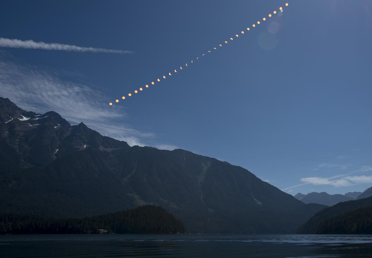
This composite image shows the progression of a partial solar eclipse over Ross Lake, in Northern Cascades National Park, Washington on Monday, Aug. 21, 2017. A total solar eclipse swept across a narrow portion of the contiguous United States from Lincoln Beach, Oregon to Charleston, South Carolina. A partial solar eclipse was visible across the entire North American continent along with parts of South America, Africa, and Europe. Photo Credit: (NASA/Bill Ingalls)
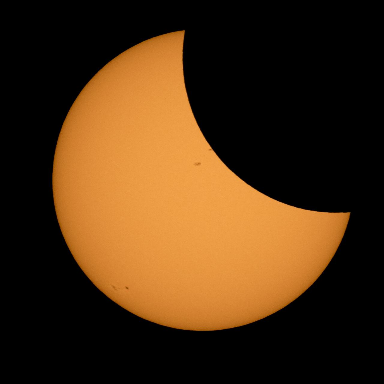
The Moon is seen passing in front of the Sun during a solar eclipse from Ross Lake, Northern Cascades National Park, Washington on Monday, Aug. 21, 2017. A total solar eclipse swept across a narrow portion of the contiguous United States from Lincoln Beach, Oregon to Charleston, South Carolina. A partial solar eclipse was visible across the entire North American continent along with parts of South America, Africa, and Europe. Photo Credit: (NASA/Bill Ingalls)
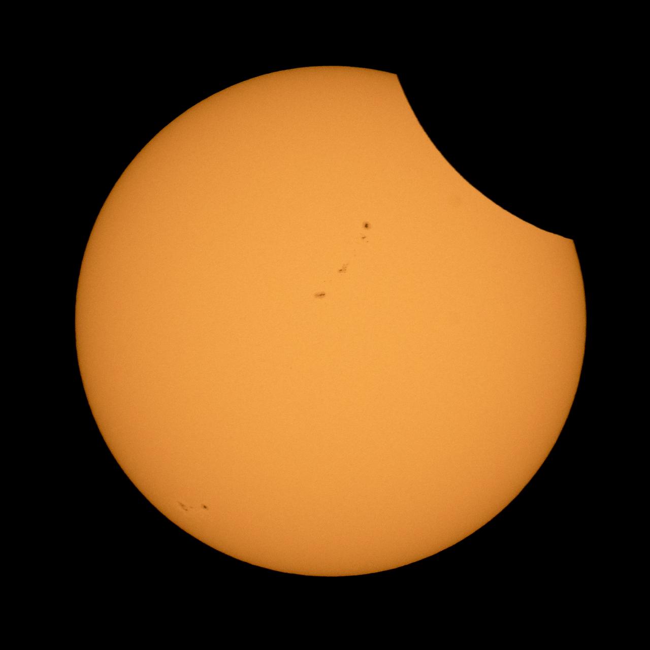
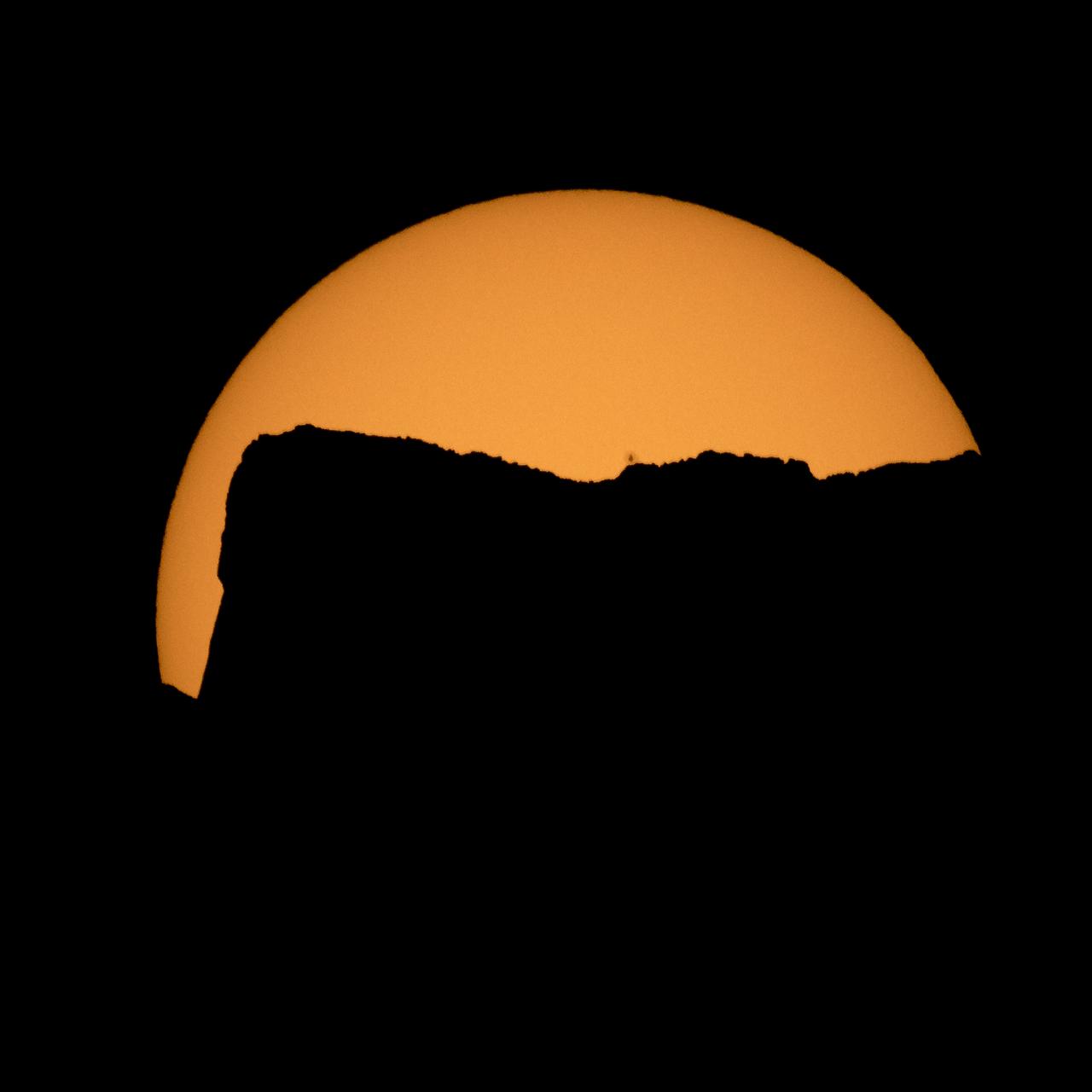
The Moon is seen as it starts passing in front of the Sun during a solar eclipse from Ross Lake, Northern Cascades National Park, Washington on Monday, Aug. 21, 2017. A total solar eclipse swept across a narrow portion of the contiguous United States from Lincoln Beach, Oregon to Charleston, South Carolina. A partial solar eclipse was visible across the entire North American continent along with parts of South America, Africa, and Europe. Photo Credit: (NASA/Bill Ingalls)
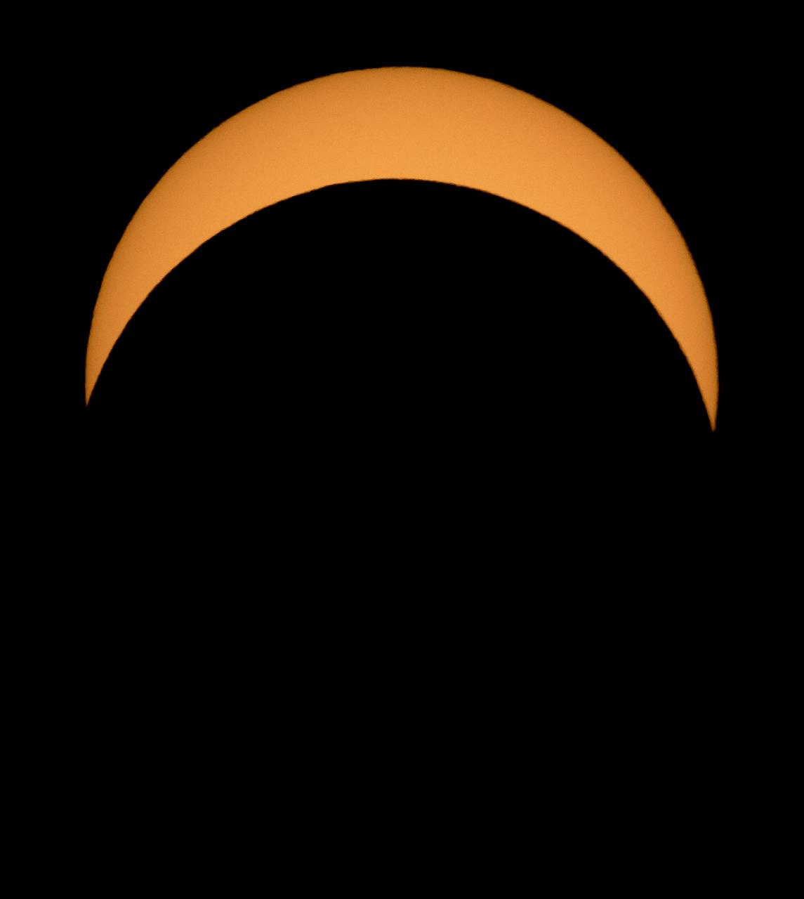
The Moon is seen passing in front of the Sun during a solar eclipse from Ross Lake, Northern Cascades National Park, Washington on Monday, Aug. 21, 2017. A total solar eclipse swept across a narrow portion of the contiguous United States from Lincoln Beach, Oregon to Charleston, South Carolina. A partial solar eclipse was visible across the entire North American continent along with parts of South America, Africa, and Europe. Photo Credit: (NASA/Bill Ingalls)
The Sun is seen as it rises behind Jack Mountain head of the solar eclipse, Monday, Aug. 21, 2017, Ross Lake, Northern Cascades National Park, Washington. A total solar eclipse will sweep across a narrow portion of the contiguous United States from Lincoln Beach, Oregon to Charleston, South Carolina. A partial solar eclipse was visible across the entire North American continent along with parts of South America, Africa, and Europe. Photo Credit: (NASA/Bill Ingalls)
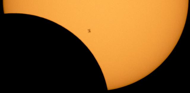
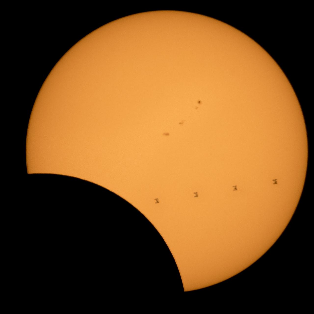
The International Space Station, with a crew of six onboard, is seen in silhouette as it transits the Sun at roughly five miles per second during a partial solar eclipse, Monday, Aug. 21, 2017 from Ross Lake, Northern Cascades National Park, Washington. Onboard as part of Expedition 52 are: NASA astronauts Peggy Whitson, Jack Fischer, and Randy Bresnik; Russian cosmonauts Fyodor Yurchikhin and Sergey Ryazanskiy; and ESA (European Space Agency) astronaut Paolo Nespoli. A total solar eclipse swept across a narrow portion of the contiguous United States from Lincoln Beach, Oregon to Charleston, South Carolina. A partial solar eclipse was visible across the entire North American continent along with parts of South America, Africa, and Europe. Photo Credit: (NASA/Bill Ingalls)
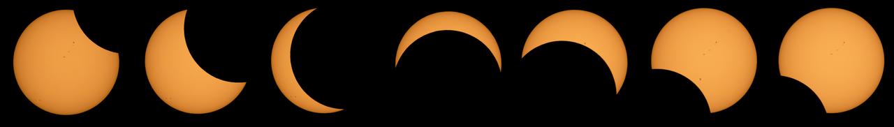
This composite image of seven pictures shows the progression of a partial solar eclipse near from Ross Lake, Northern Cascades National Park, Washington on Monday, Aug. 21, 2017. The second to the last frame shows the International Space Station, with a crew of six onboard, in silhouette as it transits the Sun at roughly five miles per second. A total solar eclipse swept across a narrow portion of the contiguous United States from Lincoln Beach, Oregon to Charleston, South Carolina. A partial solar eclipse was visible across the entire North American continent along with parts of South America, Africa, and Europe. Photo Credit: (NASA/Bill Ingalls)
Views of the Columbia landing at EAFB ending the STS-4 Mission on 07/04/1982; of President and Mrs. Reagan greeting the crew out on the Lake bed Runway; and, the view of Roy Rogers with Astronauts Jerry Ross and Guy Gardner. 1. President Ronald Reagan & wife Nancy 2. Roy Rogers 3. Astronaut Jerry L. Ross 4. Astronaut Guy S. Gardner Edwards AFB, CA
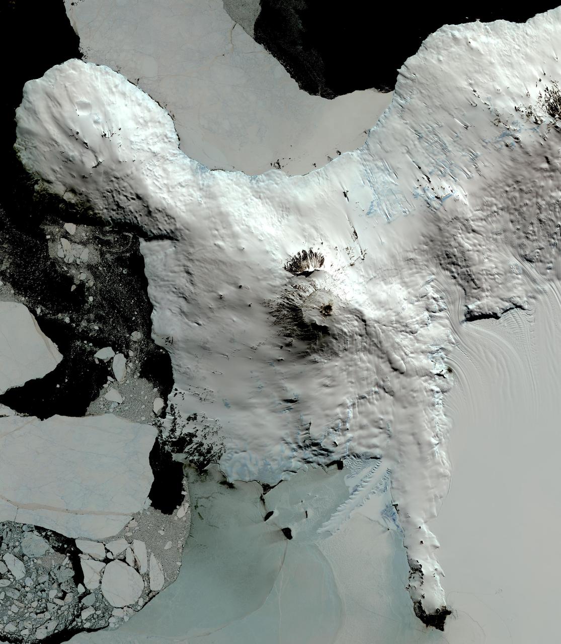
This image from NASA Terra spacecraft shows Mount Erebus, the world southernmost historically active volcano, overlooking the McMurdo research station on Ross Island. The 3794-m-high Erebus is the largest of three major volcanoes forming the crudely triangular Ross Island. An elliptical 500 x 600 m wide, 110-m-deep crater truncates the summit and contains an active lava lake within a 250-m-wide, 100-m-deep inner crater. The glacier-covered volcano was erupting when first sighted by Captain James Ross in 1841. Continuous lava-lake activity with minor explosions, punctuated by occasional larger strombolian explosions that eject bombs onto the crater rim, has been documented since 1972, but has probably been occurring for much of the volcano's recent history. The image was acquired December 31, 2013, covers an area of 63 x 73 km, and is located at 77.5 degrees south, 167.1 degrees east. http://photojournal.jpl.nasa.gov/catalog/PIA20239

STS027-S-020 (6 Dec 1988) --- The five astronauts who were aboard Atlantis for its return to flight leave their spacecraft after almost 4 1/2 days in space. From bottom to top are Astronauts Robert L. Gibson, mission commander; Guy S. Gardner, pilot; and Richard M. (Mike) Mullane, Jerry L. Ross and William M. Shepherd, mission specialists. Atlantis touched down on Rogers Dry Lake Bed at 3:36 p.m. (PST), Dec. 6, 1988.
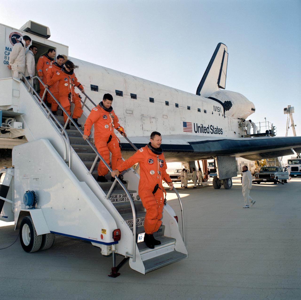
STS037-S-087 (11 April 1991) --- STS-37 crewmembers egress Atlantis via mobile stairway after landing on runway 33 dry lake bed at Edwards Air Force Base. Leading the crewmembers down the stairway is mission commander Steven R. Nagel. He is followed by pilot Kenneth D. Cameron, Mission Specialists Linda M. Godwin, Jerome Apt and Jerry L. Ross.
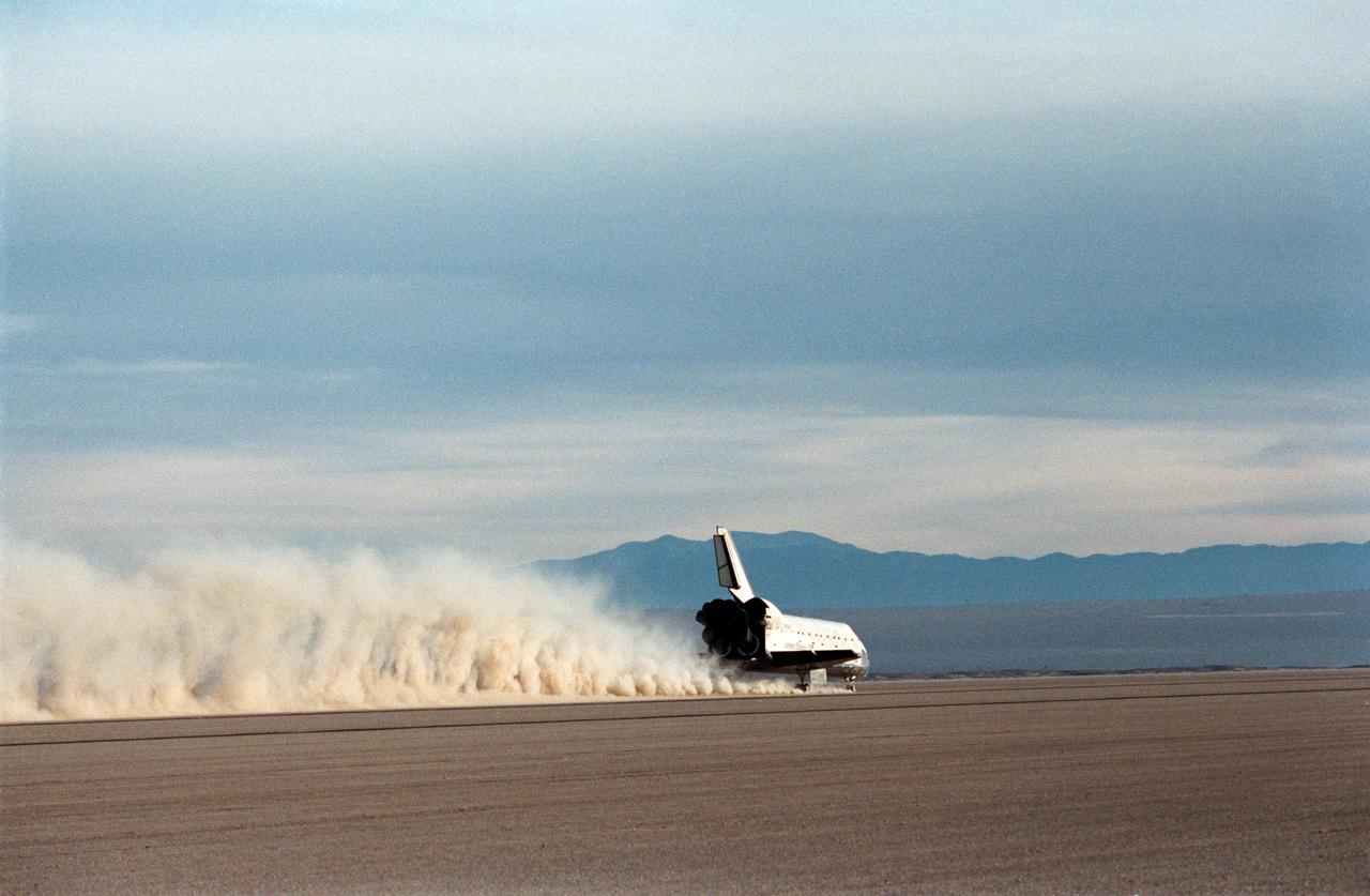
STS027-S-012 (6 Dec. 1988) --- A 70mm camera records the landing of the Space Shuttle Atlantis on Rogers Dry Lake Bed near the Dryden Flight Research Facility in California. The wheels of the vehicle came to a stop at 3:36:53 p.m. (PST), marking the completion of a successful mission which involved five veteran NASA astronauts. Onboard for the four-day flight were astronauts Robert L. Gibson, Guy S. Gardner, Jerry L. Ross, Richard M. (Mike) Mullane and William M. Shepherd.
STS027-S-014 (6 Dec. 1988) --- A 70mm camera records the landing of the space shuttle Atlantis on Rogers Dry Lake Bed near the Dryden Flight Research Facility in California. The wheels of the vehicle came to a stop at 3:36:53 p.m. (PST), marking the completion of a successful mission which involved five veteran NASA astronauts. Onboard for the four-day flight were astronauts Robert L. Gibson, Guy S. Gardner, Jerry L. Ross, Richard M. (Mike) Mullane and William M. Shepherd. Photo credit: NASA

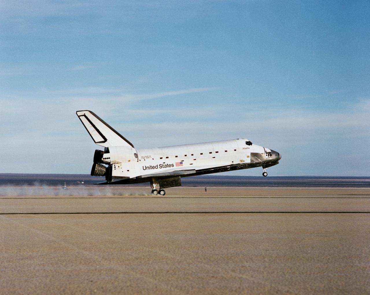
The Space Shuttle Atlantis touches down at 3:35 p.m. PST on 6 December 1988 at NASA's then Ames-Dryden Flight Research Facility at the conclusion of the STS-27 Department of Defense mission. Landing took place on runway 17 of the Rogers Dry Lake, concluding the 4-day, 9-hour, 6-minute mission. The five-man crew was led by Commander Robert L. Gibson and included Pilot Guy S. Gardner; Mission Specialists Jerry L. Ross, William M. Sheperd, and Richard M. Mullane. Atlantis was launched on December 2 from NASA's Kennedy Space Center.
This composite image, made from 4 frames, shows the International Space Station, with a crew of six onboard, as it transits the Sun at roughly five miles per second during a partial solar eclipse, Monday, Aug. 21, 2017 from , Northern Cascades National Park in Washington. Onboard as part of Expedition 52 are: NASA astronauts Peggy Whitson, Jack Fischer, and Randy Bresnik; Russian cosmonauts Fyodor Yurchikhin and Sergey Ryazanskiy; and ESA (European Space Agency) astronaut Paolo Nespoli. A total solar eclipse swept across a narrow portion of the contiguous United States from Lincoln Beach, Oregon to Charleston, South Carolina. A partial solar eclipse was visible across the entire North American continent along with parts of South America, Africa, and Europe. Photo Credit: (NASA/Bill Ingalls)
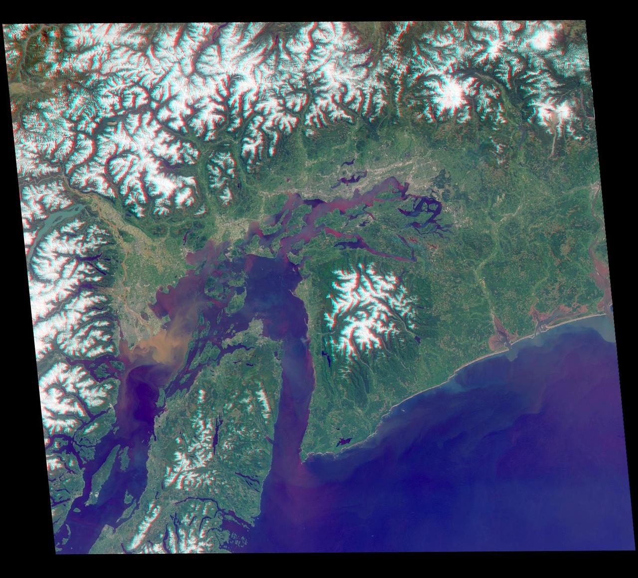
Just in time for the U.S. National Park Service's Centennial celebration on Aug. 25, NASA's Multiangle Imaging SpectroRadiometer (MISR) instrument aboard NASA's Terra satellite is releasing four new anaglyphs that showcase 33 of our nation's national parks, monuments, historical sites and recreation areas in glorious 3D. Shown in the annotated image are Lewis and Clark National Historic Park, Mt. Rainier National Park, Olympic National Park, Ebey's Landing National Historical Reserve, San Juan Island National Historic Park, North Cascades National Park, Lake Chelan National Recreation Area, and Ross Lake National Recreation Area (also Mt. St. Helens National Volcanic Monument, administered by the U.S. Forest Service) MISR views Earth with nine cameras pointed at different angles, giving it the unique capability to produce anaglyphs, stereoscopic images that allow the viewer to experience the landscape in three dimensions. The anaglyphs were made by combining data from MISR's vertical-viewing and 46-degree forward-pointing camera. You will need red-blue glasses in order to experience the 3D effect; ensure you place the red lens over your left eye. The images have been rotated so that north is to the left in order to enable 3D viewing because the Terra satellite flies from north to south. All of the images are 235 miles (378 kilometers) from west to east. These data were acquired May 12, 2012, Orbit 65960. http://photojournal.jpl.nasa.gov/catalog/PIA20891