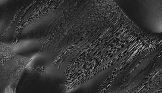
Russell Crater
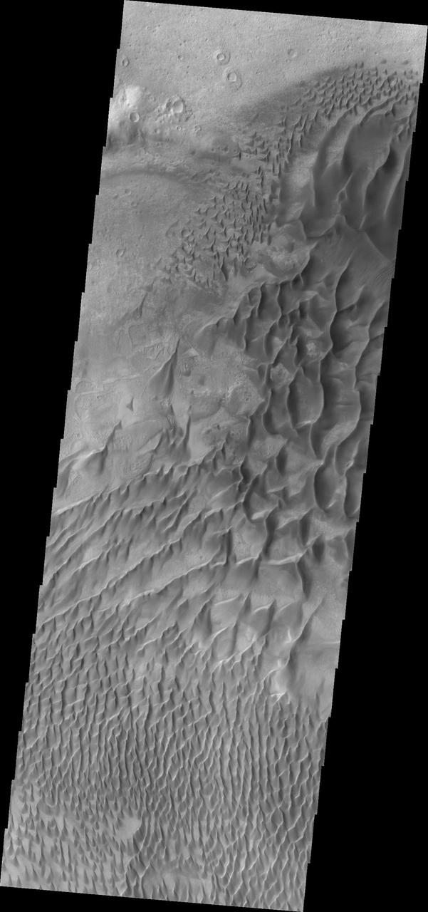
Today's VIS image shows part of the large dune form on the floor of Russell Crater. Orbit Number: 67151 Latitude: -54.3002 Longitude: 13.0603 Instrument: VIS Captured: 2017-02-02 03:15 http://photojournal.jpl.nasa.gov/catalog/PIA21517
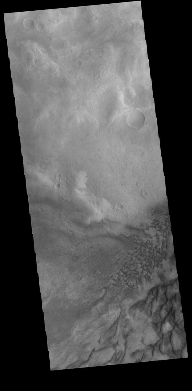
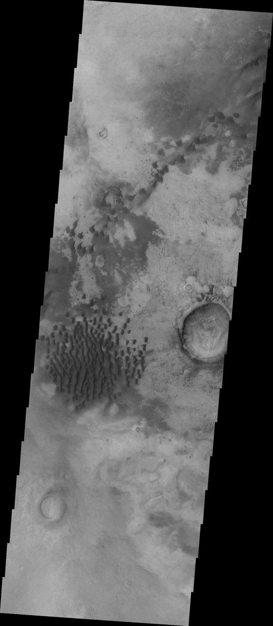
This image shows individual dunes on the floor of Russell Crater. These dunes are in the southern part of the dune field. Russell Crater is located in Noachis Terra. A spectacular dune ridge and other dune forms on the crater floor have caused extensive imaging. The Odyssey spacecraft has spent over 15 years in orbit around Mars, circling the planet more than 69000 times. It holds the record for longest working spacecraft at Mars. THEMIS, the IR/VIS camera system, has collected data for the entire mission and provides images covering all seasons and lighting conditions. Over the years many features of interest have received repeated imaging, building up a suite of images covering the entire feature. From the deepest chasma to the tallest volcano, individual dunes inside craters and dune fields that encircle the north pole, channels carved by water and lava, and a variety of other feature, THEMIS has imaged them all. For the next several months the image of the day will focus on the Tharsis volcanoes, the various chasmata of Valles Marineris, and the major dunes fields. We hope you enjoy these images! https://photojournal.jpl.nasa.gov/catalog/PIA21799
Russell Crater Dunes VIS
Russell Crater IR
Russell Crater Dunes IR
Russell Crater - VIS

Defrosting of Russell Crater Dunes
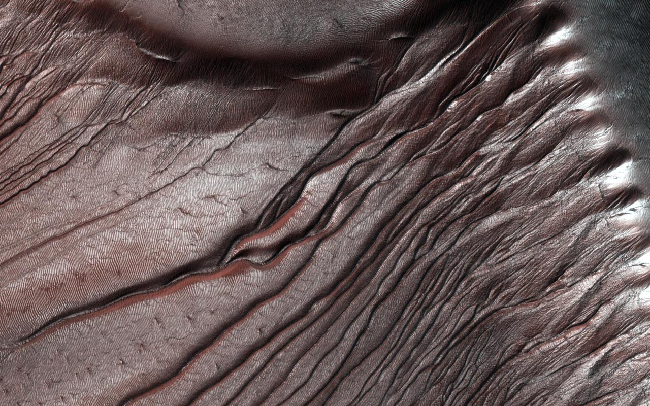
Channels on Dunes in Russell Crater
Russell Crater VIS
Russell Crater - IR

Russell Crater Dunes
The THEMIS VIS camera contains 5 filters. The data from different filters can be combined in multiple ways to create a false color image. These false color images may reveal subtle variations of the surface not easily identified in a single band image. Today's false color image shows part of Russell Crater in Noachis Terra. Orbit Number: 59591 Latitude: -54.471 Longitude: 13.1288 Instrument: VIS Captured: 2015-05-21 10:57 https://photojournal.jpl.nasa.gov/catalog/PIA21674

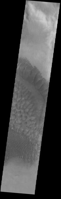
This image shows part of the dune field located on the floor of Russell Crater
This VIS image shows part of the floor of Russell Crater, including sand dunes of mulitple sizes. Russell Crater is located in Noachis Terra. Orbit Number: 74472 Latitude: -54.048 Longitude: 12.3835 Instrument: VIS Captured: 2018-09-28 06:34 https://photojournal.jpl.nasa.gov/catalog/PIA22848

The large complex dune form in this VIS image is located on the floor of Russell Crater. Russell Crater is in Noachis Terra. Orbit Number: 73050 Latitude: -54.0257 Longitude: 12.7518 Instrument: VIS Captured: 2018-06-03 03:20 https://photojournal.jpl.nasa.gov/catalog/PIA22663

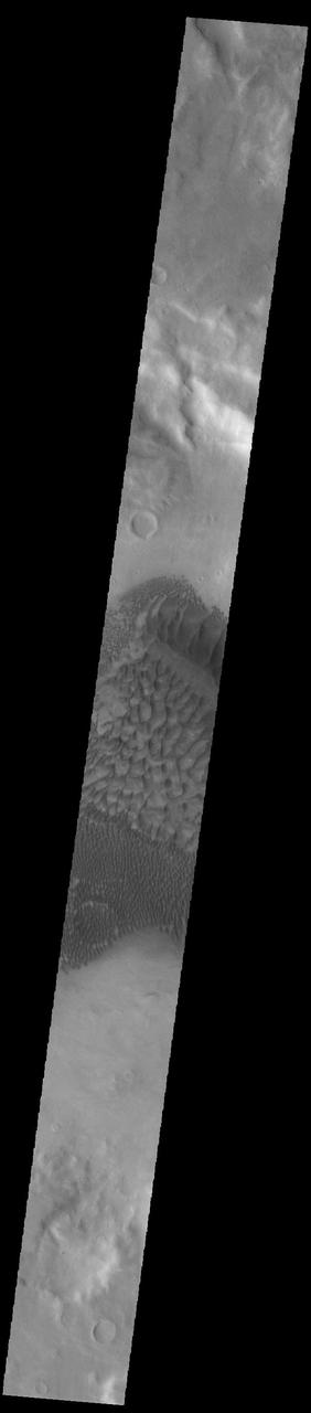
This VIS image shows part of the floor of Russell Crater. Dunes of different shapes and sizes are located on the floor of this 135 km (22 miles) diameter crater. Russell Crater is located in Noachis Terra. Orbit Number: 92871 Latitude: -54.1627 Longitude: 12.4699 Instrument: VIS Captured: 2022-11-21 06:37 https://photojournal.jpl.nasa.gov/catalog/PIA25806

This VIS image shows part of the floor of Russell Crater. Dunes of different shapes and sizes are located on the floor of this 135 km (22 miles) diameter crater. Russell Crater is located in Noachis Terra. Orbit Number: 82832 Latitude: -54.338 Longitude: 11.9602 Instrument: VIS Captured: 2020-08-16 16:35 https://photojournal.jpl.nasa.gov/catalog/PIA24155

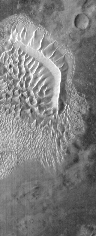
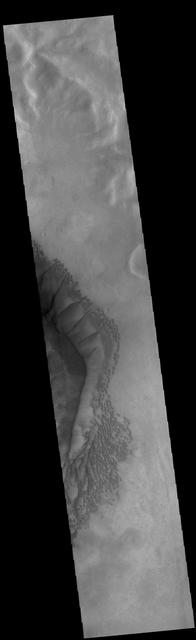
The complex dune forms in this VIS image are located on the floor of Russell Crater. The large ridge dune is unique to Russell Crater. Russell Crater is located in Noachis Terra and is 135km (83miles) in diameter. Orbit Number: 91985 Latitude: -54.4378 Longitude: 13.0741 Instrument: VIS Captured: 2022-09-09 07:45 https://photojournal.jpl.nasa.gov/catalog/PIA25716
The complex dune forms in this VIS image are located on the floor of Russell Crater. The large ridge dune is unique to Russell Crater. Russell Crater is located in Noachis Terra and is 135km (83miles) in diameter. Orbit Number: 82807 Latitude: -54.2373 Longitude: 13.1536 Instrument: VIS Captured: 2020-08-14 15:11 https://photojournal.jpl.nasa.gov/catalog/PIA24159

The complex dune forms in this VIS image are located on the floor of Russell Crater. The large ridge dune is unique to Russell Crater. Russell Crater is located in Noachis Terra and is 135km (83miles) in diameter. Orbit Number: 91018 Latitude: -54.3869 Longitude: 13.2455 Instrument: VIS Captured: 2022-06-21 17:11 https://photojournal.jpl.nasa.gov/catalog/PIA25531
The complex dune forms in this VIS image are located on the floor of Russell Crater. The large ridge dune is unique to Russell Crater. Russell Crater is located in Noachis Terra and is 135km (83miles) in diameter. Orbit Number: 91411 Latitude: -54.3479 Longitude: 12.7322 Instrument: VIS Captured: 2022-07-24 01:26 https://photojournal.jpl.nasa.gov/catalog/PIA25549
The complex dune forms in this VIS image are located on the floor of Russell Crater. The large ridge dune is unique to Russell Crater. Russell Crater is located in Noachis Terra and is 135km (83miles) in diameter. Orbit Number: 83200 Latitude: -54.3721 Longitude: 12.9113 Instrument: VIS Captured: 2020-09-15 23:24 https://photojournal.jpl.nasa.gov/catalog/PIA24242
This 2001 Mars Odyssey image shows a portion of the extensive dune field in on the floor of Russell Crater.

The sand dunes in this image from NASA Mars Odyssey are located on the floor of Russell Crater.

The Thermal Emission Imaging System aboard NASA Mars Odyssey highlights the complexity and variety of dune forms on the floor of Russell Crater.

This daytime infrared 2001 Mars Odyssey image shows part of the extensive dune field on the floor of Russell Crater.
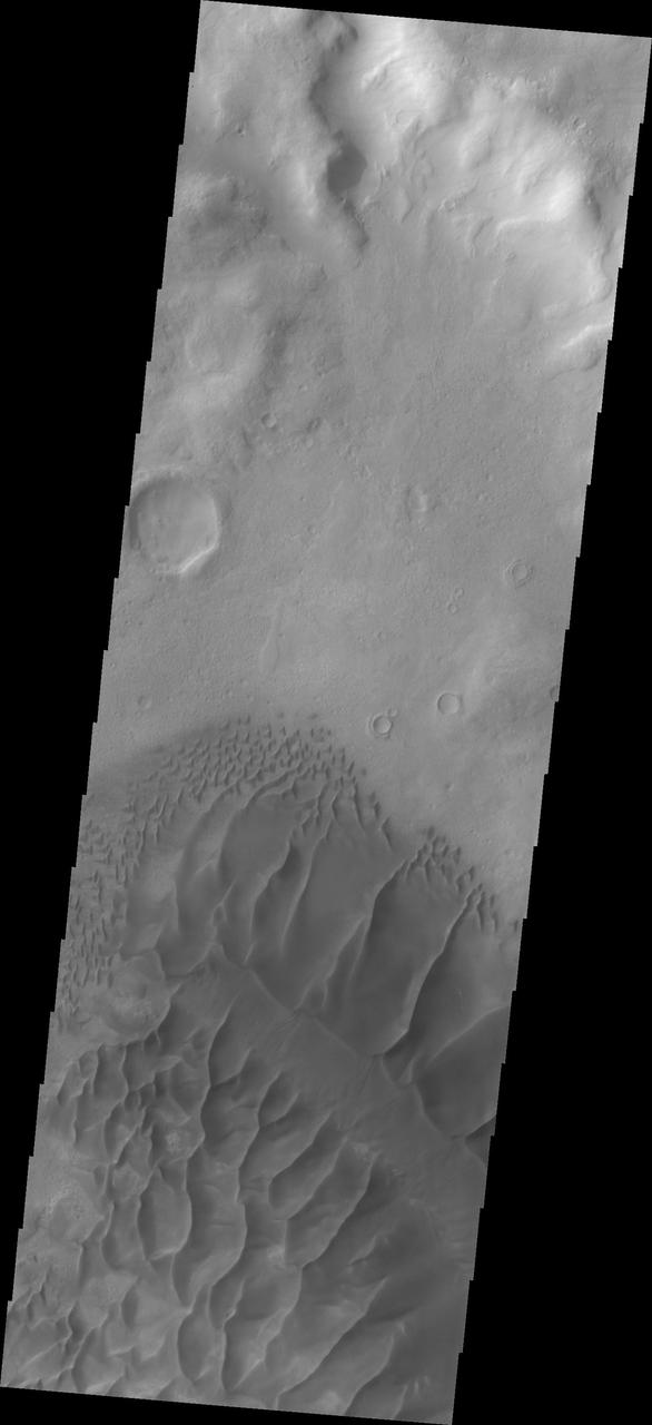
Dunes on the floor of Russell Crater vary from individual dunes, to a large hook shaped, towering sand sheet as seen by NASA Mars Odyssey.
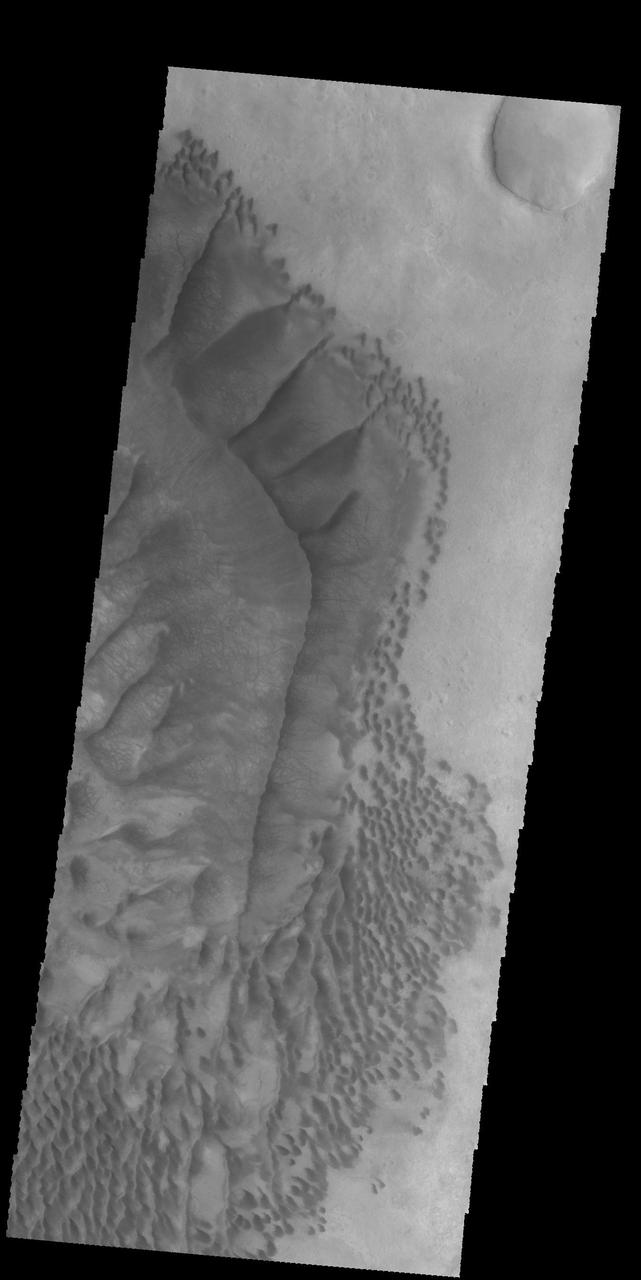
This image from NASA 2001 Mars Odyssey spacecraft shows part of the large sand sheet and dune forms on the floor of Russell Crater.
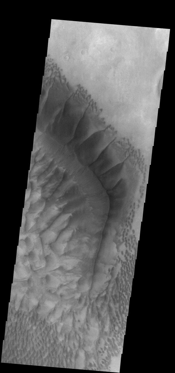
This image from NASA 2001 Mars Odyssey shows a huge ridge of sand in Russell Crater that makes its dune field one of the most unusual on Mars.
This beautiful huge dune and associated smaller dunes are located on the floor of Russell Crater. NASA Mars Odyssey captured this image on Nov. 28, 2010.
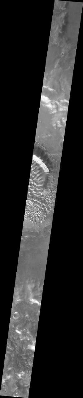
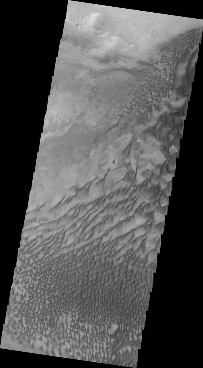
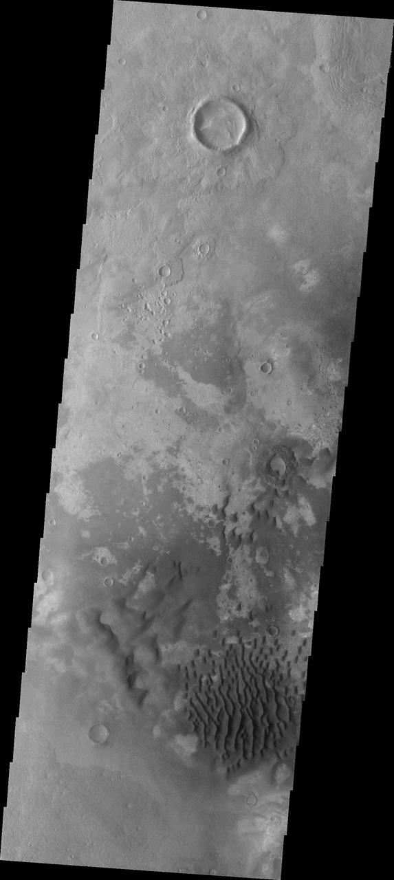
This image shows a slice of the floor of Russell Crater. Russell Crater is located in Noachis Terra. The spectacular dune ridge and other dune forms on the crater floor have caused extensive imaging. The Odyssey spacecraft has spent over 15 years in orbit around Mars, circling the planet more than 69,000 times. It holds the record for longest working spacecraft at Mars. THEMIS, the IR/VIS camera system, has collected data for the entire mission and provides images covering all seasons and lighting conditions. Over the years many features of interest have received repeated imaging, building up a suite of images covering the entire feature. From the deepest chasma to the tallest volcano, individual dunes inside craters and dune fields that encircle the north pole, channels carved by water and lava, and a variety of other feature, THEMIS has imaged them all. For the next several months the image of the day will focus on the Tharsis volcanoes, the various chasmata of Valles Marineris, and the major dunes fields. We hope you enjoy these images! Orbit Number: 6354 Latitude: -54.6188 Longitude: 12.9816 Instrument: VIS Captured: 2003-05-21 14:24 https://photojournal.jpl.nasa.gov/catalog/PIA21798

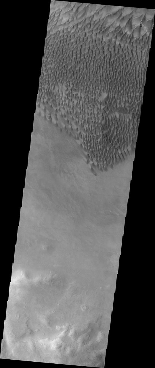
This image shows the western part of the dune field on the floor of Russell Crater. Russell Crater is located in Noachis Terra. A spectacular dune ridge and other dune forms on the crater floor have caused extensive imaging. The Odyssey spacecraft has spent over 15 years in orbit around Mars, circling the planet more than 69000 times. It holds the record for longest working spacecraft at Mars. THEMIS, the IR/VIS camera system, has collected data for the entire mission and provides images covering all seasons and lighting conditions. Over the years many features of interest have received repeated imaging, building up a suite of images covering the entire feature. From the deepest chasma to the tallest volcano, individual dunes inside craters and dune fields that encircle the north pole, channels carved by water and lava, and a variety of other feature, THEMIS has imaged them all. For the next several months the image of the day will focus on the Tharsis volcanoes, the various chasmata of Valles Marineris, and the major dunes fields. We hope you enjoy these images! Orbit Number: 33970 Latitude: -54.3831 Longitude: 12.3712 Instrument: VIS Captured: 2009-08-11 09:20 https://photojournal.jpl.nasa.gov/catalog/PIA21802
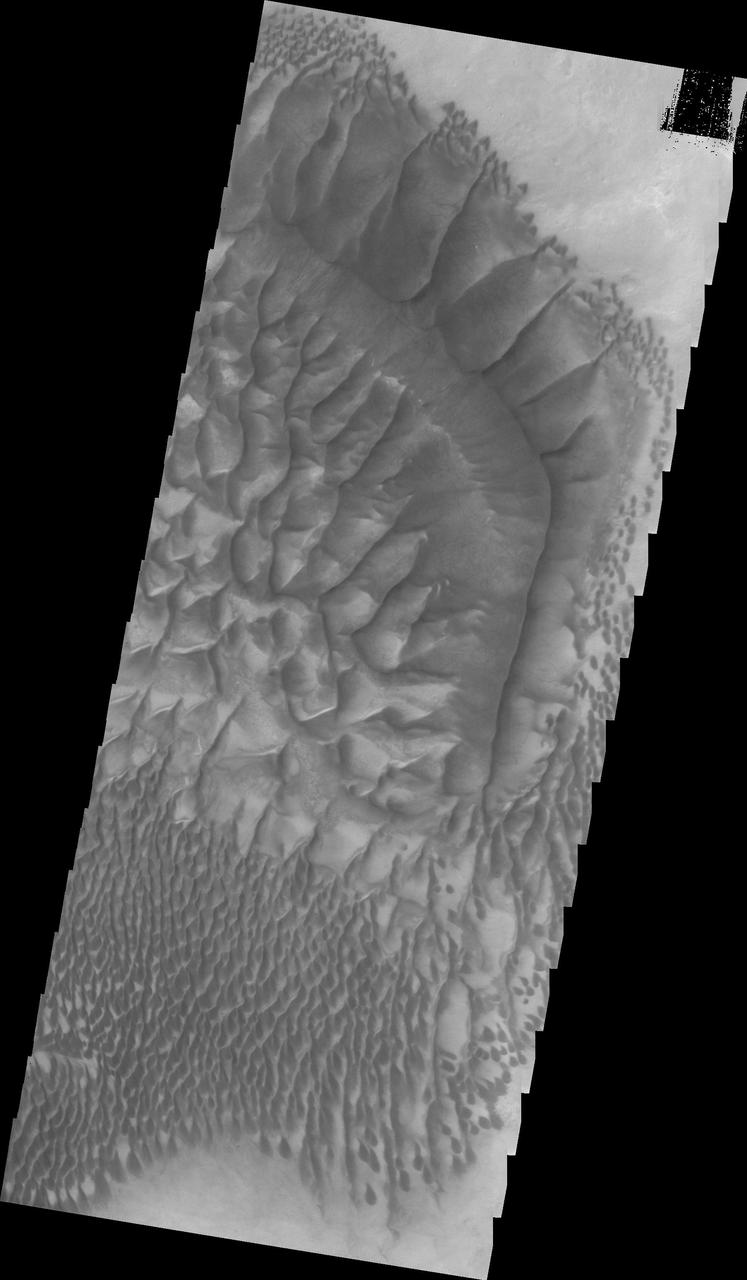
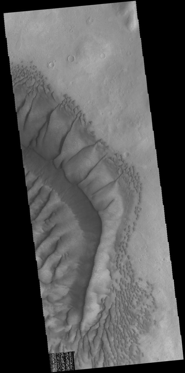
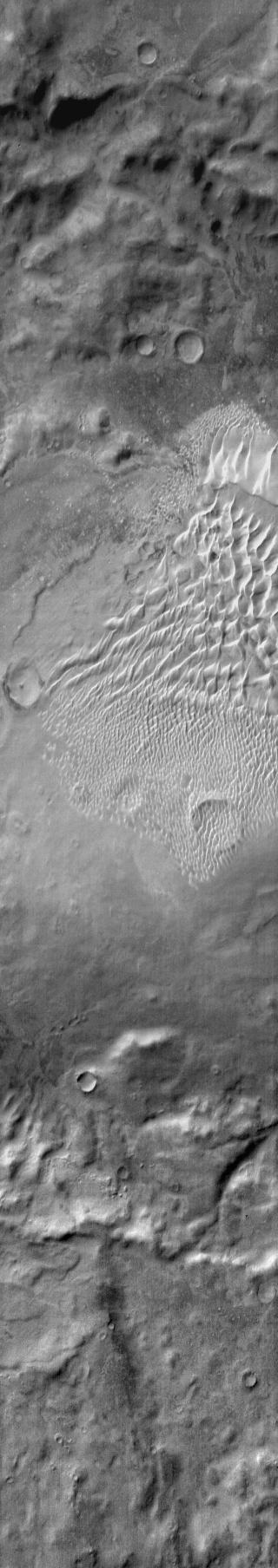
This image shows the central part of the dune field on the floor of Russell Crater. The large ridge "bends" about 60 degrees from parallel to the right side of the image to angle towards the upper left corner. Russell Crater is located in Noachis Terra. A spectacular dune ridge and other dune forms on the crater floor have caused extensive imaging. The Odyssey spacecraft has spent over 15 years in orbit around Mars, circling the planet more than 69000 times. It holds the record for longest working spacecraft at Mars. THEMIS, the IR/VIS camera system, has collected data for the entire mission and provides images covering all seasons and lighting conditions. Over the years many features of interest have received repeated imaging, building up a suite of images covering the entire feature. From the deepest chasma to the tallest volcano, individual dunes inside craters and dune fields that encircle the north pole, channels carved by water and lava, and a variety of other feature, THEMIS has imaged them all. For the next several months the image of the day will focus on the Tharsis volcanoes, the various chasmata of Valles Marineris, and the major dunes fields. We hope you enjoy these images! Orbit Number: 34232 Latitude: -54.4921 Longitude: 12.9013 Instrument: VIS Captured: 2009-09-01 23:04 https://photojournal.jpl.nasa.gov/catalog/PIA21804
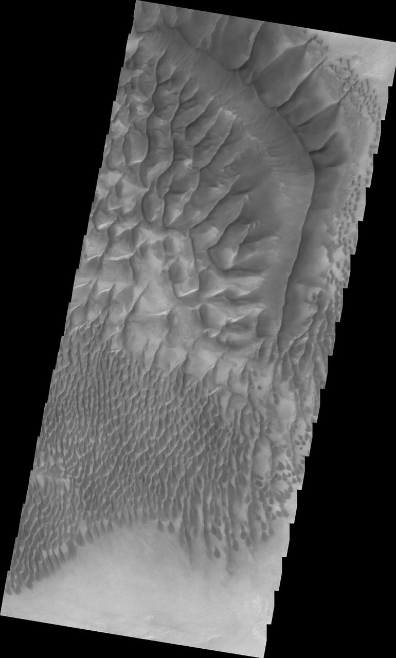
This image shows the central part of the dune field on the floor of Russell Crater. Russell Crater is located in Noachis Terra. A spectacular dune ridge and other dune forms on the crater floor have caused extensive imaging. The Odyssey spacecraft has spent over 15 years in orbit around Mars, circling the planet more than 69000 times. It holds the record for longest working spacecraft at Mars. THEMIS, the IR/VIS camera system, has collected data for the entire mission and provides images covering all seasons and lighting conditions. Over the years many features of interest have received repeated imaging, building up a suite of images covering the entire feature. From the deepest chasma to the tallest volcano, individual dunes inside craters and dune fields that encircle the north pole, channels carved by water and lava, and a variety of other feature, THEMIS has imaged them all. For the next several months the image of the day will focus on the Tharsis volcanoes, the various chasmata of Valles Marineris, and the major dunes fields. We hope you enjoy these images! Orbit Number: 34856 Latitude: -54.5757 Longitude: 12.8629 Instrument: VIS Captured: 2009-10-23 08:04 https://photojournal.jpl.nasa.gov/catalog/PIA21806
In this infrared image of the dunes on the floor of Russell Crater, the dunes are brighter than the surround materials, as shown in this image from NASA 2001 Mars Odyssey spacecraft. Latitude: -54.4765 Longitude: 13.0926 Instrument: IR Captured: 2015-01-21 17:09 http://photojournal.jpl.nasa.gov/catalog/PIA19228
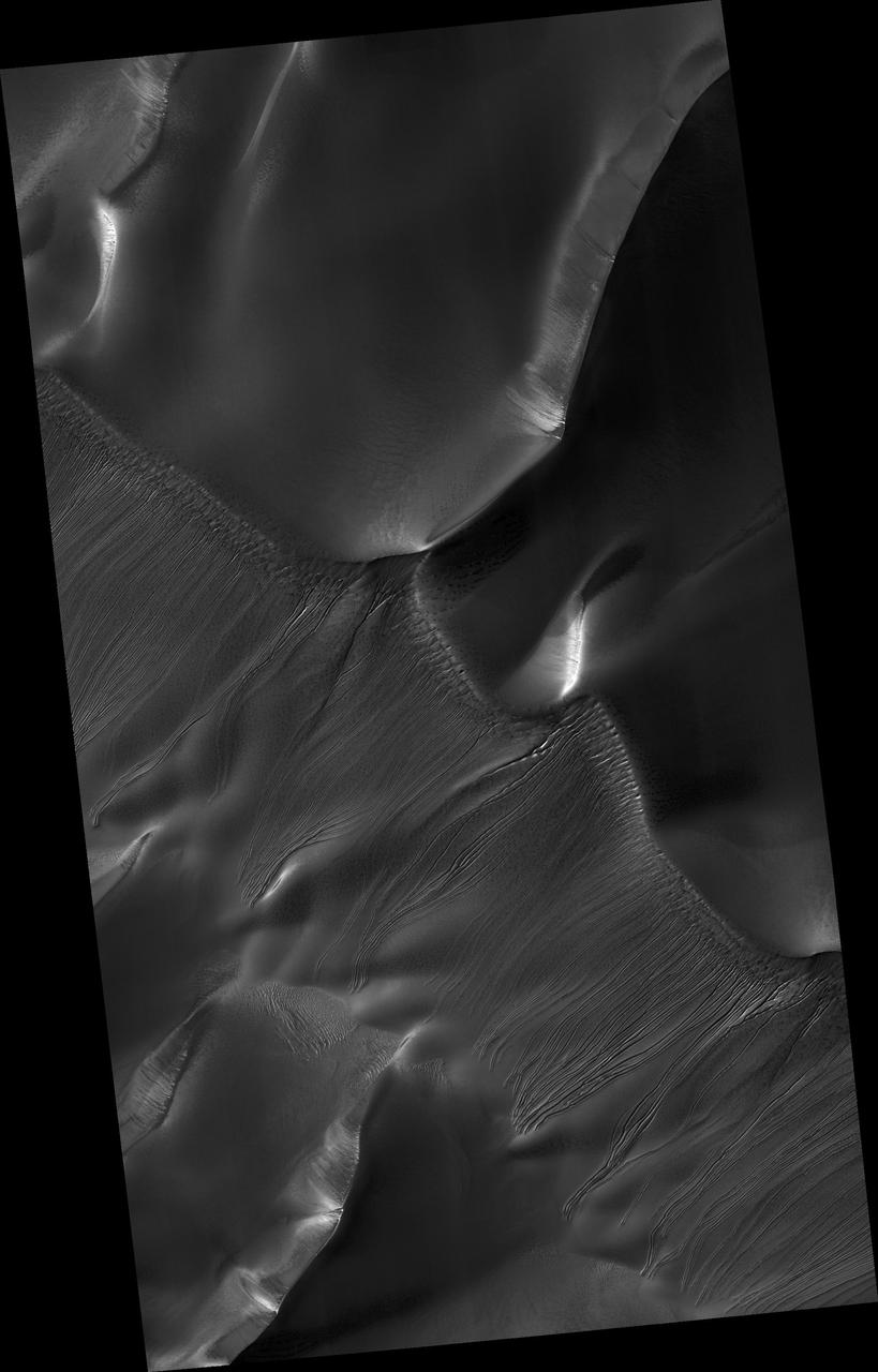
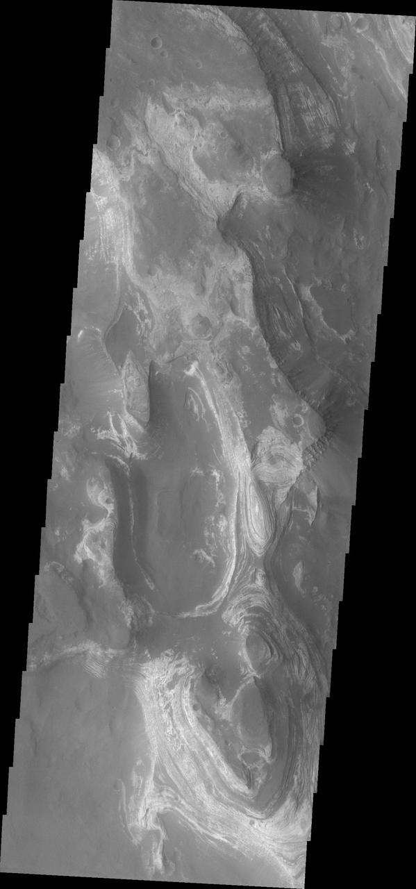
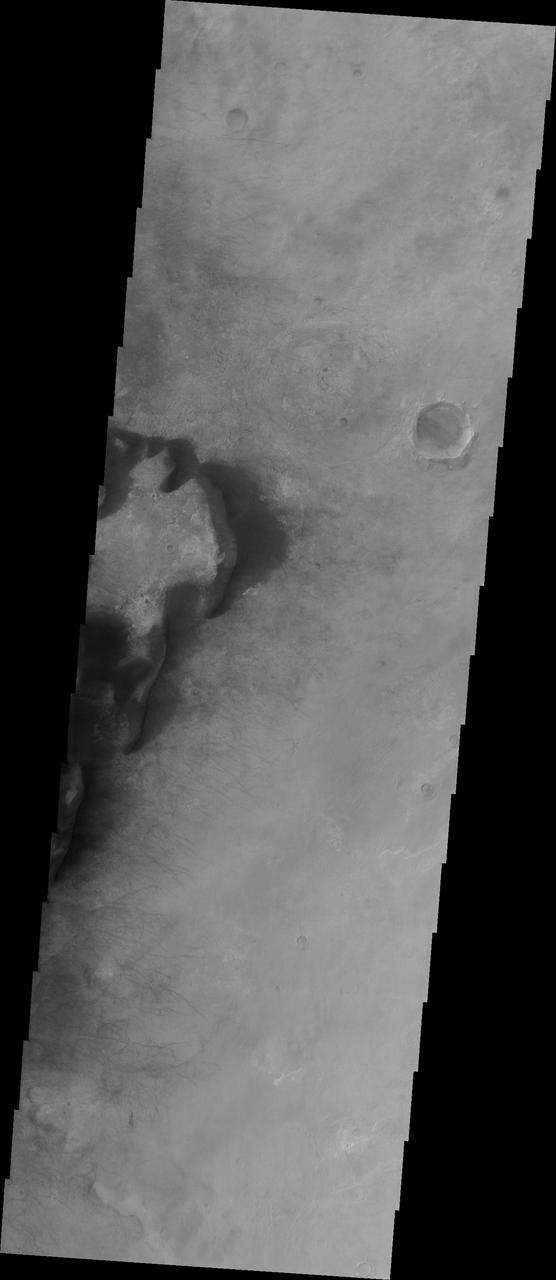
In an area like Russell Crater, very ancient impact crater, NASA Mars Reconnaissance Orbiter can follow changes in the terrain by comparing images taken at different times. Frost carbon dioxide ice is seen in this image.

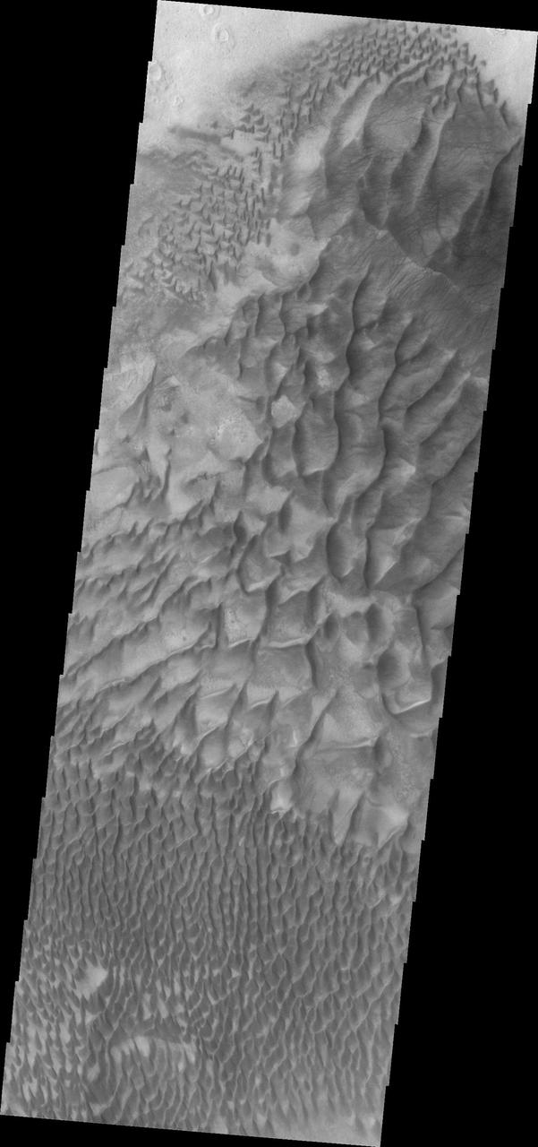
This image shows individual dunes on the floor of Russell Crater, as well as larger dunes created by individual dunes coalescing . These dunes are in the western part of the dune field. Russell Crater is located in Noachis Terra. A spectacular dune ridge and other dune forms on the crater floor have caused extensive imaging. The Odyssey spacecraft has spent over 15 years in orbit around Mars, circling the planet more than 69000 times. It holds the record for longest working spacecraft at Mars. THEMIS, the IR/VIS camera system, has collected data for the entire mission and provides images covering all seasons and lighting conditions. Over the years many features of interest have received repeated imaging, building up a suite of images covering the entire feature. From the deepest chasma to the tallest volcano, individual dunes inside craters and dune fields that encircle the north pole, channels carved by water and lava, and a variety of other feature, THEMIS has imaged them all. For the next several months the image of the day will focus on the Tharsis volcanoes, the various chasmata of Valles Marineris, and the major dunes fields. We hope you enjoy these images! Orbit Number: 26372 Latitude: -54.372 Longitude: 12.5481 Instrument: VIS Captured: 2007-11-24 17:16 https://photojournal.jpl.nasa.gov/catalog/PIA21800
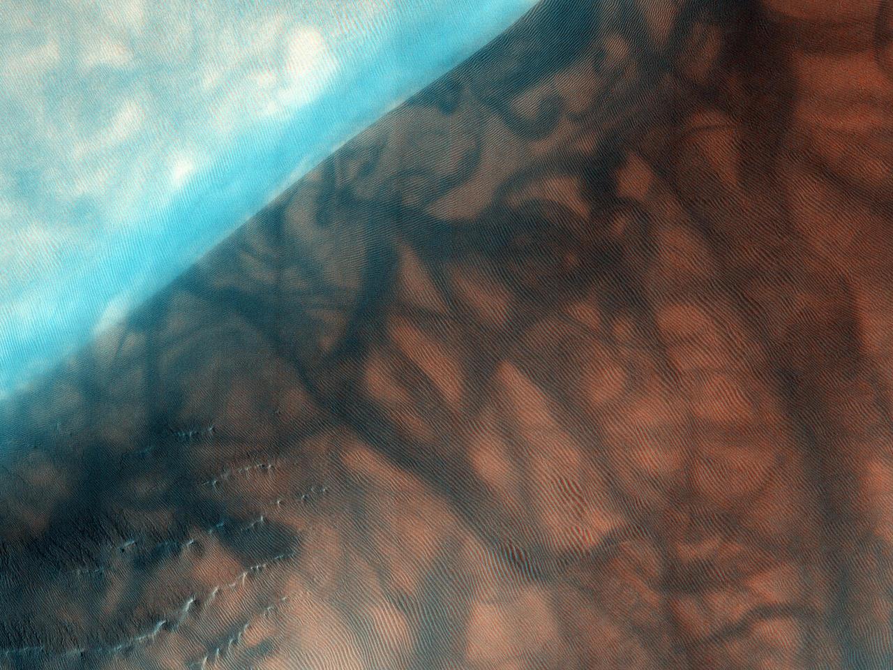
The Russell Crater dune field is covered seasonally by carbon dioxide frost; this image from NASA Mars Reconnaissance Orbiter shows the dune field after the frost has sublimated. There are just a few patches left of the bright seasonal frost.
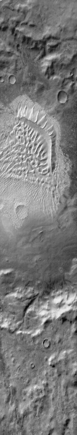
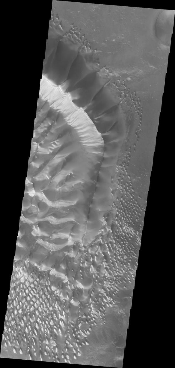
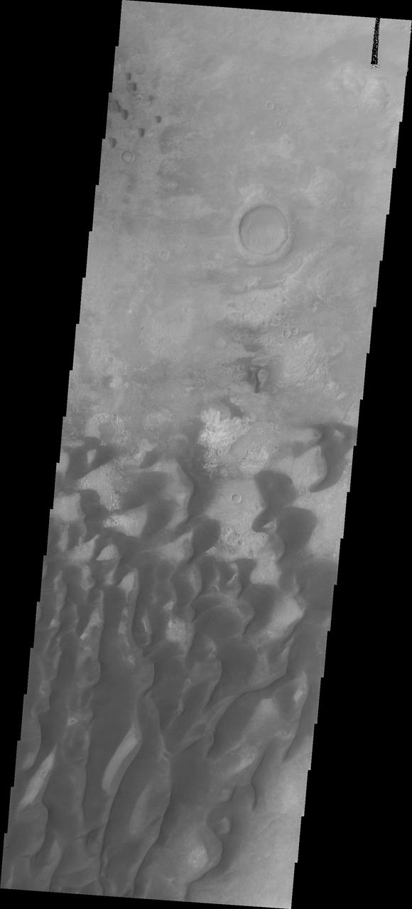
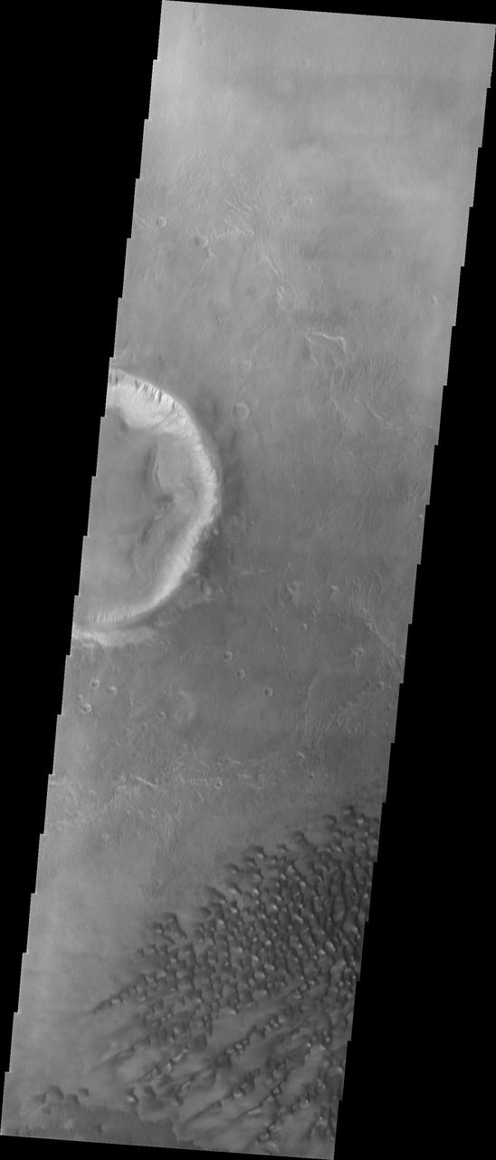
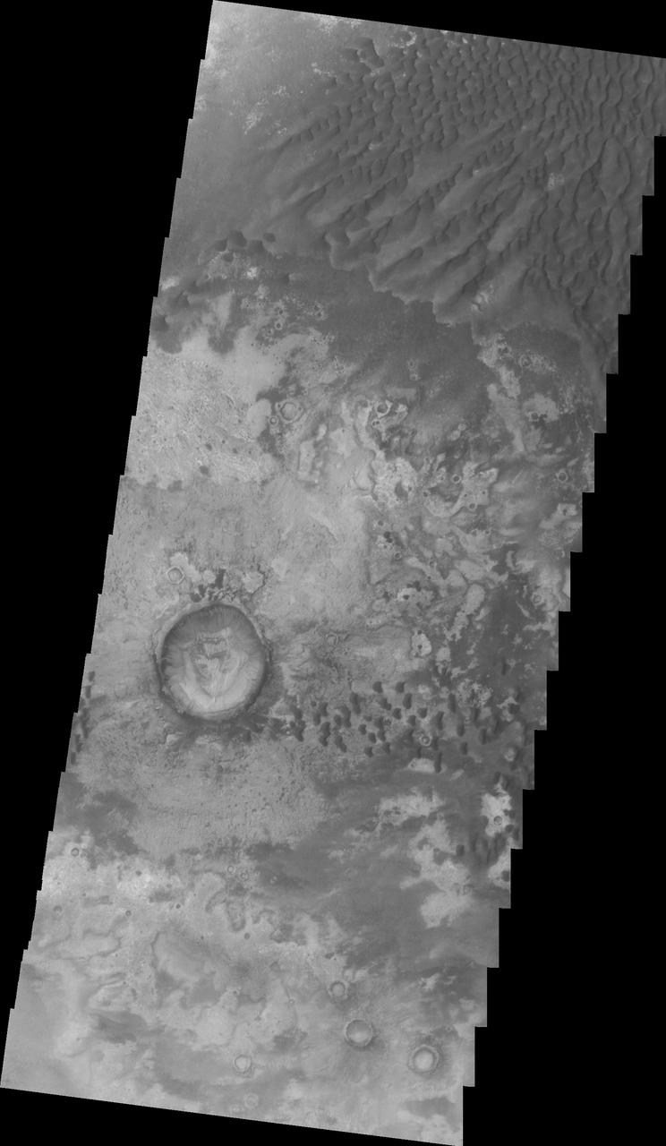
This image shows the western section of the large sand ridge on the floor of Russell Crater. This is also the northern extent of the dune field. The crest of the large ridge runs from lower right to upper left. Smaller dune ridges intersect the large ridge perpendicular to the crest. Russell Crater is located in Noachis Terra. A spectacular dune ridge and other dune forms on the crater floor have caused extensive imaging. The Odyssey spacecraft has spent over 15 years in orbit around Mars, circling the planet more than 69000 times. It holds the record for longest working spacecraft at Mars. THEMIS, the IR/VIS camera system, has collected data for the entire mission and provides images covering all seasons and lighting conditions. Over the years many features of interest have received repeated imaging, building up a suite of images covering the entire feature. From the deepest chasma to the tallest volcano, individual dunes inside craters and dune fields that encircle the north pole, channels carved by water and lava, and a variety of other feature, THEMIS has imaged them all. For the next several months the image of the day will focus on the Tharsis volcanoes, the various chasmata of Valles Marineris, and the major dunes fields. We hope you enjoy these images! Orbit Number: 26659 Latitude: -54.0179 Longitude: 12.8638 Instrument: VIS Captured: 2007-12-18 08:26 https://photojournal.jpl.nasa.gov/catalog/PIA21801

This image shows the central part of the dune field on the floor of Russell Crater, including the large dune ridge. Comparing this image to yesterday's you will see a significant difference in appearance. This image was collected at a higher incidence angle, so the sun is at a different angle to the surface. Russell Crater is located in Noachis Terra. A spectacular dune ridge and other dune forms on the crater floor have caused extensive imaging. The Odyssey spacecraft has spent over 15 years in orbit around Mars, circling the planet more than 69000 times. It holds the record for longest working spacecraft at Mars. THEMIS, the IR/VIS camera system, has collected data for the entire mission and provides images covering all seasons and lighting conditions. Over the years many features of interest have received repeated imaging, building up a suite of images covering the entire feature. From the deepest chasma to the tallest volcano, individual dunes inside craters and dune fields that encircle the north pole, channels carved by water and lava, and a variety of other feature, THEMIS has imaged them all. For the next several months the image of the day will focus on the Tharsis volcanoes, the various chasmata of Valles Marineris, and the major dunes fields. We hope you enjoy these images! Orbit Number: 39723 Latitude: -54.4434 Longitude: 13.0526 Instrument: VIS Captured: 2010-11-28 01:47 https://photojournal.jpl.nasa.gov/catalog/PIA21807

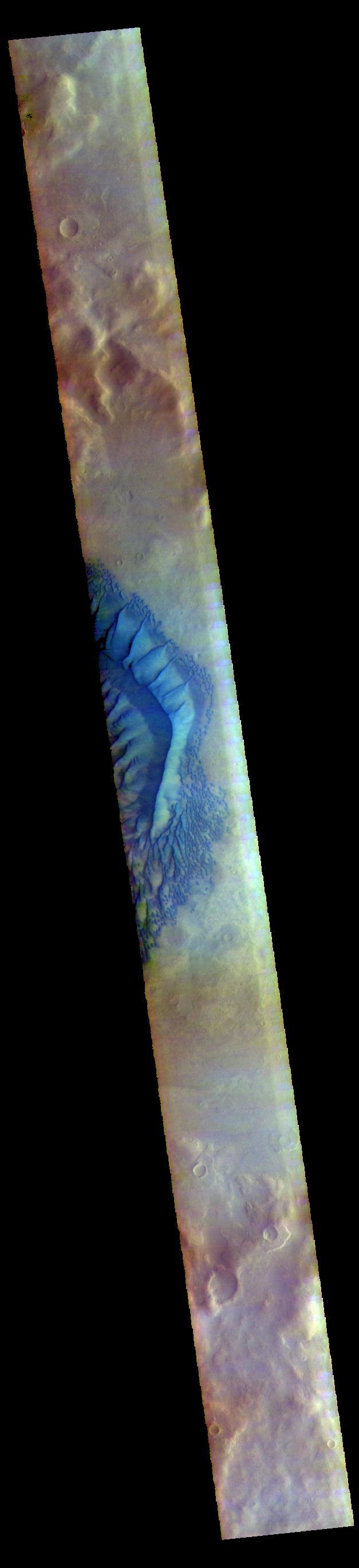
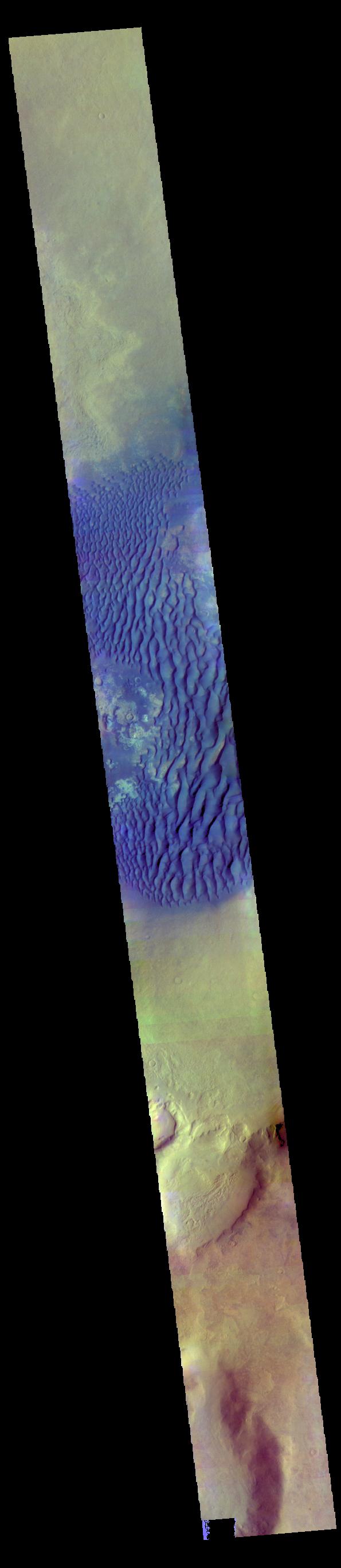
This image shows the western part of the dune field on the floor of Russell Crater. This is a false color image of Russell crater and it's surroundings. Sand Dunes usually appear "blue" in false color images. Russell Crater is located in Noachis Terra. A spectacular dune ridge and other dune forms on the crater floor have caused extensive imaging. The THEMIS VIS camera contains 5 filters. The data from different filters can be combined in multiple ways to create a false color image. These false color images may reveal subtle variations of the surface not easily identified in a single band image. The Odyssey spacecraft has spent over 15 years in orbit around Mars, circling the planet more than 69000 times. It holds the record for longest working spacecraft at Mars. THEMIS, the IR/VIS camera system, has collected data for the entire mission and provides images covering all seasons and lighting conditions. Over the years many features of interest have received repeated imaging, building up a suite of images covering the entire feature. From the deepest chasma to the tallest volcano, individual dunes inside craters and dune fields that encircle the north pole, channels carved by water and lava, and a variety of other feature, THEMIS has imaged them all. For the next several months the image of the day will focus on the Tharsis volcanoes, the various chasmata of Valles Marineris, and the major dunes fields. We hope you enjoy these images! Orbit Number: 59591 Latitude: -54.471 Longitude: 13.1288 Instrument: VIS Captured: 2015-05-21 10:57 https://photojournal.jpl.nasa.gov/catalog/PIA21808

The THEMIS VIS camera contains 5 filters. The data from different filters can be combined in multiple ways to create a false color image. These false color images may reveal subtle variations of the surface not easily identified in a single band image. Today's false color image shows part of the large dune form on the floor of Russell Crater. Orbit Number: 59672 Latitude: -54.337 Longitude: 13.1087 Instrument: VIS Captured: 2015-05-28 02:39 https://photojournal.jpl.nasa.gov/catalog/PIA21701

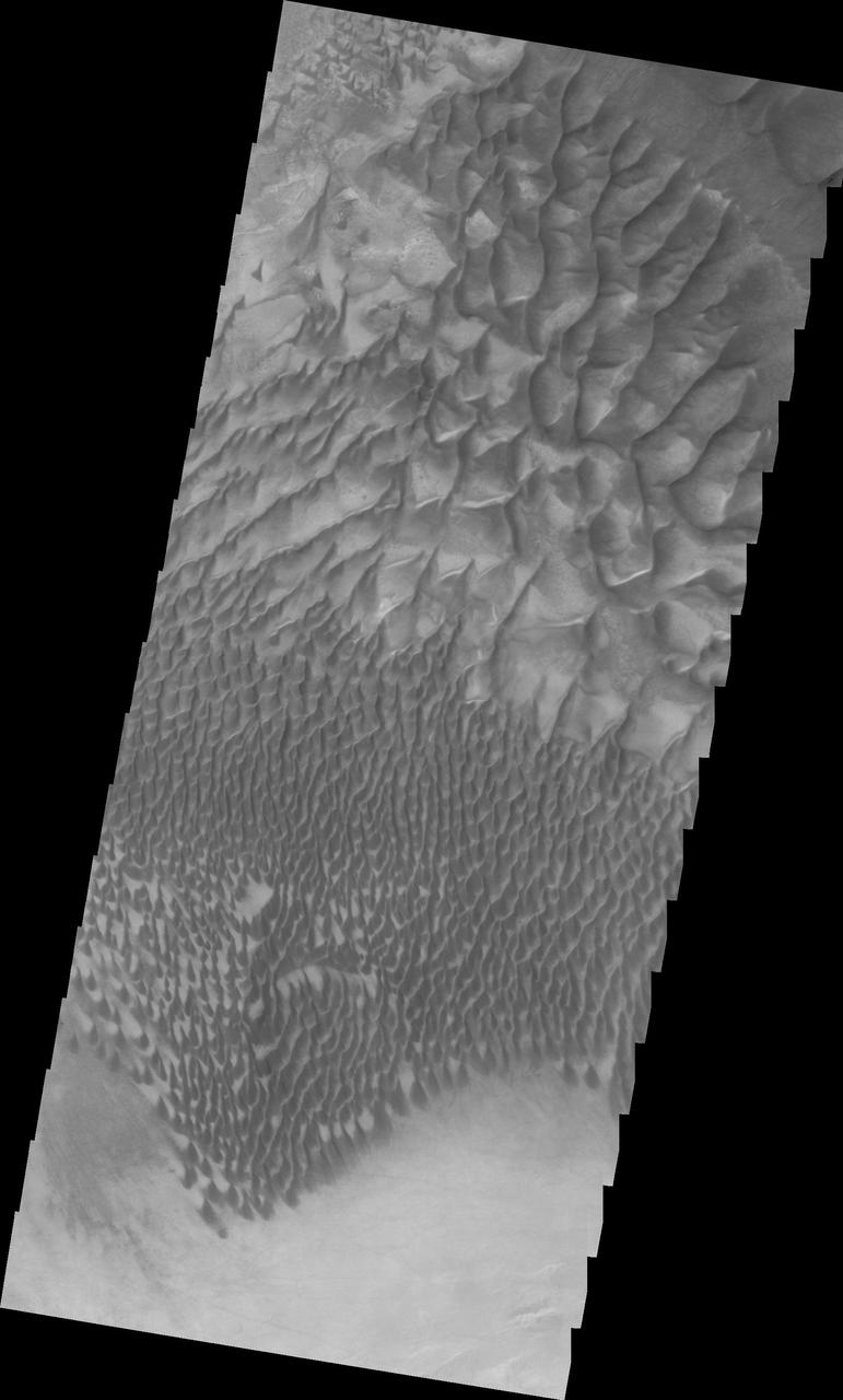
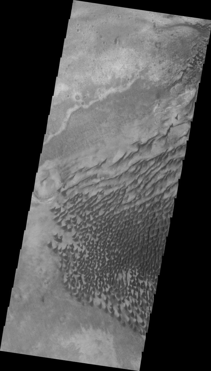
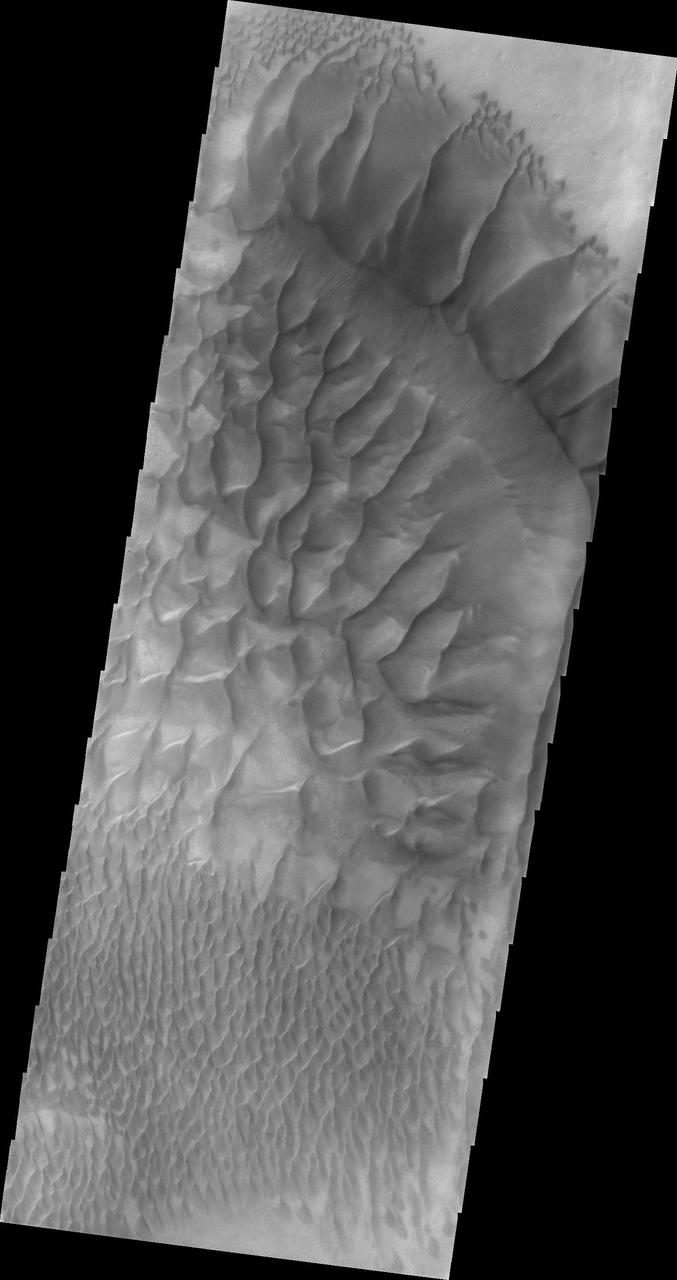
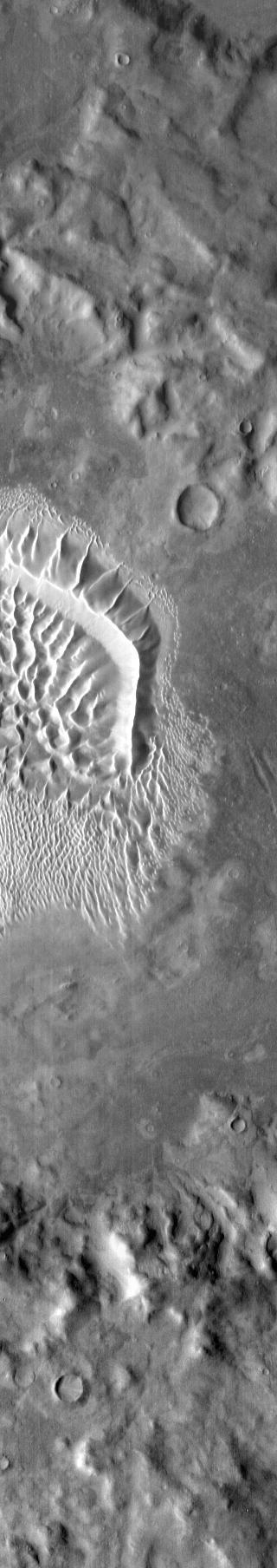
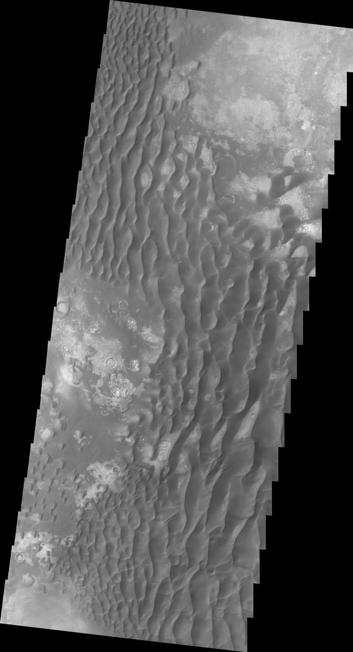
This image shows part of the dune field just south of the large sand ridge - which is visible on the very top of the image. There is a huge range of dune sizes on the floor of Russell Crater. In this image the small sizes are at the bottom of the image and transition to larger dunes at the top. Russell Crater is located in Noachis Terra. A spectacular dune ridge and other dune forms on the crater floor have caused extensive imaging. The Odyssey spacecraft has spent over 15 years in orbit around Mars, circling the planet more than 69000 times. It holds the record for longest working spacecraft at Mars. THEMIS, the IR/VIS camera system, has collected data for the entire mission and provides images covering all seasons and lighting conditions. Over the years many features of interest have received repeated imaging, building up a suite of images covering the entire feature. From the deepest chasma to the tallest volcano, individual dunes inside craters and dune fields that encircle the north pole, channels carved by water and lava, and a variety of other feature, THEMIS has imaged them all. For the next several months the image of the day will focus on the Tharsis volcanoes, the various chasmata of Valles Marineris, and the major dunes fields. We hope you enjoy these images! Orbit Number: 34544 Latitude: -54.6035 Longitude: 12.6071 Instrument: VIS Captured: 2009-09-27 15:35 https://photojournal.jpl.nasa.gov/catalog/PIA21805
This image from NASA 2001 Mars Odyssey spacecraft was collected at the same time as yesterday IR image. The dunes are dark in the VIS image, because the material is darker in color than the surrounding material. Latitude: -54.3016 Longitude: 13.1403 Instrument: VIS Captured: 2015-01-21 17:09 http://photojournal.jpl.nasa.gov/catalog/PIA19229
Several types of downhill flow features have been observed on Mars. Shown here is an example of a type called linear gullies as seen by NASA Mars Reconnaissance Orbiter.
This VIS image of Kaiser Crater shows a region of the dunes with varied appearances. The different dune forms developed due to different amounts of available sand, different wind directions, and the texture of the crater floor. Dune size, shape, and spacing is controlled by a variety of factors. Note the dune that fills half of the crater in the center of the image. Kaiser Crater is located in the southern hemisphere in the Noachis region west of Hellas Planitia. Kaiser Crater is just one of several large craters with extensive dune fields on the crater floor. Other nearby dune filled craters are Proctor, Russell, and Rabe. Kaiser Crater is 207 km (129 miles) in diameter. The dunes are located in the southern part of the crater floor. The Odyssey spacecraft has spent over 15 years in orbit around Mars, circling the planet more than 71000 times. It holds the record for longest working spacecraft at Mars. THEMIS, the IR/VIS camera system, has collected data for the entire mission and provides images covering all seasons and lighting conditions. Over the years many features of interest have received repeated imaging, building up a suite of images covering the entire feature. From the deepest chasma to the tallest volcano, individual dunes inside craters and dune fields that encircle the north pole, channels carved by water and lava, and a variety of other feature, THEMIS has imaged them all. For the next several months the image of the day will focus on the Tharsis volcanoes, the various chasmata of Valles Marineris, and the major dunes fields. We hope you enjoy these images! Orbit Number: 14953 Latitude: -46.7919 Longitude: 18.4314 Instrument: VIS Captured: 2005-04-28 12:59 https://photojournal.jpl.nasa.gov/catalog/PIA22175
This is a false color image of Kaiser Crater. In this combination of filters "blue" typically means basaltic sand. This VIS image crosses 3/4 of the crater and demonstrates how extensive the dunes are on the floor of Kaiser Crater. Kaiser Crater is located in the southern hemisphere in the Noachis region west of Hellas Planitia. Kaiser Crater is just one of several large craters with extensive dune fields on the crater floor. Other nearby dune filled craters are Proctor, Russell, and Rabe. Kaiser Crater is 207 km (129 miles) in diameter. The dunes are located in the southern part of the crater floor. The THEMIS VIS camera contains 5 filters. The data from different filters can be combined in multiple ways to create a false color image. These false color images may reveal subtle variations of the surface not easily identified in a single band image. The Odyssey spacecraft has spent over 15 years in orbit around Mars, circling the planet more than 71,000 times. It holds the record for longest working spacecraft at Mars. THEMIS, the IR/VIS camera system, has collected data for the entire mission and provides images covering all seasons and lighting conditions. Over the years many features of interest have received repeated imaging, building up a suite of images covering the entire feature. From the deepest chasma to the tallest volcano, individual dunes inside craters and dune fields that encircle the north pole, channels carved by water and lava, and a variety of other feature, THEMIS has imaged them all. For the next several months the image of the day will focus on the Tharsis volcanoes, the various chasmata of Valles Marineris, and the major dunes fields. We hope you enjoy these images! Orbit Number: 66602 Latitude: -47.0551 Longitude: 19.446 Instrument: VIS Captured: 2016-12-18 21:42 https://photojournal.jpl.nasa.gov/catalog/PIA22265
This VIS image of Kaiser Crater shows a region of the dunes with varied appearances. The different dune forms developed due to different amounts of available sand, different wind directions, and the texture of the crater floor. The dune forms change from the bottom to the top of the image - large long connected dunes, to large individual dunes, to the very small individual dunes at the top of the image. Kaiser Crater is located in the southern hemisphere in the Noachis region west of Hellas Planitia. Kaiser Crater is just one of several large craters with extensive dune fields on the crater floor. Other nearby dune filled craters are Proctor, Russell, and Rabe. Kaiser Crater is 207 km (129 miles) in diameter. The dunes are located in the southern part of the crater floor. The Odyssey spacecraft has spent over 15 years in orbit around Mars, circling the planet more than 71,000 times. It holds the record for longest working spacecraft at Mars. THEMIS, the IR/VIS camera system, has collected data for the entire mission and provides images covering all seasons and lighting conditions. Over the years many features of interest have received repeated imaging, building up a suite of images covering the entire feature. From the deepest chasma to the tallest volcano, individual dunes inside craters and dune fields that encircle the north pole, channels carved by water and lava, and a variety of other feature, THEMIS has imaged them all. For the next several months the image of the day will focus on the Tharsis volcanoes, the various chasmata of Valles Marineris, and the major dunes fields. We hope you enjoy these images! Orbit Number: 17686 Latitude: -46.6956 Longitude: 19.8394 Instrument: VIS Captured: 2005-12-09 13:25 https://photojournal.jpl.nasa.gov/catalog/PIA22261
This VIS image of Kaiser Crater shows individual dunes and where the dunes have coalesced into longer dune forms. The addition of sand makes the dunes larger and the intra-dune areas go from sand-free to complete coverage of the hard surface of the crater floor. With a continued influx of sand the region will transition from individual dunes to a sand sheet with surface dune forms. Kaiser Crater is located in the southern hemisphere in the Noachis region west of Hellas Planitia. Kaiser Crater is just one of several large craters with extensive dune fields on the crater floor. Other nearby dune filled craters are Proctor, Russell, and Rabe. Kaiser Crater is 207 km (129 miles) in diameter. The dunes are located in the southern part of the crater floor. The Odyssey spacecraft has spent over 15 years in orbit around Mars, circling the planet more than 69000 times. It holds the record for longest working spacecraft at Mars. THEMIS, the IR/VIS camera system, has collected data for the entire mission and provides images covering all seasons and lighting conditions. Over the years many features of interest have received repeated imaging, building up a suite of images covering the entire feature. From the deepest chasma to the tallest volcano, individual dunes inside craters and dune fields that encircle the north pole, channels carved by water and lava, and a variety of other feature, THEMIS has imaged them all. For the next several months the image of the day will focus on the Tharsis volcanoes, the various chasmata of Valles Marineris, and the major dunes fields. We hope you enjoy these images! Orbit Number: 1423 Latitude: -46.9573 Longitude: 18.6192 Instrument: VIS Captured: 2002-04-10 16:44 https://photojournal.jpl.nasa.gov/catalog/PIA22173
This VIS image of the floor of Kaiser Crater contains a large variety of sand dune shapes and sizes. The "whiter" material is the hard crater floor surface. Kaiser Crater is located in the southern hemisphere in the Noachis region west of Hellas Planitia. Kaiser Crater is just one of several large craters with extensive dune fields on the crater floor. Other nearby dune filled craters are Proctor, Russell, and Rabe. Kaiser Crater is 207 km (129 miles) in diameter. The dunes are located in the southern part of the crater floor. The Odyssey spacecraft has spent over 15 years in orbit around Mars, circling the planet more than 71,000 times. It holds the record for longest working spacecraft at Mars. THEMIS, the IR/VIS camera system, has collected data for the entire mission and provides images covering all seasons and lighting conditions. Over the years many features of interest have received repeated imaging, building up a suite of images covering the entire feature. From the deepest chasma to the tallest volcano, individual dunes inside craters and dune fields that encircle the north pole, channels carved by water and lava, and a variety of other feature, THEMIS has imaged them all. For the next several months the image of the day will focus on the Tharsis volcanoes, the various chasmata of Valles Marineris, and the major dunes fields. We hope you enjoy these images! Orbit Number: 35430 Latitude: -46.8699 Longitude: 19.4731 Instrument: VIS Captured: 2009-12-09 14:09 https://photojournal.jpl.nasa.gov/catalog/PIA22263

This VIS image of the floor of Kaiser Crater contains several sand dune shapes and sizes. The "whiter" material is the hard crater floor surface. Kaiser Crater is located in the southern hemisphere in the Noachis region west of Hellas Planitia. Kaiser Crater is just one of several large craters with extensive dune fields on the crater floor. Other nearby dune filled craters are Proctor, Russell, and Rabe. Kaiser Crater is 207 km (129 miles) in diameter. The dunes are located in the southern part of the crater floor. The Odyssey spacecraft has spent over 15 years in orbit around Mars, circling the planet more than 71,000 times. It holds the record for longest working spacecraft at Mars. THEMIS, the IR/VIS camera system, has collected data for the entire mission and provides images covering all seasons and lighting conditions. Over the years many features of interest have received repeated imaging, building up a suite of images covering the entire feature. From the deepest chasma to the tallest volcano, individual dunes inside craters and dune fields that encircle the north pole, channels carved by water and lava, and a variety of other feature, THEMIS has imaged them all. For the next several months the image of the day will focus on the Tharsis volcanoes, the various chasmata of Valles Marineris, and the major dunes fields. We hope you enjoy these images! Orbit Number: 39910 Latitude: -46.9063 Longitude: 19.8112 Instrument: VIS Captured: 2010-12-13 11:17 https://photojournal.jpl.nasa.gov/catalog/PIA22264
This VIS image of Kaiser Crater shows the central part of the crater floor. At the bottom of the image there is a topographic rise. The change in topography has altered the winds in this region, forming a linear pattern at the edge of the high land. Kaiser Crater is located in the southern hemisphere in the Noachis region west of Hellas Planitia. Kaiser Crater is just one of several large craters with extensive dune fields on the crater floor. Other nearby dune filled craters are Proctor, Russell, and Rabe. Kaiser Crater is 207 km (129 miles) in diameter. The dunes are located in the southern part of the crater floor. The Odyssey spacecraft has spent over 15 years in orbit around Mars, circling the planet more than 71000 times. It holds the record for longest working spacecraft at Mars. THEMIS, the IR/VIS camera system, has collected data for the entire mission and provides images covering all seasons and lighting conditions. Over the years many features of interest have received repeated imaging, building up a suite of images covering the entire feature. From the deepest chasma to the tallest volcano, individual dunes inside craters and dune fields that encircle the north pole, channels carved by water and lava, and a variety of other feature, THEMIS has imaged them all. For the next several months the image of the day will focus on the Tharsis volcanoes, the various chasmata of Valles Marineris, and the major dunes fields. We hope you enjoy these images! Orbit Number: 5505 Latitude: -46.2432 Longitude: 19.028 Instrument: VIS Captured: 2003-03-12 17:05 https://photojournal.jpl.nasa.gov/catalog/PIA22174
Kaiser Crater is located in the southern hemisphere in the Noachis region west of Hellas Planitia. Kaiser Crater is just one of several large craters with extensive dune fields on the crater floor. Other nearby dune filled craters are Proctor, Russell, and Rabe. Kaiser Crater is 207 km (129 miles) in diameter. The dunes are located in the southeastern part of the crater floor. Most of the individual dunes in Kaiser Crater are barchan dunes. Barchan dunes are crescent shaped with the points of the crescent pointing downwind. The sand is blown up the low angle side of the dune and then tumbles down the steep slip face. This dune type forms on hard surfaces where there is limited amounts of sand. Barchan dunes can merge together over time with increased sand in the local area. The Odyssey spacecraft has spent over 15 years in orbit around Mars, circling the planet more than 69000 times. It holds the record for longest working spacecraft at Mars. THEMIS, the IR/VIS camera system, has collected data for the entire mission and provides images covering all seasons and lighting conditions. Over the years many features of interest have received repeated imaging, building up a suite of images covering the entire feature. From the deepest chasma to the tallest volcano, individual dunes inside craters and dune fields that encircle the north pole, channels carved by water and lava, and a variety of other feature, THEMIS has imaged them all. For the next several months the image of the day will focus on the Tharsis volcanoes, the various chasmata of Valles Marineris, and the major dunes fields. We hope you enjoy these images! Orbit Number: 1036 Latitude: -46.7795 Longitude: 20.2075 Instrument: VIS Captured: 2002-03-09 20:07 https://photojournal.jpl.nasa.gov/catalog/PIA22172
At the top of this VIS image crescent shaped dunes are visible. As the dunes approach a break in elevation the forms change to connect the crescents together forming long aligned dune forms. Kaiser Crater is located in the southern hemisphere in the Noachis region west of Hellas Planitia. Kaiser Crater is just one of several large craters with extensive dune fields on the crater floor. Other nearby dune filled craters are Proctor, Russell, and Rabe. Kaiser Crater is 207 km (129 miles) in diameter. The dunes are located in the southern part of the crater floor. The Odyssey spacecraft has spent over 15 years in orbit around Mars, circling the planet more than 71,000 times. It holds the record for longest working spacecraft at Mars. THEMIS, the IR/VIS camera system, has collected data for the entire mission and provides images covering all seasons and lighting conditions. Over the years many features of interest have received repeated imaging, building up a suite of images covering the entire feature. From the deepest chasma to the tallest volcano, individual dunes inside craters and dune fields that encircle the north pole, channels carved by water and lava, and a variety of other feature, THEMIS has imaged them all. For the next several months the image of the day will focus on the Tharsis volcanoes, the various chasmata of Valles Marineris, and the major dunes fields. We hope you enjoy these images! Orbit Number: 34157 Latitude: -46.9336 Longitude: 18.9272 Instrument: VIS Captured: 2009-08-26 18:49 https://photojournal.jpl.nasa.gov/catalog/PIA22262