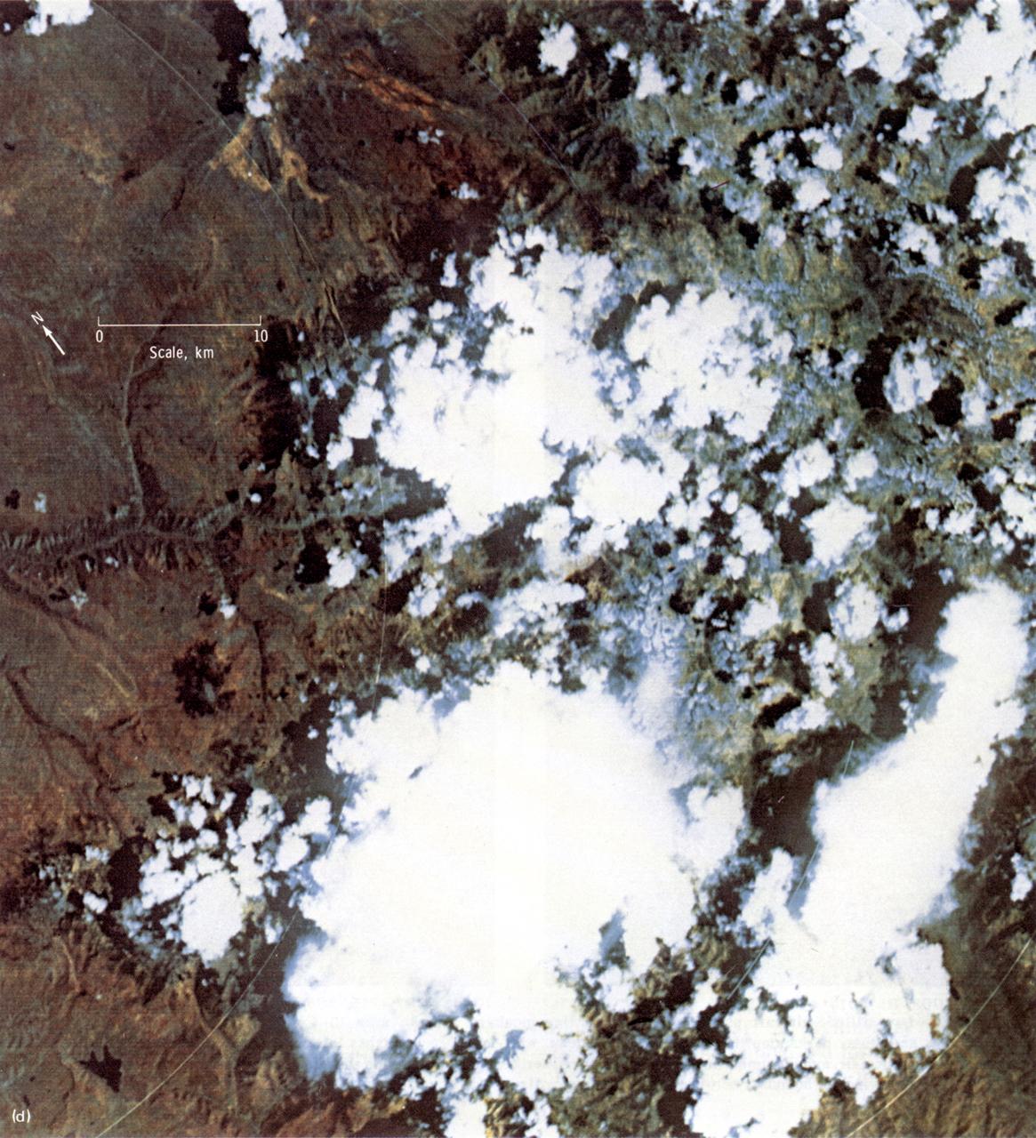
This Earth Resource Experiment Package (EREP) photograph of the Uncompahgre area of Colorado was electronically acquired in September of 1973 by the Multi-spectral Scarner, Skylab Experiment S192. EREP images were used to analyze the vegetation conditions and landscape characteristic of this area. Skylab's Earth sensors played the dual roles of gathering information about the planet and perfecting instruments and techniques for future satellites and manned stations. An array of six fixed cameras, another for high resolution, and the astronauts' handheld cameras photographed surface features. Other instruments, recording on magnetic tape, measured the reflectivity of plants, soils, and water. Radar measured the altitude of land and water surfaces. The sensors' objectives were to survey croplands and forests, identify soils and rock types, map natural features and urban developments, detect sediments and the spread of pollutants, study clouds and the sea, and determine the extent of snow and ice cover.
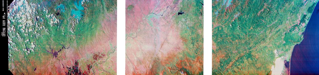
S73-34295B (June 1973) --- A vertical view of a portion of northern California reproduced from data taken from the Skylab Multispectral Scanner, experiment S192, in the Skylab space station in Earth orbit. This view is the most westerly one-third of Frame No. 001, Roll No. 518, S192, Skylab 2. Frame No. 001 extends from the Pacific coast at the Eureka area southeasterly 175 nautical miles to the Feather River drainage basin. Included in this view are Lake Shasta, Sacramento River Valley, Redding and Red Bluff. This non-photographic image is a color composite of channels 2 (visible), 7, and 12 (infrared) from the Earth Resources Experiments Package (EREP) S192 scanner. The scanner techniques assist with spectral signature identification and mapping of ground truth targets in agriculture, forestry, geology, hydrology and oceanography. Photo credit: NASA
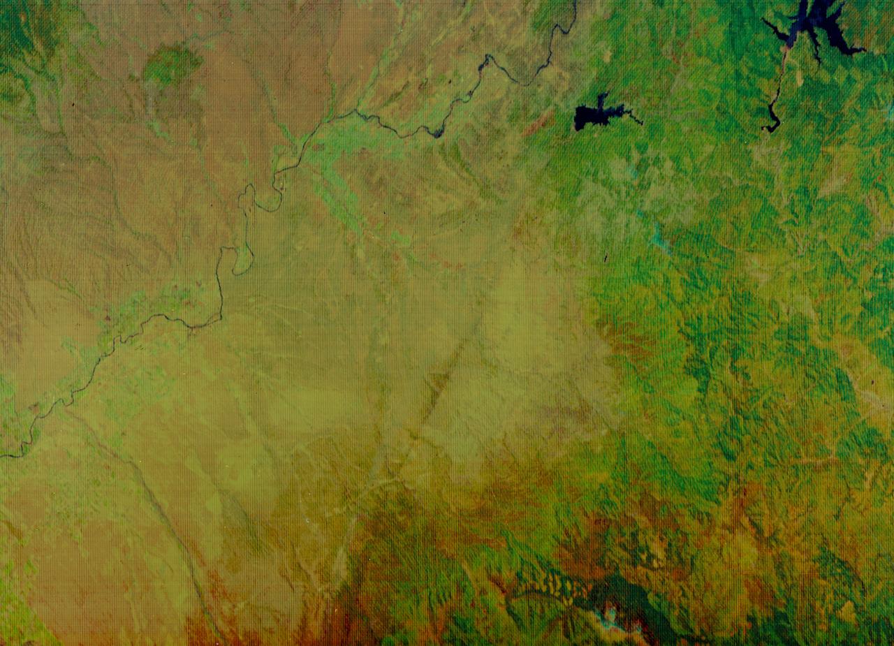
S73-34295 (June 1973) --- A vertical view of a portion of northern California reproduced from data taken from the Skylab Multispectral Scanner, experiment S192, in the Skylab space station in Earth orbit. This view is the most westerly one-third of Frame No. 001, Roll No. 518, S192, Skylab 2. Frame No. 001 extends from the Pacific coast at the Eureka area southeasterly 175 nautical miles to the Feather River drainage basin. Included in this view are Eureka, Trinidad, Klamath & Trinity Rivers and the Coastal Range mountains. This non-photographic image is a color composite of channels 2 (visible), 7, and 12 (infrared) from the Earth Resources Experiments Package (EREP) S192 scanner. The scanner techniques assist with spectral signature identification and mapping of ground truth targets in agriculture, forestry, geology, hydrology and oceanography. Photo credit: NASA
S73-34295A (June 1973) --- A vertical view of a portion of northern California reproduced from data taken from the Skylab Multispectral Scanner, experiment S192, in the Skylab space station in Earth orbit. This view is the most westerly one-third of Frame No. 001, Roll No. 518, S192, Skylab 2. Frame No. 001 extends from the Pacific coast at the Eureka area southeasterly 175 nautical miles to the Feather River drainage basin. Included in this view are Sacramento River Valley, Oroville Reservoir, Oroville and Chico. This non-photographic image is a color composite of channels 2 (visible), 7 and 12 (infrared) from the Earth Resources Experiments Package (EREP) S192 scanner. The scanner techniques assist with spectral signature identification and mapping of ground truth targets in agriculture, forestry, geology, hydrology and oceanography. Photo credit: NASA

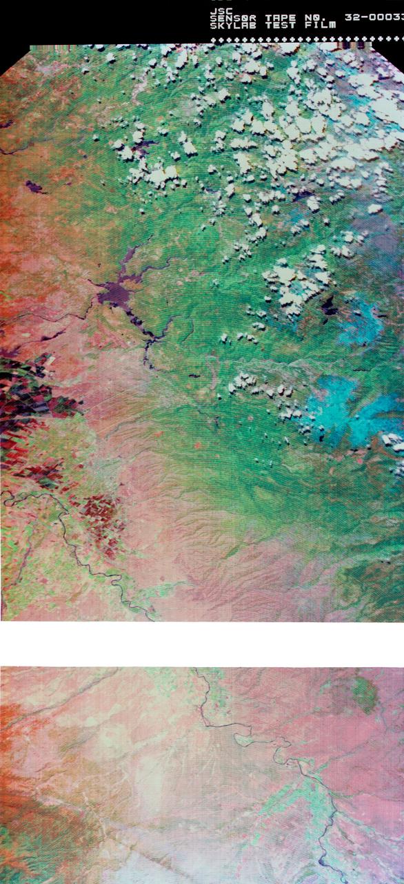
This 1970 photograph shows Skylab's Multispectral Scanner, one of the major components of an Earth Resources Experiment Package (EREP). It was designed to evaluate the on-orbit use of multispectral scanning of Earth resources. Investigators could evaluate the usefulness of spacecraft multispectral data for crop identification, vegetation mapping, soil moisture measurements, identification of contaminated areas in large bodies of water, and surface temperature mapping. The overall purpose of the EREP was to test the use of sensors that operated in the visible, infrared, and microwave portions of the electromagnetic spectrum to monitor and study Earth resources. The Marshall Space Flight Center had program management responsibility for the development of Skylab hardware and experiments.