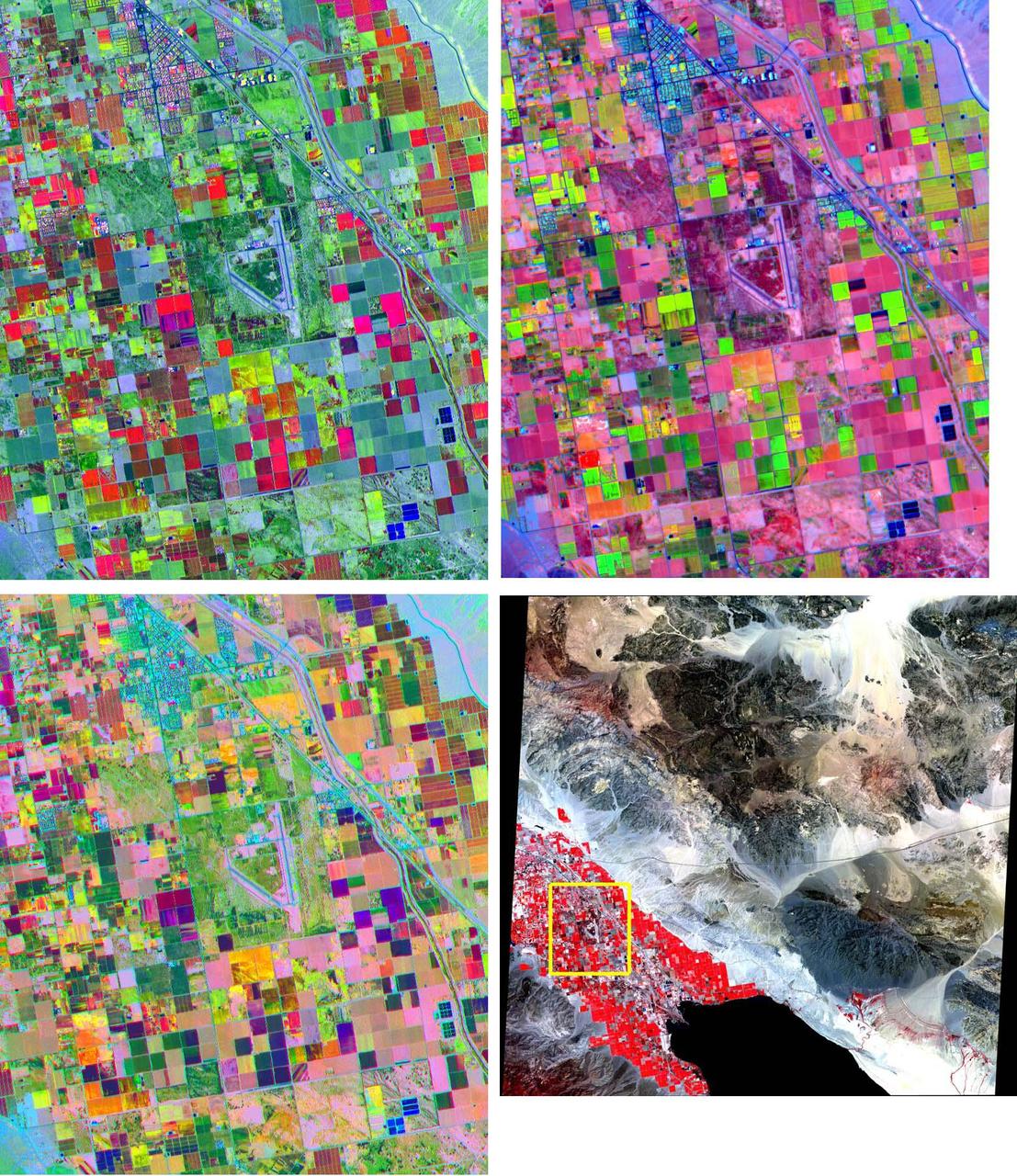
These band composites, acquired on June 4, 2000, cover a 11 by 13.5 km sub-scene in the Coachella Valley, CA. The area is shown by the yellow box on the full scene in the LOWER RIGHT corner, northwest of the Salton Sea. This is a major agricultural region of California, growing fruit and produce throughout the year. Different combinations of ASTER bands help identify the different crop types. UPPER LEFT: bands 3, 2, 1 as red, green, and blue (RGB); UPPER RIGHT: bands 4, 2, 1 as RGB; LOWER LEFT: bands 4, 3, 2 as RGB. The image is centered at 33.6 degrees north latitude, 116.1 degrees west longitude. http://photojournal.jpl.nasa.gov/catalog/PIA11161

STS-31 Earth observation taken aboard Discovery, Orbiter Vehicle (OV) 103, is of the western United States with the Salton Sea and Imperial Valley area recognizable at the lower left. The view is framed in a flight deck window and was photographed using a fish-eye lens.