Hematite Outlier and Sand Dunes
Sand Dunes in Hellas
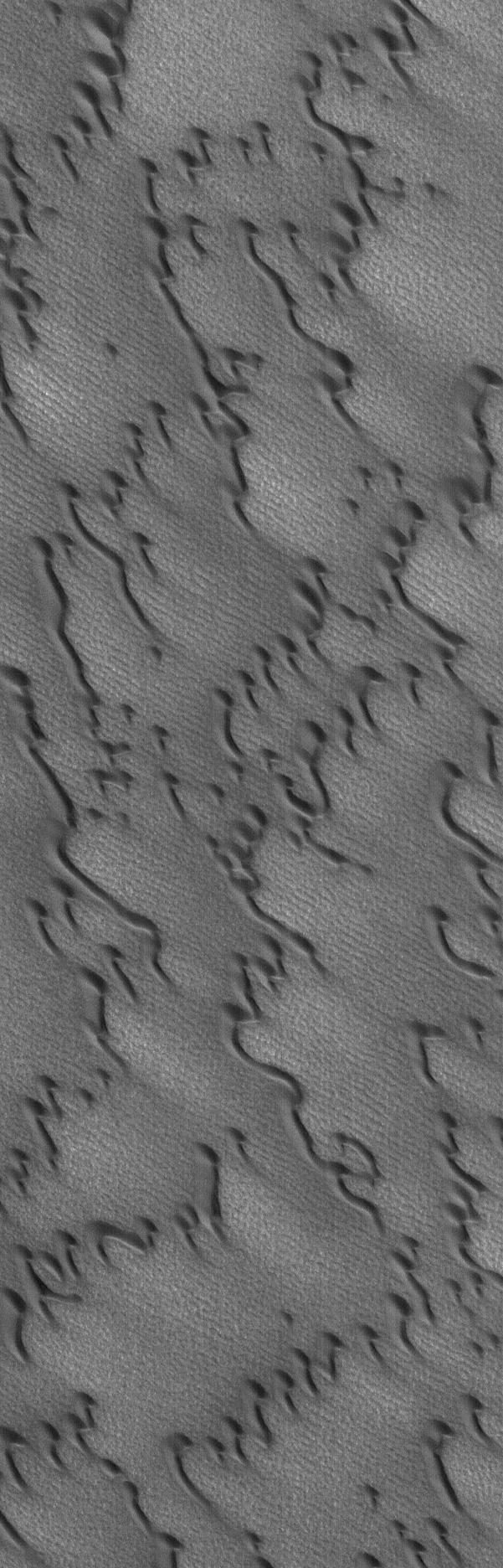
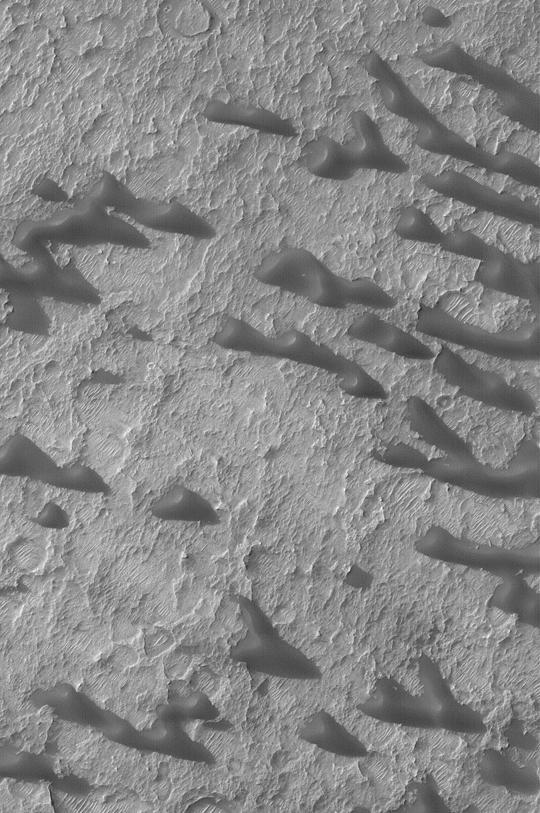
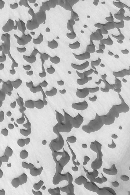
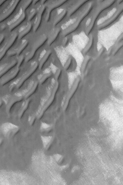
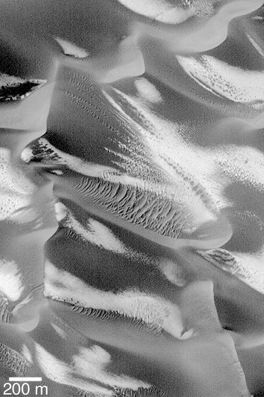
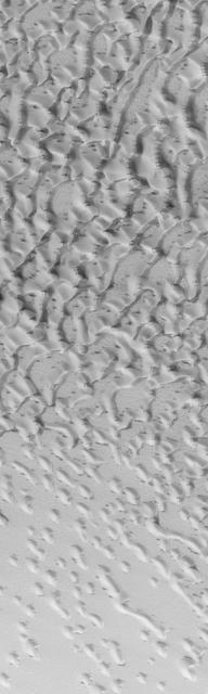
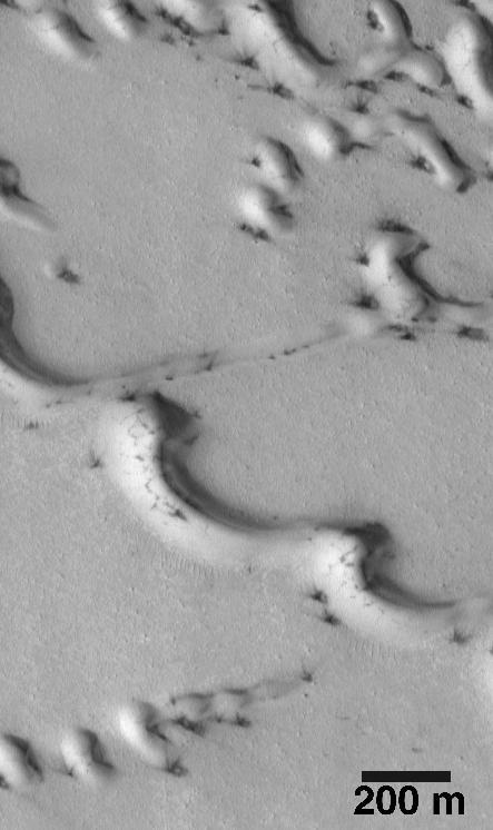
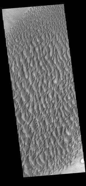
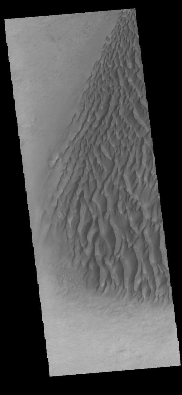
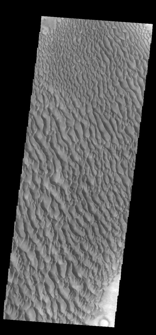
Martian Sand Dunes
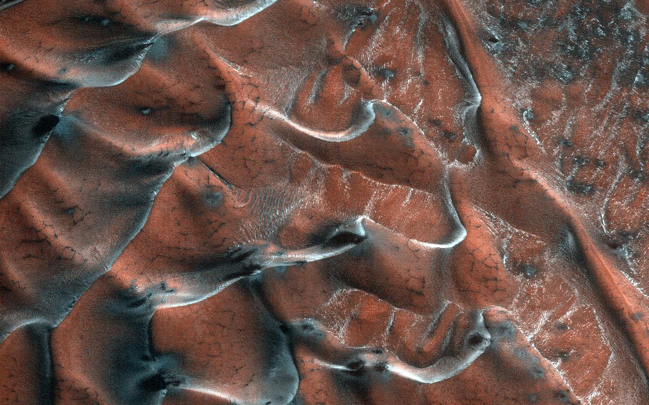
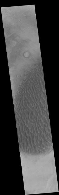
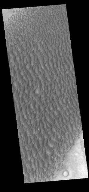
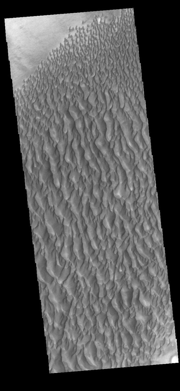
Dark Sand Dunes
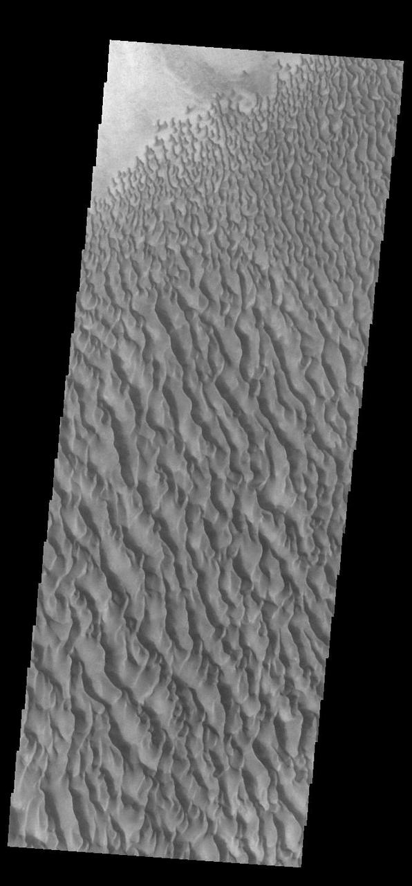
Dark Sand Dunes
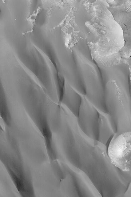
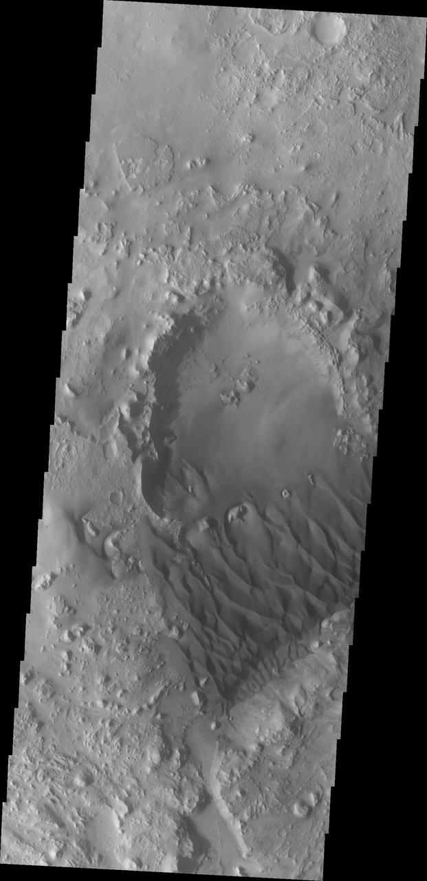
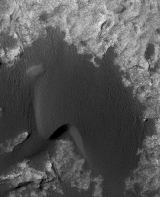
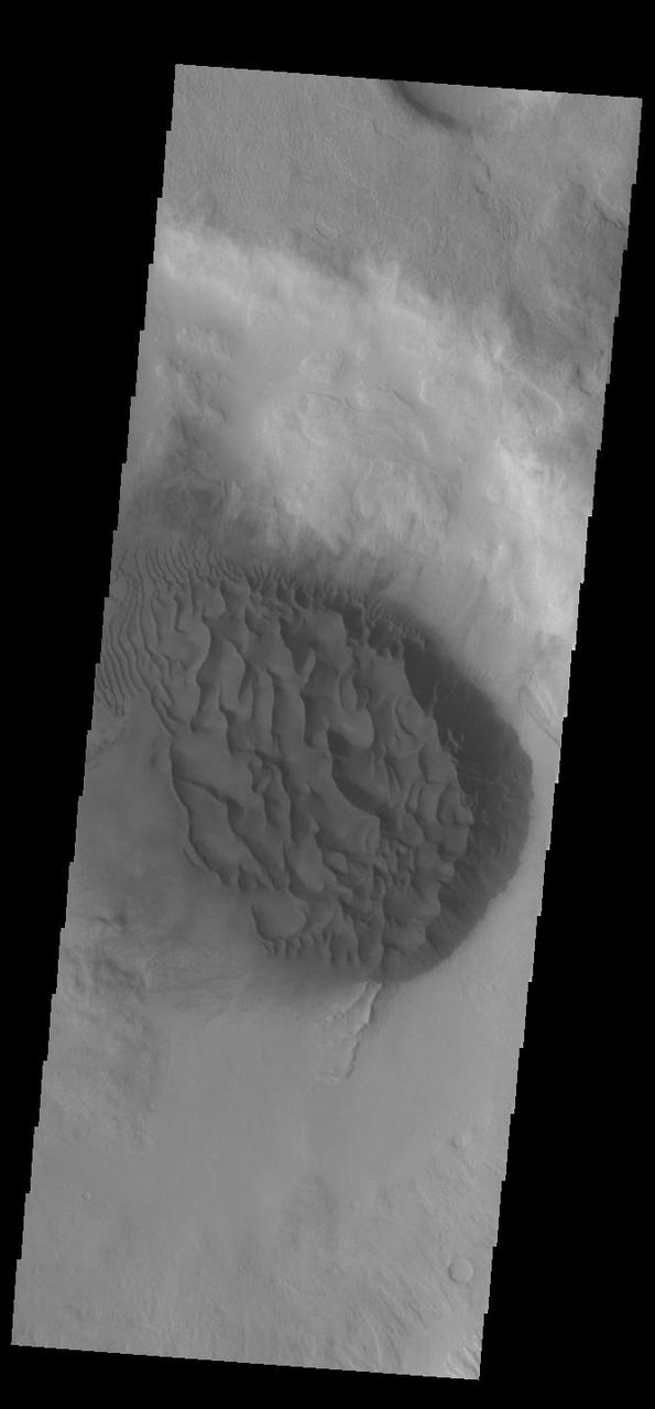
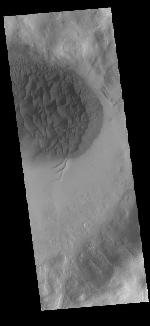
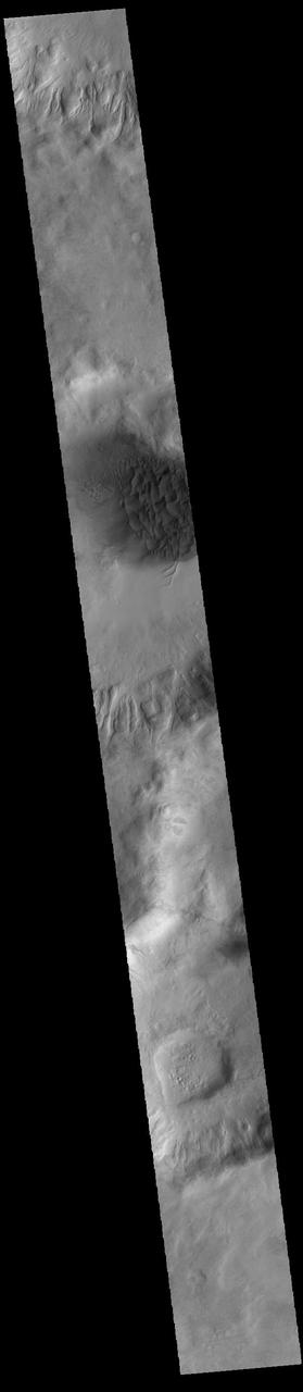
Sand Dunes of Schaeberle Crater
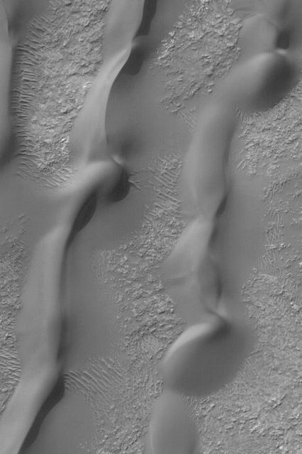
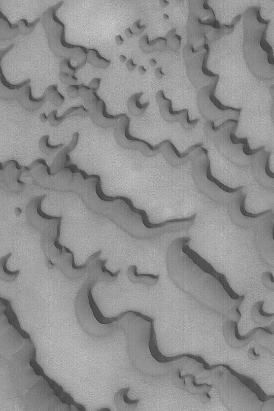
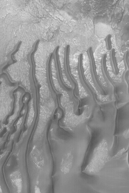
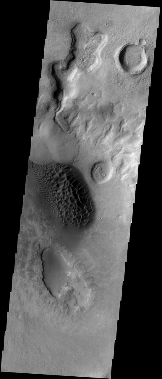
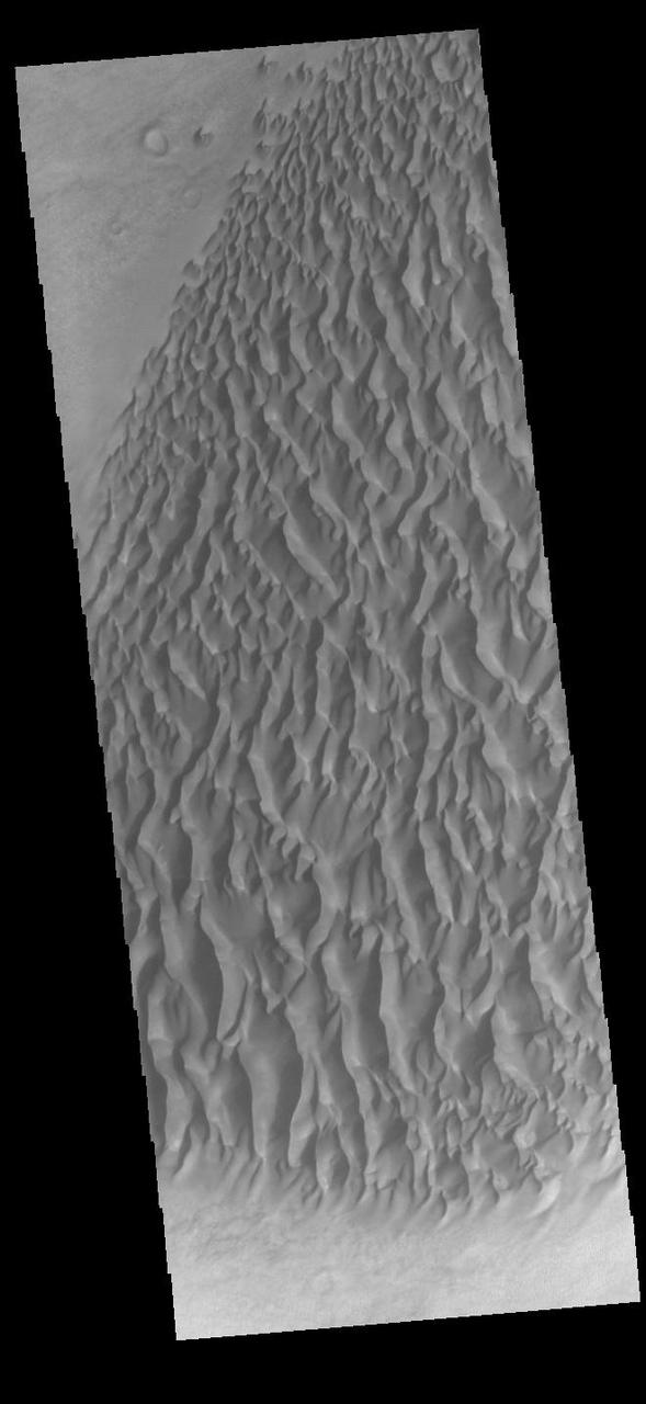
Sand Dunes in Noachis

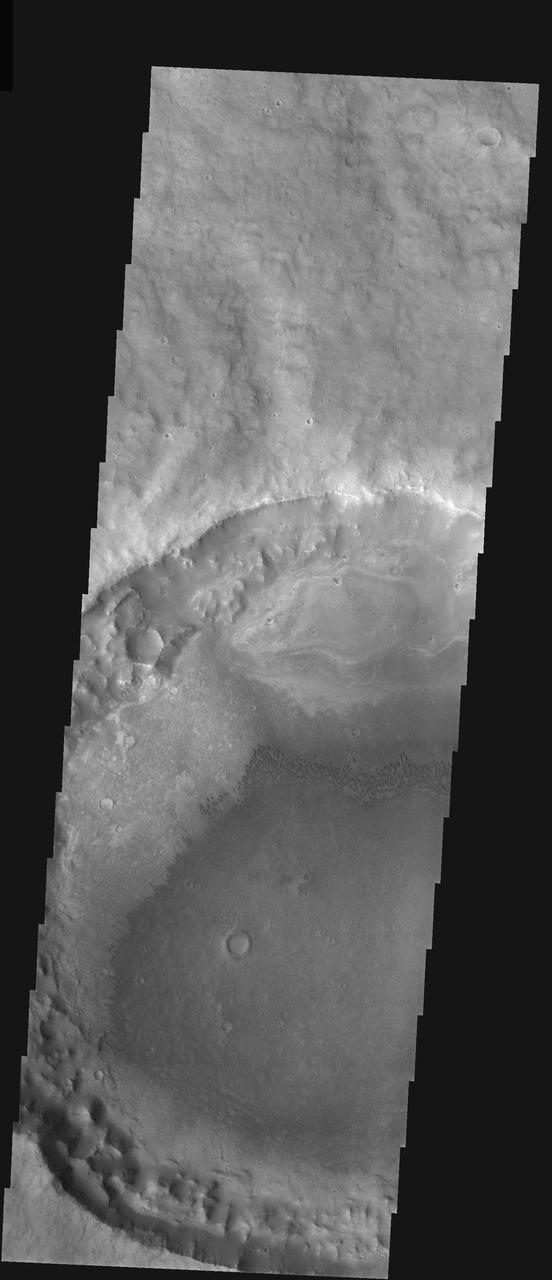
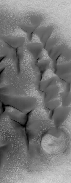
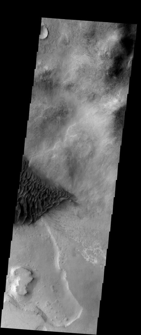
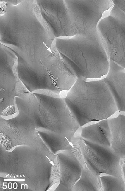
Sand Dunes in Rabe Crater
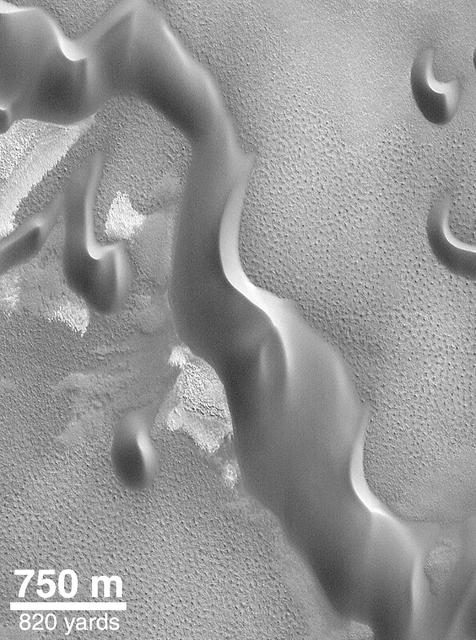
Windblown Sand Dunes
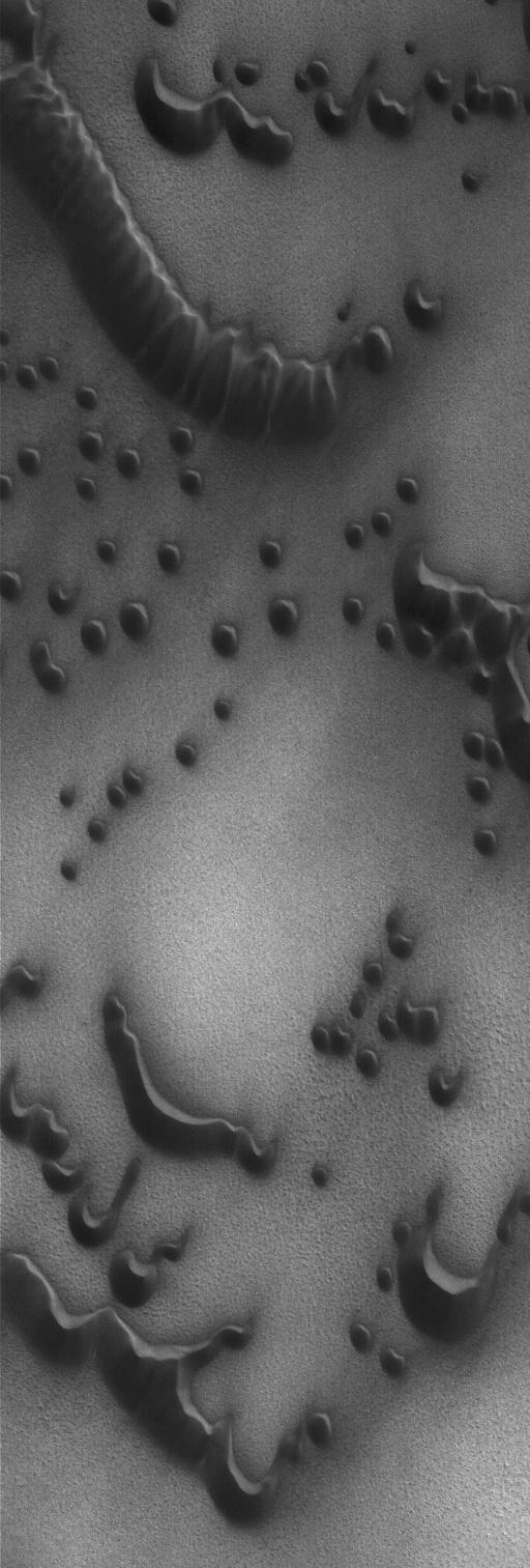
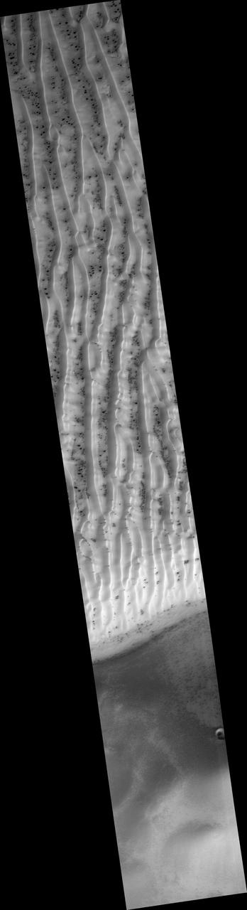
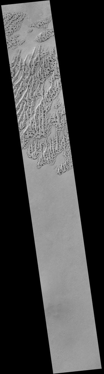
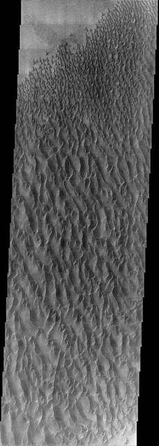
Polar Sand Dunes
North Polar Sand Dunes
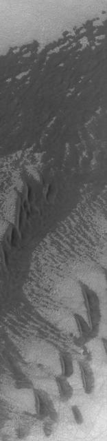
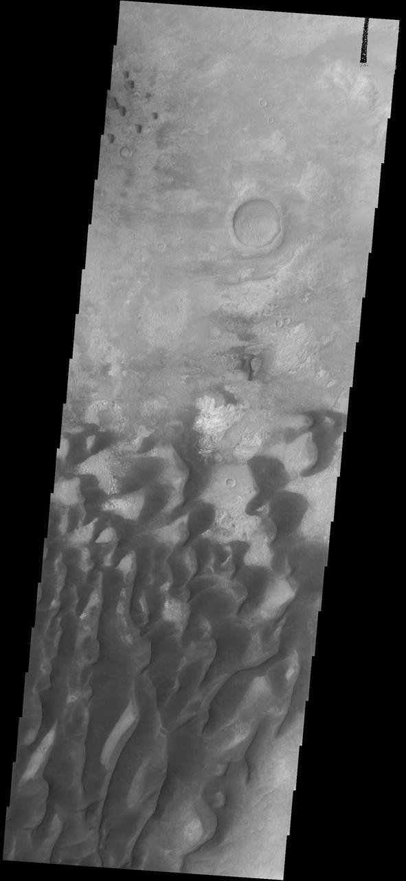
Sand Dunes in Kaiser Crater
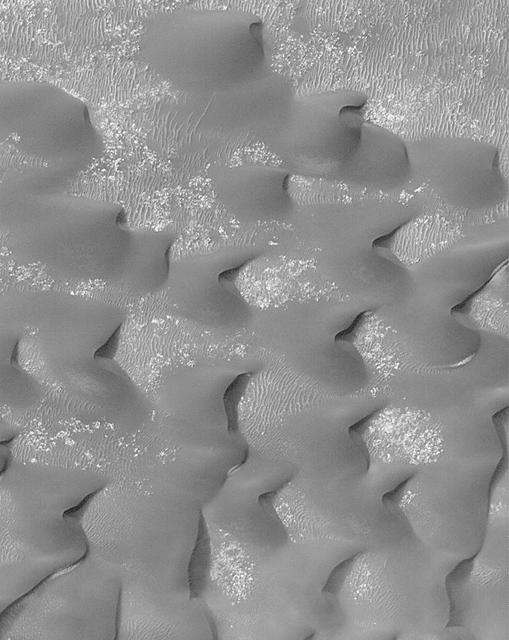
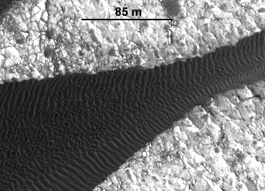
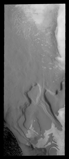
Sand Sheet and Dunes
Fortune Cookie Sand Dunes
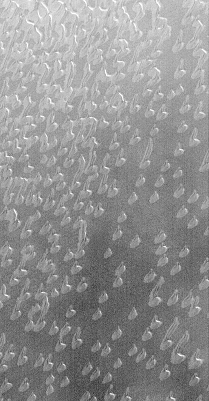
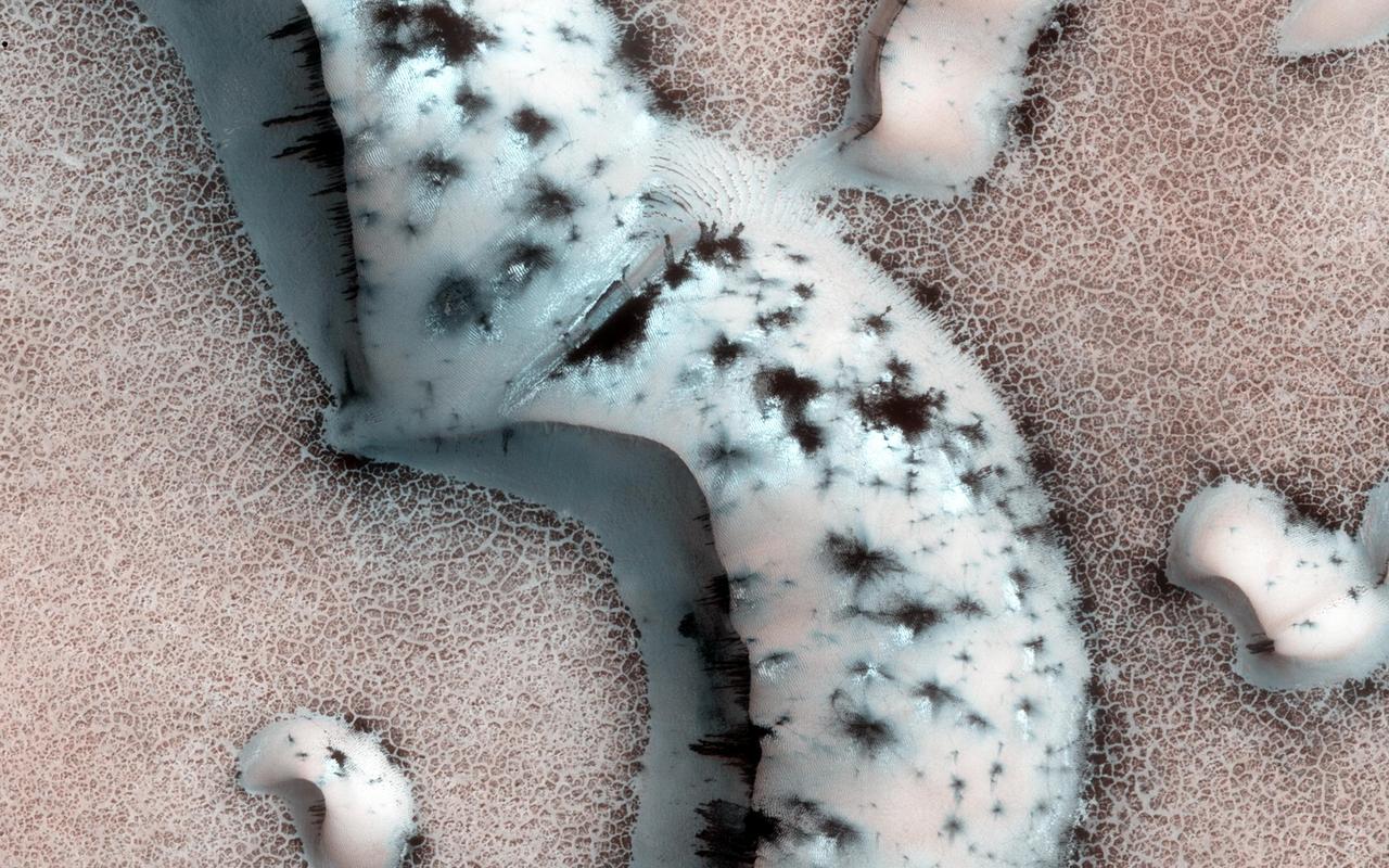
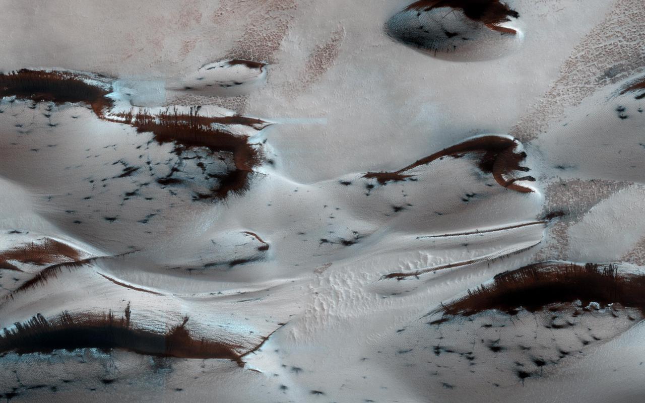
Sand Dunes with Frost
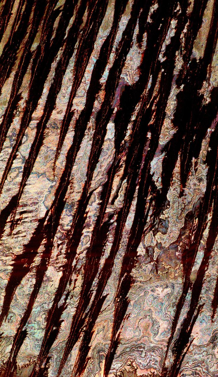
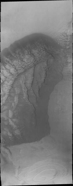
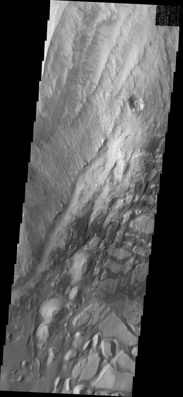
Layers, Landslides, and Sand Dunes
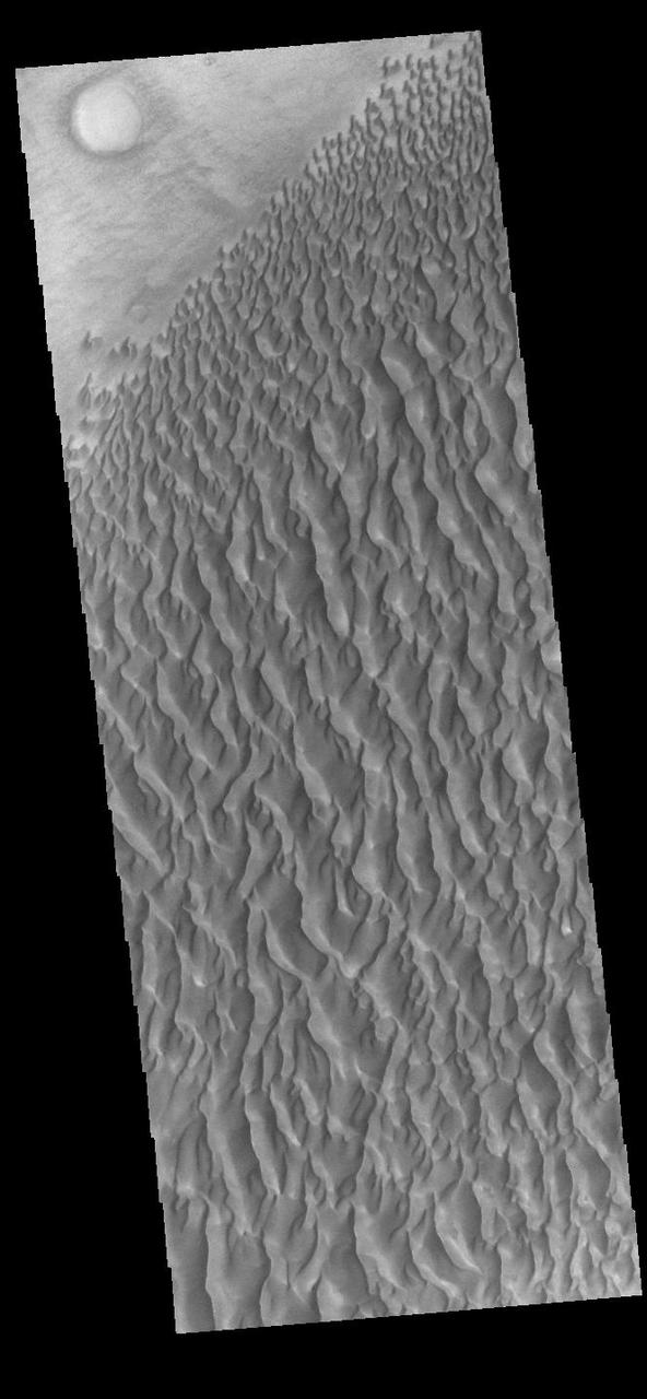
South Polar Sand Dunes
Defrosting Sand Dunes
Dark Sand Dunes
Sand Dunes in Noachis Terra
North Polar Sand Dunes
These sand dunes are located on the floor of Halley Crater
These sand dunes are located on the floor of Kaiser Crater
These sand dunes are located on the floor of Kaiser Crater.
Sand Dune Field in Richardson Crater
New Gullies on Martian Sand Dune
These sand dunes are located on the floor of an unnamed crater west of Hellas Basin
Today's VIS image shows a field of sand dunes in an unnamed crater located in Margaritifer Terra. Most sand dunes on Mars are made of dark basaltic sands. Orbit Number: 78228 Latitude: 6.60598 Longitude: 346.706 Instrument: VIS Captured: 2019-08-03 14:35 https://photojournal.jpl.nasa.gov/catalog/PIA23455
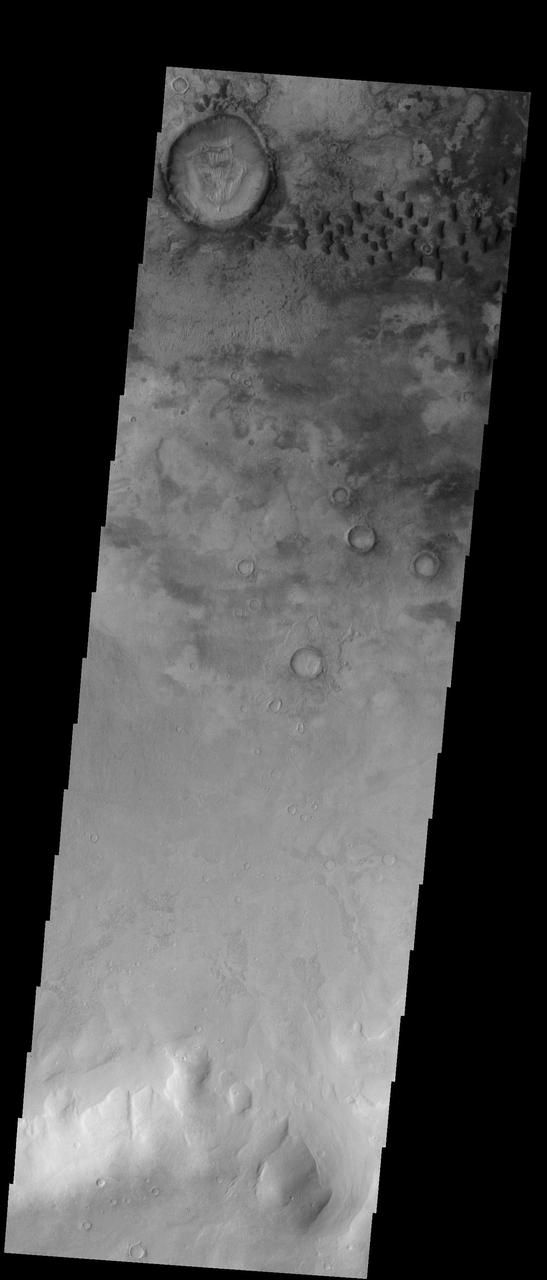
This image from NASA Mars Odyssey shows sand dunes covering the floor of this unnamed crater in Terra Cimmeria.
This image from NASA Mars Odyssey shows a sand sheet with dune forms on its surface.
This region of dark sand dunes is located on the floor of an unnamed crater south of Bosporos Planum
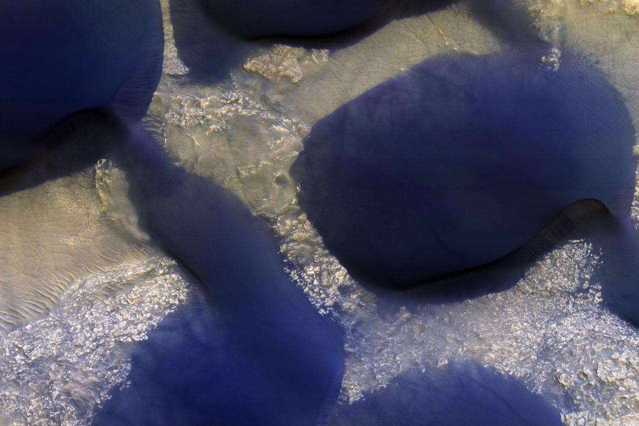
![NASA's Mars Reconnaissance Orbiter (MRO) captured this crater featuring sand dunes and sand sheets on its floor. What are sand sheets? Snow fall on Earth is a good example of sand sheets: when it snows, the ground gets blanketed with up to a few meters of snow. The snow mantles the ground and "mimics" the underlying topography. Sand sheets likewise mantle the ground as a relatively thin deposit. This kind of environment has been monitored by HiRISE since 2007 to look for movement in the ripples covering the dunes and sheets. This is how scientists who study wind-blown sand can track the amount of sand moving through the area and possibly where the sand came from. Using the present environment is crucial to understanding the past: sand dunes, sheets, and ripples sometimes become preserved as sandstone and contain clues as to how they were deposited The map is projected here at a scale of 25 centimeters (9.8 inches) per pixel. [The original image scale is 25 centimeters (9.8 inches) per pixel (with 1 x 1 binning); objects on the order of 75 centimeters (29.5 inches) across are resolved.] North is up. https://photojournal.jpl.nasa.gov/catalog/PIA21757](https://images-assets.nasa.gov/image/PIA21757/PIA21757~medium.jpg)
NASA's Mars Reconnaissance Orbiter (MRO) captured this crater featuring sand dunes and sand sheets on its floor. What are sand sheets? Snow fall on Earth is a good example of sand sheets: when it snows, the ground gets blanketed with up to a few meters of snow. The snow mantles the ground and "mimics" the underlying topography. Sand sheets likewise mantle the ground as a relatively thin deposit. This kind of environment has been monitored by HiRISE since 2007 to look for movement in the ripples covering the dunes and sheets. This is how scientists who study wind-blown sand can track the amount of sand moving through the area and possibly where the sand came from. Using the present environment is crucial to understanding the past: sand dunes, sheets, and ripples sometimes become preserved as sandstone and contain clues as to how they were deposited The map is projected here at a scale of 25 centimeters (9.8 inches) per pixel. [The original image scale is 25 centimeters (9.8 inches) per pixel (with 1 x 1 binning); objects on the order of 75 centimeters (29.5 inches) across are resolved.] North is up. https://photojournal.jpl.nasa.gov/catalog/PIA21757
Defrosting Sand Dunes in Late Southern Winter
Autumn Frost, North Polar Sand Dunes
Frosted North Polar Sand Dunes in Early Spring
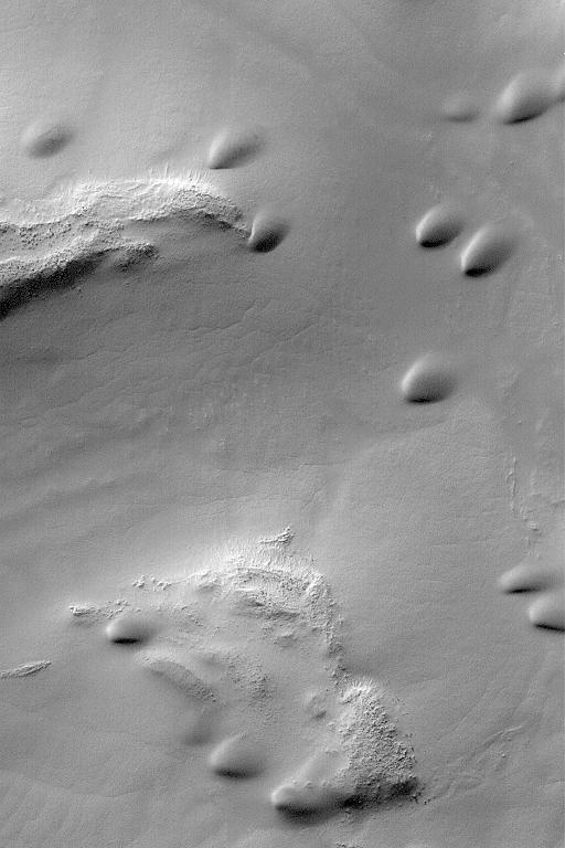
Recent Sand Avalanching on Rabe Crater Dunes
Spring Time View of North Polar Sand Dunes
Sand Dunes and Ripples in Proctor Crater, Mars
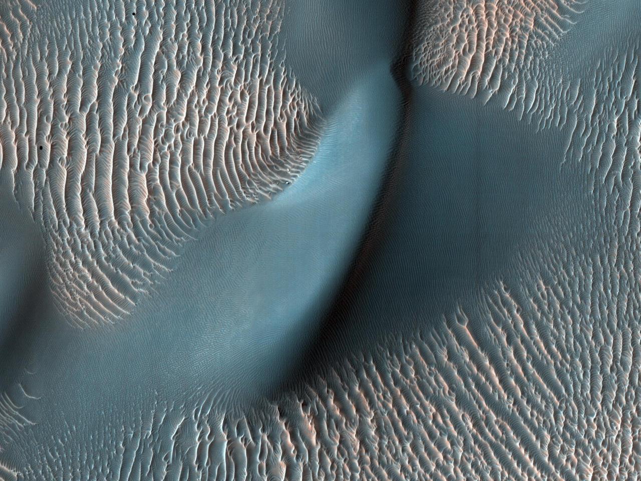
Sand Dunes of Nili Patera, Syrtis Major
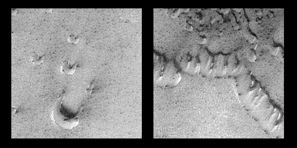
Evidence for Recent Wind Action on Martian Sand Dunes
This image from NASA Mars Odyssey spacecraft displays sand dunes covered in CO2 frost. This is a region of Mars that contains circumpolar sand seas.
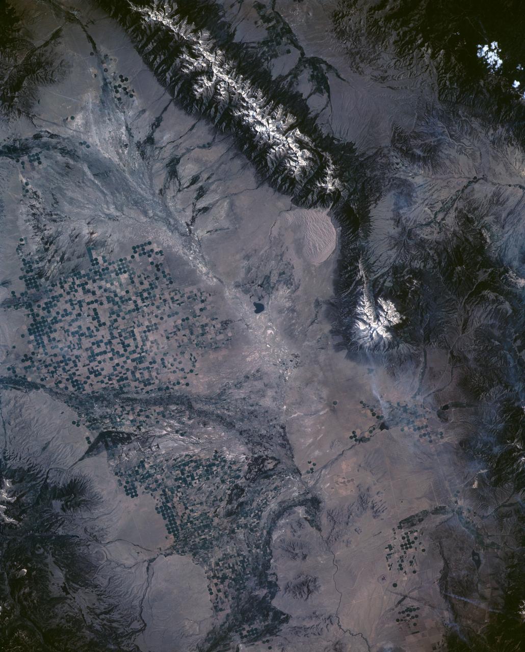
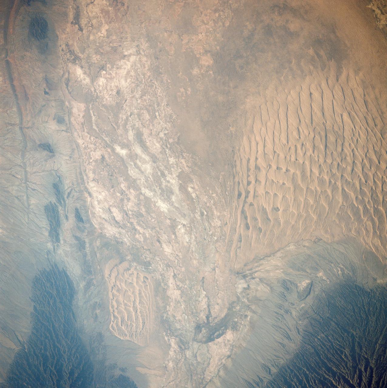
STS040-151-126 (5-14 June 1991) --- Croplands of the San Luis Valley stand out exceptionally clearly from low Earth orbit. The Rio Grande flows through the valley. Circular center pivot irrigation patterns have almost completely replaced the earlier rectangular grid pattern. Pinto beans are the specialty of the area. The Great Sand Dunes National Monument appears in fine detail near the center of the picture. The sands of these dunes have been blown from the valley floor by westerly winds in the course of the last few tens of thousands of years, now banked up against the foot of the Sangre de Christo Mountains (snowcapped peaks reach over 14000 feet). The town of Alamosa lies on the Rio Grande. The San Juan Mountains appear at the bottom left.
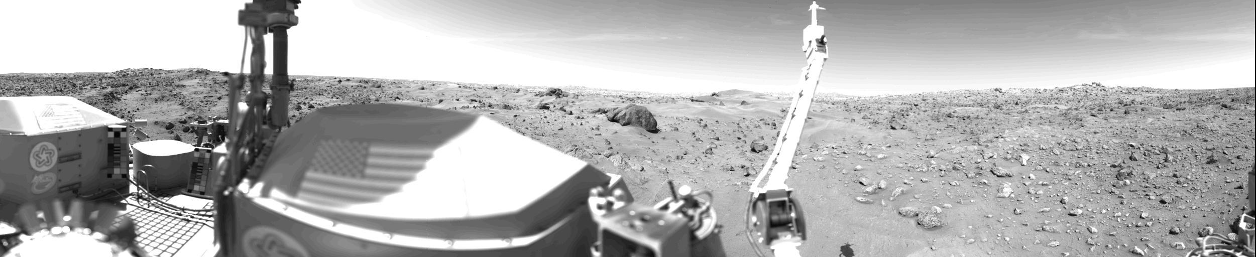
Sand Dunes And Large Rocks Revealed By Camera 1 http://photojournal.jpl.nasa.gov/catalog/PIA00391
A sand dune field is located on the floor of this unnamed crater in Terra Cimmeria by NASA 2001 Mars Odyssey spacecraft.
Mars permanent North Polar cap is ringed by sand dunes. In the winter and spring the dunes are covered by a seasonal cap of dry ice as seen by NASA by NASA Mars Reconnaissance Orbiter spacecraft.

This observation from NASA Mars Reconnaissance Orbiter shows sand dunes in late Northern spring on Mars, mixed with rock outcrops on the floor of a large crater.
NASA Terra spacecraft monitored the migration of sand dunes in the Bodele depression of northern Chad from at various times from one month to 6.5 years
This view of the undisturbed surface of a Martian sand dune called "High Dune" visited by NASA's Curiosity rover shows coarse grains remaining on the surface after wind removal of smaller particles. The image covers an area 1.4 inches by 1.1 inches (3.6 by 2.7 centimeters). It was taken by the Mars Hand Lens Imager (MAHLI) camera on the rover's arm on Dec. 5, 2015, during the 1,184th Martian day, or sol, of Curiosity's work on Mars. The imaged location is near the base of the dune. High Dune, in the Bagnold Dunes field skirting the northwestern flank of Mount Sharp, is the first sand dune studied in place anywhere except Earth. What distinguishes actual dunes from windblown ripples of sand or dust, like those found at several sites visited previously by Mars rovers, is that dunes form a downwind face steep enough for sand to slide down. http://photojournal.jpl.nasa.gov/catalog/PIA20171
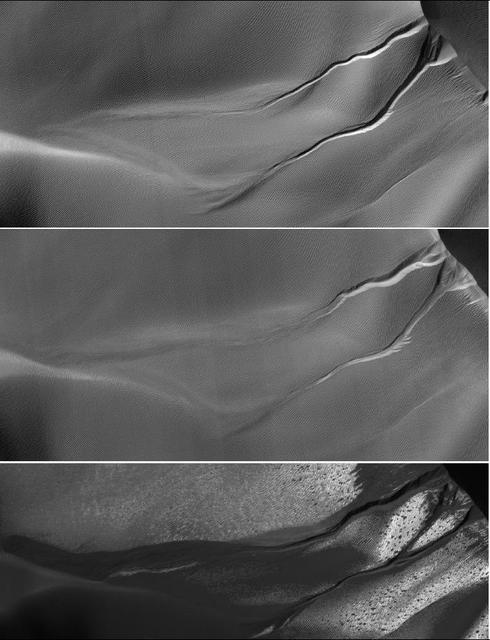
The gullies on a Martian sand dune in this trio of images from NASA Mars Reconnaissance Orbiter deceptively resemble features on Earth that are carved by streams of water. The dunes lie inside Matara Crater.
This image from NASA Mars Reconnaissance Orbiter is a view of the sand dune field in Richardson Crater covered with seasonal frost. The frost is a combination of frozen carbon dioxide and some water ice that covers the dunes in the winter and spring.
Erosion of North Polar Layers and Genesis of nearby Sand Dunes
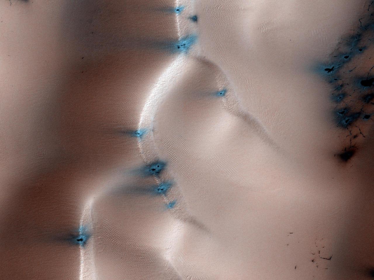
This image shows numerous dark shapes and bright spots on a sand dune in the Northern polar regions of Mars. This observation is from NASA Mars Reconnaissance Orbiter.
This animation flips back and forth between views taken in 2010 and 2014 of a Martian sand dune at the edge of Mount Sharp, documenting dune activity. The images are from the High Resolution Imaging Science Experiment (HiRISE) camera on NASA's Mars Reconnaissance Orbiter. They cover an area about 740 feet (about 225 meters) wide, showing a site called "Dune 2" in the "Bagnold Dunes" dune field. NASA's Curiosity Mars rover will observe this dune up close on the rover's route up Mount Sharp. North is toward the top. The edge of the dune at the crescent-shaped slip face on the south edge advances slightly during the four-year period between the dates of the images. Figure A is an annotated version with an arrow indicating the location of this change. The lighting angle is different in the two images, resulting in numerous changes in shadows. http://photojournal.jpl.nasa.gov/catalog/PIA20161
AST-27-2341 (20 July 1975) --- A near vertical view of sand dunes in the San Juan Province of Western Argentina, as photographed from the Apollo spacecraft in Earth orbit during the joint U.S.-USSR Apollo-Soyuz Test Project mission. The picture was taken at an altitude of 220 kilometers (136 statute miles) with a 70mm Hasselblad camera using medium-speed Ektachrome QX-807 type film.
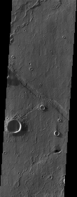
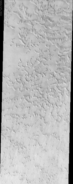
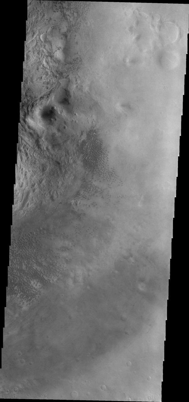
At first glance, this NASA Mars Odyssey image showing impact craters and linear ridges and troughs is typical of the southern highlands. However, upon closer examination migrating sand dunes are observed within the troughs.
This ASTER image covers an area of 10.5 x 15 km in southern Afghanistan and was acquired on August 20, 2000. The band 3-2-1 composite shows part of an extensive field of barchan sand dunes south of Kandahar. The shape of the dunes indicates that the prevailing wind direction is from the west. The image is located at 30.7 degrees north latitude and 65.7 degrees east longitude. http://photojournal.jpl.nasa.gov/catalog/PIA11099
A field of sand dunes occupies this frosty 5-kilometer diameter crater in the high-latitudes of the northern plains of Mars. Some dunes have separated from the main field and appear to be climbing up the crater slope along a gully-like form. The surface of the main dune field is characterized by a series of dark-toned polygonal patterns. These may be the result of seasonal frost processes. Several of the steeper dune slopes, pointing in the downwind direction, host narrow furrows suggesting the start of gully formation. The crater floor contains a variety of textures, including lobate and striped patterns that indicate seasonal thaw caused by sublimating ice. Broad downslope movement of materials on the crater slopes opposite the dune field superficially resemble gullies, except that they are generally not defined by distinctive alcoves, incised channels, or sediment aprons. These are the hallmarks of gullies elsewhere on the planet. https://photojournal.jpl.nasa.gov/catalog/PIA24420

The ultimate origin of the sediment that forms Martian dunes has long been debated. While sand dunes on Earth are primarily sourced by quartz-bearing components of granitic continental crust, it's often suggested that sand on Mars derives from eroded volcanic flows or sedimentary deposits, but exact sources are often vague. This image reveals a unique situation where this small dune field occurs along the summit of the large 1-mile-tall mound near the center of Juventae Chasma. The layered mound slopes are far too steep for dunes to climb, and bedform sand is unlikely to come from purely airborne material. Instead, the mound's summit displays several dark-toned, mantled deposits that are adjacent to the dunes and appear to be eroding into fans of sandy material. Along with local HiRISE images, spectral data from other instruments on MRO have confirmed such units are likely to be the sand source for these mound summit dunes and reveal how landscape evolution on Mars might occur. More information is available at https://photojournal.jpl.nasa.gov/catalog/PIA22785
This image, one of two from a two-image animation from NASA Mars Reconnaissance Orbiter, shows movement of ripples covering a sand dune on Mars.
The rippled surface of the first Martian sand dune ever studied up close fills this view of "High Dune" from the Mast Camera (Mastcam) on NASA's Curiosity rover. This site is part of the "Bagnold Dunes" field along the northwestern flank of Mount Sharp. The dunes are active, migrating up to about one yard or meter per year. The component images of this mosaic view were taken on Nov. 27, 2015, during the 1,176th Martian day, or sol, of Curiosity's work on Mars. The scene is presented with a color adjustment that approximates white balancing, to resemble how the sand would appear under daytime lighting conditions on Earth. The annotated version includes superimposed scale bars of 30 centimeters (1 foot) in the foreground and 100 centimeters (3.3 feet) in the middle distance. Malin Space Science Systems, San Diego, built and operates Curiosity's Mastcam. NASA's Jet Propulsion Laboratory, a division of the California Institute of Technology, Pasadena, built the rover and manages the project for NASA's Science Mission Directorate, Washington. http://photojournal.jpl.nasa.gov/catalog/PIA20169
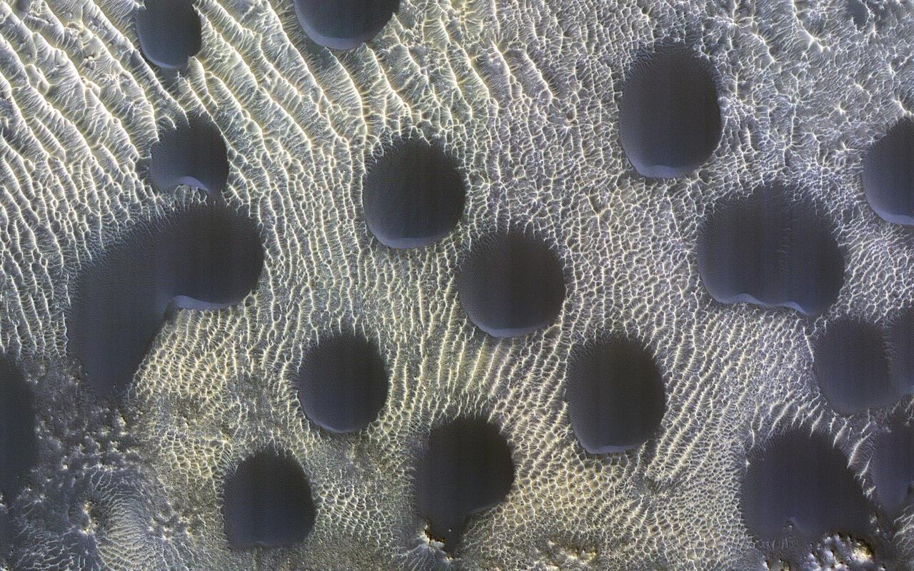
Sand dunes of many shapes and sizes are common on Mars. In this example, the dunes are almost perfectly circular, which is unusual. They are still slightly asymmetrical, with steep slip faces on the south ends. This indicates that sand generally moves to the south, but the winds may be variable. This is part of a series of images to monitor how frost disappears in the late winter; this observation appears to be free of frost. A previous image shows when the surface was covered by frost. https://photojournal.jpl.nasa.gov/catalog/PIA25795
NASA Mars Reconnaissance Orbiter shows Mars northern-most sand dunes beginning to emerge from their winter cover of seasonal carbon dioxide dry ice. Dark, bare south-facing slopes are soaking up the warmth of the sun.
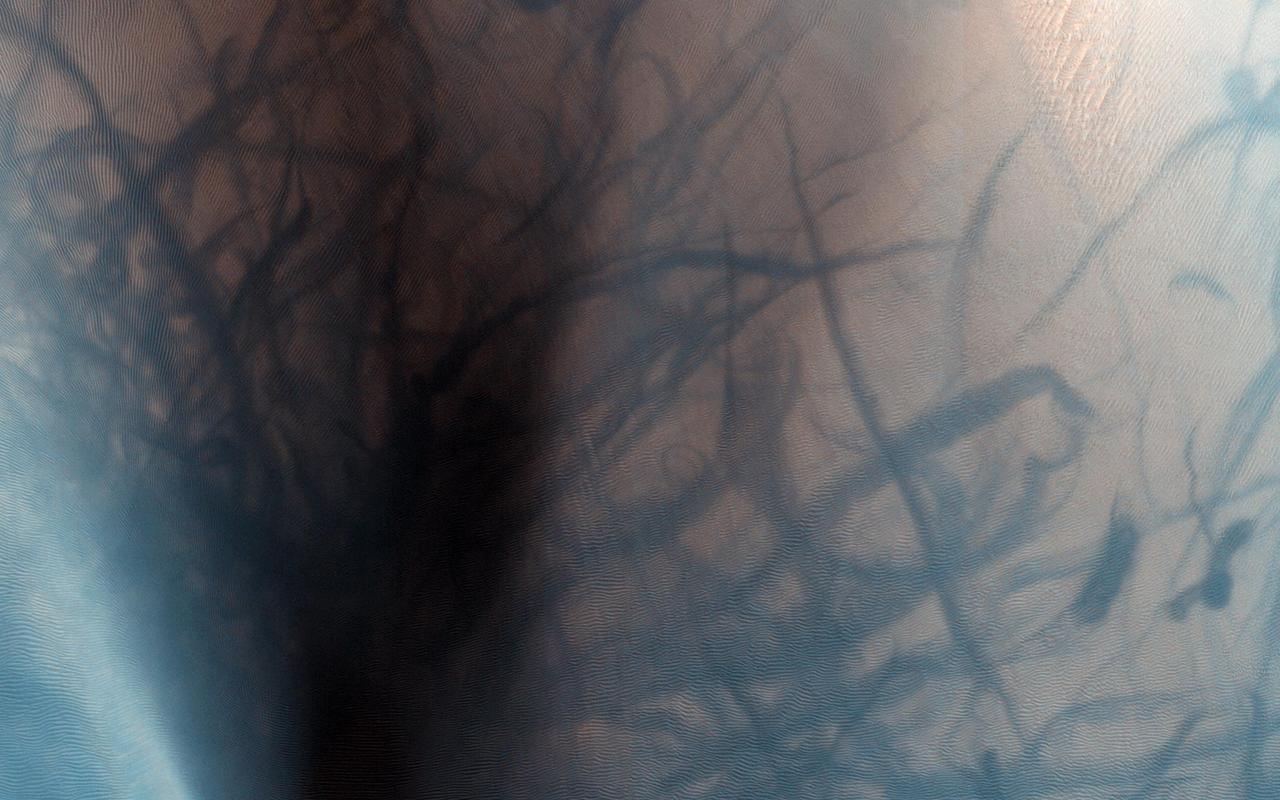
This observation from NASA Mars Reconnaissance Orbiter shows a sand dune field in the Nili Fossae region of Mars. The dark lines swirling over the surface of the dunes are the tracks of dust devils.
This three-frequency space radar image of west central Egypt shows detailed patterns of eroded sedimentary rock formations emerging through a vast sea of sand dunes.
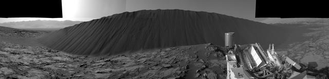
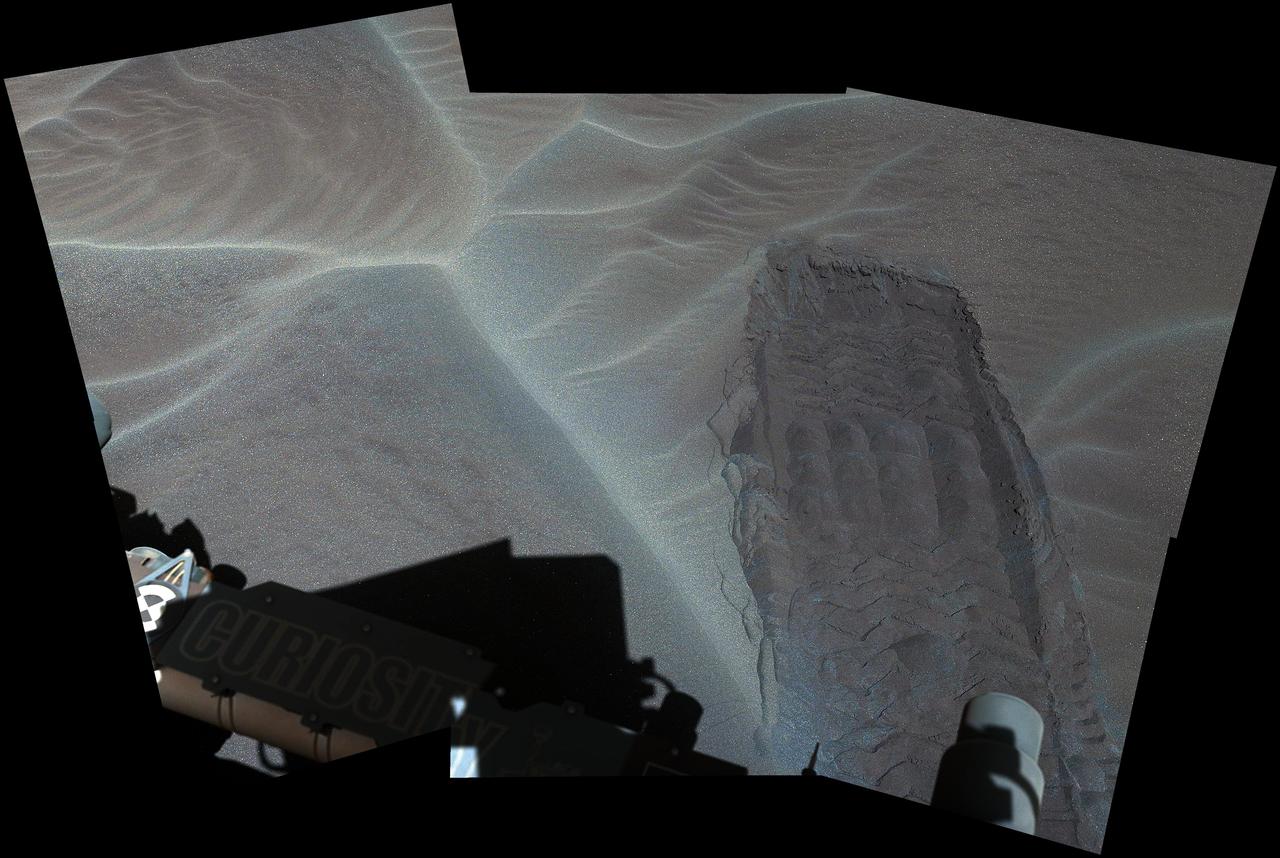
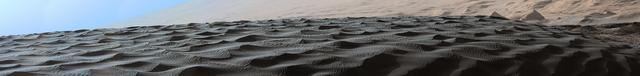
This view from NASA's Curiosity Mars Rover shows the downwind side of "Namib Dune," which stands about 13 feet (4 meters) high. The site is part of Bagnold Dunes, a band of dark sand dunes along the northwestern flank of Mars' Mount Sharp. The component images stitched together into this scene were taken with Curiosity's Navigation Camera (Navcam) on Dec. 17, 2015, during the 1,196th Martian day, or sol, of the rover's work on Mars. In late 2015 and early 2016, Curiosity is conducting the first up-close studies ever made of active sand dunes anywhere but on Earth. Under the influence of Martian wind, the Bagnold Dunes are migrating up to about one yard or meter per Earth year. The view spans from westward on the left to east-southeastward on the right. It is presented as a cylindrical perspective projection. http://photojournal.jpl.nasa.gov/catalog/PIA20281
STS054-152-189 (13-19 Jan. 1993) --- This near-vertical color photograph shows the very diverse landscape that is part of the great Sahara Desert of north Africa. Specifically, the vast expanse of sand dunes, located in the extreme southwestern corner of Libya, is known as the Murzuk Sand Sea. Close inspection of this photograph shows the agricultural village of Murzuk as evidenced by the numerous center pivot irrigation patterns at the edge of the Murzuk Sand Sea. The very rugged, dissected terrain to the west of this sand sea is the eastern tip of the Tassili N'ajjer Mountains and the Tadrart Plateau that are in neighboring Algeria. Several smaller areas of sand dunes are interspersed between the major areas of rock outcrops. The photograph was taken with a Linhof camera.
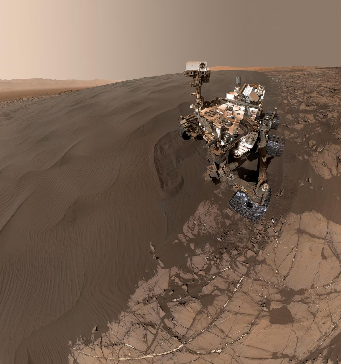
This self-portrait of NASA's Curiosity Mars rover shows the vehicle at "Namib Dune," where the rover's activities included scuffing into the dune with a wheel and scooping samples of sand for laboratory analysis. The scene combines 57 images taken on Jan. 19, 2016, during the 1,228th Martian day, or sol, of Curiosity's work on Mars. The camera used for this is the Mars Hand Lens Imager (MAHLI) at the end of the rover's robotic arm. Namib Dune is part of the dark-sand "Bagnold Dune Field" along the northwestern flank of Mount Sharp. Images taken from orbit have shown that dunes in the Bagnold field move as much as about 3 feet (1 meter) per Earth year. The location of Namib Dune is show on a map of Curiosity's route at http://mars.nasa.gov/msl/multimedia/images/?ImageID=7640. The relationship of Bagnold Dune Field to the lower portion of Mount Sharp is shown in a map at PIA16064. The view does not include the rover's arm. Wrist motions and turret rotations on the arm allowed MAHLI to acquire the mosaic's component images. The arm was positioned out of the shot in the images, or portions of images, that were used in this mosaic. This process was used previously in acquiring and assembling Curiosity self-portraits taken at sample-collection sites, including "Rocknest" (PIA16468), "Windjana" (PIA18390) and "Buckskin" (PIA19807). For scale, the rover's wheels are 20 inches (50 centimeters) in diameter and about 16 inches (40 centimeters) wide. Other Curiosity self-portraits are available at http://photojournal.jpl.nasa.gov/catalog/PIA20316

The THEMIS VIS camera contains 5 filters. Data from the filters can be used in many ways to create a false color image. These false color images may reveal subtle variations of the surface not easily identified in a single band image. This image from NASA 2001 Mars Odyssey spacecraft shows small dunes and sand located in and around an unnamed crater in Arabia Terra. Orbit Number: 17037 Latitude: 14.1416 Longitude: 1.43441 Instrument: VIS Captured: 2005-10-17 04:38 http://photojournal.jpl.nasa.gov/catalog/PIA20107
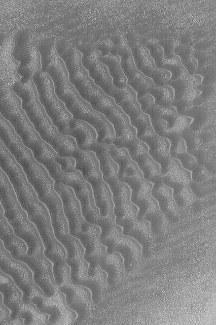
Two sizes of wind-sculpted ripples are evident in this view of the top surface of a Martian sand dune. Sand dunes and the smaller type of ripples also exist on Earth. The larger ripples -- roughly 10 feet (3 meters) apart -- are a type not seen on Earth nor previously recognized as a distinct type on Mars. The Mast Camera (Mastcam) on NASA's Curiosity Mars rover took the multiple component images of this scene on Dec. 13, 2015, during the 1,192nd Martian day, or sol, of the rover's work on Mars. That month, Curiosity was conducting the first close-up investigation ever made of active sand dunes anywhere other than Earth. The larger ripples have distinctive sinuous crest lines, compared to the smaller ripples. The location is part of "Namib Dune" in the Bagnold Dune Field, which forms a dark band along the northwestern flank of Mount Sharp. The component images were taken in early morning at this site, with the camera looking in the direction of the sun. This mosaic combining the images has been processed to brighten it and make the ripples more visible. The sand is very dark, both from the morning shadows and from the intrinsic darkness of the minerals that dominate its composition. http://photojournal.jpl.nasa.gov/catalog/PIA20755
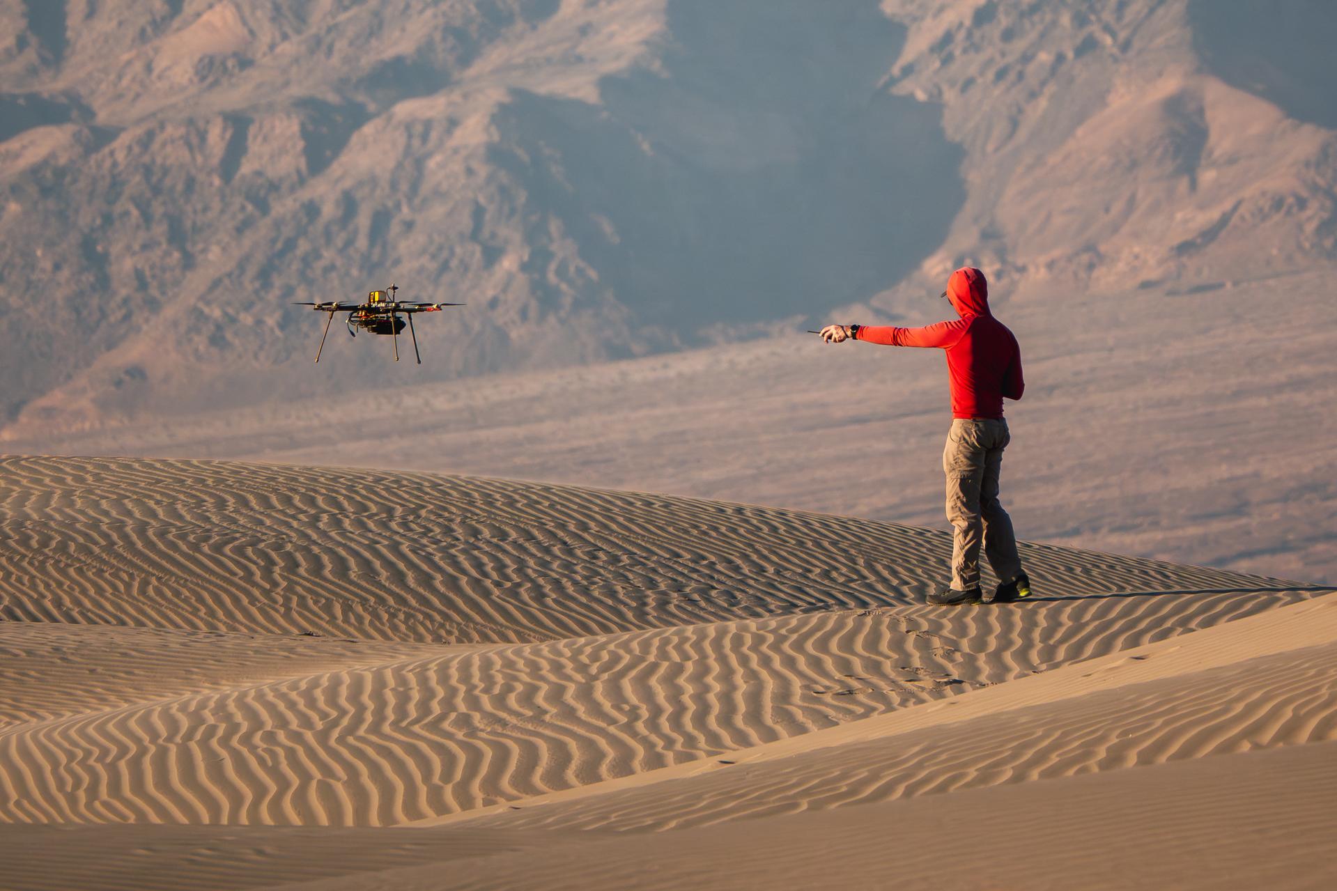
A researcher from NASA’s Jet Propulsion Laboratory in Southern California monitors a drone as it flies over sand dunes in September 2025. This image was captured in Death Valley National Park during a larger test campaign to develop navigation software that would guide future rotorcraft on Mars. The work was among 25 projects funded by NASA’s Mars Exploration Program this past year to push the limits of future technologies. Sand dunes confused the navigation algorithm of the Ingenuity Mars helicopter during several of its last flights, including its 72nd and final flight on the Red Planet in January 2024. The navigation software in development would help future rotorcraft track the surface of especially bland, featureless terrain similar to the barren sand dunes seen in parts of Death Valley. Tests also included flights over a region of the park called Mars Hill, which is littered with rubbly volcanic rocks and has been used by NASA’s Mars researchers since the 1970s, during preparations for the Viking lander missions.
This stereo view from NASA's Curiosity Mars Rover shows the downwind side of "Namib Dune," which stands about 13 feet (4 meters) high. The image appears three-dimensional when viewed through red-blue glasses with the red lens on the left. The site is part of Bagnold Dunes, a band of dark sand dunes along the northwestern flank of Mars' Mount Sharp. The component images stitched together into this scene were taken with Curiosity's Navigation Camera (Navcam) on Dec. 17, 2015, during the 1,196th Martian day, or sol, of the rover's work on Mars. In late 2015 and early 2016, Curiosity is conducting the first up-close studies ever made of active sand dunes anywhere but on Earth. Under the influence of Martian wind, the Bagnold Dunes are migrating up to about one yard or meter per Earth year. http://photojournal.jpl.nasa.gov/catalog/PIA20282
These sand dunes are part of the sand sea that surrounds the south polar cap
Sand dunes cover the floor of this channel in Terra Sabaea
The sand dunes in this image are located on the floor of Herschel Crater.
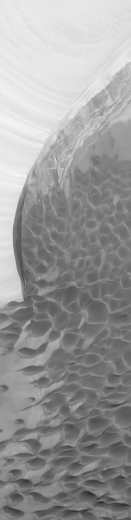
This field of sand dunes occurs within Chasma Borealis
This VIS image shows a sand sheet with surface dune forms as well as smaller sand dunes within an unnamed crater in Noachis Terra. These dunes are composed of basaltic sand that has collected in the bottom of the crater. The topographic depression of the crater forms a sand trap that prevents the sand from escaping. Dune fields are common in the bottoms of craters on Mars and appear as dark splotches that often lean up against the downwind walls of the craters. Dunes are useful for studying both the geology and meteorology of Mars. The sand forms by erosion of larger rocks, but it is unclear when and where this erosion took place on Mars or how such large volumes of sand could be formed. The dunes also indicate the local wind directions by their morphology. Orbit Number: 91766 Latitude: -52.1525 Longitude: 33.3362 Instrument: VIS Captured: 2022-08-22 07:22 https://photojournal.jpl.nasa.gov/catalog/PIA25641
Located in the center of this VIS image is a group of sand dunes. With enough wind and sand, sand dunes are formed. Dune morphology typically has a shallow slope on the side the wind is blowing from and a steep face on the other side. The darker part of the dunes in this image are the steep slopes. Wind blows sand particles up the shallow slope and then the particles 'fall' off the crest of the dune down the steep side. With time, the constant wind will move the crest of the dune forward. Depending on the amount of available sand, dunes can grow to large heights and sizes. In the case of this image, the dunes are moving toward the top of the image, which means up the surface slope. In cases like this, the dunes 'climb' up hills. Orbit Number: 74955 Latitude: -50.2322 Longitude: 292.058 Instrument: VIS Captured: 2018-11-07 00:56 https://photojournal.jpl.nasa.gov/catalog/PIA22975
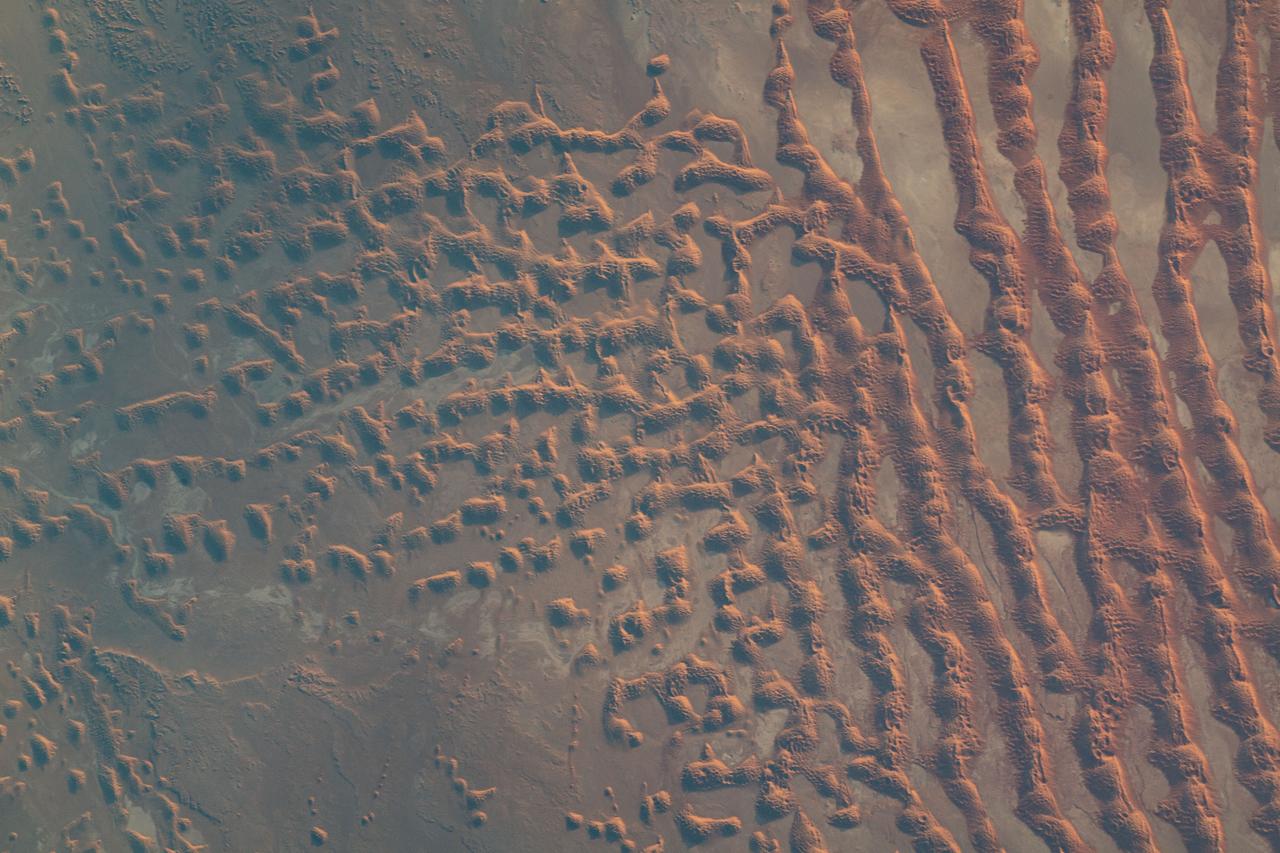
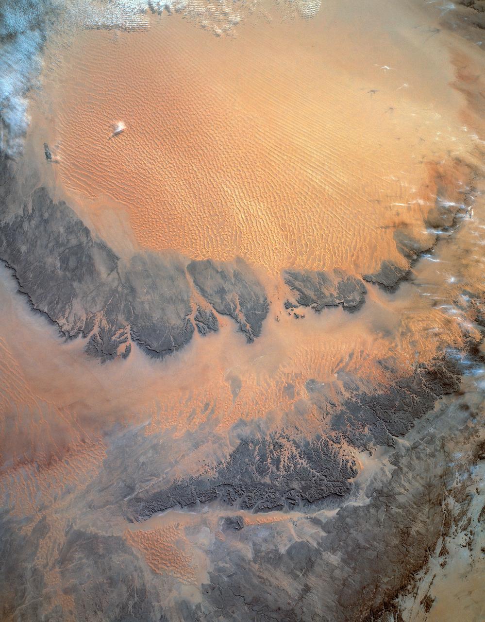
iss069e010867 (May 16, 2023) --- Sand dunes in the desert area along the Saudi Arabia-Oman border were pictured by UAE (United Arab Emirates) astronaut and Expedition 69 Flight Engineer Sultan Alneyadi from the International Space Station as it orbited 256 miles above.
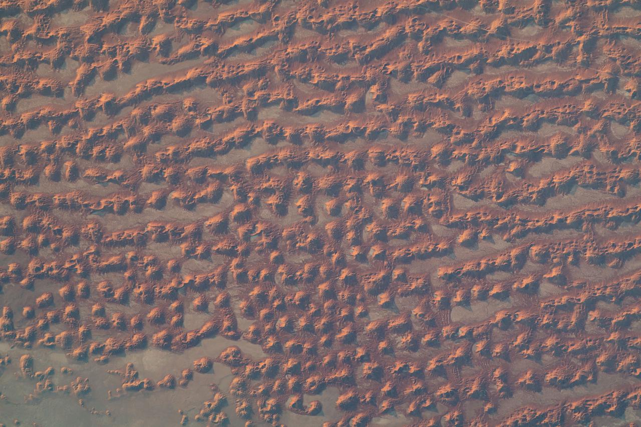
iss069e010869 (May 16, 2023) --- Sand dunes in the desert area along the Saudi Arabia-Oman border were pictured by UAE (United Arab Emirates) astronaut and Expedition 69 Flight Engineer Sultan Alneyadi from the International Space Station as it orbited 256 miles above.
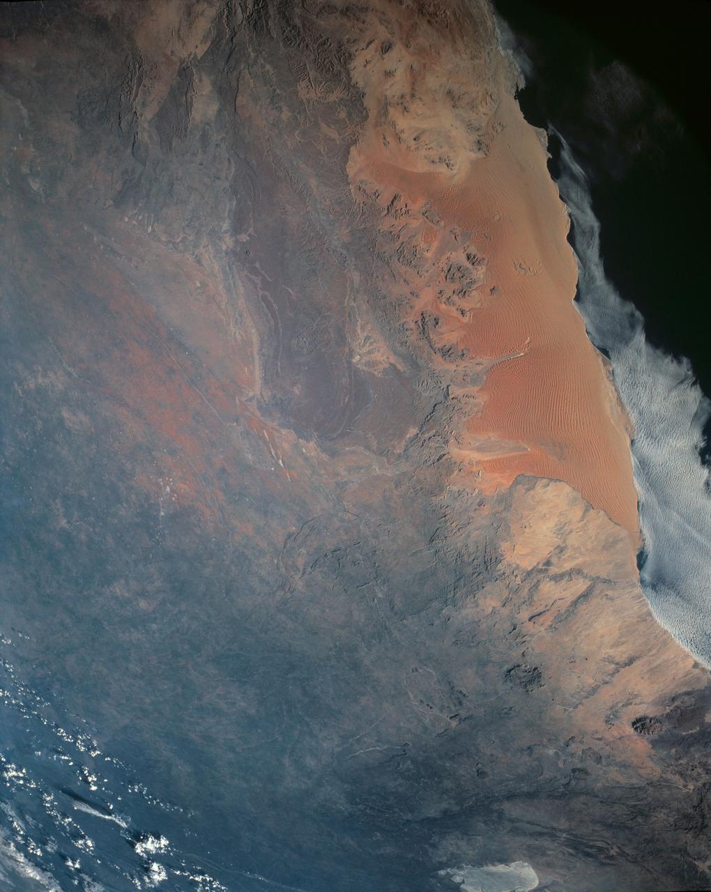
One of the driest regions on Earth, the Namib Desert, Namibia, Africa (23.0N, 15.0E) lies adjacent to the Atlantic coast but the upwelling oceanic water causes a very stable rainless atmosphere. The few local inland rivers do not reach the sea but instead, appear as long indentations where they penetrate the dune fields and end as small dry lakes. The vast dune fields are the result of sands deposited over millions of years by the stream flow.
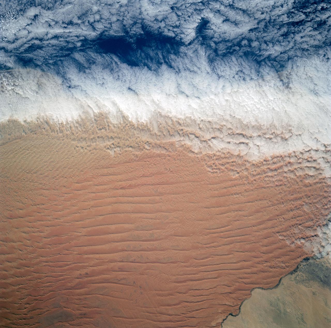
Fog is the only source of moisture for desert dwelling animals and plants living in the Namib Desert sand dune field, Namibia (23.5N, 15.0E). Coastal stratus clouds provide most of the life supporting moisture as fog droplets in this arid land where the usual annual rainfall is less than a quarter of an inch for decades at a time. In this view, the stratus clouds over the coast conform to the dune pattern proving that the fog is in ground contact.
This 2001 Mars Odyssey image of Jeans Crater shows a sand sheet with dune forms and a layered region to the south of the sand sheet.
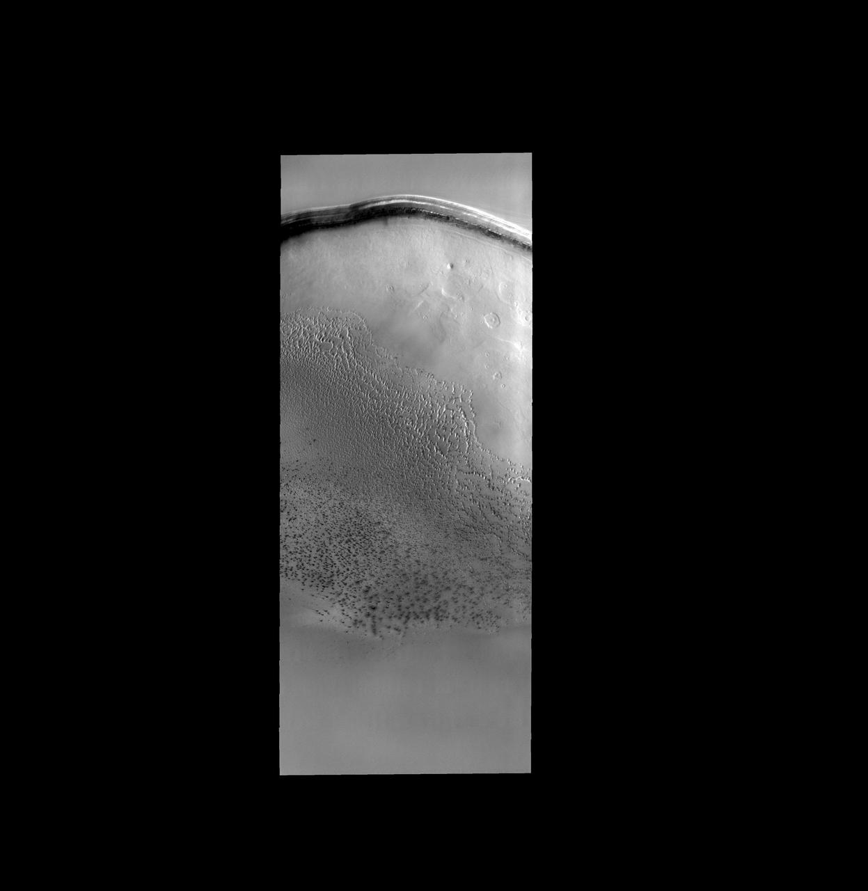
The dark sand dunes in this image are only a very small portion of the sand sea that surrounds the north polar cap of Mars
This VIS image shows a large sand sheet with surface dune forms as well as smaller sand dunes within an unnamed crater in Noachis Terra. These dunes are composed of basaltic sand that has collected in the bottom of the crater. The topographic depression of the crater forms a sand trap that prevents the sand from escaping. Dune fields are common in the bottoms of craters on Mars and appear as dark splotches that often lean up against the downwind walls of the craters. Dunes are useful for studying both the geology and meteorology of Mars. The sand forms by erosion of larger rocks, but it is unclear when and where this erosion took place on Mars or how such large volumes of sand could be formed. The dunes also indicate the local wind directions by their morphology. Orbit Number: 91585 Latitude: -48.766 Longitude: 34.0294 Instrument: VIS Captured: 2022-08-07 09:15 https://photojournal.jpl.nasa.gov/catalog/PIA25576
This VIS image shows a large sand sheet with surface dune forms as well as smaller sand dunes within an unnamed crater in Noachis Terra. These dunes are composed of basaltic sand that has collected in the bottom of the crater. The topographic depression of the crater forms a sand trap that prevents the sand from escaping. Dune fields are common in the bottoms of craters on Mars and appear as dark splotches that often lean up against the downwind walls of the craters. Dunes are useful for studying both the geology and meteorology of Mars. The sand forms by erosion of larger rocks, but it is unclear when and where this erosion took place on Mars or how such large volumes of sand could be formed. The dunes also indicate the local wind directions by their morphology. Orbit Number: 92028 Latitude: -48.9171 Longitude: 34.0952 Instrument: VIS Captured: 2022-09-12 21:08 https://photojournal.jpl.nasa.gov/catalog/PIA25742
This VIS image shows a large sand sheet with surface dune forms as well as smaller sand dunes within an unnamed crater in Noachis Terra. These dunes are composed of basaltic sand that has collected in the bottom of the crater. The topographic depression of the crater forms a sand trap that prevents the sand from escaping. Dune fields are common in the bottoms of craters on Mars and appear as dark splotches that often lean up against the downwind walls of the craters. Dunes are useful for studying both the geology and meteorology of Mars. The sand forms by erosion of larger rocks, but it is unclear when and where this erosion took place on Mars or how such large volumes of sand could be formed. The dunes also indicate the local wind directions by their morphology. Orbit Number: 91741 Latitude: -49.2207 Longitude: 33.9713 Instrument: VIS Captured: 2022-08-20 05:58 https://photojournal.jpl.nasa.gov/catalog/PIA25632
This image displays sand dunes within Proctor Crater. These dunes are composed of basaltic sand that has collected in the bottom of the crater. The topographic depression of the crater forms a sand trap that prevents the sand from escaping. Dune fields are common in the bottoms of craters on Mars and appear as dark splotches that lean up against the downwind walls of the craters. Dunes are useful for studying both the geology and meteorology of Mars. The sand forms by erosion of larger rocks, but it is unclear when and where this erosion took place on Mars or how such large volumes of sand could be formed. The dunes also indicate the local wind directions by their morphology. In this case, there are few clear slipfaces that would indicate the downwind direction. The crests of the dunes also typically run north-south in the image. This dune form indicates that there are probably two prevailing wind directions that run east and west (left to right and right to left). Orbit Number: 83605 Latitude: -47.5325 Longitude: 30.3915 Instrument: VIS Captured: 2020-10-19 08:09 https://photojournal.jpl.nasa.gov/catalog/PIA24276
This VIS image displays sand dunes within Proctor Crater. These dunes are composed of basaltic sand that has collected in the bottom of the crater. The topographic depression of the crater forms a sand trap that prevents the sand from escaping. Dune fields are common in the bottoms of craters on Mars and appear as dark splotches that often lean up against the downwind walls of the craters. Dunes are useful for studying both the geology and meteorology of Mars. The sand forms by erosion of larger rocks, but it is unclear when and where this erosion took place on Mars or how such large volumes of sand could be formed. The dunes also indicate the local wind directions by their morphology. In this case, there are few clear slipfaces that would indicate the downwind direction. The crests of the dunes also typically run north-south in the image. This dune form indicates that there are probably two prevailing wind directions that run east and west (left to right and right to left). Proctor Crater is located in Noachis Terra and is 168 km (104 miles) in diameter. Orbit Number: 92103 Latitude: -47.6832 Longitude: 30.1021 Instrument: VIS Captured: 2022-09-19 01:21 https://photojournal.jpl.nasa.gov/catalog/PIA25746
This image displays sand dunes within Proctor Crater. These dunes are composed of basaltic sand that has collected in the bottom of the crater. The topographic depression of the crater forms a sand trap that prevents the sand from escaping. Dune fields are common in the bottoms of craters on Mars and appear as dark splotches that lean up against the downwind walls of the craters. Dunes are useful for studying both the geology and meteorology of Mars. The sand forms by erosion of larger rocks, but it is unclear when and where this erosion took place on Mars or how such large volumes of sand could be formed. The dunes also indicate the local wind directions by their morphology. In this case, there are few clear slipfaces that would indicate the downwind direction. The crests of the dunes also typically run north-south in the image. This dune form indicates that there are probably two prevailing wind directions that run east and west (left to right and right to left). Orbit Number: 82145 Latitude: -47.5218 Longitude: 30.1064 Instrument: VIS Captured: 2020-06-21 03:00 https://photojournal.jpl.nasa.gov/catalog/PIA24142
This image displays sand dunes within Proctor Crater. These dunes are composed of basaltic sand that has collected in the bottom of the crater. The topographic depression of the crater forms a sand trap that prevents the sand from escaping. Dune fields are common in the bottoms of craters on Mars and appear as dark splotches that lean up against the downwind walls of the craters. Dunes are useful for studying both the geology and meteorology of Mars. The sand forms by erosion of larger rocks, but it is unclear when and where this erosion took place on Mars or how such large volumes of sand could be formed. The dunes also indicate the local wind directions by their morphology. In this case, there are few clear slipfaces that would indicate the downwind direction. The crests of the dunes also typically run north-south in the image. This dune form indicates that there are probably two prevailing wind directions that run east and west (left to right and right to left). Proctor Crater is located in Noachis Terra and is 168 km (104 miles) in diameter. Orbit Number: 82719 Latitude: -47.5005 Longitude: 30.5331 Instrument: VIS Captured: 2020-08-07 09:19 https://photojournal.jpl.nasa.gov/catalog/PIA24152
This image from NASA Mars Odyssey spacecraft, located near 30E and 47.5S, displays sand dunes within Proctor Crater. These dunes are composed of basaltic sand that has collected in the bottom of the crater. The topographic depression of the crater forms a sand trap that prevents the sand from escaping. Dune fields are common in the bottoms of craters on Mars and appear as dark splotches that lean up against the downwind walls of the craters. Dunes are useful for studying both the geology and meteorology of Mars. The sand forms by erosion of larger rocks, but it is unclear when and where this erosion took place on Mars or how such large volumes of sand could be formed. The dunes also indicate the local wind directions by their morphology. In this case, there are few clear slipfaces that would indicate the downwind direction. The crests of the dunes also typically run north-south in the image. This dune form indicates that there are probably two prevailing wind directions that run east and west (left to right and right to left). http://photojournal.jpl.nasa.gov/catalog/PIA04011
This VIS image displays sand dunes within Proctor Crater. These dunes are composed of basaltic sand that has collected in the bottom of the crater. The topographic depression of the crater forms a sand trap that prevents the sand from escaping. Dune fields are common in the bottoms of craters on Mars and appear as dark splotches that often lean up against the downwind walls of the craters. Dunes are useful for studying both the geology and meteorology of Mars. The sand forms by erosion of larger rocks, but it is unclear when and where this erosion took place on Mars or how such large volumes of sand could be formed. The dunes also indicate the local wind directions by their morphology. In this case, there are few clear slipfaces that would indicate the downwind direction. The crests of the dunes also typically run north-south in the image. This dune form indicates that there are probably two prevailing wind directions that run east and west (left to right and right to left). Proctor Crater is located in Noachis Terra and is 168 km (104 miles) in diameter. Orbit Number: 90069 Latitude: -47.5035 Longitude: 30.2656 Instrument: VIS Captured: 2022-04-04 13:50 https://photojournal.jpl.nasa.gov/catalog/PIA25469
This VIS image displays sand dunes within Proctor Crater. These dunes are composed of basaltic sand that has collected in the bottom of the crater. The topographic depression of the crater forms a sand trap that prevents the sand from escaping. Dune fields are common in the bottoms of craters on Mars and appear as dark splotches that often lean up against the downwind walls of the craters. Dunes are useful for studying both the geology and meteorology of Mars. The sand forms by erosion of larger rocks, but it is unclear when and where this erosion took place on Mars or how such large volumes of sand could be formed. The dunes also indicate the local wind directions by their morphology. In this case, there are few clear slipfaces that would indicate the downwind direction. The crests of the dunes also typically run north-south in the image. This dune form indicates that there are probably two prevailing wind directions that run east and west (left to right and right to left). Proctor Crater is located in Noachis Terra and is 168 km (104 miles) in diameter. Orbit Number: 91816 Latitude: -47.7614 Longitude: 29.9278 Instrument: VIS Captured: 2022-08-26 10:12 https://photojournal.jpl.nasa.gov/catalog/PIA25646
This VIS image displays sand dunes within Proctor Crater. These dunes are composed of basaltic sand that has collected in the bottom of the crater. The topographic depression of the crater forms a sand trap that prevents the sand from escaping. Dune fields are common in the bottoms of craters on Mars and appear as dark splotches that often lean up against the downwind walls of the craters. Dunes are useful for studying both the geology and meteorology of Mars. The sand forms by erosion of larger rocks, but it is unclear when and where this erosion took place on Mars or how such large volumes of sand could be formed. The dunes also indicate the local wind directions by their morphology. In this case, there are few clear slipfaces that would indicate the downwind direction. The crests of the dunes also typically run north-south in the image. This dune form indicates that there are probably two prevailing wind directions that run east and west (left to right and right to left). Proctor Crater is located in Noachis Terra and is 168 km (104 miles) in diameter. Orbit Number: 91660 Latitude: -47.4832 Longitude: 30.5852 Instrument: VIS Captured: 2022-08-13 13:28 https://photojournal.jpl.nasa.gov/catalog/PIA25616
This VIS image displays sand dunes within Proctor Crater. These dunes are composed of basaltic sand that has collected in the bottom of the crater. The topographic depression of the crater forms a sand trap that prevents the sand from escaping. Dune fields are common in the bottoms of craters on Mars and appear as dark splotches that lean up against the downwind walls of the craters. Dunes are useful for studying both the geology and meteorology of Mars. The sand forms by erosion of larger rocks, but it is unclear when and where this erosion took place on Mars or how such large volumes of sand could be formed. The dunes also indicate the local wind directions by their morphology. In this case, there are few clear slipfaces that would indicate the downwind direction. The crests of the dunes also typically run north-south in the image. This dune form indicates that there are probably two prevailing wind directions that run east and west (left to right and right to left). Proctor Crater is located in Noachis Terra and is 168 km (104 miles) in diameter. Orbit Number: 90356 Latitude: -47.4835 Longitude: 30.3891 Instrument: VIS Captured: 2022-04-28 05:00 https://photojournal.jpl.nasa.gov/catalog/PIA25475
This VIS image shows sand dunes within Proctor Crater. These dunes are composed of basaltic sand that has collected in the bottom of the crater. The topographic depression of the crater forms a sand trap that prevents the sand from escaping. Dune fields are common in the bottoms of craters on Mars and appear as dark splotches that often lean up against the downwind walls of the craters. Dunes are useful for studying both the geology and meteorology of Mars. The sand forms by erosion of larger rocks, but it is unclear when and where this erosion took place on Mars or how such large volumes of sand could be formed. The dunes also indicate the local wind directions by their morphology. In this case, there are few clear slipfaces that would indicate the downwind direction. The crests of the dunes also typically run north-south in the image. This dune form indicates that there are probably two prevailing wind directions that run east and west (left to right and right to left). Proctor Crater is located in Noachis Terra and is 168 km (104 miles) in diameter. Orbit Number: 91373 Latitude: -47.4558 Longitude: 30.4026 Instrument: VIS Captured: 2022-07-20 22:18 https://photojournal.jpl.nasa.gov/catalog/PIA25537
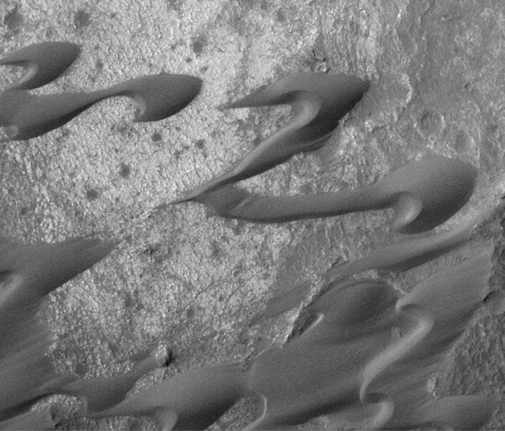
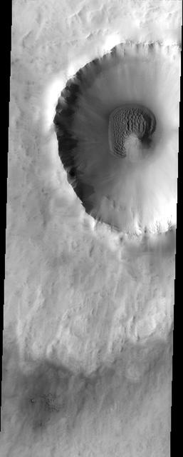
The large dark feature is a classic Martian sand dune. Most sand on Earth is made from the mineral quartz, which is white and bright. On Mars, most sand is composed of dark basalt, a volcanic rock. For this reason, dunes on Mars are darker than those on Earth. The dunes in this observation, within Wirtz Crater, are known as "barchans." The steepest slope is on the eastern (right) side, partially in shadow, and represents the direction the dune is migrating as the sand is blown and transported by the wind. Small ripples are visible on much of the dune surface. The dark streaks on the dune are tracks left by passing vortices known to us as dust devils. These raise dust off the dune, revealing a darker substrate. http://photojournal.jpl.nasa.gov/catalog/PIA12289
This sand sheet and dune field occurs on the floor of Candor Chasma
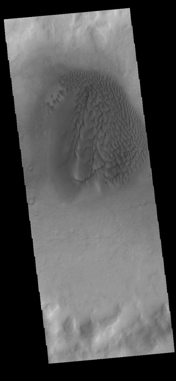
Small, dark sand dunes are located on the floor of Moreux Crater.
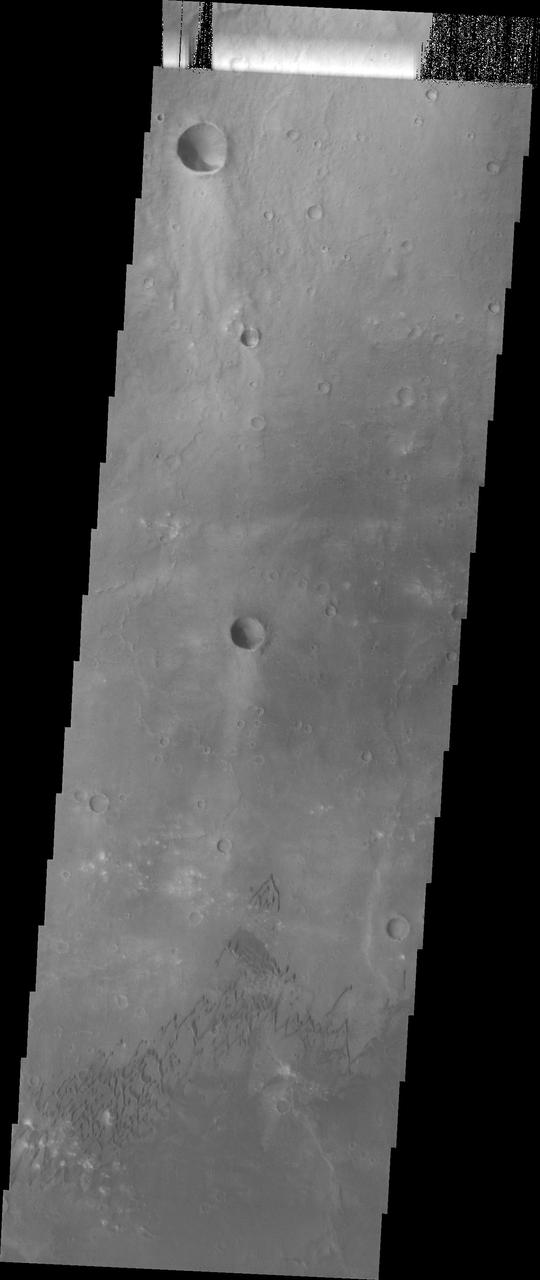
The sand dunes in this image surround the northwestern half of the central peak of this crater