The NISAR mission is a collaboration between NASA and the Indian Space Research Organization (ISRO) that will use two kinds of synthetic aperture radar (SAR) to track subtle changes in Earth's surface: S-band SAR and L-band SAR. (The "S" and "L" denote the wavelength of their signal.) On March 19, 2021, the assembly, test, and launch team at NASA's Jet Propulsion Laboratory in Southern California received the S-band SAR from its partner in India. NISAR, short for NASA-ISRO SAR, will spot warning signs of imminent volcanic eruptions, help to monitor groundwater supplies, track the melt rate of ice sheets tied to sea level rise, and observe shifts in the distribution of vegetation around the world. Movie available at https://photojournal.jpl.nasa.gov/catalog/PIA24137
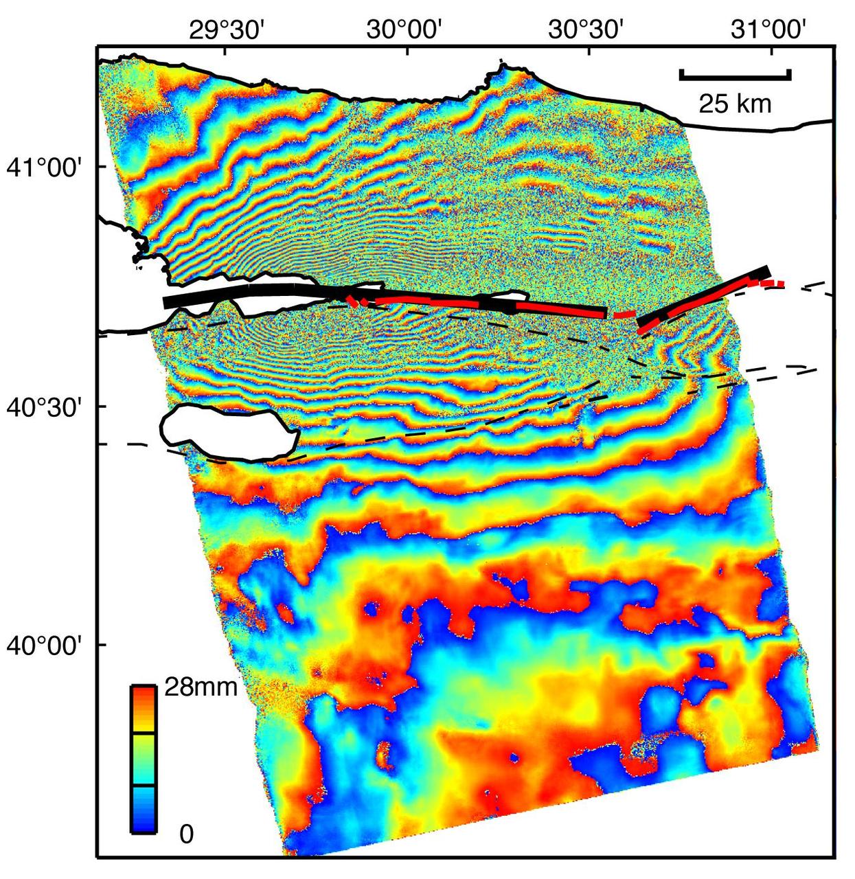
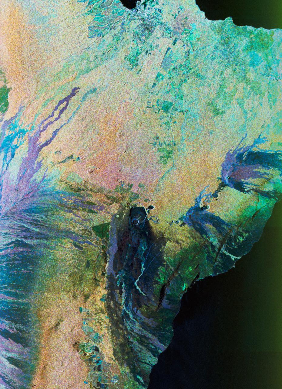
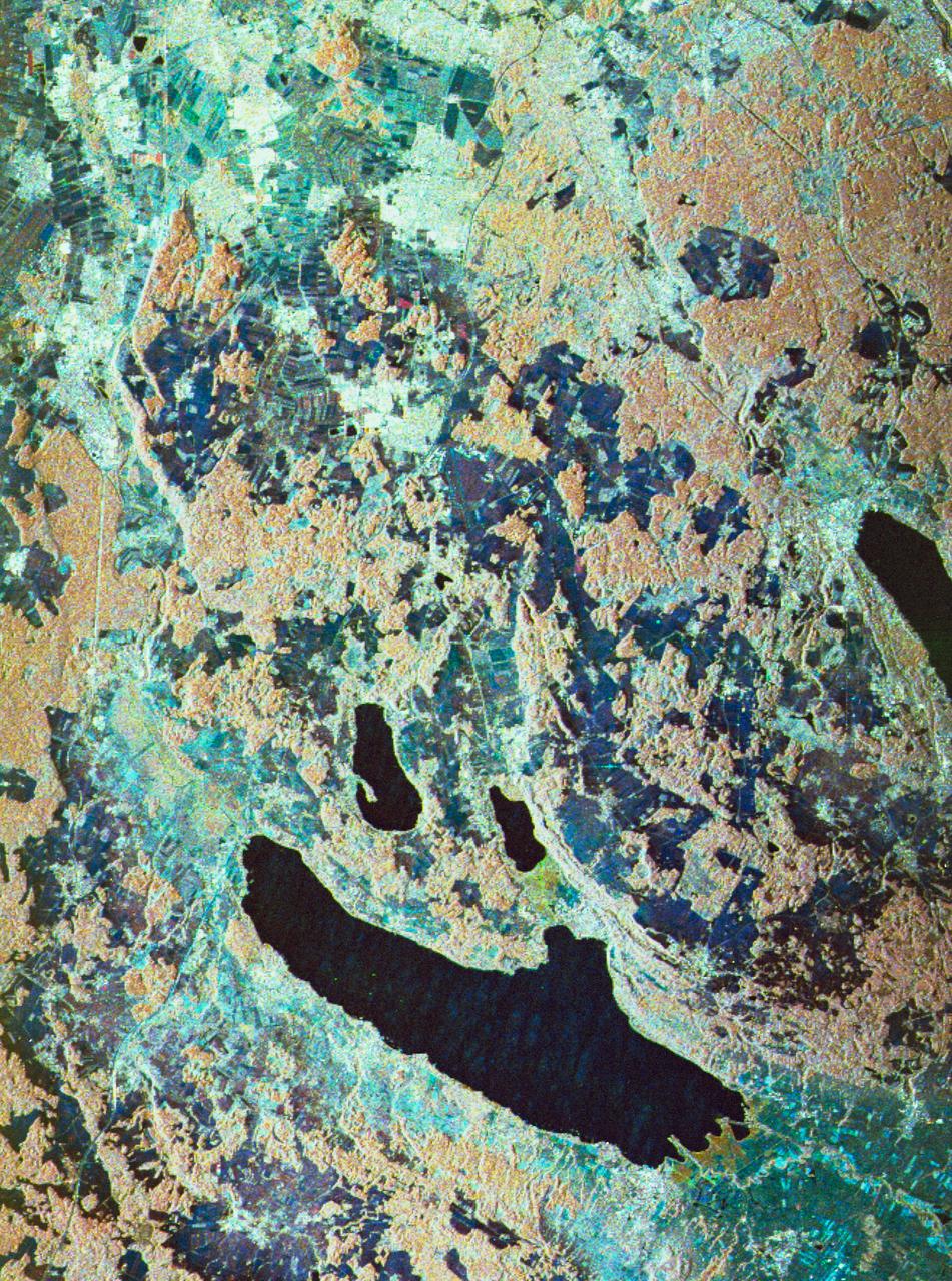
This image is an interferogram that was created using pairs of images taken by Synthetic Aperture Radar (SAR). The images, acquired at two different times, have been combined to measure surface deformation or changes that may have occurred during the time between data acquisition. The images were collected by the European Space Agency's Remote Sensing satellite (ERS-2) on 13 August 1999 and 17 September 1999 and were combined to produce these image maps of the apparent surface deformation, or changes, during and after the 17 August 1999 Izmit, Turkey earthquake. This magnitude 7.6 earthquake was the largest in 60 years in Turkey and caused extensive damage and loss of life. Each of the color contours of the interferogram represents 28 mm (1.1 inches) of motion towards the satellite, or about 70 mm (2.8 inches) of horizontal motion. White areas are outside the SAR image or water of seas and lakes. The North Anatolian Fault that broke during the Izmit earthquake moved more than 2.5 meters (8.1 feet) to produce the pattern measured by the interferogram. Thin red lines show the locations of fault breaks mapped on the surface. The SAR interferogram shows that the deformation and fault slip extended west of the surface faults, underneath the Gulf of Izmit. Thick black lines mark the fault rupture inferred from the SAR data. Scientists are using the SAR interferometry along with other data collected on the ground to estimate the pattern of slip that occurred during the Izmit earthquake. This then used to improve computer models that predict how this deformation transferred stress to other faults and to the continuation of the North Anatolian Fault, which extends to the west past the large city of Istanbul. These models show that the Izmit earthquake further increased the already high probability of a major earthquake near Istanbul. http://photojournal.jpl.nasa.gov/catalog/PIA00557
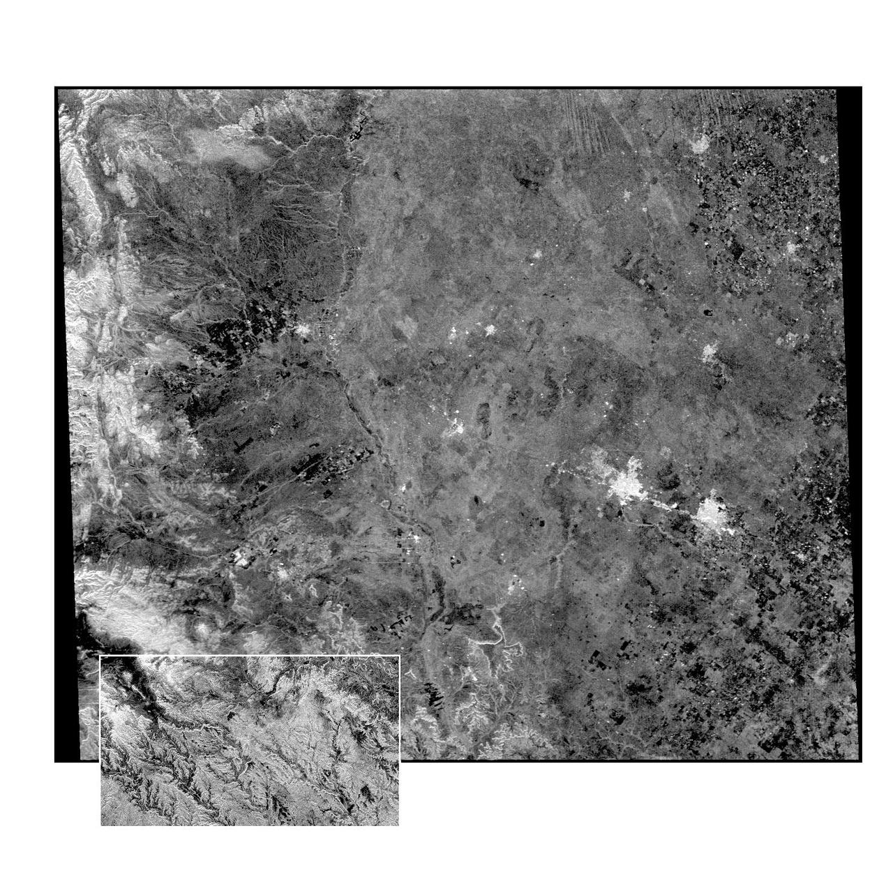
This radar image of the Midland/Odessa region of West Texas, demonstrates an experimental technique, called ScanSAR, that allows scientists to rapidly image large areas of the Earth's surface. The large image covers an area 245 kilometers by 225 kilometers (152 miles by 139 miles). It was obtained by the Spaceborne Imaging Radar-C/X-Band Synthetic Aperture Radar (SIR-C/X-SAR) flying aboard the space shuttle Endeavour on October 5, 1994. The smaller inset image is a standard SIR-C image showing a portion of the same area, 100 kilometers by 57 kilometers (62 miles by 35 miles) and was taken during the first flight of SIR-C on April 14, 1994. The bright spots on the right side of the image are the cities of Odessa (left) and Midland (right), Texas. The Pecos River runs from the top center to the bottom center of the image. Along the left side of the image are, from top to bottom, parts of the Guadalupe, Davis and Santiago Mountains. North is toward the upper right. Unlike conventional radar imaging, in which a radar continuously illuminates a single ground swath as the space shuttle passes over the terrain, a Scansar radar illuminates several adjacent ground swaths almost simultaneously, by "scanning" the radar beam across a large area in a rapid sequence. The adjacent swaths, typically about 50 km (31 miles) wide, are then merged during ground processing to produce a single large scene. Illumination for this L-band scene is from the top of the image. The beams were scanned from the top of the scene to the bottom, as the shuttle flew from left to right. This scene was acquired in about 30 seconds. A normal SIR-C image is acquired in about 13 seconds. The ScanSAR mode will likely be used on future radar sensors to construct regional and possibly global radar images and topographic maps. The ScanSAR processor is being designed for 1996 implementation at NASA's Alaska SAR Facility, located at the University of Alaska Fairbanks, and will produce digital images from the forthcoming Canadian RADARSAT satellite. http://photojournal.jpl.nasa.gov/catalog/PIA01787
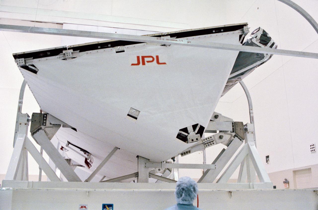
S93-48551 (October 1993) --- The Spaceborne Imaging Radar-C and X-Band Synthetic Aperture Radar (SIR-C/X-SAR) antenna, developed by the Jet Propulsion Laboratory (JPL) as part of NASA's Mission to Planet Earth (MTPE), will fly aboard the Space Shuttle Endeavour. The radar antenna uses microwave energy which gives it the ability to collect data over virtually any region at any time, regardless of weather or sunlight conditions. The radar waves can penetrate clouds, and under certain conditions the radar can also see through vegetation, ice and dry sand. In many cases, spaceborne radar is the only way scientists can explore large-scale and inaccessible regions of the Earth's surface. SIR-C/X-SAR uses three microwave wavelengths: L-Band (24 cm), C-Band (6 cm) and X-Ban (3 cm). The multi-frequency data will be used by the international scientific community to monitor global environmental processes with a focus on climate change. The MTPE spaceborne data, complemented by aircraft and ground studies, will give scientists clearer insights into those environmental changes which are caused by nature and those changes which are induced by human activity.
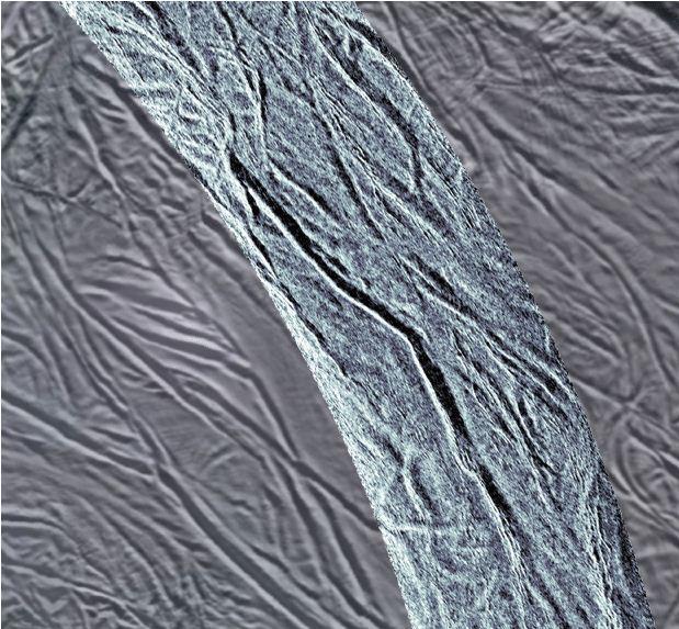
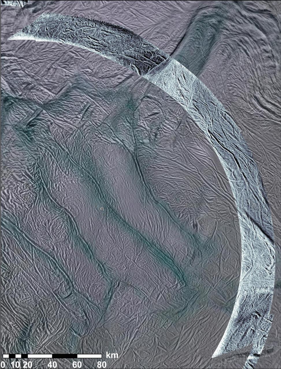
This image using synthetic-aperture radar SAR data acquired by NASA Cassini spacecraft shows grooves in the southern part of Saturn moon Enceladus.
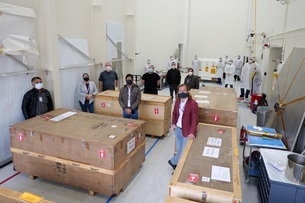
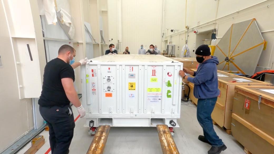
On March 20, 2021, members of the NISAR mission at NASA's Jet Propulsion Laboratory in Southern California received the S-band synthetic aperture radar (SAR) from their partner in India. Together with the L-band SAR provided by JPL, the two radars serve as the beating heart of the mission (the "S" and "L" denote the wavelength of the signal they transmit). A collaboration between NASA and the Indian Space Research Organization (ISRO), NISAR (short for NASA-ISRO SAR) will use SAR to track subtle changes in Earth's surface. In doing so, it will spot warning signs of imminent volcanic eruptions, help to monitor groundwater supplies, track the melt rate of ice sheets tied to sea level rise, and observe shifts in the distribution of vegetation around the world. https://photojournal.jpl.nasa.gov/catalog/PIA24138
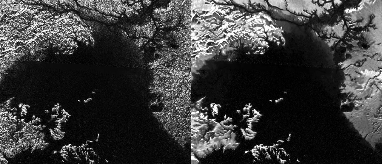
Presented here are side-by-side comparisons of a traditional Cassini Synthetic Aperture Radar (SAR) view and one made using a new technique for handling electronic noise that results in clearer views of Titan's surface. The technique, called despeckling, produces images that can be easier for researchers to interpret. The view is a mosaic of SAR swaths over Ligeia Mare, one of the large hydrocarbons seas on Titan. In particular, despeckling improves the visibility of channels flowing down to the sea. http://photojournal.jpl.nasa.gov/catalog/PIA19052

NASA SIR-C/X-SAR is shown here in the payload bay of the orbiting space shuttle Endeavour STS-59, with an area of the Pacific Ocean northeast of Hawaii in the background.
NASA Cassini spacecraft obtained this view of the south polar area of Saturn moon Enceladus in visible and near-visible ultraviolet and infrared light and synthetic-aperture radar SAR.
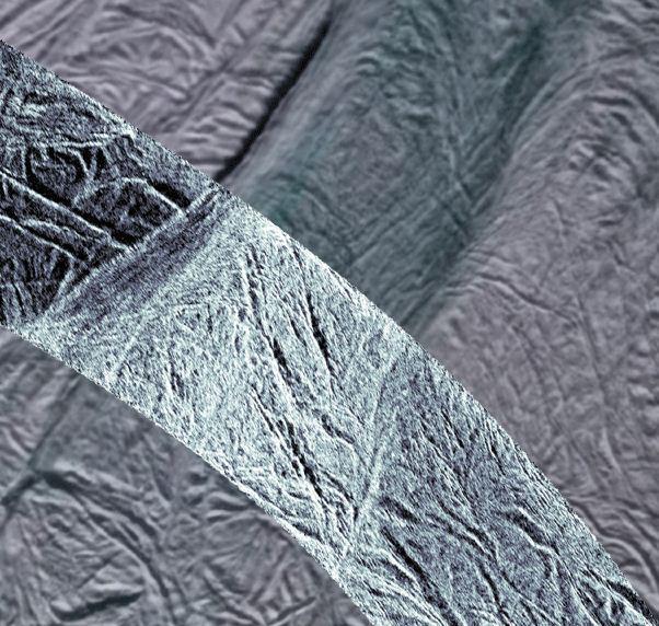
This image shows rough ice in the southern part of Saturn moon Enceladus. It was created using synthetic-aperture radar SAR data acquired by NASA Cassini spacecraft on Nov. 6, 2011.
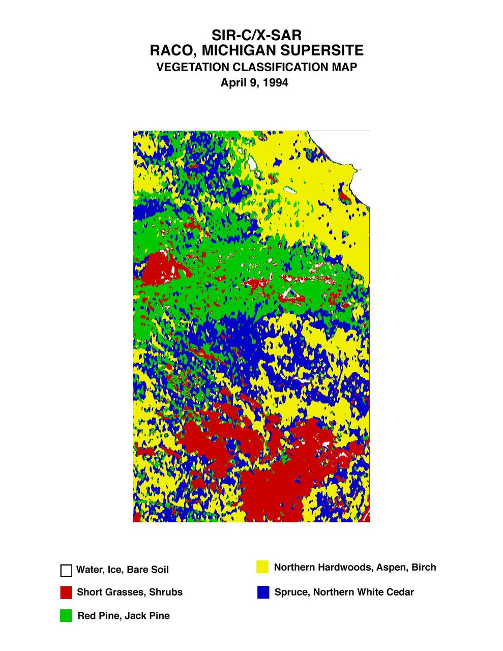
This is a vegetation map of the Raco, Michigan area produced from data acquired by NASA Spaceborne Imaging Radar C/X-Band Synthetic Aperture Radar SIR-C/X-SAR onboard space shuttle Endeavour.
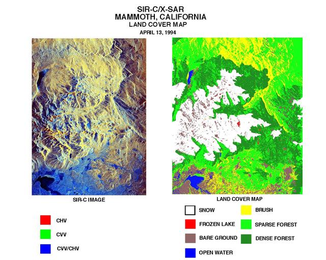
These two images were created using data from NASA Spaceborne Imaging Radar C/X-Band Synthetic Aperture Radar SIR-C/X-SAR.
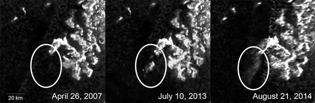
These three images, created from NASA Cassini Synthetic Aperture Radar SAR data, show the appearance and evolution of a mysterious feature in Ligeia Mare, one of the largest hydrocarbon seas on Saturn moon Titan.
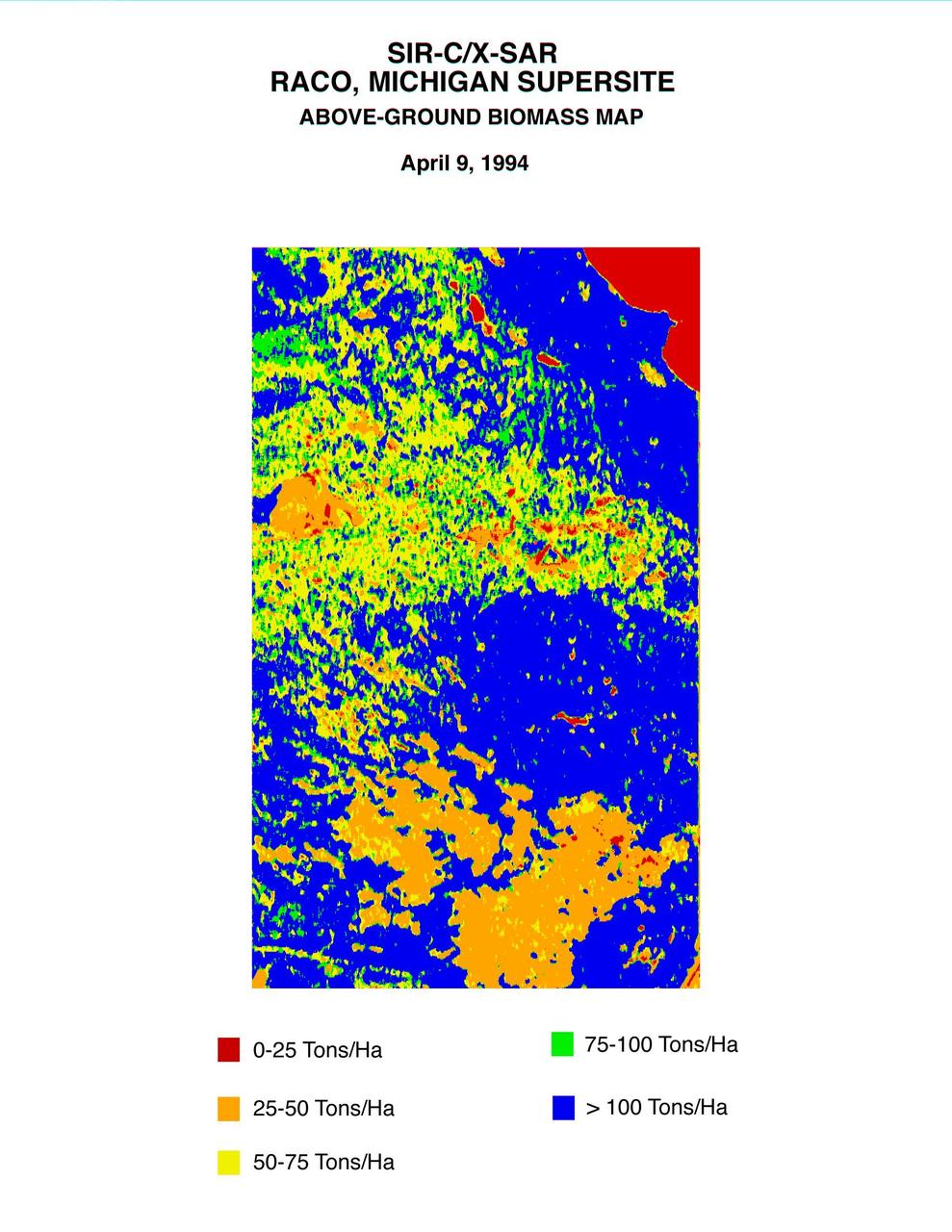
This biomass map of the Raco, Michigan, area was produced from data acquired by NASA Spaceborne Imaging Radar C/X-Band Synthetic Aperture Radar SIR-C/X-SAR onboard space shuttle Endeavour.
NASA Magellan synthetic aperture radar SAR imaged this unique triplet crater, or crater field during orbits 418-421 on Sept. 21, 1990. The three craters appear to have relatively steep walls. http://photojournal.jpl.nasa.gov/catalog/PIA00088
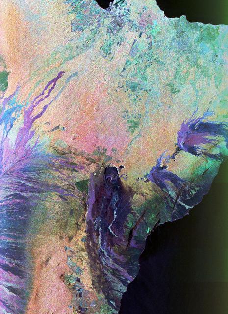
This false-color L-band image of the Manaus region of Brazil was acquired by NASA Spaceborne Imaging Radar-C and X-Band Synthetic Aperture Radar SIR-C/X-SAR aboard the space shuttle Endeavour on orbit 46 of the mission.
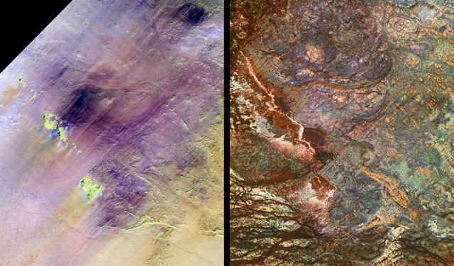
These images show two views of a region of south-central Egypt. On the left is an optical image from NASA Landsat Thematic Mapper, and on the right is a radar image from NASA Spaceborne Imaging Radar-C/X-band Synthetic Aperture Radar SIR-C/X-SAR.
This color composite C-band and L-band image of the Kilauea volcano on the Big Island of Hawaii was acquired by NASA Spaceborne Imaging Radar-C/X-band Synthetic Aperture Radar SIR-C/X-SAR flying on space shuttle Endeavour.
This mosaic of image swaths from Cassini’s Titan Radar Mapper, taken with the synthetic-aperture radar SAR, features a large dark region several hundred kilometers across that differs in several significant ways from potential lakes observed on Titan.
STS059-S-085 (18 April 1994) --- This is a three-dimensional perspective view of part of Isla Isabela in the western Galapagos Islands. It was taken by the L-Band radar in HH polarization from the Spaceborne Imaging Radar-C and X-Band Synthetic Aperture Radar (SIR-C/X-SAR) on the 40th orbit of the Space Shuttle Endeavour. This view was constructed by overlaying a SIR-C radar image on a U.S. Geological Survey digital elevation map. The image is centered at about .5 degrees south latitude and 91 degrees west longitude, and covers an area of 75 by 60 kilometers. The radar incidence angle at the center of the image is about 20 degrees. The western Galapagos Islands, which lie about 1200 kilometers west of Ecuador in the eastern Pacific, have six active volcanoes similar to the volcanoes found in Hawaii. Since the time of Charles Darwin's visit to the area in 1835, there have been over 60 recorded eruptions on these volcanoes. This SIR-C/X-SAR image of Alcedo and Sierra Negra volcanoes shows the rougher lava flows as bright features, while ash deposits and smooth pahoehoe lava flows appear dark. The Galapagos Islands are one of the SIR-C/X-SAR supersites and data of this area will be taken several times during the flight to allow scientists to conduct topographic change studies and to search for different lava flow types, ash deposits and fault lines. SIR-C/X-SAR is part of NASA's Mission to Planet Earth (MTPE). SIR-C/X-SAR radars illuminate Earth with microwaves allowing detailed observations at any time, regardless of weather or sunlight conditions. SIR-C/X-SAR uses three microwave wavelengths: L-Band (24 cm), C-Band (6 cm), and X-Band (3 cm). The multi-frequency data will be used by the international scientific community to better understand the global environment and how it is changing. The SIR-C/X-SAR data, complemented by aircraft and ground studies, will give scientists clearer insights into those environmental changes which are caused by nature and those changes which are induced by human activity. SIR-C was developed by NASA's Jet Propulsion Laboratory (JPL). X-SAR was developed by the Dornire and Alenia Spazio Companies for the German Space Agency, Deutsche Agentur fuer Raumfahrtangelegenheiten (DARA), and the Italian Space Agency, Agenzia Spaziale Italiana (ASI). JPL Photo ID: P-43938
STS059-S-084 (17 April 1994) --- This is a three-dimensional perspective of Mammoth Mountain, California. This view was constructed by overlaying a SIR-C radar image on a U.S. Geological Survey digital elevation map. Vertical exaggeration is 2x. The image is centered at 37.6 degrees north, 119.0 degrees west. It was acquired from the Spaceborne Imaging Radar-C and X-Band Synthetic Aperture Radar (SIR-C/X-SAR) onboard the Space Shuttle Endeavour on its 67th orbit, April 13, 1994. In this color representation, red is C-Band HV-polarization, green is C-Band VV-polarization and blue is the ratio of C-Band VV to C-Band HV. Blue areas are smooth and yellow areas are rock outcrops with varying amounts of snow and vegetation. Crowley Lake is in the foreground and Highway 395 crosses in the middle of the image. Mammoth Mountain is shown in the upper right. SIR-C/X-SAR is part of NASA's Mission to Planet Earth (MTPE). SIR-C/X-SAR radars illuminate Earth with microwaves allowing detailed observations at any time, regardless of weather or sunlight conditions. SIR-C/X-SAR uses three microwave wavelengths: L-Band (24 cm), C-Band (6 cm), and X-Band (3 cm). The multi-frequency data will be used by the international scientific community to better understand the global environment and how it is changing. The SIR-C/X-SAR data, complemented by aircraft and ground studies, will give scientists clearer insights into those environmental changes which are caused by nature and those changes which are induced by human activity. SIR-C was developed by NASA's Jet Propulsion Laboratory (JPL). X-SAR was developed by the Dornire and Alenia Spazio Companies for the German Space Agency, Deutsche Agentur fuer Raumfahrtangelegenheiten (DARA), and the Italian Space Agency, Agenzia Spaziale Italiana (ASI). JPL Photo ID: P-43933
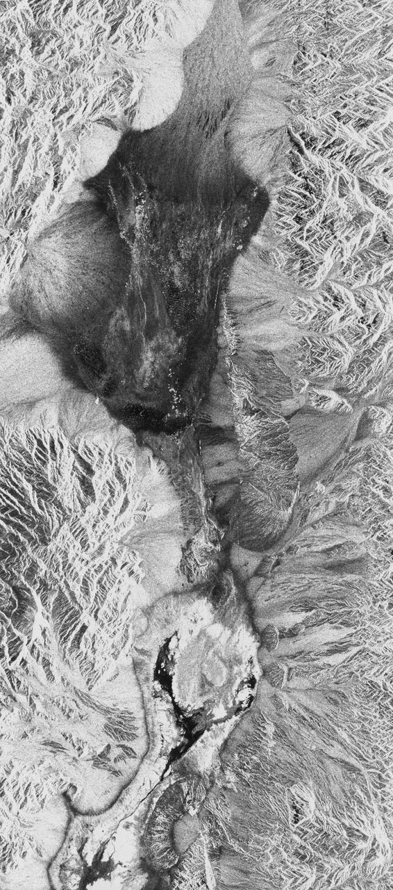
STS059-S-026 (11 April 1994) --- This is an image of Death Valley, California, centered at 36.629 degrees north latitude, 117.069 degrees west longitude. The image shows Furnace Creek alluvial fan and Furnace Creek Ranch at the far right, and the sand dunes near Stove Pipe Wells at the center. The dark fork-shaped feature between Furnace Creek fan and the dunes is a smooth flood-plain which encloses Cottonball Basin. The SIR-C/X-SAR supersite is an area of extensive field investigations and has been visited by both Space Radar Lab astronaut crews. Elevations in the Valley range from 70 meters below sea level, the lowest in the United States, to more than 3300 meters above sea level. Scientists are using SIR-C/X-SAR data from Death Valley to help answer a number of different questions about the Earth's geology. One question concerns how alluvial fans are formed and change through time under the influence of climatic changes and earthquakes. Alluvial fans are gravel deposits that wash down from the mountains over time. They are visible in the image as circular, fan-shaped bright areas extending into the darker valley floor from the mountains. Information about the alluvial fans help scientists study Earth's ancient climate. Scientists know the fans are bulit up through climatic and tectonic processes and they will use the SIR-C/X-SAR data to understand the nature and rates of weathering processes on the fans, soil formation, and the transport of sand and dust by the wind. SIR-C/X-SAR's sensitivity to centimeter-scale (or inch-scale) roughness provides detailed maps of surface texture. Such information can be used to study the occurrence and movement of dust storms and sand dunes. the goal of these studies is to gain a better understanding of the record of past climatic changes and the effects of those changes on a sensitive environment. This may lead to a better ability to predict future response of the land to different potential global cimate-change scenarios. Death Valley is also one of the primary calibration sites for SIR-C/X-SAR. The bright dots near the center of the image are corner reflectors that have been set-up to calibrate the radar as the Shuttle passes overhead. Thirty triangular-shaped reflectors (they look like aluminum pyramids) have been deployed by the calibration team from JPL over a 40 kilometer by 40 kilometer area in and around Death Valley. The calibration team will also deploy transponders (electronic reflectors) and recievers to measure the radar signals from SIR-C/X-SAR on the ground. Spaceborne Imaging Radar-C and X-Synthetic Aperture Radar (SIR-C/X-SAR) is part of NASA's Mission to Planet Earth (MTPE). The radars illuminate Earth with microwaves allowing detailed observations at any time, regardless of weather or sunlight conditions. SIR-C/X-SAR uses three microwave wavelengths: L-Band (24 cm), C-Band (6 cm), and X-Band (3 cm). The multi-frequency data will be used by the international scientific community to better understand the global environment and how it is changing. The SIR-C/X-SAR data, complemented by aircraft and ground studies, will give scientists clearer insights into those environmental changes which are caused by nature and those changes which are induced by human activity. SIR-C was develpoed by NASA's Jet Propulsion Laboratory (JPL). X-SAR was developed by the Dornire and Alenia Spazio Companies for the German Space Agency, Deutsche Agentur fuer Raumfahrtangelegenheiten (DARA), and the Italian Space Agency, Agenzia Spaziale Italiana (ASI). JPL Photo ID: P-43883
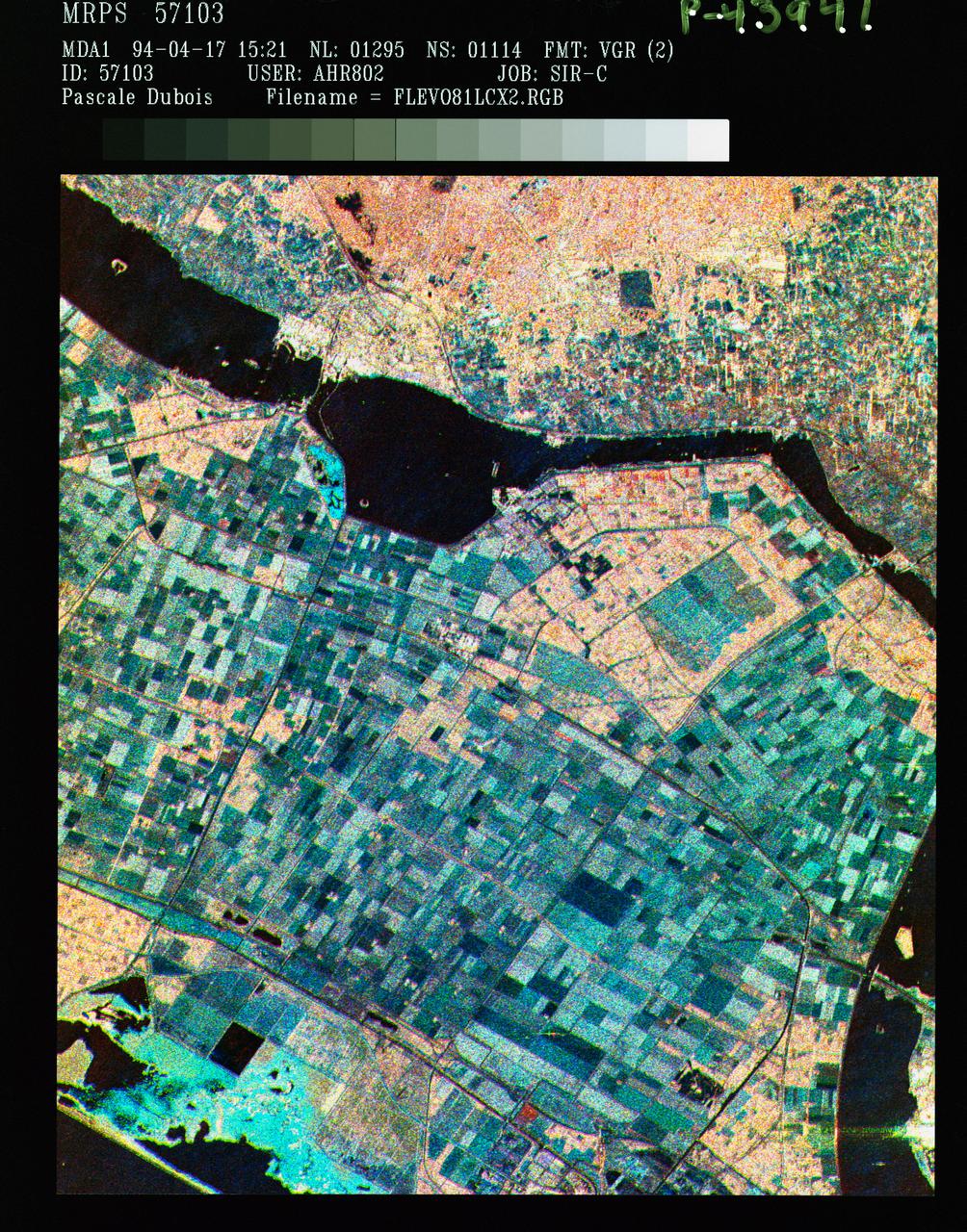
STS059-S-086 (18 April 1994) --- This is a three-frequency false-color image of Flevoland, the Netherlands, centered at 52.4 degrees north latitude, and 5.4 degrees east longitude. This image was acquired by the Spaceborne Imaging Radar-C and X-Band Synthetic Aperture Radar (SIR-C/X-SAR) aboard the Space Shuttle Endeavour on April 14, 1994. It was produced by combining data from the X-Band, C-Band and L-Band radar's. The area shown is approximately 25 by 28 kilometers (15 1/2 by 17 1/2 miles). Flevoland, which fills the lower two-thirds of the image, is a very flat area that is made up of reclaimed land that is used for agriculture and forestry. At the top of the image, across the canal from Flevoland, is an older forest shown in red; the city of Harderwijk is shown in white on the shore of the canal. At this time of the year, the agricultural fields are bare soil, and they show up in this images in blue. The changes in the brightness of the blue areas are equal to the changes in roughness. The dark blue areas are water and the small dots in the canal are boats. This SIR-C/X-SAR supersite is being used for both calibration and agricultural studies. Several soil and crop ground-truth studies will be conducted during the Shuttle flight. In addition, about 10 calibration devices and 10 corner reflectors have been deployed to calibrate and monitor the radar signal. One of these transponders can be seen as a bright star in the lower right quadrant of the image. This false-color image was made using L-Band total power in the red channel, C-Band total power in the green channel, and X-Band VV polarization in the blue channel. SIR-C/X-SAR is part of NASA's Mission to Planet Earth (MTPE). SIR-C/X-SAR radars illuminate Earth with microwaves allowing detailed observations at any time, regardless of weather or sunlight conditions. SIR-C/X-SAR uses three microwave wavelengths: L-Band (24 cm), C-Band (6 cm), and X-Band (3 cm). The multi-frequency data will be used by the international scientific community to better understand the global environment and how it is changing. The SIR-C/X-SAR data, complemented by aircraft and ground studies, will give scientists clearer insights into those environmental changes which are caused by nature and those changes which are induced by human activity. SIR-C was developed by NASA's Jet Propulsion Laboratory (JPL). X-SAR was developed by the Dornire and Alenia Spazio Companies for the German Space Agency, Deutsche Agentur fuer Raumfahrtangelegenheiten (DARA), and the Italian Space Agency, Agenzia Spaziale Italiana (ASI). JPL Photo ID: P-43941
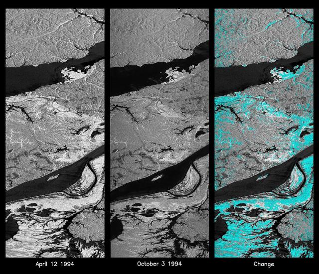
These L-band images of the Manaus region of Brazil were acquired by the Spaceborne Imaging Radar-C and X-band Synthetic Aperture Radar (SIR-C/X-SAR) aboard the space shuttle Endeavour. The left image was acquired on April 12, 1994, and the middle image was acquired on October 3, 1994. The area shown is approximately 8 kilometers by 40 kilometers (5 miles by 25 miles). The two large rivers in this image, the Rio Negro (top) and the Rio Solimoes (bottom), combine at Manaus (west of the image) to form the Amazon River. The image is centered at about 3 degrees south latitude and 61 degrees west longitude. North is toward the top left of the images. The differences in brightness between the images reflect changes in the scattering of the radar channel. In this case, the changes are indicative of flooding. A flooded forest has a higher backscatter at L-band (horizontally transmitted and received) than an unflooded river. The extent of the flooding is much greater in the April image than in the October image, and corresponds to the annual, 10-meter (33-foot) rise and fall of the Amazon River. A third image at right shows the change in the April and October images and was created by determining which areas had significant decreases in the intensity of radar returns. These areas, which appear blue on the third image at right, show the dramatic decrease in the extent of flooded forest, as the level of the Amazon River falls. The flooded forest is a vital habitat for fish and floating meadows are an important source of atmospheric methane. This demonstrates the capability of SIR-C/X-SAR to study important environmental changes that are impossible to see with optical sensors over regions such as the Amazon, where frequent cloud cover and dense forest canopies obscure monitoring of floods. Field studies by boat, on foot and in low-flying aircraft by the University of California at Santa Barbara, in collaboration with Brazil's Instituto Nacional de Pesguisas Estaciais, during the first and second flights of the SIR-C/X-SAR system have validated the interpretation of the radar images. http://photojournal.jpl.nasa.gov/catalog/PIA01740
To show the kind of imagery that data from the NISAR (NASA-ISRO Synthetic Aperture Radar) satellite mission will produce, researchers pointed to this composite image of a portion of the so-called "arc of deforestation," a region on the southeast edge of the Amazonian jungle in Brazil where forests are being cleared at a fast pace through human activity. This three-color image shows change to the land cover in the Xingu River basin between 1996 (red) and 2007 (blue/green), using data from the Japanese L-band SAR satellites JERS-1 and ALOS-1, respectively. Black indicates areas converted from rainforest to agricultural land prior to 1996, and red shows the additional areas that had been cleared by 2007. NISAR will offer detailed insights into how the planet's forest ecosystems are changing over time, which will help researchers understand regional and global dynamics of deforestation and study the role of wooded areas in the global carbon cycle. NISAR could also help improve accounting of forest loss and growth, as countries that rely on logging try to shift toward more sustainable practices. NISAR is a joint mission of the U.S. and Indian space agencies. When in orbit, its sophisticated L- and S-band radar systems will scan nearly all of Earth's land and ice surfaces twice every 12 days with exquisite precision. Scheduled to launch in early 2024, NISAR is an equal collaboration between NASA and the Indian Space Research Organisation and marks the first time the two agencies have cooperated on hardware development for an Earth-observing mission. NASA's Jet Propulsion Laboratory, which is managed for the agency by Caltech in Pasadena, leads the U.S. component of the project and is providing the mission's L-band SAR. NASA is also providing the radar reflector antenna, the deployable boom, a high-rate communication subsystem for science data, GPS receivers, a solid-state recorder, and payload data subsystem. ISRO's U R Rao Satellite Centre in Bengaluru, which is leading the ISRO component of the mission, is providing the spacecraft bus, the S-band SAR electronics, the launch vehicle, and associated launch services and satellite mission operations. https://photojournal.jpl.nasa.gov/catalog/PIA26111
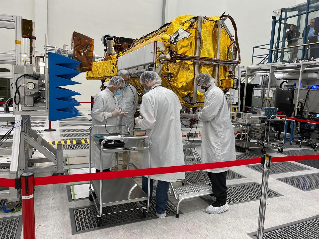
Engineers and technicians from NASA's Jet Propulsion Laboratory work on the NASA-ISRO Synthetic Aperture Radar (NISAR) science instrument payload in a clean room at JPL on Feb. 3, 2023. The payload is scheduled to ship to India in March 2023. The NISAR mission – a joint effort between NASA and ISRO – will measure changes to Earth's land ice surfaces down to fractions of an inch. Data collected by this satellite will help researchers monitor a wide range of changes critical to life on Earth in unprecedented detail. This includes spotting warning signs of imminent volcanic eruptions, helping to monitor groundwater supplies, tracking the melt rate of ice sheets tied to sea level rise, and observing shifts in the distribution of vegetation around the world. The data will inform humanity's responses to urgent challenges posed by natural disasters and climate change, and help communities prepare for and manage hazards. There are two instruments on the satellite that will send and receive radar signals to and from Earth's surface to make the mission's measurements. An L-band synthetic aperture radar (SAR), which uses a signal wavelength of around 9 inches (24 centimeters), and an S-band SAR with a signal wavelength of nearly 5 inches (12 centimeters). Both will bounce their microwave signal off of the planet's surface and record how long it takes the signal to make one roundtrip, as well as the strength of that return signal. This enables the researchers to calculate the distance from the spacecraft to Earth's surface and thereby determine how the land or ice is changing. An antenna reflector nearly 40 feet (12 meters) in diameter, supported by a deployable boom, will focus the microwave signals sent and received by the SARs. JPL, which is managed for NASA by Caltech in Pasadena, leads the U.S. component of NISAR and is providing the mission's L-band SAR instrument. NASA is also providing the radar reflector antenna, the deployable boom, a high-rate communication subsystem for science data, GPS receivers, a solid-state recorder, and payload data subsystem. ISRO is providing the spacecraft bus, the S-band SAR, the launch vehicle, and associated launch services and satellite mission operations. https://photojournal.jpl.nasa.gov/catalog/PIA25771
STS059-S-074 (15 April 1994) --- This color composite C-Band and L-Band image of the Kilauea volcano on the big island of Hawaii was acquired by the Spaceborne Imaging Radar-C and X-Band Synthetic Aperture Radar (SIR-C/X-SAR) flying on the Space Shuttle Endeavour. The city of Hilo can be seen at the top. The image shows the different types of lava flows around the crater Pu'u O'o. Ash deposits which erupted in 1790 from the summit of Kilauea volcano show up as dark in this image, and fine details associated with lava flows which erupted in 1919 and 1974 can be seen to the south of the summit in an area called the Ka'u Desert. In addition, the other historic lava flows created in 1881 and 1984 from Mauna Loa volcano (out of view to the left of this image) can easily be seen despite the fact that the surrounding area is covered by forest. Such information will be used to map the extent of such flows, which can pose a hazard to the subdivisions of Hilo. Highway 11 is the linear feature running from Hilo to the Kilauea volcano. The Kilauea volcano has been almost continuously active for more than the last 11 years. Field teams that were on the ground specifically to support these radar observations report that there was vigorous surface activity about 400 meters (one-quarter mile) inland from the coast. A moving lava flow about 200 meters (660 feet) in length was observed at the time of the Shuttle over flight, raising the possibility that subsequent images taken during this mission will show changes in the landscape. SIR-C/X-SAR is part of NASA's Mission to Planet Earth (MTPE). SIR-C/X-SAR radars illuminate Earth with microwaves allowing detailed observations at any time, regardless of weather or sunlight conditions. SIR-C/X-SAR uses three microwave wavelengths: L-Band (24 cm), C-Band (6 cm), and X-Band (3 cm). The multi-frequency data will be used by the international scientific community to better understand the global environment and how it is changing. The SIR-C/X-SAR data, complemented by aircraft and ground studies, will give scientists clearer insights into those environmental changes which are caused by nature and those changes which are induced by human activity. SIR-C was developed by NASA's Jet Propulsion Laboratory (JPL). X-SAR was developed by the Dornire and Alenia Spazio Companies for the German Space Agency, Deutsche Agentur fuer Raumfahrtangelegenheiten (DARA), and the Italian Space Agency, Agenzia Spaziale Italiana (ASI). JPL Photo ID: P-43918
STS059-S-068 (13 April 1994) --- This false-color L-Band image of the Manaus region of Brazil was acquired by the Spaceborne Imaging Radar-C and X-Band Synthetic Aperture Radar (SIR-C/X-SAR) aboard the Space Shuttle Endeavour on orbit 46 of the mission. The area shown is approximately 8 kilometers by 40 kilometers (5 by 25 miles). At the top of the image are the Solimoes and Rio Negro Rivers just before they combine at Manaus to form the Amazon River. The image is centered at about 3 degrees south latitude, and 61 degrees west longitude. The false colors are created by displaying three L-Band polarization channels; red areas correspond to high backscatter at HH polarization, while green areas exhibit high backscatter at HV polarization. Blue areas show low returns at VV polarization; hence the bright blue colors of the smooth river surfaces. Using this color scheme, green areas in the image are heavily forested, while blue areas are either cleared forest or open water. The yellow and red areas are flooded forest. Between Rio Solimoes and Rio Negro a road can be seen running from some cleared areas (visible as blue rectangles north of Rio Solimoes) north towards a tributary of Rio Negro. SIR-C/X-SAR is part of NASA's Mission to Planet Earth (MTPE). SIR-C/X-SAR radars illuminate Earth with microwaves allowing detailed observations at any time, regardless of weather or sunlight conditions. SIR-C/X-SAR uses three microwave wavelengths: L-Band (24 cm), C-Band (6 cm), and X-Band (3 cm). The multi-frequency data will be used by the international scientific community to better understand the global environment and how it is changing. The SIR-C/X-SAR data, complemented by aircraft and ground studies, will give scientists clearer insights into those environmental changes which are caused by nature and those changes which are induced by human activity. SIR-C was developed by NASA's Jet Propulsion Laboratory (JPL). X-SAR was developed by the Dornire and Alenia Spazio Companies for the German Space Agency, Deutsche Agentur fuer Raumfahrtangelegenheiten (DARA), and the Italian Space Agency, Agenzia Spaziale Italiana (ASI). JPL Photo ID: P-43895
STS068-S-055 (7 October 1994) --- This is a false-color L-Band image of an area near Glasgow, Missouri, centered at about 39.2 degrees north latitude and 92.8 degrees west longitude. The image was acquired using the L-Band radar channel (horizontally transmitted and received and horizontally transmitted and vertically received) polarization's combined. The data were acquired by the Spaceborne Imaging Radar-C/X-Band Synthetic Aperture Radar (SIR-C/X-SAR) aboard the Space Shuttle Endeavour on orbit 50 on October 3, 1994. The area shown is approximately 37 by 25 kilometers (23 by 16 miles). The radar data, coupled with pre-flood aerial photography and satellite data and post-flood topographic and field data, are being used to evaluate changes associated with levee breaks in land forms, where deposits formed during the widespread flooding in 1993 along the Missouri and Mississippi Rivers. The distinct radar scattering properties of farmland, sand fields and scoured areas will be used to inventory flood plains along the Missouri River and determine the processes by which these areas return to preflood conditions. The image shows one such levee break near Glasgow, Missouri. In the upper center of the radar image, below the bend of the river, is a region covered by several meters of sand, shown as dark regions. West (left) of the dark areas, a gap in the levee tree canopy shows the area where the levee failed. Radar data such as these can help scientists more accurately assess the potential for future flooding in this region and how that might impact surrounding communities. Spaceborne Imaging Radar-C/X-Band Synthetic Aperture Radar (SIR-C/X-SAR) is part of NASA's Mission to Planet Earth. The radars illuminate Earth with microwaves, allowing detailed observations at any time, regardless of weather or sunlight conditions. SIR-C/X-SAR uses the three microwave wavelengths: the L-Band (24 centimeters), C-Band (6 centimeters) and X-Band (3 centimeters). The multi-frequency data will be used by the international scientific community to better understand the global environment and how it is changing. The SIR-C/X-SAR data, complemented by aircraft and ground studies, will give scientists clearer insights into those environmental changes which are caused by nature and those changes which are induced by human activity. SIR-C was developed by NASA's Jet Propulsion Laboratory (JPL). X-SAR was developed by the Dornier and Alenia Spazio companies for the German space agency, Deutsche Agentur fuer Raumfahrtangelegenheiten (DARA), and the Italian space agency, Agenzia Spaziale Italiana (ASI), with the Deutsche Forschungsanstalt fuer Luft und Raumfahrt e.v. (DLR), the major partner in science, operations and data processing of X-SAR. (P-44734)
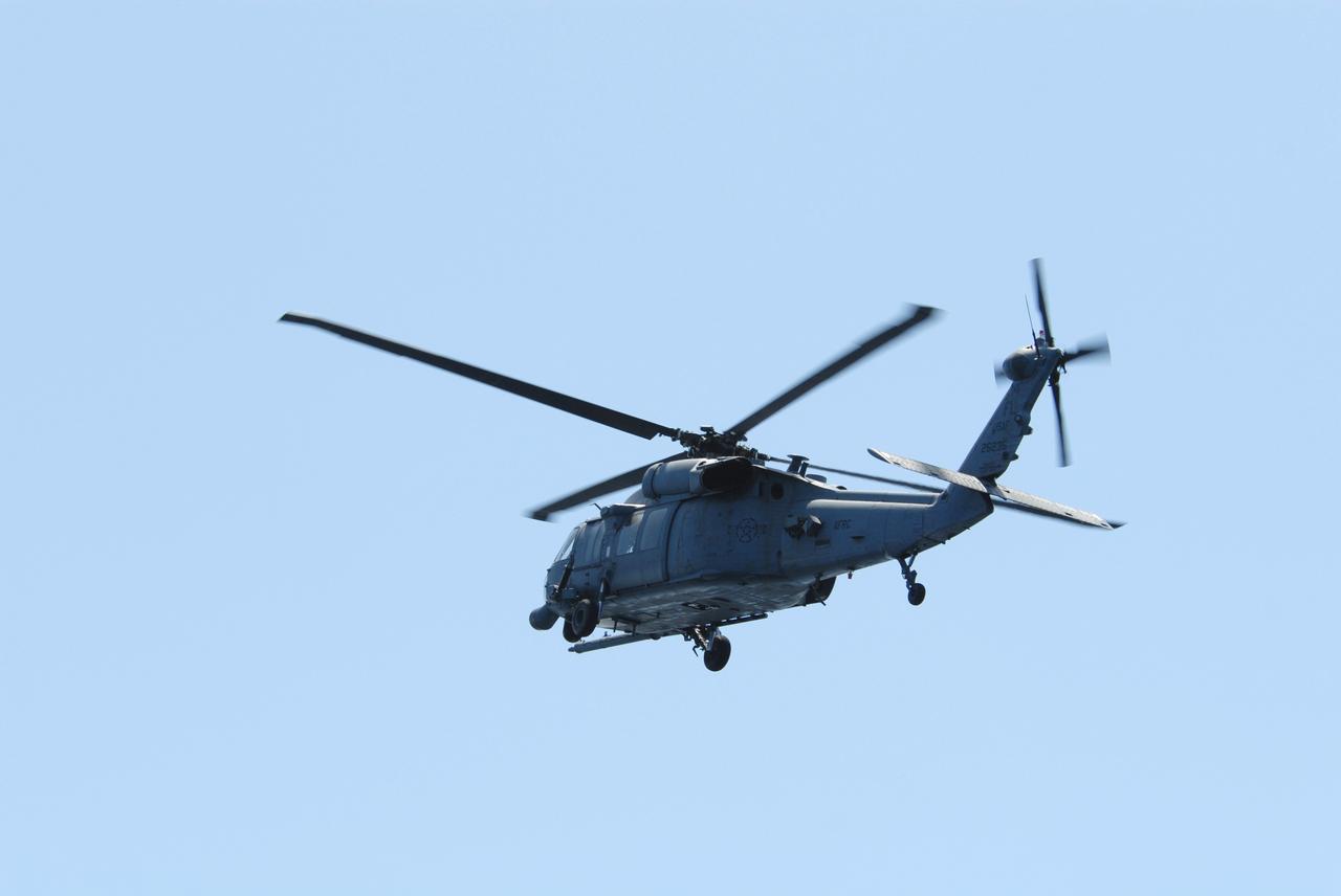
CAPE CANAVERAL, Fla. -- An HH-60G helicopter flies overhead of a rescue boat during a training exercise, known as Mode VIII, off Florida's central east coast. In support of, and with logistical support from, NASA, USSTRATCOM is hosting a major exercise involving Department of Defense, Department of Homeland Security, search and rescue (SAR) forces, including the 45th Space Wing at Patrick Air Force Base, which support space shuttle astronaut bailout contingency operations, known as Mode VIII. This exercise tests SAR capabilities to locate, recover and provide medical treatment for astronauts following a space shuttle launch phase open-ocean bailout. Participants include members of the U.S. Navy, U.S. Coast Guard, U.S. Air Force, and NASA's Kennedy Space Center and Johnson Space Center. Photo credit: NASA/Dimitri Gerondidakis
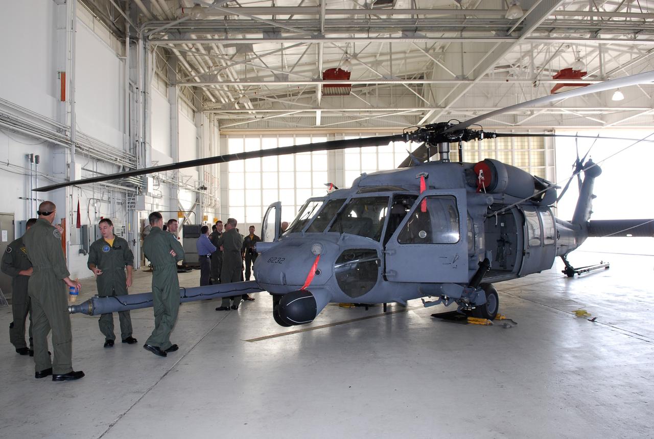
CAPE CANAVERAL, Fla. -- Participants in the Mode VIII exercise being conducted at Patrick Air Force Base, Fla., are introduced to the equipment they will be working with. In the foreground is an HH-60 helicopter. In support of, and with logistical support from, NASA, USSTRATCOM is hosting a major exercise involving Department of Defense, Department of Homeland Security, search and rescue (SAR) forces, including the 45th Space Wing at Patrick Air Force Base, which support space shuttle astronaut bailout contingency operations, known as Mode VIII. This exercise tests SAR capabilities to locate, recover and provide medical treatment for astronauts following a space shuttle launch phase open-ocean bailout. Participants include members of the U.S. Navy, U.S. Coast Guard, U.S. Air Force, and NASA's Kennedy Space Center and Johnson Space Center. This will be the 15th Mode VIII exercise conducted in the past 20 years. Photo credit: NASA/Kim Shiflett
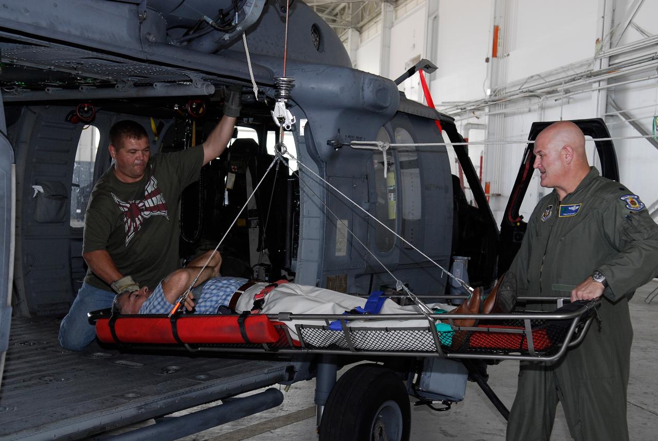
CAPE CANAVERAL, Fla. -- In a rescue training exercise, known as Mode VIII, off Florida's central east coast, an HH-60G helicopter lifts the stretcher bearing a participant. In support of, and with logistical support from, NASA, USSTRATCOM is hosting a major exercise involving Department of Defense, Department of Homeland Security, search and rescue (SAR) forces, including the 45th Space Wing at Patrick Air Force Base, which support space shuttle astronaut bailout contingency operations, known as Mode VIII. This exercise tests SAR capabilities to locate, recover and provide medical treatment for astronauts following a space shuttle launch phase open-ocean bailout. Participants include members of the U.S. Navy, U.S. Coast Guard, U.S. Air Force, and NASA's Kennedy Space Center and Johnson Space Center. Photo credit: NASA/Dimitri Gerondidakis
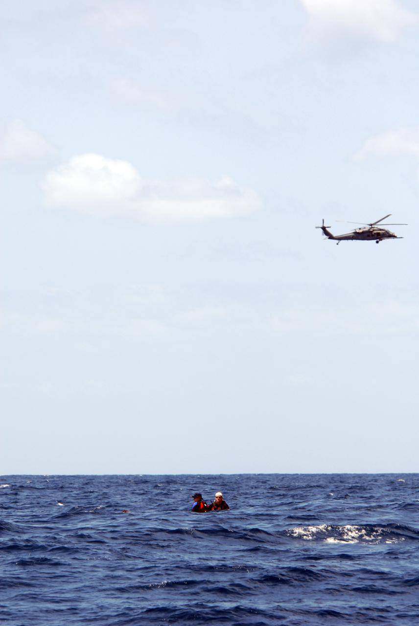
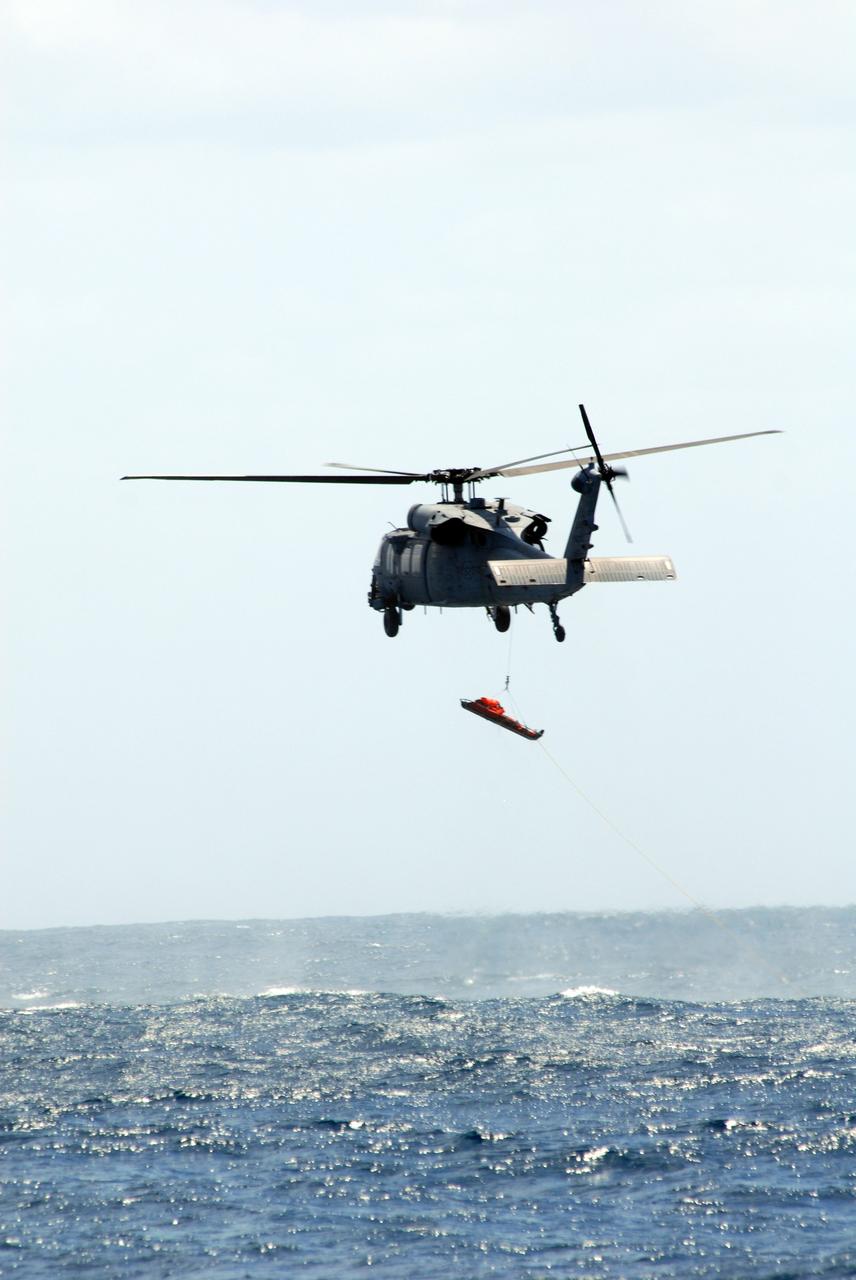
CAPE CANAVERAL, Fla. -- In a training exercise, known as Mode VIII, off Florida's central east coast, an HH-60G helicopter rescues a participant from the Atlantic Ocean. In support of, and with logistical support from, NASA, USSTRATCOM is hosting a major exercise involving Department of Defense, Department of Homeland Security, search and rescue (SAR) forces, including the 45th Space Wing at Patrick Air Force Base, which support space shuttle astronaut bailout contingency operations, known as Mode VIII. This exercise tests SAR capabilities to locate, recover and provide medical treatment for astronauts following a space shuttle launch phase open-ocean bailout. Participants include members of the U.S. Navy, U.S. Coast Guard, U.S. Air Force, and NASA's Kennedy Space Center and Johnson Space Center. Photo credit: NASA/Dimitri Gerondidakis
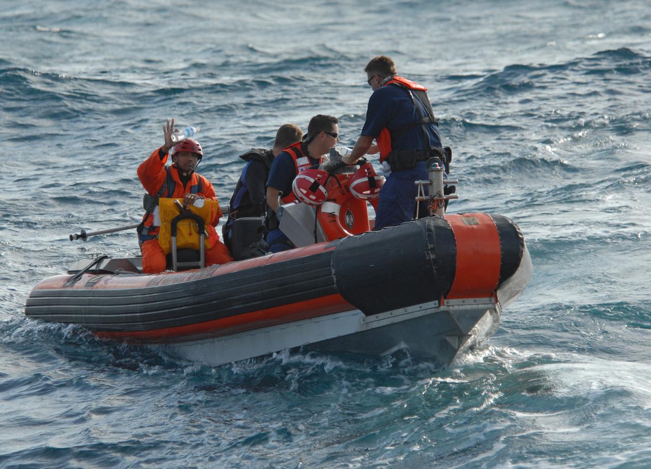
CAPE CANAVERAL, Fla. -- Off Florida's central east coast, a member of the rescue team in a training exercise, known as Mode VIII, keeps watch for the returning support crew from the U.S. Coast Guard cutter Kingfisher, from Port Canaveral, Fla. In support of, and with logistical support from, NASA, USSTRATCOM is hosting a major exercise involving Department of Defense, Department of Homeland Security, search and rescue (SAR) forces, including the 45th Space Wing at Patrick Air Force Base, which support space shuttle astronaut bailout contingency operations, known as Mode VIII. This exercise tests SAR capabilities to locate, recover and provide medical treatment for astronauts following a space shuttle launch phase open-ocean bailout. Participants include members of the U.S. Navy, U.S. Coast Guard, U.S. Air Force, and NASA's Kennedy Space Center and Johnson Space Center. Photo credit: NASA/Dimitri Gerondidakis
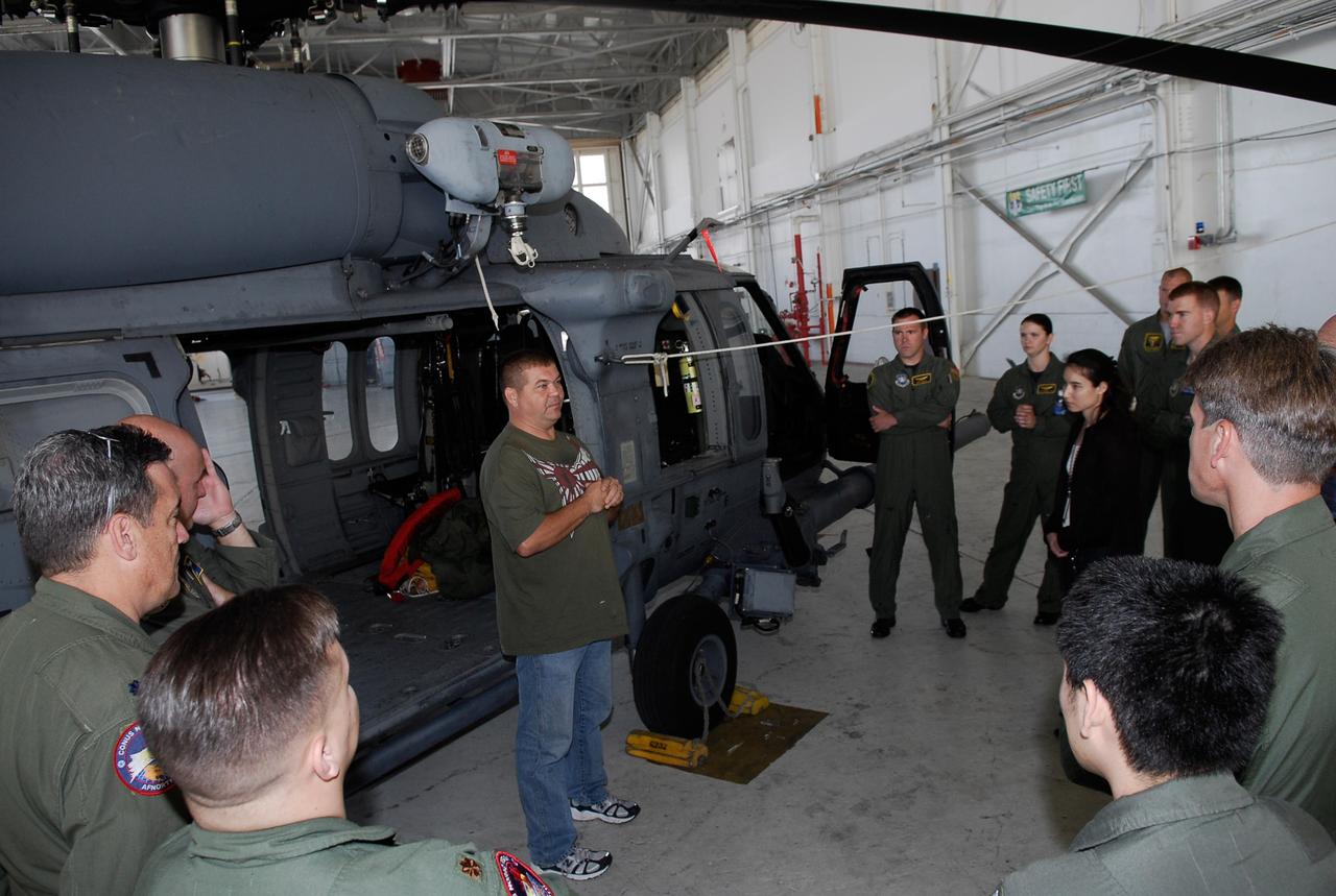
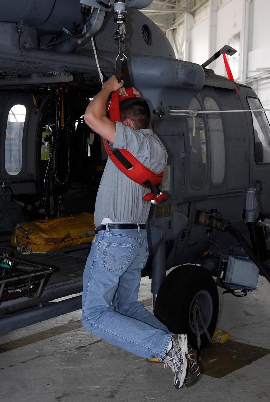
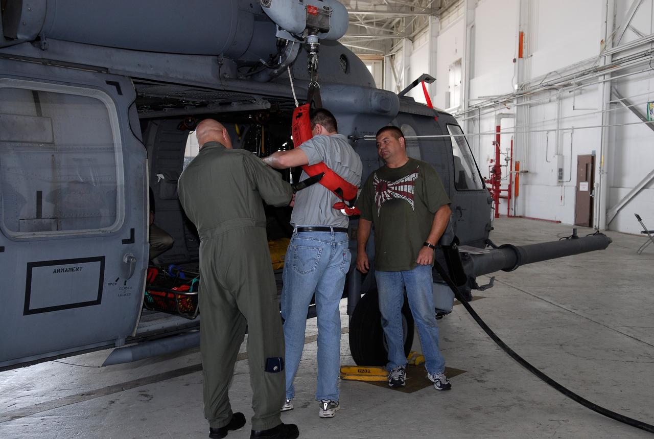
CAPE CANAVERAL, Fla. -- Participants in the Mode VIII exercise being conducted at Patrick Air Force Base, Fla., get instruction about the rescue equipment they will be working with. In support of, and with logistical support from, NASA, USSTRATCOM is hosting a major exercise involving Department of Defense, Department of Homeland Security, search and rescue (SAR) forces, including the 45th Space Wing at Patrick Air Force Base, which support space shuttle astronaut bailout contingency operations, known as Mode VIII. This exercise tests SAR capabilities to locate, recover and provide medical treatment for astronauts following a space shuttle launch phase open-ocean bailout. Participants include members of the U.S. Navy, U.S. Coast Guard, U.S. Air Force, and NASA's Kennedy Space Center and Johnson Space Center. This will be the 15th Mode VIII exercise conducted in the past 20 years. Photo credit: NASA/Kim Shiflett

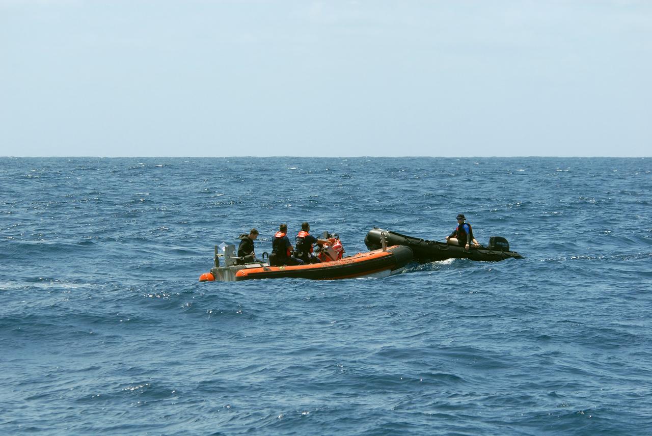
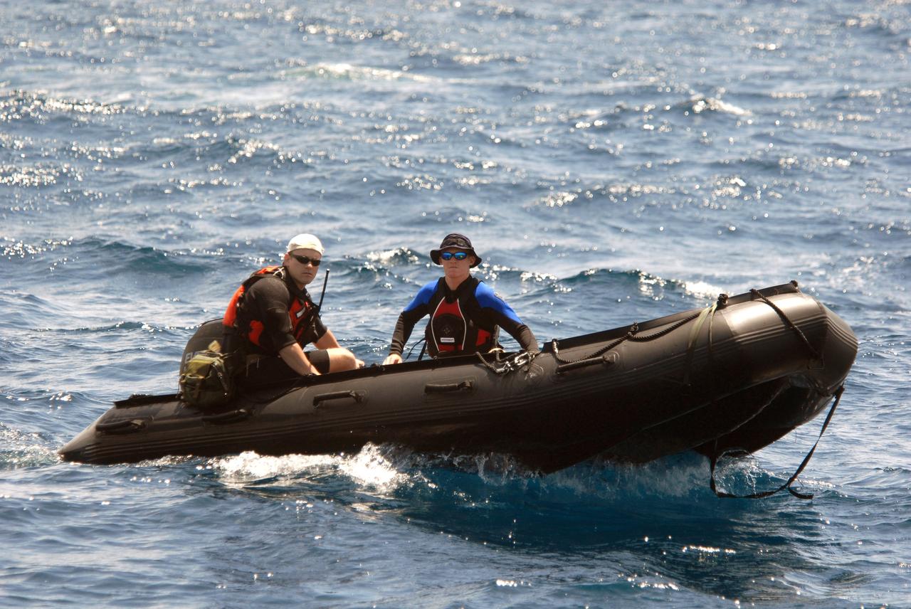
CAPE CANAVERAL, Fla. -- Participants in a rescue training exercise, known as Mode VIII, are successfully launched from a U.S. Coast Guard rescue boat off Florida's central east coast. In support of, and with logistical support from, NASA, USSTRATCOM is hosting a major exercise involving Department of Defense, Department of Homeland Security, search and rescue (SAR) forces, including the 45th Space Wing at Patrick Air Force Base, which support space shuttle astronaut bailout contingency operations, known as Mode VIII. This exercise tests SAR capabilities to locate, recover and provide medical treatment for astronauts following a space shuttle launch phase open-ocean bailout. Participants include members of the U.S. Navy, U.S. Coast Guard, U.S. Air Force, and NASA's Kennedy Space Center and Johnson Space Center. Photo credit: NASA/Dimitri Gerondidakis
CAPE CANAVERAL, Fla. -- Representatives of the 301st Rescue Squadron demonstrate the use of rescue equipment on the HH-60G helicopter that is used by participants in the Mode VIII exercise being conducted at Patrick Air Force Base, Fla. In support of, and with logistical support from, NASA, USSTRATCOM is hosting a major exercise involving Department of Defense, Department of Homeland Security, search and rescue (SAR) forces, including the 45th Space Wing at Patrick Air Force Base, which support space shuttle astronaut bailout contingency operations, known as Mode VIII. This exercise tests SAR capabilities to locate, recover and provide medical treatment for astronauts following a space shuttle launch phase open-ocean bailout. Participants include members of the U.S. Navy, U.S. Coast Guard, U.S. Air Force, and NASA's Kennedy Space Center and Johnson Space Center. This will be the 15th Mode VIII exercise conducted in the past 20 years. Photo credit: NASA/Kim Shiflett
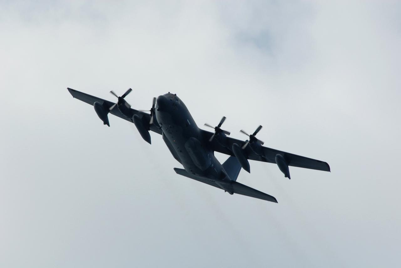
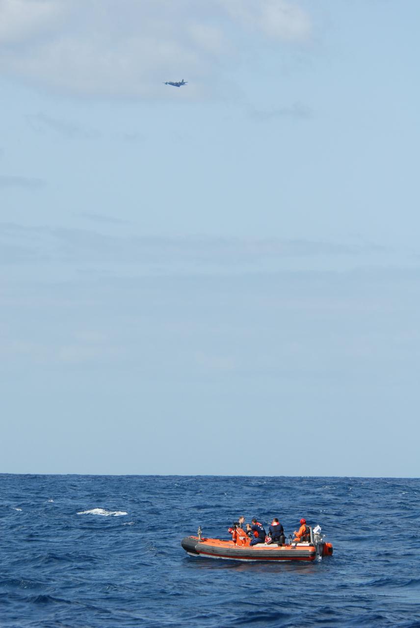
CAPE CANAVERAL, Fla. -- An Air Force HC-130 rescue tanker flies over the target area off Florida's central east coast during a rescue training exercise, known as Mode VIII. In support of, and with logistical support from, NASA, USSTRATCOM is hosting a major exercise involving Department of Defense, Department of Homeland Security, search and rescue (SAR) forces, including the 45th Space Wing at Patrick Air Force Base, which support space shuttle astronaut bailout contingency operations, known as Mode VIII. This exercise tests SAR capabilities to locate, recover and provide medical treatment for astronauts following a space shuttle launch phase open-ocean bailout. Participants include members of the U.S. Navy, U.S. Coast Guard, U.S. Air Force, and NASA's Kennedy Space Center and Johnson Space Center. Photo credit: NASA/Dimitri Gerondidakis
CAPE CANAVERAL, Fla. -- Participants in a rescue training exercise, known as Mode VIII, wait for a support boat off Florida's central east coast. In support of, and with logistical support from, NASA, USSTRATCOM is hosting a major exercise involving Department of Defense, Department of Homeland Security, search and rescue (SAR) forces, including the 45th Space Wing at Patrick Air Force Base, which support space shuttle astronaut bailout contingency operations, known as Mode VIII. This exercise tests SAR capabilities to locate, recover and provide medical treatment for astronauts following a space shuttle launch phase open-ocean bailout. Participants include members of the U.S. Navy, U.S. Coast Guard, U.S. Air Force, and NASA's Kennedy Space Center and Johnson Space Center. Photo credit: NASA/Dimitri Gerondidakis
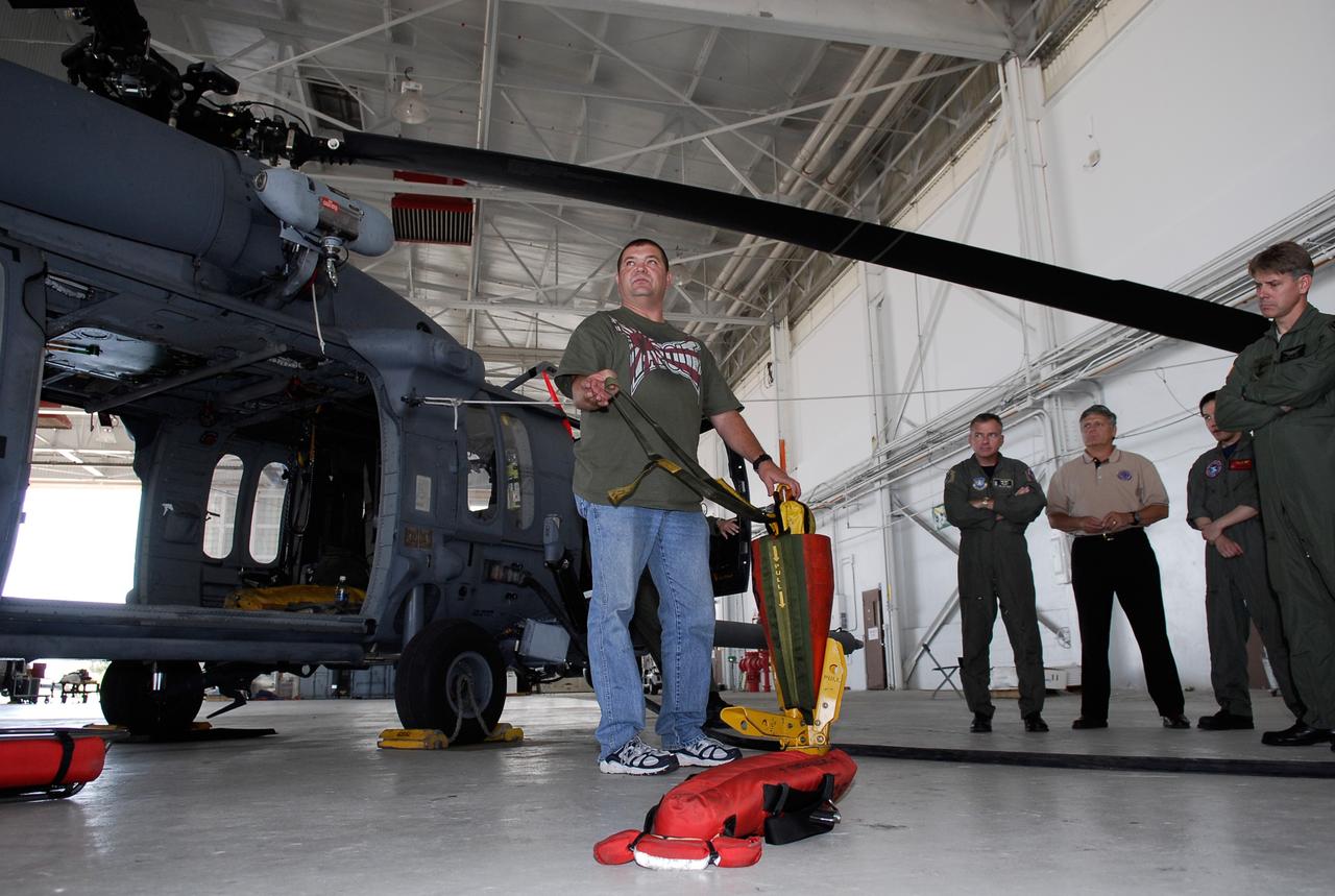
CAPE CANAVERAL, Fla. -- A representative of the 301st Rescue Squadron demonstrates rescue equipment that is used by participants in the Mode VIII exercise being conducted at Patrick Air Force Base, Fla. In the background is an HH-60G helicopter. In support of, and with logistical support from, NASA, USSTRATCOM is hosting a major exercise involving Department of Defense, Department of Homeland Security, search and rescue (SAR) forces, including the 45th Space Wing at Patrick Air Force Base, which support space shuttle astronaut bailout contingency operations, known as Mode VIII. This exercise tests SAR capabilities to locate, recover and provide medical treatment for astronauts following a space shuttle launch phase open-ocean bailout. Participants include members of the U.S. Navy, U.S. Coast Guard, U.S. Air Force, and NASA's Kennedy Space Center and Johnson Space Center. This will be the 15th Mode VIII exercise conducted in the past 20 years. Photo credit: NASA/Kim Shiflett
CAPE CANAVERAL, Fla. -- Participants in a rescue training exercise, known as Mode VIII, are successfully launched from a U.S. Coast Guard rescue boat off Florida's central east coast. In support of, and with logistical support from, NASA, USSTRATCOM is hosting a major exercise involving Department of Defense, Department of Homeland Security, search and rescue (SAR) forces, including the 45th Space Wing at Patrick Air Force Base, which support space shuttle astronaut bailout contingency operations, known as Mode VIII. This exercise tests SAR capabilities to locate, recover and provide medical treatment for astronauts following a space shuttle launch phase open-ocean bailout. Participants include members of the U.S. Navy, U.S. Coast Guard, U.S. Air Force, and NASA's Kennedy Space Center and Johnson Space Center. Photo credit: NASA/Dimitri Gerondidakis

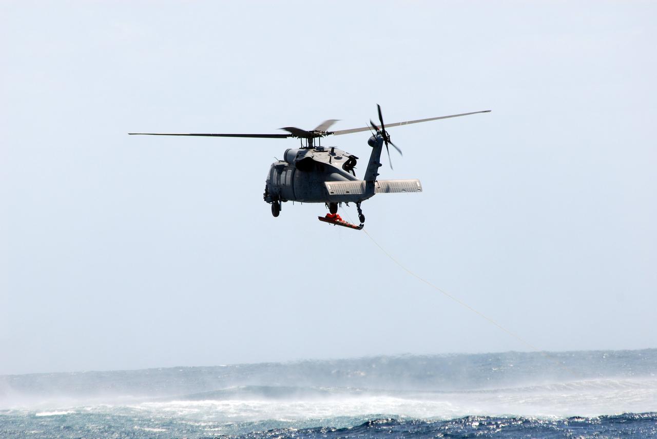
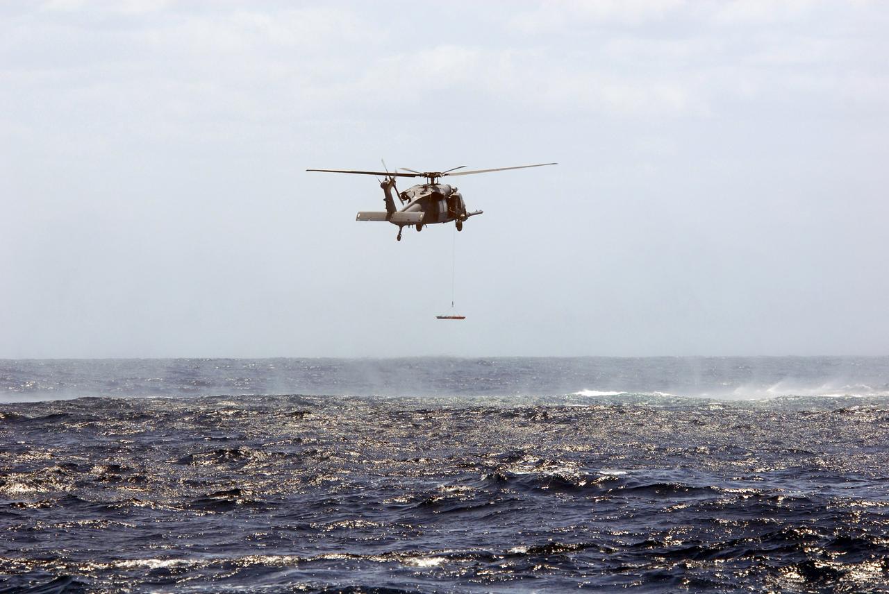
CAPE CANAVERAL, Fla. -- In a rescue training exercise, known as Mode VIII, off Florida's central east coast, a participant is lifted out of the water with a harness from an HH-60G helicopter. In support of, and with logistical support from, NASA, USSTRATCOM is hosting a major exercise involving Department of Defense, Department of Homeland Security, search and rescue (SAR) forces, including the 45th Space Wing at Patrick Air Force Base, which support space shuttle astronaut bailout contingency operations, known as Mode VIII. This exercise tests SAR capabilities to locate, recover and provide medical treatment for astronauts following a space shuttle launch phase open-ocean bailout. Participants include members of the U.S. Navy, U.S. Coast Guard, U.S. Air Force, and NASA's Kennedy Space Center and Johnson Space Center. Photo credit: NASA/Dimitri Gerondidakis
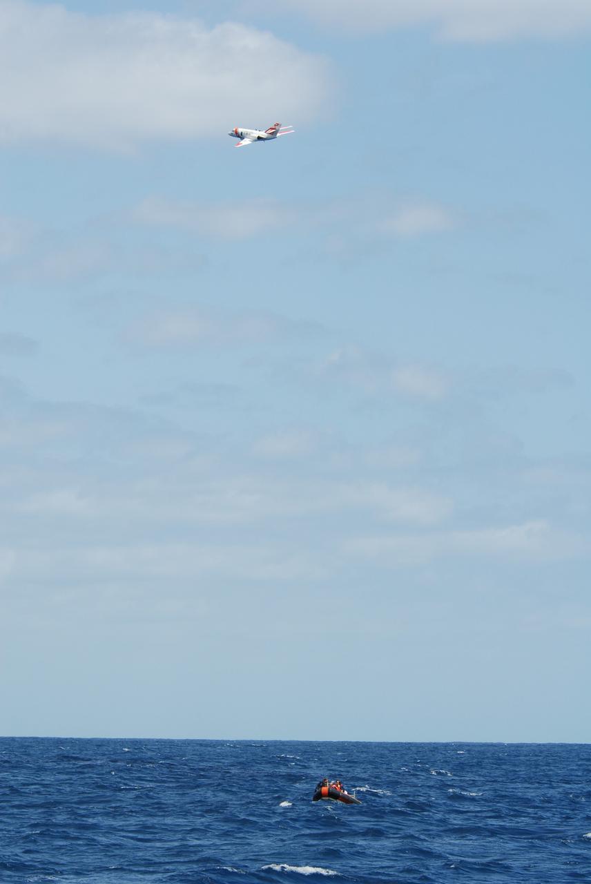
CAPE CANAVERAL, Fla. -- A U.S. Coast Guard HU-25 Falcon jet flies over a rescue boat during a training exercise, known as Mode VIII, off Florida's central east coast. In support of, and with logistical support from, NASA, USSTRATCOM is hosting a major exercise involving Department of Defense, Department of Homeland Security, search and rescue (SAR) forces, including the 45th Space Wing at Patrick Air Force Base, which support space shuttle astronaut bailout contingency operations, known as Mode VIII. This exercise tests SAR capabilities to locate, recover and provide medical treatment for astronauts following a space shuttle launch phase open-ocean bailout. Participants include members of the U.S. Navy, U.S. Coast Guard, U.S. Air Force, and NASA's Kennedy Space Center and Johnson Space Center. Photo credit: NASA/Dimitri Gerondidakis
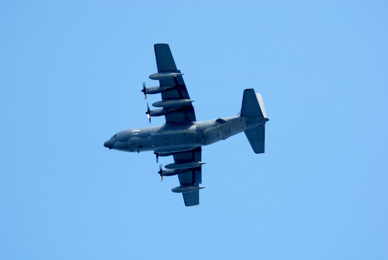
CAPE CANAVERAL, Fla. -- An Air Force HC-130 rescue tanker flies over the target area off Florida's central east coast during a rescue training exercise, known as Mode VIII. In support of, and with logistical support from, NASA, USSTRATCOM is hosting a major exercise involving Department of Defense, Department of Homeland Security, search and rescue (SAR) forces, including the 45th Space Wing at Patrick Air Force Base, which support space shuttle astronaut bailout contingency operations, known as Mode VIII. This exercise tests SAR capabilities to locate, recover and provide medical treatment for astronauts following a space shuttle launch phase open-ocean bailout. Participants include members of the U.S. Navy, U.S. Coast Guard, U.S. Air Force, and NASA's Kennedy Space Center and Johnson Space Center. Photo credit: NASA/Dimitri Gerondidakis
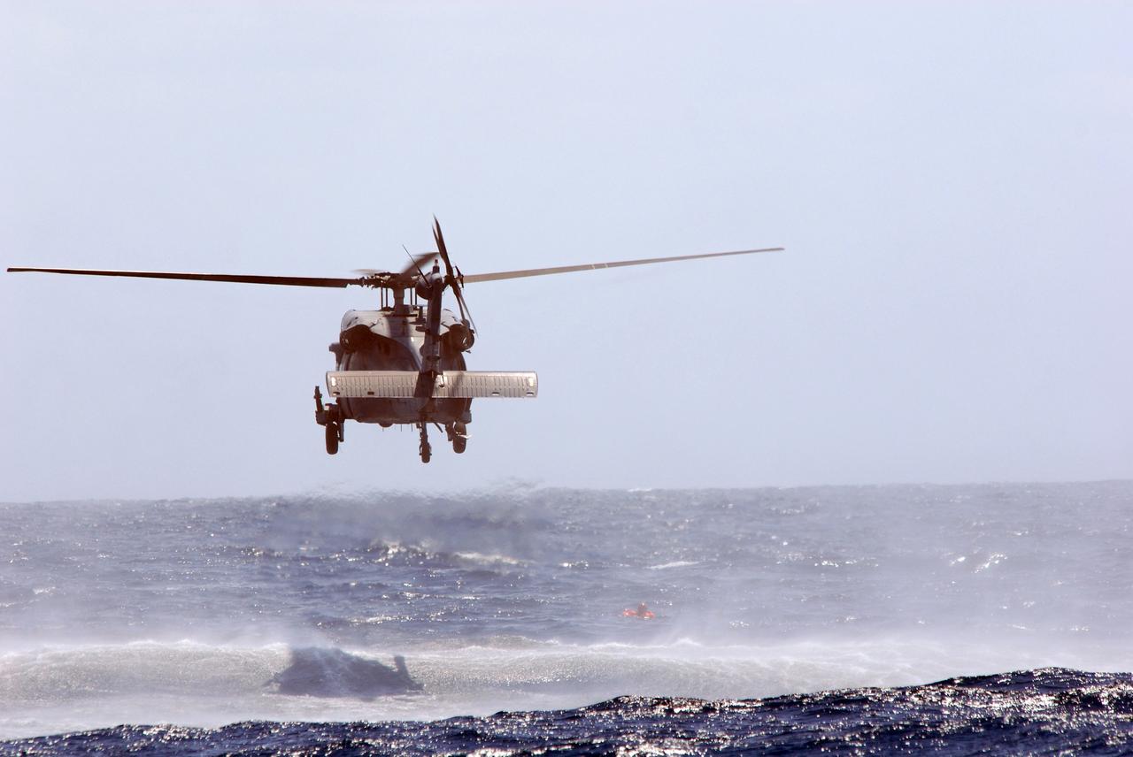
CAPE CANAVERAL, Fla. -- In a training exercise, known as Mode VIII, off Florida's central east coast, an HH-60G helicopter executes a rescue maneuver of a participant. In support of, and with logistical support from, NASA, USSTRATCOM is hosting a major exercise involving Department of Defense, Department of Homeland Security, search and rescue (SAR) forces, including the 45th Space Wing at Patrick Air Force Base, which support space shuttle astronaut bailout contingency operations, known as Mode VIII. This exercise tests SAR capabilities to locate, recover and provide medical treatment for astronauts following a space shuttle launch phase open-ocean bailout. Participants include members of the U.S. Navy, U.S. Coast Guard, U.S. Air Force, and NASA's Kennedy Space Center and Johnson Space Center. Photo credit: NASA/Dimitri Gerondidakis

CAPE CANAVERAL, Fla. -- Off Florida's central east coast, a support boat from a rescue training exercise, known as Mode VIII, returns to the Freedom Star, one of NASA's solid rocket booster retrieval ships from NASA's Kennedy Space Center. In support of, and with logistical support from, NASA, USSTRATCOM is hosting a major exercise involving Department of Defense, Department of Homeland Security, search and rescue (SAR) forces, including the 45th Space Wing at Patrick Air Force Base, which support space shuttle astronaut bailout contingency operations, known as Mode VIII. This exercise tests SAR capabilities to locate, recover and provide medical treatment for astronauts following a space shuttle launch phase open-ocean bailout. Participants include members of the U.S. Navy, U.S. Coast Guard, U.S. Air Force, and NASA's Kennedy Space Center and Johnson Space Center. Photo credit: NASA/Dimitri Gerondidakis
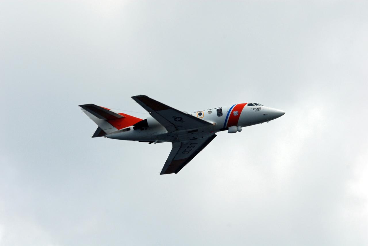
CAPE CANAVERAL, Fla. -- A U.S. Coast Guard HU-25 Falcon jet flies overhead during a rescue training exercise, known as Mode VIII, off Florida's central east coast. In support of, and with logistical support from, NASA, USSTRATCOM is hosting a major exercise involving Department of Defense, Department of Homeland Security, search and rescue (SAR) forces, including the 45th Space Wing at Patrick Air Force Base, which support space shuttle astronaut bailout contingency operations, known as Mode VIII. This exercise tests SAR capabilities to locate, recover and provide medical treatment for astronauts following a space shuttle launch phase open-ocean bailout. Participants include members of the U.S. Navy, U.S. Coast Guard, U.S. Air Force, and NASA's Kennedy Space Center and Johnson Space Center. Photo credit: NASA/Dimitri Gerondidakis
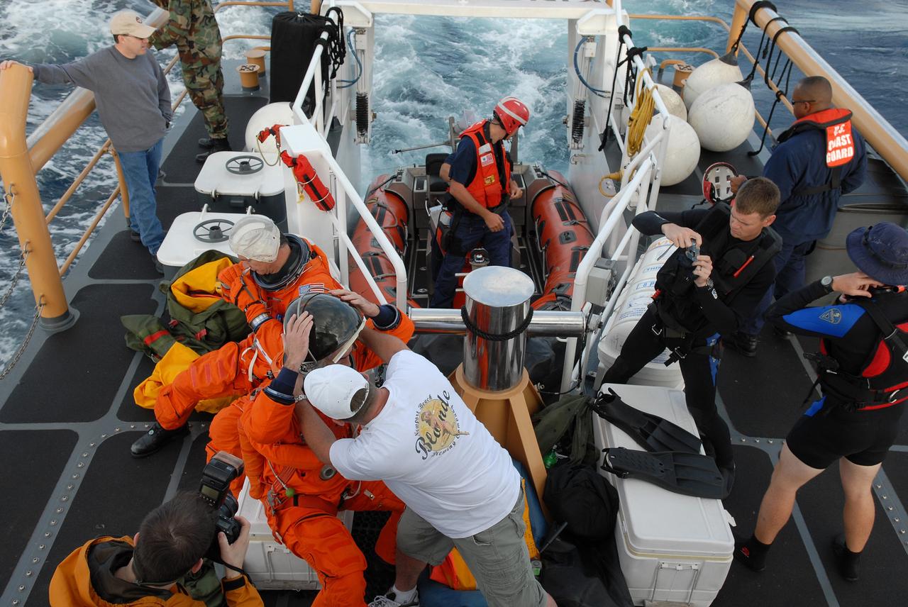
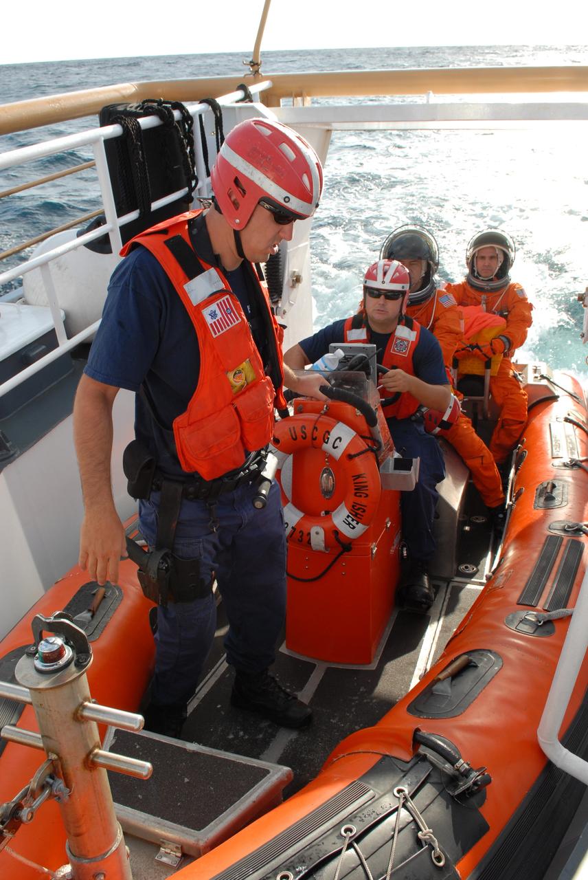
CAPE CANAVERAL, Fla. -- In a U.S. Coast Guard rescue boat off Florida's central east coast, participants in a rescue training exercise, known as Mode VIII, put on astronauts' launch-and-entry suits. In support of, and with logistical support from, NASA, USSTRATCOM is hosting a major exercise involving Department of Defense, Department of Homeland Security, search and rescue (SAR) forces, including the 45th Space Wing at Patrick Air Force Base, which support space shuttle astronaut bailout contingency operations, known as Mode VIII. This exercise tests SAR capabilities to locate, recover and provide medical treatment for astronauts following a space shuttle launch phase open-ocean bailout. Participants include members of the U.S. Navy, U.S. Coast Guard, U.S. Air Force, and NASA's Kennedy Space Center and Johnson Space Center. Photo credit: NASA/Dimitri Gerondidakis
CAPE CANAVERAL, Fla. -- A representative of the 301st Rescue Squadron demonstrates rescue equipment on the HH-60G helicopter that is used by participants in the Mode VIII exercise being conducted at Patrick Air Force Base, Fla. In support of, and with logistical support from, NASA, USSTRATCOM is hosting a major exercise involving Department of Defense, Department of Homeland Security, search and rescue (SAR) forces, including the 45th Space Wing at Patrick Air Force Base, which support space shuttle astronaut bailout contingency operations, known as Mode VIII. This exercise tests SAR capabilities to locate, recover and provide medical treatment for astronauts following a space shuttle launch phase open-ocean bailout. Participants include members of the U.S. Navy, U.S. Coast Guard, U.S. Air Force, and NASA's Kennedy Space Center and Johnson Space Center. This will be the 15th Mode VIII exercise conducted in the past 20 years. Photo credit: NASA/Kim Shiflett
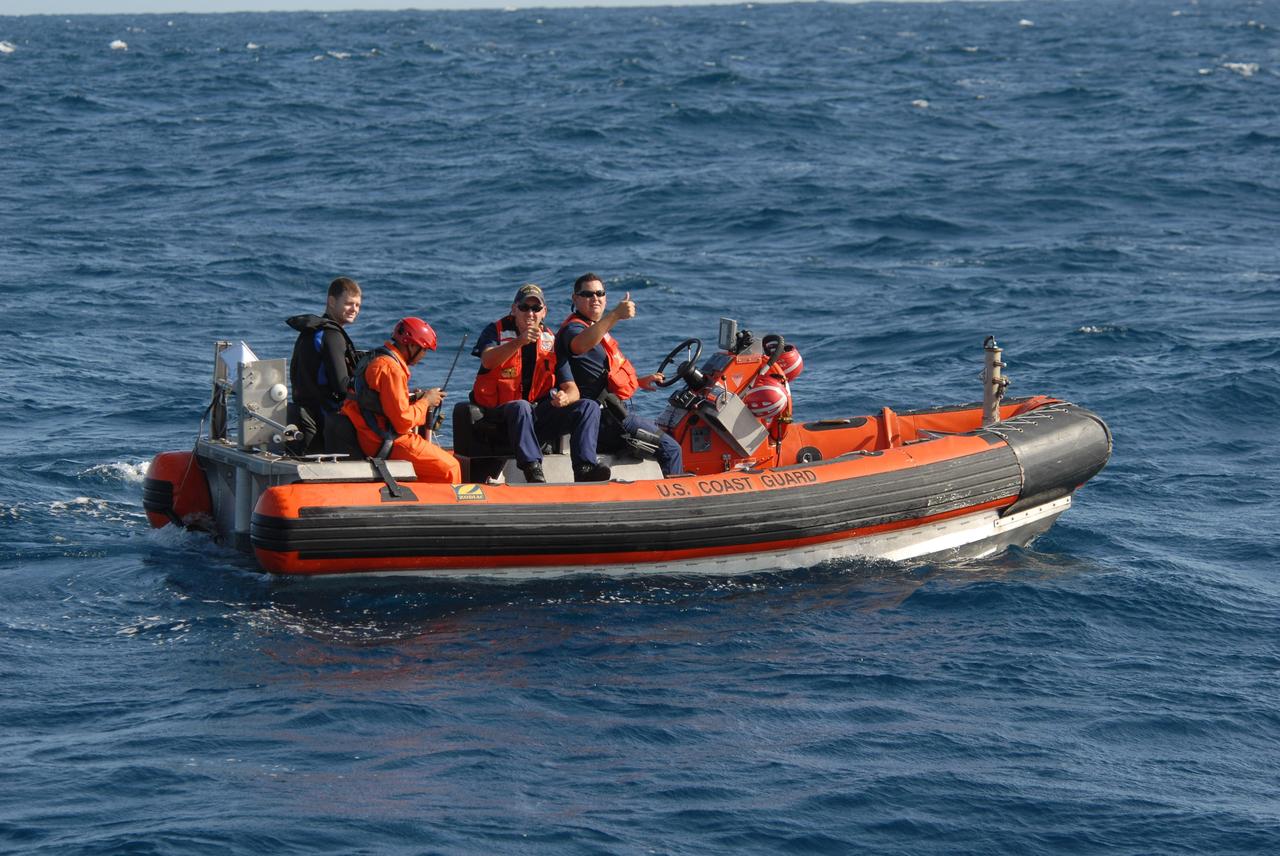
CAPE CANAVERAL, Fla. -- Participants in a rescue training exercise, known as Mode VIII, are successfully launched from a U.S. Coast Guard rescue boat off Florida's central east coast. In support of, and with logistical support from, NASA, USSTRATCOM is hosting a major exercise involving Department of Defense, Department of Homeland Security, search and rescue (SAR) forces, including the 45th Space Wing at Patrick Air Force Base, which support space shuttle astronaut bailout contingency operations, known as Mode VIII. This exercise tests SAR capabilities to locate, recover and provide medical treatment for astronauts following a space shuttle launch phase open-ocean bailout. Participants include members of the U.S. Navy, U.S. Coast Guard, U.S. Air Force, and NASA's Kennedy Space Center and Johnson Space Center. Photo credit: NASA/Dimitri Gerondidakis

CAPE CANAVERAL, Fla. -- In a U.S. Coast Guard boat off Florida's central east coast, astronaut Richard Mastracchio adjusts his launch-and-entry suit to participate in a rescue training exercise, known as Mode VIII. Behind him is astronaut Paulo Nespoli. In support of, and with logistical support from, NASA, USSTRATCOM is hosting a major exercise involving Department of Defense, Department of Homeland Security, search and rescue (SAR) forces, including the 45th Space Wing at Patrick Air Force Base, which support space shuttle astronaut bailout contingency operations, known as Mode VIII. This exercise tests SAR capabilities to locate, recover and provide medical treatment for astronauts following a space shuttle launch phase open-ocean bailout. Participants include members of the U.S. Navy, U.S. Coast Guard, U.S. Air Force, and NASA's Kennedy Space Center and Johnson Space Center. Photo credit: NASA/Dimitri Gerondidakis

CAPE CANAVERAL, Fla. -- In a rescue training exercise, known as Mode VIII, off Florida's central east coast, a participant is lifted out of the water with a harness from an HH-60G helicopter. In support of, and with logistical support from, NASA, USSTRATCOM is hosting a major exercise involving Department of Defense, Department of Homeland Security, search and rescue (SAR) forces, including the 45th Space Wing at Patrick Air Force Base, which support space shuttle astronaut bailout contingency operations, known as Mode VIII. This exercise tests SAR capabilities to locate, recover and provide medical treatment for astronauts following a space shuttle launch phase open-ocean bailout. Participants include members of the U.S. Navy, U.S. Coast Guard, U.S. Air Force, and NASA's Kennedy Space Center and Johnson Space Center. Photo credit: NASA/Dimitri Gerondidakis
CAPE CANAVERAL, Fla. -- Representatives of the 301st Rescue Squadron demonstrate the use of rescue equipment on the HH-60G helicopter that is used by participants in the Mode VIII exercise being conducted at Patrick Air Force Base, Fla. In support of, and with logistical support from, NASA, USSTRATCOM is hosting a major exercise involving Department of Defense, Department of Homeland Security, search and rescue (SAR) forces, including the 45th Space Wing at Patrick Air Force Base, which support space shuttle astronaut bailout contingency operations, known as Mode VIII. This exercise tests SAR capabilities to locate, recover and provide medical treatment for astronauts following a space shuttle launch phase open-ocean bailout. Participants include members of the U.S. Navy, U.S. Coast Guard, U.S. Air Force, and NASA's Kennedy Space Center and Johnson Space Center. This will be the 15th Mode VIII exercise conducted in the past 20 years. Photo credit: NASA/Kim Shiflett

CAPE CANAVERAL, Fla. -- Off Florida's central east coast, support boats from a training exercise, known as Mode VIII, return to the U.S. Coast Guard cutter Kingfisher, from Port Canaveral, Fla. In support of, and with logistical support from, NASA, USSTRATCOM is hosting a major exercise involving Department of Defense, Department of Homeland Security, search and rescue (SAR) forces, including the 45th Space Wing at Patrick Air Force Base, which support space shuttle astronaut bailout contingency operations, known as Mode VIII. This exercise tests SAR capabilities to locate, recover and provide medical treatment for astronauts following a space shuttle launch phase open-ocean bailout. Participants include members of the U.S. Navy, U.S. Coast Guard, U.S. Air Force, and NASA's Kennedy Space Center and Johnson Space Center. Photo credit: NASA/Dimitri Gerondidakis
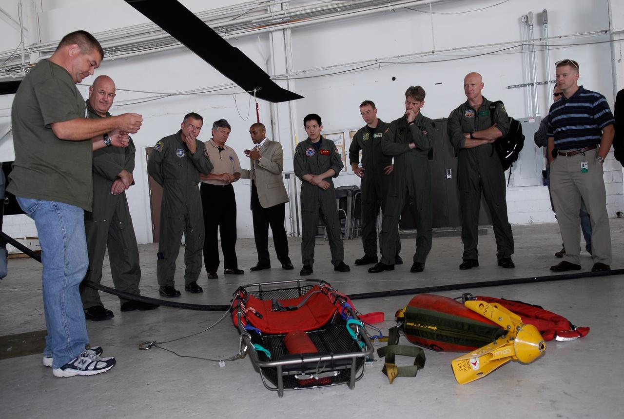
CAPE CANAVERAL, Fla. -- A representative of the 301st Rescue Squadron demonstrates rescue equipment that is used by participants in the Mode VIII exercise being conducted at Patrick Air Force Base, Fla. In support of, and with logistical support from, NASA, USSTRATCOM is hosting a major exercise involving Department of Defense, Department of Homeland Security, search and rescue (SAR) forces, including the 45th Space Wing at Patrick Air Force Base, which support space shuttle astronaut bailout contingency operations, known as Mode VIII. This exercise tests SAR capabilities to locate, recover and provide medical treatment for astronauts following a space shuttle launch phase open-ocean bailout. Participants include members of the U.S. Navy, U.S. Coast Guard, U.S. Air Force, and NASA's Kennedy Space Center and Johnson Space Center. This will be the 15th Mode VIII exercise conducted in the past 20 years. Photo credit: NASA/Kim Shiflett
CAPE CANAVERAL, Fla. -- Participants take part in a rescue training exercise, known as Mode VIII, off Florida's central east coast while a U.S. Coast Guard HU-25 Falcon jet flies overhead. In support of, and with logistical support from, NASA, USSTRATCOM is hosting a major exercise involving Department of Defense, Department of Homeland Security, search and rescue (SAR) forces, including the 45th Space Wing at Patrick Air Force Base, which support space shuttle astronaut bailout contingency operations, known as Mode VIII. This exercise tests SAR capabilities to locate, recover and provide medical treatment for astronauts following a space shuttle launch phase open-ocean bailout. Participants include members of the U.S. Navy, U.S. Coast Guard, U.S. Air Force, and NASA's Kennedy Space Center and Johnson Space Center. Photo credit: NASA/Dimitri Gerondidakis
CAPE CANAVERAL, Fla. -- In a U.S. Coast Guard rescue boat off Florida's central east coast, participants in a rescue training exercise, known as Mode VIII, are ready to be launched into the Atlantic Ocean. In support of, and with logistical support from, NASA, USSTRATCOM is hosting a major exercise involving Department of Defense, Department of Homeland Security, search and rescue (SAR) forces, including the 45th Space Wing at Patrick Air Force Base, which support space shuttle astronaut bailout contingency operations, known as Mode VIII. This exercise tests SAR capabilities to locate, recover and provide medical treatment for astronauts following a space shuttle launch phase open-ocean bailout. Participants include members of the U.S. Navy, U.S. Coast Guard, U.S. Air Force, and NASA's Kennedy Space Center and Johnson Space Center. Photo credit: NASA/Dimitri Gerondidakis
CAPE CANAVERAL, Fla. -- Support boats connect off Florida's central east coast during a rescue training exercise, known as Mode VIII. In support of, and with logistical support from, NASA, USSTRATCOM is hosting a major exercise involving Department of Defense, Department of Homeland Security, search and rescue (SAR) forces, including the 45th Space Wing at Patrick Air Force Base, which support space shuttle astronaut bailout contingency operations, known as Mode VIII. This exercise tests SAR capabilities to locate, recover and provide medical treatment for astronauts following a space shuttle launch phase open-ocean bailout. Participants include members of the U.S. Navy, U.S. Coast Guard, U.S. Air Force, and NASA's Kennedy Space Center and Johnson Space Center. Photo credit: NASA/Dimitri Gerondidakis
CAPE CANAVERAL, Fla. -- In a rescue training exercise, known as Mode VIII, off Florida's central east coast, an HH-60G helicopter lifts the stretcher bearing a participant. In support of, and with logistical support from, NASA, USSTRATCOM is hosting a major exercise involving Department of Defense, Department of Homeland Security, search and rescue (SAR) forces, including the 45th Space Wing at Patrick Air Force Base, which support space shuttle astronaut bailout contingency operations, known as Mode VIII. This exercise tests SAR capabilities to locate, recover and provide medical treatment for astronauts following a space shuttle launch phase open-ocean bailout. Participants include members of the U.S. Navy, U.S. Coast Guard, U.S. Air Force, and NASA's Kennedy Space Center and Johnson Space Center. Photo credit: NASA/Dimitri Gerondidakis
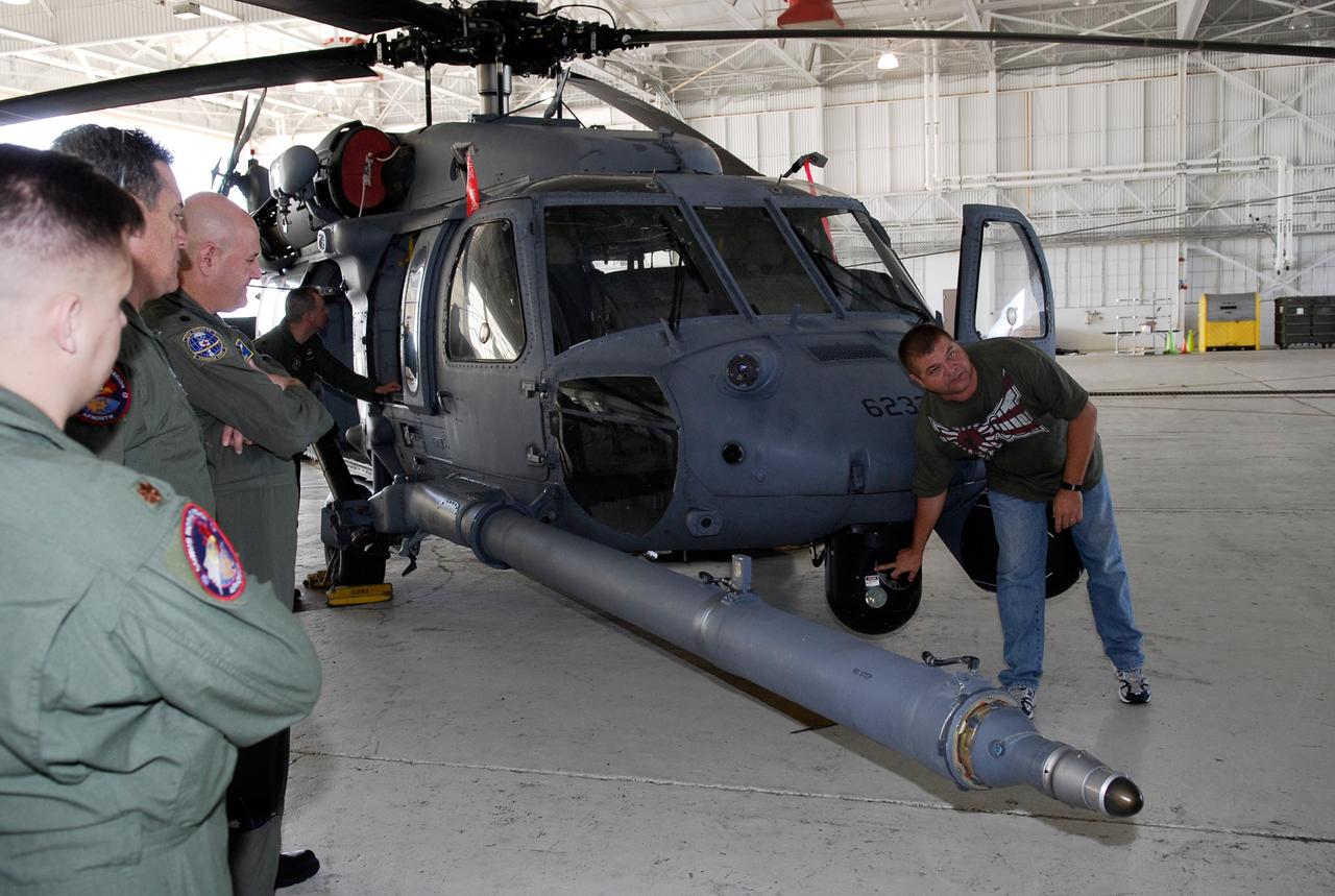
CAPE CANAVERAL, Fla. -- A representative of the 301st Rescue Squadron familiarizes participants in the Mode VIII exercise with the HH-60G helicopter that will play a part. The Mode VIII is being conducted at Patrick Air Force Base, Fla. In support of, and with logistical support from, NASA, USSTRATCOM is hosting a major exercise involving Department of Defense, Department of Homeland Security, search and rescue (SAR) forces, including the 45th Space Wing at Patrick Air Force Base, which support space shuttle astronaut bailout contingency operations, known as Mode VIII. This exercise tests SAR capabilities to locate, recover and provide medical treatment for astronauts following a space shuttle launch phase open-ocean bailout. Participants include members of the U.S. Navy, U.S. Coast Guard, U.S. Air Force, and NASA's Kennedy Space Center and Johnson Space Center. This will be the 15th Mode VIII exercise conducted in the past 20 years. Photo credit: NASA/Kim Shiflett
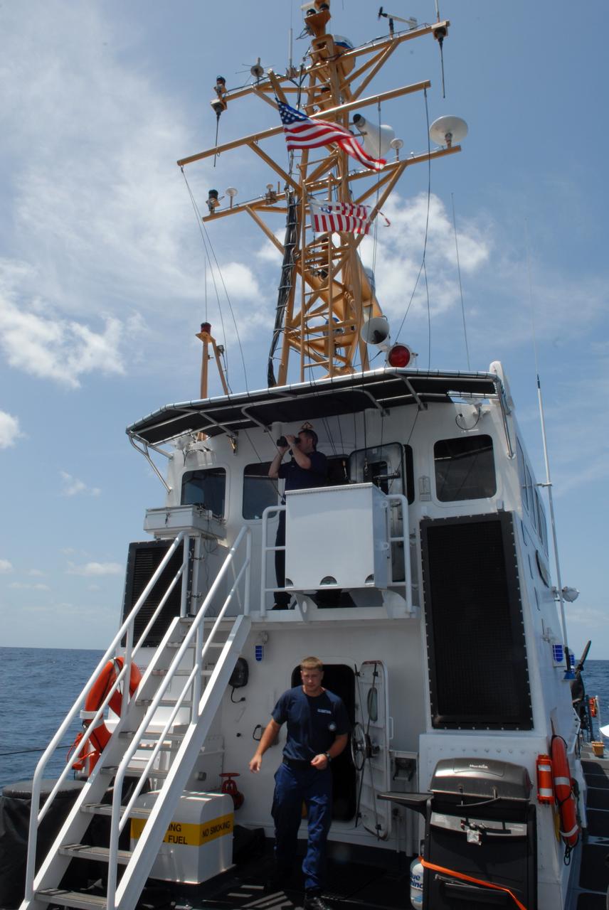
CAPE CANAVERAL, Fla. -- Off Florida's central east coast, members of the rescue team in a training exercise, known as Mode VIII, stay alert aboard the U.S. Coast Guard cutter Kingfisher, from Port Canaveral, Fla. In support of, and with logistical support from, NASA, USSTRATCOM is hosting a major exercise involving Department of Defense, Department of Homeland Security, search and rescue (SAR) forces, including the 45th Space Wing at Patrick Air Force Base, which support space shuttle astronaut bailout contingency operations, known as Mode VIII. This exercise tests SAR capabilities to locate, recover and provide medical treatment for astronauts following a space shuttle launch phase open-ocean bailout. Participants include members of the U.S. Navy, U.S. Coast Guard, U.S. Air Force, and NASA's Kennedy Space Center and Johnson Space Center. Photo credit: NASA/Dimitri Gerondidakis
CAPE CANAVERAL, Fla. -- A support boat from a rescue training exercise, known as Mode VIII, returns to the ship off Florida's central east coast. In support of, and with logistical support from, NASA, USSTRATCOM is hosting a major exercise involving Department of Defense, Department of Homeland Security, search and rescue (SAR) forces, including the 45th Space Wing at Patrick Air Force Base, which support space shuttle astronaut bailout contingency operations, known as Mode VIII. This exercise tests SAR capabilities to locate, recover and provide medical treatment for astronauts following a space shuttle launch phase open-ocean bailout. Participants include members of the U.S. Navy, U.S. Coast Guard, U.S. Air Force, and NASA's Kennedy Space Center and Johnson Space Center. Photo credit: NASA/Dimitri Gerondidakis

CAPE CANAVERAL, Fla. -- In a U.S. Coast Guard rescue boat off Florida's central east coast, participants in a rescue training exercise, known as Mode VIII, put on astronauts' launch-and-entry suits. In support of, and with logistical support from, NASA, USSTRATCOM is hosting a major exercise involving Department of Defense, Department of Homeland Security, search and rescue (SAR) forces, including the 45th Space Wing at Patrick Air Force Base, which support space shuttle astronaut bailout contingency operations, known as Mode VIII. This exercise tests SAR capabilities to locate, recover and provide medical treatment for astronauts following a space shuttle launch phase open-ocean bailout. Participants include members of the U.S. Navy, U.S. Coast Guard, U.S. Air Force, and NASA's Kennedy Space Center and Johnson Space Center. Photo credit: NASA/Dimitri Gerondidakis

CAPE CANAVERAL, Fla. -- A representative of the 301st Rescue Squadron demonstrates rescue equipment that is used by participants in the Mode VIII exercise being conducted at Patrick Air Force Base, Fla. In the background is an HH-60G helicopter. In support of, and with logistical support from, NASA, USSTRATCOM is hosting a major exercise involving Department of Defense, Department of Homeland Security, search and rescue (SAR) forces, including the 45th Space Wing at Patrick Air Force Base, which support space shuttle astronaut bailout contingency operations, known as Mode VIII. This exercise tests SAR capabilities to locate, recover and provide medical treatment for astronauts following a space shuttle launch phase open-ocean bailout. Participants include members of the U.S. Navy, U.S. Coast Guard, U.S. Air Force, and NASA's Kennedy Space Center and Johnson Space Center. This will be the 15th Mode VIII exercise conducted in the past 20 years. Photo credit: NASA/Kim Shiflett

STS059-S-039 (11 April 1994) --- This is a false-color composite of Prince Albert, Canada, centered at 53.91 north latitude and 104.69 west longitude. This image was acquired by the Spaceborne Imaging Radar-C and X-Band Synthetic Aperture Radar (SIR-C/X-SAR) aboard the Space Shuttle Endeavour on its 20th orbit. The area is located 40 kilometers (25 miles) north and 30 kilometers (20 miles) east of the town of Prince Albert in the Saskatchewan province of Canada. The image covers the area east of the Candle Lake, between gravel surface Highways 120 and 106 and west of 106. The area in the middle of the image covers the entire Nipawin (Narrow Hills) provincial park. The look angle of the radar is 30 degrees and the size of the image is approximately 20 kilometers by 50 kilometers (12 by 30 miles). The image was produced by using only the L-Band. The three polarization channels HH, HV and VV are illustrated by red, green and blue respectively. The changes in the intensity of each color are related to various surface conditions such as variations in forest stands, frozen or thawed condition of the surface, disturbances (fire and deforestation), and areas of re-growth. Most of the dark areas in the image are the ice-covered lakes in the region. The dark area on the top right corner of the image is the White Gull Lake north of the intersection of Highway 120 and 913. The right middle part of the image shows Lake Ispuchaw and Lower Fishing Lake. The deforested areas are also shown by dark areas in the image. Since most of the logging practice at the Prince Albert area is around the major highways, the deforested areas can be easily detected as small geometrically shaped dark regions along the roads. At the time of the SIR-C/X-SAR overpass, a major part of the forest is either frozen or undergoing the spring thaw. The L-Band HH shows a high return in the jack pine forest. The reddish areas in the image are old jack pine forest, 12-17 meters (40-55 feet) in height and 60-75 years old. The orange-greenish areas are young jack pine trees, 3-5 meters (10-16 feet) in height and 11-16 years old. The green areas are due to the relative high intensity of the HV channel which is strongly correlated with the amount of biomass. L-Band HV channel shows the biomass variations over the entire region. Most of the green areas, when compared to the forest cover maps are identified as black spruce trees. The dark blue and dark purple colors show recently harvested or re-growth areas respectively. SIR-C/X-SAR is part of NASA's Mission to Planet Earth (MTPE). SIR-C/X-SAR radars illuminate Earth with microwaves allowing detailed observations at any time, regardless of weather or sunlight conditions. SIR-C/X-SAR uses three microwave wavelengths: L-Band (24 cm), C-Band (6 cm), and X-Band (3 cm). The multi-frequency data will be used by the international scientific community to better understand the global environment and how it is changing. The SIR-C/X-SAR data, complemented by aircraft and ground studies, will give scientists clearer insights into those environmental changes which are caused by nature and those changes which are induced by human activity. SIR-C was developed by NASA's Jet Propulsion Laboratory (JPL). X-SAR was developed by the Dornire and Alenia Spazio Companies for the German Space Agency, Deutsche Agentur fuer Raumfahrtangelegenheiten (DARA), and the Italian Space Agency, Agenzia Spaziale Italiana (ASI). JPL Photo ID: P-43886
STS059-S-080 (18 April 1994) --- This is a false-color three frequency image of the Oberpfaffenhofen supersite, an area just south-west of Munich in southern Germany. The colors show the different conditions that the three radars (X-Band, C-Band and L-Band) can see on the ground. The image covers a 27 by 36 kilometer area. The center of the site is 48.09 degrees north and 11.29 degrees east. The image was acquired by the Spaceborne Imaging Radar-C and X-Band Synthetic Aperture Radar (SIR-C/X-SAR) onboard the Space Shuttle Endeavour on April 11, 1994. The dark area on the left is Lake Ammersee. The two smaller lakes are the Woerthsee and the Pilsensee. On the bottom is the tip of the Starnbergersee. The city of Munich is located just beyond the right of the image. The Oberpfaffenhofen supersite is the major test site for SIR-C/X-SAR calibration and scientific investigations concerning agriculture, forestry, hydrology and geology. This color composite image is a three frequency overlay. L-Band total power was assigned red, the C-Band total power is shown in green and the X-Band VV polarization appears blue. The colors on the image stress the differences between the L-Band, C-Band, X-Band images. If the three radar antennas were getting an equal response from objects on the ground, this image would appear in black and white. However, in this image, the blue areas corresponds to area for which the X-Band backscatter is relatively higher than the backscatter at L and C-Bands. This behavior is characteristic of grasslands, clear cuts and shorter vegetation. Similarly, the forested areas have a reddish tint (L-Band). The green areas seen near both the Ammersee and the Pilsensee lakes indicate marshy areas. The agricultural fields in the upper right hand corner appear mostly in blue and green (X-Band and C-Band). The white areas are mostly urban areas, while the smooth surfaces of the lakes appear very dark. SIR-C/X-SAR is part of NASA's Mission to Planet Earth (MTPE). SIR-C/X-SAR radars illuminate Earth with microwaves allowing detailed observations at any time, regardless of weather or sunlight conditions. SIR-C/X-SAR uses three microwave wavelengths: L-Band (24 cm), C-Band (6 cm), and X-Band (3 cm). The multi-frequency data will be used by the international scientific community to better understand the global environment and how it is changing. The SIR-C/X-SAR data, complemented by aircraft and ground studies, will give scientists clearer insights into those environmental changes which are caused by nature and those changes which are induced by human activity. SIR-C was developed by NASA's Jet Propulsion Laboratory (JPL). X-SAR was developed by the Dornire and Alenia Spazio Companies for the German Space Agency, Deutsche Agentur fuer Raumfahrtangelegenheiten (DARA), and the Italian Space Agency, Agenzia Spaziale Italiana (ASI). JPL Photo ID: P-43930
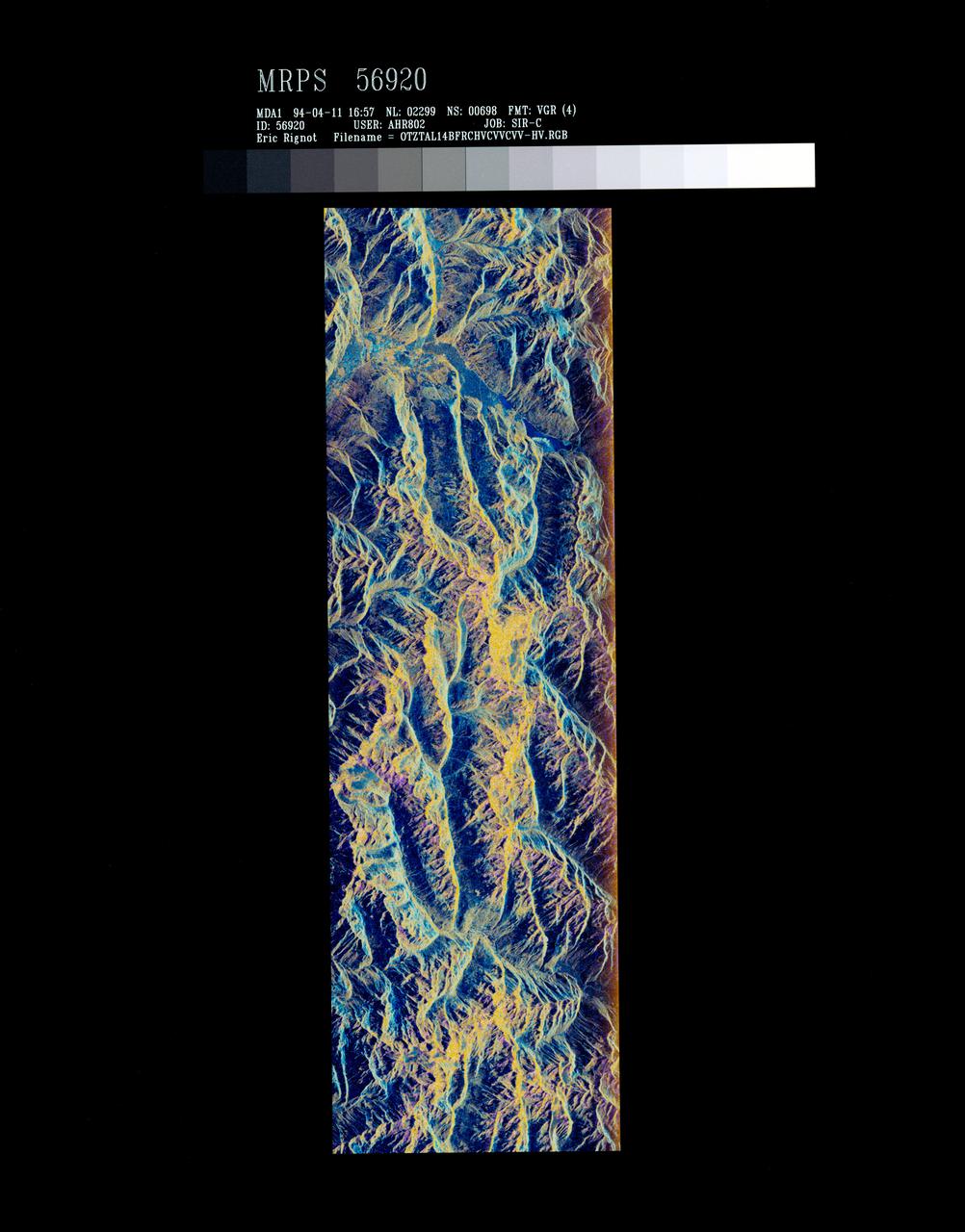
STS059-S-072 (13 April 1994) --- This image is a false-color composite of Oetztal, Austria located in the Central Alps, centered at 46.8 degrees north latitude, and 10.70 degrees east longitude, at the border between Switzerland (top), Italy (left) and Austria (right and bottom). The area shown is 50 kilometers (30 miles) south of Innsbruck, Austria. This image was acquired by the Spaceborne Imaging Radar-C and X-Band Synthetic Aperture Radar (SIR-C/X-SAR) aboard the Space Shuttle Endeavour on its 14th orbit. Oetztal is a SIR-C/X-SAR hydrology supersite. Approximately one quarter of this image is covered by glaciers, the largest of which, Gepatschferner, is visible as a triangular yellow patch in the center of the scene. The summits of the main peaks reach elevations between 3,500 and 3,768 meters (11,500 and 12,362 feet) above sea level. The tongues of the glaciers are descending from elevated plateaus down into narrow valleys which were formed during the last ice age. This color image was produced in C-Band using multi-polarization information (Red=CHV, Green=CVV, Blue=CVV/CHV). The blue areas are lakes (Gepatsch Dam at center right; Lake Muta at top right) and glacier ice. The yellow areas are slopes facing the radar and areas of dry snow. Purple corresponds to slopes facing away from the radar. Yellow in the valley bottom corresponds to tree covered areas. There is 30 to 50 centimeters (12 to 20 inches) of dry, fresh snow on the glaciers, and about 10 centimeters (4 inches) in the valley at the city of Vent, Austria (center). At these data were taken, the weather was cold, with snow and thick fog. The entire area would appear white to an optical sensor because it is all covered under a winter snowpack. Researchers are interested in Oetztal because knowing how glaciers shrink and grow over time is an important indication of climatic change. SIR-C/X-SAR is part of NASA's Mission to Planet Earth (MTPE). SIR-C/X-SAR radars illuminate Earth with microwaves allowing detailed observations at any time, regardless of weather or sunlight conditions. SIR-C/X-SAR uses three microwave wavelengths: L-Band (24 cm), C-Band (6 cm), and X-Band (3 cm). The multi-frequency data will be used by the international scientific community to better understand the global environment and how it is changing. The SIR-C/X-SAR data, complemented by aircraft and ground studies, will give scientists clearer insights into those environmental changes which are caused by nature and those changes which are induced by human activity. SIR-C was developed by NASA's Jet Propulsion Laboratory (JPL). X-SAR was developed by the Dornire and Alenia Spazio Companies for the German Space Agency, Deutsche Agentur fuer Raumfahrtangelegenheiten (DARA), and the Italian Space Agency, Agenzia Spaziale Italiana (ASI). JPL Photo ID: P-43890
STS059-S-079 (18 April 1994) --- This is a false-color, three frequency image of Prince Albert, Canada, centered at 53.91 north latitude and 104.69 west longitude. It was produced using data from the X-Band, C-Band and L-Band radars that comprise the Spaceborne Imaging Radar-C and X-Band Synthetic Aperture Radar (SIR-C/X-SAR). SIR-C/X-SAR acquired this image on the 20th orbit of the Space Shuttle Endeavour. The area is located 40 kilometers north and 30 kilometers east of the town of Prince Albert in the Saskatchewan province of Canada. The image covers the area east of the Candle Lake, between gravel surface Highways 120 and 106 and west of 106. The area in the middle of the image covers the entire Nipawin (Narrow Hills) provincial park. The look angle of the radar is 30 degrees and the size of the image is approximately 20 by 50 kilometers. The red, green, and blue colors represent L-Band total power, C-Band total power, and XVV respectively. The changes in the intensity of each color are related to various surface conditions such as frozen or thawed forest, fire, deforestation and areas of regrowth. Most of the dark blue areas in the image are the ice covered lakes. The dark area on the top right corner of the image is the White Gull Lake north of the intersection of Highway 120 and 913. The right middle part of the image shows Lake Ispuchaw and Lower Fishing Lake. The deforested areas are shown by light blue in the image. Since most of the logging practice at the Prince Albert area is around the major highways, the deforested areas can be easily detected as small geometrically shaped dark regions along the roads. At the time these data were taken, a major part of the forest was either frozen or undergoing the spring thaw. In such conditions, due to low volume of water in the vegetation, a deeper layer of the canopy is imaged by the radar, revealing valuable information about the type of trees, the amount of vegetation biomass and the condition of the surface. As the frequency increases, the penetration depth in the canopy decreases. Over forest canopies, the X-Band radar contains information about the top of the canopy. Whereas, C-Band and L-Band radar returns show contributions from the crown and trunk areas respectively. The bright areas in the image are dense mixed aspen and old jackpine forests where the return from all three bands is high. The reddish area corresponds to more sparse old jack pine (12 to 17 meters in height and 60 to 75 years old) where the L-Band signal penetrates deeper in the canopy and dominates C-Band and X-Band returns. Comparison of the image with the forest cover map of the area indicates that the three band radar can be used to classify various stands. SIR-C/X-SAR is part of NASA's Mission to Planet Earth (MTPE). SIR-C/X-SAR radars illuminate Earth with microwaves allowing detailed observations at any time, regardless of weather or sunlight conditions. SIR-C/X-SAR uses three microwave wavelengths: L-Band (24 cm), C-Band (6 cm), and X-Band (3 cm). The multi-frequency data will be used by the international scientific community to better understand the global environment and how it is changing. The SIR-C/X-SAR data, complemented by aircraft and ground studies, will give scientists clearer insights into those environmental changes which are caused by nature and those changes which are induced by human activity. SIR-C was developed by NASA's Jet Propulsion Laboratory (JPL). X-SAR was developed by the Dornire and Alenia Spazio Companies for the German Space Agency, Deutsche Agentur fuer Raumfahrtangelegenheiten (DARA), and the Italian Space Agency, Agenzia Spaziale Italiana (ASI). JPL Photo ID: P-43929
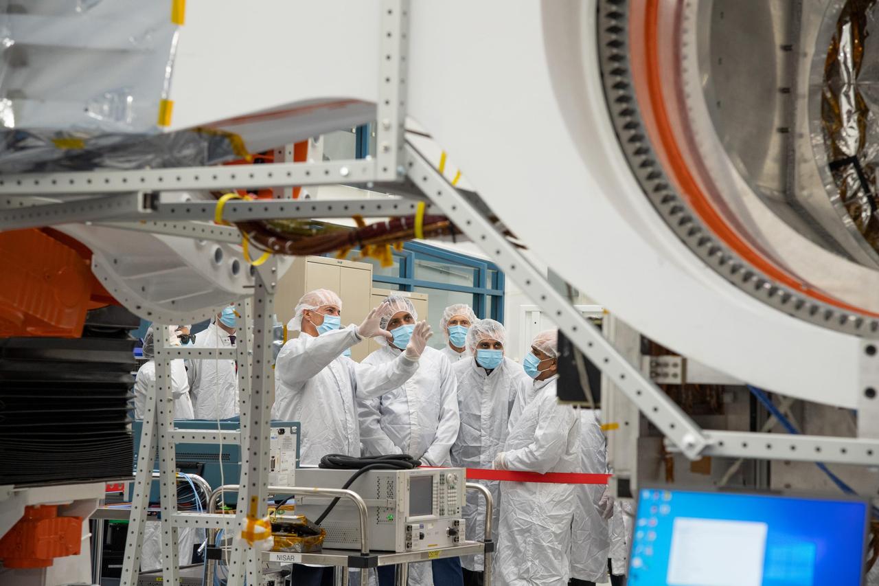
NASA's NISAR Project Manager Phil Barela (with hands raised) speaks with Indian Space Research Organisation Chairman S. Somanath about the NASA-ISRO Synthetic Aperture Radar (NISAR) science instrument payload in a clean room at NASA's Jet Propulsion Laboratory in Southern California on Feb. 3, 2023. Somanath was among a group of visitors to the facility that included officials from NASA, ISRO, and the Indian Embassy. The NISAR mission – a joint effort between NASA and ISRO – will measure changes to Earth's land ice surfaces down to fractions of an inch. Data collected by this satellite will help researchers monitor a wide range of changes critical to life on Earth in unprecedented detail. This includes spotting warning signs of imminent volcanic eruptions, helping to monitor groundwater supplies, tracking the melt rate of ice sheets tied to sea level rise, and observing shifts in the distribution of vegetation around the world. The data will inform humanity's responses to urgent challenges posed by natural disasters and climate change, and help communities prepare for and manage hazards. There are two instruments on the satellite that will send and receive radar signals to and from Earth's surface to make the mission's measurements. An L-band synthetic aperture radar (SAR), which uses a signal wavelength of around 9 inches (24 centimeters), and an S-band SAR with a signal wavelength of nearly 5 inches (12 centimeters). Both will bounce their microwave signal off of the planet's surface and record how long it takes the signal to make one roundtrip, as well as the strength of that return signal. This enables the researchers to calculate the distance from the spacecraft to Earth's surface and thereby determine how the land or ice is changing. An antenna reflector nearly 40 feet (12 meters) in diameter, supported by a deployable boom, will focus the microwave signals sent and received by the SARs. JPL, which is managed for NASA by Caltech in Pasadena, leads the U.S. component of NISAR and is providing the mission's L-band SAR instrument. NASA is also providing the radar reflector antenna, the deployable boom, a high-rate communication subsystem for science data, GPS receivers, a solid-state recorder, and payload data subsystem. ISRO is providing the spacecraft bus, the S-band SAR, the launch vehicle, and associated launch services and satellite mission operations. https://photojournal.jpl.nasa.gov/catalog/PIA25598
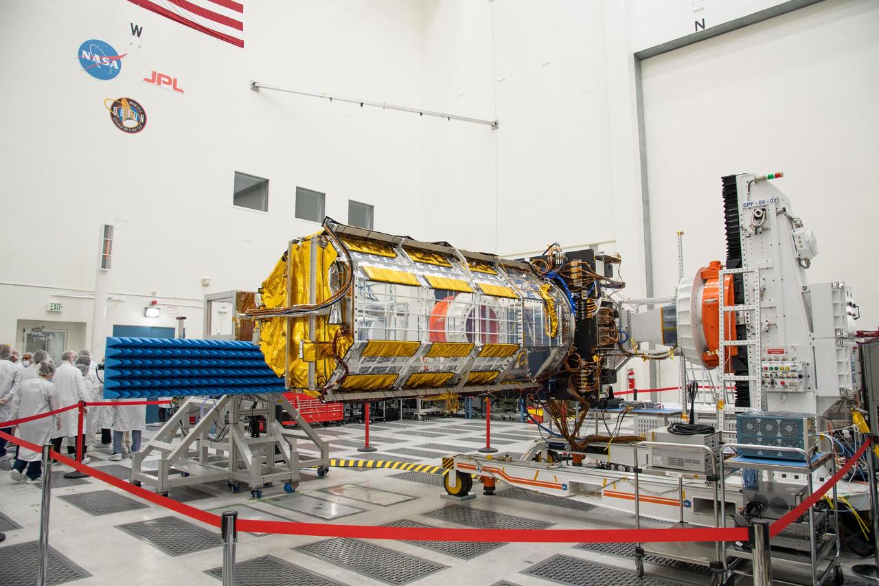
Officials from NASA, the Indian Space Research Organisation, and the Indian Embassy, grouped at left, visit a clean room at NASA's Jet Propulsion Laboratory in Southern California on Feb. 3, 2023, to view the scientific instrument payload for the NASA-ISRO Synthetic Aperture Radar (NISAR) mission. The payload is scheduled to be shipped to India in March 2023. The NISAR mission – a joint effort between NASA and ISRO – will measure changes to Earth's land ice surfaces down to fractions of an inch. Data collected by this satellite will help researchers monitor a wide range of changes critical to life on Earth in unprecedented detail. This includes spotting warning signs of imminent volcanic eruptions, helping to monitor groundwater supplies, tracking the melt rate of ice sheets tied to sea level rise, and observing shifts in the distribution of vegetation around the world. The data will inform humanity's responses to urgent challenges posed by natural disasters and climate change, and help communities prepare for and manage hazards. There are two instruments on the satellite that will send and receive radar signals to and from Earth's surface to make the mission's measurements. An L-band synthetic aperture radar (SAR), which uses a signal wavelength of around 9 inches (24 centimeters), and an S-band SAR with a signal wavelength of nearly 5 inches (12 centimeters). Both will bounce their microwave signal off of the planet's surface and record how long it takes the signal to make one roundtrip, as well as the strength of that return signal. This enables the researchers to calculate the distance from the spacecraft to Earth's surface and thereby determine how the land or ice is changing. An antenna reflector nearly 40 feet (12 meters) in diameter, supported by a deployable boom, will focus the microwave signals sent and received by the SARs. JPL, which is managed for NASA by Caltech in Pasadena, leads the U.S. component of NISAR and is providing the mission's L-band SAR instrument. NASA is also providing the radar reflector antenna, the deployable boom, a high-rate communication subsystem for science data, GPS receivers, a solid-state recorder, and payload data subsystem. ISRO is providing the spacecraft bus, the S-band SAR, the launch vehicle, and associated launch services and satellite mission operations. https://photojournal.jpl.nasa.gov/catalog/PIA25599
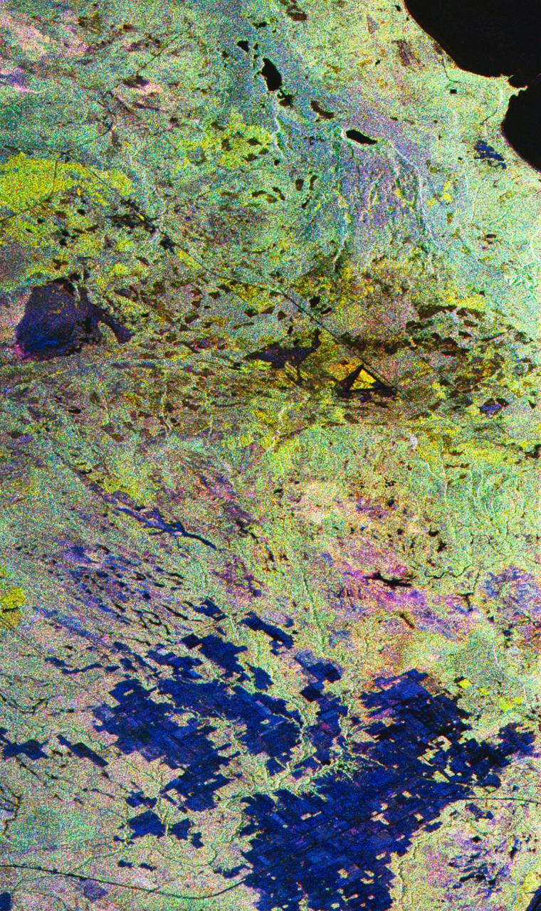
STS059-S-027 (10 April 1994) --- This image is a false-color composite of Raco, Michigan, centered at 46.39 degrees north latitude, 84.88 degrees east longitude. This image was acquired by the Spaceborne Imaging Radar-C and X-Band Synthetic Aperture Radar (SIR-C/X-SAR) aboard the Space Shuttle Endeavour on its 6th orbit and during the first full-capacity test of the instrument. This image was produced using both L-Band and C-Band data. The area shown is approximately 20 kilometers by 50 kilometers. Raco is located at the eastern end of Michigan's upper peninsula, west of Sault Ste. Marie and south of Whitefish Bay on Lake Superior. The site is located at the boundary between the boreal forests and the northern temperate forests, a transitional zone that is expected to be ecologically sensitive to anticipated global changes resulting from climatic warming. On any given day, there is a 60 percent chance that this area will be obscured to some extent by cloud cover which makes it difficult to image using optical sensors. In this color representation (Red=LHH, Green=LHV, Blue=CHH), darker areas in the image are smooth surfaces such as frozen lakes and other non-forested areas. The colors are related to the types of trees and the brightness is related to the amount of plant material covering the surface, called forest biomass. Accurate information about land-cover is important to area resource managers and for use in regional- to global-scale scientific models used to understand global change. SIR-C/X-SAR radars illuminate Earth with microwaves allowing detailed observations at any time, regardless of weather or sunlight conditions. SIR-C/X-SAR uses three microwave wavelengths: L-Band (24 cm), C-Band (6 cm), and X-Band (3 cm). The multi-frequency data will be used by the international scientific community to better understand the global environment and how it is changing. The SIR-C/X-SAR data, complemented by aircraft and ground studies, will give scientists clearer insights into those environmental changes which are caused by nature and those changes which are induced by human activity. SIR-C was developed by NASA's Jet Propulsion Laboratory (JPL). X-SAR was developed by the Dornire and Alenia Spazio Companies for the German Space Agency, Deutsche Agentur fuer Raumfahrtangelegenheiten (DARA), and the Italian Space Agency, Agenzia Spaziale Italiana (ASI). JPL Photo ID: P-43882
This montage of Cassini Synthetic Aperture Radar (SAR) images of the surface of Titan shows four examples of how a newly developed technique for handling noise results in clearer, easier to interpret views. The top row of images was produced in the manner used since the mission arrived in the Saturn system a decade ago; the row at bottom was produced using the new technique. The three leftmost image pairs show bays and spits of land in Ligea Mare, one of Titan's large hydrocarbon seas. The rightmost pair shows a valley network along Jingpo Lacus, one of Titan's larger northern lakes. North is toward the left in these images. Each thumbnail represents an area 70 miles (112 kilometers) wide. http://photojournal.jpl.nasa.gov/catalog/PIA19053
Presented here are side-by-side comparisons of a traditional Cassini Synthetic Aperture Radar (SAR) view, at left, and one made using a new technique for handling electronic noise that results in clearer views of Titan's surface, at right. The technique, called despeckling, produces images that can be easier for researchers to interpret. The terrain seen here is in the flow region named Leilah Fluctus (55 degrees north, 80 degrees west). With the speckle noise suppressed, the overall pattern of bright and dark in the scene becomes more apparent. In particular, cone-shaped features near lower right stand out, which could be alluvial analogues on Titan -- features produced by the action of rivers or floods. North is toward right in this image, which shows an area about 50 miles (80 kilometers) wide. http://photojournal.jpl.nasa.gov/catalog/PIA19054
This is an X-SAR image spanning an area of approximately 20 kilometers by 40 kilometers (12 miles by 25 miles) of the island of Hong Kong, the Kowloon Peninsula and the new territories in southern China, taken by the imaging radar on board the space shuttle Endeavour on October 4, 1994. North is toward the top left corner of the image. The Kaitak Airport runway on Kowloon Peninsula (center right of image) was built on reclaimed land and extends almost 3 kilometers (nearly 2 miles) into Victoria Harbor. To the south of the harbor lies the island of Hong Kong. The bright areas around the harbor are the major residential and business districts. Housing more than six million residents, Hong Kong is the most densely populated area in the world. The large number of objects visible in the harbor and surrounding waters are a variety of sea-going vessels, anchored in one of the busiest seaports in the Far East. http://photojournal.jpl.nasa.gov/catalog/PIA01750
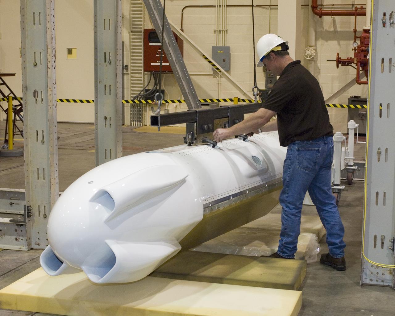
NASA Dryden lead technician David Neufeld prepares JPL's unmanned aircraft Synthetic Aperture Radar pod for inertial swing tests in Dryden's loads laboratory.
STS059-50-011 (9-20 April 94) --- A greenish appearing aurora forms the backdrop for this 35mm scene of the Earth orbiting Space Shuttle Endeavour's aft cargo bay. Featured in the bay are the antennae for the SIR-C/X-SAR imaging radar instruments, illuminated by moonlight. The crew sighted the southern lights (aurora australis) several times during each of the eleven days of the mission.
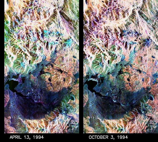
These two false-color composite images of the Mammoth Mountain area in the Sierra Nevada Mountains, Calif., show significant seasonal changes in snow cover. The image at left was acquired by the Spaceborne Imaging Radar-C and X-band Synthetic Aperture Radar aboard the space shuttle Endeavour on its 67th orbit on April 13, 1994. The image is centered at 37.6 degrees north latitude and 119 degrees west longitude. The area is about 36 kilometers by 48 kilometers (22 miles by 29 miles). In this image, red is L-band (horizontally transmitted and vertically received) polarization data; green is C-band (horizontally transmitted and vertically received) polarization data; and blue is C-band (horizontally transmitted and received) polarization data. The image at right was acquired on October 3, 1994, on the space shuttle Endeavour's 67th orbit of the second radar mission. Crowley Lake appears dark at the center left of the image, just above or south of Long Valley. The Mammoth Mountain ski area is visible at the top right of the scene. The red areas correspond to forests, the dark blue areas are bare surfaces and the green areas are short vegetation, mainly brush. The changes in color tone at the higher elevations (e.g. the Mammoth Mountain ski area) from green-blue in April to purple in September reflect changes in snow cover between the two missions. The April mission occurred immediately following a moderate snow storm. During the mission the snow evolved from a dry, fine-grained snowpack with few distinct layers to a wet, coarse-grained pack with multiple ice inclusions. Since that mission, all snow in the area has melted except for small glaciers and permanent snowfields on the Silver Divide and near the headwaters of Rock Creek. On October 3, 1994, only discontinuous patches of snow cover were present at very high elevations following the first snow storm of the season on September 28, 1994. For investigations in hydrology and land-surface climatology, seasonal snow cover and alpine glaciers are critical to the radiation and water balances. SIR-C/X-SAR is a powerful tool because it is sensitive to most snowpack conditions and is less influenced by weather conditions than other remote sensing instruments, such as Landsat. In parallel with the operational SIR-C data processing, an experimental effort is being conducted to test SAR data processing using the Jet Propulsion Laboratory's massively parallel supercomputing facility, centered around the Cray Research T3D. These experiments will assess the abilities of large supercomputers to produce high throughput SAR processing in preparation for upcoming data-intensive SAR missions. The images released here were produced as part of this experimental effort. http://photojournal.jpl.nasa.gov/catalog/PIA01753
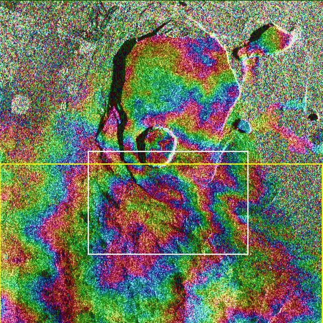
Data acquired on April 13, 1994 and on October 4, 1994 from the X-band Synthetic Aperture Radar on board the space shuttle Endeavour were used to generate interferometric fringes, which were overlaid on the X-SAR image of Kilauea. The volcano is centered in this image at 19.58 degrees north latitude and 155.55 degrees west longitude. The image covers about 9 kilometers by 13 kilometers (5.6 miles by 8 miles). The X-band fringes correspond clearly to the expected topographic image. The yellow line indicates the area below which was used for the three-dimensional image using altitude lines. The yellow rectangular frame fences the area for the final topographic image. http://photojournal.jpl.nasa.gov/catalog/PIA01762
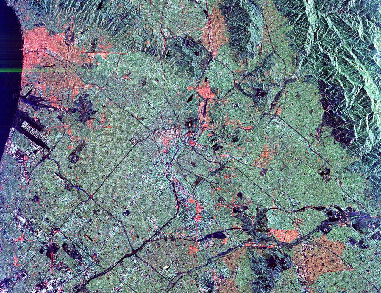
This radar image shows the massive urbanization of Los Angeles, California. The image extends from the Santa Monica Bay at the left to the San Gabriel Mountains at the right. Downtown Los Angeles is in the center of the image. The runways of the Los Angeles International Airport appear as black strips at the left center of the image. The waterways of Marina del Rey are seen just above the airport. The San Gabriel Mountains and the city of Pasadena are at the right center of the image. Black areas on the mountains on the right are fire scars from the 1993 Altadena fire. The Rose Bowl is shown as a small circle near the right center. The complex freeway system is visible as dark lines throughout the image. Some city areas, such as Santa Monica in the upper left, appear red due to the alignment of streets and buildings to the incoming radar beam. The image was acquired by the Spaceborne Imaging Radar-C/X-band Synthetic Aperture Radar (SIR-C/X-SAR) onboard the space shuttle Endeavour on October 3, 1994. SIR-C/X-SAR, a joint mission of the German, Italian and the United States space agencies, is part of NASA's Mission to Planet Earth. This image is centered at 34.04 degrees North latitude and 118.2 degrees West longitude with North pointing toward the upper right. The area shown measures 40 kilometers by 50 kilometers (25 miles by 31 miles). http://photojournal.jpl.nasa.gov/catalog/PIA01789
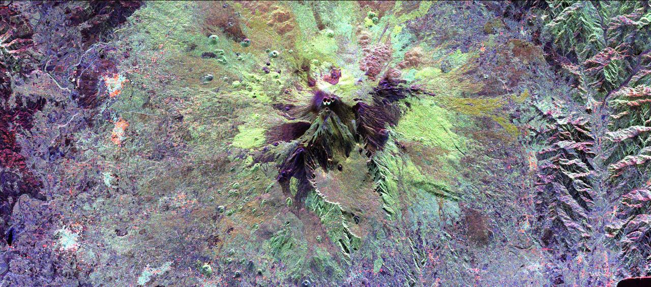
The summit of the Mount Etna volcano on the island of Sicily, Italy, one of the most active volcanoes in the world, is shown near the center of this radar image. Lava flows of different ages and surface roughness appear in shades of purple, green, yellow and pink surrounding the four small craters at the summit. Etna is one of the best-studied volcanoes in the world and scientists are using this radar image to identify and distinguish a variety of volcanic features. Etna has erupted hundreds of times in recorded history, with the most recent significant eruption in 1991-1993. Scientists are studying Etna as part of the international "Decade Volcanoes" project, because of its high level of activity and potential threat to local populations. This image was acquired on October 11, 1994 by the Spaceborne Imaging Radar-C/X-Band Synthetic Aperture Radar (SIR-C/X-SAR) aboard the space shuttle Endeavour. SIR-C/X-SAR, a joint mission of the German, Italian and the United States space agencies, is part of NASA's Mission to Planet Earth. The image is centered at 37.8 degrees North latitude and 15.1 degrees East longitude and covers an area of 51.2 kilometers by 22.6 kilometers (31.7 miles by 14.0 miles). http://photojournal.jpl.nasa.gov/catalog/PIA01776

CAPE CANAVERAL, Fla. -- A representative of the 301st Rescue Squadron and a volunteer (in the stretcher) from the NASA Vehicle Integration Test Team office get ready to demonstrate rescue equipment on the HH-60G helicopter that is used by participants in the Mode VIII exercise being conducted at Patrick Air Force Base, Fla. In support of, and with logistical support from, NASA, USSTRATCOM is hosting a major exercise involving Department of Defense, Department of Homeland Security, search and rescue (SAR) forces, including the 45th Space Wing at Patrick Air Force Base, which support space shuttle astronaut bailout contingency operations, known as Mode VIII. This exercise tests SAR capabilities to locate, recover and provide medical treatment for astronauts following a space shuttle launch phase open-ocean bailout. Participants include members of the U.S. Navy, U.S. Coast Guard, U.S. Air Force, and NASA's Kennedy Space Center and Johnson Space Center. This will be the 15th Mode VIII exercise conducted in the past 20 years. Photo credit: NASA/Kim Shiflett
CAPE CANAVERAL, Fla. -- A representative of the 301st Rescue Squadron and a volunteer from the NASA Vehicle Integration Test Team office get ready to demonstrate rescue equipment that is used by participants in the Mode VIII exercise being conducted at Patrick Air Force Base. In the background is an HH-60G helicopter. In support of, and with logistical support from, NASA, USSTRATCOM is hosting a major exercise involving Department of Defense, Department of Homeland Security, search and rescue (SAR) forces, including the 45th Space Wing at Patrick Air Force Base, which support space shuttle astronaut bailout contingency operations, known as Mode VIII. This exercise tests SAR capabilities to locate, recover and provide medical treatment for astronauts following a space shuttle launch phase open-ocean bailout. Participants include members of the U.S. Navy, U.S. Coast Guard, U.S. Air Force, and NASA's Kennedy Space Center and Johnson Space Center. This will be the 15th Mode VIII exercise conducted in the past 20 years. Photo credit: NASA/Kim Shiflett
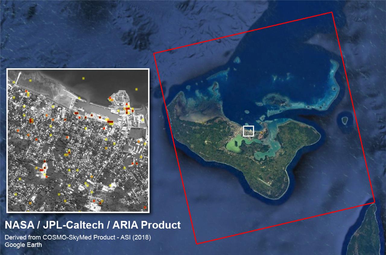
The Advanced Rapid Imaging and Analysis (ARIA) team at NASA's Jet Propulsion Laboratory created this Damage Proxy Map (DPM) of Tongatapu, the main island of Tonga, following the landfall of Cyclone Gita, a Category 4 storm that hit Tonga on Feb. 12-13, 2018. The map depicts areas that are likely damaged from the storm, shown by red and yellow pixels. The map was produced by comparing two pairs of interferometric synthetic aperture radar (InSAR) images from the COSMO-SkyMed satellites, operated by the Italian Space Agency (ASI). The pre- and post-cyclone images were acquired on Jan. 19 and Feb. 13, 2018, respectively. The later image was acquired just 4-1/2 hours after the peak damage by the cyclone. The map covers the entire island of Tongatapu (the 25-by-25-mile, or 40-by-40 kilometer SAR image footprint indicated with the large red polygon). Each pixel measures about 98 feet (30 meters) across. The color variation from yellow to red indicates increasingly more significant ground surface change. Preliminary validation of the SAR data was done by comparing them with high-resolution optical imagery acquired by DigitalGlobe. This Damage Proxy Map should be used as guidance to identify damaged areas and may be less reliable over vegetated and flooded areas. https://photojournal.jpl.nasa.gov/catalog/PIA22257
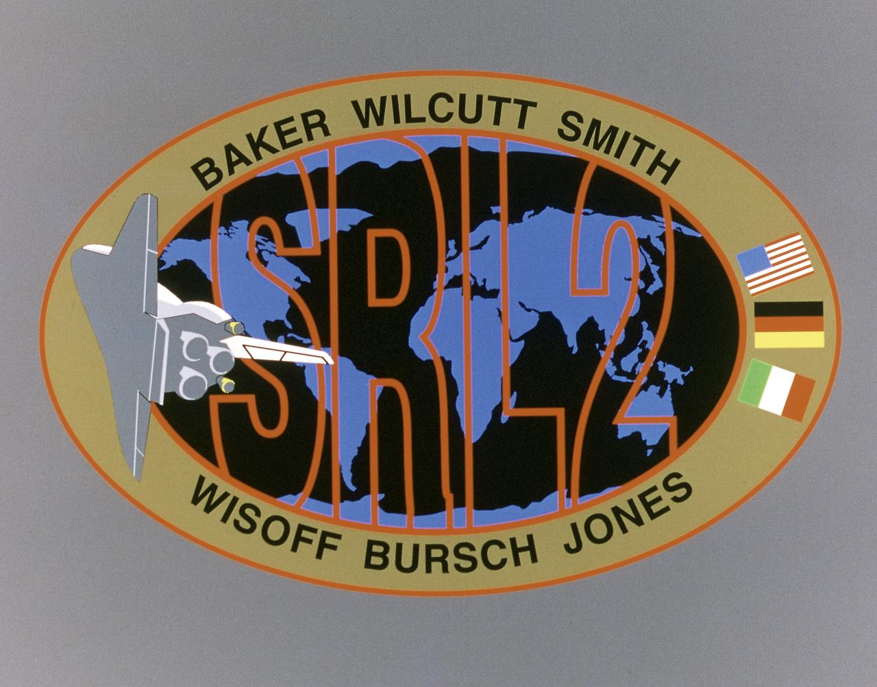
This STS-68 patch was designed by artist Sean Collins. Exploration of Earth from space is the focus of the design of the insignia, the second flight of the Space Radar Laboratory (SRL-2). SRL-2 was part of NASA's Mission to Planet Earth (MTPE) project. The world's land masses and oceans dominate the center field, with the Space Shuttle Endeavour circling the globe. The SRL-2 letters span the width and breadth of planet Earth, symbolizing worldwide coverage of the two prime experiments of STS-68: The Shuttle Imaging Radar-C and X-Band Synthetic Aperture Radar (SIR-C/X-SAR) instruments; and the Measurement of Air Pollution from Satellites (MAPS) sensor. The red, blue, and black colors of the insignia represent the three operating wavelengths of SIR-C/X-SAR, and the gold band surrounding the globe symbolizes the atmospheric envelope examined by MAPS. The flags of international partners Germany and Italy are shown opposite Endeavour. The relationship of the Orbiter to Earth highlights the usefulness of human space flights in understanding Earth's environment, and the monitoring of its changing surface and atmosphere. In the words of the crew members, the soaring Orbiter also typifies the excellence of the NASA team in exploring our own world, using the tools which the Space Program developed to explore the other planets in the solar system.
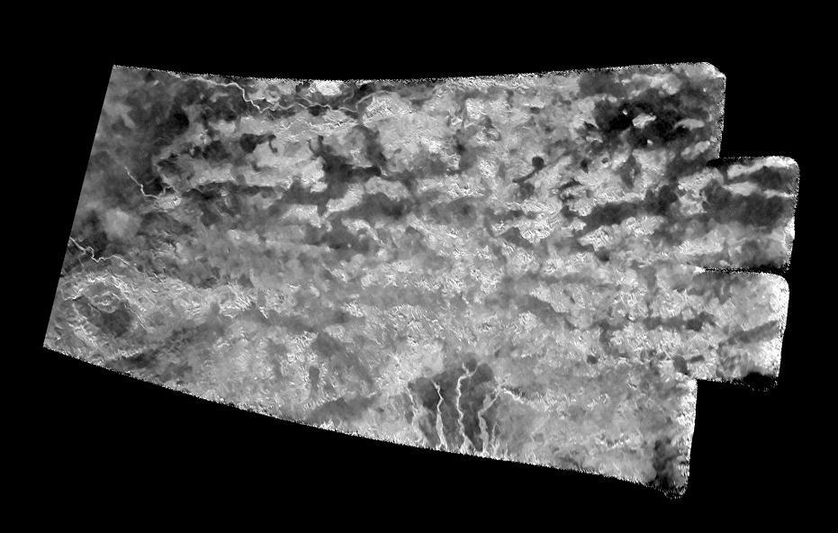
This synthetic-aperture radar (SAR) image was obtained by NASA's Cassini spacecraft on July 25, 2016, during its 'T-121' pass over Titan's southern latitudes. The improved contrast provided by the denoising algorithm helps river channels (at bottom and upper left) stand out, as well as the crater-like feature at left. The image shows an area nicknamed the "Xanadu annex" by members of the Cassini radar team, earlier in the mission. This area had not been imaged by Cassini's radar until now, but measurements of its brightness temperature from Cassini's microwave radiometer were quite similar to that of the large region on Titan named Xanadu. Cassini's radiometer is essentially a very sensitive thermometer, and brightness temperature is a measure of the intensity of microwave radiation received from a feature by the instrument. Radar team members predicted at the time that, if this area were ever imaged, it would be similar in appearance to Xanadu, which lies just to the north. That earlier hunch appears to have been borne out, as features in this scene bear a strong similarity to the mountainous terrains Cassini's radar has imaged in Xanadu. Xanadu -- and now perhaps its annex -- remains something of a mystery. First imaged in 1994 by the Hubble Space Telescope (just three years before Cassini's launch from Earth), Xanadu was the first surface feature to be recognized on Titan. Once thought to be a raised plateau, the region is now understood to be slightly tilted, but not higher than, the darker surrounding regions. It blocks the formation of sand dunes, which otherwise extend all the way around Titan at its equator. The image was taken by the Cassini Synthetic Aperture radar (SAR) on July 25, 2016 during the mission's 122nd targeted Titan encounter. The image has been modified by the denoising method described in A. Lucas, JGR:Planets (2014). http://photojournal.jpl.nasa.gov/catalog/PIA20714
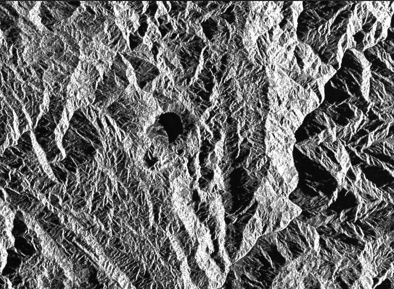
This is a radar image of a little known volcano in northern Colombia. The image was acquired on orbit 80 of space shuttle Endeavour on April 14, 1994, by NASA Spaceborne Imaging Radar C/X-Band Synthetic Aperture Radar SIR-C/X-SAR. The volcano near the center of the image is located at 5.6 degrees north latitude, 75.0 degrees west longitude, about 100 kilometers (65 miles) southeast of Medellin, Colombia. The conspicuous dark spot is a lake at the bottom of an approximately 3-kilometer-wide (1.9-mile) volcanic collapse depression or caldera. A cone-shaped peak on the bottom left (northeast rim) of the caldera appears to have been the source for a flow of material into the caldera. This is the northern-most known volcano in South America and because of its youthful appearance, should be considered dormant rather than extinct. The volcano's existence confirms a fracture zone proposed in 1985 as the northern boundary of volcanism in the Andes. The SIR-C/X-SAR image reveals another, older caldera further south in Colombia, along another proposed fracture zone. Although relatively conspicuous, these volcanoes have escaped widespread recognition because of frequent cloud cover that hinders remote sensing imaging in visible wavelengths. Four separate volcanoes in the Northern Andes nations of Colombia and Ecuador have been active during the last 10 years, killing more than 25,000 people, including scientists who were monitoring the volcanic activity. Detection and monitoring of volcanoes from space provides a safe way to investigate volcanism. The recognition of previously unknown volcanoes is important for hazard evaluations because a number of major eruptions this century have occurred at mountains that were not previously recognized as volcanoes. http://photojournal.jpl.nasa.gov/catalog/PIA01722
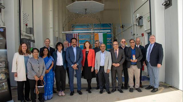
Officials from NASA, the Indian Space Research Organization (ISRO), and the Embassy of India hold a send-off ceremony for the NASA-ISRO Synthetic Aperture Radar (NISAR) science instrument payload on Feb. 3, 2023, outside a clean room at NASA's Jet Propulsion Laboratory in Southern California. The payload is scheduled to be shipped to India in March. Pictured left to right: Karen St. Germain, director, Earth Science Division, NASA; Mitra Dutta, NISAR program executive, NASA; Sripriya Ranganathan, ambassador and deputy chief of mission, Indian Embassy; Larry James, deputy director, JPL; Bhavya Lal, associate administrator for technology, policy, and strategy, NASA; Jim Graf, director, Earth Science and Technology Directorate, JPL; S. Somanath, chairman, ISRO; Laurie Leshin, director, JPL; Krunal Joshi, counselor, space and ISRO technical liaison officer, Indian Embassy; M. Sankaran, director, U R Rao Satellite Centre, ISRO; Shantanu Bhatawdekar, scientific secretary, ISRO; Paul Rosen, NISAR project scientist, JPL; CV Shrikant, NISAR project director, ISRO; Phil Barela, NISAR project manager, JPL; and Gerald Bawden, NISAR program scientist, NASA. NISAR – a joint effort between NASA and ISRO – will measure changes to Earth's land ice surfaces down to fractions of an inch. Data collected by this satellite will help researchers monitor a wide range of changes critical to life on Earth in unprecedented detail. This includes spotting warning signs of imminent volcanic eruptions, helping to monitor groundwater supplies, tracking the melt rate of ice sheets tied to sea level rise, and observing shifts in the distribution of vegetation around the world. The data will inform humanity's responses to urgent challenges posed by natural disasters and climate change, and help communities prepare for and manage hazards. There are two instruments on the satellite that will send and receive radar signals to and from Earth's surface to make the mission's measurements. An L-band synthetic aperture radar (SAR), which uses a signal wavelength of around 9 inches (24 centimeters), and an S-band SAR with a signal wavelength of nearly 5 inches (12 centimeters). Both will bounce their microwave signal off of the planet's surface and record how long it takes the signal to make one roundtrip, as well as the strength of that return signal. This enables the researchers to calculate the distance from the spacecraft to Earth's surface and thereby determine how the land or ice is changing. An antenna reflector nearly 40 feet (12 meters) in diameter, supported by a deployable boom, will focus the microwave signals sent and received by the SARs. JPL, which is managed for NASA by Caltech in Pasadena, leads the U.S. component of NISAR and is providing the mission's L-band SAR instrument. NASA is also providing the radar reflector antenna, the deployable boom, a high-rate communication subsystem for science data, GPS receivers, a solid-state recorder, and payload data subsystem. ISRO is providing the spacecraft bus, the S-band SAR, the launch vehicle, and associated launch services and satellite mission operations. https://photojournal.jpl.nasa.gov/catalog/PIA25600
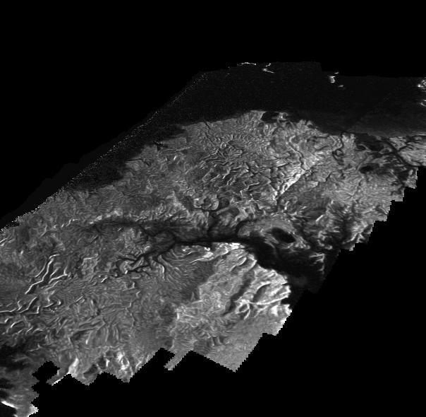
This Cassini Synthetic Aperture Radar (SAR) image is presented as a perspective view and shows a landscape near the eastern shoreline of Kraken Mare, a hydrocarbon sea in Titan's north polar region. This image was processed using a technique for handling noise that results in clearer views that can be easier for researchers to interpret. The technique, called despeckling, also is useful for producing altimetry data and 3-D views called digital elevation maps. Scientists have used a technique called radargrammetry to determine the altitude of surface features in this view at a resolution of approximately half a mile, or 1 kilometer. The altimetry reveals that the area is smooth overall, with a maximum amplitude of 0.75 mile (1.2 kilometers) in height. The topography also shows that all observed channels flow downhill. The presence of what scientists call "knickpoints" -- locations on a river where a sharp change in slope occurs -- might indicate stratification in the bedrock, erosion mechanisms at work or a particular way the surface responds to runoff events, such as floods following large storms. One such knickpoint is visible just above the lower left corner, where an area of bright slopes is seen. The image was obtained during a flyby of Titan on April 10, 2007. A more traditional radar image of this area on Titan is seen in PIA19046. http://photojournal.jpl.nasa.gov/catalog/PIA19051
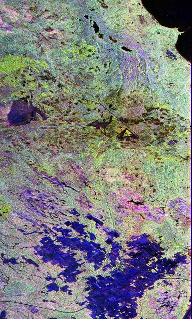
This image is a false-color composite of Raco, Michigan, centered at 46.39 degrees north latitude, 84.88 degrees west longitude. This image was acquired by the Spaceborne Imaging Radar-C and X-Band Synthetic Aperture Radar (SIR-C/X-SAR) aboard the space shuttle Endeavour on its sixth orbit and during the first full-capability test of the instrument on April 9, 1994. This image was produced using both L-band and C-band data. The area shown is approximately 20 kilometers by 50 kilometers (12 by 30 miles). Raco is located at the eastern end of Michigan's upper peninsula, west of Sault Ste. Marie and south of Whitefish Bay on Lake Superior. The site is located at the boundary between the boreal forests and the northern temperate forests, a transitional zone that is expected to be ecologically sensitive to anticipated global changes resulting from climatic warming. On any given day, there is a 60 percent chance that this area will be obscured to some extent by cloud clover which makes it difficult to image using optical sensors. http://photojournal.jpl.nasa.gov/catalog/PIA01700
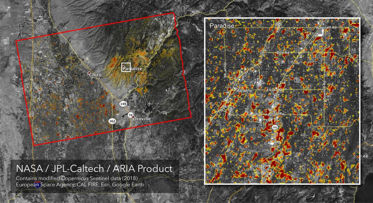
The Advanced Rapid Imaging and Analysis (ARIA) team at NASA's Jet Propulsion Laboratory in Pasadena, California, created this Damage Proxy Map (DPM) depicting areas of Northern California that are likely damaged (shown by red and yellow pixels) as a result of the Camp Fire. The map is derived from synthetic aperture radar (SAR) images from the Copernicus Sentinel-1 satellites, operated by the European Space Agency (ESA). The pre-event images were taken before (November 4, 2018) and the post-event image was acquired during the fire (6pm November 16, 2018, both local time). https://photojournal.jpl.nasa.gov/catalog/PIA22819

STS068-267-079 (30 September-11 October 1994) --- The rear windows of the Space Shuttle Endeavour reflect sunlight in this view of part of the cargo bay, 115 nautical miles above the Earth. The Space Radar Laboratory (SRL-2) Multipurpose Experiment Support Structure (MPESS) is seen at bottom frame. Also partially seen are other experiments including other components of the primary payload. They are the antenna for the Spaceborne Imaging Radar (SIR-C), the X-band Synthetic Aperture Radar (X-SAR), the device for Measurement of Air Pollution from Satellites (MAPS) and some Getaway Special (GAS) canisters.
STS059-86-059 (9-20 April 1994) --- This oblique handheld Hasselblad 70mm photo shows Death Valley, near California's border with Nevada. The valley -- the central feature of Death Valley National Monument -- extends north to south for some 140 miles (225 kilometers). Hemmed in to the east by the Amargosa Range and to the west by the Panamints, its width varies from 5 to 15 miles (8 to 24 kilometers). Using Spaceborne Imaging Radar (SIR-C) and X-band Synthetic Aperture Radar (X-SAR) onboard the Space Shuttle Endeavour, the crew was able to record a great deal of data on this and other sites, as part of NASA's Mission to Planet Earth.

STS068-272-075 (30 September-11 October 1994) --- The darkness of space forms the backdrop for this scene of the Space Shuttle Endeavour's cargo bay, 115 nautical miles above a cloud covered Indian Ocean. The Space Radar Laboratory (SRL-2) Multipurpose Experiment Support Structure (MPESS) is seen at bottom frame. Also partially seen are other experiments including other components of the primary payload. They are the antenna for the Spaceborne Imaging Radar (SIR-C), the X-band Synthetic Aperture Radar (X-SAR), the device for Measurement of Air Pollution from Satellites (MAPS) and some Getaway Special (GAS) canisters.
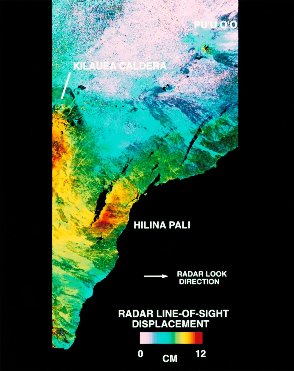
STS068-S-054 (10 October 1994) --- This is a deformation map of the south flank of Kilauea volcano on the big island of Hawaii, centered at 19.5 degrees north latitude and 155.25 degrees west longitude. The map was created by combining interferometric radar data - that is data acquired on different passes of the Space Shuttle Endeavour which are then overlaid to obtain elevation information - acquired by the Spaceborne Imaging Radar-C/X-Band Synthetic Aperture Radar (SIR-C/X-SAR) during its first flight in April 1994 and its second flight in October 1994. The area shown is approximately 40 by 80 kilometers (25 by 50 miles). North is toward the upper left of the image. The colors indicate the displacement of the surface in that direction that the radar instrument was pointed (toward the right of the image) in the six months between images. The analysis of ground movement is preliminary, but appears consistent with the motions detected by the Global Positioning System ground receivers that have been used over the past five years. The south flank of the Kilauea volcano is among the most rapidly deforming terrain's on Earth. Several regions show motion over the six-month time period. Most obvious is at the base of Hilina Pali, where 10 centimeters (4 inches) or more of crustal deformation can be seen in a concentrated area near the coastline. On a more localized scale, the currently active Pu'u O'o summit also shows about 10 centimeters (4 inches) of change near the vent area. Finally, there are indications of additional movement along the upper southwest rift zone, just below the Kilauea caldera in the image. Deformation of the south flank is believed to be the result of movements along faults deep beneath the surface of the volcano, as well as injections of magma, or molten rock, into the volcano's "plumbing" system. Detection of ground motions from space has proven to be a unique capability of imaging radar technology. Scientists hope to use deformation data acquired by SIR-C/X-SAR and future imaging radar missions to help in better understanding the processes responsible for volcanic eruptions and earthquakes. Spaceborne Imaging Radar-C/X-Band Synthetic Aperture Radar (SIR-C/X-SAR) is part of NASA's Mission to Planet Earth. (P-44753)
This is an X-band seasonal image of the Altona test site in Manitoba, Canada, about 80 kilometers (50 miles) south of Winnipeg. The image is centered at approximately 49 degrees north latitude and 97.5 degrees west longitude. This image was acquired by the Spaceborne Imaging Radar-C and X-band Synthetic Aperture Radar (SIR-C/X-SAR) aboard the space shuttle Endeavour on April 11, 1994, during the first flight of the radar system, and on October 2, 1994, during the second flight of SIR-C/X-SAR. The image channels have the following color assignments: red represents data acquired on April 11, 1994; green represents data acquired on October 2, 1994; blue represents the ratio of the two data sets. The test site is located in the Red River Basin and is characterized by rich farmland where a variety of crops are grown, including wheat, barley, canola, corn, sunflowers and sugar beets. This SIR-C/X-SAR research site is applying radar remote sensing to study the characteristics of vegetation and soil moisture. The seasonal comparison between the April and October 1994 data show the dramatic differences between surface conditions on the two dates. At the time of the April acquisition, almost all agricultural fields were bare and soil moisture levels were high. In October, however, soils were drier and while most crops had been harvested, some standing vegetation was still present. The areas which are cyan in color are dark in April and bright in October. These represent fields of standing biomass (amount of vegetation in a specified area) and the differences in brightness within these cyan fields represent differences in vegetation type. The very bright fields in October represent standing broadleaf crops such as corn, which had not yet been harvested. Other standing vegetation which has less biomass, such as hay and grain fields, are less bright. The magenta indicates bare soil surfaces which were wetter (brighter) in April than in October. The variations in brightness of the magenta indicate differences in the degree of soil moisture change and differences in surface roughness. This seasonal composite demonstrates the sensitivity of radar to changes in agricultural surface conditions such as soil moisture, tillage, cropping and harvesting. http://photojournal.jpl.nasa.gov/catalog/PIA01742
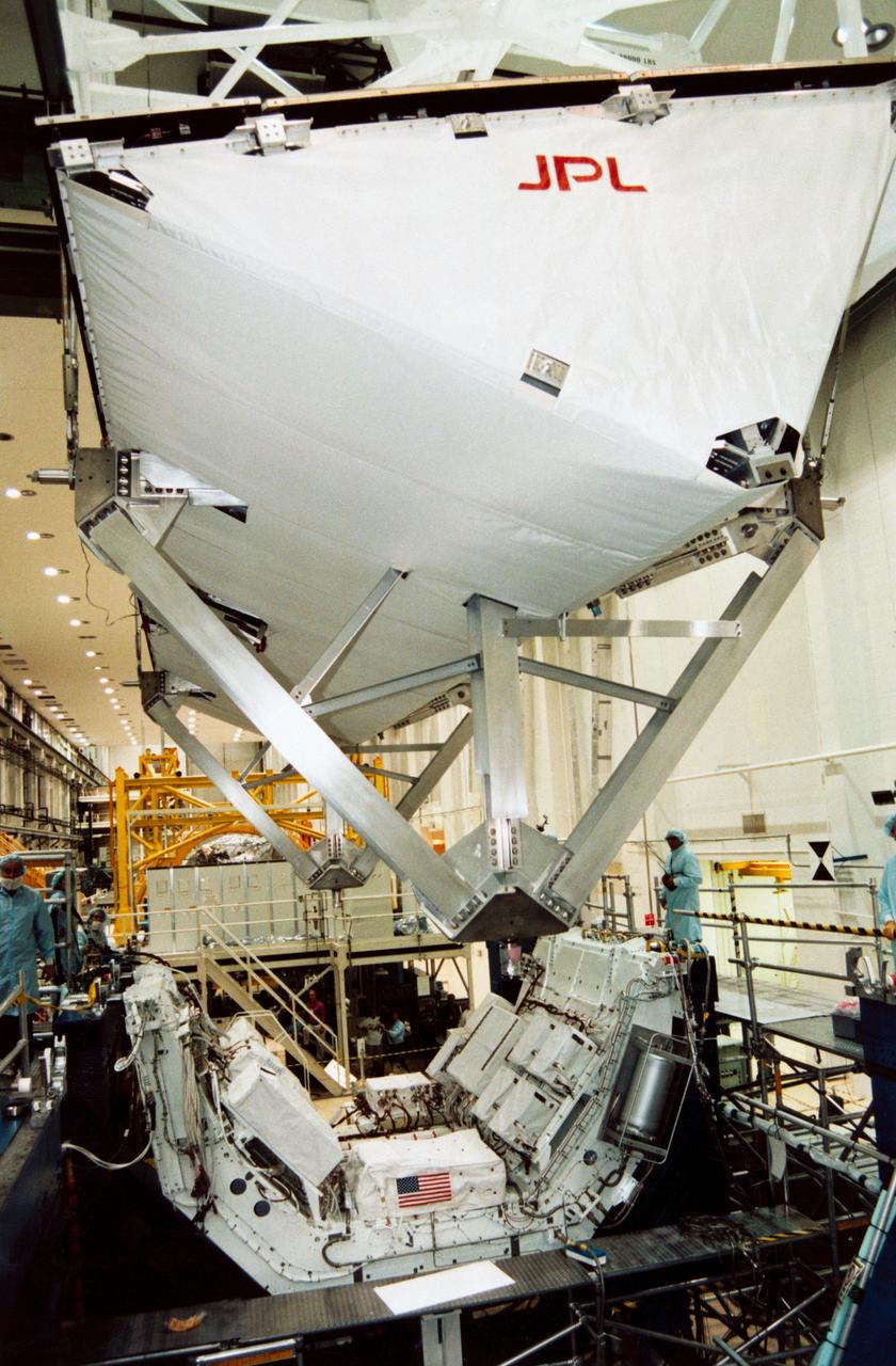
S94-30393 (23 Nov 1993) --- In the south level IV stand of the Operations and Checkout Building low bay, the Space Radar Laboratory -1 (SRL-1) antenna is being placed atop a pallet which holds the antenna electronics. SRL-1 is scheduled to fly on Space Shuttle mission STS-59 next year. It is comprised of two different imaging radars, the Spaceborne Imaging Radar-C (SIR-C) and the X-band Synthetic Aperture Radar (X-SAR). These radars are the most advanced of their kind to fly in space to date, and will allow scientists to make highly detailed studies of the Earth's surface on a global scale. An Interface Verification Test of the antenna and a Mission Sequence Test will be performed on the fully assembled SRL-1 later this month.

The ability of a sophisticated radar instrument to image large regions of the world from space, using different frequencies that can penetrate dry sand cover, produced the discovery in this image: a previously unknown branch of an ancient river, buried under thousands of years of windblown sand in a region of the Sahara Desert in North Africa. This area is near the Kufra Oasis in southeast Libya, centered at 23.3 degrees north latitude, 22.9 degrees east longitude. The image was acquired by the Spaceborne Imaging Radar-C/X-band Synthetic Aperture (SIR-C/X-SAR) imaging radar when it flew aboard the space shuttle Endeavour on its 60th orbit on October 4, 1994. This SIR-C image reveals a system of old, now inactive stream valleys, called "paleodrainage systems, http://photojournal.jpl.nasa.gov/catalog/PIA01310
The Advanced Rapid Imaging and Analysis (ARIA) team at NASA's Jet Propulsion Laboratory in Pasadena, California, created this map depicting areas that are likely damaged as a result of the recent major earthquakes in Southern California. The color variation from yellow to red indicates increasingly more significant surface change, or damage. The map covers an area of 155 by 186 miles (250 by 300 kilometers), shown by the large red polygon. Each pixel measures about 33 yards (30 meters) across. To make the map, the team used synthetic aperture radar (SAR) images from the European Space Agency's Copernicus Sentinel-1 satellites from before and after the sequence of quakes — July 4, 2019 and July 10, 2019 respectively. The map may be less reliable over vegetated areas but can provide useful guidance in identifying damaged areas. https://photojournal.jpl.nasa.gov/catalog/PIA23354
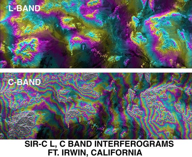
This is an X-SAR image spanning an area of approximately 20 kilometers by 40 kilometers (12 miles by 25 miles) of the island of Hong Kong, the Kowloon Peninsula and the new territories in southern China, taken by the imaging radar on board the space shuttle Endeavour on October 4, 1994. North is toward the top left corner of the image. The Kaitak Airport runway on Kowloon Peninsula (center right of image) was built on reclaimed land and extends almost 3 kilometers (nearly 2 miles) into Victoria Harbor. To the south of the harbor lies the island of Hong Kong. The bright areas around the harbor are the major residential and business districts. Housing more than six million residents, Hong Kong is the most densely populated area in the world. The large number of objects visible in the harbor and surrounding waters are a variety of sea-going vessels, anchored in one of the busiest seaports in the Far East. http://photojournal.jpl.nasa.gov/catalog/PIA01750
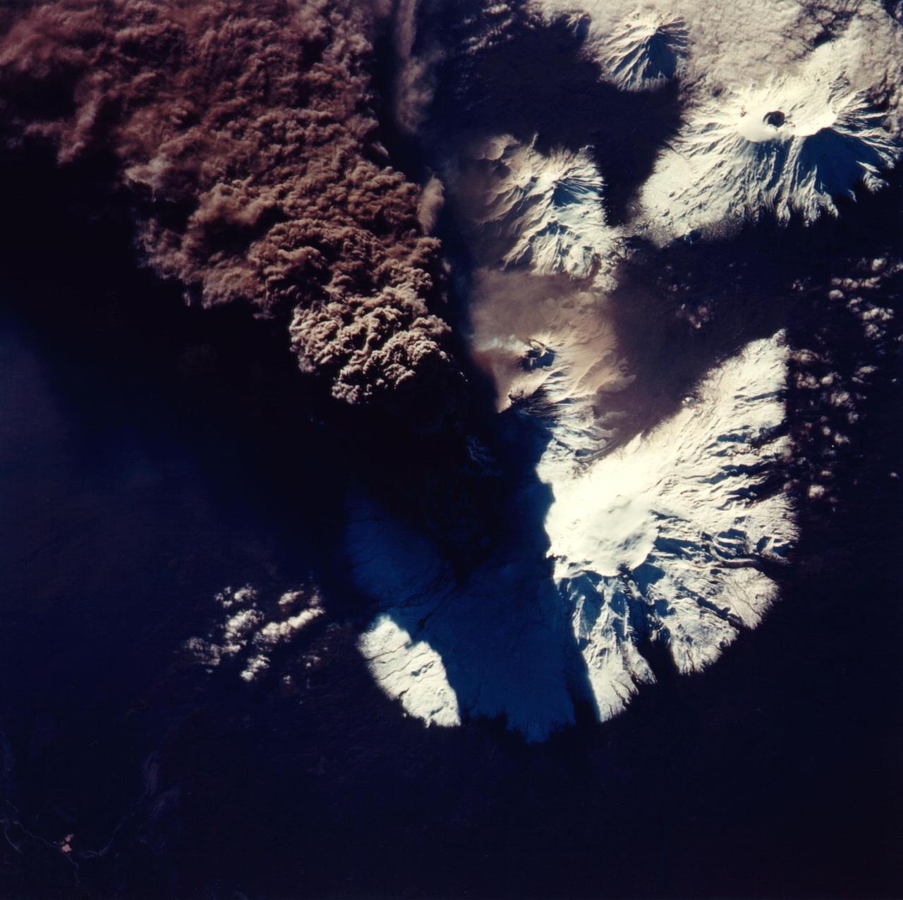
This photograph of the eruption of Kliuchevskoi volcano, Kamchatka, Russia was taken by space shuttle Endeavour astronauts during the early hours of the eruption on September 30, 1994. The ash plume, which reached heights of more than 18 kilometers (50,000 feet), is emerging from a vent on the north flank of Kliuchevskoi, partially hidden by the plume and its shadow in this view. The photograph is oriented with north toward the bottom, for comparison with the Spaceborne Imaging Radar C/X-Band Synthetic Aperture Radar (SIR-C/X-SAR) image (P-44823) that was acquired a few days later. Near the center of the photo, a small whitish steam plume may be seen emanating from the growing lava dome of a companion volcano, Bezymianny. http://photojournal.jpl.nasa.gov/catalog/PIA01766