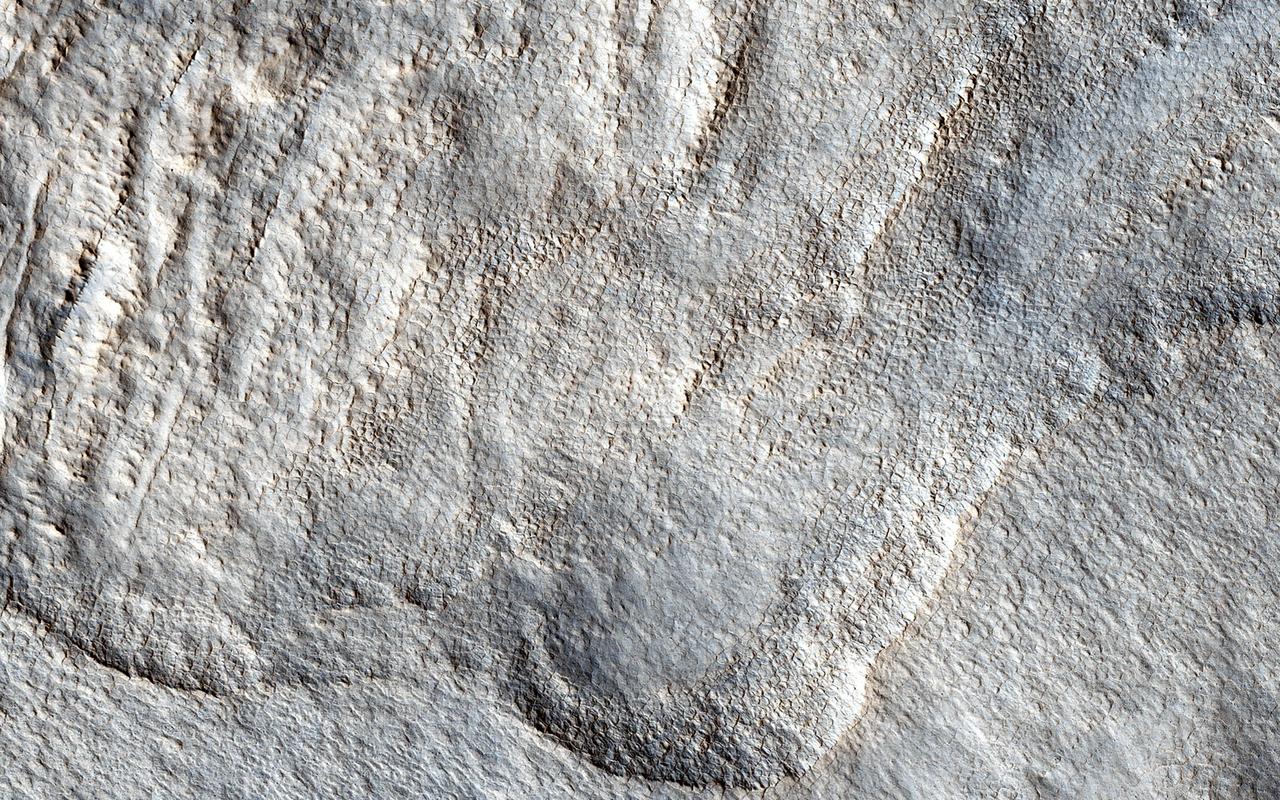
This radargram shows data collected by the Shallow Radar, or SHARAD, on NASA's Mars Reconnaissance Orbiter (MRO) on May 2, 2023, as it performed a 120-degree roll maneuver called a "very large roll" over a formation named Medusae Fossae. Scientists used SHARAD to look for ice beneath the surface of this region. Designed to peer from about a half-mile to a little over a mile (1 to 2 kilometers) below ground, SHARAD emits radio waves that are reflected off materials in the subsurface, measuring how long it takes for those waves to bounce back to the instrument. The longer it takes, the deeper the subsurface layer is. Because different materials reflect radio waves differently, SHARAD allows scientists to distinguish between rock, sand, and ice. While MRO often performs a standard 28-degree roll to give SHARAD's antenna a more direct view of Martian terrain, the 120-degree very large roll rotates the antenna even farther, providing its radio waves an unobstructed path to the surface. This boosts the radar's signals by 10 times or more, giving SHARAD a clearer, deeper view of the Martian underground than ever before. Scientists hope the very large rolls will help them look for frozen and liquid water, among other things. https://photojournal.jpl.nasa.gov/catalog/PIA26555

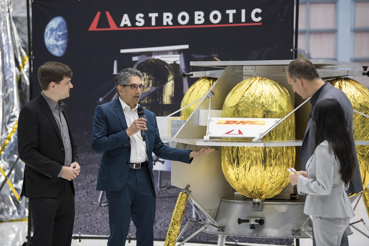
Sharad Bhaskaran, mission director for Pittsburgh-based Astrobotic, delivers the monthly Tech Talk on Sept. 12 in Building 4221 at NASA’s Marshall Space Flight Center. Bhaskaran presented Astrobotic’s Peregrine lunar lander which will deliver payloads to the surface of the Moon for government and commercial customers, including NASA.
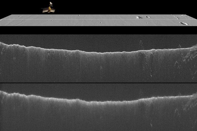
A comparison of two radargrams from the SHARAD instrument on NASA Mars Reconnaissance Orbiter shows effects on the Martian ionosphere from the close passage of a comet.
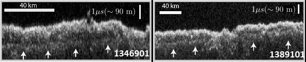
These two images show data acquired by the Shallow Radar (SHARAD) instrument while passing over two ground tracks in a part of Mars' Utopia Planitia region where the orbiting, ground-penetrating radar detected subsurface deposits rich in water ice. The instrument on NASA's Mars Reconnaissance Orbiter emits radio waves and times their echo off of radio-reflective surfaces and interfaces on Mars. The white arrows indicate a subsurface reflector interpreted as the bottom of the ice-rich deposit. The deposit is about as large in area as the state of New Mexico and contains about as much water as Lake Superior. The horizontal scale bar indicates 40 kilometers (25 miles) along the ground track of the radar, as flown by the orbiter overhead. The vertical scale bar indicates a return time of one microsecond for the reflected radio signal, equivalent to a distance of about 90 meters (295 feet). http://photojournal.jpl.nasa.gov/catalog/PIA21137
NASA Associate Administrator, Science Mission Directorate, Thomas Zurbuchen, second from right, speaks to Astrobotic CEO, John Thornton, second from left, and Astrobotic Mission Director, Sharad Bhaskaran, left, about their lunar lander, Friday, May 31, 2019, at Goddard Space Flight Center in Md. Astrobotic, Intuitive Machines, and Orbit Beyond have been selected to provide the first lunar landers for the Artemis program's lunar surface exploration. Photo credit: (NASA/Aubrey Gemignani)
NASA Associate Administrator, Science Mission Directorate, Thomas Zurbuchen, second from right, speaks to Astrobotic CEO, John Thornton, left, and Astrobotic Mission Director, Sharad Bhaskaran, second from left, about their lunar lander, Friday, May 31, 2019, at Goddard Space Flight Center in Md. Astrobotic, Intuitive Machines, and Orbit Beyond have been selected to provide the first lunar landers for the Artemis program's lunar surface exploration. Photo credit: (NASA/Aubrey Gemignani)
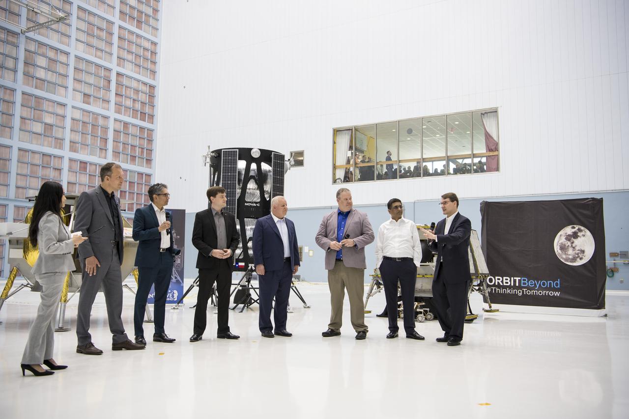
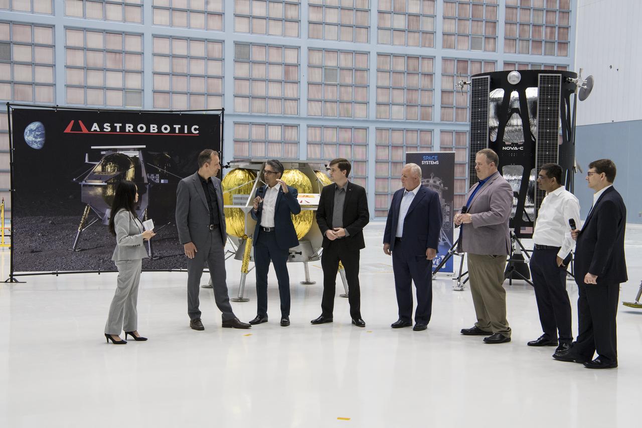
Chief Science Officer, OrbitBeyond, Jon Morse speaks about their lunar lander with, from left to right, NASA Press Officer, Felicia Chou; NASA Associate Administrator, Science Mission Directorate, Thomas Zurbuchen; Astrobotic Mission Director, Sharad Bhaskaran; Astrobotic CEO, John Thornton; Chairman of the Board of Intuitive Machines, Kam Ghaffarian; VP of Research and Development of Intuitive Machines, Tim Crain; President and CEO of OrbitBeyond, Siba Padhi, Friday, May 31, 2019, at Goddard Space Flight Center in Md. Astrobotic, Intuitive Machines, and OrbitBeyond have been selected to provide the first lunar landers for the Artemis program's lunar surface exploration. Photo credit: (NASA/Aubrey Gemignani)
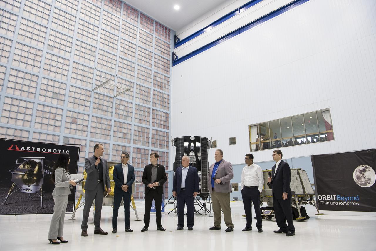
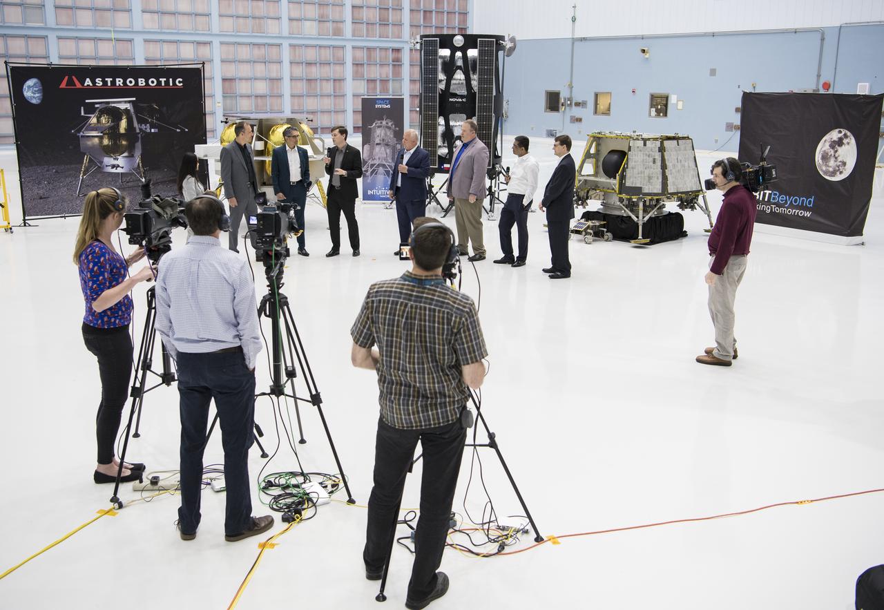
From left to right, NASA Press Officer, Felicia Chou; NASA Associate Administrator, Science Mission Directorate, Thomas Zurbuchen; Astrobotic Mission Director, Sharad Bhaskaran; Astrobotic CEO, John Thornton; Chairman of the Board of Intuitive Machines, Kam Ghaffarian; VP of Research and Development of Intuitive Machines, Tim Crain; President and CEO of OrbitBeyond, Siba Padhi; and Chief Science Officer, OrbitBeyond, Jon Morse talk about their lunar landers, Friday, May 31, 2019, at Goddard Space Flight Center in Md. Astrobotic, Intuitive Machines, and OrbitBeyond have been selected to provide the first lunar landers for the Artemis program's lunar surface exploration. Photo credit: (NASA/Aubrey Gemignani)
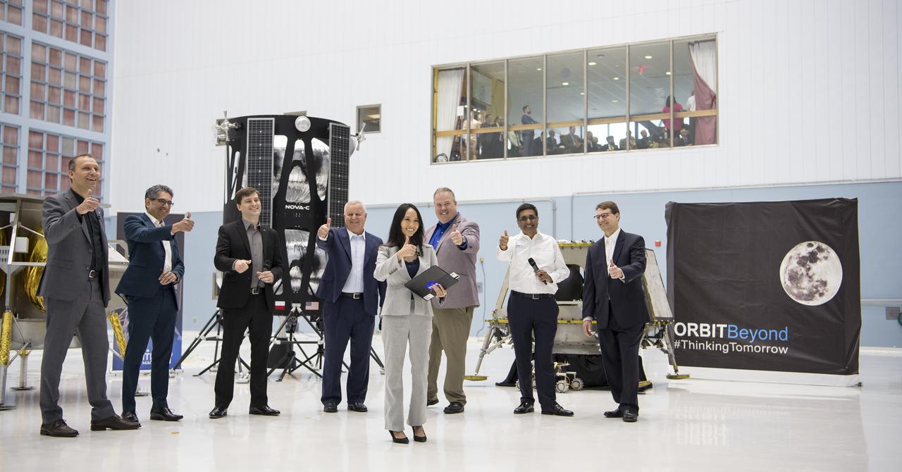
From left to right, NASA Associate Administrator, Science Mission Directorate, Thomas Zurbuchen; Astrobotic Mission Director, Sharad Bhaskaran; Astrobotic CEO, John Thornton; Chairman of the Board of Intuitive Machines, Kam Ghaffarian; VP of Research and Development of Intuitive Machines, Tim Crain; President and CEO of OrbitBeyond, Siba Padhi; Chief Science Officer, OrbitBeyond, Jon Morse; and NASA Press Officer, Felicia Chou, front center, put their thumbs up at the conclusion of an event announcing the companies that will provide the first lunar landers for the Artemis program's lunar surface exploration, Friday, May 31, 2019, at Goddard Space Flight Center in Md. Photo credit: (NASA/Aubrey Gemignani)
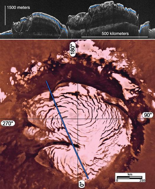
This image montage features a two-dimensional radar cross section of Mars north polar cap collected by SHARAD instrument on NASA Mars Reconnaissance Orbiter spacecraft top, and a color image mosaic of the polar cap from NASA Viking project bottom
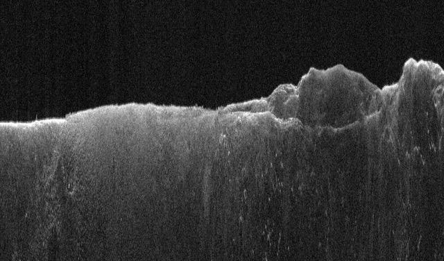
This animation depicts NASA's Mars Reconnaissance Orbiter (MRO) performing what's called a "very large roll": a 120-degree roll that can increase the capabilities of the spacecraft's subsurface radar instrument, called Shallow Radar, or SHARAD. Very large rolls boost SHARAD's signal by 10 times or more, giving scientists a clearer and deeper look below the Martian surface than MRO has ever had before. The orbiter was designed to roll up to 30 degrees in any direction so that it can point its instruments at surface targets. These standard rolls give cameras like the High-Resolution Imaging Science Experiment (HiRISE) prime viewing at the front of MRO at the expense of SHARAD, which has an antenna mounted at the back of the orbiter. While this setup helps the cameras, it also means that radio signals SHARAD pings onto the surface below encounter parts of the spacecraft, interfering with the signals and resulting in images that are less clear. In 2023, the team decided to try developing 120-degree rolls – the very large rolls – that rotate SHARAD's antenna toward the planet and provide the radio waves an unobstructed path to the surface. That lets the radar's signals reach deeper and get a clearer picture of rocks, sand, and geologic layers underground. It also helps SHARAD look for water ice in the near-subsurface that could be accessed by astronauts to produce rocket propellant for the trip home and is important for learning more about the climate, geology, and potential for life at Mars. Animation available at https://photojournal.jpl.nasa.gov/catalog/PIA26478
Astrobotic CEO, John Thornton, fourth from left, speaks about their lunar lander with, from left to right, NASA Press Officer, Felicia Chou; NASA Associate Administrator, Science Mission Directorate, Thomas Zurbuchen; Astrobotic Mission Director, Sharad Bhaskaran; Chairman of the Board of Intuitive Machines, Kam Ghaffarian; VP of Research and Development of Intuitive Machines, Tim Crain; President and CEO of OrbitBeyond, Siba Padhi; and Chief Science Officer, OrbitBeyond, Jon Morse, Friday, May 31, 2019, at Goddard Space Flight Center in Md. Astrobotic, Intuitive Machines, and OrbitBeyond have been selected to provide the first lunar landers for the Artemis program's lunar surface exploration. Photo credit: (NASA/Aubrey Gemignani)
Astrobotic Mission Director, Sharad Bhaskaran , third from left, speaks about their lunar lander with, from left to right, NASA Press Officer, Felicia Chou; NASA Associate Administrator, Science Mission Directorate, Thomas Zurbuchen; Astrobotic CEO, John Thornton; Chairman of the Board of Intuitive Machines, Kam Ghaffarian; VP of Research and Development of Intuitive Machines, Tim Crain; President and CEO of OrbitBeyond, Siba Padhi; and Chief Science Officer, OrbitBeyond, Jon Morse, Friday, May 31, 2019, at Goddard Space Flight Center in Md. Astrobotic, Intuitive Machines, and OrbitBeyond have been selected to provide the first lunar landers for the Artemis program's lunar surface exploration. Photo credit: (NASA/Aubrey Gemignani)
This image has low-sun lighting that accentuates the many transverse ridges on this slope, extending from Euripus Mons (mountains). These flow-like structures were previously called "lobate debris aprons," but the Shallow Radar (SHARAD) instrument on MRO has shown that they are actually debris-covered flows of ice, or glaciers. There is no evidence for present-day flow of these glaciers, so they appear to be remnants of past climates. http://photojournal.jpl.nasa.gov/catalog/PIA20745
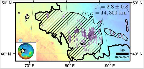
Diagonal striping on this map of a portion of the Utopia Planitia region on Mars indicates the area where a large subsurface deposit rich in water ice was assessed using the Shallow Radar (SHARAD) instrument on NASA's Mars Reconnaissance Orbiter. The area is about halfway between the planet's equator and north pole, and the deposit is estimated to hold about as much water as what is in Lake Superior, largest of the Great Lakes. The scale bar at lower right indicates 140 kilometers (76 miles). The violet vertical bars show depth to the bottom of the ice-rich deposit, as estimated from SHARAD passes overhead. Darkest violet indicates a depth of about 550 feet (about 170 meters). Palest violet indicates a depth of about 33 feet (10 meters). The value of 2.8 plus-or-minus 0.8 in the upper right corner denotes the dielectric constant, a property related to radar reflectivity. The value of 14,300 cubic kilometers is an estimate of the volume of water in the deposit. http://photojournal.jpl.nasa.gov/catalog/PIA21138
KENNEDY SPACE CENTER, FLA. - In the Payload Hazardous Servicing Facility, technicians prepare the solar arrays for the Mars Reconnaissance Orbiter (MRO) and an antenna simulator (yellow horizontal rod) for an electromagnetic interference verification test. If no interference is found during the test, the Shallow Radar Antenna (SHARAD) will be installed on the spacecraft. The spacecraft is undergoing multiple mechanical assembly operations and electrical tests to verify its readiness for launch. The MRO was built by Lockheed Martin for NASA’s Jet Propulsion Laboratory in California. It is the next major step in Mars exploration and scheduled for launch from Launch Complex 41 at Cape Canaveral Air Force Station in a window opening Aug. 10. The MRO is an important next step in fulfilling NASA’s vision of space exploration and ultimately sending human explorers to Mars and beyond.
KENNEDY SPACE CENTER, FLA. - In the Payload Hazardous Servicing Facility, an electromagnetic interference verification test is being conducted on the solar arrays for the Mars Reconnaissance Orbiter (MRO) and an antenna simulator (yellow horizontal rod). If no interference is found during the test, the Shallow Radar Antenna (SHARAD) will be installed on the spacecraft. The spacecraft is undergoing multiple mechanical assembly operations and electrical tests to verify its readiness for launch. The MRO was built by Lockheed Martin for NASA’s Jet Propulsion Laboratory in California. It is the next major step in Mars exploration and scheduled for launch from Launch Complex 41 at Cape Canaveral Air Force Station in a window opening Aug. 10. The MRO is an important next step in fulfilling NASA’s vision of space exploration and ultimately sending human explorers to Mars and beyond.
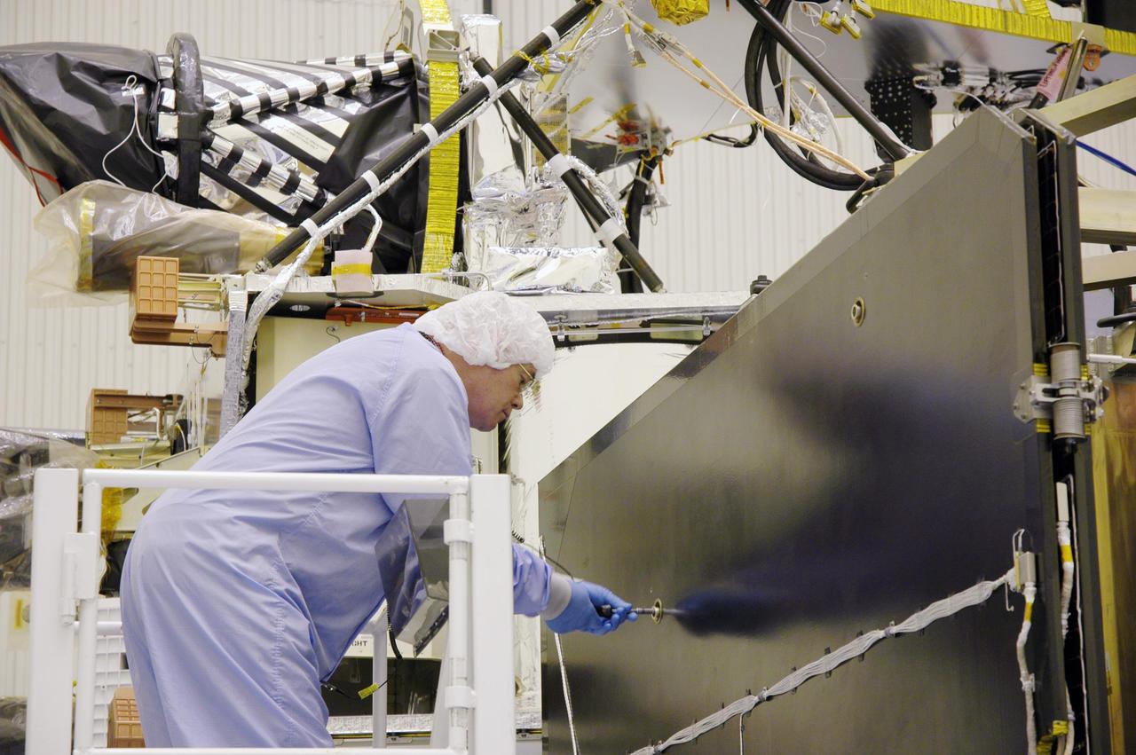
KENNEDY SPACE CENTER, FLA. - In the Payload Hazardous Servicing Facility, a technician prepares the solar arrays for the Mars Reconnaissance Orbiter (MRO) for an electromagnetic interference verification test. If no interference is found during the test, the Shallow Radar Antenna (SHARAD) will be installed on the spacecraft. The spacecraft is undergoing multiple mechanical assembly operations and electrical tests to verify its readiness for launch. The MRO was built by Lockheed Martin for NASA’s Jet Propulsion Laboratory in California. It is the next major step in Mars exploration and scheduled for launch from Launch Complex 41 at Cape Canaveral Air Force Station in a window opening Aug. 10. The MRO is an important next step in fulfilling NASA’s vision of space exploration and ultimately sending human explorers to Mars and beyond.
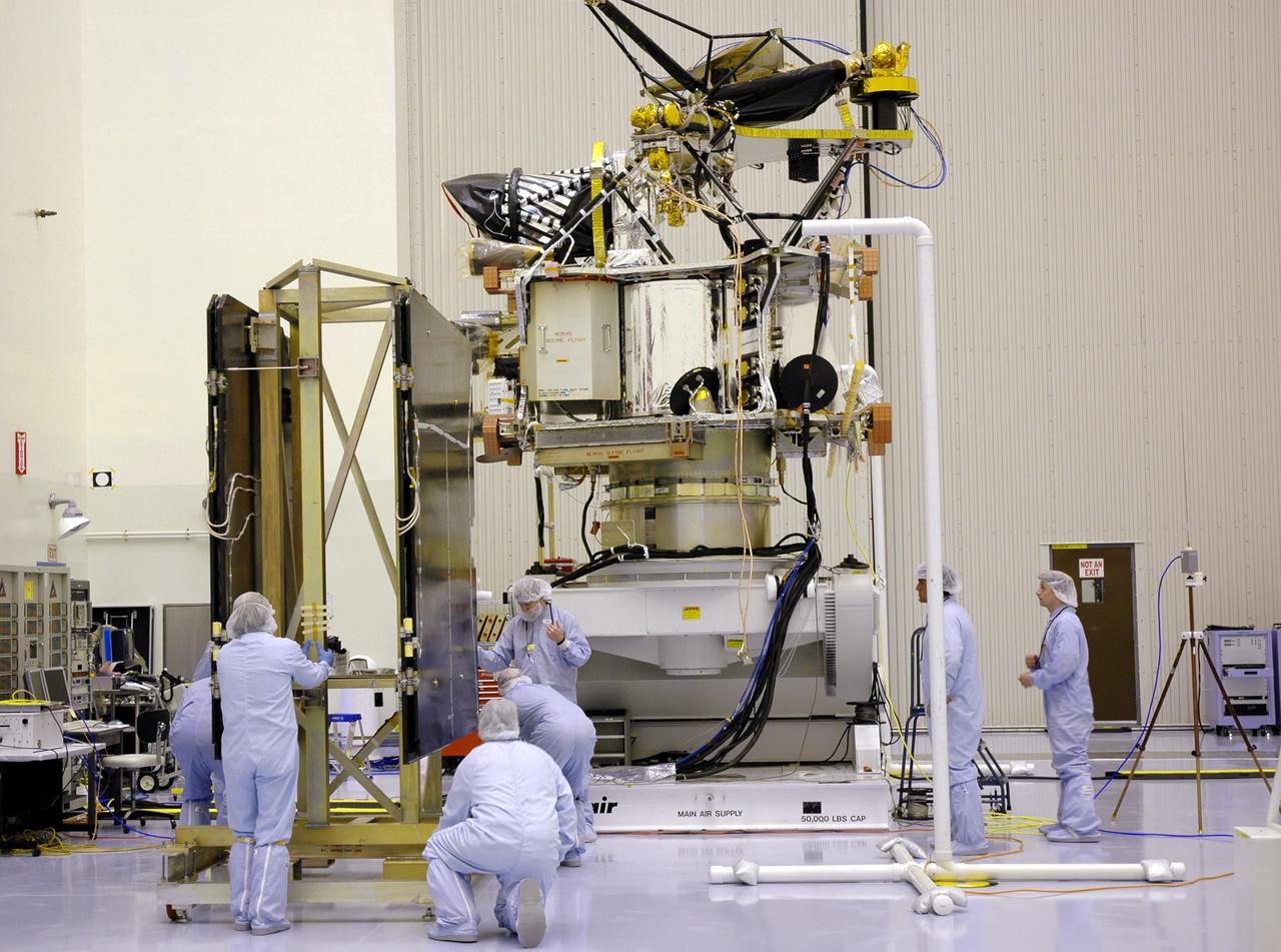
KENNEDY SPACE CENTER, FLA. - In the Payload Hazardous Servicing Facility, technicians position the solar arrays for the Mars Reconnaissance Orbiter (MRO) in preparation for an electromagnetic interference verification test. If no interference is found during the test, the Shallow Radar Antenna (SHARAD) will be installed on the spacecraft. The spacecraft is undergoing multiple mechanical assembly operations and electrical tests to verify its readiness for launch. The MRO was built by Lockheed Martin for NASA’s Jet Propulsion Laboratory in California. It is the next major step in Mars exploration and scheduled for launch from Launch Complex 41 at Cape Canaveral Air Force Station in a window opening Aug. 10. The MRO is an important next step in fulfilling NASA’s vision of space exploration and ultimately sending human explorers to Mars and beyond.
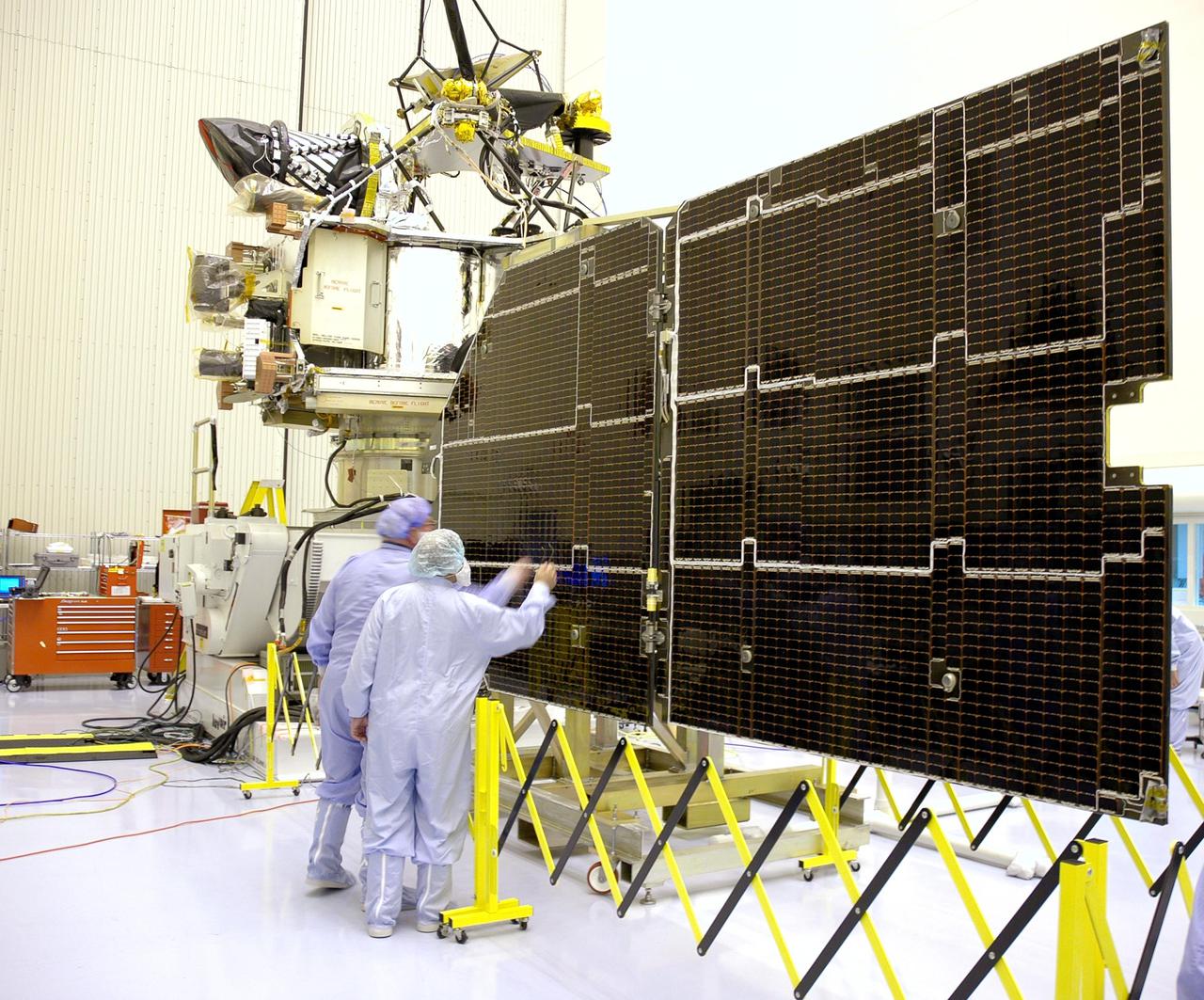
KENNEDY SPACE CENTER, FLA. - In the Payload Hazardous Servicing Facility, technicians inspect the solar panels for the Mars Reconnaissance Orbiter (MRO) during an electromagnetic interference verification test. If no interference is found during the test, the Shallow Radar Antenna (SHARAD) will be installed on the spacecraft. The spacecraft is undergoing multiple mechanical assembly operations and electrical tests to verify its readiness for launch. The MRO was built by Lockheed Martin for NASA’s Jet Propulsion Laboratory in California. It is the next major step in Mars exploration and scheduled for launch from Launch Complex 41 at Cape Canaveral Air Force Station in a window opening Aug. 10. The MRO is an important next step in fulfilling NASA’s vision of space exploration and ultimately sending human explorers to Mars and beyond.
This enhanced color image from NASA's Mars Reconnaissance Orbiter shows the surface of a lobate debris apron in the Deuteronilus Mensae region of Mars, on the boundary between the Northern plains and Southern lowlands. These lobe-shaped formations commonly emanate from mesas in this region and have pitted, lineated textures that suggest the flow of water ice. Results from the SHARAD (SHAllow RADar) instrument on MRO indicate that lobate debris aprons in Deuteronilus Mensae, similar to those visible here, are composed of material dominated by ice and are interpreted to be potential debris-covered glaciers or rock glaciers. These debris apron surfaces are also covered by an ice-rich deposit that we’ve observed draping over entire regions in the mid-latitudes of Mars. It is this mantling deposit that filled in the crater, with its subsequent removal around the outer margins, probably due to differential sublimation of the ice. The same textures in the center of the crater are like those of the surrounding terrain. https://photojournal.jpl.nasa.gov/catalog/PIA21955
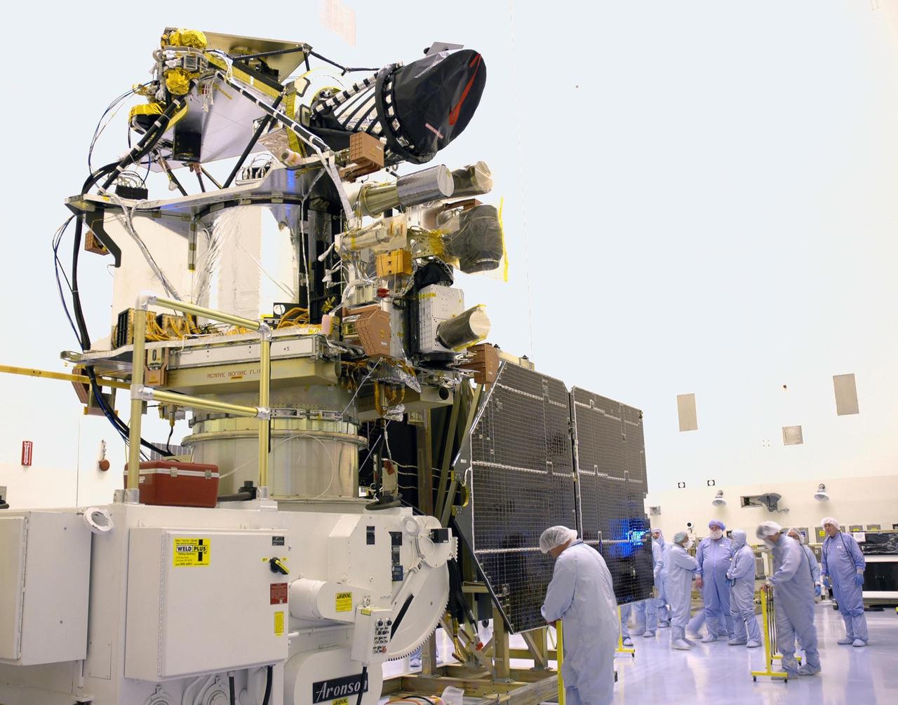
KENNEDY SPACE CENTER, FLA. - In the Payload Hazardous Servicing Facility, technicians prepare to conduct an electromagnetic interference verification test using the solar arrays for the Mars Reconnaissance Orbiter (MRO) and an antenna simulator. If no interference is found during the test, the Shallow Radar Antenna (SHARAD) will be installed on the spacecraft. The spacecraft is undergoing multiple mechanical assembly operations and electrical tests to verify its readiness for launch. The MRO was built by Lockheed Martin for NASA’s Jet Propulsion Laboratory in California. It is the next major step in Mars exploration and scheduled for launch from Launch Complex 41 at Cape Canaveral Air Force Station in a window opening Aug. 10. The MRO is an important next step in fulfilling NASA’s vision of space exploration and ultimately sending human explorers to Mars and beyond.

Astrobotic CEO, John Thornton, second from right, speaks about their lunar lander, Friday, May 31, 2019, at Goddard Space Flight Center in Md. Astrobotic, Intuitive Machines, and Orbit Beyond have been selected to provide the first lunar landers for the Artemis program's lunar surface exploration. Photo credit: (NASA/Aubrey Gemignani)
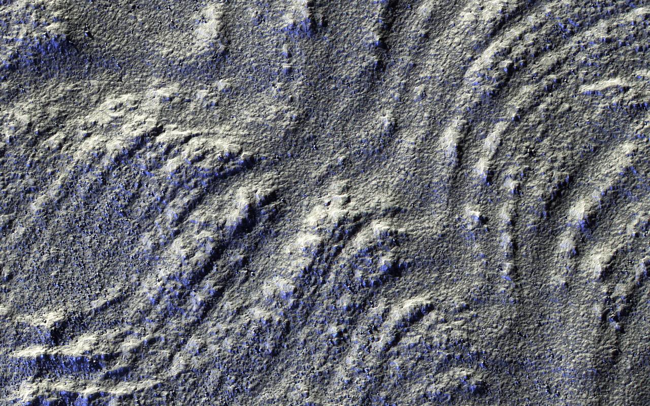
The rotational axis of Mars is currently tilted by about 25 degrees, very similar to that of the Earth (at 23.4 degrees). However, while Earth's axial tilt (also known as "obliquity") tends to change very slightly over time (almost 3 degrees in 40,000 year-cycles), the obliquity of Mars is much more chaotic and varies widely from 0 to almost 60 degrees! The fact that it is currently similar to that of the Earth is merely a coincidence. Currently, water-ice is stable on the Martian surface only in the polar regions. However, during times of "high obliquity," that stability shifts towards the equatorial regions. We see evidence for recent periods of high obliquity on Mars in the form of features common in the mid-latitude regions, which planetary scientists call "viscous flow features," "lobate debris aprons," or "lineated valley fills." These are all scientifically conservative ways of describing features on Mars that resemble mountain glaciers on Earth. We now know from radar observations, particularly using the SHARAD instrument on board the Mars Reconnaissance Orbiter, that these features are really composed of mixtures of pure ice and dust, and as a result, many scientists have started using the term "glacier-like forms" (GLF) to describe some of them. The main reason that these feature are still present for us to observe nowadays-despite the inhospitable conditions for water ice in these latitudes-is that these "glaciers" are covered by thin layers of dust, which protect them from the atmosphere of Mars and prevents, or significantly slows down, the loss of ice through sublimation to the atmosphere. However, if we were to take a look at this image of a "lobate debris apron," we will see that some areas show numerous depressions, which suggests that these areas have lost some of the ice creating these "deflation features." In addition, if we zoom in on one of these depressions, we will see surface polygonal patterns, which are common in cold regions on Earth (such as Alaska, northern Canada, and Siberia) and are indicators of shallow sub-surface water-ice. http://photojournal.jpl.nasa.gov/catalog/PIA21065