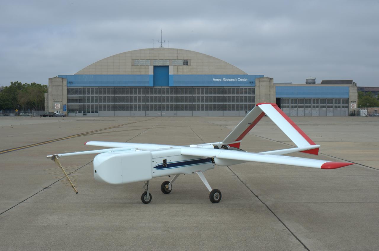
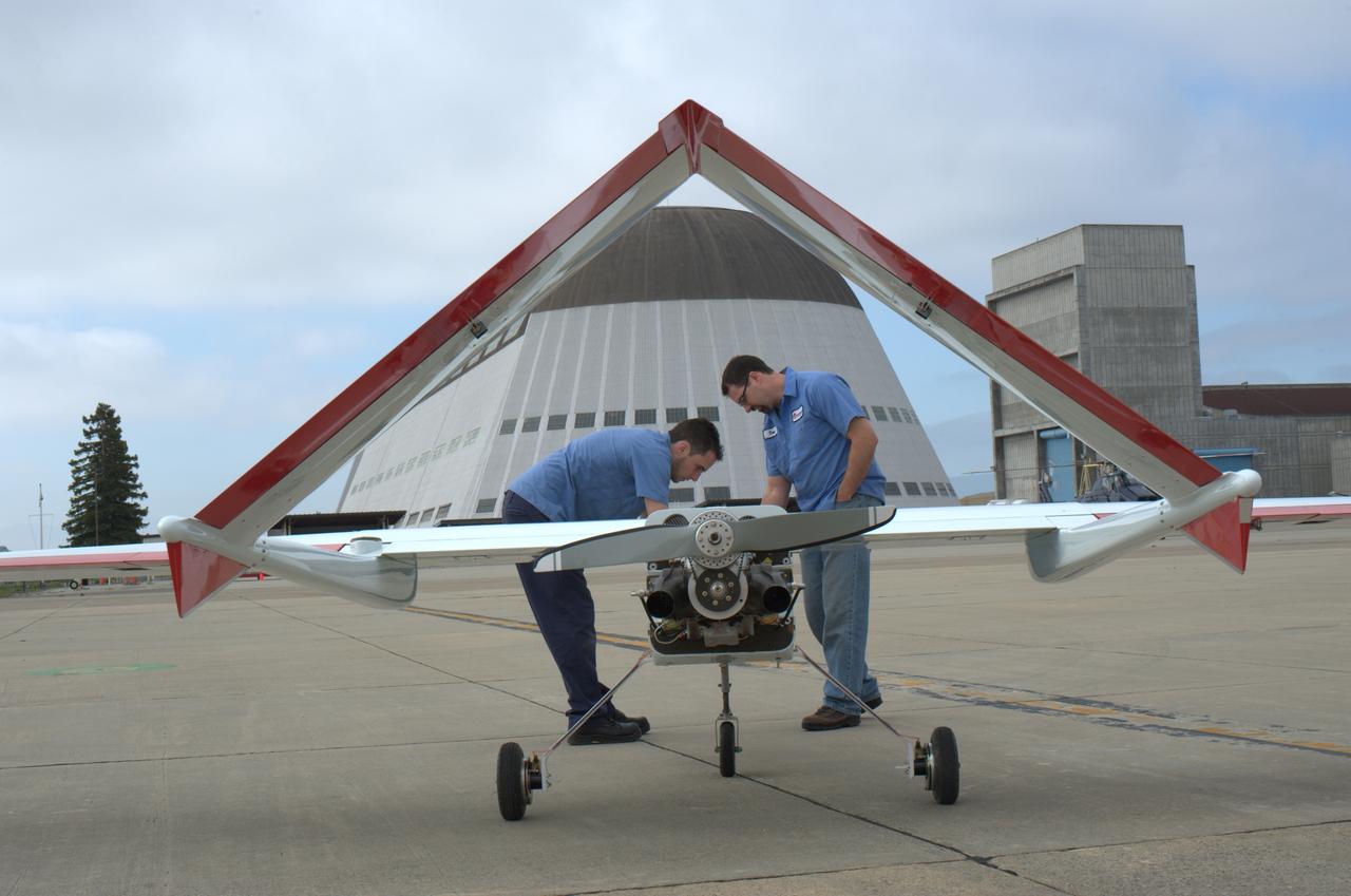
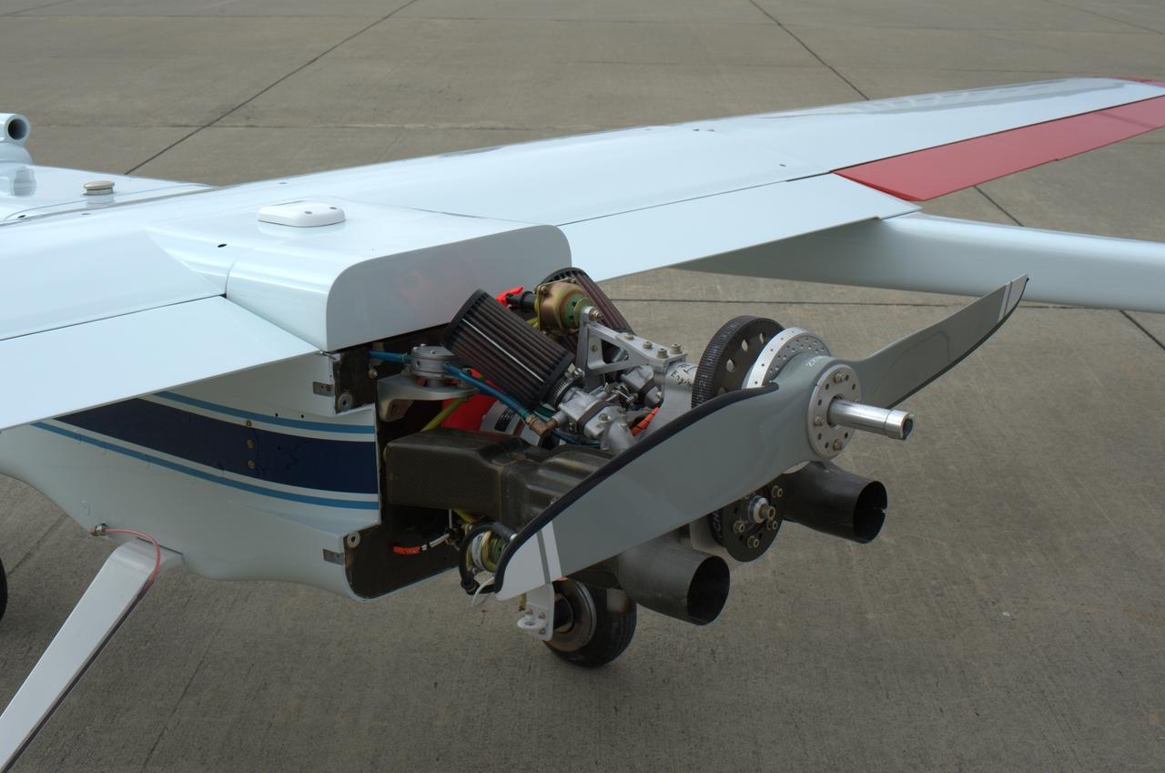
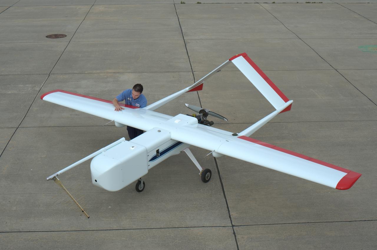
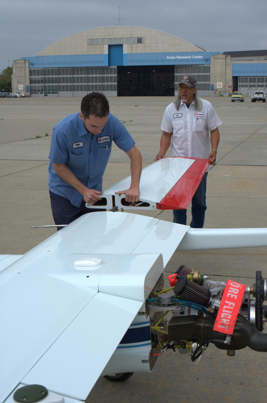
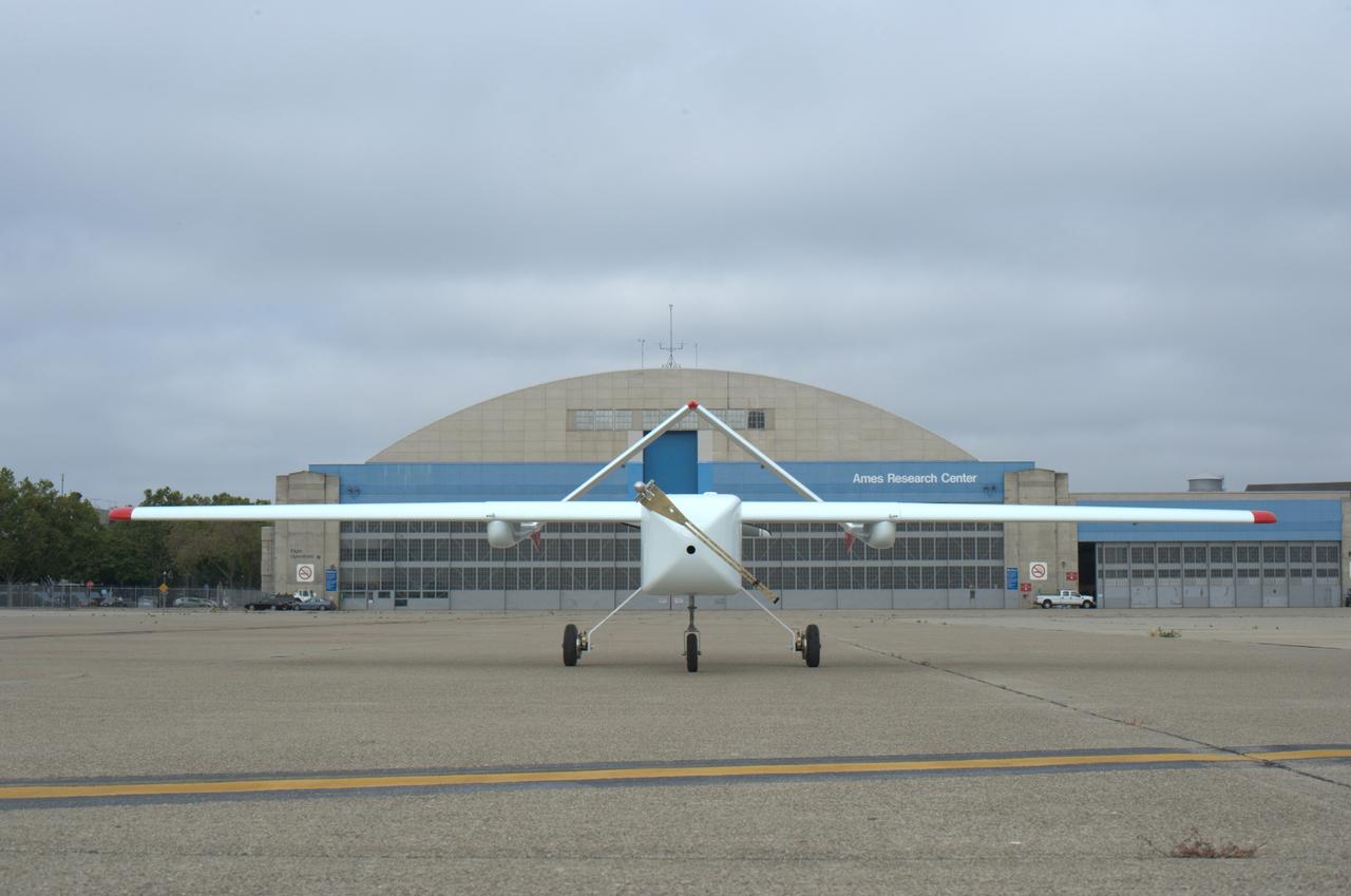
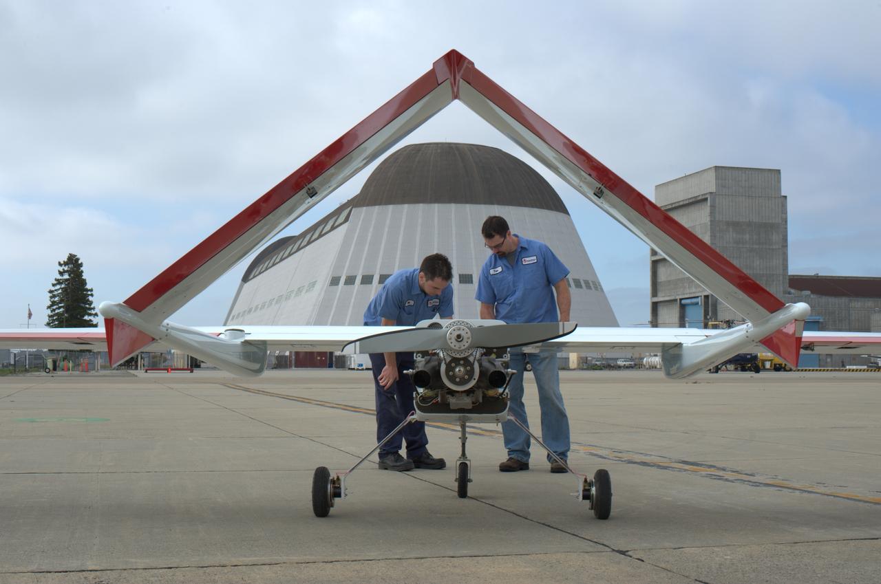
SIERRA (Systems Integration Evaluation Remote Research Aircraft) Uninhabited Aerial System (UAV plane) on the Ames flightline (aka; Sierra Unpiloted Aerial system (UAS))
SIERRA (Systems Integration Evaluation Remote Research Aircraft) Uninhabited Aerial System (UAV plane) on the Ames flightline (aka; Sierra Unpiloted Aerial system (UAS))
SIERRA (Systems Integration Evaluation Remote Research Aircraft) Uninhabited Aerial System (UAV plane) on the Ames flightline (aka; Sierra Unpiloted Aerial system (UAS))
SIERRA (Systems Integration Evaluation Remote Research Aircraft) Uninhabited Aerial System (UAV plane) on the Ames flightline (aka; Sierra Unpiloted Aerial system (UAS))
SIERRA (Systems Integration Evaluation Remote Research Aircraft) Uninhabited Aerial System (UAV plane) on the Ames flightline (aka; Sierra Unpiloted Aerial system (UAS))
SIERRA (Systems Integration Evaluation Remote Research Aircraft) Uninhabited Aerial System (UAV plane) on the Ames flightline (aka; Sierra Unpiloted Aerial system (UAS))
SIERRA (Systems Integration Evaluation Remote Research Aircraft) Uninhabited Aerial System (UAV plane) on the Ames flightline (aka; Sierra Unpiloted Aerial system (UAS))

An ER-2 high-altitude Earth science aircraft banks away during a flight over the southern Sierra Nevada. NASA’s Armstrong Flight Research Center operates two of the Lockheed-built aircraft on a wide variety of environmental science, atmospheric sampling, and satellite data verification missions.
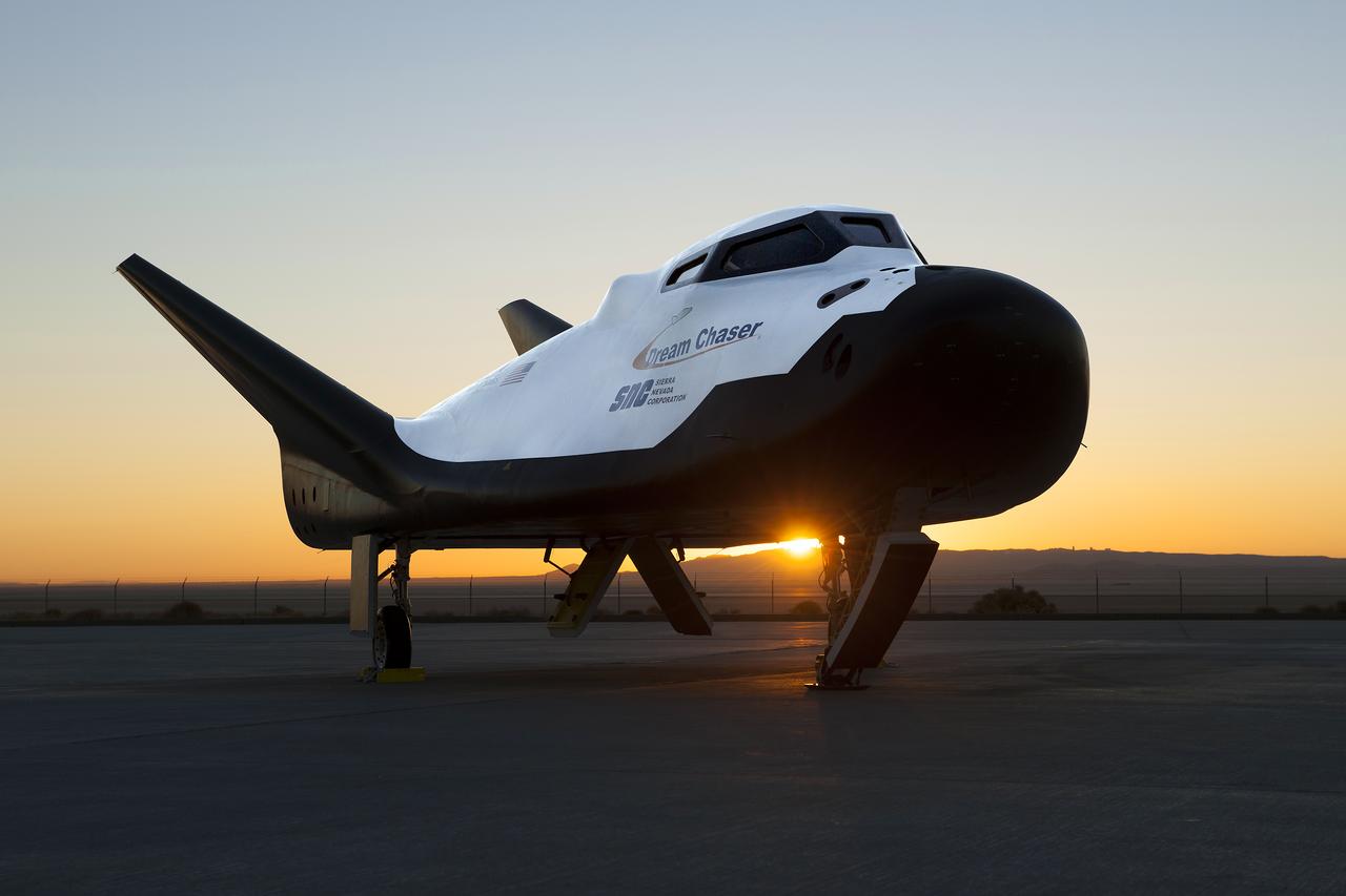
Sierra Nevada Corp’s Dream Chaser posed on ramp at sunrise at NASA Armstrong Flight Research Center in California where the aircraft has gone through a series of tests in preparation for flight.
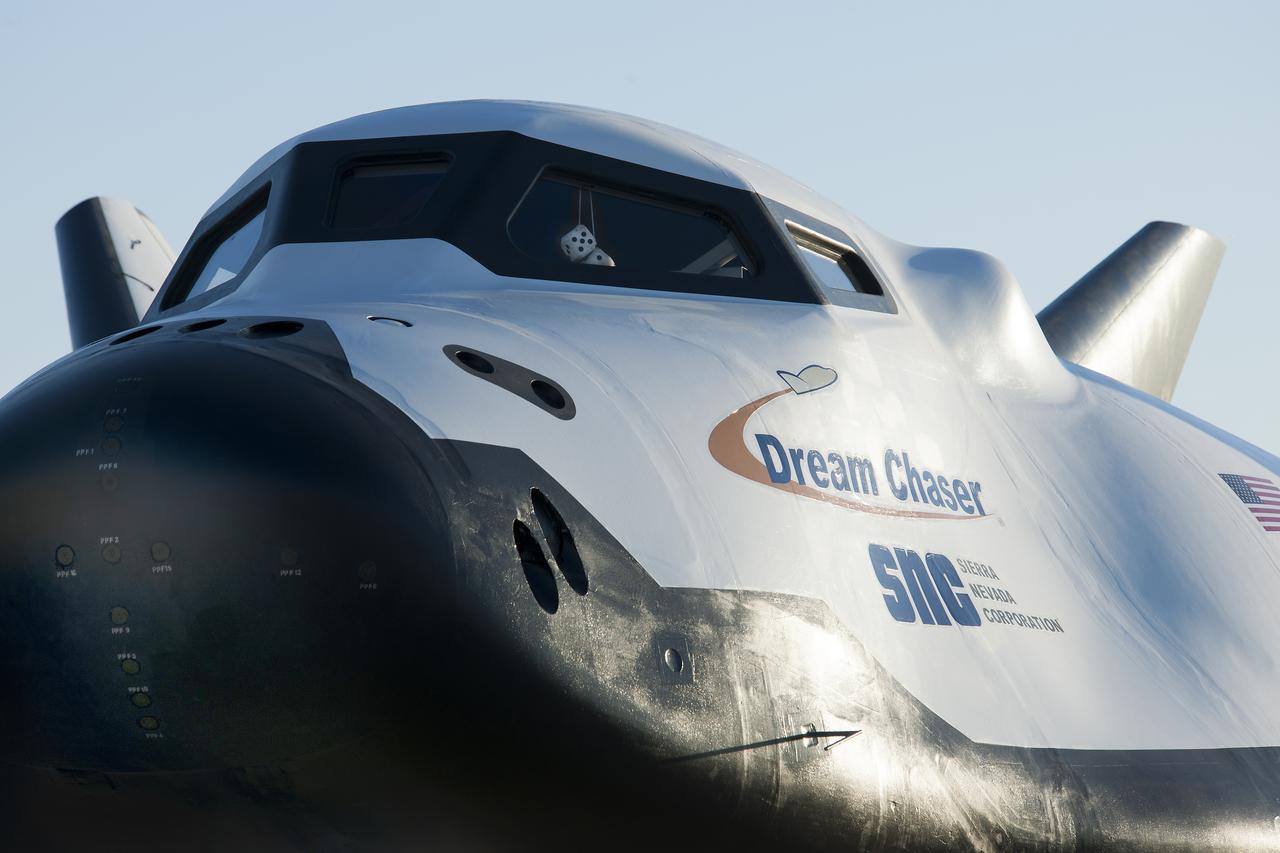
Sierra Nevada Corp’s Dream Chaser posed on ramp at sunrise at NASA Armstrong Flight Research Center in California where the aircraft has gone through a series of tests in preparation for flight.

Sierra Nevada Corp’s Dream Chaser posed on ramp at sunrise at NASA Armstrong Flight Research Center in California where the aircraft has gone through a series of tests in preparation for flight.
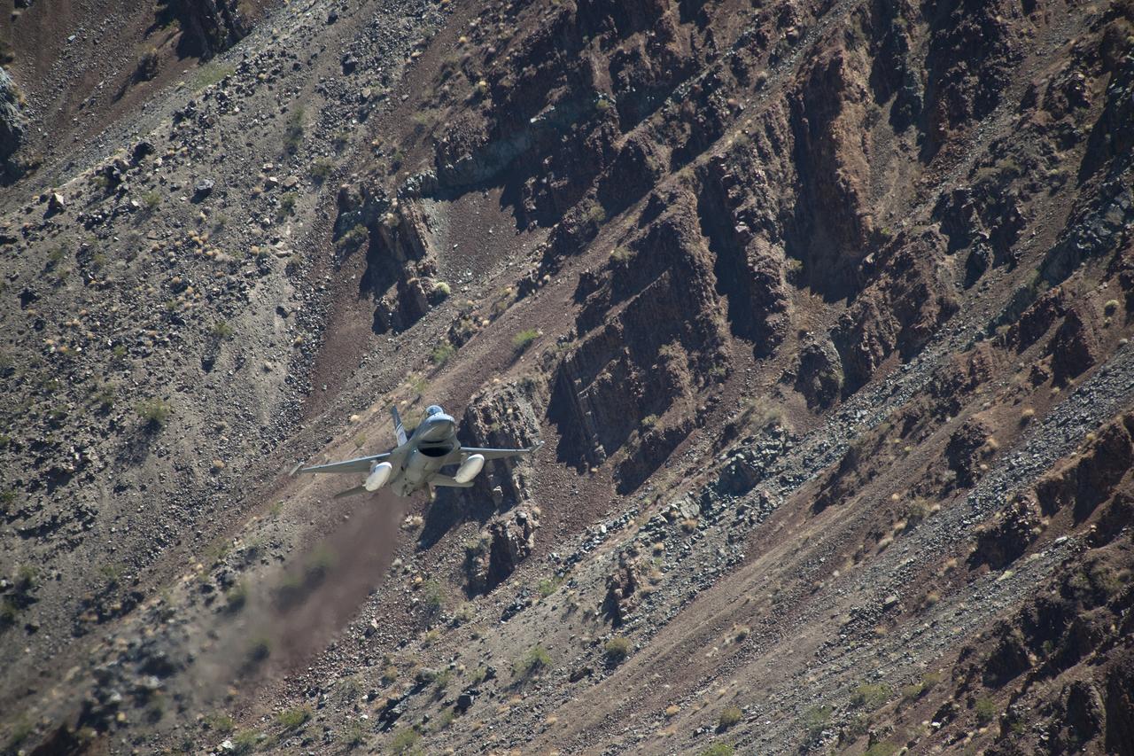
The Air Force F-16D Automatic Collision Avoidance Technology aircraft flew at low levels above the Sierra Nevada Mountains to test the ACAT Fighter Risk Reduction Project to develop collision avoidance technologies for aircraft, to reduce the risk of ground collisions.
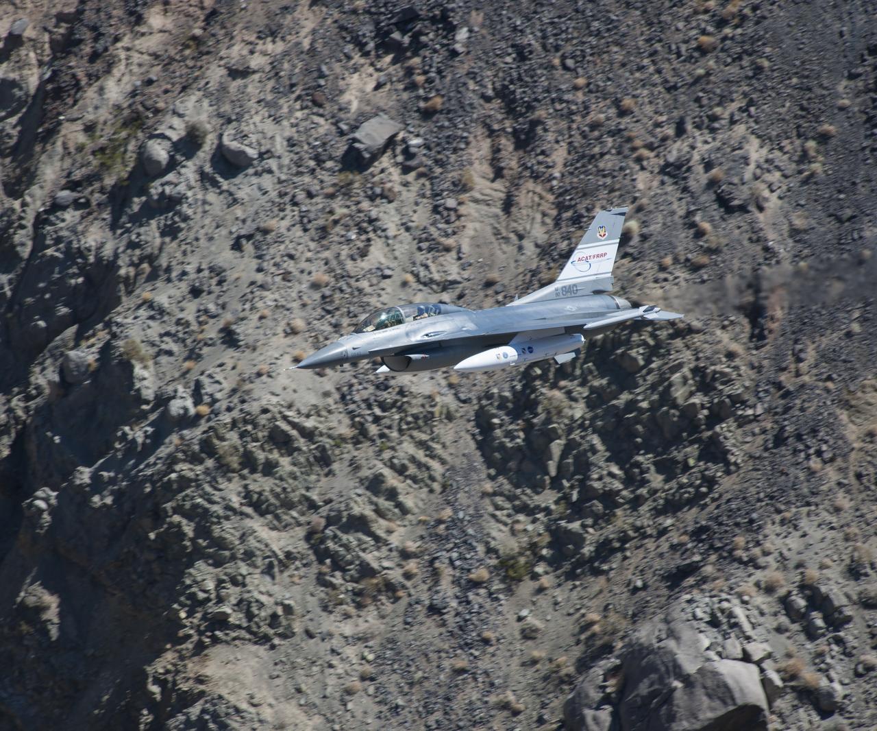
The U.S. Air Force F-16D Automatic Collision Avoidance Technology aircraft flew at low levels above the Sierra Nevada Mountains to test the ACAT Fighter Risk Reduction project. The goal was to develop collision avoidance technologies for aircraft to reduce the risk of ground collisions. Such systems on U.S. Air Force aircraft have resulted in saving eight lives and seven aircraft.
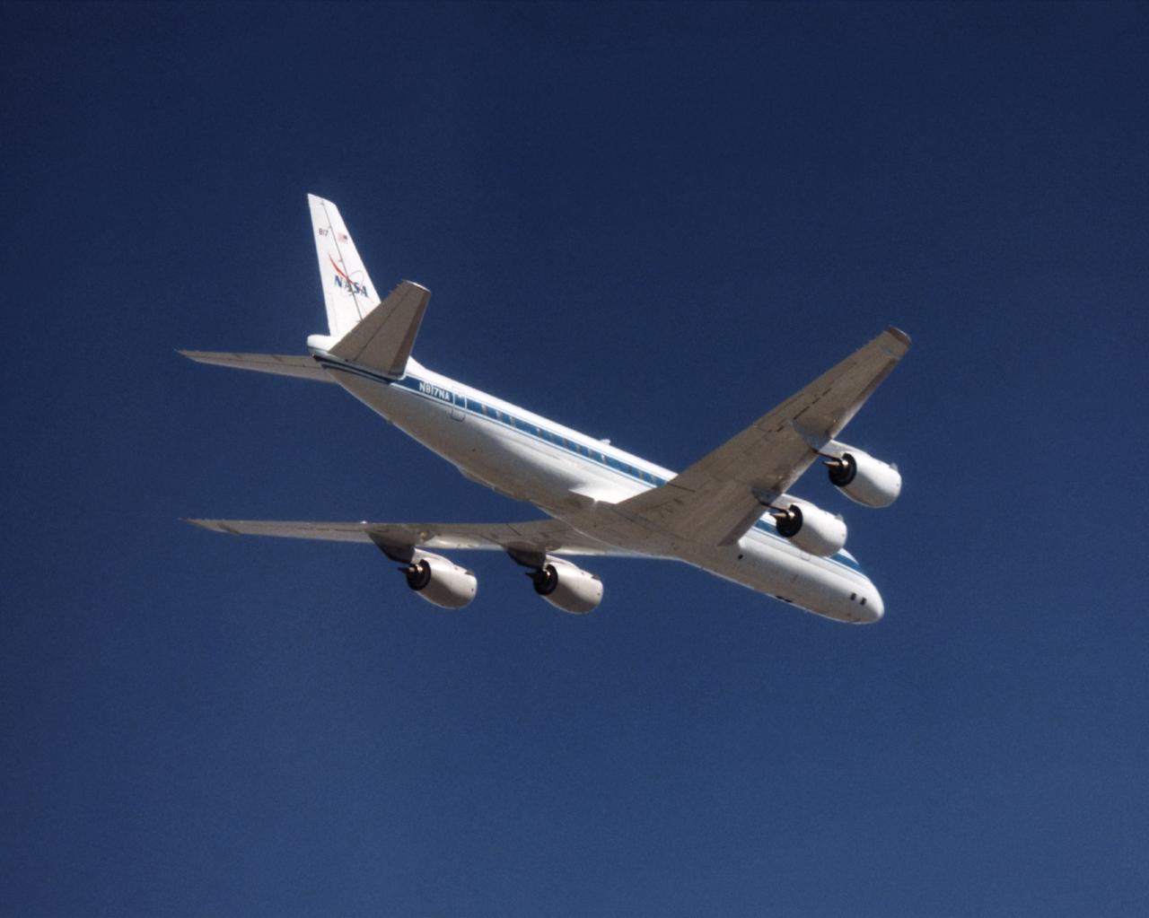
The NASA DC-8 in a right bank over the rugged Sierra Nevada Mountains. The former airliner is a "dash-72" model and has a range of 5,500 miles. The craft can stay airborne for 12 hours and has an operational speed range between 300 and 500 knots. The research flights are made at between 500 and 41,000 feet. The aircraft can carry up to 30,000 lbs of research/science payload equipment installed in 15 mission-definable spaces. In this photo, the aircraft is shown in flight from below, with the DC-8 silhouetted against a blue sky.
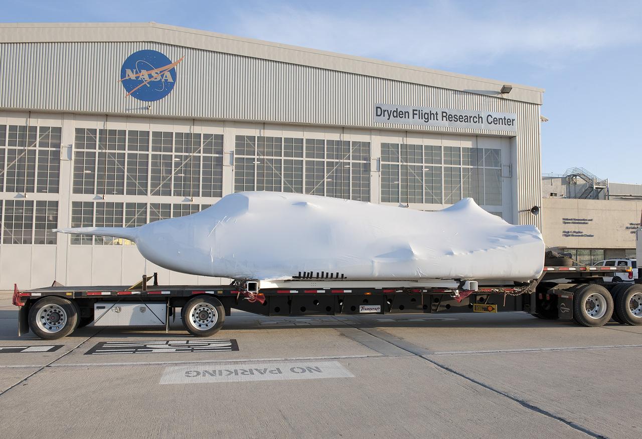
EDWARDS, Calif. – ED13-0142-08: The flatbed truck and trailer that transported Sierra Nevada Corporation, or SNC, Space Systems' Dream Chaser engineering test article pauses behind Hangar 4802 on the aircraft ramp at NASA's Dryden Flight Research Center on Edwards Air Force Base, Calif., upon arrival at the center. The vehicle was shrouded in protective plastic wrap with its wings and tail structure removed for its four-day overland transport from Sierra Nevada's facility in Louisville, Colo., to NASA Dryden. SNC is one of three companies working with NASA's Commercial Crew Program, or CCP, during the agency's Commercial Crew Integrated Capability, or CCiCap, initiative, which is intended to lead to the availability of commercial human spaceflight services for government and commercial customers. To learn more about CCP and its industry partners, visit www.nasa.gov/commercialcrew. Image credit: NASA/Tom Tschida
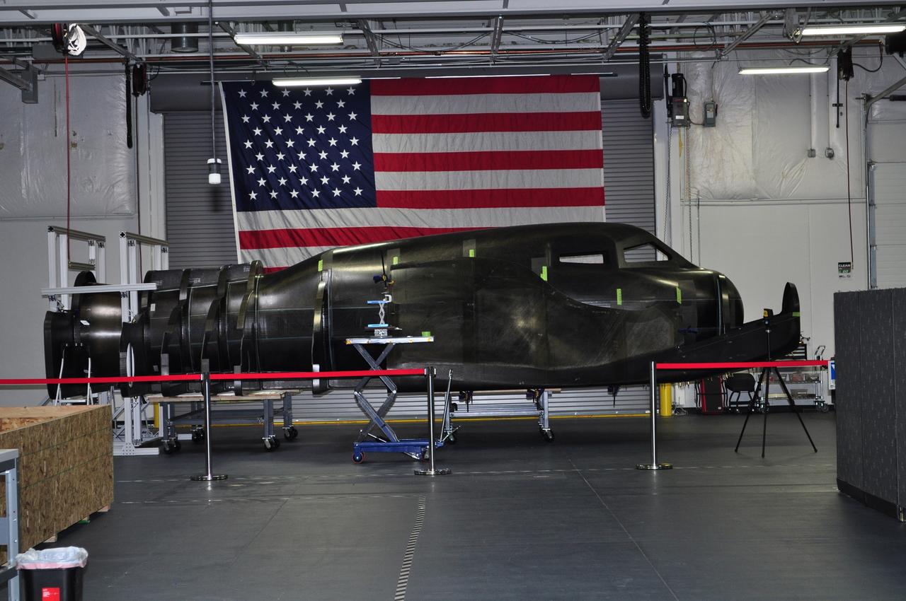
LOUISVILLE, Colo. – During NASA's Commercial Crew Development Round 2 CCDev2) activities for the Commercial Crew Program CCP, Sierra Nevada Corp. SNC delivered the primary structure of its Dream Chaser flight test vehicle to the company’s office in Louisville, Colo. SNC engineers currently are assembling the full-scale prototype, which includes the integration of secondary structures and subsystems. This all-composite structure of the company's planned winged spacecraft, the Dream Chaser, will be used to carry out several remaining CCDev2 milestones including a captive carry flight and the first approach and landing test of the spacecraft. During the captive carry flight, a carrier aircraft will the Dream Chaser vehicle over NASA's Dryden Flight Research Center in Edwards, Calif. Sierra Nevada is one of seven companies NASA entered into Space Act Agreements SAAs with during CCDev2 to aid in the innovation and development of American-led commercial capabilities for crew transportation and rescue services to and from the International Space Station and other low Earth orbit destinations. For information about CCP, visit www.nasa.gov/commercialcrew. Photo credit: Sierra Nevada Corp.
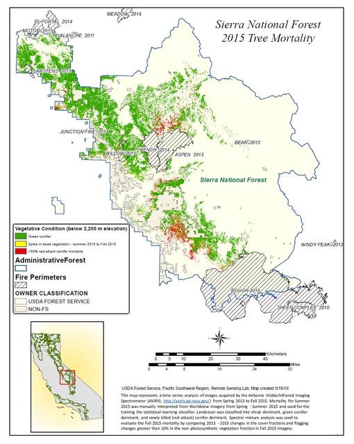
California, reveals the devastating effect of California's ongoing drought on Sierra Nevada conifer forests. The map will be used to help the U.S. Forest Service assess and respond to the impacts of increased tree mortality caused by the drought, particularly where wildlands meet urban areas within the Sierra National Forest. After several years of extreme drought, the highly stressed conifers (trees or bushes that produce cones and are usually green year-round) of the Sierra Nevada are now more susceptible to bark beetles (Dendroctonus spp.). While bark beetles killing trees in the Sierra Nevada is a natural phenomenon, the scale of mortality in the last couple of years is far greater than previously observed. The U.S. Forest Service is using recent airborne spectroscopic measurements from NASA's Airborne Visible/Infrared Imaging Spectrometer (AVIRIS) instrument aboard NASA's ER-2 aircraft, together with new advanced algorithms, to quantify this impact over this large region of rugged terrain. The high-altitude ER-2 aircraft is based at NASA's Armstrong Flight Research Center, Edwards, California. The image was created by scientists at the USFS's Pacific Southwest Region Remote Sensing Lab, McClellan, California, by performing a time series analysis of AVIRIS images. Scientists evaluated baseline tree mortality on public lands in the summer of 2015 using a machine learning algorithm called "random forest." This algorithm classifies the AVIRIS measurements as dominated by either shrubs, healthy trees or newly dead conifer trees. To quantify how much the amount of dead vegetation increased during the fall of 2015, the Forest Service scientists conducted an advanced spectral mixture analysis. This analysis evaluates each spectrum to determine the fraction of green vegetation, dead vegetation and soil. The full spectral range of AVIRIS is important to separate the signatures of soil and dead vegetation. To produce this comprehensive Sierra National Forest tree mortality map, the result from the summer of 2015 was evaluated to look for increases of more than 10 percent in dead vegetation during the fall of 2015. AVIRIS measures spectra of the Earth system to conduct advanced science research. These western U.S. AVIRIS measurements were acquired as part of NASA's Hyperspectral Infrared Imager (HyspIRI) preparatory airborne campaign. HyspIRI was one of the space missions suggested to NASA by the National Academy of Sciences in its 2007 decadal survey for Earth Science. In the future, HyspIRI could provide spectral and thermal measurements of this type globally for ecosystem research and additional science objectives. http://photojournal.jpl.nasa.gov/catalog/PIA20717
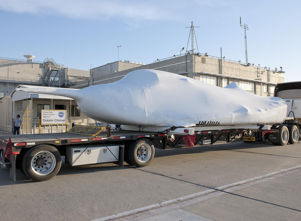
EDWARDS, Calif. – ED13-0142-10: The flatbed truck and trailer that transported Sierra Nevada Corporation, or SNC, Space Systems' Dream Chaser engineering test article pauses on the aircraft ramp at NASA's Dryden Flight Research Center on Edwards Air Force Base, Calif., upon arrival at the center. Following removal of the protective plastic wrap and reinstallation of its wings and tail structure, the Dream Chaser will begin ground tests in the next few weeks leading to approach and landing flight tests this summer. SNC is one of three companies working with NASA's Commercial Crew Program, or CCP, during the agency's Commercial Crew Integrated Capability, or CCiCap, initiative, which is intended to lead to the availability of commercial human spaceflight services for government and commercial customers. To learn more about CCP and its industry partners, visit www.nasa.gov/commercialcrew. Image credit: NASA/Tom Tschida
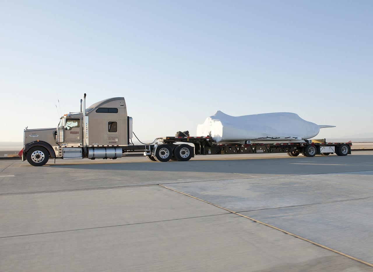
EDWARDS, Calif. – ED13-0142-11: The truck and trailer that transported the Dream Chaser engineering test article from Sierra Nevada Corporation, or SNC, Space Systems facility in Louisville, Colo., arrives on the aircraft ramp at NASA's Dryden Flight Research Center on Edwards Air Force Base, Calif., early in the morning. Based on NASA's HL-20 lifting body design, the Dream Chaser will begin its approach-and-landing flight test program in collaboration with NASA's Commercial Crew Program this summer. SNC is one of three companies working with NASA's Commercial Crew Program, or CCP, during the agency's Commercial Crew Integrated Capability, or CCiCap, initiative, which is intended to lead to the availability of commercial human spaceflight services for government and commercial customers. To learn more about CCP and its industry partners, visit www.nasa.gov/commercialcrew. Image credit: NASA/Tom Tschida
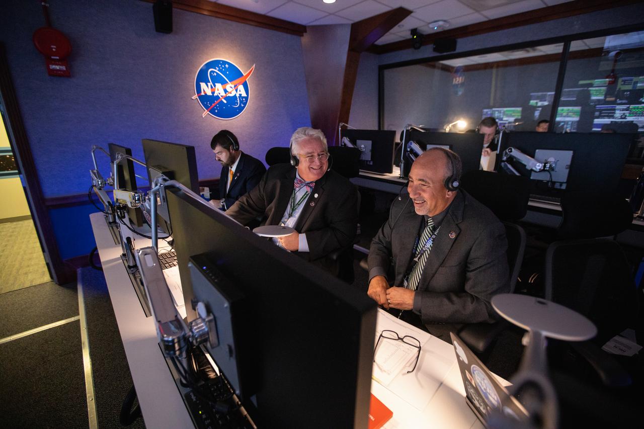
Albert Sierra (right), chief of NASA’s Launch Services Program’s (LSP) Flight Projects Office, and Garrett Lee Skrobot (second from right), senior mission manager, monitor the launch of the agency’s Ionospheric Connection Explorer (ICON) inside Hangar AE’s Mission Director’s Center at Cape Canaveral Air Force Station (CCAFS). The Northrop Grumman Pegasus XL rocket carrying ICON was released from the company’s L-1011 Stargazer aircraft at 9:59 p.m. EDT on Oct. 10, 2019, over the Atlantic Ocean about 50 miles from Daytona Beach, Florida, following takeoff from CCAFS. ICON will spend two years studying the Earth’s ionosphere – the dynamic zone in our atmosphere where terrestrial weather from below meets space weather from above. The ICON launch was managed by LSP.
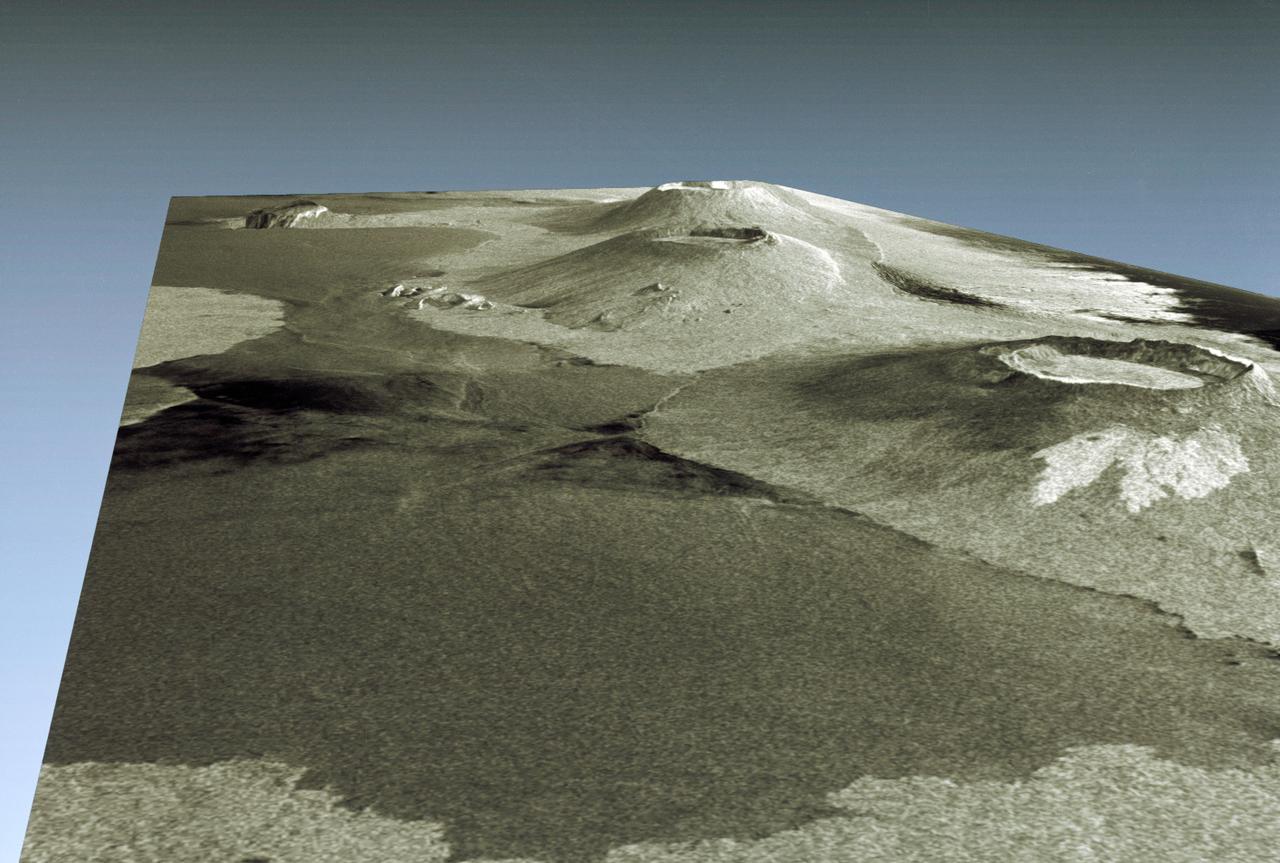
STS059-S-085 (18 April 1994) --- This is a three-dimensional perspective view of part of Isla Isabela in the western Galapagos Islands. It was taken by the L-Band radar in HH polarization from the Spaceborne Imaging Radar-C and X-Band Synthetic Aperture Radar (SIR-C/X-SAR) on the 40th orbit of the Space Shuttle Endeavour. This view was constructed by overlaying a SIR-C radar image on a U.S. Geological Survey digital elevation map. The image is centered at about .5 degrees south latitude and 91 degrees west longitude, and covers an area of 75 by 60 kilometers. The radar incidence angle at the center of the image is about 20 degrees. The western Galapagos Islands, which lie about 1200 kilometers west of Ecuador in the eastern Pacific, have six active volcanoes similar to the volcanoes found in Hawaii. Since the time of Charles Darwin's visit to the area in 1835, there have been over 60 recorded eruptions on these volcanoes. This SIR-C/X-SAR image of Alcedo and Sierra Negra volcanoes shows the rougher lava flows as bright features, while ash deposits and smooth pahoehoe lava flows appear dark. The Galapagos Islands are one of the SIR-C/X-SAR supersites and data of this area will be taken several times during the flight to allow scientists to conduct topographic change studies and to search for different lava flow types, ash deposits and fault lines. SIR-C/X-SAR is part of NASA's Mission to Planet Earth (MTPE). SIR-C/X-SAR radars illuminate Earth with microwaves allowing detailed observations at any time, regardless of weather or sunlight conditions. SIR-C/X-SAR uses three microwave wavelengths: L-Band (24 cm), C-Band (6 cm), and X-Band (3 cm). The multi-frequency data will be used by the international scientific community to better understand the global environment and how it is changing. The SIR-C/X-SAR data, complemented by aircraft and ground studies, will give scientists clearer insights into those environmental changes which are caused by nature and those changes which are induced by human activity. SIR-C was developed by NASA's Jet Propulsion Laboratory (JPL). X-SAR was developed by the Dornire and Alenia Spazio Companies for the German Space Agency, Deutsche Agentur fuer Raumfahrtangelegenheiten (DARA), and the Italian Space Agency, Agenzia Spaziale Italiana (ASI). JPL Photo ID: P-43938