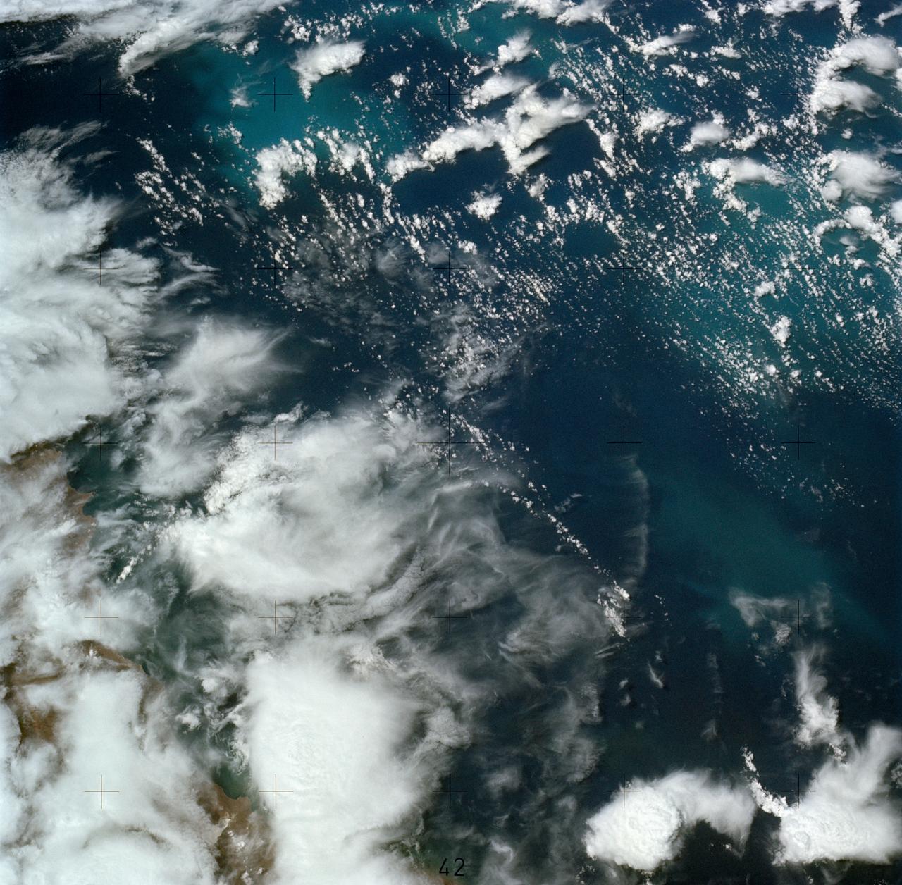
SL4-137-3608 (14 Dec. 1973) --- A view of cold water eddies in the Falkland Current off the South Atlantic coast of southern Argentina as seen from the Skylab space station in Earth orbit. This picture was taken by one of the Skylab 4 crewmen using a hand-held 70mm Hasselblad camera. This land area (left corner) extends south along the coast from Puerto Deseado (center left border) for about 50 miles. Within the ocean, several light blue areas are visible and represent the occurrence of plankton with the Falkland Current. Over the ocean, the cold water eddies are identified by the circular cloud-free areas within the cloud street pattern and bordered by cumulus cloud buildup (white). The cloud streets indicate the wind is from the southwest and do not form over eddies because energy form the atmosphere is absorbed by the cold ocean water. On the downwind side of the eddies, cumulus clouds tend to form as the cold moist air flows over the warmer water. Similar cloud and eddy features have been observed by the Skylab 4 crewmen in the Yucatan Current off Yucatan Peninsula and in some parts of the South Pacific. Studies are underway by Dr. George Maul, NOAA, and Dr. Robert Stevenson, ONR, to determine the significance of the cold water eddies to ocean dynamics. Photo credit: NASA
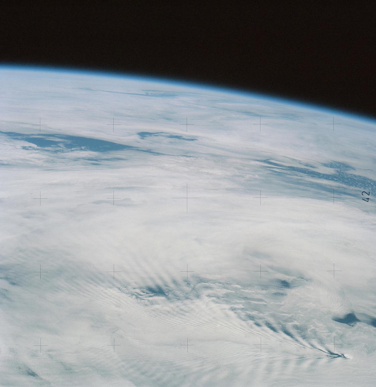
SL4-137-3655 (16 Dec. 1973) --- An island wake produced by the Antipodes Islands in the ocean current south of New Zealand is seen in this photograph taken from the Skylab space station in Earth orbit. A Skylab 4 crewmen took the picture with a hand-held 70mm Hasselblad camera. The bow wave pattern is quite evident and can be used to determine the current speed from the angle of the bow wave if the propagation speed of the surface wave is known. Also, evident is the darker band extending downstream from the island tens of miles. This is the actual wake of the island. The existence of water color differences from within to outside a turbulent island wake may indicate a temperature difference, with cooler water being stirred to the surface in the wake. This temperature difference could be used to drive a thermo-electric type generator to reduce small islands' dependence on imported oil for power generation. Photo credit: NASA
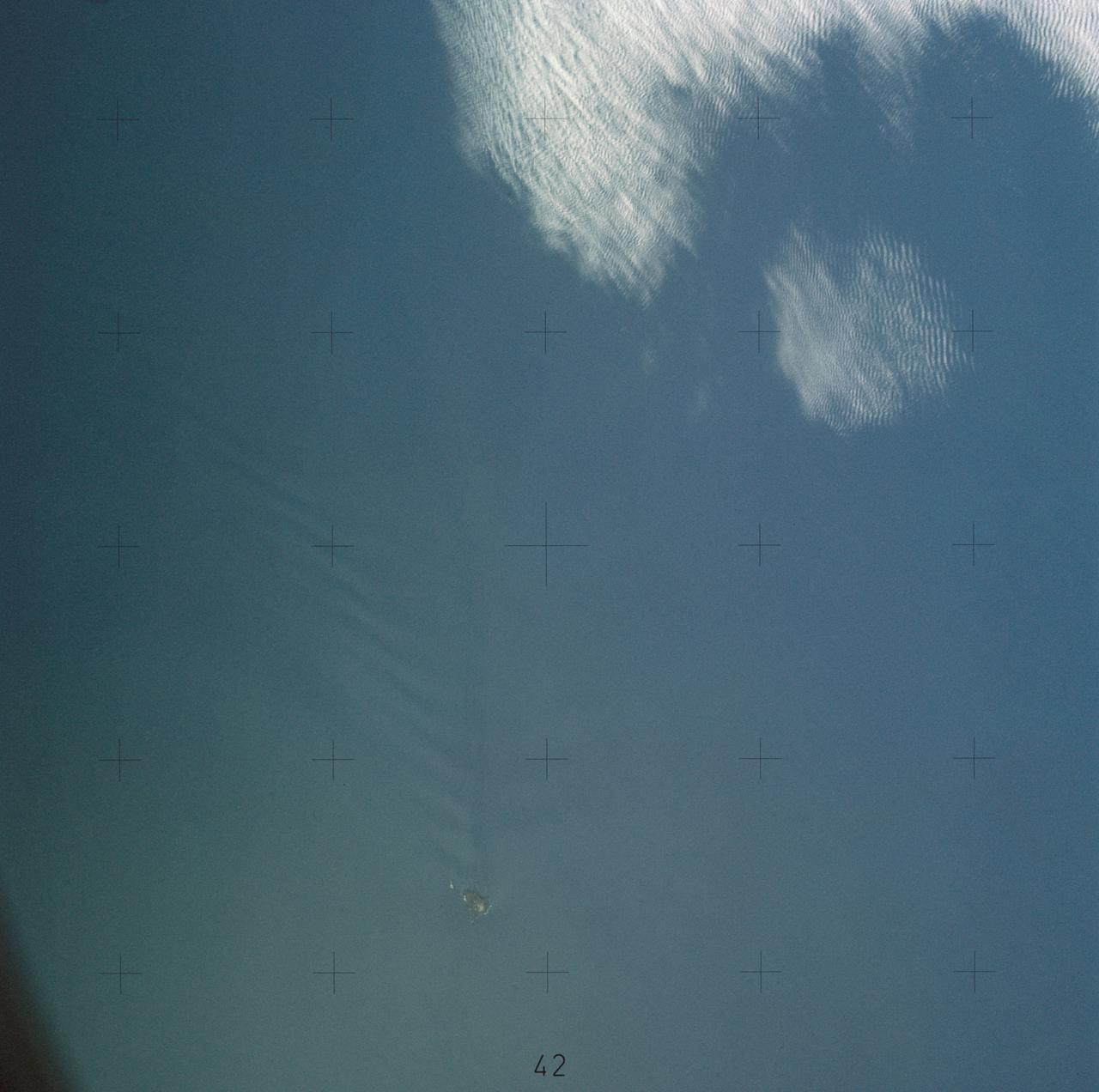
SL4-137-3632 (February 1974) --- A photograph taken from the Skylab space station in Earth orbit illustrating an atmospheric wave pattern by the affect of a small mountainous island on wind currents. Various patterns can be seen downwind of small islands. Often a Von Karmon vortex can be seen which appears as a spiral pattern. Multiple vortices have been photographed on previous missions. This photograph illustrates a "bow wave" pattern which extends for hundreds of miles downwind from the island. The island itself is often clear when a wave pattern is formed downstream. This particular pattern is very symmetrical. These wave patterns are most common in the South Pacific. This picture was taken by a Skylab 4 crewmen using a hand-held 70mm Hasselblad camera. Photo credit: NASA