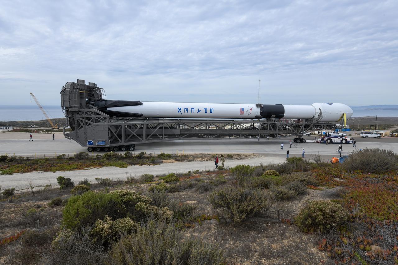
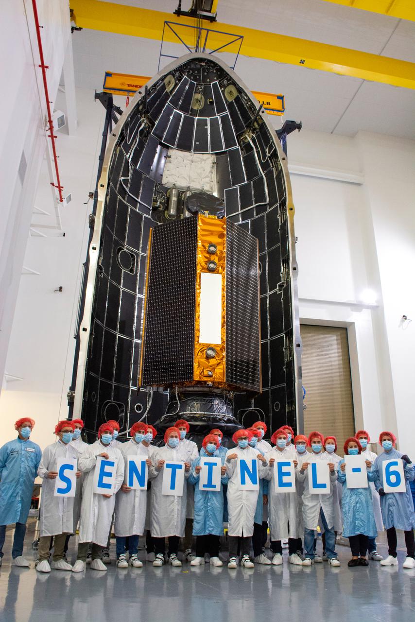
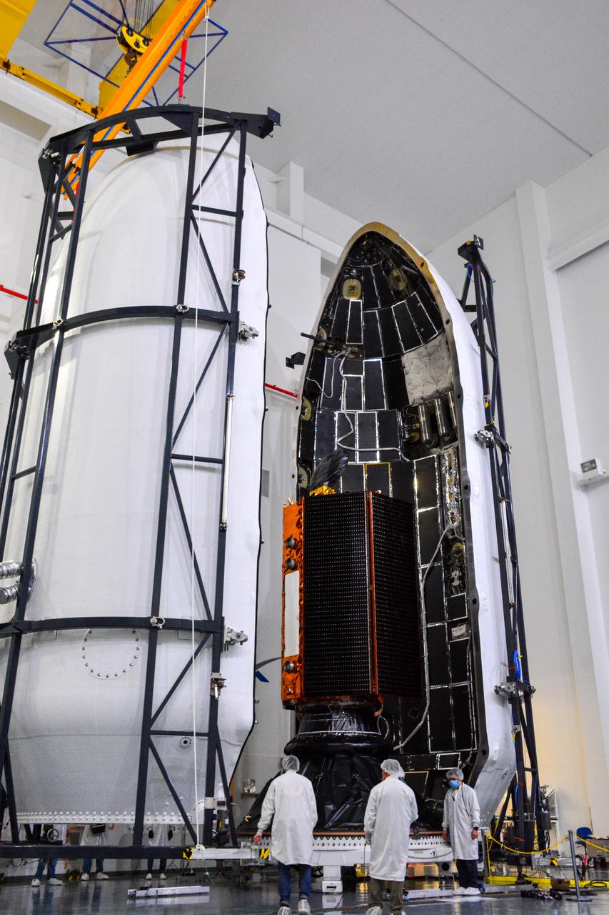
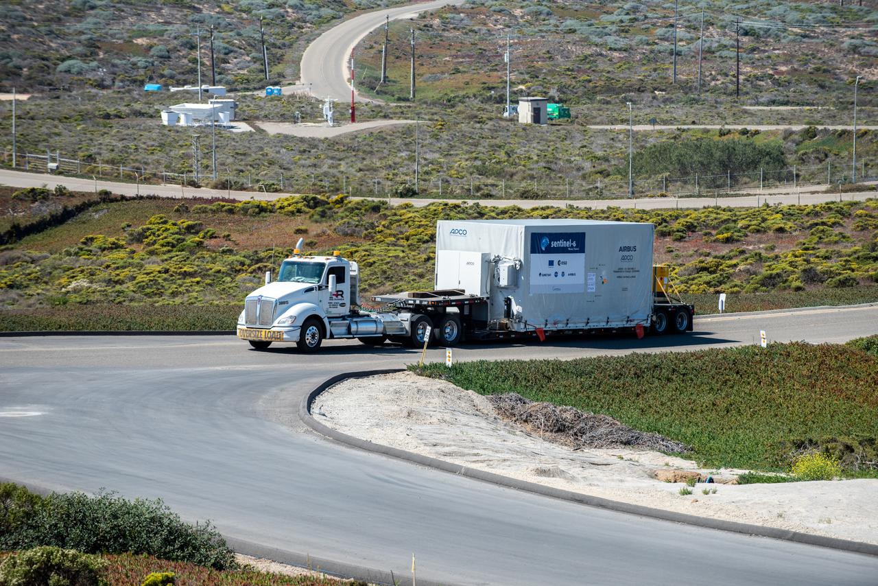
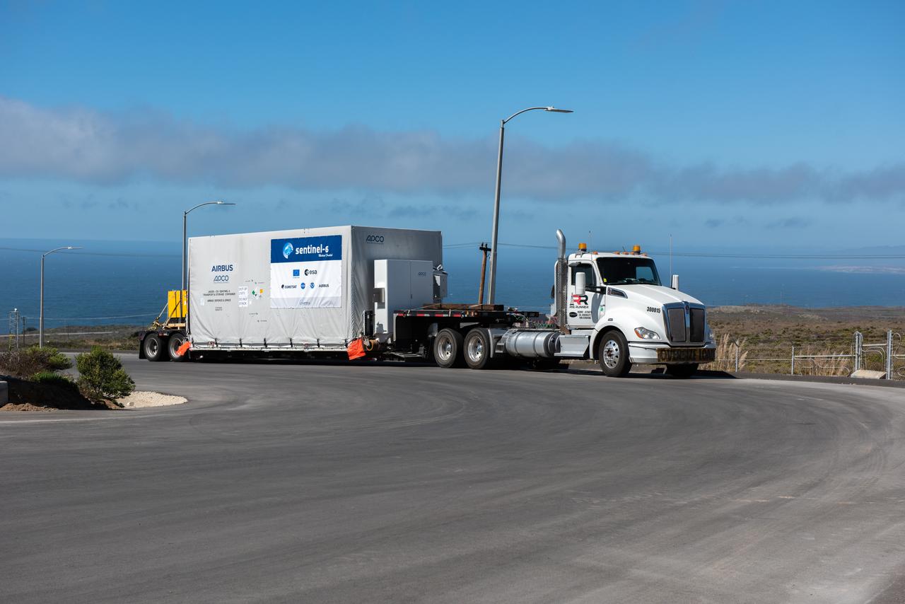
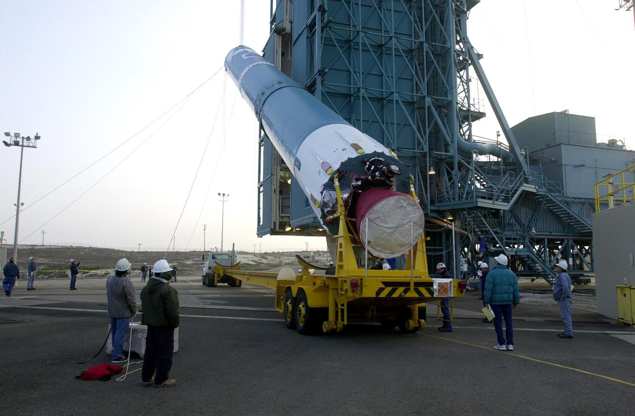
The SpaceX Falcon 9 rocket, topped with the Sentinel-6 Michael Freilich satellite secured inside its payload fairing, rolls from SpaceX’s Payload Processing Facility at Vandenberg Air Force Base in California to Space Launch Complex 4 on Nov. 20, 2020. The Sentinel-6/Jason-CS (Continuity of Service) mission consists of the Sentinel-6 Michael Freilich satellite, which will be followed by its twin, the Sentinel-6B satellite, in 2025. The Sentinel-6/Jason-CS mission is part of Copernicus, the European Union’s Earth observation program, managed by the European Commission. Continuing the legacy of the Jason series missions, Sentinel-6/Jason-CS will extend the records of sea level into their fourth decade, collecting accurate measurements of sea surface height for more than 90% of the world’s seas, and providing crucial information for operational oceanography, marine meteorology, and climate studies. Sentinel-6 Michael Freilich launched Nov. 21, 2020, at 9:17 PST (12:17 EST). NASA’s Launch Services Program at Kennedy Space Center was responsible for launch management.
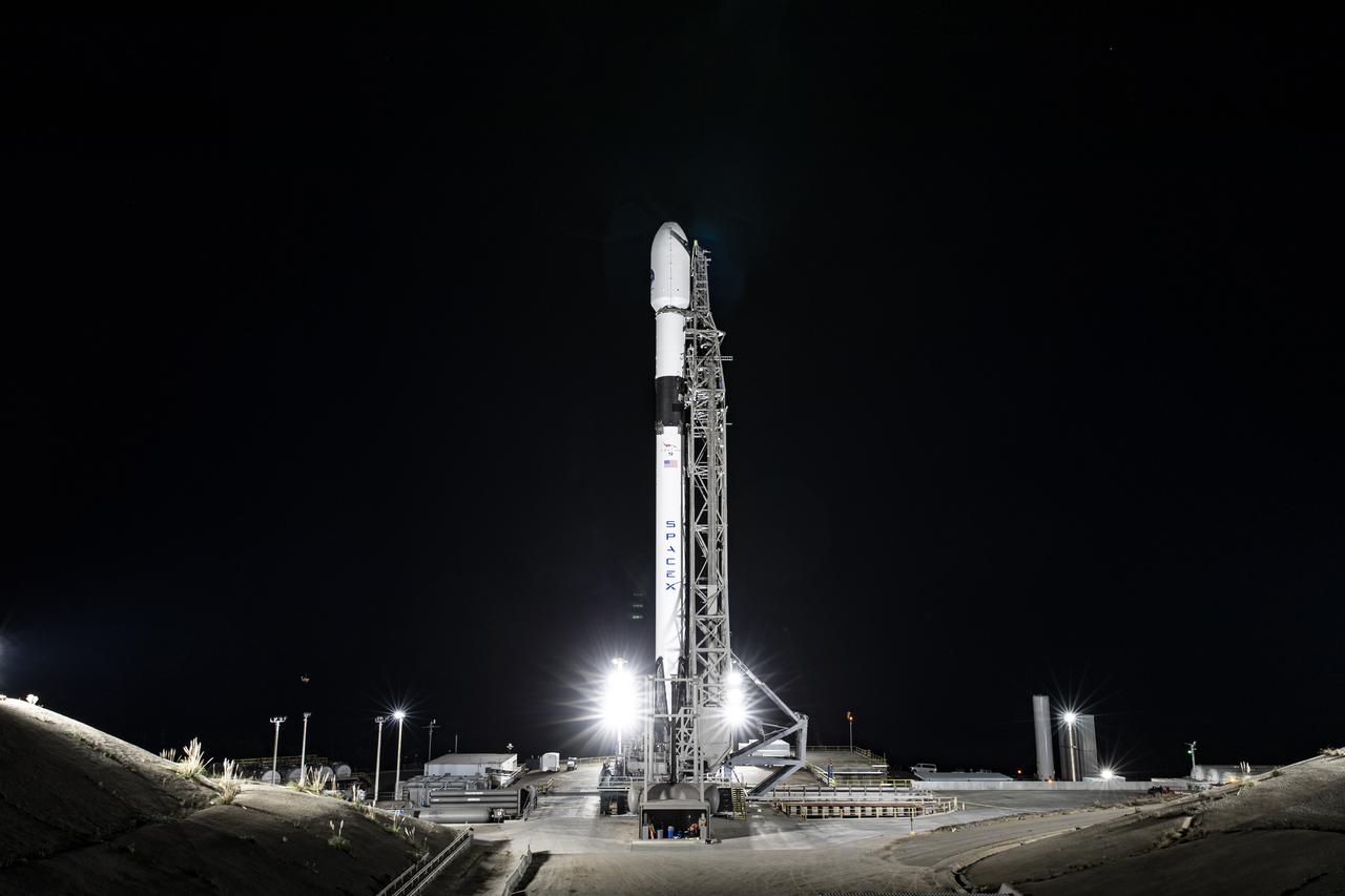
The SpaceX Falcon 9 rocket, topped with the Sentinel-6 Michael Freilich satellite secured inside its payload fairing, is lifted to vertical at Space Launch Complex 4 at Vandenberg Air Force Base in California on Nov. 20, 2020. The Sentinel-6/Jason-CS (Continuity of Service) mission consists of the Sentinel-6 Michael Freilich satellite, which will be followed by its twin, the Sentinel-6B satellite, in 2025. The Sentinel-6/Jason-CS mission is part of Copernicus, the European Union’s Earth observation program, managed by the European Commission. Continuing the legacy of the Jason series missions, Sentinel-6/Jason-CS will extend the records of sea level into their fourth decade, collecting accurate measurements of sea surface height for more than 90% of the world’s seas, and providing crucial information for operational oceanography, marine meteorology, and climate studies. Sentinel-6 Michael Freilich launched Nov. 21, 2020, at 9:17 PST (12:17 EST). NASA’s Launch Services Program at Kennedy Space Center was responsible for launch management.
The SpaceX Falcon 9 rocket, topped with the Sentinel-6 Michael Freilich satellite secured inside its payload fairing, is lifted to vertical at Space Launch Complex 4 at Vandenberg Air Force Base in California on Nov. 20, 2020. The Sentinel-6/Jason-CS (Continuity of Service) mission consists of the Sentinel-6 Michael Freilich satellite, which will be followed by its twin, the Sentinel-6B satellite, in 2025. The Sentinel-6/Jason-CS mission is part of Copernicus, the European Union’s Earth observation program, managed by the European Commission. Continuing the legacy of the Jason series missions, Sentinel-6/Jason-CS will extend the records of sea level into their fourth decade, collecting accurate measurements of sea surface height for more than 90% of the world’s seas, and providing crucial information for operational oceanography, marine meteorology, and climate studies. Sentinel-6 Michael Freilich launched Nov. 21, 2020, at 9:17 PST (12:17 EST). NASA’s Launch Services Program at Kennedy Space Center was responsible for launch management.
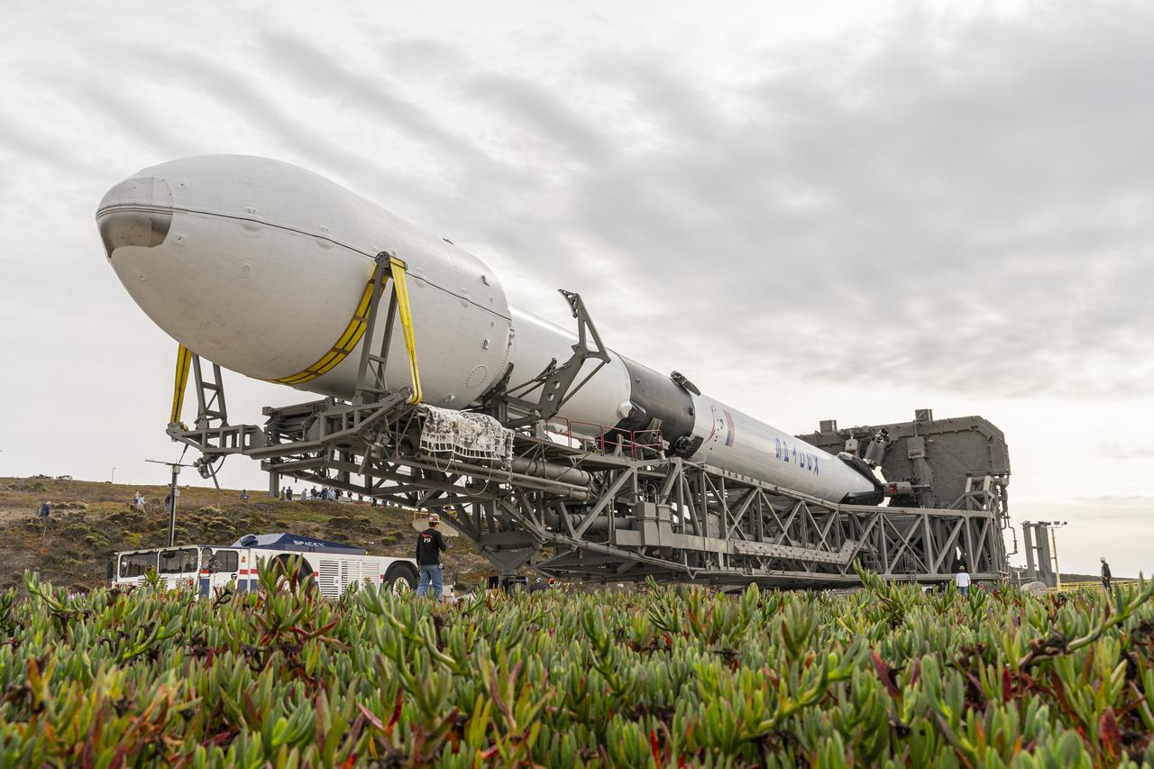
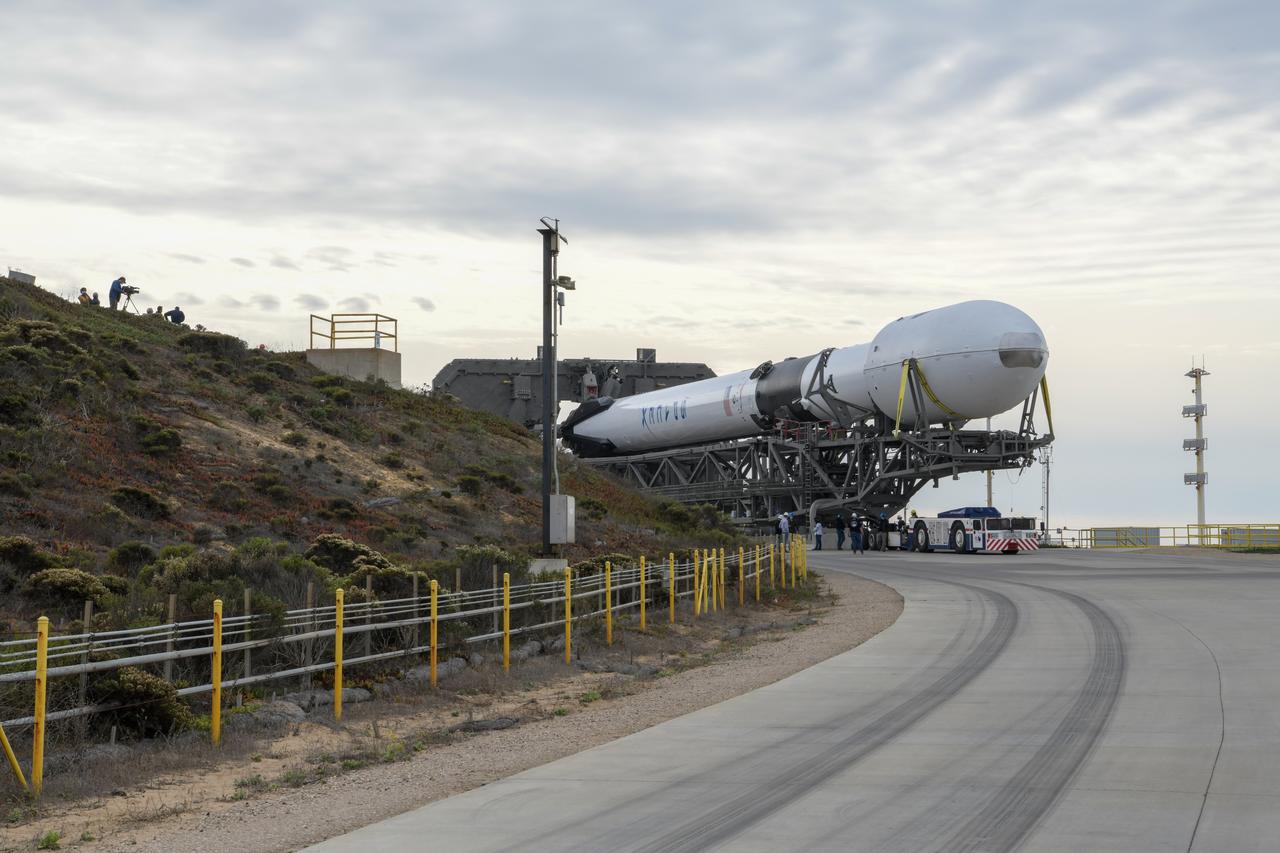
The SpaceX Falcon 9 rocket, topped with the Sentinel-6 Michael Freilich satellite secured inside its payload fairing, is rolled to Space Launch Complex 4 at Vandenberg Air Force Base in California on Nov. 20, 2020, in preparation for launch. The Sentinel-6/Jason-CS (Continuity of Service) mission consists of the Sentinel-6 Michael Freilich satellite, which will be followed by its twin, the Sentinel-6B satellite, in 2025. The Sentinel-6/Jason-CS mission is part of Copernicus, the European Union’s Earth observation program, managed by the European Commission. Continuing the legacy of the Jason series missions, Sentinel-6/Jason-CS will extend the records of sea level into their fourth decade, collecting accurate measurements of sea surface height for more than 90% of the world’s seas, and providing crucial information for operational oceanography, marine meteorology, and climate studies. Sentinel-6 Michael Freilich launched Nov. 21, 2020, at 9:17 PST (12:17 EST). NASA’s Launch Services Program at Kennedy Space Center was responsible for launch management.
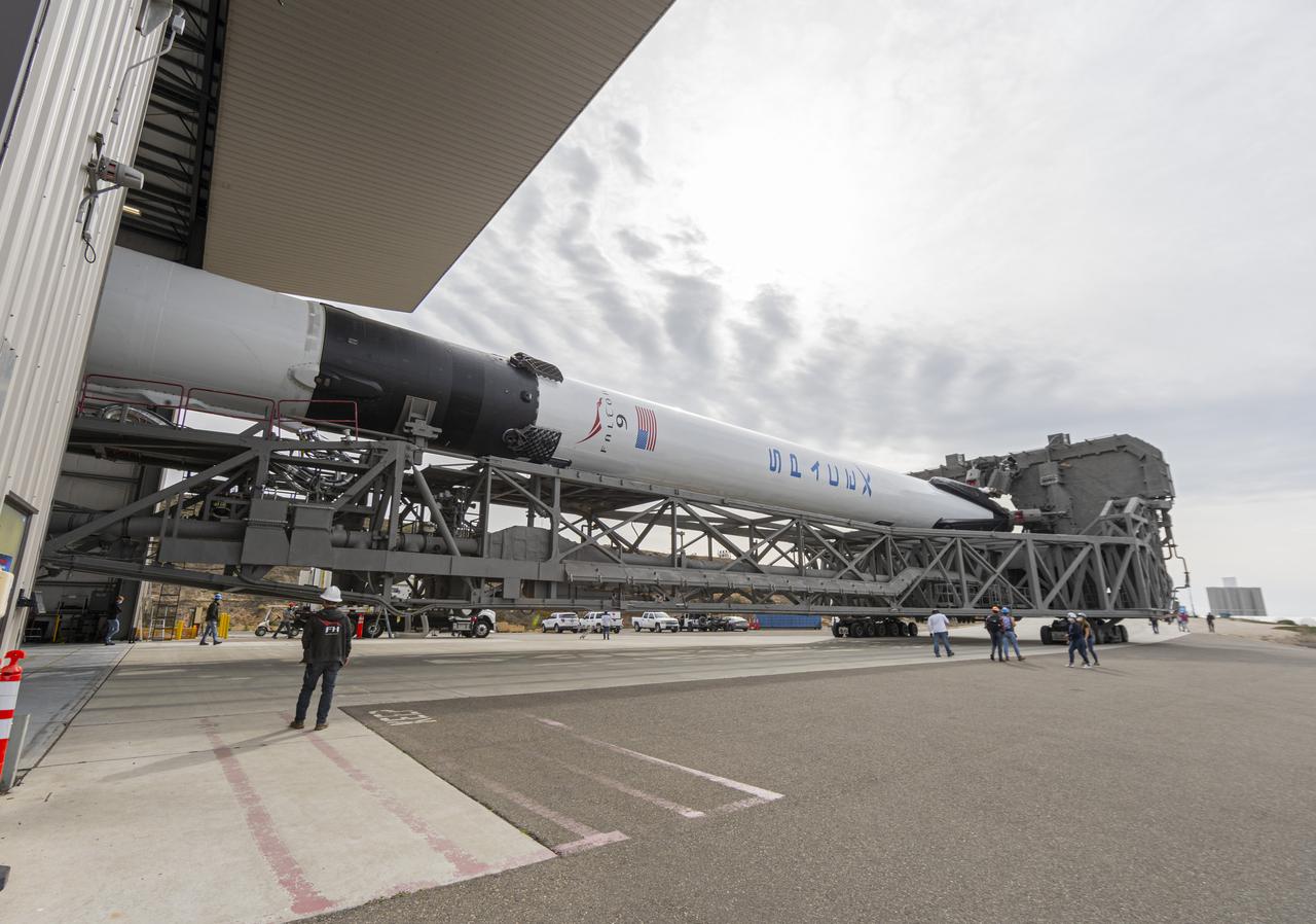
The SpaceX Falcon 9 rocket, topped with the Sentinel-6 Michael Freilich satellite secured inside its payload fairing, departs SpaceX’s Payload Processing Facility at Vandenberg Air Force Base in California for its journey to Space Launch Complex 4 on Nov. 20, 2020. The Sentinel-6/Jason-CS (Continuity of Service) mission consists of the Sentinel-6 Michael Freilich satellite, which will be followed by its twin, the Sentinel-6B satellite, in 2025. The Sentinel-6/Jason-CS mission is part of Copernicus, the European Union’s Earth observation program, managed by the European Commission. Continuing the legacy of the Jason series missions, Sentinel-6/Jason-CS will extend the records of sea level into their fourth decade, collecting accurate measurements of sea surface height for more than 90% of the world’s seas, and providing crucial information for operational oceanography, marine meteorology, and climate studies. Sentinel-6 Michael Freilich launched Nov. 21, 2020, at 9:17 PST (12:17 EST). NASA’s Launch Services Program at Kennedy Space Center was responsible for launch management.
The SpaceX Falcon 9 rocket, topped with the Sentinel-6 Michael Freilich satellite secured inside its payload fairing, rolls from SpaceX’s Payload Processing Facility at Vandenberg Air Force Base in California to Space Launch Complex 4 on Nov. 20, 2020. The Sentinel-6/Jason-CS (Continuity of Service) mission consists of the Sentinel-6 Michael Freilich satellite, which will be followed by its twin, the Sentinel-6B satellite, in 2025. The Sentinel-6/Jason-CS mission is part of Copernicus, the European Union’s Earth observation program, managed by the European Commission. Continuing the legacy of the Jason series missions, Sentinel-6/Jason-CS will extend the records of sea level into their fourth decade, collecting accurate measurements of sea surface height for more than 90% of the world’s seas, and providing crucial information for operational oceanography, marine meteorology, and climate studies. Sentinel-6 Michael Freilich launched Nov. 21, 2020, at 9:17 PST (12:17 EST). NASA’s Launch Services Program at Kennedy Space Center was responsible for launch management.
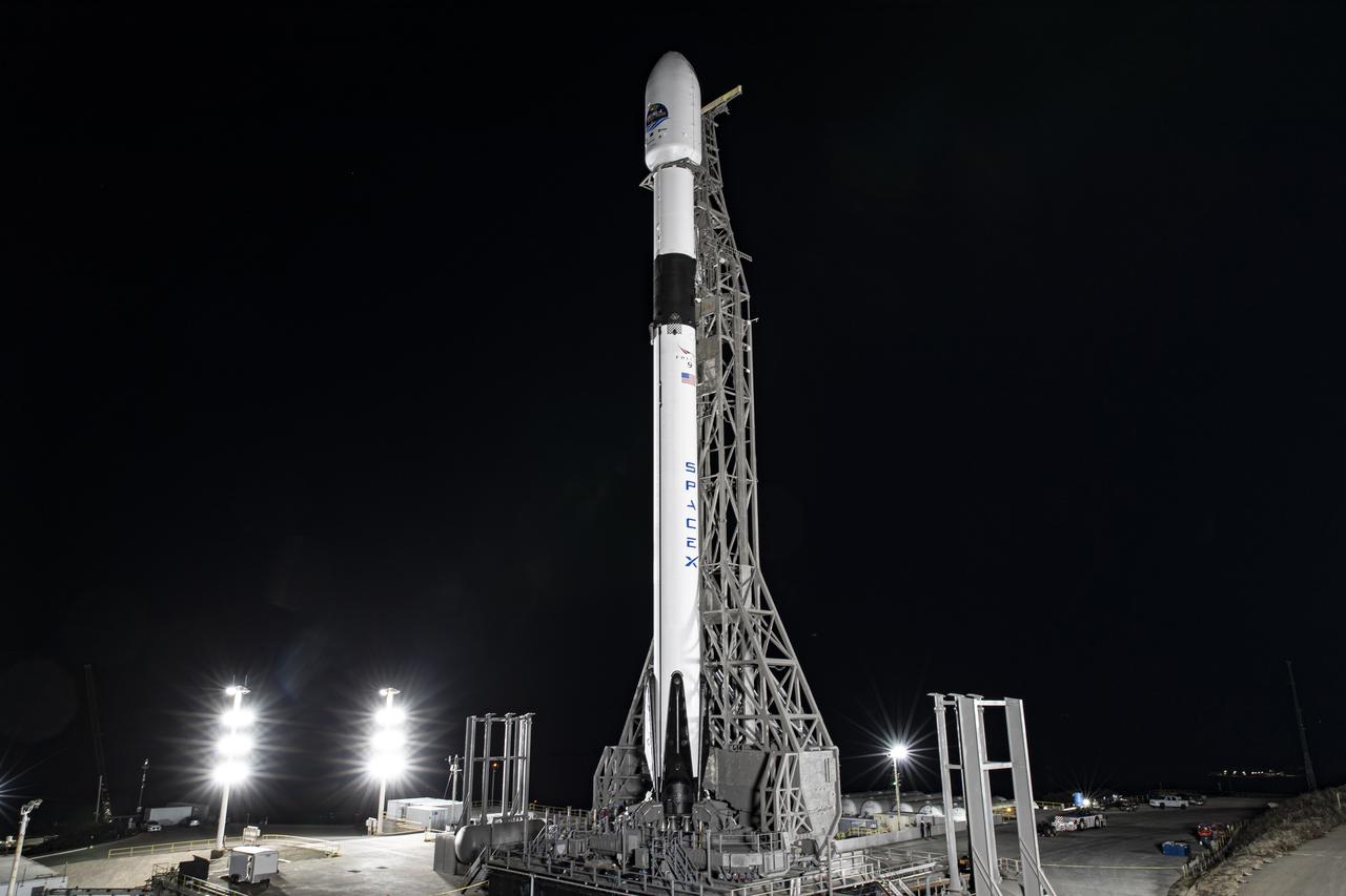
The SpaceX Falcon 9 rocket, topped with the Sentinel-6 Michael Freilich satellite secured inside its payload fairing, is lifted to vertical at Space Launch Complex 4 at Vandenberg Air Force Base in California on Nov. 20, 2020. The Sentinel-6/Jason-CS (Continuity of Service) mission consists of the Sentinel-6 Michael Freilich satellite, which will be followed by its twin, the Sentinel-6B satellite, in 2025. The Sentinel-6/Jason-CS mission is part of Copernicus, the European Union’s Earth observation program, managed by the European Commission. Continuing the legacy of the Jason series missions, Sentinel-6/Jason-CS will extend the records of sea level into their fourth decade, collecting accurate measurements of sea surface height for more than 90% of the world’s seas, and providing crucial information for operational oceanography, marine meteorology, and climate studies. Sentinel-6 Michael Freilich launched Nov. 21, 2020, at 9:17 PST (12:17 EST). NASA’s Launch Services Program at Kennedy Space Center was responsible for launch management.
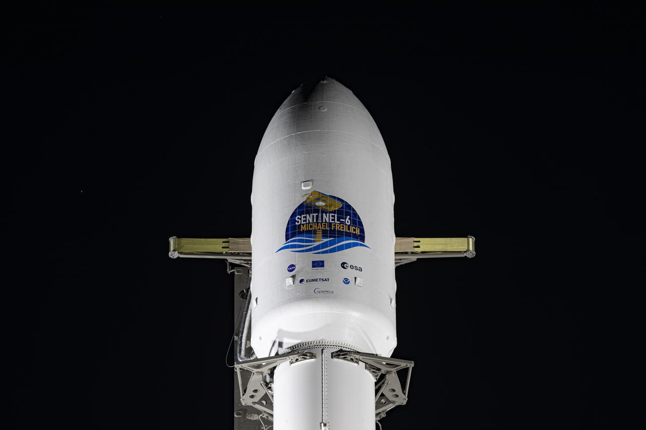
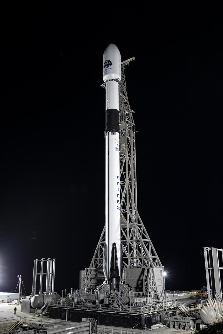
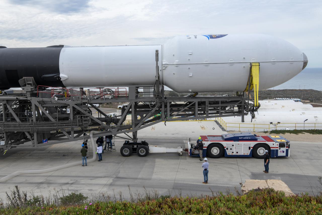
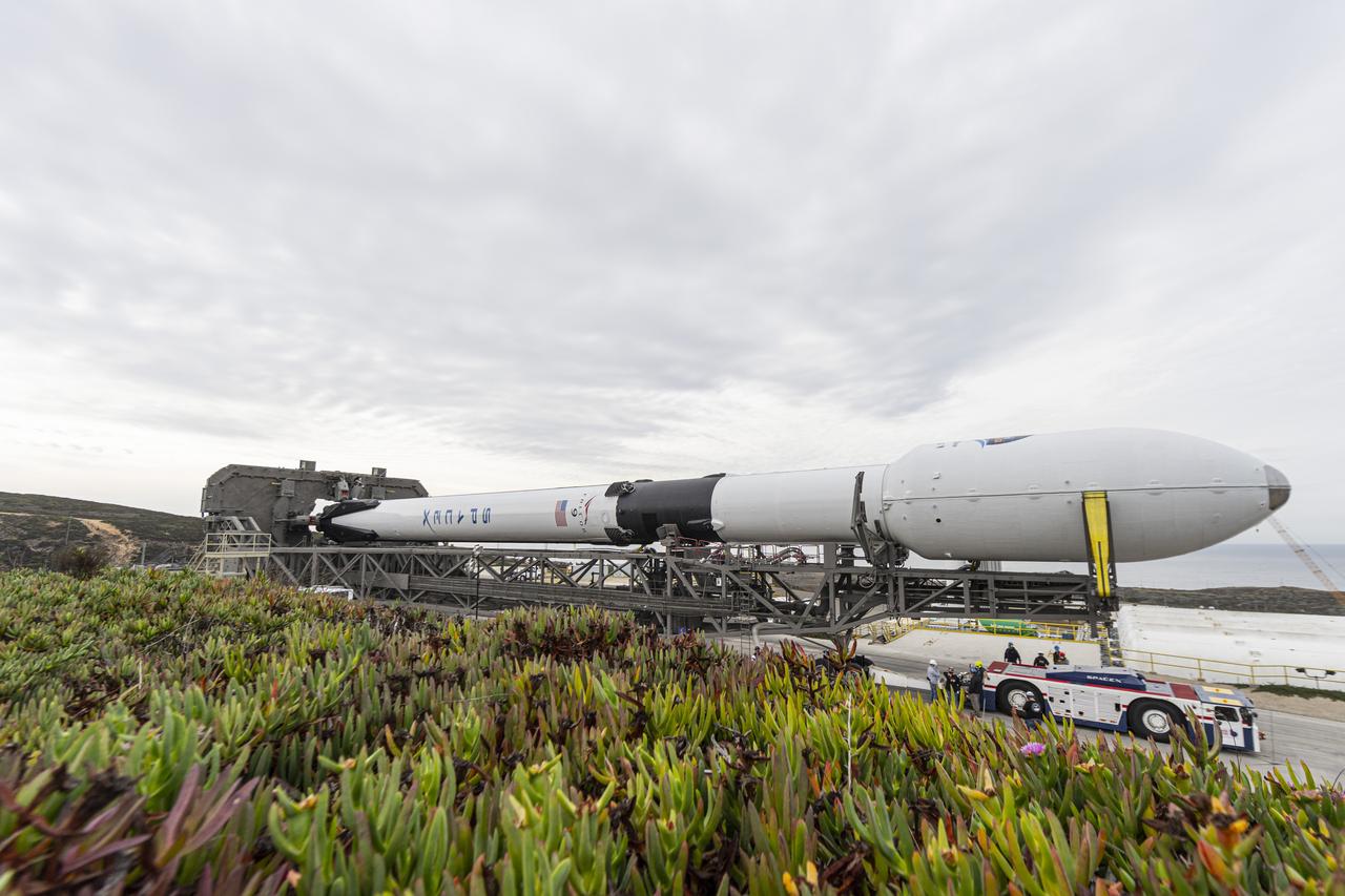
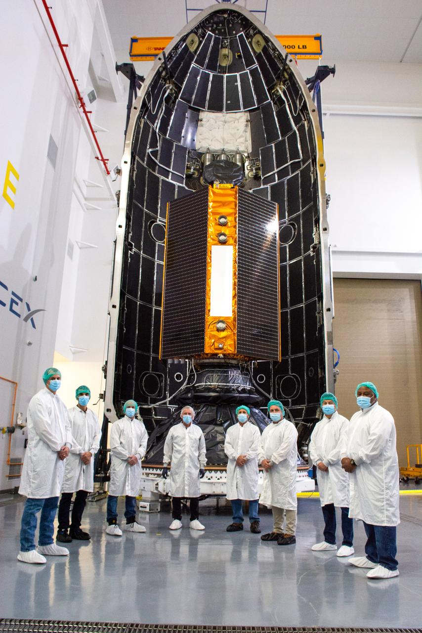
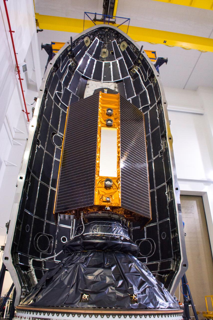
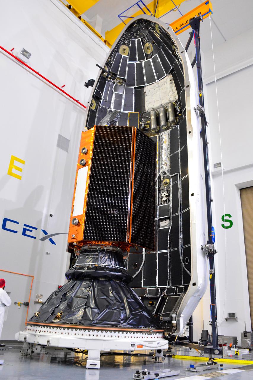
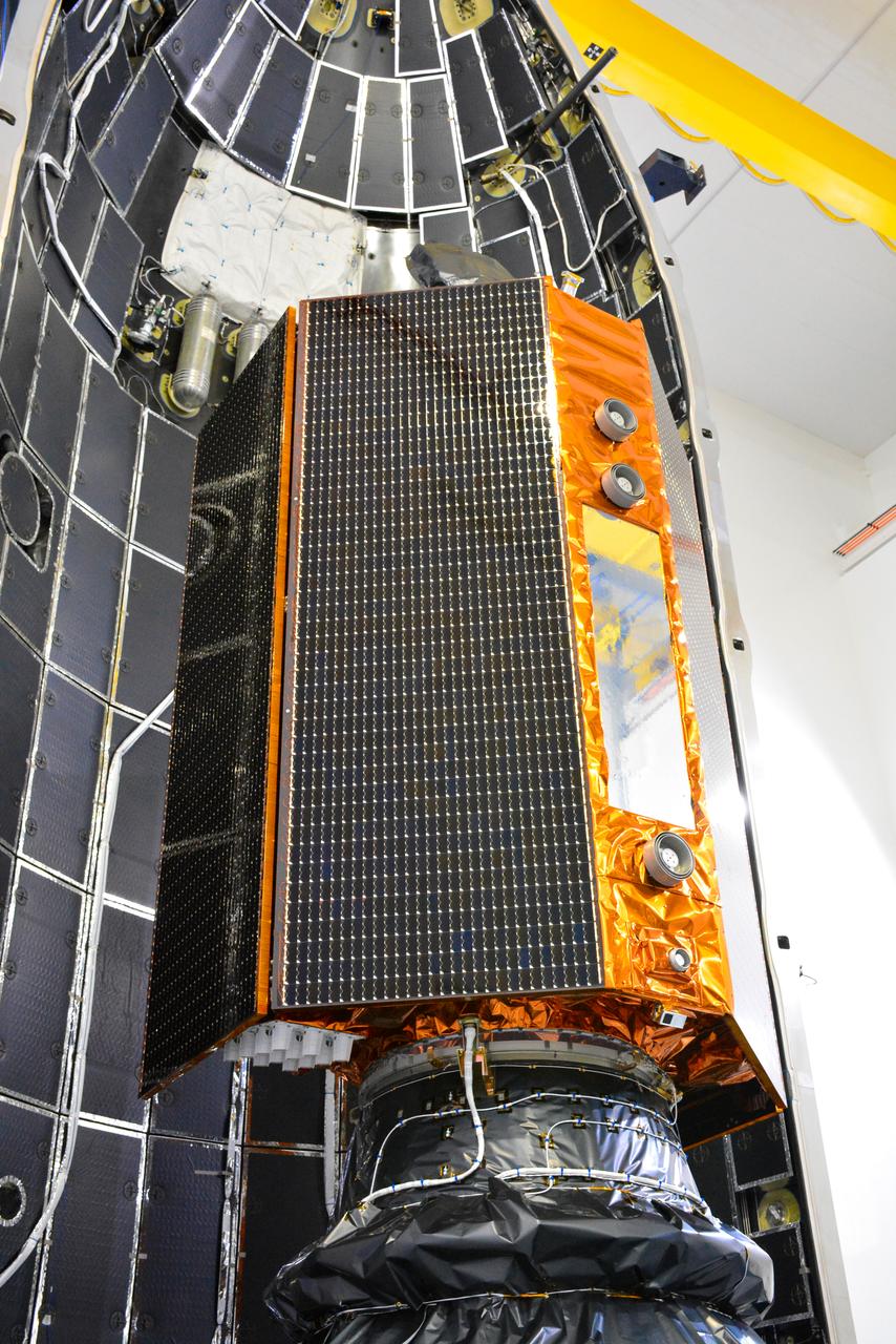
The protective payload fairing containing the Sentinel-6 Michael Freilich satellite is seen atop the SpaceX Falcon 9 after the rocket was lifted to vertical at Space Launch Complex 4 at Vandenberg Air Force Base in California on Nov. 20, 2020. The Sentinel-6/Jason-CS (Continuity of Service) mission consists of the Sentinel-6 Michael Freilich satellite, which will be followed by its twin, the Sentinel-6B satellite, in 2025. The Sentinel-6/Jason-CS mission is part of Copernicus, the European Union’s Earth observation program, managed by the European Commission. Continuing the legacy of the Jason series missions, Sentinel-6/Jason-CS will extend the records of sea level into their fourth decade, collecting accurate measurements of sea surface height for more than 90% of the world’s seas, and providing crucial information for operational oceanography, marine meteorology, and climate studies. Sentinel-6 Michael Freilich launched Nov. 21, 2020, at 9:17 PST (12:17 EST). NASA’s Launch Services Program at Kennedy Space Center was responsible for launch management.
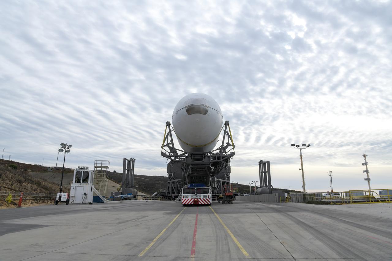
The SpaceX Falcon 9 rocket, topped with the Sentinel-6 Michael Freilich satellite secured inside its payload fairing, rolls from SpaceX’s Payload Processing Facility at Vandenberg Air Force Base in California to Space Launch Complex 4 on Nov. 20, 2020. The Sentinel-6/Jason-CS (Continuity of Service) mission consists of the Sentinel-6 Michael Freilich satellite, which will be followed by its twin, the Sentinel-6B satellite, in 2025. The Sentinel-6/Jason-CS mission is part of Copernicus, the European Union’s Earth observation program, managed by the European Commission. Continuing the legacy of the Jason series missions, Sentinel-6/Jason-CS will extend the records of sea level into their fourth decade, collecting accurate measurements of sea surface height for more than 90% of the world’s seas, and providing crucial information for operational oceanography, marine meteorology, and climate studies. Sentinel-6 Michael Freilich launched Nov. 21, 2020, at 9:17 PST (12:17 EST). NASA’s Launch Services Program at Kennedy Space Center was responsible for launch management.
The SpaceX Falcon 9 rocket, topped with the Sentinel-6 Michael Freilich satellite secured inside its payload fairing, rolls from SpaceX’s Payload Processing Facility at Vandenberg Air Force Base in California to Space Launch Complex 4 on Nov. 20, 2020. The Sentinel-6/Jason-CS (Continuity of Service) mission consists of the Sentinel-6 Michael Freilich satellite, which will be followed by its twin, the Sentinel-6B satellite, in 2025. The Sentinel-6/Jason-CS mission is part of Copernicus, the European Union’s Earth observation program, managed by the European Commission. Continuing the legacy of the Jason series missions, Sentinel-6/Jason-CS will extend the records of sea level into their fourth decade, collecting accurate measurements of sea surface height for more than 90% of the world’s seas, and providing crucial information for operational oceanography, marine meteorology, and climate studies. Sentinel-6 Michael Freilich launched Nov. 21, 2020, at 9:17 PST (12:17 EST). NASA’s Launch Services Program at Kennedy Space Center was responsible for launch management.
The SpaceX Falcon 9 rocket, topped with the Sentinel-6 Michael Freilich satellite secured inside its payload fairing, is rolled to Space Launch Complex 4 at Vandenberg Air Force Base in California on Nov. 20, 2020, in preparation for launch. The Sentinel-6/Jason-CS (Continuity of Service) mission consists of the Sentinel-6 Michael Freilich satellite, which will be followed by its twin, the Sentinel-6B satellite, in 2025. The Sentinel-6/Jason-CS mission is part of Copernicus, the European Union’s Earth observation program, managed by the European Commission. Continuing the legacy of the Jason series missions, Sentinel-6/Jason-CS will extend the records of sea level into their fourth decade, collecting accurate measurements of sea surface height for more than 90% of the world’s seas, and providing crucial information for operational oceanography, marine meteorology, and climate studies. Sentinel-6 Michael Freilich launched Nov. 21, 2020, at 9:17 PST (12:17 EST). NASA’s Launch Services Program at Kennedy Space Center was responsible for launch management.
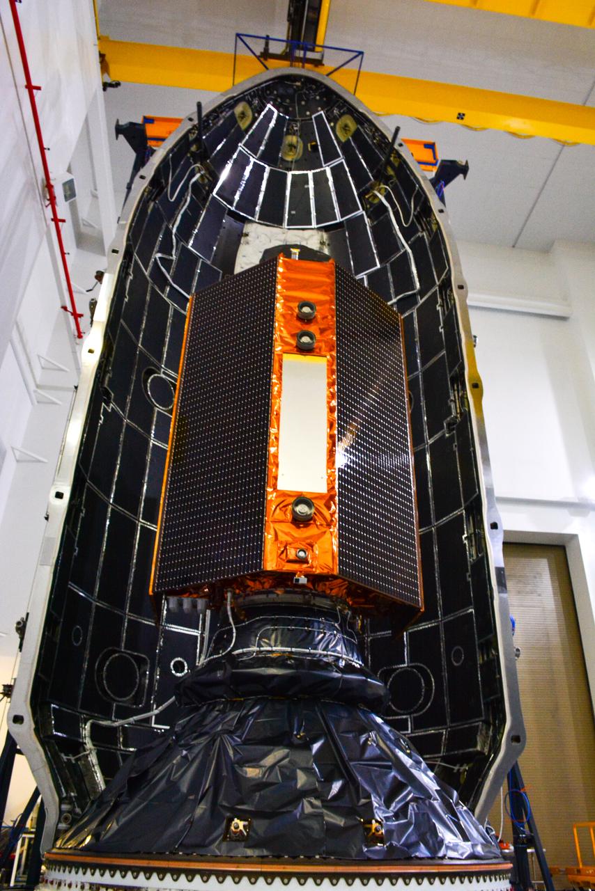
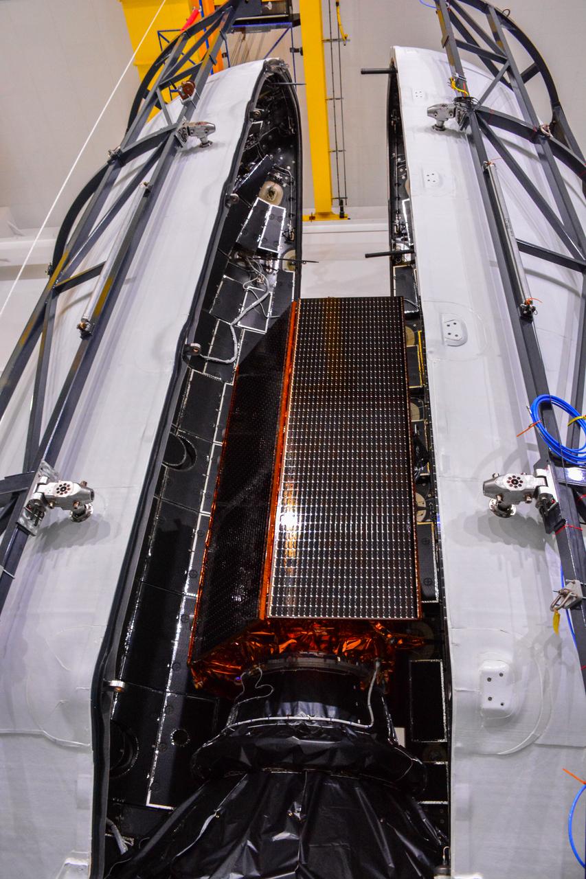
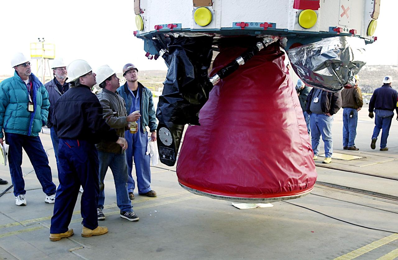
The U.S.-European Sentinel-6 Michael Freilich ocean-monitoring satellite is being encapsulated in the SpaceX Falcon 9 rocket’s payload fairing on Nov. 3, 2020, inside SpaceX’s Payload Processing Facility at Vandenberg Air Force Base (VAFB) in California. Sentinel-6 is scheduled to launch on Nov. 21, 2020, at 12:17 p.m. EST (9:17 a.m. PST), from Space Launch Complex 4E at VAFB. The Launch Services Program at NASA’s Kennedy Space Center in Florida is responsible for launch management.
Inside SpaceX’s Payload Processing Facility at Vandenberg Air Force Base in California, the U.S.-European Sentinel-6 Michael Freilich ocean-monitoring satellite is being encapsulated in the SpaceX Falcon 9 payload fairing on Nov. 3, 2020. Sentinel-6 is scheduled to launch on Nov. 21, 2020, at 12:17 p.m. EST (9:17 a.m. PST), atop the SpaceX Falcon 9 rocket from Space Launch Complex 4E at Vandenberg Air Force Base. The Launch Services Program at Kennedy is responsible for launch management.
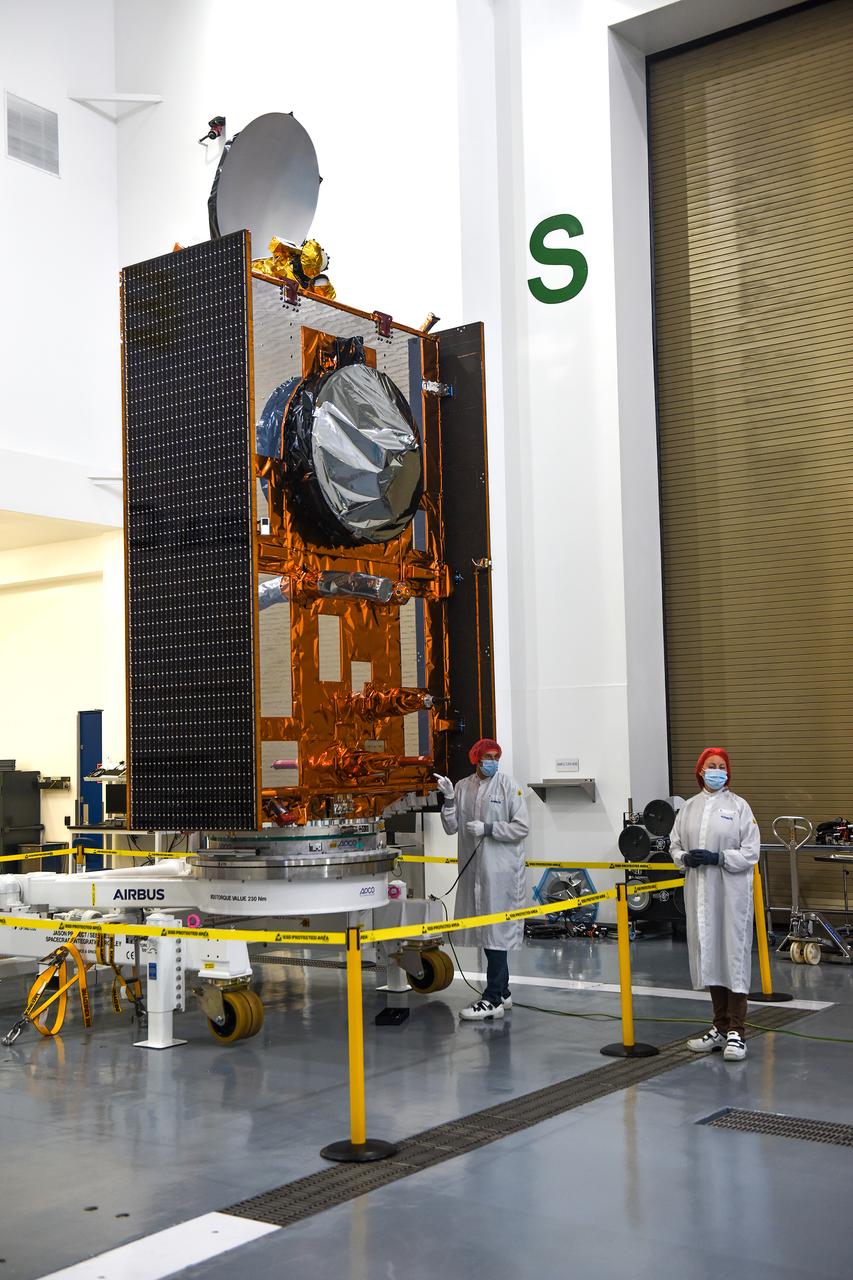
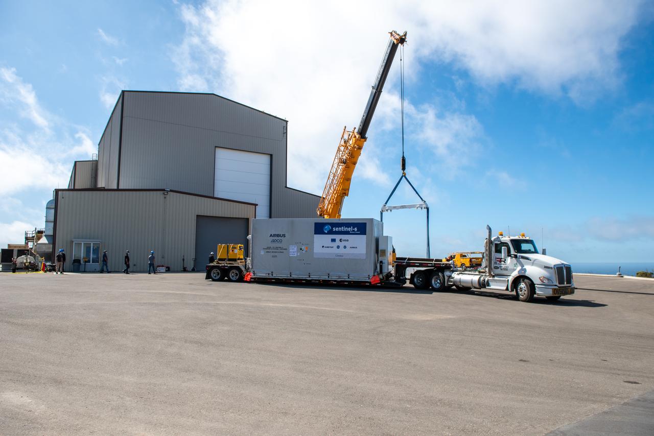
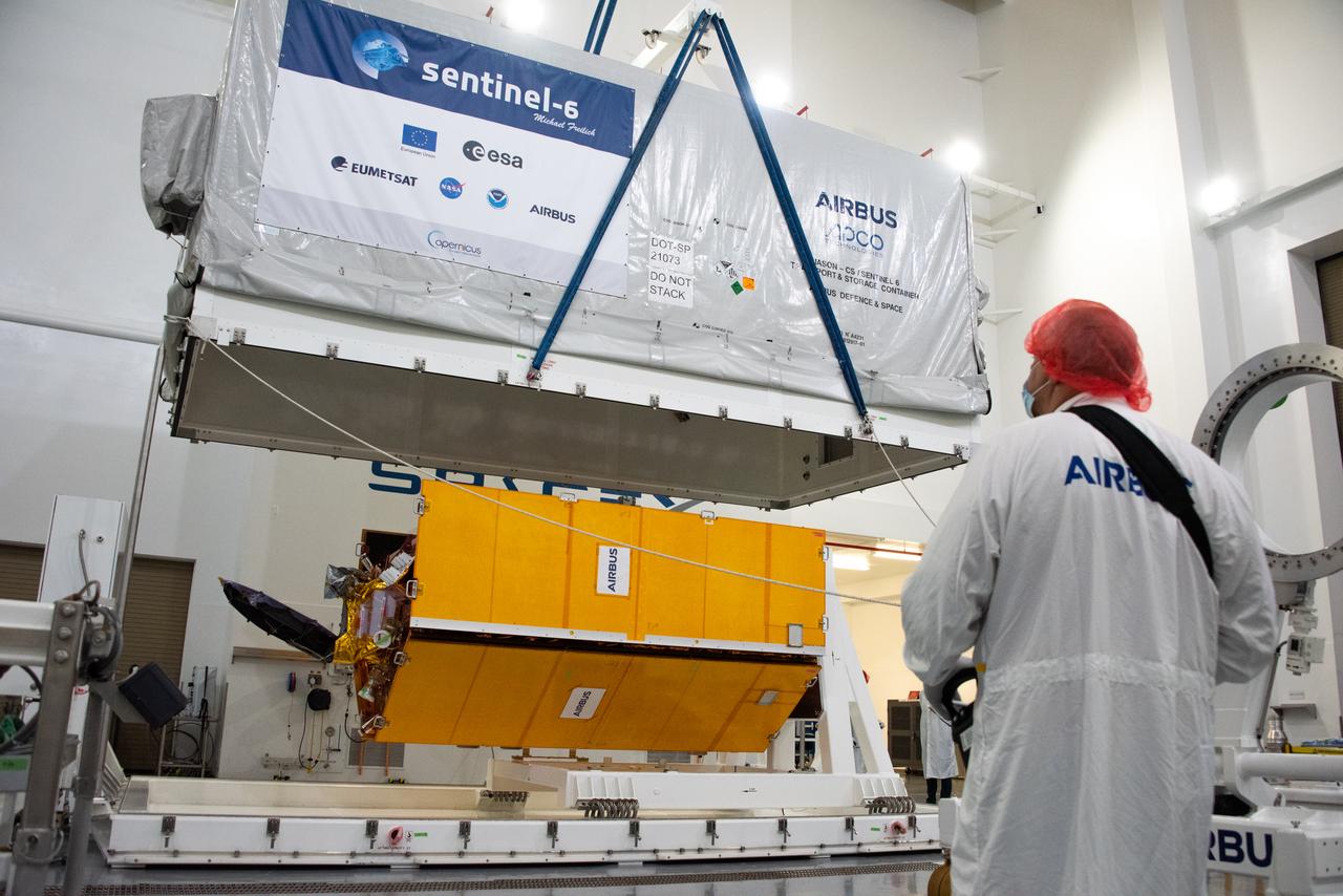
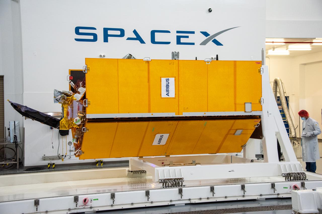
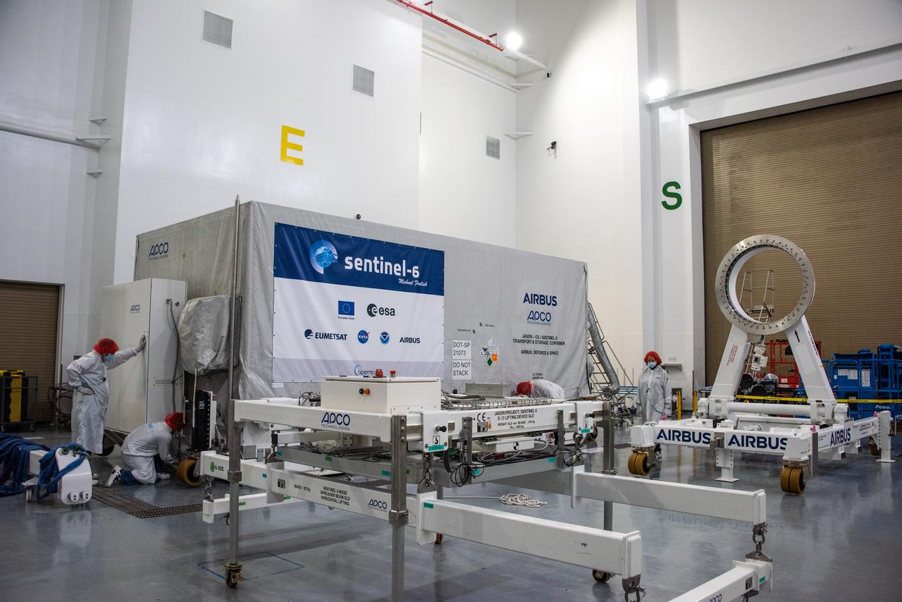
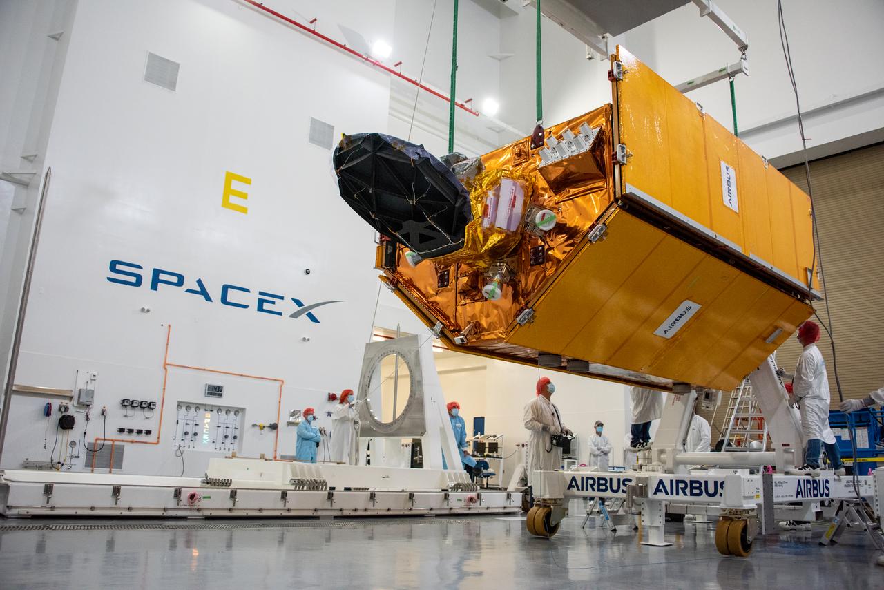
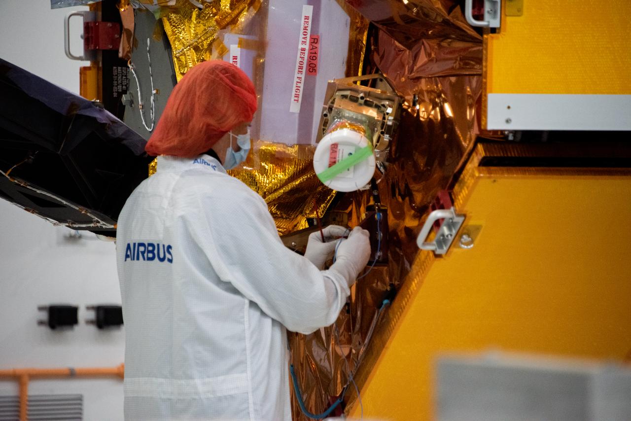
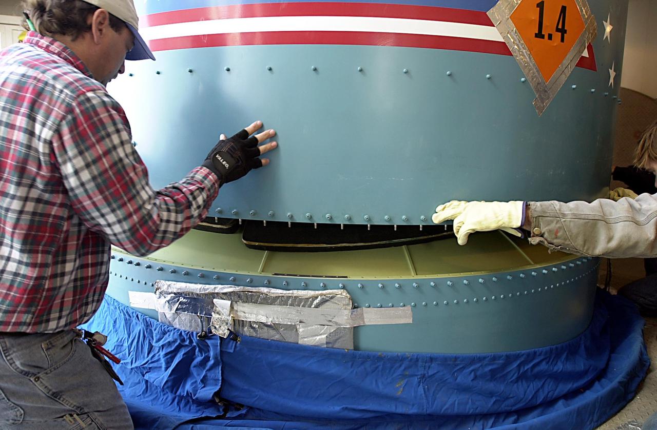
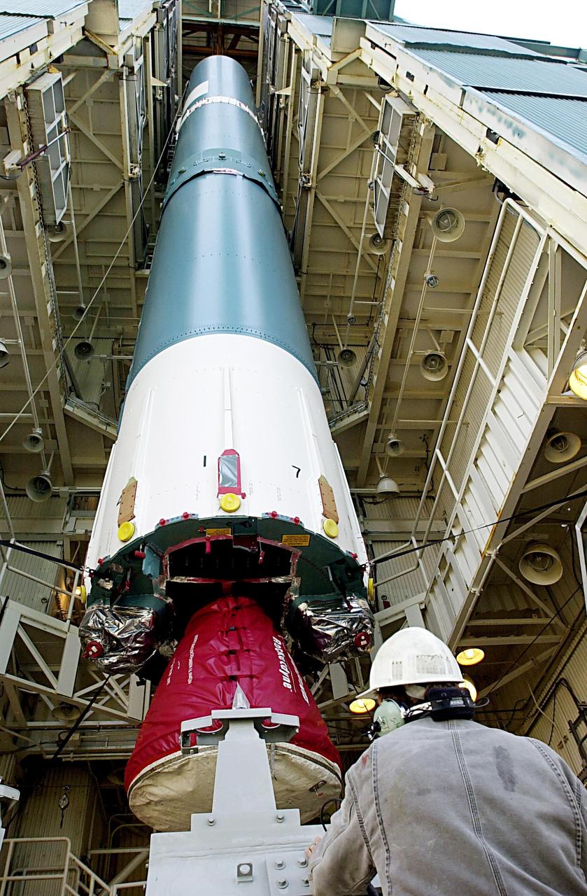
Airbus Defence and Space technicians position the Sentinel-6 Michael Freilich spacecraft for fueling inside SpaceX’s Payload Processing Facility at Vandenberg Air Force Base (VAFB) in California on Oct. 22, 2020. The mission is an international collaboration and will be the first of two satellites launched to continue observing changes in Earth’s sea levels for at least the next decade. The Sentinel-6 Michael Freilich satellite is scheduled to launch from VAFB atop a SpaceX Falcon 9 rocket. NASA’s Launch Services Program at Kennedy Space Center in Florida is responsible for launch management.
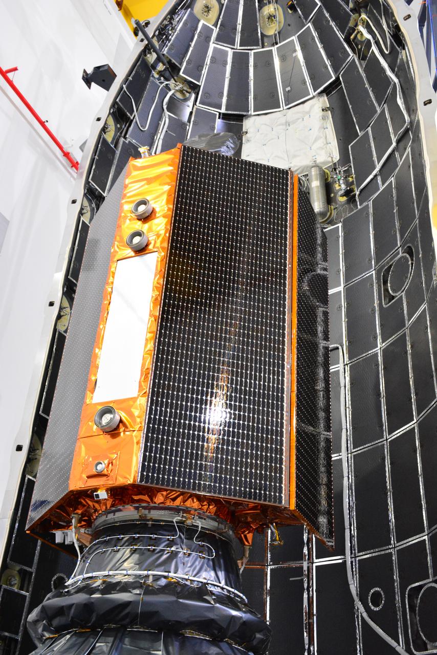
The U.S.-European Sentinel-6 Michael Freilich ocean-monitoring satellite, secured inside the SpaceX Falcon 9 rocket’s payload fairing, is shown inside SpaceX’s Payload Processing Facility at Vandenberg Air Force Base (VAFB) in California following encapsulation on Nov. 3, 2020. Sentinel-6 is scheduled to launch on Nov. 21, 2020, at 12:17 p.m. EST (9:17 a.m. PST), from Space Launch Complex 4E at VAFB. The Launch Services Program at NASA’s Kennedy Space Center in Florida is responsible for launch management.
Inside SpaceX’s Payload Processing Facility at Vandenberg Air Force Base in California, the U.S.-European Sentinel-6 Michael Freilich ocean-monitoring satellite is being encapsulated in the SpaceX Falcon 9 payload fairing on Nov. 3, 2020. Sentinel-6 is scheduled to launch on Nov. 21, 2020, at 12:17 p.m. EST (9:17 a.m. PST), atop the SpaceX Falcon 9 rocket from Space Launch Complex 4E at Vandenberg Air Force Base. The Launch Services Program at Kennedy is responsible for launch management.
Inside SpaceX’s Payload Processing Facility at Vandenberg Air Force Base in California, the U.S.-European Sentinel-6 Michael Freilich ocean-monitoring satellite is being encapsulated in the SpaceX Falcon 9 payload fairing on Nov. 3, 2020. Sentinel-6 is scheduled to launch on Nov. 21, 2020, at 12:17 p.m. EST (9:17 a.m. PST), atop the SpaceX Falcon 9 rocket from Space Launch Complex 4E at Vandenberg Air Force Base. The Launch Services Program at Kennedy is responsible for launch management.
Inside SpaceX’s Payload Processing Facility at Vandenberg Air Force Base in California, the U.S.-European Sentinel-6 Michael Freilich ocean-monitoring satellite is being encapsulated in the SpaceX Falcon 9 payload fairing on Nov. 3, 2020. Sentinel-6 is scheduled to launch on Nov. 21, 2020, at 12:17 p.m. EST (9:17 a.m. PST), atop the SpaceX Falcon 9 rocket from Space Launch Complex 4E at Vandenberg Air Force Base. The Launch Services Program at Kennedy is responsible for launch management.
The U.S.-European Sentinel-6 Michael Freilich ocean-monitoring satellite is encapsulated in the SpaceX Falcon 9 rocket’s payload fairing on Nov. 3, 2020, inside SpaceX’s Payload Processing Facility at Vandenberg Air Force Base (VAFB) in California. Sentinel-6 is scheduled to launch on Nov. 21, 2020, at 12:17 p.m. EST (9:17 a.m. PST), from Space Launch Complex 4E at VAFB. The Launch Services Program at NASA’s Kennedy Space Center in Florida is responsible for launch management.

The U.S.-European Sentinel-6 Michael Freilich ocean-monitoring satellite is being encapsulated in the SpaceX Falcon 9 rocket’s payload fairing on Nov. 3, 2020, inside SpaceX’s Payload Processing Facility at Vandenberg Air Force Base (VAFB) in California. Sentinel-6 is scheduled to launch on Nov. 21, 2020, at 12:17 p.m. EST (9:17 a.m. PST), from Space Launch Complex 4E at VAFB. The Launch Services Program at NASA’s Kennedy Space Center in Florida is responsible for launch management.
Inside SpaceX’s Payload Processing Facility at Vandenberg Air Force Base in California, the U.S.-European Sentinel-6 Michael Freilich ocean-monitoring satellite is being encapsulated in the SpaceX Falcon 9 payload fairing on Nov. 3, 2020. Sentinel-6 is scheduled to launch on Nov. 21, 2020, at 12:17 p.m. EST (9:17 a.m. PST), atop the SpaceX Falcon 9 rocket from Space Launch Complex 4E at Vandenberg Air Force Base. The Launch Services Program at Kennedy is responsible for launch management.
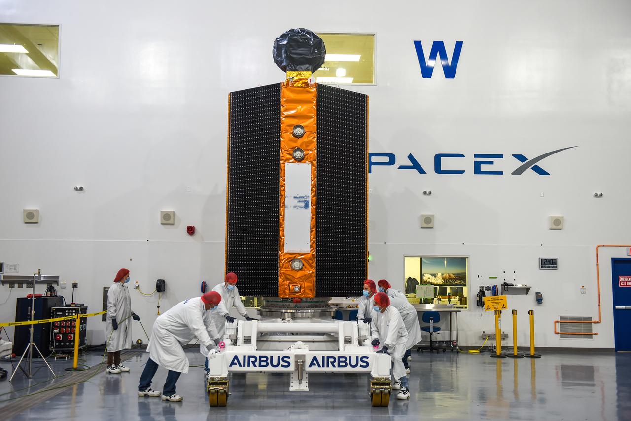
Airbus Defence and Space technicians position the Sentinel-6 Michael Freilich spacecraft for fueling inside SpaceX’s Payload Processing Facility at Vandenberg Air Force Base (VAFB) in California on Oct. 22, 2020. The mission is an international collaboration and will be the first of two satellites launched to continue observing changes in Earth’s sea levels for at least the next decade. The Sentinel-6 Michael Freilich satellite is scheduled to launch from VAFB atop a SpaceX Falcon 9 rocket. NASA’s Launch Services Program at Kennedy Space Center in Florida is responsible for launch management.

Inside SpaceX’s Payload Processing Facility at Vandenberg Air Force Base in California, the U.S.-European Sentinel-6 Michael Freilich ocean-monitoring satellite is being encapsulated in the SpaceX Falcon 9 payload fairing on Nov. 3, 2020. Sentinel-6 is scheduled to launch on Nov. 21, 2020, at 12:17 p.m. EST (9:17 a.m. PST), atop the SpaceX Falcon 9 rocket from Space Launch Complex 4E at Vandenberg Air Force Base. The Launch Services Program at Kennedy is responsible for launch management.
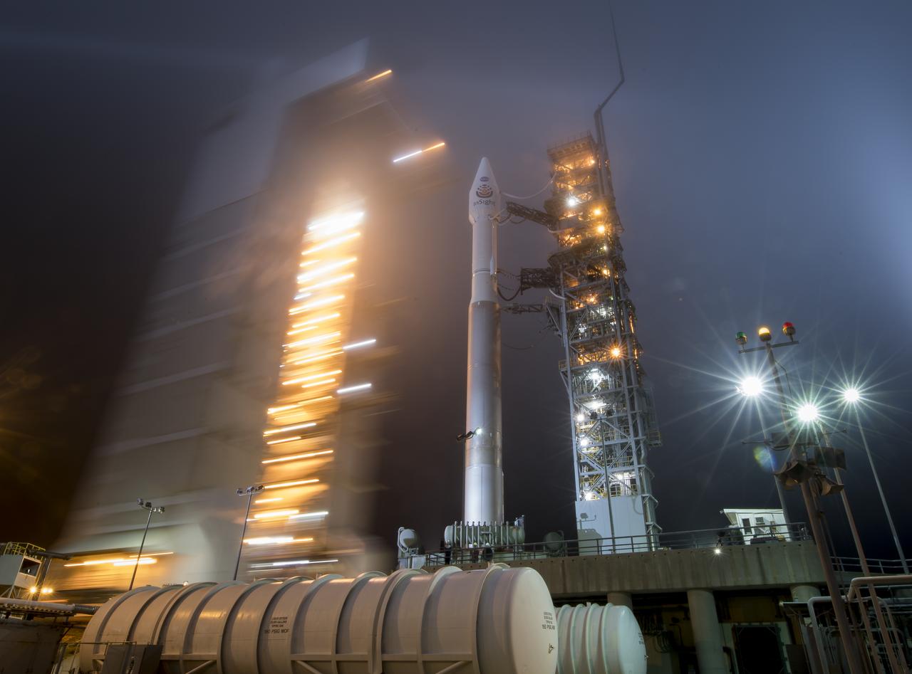
The mobile service tower at SLC-3 is rolled back to reveal the United Launch Alliance (ULA) Atlas-V rocket with the NASA InSight spacecraft onboard, Friday, May 4, 2018, at Vandenberg Air Force Base in California. InSight, short for Interior Exploration using Seismic Investigations, Geodesy and Heat Transport, is a Mars lander designed to study the "inner space" of Mars: its crust, mantle, and core. Photo Credit: (NASA/Bill Ingalls)
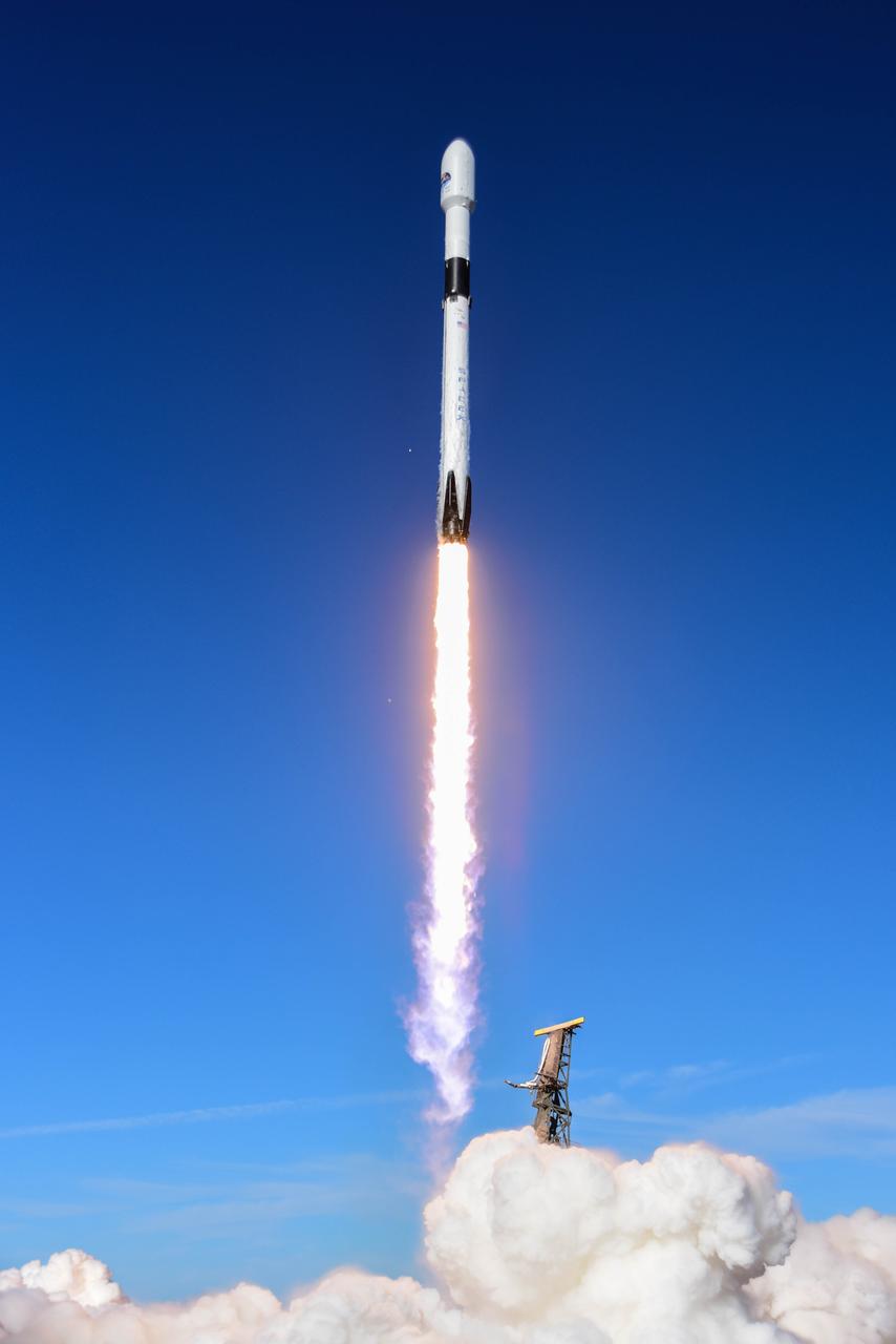
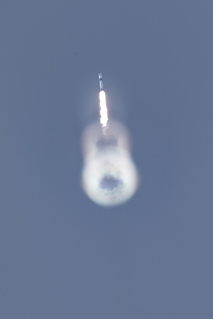
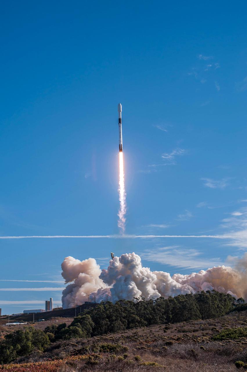
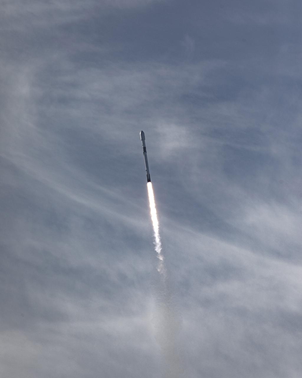
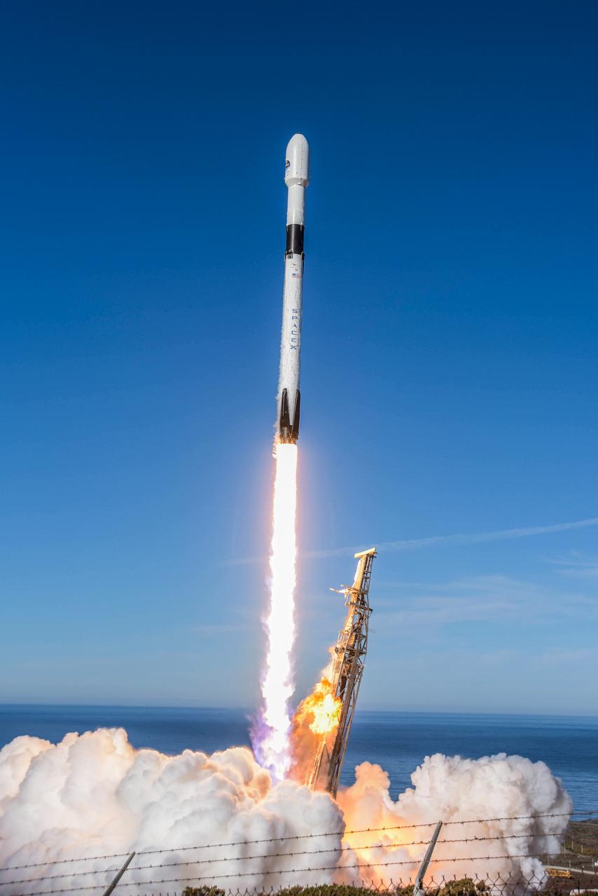
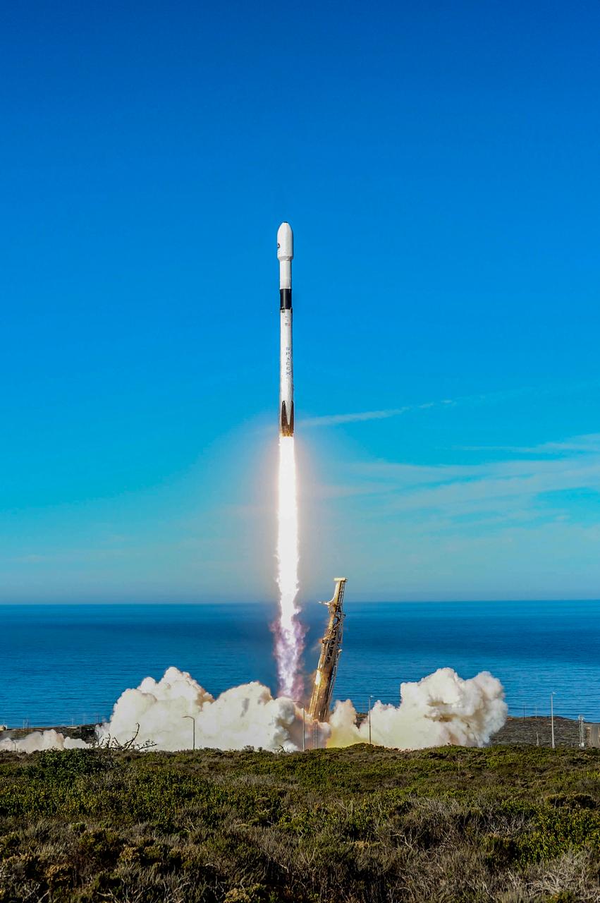
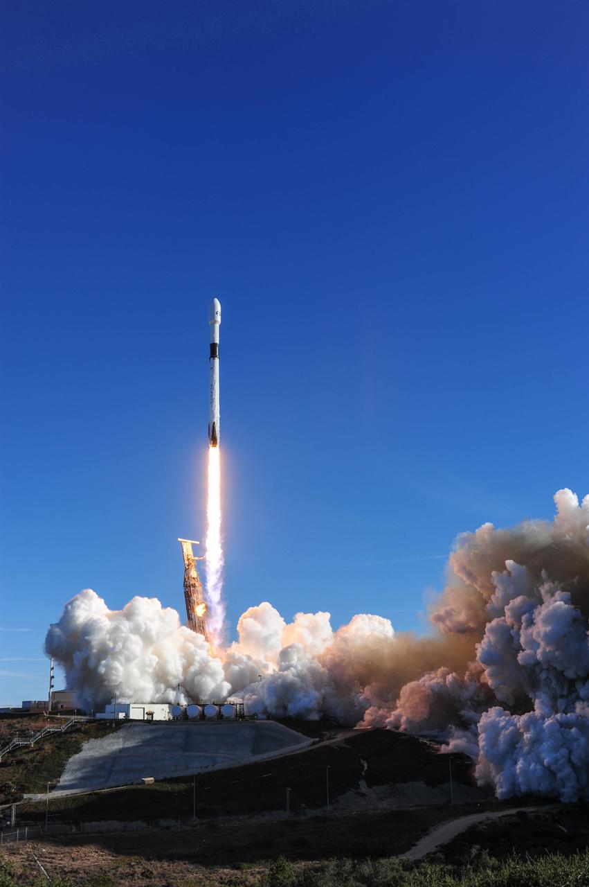
The SpaceX Falcon 9 rocket carrying the Sentinel-6 Michael Freilich spacecraft lifts off from Space Launch Complex 4 at Vandenberg Air Force Base in California, Nov. 21, 2020, at 9:17 a.m. PST (12:17 p.m. EST). The Sentinel-6/Jason-CS (Continuity of Service) mission consists of the Sentinel-6 Michael Freilich satellite, which will be followed by its twin, the Sentinel-6B satellite, in 2025. The Sentinel-6/Jason-CS mission is part of Copernicus, the European Union’s Earth observation program, managed by the European Commission. Continuing the legacy of the Jason series missions, Sentinel-6/Jason-CS will extend the records of sea level into their fourth decade, collecting accurate measurements of sea surface height for more than 90% of the world’s seas, and providing crucial information for operational oceanography, marine meteorology, and climate studies. NASA’s Launch Services Program at Kennedy Space Center was responsible for launch management.
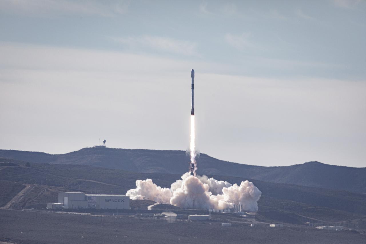
The SpaceX Falcon 9 rocket carrying the Sentinel-6 Michael Freilich spacecraft lifts off from Space Launch Complex 4 at Vandenberg Air Force Base in California, Nov. 21, 2020, at 9:17 a.m. PST (12:17 p.m. EST). The Sentinel-6/Jason-CS (Continuity of Service) mission consists of the Sentinel-6 Michael Freilich satellite, which will be followed by its twin, the Sentinel-6B satellite, in 2025. The Sentinel-6/Jason-CS mission is part of Copernicus, the European Union’s Earth observation program, managed by the European Commission. Continuing the legacy of the Jason series missions, Sentinel-6/Jason-CS will extend the records of sea level into their fourth decade, collecting accurate measurements of sea surface height for more than 90% of the world’s seas, and providing crucial information for operational oceanography, marine meteorology, and climate studies. NASA’s Launch Services Program at Kennedy Space Center was responsible for launch management.
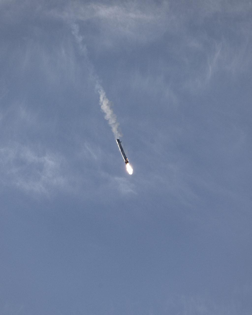
The first-stage booster of a SpaceX Falcon 9 rocket flies down to a landing at Vandenberg Air Force Base in California during the launch of the Sentinel-6 Michael Freilich mission. The Falcon 9 carrying the satellite lifted off from Vandenberg’s Space Launch Complex 4 on Nov. 21, 2020, at 9:17 a.m. PST (12:17 p.m. EST). The Sentinel-6/Jason-CS (Continuity of Service) mission consists of the Sentinel-6 Michael Freilich satellite, which will be followed by its twin, the Sentinel-6B satellite, in 2025. The Sentinel-6/Jason-CS mission is part of Copernicus, the European Union’s Earth observation program, managed by the European Commission. Continuing the legacy of the Jason series missions, Sentinel-6/Jason-CS will extend the records of sea level into their fourth decade, collecting accurate measurements of sea surface height for more than 90% of the world’s seas, and providing crucial information for operational oceanography, marine meteorology, and climate studies. NASA’s Launch Services Program at Kennedy Space Center was responsible for launch management.
The first-stage booster of a SpaceX Falcon 9 rocket flies down to a landing at Vandenberg Air Force Base in California during the launch of the Sentinel-6 Michael Freilich mission. The Falcon 9 carrying the satellite lifted off from Vandenberg’s Space Launch Complex 4 on Nov. 21, 2020, at 9:17 a.m. PST (12:17 p.m. EST). The Sentinel-6/Jason-CS (Continuity of Service) mission consists of the Sentinel-6 Michael Freilich satellite, which will be followed by its twin, the Sentinel-6B satellite, in 2025. The Sentinel-6/Jason-CS mission is part of Copernicus, the European Union’s Earth observation program, managed by the European Commission. Continuing the legacy of the Jason series missions, Sentinel-6/Jason-CS will extend the records of sea level into their fourth decade, collecting accurate measurements of sea surface height for more than 90% of the world’s seas, and providing crucial information for operational oceanography, marine meteorology, and climate studies. NASA’s Launch Services Program at Kennedy Space Center was responsible for launch management.
The SpaceX Falcon 9 rocket carrying the Sentinel-6 Michael Freilich spacecraft lifts off from Space Launch Complex 4 at Vandenberg Air Force Base in California, Nov. 21, 2020, at 9:17 a.m. PST (12:17 p.m. EST). The Sentinel-6/Jason-CS (Continuity of Service) mission consists of the Sentinel-6 Michael Freilich satellite, which will be followed by its twin, the Sentinel-6B satellite, in 2025. The Sentinel-6/Jason-CS mission is part of Copernicus, the European Union’s Earth observation program, managed by the European Commission. Continuing the legacy of the Jason series missions, Sentinel-6/Jason-CS will extend the records of sea level into their fourth decade, collecting accurate measurements of sea surface height for more than 90% of the world’s seas, and providing crucial information for operational oceanography, marine meteorology, and climate studies. NASA’s Launch Services Program at Kennedy Space Center was responsible for launch management.
The SpaceX Falcon 9 rocket carrying the Sentinel-6 Michael Freilich spacecraft lifts off from Space Launch Complex 4 at Vandenberg Air Force Base in California, Nov. 21, 2020, at 9:17 a.m. PST (12:17 p.m. EST). The Sentinel-6/Jason-CS (Continuity of Service) mission consists of the Sentinel-6 Michael Freilich satellite, which will be followed by its twin, the Sentinel-6B satellite, in 2025. The Sentinel-6/Jason-CS mission is part of Copernicus, the European Union’s Earth observation program, managed by the European Commission. Continuing the legacy of the Jason series missions, Sentinel-6/Jason-CS will extend the records of sea level into their fourth decade, collecting accurate measurements of sea surface height for more than 90% of the world’s seas, and providing crucial information for operational oceanography, marine meteorology, and climate studies. NASA’s Launch Services Program at Kennedy Space Center was responsible for launch management.
The SpaceX Falcon 9 rocket carrying the Sentinel-6 Michael Freilich spacecraft lifts off from Space Launch Complex 4 at Vandenberg Air Force Base in California, Nov. 21, 2020, at 9:17 a.m. PST (12:17 p.m. EST). The Sentinel-6/Jason-CS (Continuity of Service) mission consists of the Sentinel-6 Michael Freilich satellite, which will be followed by its twin, the Sentinel-6B satellite, in 2025. The Sentinel-6/Jason-CS mission is part of Copernicus, the European Union’s Earth observation program, managed by the European Commission. Continuing the legacy of the Jason series missions, Sentinel-6/Jason-CS will extend the records of sea level into their fourth decade, collecting accurate measurements of sea surface height for more than 90% of the world’s seas, and providing crucial information for operational oceanography, marine meteorology, and climate studies. NASA’s Launch Services Program at Kennedy Space Center was responsible for launch management.
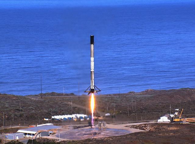
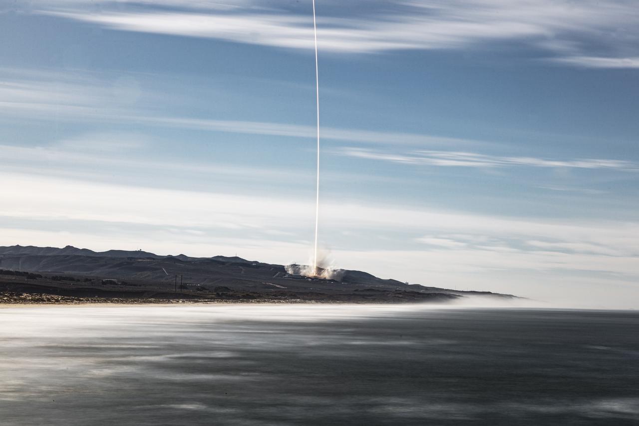
The SpaceX Falcon 9 first stage booster lands at Space Launch Complex 4 at Vandenberg Air Force Base in California after launching the Sentinel-6 Michael Freilich spacecraft on Nov. 21, 2020, at 9:17 a.m. PST (12:17 p.m. EST). The Sentinel-6/Jason-CS (Continuity of Service) mission consists of the Sentinel-6 Michael Freilich satellite, which will be followed by its twin, the Sentinel-6B satellite, in 2025. The Sentinel-6/Jason-CS mission is part of Copernicus, the European Union’s Earth observation program, managed by the European Commission. Continuing the legacy of the Jason series missions, Sentinel-6/Jason-CS will extend the records of sea level into their fourth decade, collecting accurate measurements of sea surface height for more than 90% of the world’s seas, and providing crucial information for operational oceanography, marine meteorology, and climate studies. NASA’s Launch Services Program at Kennedy Space Center was responsible for launch management.
The SpaceX Falcon 9 rocket carrying the Sentinel-6 Michael Freilich spacecraft lifts off from Space Launch Complex 4 at Vandenberg Air Force Base in California, Nov. 21, 2020, at 9:17 a.m. PST (12:17 p.m. EST). The Sentinel-6/Jason-CS (Continuity of Service) mission consists of the Sentinel-6 Michael Freilich satellite, which will be followed by its twin, the Sentinel-6B satellite, in 2025. The Sentinel-6/Jason-CS mission is part of Copernicus, the European Union’s Earth observation program, managed by the European Commission. Continuing the legacy of the Jason series missions, Sentinel-6/Jason-CS will extend the records of sea level into their fourth decade, collecting accurate measurements of sea surface height for more than 90% of the world’s seas, and providing crucial information for operational oceanography, marine meteorology, and climate studies. NASA’s Launch Services Program at Kennedy Space Center was responsible for launch management.
The SpaceX Falcon 9 rocket carrying the Sentinel-6 Michael Freilich spacecraft lifts off from Space Launch Complex 4 at Vandenberg Air Force Base in California, Nov. 21, 2020, at 9:17 a.m. PST (12:17 p.m. EST). The Sentinel-6/Jason-CS (Continuity of Service) mission consists of the Sentinel-6 Michael Freilich satellite, which will be followed by its twin, the Sentinel-6B satellite, in 2025. The Sentinel-6/Jason-CS mission is part of Copernicus, the European Union’s Earth observation program, managed by the European Commission. Continuing the legacy of the Jason series missions, Sentinel-6/Jason-CS will extend the records of sea level into their fourth decade, collecting accurate measurements of sea surface height for more than 90% of the world’s seas, and providing crucial information for operational oceanography, marine meteorology, and climate studies. NASA’s Launch Services Program at Kennedy Space Center was responsible for launch management.
The SpaceX Falcon 9 rocket carrying the Sentinel-6 Michael Freilich spacecraft lifts off from Space Launch Complex 4 at Vandenberg Air Force Base in California, Nov. 21, 2020, at 9:17 a.m. PST (12:17 p.m. EST). The Sentinel-6/Jason-CS (Continuity of Service) mission consists of the Sentinel-6 Michael Freilich satellite, which will be followed by its twin, the Sentinel-6B satellite, in 2025. The Sentinel-6/Jason-CS mission is part of Copernicus, the European Union’s Earth observation program, managed by the European Commission. Continuing the legacy of the Jason series missions, Sentinel-6/Jason-CS will extend the records of sea level into their fourth decade, collecting accurate measurements of sea surface height for more than 90% of the world’s seas, and providing crucial information for operational oceanography, marine meteorology, and climate studies. NASA’s Launch Services Program at Kennedy Space Center was responsible for launch management.
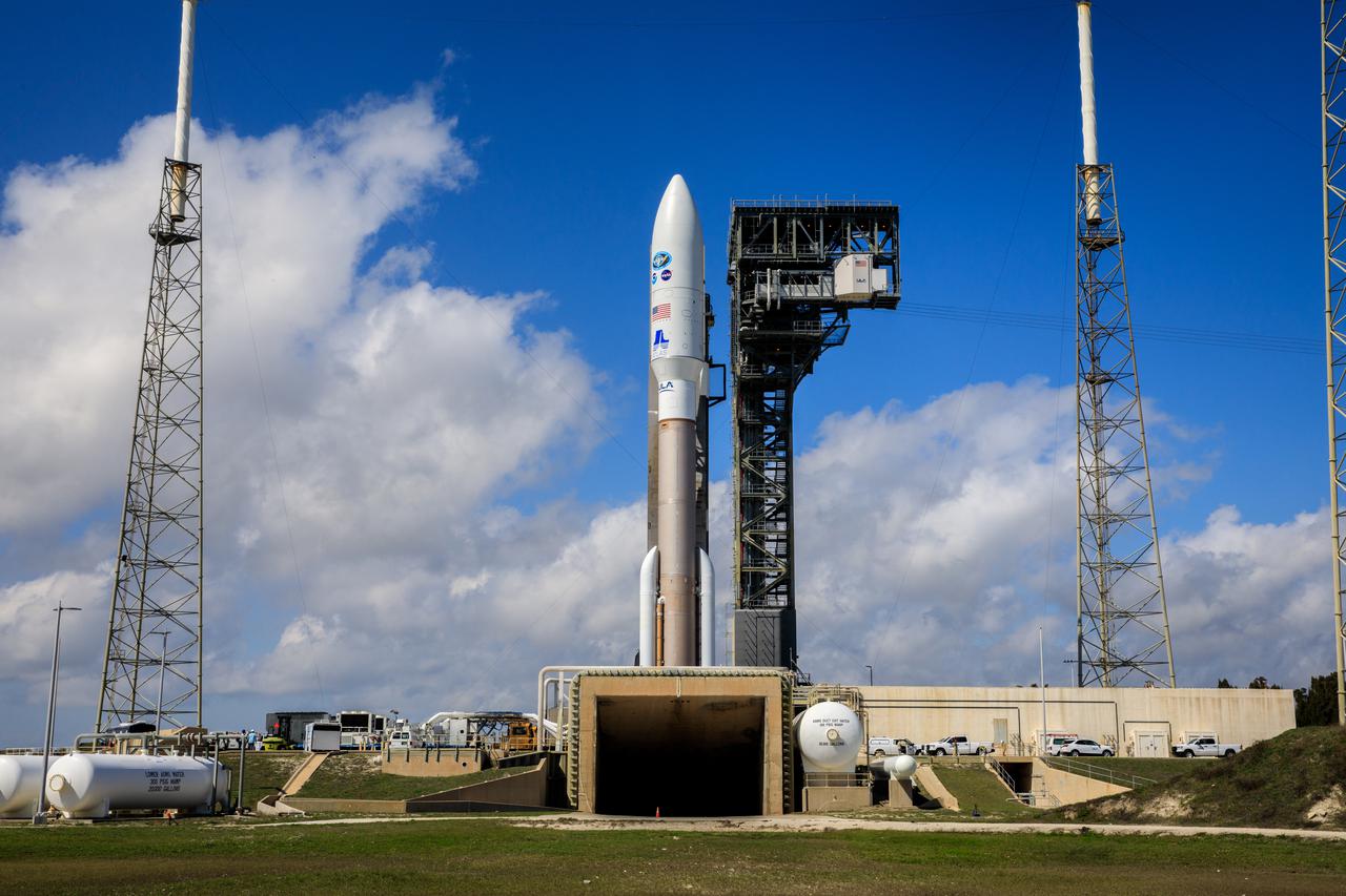
A United Launch Alliance Atlas V 541 rocket carrying the National Oceanic and Atmospheric Administration’s (NOAA) Geostationary Operational Environmental Satellite-T (GOES-T), is secured on the pad at Space Launch Complex 41 at Cape Canaveral Space Force Station in Florida on Feb. 28, 2022. GOES-T will lift off atop the Atlas V from SLC-41 on March 1, 2022, at 4:38 p.m. GOES-T is the third satellite in the GOES-R series that will continue to help meteorologists observe and predict local weather events that affect public safety. GOES-T will be renamed GOES-18 once it reaches geostationary orbit. GOES-18 will go into operational service as GOES West to provide critical data for the U.S. West Coast, Alaska, Hawaii, Mexico, Central America, and the Pacific Ocean. The launch is managed by NASA’s Launch Services Program based at Kennedy Space Center in Florida, America’s multi-user spaceport.
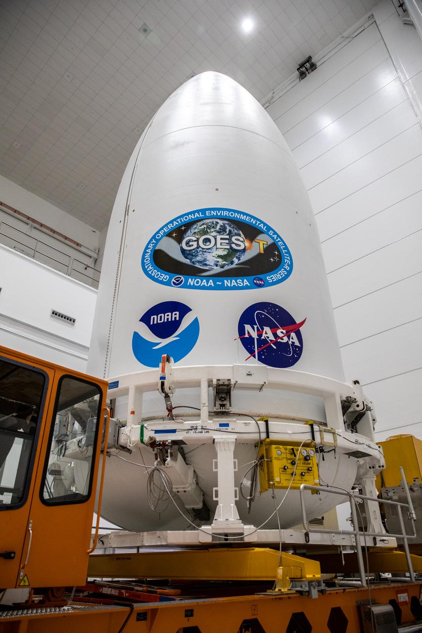
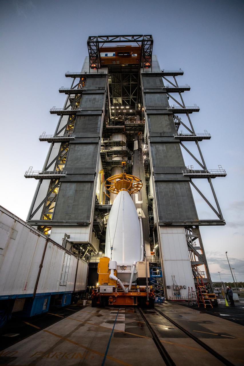
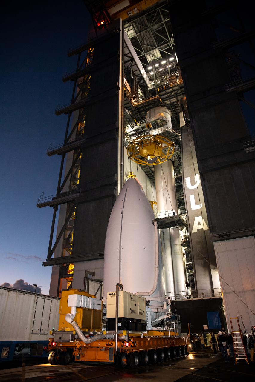
The National Oceanic and Atmospheric Administration’s (NOAA) Geostationary Operational Environmental Satellite-T (GOES-T), enclosed in its payload fairing, is lifted up by crane for its move into the Vertical Integration Facility at Space Launch Complex 41 at Cape Canaveral Space Force Station in Florida on Feb. 17, 2022. The satellite will be secured atop the United Launch Alliance Atlas V 541 rocket. GOES-T is scheduled to launch atop the Atlas V rocket from SLC-41 on March 1, 2022, at 4:38 p.m. GOES-T is the third satellite in the GOES-R series that will continue to help meteorologists observe and predict local weather events that affect public safety. The launch is being managed by NASA’s Launch Services Program based at Kennedy Space Center in Florida, America’s multi-user spaceport.
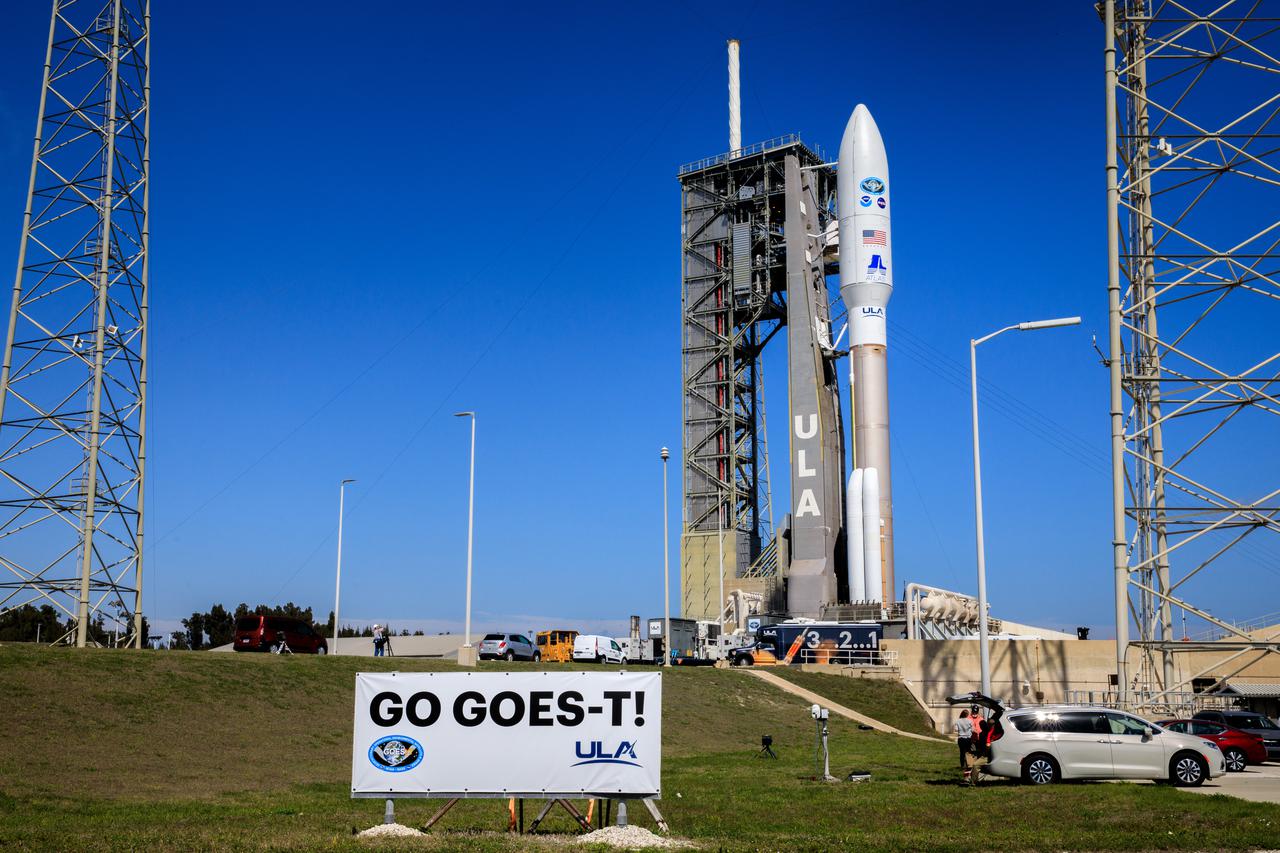
A United Launch Alliance Atlas V 541 rocket carrying the National Oceanic and Atmospheric Administration’s (NOAA) Geostationary Operational Environmental Satellite-T (GOES-T), is secured on the pad at Space Launch Complex 41 at Cape Canaveral Space Force Station in Florida on Feb. 28, 2022. GOES-T will lift off atop the Atlas V from SLC-41 on March 1, 2022, at 4:38 p.m. GOES-T is the third satellite in the GOES-R series that will continue to help meteorologists observe and predict local weather events that affect public safety. GOES-T will be renamed GOES-18 once it reaches geostationary orbit. GOES-18 will go into operational service as GOES West to provide critical data for the U.S. West Coast, Alaska, Hawaii, Mexico, Central America, and the Pacific Ocean. The launch is managed by NASA’s Launch Services Program based at Kennedy Space Center in Florida, America’s multi-user spaceport.
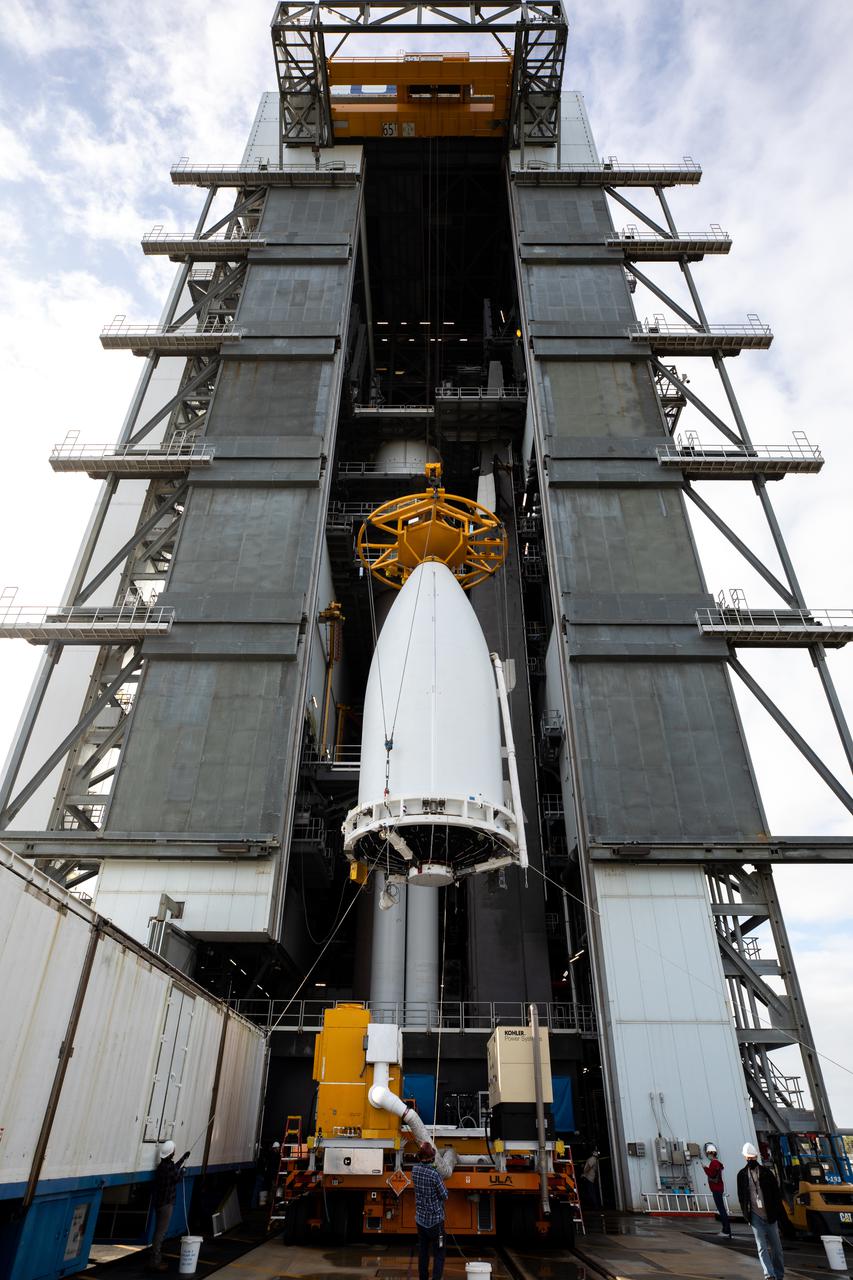
Preparations are underway to lift the National Oceanic and Atmospheric Administration’s (NOAA) Geostationary Operational Environmental Satellite-T (GOES-T), enclosed in its payload fairing, up into the Vertical Integration Facility at Space Launch Complex 41 at Cape Canaveral Space Force Station in Florida on Feb. 17, 2022. The satellite will be secured atop the United Launch Alliance Atlas V 541 rocket. GOES-T is scheduled to launch atop the Atlas V rocket from SLC-41 on March 1, 2022, at 4:38 p.m. GOES-T is the third satellite in the GOES-R series that will continue to help meteorologists observe and predict local weather events that affect public safety. The launch is being managed by NASA’s Launch Services Program based at Kennedy Space Center in Florida, America’s multi-user spaceport.
The National Oceanic and Atmospheric Administration’s (NOAA) Geostationary Operational Environmental Satellite-T (GOES-T), enclosed in its payload fairing, is lifted up by crane for its move into the Vertical Integration Facility at Space Launch Complex 41 at Cape Canaveral Space Force Station in Florida on Feb. 17, 2022. The satellite will be secured atop the United Launch Alliance Atlas V 541 rocket. GOES-T is scheduled to launch atop the Atlas V rocket from SLC-41 on March 1, 2022, at 4:38 p.m. GOES-T is the third satellite in the GOES-R series that will continue to help meteorologists observe and predict local weather events that affect public safety. The launch is being managed by NASA’s Launch Services Program based at Kennedy Space Center in Florida, America’s multi-user spaceport.
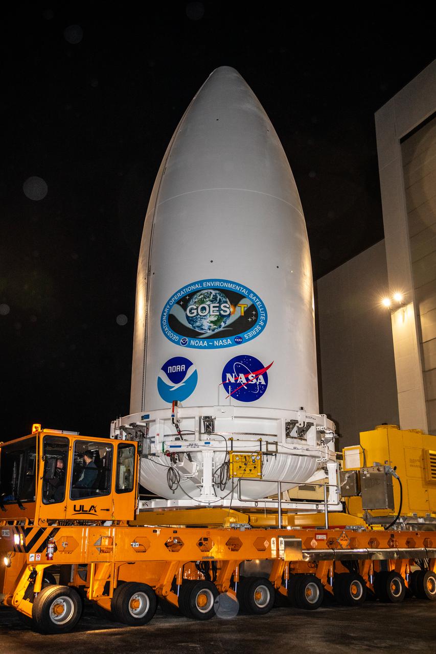
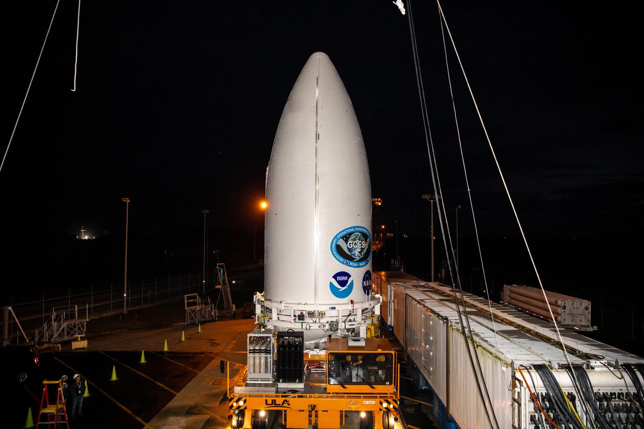
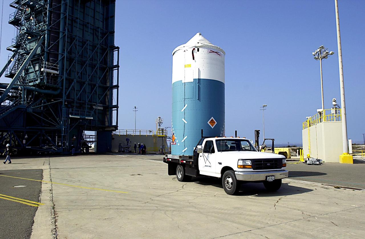
The National Oceanic and Atmospheric Administration’s (NOAA) Geostationary Operational Environmental Satellite-T (GOES-T), enclosed in its payload fairing, exits the Astrotech Space Operations facility in Titusville, Florida, for its trip to the Vertical Integration Facility at Space Launch Complex 41 at Cape Canaveral Space Force Station in Florida on Feb. 17, 2022. The satellite will be lifted up inside the integration facility and secured to the United Launch Alliance Atlas V 541 rocket. GOES-T is scheduled to launch atop the Atlas V rocket from SLC-41 on March 1, 2022, at 4:38 p.m. GOES-T is the third satellite in the GOES-R series that will continue to help meteorologists observe and predict local weather events that affect public safety. The launch is being managed by NASA’s Launch Services Program based at Kennedy Space Center in Florida, America’s multi-user spaceport.
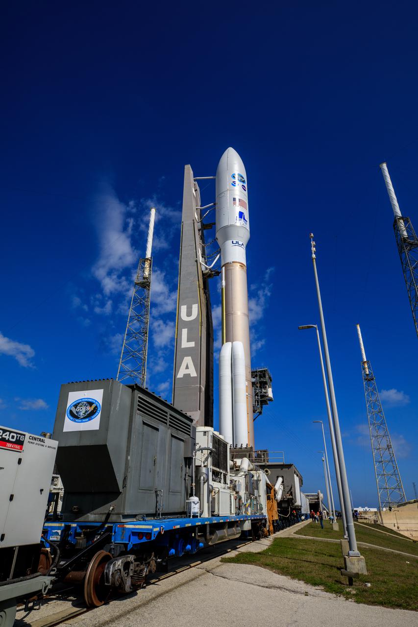
A United Launch Alliance Atlas V 541 rocket carrying the National Oceanic and Atmospheric Administration’s (NOAA) Geostationary Operational Environmental Satellite-T (GOES-T), arrives at Space Launch Complex 41 at Cape Canaveral Space Force Station in Florida on Feb. 28, 2022. GOES-T will lift off atop the Atlas V from SLC-41 on March 1, 2022, at 4:38 p.m. GOES-T is the third satellite in the GOES-R series that will continue to help meteorologists observe and predict local weather events that affect public safety. GOES-T will be renamed GOES-18 once it reaches geostationary orbit. GOES-18 will go into operational service as GOES West to provide critical data for the U.S. West Coast, Alaska, Hawaii, Mexico, Central America, and the Pacific Ocean. The launch is managed by NASA’s Launch Services Program based at Kennedy Space Center in Florida, America’s multi-user spaceport.
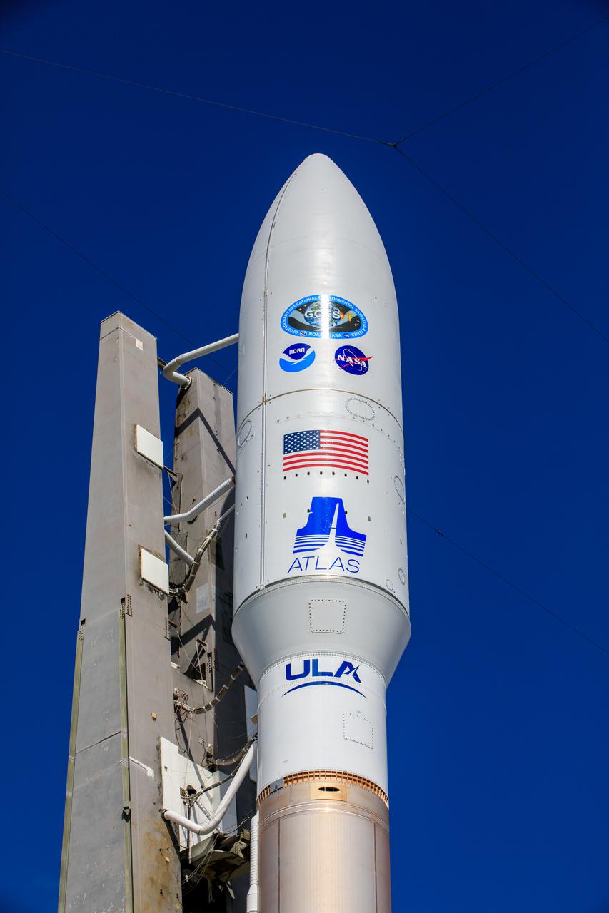
A United Launch Alliance Atlas V 541 rocket carrying the National Oceanic and Atmospheric Administration’s (NOAA) Geostationary Operational Environmental Satellite-T (GOES-T), arrives at Space Launch Complex 41 at Cape Canaveral Space Force Station in Florida on Feb. 28, 2022. GOES-T will lift off atop the Atlas V from SLC-41 on March 1, 2022, at 4:38 p.m. GOES-T is the third satellite in the GOES-R series that will continue to help meteorologists observe and predict local weather events that affect public safety. GOES-T will be renamed GOES-18 once it reaches geostationary orbit. GOES-18 will go into operational service as GOES West to provide critical data for the U.S. West Coast, Alaska, Hawaii, Mexico, Central America, and the Pacific Ocean. The launch is managed by NASA’s Launch Services Program based at Kennedy Space Center in Florida, America’s multi-user spaceport.
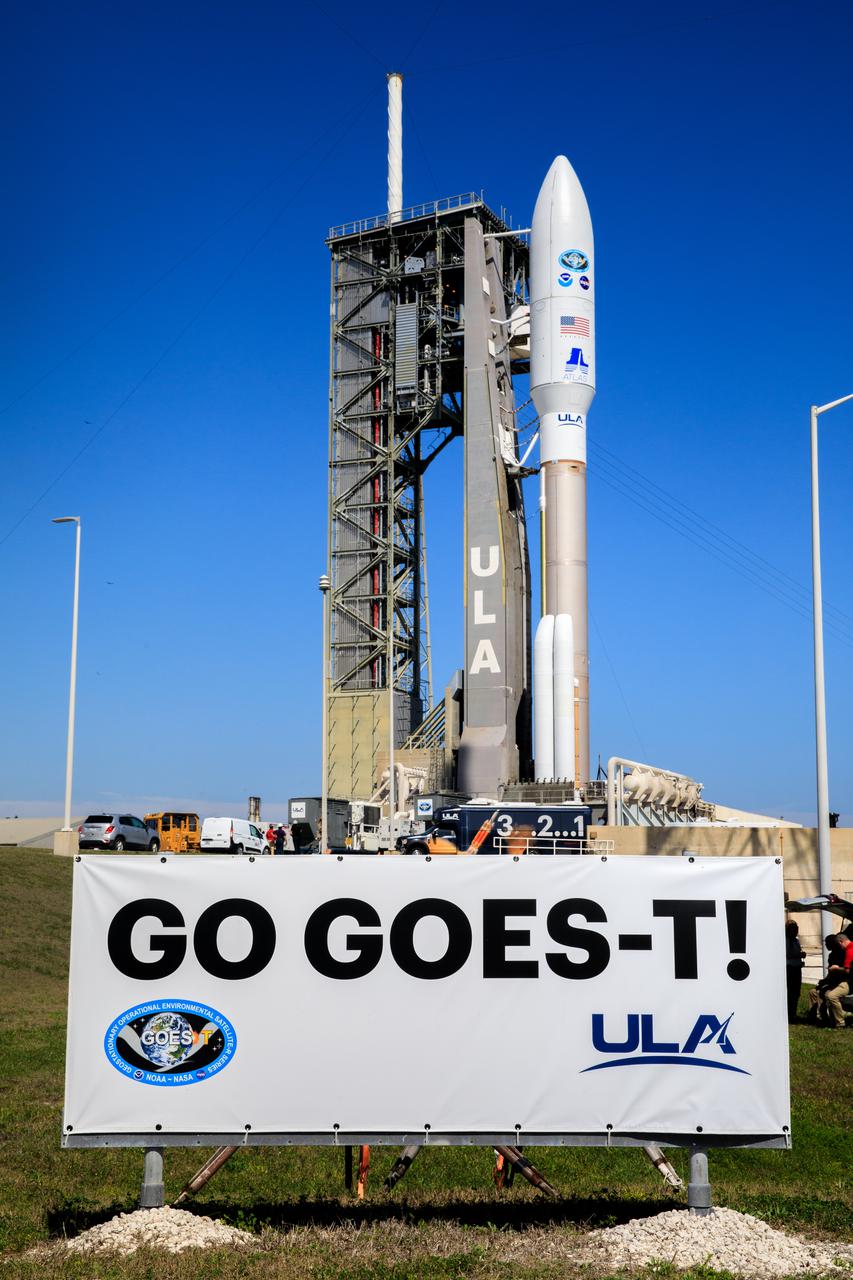
A United Launch Alliance Atlas V 541 rocket carrying the National Oceanic and Atmospheric Administration’s (NOAA) Geostationary Operational Environmental Satellite-T (GOES-T), is secured on the pad at Space Launch Complex 41 at Cape Canaveral Space Force Station in Florida on Feb. 28, 2022. GOES-T will lift off atop the Atlas V from SLC-41 on March 1, 2022, at 4:38 p.m. GOES-T is the third satellite in the GOES-R series that will continue to help meteorologists observe and predict local weather events that affect public safety. GOES-T will be renamed GOES-18 once it reaches geostationary orbit. GOES-18 will go into operational service as GOES West to provide critical data for the U.S. West Coast, Alaska, Hawaii, Mexico, Central America, and the Pacific Ocean. The launch is managed by NASA’s Launch Services Program based at Kennedy Space Center in Florida, America’s multi-user spaceport.
The National Oceanic and Atmospheric Administration’s (NOAA) Geostationary Operational Environmental Satellite-T (GOES-T), enclosed in its payload fairing, is prepared for its move from the Astrotech Space Operations facility in Titusville, Florida, to the Vertical Integration Facility at Space Launch Complex 41 at Cape Canaveral Space Force Station in Florida on Feb. 17, 2022. The satellite will be lifted up inside the integration facility and secured to the United Launch Alliance Atlas V 541 rocket. GOES-T is scheduled to launch atop the Atlas V rocket from SLC-41 on March 1, 2022, at 4:38 p.m. GOES-T is the third satellite in the GOES-R series that will continue to help meteorologists observe and predict local weather events that affect public safety. The launch is being managed by NASA’s Launch Services Program based at Kennedy Space Center in Florida, America’s multi-user spaceport.
Preparations are underway to lift the National Oceanic and Atmospheric Administration’s (NOAA) Geostationary Operational Environmental Satellite-T (GOES-T), enclosed in its payload fairing, up into the Vertical Integration Facility at Space Launch Complex 41 at Cape Canaveral Space Force Station in Florida on Feb. 17, 2022. The satellite will be secured atop the United Launch Alliance Atlas V 541 rocket. GOES-T is scheduled to launch atop the Atlas V rocket from SLC-41 on March 1, 2022, at 4:38 p.m. GOES-T is the third satellite in the GOES-R series that will continue to help meteorologists observe and predict local weather events that affect public safety. The launch is being managed by NASA’s Launch Services Program based at Kennedy Space Center in Florida, America’s multi-user spaceport.
Preparations are underway to lift the National Oceanic and Atmospheric Administration’s (NOAA) Geostationary Operational Environmental Satellite-T (GOES-T), enclosed in its payload fairing, up into the Vertical Integration Facility at Space Launch Complex 41 at Cape Canaveral Space Force Station in Florida on Feb. 17, 2022. The satellite will be secured atop the United Launch Alliance Atlas V 541 rocket. GOES-T is scheduled to launch atop the Atlas V rocket from SLC-41 on March 1, 2022, at 4:38 p.m. GOES-T is the third satellite in the GOES-R series that will continue to help meteorologists observe and predict local weather events that affect public safety. The launch is being managed by NASA’s Launch Services Program based at Kennedy Space Center in Florida, America’s multi-user spaceport.
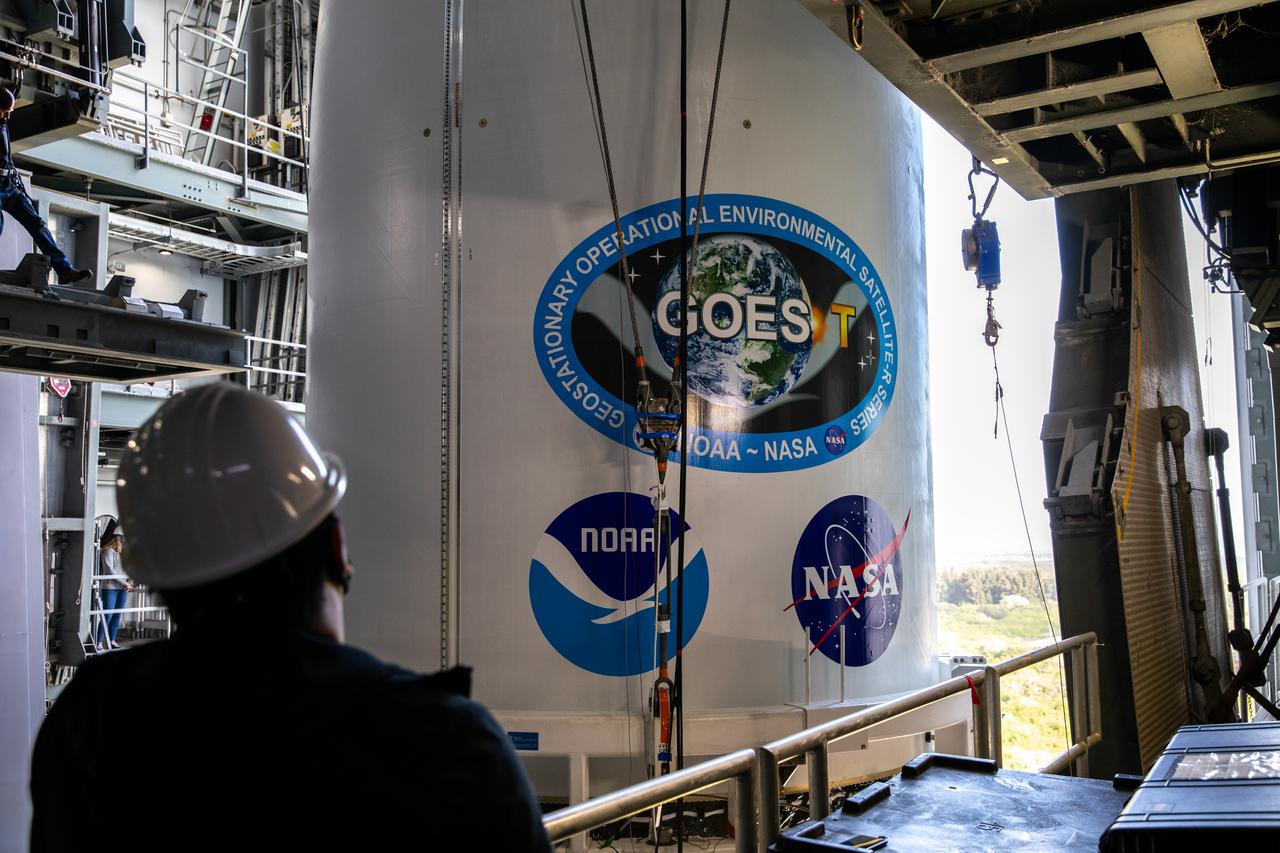
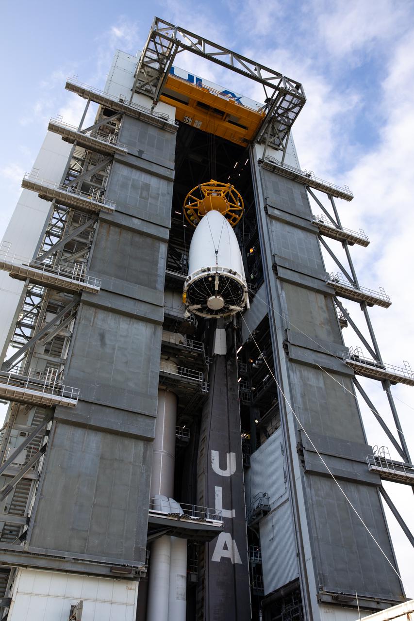
A United Launch Alliance technician monitors the progress as the National Oceanic and Atmospheric Administration’s (NOAA) Geostationary Operational Environmental Satellite-T (GOES-T), enclosed in its payload fairing, is moved into the Vertical Integration Facility at Space Launch Complex 41 at Cape Canaveral Space Force Station in Florida on Feb. 17, 2022. The satellite will be secured atop the United Launch Alliance Atlas V 541 rocket. GOES-T is scheduled to launch atop the Atlas V rocket from SLC-41 on March 1, 2022, at 4:38 p.m. GOES-T is the third satellite in the GOES-R series that will continue to help meteorologists observe and predict local weather events that affect public safety. The launch is being managed by NASA’s Launch Services Program based at Kennedy Space Center in Florida, America’s multi-user spaceport.
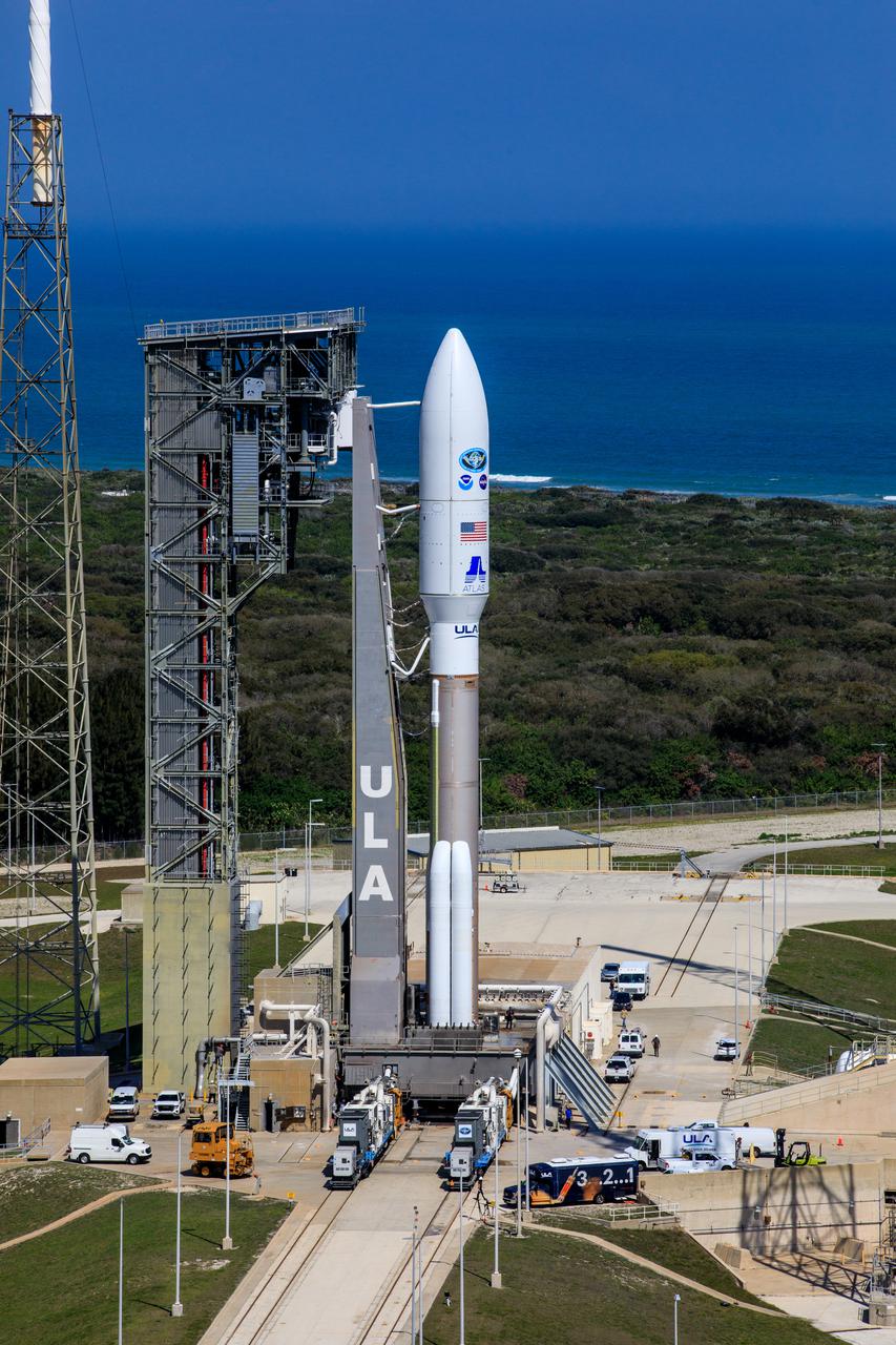
A United Launch Alliance Atlas V 541 rocket carrying the National Oceanic and Atmospheric Administration’s (NOAA) Geostationary Operational Environmental Satellite-T (GOES-T), is secured on the pad at Space Launch Complex 41 at Cape Canaveral Space Force Station in Florida on Feb. 28, 2022. GOES-T will lift off atop the Atlas V from SLC-41 on March 1, 2022, at 4:38 p.m. GOES-T is the third satellite in the GOES-R series that will continue to help meteorologists observe and predict local weather events that affect public safety. GOES-T will be renamed GOES-18 once it reaches geostationary orbit. GOES-18 will go into operational service as GOES West to provide critical data for the U.S. West Coast, Alaska, Hawaii, Mexico, Central America, and the Pacific Ocean. The launch is managed by NASA’s Launch Services Program based at Kennedy Space Center in Florida, America’s multi-user spaceport.
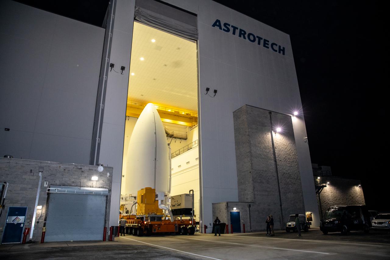
The National Oceanic and Atmospheric Administration’s (NOAA) Geostationary Operational Environmental Satellite-T (GOES-T), enclosed in its payload fairing, begins its move out of the Astrotech Space Operations facility in Titusville, Florida, for the trip to the Vertical Integration Facility at Space Launch Complex 41 at Cape Canaveral Space Force Station in Florida on Feb. 17, 2022. The satellite will be lifted up inside the integration facility and secured to the United Launch Alliance Atlas V 541 rocket. GOES-T is scheduled to launch atop the Atlas V rocket from SLC-41 on March 1, 2022, at 4:38 p.m. GOES-T is the third satellite in the GOES-R series that will continue to help meteorologists observe and predict local weather events that affect public safety. The launch is being managed by NASA’s Launch Services Program based at Kennedy Space Center in Florida, America’s multi-user spaceport.
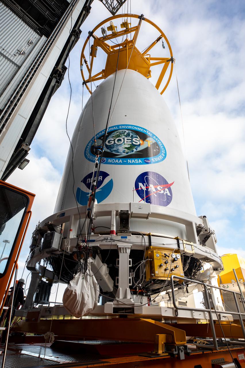
A crane is attached to the National Oceanic and Atmospheric Administration’s (NOAA) Geostationary Operational Environmental Satellite-T (GOES-T), enclosed in its payload fairing, for its lift up into the Vertical Integration Facility at Space Launch Complex 41 at Cape Canaveral Space Force Station in Florida on Feb. 17, 2022. The satellite will be secured atop the United Launch Alliance Atlas V 541 rocket. GOES-T is scheduled to launch atop the Atlas V rocket from SLC-41 on March 1, 2022, at 4:38 p.m. GOES-T is the third satellite in the GOES-R series that will continue to help meteorologists observe and predict local weather events that affect public safety. The launch is being managed by NASA’s Launch Services Program based at Kennedy Space Center in Florida, America’s multi-user spaceport.
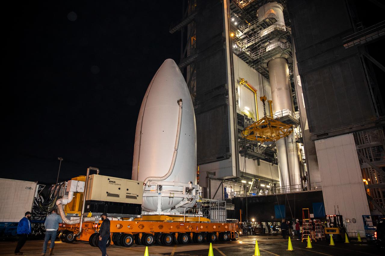
The National Oceanic and Atmospheric Administration’s (NOAA) Geostationary Operational Environmental Satellite-T (GOES-T), enclosed in its payload fairing, arrives at the Vertical Integration Facility at Space Launch Complex 41 at Cape Canaveral Space Force Station in Florida on Feb. 17, 2022. The satellite will be lifted up inside the integration facility and secured to the United Launch Alliance Atlas V 541 rocket. GOES-T is scheduled to launch atop the Atlas V rocket from SLC-41 on March 1, 2022, at 4:38 p.m. GOES-T is the third satellite in the GOES-R series that will continue to help meteorologists observe and predict local weather events that affect public safety. The launch is being managed by NASA’s Launch Services Program based at Kennedy Space Center in Florida, America’s multi-user spaceport.
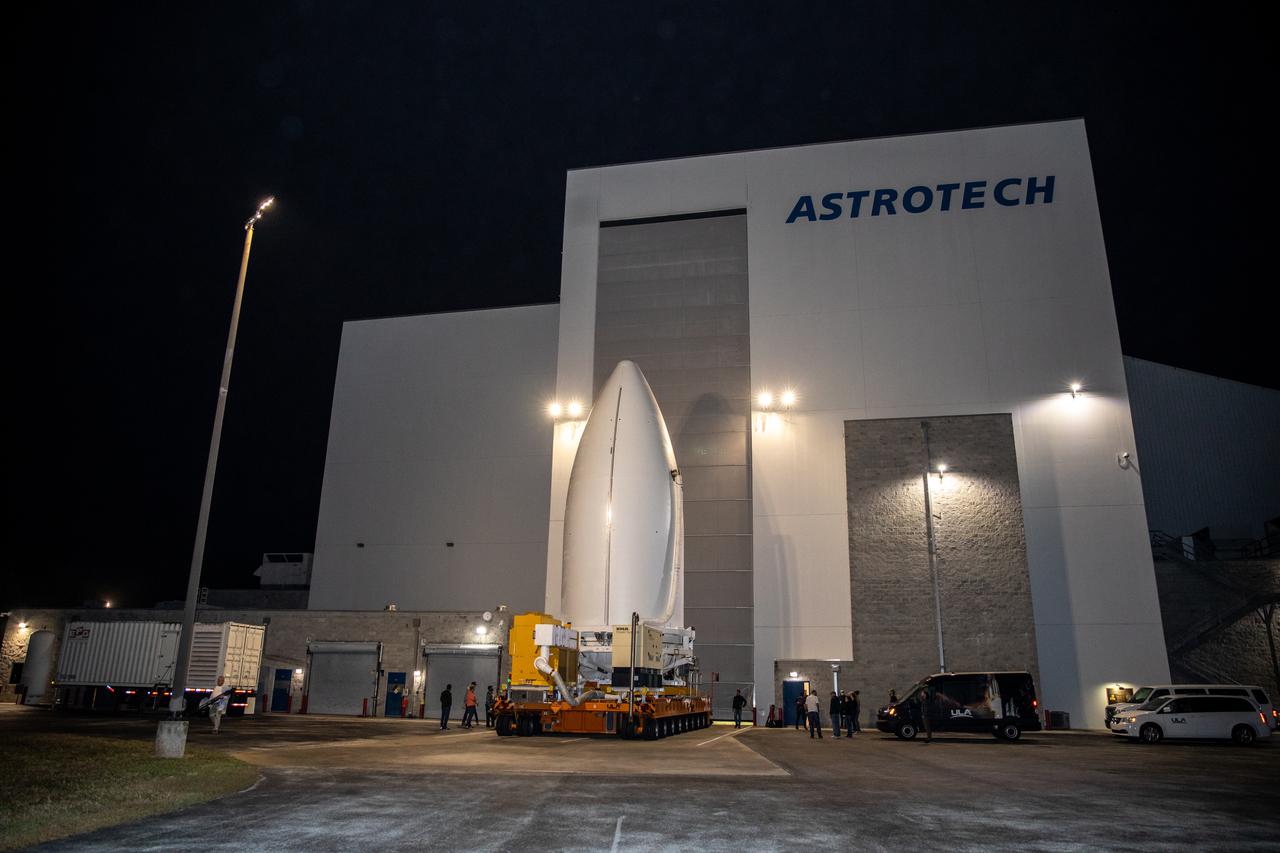
The National Oceanic and Atmospheric Administration’s (NOAA) Geostationary Operational Environmental Satellite-T (GOES-T), enclosed in its payload fairing, exits the Astrotech Space Operations facility in Titusville, Florida, for its trip to the Vertical Integration Facility at Space Launch Complex 41 at Cape Canaveral Space Force Station in Florida on Feb. 17, 2022. The satellite will be lifted up inside the integration facility and secured to the United Launch Alliance Atlas V 541 rocket. GOES-T is scheduled to launch atop the Atlas V rocket from SLC-41 on March 1, 2022, at 4:38 p.m. GOES-T is the third satellite in the GOES-R series that will continue to help meteorologists observe and predict local weather events that affect public safety. The launch is being managed by NASA’s Launch Services Program based at Kennedy Space Center in Florida, America’s multi-user spaceport.
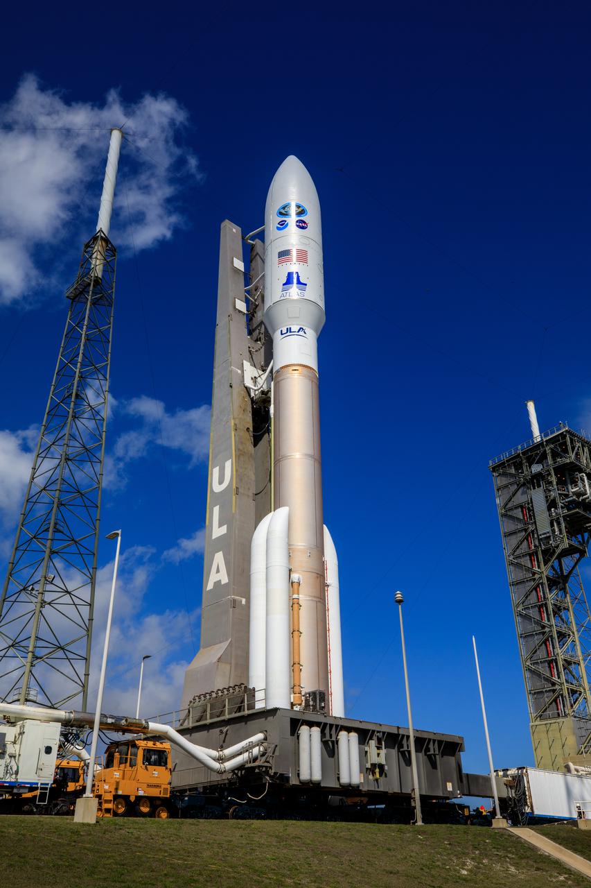
A United Launch Alliance Atlas V 541 rocket carrying the National Oceanic and Atmospheric Administration’s (NOAA) Geostationary Operational Environmental Satellite-T (GOES-T), arrives at Space Launch Complex 41 at Cape Canaveral Space Force Station in Florida on Feb. 28, 2022. GOES-T will lift off atop the Atlas V from SLC-41 on March 1, 2022, at 4:38 p.m. GOES-T is the third satellite in the GOES-R series that will continue to help meteorologists observe and predict local weather events that affect public safety. GOES-T will be renamed GOES-18 once it reaches geostationary orbit. GOES-18 will go into operational service as GOES West to provide critical data for the U.S. West Coast, Alaska, Hawaii, Mexico, Central America, and the Pacific Ocean. The launch is managed by NASA’s Launch Services Program based at Kennedy Space Center in Florida, America’s multi-user spaceport.
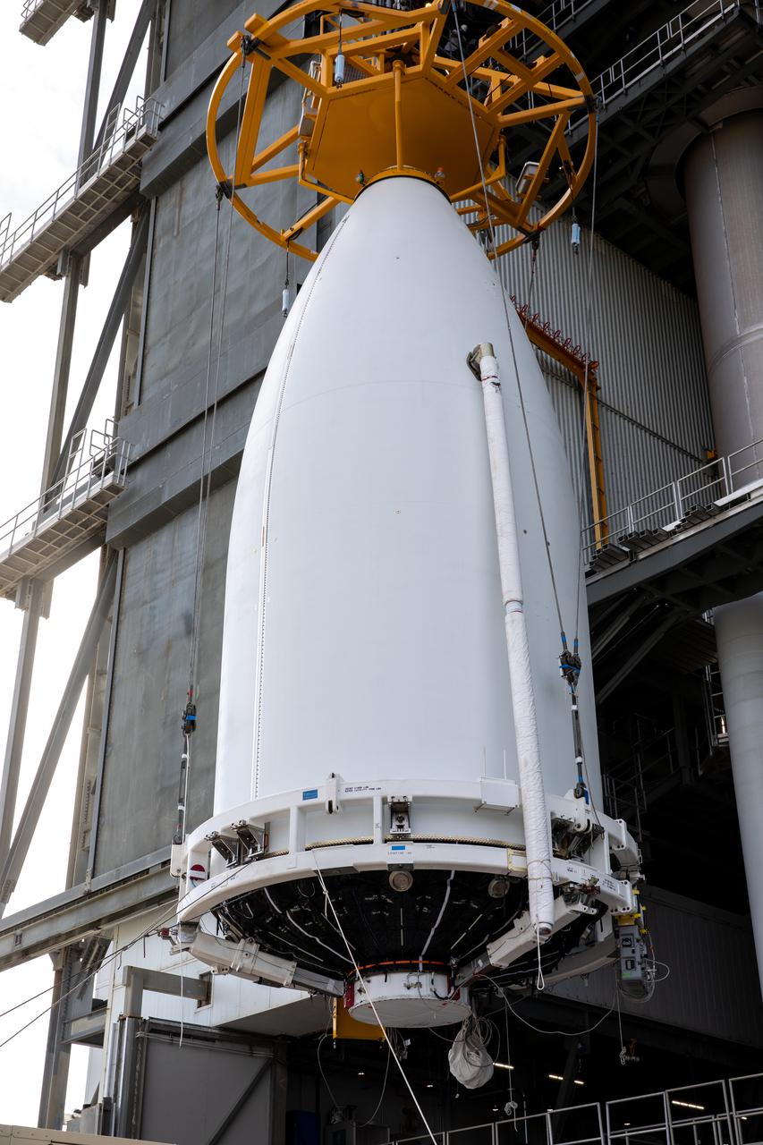
The National Oceanic and Atmospheric Administration’s (NOAA) Geostationary Operational Environmental Satellite-T (GOES-T), enclosed in its payload fairing, is lifted up by crane for its move into the Vertical Integration Facility at Space Launch Complex 41 at Cape Canaveral Space Force Station in Florida on Feb. 17, 2022. The satellite will be secured atop the United Launch Alliance Atlas V 541 rocket. GOES-T is scheduled to launch atop the Atlas V rocket from SLC-41 on March 1, 2022, at 4:38 p.m. GOES-T is the third satellite in the GOES-R series that will continue to help meteorologists observe and predict local weather events that affect public safety. The launch is being managed by NASA’s Launch Services Program based at Kennedy Space Center in Florida, America’s multi-user spaceport.
The Sentinel-6 Michael Freilich mission is an international partnership and the first launch of a constellation of two satellites that will observe changes in Earth’s sea levels for at least the next decade. Launching atop a SpaceX Falcon 9 rocket, Sentinel-6 Michael Freilich is targeted to lift off from Vandenberg Air Force Base in California on Nov. 10, 2020. The Launch Services Program at Kennedy Space Center in Florida is responsible for launch management.
The Sentinel-6 Michael Freilich mission is an international partnership and the first launch of a constellation of two satellites that will observe changes in Earth’s sea levels for at least the next decade. Launching atop a SpaceX Falcon 9 rocket, Sentinel-6 Michael Freilich is targeted to lift off from Vandenberg Air Force Base in California on Nov. 10, 2020. The Launch Services Program at Kennedy Space Center in Florida is responsible for launch management.
The Sentinel-6 Michael Freilich mission is an international partnership and the first launch of a constellation of two satellites that will observe changes in Earth’s sea levels for at least the next decade. Launching atop a SpaceX Falcon 9 rocket, Sentinel-6 Michael Freilich is targeted to lift off from Vandenberg Air Force Base in California on Nov. 10, 2020. The Launch Services Program at Kennedy Space Center in Florida is responsible for launch management.
The Sentinel-6 Michael Freilich mission is an international partnership and the first launch of a constellation of two satellites that will observe changes in Earth’s sea levels for at least the next decade. Launching atop a SpaceX Falcon 9 rocket, Sentinel-6 Michael Freilich is targeted to lift off from Vandenberg Air Force Base in California on Nov. 10, 2020. The Launch Services Program at Kennedy Space Center in Florida is responsible for launch management.
The Sentinel-6 Michael Freilich mission is an international partnership and the first launch of a constellation of two satellites that will observe changes in Earth’s sea levels for at least the next decade. Launching atop a SpaceX Falcon 9 rocket, Sentinel-6 Michael Freilich is targeted to lift off from Vandenberg Air Force Base in California on Nov. 10, 2020. The Launch Services Program at Kennedy Space Center in Florida is responsible for launch management.
The Sentinel-6 Michael Freilich mission is an international partnership and the first launch of a constellation of two satellites that will observe changes in Earth’s sea levels for at least the next decade. Launching atop a SpaceX Falcon 9 rocket, Sentinel-6 Michael Freilich is targeted to lift off from Vandenberg Air Force Base in California on Nov. 10, 2020. The Launch Services Program at Kennedy Space Center in Florida is responsible for launch management.
The Sentinel-6 Michael Freilich mission is an international partnership and the first launch of a constellation of two satellites that will observe changes in Earth’s sea levels for at least the next decade. Launching atop a SpaceX Falcon 9 rocket, Sentinel-6 Michael Freilich is targeted to lift off from Vandenberg Air Force Base in California on Nov. 10, 2020. The Launch Services Program at Kennedy Space Center in Florida is responsible for launch management.
The Sentinel-6 Michael Freilich mission is an international partnership and the first launch of a constellation of two satellites that will observe changes in Earth’s sea levels for at least the next decade. Launching atop a SpaceX Falcon 9 rocket, Sentinel-6 Michael Freilich is targeted to lift off from Vandenberg Air Force Base in California on Nov. 10, 2020. The Launch Services Program at Kennedy Space Center in Florida is responsible for launch management.
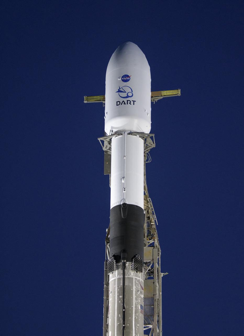
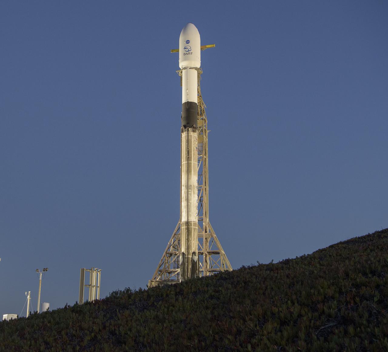
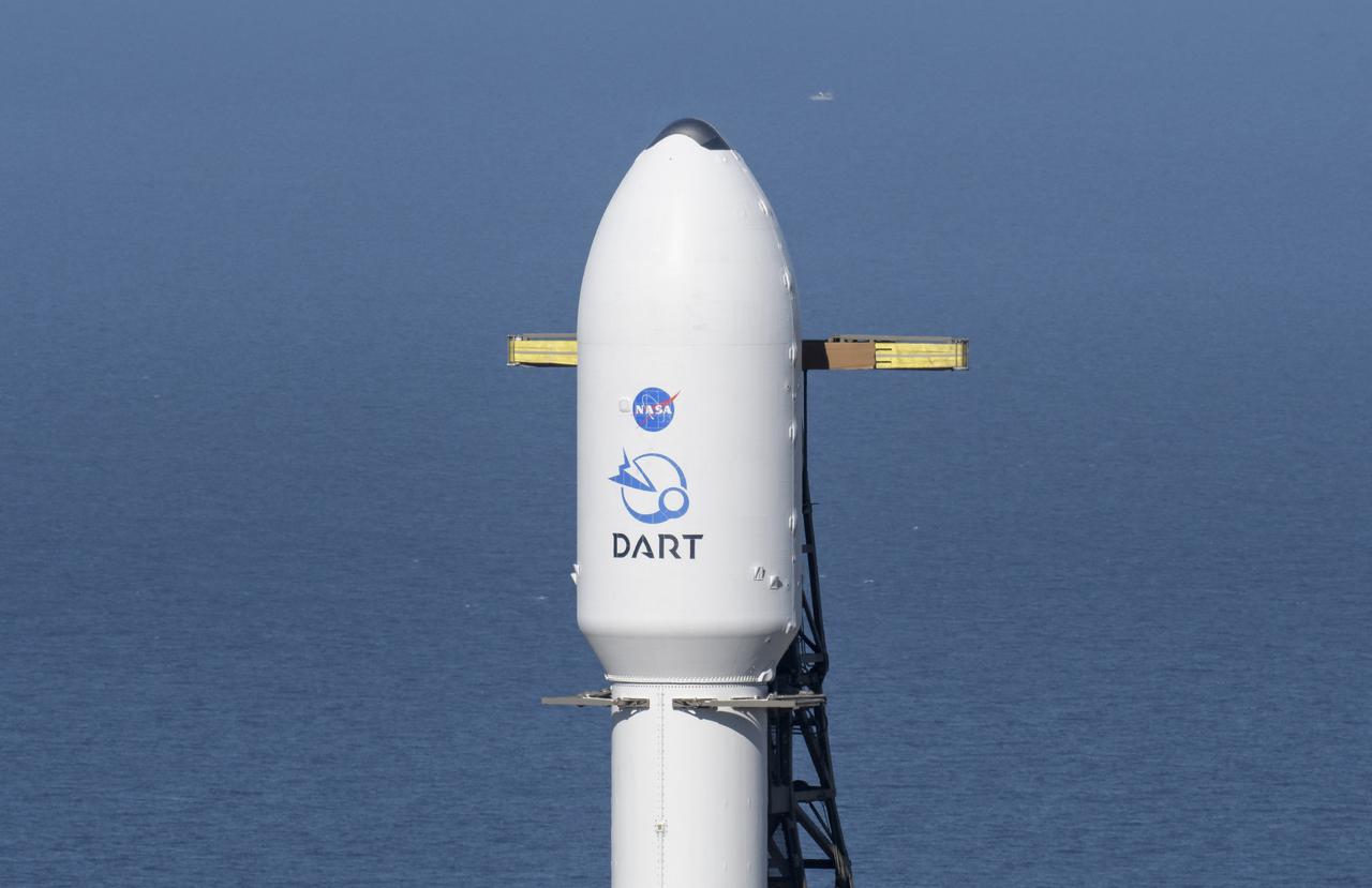
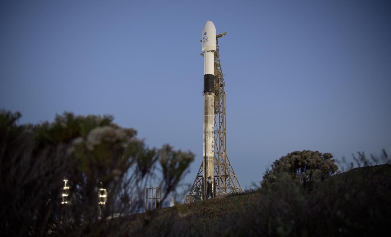
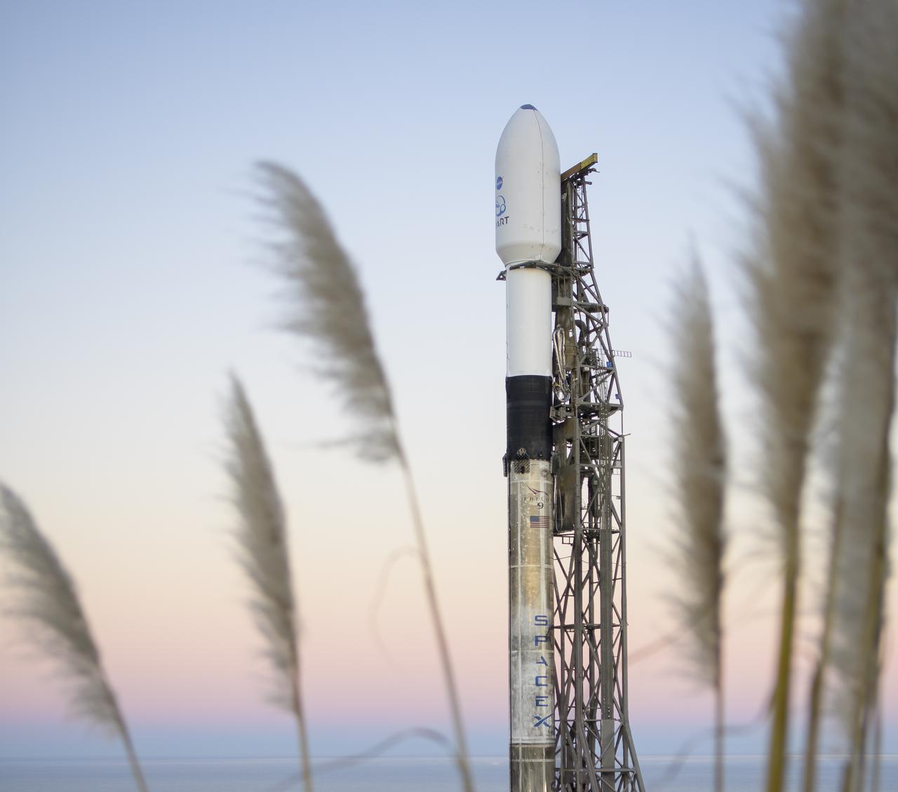
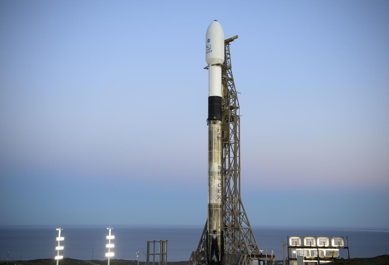
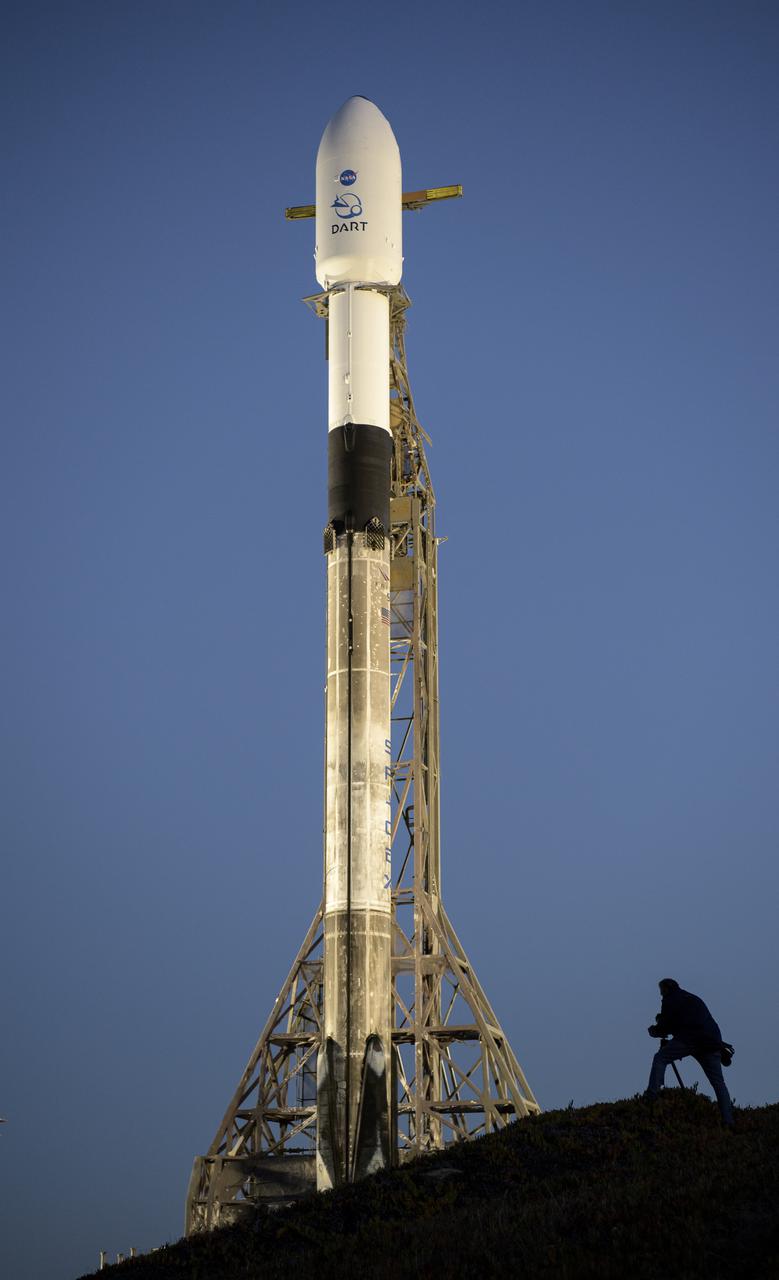
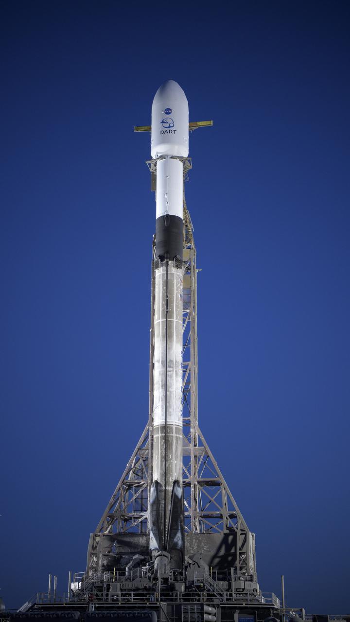
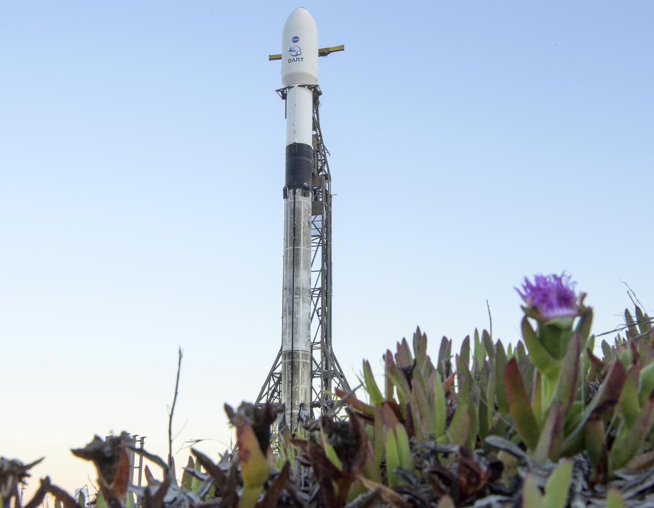
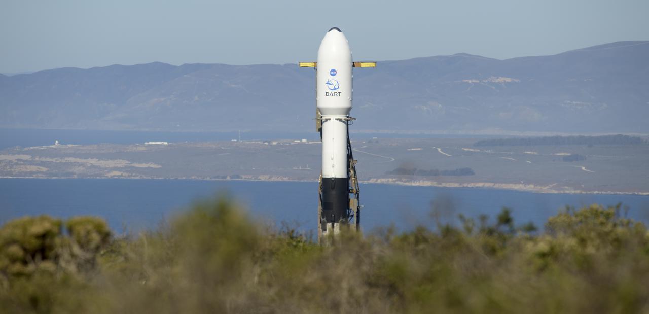
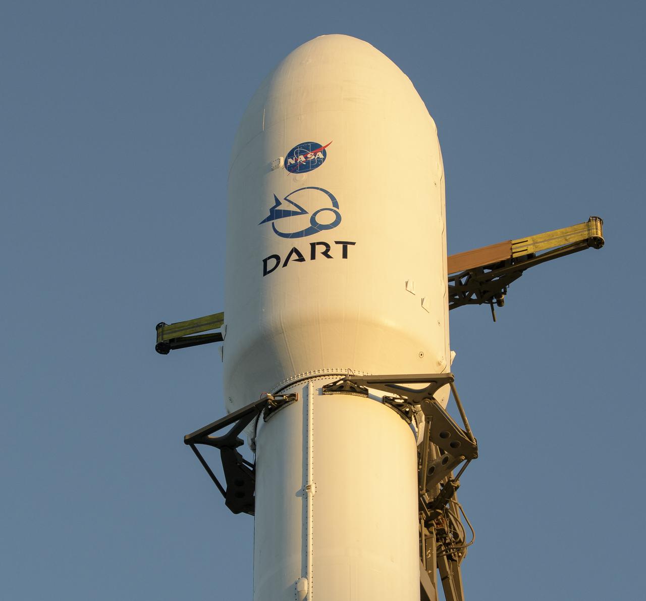
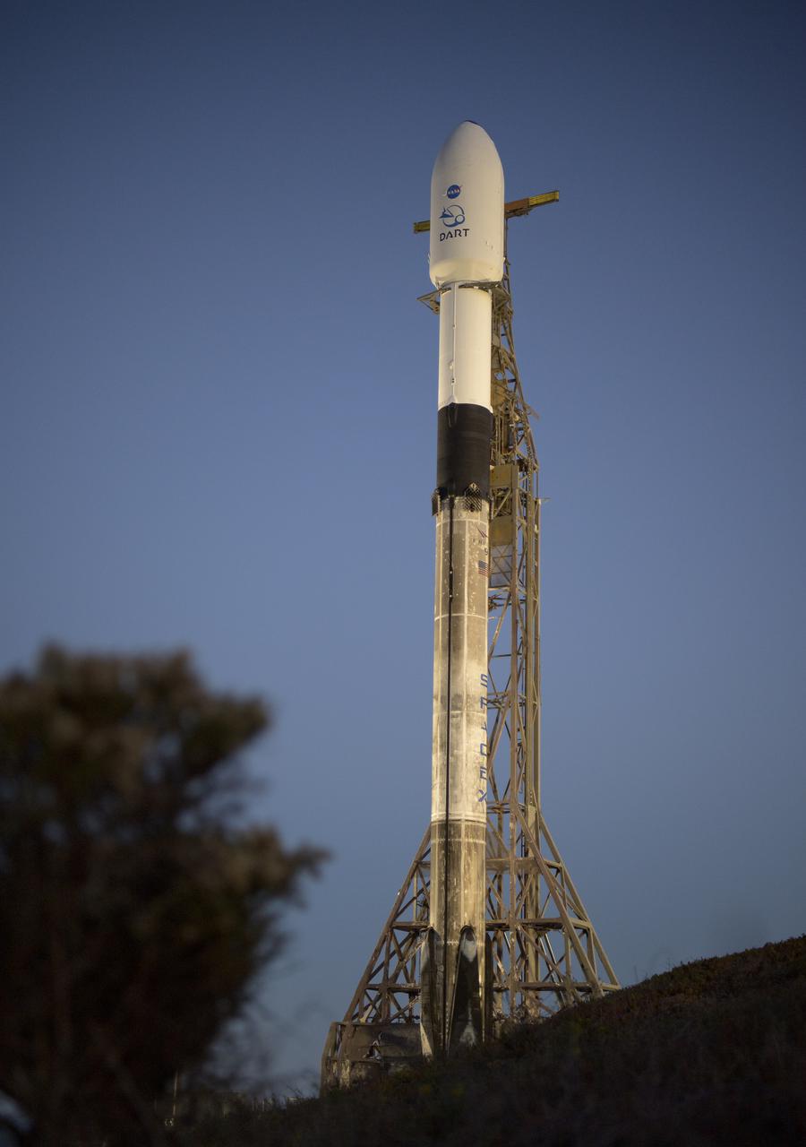
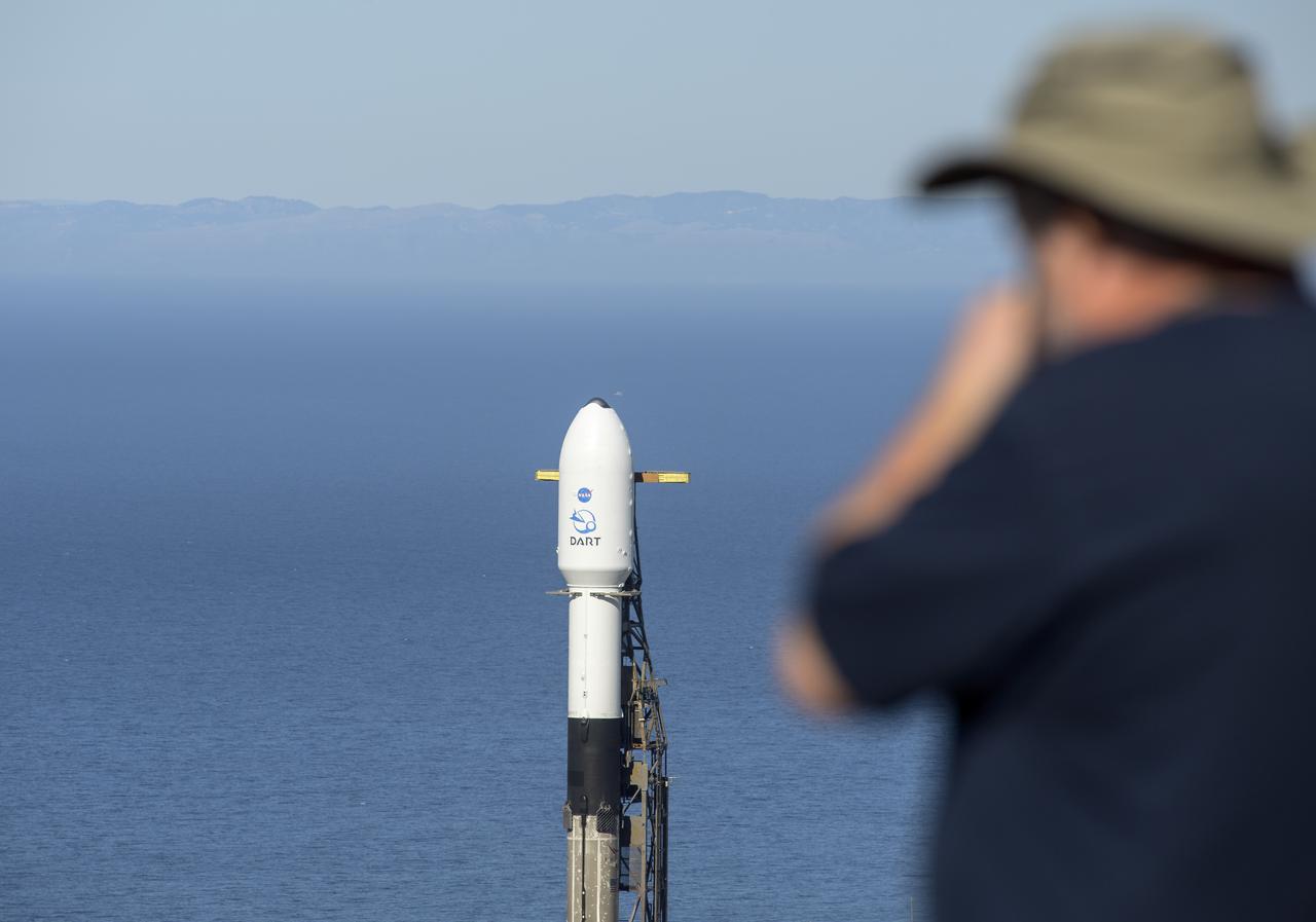
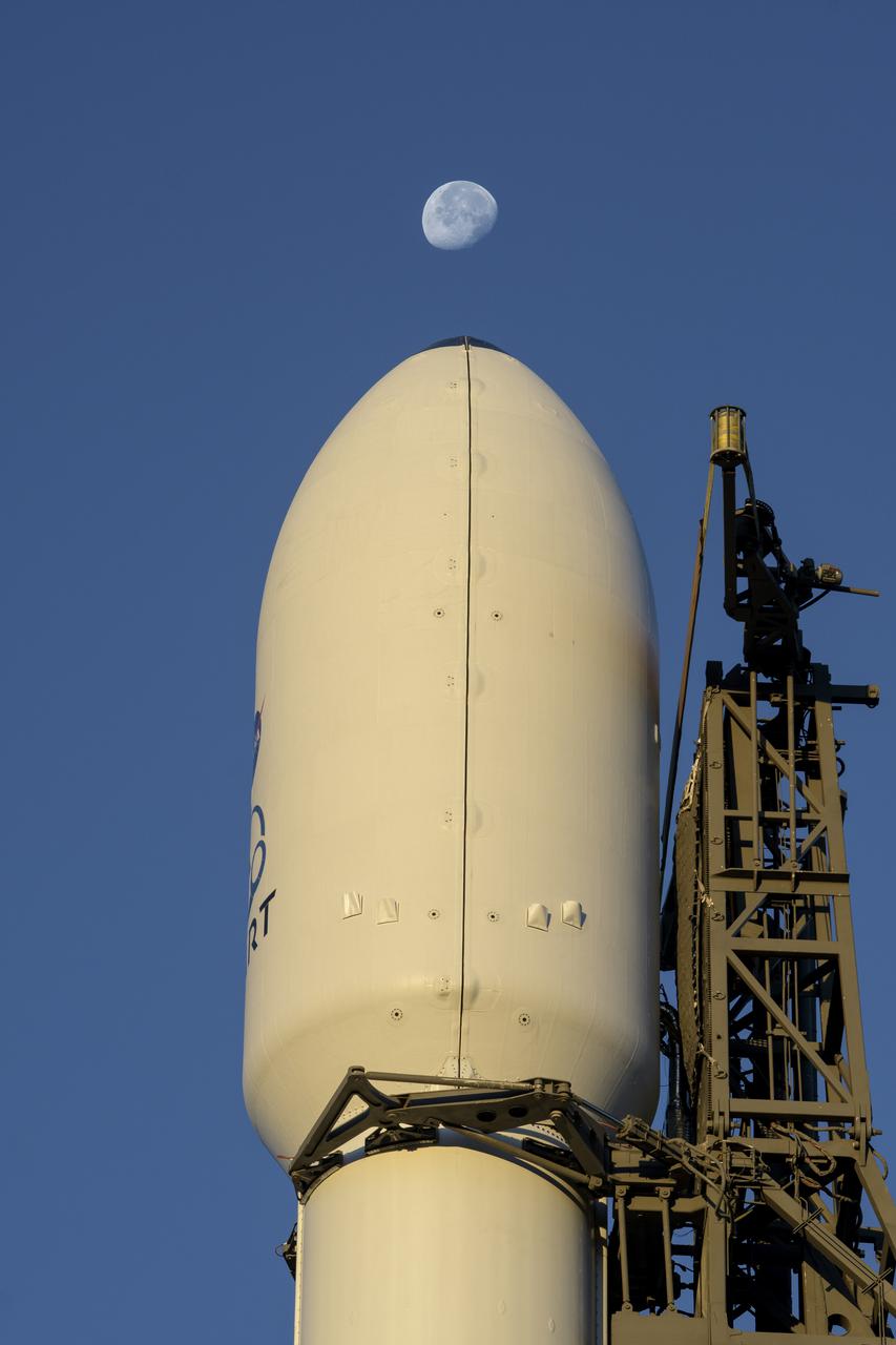
The SpaceX Falcon 9 rocket with the Double Asteroid Redirection Test, or DART, spacecraft onboard, is seen during sunrise, Tuesday, Nov. 23, 2021, at Space Launch Complex 4E, Vandenberg Space Force Base in California. DART is the world’s first full-scale planetary defense test, demonstrating one method of asteroid deflection technology. The mission was built and is managed by the Johns Hopkins APL for NASA’s Planetary Defense Coordination Office. Photo Credit: (NASA/Bill Ingalls)
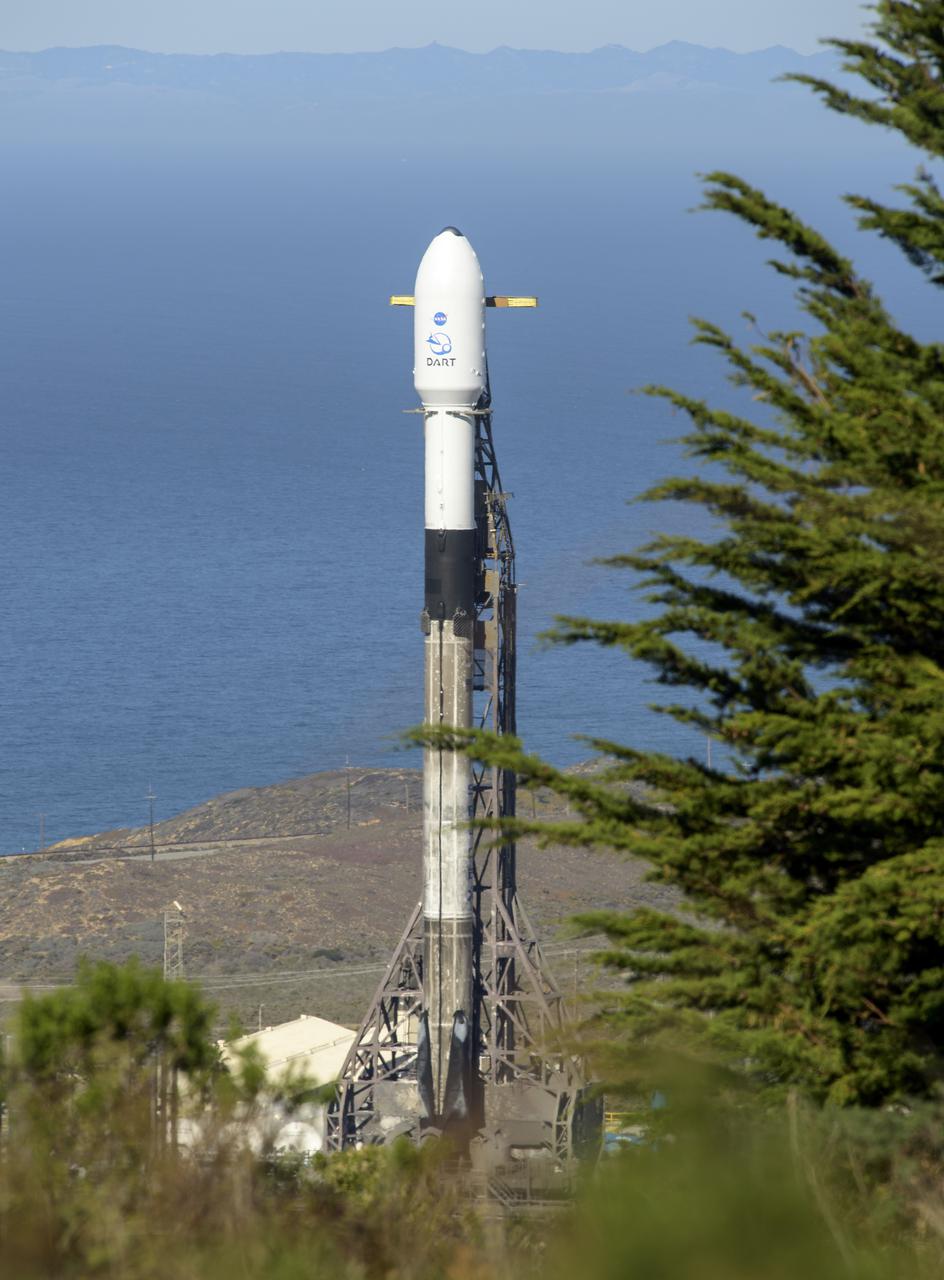
The SpaceX Falcon 9 rocket with the Double Asteroid Redirection Test, or DART, spacecraft onboard, is seen, Tuesday, Nov. 23, 2021, at Space Launch Complex 4E, Vandenberg Space Force Base in California. DART is the world’s first full-scale planetary defense test, demonstrating one method of asteroid deflection technology. The mission was built and is managed by Johns Hopkins APL for NASA’s Planetary Defense Coordination Office. Photo Credit: (NASA/Bill Ingalls)
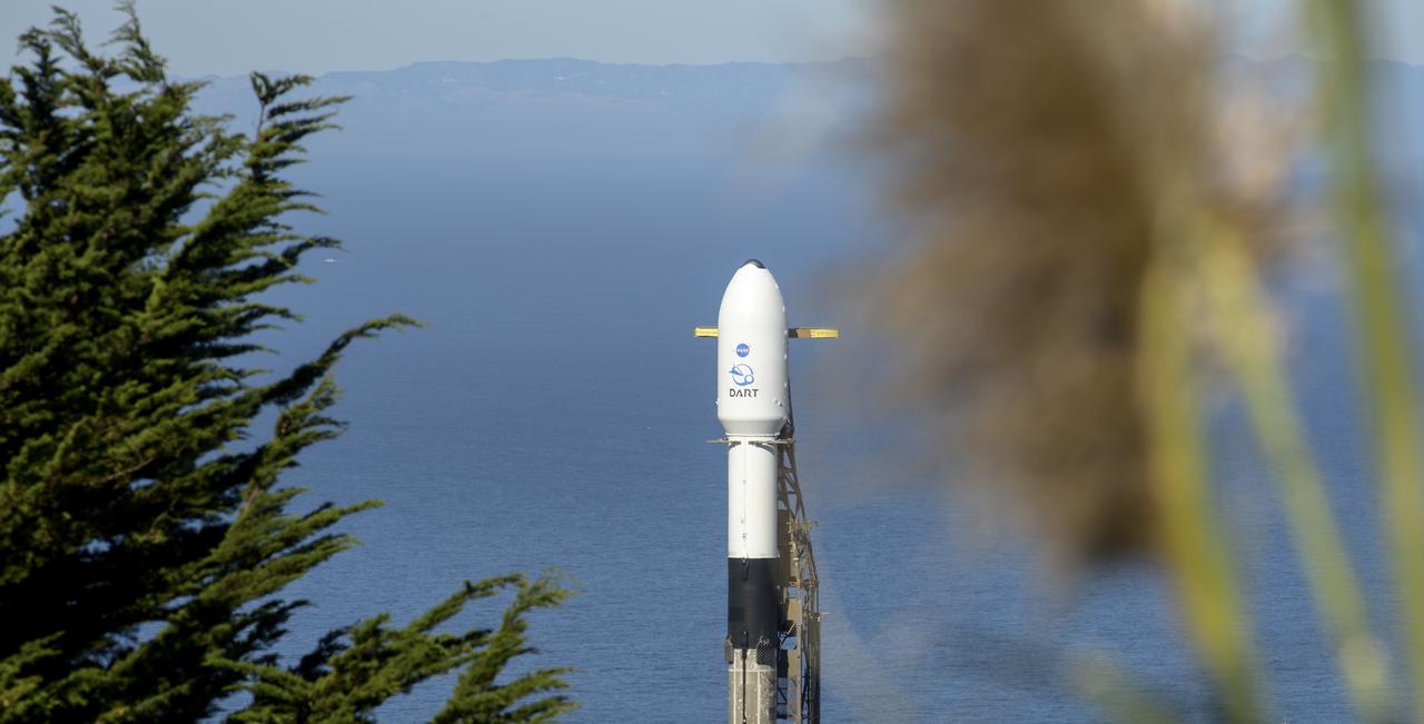
The SpaceX Falcon 9 rocket with the Double Asteroid Redirection Test, or DART, spacecraft onboard, is seen, Tuesday, Nov. 23, 2021, at Space Launch Complex 4E, Vandenberg Space Force Base in California. DART is the world’s first full-scale planetary defense test, demonstrating one method of asteroid deflection technology. The mission was built and is managed by Johns Hopkins APL for NASA’s Planetary Defense Coordination Office. Photo Credit: (NASA/Bill Ingalls)
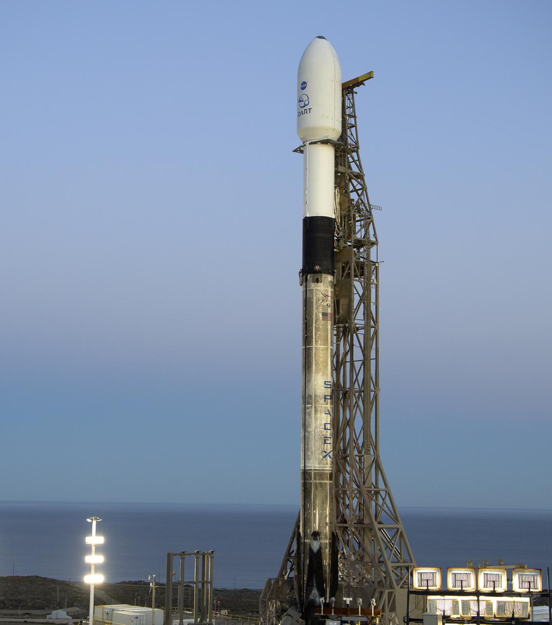
The SpaceX Falcon 9 rocket with the Double Asteroid Redirection Test, or DART, spacecraft onboard, is seen during sunrise, Tuesday, Nov. 23, 2021, at Space Launch Complex 4E, Vandenberg Space Force Base in California. DART is the world’s first full-scale planetary defense test, demonstrating one method of asteroid deflection technology. The mission was built and is managed by the Johns Hopkins APL for NASA’s Planetary Defense Coordination Office. Photo Credit: (NASA/Bill Ingalls)
The SpaceX Falcon 9 rocket with the Double Asteroid Redirection Test, or DART, spacecraft onboard, is seen during sunrise, Tuesday, Nov. 23, 2021, at Space Launch Complex 4E, Vandenberg Space Force Base in California. DART is the world’s first full-scale planetary defense test, demonstrating one method of asteroid deflection technology. The mission was built and is managed by the Johns Hopkins APL for NASA’s Planetary Defense Coordination Office. Photo Credit: (NASA/Bill Ingalls)
The SpaceX Falcon 9 rocket with the Double Asteroid Redirection Test, or DART, spacecraft onboard, is seen, Tuesday, Nov. 23, 2021, at Space Launch Complex 4E, Vandenberg Space Force Base in California. DART is the world’s first full-scale planetary defense test, demonstrating one method of asteroid deflection technology. The mission was built and is managed by Johns Hopkins APL for NASA’s Planetary Defense Coordination Office. Photo Credit: (NASA/Bill Ingalls)
The SpaceX Falcon 9 rocket with the Double Asteroid Redirection Test, or DART, spacecraft onboard, is seen ready for launch, Tuesday, Nov. 23, 2021, at Space Launch Complex 4E, Vandenberg Space Force Base in California. DART is the world’s first full-scale planetary defense test, demonstrating one method of asteroid deflection technology. The mission was built and is managed by Johns Hopkins APL for NASA’s Planetary Defense Coordination Office. Photo Credit: (NASA/Bill Ingalls)
The SpaceX Falcon 9 rocket with the Double Asteroid Redirection Test, or DART, spacecraft onboard, is seen during sunrise, Tuesday, Nov. 23, 2021, at Space Launch Complex 4E, Vandenberg Space Force Base in California. DART is the world’s first full-scale planetary defense test, demonstrating one method of asteroid deflection technology. The mission was built and is managed by the Johns Hopkins APL for NASA’s Planetary Defense Coordination Office. Photo Credit: (NASA/Bill Ingalls)
The SpaceX Falcon 9 rocket with the Double Asteroid Redirection Test, or DART, spacecraft onboard, is seen during sunrise, Tuesday, Nov. 23, 2021, at Space Launch Complex 4E, Vandenberg Space Force Base in California. DART is the world’s first full-scale planetary defense test, demonstrating one method of asteroid deflection technology. The mission was built and is managed by the Johns Hopkins APL for NASA’s Planetary Defense Coordination Office. Photo Credit: (NASA/Bill Ingalls)
The SpaceX Falcon 9 rocket with the Double Asteroid Redirection Test, or DART, spacecraft onboard, is seen during sunrise, Tuesday, Nov. 23, 2021, at Space Launch Complex 4E, Vandenberg Space Force Base in California. DART is the world’s first full-scale planetary defense test, demonstrating one method of asteroid deflection technology. The mission was built and is managed by the Johns Hopkins APL for NASA’s Planetary Defense Coordination Office. Photo Credit: (NASA/Bill Ingalls)
The SpaceX Falcon 9 rocket with the Double Asteroid Redirection Test, or DART, spacecraft onboard, is seen during sunrise, Tuesday, Nov. 23, 2021, at Space Launch Complex 4E, Vandenberg Space Force Base in California. DART is the world’s first full-scale planetary defense test, demonstrating one method of asteroid deflection technology. The mission was built and is managed by the Johns Hopkins APL for NASA’s Planetary Defense Coordination Office. Photo Credit: (NASA/Bill Ingalls)
The SpaceX Falcon 9 rocket with the Double Asteroid Redirection Test, or DART, spacecraft onboard, is seen during sunrise, Tuesday, Nov. 23, 2021, at Space Launch Complex 4E, Vandenberg Space Force Base in California. DART is the world’s first full-scale planetary defense test, demonstrating one method of asteroid deflection technology. The mission was built and is managed by the Johns Hopkins APL for NASA’s Planetary Defense Coordination Office. Photo Credit: (NASA/Bill Ingalls)

The SpaceX Falcon 9 rocket with the Double Asteroid Redirection Test, or DART, spacecraft onboard, is seen during sunrise, Tuesday, Nov. 23, 2021, at Space Launch Complex 4E, Vandenberg Space Force Base in California. DART is the world’s first full-scale planetary defense test, demonstrating one method of asteroid deflection technology. The mission was built and is managed by the Johns Hopkins APL for NASA’s Planetary Defense Coordination Office. Photo Credit: (NASA/Bill Ingalls)
The SpaceX Falcon 9 rocket with the Double Asteroid Redirection Test, or DART, spacecraft onboard, is seen during sunrise, Tuesday, Nov. 23, 2021, at Space Launch Complex 4E, Vandenberg Space Force Base in California. DART is the world’s first full-scale planetary defense test, demonstrating one method of asteroid deflection technology. The mission was built and is managed by the Johns Hopkins APL for NASA’s Planetary Defense Coordination Office. Photo Credit: (NASA/Bill Ingalls)
The SpaceX Falcon 9 rocket with the Double Asteroid Redirection Test, or DART, spacecraft onboard, is seen, Tuesday, Nov. 23, 2021, at Space Launch Complex 4E, Vandenberg Space Force Base in California. DART is the world’s first full-scale planetary defense test, demonstrating one method of asteroid deflection technology. The mission was built and is managed by Johns Hopkins APL for NASA’s Planetary Defense Coordination Office. Photo Credit: (NASA/Bill Ingalls)
The SpaceX Falcon 9 rocket with the Double Asteroid Redirection Test, or DART, spacecraft onboard, is seen during sunrise, Tuesday, Nov. 23, 2021, at Space Launch Complex 4E, Vandenberg Space Force Base in California. DART is the world’s first full-scale planetary defense test, demonstrating one method of asteroid deflection technology. The mission was built and is managed by the Johns Hopkins APL for NASA’s Planetary Defense Coordination Office. Photo Credit: (NASA/Bill Ingalls)
The SpaceX Falcon 9 rocket with the Double Asteroid Redirection Test, or DART, spacecraft onboard, is seen during sunrise, Tuesday, Nov. 23, 2021, at Space Launch Complex 4E, Vandenberg Space Force Base in California. DART is the world’s first full-scale planetary defense test, demonstrating one method of asteroid deflection technology. The mission was built and is managed by the Johns Hopkins APL for NASA’s Planetary Defense Coordination Office. Photo Credit: (NASA/Bill Ingalls)
The SpaceX Falcon 9 rocket with the Double Asteroid Redirection Test, or DART, spacecraft onboard, is seen, Tuesday, Nov. 23, 2021, at Space Launch Complex 4E, Vandenberg Space Force Base in California. DART is the world’s first full-scale planetary defense test, demonstrating one method of asteroid deflection technology. The mission was built and is managed by Johns Hopkins APL for NASA’s Planetary Defense Coordination Office. Photo Credit: (NASA/Bill Ingalls)
The SpaceX Falcon 9 rocket with the Double Asteroid Redirection Test, or DART, spacecraft onboard, is seen during sunrise, Tuesday, Nov. 23, 2021, at Space Launch Complex 4E, Vandenberg Space Force Base in California. DART is the world’s first full-scale planetary defense test, demonstrating one method of asteroid deflection technology. The mission was built and is managed by the Johns Hopkins APL for NASA’s Planetary Defense Coordination Office. Photo Credit: (NASA/Bill Ingalls)
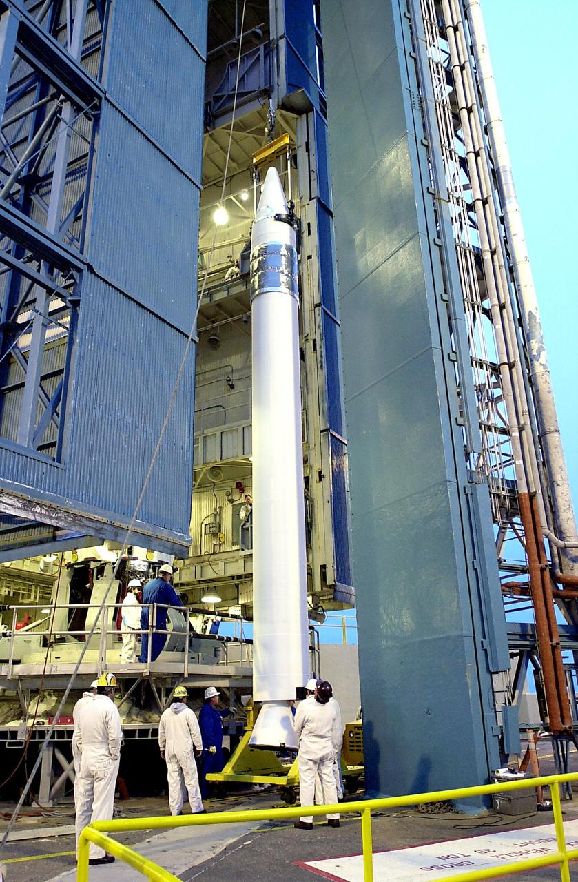
KENNEDY SPACE CENTER, FLA. - Workers at NASA's Space Launch Complex 2 (SLC-2) at Vandenberg Air Force Base, Calif., watch as the first stage of the Delta II rocket is raised to a vertical position. The rocket will carry the ICESat and CHIPSat satellites into Earth orbits. ICESat is a 661-pound satellite known as Geoscience Laser Altimeter System (GLAS) that will revolutionize our understanding of ice and its role in global climate change and how we protect and understand our home planet. It will help scientists determine if the global sea level is rising or falling. It will look at the ice sheets that blanket the Earth's poles to see if they are growing or shrinking. It will assist in developing an understanding of how changes in the Earth's atmosphere and climate effect polar ice masses and global sea level. CHIPSat, a suitcase-size 131-pound satellite, will provide invaluable information into the origin, physical processes and properties of the hot gas contained in the interstellar medium. This can provide important clues about the formation and evolution of galaxies since the interstellar medium literally contains the seeds of future stars. The Delta II launch is scheduled for Jan. 11 between 4:45 p.m. - 5:30 p.m. PST.
KENNEDY SPACE CENTER, FLA. - With the transporter moved from below, the first stage of the Delta II rocket is suspended in air waiting to be lifted up the tower on NASA's Space Launch Complex 2 (SLC-2), Vandenberg Air Force Base, Calif. The rocket will carry the ICESat and CHIPSat satellites into Earth orbits. ICESat is a 661-pound satellite known as Geoscience Laser Altimeter System (GLAS) that will revolutionize our understanding of ice and its role in global climate change and how we protect and understand our home planet. It will help scientists determine if the global sea level is rising or falling. It will look at the ice sheets that blanket the Earth's poles to see if they are growing or shrinking. It will assist in developing an understanding of how changes in the Earth's atmosphere and climate effect polar ice masses and global sea level. CHIPSat, a suitcase-size 131-pound satellite, will provide invaluable information into the origin, physical processes and properties of the hot gas contained in the interstellar medium. This can provide important clues about the formation and evolution of galaxies since the interstellar medium literally contains the seeds of future stars. The Delta II launch is scheduled for Jan. 11 between 4:45 p.m. - 5:30 p.m. PST.
KENNEDY SPACE CENTER, FLA. - Workers on the launch tower on NASA's Space Launch Complex 2 (SLC-2), Vandenberg Air Force Base, Calif., help guide the interstage of the Delta II rocket into position for mating with the first stage. The rocket will carry the ICESat and CHIPSat satellites into Earth orbits. ICESat is a 661-pound satellite known as Geoscience Laser Altimeter System (GLAS) that will revolutionize our understanding of ice and its role in global climate change and how we protect and understand our home planet. It will help scientists determine if the global sea level is rising or falling. It will look at the ice sheets that blanket the Earth's poles to see if they are growing or shrinking. It will assist in developing an understanding of how changes in the Earth's atmosphere and climate effect polar ice masses and global sea level. CHIPSat, a suitcase-size 131-pound satellite, will provide invaluable information into the origin, physical processes and properties of the hot gas contained in the interstellar medium. This can provide important clues about the formation and evolution of galaxies since the interstellar medium literally contains the seeds of future stars. The Delta II launch is scheduled for Jan. 11 between 4:45 p.m. - 5:30 p.m. PST.
KENNEDY SPACE CENTER, FLA. - Workers on the launch tower on NASA's Space Launch Complex 2 (SLC-2), Vandenberg Air Force Base, Calif., help guide the interstage of the Delta II rocket into position for mating with the first stage. The rocket will carry the ICESat and CHIPSat satellites into Earth orbits. ICESat is a 661-pound satellite known as Geoscience Laser Altimeter System (GLAS) that will revolutionize our understanding of ice and its role in global climate change and how we protect and understand our home planet. It will help scientists determine if the global sea level is rising or falling. It will look at the ice sheets that blanket the Earth's poles to see if they are growing or shrinking. It will assist in developing an understanding of how changes in the Earth's atmosphere and climate effect polar ice masses and global sea level. CHIPSat, a suitcase-size 131-pound satellite, will provide invaluable information into the origin, physical processes and properties of the hot gas contained in the interstellar medium. This can provide important clues about the formation and evolution of galaxies since the interstellar medium literally contains the seeds of future stars. The Delta II launch is scheduled for Jan. 11 between 4:45 p.m. - 5:30 p.m. PST.
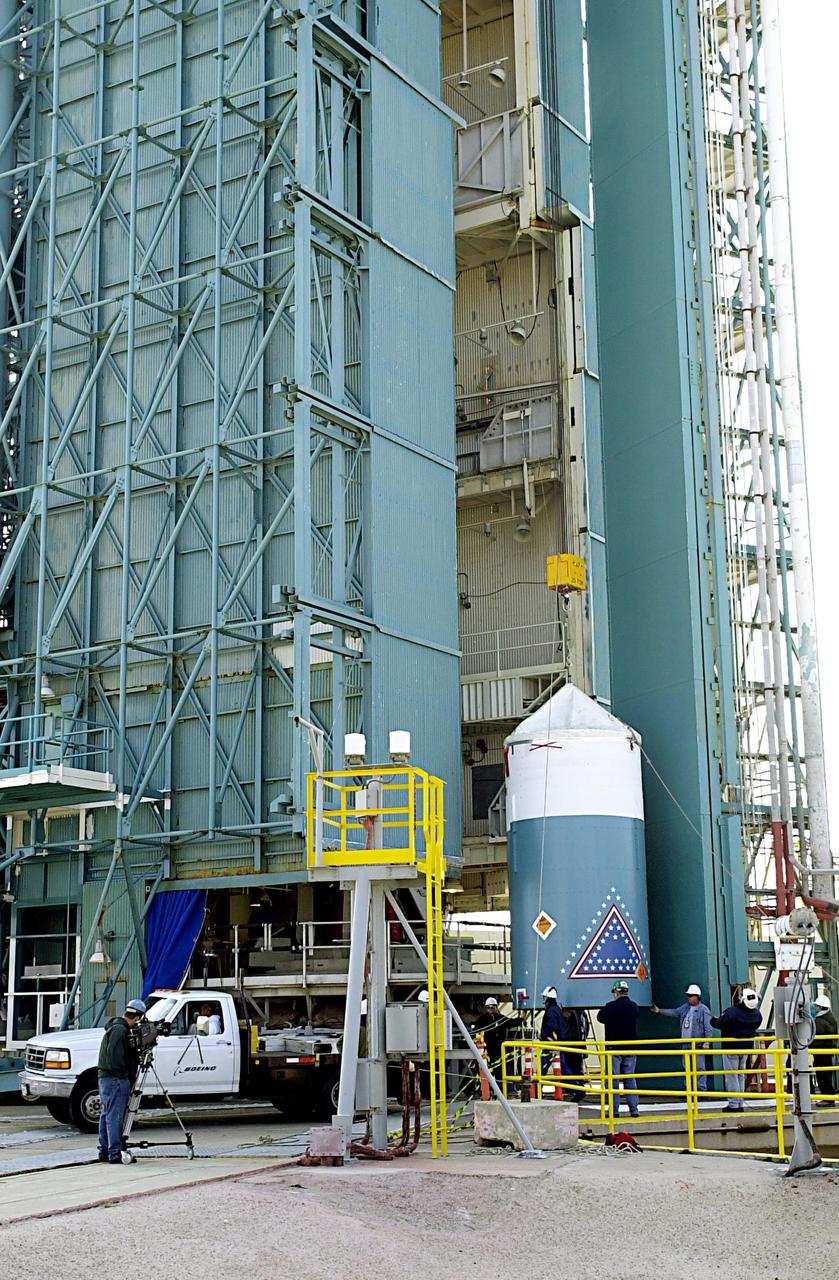
KENNEDY SPACE CENTER, FLA. - A second stage is lifted at NASA's Space Launch Complex 2 (SLC-2) at Vandenberg Air Force Base, Calif., for placement atop a Delta II rocket. The rocket will carry the ICESat and CHIPSat satellites into Earth orbits. The Ice, Cloud, and Land Elevation Satellite, or ICESat, is a 661-pound satellite carrying the Geoscience Laser Altimeter System (GLAS) that will revolutionize our understanding of ice and its role in global climate change and how we protect and understand our home planet. It will help scientists determine if the global sea level is rising or falling. It will look at the ice sheets that blanket the Earth's poles to see if they are growing or shrinking. It will assist in developing an understanding of how changes in the Earth's atmosphere and climate effect polar ice masses and global sea level. The Cosmic Hot Interstellar Plasma Spectrometer, or CHIPSat, a suitcase-size 131-pound satellite, will provide invaluable information into the origin, physical processes and properties of the hot gas contained in the interstellar medium. This can provide important clues about the formation and evolution of galaxies since the interstellar medium literally contains the seeds of future stars. The Delta II launch is scheduled for Jan. 11, 2003, between 4:45 p.m. - 5:30 p.m. PST.
KENNEDY SPACE CENTER, FLA. - The interstage of the Delta II rocket arrives at NASA's Space Launch Complex 2 (SLC-2), Vandenberg Air Force Base, Calif. The rocket will carry the ICESat and CHIPSat satellites into Earth orbits. ICESat is a 661-pound satellite known as Geoscience Laser Altimeter System (GLAS) that will revolutionize our understanding of ice and its role in global climate change and how we protect and understand our home planet. It will help scientists determine if the global sea level is rising or falling. It will look at the ice sheets that blanket the Earth's poles to see if they are growing or shrinking. It will assist in developing an understanding of how changes in the Earth's atmosphere and climate effect polar ice masses and global sea level. CHIPSat, a suitcase-size 131-pound satellite, will provide invaluable information into the origin, physical processes and properties of the hot gas contained in the interstellar medium. This can provide important clues about the formation and evolution of galaxies since the interstellar medium literally contains the seeds of future stars. The Delta II launch is scheduled for Jan. 11 between 4:45 p.m. - 5:30 p.m. PST.
KENNEDY SPACE CENTER, FLA. - The first stage of the Delta II rocket is moved into place in the tower on NASA's Space Launch Complex 2 (SLC-2), Vandenberg Air Force Base, Calif. The rocket will carry the ICESat and CHIPSat satellites into Earth orbits. ICESat is a 661-pound satellite known as Geoscience Laser Altimeter System (GLAS) that will revolutionize our understanding of ice and its role in global climate change and how we protect and understand our home planet. It will help scientists determine if the global sea level is rising or falling. It will look at the ice sheets that blanket the Earth's poles to see if they are growing or shrinking. It will assist in developing an understanding of how changes in the Earth's atmosphere and climate effect polar ice masses and global sea level. CHIPSat, a suitcase-size 131-pound satellite, will provide invaluable information into the origin, physical processes and properties of the hot gas contained in the interstellar medium. This can provide important clues about the formation and evolution of galaxies since the interstellar medium literally contains the seeds of future stars. The Delta II launch is scheduled for Jan. 11 between 4:45 p.m. - 5:30 p.m. PST.
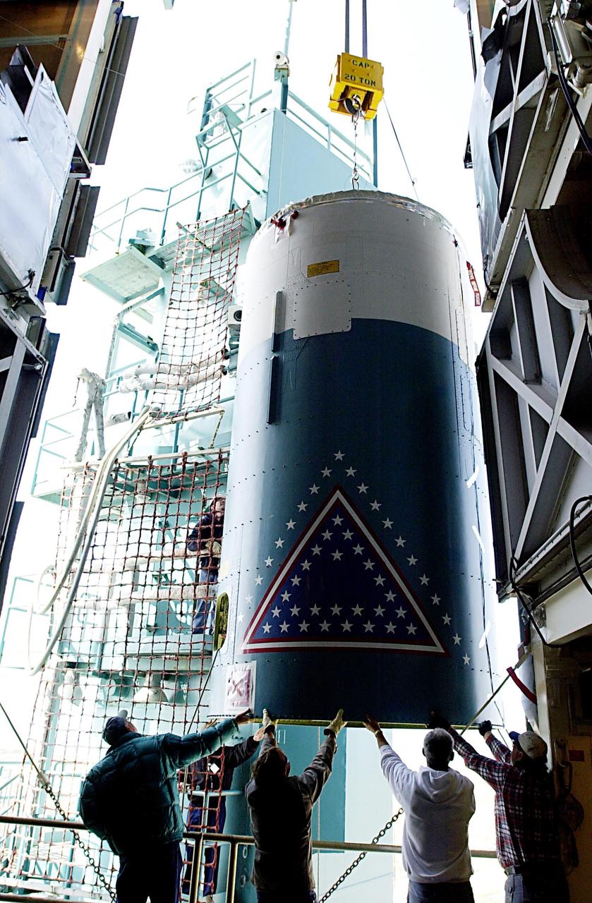
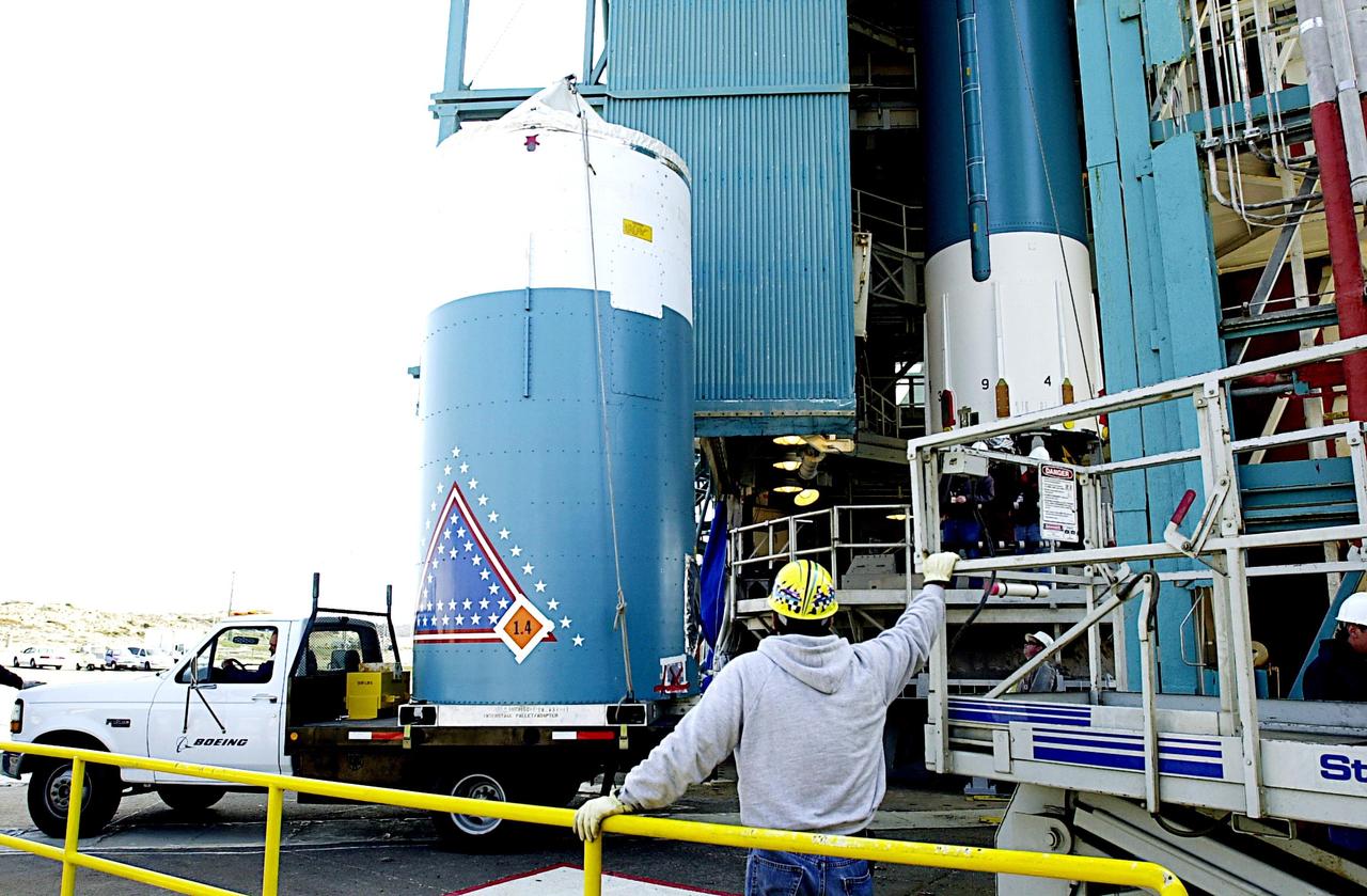
KENNEDY SPACE CENTER, FLA. - On the launch tower on NASA's Space Launch Complex 2 (SLC-2), Vandenberg Air Force Base, Calif., a solid rocket booster is lifted into an upright position as preparations continue to mate it to a Delta II rocket. The rocket will carry the ICESat and CHIPSat satellites into Earth orbits. ICESat is a 661-pound satellite known as Geoscience Laser Altimeter System (GLAS) that will revolutionize our understanding of ice and its role in global climate change and how we protect and understand our home planet. It will help scientists determine if the global sea level is rising or falling. It will look at the ice sheets that blanket the Earth's poles to see if they are growing or shrinking. It will assist in developing an understanding of how changes in the Earth's atmosphere and climate effect polar ice masses and global sea level. CHIPSat, a suitcase-size 131-pound satellite, will provide invaluable information into the origin, physical processes and properties of the hot gas contained in the interstellar medium. This can provide important clues about the formation and evolution of galaxies since the interstellar medium literally contains the seeds of future stars. The Delta II launch is scheduled for Jan. 11 between 4:45 p.m. - 5:30 p.m. PST.
KENNEDY SPACE CENTER, FLA. - Workers at the base of the launch tower on NASA's Space Launch Complex 2 (SLC-2), Vandenberg Air Force Base, Calif., watch as the interstage of the Delta II rocket is lifted up the tower. The interstage will eventually house the second stage and will be mated with the first stage. The rocket will carry the ICESat and CHIPSat satellites into Earth orbits. ICESat is a 661-pound satellite known as Geoscience Laser Altimeter System (GLAS) that will revolutionize our understanding of ice and its role in global climate change and how we protect and understand our home planet. It will help scientists determine if the global sea level is rising or falling. It will look at the ice sheets that blanket the Earth's poles to see if they are growing or shrinking. It will assist in developing an understanding of how changes in the Earth's atmosphere and climate effect polar ice masses and global sea level. CHIPSat, a suitcase-size 131-pound satellite, will provide invaluable information into the origin, physical processes and properties of the hot gas contained in the interstellar medium. This can provide important clues about the formation and evolution of galaxies since the interstellar medium literally contains the seeds of future stars. The Delta II launch is scheduled for Jan. 11 between 4:45 p.m. - 5:30 p.m. PST.
KENNEDY SPACE CENTER, FLA. - A second stage is inserted into an interstage atop a Delta II rocket at NASA's Space Launch Complex 2 (SLC-2) at Vandenberg Air Force Base, Calif. The rocket will carry the ICESat and CHIPSat satellites into Earth orbits. The Ice, Cloud, and Land Elevation Satellite, or ICESat, is a 661-pound satellite carrying the Geoscience Laser Altimeter System (GLAS) that will revolutionize our understanding of ice and its role in global climate change and how we protect and understand our home planet. It will help scientists determine if the global sea level is rising or falling. It will look at the ice sheets that blanket the Earth's poles to see if they are growing or shrinking. It will assist in developing an understanding of how changes in the Earth's atmosphere and climate effect polar ice masses and global sea level. The Cosmic Hot Interstellar Plasma Spectrometer, or CHIPSat, a suitcase-size 131-pound satellite, will provide invaluable information into the origin, physical processes and properties of the hot gas contained in the interstellar medium. This can provide important clues about the formation and evolution of galaxies since the interstellar medium literally contains the seeds of future stars. The Delta II launch is scheduled for Jan. 11, 2003, between 4:45 p.m. - 5:30 p.m. PST.
KENNEDY SPACE CENTER, FLA. - Workers check the lower end of the first stage of the Delta II rocket before it is lifted up the tower on NASA's Space Launch Complex 2 (SLC-2), Vandenberg Air Force Base, Calif. The rocket will carry the ICESat and CHIPSat satellites into Earth orbits. ICESat is a 661-pound satellite known as Geoscience Laser Altimeter System (GLAS) that will revolutionize our understanding of ice and its role in global climate change and how we protect and understand our home planet. It will help scientists determine if the global sea level is rising or falling. It will look at the ice sheets that blanket the Earth's poles to see if they are growing or shrinking. It will assist in developing an understanding of how changes in the Earth's atmosphere and climate effect polar ice masses and global sea level. CHIPSat, a suitcase-size 131-pound satellite, will provide invaluable information into the origin, physical processes and properties of the hot gas contained in the interstellar medium. This can provide important clues about the formation and evolution of galaxies since the interstellar medium literally contains the seeds of future stars. The Delta II launch is scheduled for Jan. 11 between 4:45 p.m. - 5:30 p.m. PST.
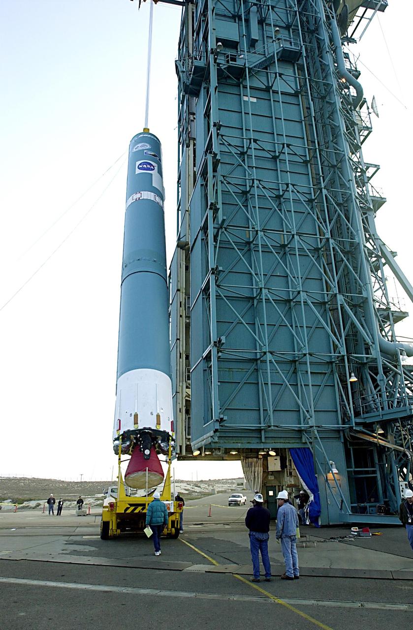
KENNEDY SPACE CENTER, FLA. - The first stage of the Delta II rocket is raised to a vertical position at NASA's Space Launch Complex 2 (SLC-2) at Vandenberg Air Force Base, Calif. The rocket will carry the ICESat and CHIPSat satellites into Earth orbits. ICESat is a 661-pound satellite known as Geoscience Laser Altimeter System (GLAS) that will revolutionize our understanding of ice and its role in global climate change and how we protect and understand our home planet. It will help scientists determine if the global sea level is rising or falling. It will look at the ice sheets that blanket the Earth's poles to see if they are growing or shrinking. It will assist in developing an understanding of how changes in the Earth's atmosphere and climate effect polar ice masses and global sea level. CHIPSat, a suitcase-size 131-pound satellite, will provide invaluable information into the origin, physical processes and properties of the hot gas contained in the interstellar medium. This can provide important clues about the formation and evolution of galaxies since the interstellar medium literally contains the seeds of future stars. The Delta II launch is scheduled for Jan. 11 between 4:45 p.m. - 5:30 p.m. PST.
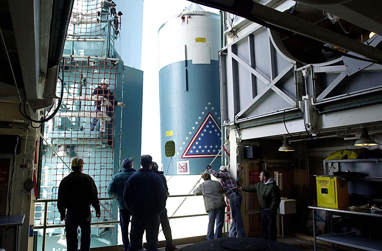
KENNEDY SPACE CENTER, FLA. - Workers on the launch tower on NASA's Space Launch Complex 2 (SLC-2), Vandenberg Air Force Base, Calif., watch as the interstage of the Delta II rocket is lifted to a level where it can be mated with the first stage. The rocket will carry the ICESat and CHIPSat satellites into Earth orbits. ICESat is a 661-pound satellite known as Geoscience Laser Altimeter System (GLAS) that will revolutionize our understanding of ice and its role in global climate change and how we protect and understand our home planet. It will help scientists determine if the global sea level is rising or falling. It will look at the ice sheets that blanket the Earth's poles to see if they are growing or shrinking. It will assist in developing an understanding of how changes in the Earth's atmosphere and climate effect polar ice masses and global sea level. CHIPSat, a suitcase-size 131-pound satellite, will provide invaluable information into the origin, physical processes and properties of the hot gas contained in the interstellar medium. This can provide important clues about the formation and evolution of galaxies since the interstellar medium literally contains the seeds of future stars. The Delta II launch is scheduled for Jan. 11 between 4:45 p.m. - 5:30 p.m. PST.
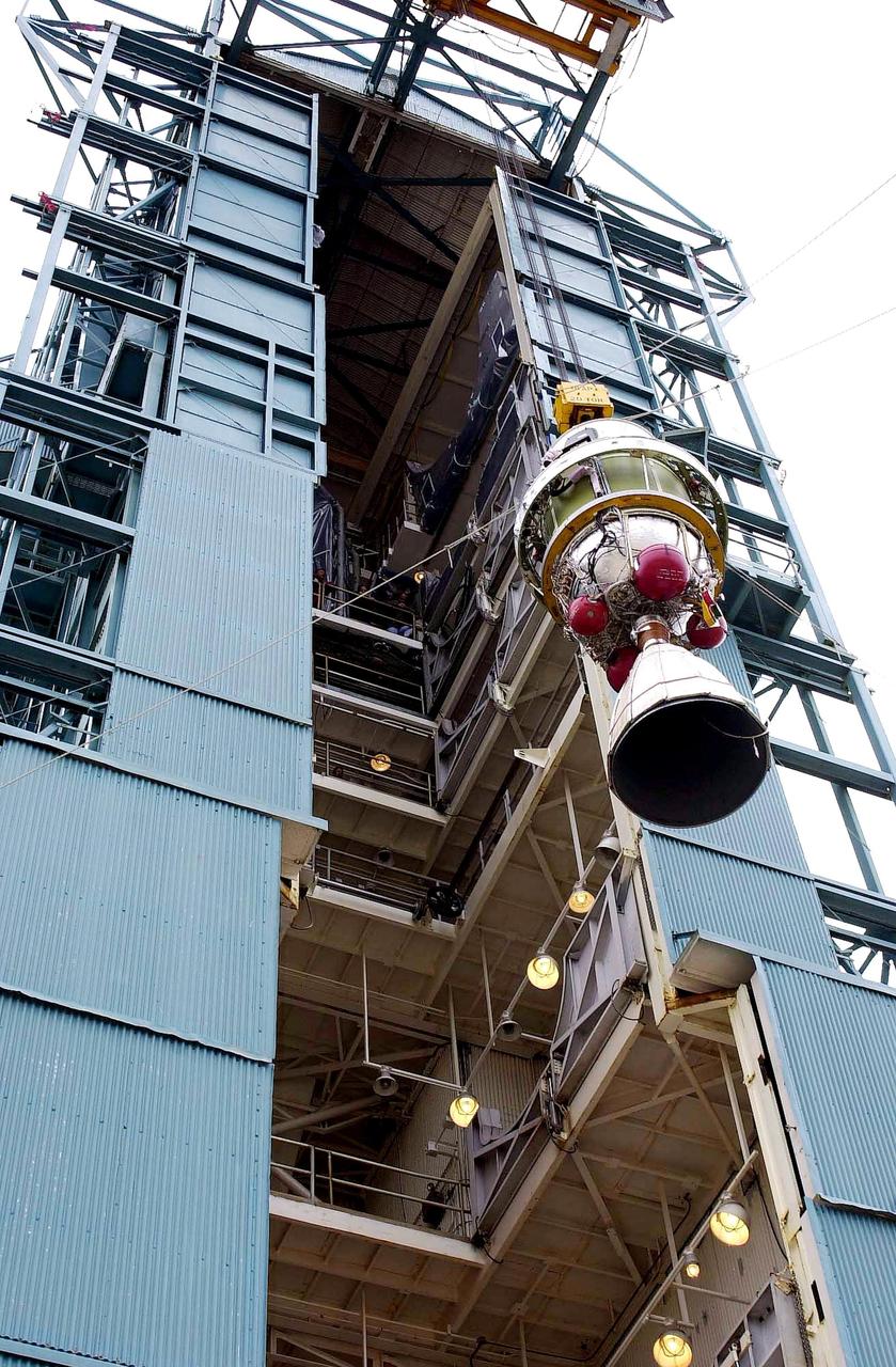
KENNEDY SPACE CENTER, FLA. - On NASA's Space Launch Complex 2 (SLC-2), Vandenberg Air Force Base, Calif., the interstage of the Delta II rocket is ready to be lifted up the tower for mating with the first stage (seen behind it). The rocket will carry the ICESat and CHIPSat satellites into Earth orbits. ICESat is a 661-pound satellite known as Geoscience Laser Altimeter System (GLAS) that will revolutionize our understanding of ice and its role in global climate change and how we protect and understand our home planet. It will help scientists determine if the global sea level is rising or falling. It will look at the ice sheets that blanket the Earth's poles to see if they are growing or shrinking. It will assist in developing an understanding of how changes in the Earth's atmosphere and climate effect polar ice masses and global sea level. CHIPSat, a suitcase-size 131-pound satellite, will provide invaluable information into the origin, physical processes and properties of the hot gas contained in the interstellar medium. This can provide important clues about the formation and evolution of galaxies since the interstellar medium literally contains the seeds of future stars. The Delta II launch is scheduled for Jan. 11 between 4:45 p.m. - 5:30 p.m. PST.
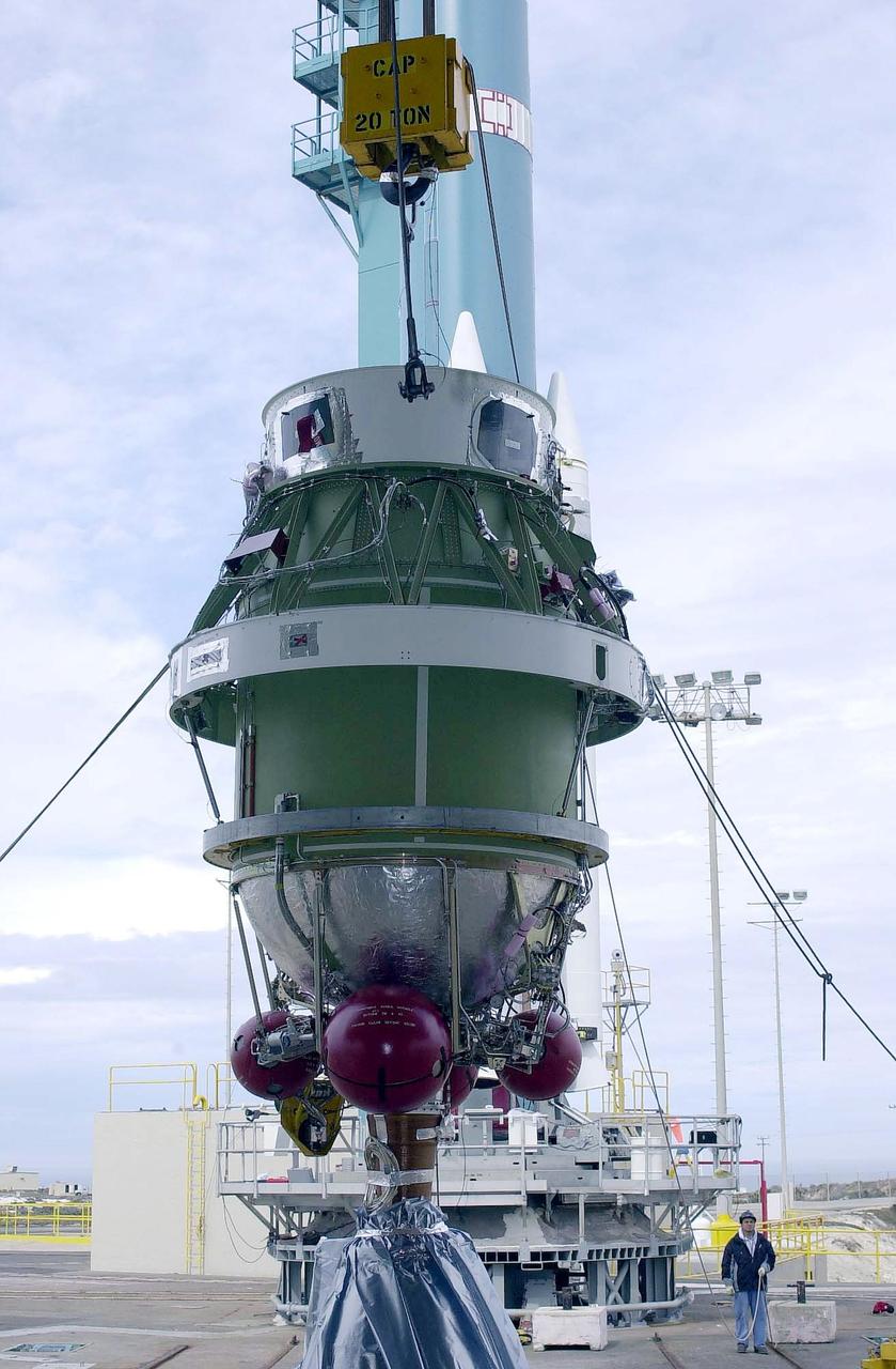
KENNEDY SPACE CENTER, FLA. - A second stage is lifted at NASA's Space Launch Complex 2 (SLC-2) at Vandenberg Air Force Base, Calif., for placement on a Delta II rocket The rocket will carry the ICESat and CHIPSat satellites into Earth orbits. The Ice, Cloud, and Land Elevation Satellite, or ICESat, is a 661-pound satellite carrying the Geoscience Laser Altimeter System (GLAS) that will revolutionize our understanding of ice and its role in global climate change and how we protect and understand our home planet. It will help scientists determine if the global sea level is rising or falling. It will look at the ice sheets that blanket the Earth's poles to see if they are growing or shrinking. It will assist in developing an understanding of how changes in the Earth's atmosphere and climate effect polar ice masses and global sea level. The Cosmic Hot Interstellar Plasma Spectrometer, or CHIPSat, a suitcase-size 131-pound satellite, will provide invaluable information into the origin, physical processes and properties of the hot gas contained in the interstellar medium. This can provide important clues about the formation and evolution of galaxies since the interstellar medium literally contains the seeds of future stars. The Delta II launch is scheduled for Jan. 11, 2003, between 4:45 p.m. - 5:30 p.m. PST.
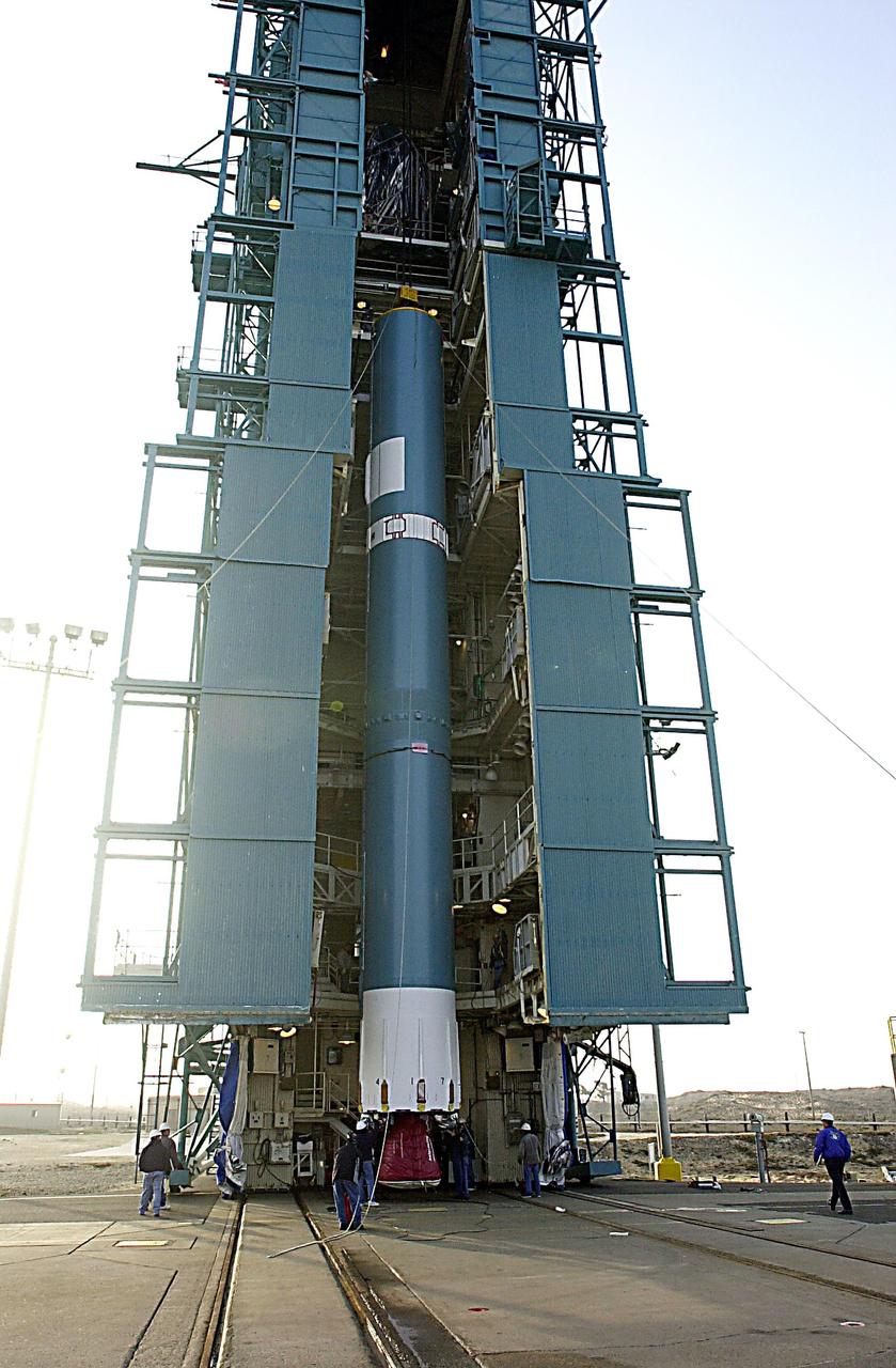
KENNEDY SPACE CENTER, FLA. - The first stage of the Delta II rocket is ready to be lifted up the tower on NASA's Space Launch Complex 2 (SLC-2), Vandenberg Air Force Base, Calif. The rocket will carry the ICESat and CHIPSat satellites into Earth orbits. ICESat is a 661-pound satellite known as Geoscience Laser Altimeter System (GLAS) that will revolutionize our understanding of ice and its role in global climate change and how we protect and understand our home planet. It will help scientists determine if the global sea level is rising or falling. It will look at the ice sheets that blanket the Earth's poles to see if they are growing or shrinking. It will assist in developing an understanding of how changes in the Earth's atmosphere and climate effect polar ice masses and global sea level. CHIPSat, a suitcase-size 131-pound satellite, will provide invaluable information into the origin, physical processes and properties of the hot gas contained in the interstellar medium. This can provide important clues about the formation and evolution of galaxies since the interstellar medium literally contains the seeds of future stars. The Delta II launch is scheduled for Jan. 11 between 4:45 p.m. - 5:30 p.m. PST.