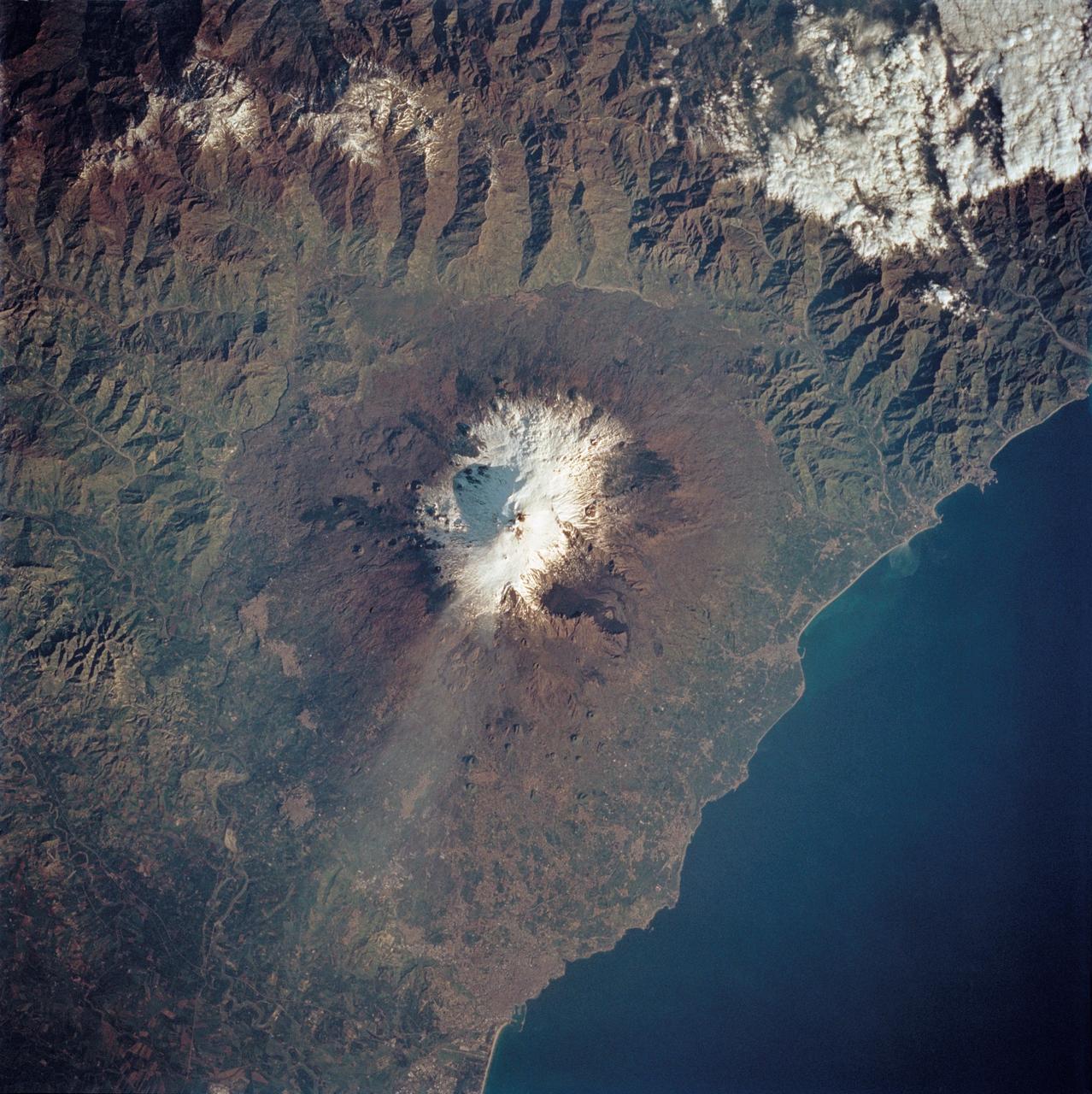
STS062-85-195 (4-18 March 1994) --- A thin plume of steam blows southward from the summit of Mt. Etna, the active volcano on the island of Sicily. The summit is capped with snow but the dark lava flow along the eastern flank (the 1991-93 flow) is clearly visible. The coastal city south of Etna is Catania.
STS058-72-004 (18 Oct-1 Nov 1993) --- The Sierra Nevada Mountain Range can be seen in this north-looking high oblique view taken in October, 1993, by the STS-58 crew. Visible in the view to the west of the Sierra Nevada are the San Joaquin and Sacramento Valleys of central California. The San Francisco/Oakland Bay Area can be seen to the west of the valley at the extreme left of the photograph. To the east or right of the Sierra Nevada, the basin and Range Region of central and northern Nevada is visible. Mono Lake, Lake Tahoe and Pyramid Lake are also visible in this scene. The long northwest/southeast trending Walker Lane Shear Zone, which lies just to the east (right) of the Sierra Nevada is also visible. Near the top of the view (near the horizon), the snow covered volcanic peak Mount Shasta can be seen. Over 645 kilometers (400 miles) long and from 65 to 130 kilometers (40 to 80 miles) wide, the Sierra Nevada have many peaks in excess of 3,300 meters (11,000 feet) above sea level. A titled fault block in structure (the largest in the United States) and shaped by glaciers during the last ice age over 12,000 years ago, the Sierra Nevada eastern front rises sharply from the Great Basin of Nevada, while its western slope descends gradually to the hills bordering the Central Valley of California. Snow-fed streams supply much of the irrigation water to the Central Valley and to western Nevada and also generate hydroelectricity. Recent above normal precipitation (snowfall) of the last two years has helped in alleviating the drought conditions that had prevailed throughout most of California in the mid and late 1980's and early 1990's.
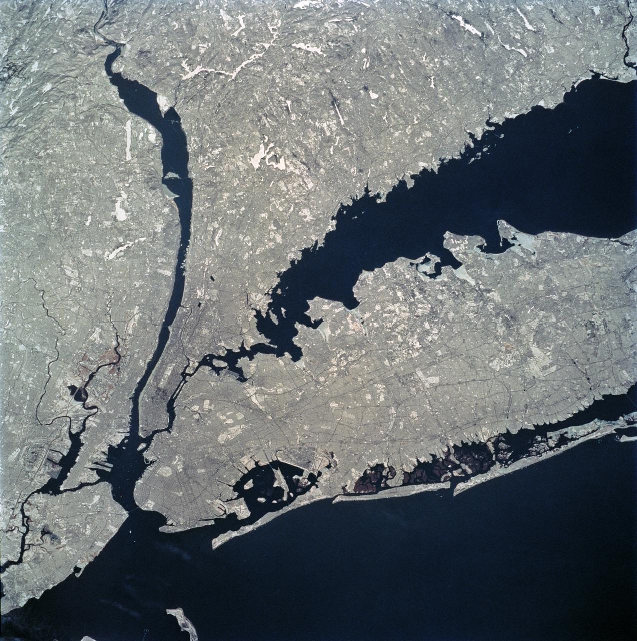
STS062-81-010 (4-18 March 1994) --- The recent heavy snowfalls help to accentuate the major transportation networks, (railroads, highways and airports), throughout the New York City metropolitan area. This particular scene also highlights the land-water boundaries and the lighter open spaces, such as parks, cemeteries and recreational areas. The snows have produced a white blanket effect on these areas. Even some of the snow-covered lakes can be discerned. The boroughs of Staten Island, Brooklyn, Queens, The Bronx and Manhattan are also recognizable on the photograph.
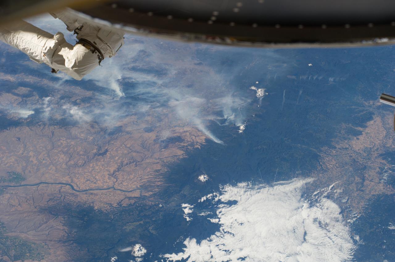
ISS040-E-070412 (19 July 2014) --- One of the Expedition 40 crew members aboard the Earth-orbiting International Space Station recorded this July 19 panorama featuring wildfires which are plaguing the Northwest and causing widespread destruction. (Note: south is at the top of the frame). The orbital outpost was flying 223 nautical miles above Earth at the time of the photo. Parts of Oregon and Washington are included in the scene. Mt. Jefferson, Three Sisters and Mt. St. Helens are all snow-capped and visible in the photo, and the Columbia River can also be delineated.
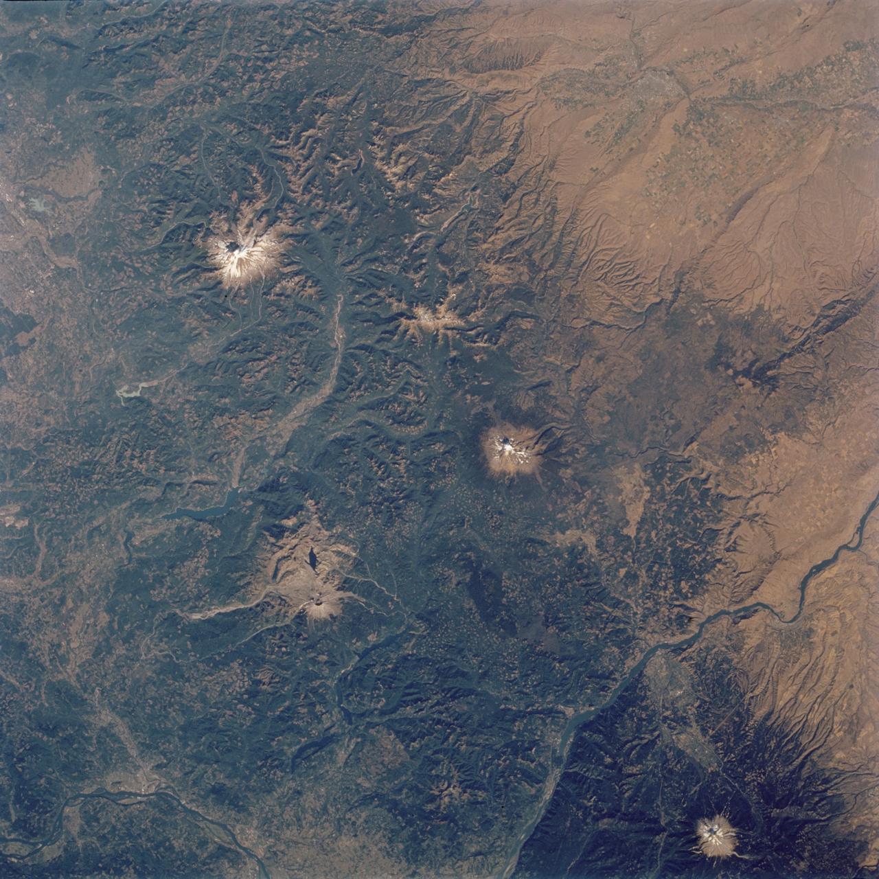
STS112-704-142 (7-18 October 2002) --- (For orientation purposes, north is toward the top left corner). Green colors of the forests of the Cascade Mountains dominate this view, photographed from the Earth-orbiting Space Shuttle Atlantis. Browner colors (top right) are the semiarid plains of the Columbia Basin, in the rain shadow of the Cascades. The highest peaks in this part of the Cascades are four volcanoes. The amount of snow is a good indication of their altitude. The highest is Mt. Rainier (14,410 feet) with the greatest amount of white snow (top left). Seattle lies immediately downslope (top left margin). Mt. Adams (12,276) lies due south in the middle of the view. Mt. Hood (11,235 feet) in the lower right corner, lies south of the great gorge of the Columbia River (which crosses the lower right and then the lower left corners of the view). The river flows broadly west (left) to the Pacific Ocean (out of the picture left). Mt. St Helens (8,364 feet), the snow-free brown patch lower left, was too low to retain snow after the recent fall. According to geologists studying the STS-112 photography, even from the altitude of the Space Shuttle, the intact south half of the cone can be discerned. The geologists point out that the famous blast of 1980 not only destroyed the north side of the cone but blew down the green forest for many square miles on the north side (brown signature).
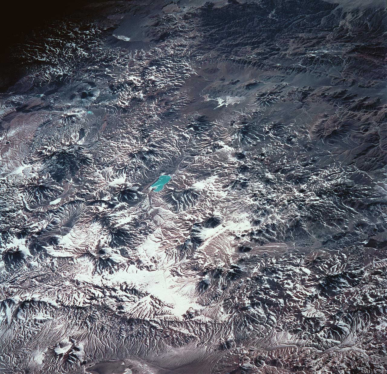
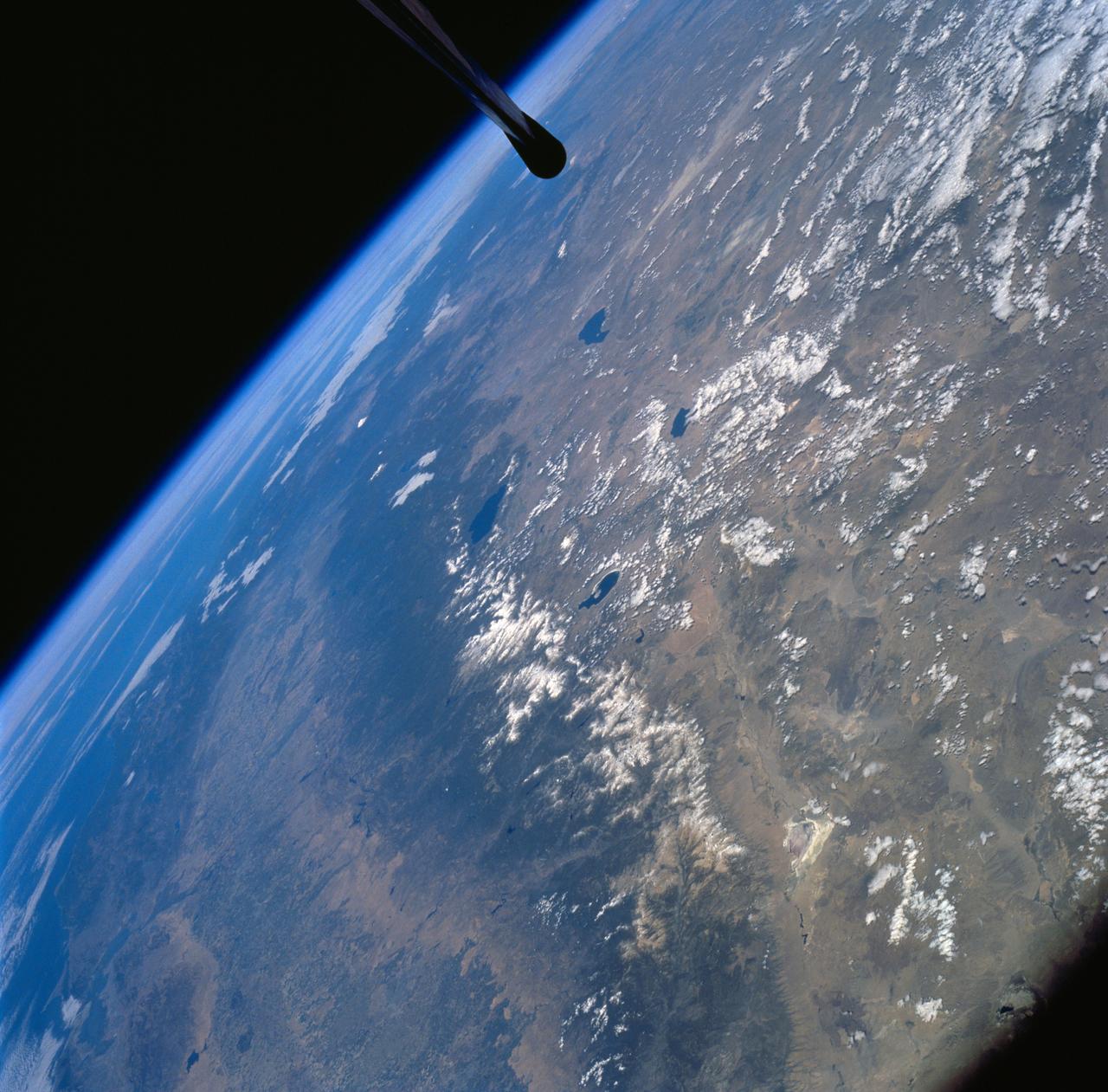
STS093-704-087 (23-27 July 1999) --- This low angle, early morning shot over Chile was photographed from the Earth-orbiting Space Shuttle Columbia during the STS-93 mission. In the words of one of the scientists studying the STS-93 Earth imagery, Laguna Verde, in the Atacama Province of Chile (near the Argentine border), lies like a turquoise jewel among the stark black and white snow covered volcanic peaks of the High Andes. The ambient elevation in this part of the Andes is 16,000 feet (4,877 meters) with the highest local peak, Nevada Ojas de Salado (just to the right of the lake), reaching to 23,240 feet. (7084 meters.)