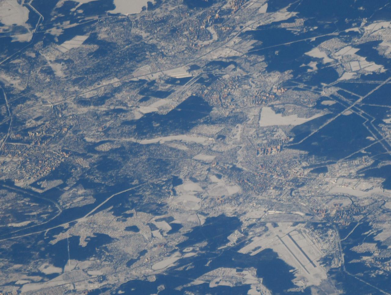
iss064e029481 (Feb. 8, 2021) --- An icy, snow-covered northeast Moscow is pictured from the International Space Station as it orbited 264 miles above Russia. Credit: Roscosmos
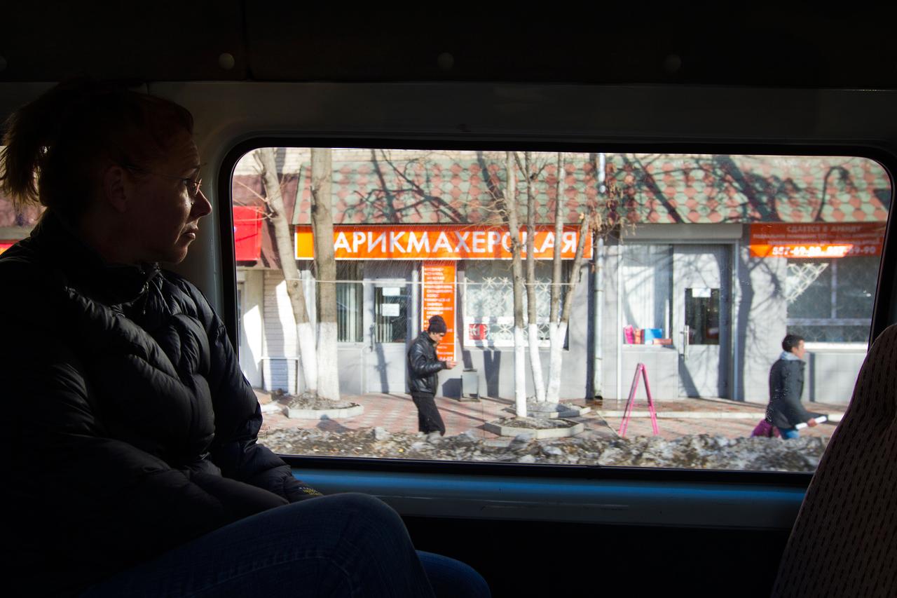
JSC2011-E-040323 (29 March 2011) --- NASA astronaut Sandy Magnus, STS-135 mission specialist, looks at a snow-covered neighborhood out the window of a van carrying her back to Star City following a fit check of her Sokol spacesuit at the Zvezda facility in Moscow March 29, 2011. The crew of the final shuttle mission traveled to Moscow for a suit fit check of their Russian spacesuits which would be required in the event of an emergency. Photo credit: NASA Photo/Houston Chronicle, Smiley N. Pool
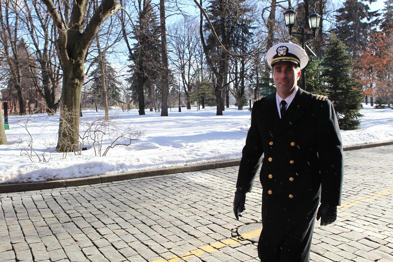
With a few snow flurries falling on an otherwise sunny day, Expedition 35-36 Flight Engineer Chris Cassidy of NASA walked through the grounds of the Kremlin in Moscow March 7 during a traditional tour of the Kremlin and Red Square. Cassidy, Soyuz Commander Pavel Vinogradov and Flight Engineer Alexander Misurkin are preparing for launch to the International Space Station March 29, Kazakh time, in their Soyuz TMA-08M spacecraft from the Baikonur Cosmodrome in Kazakhstan. NASA / Stephanie Stoll
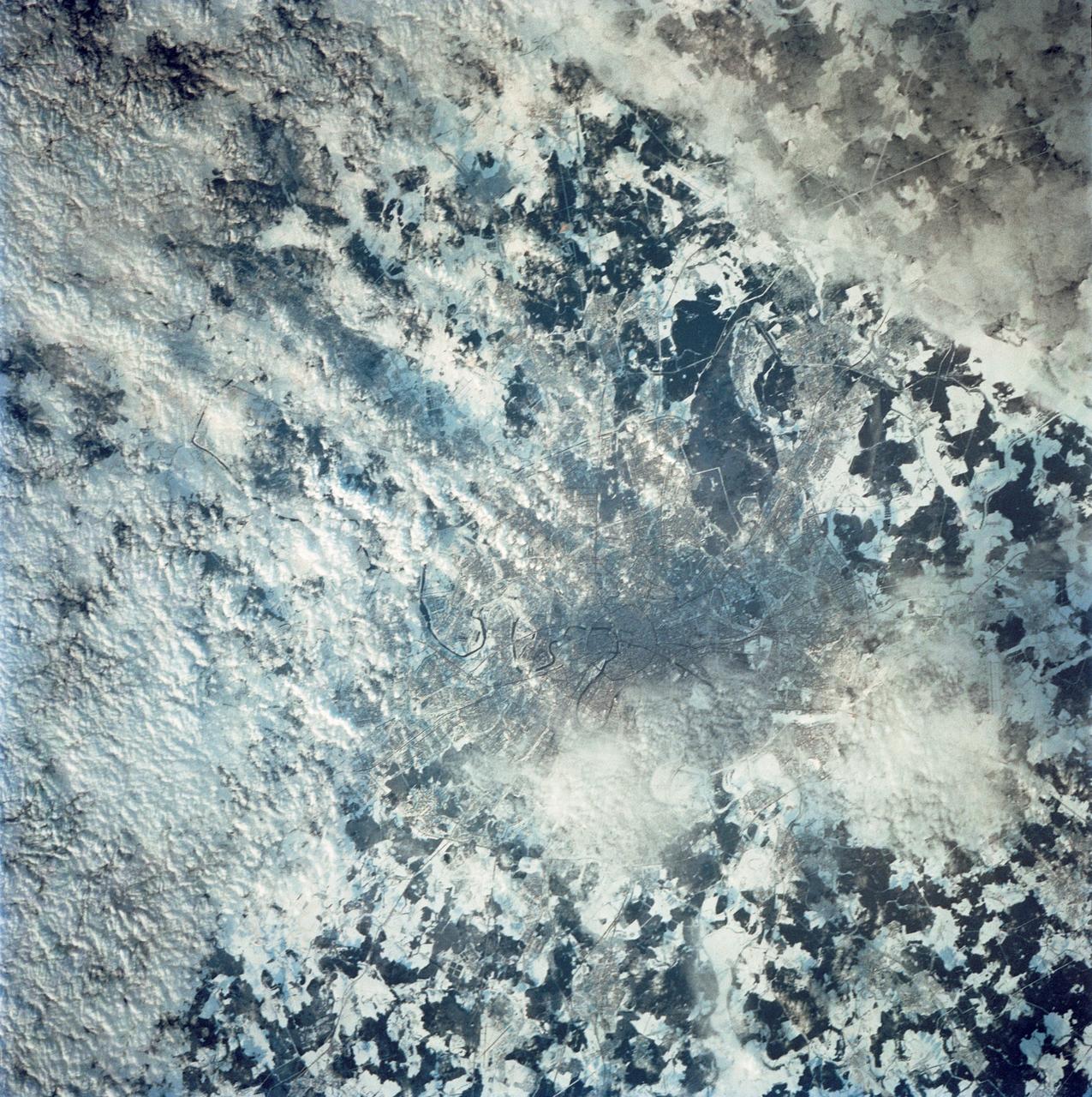
STS042-80-000AV (22-30 Jan. 1992) --- Moscow is arranged as a series of concentric transportation routes crossed by straight spokes which lead away from the Kremlin at the city center. One of the inner rings, the Garden Ring, follows the line of the Sixteenth Century city wall and moat. Both this and the outer ring of the Moscow Circular Motorway can be seen. The Kremlin, established in the Twelfth Century, lies on the north bank of the winding Moskva River. Very large high-rise buildings were erected after World War II. Clusters of these produce a coarser pattern and can be detected at two points within the outer ring road. Of the five airports surrounding the city, Vnukovo Airport to the south is easily distinguished, and Sheremetyevo to the west can also be delineated. The once-secret Ramenskoye Airport, with the longest runways in the world, lies under clouds to the northeast.
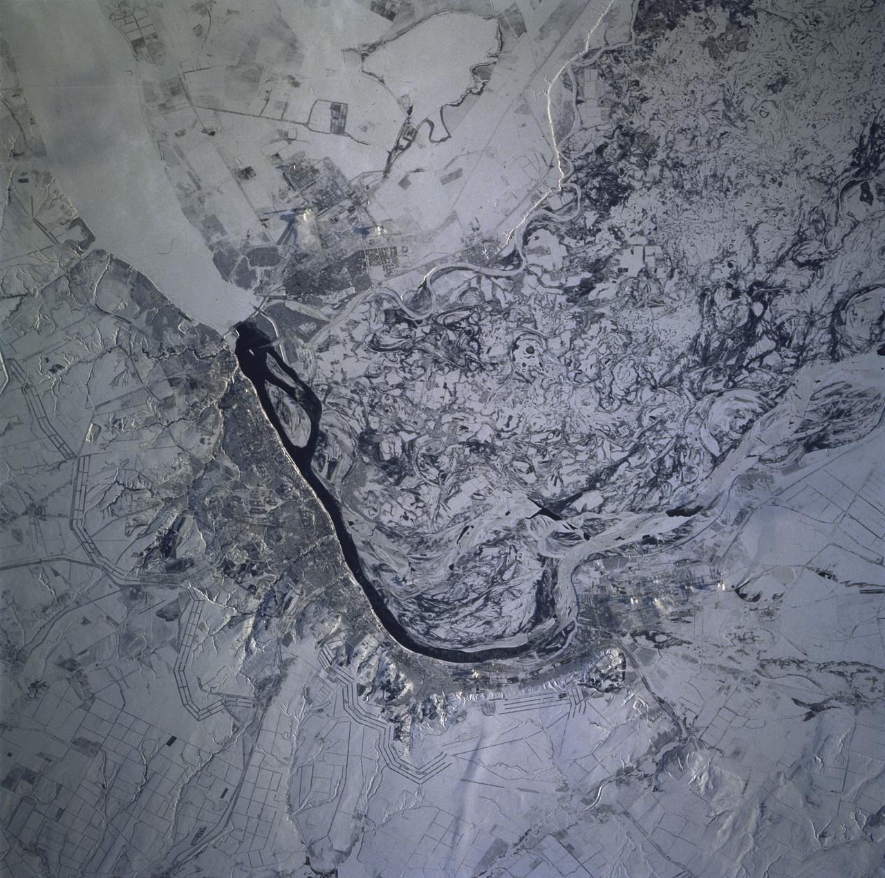
STS081-715-004 (12-22 Jan. 1997) --- As photographed with a 70mm camera aboard the Space Shuttle Atlantis, this scene features the Volga River and Volgograd under snow. Contrast in brightness shows up many features in this near-vertical view of the great bend of the Volga River's dark, open strip of water, center. The Volga flows south into the view from top right, then southeast from the center to the bottom. Volgograd appears as the gray zone along the left (west) side of the open water. Presumably the ice-free part of the river opposite Volgograd relates to the slightly warmer water which is spilled from prominent, ice-covered Lake Volgograd (top right). The wide patterns of swirls, center to lower right, are numerous meander bends on the Volga's floodplain (up to 20 miles wide), highlighted by snow. The main course of the Volga is once again ice covered in this floodplain belt. The Volga-Don Canal can be seen leaving the river just south of the bend, exiting the view center left. This canal, with others in the Moscow region, allows barge traffic to move through the Russian heartland, from the Black Sea to the Baltic at Leningrad. The long parallel lines in threes and fours are lines of trees used as wind breaks. They stretch across Russia for hundreds of miles.