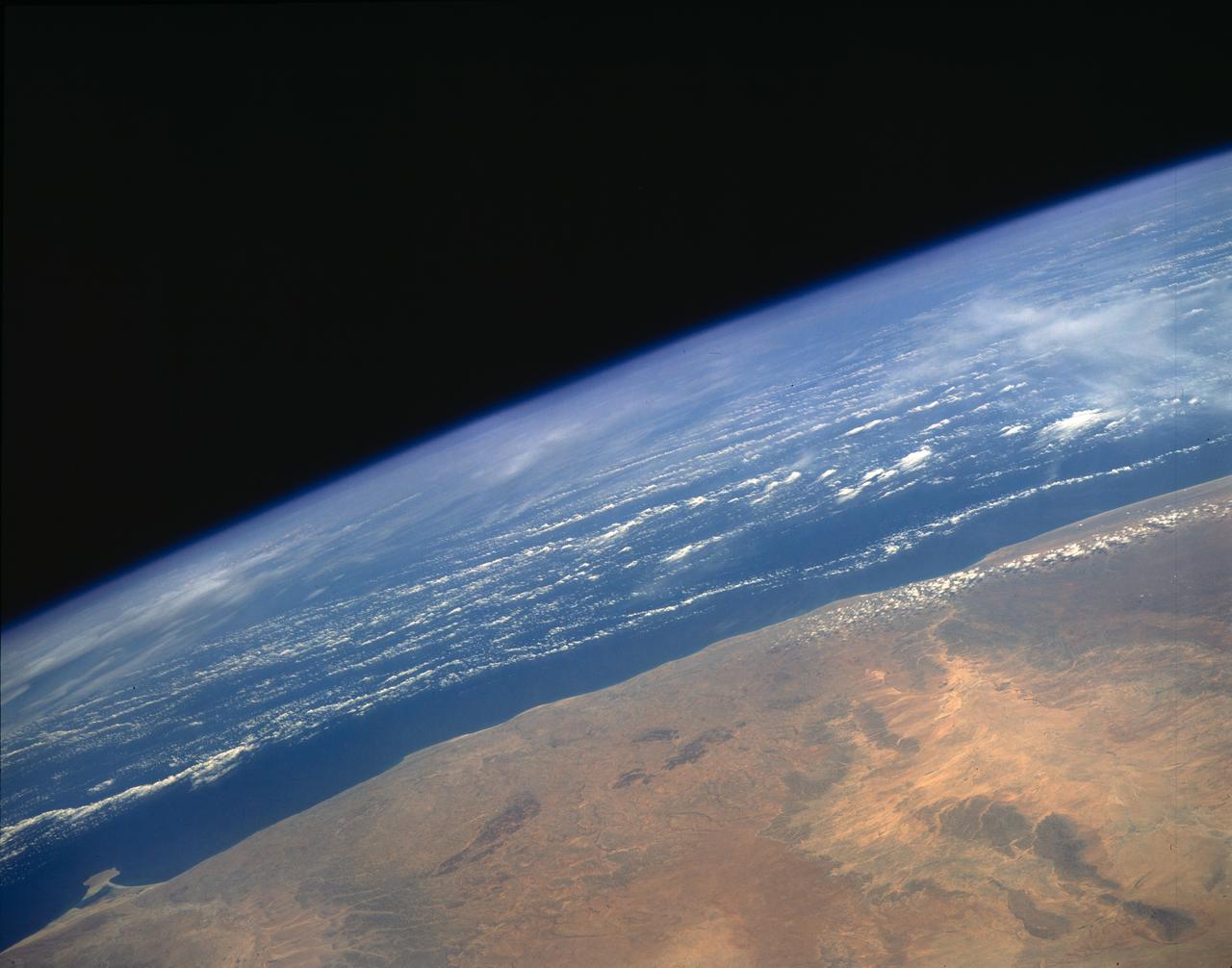
STS054-152-001 (13-19 Jan 1993) --- View southeastward across the northern, arid coastal plain of Somalia from Dhul Hafun (Hafun Peninsula) on the extreme left to Ras (Cape) Illig on the extreme right. There are no good harbors, no permanent streams, and few people in this 200-mile-wide expanse of dry coastal Plain. The cloud line offshore marks the limit of offshore breeze, and provides a partial explanation of the lack of rain in this region.
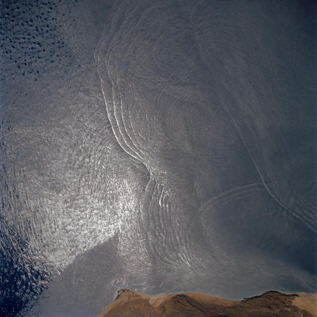
The arculate fronts of these apparently converging internal waves off the northeast coast of Somalia (11.5N, 51.5E) probably were produced by interaction with two parallel submarine canyons off the Horn of Africa. Internal waves are packets of tidally generated waves traveling within the ocean at varying depths and are not detectable by any surface disturbance.
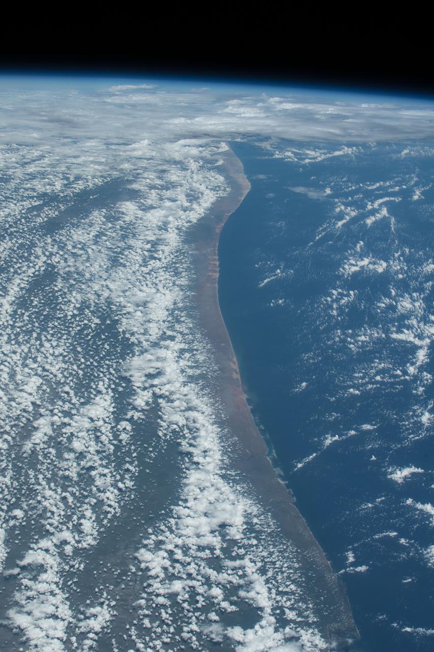
iss062e103524 (March 20, 2020) --- The northeast coast of Somalia is pictured as the International Space Station orbited above the Gulf of Aden.
iss062e103508 (March 20, 2020) --- The coast of Somalia on the Gulf of Aden is pictured as the International Space Station orbited 258 miles above the African continent.
iss057e106506 (Nov. 30, 2018) --- The Indian Ocean coastline of Kenya and Somalia is pictured as the International Space Station orbited 253 miles above the African continent.
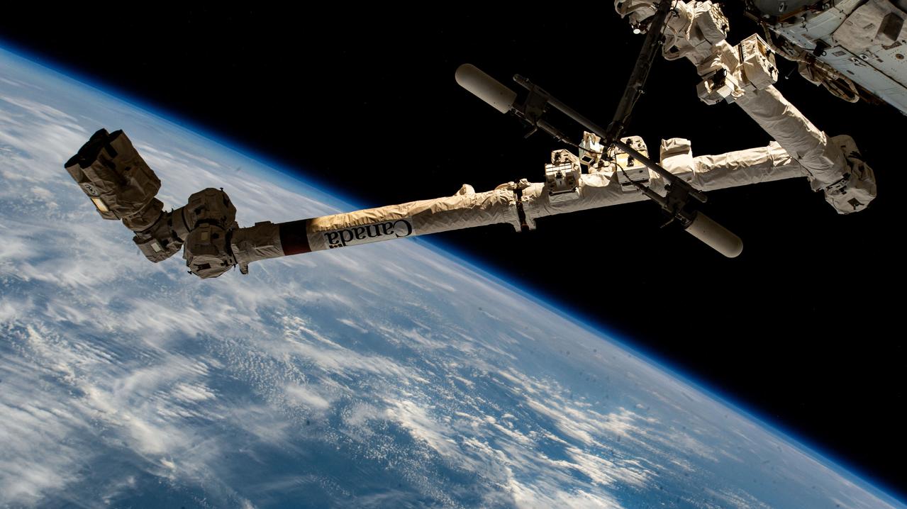
iss071e235690 (June 28, 2024) --- The 57.7-foot-long Canadarm2 robotic arm extends outward from the International Space Station as it orbited 264 miles above the Indian Ocean off the coast of the African nation of Somalia.
iss067e265002 (Aug. 13, 2022) --- The sun's glint beams off the Indian Ocean in this photograph from the International Space Station as it soared 260 miles above during an early morning orbital trek off the coast of Somalia.
Earth observation taken during a day pass by an Expedition 36 crew member on board the International Space Station (ISS). Per Twitter message: Coast of Somalia on the Indian Ocean.
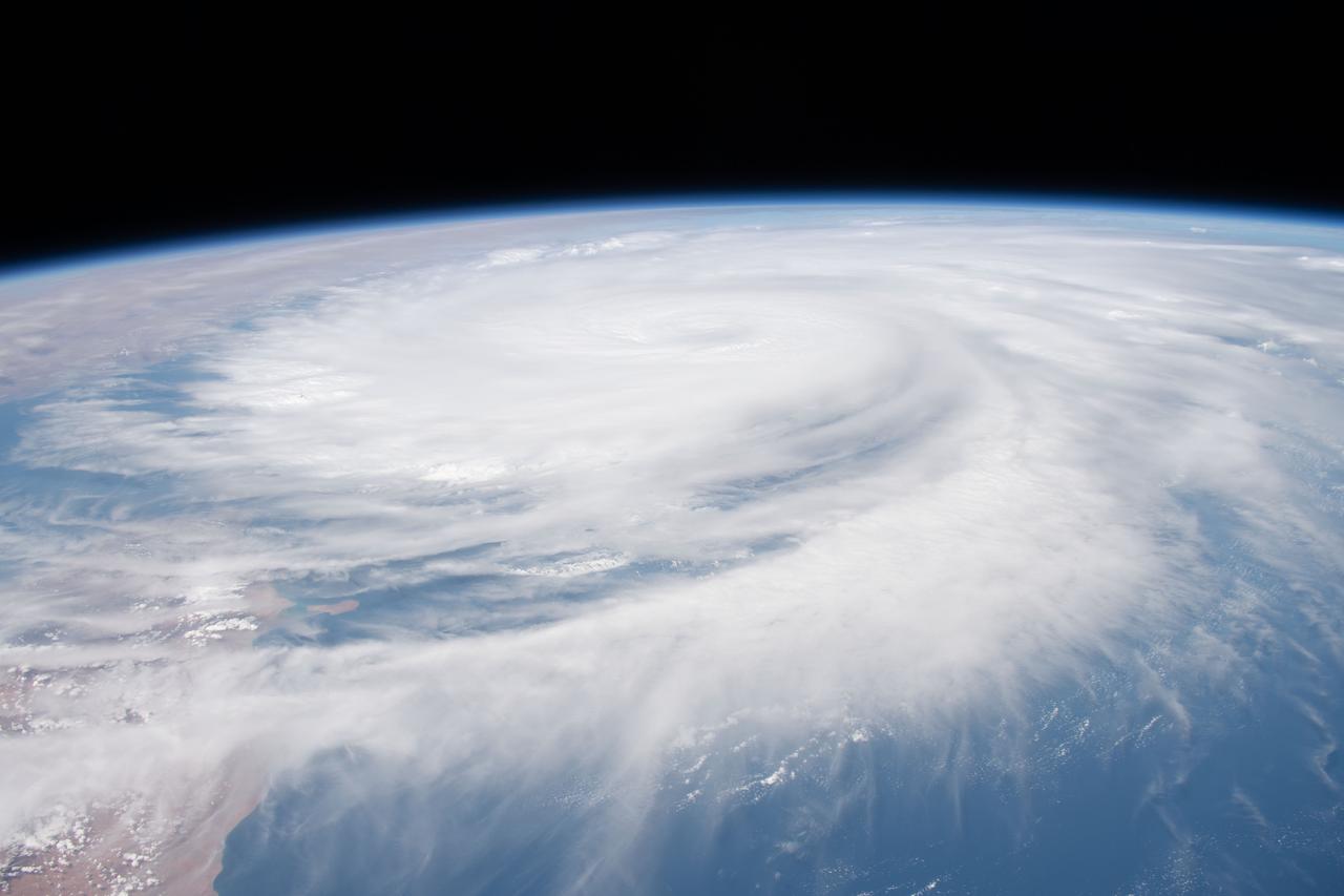
iss070e008366 (Oct. 22, 2023) --- The International Space Station was orbiting 260 miles above the coast of Somalia on the Indian Ocean as Tropical Cyclone Tej was pictured on the Arabian Sea approaching the coast of Yemen.
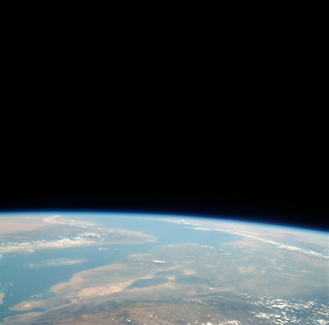
S66-38423 (6 June 1966) --- The southern tip of the Red Sea area as seen from the Gemini-9A spacecraft during its 43rd revolution of Earth. The Red Sea is at lower left. The Gulf of Aden is in the center of the picture. The land mass at bottom center is Ethiopia. Yemen is at upper center, southwestern tip of Arabian Peninsula. Somalia is the land mass in the background, center of picture. The image was taken with a modified 70mm Hasselblad camera, using Eastman Kodak, Ektachrome MS (S.O. 217) color film. Photo credit: NASA

iss073e0982679 (Oct. 25, 2025) --- The Milky Way spans the night sky above a bright orange-yellow airglow that blankets the city lights along the east coast of Africa, from Kenya to Somalia. The International Space Station was orbiting 259 miles above the Indian Ocean, north of Madagascar, at approximately 10:29 p.m. local time when this photograph was taken.

61A-200-003 (30 Oct 1985) --- A large format Linhof camera onboard the Space Shuttle Columbia provided this coastal view of Somalia. The perspective is looking north from Muqdisho (foreground) to Raas Xaafuun at the horizon. Cumulus clouds cover the Somali Desert. The elongated, thinner steak of clouds follows a topographically depressed area, a wash know as Webi Shibeli.
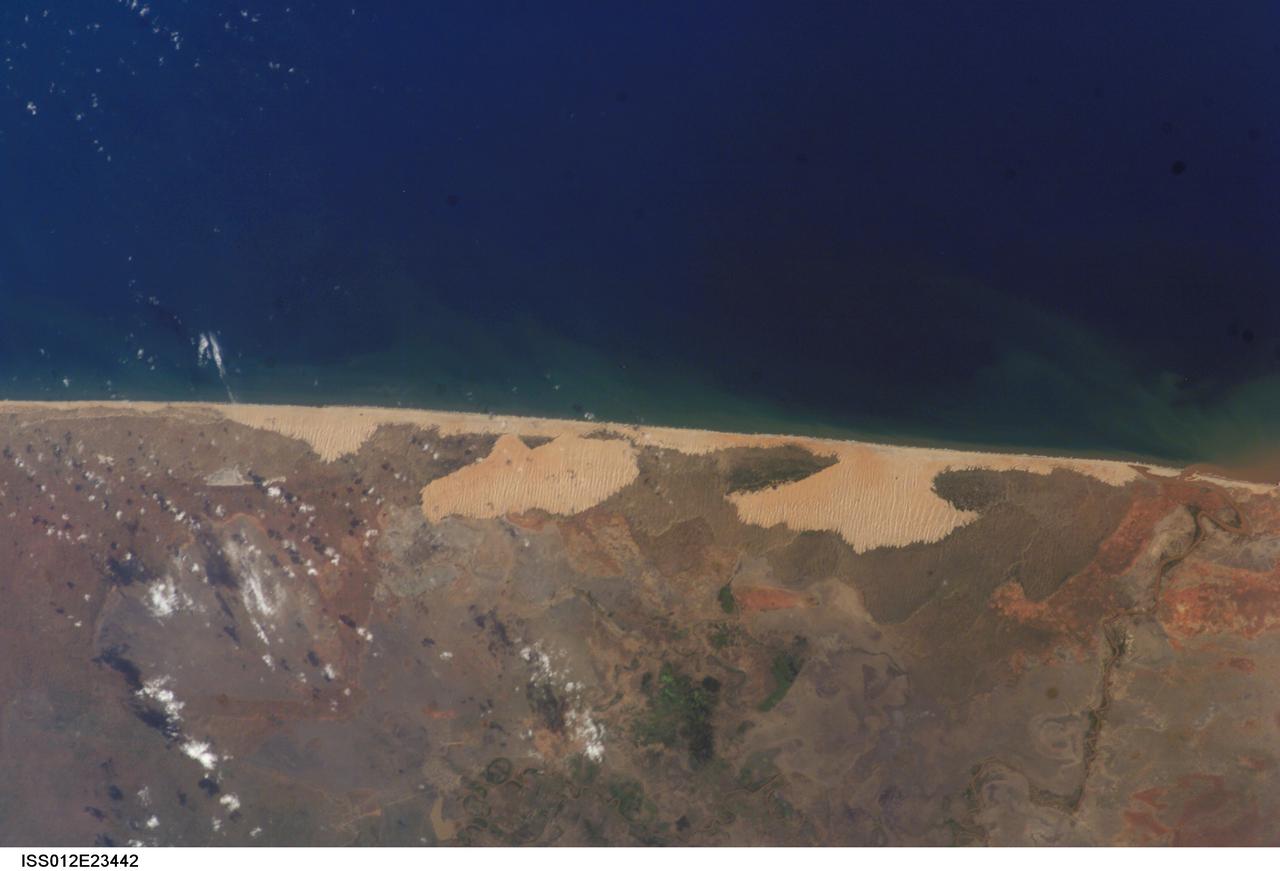
ISS012-E-23442 (2 Dec. 2005) --- The coastal region in Somalia, south of the capital of Mogadishu (out of frame), is featured in this image photographed during normal conditions by an Expedition 12 crewmember on the International Space Station. An image captured during the Expedition 14 mission (ISS014-E-13848) shows the same coastal region with contrasting wet conditions.
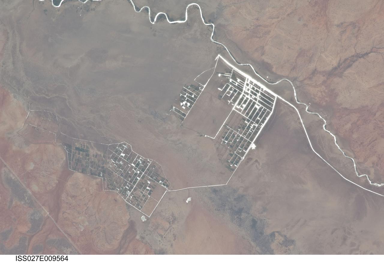
ISS027-E-009564 (31 March 2011) --- Agricultural fields along the Shebelle River in Ethiopia are featured in this image photographed by an Expedition 27 crew member on the International Space Station. The Shebelle River supports limited agricultural development within the arid to semi-arid Ogaden Plateau region of southeastern Ethiopia. This detailed photograph illustrates a network of irrigation canals and fields located approximately 42 kilometers to the west-northwest of the city of Gode, Ethiopia. Floodplain sediments and soils are dark brown to gray (center), and contrast with reddish rocks and soils of the adjacent plateau. Water in the Shebelle River, and the irrigation canals, has a bright, mirror-like appearance due to sunglint, or light reflecting off the water surface back towards the observer on the space station. Vegetation in the floodplain (bottom center) and agricultural fields is dark green. The river water supports a variety of crops?the most common being sorghum and maize?as well as grazing for livestock (cattle, sheep, goats, and camels). The Shebelle River has its headwaters in the Ethiopian Highlands, and transports water and sediment 1,000 kilometers to the southeast across Ethiopia, continuing an additional 130 kilometers into neighboring Somalia. The Shebelle River does not reach the Indian Ocean during most years, but disappears into the sands near the coast in Somalia. During periods of heavy rainfall and flooding however, the Shebelle can reach the Indian Ocean.
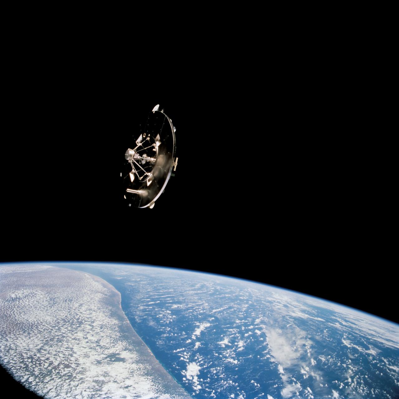
STS069-732-048 (11 September 1995) --- Having earlier been released by the Space Shuttle Endeavour's Remote Manipulator System (RMS), the Wake Shield Facility (WSF) moves away from the Space Shuttle. The coast of Somalia can be seen in the lower left quadrant of the frame. STS-69 and the Space Shuttle Endeavour, with a five-member crew, launched on September 7, 1995, from the Kennedy Space Center (KSC) and ended its mission there on September 18, 1995, with a successful landing on Runway 33. The multifaceted mission carried a crew of astronauts David M. Walker, mission commander; Kenneth D. Cockrell, pilot; and James S. Voss (payload commander), James H. Newman and Michael L. Gernhardt, all mission specialists.
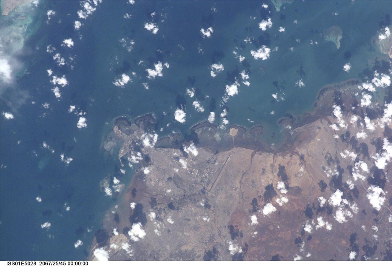
ISS001-E-5028 (December 2000) --- Djibouti, the capital city of the country of Djibouti, can be seen in this northeast-looking view taken from the International Space Station (ISS) with a digital still camera using a 400mm lens. Djibouti, scarcely 100 years old, sits on the western shore of an isthmus in the Gulf of Tadjoura, an arm of the Gulf of Aden. Djibouti is surrounded by a rugged and bleak landscape, that has a dry and hot climate. The population of Djibouti has grown from an estimated 96,000 in 1973 to over 330,000 in 1991 mainly due to the influx of refugees from the neighboring, war torn countries of Ethiopia and Somalia. With its strategically located port, Djibouti’s economic importance results from the large transit trade it enjoys as the terminus of a railroad line from Addis Ababa in Ethiopia. The city has seen an increase in tourism in the past decade due a large number of cruise ships visiting the port. Besides tourism, salt production and shipbuilding and repair are other major industries. Below the center of the image, the long runway of the Djibouti/Ambouli International Airport is visible. Coral reefs are discernible in the upper left and upper right quadrants of the image.