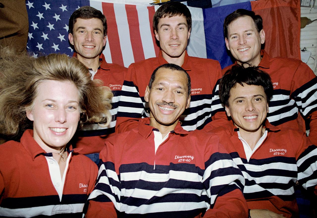
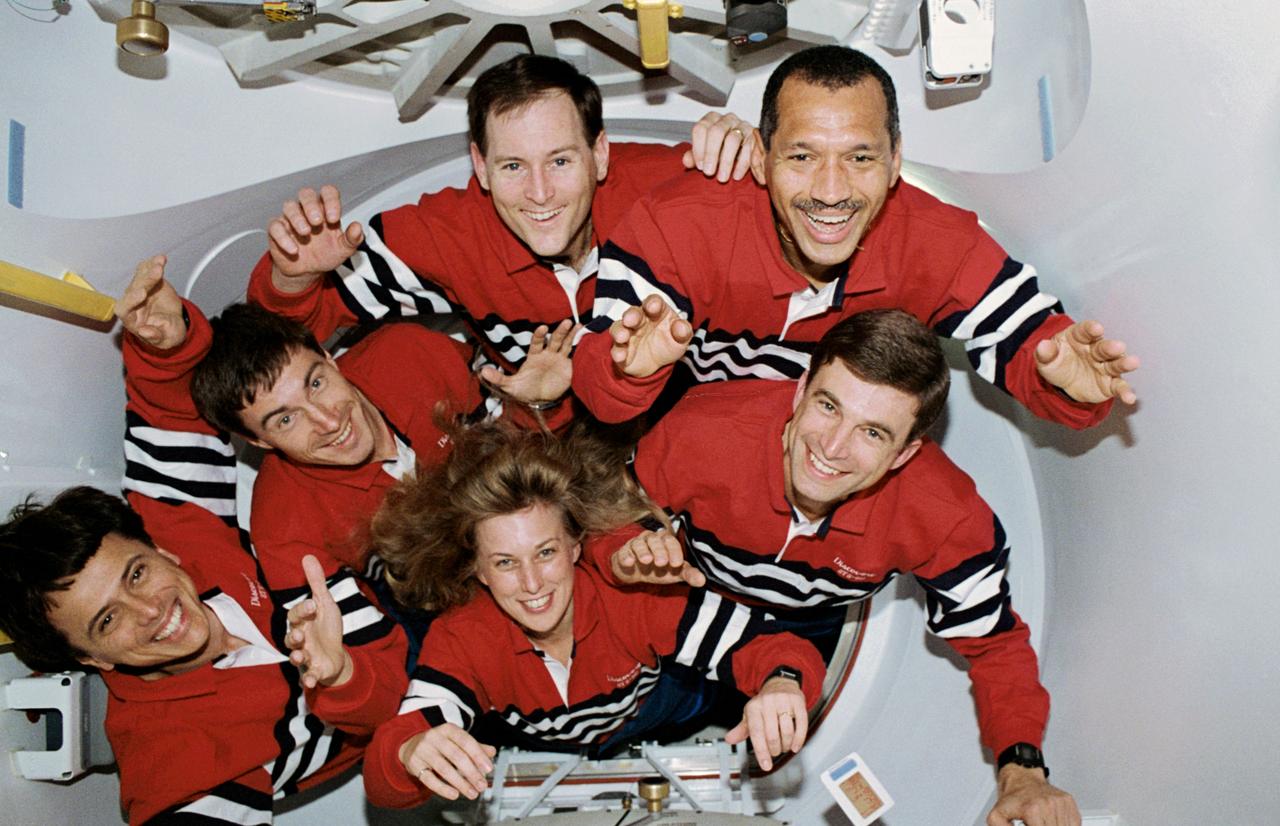
STS060-31-009 (3-11 Feb. 1994) --- The six-member STS-60 crew pose for the traditional in-flight crew portrait, with American and Russian flags forming the backdrop on the space shuttle Discovery’s middeck. Left to right (front row) are N. Jan Davis, Charles F. Bolden Jr. and Franklin R. Chang-Diaz; and (back row) Ronald M. Sega, Sergei K. Krikalev and Kenneth S. Reightler Jr. Photo credit: NASA or National Aeronautics and Space Administration
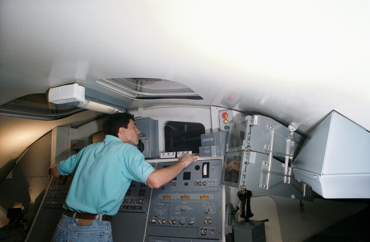
Astronauts Charles F. Bolden Jr. (left) and Kenneth S. Reightler, commander and pilot, respectively, for the STS-60 mission, rehearse some of their duties on the flight deck of the crew compartment trainer in JSC's Shuttle mockup and integration laboratory (50652); Astronaut N. Jan Davis, mission specialist for STS-60, gets assistance with her suit from Lockheed's Max Kandler during a training session at JSC's Shuttle mockup and integration laboratory. She is seated in the mission specialist station on the middeck mockup (50653).
Astronauts Charles F. Bolden Jr. (left) and Kenneth S. Reightler, commander and pilot, respectively, for the STS-60 mission, take a break during rehearsal for some of their flight duties near the crew compartment trainer in JSC's Shuttle mock-up and integration laboratory (50648); Cosmonaut Sergei Krikalev, mission specialist for STS-60, gets assistance with his launch and entry suit from Lockheed's Max Kandloer during a training session. Others pictured, left to right, are Astronauts Franklin R. Chang-Diaz, Ronald M. Sega and N. Jan Davis (50649); Astronaut Kenneth S. Reightler, pilot for STS-60, gets assistance with his launch and entry suit (LES) from Boeing's William Todd during a training session (50650).
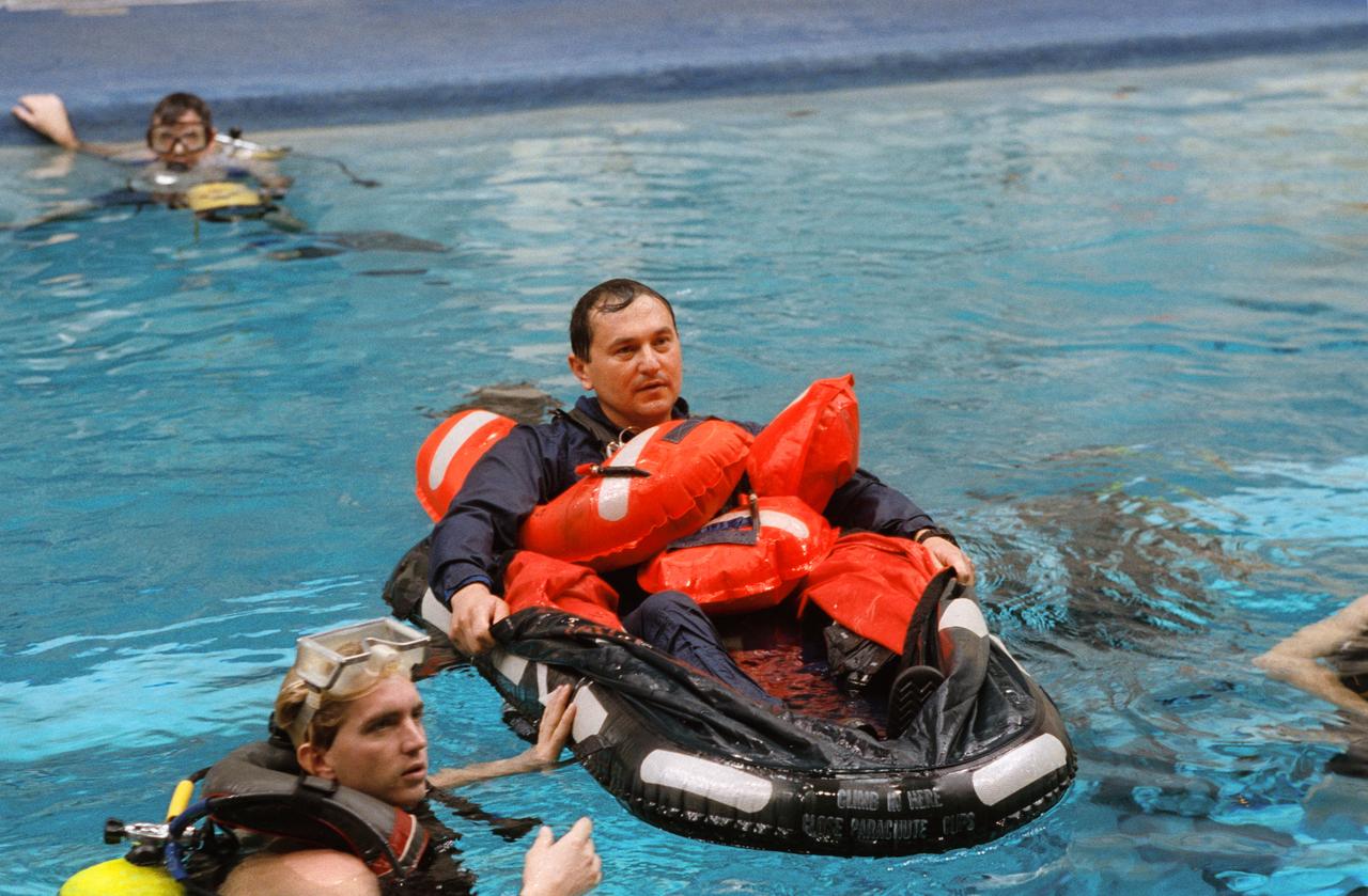
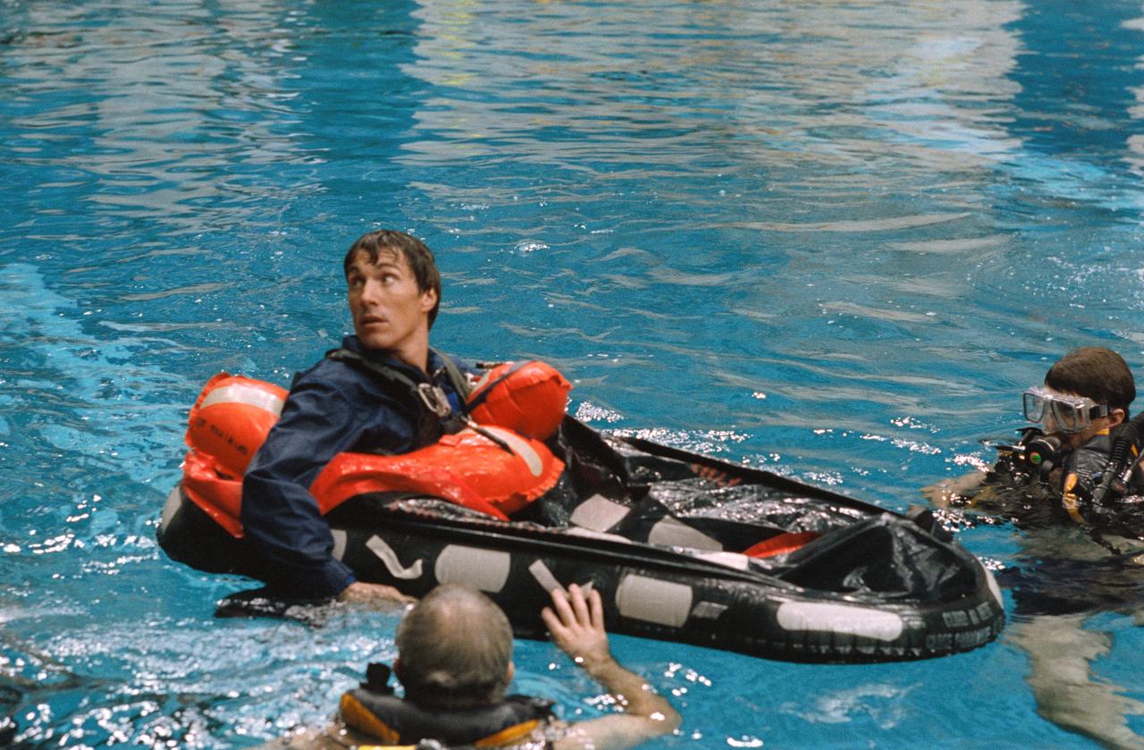
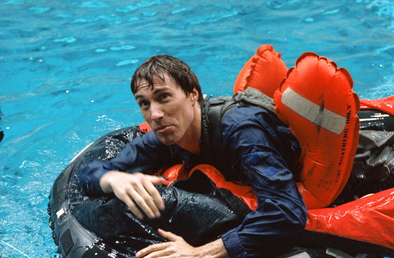
Russian Cosmonaut Vladimir Titov maneuvers a small life raft during bailout training at JSC's Weightless Environment Training Facility (WETF). Two SCUBA-equipped divers assisted Titov in the STS-60 training exercise.
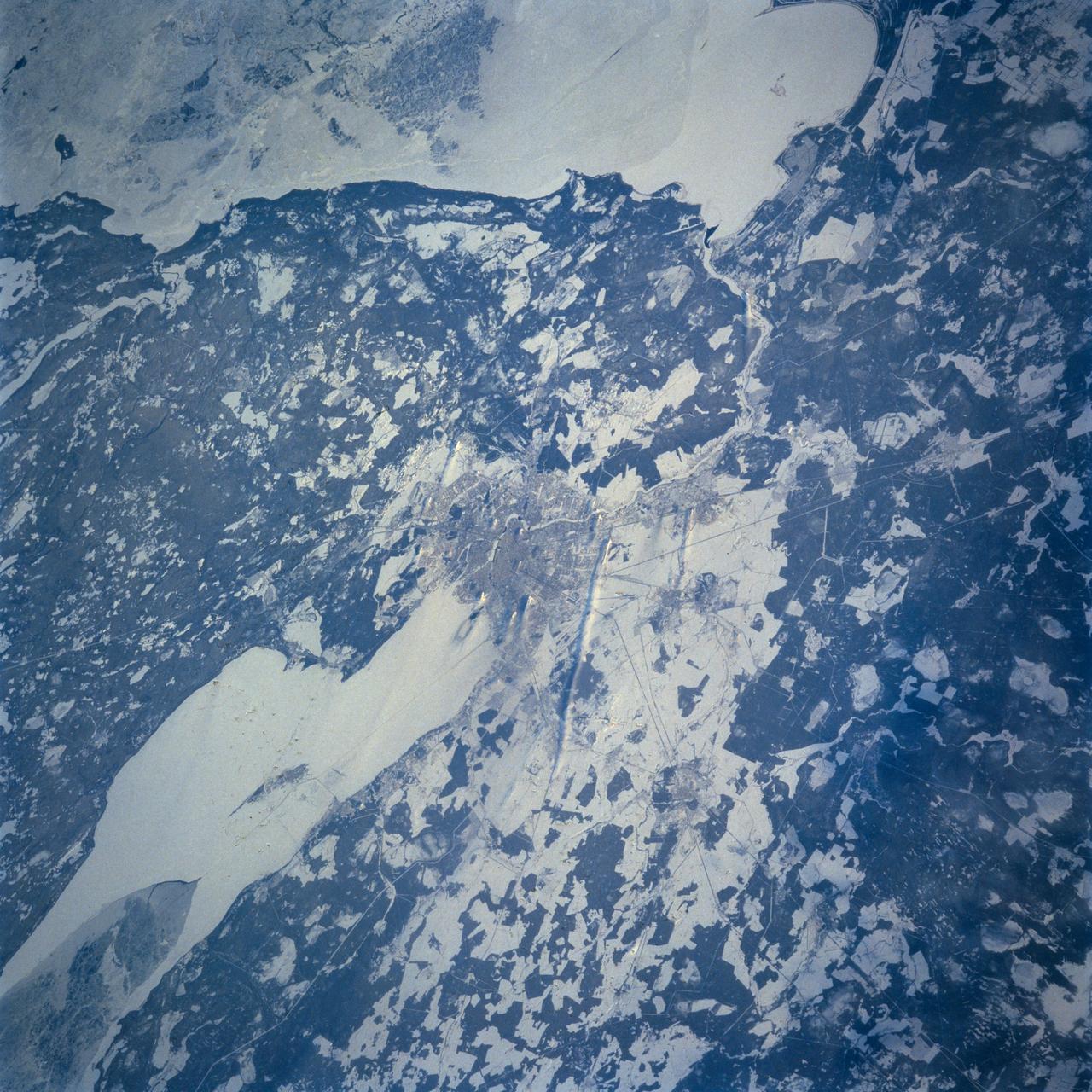
STS060-103-055 (3-11 Feb 1994) --- This wintertime photograph shows the large city of St. Petersburg Russia at the head of the Gulf of Finland. The city, built by Peter the Great, is situated in the former swampy delta of the Neva River which connects the large Lake Ladoga (the frozen white surface on the edge of the photograph) to the Gulf of Finland. An interesting feature of St. Petersburg which can be discerned in this photograph is the new storm surge barrier built from both sides of the Gulf of Finland out to the island of Kronstadt in the middle. This barrier, similar to that which was built on the Thames River south of London to protect it from storm surges out of the North Sea, was constructed to protect St. Petersburg from storm surges coming out of the Baltic Sea and being magnified by the topography and hydrography of the Gulf of Finland. Also visible as a thin line between Kronstadt and St. Petersburg is the ice-free shipping channel kept open much of the winter. Power plant plumes are also visible on the frame. St. Petersburg is the home of the Russian cosmonaut, Sergei Krikalev, who flew aboard the Space Shuttle Discovery during STS-60.
STS060-84-021 (3-11 Feb 1994) --- The Kennedy Space Center (KSC) and its partially cloud-covered environs were captured on 70mm by one of the STS-60 crew members during the eight-day mission. The Shuttle landing facility, on which Discovery landed February 11, 1994, visible at left center.
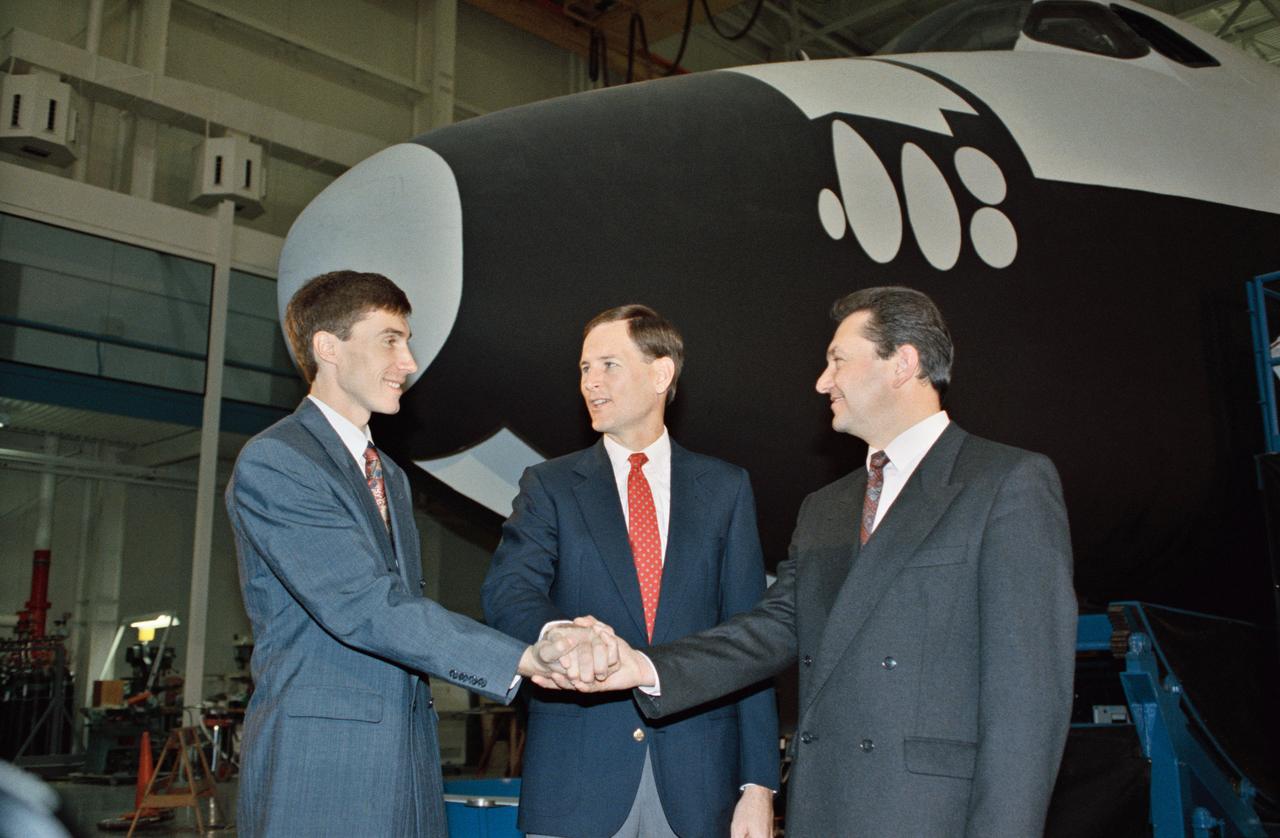
S92-49715 (10 Nov 1992) --- Russian cosmonauts Sergei Krikalev (left), and Vladimir Titov (right) share a team handshake with Kenneth L. Reightler, STS-60 pilot. The cosmonauts toured the Space Shuttle mockup and integration laboratory, in which they will undergo a great deal of training in preparation for the mission. One of the two will later be named as prime payload specialist and the second will serve as his alternate. The six person crew, to be led by astronaut Charles F. Bolden, mission commander, will man the Space Shuttle Discovery for the scheduled eight-day flight.
S93-26021 (Feb 1993) --- Russian cosmonaut Sergei Krikalev maneuvers a small life raft during bailout training at the Johnson Space Center's (JSC) Weightless Environment Training Facility (WET-F). Two SCUBA-equipped divers assisted Krikalev in the STS-60 training exercise. Shuttle crew members frequently utilize the 25-ft. deep pool to learn proper procedures to follow in the event of emergency egress from their Space Shuttle via the escape pole system. Krikalev is one of two cosmonauts in training for the STS-60 mission. One of the two will serve as primary payload specialist with the other filling an alternate's role. This pool and the facility in which it is housed are titled the WET-F, because they are also used by astronauts rehearsing both mission-specific and contingency extravehicular activities (EVA).
Astronaut Kenneth S. Reightler, pilot for the STS-60 mission, prepares to simulate egress from a troubled Space Shuttle using Crew Escape System (CES) pole. The action came during emergency egress training in JSC's Shuttle mockup and integration laboratory.
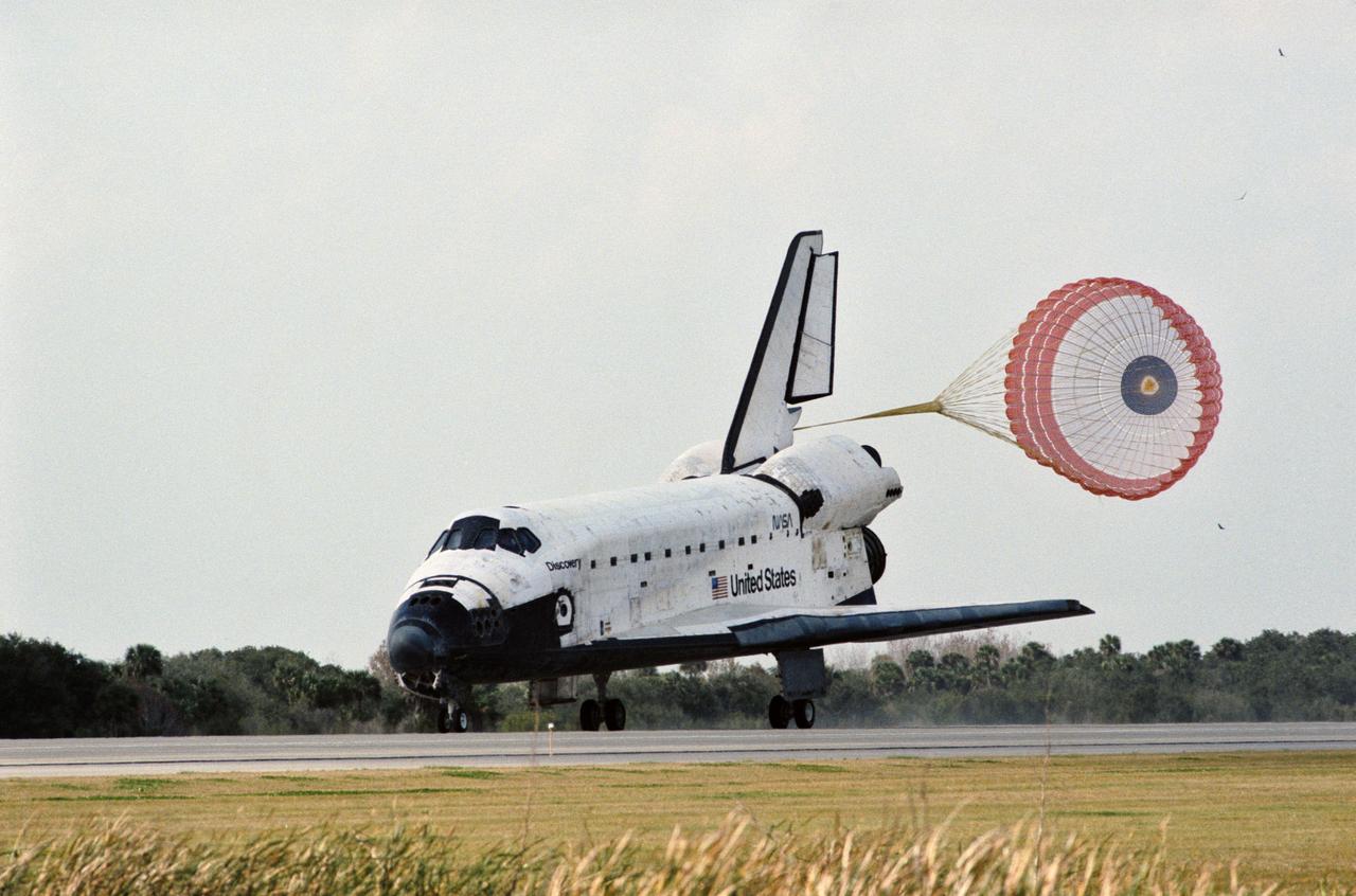
STS060-S-035 (11 Feb 1994) --- The drag chute for Space Shuttle Discovery is deployed on the Shuttle Landing Facility, marking an end to the eight-day STS-60 mission. Landing occurred at 2:19:22 p.m. (EST). Onboard were astronauts Charles F. Bolden Jr., Kenneth S. Reightler Jr., Franklin R. Chang-Diaz, N. Jan Davis and Ronald M. Sega along with Russian cosmonaut Sergei K. Krikalev.
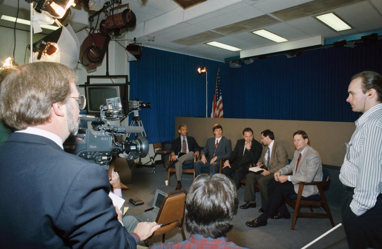
Three members of the STS-60 crew and an alternate crew member discuss their upcoming mission with the news media in JSC's public affairs facility. Seated from the left are Charles F. Bolden Jr., mission commander; Russian Cosmonaut Sergei Krikalev, mission specialist; Russian Cosmonaut Vladimir Titov, alternate mission specialist; interpreter Vladimir Fischel and Astronaut Kenneth S. Reightler, pilot.

STS060-93-043 (9 Feb 1994) --- BREMSAT, a 140 pound (63 kilogram) satellite, quickly leaves the cargo bay of the Space Shuttle Discovery. The 480 mm (19 inch) deployable satellite was built by the University of Bremen's Center of Applied Space Technology and Microgravity (ZARM) under sponsorship of the German Space Agency (DARA). A modified ejection system in one of the payload bay's getaway special (GAS) type canisters aided the STS-60 crew members in deploying the satellite toward the end of their eight-day mission in Earth orbit.
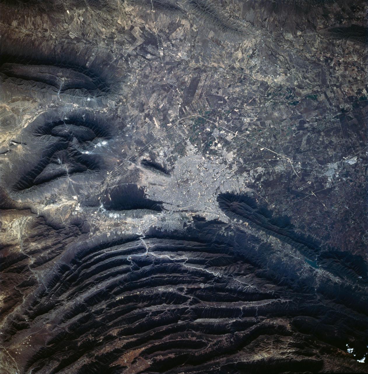
STS060-83-041 (3-11 Feb 1994) --- The large city of Monterrey, in northeastern Mexico, was founded at the edge between the Sierra Madre Oriental and the Rio Grande Embayment portion of the Gulf Coastal Plain. This location is analogous to the Fall Line along the United States eastern seaboard, but instead of lying along a stream at the head of navigation, Monterrey lies at the boundary between a well-watered mountain range and a semi-arid plain where irrigation is often necessary for successful agriculture. The mountains themselves are formed from folded limestone and shale beds; to the south of the city, beds are crumpled into tight folds. Around and north of the city, more open folds gradually give way to nearly flat-lying beds of the coastal plain. Because of the water and other resources such as shale and limestone to quarry and burn for cement, Monterrey early became a thriving industrial center. It is now one of Mexico's largest cities with a population of approximately 5 million. According to NASA geologists, the STS-60 photography of this area is the best that has been acquired during the past 32 years of space photography by the United States. Monterrey remains an area of high interest for future photography in order to assess the impact of urbanization in this area.
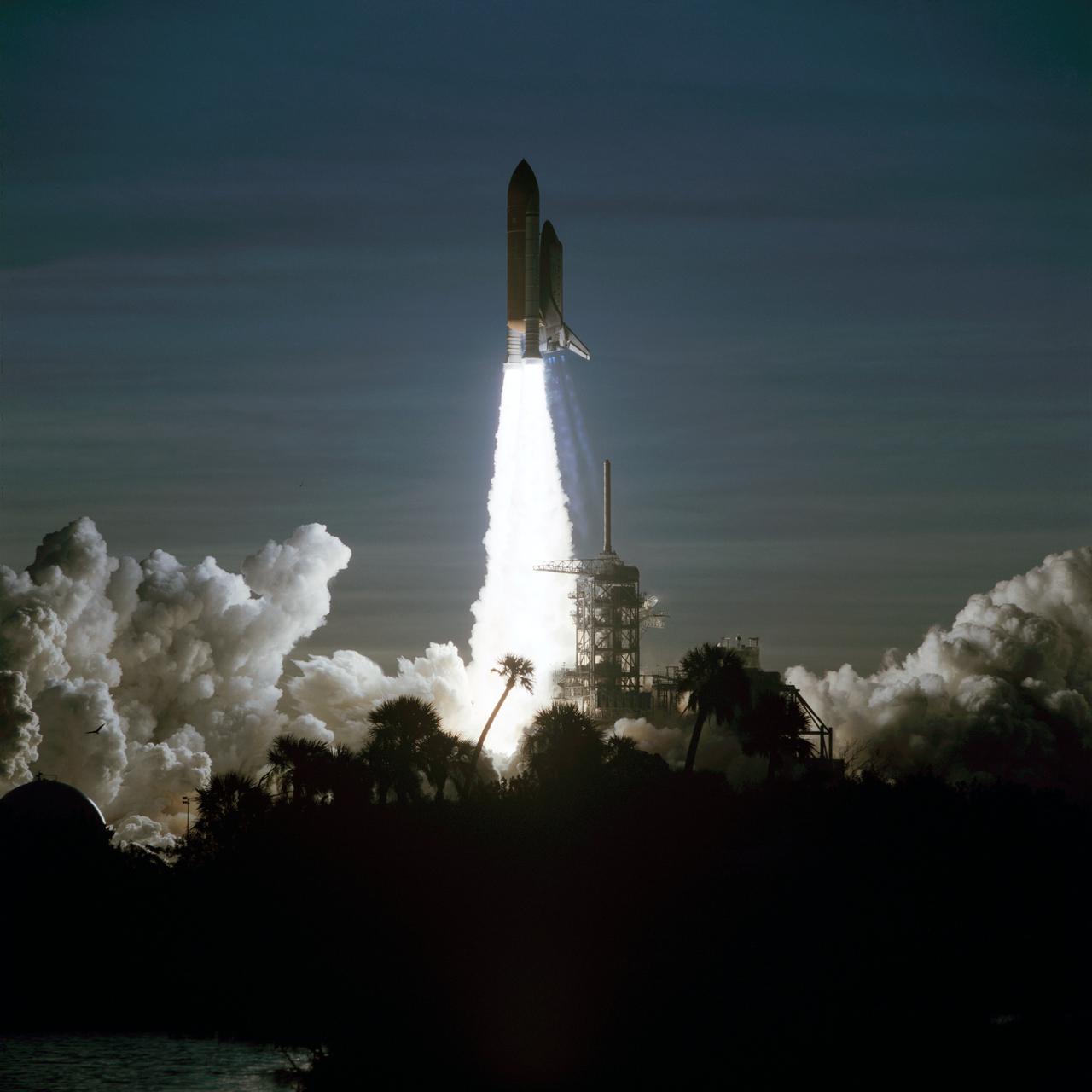
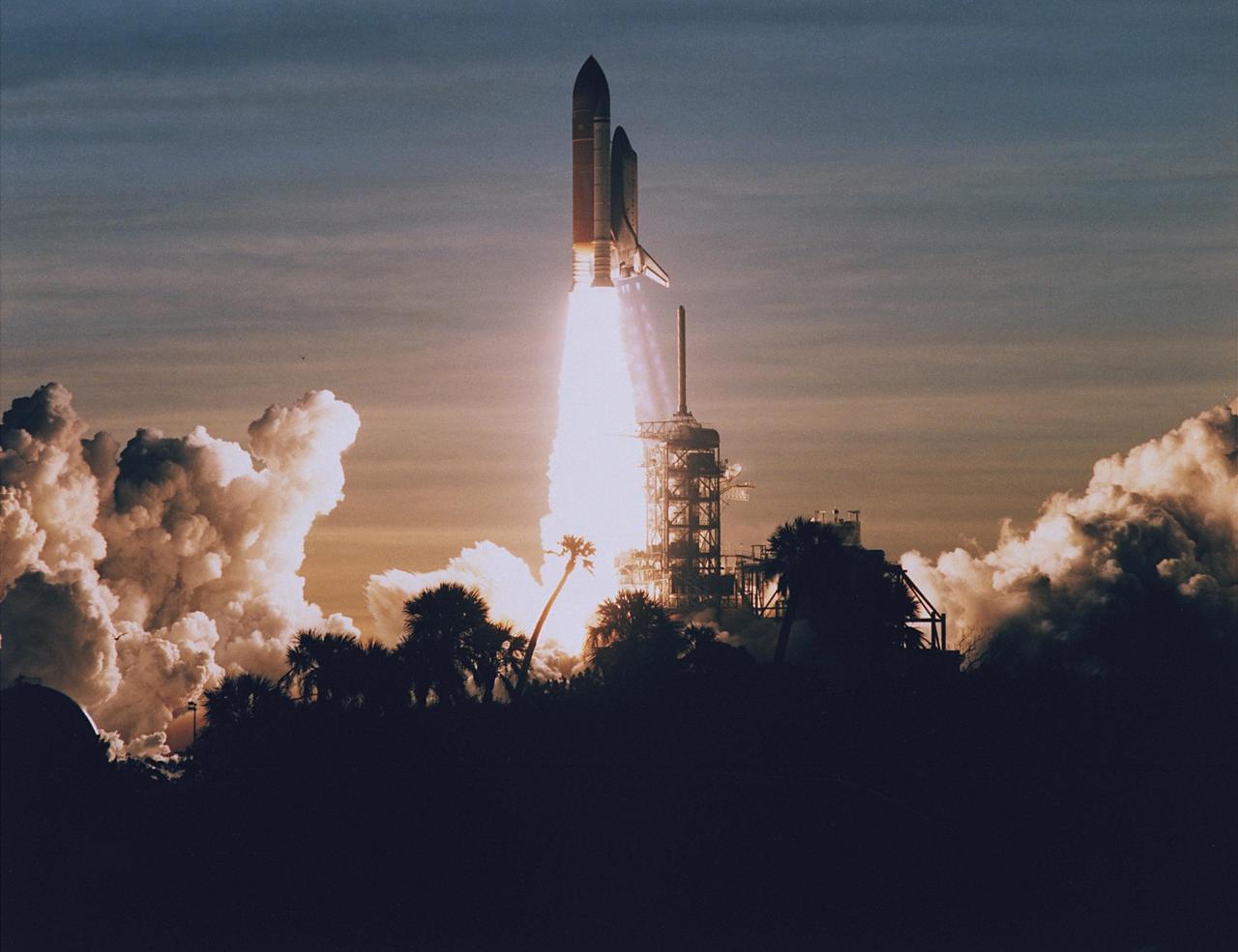
STS060-S-106 (3 Feb 1994) --- Palm trees are silhouetted in the foreground of this 70mm image as the Space Shuttle Discovery heads toward an eight-day mission in Earth orbit. Liftoff occurred as scheduled at 7:10 a.m. (EST), February 3, 1994. Aboard the spacecraft were astronauts Charles F. Bolden Jr., commander; Kenneth S. Reightler Jr., pilot; Franklin R. Chang-Diaz, payload commander; and N. Jan Davis and Ronald M. Sega, mission specialists, along with Russian cosmonaut Sergei K. Krikalev, also a mission specialist.
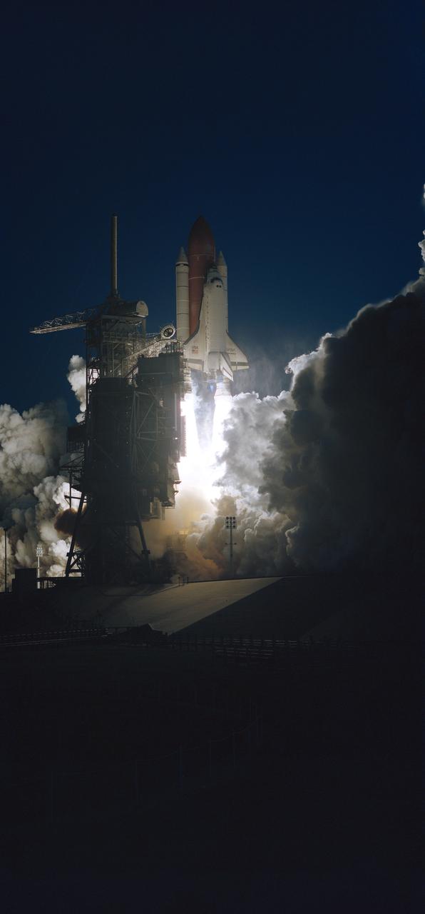
Launch Complex 39 is in partial darkness as the Space Shuttle Discovery heads toward an eight-day mission in Earth orbit. Liftoff occurred as scheduled at 7:10 a.m., February 3, 1994.
Astronauts Charles F. Bolden Jr. (left) and Kenneth S. Reightler, commander and pilot, respectively, for the STS-60 mission, rehearse some of their duties on the flight deck of the crew compartment trainer in JSC's Shuttle mockup and integration laboratory (50652); Astronaut N. Jan Davis, mission specialist for STS-60, gets assistance with her suit from Lockheed's Max Kandler during a training session at JSC's Shuttle mockup and integration laboratory. She is seated in the mission specialist station on the middeck mockup (50653).
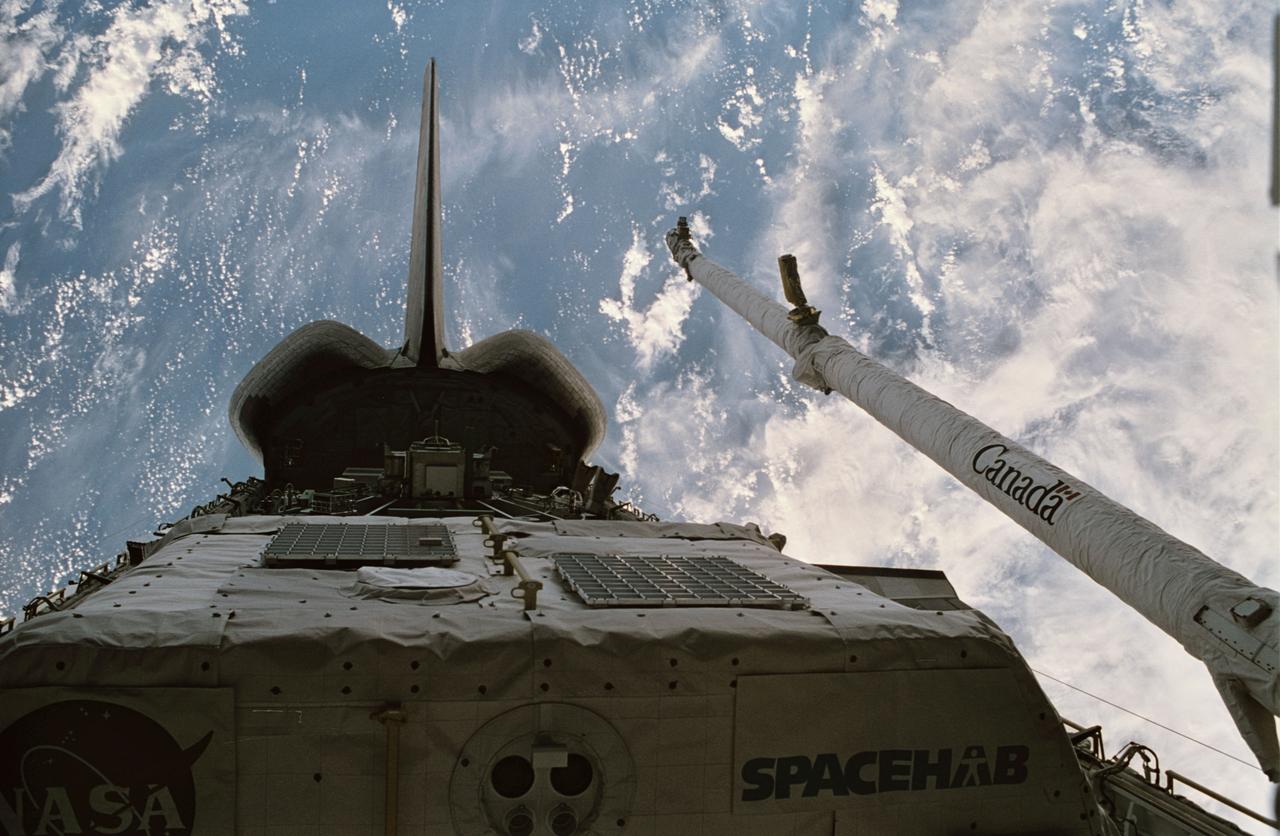
STS060-15-003 (3-11 Feb 1994) --- This 35mm frame shows the major payloads of the Space Shuttle Discovery's STS-60 mission, backdropped against clouds over the Atlantic Ocean. In the foreground is the SPACEHAB module, with the Wake Shield Facility (WSF) partially visible in its berthed position near the Orbital Maneuvering System (OMS) pods and the vertical stabilizer. Television cameras on the Remote Manipulator System (RMS) were being used for a survey of the cargo. Five NASA astronauts and a Russian cosmonaut went on to spend eight days in Earth orbit in support of the mission.
Astronauts Charles F. Bolden Jr. (left) and Kenneth S. Reightler, commander and pilot, respectively, for the STS-60 mission, take a break during rehearsal for some of their flight duties near the crew compartment trainer in JSC's Shuttle mock-up and integration laboratory (50648); Cosmonaut Sergei Krikalev, mission specialist for STS-60, gets assistance with his launch and entry suit from Lockheed's Max Kandloer during a training session. Others pictured, left to right, are Astronauts Franklin R. Chang-Diaz, Ronald M. Sega and N. Jan Davis (50649); Astronaut Kenneth S. Reightler, pilot for STS-60, gets assistance with his launch and entry suit (LES) from Boeing's William Todd during a training session (50650).
Pictured on a test stand at JSC is the Wake Shield Facility scheduled to fly on STS-60.
STS060-31-028 (3-11 Feb. 1994) --- Five NASA astronauts and a Russian cosmonaut squeeze through the tunnel which connects the shirt-sleeve environments of the space shuttle Discovery and the SPACEHAB module. SPACEHAB is located in the spacecraft’s payload bay. Charles F. Bolden Jr., mission commander, is at upper right. Others, clockwise from the commander, are Ronald M. Sega and N. Jan Davis, both mission specialists; Franklin R. Chang-Diaz, payload commander; cosmonaut Sergei K. Krikalev, mission specialist; and Kenneth S. Reightler Jr., pilot. The six spent eight days in Earth orbit. Photo credit: NASA
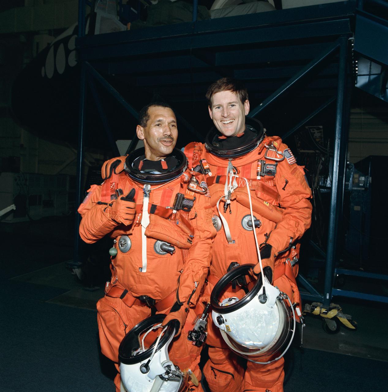
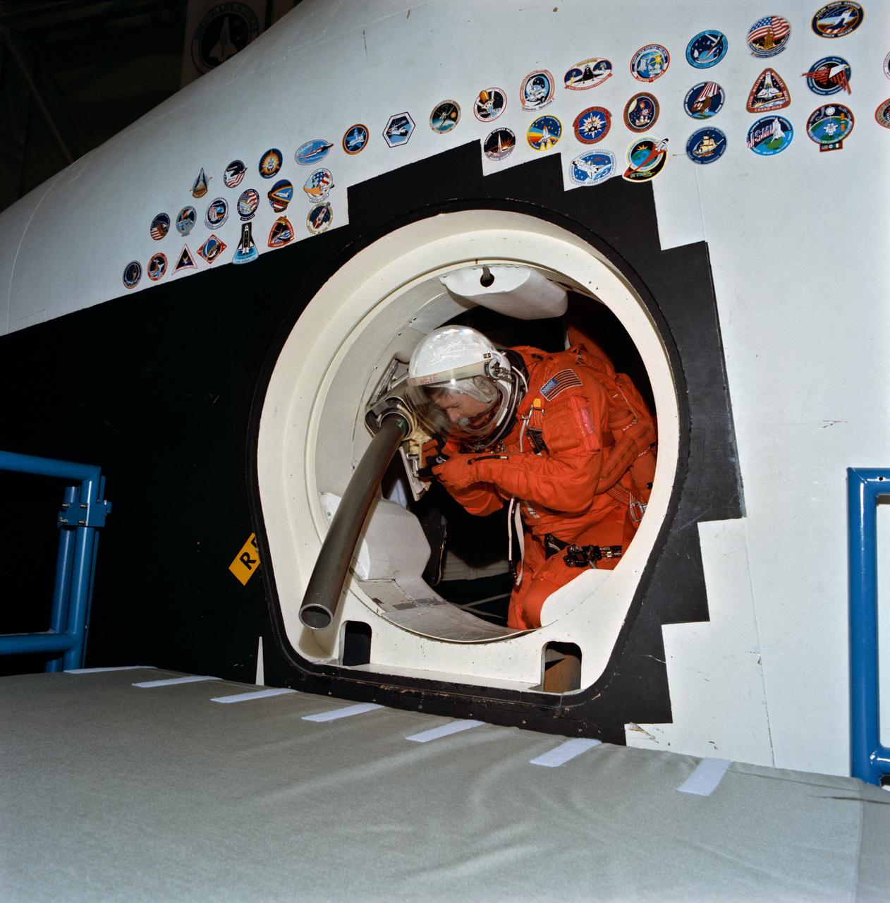
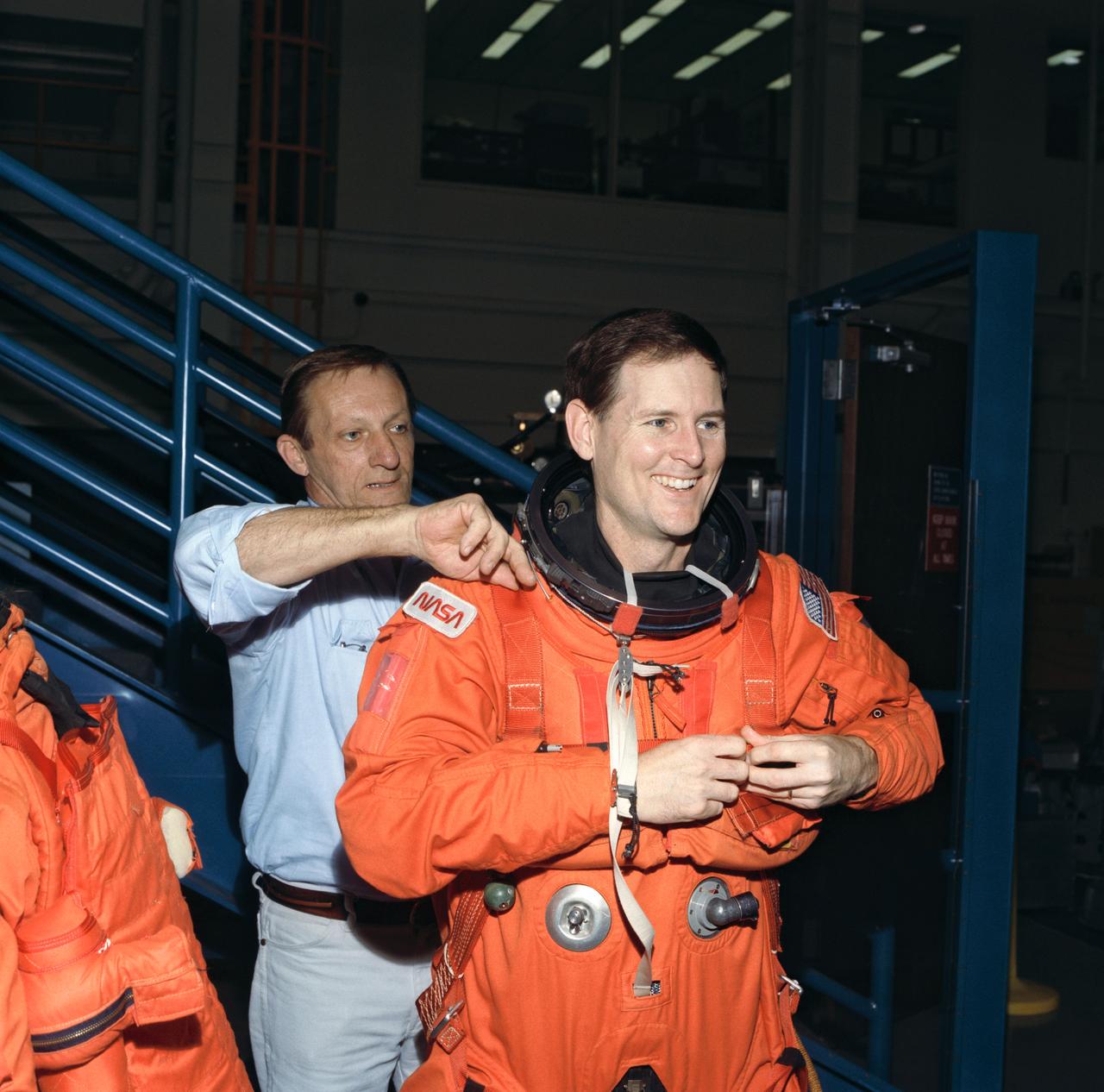
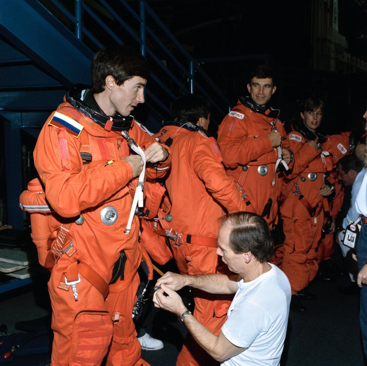
STS-60 Mission Commander Charles F. Bolden, Jr., gets a helping hand as he dons his Launch/Entry suit in the O&C building. Soon Bolden and five fellow crew members will head fro launch pad 39A, where the Space Shuttle Discovery awaits liftoff at 7:10 am, EST. (Op. No. D6022)(Item D112B)
STS-60 Discovery, Orbiter Vehicle (OV) 103, Russian Mission Specialist Sergei Krikalev and Russian backup Mission Specialist Vladimir Titov work with Training Instructor Richard M. Davis (holding space shuttle model) prior to entering the Building 16 Systems Engineering Simulator (SES).
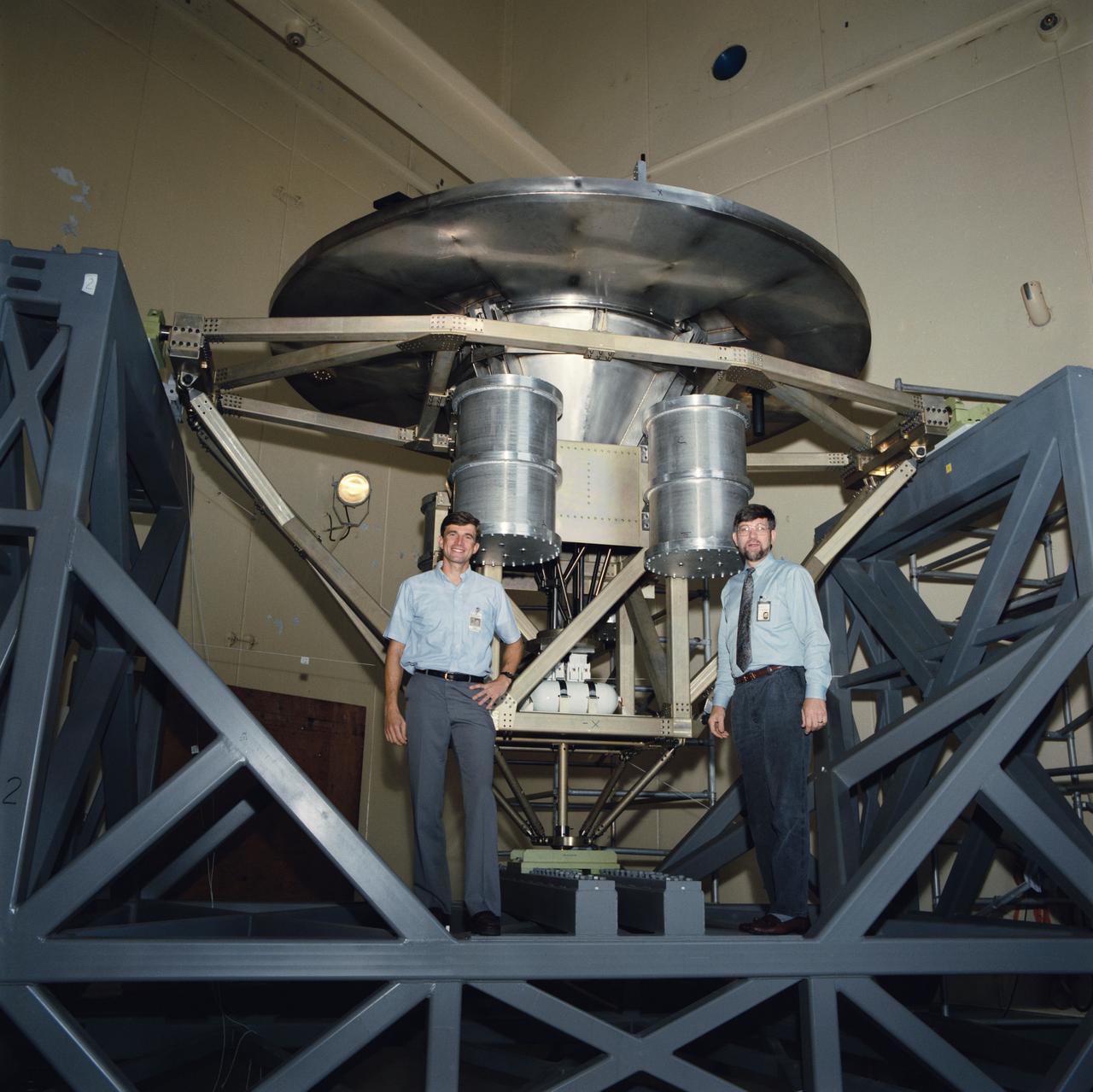
The Wake Shield Facility is displayed on a test stand at JSC. Astronaut Ronald M. Sega, mission specialist for STS-60, is seen with the facility during a break in testing in the acoustic and vibration facility at JSC.
Cosmonaut Sergei Krikalev, STS-60 mission specialist, practices operating the Shuttle's Remote Manipulator System (RMS) during a training exercise at JSC's Shuttle mockup and integration laboratory.
STS060-103-089 (3-11 Feb. 1994) --- The Chicago, Illinois area is in this northeast looking low oblique view obtained in February, 1994. Lake Michigan, a good portion covered with ice due to the very cold winter weather that has plagued this region since early December, 1993, can be seen to the east of the city. The Des Plaines river is visible traversing northeast to southwest through the center of the city. O'Hare International Airport and the Glenview Naval Air Station can be seen to the north of the Des Plaines River. Midway Airport is visible just to the south of the river. Chicago is a port of entry; a major Great Lakes port located at the junction of the St. Lawrence Seaway with the Mississippi River system; the busiest air center in the United States; and an important rail and highway transportation hub. Chicago is known for large grain mills and elevators, iron and steel works, steel fabrication plants, stockyards, meat-packing establishments, and printing and publishing houses. In the early days of settlement, the narrow watershed between Lake Michigan and the Des Plaines River (draining the Mississippi River through the Illinois River), offered an easy portage that led explorers like Father Marquette and Louis Joliet and others to the Great Central Plains. Fort Dearborn, a military post was established in 1803. By 1860, the railroad connected Chicago to the rest of the country and the city became a great mid-continent shipping and receiving center. In 1871, the city built of wood, was almost entirely destroyed by a great fire. After the fire, Chicago was built as a city of steel and stone. During the World's Colombian Exposition held in Chicago in 1893, the city became a leading architectural center. It was here during the Exposition that the skyscraper came into being. Chicago continues to lead the way in this type of architectural structure as is evidenced with the completion of the Sears Tower in 1974.

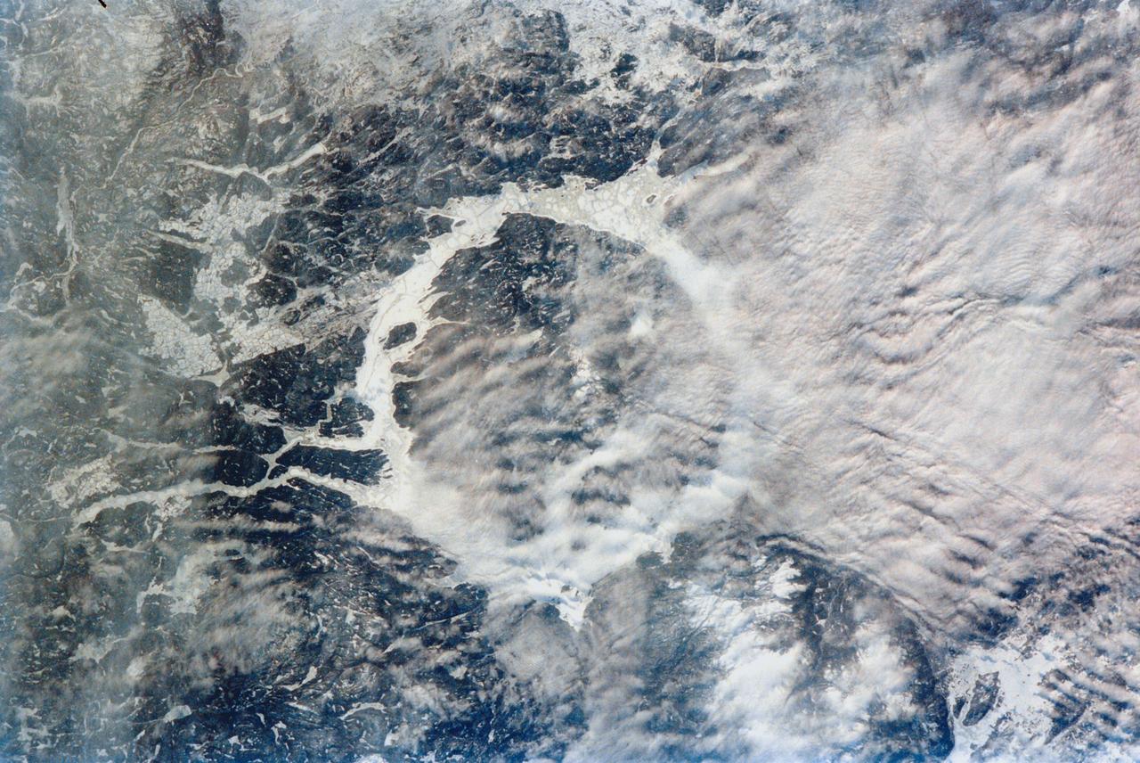
STS060-87-087 (3-11 Feb 1994) --- Lake Baikal, in southeastern Siberia, is the largest freshwater lake in the world by volume, holding nearly 20 per cent of the world's fresh water. Lake Baikal is a biospheric reserve of high international interest to the global scientific community. It is home to some 600 endemic species, many found in no other location. This view shows the northern end of the lake, and was taken in the early morning with low sun highlighting the mountain ranges rimming the lake basin. Pristine forests surround the lake, although heavy logging is evident in other photography of the central and southern portions of the lake. Another unique aspect of Lake Baikal is the existence of the world's only known freshwater hydrothermal springs. The fault system which bounds the lake allows fluids to circulate deep into the Earth and resurface as hot springs around and in the lake. Russian and American scientists are using the Shuttle photography to examine the relationship of the lake's ice cover to areas of known hydrothermal activity. Thus Lake Baikal has been and continues to be a high-priority site for photography from space from both the Space Shuttle and the Russian Space Station MIR.

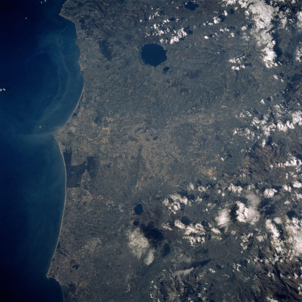
STS060-88-070 (3-11 Feb 1994) --- This view shows sunglint in the Strait of Gibralter. In this photograph a high pressure atmospheric system over the Iberian Peninsula has set the conditions for seeing a plankton bloom along the Moroccan coast in the Alboran Sea (Western Mediterranean) coastal counter current as well as illumining the influence of winds in the sunglint pattern near the Strait of Gibraltar. Where the water is ruffled from a wind gust, such as off Cadiz, Spain, the surface is less reflective and thus appears dark. A combination of the effects of the tide and the surface winds through the Strait of Gibraltar have created a unique sunglint pattern at the entrance of the Mediterranean. The Atlantic Ocean waters are flowing with the tide through the Strait of Gibraltar into the Mediterranean Sea and are probably smoothing out some of the smaller waves at the surface. The incoming tide generates internal waves as can be faintly seen in this photograph. The incoming relatively cooler, less dense Atlantic water flows over the warm, more saline Mediterranean water. As the tide moves into the Strait of Gibraltar it encounters the Camarinal Sill, which is like a cliff under the water, south of Camarinal Point, Spain. Internal waves are generated at this sill and they travel along the density boundary between the Atlantic water and the Mediterranean water masses. There is little evidence of the internal waves at the surface of the ocean. We can see them in spacecraft photography because of the sunglint which reflects off the different water layers in differential patterns. The internal waves also smooth out some of the bands of capillary waves at the surface. That is, the sun reflects more brightly from these smooth areas, showing the pattern of the underwater waves more prominently than do the surface waves. The Bay of Cadiz on the southwest coast of Spain, the Rock of Gibraltar, and the Moroccan coast are also beautifully illustrated in this photography. The focus for scientists, however, remains the high clarity and spatial resolution given by sunglint studies to physical phenomena in the ocean.
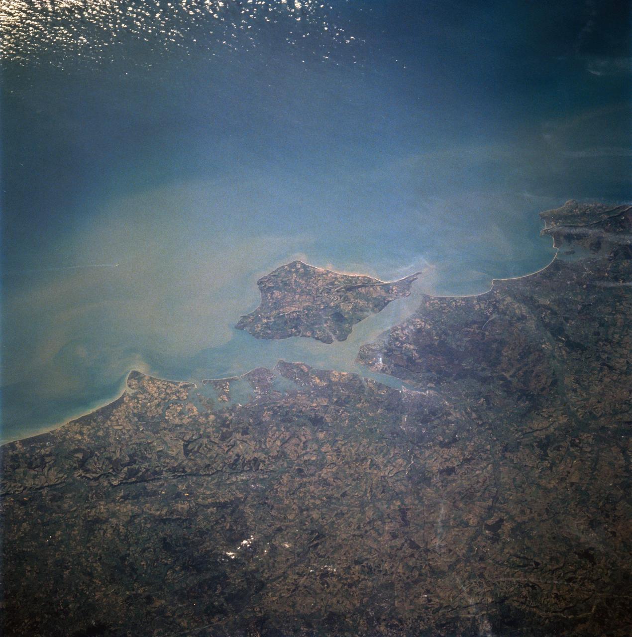
STS060-94-007 (3-11 Feb 1994) --- The Isle of Wight, over 380 square kilometers, is a diamond-shaped island located off the south coast of England. Separated from the mainland by The Solent, a narrow channel of water, the island is a popular resort area due to its scenery and mild climate. Sediment from English Lowland drainage systems, most notably the River Test, is visible entering The Solent and spilling into the English Channel. At the tip of the linear, northwestward inlet is the mouth of the Test and the city of Southampton, discernible as a small patch of lighter gray. Further east is a series of protected bays which are, from west to east: Portsmouth Harbour, Langstone Harbour, and Chichester Harbour. The city of Portsmouth is the location of Great Britain's chief naval station and arsenal. Portsmouth houses numerous ships of past and present glory. Two of the most notable vessels in Portsmouth are the 104-gun Victory, and the remains of the Mary Rose. The renowned HMS Victory, still carried on active duty rolls of the Royal Navy, and the acting Post Ship of the Royal Navy Base Commander, was built in 1765. The HMS Victory was severely damaged and dismasted in battle. A careful inspection of the original film will show the 175-foot long HMS Victory in this frame. According to NASA geologists it is extremely unusual for Portsmouth to be this cloud-free. It has been a site of some interest for many Space Shuttle missions during the past 10 years.
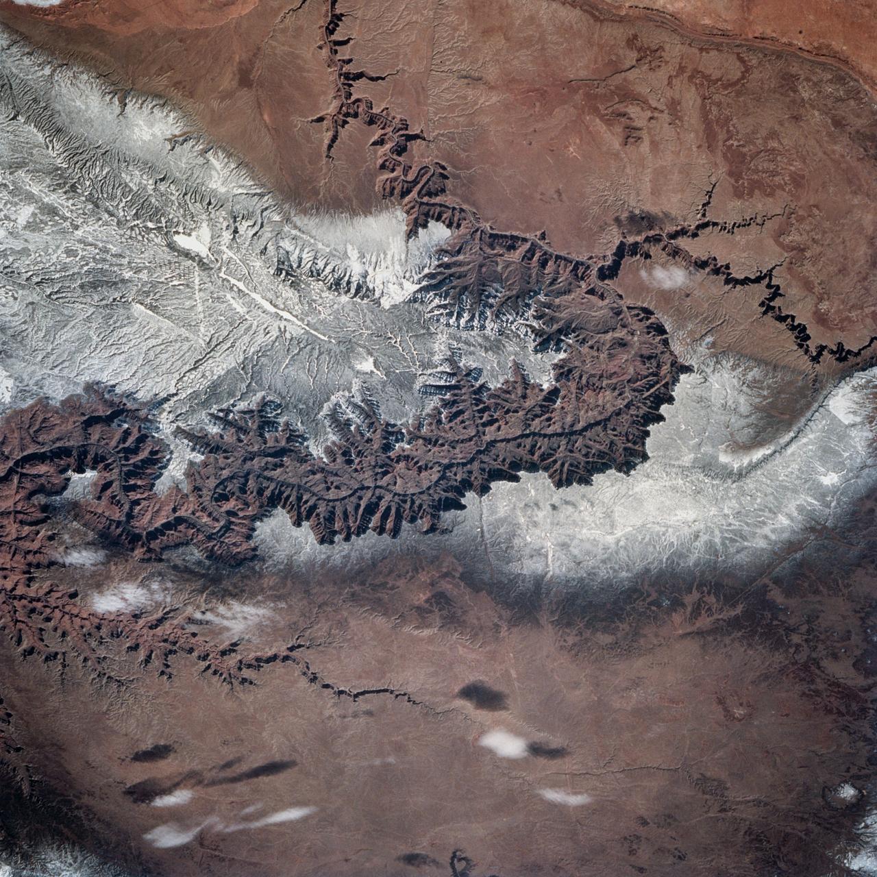
STS060-83-004 (3-11 Feb 1994) --- In this winter scene of the Grand Canyon of Arizona, the canyon is particularly well revealed because snow lies on the rims of the canyon, and exits mid-right; the Little Colorado River enters from the left, joining the Colorado just upstream of its big bend. Visitors to the South Rim can view the canyon in both the east-west and north-south reaches. The South Rim is closer to centers of transportation so that tourists mostly see the canyon from this area, that is from about 7,000 feet. The canyon floor lies at 2,000 feet in this sector. The most heavily snow covered area is the highest, reaching more than 9,000 feet (bottom right). Visitors see this protected area by hiking and mule and helicopter rides. The ecology of this part of the Colorado has been changed since the building of a lake upstream: river water is now derived from snow melt water from the bottom of the lake. This water is much colder than the water which used to flow through the canyon. According to NASA scientists, the view is unusual because the snow also reveals so well the higher country around the canyon, a swath stretching from bottom right to middle left of the view. This higher swath is an arch of uplifted rocks known as the Kaibab Plateau, raised vertically by tectonic forces in the recent geologic past. Despite this up parching, the Colorado River managed to maintain its course to the sea by cutting an ever deeper canyon into the Plateau. The white snow cover hides the fact that the Kaibab Plateau is thickly forested and thus appears dark green in summer, except in areas of clear-cutting. Since the Plateau reaches altitudes of 6 to 9,000 feet, it is both cooler and moister than the surrounding lower desert floor (top and bottom in this view) - where sparse vegetation and rocky country appear as brown colors. The zone of dark color running parallel to the snow line is all that can be seen of the pine forest on the south flanks of the Plateau.
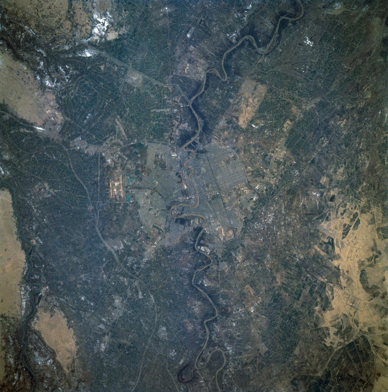
STS060-92-082 (3-11 Feb 1994) --- This cloud-free view is centered on the city of Baghdad, Iraq. Baghdad has had a reputation for scholarship and learning from ancient times in the Islamic world. Modern Baghdad is a city with a typical urban land use patterns. The color of Tigris river flowing through the city indicates the heavily sediment laden waters of the river. Agricultural land uses are evident in the surrounding areas of the city.
STS-60 pilot Ken Reightler (front left) and Mission Commander Charlie Bolden (front right) lead the way from the O&C bldg. enroute to Discovery at Pad 39A. Behidn are (from felt) Mission Specs Sega adn Krikalev: Payload Commander Chang-Diaz: and Misssion Spec Davis. (Op. No. D6022)(Item D-112C)
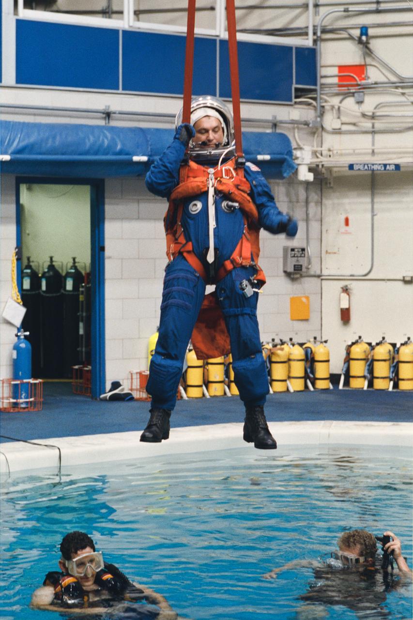
Cosmanaut Vladimir Titov, an alternate mission specialist for STS-60, simulates a parachute glide into water during a bailout training exercise at JSC. This phase of emergency egress training took place in JSC's Weightless Environment Training Facility (WETF).
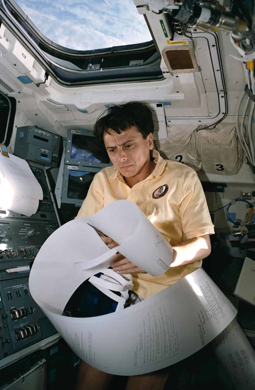
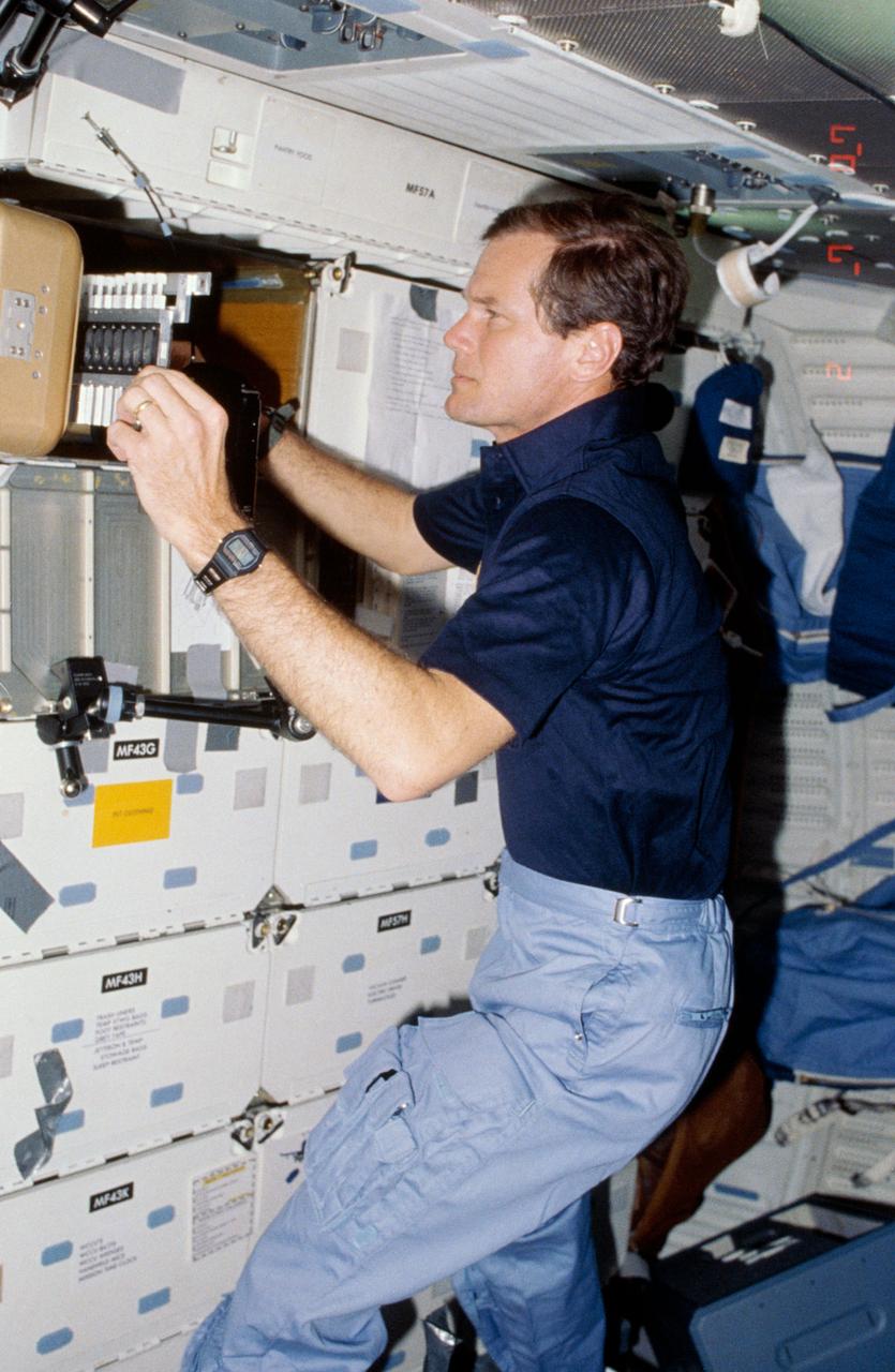
STS060-25-016 (6 Feb. 1994) --- On space shuttle Discovery?s aft flight deck, astronaut Franklin R. Chang-Diaz, STS-60 payload commander, begins to organize what was believed to be among the longest mail messages in shuttle history. Though early shuttle flights could brag of longer teleprinted messages, the Thermal Imaging Printing System?s day four correspondence, most of which is out of frame here, is record length for recent flights. Chang-Diaz joined four other NASA astronauts and a Russian cosmonaut for eight days aboard Discovery. Photo credit: NASA or National Aeronautics and Space Administration
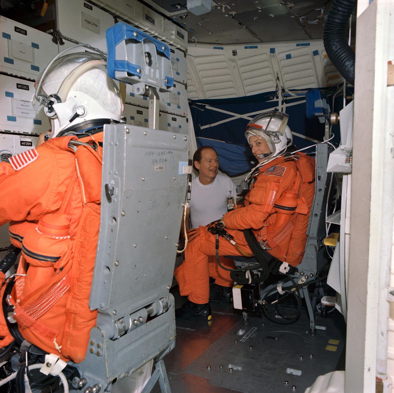
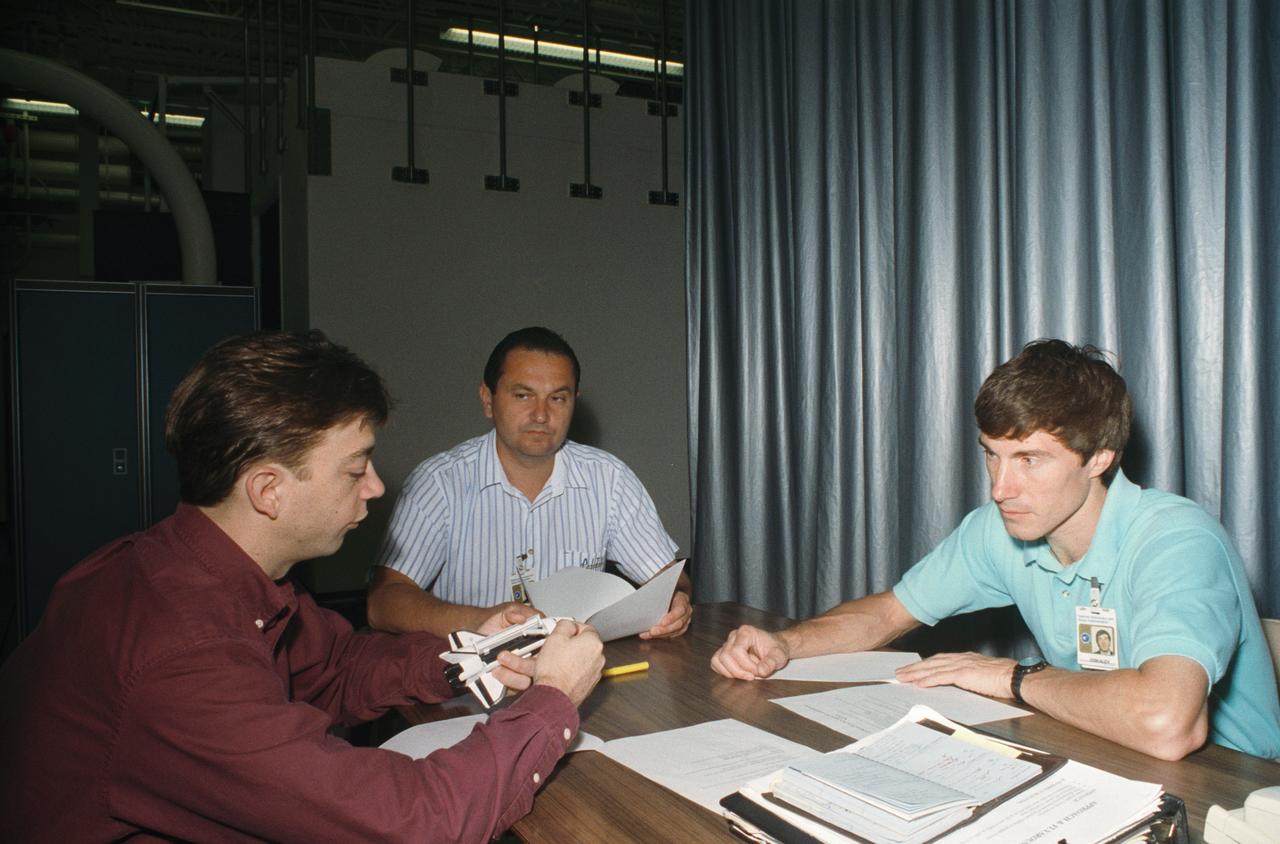
S93-50649 (Dec 1993) --- Cosmonaut Sergei Krikalev, mission specialist for the STS-60 mission, gets assistance with his launch and entry suit from Lockheed's Max Kandler during a training session at the Johnson Space Center (JSC). Others pictured, left to right, are astronauts Franklin R. Chang-Diaz, Ronald M. Sega and N. Jan Davis. This particular phase of training, conducted in the crew compartment trainer in the Shuttle mockup and integration laboratory, familiarizes the crew members with entry activities and launch countdown procedures, as well as emergency egress procedures.
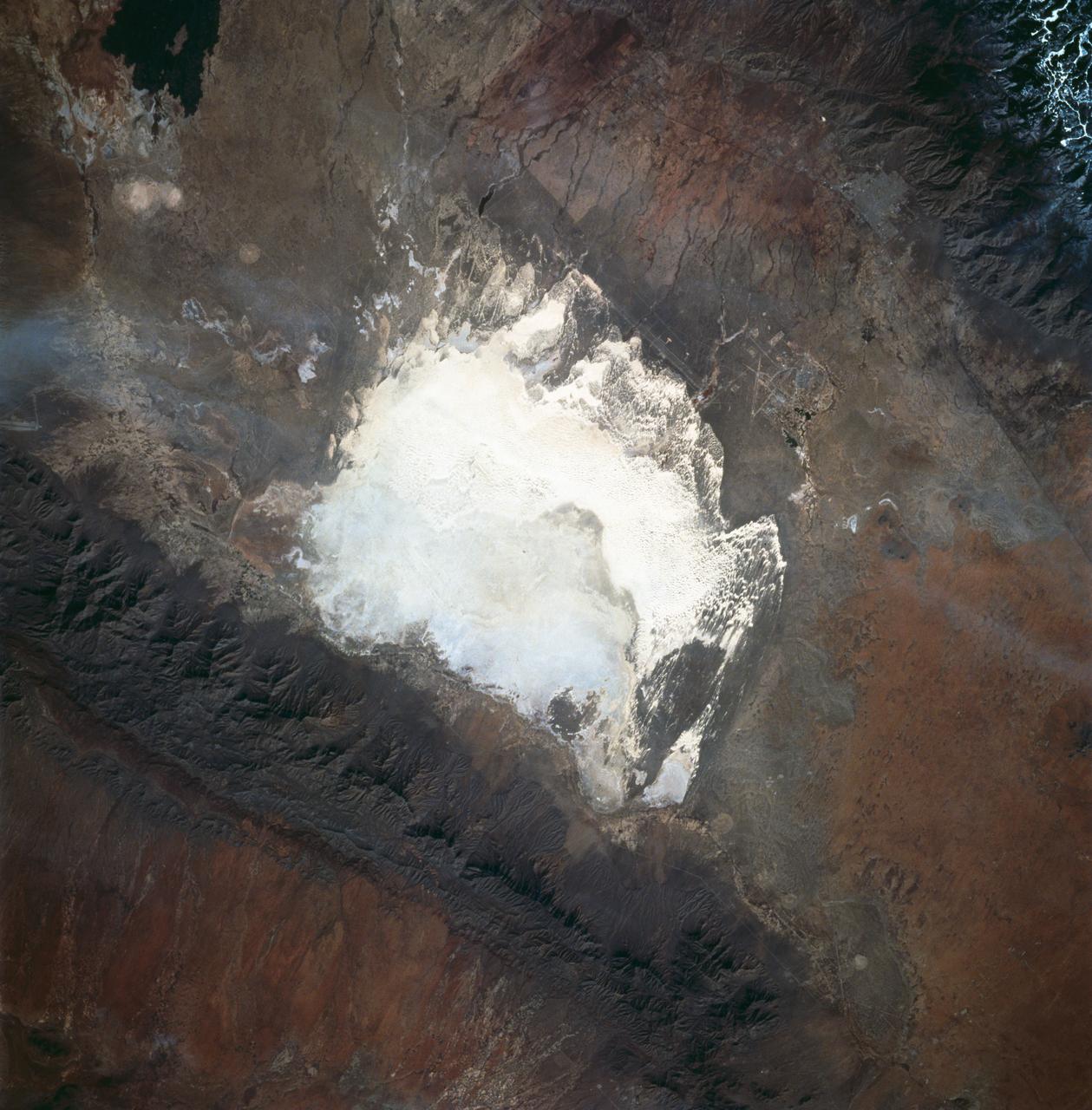
STS060-83-016 (3-11 Feb 1994) --- White Sands National Monument (Park) is easily recognized in the center of this near-vertical color photograph. White Sands is the world's largest gypsum dune field. It represents an alabaster sea that covers nearly 300 square miles. The National Park Service has the responsibility to preserve this unique feature, allowing the dune world to unfold in its natural environment, but without interference from humans. White Sands lies within a spectacular, oblong geological depression called the Tularosa Basin bounded by the Sacramento Mountains on the east and the San Andres Mountains on the west. Climatically the basin is a true desert, averaging less than 10 inches of rainfall per year. In terms of topographic relief the Sacramento Mountains attain elevations greater than 9,000 feet above sea level, while the San Andres Mountains on the west exceed altitudes of 8,000 feet. At the southwest corner of the White Sands is dry lake, Lucero. This lake is the lowest point in the Tularosa Basin at 3,900 feet. In terms of cultural features the city of Alamogordo (over 20,000 population) and Holloman Air Force Base can be seen with great clarity on this photograph. The area is accessible by highways U.S.70 & 82 from Las Cruces, New Mexico, and U.S.54 from El Paso, Texas.
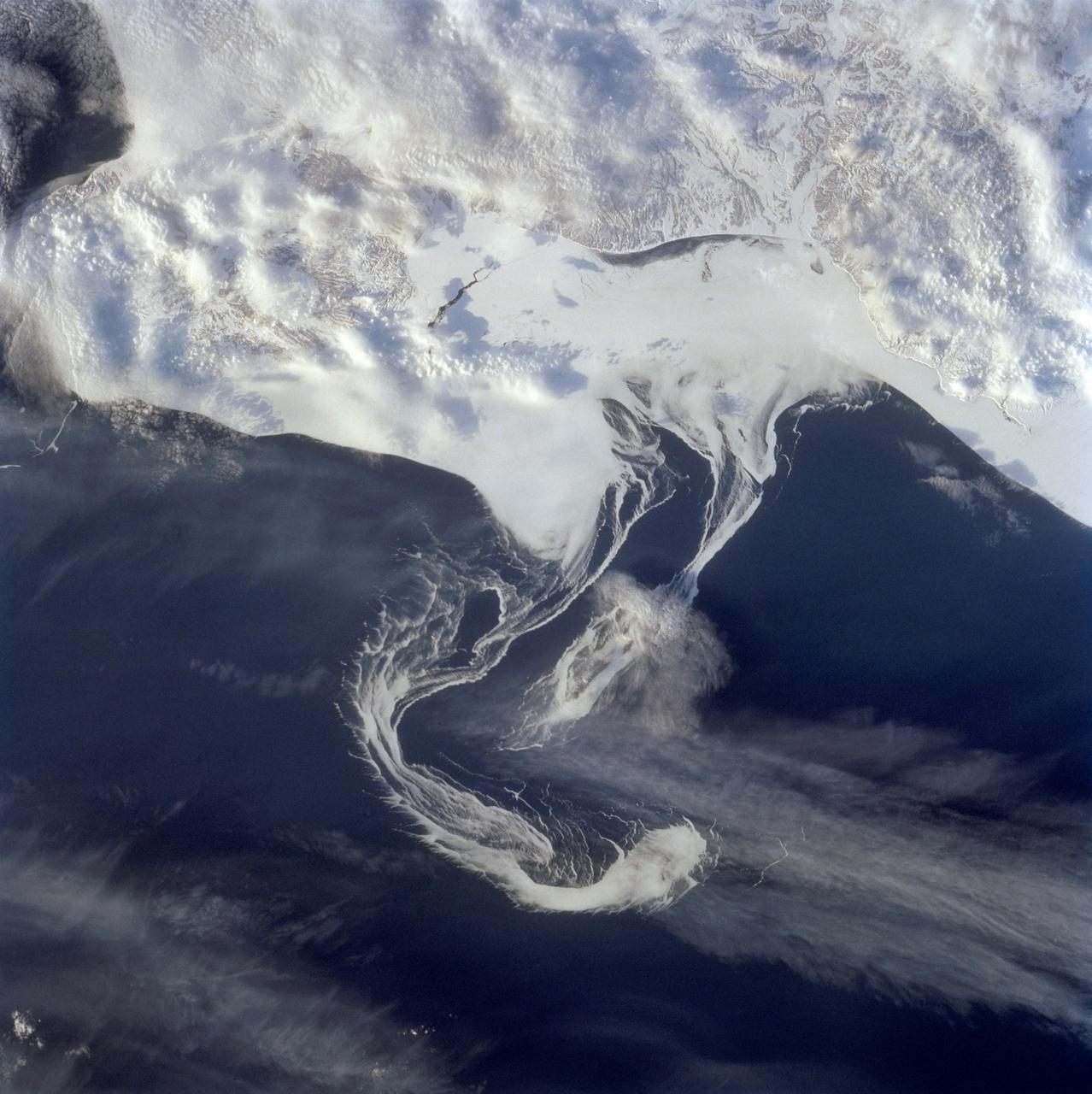
STS060-73-038 (3-11 Feb 1994) --- Pack ice is documented in this photograph along the coast of the Kamchatka Peninsula of Russia in Zaliv Ozernoj. Newly formed ice continually breaks away from the land and takes the form imposed by coastal currents. Detailed photographs of the ice provide information to scientists in both Russia and the united States about the location and fluctuation of ice edges, and how this new sea ice interacts with ocean and littoral currents. This information results in better ice warnings to shipping traffic and provides data points for long-range climate change research for both the Mission-To-Planet Earth and the Russian Priroda ("Nature") monitoring and assessment programs that are respectively coordinated by NASA and the Russian Academy of Sciences. This photography of ice development in the North Pacific, North Atlantic, the Southern Ocean, the Baltic and North Seas, and the Great Lakes is of great interest to the international scientific community. NASA scientists feel high-resolution analog and digital photography from the Space Shuttle and future craft can be a particularly important component in satisfying their data needs on both an operational and a long-term research basis.
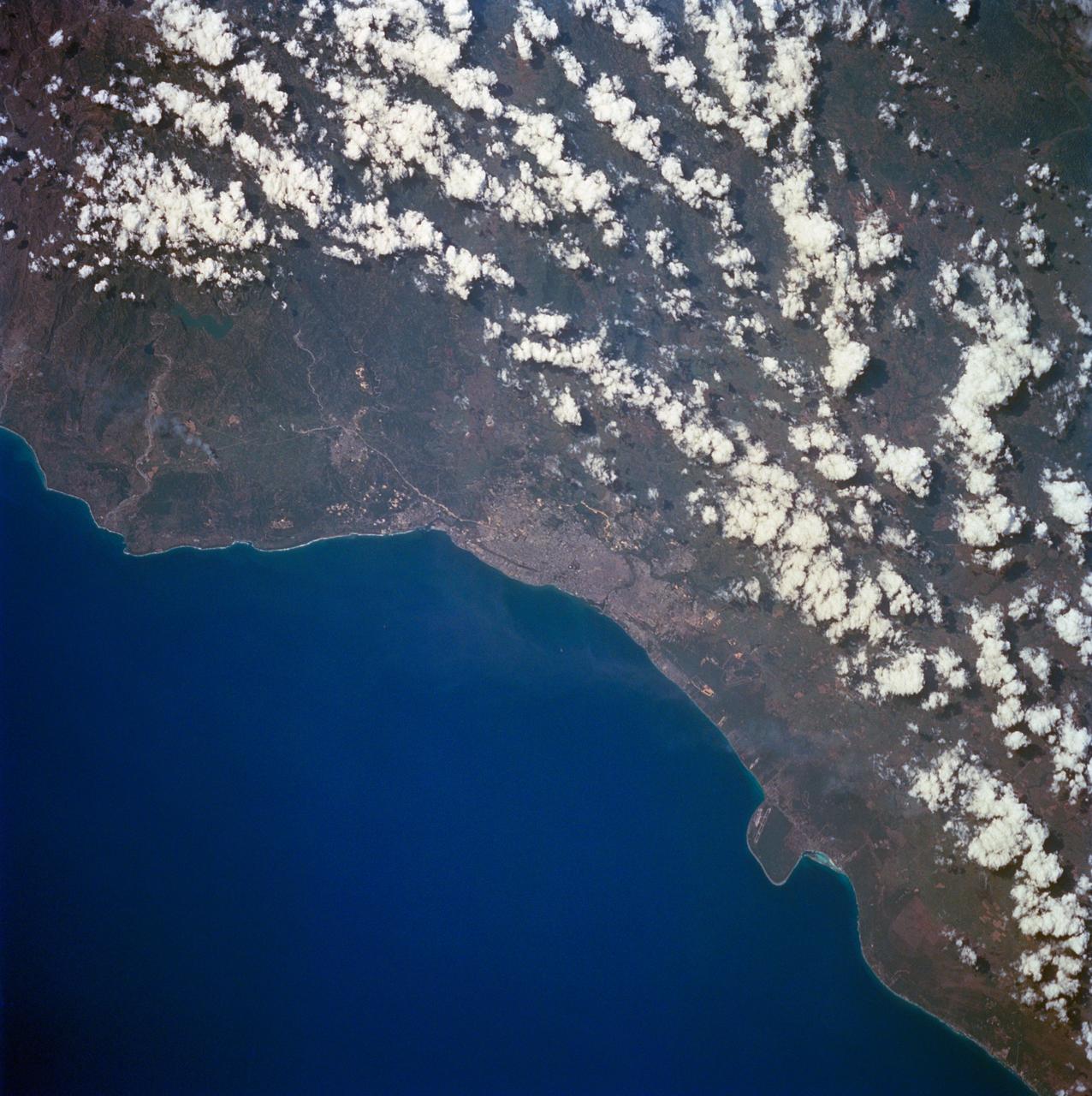
STS060-84-063 (3-11 Feb 1994) --- This is an excellent photograph of the coastal city of Santo Domingo on the Caribbean Sea. The airports including De las Americas International Airport are clearly seen. This photo illustrates the resolving power of the films. For example, two isolated smoke plumes are clearly seen each side of the city.
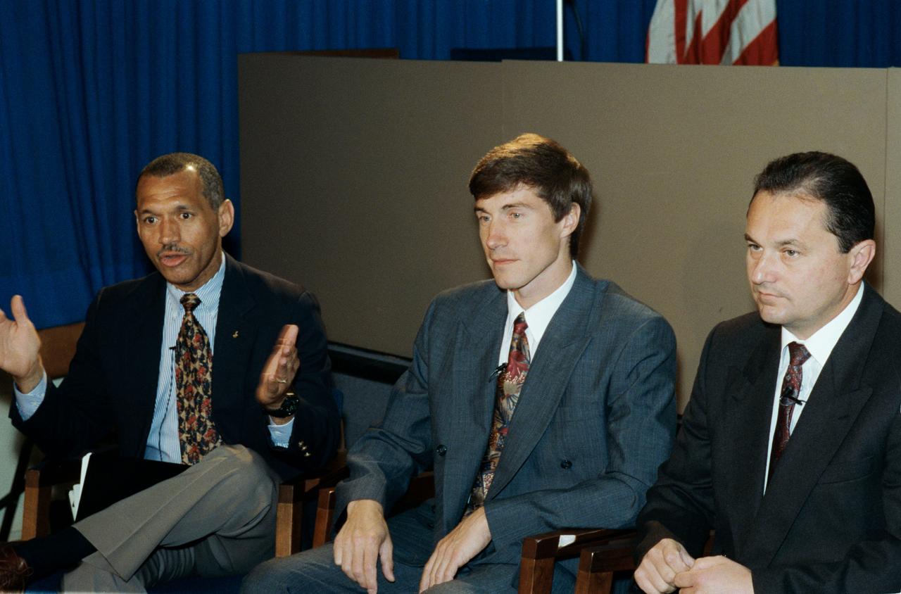
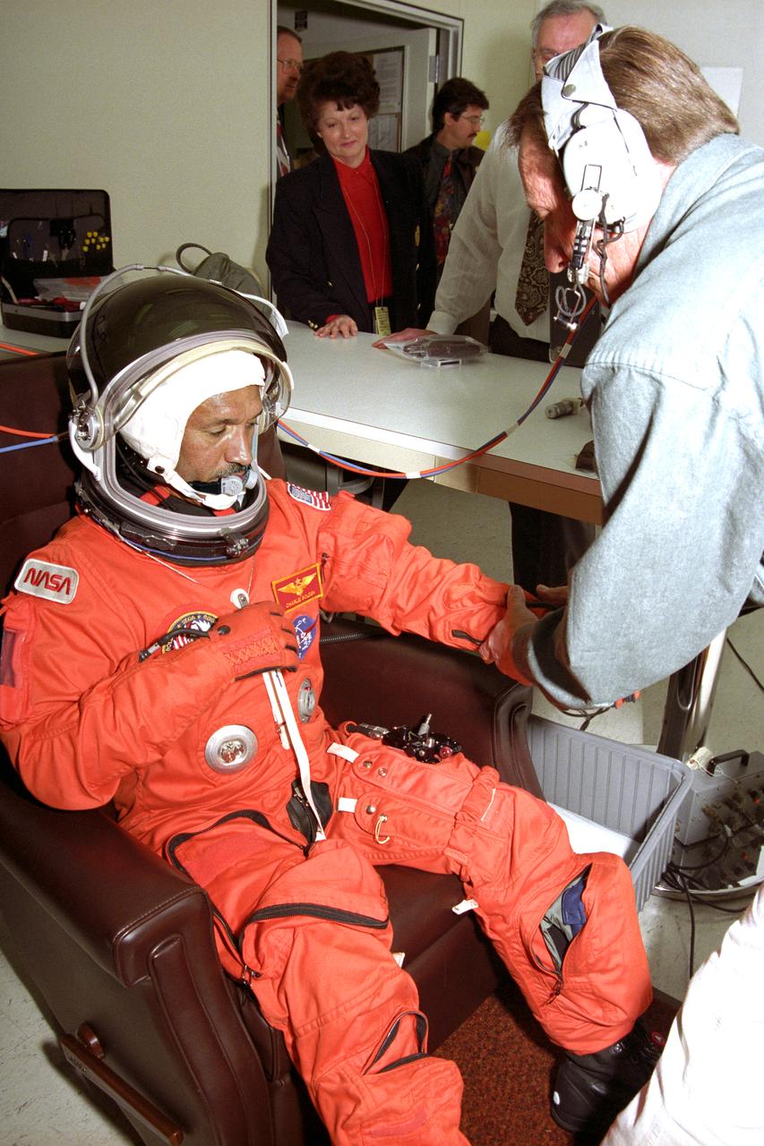
Two prime crew members and an alternate are pictured during a mission planning session in JSC's public affairs facility. Left to right are astronaut Charles F. Bolden Jr., mission commander; and Cosmonauts sergei Krikalev and Vladimir Titov, prime and alternate mission specialists, respectively.
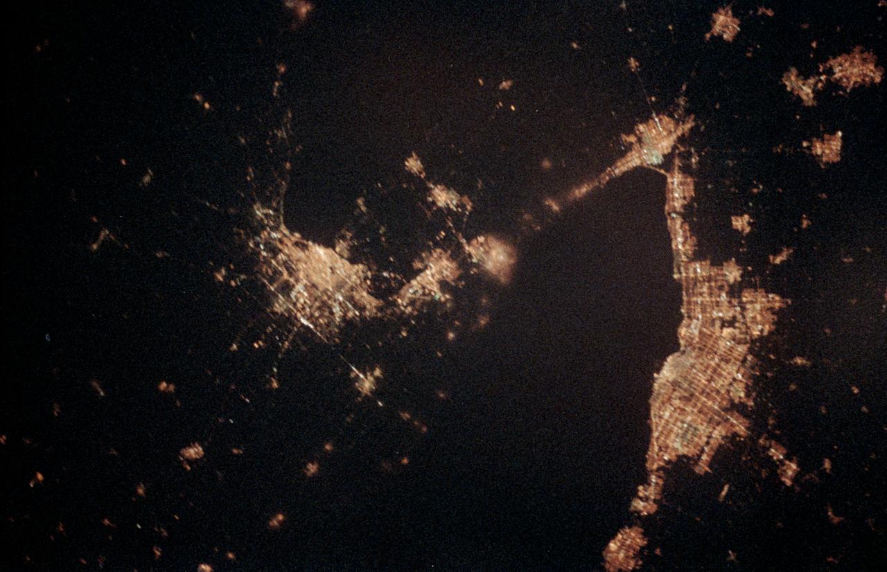
STS060-06-037 (3-11 Feb 1994) --- The city lights of Buffalo and Toronto outline the shores of the east end of Lake Erie and the west end of Lake Ontario in this night scene of western New York and southern Ontario. Between the two major cities are the cities of Niagara Falls, New York and Niagara Falls, Canada, which straddle the Niagara River just north of the actual falls. This photograph was taken with a special ASA-1600 film that is normally used for night-time photography of aurora, noctilucent clouds, biomass burning, and city lights.
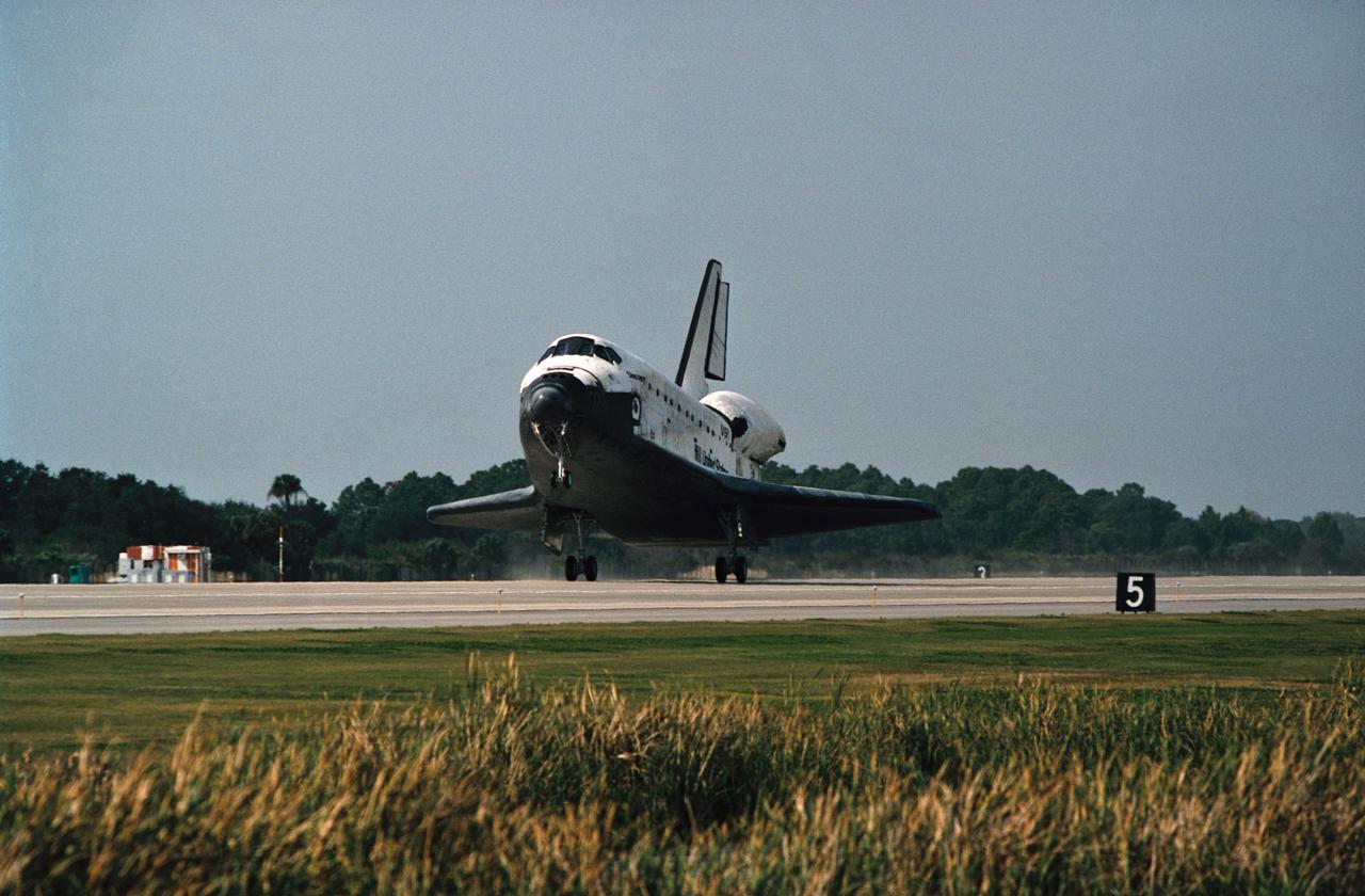
The drag chute for Space Shuttle Discovery is deployed on the Shuttle Landing Facility, marking the end to the eight-day STS-60 mission. Landing occurred at 2:19:22 p.m. (035); The main landing gear on the Space Shuttle Discovery touches down on the Shuttle Landing Facility (036); The main landing gear on the Space Shuttle Discovery is about to touch down on the Shuttle Landing Facility. Note the Shuttle Training Aircraft (STA) monitoring the landing phase of the mission (037).

The drag chute for Space Shuttle Discovery is deployed on the Shuttle Landing Facility, marking the end to the eight-day STS-60 mission. Landing occurred at 2:19:22 p.m. (035); The main landing gear on the Space Shuttle Discovery touches down on the Shuttle Landing Facility (036); The main landing gear on the Space Shuttle Discovery is about to touch down on the Shuttle Landing Facility. Note the Shuttle Training Aircraft (STA) monitoring the landing phase of the mission (037).
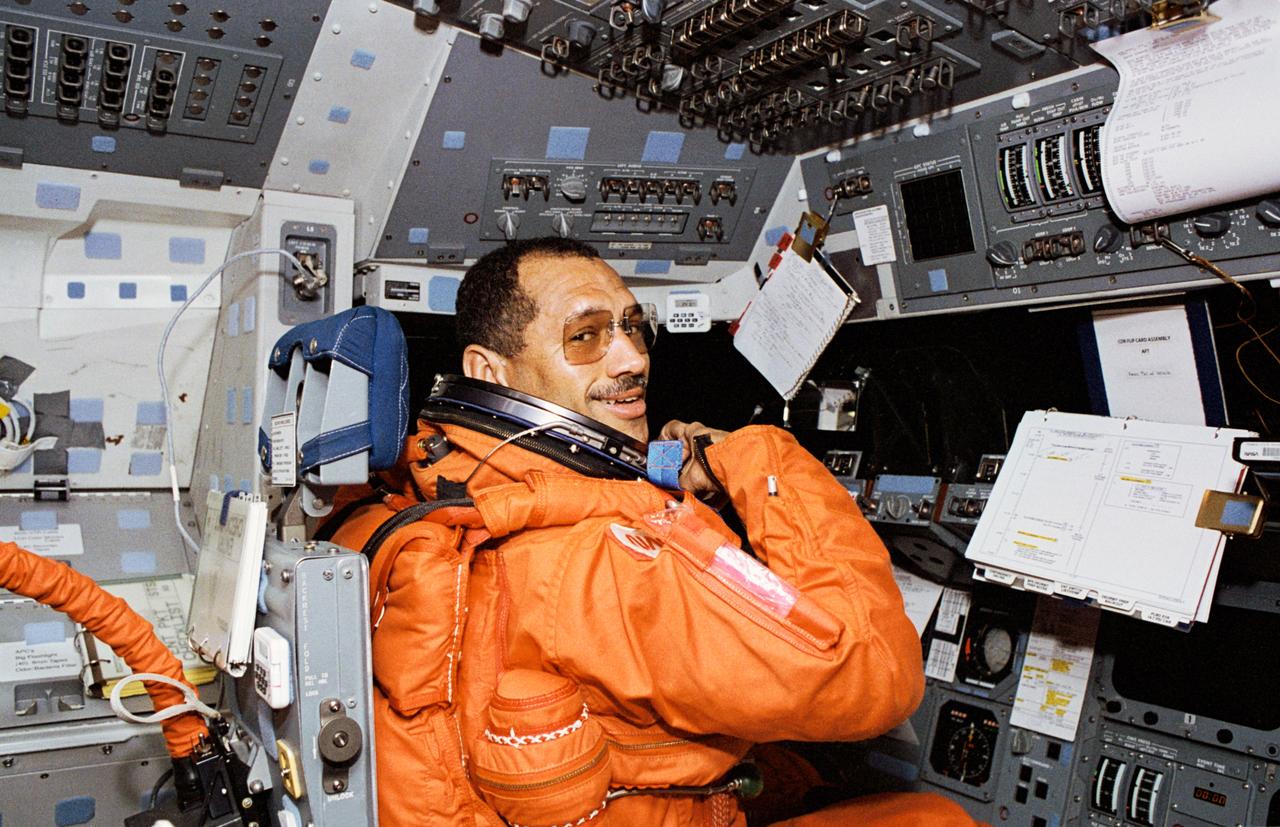
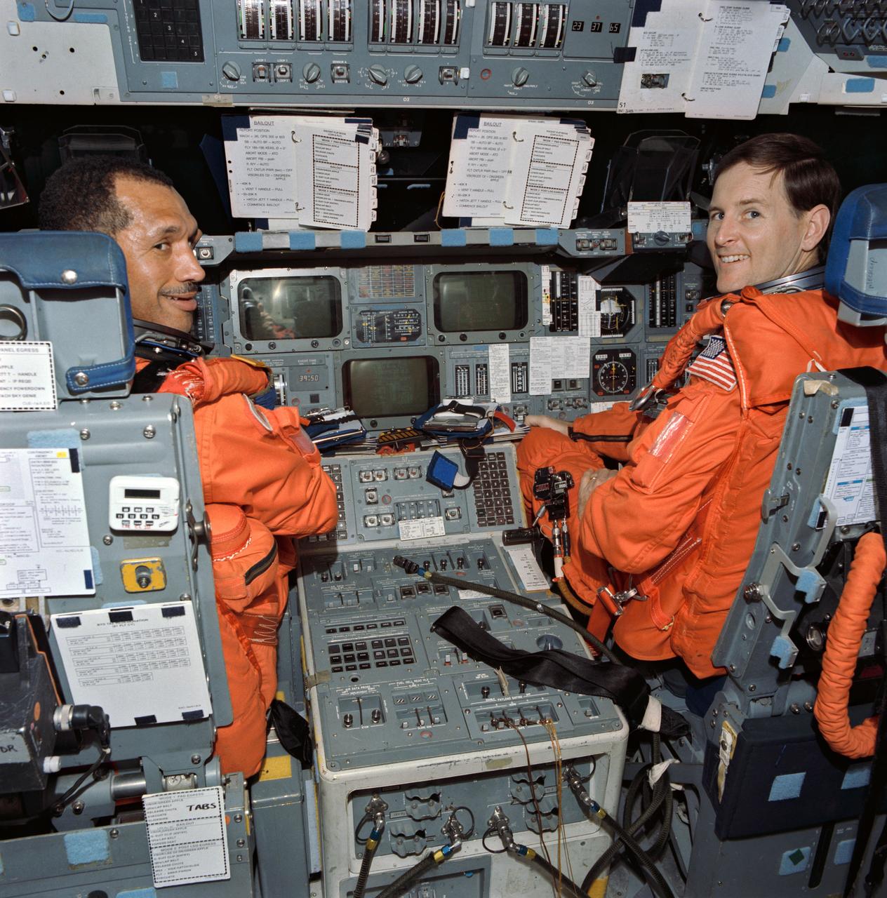
STS060-302-001 (3-11 Feb.1994) --- STS-60 commander Charles F. Bolden is seen at the commander's station on the forward flight deck of the space shuttle Discovery. He is wearing the orange launch and entry suit. Bolden and his crewmates performed proximity operations with the Russian Mir space station. Photo credit: NASA
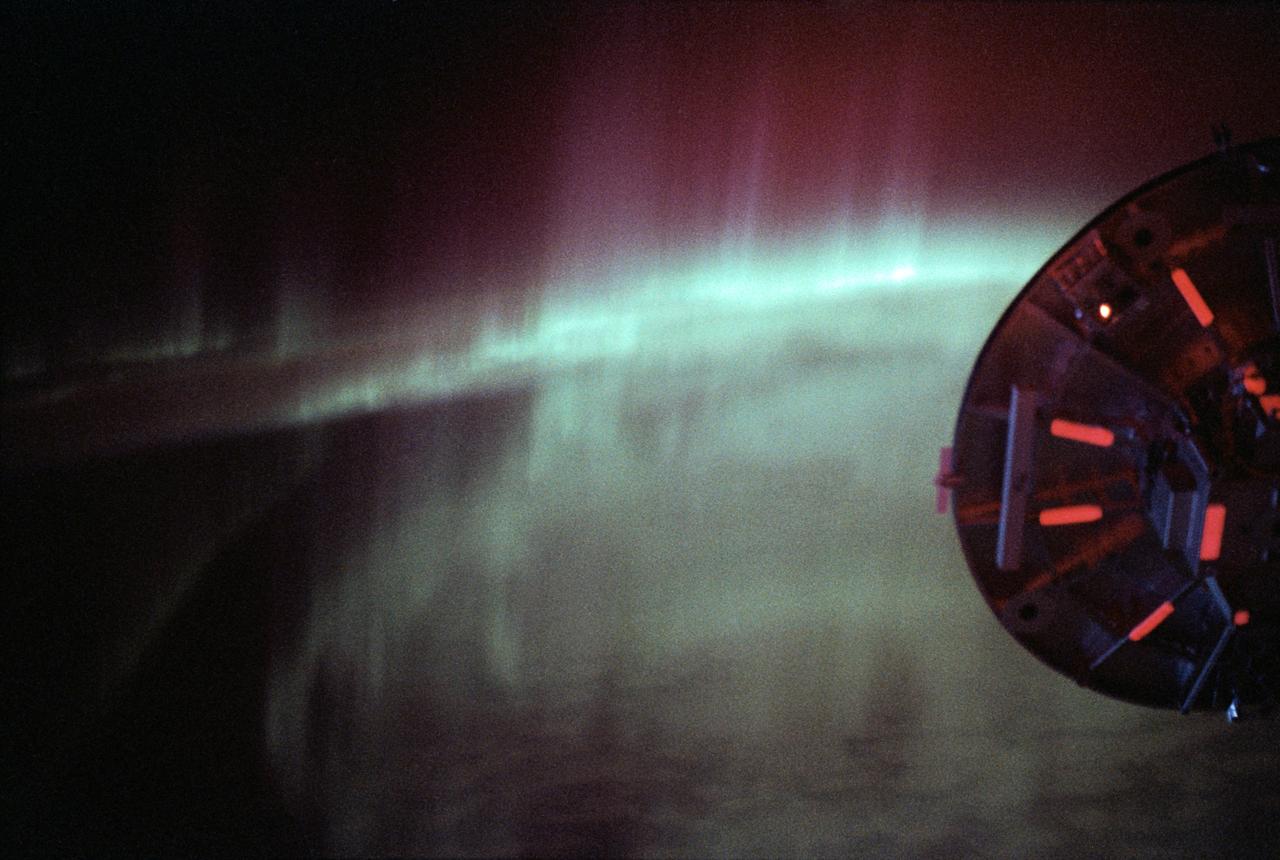
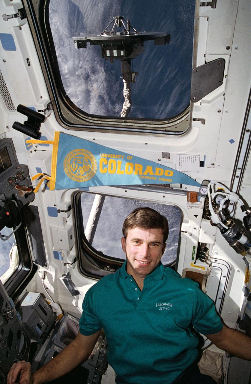
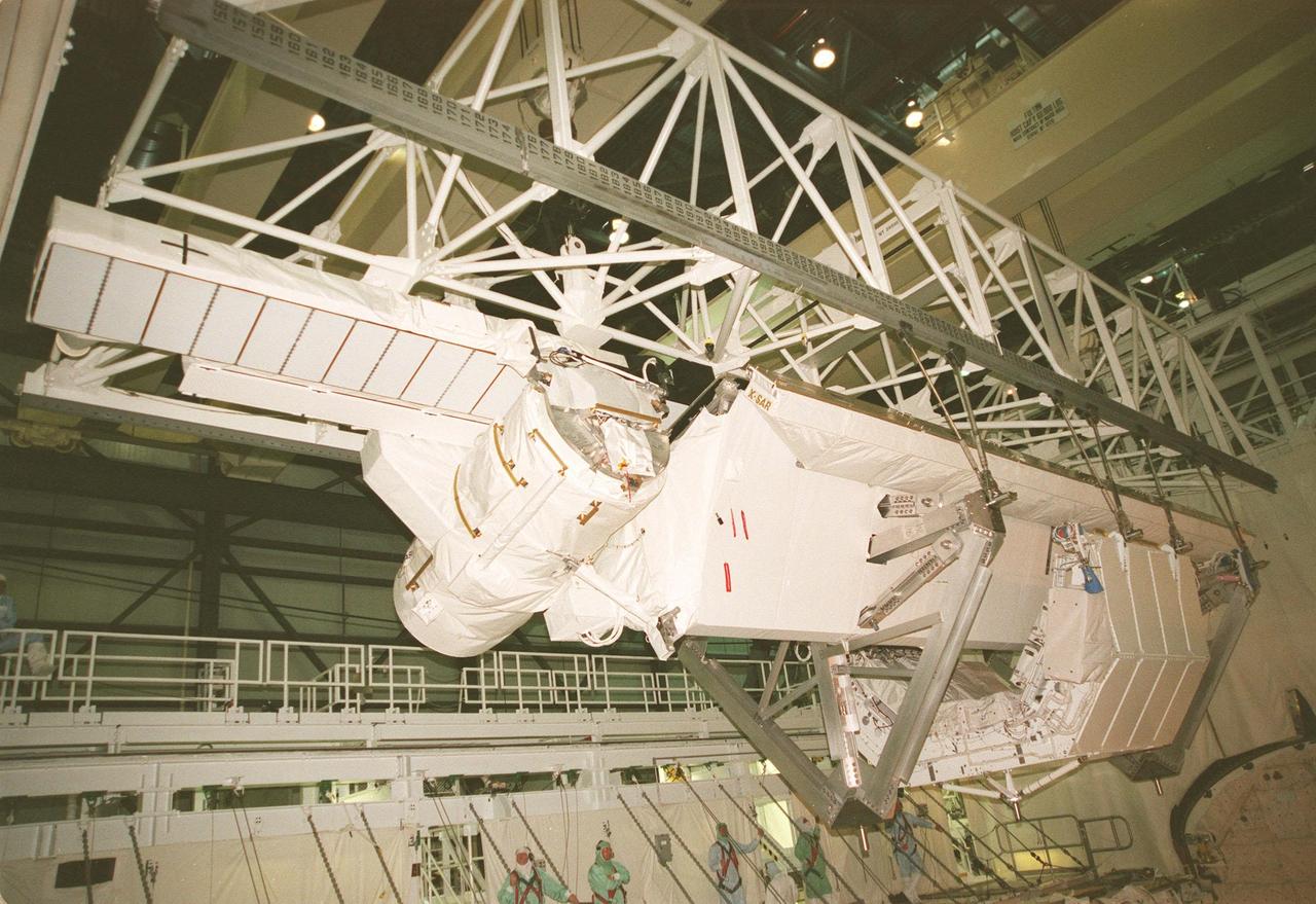
STS060-09-024 (3-11 Feb 1994) --- As the Space Shuttle Discovery flew over a point between New Zealand and Australia, one of the STS-60 crew members used a 35mm camera to capture this image featuring three-fourths of the disc of the Wake Shield Facility (WSF) back dropped against the Southern Lights. The WSF was in the grasp of the Remote Manipulator System (RMS) end effector (out of frame at right).
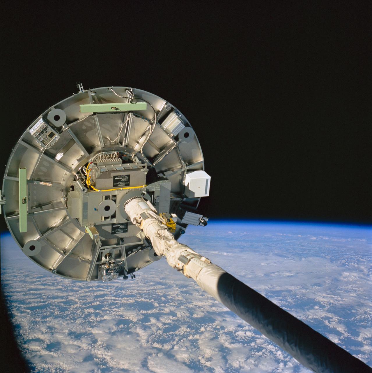
STS060-76-095 (3-11 Feb 1994) --- The ram side of the Wake Shield Facility (WSF) in the grasp of the Space Shuttle Discovery's Remote Manipulator System (RMS) arm is featured in this 70mm frame. Clouds over the Atlantic Ocean and the blackness of space share the backdrop for the picture. Five NASA astronauts and a Russian cosmonaut spent eight days in Earth orbit in support of the STS-60 mission.
S93-26022 (Feb 1993) --- Russian cosmonaut Sergei Krikalev maneuvers a small life raft during bailout training at the Johnson Space Center's (JSC) Weightless Environment Training Facility (WET-F). Shuttle crew members frequently utilize the 25-ft. deep pool to learn proper procedures to follow in the event of emergency egress from their Space Shuttle via the escape pole system. Krikalev is one of two cosmonauts in training for the STS-60 mission. One of the two will serve as primary payload specialist with the other filling an alternate's role. This pool and the facility in which it is housed are titled the WET-F because they are also used by astronauts rehearsing both mission-specific and contingency extravehicular activities (EVA).
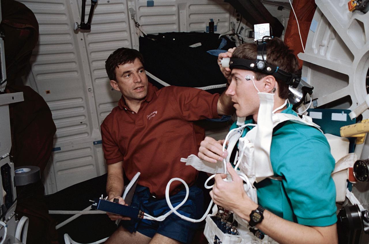
STS060-21-027 (3-11 Feb 1994) --- Astronaut Ronald M. Sega (left) and Russian cosmonaut Sergei K. Krikalev work on a joint U.S./Russian metabolic experiment on the Space Shuttle Discovery's middeck. A number of other U.S./Russian cooperative Detailed Supplementary Objectives (DSO) are included among the experiments conducted on the eight-day mission.
KENNEDY SPACE CENTER, FLA. -- STS-60: Discovery
STS-60, Commander Charlie Bolden arrived at KSC's Shuttle Landing Facility. Along with five fellow crew members. Bolden will spend a couple of days at KSC participating in the Termianl countdown Demonstration Test. STS-60 is currently slated for liftoff from Pad 39A around February 3.
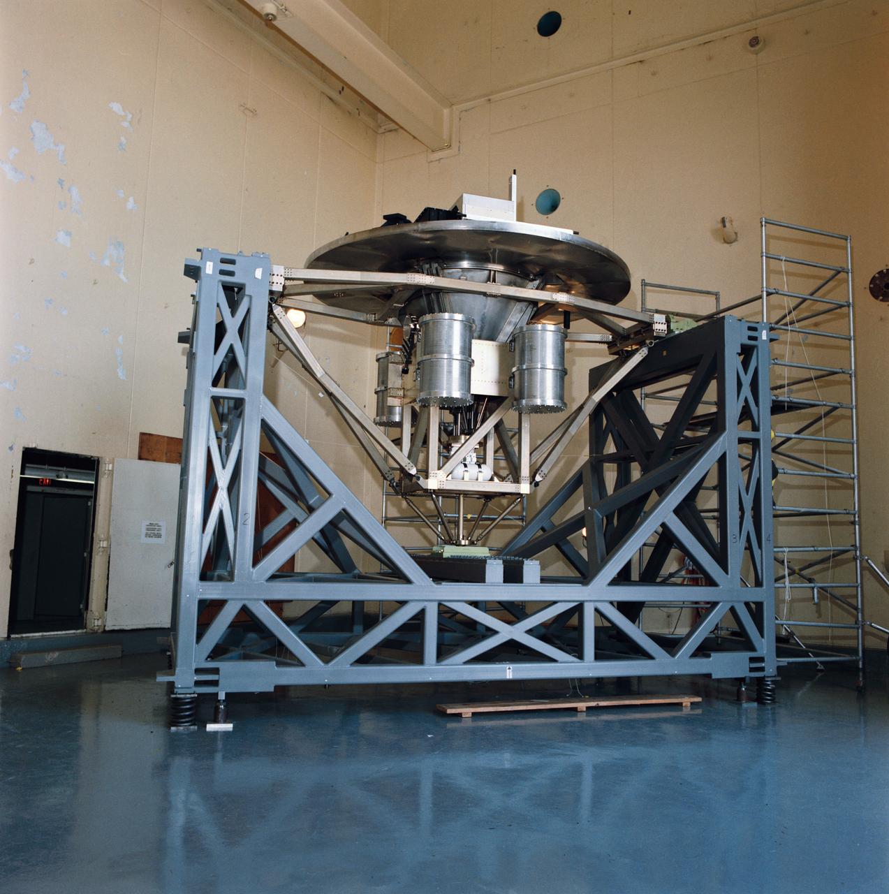
Pictured on a test stand at JSC is the Wake Shield Facility scheduled to fly on STS-60.
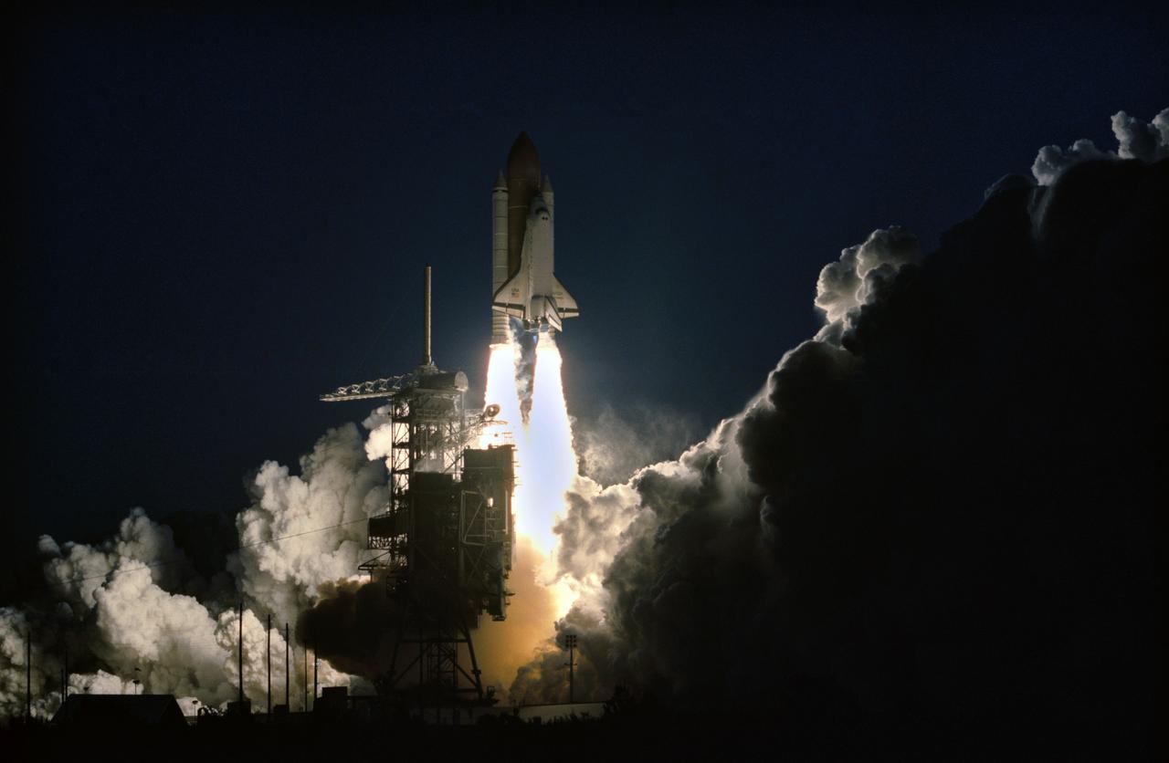
STS060-S-105 (3 Feb 1994) --- The Space Shuttle Discovery heads toward an eight-day mission in Earth orbit with five NASA astronauts and a Russian cosmonaut aboard. Liftoff occurred as scheduled at 7:10 a.m. (EST), February 3, 1994. Aboard the spacecraft were astronauts Charles F. Bolden Jr., commander; Kenneth S. Reightler Jr., pilot; Franklin R. Chang-Diaz, payload commander; and N. Jan Davis and Ronald M. Sega, mission specialists, along with Russian cosmonaut Sergei K. Krikalev, also a mission specialist.
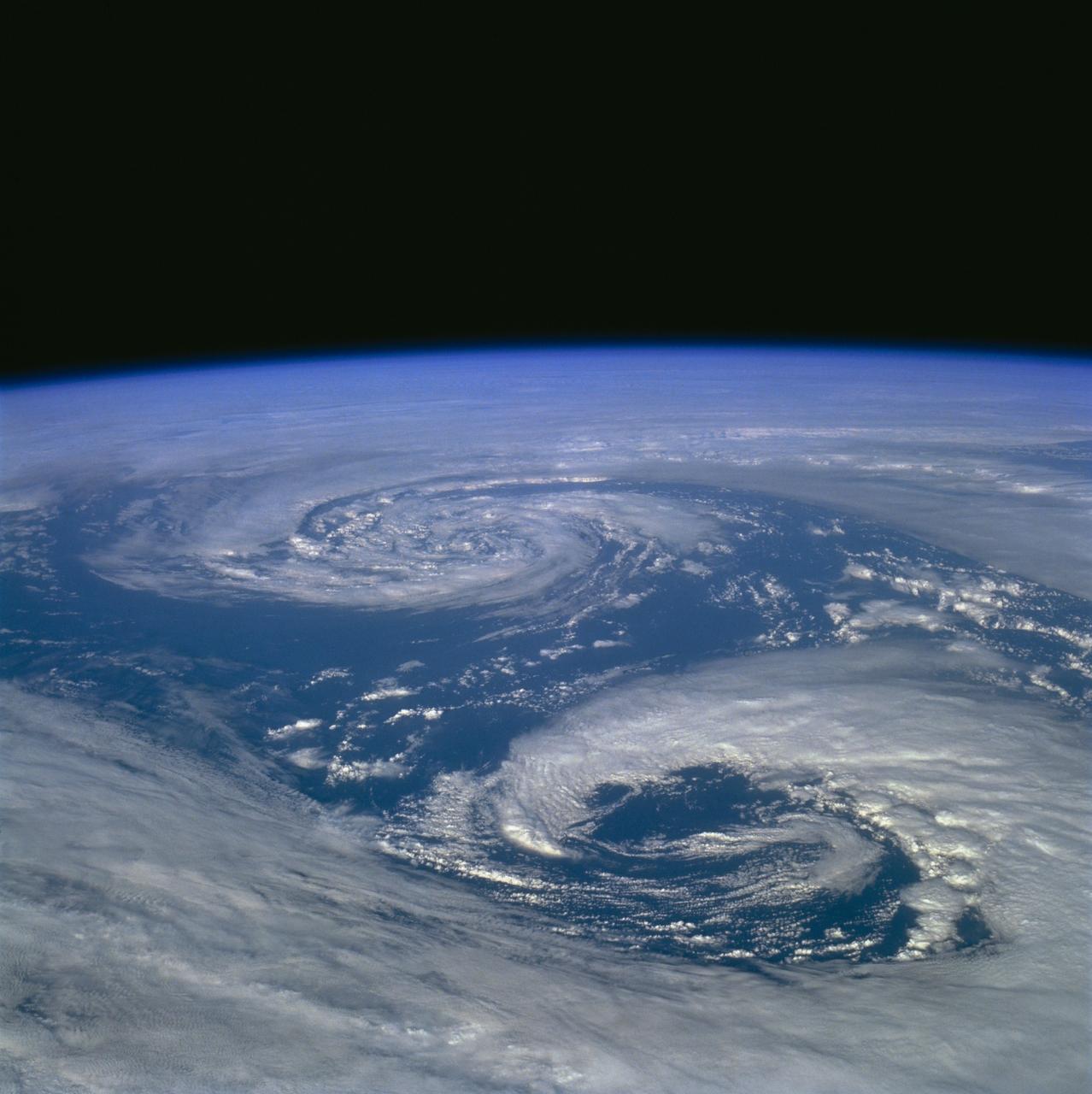
STS060-89-000N (3-11 Feb 1994) --- Two areas of low pressure in the Bering Sea were captured on 70mm film by one of the STS-60 crew members on the Space Shuttle Discovery's aft flight deck.
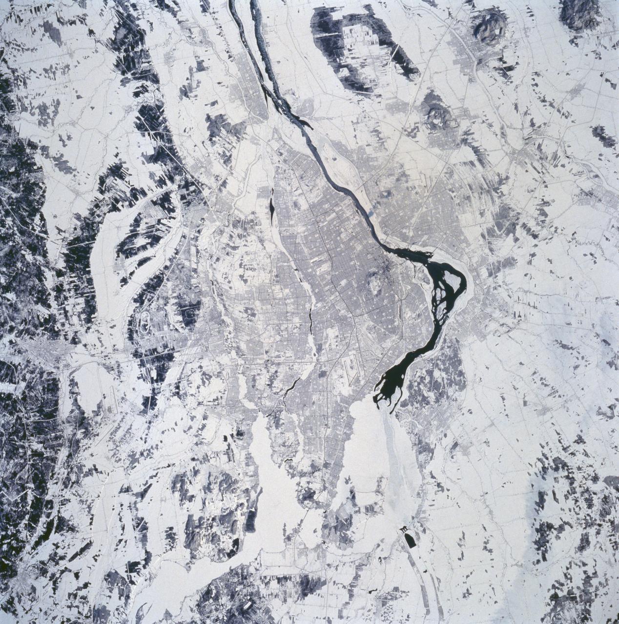
STS060-94-072 (3-11 Feb 1994) --- The city of Montreal is located on the island of Montreal at the confluence of the St. Lawrence and Ottawa Rivers. Despite its distance from the sea (1,000 miles) Montreal is a large inland port. It is also Canada's largest city and the second largest French speaking city in the world. This particular snow covered scene highlights the major highways and street patterns throughout the metropolitan Montreal area. The runways of the two large international airports of Mirabel (located 25 miles northwest of downtown Montreal) and Dorval (located approximately 8 miles west of the downtown area) are clearly visible on this photograph. Even the outline of Mount Royal Park, an imposing hilly feature near the downtown central business district, can be seen. Patches of open, ice-free (very dark areas) are detectable as the St. Lawrence River (Seaway) makes its way along the south and southeastern side of Montreal.
STS060-90-028 (3-11 Feb 1994) --- This view is centered over Rome and covers approximately 3,600 square miles. Anzio, the site of the January 22, 1944, Allied landing in Central Italy, is on the coast at the lower left. The coastal protuberance near the center is Ostia. This Roman Empire port on the Tiber River silted in and was covered over. It is now an archeological site and a tourist attraction. Southeast of the mouth of the Tiber is the Pontine Marsh. These marshlands were drained in the 1930's and have been converted to farmland. Volcanism formed the land in the region. It is evidenced in the circular caldera lakes visible. Castel Gandolfo, part of the Papal State, is on Lake Albano toward the bottom of the frame. Rome was founded during the Bronze Age on a river crossing. The road from the coast along the river was the main route for the early salt trade. The city became the capital of modern Italy in 1861. It has undergone explosive growth since World War II and now has a population of over three million people. Leonardo da Vinci (Fiumicino) Airport, the main international airport, is visible near the coast north of the Tiber River.

STS060-301-003 (3-11 Feb 1994) --- Astronaut Kenneth S. Reightler, STS-60 pilot, processes biomedical samples in a centrifuge aboard the SPACEHAB module. Reightler joined four other NASA astronauts and a Russian cosmonaut for eight days of research aboard the Space Shuttle Discovery.
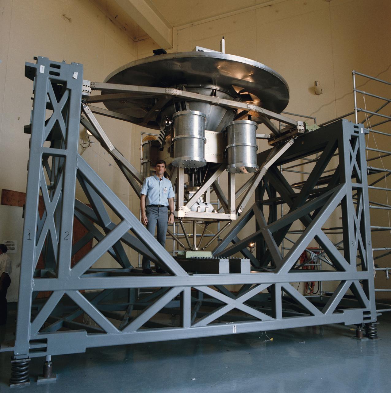
Astronaut Ronald M. Sega stands beside the University of Houston's Wake Shield Facility before it undergoes a Modal Survey Test in the Vibration and Acoustic Test Facility Building 49, prior to being flown on space shuttle mission STS-60.
61C-05-036 (12-18 Jan. 1986) --- U.S. Representative Bill Nelson (Democrat - Florida), STS-61C payload specialist, prepares to photograph individual samples in the Handheld Protein Crystal Growth Experiment (HPCG) on Columbia's middeck. The operations involve the use of four pieces of equipment to attempt the growth of 60 different types of crystals -- 12 by means of dialysis and 48 via the vapor diffusion method. The photo was used by members of the STS-61C crew at their Jan. 23, 1986, Post-Flight Press Conference.
KENNEDY SPACE CENTER, FLA. - This bird's-eye view of a high bay in the Orbiter Processing Facility (OPF) shows Space Shuttle Atlantis surrounded by the standard platforms and equipment required to process a Space Shuttle orbiter for flight. The high bay is 197 feet (60 meters) long, 150 feet (46 meters) wide, 95 feet (29 meters) high, and encompasses a 29,000-square-foot (2,694-meter) area. Platforms, a main access bridge, and two rolling bridges with trucks provide access to various parts of the orbiter. The next mission scheduled for Atlantis is STS-114, a utilization and logistics flight to the International Space Station.
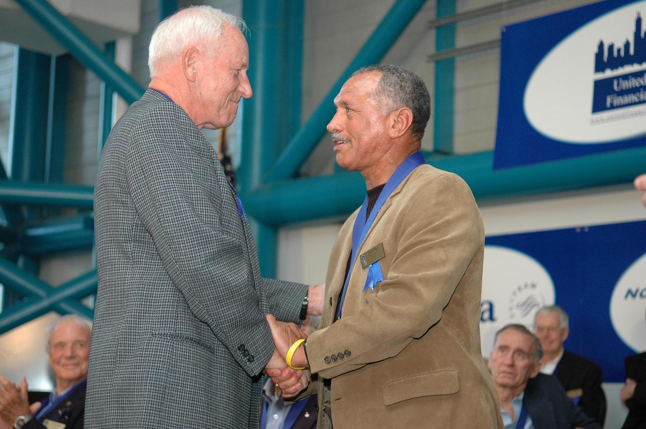
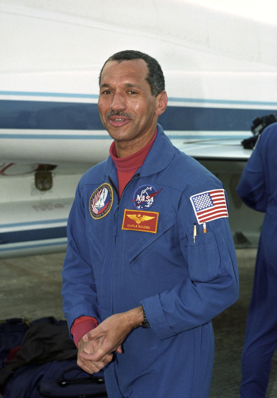
KENNEDY SPACE CENTER, FLA. - Charles F. Bolden Jr. (right) accepts congratulations from Al Worden, U.S. Astronaut Hall of Fame member and chairman of the Astronaut Scholarship Foundation. The occasion is the 2006 induction ceremony for the U.S. Astronaut Hall of Fame, held in the Apollo/Saturn V Center. The inductees for 2006 are former NASA astronauts Bolden, Henry "Hank" Hartsfield Jr. and Brewster H. Shaw Jr. Bolden flew on four space shuttle missions including STS-61C, STS-31, STS-45 and STS-60, logging 680 hours in space. The U.S. Astronaut Hall of Fame now includes 63 space explorers. Photo credit: NASA/Kim Shiflett
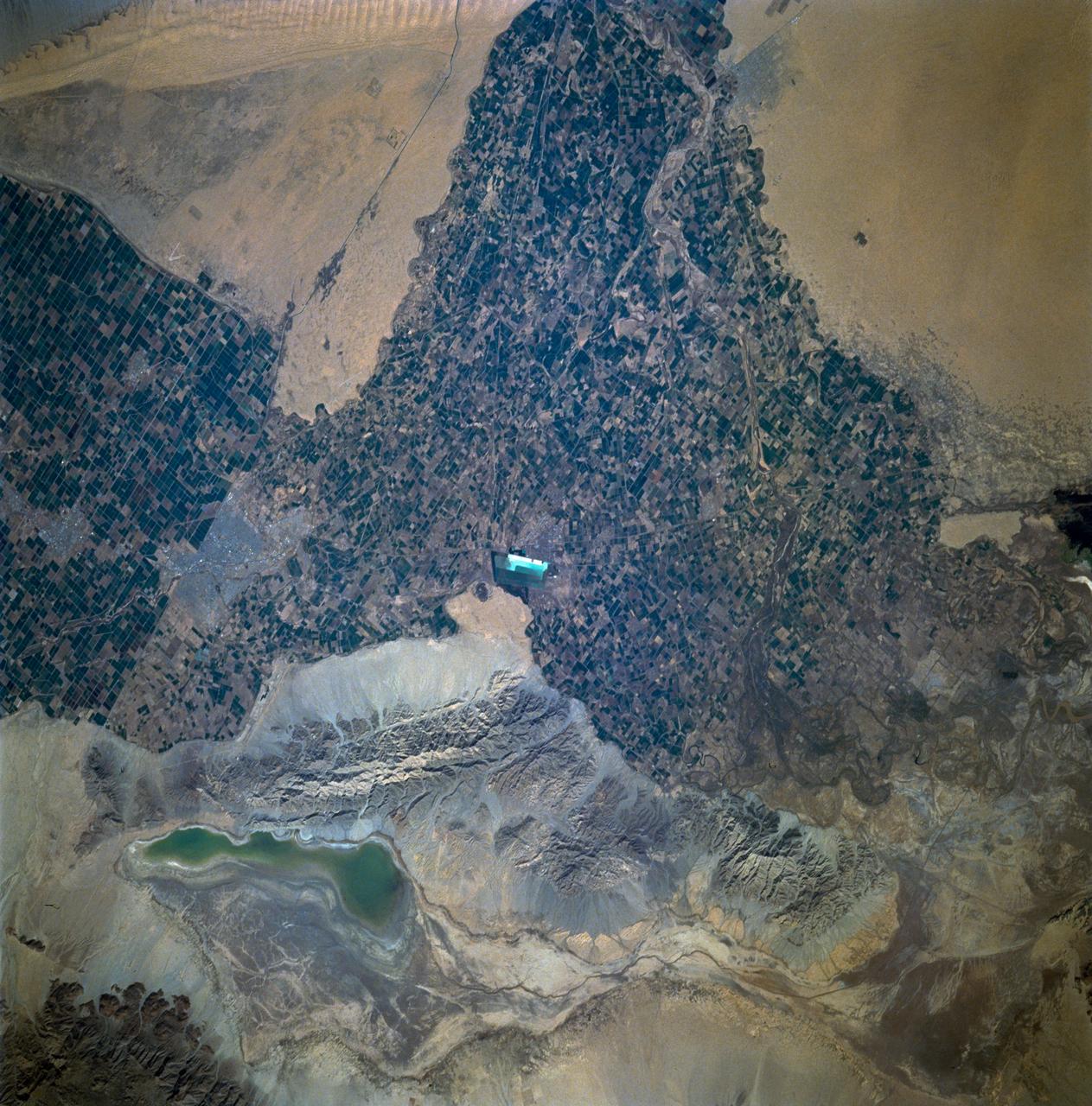
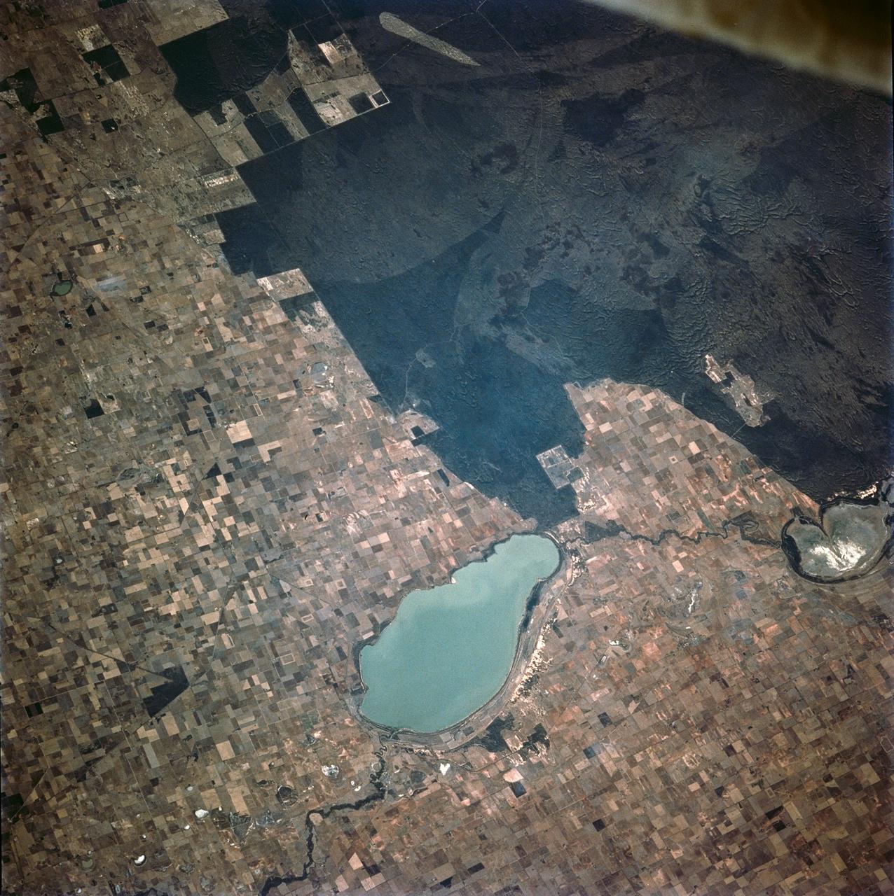
STS060-93-081 (3-11 Feb 1994)--- The Imperial Valley was documented using three films - color visible (seen here), the American infrared film (Kodak Aerochrome 2443), and the Russian panchromatic infrared film (SN-10). Results of this test still await detailed science analysis. However it does appear that good data was acquired of the region, and this data will be complemented by photography acquired by the Mir cosmonauts. In this frame, the U.S.-Mexico border goes from the upper left to the middle right. It is discernible as a vegetation line between Calexico, California and Mexicali, Mexico. The darker vegetation north of that line is due to different agricultural practices, heavier uses of fertilizers and pesticides, and lined (tiled) agricultural fields allowing subterraneean runoff of saline irrigation runoff. South of the line, the more polluted water draining out of the U.S. agricultural areas into the Mexican area has resulted in higher soil salinities and a consequent reduction in agricultural productivity. At the center of the frame, a large settling and desalinization plant has been built to attempt to purify, to some degree, the polluted irrigation waters draining south out of California. The All-American Canal, which brings in water from the Colorado River (off the frame, to the right), is located in the middle right hand portion of the frame. To the upper left is the normally dry Laguna Salada.
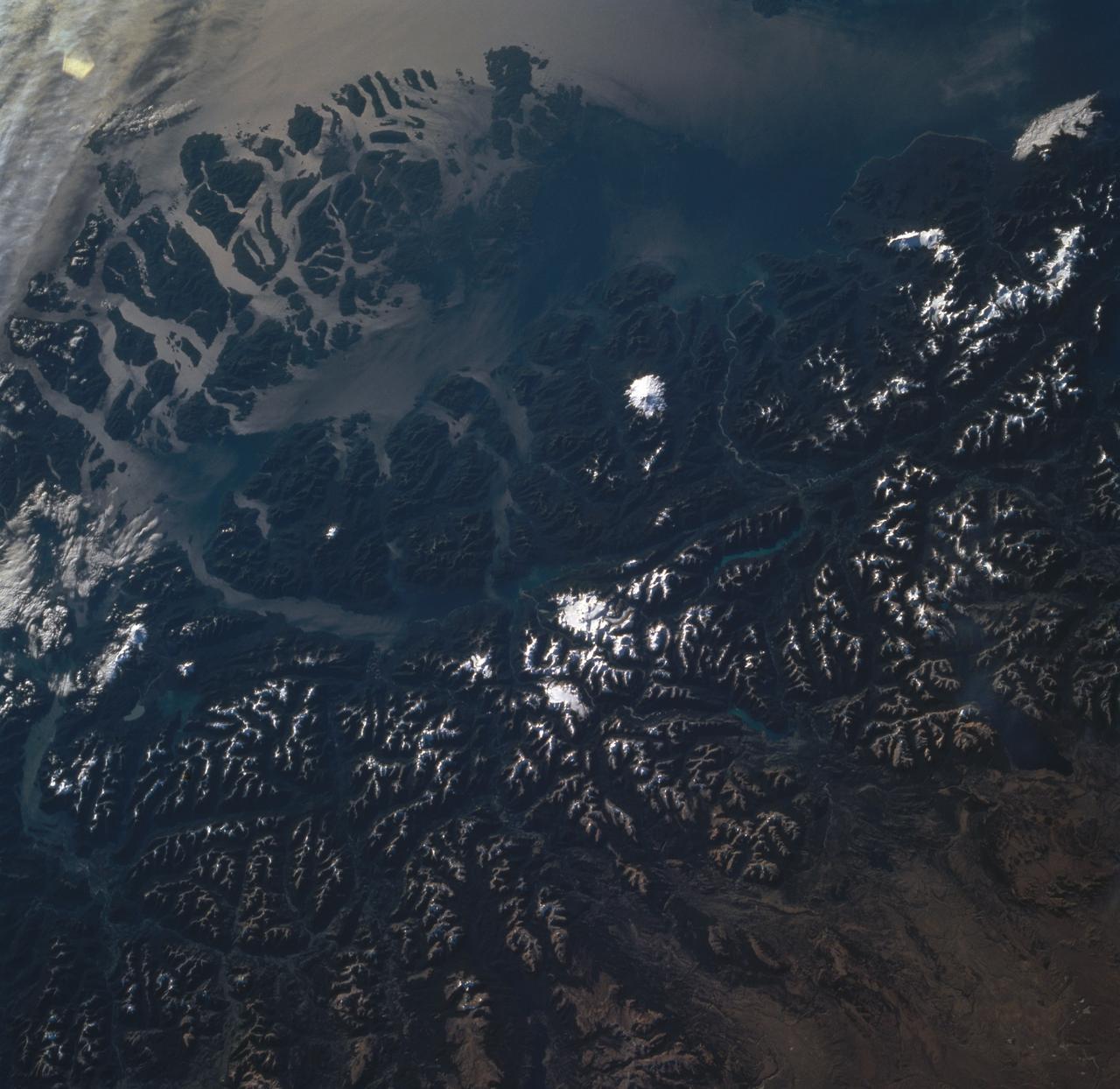
STS060-85-000AH (3-11 Feb 1994) --- This view is centered at about 44 degrees south along the Chilean continental margin of South America. The dark-colored coastal region is heavily forested by dense old-growth forests that are now being cut, but east of the mountains in Argentina the dry climate supports very little vegetation. This desert region known as Patagonia appears as light brown colors. The coastline is especially dramatic because it is shaped by the tortuous channels carved by glaciers which have left fjords. These fjords have effectively cut across the continental divide, and are bordered by active volcanoes which reach elevations between 2, 000 - 3,000 meters. The prominent volcanic peak in the center of the frame is Mt. Melimoya. To the north is a long, snow-covered volcanic ridge called Cerro Yantales. Cerro Yantales recently reported greatly increased fumarolic activity, including the emission of yellow gases near the summit. Russian and American scientists will use this photography to look for further evidence of increased activity like snow melt around the peak. Other Russian and American scientists are particularly interested in mapping the summertime snowline and firm (permanent snow field) elevations as early indications of any potential climatic variation in the making.
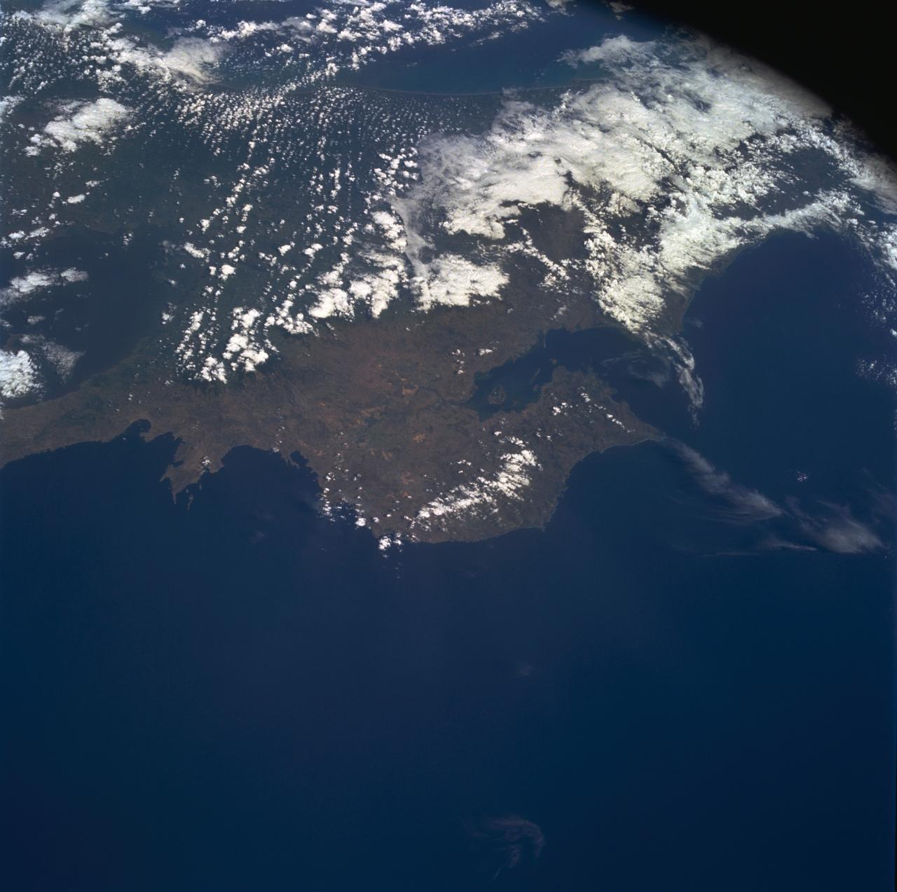
STS060-85-000AD (3-11 Feb 1994) --- This photograph shows the Central American nations of Nicaragua, Costa Rica and parts of Panama. Lake Nicaragua defines the southern limits of the country of Nicaragua. The cloud-free portion of the photo shows Costa Rica, it's gulf and Peninsula of Nicoya. Agricultural land use is clearly seen around Nicoya and a few islands of tropical forests are seen at the edges. The capital city of San Jose, Costa Rica, is partly cloud-covered in this image.
STS060-57-033 (3-11 Feb 1994) --- Astronaut Ronald M. Sega suspends himself in the weightlessness aboard the Space Shuttle Discovery's crew cabin, as the Remote Manipulator System (RMS) arm holds the Wake Shield Facility (WSF) aloft. The mission specialist is co-principal investigator on the WSF project.
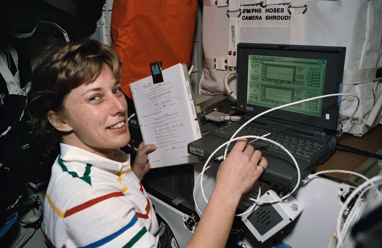
STS060-21-031 (3-11 Feb 1994) --- Using a lap top computer, astronaut N. Jan Davis monitors systems for the Commercial Protein Crystal Growth (CPCG) experiment onboard the Space Shuttle Discovery. Davis joined four other NASA astronauts and a Russian cosmonaut for eight days in space aboard Discovery.
jsc2019e036814 - With St. Basil’s Cathedral in Moscow’s Red Square providing the backdrop, Expedition 60 crewmember Drew Morgan of NASA poses for pictures June 28 as part of traditional pre-launch activities. Morgan, Luca Parmitano of the European Space Agency and Alexander Skvortsov of Roscosmos will launch July 20 on the Soyuz MS-13 spacecraft from the Baikonur Cosmodrome in Kazakhstan for a mission on the International Space Station...NASA/Beth Weissinger.
jsc2019e036815 - With St. Basil’s Cathedral in Moscow’s Red Square providing the backdrop, Expedition 60 crewmember Drew Morgan of NASA poses for pictures June 28 as part of traditional pre-launch activities. Morgan, Luca Parmitano of the European Space Agency and Alexander Skvortsov of Roscosmos will launch July 20 on the Soyuz MS-13 spacecraft from the Baikonur Cosmodrome in Kazakhstan for a mission on the International Space Station...NASA/Beth Weissinger..
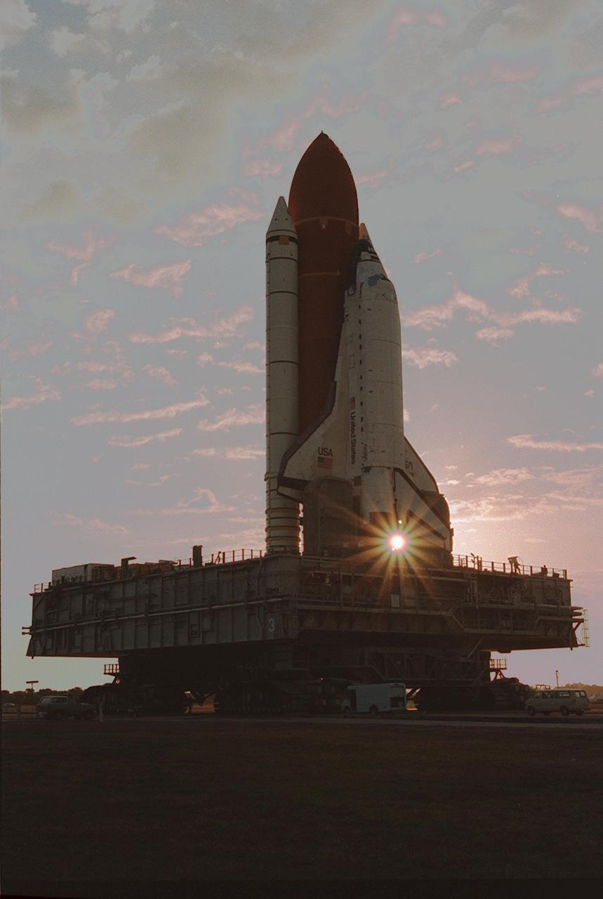
KENNEDY SPACE CENTER, FLA. -- Leaving the Vehicle Assembly Building for Launch Pad 39A on a crisp, clear winter day, the Space Shuttle Discovery makes the final Earth-bound leg of a journey into space. Once at the pad, two of the payloads for Discovery's upcoming flight, mission STS-60, will be installed. The Wake Shield Facility-1 and Get Away Special bridge assembly will be joining SPACEHAB-2 in the orbiter's payload bay. Liftoff of the first Space Shuttle flight of 1994 is currently targeted for around Feb. 3
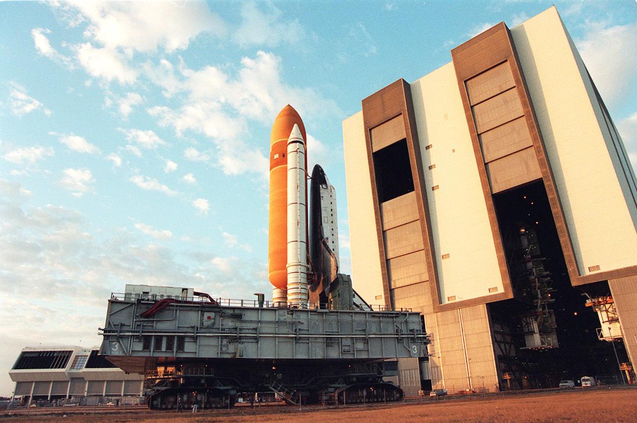
KENNEDY SPACE CENTER, FLA. -- Leaving the Vehicle Asembly Building for Launch Pad 39A on a crisp, clear winter day, the Space Shuttle Discovery makes the final Earth-bound leg of a journey into space. Once at the pad, two of the payloads for Discovery's upcoming flight, mission STS-60, will be installed. The Wake Shield Facility-1 and Get Away Special bridge assembly will be joining SPACEHAB-2 in the orbiter's payload bay. Liftoff of the first Space Shuttle flight of 1994 is currently targeted for around Feb. 3
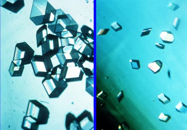
The comparison of protein crystal, Recombiant Human Insulin; space-grown (left) and earth-grown (right). On STS-60, Spacehab II indicated that space-grown crystals are larger and of greater optical clarity than their earth-grown counterparts. Recombiant Human Insulin facilitates the incorporation of glucose into cells. In diabetics, there is either a decrease in or complete lack of insulin, thereby leading to several harmful complications. Principal Investigator is Larry DeLucas.
The objective of this facility is to investigate the potential of space grown semiconductor materials by the vapor transport technique and develop powdered metal and ceramic sintering techniques in microgravity. The materials processed or developed in the SEF have potential application for improving infrared detectors, nuclear particle detectors, photovoltaic cells, bearing cutting tools, electrical brushes and catalysts for chemical production. Flown on STS-60 Commercial Center: Consortium for Materials Development in Space - University of Alabama Huntsville (UAH)
Recorded by the Space Shuttle Atlantis STS-110 mission, this is a photograph of the ice- covered Manicouagin Reservoir located in the Canadian Shield of Quebec Province in Eastern Canada, partially obscured by low clouds. This reservoir marks the site of an impact crater, 60 miles (100 kilometers) wide, which according to geologists was formed 212 million years ago when a meteorite crashed into this area. Over millions of years, the crater has been worn down by glaciers and other erosional processes. The Space Shuttle Orbiter Atlantis, STS-110 mission, was launched April 8, 2002 and returned to Earth April 19, 2002.
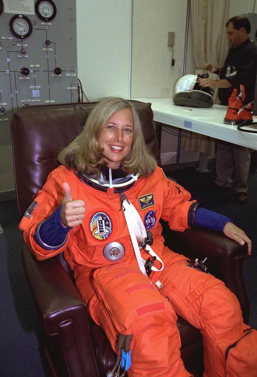
STS-85 Payload Commander N. Jan Davis gives a thumbs up as she is assisted with her ascent/reentry flight suit in the Operations and Checkout (O&C) Building. She has logged nearly 400 hours in space on the STS-47 and STS-60 missions and holds a doctorate in mechanical engineering. Davis will have overall responsibility for the experiments conducted on STS-85. She will also deploy and retrieve the Cryogenic Infrared Spectrometers and Telescopes for the AtmosphereShuttle Pallet Satellite-2 (CRISTA-SPAS-2) free-flyer and operate the prototype Japanese robotic arm. The primary payload aboard the Space Shuttle orbiter Discovery is the CRISTA-SPAS-2. Other payloads on the 11-day mission include the Manipulator Flight Demonstration (MFD), and Technology Applications and Science-1 (TAS-1) and International Extreme Ultraviolet Hitchhiker-2 (IEH-2) experiments
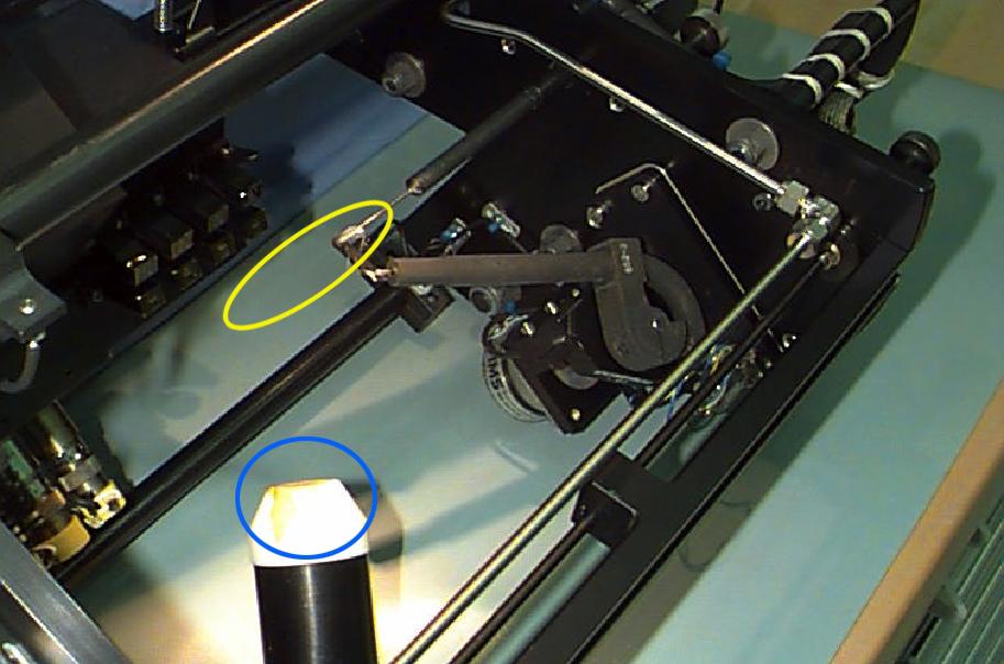
Interior of the Equipment Module for the Laminar Soot Processes (LSP-2) experiment that fly in the STS-107 Research 1 mission in 2002 (LSP-1 flew on Microgravity Sciences Lab-1 mission in 1997). The principal investigator is Dr. Gerard Faeth of the University of Michigan. LSP uses a small jet burner (yellow ellipse), similar to a classroom butane lighter, that produces flames up to 60 mm (2.3 in) long. Measurements include color TV cameras and a radiometer or heat sensor (blue circle), and laser images whose darkness indicates the quantity of soot produced in the flame. Glenn Research in Cleveland, OH, manages the project.
The Laminar Soot Processes (LSP) experiment under way during the Microgravity Sciences Lab-1 mission in 1997. LSP-2 will fly in the STS-107 Research 1 mission in 2001. The principal investigator is Dr. Gerard Faeth of the University of Michigan. LSP uses a small jet burner, similar to a classroom butane lighter, that produces flames up to 60 mm (2.3 in) long. Measurements include color TV cameras and a temperature sensor, and laser images whose darkness indicates the quantity of soot produced in the flame. Glenn Research in Cleveland, OH, manages the project.
STS062-106-042 (4-18 March 1994) --- This view of southern Australia about 100 miles northwest of Melbourne shows areas of protected reserves of natural forests in the midst of agricultural crop lands. The green patch seen here has been recently burned as indicated by the irregular large scar. The impact of winds on the scar is clearly visible. This nature preserve is reported to be the home to a large number of animals including the koala bears. Similar views were shot by the STS-60 crewmembers last month. These photographs will assist earth scientists in mapping the impact of forest fires and in moniotring the recovery of burned areas.
At the Russian Mission Control Center in Korolev, Russia, NASA Administrator Charles Bolden (left) and cosmonaut Sergei Krikalev, now a manager in the Russian Federal Space Agency (Roscosmos), pose for pictures Nov. 20 following the docking of the Soyuz MS-03 spacecraft to the International Space Station. Aboard the Soyuz were Expedition 50-51 crewmembers Peggy Whitson of NASA, Oleg Novitskiy of the Russian Federal Space Agency (Roscosmos) and Thomas Pesquet of the European Space Agency. Bolden served as commander of the space shuttle Discovery on the STS-60 mission in February 1994 in which Krikalev served as a mission specialist. NASA/Stephanie Stoll
STS111-719-061 (5-19 June 2002) --- This photo showing the Manicouagan Reservoir in Quebec, Canada, was photographed by the STS-111 crewmembers aboard the Space Shuttle Endeavour. Manicouagan Reservoir marks the site of an impact crater, 60 miles (100 km) wide, which, according to scientists, was formed 212 million years ago when a meteorite crashed into this area. Scientists say that over millions of years the many advancing and retreating glaciers and other erosional processes have worn down the crater. The Gateway to Astronaut Photography of Earth (link to http://eol.jsc.nasa.gov/sseop/) provides searchable access to other photographs of Earth taken by astronauts.
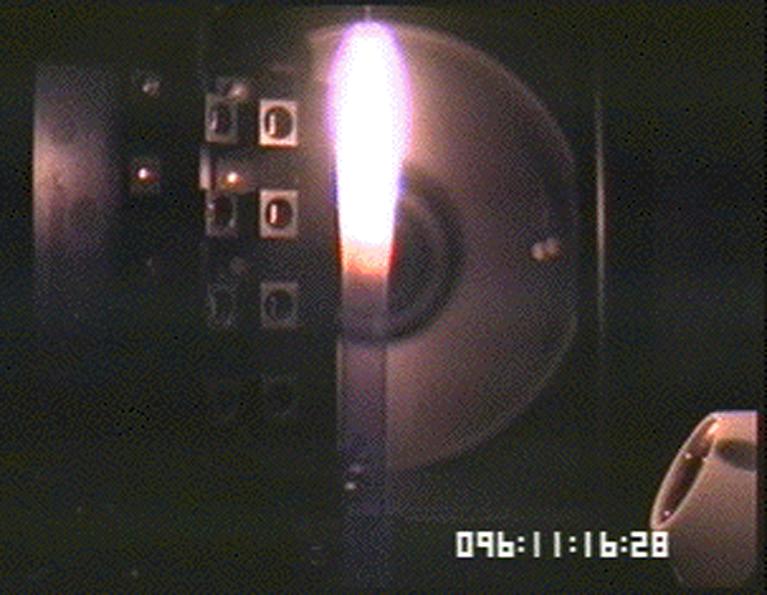
Image of soot (smoke) plume made for the Laminar Soot Processes (LSP) experiment during the Microgravity Sciences Lab-1 mission in 1997. LSP-2 will fly in the STS-107 Research 1 mission in 2002. The principal investigator is Dr. Gerard Faeth of the University of Michigan. LSP uses a small jet burner, similar to a classroom butane lighter, that produces flames up to 60 mm (2.3 in) long. Measurements include color TV cameras and a temperature sensor, and laser images whose darkness indicates the quantity of soot produced in the flame. Glenn Research in Cleveland, OH, manages the project.
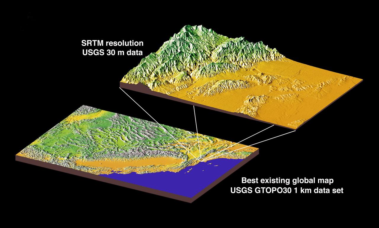
JSC2000E01552 (January 2000) --- This chart compares currently available global map data with the data which will be provided by SRTM during STS-99. The area depicted is the California coast. The SRTM mission will have approximately 1,000 scheduled data takes (every time Endeavour is over land). Data acquisition will be conducted in excess of 80 hours. The recording rate for data will be 180 Mbits/sec for C-band, 90 Mbits/sec for X-band. Total raw radar data will be approximately 9.8 terabytes (15,000 CDs). The mission will utilize some 300 high-density tapes (each tape records 30 min. of C-band, or 60 min. of X-band data).
PHOTOS OF STS-31 (DISCOVERY) CREW WITH MODELS OF THE HUBBLE SPACE TELESCOPE (HST) AND SPACE SHUTTLE AT T-30 (THIRTY DAYS BEFORE LAUNCH) BRIEFING 03/22/90 IN THE AUDITORIUM AND PUBLIC AFFAIRS FACILITY BLDG 2. GROUP PHOTOS OF LOREN J. SHRIVER, CHARLES F. BOLDEN, STEVEN A. HAWLEY, BRUCE MCCANDLESS, AND KATHRYN D. SULLIVAN (32748, 32750, 32758-60 (WIDE ANGLE)) AND INDIVIDUAL PHOTOS OF HAWLEY (32747), MCCANDLESS (32751), SULLIVAN (32753-4), BOLDEN (32755), AND SHRIVER (32757) INCLUDED. ALSO PHOTGRAPHED TOGETHER ARE SULLIVAN, HAWLEY, MCCANDLESS (32749) AND BOLDEN, SHRIVER (32752, 32756).
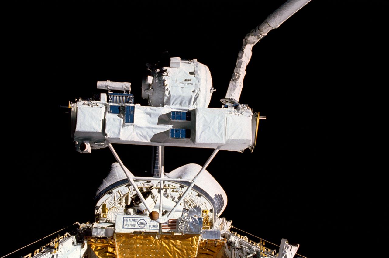
STS039-15-017 (3 May 1990) --- This STS-39 35mm scene shows the Strategic Defense Initiative Organization (SDIO) Shuttle Pallet Satellite (SPAS-II) during its berthing following a period of data collection. During the eight-day flight, SPAS collected data in both a free-flying mode and while attached to the end effector of Discovery's remote manipulator system (RMS). Additional cargo, elements of the Air Force Program (AFP) 675 package, is seen near Discovery's aft bulkhead in the 60-ft. long payload bay.
STS60-29-009 (10 Feb 1994) --- On the Space Shuttle Discovery's aft flight deck, Russian cosmonaut Sergei K. Krikalev prepares for one chore while performing another. Using the Shuttle Amateur Radio Experiment (SAREX) gear, the mission specialist was talking with students in Maine. He holds a camcorder, which was later called into action to record inflight activities. Krikalev joined five NASA astronauts for eight days in space aboard Discovery.
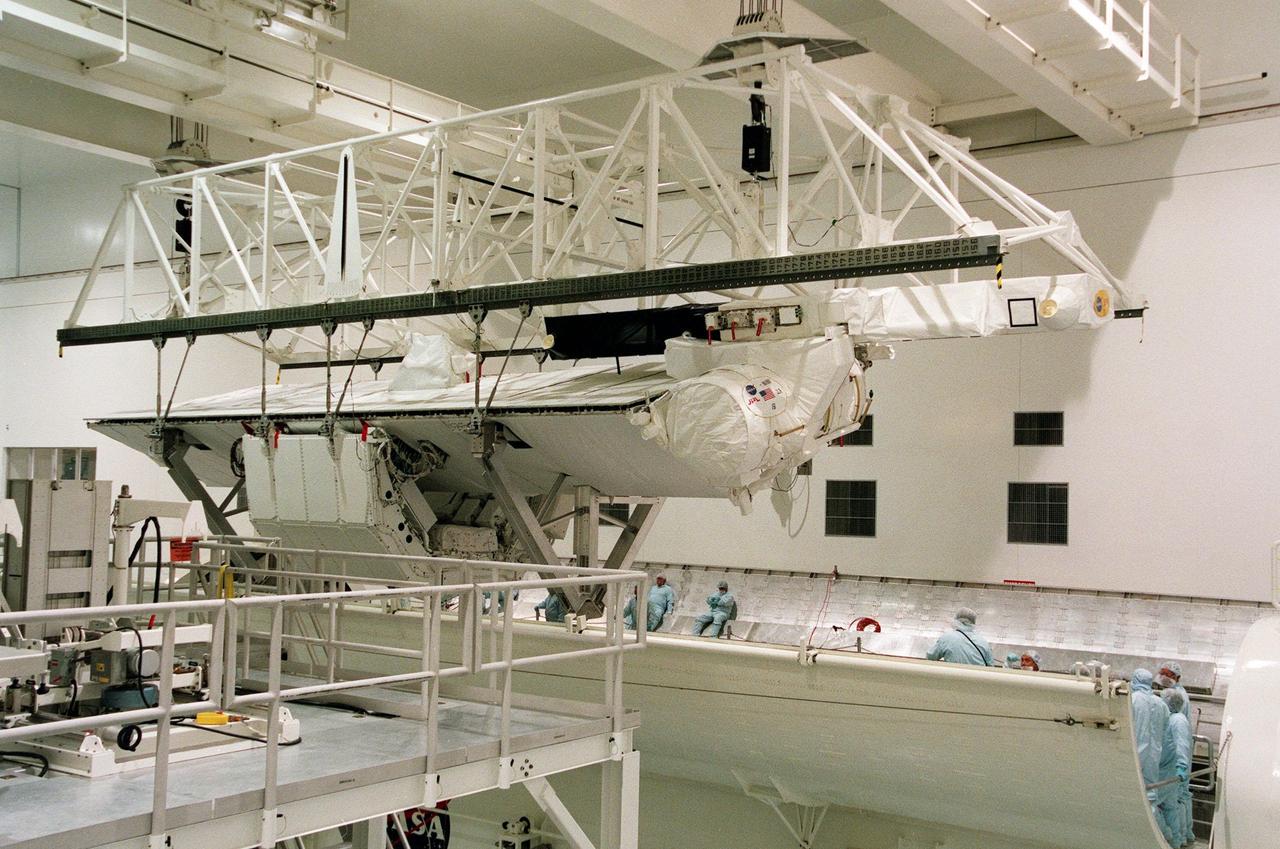
KENNEDY SPACE CENTER, FLA. -- A crane is lowered over the payload canister with the Shuttle Radar Topography Mission (SRTM) inside in Orbiter Processing Facility (OPF) bay 2. The primary payload on STS-99, the SRTM will soon be lifted out of the canister and installed into the payload bay of the orbiter Endeavour. The SRTM consists of a specially modified radar system that will gather data for the most accurate and complete topographic map of the Earth's surface that has ever been assembled. SRTM will make use of radar interferometry, wherein two radar images are taken from slightly different locations. Differences between these images allow for the calculation of surface elevation. The SRTM hardware includes one radar antenna in the Shuttle payload bay and a second radar antenna attached to the end of a mast extended 60 meters (195 feet) from the shuttle. STS-99 is scheduled to launch Sept. 16 at 8:47 a.m. from Launch Pad 39A
KENNEDY SPACE CENTER, FLA. -- A crane lifts the Shuttle Radar Topography Mission (SRTM), the primary payload on STS-99, from a payload canister used to transport it to Orbiter Processing Facility (OPF) bay 2 to the payload bay of the orbiter Endeavour. The SRTM consists of a specially modified radar system that will gather data for the most accurate and complete topographic map of the Earth's surface that has ever been assembled. SRTM will make use of radar interferometry, wherein two radar images are taken from slightly different locations. Differences between these images allow for the calculation of surface elevation. The SRTM hardware includes one radar antenna in the Shuttle payload bay and a second radar antenna attached to the end of a mast extended 60 meters (195 feet) from the shuttle. STS-99 is scheduled to launch Sept. 16 at 8:47 a.m. from Launch Pad 39A
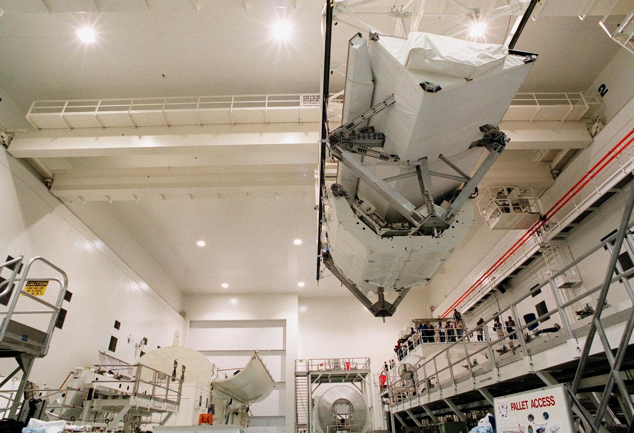
KENNEDY SPACE CENTER, FLA. -- A crane lowers the Shuttle Radar Topography Mission (SRTM), the primary payload on STS-99, into the payload bay of the orbiter Endeavour in Orbiter Processing Facility bay 2. The SRTM consists of a specially modified radar system that will gather data for the most accurate and complete topographic map of the Earth's surface that has ever been assembled. SRTM will make use of radar interferometry, wherein two radar images are taken from slightly different locations. Differences between these images allow for the calculation of surface elevation. The SRTM hardware includes one radar antenna in the Shuttle payload bay and a second radar antenna attached to the end of a mast extended 60 meters (195 feet) from the shuttle. STS-99 is scheduled to launch Sept. 16 at 8:47 a.m. from Launch Pad 39A
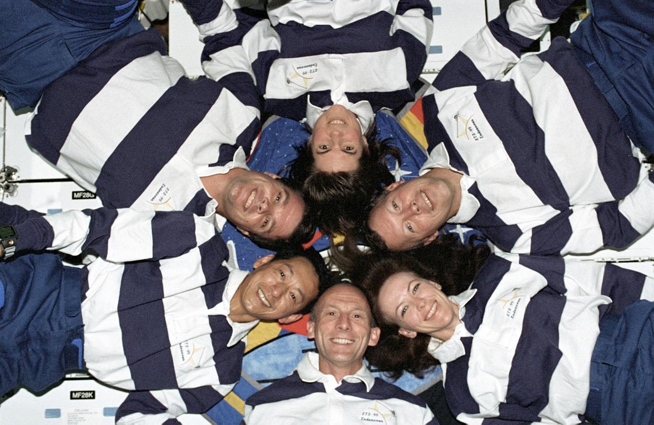
The STS-99 crew pose for a "star-burst" pose in celebration of a successful Shuttle Radar Topographic Mission (SRTM) aboard NASA's Space Shuttle Endeavor. Clockwise, around the circle, from top center are astronauts Janice Voss, Dominic L. Gorie, Janet L. Kavandi, Gerhard Thiele of the European Space Agency, Mamoru Mohri of the Japanese Space Agency, and Kevin Kregel. The STS-99 SRTM mission was the most ambitious Earth mapping mission to date. Orbiting at 233 kilometers (145 miles) above Earth, two radar anternas, one located in the Shuttle bay and the other located on the end of a 60-meter deployable mast, was used during the mission to map Earth's features. The goal was to provide a 3-dimensional topographic map of the world's surface up to the Arctic and Antarctic Circles. The mission completed 222 hours of around the clock radar mapping gathering enough information to fill more than 20,000 CDs.
KENNEDY SPACE CENTER, FLA. -- A crane lifts the Shuttle Radar Topography Mission (SRTM), the primary payload on STS-99, from a payload canister used to transport it to Orbiter Processing Facility (OPF) bay 2. The SRTM will soon be installed into the payload bay of the orbiter Endeavour. The SRTM consists of a specially modified radar system that will gather data for the most accurate and complete topographic map of the Earth's surface that has ever been assembled. SRTM will make use of radar interferometry, wherein two radar images are taken from slightly different locations. Differences between these images allow for the calculation of surface elevation. The SRTM hardware includes one radar antenna in the Shuttle payload bay and a second radar antenna attached to the end of a mast extended 60 meters (195 feet) from the shuttle. STS-99 is scheduled to launch Sept. 16 at 8:47 a.m. from Launch Pad 39A
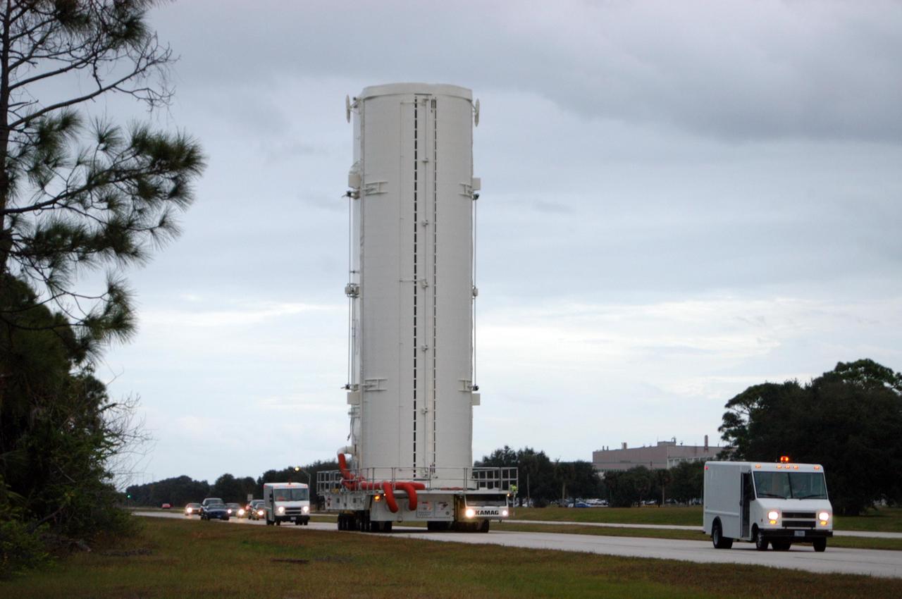
KENNEDY SPACE CENTER, FLA. -- A payload transporter, carrying a payload canister with the Shuttle Radar Topography Mission (SRTM) inside, pulls into Orbiter Processing Facility (OPF) bay 2. The SRTM, the primary payload on STS-99, will soon be installed into the payload bay of the orbiter Endeavour already undergoing processing in bay 2. The SRTM consists of a specially modified radar system that will gather data for the most accurate and complete topographic map of the Earth's surface that has ever been assembled. SRTM will make use of radar interferometry, wherein two radar images are taken from slightly different locations. Differences between these images allow for the calculation of surface elevation. The SRTM hardware includes one radar antenna in the Shuttle payload bay and a second radar antenna attached to the end of a mast extended 60 meters (195 feet) from the shuttle. STS-99 is scheduled to launch Sept. 16 at 8:47 a.m. from Launch Pad 39A
KENNEDY SPACE CENTER, FLA. -- A crane lowers the Shuttle Radar Topography Mission (SRTM), the primary payload on STS-99, into the payload bay of the orbiter Endeavour in Orbiter Processing Facility (OPF) bay 2. The SRTM consists of a specially modified radar system that will gather data for the most accurate and complete topographic map of the Earth's surface that has ever been assembled. SRTM will make use of radar interferometry, wherein two radar images are taken from slightly different locations. Differences between these images allow for the calculation of surface elevation. The SRTM hardware includes one radar antenna in the Shuttle payload bay and a second radar antenna attached to the end of a mast extended 60 meters (195 feet) from the shuttle. STS-99 is scheduled to launch Sept. 16 at 8:47 a.m. from Launch Pad 39A
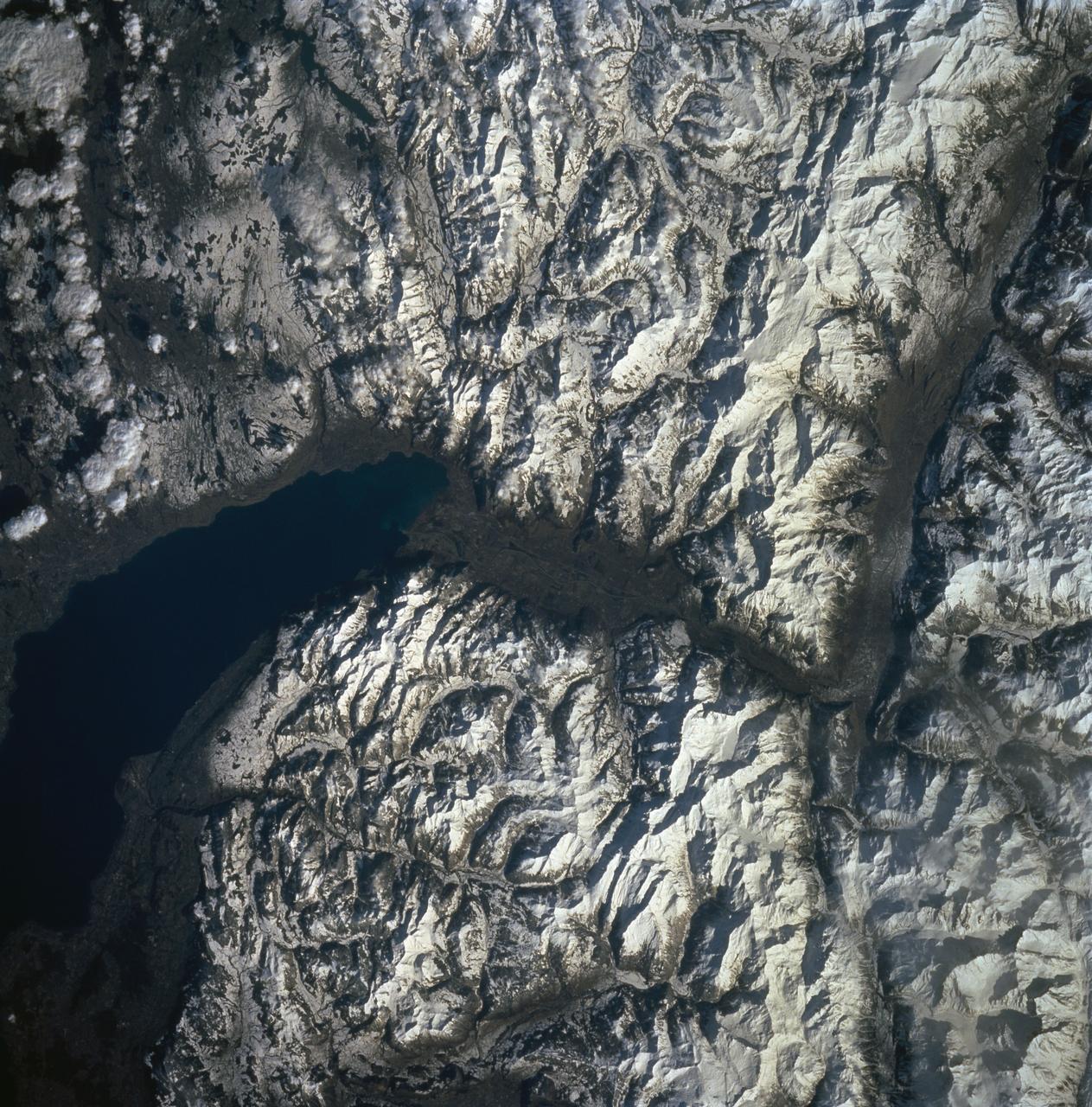
STS060-90-007 (3-11 Feb 1994) --- Parts of the Swiss Cantons of Vaud and Valois and the French province of Chablais are shown. These mountains were created in the last great mountain-building episode in Europe around 50 million years ago. They have been reshaped by glaciers during the Pleistocene. The glaciers created the wide valley of the Rhone River by scouring a pre-existing stream. The fertile Swiss Plateau runs northwest from the shore of Lake Geneva and is visible in the upper right. The Franco-Swiss border is located in the center of the lake and follows a mountain divide east of the Rhone Valley. According to NASA geologists eutrofication is a problem in Lake Geneva. In 1971 a Swiss Commission was formed to try to slow the problem. Strong discharge laws were enacted, but they are hard to enforce due to the multi-national and multi-organizational parties contributing to the problem.
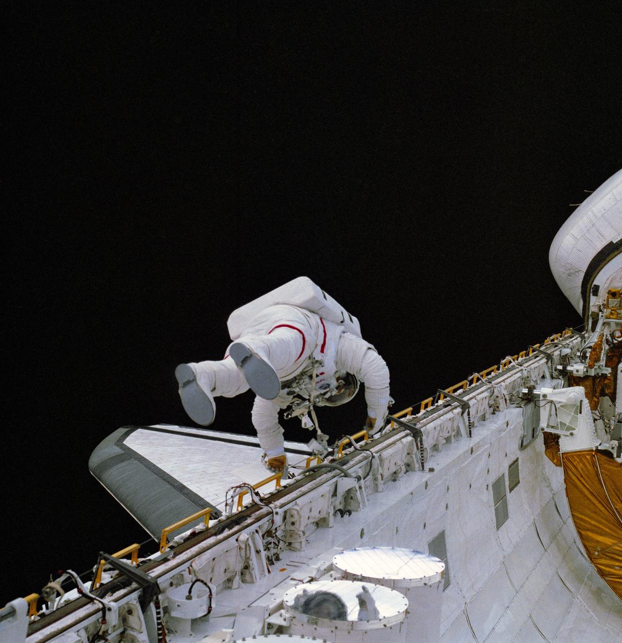
S83-30215 (7 April 1983) --- This photograph of astronaut Story Musgrave, STS-6 mission specialist, translating along the longerons on the port side of the cargo bay of the Earth-orbiting space shuttle Challenger was taken with a hand-held 70mm camera from some 18 meters (60 feet) away by one of two crew members who remained inside the cabin. Astronauts Musgrave and Donald H. Peterson (out of frame) were in the midst of NASA?s first ever shuttle extravehicular activity (EVA). Astronaut Karol J. Bobko, pilot, took a number of photographs through the aft flight deck?s windows, and astronaut Paul J. Weitz, mission commander, also exposed some images but remained in control of the orbiter during the EVA. Photo credit: NASA
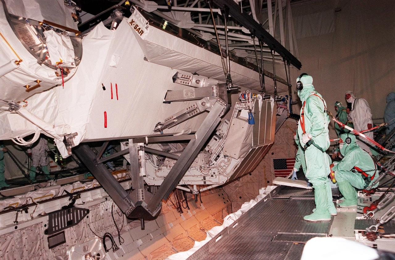
Launched February 11, 2000, the STS-99 Shuttle Radar Topographic Mission (SRTM) was the most ambitious Earth mapping mission to date. A 200-ft long (60 meter) mast supporting the SRTM where it jutted into space from the Space Shuttle Endeavour. In this photograph, part of the SRTM hardware is shown in the payload bay of the shuttle. Orbiting some 145 miles (233 kilometers) above Earth, the giant structure was deployed on February 12, 2000 and the C-band and X-band anternae mounted on it quickly went to work mapping parts of the Earth. The SRTM radar was able to penetrate clouds as well as provide its own illumination, independent of daylight, obtaining3-dimentional topographic images of the world's surface up to the Arctic and Antarctic Circles. The mission completed 222 hours of around the clock radar mapping gathering enough information to fill more than 20,000 CDs.
KENNEDY SPACE CENTER, FLA. -- Under a darkening, cloud-covered sky, the payload canister transporter carries its cargo very slowly along the road to Launch Pad 39B for mission STS-116. Inside the canister are the SPACEHAB module and the port 5 truss segment, which will be moved into the payload changeout room at the pad and transferred into Space Shuttle Discovery's payload bay once the vehicle has rolled out to the pad. The payload canister is 65 feet long, 18 feet wide and 18 feet, 7 inches high. It has the capability to carry vertically or horizontally processed payloads up to 15 feet in diameter and 60 feet long, matching the capacity of the orbiter payload bay. It can carry payloads weighing up to 65,000 pounds. Clamshell-shaped doors at the top of the canister operate like the orbiter payload bay doors, with the same allowable clearances. Photo credit: NASA/George Shelton
KENNEDY SPACE CENTER, FLA. -- Installed on a transporter, the payload canister moves out of the Vertical Processing Facility. Inside the canister are the SPACEHAB module and the port 5 truss segment for mission STS-116. They will be moved into the payload changeout room at the pad and transferred into Space Shuttle Discovery's payload bay once the vehicle has rolled out to the pad. The payload canister is 65 feet long, 18 feet wide and 18 feet, 7 inches high. It has the capability to carry vertically or horizontally processed payloads up to 15 feet in diameter and 60 feet long, matching the capacity of the orbiter payload bay. It can carry payloads weighing up to 65,000 pounds. Clamshell-shaped doors at the top of the canister operate like the orbiter payload bay doors, with the same allowable clearances. Photo credit: NASA/George Shelton
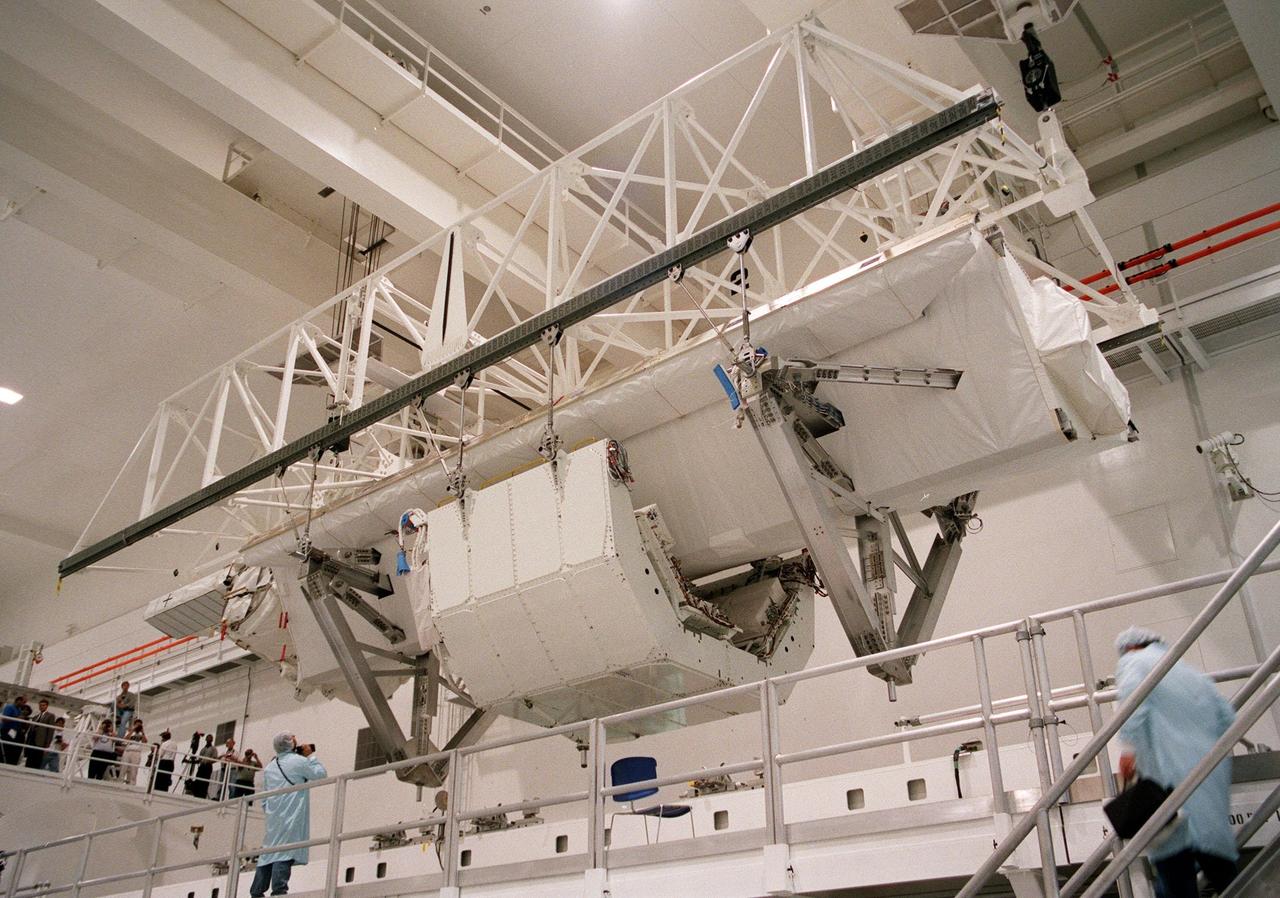
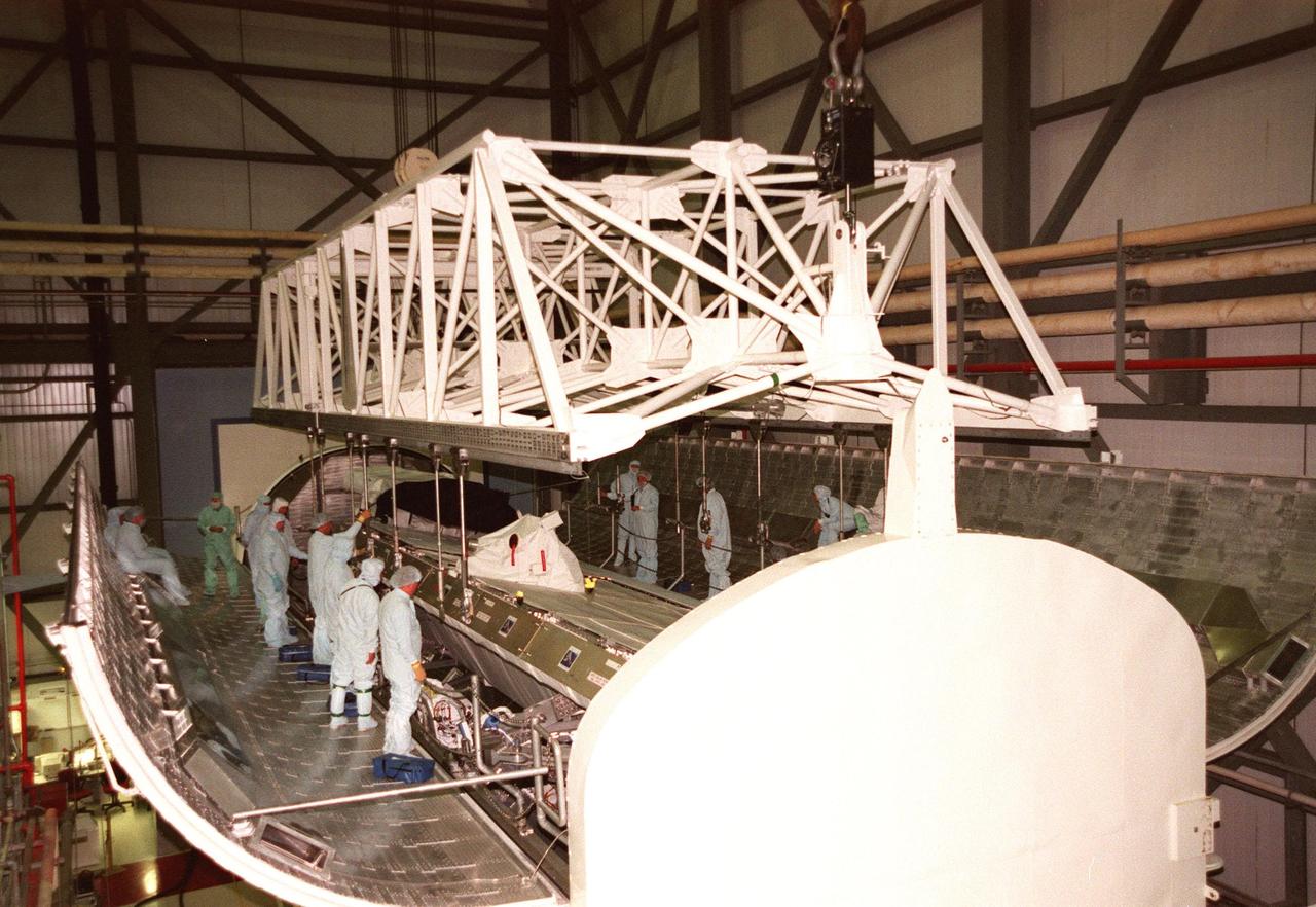
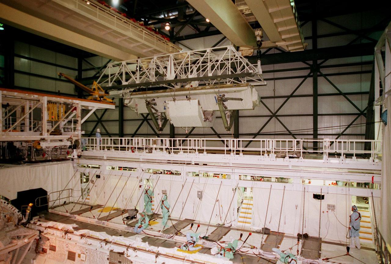
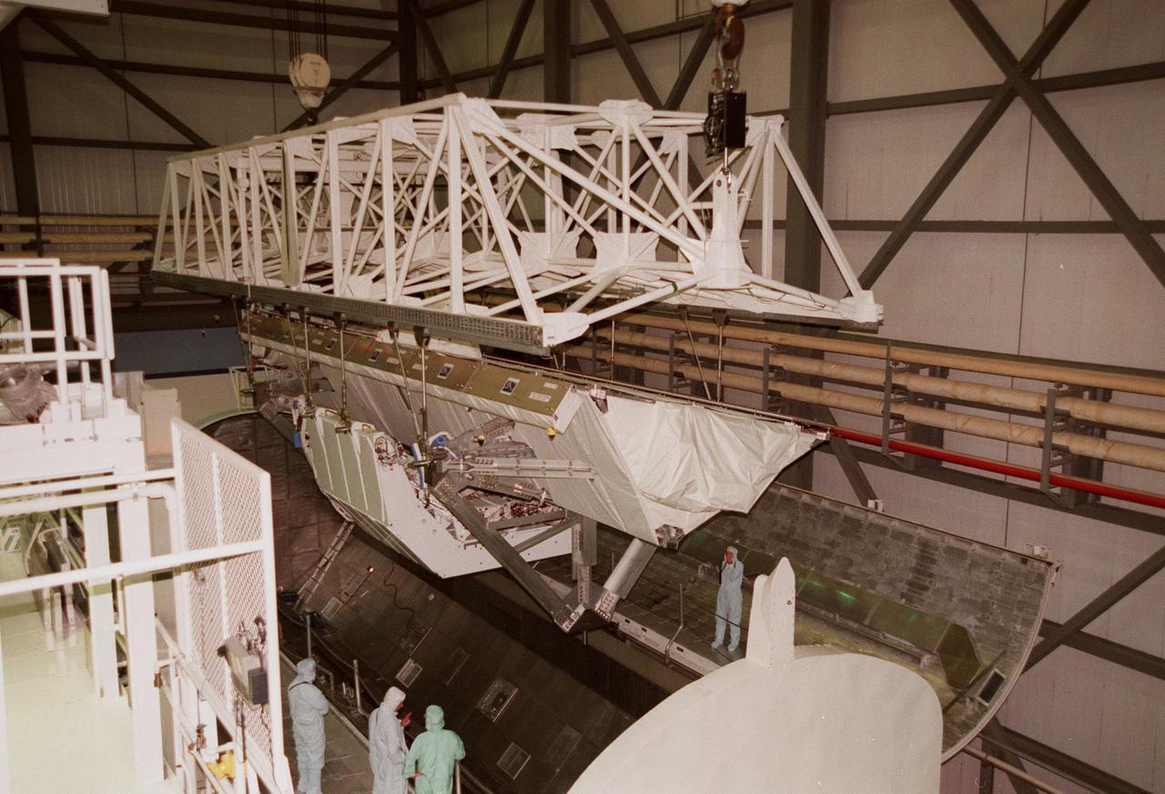
KENNEDY SPACE CENTER, FLA. -- In the Space Station Processing Facility, the Shuttle Radar Topography Mission (SRTM) is lifted for its move to a payload bay canister on the floor. The canister will then be moved to the Orbiter Processing Facility and placed in the bay of the orbiter Endeavour. The SRTM consists of a specially modified radar system that will gather data for the most accurate and complete topographic map of the Earth's surface that has ever been assembled. SRTM will make use of radar interferometry, wherein two radar images are taken from slightly different locations. Differences between these images allow for the calculation of surface elevation, or change. The SRTM hardware will consist of one radar antenna in the shuttle payload bay and a second radar antenna attached to the end of a mast extended 60 meters (195 feet) out from the shuttle. STS-99 is scheduled to launch Sept. 16 at 8:47 a.m. from Launch Pad 39A
KENNEDY SPACE CENTER, FLA. -- In the Space Station Processing Facility, the Shuttle Radar Topography Mission (SRTM) clears the railing on the right as a crane moves it toward the open payload bay canister in the background (left). The canister will then be moved to the Orbiter Processing Facility and placed in the bay of the orbiter Endeavour. The SRTM consists of a specially modified radar system that will gather data for the most accurate and complete topographic map of the Earth's surface that has ever been assembled. SRTM will make use of radar interferometry, wherein two radar images are taken from slightly different locations. Differences between these images allow for the calculation of surface elevation, or change. The SRTM hardware will consist of one radar antenna in the shuttle payload bay and a second radar antenna attached to the end of a mast extended 60 meters (195 feet) out from the shuttle. STS-99 is scheduled to launch Sept. 16 at 8:47 a.m. from Launch Pad 39A
KENNEDY SPACE CENTER, FLA. -- In the Space Station Processing Facility, a crane lowers the Shuttle Radar Topography Mission (SRTM) toward the opening of the payload bay canister below. The canister will then be moved to the Orbiter Processing Facility and placed in the bay of the orbiter Endeavour. The SRTM consists of a specially modified radar system that will gather data for the most accurate and complete topographic map of the Earth's surface that has ever been assembled. SRTM will make use of radar interferometry, wherein two radar images are taken from slightly different locations. Differences between these images allow for the calculation of surface elevation, or change. The SRTM hardware will consist of one radar antenna in the shuttle payload bay and a second radar antenna attached to the end of a mast extended 60 meters (195 feet) out from the shuttle. STS-99 is scheduled to launch Sept. 16 at 8:47 a.m. from Launch Pad 39A
KENNEDY SPACE CENTER, FLA. -- The payload canister transporter carries its cargo very slowly along the road to Launch Pad 39B for mission STS-116. Inside the canister are the SPACEHAB module and the port 5 truss segment, which will be moved into the payload changeout room at the pad and transferred into Space Shuttle Discovery's payload bay once the vehicle has rolled out to the pad. The payload canister is 65 feet long, 18 feet wide and 18 feet, 7 inches high. It has the capability to carry vertically or horizontally processed payloads up to 15 feet in diameter and 60 feet long, matching the capacity of the orbiter payload bay. It can carry payloads weighing up to 65,000 pounds. Clamshell-shaped doors at the top of the canister operate like the orbiter payload bay doors, with the same allowable clearances. Photo credit: NASA/George Shelton
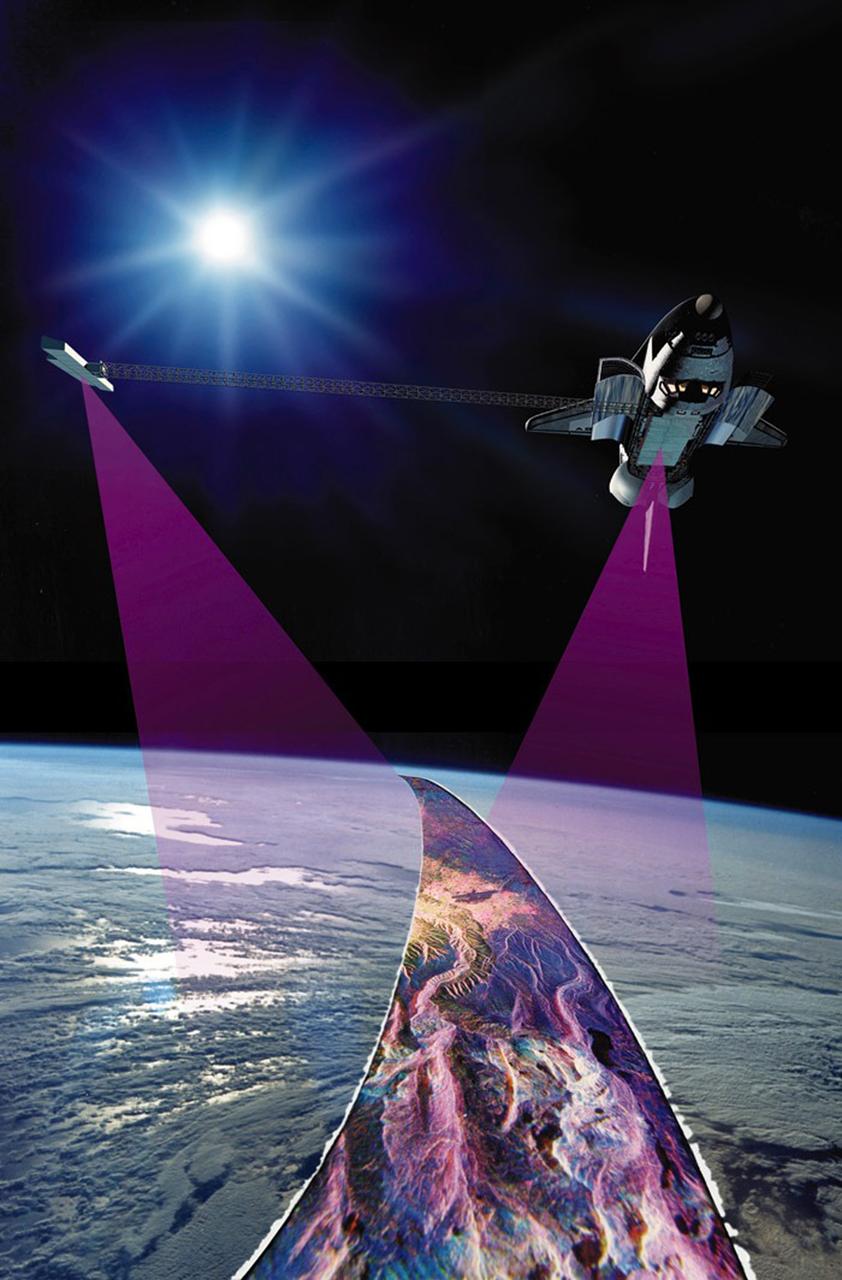
Launched February 11, 2000, the STS-99 Shuttle Radar Topographic Mission (SRTM) was the most ambitious Earth mapping mission to date. This illustration shows the Space Shuttle Endeavour orbiting some 145 miles (233 kilometers) above Earth. With C-band and X-band outboard anternae at work, one located in the Shuttle bay and the other located on the end of a 60-meter deployable mast, the SRTM radar was able to penetrate clouds as well as provide its own illumination, independent of daylight, obtaining 3-dimentional topographic images of the world's surface up to the Arctic and Antarctic Circles. The mission completed 222 hours of around the clock radar mapping, gathering enough information to fill more than 20,000 CDs.
KENNEDY SPACE CENTER, FLA. -- Lamps spotlight the payload canister transporter as it slowly carries its cargo past the Vehicle Assembly Building on the road to Launch Pad 39B for mission STS-116. Inside the canister are the SPACEHAB module and the port 5 truss segment, which will be moved into the payload changeout room at the pad and transferred into Space Shuttle Discovery's payload bay once the vehicle has rolled out to the pad. The payload canister is 65 feet long, 18 feet wide and 18 feet, 7 inches high. It has the capability to carry vertically or horizontally processed payloads up to 15 feet in diameter and 60 feet long, matching the capacity of the orbiter payload bay. It can carry payloads weighing up to 65,000 pounds. Clamshell-shaped doors at the top of the canister operate like the orbiter payload bay doors, with the same allowable clearances. Photo credit: NASA/George Shelton
The Space Shuttle Orbiter Endeavour blasts form the launch pad on February 11, 2000 carrying its crew of six for the STS-99 mission, a Shuttle Radar Topography Mission (SRTM), the most ambitious Earth mapping mission to date. Orbiting at 233 kilometers (145 miles) above Earth, two radar anternas, one located in the Shuttle bay and the other located on the end of a 60-meter deployable mast, was used during the mission to map Earth's features. The goal was to provide a 3-dimensional topographic map of the world's surface up to the Arctic and Antarctic Circles. The mission completed 222 hours of around the clock radar mapping gathering enough information to fill more than 20,000 CDs.