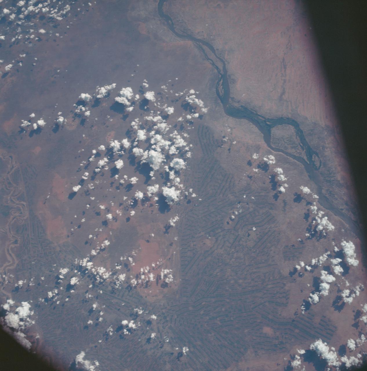
AS7-06-1718 (14 Oct. 1968) --- Sudan, showing White Nile and Blue Nile rivers below Khartoum, as seen from the Apollo 7 spacecraft during its 44th revolution of Earth. Photographed from an altitude of approximately 130 nautical miles, at ground elapsed time of 69 hours and 10 minutes. Note quilted-patchwork effect created by irrigated cultivated land.

Al Jazirah also Gezira is one of the 26 states of Sudan. The state lies between the Blue Nile and the White Nile in the east-central region of the country. This image was acquired December 25, 2006 by NASA Terra spacecraft.
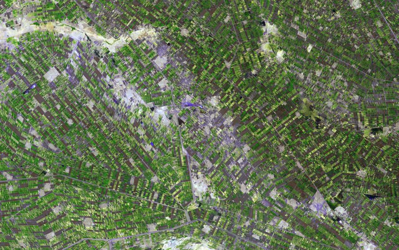
NASA Terra spacecraft captured this image of the province of Al Jazirah, a region of great fertility which lies in the central Sudan between the White and Blue Niles south of Khartoum.
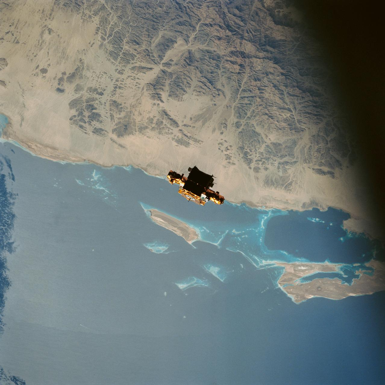
During STS-56, the Shuttle Pointed Autonomous Research Tool for Astronomy 201 (SPARTAN-201), a freeflying payload, was captured on 70mm film as it drifts over the Red Sea coast of Sudan. SPARTAN-201 was photographed by the crewmembers aboard Discovery, Orbiter Vehicle (OV) 103. On the mission's third day, crewmembers used the remote manipulator system (RMS) to lift the satellite from its support structure in OV-103's payload bay (PLB) and release it into space. SPARTAN-201 was later recaptured by OV-103's RMS and returned to Earth with the astronaut crew. The cape structure in the background is Ras abu Shagara, north of Port Sudan.
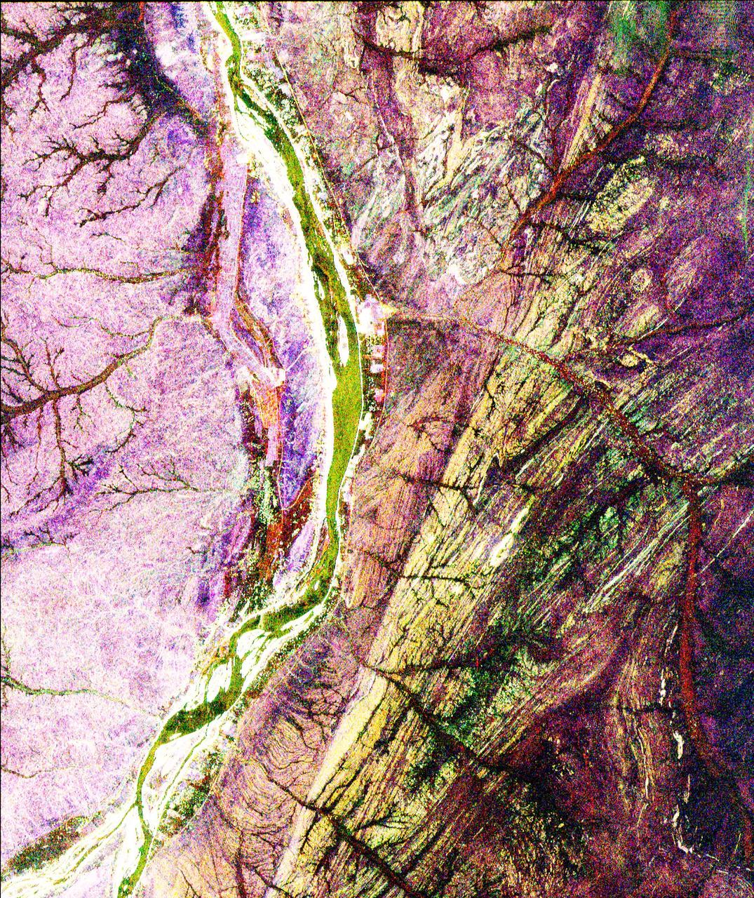
This is a radar image of a region in northern Sudan called the Keraf Suture that reveals newly discovered geologic features buried beneath layers of sand.
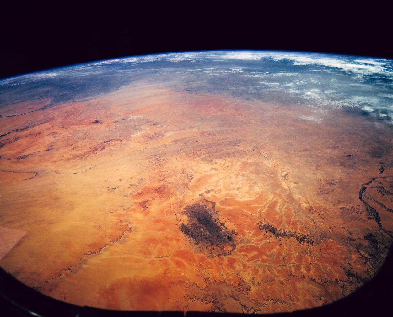
STS062-151-182Z (4-18 March 1994) --- This east-looking view shows most of the east-west extent of the country of Sudan. The foreground shows a vegetation-less and almost uninhabited region of northwest Sudan. The rich earth colors are ancient soils (browner and redder tones), a concentrated mass of what may be volcanic cinder cones (dark brown dots - center) and dune and younger river sediments (yellows). The photo would have been difficult to locate had it not been for two recognizable features in the background: a visually well-known inselberg ("island mountain" -- top center) on a large west-bank tributary of the White Nile; and the confluence of the Blue and White Nile's, with the great cotton developments of the Gezira Scheme between them (top left). The Red Sea coast is almost obscured by a dust cloud but can be discerned running across the top of the picture. The clouds at top may be developing over the coastal ranges of Saudi Arabia beyond the Red Sea.
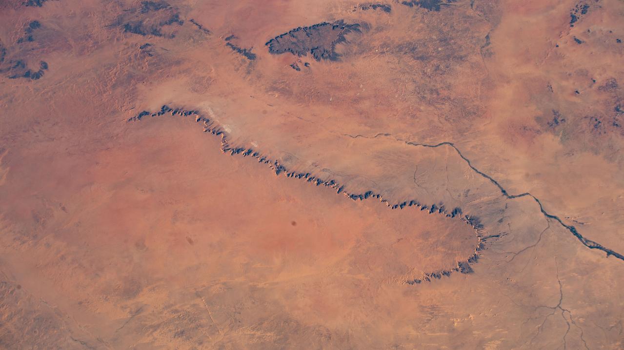
iss072e474251 (Jan. 14, 2025) --- A portion of the Libyan Desert near the Northern Sudan city of Al Dabbah, on the bank of Nile River, is pictured from the International Space Station as it orbited 259 miles above the African nation.
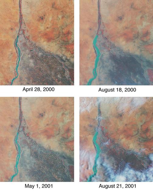
Throughout history, the rising and falling waters of the mighty Nile River have directly impacted the lives of the people who live along its banks. These images of the area around Sudan's capital city of Khartoum capture the river's dynamic nature. Acquired by the Multi-angle Imaging SpectroRadiometer's nadir (vertical-viewing) camera, they display the extent of the Nile waters before and after the onset of the rainy seasons of 2000 (top pair) and 2001 (bottom pair). The images are displayed in "false color," using the camera's near-infrared, green, and blue bands. With this particular spectral combination, water appears in shades of blue and turquoise, and highly vegetated areas show up as bright red. Originating in Uganda and Ethiopia, respectively, the waters of the White Nile (western branch) and Blue Nile (eastern branch) converge at Khartoum (about half-way between image center and the left-hand side), and continue to flow northward as the Great Nile. Although the most obvious feature in these images is the increased width of the White Nile between spring and summer, careful inspection shows that the Great Nile is at its widest in August 2001 (note in particular the area between the clouds near the top of this panel). Heavy rains in the Blue Nile catchment area of the Ethiopian highlands led to a rapid overflow of the river's floodwaters into the main stream of the Great Nile, leading to extensive flooding, the worst effects of which occurred north of Khartoum. According to the Food and Agriculture Organization of the United Nations, tens of thousands of people have fled their homes, and the number of people in need of urgent food assistance in Sudan, estimated at three million earlier in the year, was likely to increase with the onset of these floods. South of the confluence of the White Nile and the Blue Nile, the area of a cross-hatched appearance is the irrigated plain of El Gezira. The Gezira irrigation scheme uses water from the Makwar Dam (now called the Sennar Dam), located across the Blue Nile south of Khartoum. Among the main agricultural products of this region are cotton, millet, peanuts and fodder crops. Overall prospects for Sudan's 2001 grain crop were already poor prior to the flooding due to a late start of the rainy season in parts of the country. Following two consecutive years of serious drought, precipitation arrived too late to save the grain harvest that normally begins in late August. Lower harvests for the past two years coupled with depletion of stocks have led to a rise in cereal prices, reducing access to food for the Sudan's poorer citizens, already suffering from the effects of Africa's longest running civil war. Each of these images represents an area of about 130 kilometers x 150 kilometers. The data were obtained during Terra orbits 1922, 3553, 7281, and 8912. http://photojournal.jpl.nasa.gov/catalog/PIA03420
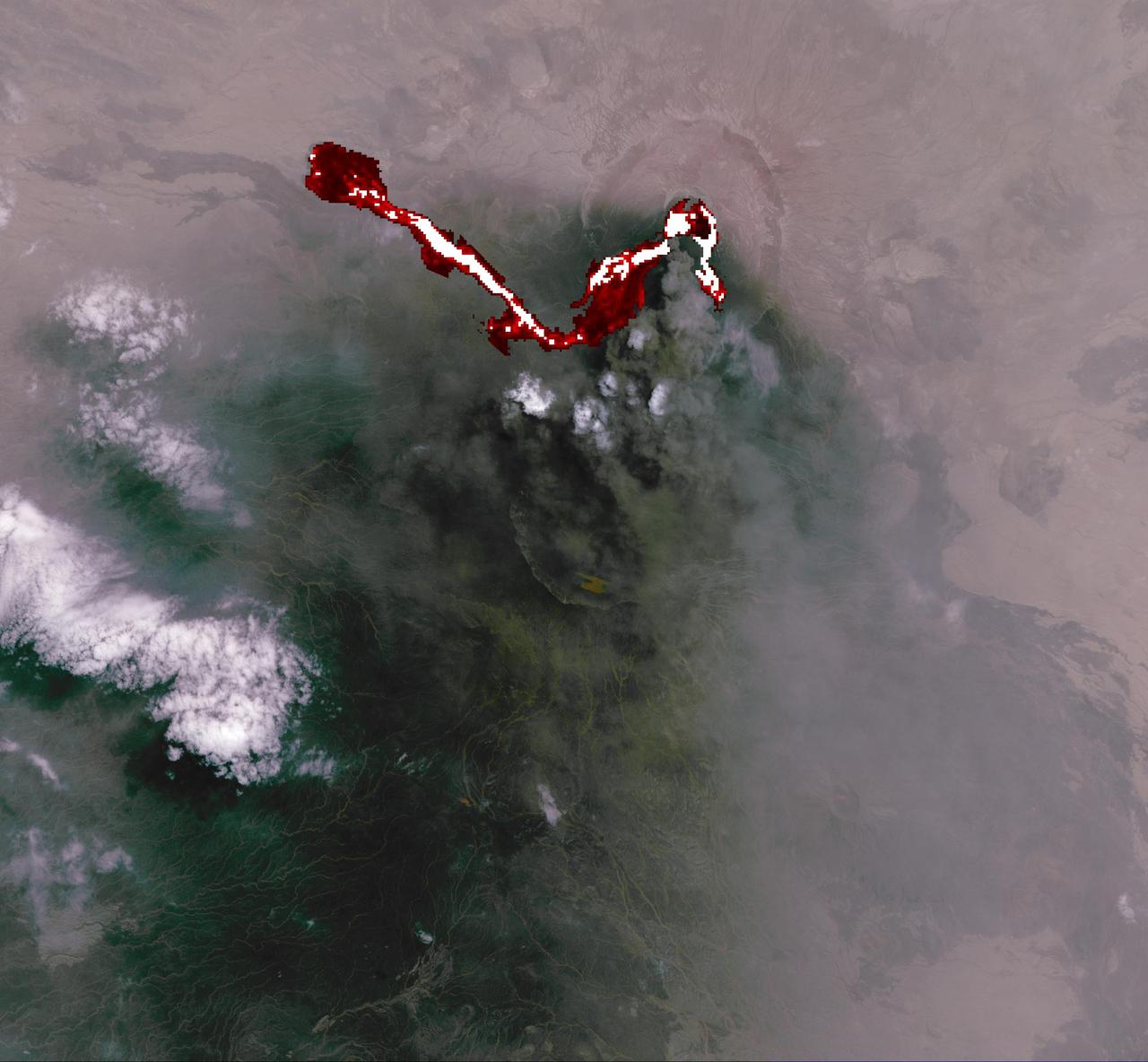
This image of Africa Nabro volcano in Eritrea was acquired by NASA Terra spacecraft on July 6, 2011. Ash plumes sent into the stratosphere disrupted air traffic in Sudan, Djibouti, Ethiopia and Sudan.
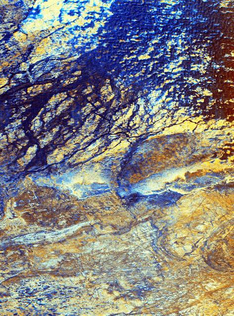
This is a false-color image of the uninhabited Safsaf Oasis in southern Egypt near the Egypt/Sudan border.
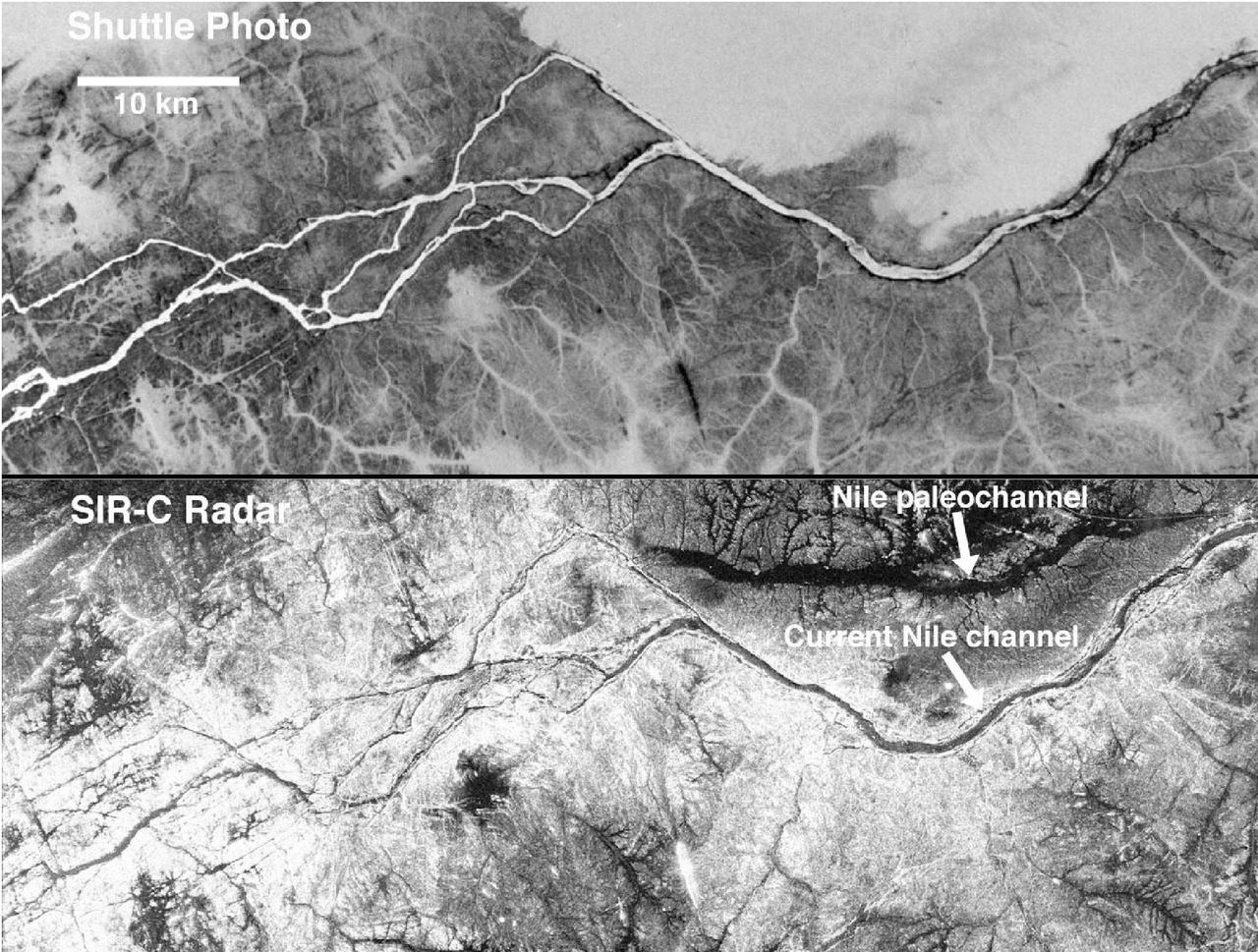
These two gray-scale images from NASA Space Shuttle show part of the Nile River, near the Fourth Cataract in Sudan.
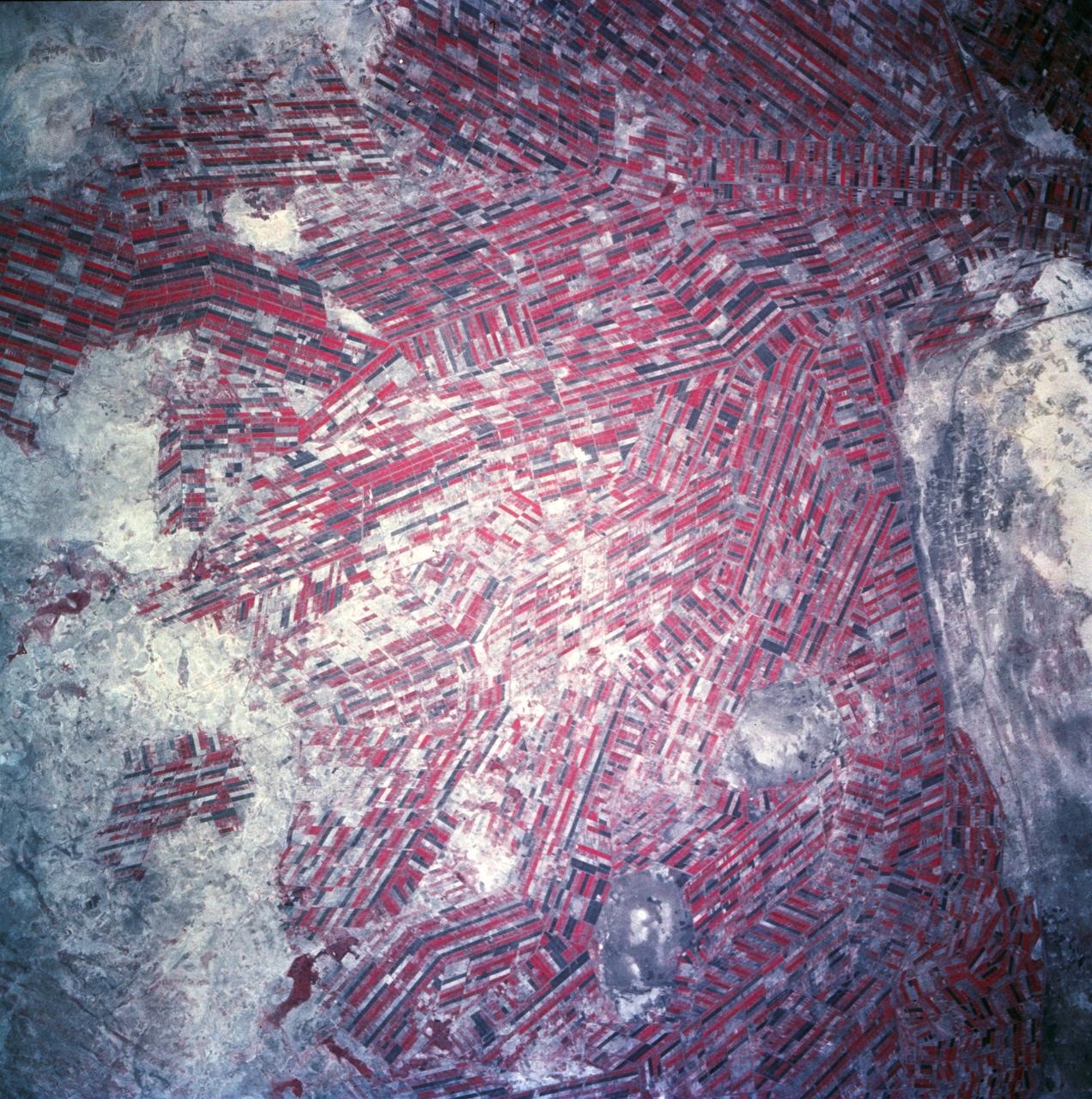
Agricultural patterns are distinctly visible in this near-vertical false color infrared photography taken in November 1994. The area depicted on the photograph is south of Khartoum between the White and Blue Nile Rivers. By far the most important irrigation project in sub-Saharan Africa, both large and small scale agricultural enterprises have been developed using water transported from the perennial Nile Rivers. Hundreds of small rectangular fields and water-filled canals can be seen in this photograph.
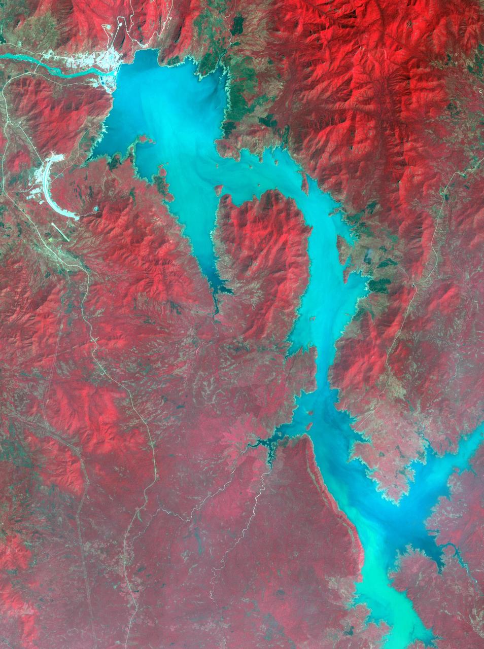
Filling of the Grand Ethiopian Renaissance Dam (GERD) along the Blue Nile River is well under way near the Ethiopia-Sudan border. For a decade, Egypt and Ethiopia have been at a diplomatic stalemate over the Nile's management. Egypt proposes that Ethiopia should be able to generate hydropower from the GERD while minimizing the harm on downstream communities in Egypt and Sudan. Ethiopia's objective is to assert control over the Blue Nile, the largest tributary of the Nile River. The image was acquired November 6, 2020, covers an area of 32 by 42.9 kilometers, and is located near 11.1 degrees north, 35.2 degrees east. https://photojournal.jpl.nasa.gov/catalog/PIA24150

iss070e028251 (Nov. 21, 2023) --- This view of Earth shows the White Nile River leading to the Nile River and winding through the African nation of Sudan. The dark spot at top left, is the Jebel Al Dair National Park containing a variety of mountains in the southern portion of Sudan.

ISS030-E-005199 (26 Nov. 2011) --- Juba, South Sudan ? the world?s newest capital city ? is featured in this image photographed by an Expedition 30 crew member on the International Space Station. Almost one year ago, on July 9, 2011, the Republic of South Sudan became the newest nation in the world, six months after its declaration of independence from Sudan. Juba, a port city (center) on the White Nile, is the capital of the new nation (although the capital will be moved in the future to a more central location) and is one of the fastest growing cities in the world. Juba?s population is uncertain, but is estimated to be roughly 350,000-400,000 having doubled in size since 2005, when a peace agreement was signed ending the civil war in Sudan. Both hopeful immigrants and returning residents have created the population surge. The city hosts the Juba Game Reserve, a protected area of savannah and woodlands that is home to key bird species.
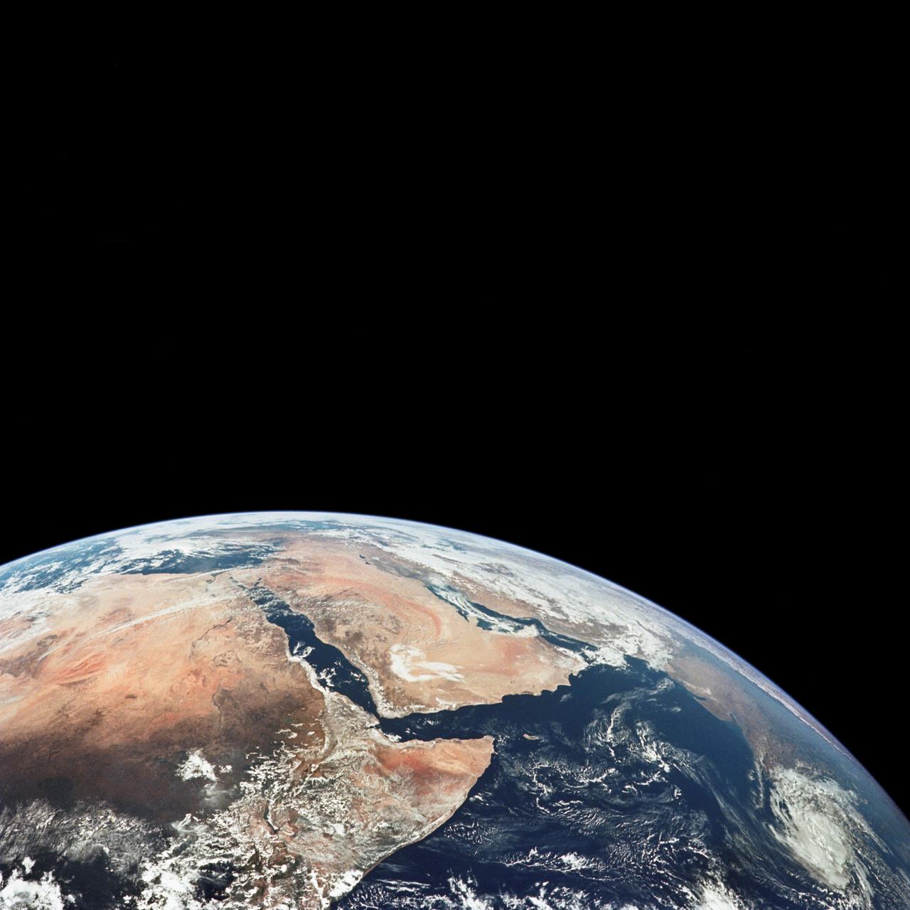
AS17-148-22718 (7-19 Dec. 1972) --- This excellent view of Saudi Arabia and the north eastern portion of the African continent was photographed by the Apollo 17 astronauts with a hand-held camera on their trans-lunar coast toward man's last lunar visit. Egypt, Sudan, Ethiopia are some of the African nations are visible. Iran, Iraq, Jordan are not so clearly visible because of cloud cover and their particular location in the picture. India is dimly visible at right of frame. The Red Sea is seen entirely in this one single frame, a rare occurrence in Apollo photography or any photography taken from manned spacecraft. The Gulf of Suez, the Dead Sea, Gulf of Aden, Persian Gulf and Gulf of Oman are also visible. This frame is one of 169 frames on film magazine NN carried aboard Apollo 17, all of which are SO368 (color) film. A 250mm lens on a 70mm Hasselblad camera recorded the image, one of 92 taken during the trans-lunar coast. Note AS17-148-22727 (also magazine NN) for an excellent full Earth picture showing the entire African continent.
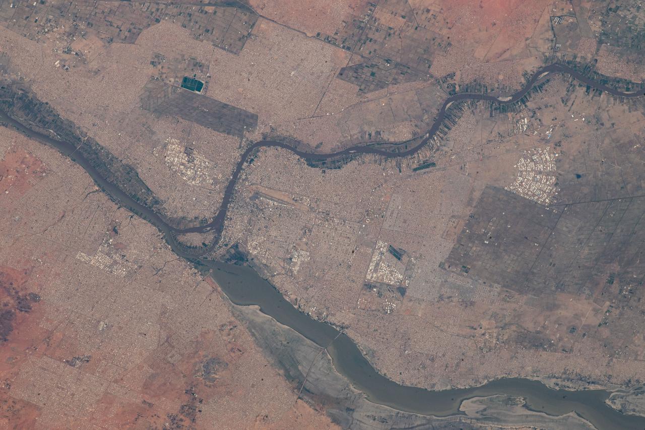
iss070e002191 (Oct. 6, 2023) --- The cities of Khartoum and Omdurman in Sudan are pictured from the International Space Station as it orbited 258 miles above the African nation.
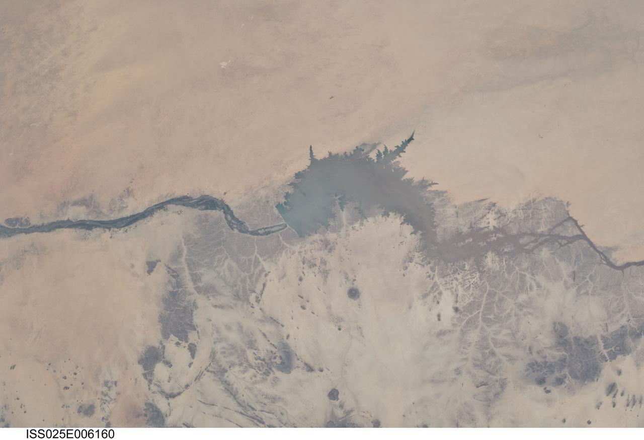
ISS025-E-006160 (5 Oct. 2010) --- Merowe Dam, Nile River and the Republic of the Sudan are featured in this image photographed by an Expedition 25 crew member on the International Space Station. The Merowe Dam is located near the 4th cataract of the Nile River, in the Nubian Desert of the northeastern Republic of the Sudan (also known as Sudan). The dam was built to generate hydroelectric power—electricity intended to further industrial and agricultural development of the country. This photograph illustrates the current extent of the reservoir filling behind the dam; the final spill gate was closed in 2008. The Merowe Dam is located approximately 350 kilometers (215 miles) to the northwest of Sudan’s capital, Khartoum. The nearest settlement downstream of the dam is Karima. Following Sudan’s independence from Egypt and the United Kingdom in 1956, allocation and control of Nile River water was divided between Egypt and Sudan by the Nile Waters Treaty signed in 1959. Today, other countries within the Nile basin—including Ethiopia, Kenya, Rwanda, Tanzania, and Uganda—are seeking more equitable allocation and utilization of the water and recently (2010) signed a new water use pact challenging the 1959 treaty. Beyond the issues of water rights, several local tribes will be displaced by the planned 170 kilometer-long reservoir, and the flooded region contains significant but little-studied archeological sites. The Sudanese government has a resettlement program in place for the tribes. A variety of international institutions have been conducting “salvage” or “rescue” archeological surveys since 1999. Such rescue surveys seek to preserve as much information as possible from sites that will be destroyed or otherwise made inaccessible (in this case by flooding).
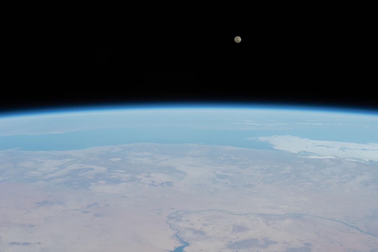
iss066e145575 (Feb. 15, 2022) --- The Full Moon is pictured above the Red Sea as the International Space Station orbited 257 miles above the Nile River in the African nation of Sudan.
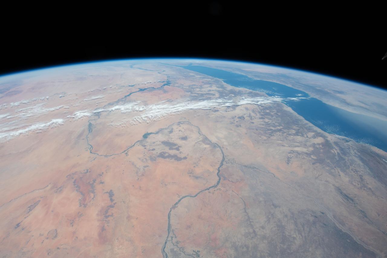
iss062e069299 (March 1, 2020) --- This image taken from the International Space Station as it orbited 263 miles above Sudan shows the Nile River winding northward next to the Red Sea toward the Mediterranean Sea.

iss063e028234 (June 16, 2020) --- Lake Nasser, a vast reservoir in southern Egypt and northern Sudan, is pictured from the International Space Station as it orbited above northeast Africa.
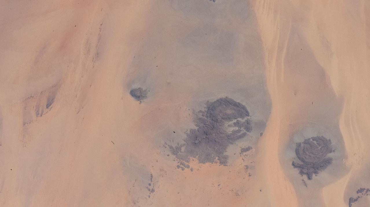
iss067e141205 (June 19, 2022) --- This portion of the Western Desert is an area of the Sahara where the borders of Egypt, Libya, and Sudan meet. The International Space Station was orbiting 259 miles above north Africa at the time of this photograph.
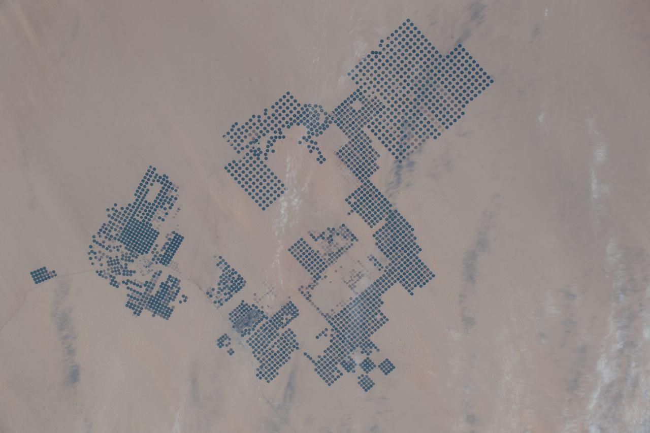
iss068e050817 (Feb. 9, 2023) --- An agricultural development in Egypt's New Valley Governate near the Sudan border is pictured from the International Space Station as it orbited 258 miles above the eastern Sahara.
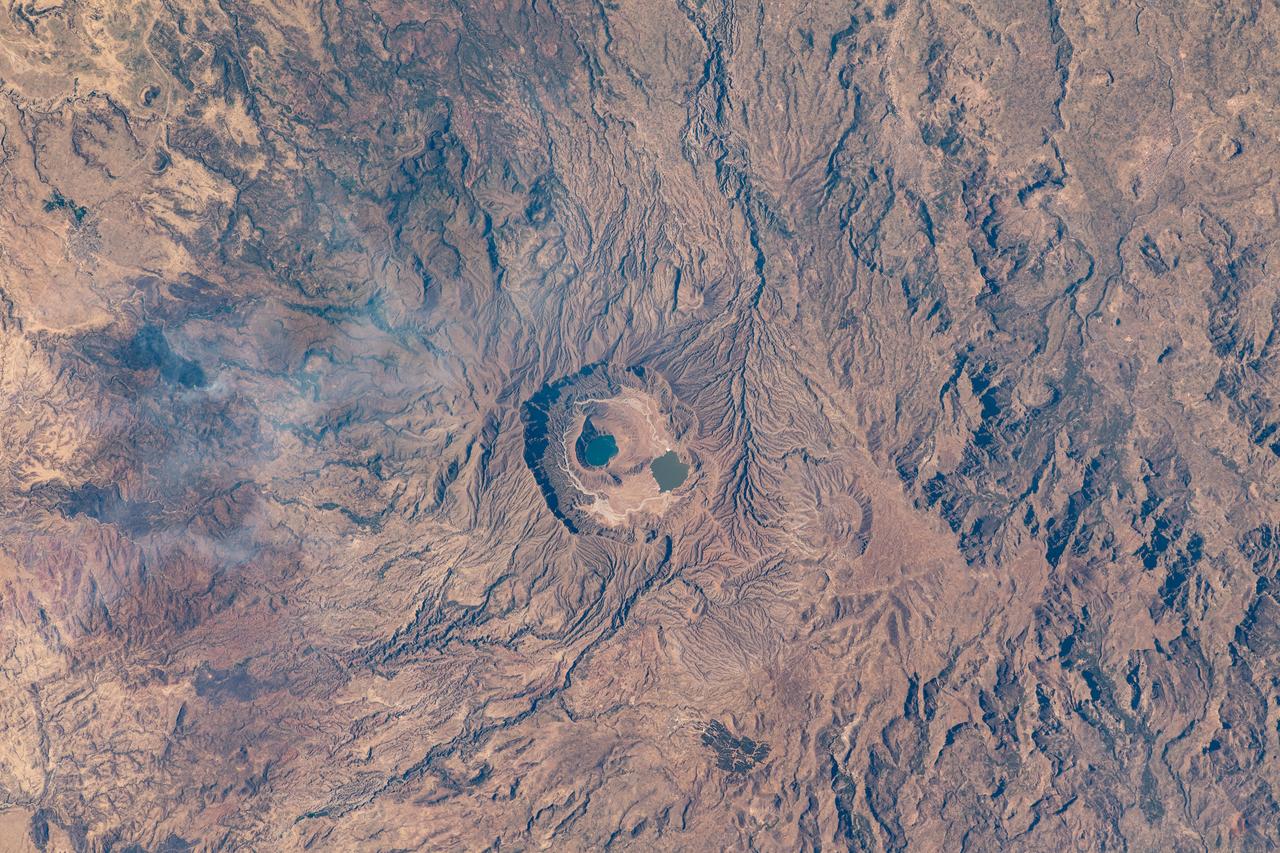
iss064e006219 (Nov. 26, 2020) --- The Deriba caldera in Darfur, Sudan, which holds two lakes, was pictured from the International Space Station as it orbited 260 miles above the Marrah Mountains.
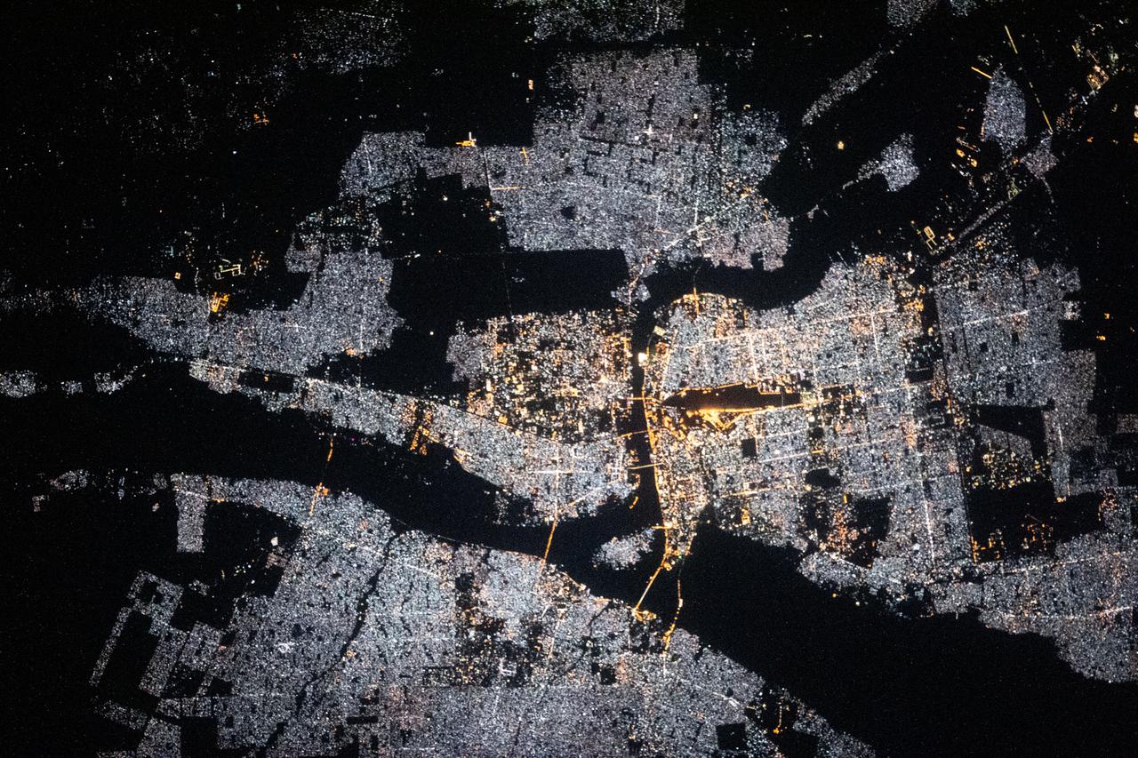
iss064e004061 (Nov. 11, 2020) --- This nighttime shot from the International Space Station shows Khartoum, the capital of Sudan, surrounded by the Nile, Blue Nile and White Nile Rivers.
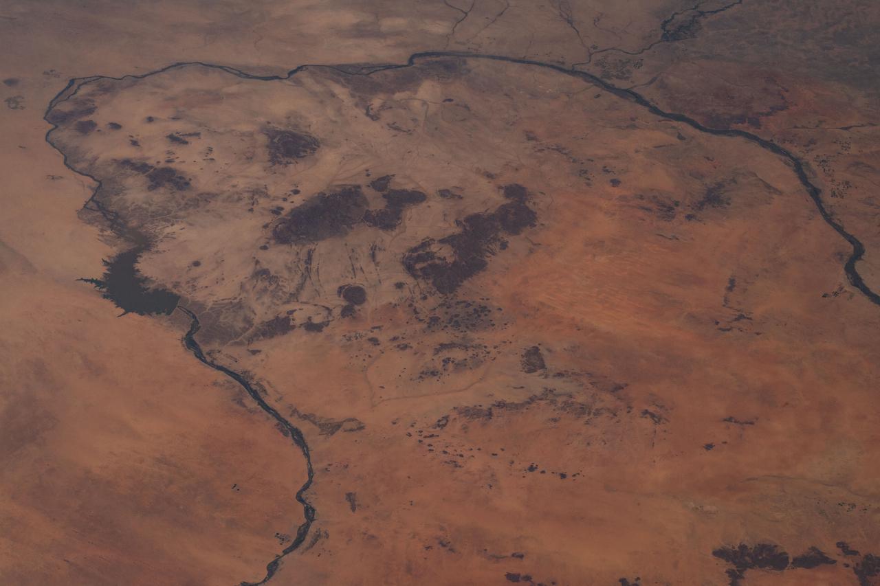
iss066e091596 (Nov. 30, 2021) --- The Merowe Reservoir (center left) on the river Nile is pictured from the International Space Station as it orbited 262 miles above the African nation of Sudan.
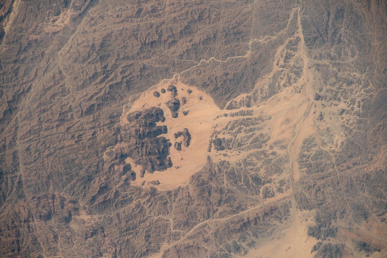
iss070e002272 (Oct. 6, 2023) --- The Jibāl Hawlad mountain range, near the Red Sea, is pictured in the African nation of Sudan as the International Space Station orbited 258 miles above.
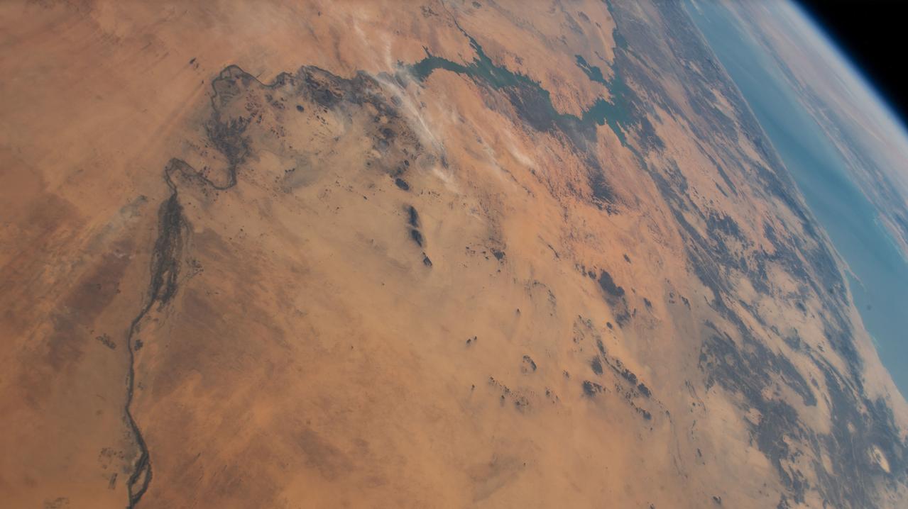
iss067e178289 (July 8, 2022) --- The Nile River is pictured flowing toward the Mediterranean Sea in this picture from the International Space Station as it orbited 261 miles above the African nation of Sudan. At right, is the Red Sea.
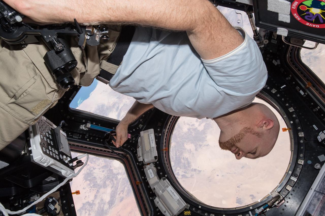
iss056e152980 (Aug. 23, 2018) --- Astronaut Alexander Gerst of ESA (European Space Agency) is in the Cupola, also known as the International Space Station's "window to the world, as the African country of Sudan passes 251 miles below.
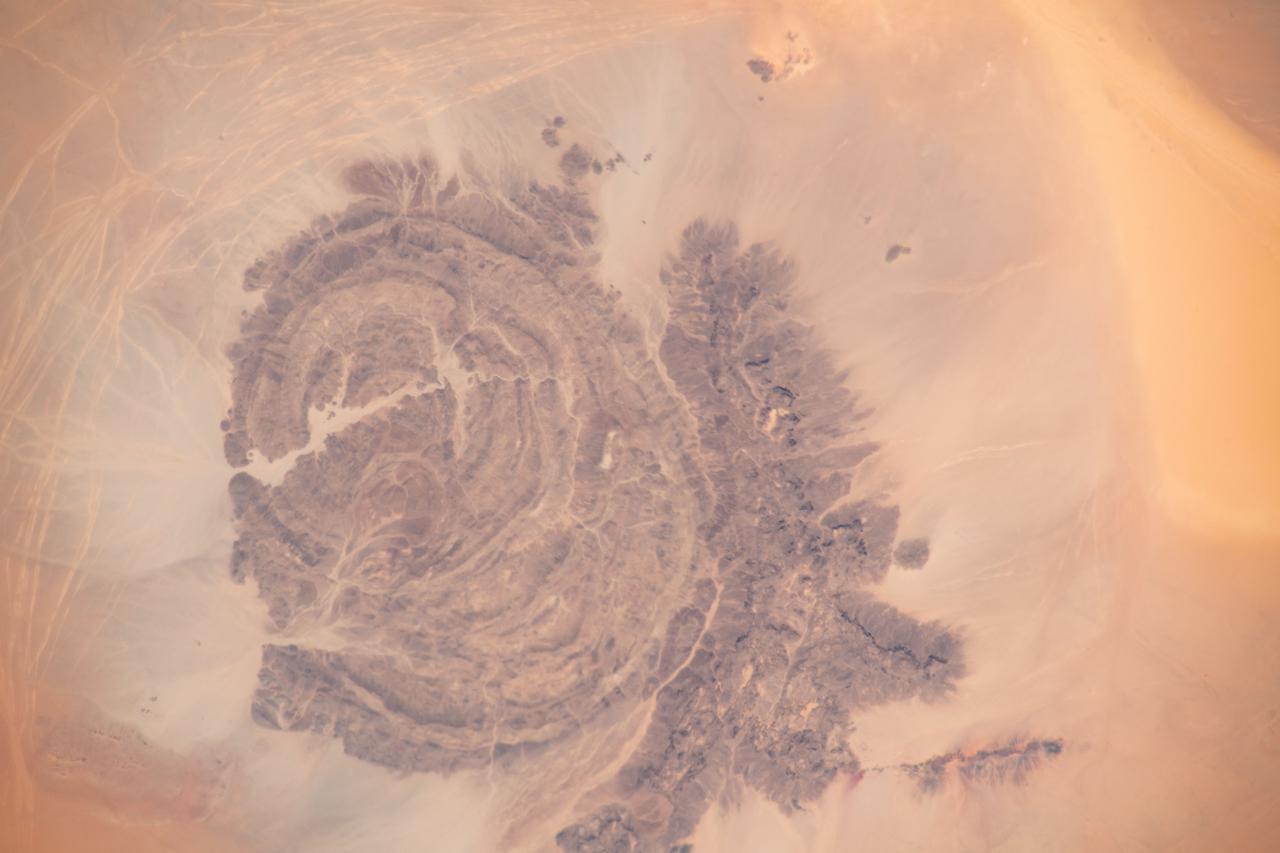
iss065e009521 (April 29, 2021) --- Mount Arkanu in southeast Libya, near the border with Egypt and Sudan, is pictured from the International Space Station as it orbited 262 miles above the Sahara Desert.
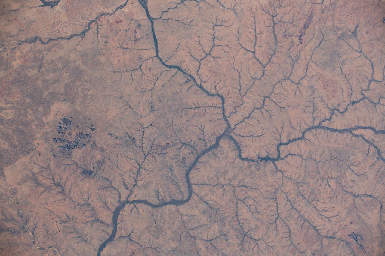
iss061e093391 (Dec. 20, 2019) --- The Kabkabiya District in western Sudan near the border of Chad is pictured as the International Space Station orbited 260 miles above the African continent.
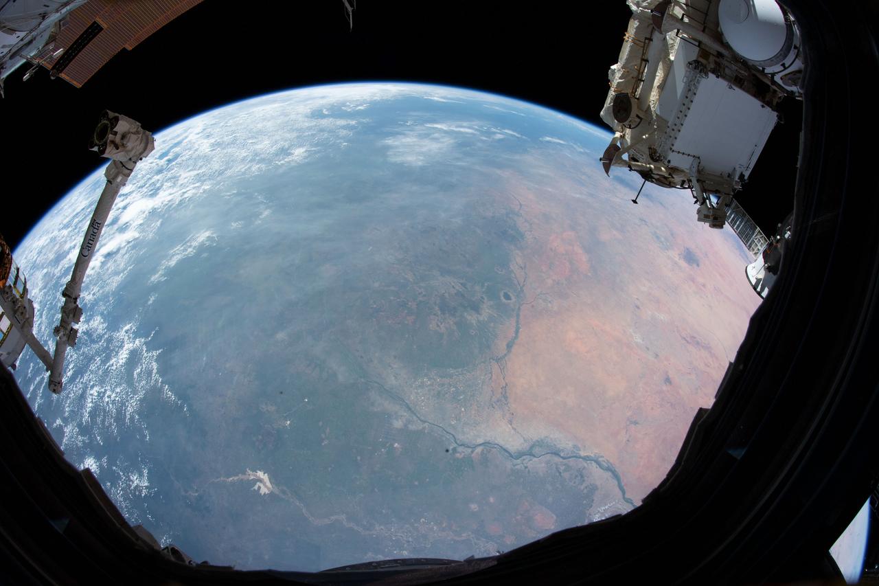
iss061e025877 (Oct. 30, 2019) --- Pictured from the International Space Station's cupola, or "window to the world," Sudan's northern arid climate transitions to a tropical climate in the country's far south in eastern Africa.
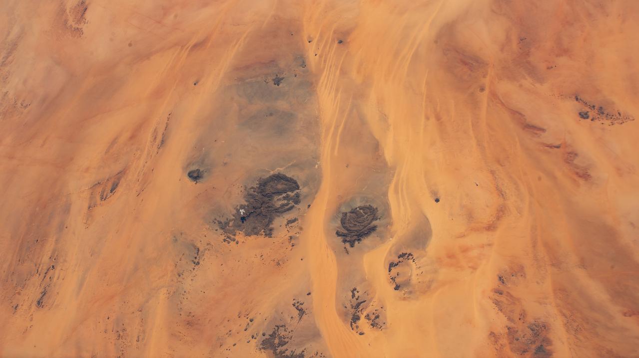
iss072e065377 (Oct. 17, 2024) --- The borders of three African nations, Libya, Sudan, and Egypt, meet in the eastern portion of the Sahara in this photograph from the International Space Station as it orbited 258 miles above.
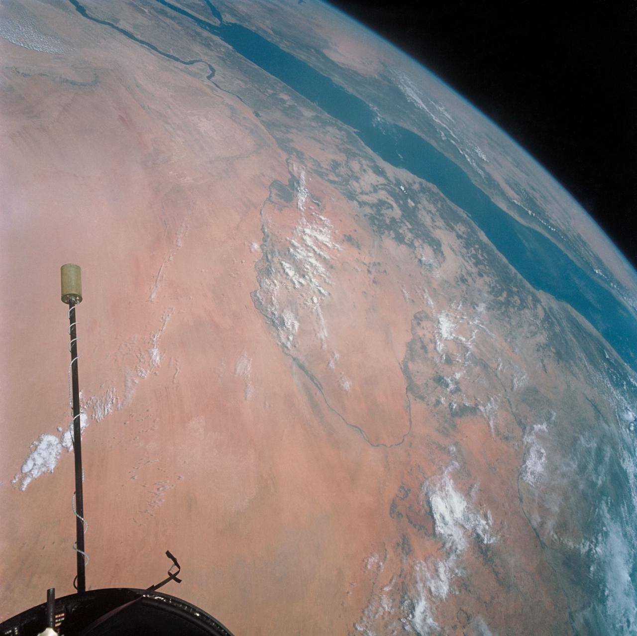
S66-54530 --- Libyan Desert area of Sudan, foreground, and the United Arab Republic (Egypt), at lower left, as seen from the orbiting Gemini-11 spacecraft at an altitude of 300 nautical miles during its 27th revolution of Earth. In view is the Nile River from Biba in Egypt to Khartoum in the Sudan. The Red Sea is in the background. At upper left is the Arabian Peninsula. At top right is Ethiopia. Note L-band antenna of the Agena Target Vehicle. Taken with a modified 70mm Hasselblad camera, using Eastman Kodak, Ektachrome, MS (S.O. 368) color film. Photo credit: NASA
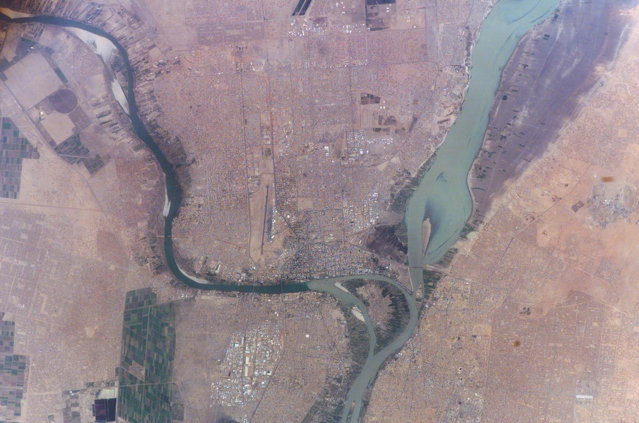
ISS010-E-23451 (7 April 2005) --- Khartoum, Sudan is featured in this image photographed by an Expedition 10 crewmember on the International Space Station (ISS). Sudan’s capital city Khartoum, which means Elephant’s Trunk, describes the shape of the Nile River where the Blue and the White Nile Rivers meet to form the united Nile that flows northward into Egypt. This image shows the rivers near the end of the dry season. The White Nile (western branch) runs through Sudan from Uganda. The White Nile’s equatorial source produces a flow that runs at a nearly constant rate throughout the year. The nearly dry Blue Nile from the highlands of Ethiopia swells in the late summer and early fall with rains from the summer monsoons. The flow can be so great the Nile flows backward at the junction. In recent years, floods in Khartoum have occurred in August with heavy monsoon rainfall. Khartoum is one of the largest Muslim cities in North Africa, but has a fairly short history.

An SUV-sized Asteroid 2008TC# Impacts on October 7, 2008 in the Nubian Desert, Northern Sudan: Dr. Peter Jenniskens, NASA/SETI joined Muawia Shaddas of the University of Khartoum in leading an expedition on a search for samples. (find) Photo Credit: NASA/SETI/P. Jenniskens
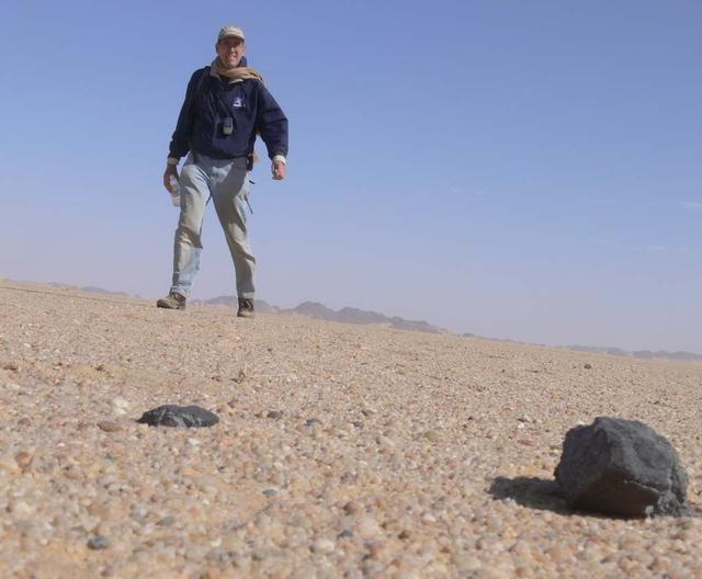
An SUV-sized Asteroid 2008TC# Impacts on October 7, 2008 in the Nubian Desert, Northern Sudan: Dr. Peter Jenniskens, NASA/SETI joined Muawia Shaddas of the University of Khartoum in leading an expedition on a search for samples. Peter Jenniskens meteorite. Photo Credit: NASA/SETI/P. Jenniskens

An SUV-sized Asteroid 2008TC# Impacts on October 7, 2008 in the Nubian Desert, Northern Sudan: Dr. Peter Jenniskens, NASA/SETI joined Muawia Shaddas of the University of Khartoum in leading an expedition on a search for samples. (meteorite 3rd-bigone) Photo Credit: NASA/SETI/P. Jenniskens
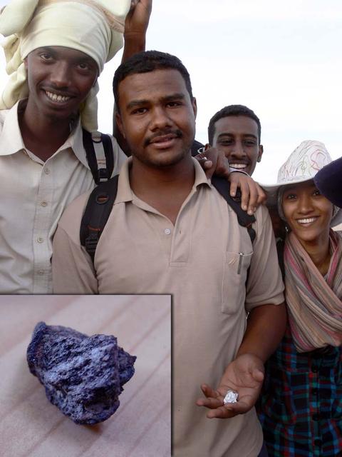
An SUV-sized Asteroid 2008TC# Impacts on October 7, 2008 in the Nubian Desert, Northern Sudan: Dr. Peter Jenniskens, NASA/SETI joined Muawia Shaddas of the University of Khartoum in leading an expedition on a search for samples. (first one found) Photo Credit: NASA/SETI/P. Jenniskens
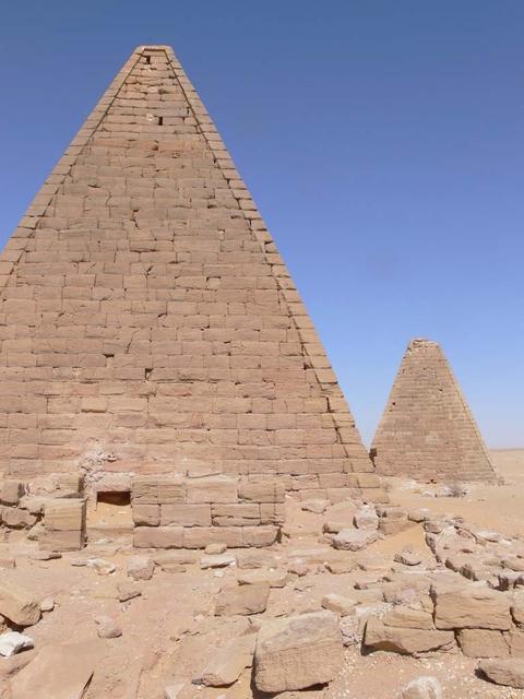
An SUV-sized Asteroid 2008TC# Impacts on October 7, 2008 in the Nubian Desert, Northern Sudan: Dr. Peter Jenniskens, NASA/SETI joined Muawia Shaddas of the University of Khartoum in leading an expedition on a search for samples. Pyramid pair Photo Credit: NASA/SETI/P. Jenniskens
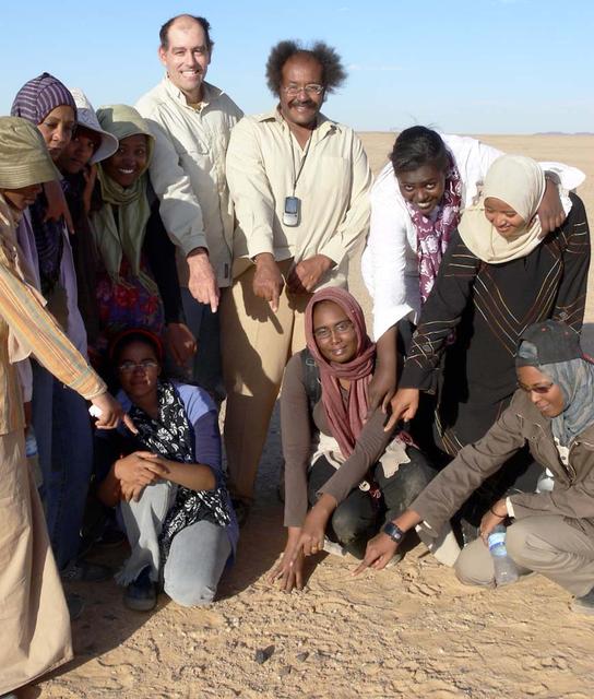
An SUV-sized Asteroid 2008TC# Impacts on October 7, 2008 in the Nubian Desert, Northern Sudan: Dr. Peter Jenniskens, NASA/SETI joined Muawia Shaddas of the University of Khartoum in leading an expedition on a search for samples. (find # 1) Photo Credit: NASA/SETI/P. Jenniskens
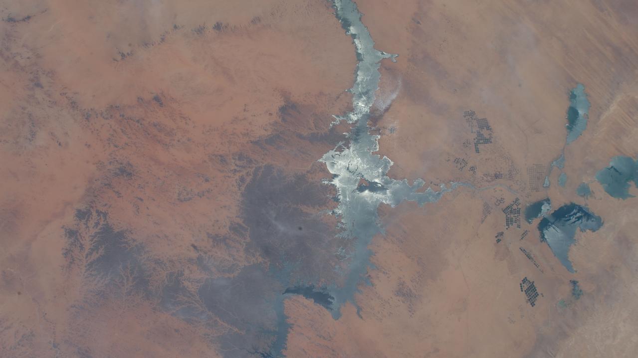
iss067e284430 (Aug. 20, 2022) --- The sun's glint beams off Egypt's Lake Nasser, one of the largest man-made lakes in the world near the border with Sudan, in this photograph from the International Space Station as it orbited 257 miles above northeastern Africa.
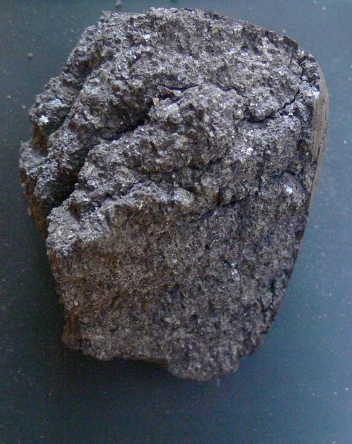
An SUV-sized Asteroid 2008TC# Impacts on October 7, 2008 in the Nubian Desert, Northern Sudan: Dr. Peter Jenniskens, NASA/SETI joined Muawia Shaddas of the University of Khartoum in leading an expedition on a search for samples. (meteorite 3rd) Photo Credit: NASA/SETI/P. Jenniskens
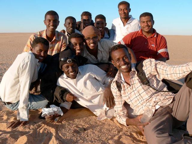
An SUV-sized Asteroid 2008TC# Impacts on October 7, 2008 in the Nubian Desert, Northern Sudan: Dr. Peter Jenniskens, NASA/SETI joined Muawia Shaddas of the University of Khartoum in leading an expedition on a search for samples. (search team) Photo Credit: NASA/SETI/P. Jenniskens
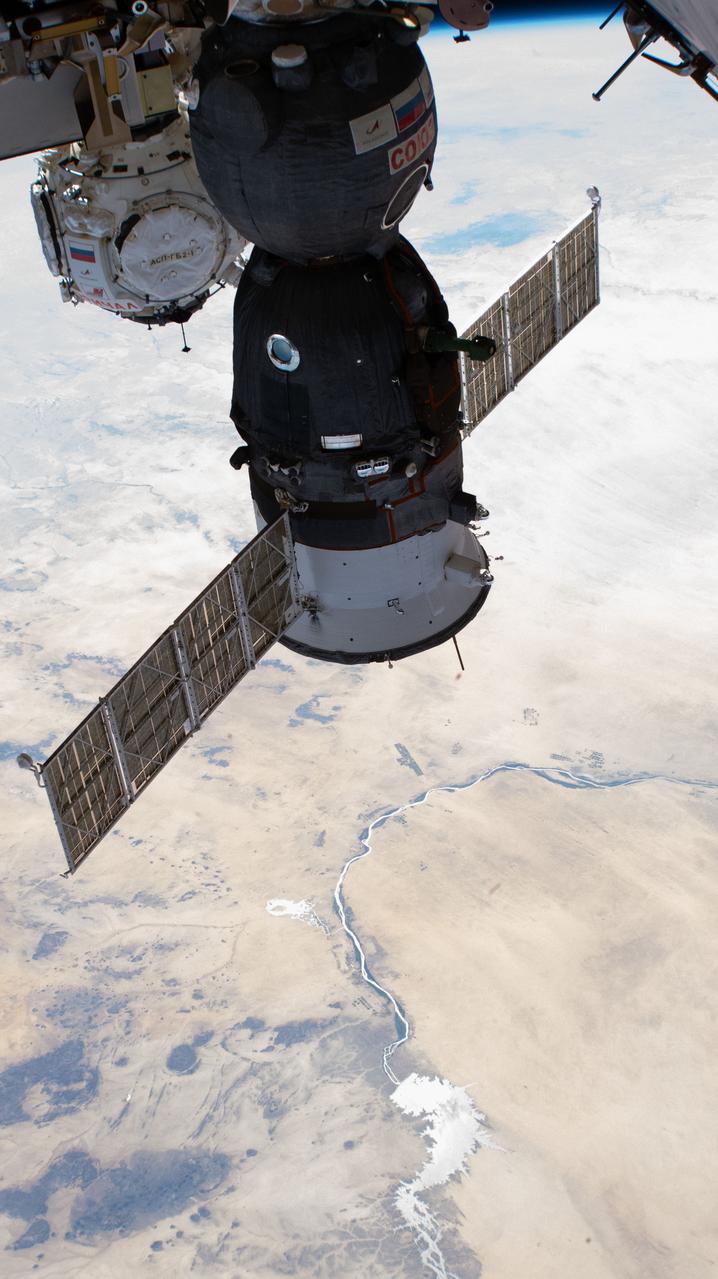
iss066e125408 (Jan. 24, 2022) --- The Soyuz MS-19 crew ship and the Prichal docking module (in the background), with the river Nile and the Menowe Reservoir below, are pictured as the International Space Station orbited 258 miles above the African nation of Sudan.

An SUV-sized Asteroid 2008TC# Impacts on October 7, 2008 in the Nubian Desert, Northern Sudan: Dr. Peter Jenniskens, NASA/SETI joined Muawia Shaddas of the University of Khartoum in leading an expedition on a search for samples. (meteorite find 3rd trip 1) Photo Credit: NASA/SETI/P. Jenniskens
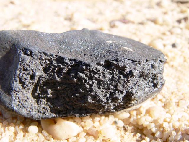
An SUV-sized Asteroid 2008TC# Impacts on October 7, 2008 in the Nubian Desert, Northern Sudan: Dr. Peter Jenniskens, NASA/SETI joined Muawia Shaddas of the University of Khartoum in leading an expedition on a search for samples. (Meteorite #14) Photo Credit: NASA/SETI/P. Jenniskens
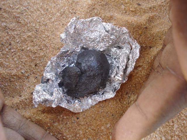
An SUV-sized Asteroid 2008TC# Impacts on October 7, 2008 in the Nubian Desert, Northern Sudan: Dr. Peter Jenniskens, NASA/SETI joined Muawia Shaddas of the University of Khartoum in leading an expedition on a search for samples. (meteorite #4) Photo Credit: NASA/SETI/P. Jenniskens

An SUV-sized Asteroid 2008TC# Impacts on October 7, 2008 in the Nubian Desert, Northern Sudan: Dr. Peter Jenniskens, NASA/SETI joined Muawia Shaddas of the University of Khartoum in leading an expedition on a search for samples. Peter Jenniskens finds meteorites 1) Photo Credit: NASA/SETI/P. Jenniskens

An SUV-sized Asteroid 2008TC# Impacts on October 7, 2008 in the Nubian Desert, Northern Sudan: Dr. Peter Jenniskens, NASA/SETI joined Muawia Shaddas of the University of Khartoum in leading an expedition on a search for samples. Photo Credit: NASA/SETI/P. Jenniskens
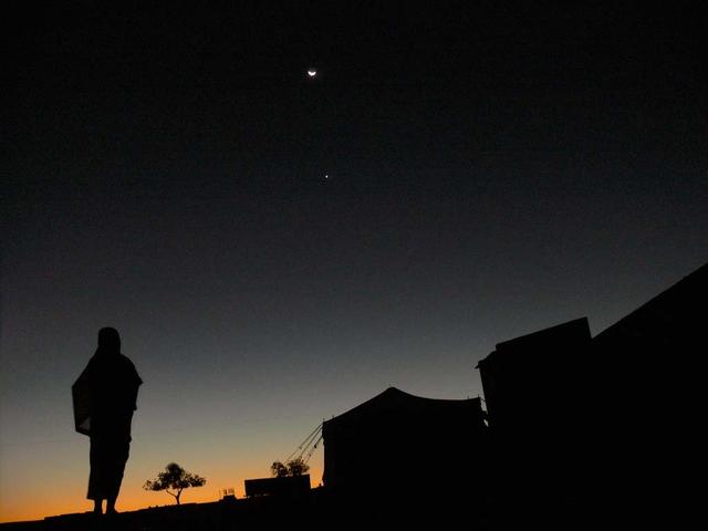
An SUV-sized Asteroid 2008TC# Impacts on October 7, 2008 in the Nubian Desert, Northern Sudan: Dr. Peter Jenniskens, NASA/SETI joined Muawia Shaddas of the University of Khartoum in leading an expedition on a search for samples. (Girls dormatory at station 6) Photo Credit: NASA/SETI/P. Jenniskens
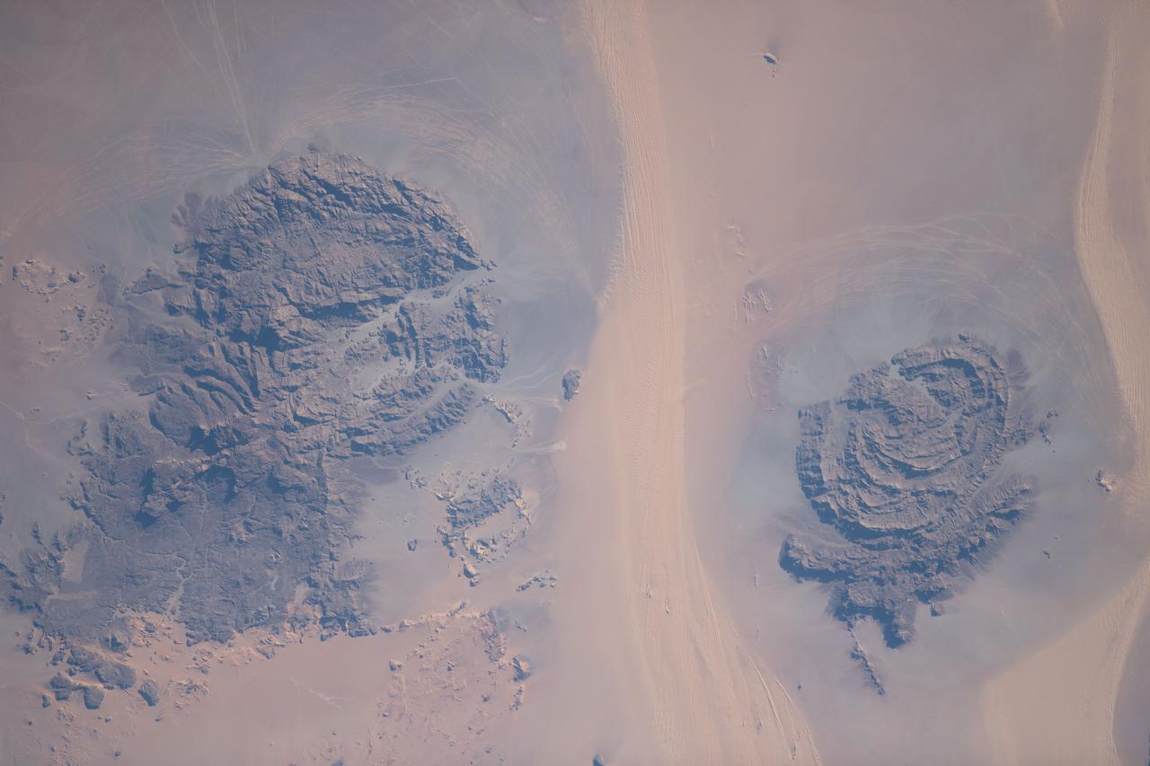
iss069e089643 (Sept. 18, 2023) --- Located in the Libyan Desert along the country's southeastern border with Sudan and Egypt are the Jebel Uweinat (left) and the Jabal Arkenu (right) mountains pictured from the International Space Station as it orbited 258 miles above.
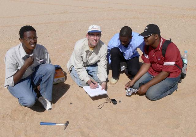
An SUV-sized Asteroid 2008TC# Impacts on October 7, 2008 in the Nubian Desert, Northern Sudan: Dr. Peter Jenniskens, NASA/SETI joined Muawia Shaddas of the University of Khartoum in leading an expedition on a search for samples. (find #11 & 12) Photo Credit: NASA/SETI/P. Jenniskens
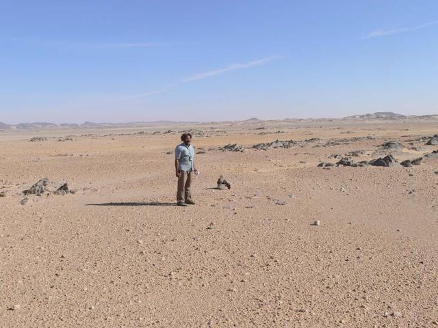
An SUV-sized Asteroid 2008TC# Impacts on October 7, 2008 in the Nubian Desert, Northern Sudan: Dr. Peter Jenniskens, NASA/SETI joined Muawia Shaddas of the University of Khartoum in leading an expedition on a search for samples. (Dr Mauwia Shaddad) Photo Credit: NASA/SETI/P. Jenniskens
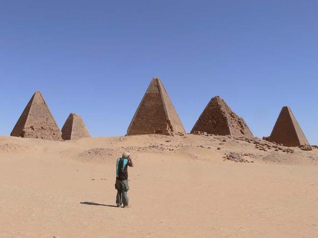
An SUV-sized Asteroid 2008TC# Impacts on October 7, 2008 in the Nubian Desert, Northern Sudan: Dr. Peter Jenniskens, NASA/SETI joined Muawia Shaddas of the University of Khartoum in leading an expedition on a search for samples. Pyramids Photo Credit: NASA/SETI/P. Jenniskens
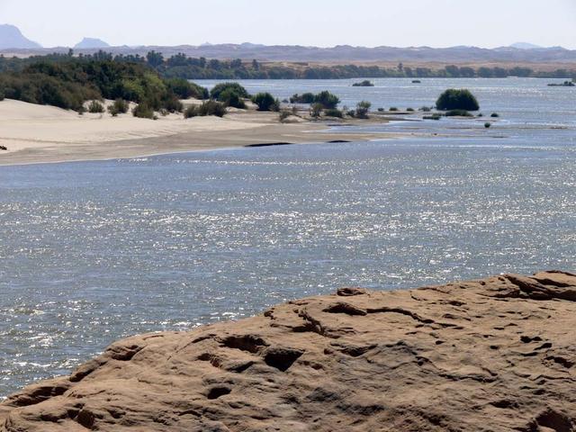
An SUV-sized Asteroid 2008TC# Impacts on October 7, 2008 in the Nubian Desert, Northern Sudan: Dr. Peter Jenniskens, NASA/SETI joined Muawia Shaddas of the University of Khartoum in leading an expedition on a search for samples. Photo Credit: NASA/SETI/P. Jenniskens
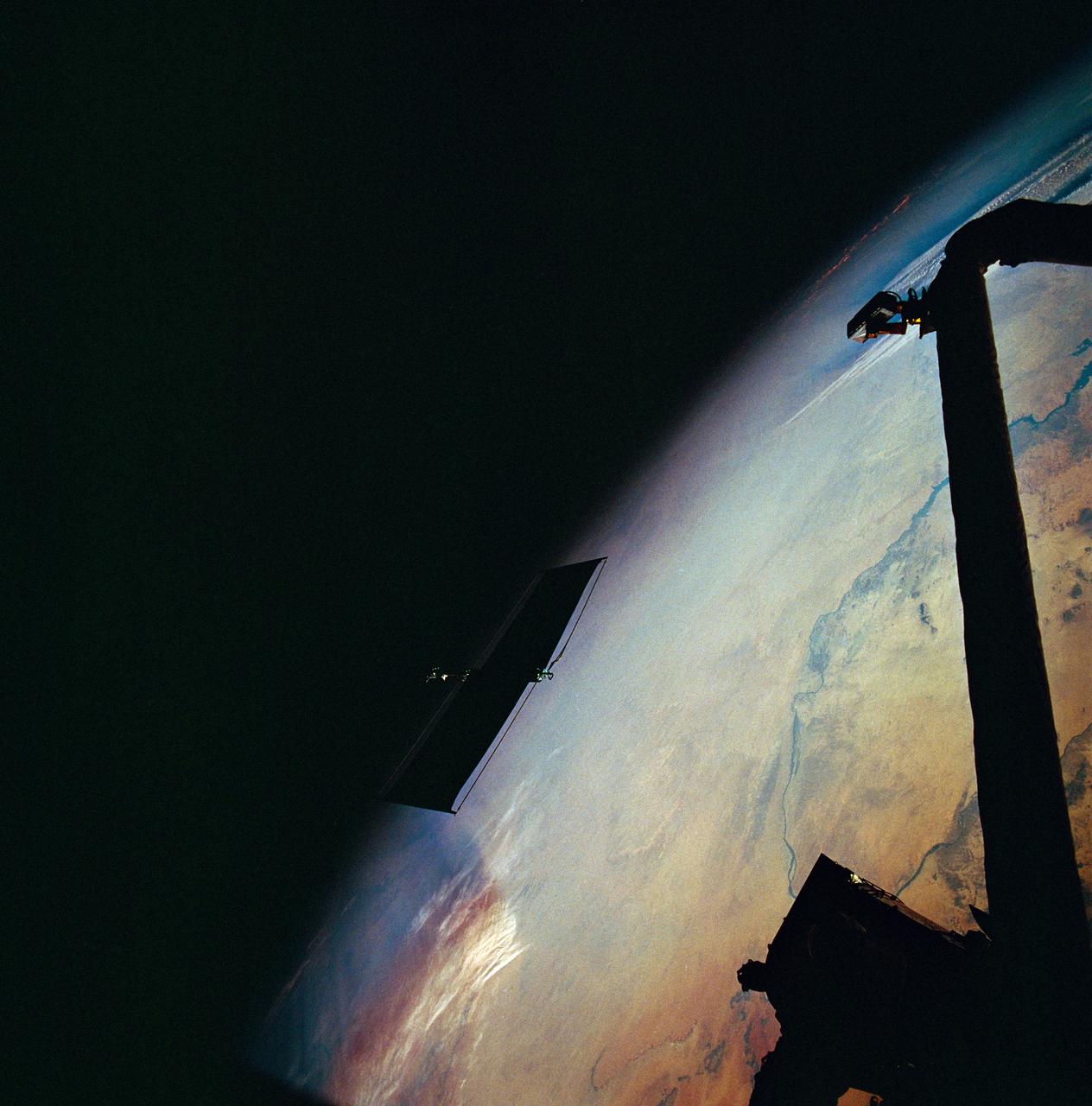
STS061-95-031 (6 Dec 1993) --- The damaged solar array panel removed from the Hubble Space Telescope (HST) is backdropped over northern Sudan. Astronaut Kathryn C. Thornton, just out of frame at top right, watched the panel after releasing it moments earlier.
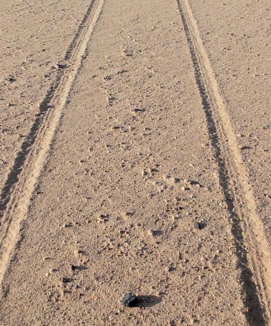
An SUV-sized Asteroid 2008TC# Impacts on October 7, 2008 in the Nubian Desert, Northern Sudan: Dr. Peter Jenniskens, NASA/SETI joined Muawia Shaddas of the University of Khartoum in leading an expedition on a search for samples. (meteorite-brick-reenactment) Photo Credit: NASA/SETI/P. Jenniskens
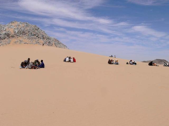
An SUV-sized Asteroid 2008TC# Impacts on October 7, 2008 in the Nubian Desert, Northern Sudan: Dr. Peter Jenniskens, NASA/SETI joined Muawia Shaddas of the University of Khartoum in leading an expedition on a search for samples. (Lunch at Marble Mountain) Photo Credit: NASA/SETI/P. Jenniskens
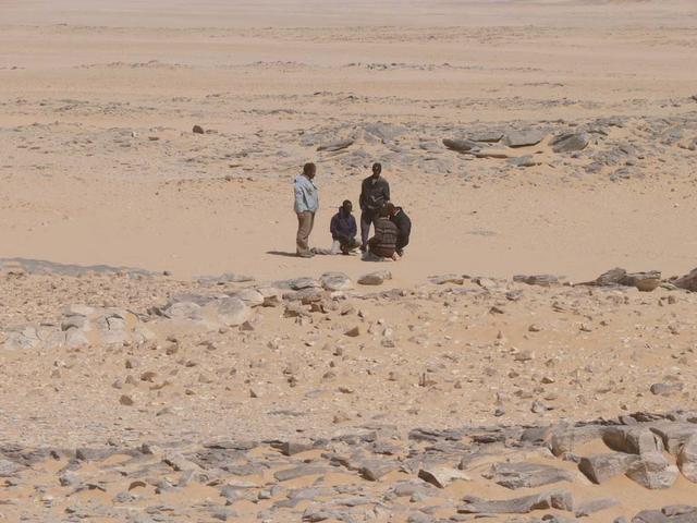
An SUV-sized Asteroid 2008TC# Impacts on October 7, 2008 in the Nubian Desert, Northern Sudan: Dr. Peter Jenniskens, NASA/SETI joined Muawia Shaddas of the University of Khartoum in leading an expedition on a search for samples. (Mauwia checks on find) Photo Credit: NASA/SETI/P. Jenniskens
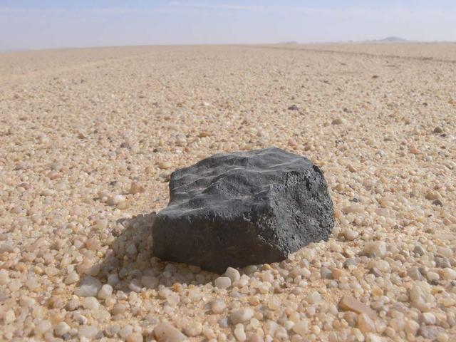
An SUV-sized Asteroid 2008TC# Impacts on October 7, 2008 in the Nubian Desert, Northern Sudan: Dr. Peter Jenniskens, NASA/SETI joined Muawia Shaddas of the University of Khartoum in leading an expedition on a search for samples. Peter Jenniskens finds the brick. Photo Credit: NASA/SETI/P. Jenniskens
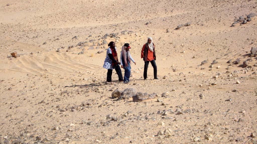
An SUV-sized Asteroid 2008TC# Impacts on October 7, 2008 in the Nubian Desert, Northern Sudan: Dr. Peter Jenniskens, NASA/SETI joined Muawia Shaddas of the University of Khartoum in leading an expedition on a search for samples. searching Photo Credit: NASA/SETI/P. Jenniskens
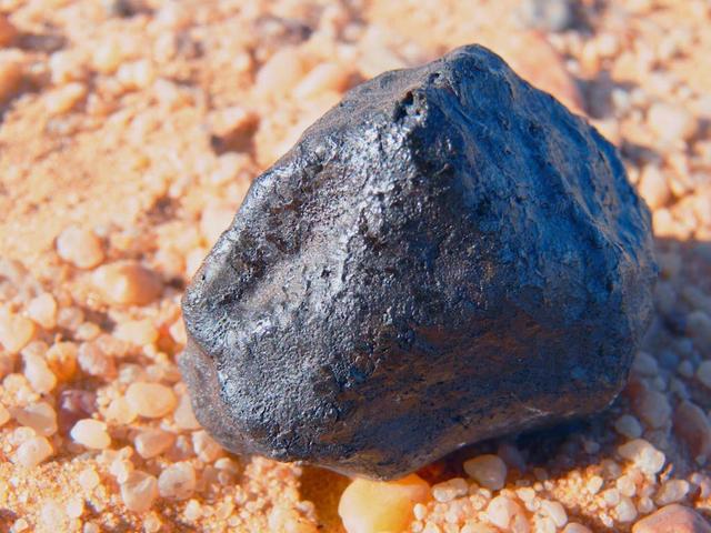
An SUV-sized Asteroid 2008TC# Impacts on October 7, 2008 in the Nubian Desert, Northern Sudan: Dr. Peter Jenniskens, NASA/SETI joined Muawia Shaddas of the University of Khartoum in leading an expedition on a search for samples. (meteorite) Photo Credit: NASA/SETI/P. Jenniskens
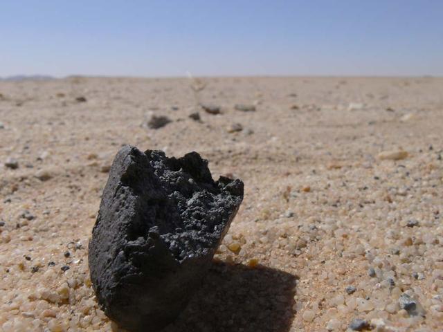
An SUV-sized Asteroid 2008TC# Impacts on October 7, 2008 in the Nubian Desert, Northern Sudan: Dr. Peter Jenniskens, NASA/SETI joined Muawia Shaddas of the University of Khartoum in leading an expedition on a search for samples. (image used as cover for March 26, 2009 journal Nature) Photo Credit: NASA/SETI/P. Jenniskens
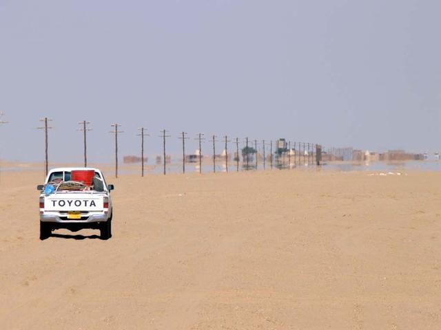
An SUV-sized Asteroid 2008TC# Impacts on October 7, 2008 in the Nubian Desert, Northern Sudan: Dr. Peter Jenniskens, NASA/SETI joined Muawia Shaddas of the University of Khartoum in leading an expedition on a search for samples. (approch station 6) Photo Credit: NASA/SETI/P. Jenniskens
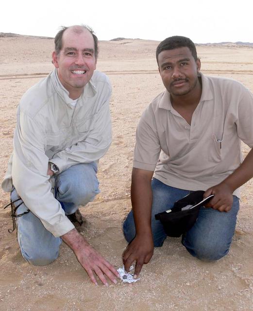
An SUV-sized Asteroid 2008TC# Impacts on October 7, 2008 in the Nubian Desert, Northern Sudan: Dr. Peter Jenniskens, NASA/SETI joined Muawia Shaddas of the University of Khartoum in leading an expedition on a search for samples. (first find) Photo Credit: NASA/SETI/P. Jenniskens
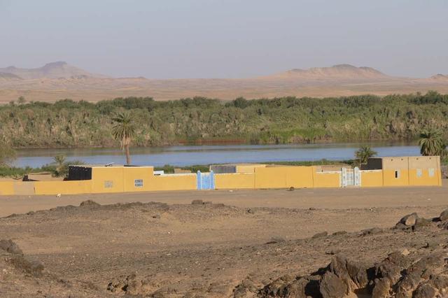
An SUV-sized Asteroid 2008TC# Impacts on October 7, 2008 in the Nubian Desert, Northern Sudan: Dr. Peter Jenniskens, NASA/SETI joined Muawia Shaddas of the University of Khartoum in leading an expedition on a search for samples. (Nubian House) Photo Credit: NASA/SETI/P. Jenniskens
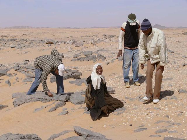
An SUV-sized Asteroid 2008TC# Impacts on October 7, 2008 in the Nubian Desert, Northern Sudan: Dr. Peter Jenniskens, NASA/SETI joined Muawia Shaddas of the University of Khartoum in leading an expedition on a search for samples. (Meteorite 3rd-several at once) Photo Credit: NASA/SETI/P. Jenniskens
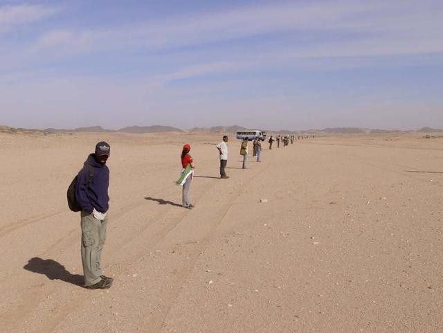
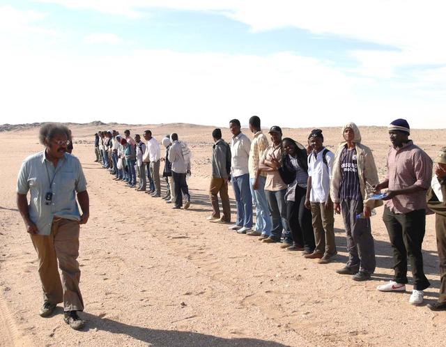
An SUV-sized Asteroid 2008TC# Impacts on October 7, 2008 in the Nubian Desert, Northern Sudan: Dr. Peter Jenniskens, NASA/SETI joined Muawia Shaddas of the University of Khartoum in leading an expedition on a search for samples. (line 3rd day) Photo Credit: NASA/SETI/P. Jenniskens
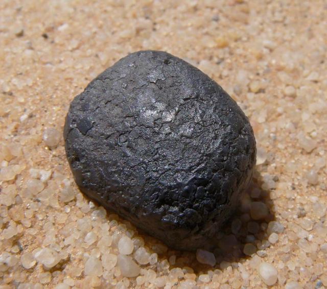
An SUV-sized Asteroid 2008TC# Impacts on October 7, 2008 in the Nubian Desert, Northern Sudan: Dr. Peter Jenniskens, NASA/SETI joined Muawia Shaddas of the University of Khartoum in leading an expedition on a search for samples. (meteorite 3rd trip-Insitu.) Photo Credit: NASA/SETI/P. Jenniskens
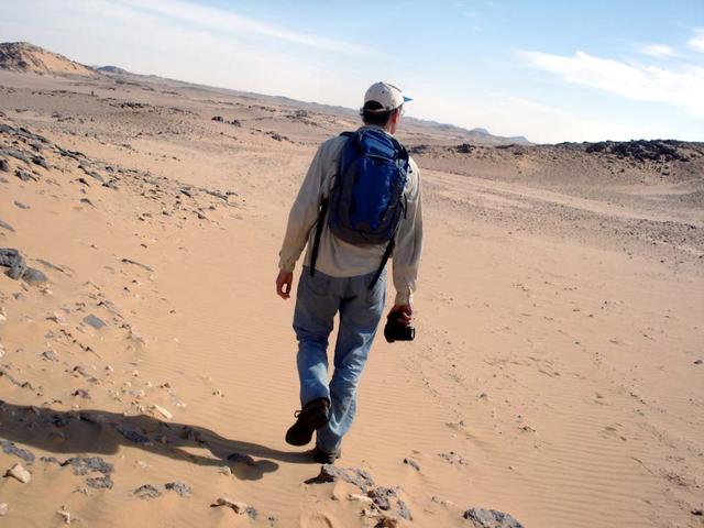
An SUV-sized Asteroid 2008TC# Impacts on October 7, 2008 in the Nubian Desert, Northern Sudan: Dr. Peter Jenniskens, NASA/SETI joined Muawia Shaddas of the University of Khartoum in leading an expedition on a search for samples. Peter Jenniskens walking Photo Credit: NASA/SETI/P. Jenniskens
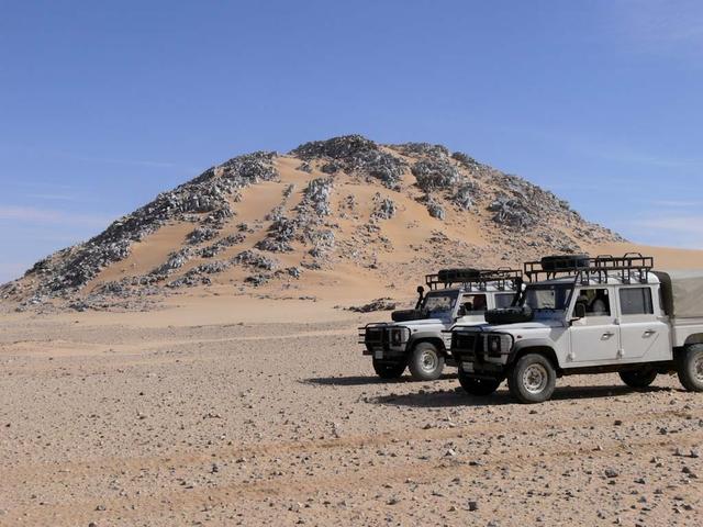
An SUV-sized Asteroid 2008TC# Impacts on October 7, 2008 in the Nubian Desert, Northern Sudan: Dr. Peter Jenniskens, NASA/SETI joined Muawia Shaddas of the University of Khartoum in leading an expedition on a search for samples. (Marble Mountain) Photo Credit: NASA/SETI/P. Jenniskens
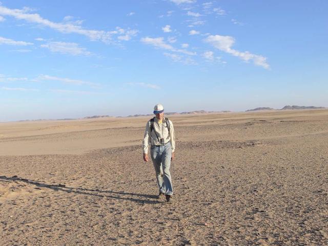
An SUV-sized Asteroid 2008TC# Impacts on October 7, 2008 in the Nubian Desert, Northern Sudan: Dr. Peter Jenniskens, NASA/SETI joined Muawia Shaddas of the University of Khartoum in leading an expedition on a search for samples. Peter Jenniskens Photo Credit: NASA/SETI/P. Jenniskens
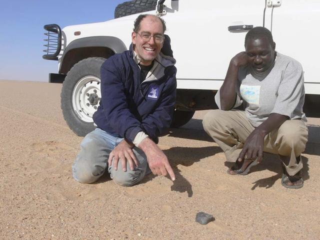
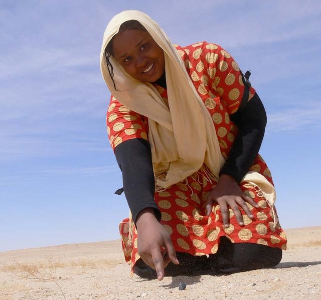
An SUV-sized Asteroid 2008TC# Impacts on October 7, 2008 in the Nubian Desert, Northern Sudan: Dr. Peter Jenniskens, NASA/SETI joined Muawia Shaddas of the University of Khartoum in leading an expedition on a search for samples. (Peter Jenniskens pointing - finds the brick) Photo Credit: NASA/SETI/P. Jenniskens
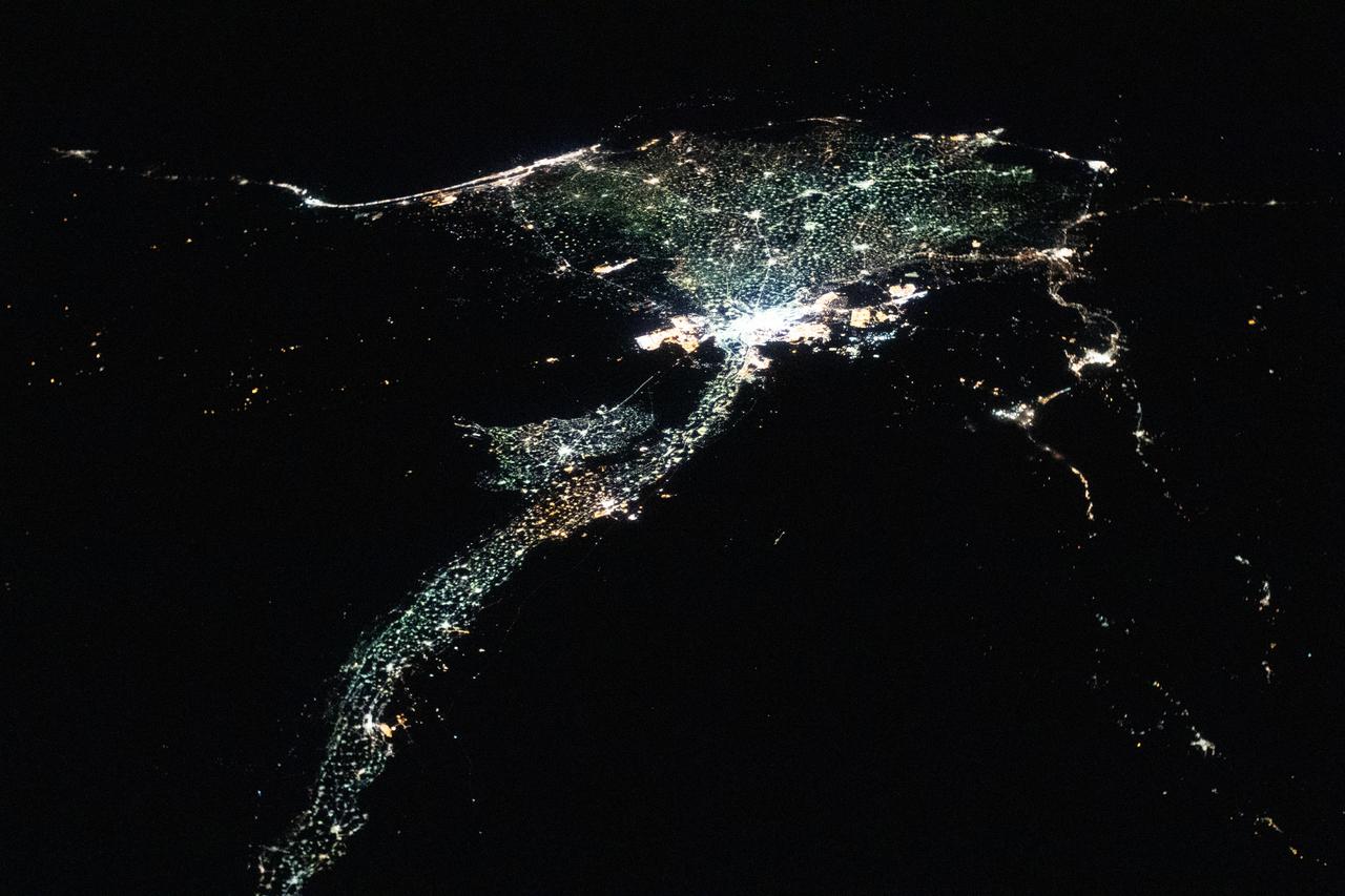
iss060e056082 (Sept. 2, 2019) --- The International Space Station was flying 255 miles above the border between Sudan and Egypt near 1 a.m. local time when an Expedition 60 crewmember photographed this oblique view of the Nile River and its delta.
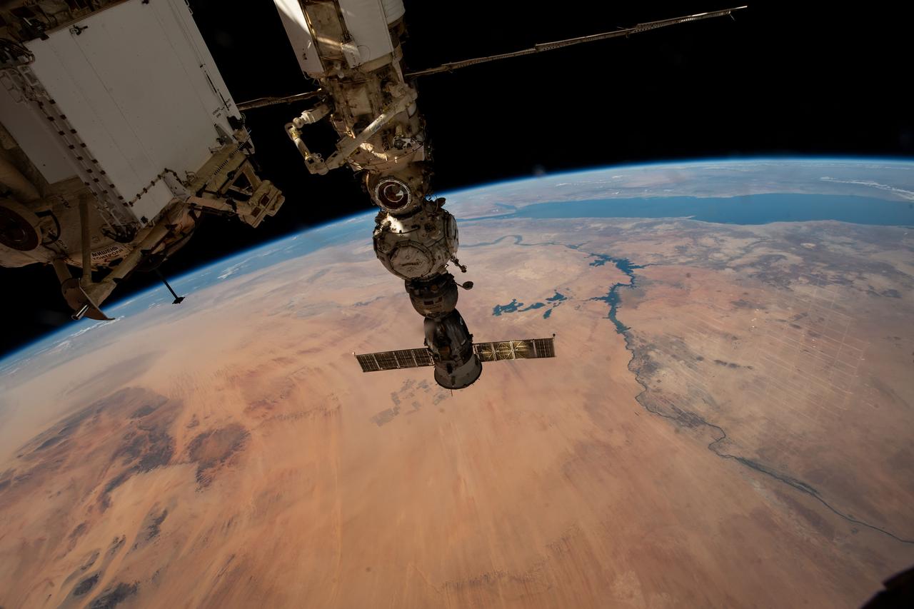
iss067e378050 (Sept. 21, 2022) --- The Soyuz MS-21 crew ship is pictured docked to the International Space Station's Prichal docking module which is itself attached to the Nauka multipurpose laboratory module. The station was orbiting 259 miles above northwest Sudan at the time this photograph was taken.
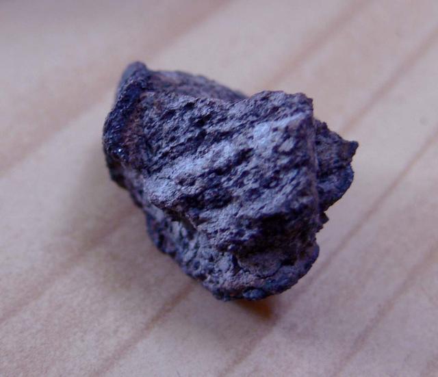
An SUV-sized Asteroid 2008TC# Impacts on October 7, 2008 in the Nubian Desert, Northern Sudan: Dr. Peter Jenniskens, NASA/SETI joined Muawia Shaddas of the University of Khartoum in leading an expedition on a search for samples. (first one recovered) Photo Credit: NASA/SETI/P. Jenniskens
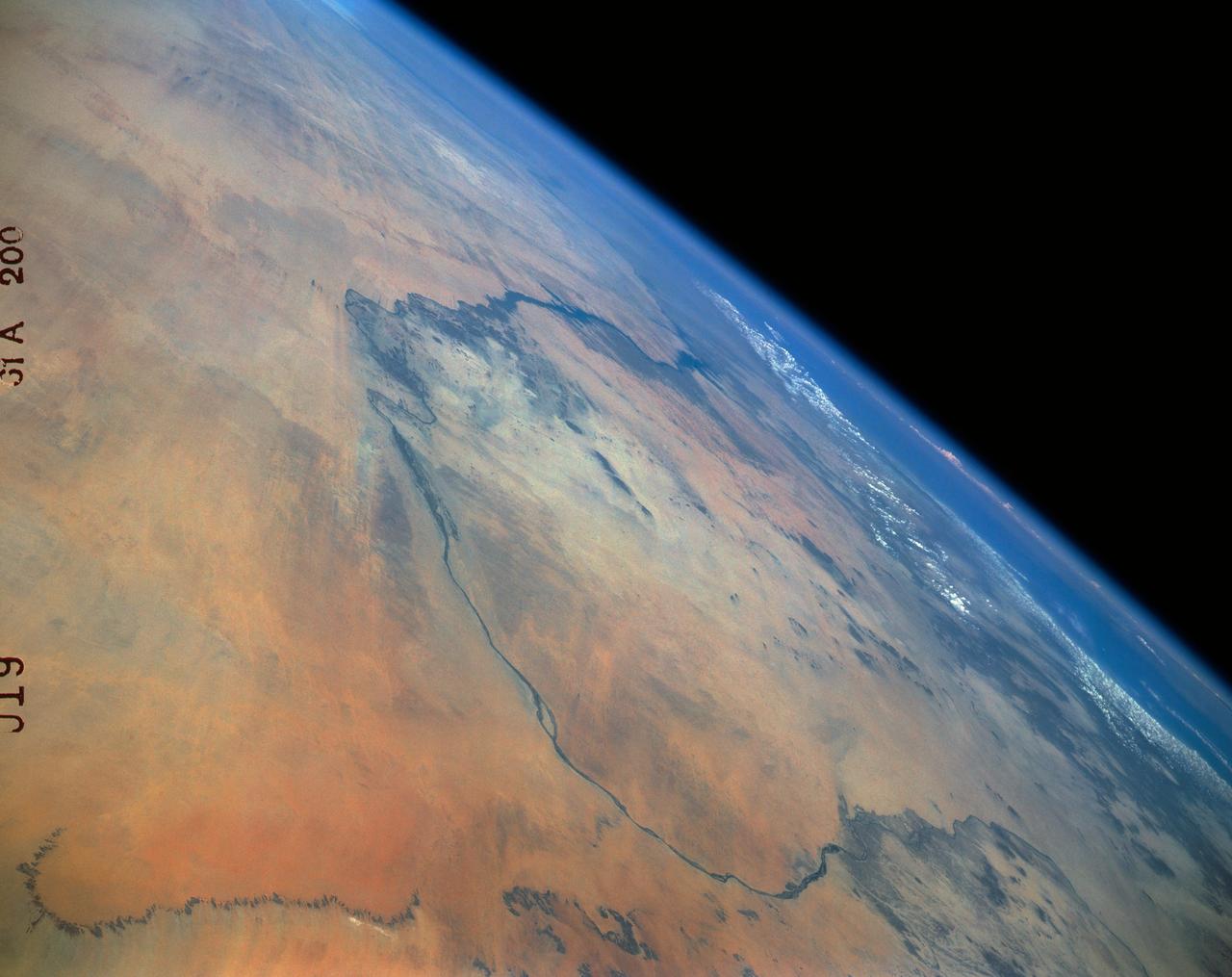
61A-200-019 (30 Oct-6 Nov 1985) --- The Nubian Desert of northern Sudan and southern Egypt. This view to the northeast, taken from a point 200 miles west of Khartoum, shows the Nile from Abu-Hamed downstream beyond Lake Nasser and the Aswan High Dam to the bend at Luxor.
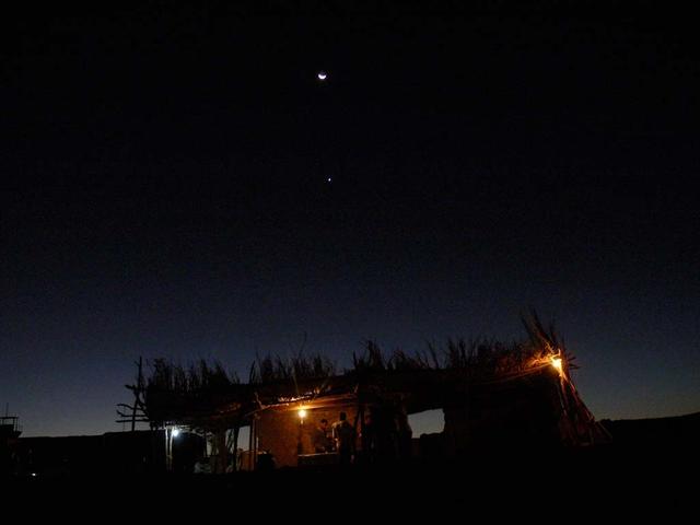
An SUV-sized Asteroid 2008TC# Impacts on October 7, 2008 in the Nubian Desert, Northern Sudan: Dr. Peter Jenniskens, NASA/SETI joined Muawia Shaddas of the University of Khartoum in leading an expedition on a search for samples. Photo Credit: NASA/SETI/P. Jenniskens
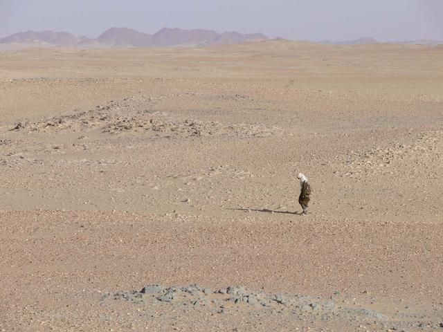
An SUV-sized Asteroid 2008TC# Impacts on October 7, 2008 in the Nubian Desert, Northern Sudan: Dr. Peter Jenniskens, NASA/SETI joined Muawia Shaddas of the University of Khartoum in leading an expedition on a search for samples. searching in the desert Photo Credit: NASA/SETI/P. Jenniskens
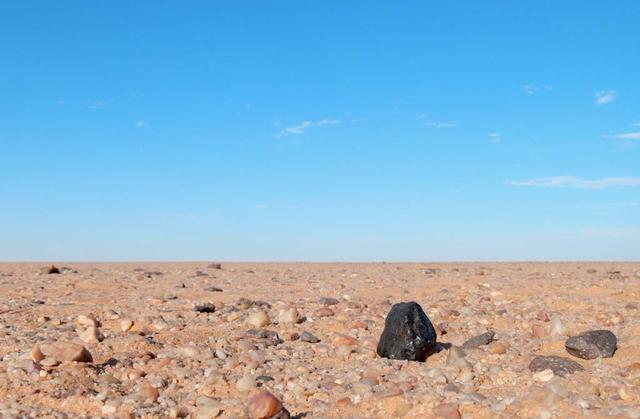
An SUV-sized Asteroid 2008TC# Impacts on October 7, 2008 in the Nubian Desert, Northern Sudan: Dr. Peter Jenniskens, NASA/SETI joined Muawia Shaddas of the University of Khartoum in leading an expedition on a search for samples. (El-Mahata-Sitah 1) Photo Credit: NASA/SETI/P. Jenniskens
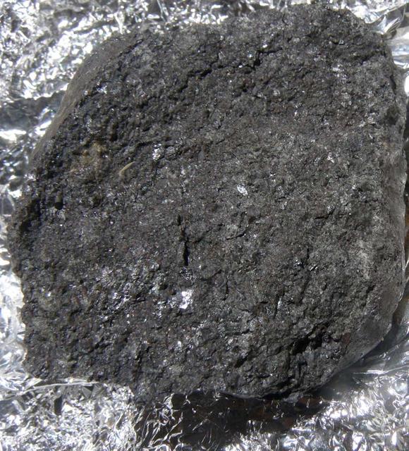
An SUV-sized Asteroid 2008TC# Impacts on October 7, 2008 in the Nubian Desert, Northern Sudan: Dr. Peter Jenniskens, NASA/SETI joined Muawia Shaddas of the University of Khartoum in leading an expedition on a search for samples. (meteorite 3rd-22) Photo Credit: NASA/SETI/P. Jenniskens
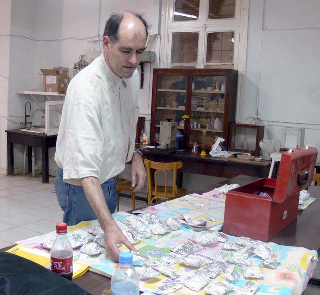
An SUV-sized Asteroid 2008TC# Impacts on October 7, 2008 in the Nubian Desert, Northern Sudan: Dr. Peter Jenniskens, NASA/SETI joined Muawia Shaddas of the University of Khartoum in leading an expedition on a search for samples. Peter Jenniskens examines 2nd trip finds) Photo Credit: NASA/SETI/P. Jenniskens
An SUV-sized Asteroid 2008TC# Impacts on October 7, 2008 in the Nubian Desert, Northern Sudan: Dr. Peter Jenniskens, NASA/SETI joined Muawia Shaddas of the University of Khartoum in leading an expedition on a search for samples. Photo Credit: NASA/SETI/P. Jenniskens
An SUV-sized Asteroid 2008TC# Impacts on October 7, 2008 in the Nubian Desert, Northern Sudan: Dr. Peter Jenniskens, NASA/SETI joined Muawia Shaddas of the University of Khartoum in leading an expedition on a search for samples. 9meteorite 3rd trip-strange) Photo Credit: NASA/SETI/P. Jenniskens
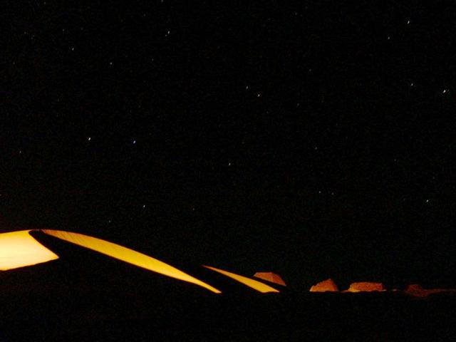
An SUV-sized Asteroid 2008TC# Impacts on October 7, 2008 in the Nubian Desert, Northern Sudan: Dr. Peter Jenniskens, NASA/SETI joined Muawia Shaddas of the University of Khartoum in leading an expedition on a search for samples. Photo Credit: NASA/SETI/P. Jenniskens
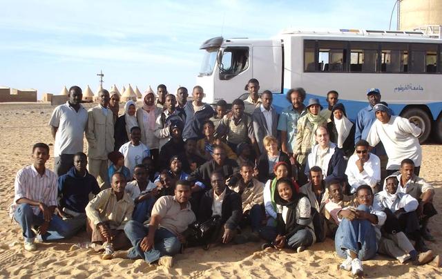
An SUV-sized Asteroid 2008TC# Impacts on October 7, 2008 in the Nubian Desert, Northern Sudan: Dr. Peter Jenniskens, NASA/SETI joined Muawia Shaddas of the University of Khartoum in leading an expedition on a search for samples. (group photo) Photo Credit: NASA/SETI/P. Jenniskens
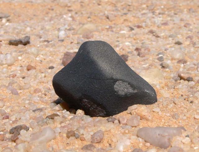
An SUV-sized Asteroid 2008TC# Impacts on October 7, 2008 in the Nubian Desert, Northern Sudan: Dr. Peter Jenniskens, NASA/SETI joined Muawia Shaddas of the University of Khartoum in leading an expedition on a search for samples. (meteorite 3rd-geologist) Photo Credit: NASA/SETI/P. Jenniskens
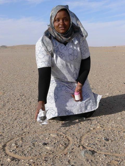
An SUV-sized Asteroid 2008TC# Impacts on October 7, 2008 in the Nubian Desert, Northern Sudan: Dr. Peter Jenniskens, NASA/SETI joined Muawia Shaddas of the University of Khartoum in leading an expedition on a search for samples. (emteorite 3rd-three found) Photo Credit: NASA/SETI/P. Jenniskens
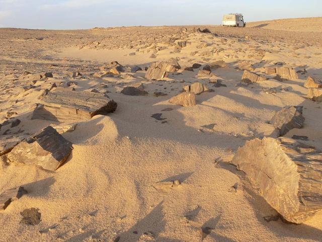
An SUV-sized Asteroid 2008TC# Impacts on October 7, 2008 in the Nubian Desert, Northern Sudan: Dr. Peter Jenniskens, NASA/SETI joined Muawia Shaddas of the University of Khartoum in leading an expedition on a search for samples. (perified wood) Photo Credit: NASA/SETI/P. Jenniskens
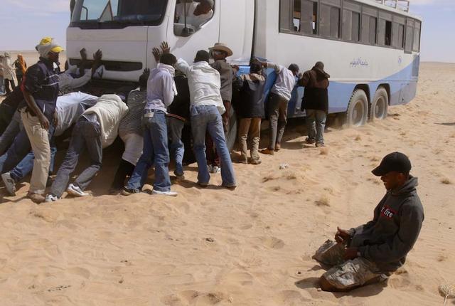
An SUV-sized Asteroid 2008TC# Impacts on October 7, 2008 in the Nubian Desert, Northern Sudan: Dr. Peter Jenniskens, NASA/SETI joined Muawia Shaddas of the University of Khartoum in leading an expedition on a search for samples. (meteorite find - bus gets stuck) Photo Credit: NASA/SETI/P. Jenniskens
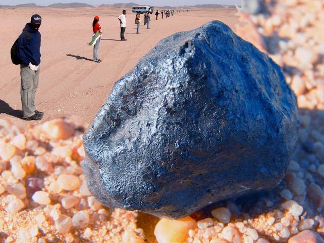
An SUV-sized Asteroid 2008TC# Impacts on October 7, 2008 in the Nubian Desert, Northern Sudan: Dr. Peter Jenniskens, NASA/SETI joined Muawia Shaddas of the University of Khartoum in leading an expedition on a search for samples. (Meteorite search 1) Photo Credit: NASA/SETI/P. Jenniskens
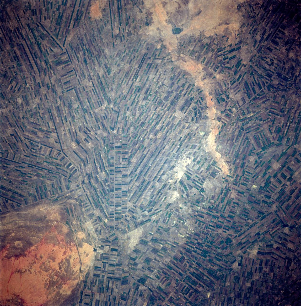
STS087-717-088 (19 November – 5 December 1997) --- Featured in this view are Sudan’s agricultural projects dependent on irrigation. Just southeast of the confluence of the Blue and White Nile rivers (and the city of Khartoum) is one of the largest irrigation projects in the world, known as the Gezira Scheme. The economy of Sudan is largely based on agriculture. The Gezira Scheme was begun by the British in 1925 and distributes water from the Blue Nile through canals and ditches to tenant farms lying between the Blue and White Nile rivers. Farmers cooperate with the Sudanese government and the Gezira Board. This network of canals and ditches is 2,700 miles (4,300 kilometers) long, and the irrigated area covers 2.5 million acres (1 million hectares). The main crop grown in this region is cotton. This picture is one of the 70mm Earth observations visuals used by the crew at its post flight presentation events.
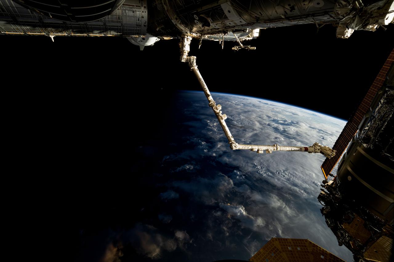
iss072e032723 (Oct. 8, 2024) --- The 57.7-foot-long Candarm2 robotic arm extends from the Harmony module as the International Space Station orbits above the terminator, the line that separates Earth's daytime from nighttime, 261 miles above the African nation of Sudan. Obscured behind Harmony toward upper left, is the SpaceX Dragon Freedom spacecraft.

STS111-321-024 (5-19 June 2002) --- This sunset over the Sahara Desert was photographed by the STS-111 crew members aboard the Space Shuttle Endeavour. When this photograph was taken, the shuttle was in a position over the Sudan near the Red Sea coast. The Gateway to Astronaut Photography of Earth (link to http://eol.jsc.nasa.gov/sseop/ ) provides searchable access to other photographs of Earth taken by astronauts.
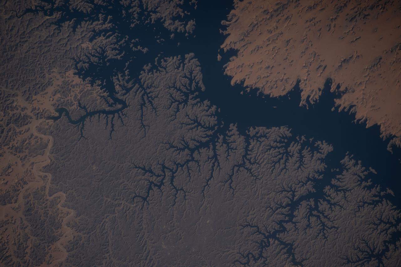
iss073e0879542 (Oct. 13, 2025) --- Lake Nasser, created by the Aswan High Dam in southern Egypt, is one of the world’s largest man-made reservoirs. Extending into northern Sudan, it stores water from the Upper Nile and regulates its flow into the Lower Nile. This photograph was taken from the International Space Station while orbiting 260 miles above the eastern Sahara.
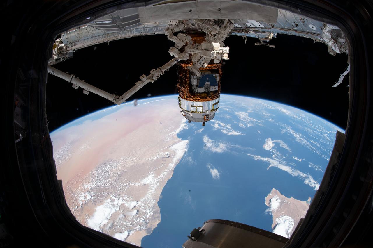
iss060e081678 (Sept. 29, 2019) --- The H-II Transfer Vehicle-8 (HTV-8) from the Japan Aerospace Exploration Agency is pictured attached to the International Space Station's Harmony module. The Canadarm2 robotic arm, with the Dextre "robotic hand" attached, is poised to remove the HTV-8 exposed pallet loaded with new lithium-ion batteries for installation and activation on the station during a series of spacewalks. The orbiting complex was flying 258 miles above Sudan about to cross the Gulf of Aden.
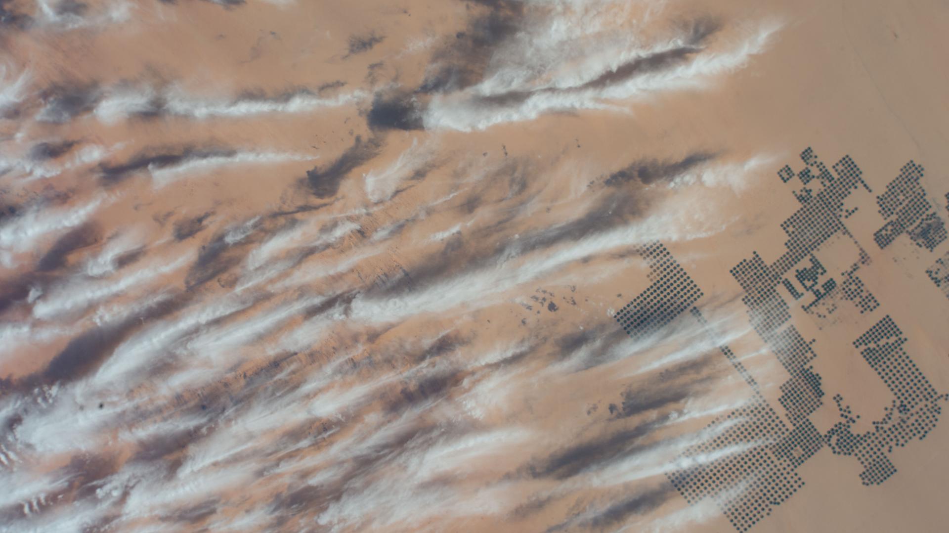
iss074e0247459 (Feb. 1, 2026) --- Large-scale agricultural projects (right) in southern Egypt near the Sudan border—known as center-pivot irrigation systems because they use an irrigation arm that rotates 360°, forming a perfect circle of crops such as potatoes and wheat—are pictured from the International Space Station as it orbited 258 miles above the African nation. Wispy cirrus clouds partly cover the cultivated land in the barren, extremely arid Western Desert.
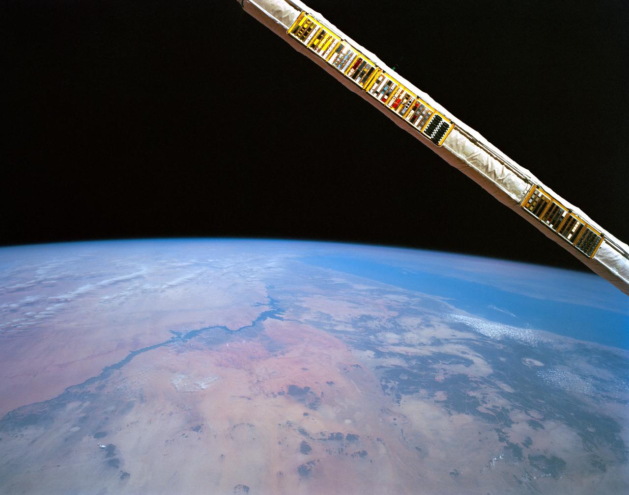
STS052-152-026 (22Oct-1 Nov 1992) --- Backdropped over eastern Egypt, the Canadian-built remote manipulator system (RMS) attached to NASA's Earth-orbiting Space Shuttle Columbia displays a Canadian Space Agency (CSA) experiment. Materials Exposure in Low Earth Orbit (MELEO) is one of a number of Canadian experiments which flew aboard Columbia for the ten-day STS-52 mission. Principal investigator for the experiment is Dr. David G. Zimick of the CSA. Plastic and composite materials used on the external surfaces of spacecraft have been found to degrade in the harsh environment of space. Evidence suggests that this degradation is caused by interaction with atomic oxygen which induces damaging chemical and physical reactions. The result is a loss in mass, strength, stiffness and stability of size and shape. During the mission, MELEO exposed over 350 material specimens mounted on "witness plates" on the RMS arm. The specimen collection will be analyzed in the weeks following the mission. Typical spacecraft materials and new developments in protective measures against atomic oxygen were tested as part of the MELEO experiment.
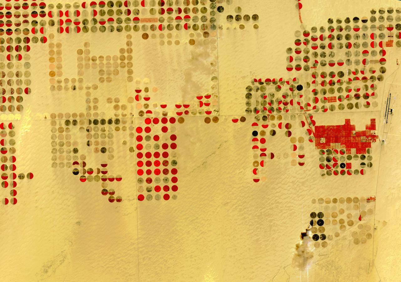
The Nubian Sandstone Aquifer System is the world's largest fossil water aquifer system. It covers an estimated area of 2.6 million square kilometers, including parts of Sudan, Chad, Libya, and most of Egypt. In the southwestern part of Egypt, the East Oweinat development project uses central pivot irrigation to mine the fossil water for extensive agricultural development. Crops include wheat and potatoes; they are transported via the airport on the eastern side. The image was acquired October 12, 2015, covers an area of 33.3 by 47.2 km, and is located near 22.6 degrees north, 28.5 degrees east. https://photojournal.jpl.nasa.gov/catalog/PIA24616