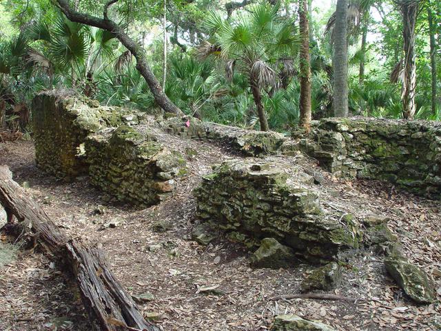
Archeological ruins of the Elliot Plantation sugar factory are revealed through the oak hammock on NASA’s Kennedy Space Center in Florida in 2008. The sugar factory structure, or sugar train, was built from fieldstone and is where sugar cane juice would be boiled during processing in graduated copper kettles until the liquid reduced into a thick syrup. The ruins of Elliot Plantation date from the 1760s and represent the largest, earliest, and southernmost British period sugar plantation in the U.S., as well as one of the most intact and best examples of a completely preserved enslaved landscape. In interagency cooperation between the National Park Service, the U.S. Fish and Wildlife Service, and NASA, and with the assistance of volunteers from the Indian River Anthropological Society, and historic preservation offices of Brevard and Volusia counties, approximately 200 shovel tests and 20 excavation units were completed in three areas of the plantation complex from 2008 to 2009.
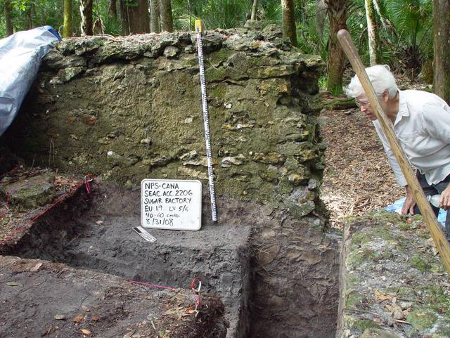
Preservationist Dot Moore views the ruins of Elliot Plantation sugar factory during an excavation in 2008 on NASA’s Kennedy Space Center. The sugar factory structure, or sugar train, was built from fieldstone and is where sugar cane juice would be boiled during processing in graduated copper kettles until the liquid reduced into a thick syrup. The ruins of Elliot Plantation date from the 1760s and represent the largest, earliest, and southernmost British period sugar plantation in the U.S., as well as one of the most intact and best examples of a completely preserved enslaved landscape. In interagency cooperation between the National Park Service, the U.S. Fish and Wildlife Service, and NASA, and with the assistance of volunteers from the Indian River Anthropological Society, and historic preservation offices of Brevard and Volusia counties, approximately 200 shovel tests and 20 excavation units were completed in three areas of the plantation complex from 2008 to 2009.
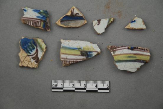
Artifacts retrieved from the ruins of Elliot Plantation on NASA’s Kennedy Space Center in Florida include Spanish majolica fragments, likely produced between the 1730s to the 1750s and imported to the plantation from England. Ceramic fragments of majolica, delftware, and other high-status domestic wares were retrieved from ruins determined to be the dwelling of the plantation overseer. The ruins of Elliot Plantation date from the 1760s and represent the largest, earliest, and southernmost British period sugar plantation in the U.S., as well as one of the most intact and best examples of a completely preserved enslaved landscape. In interagency cooperation between the National Park Service, the U.S. Fish and Wildlife Service, and NASA, and with the assistance of volunteers from the Indian River Anthropological Society, and historic preservation offices of Brevard and Volusia counties, approximately 200 shovel tests and 20 excavation units were completed in three areas of the plantation complex from 2008 to 2009.
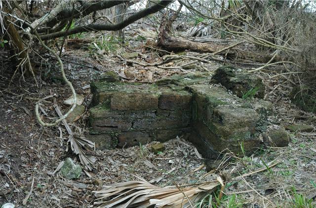
Archeological ruins of Elliot Plantation are revealed through the oak hammock on NASA’s Kennedy Space Center in Florida in 2008. Pictured is a structure composed of coquina blocks from a hearth of a large dwelling, determined to be that of the plantation overseer. The use of coquina is consistent with high-status building materials of the period. The ruins of Elliot Plantation date from the 1760s and represent the largest, earliest, and southernmost British period sugar plantation in the U.S., as well as one of the most intact and best examples of a completely preserved enslaved landscape. In interagency cooperation between the National Park Service, the U.S. Fish and Wildlife Service, and NASA, and with the assistance of volunteers from the Indian River Anthropological Society, and historic preservation offices of Brevard and Volusia counties, approximately 200 shovel tests and 20 excavation units were completed in three areas of the plantation complex from 2008 to 2009.
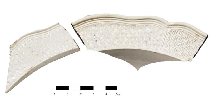
Artifacts retrieved from the ruins of Elliot Plantation on NASA’s Kennedy Space Center in Florida show high-status fine dining wares imported from 18th century England. The white salt-glazed stoneware and creamware dining wares were found scattered near a large structure, determined by archeologists to be the dwelling of the plantation overseer. The dining wares have known dates of time for manufacturing and use during the 1760s through the 1770s and helped archeologists confirm the site was from the same period. The ruins of Elliot Plantation date from the 1760s and represent the largest, earliest, and southernmost British period sugar plantation in the U.S., as well as one of the most intact and best examples of a completely preserved enslaved landscape. In interagency cooperation between the National Park Service, the U.S. Fish and Wildlife Service, and NASA, and with the assistance of volunteers from the Indian River Anthropological Society, and historic preservation offices of Brevard and Volusia counties, approximately 200 shovel tests and 20 excavation units were completed in three areas of the plantation complex from 2008 to 2009.
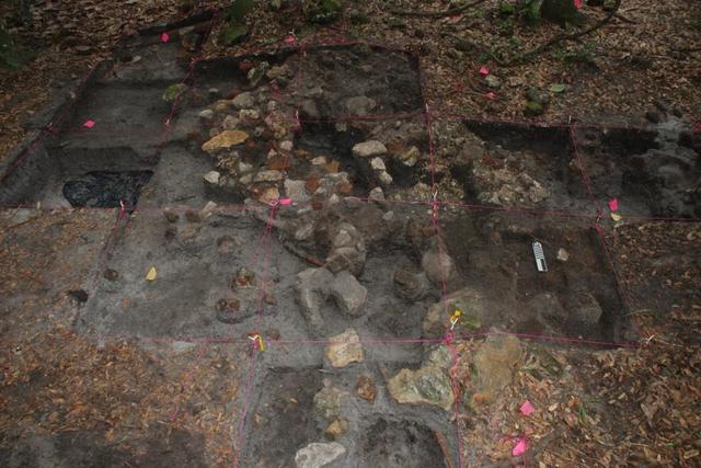
Archeological ruins of Elliot Plantation are revealed through the oak hammock on NASA’s Kennedy Space Center in Florida in 2009. Pictured is a structure composed of coquina blocks from a hearth of a large dwelling, determined to be that of the plantation overseer. The use of coquina is consistent with high-status building materials of the period. Mapped in this photo are the remnants of a chimney collapse from a detached kitchen in the overseer’s house. An enormous scatter of architectural debris, including coquina, fieldstone, brick and mortar, as well as substantial food remains, broken dishes, bottle glass, and other kitchen wares, were recovered and documented during investigations of the ruins. The ruins of Elliot Plantation date from the 1760s and represent the largest, earliest, and southernmost British period sugar plantation in the U.S., as well as one of the most intact and best examples of a completely preserved enslaved landscape. In interagency cooperation between the National Park Service, the U.S. Fish and Wildlife Service, and NASA, and with the assistance of volunteers from the Indian River Anthropological Society, and historic preservation offices of Brevard and Volusia counties, approximately 200 shovel tests and 20 excavation units were completed in three areas of the plantation complex from 2008 to 2009.
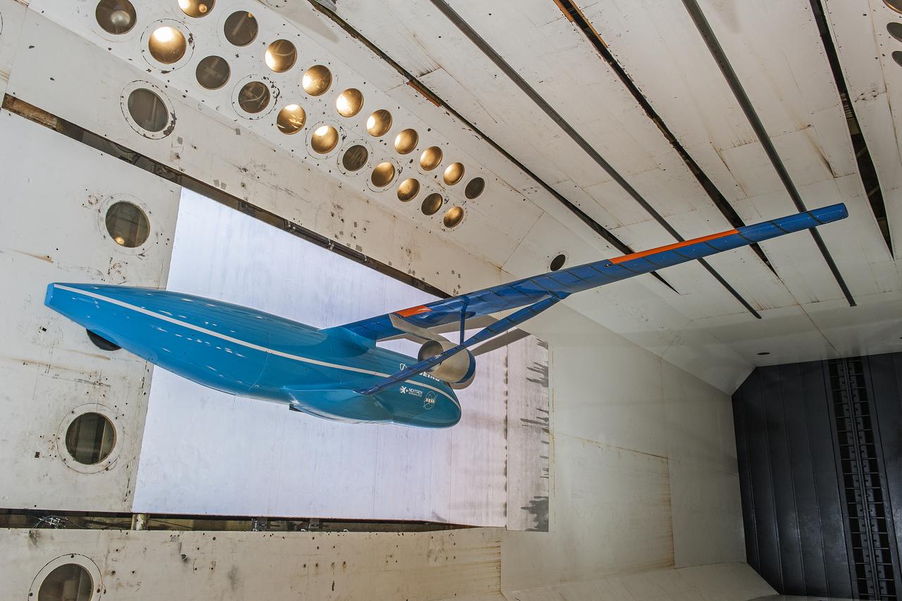
Boeing Subsonic Ultra Green Aircraft Research (SUGAR) Subsonic Fixed Wing in the (TDT) 16 Foot Transonic Dynamics Tunnel facility 648
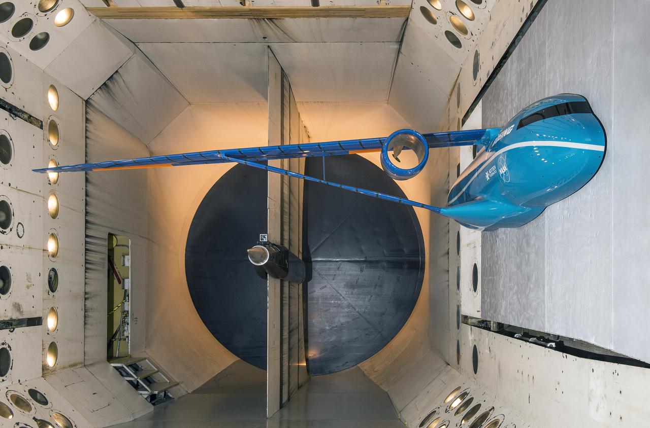
Boeing Subsonic Ultra Green Aircraft Research (SUGAR) Subsonic Fixed Wing in the (TDT) 16 Foot Transonic Dynamics Tunnel facility 648
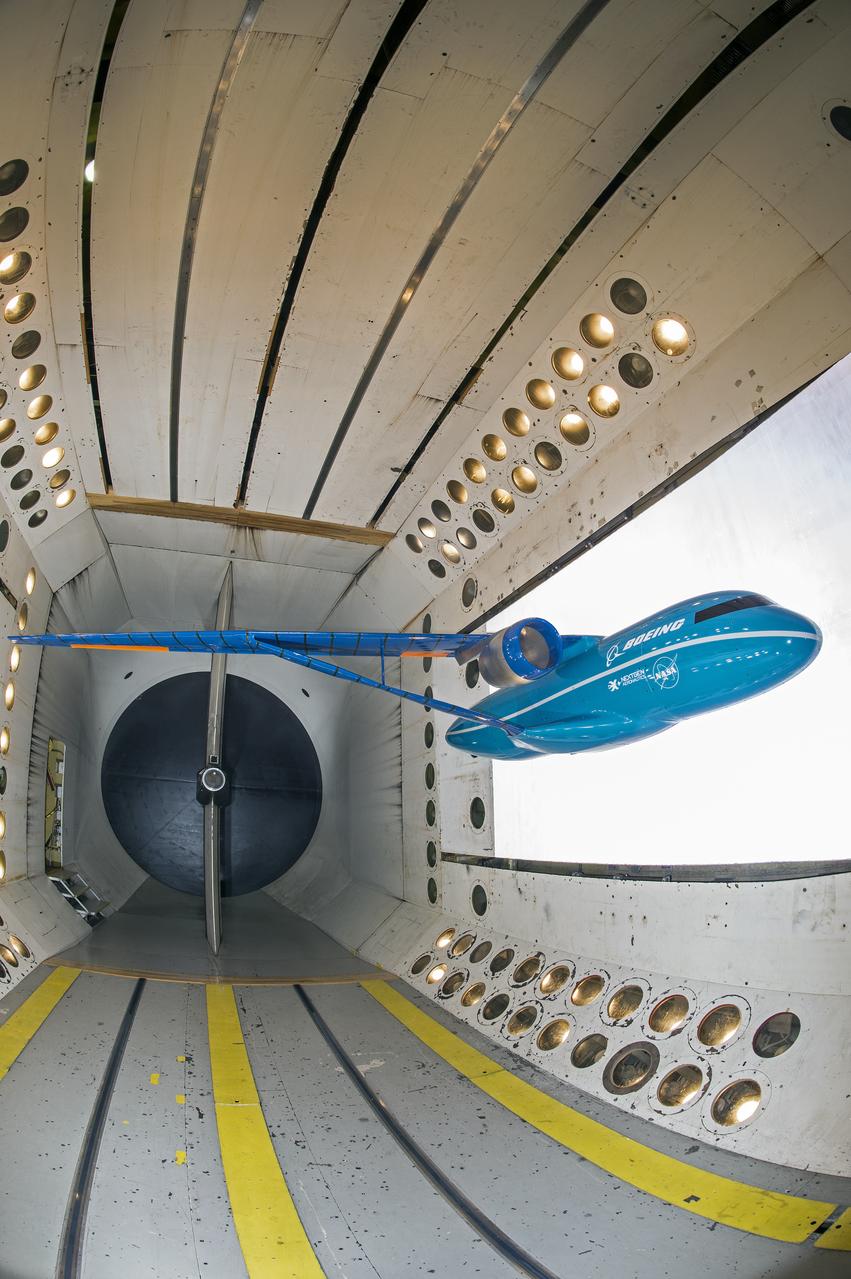
Boeing Subsonic Ultra Green Aircraft Research (SUGAR) Subsonic Fixed Wing in the (TDT) 16 Foot Transonic Dynamics Tunnel facility 648
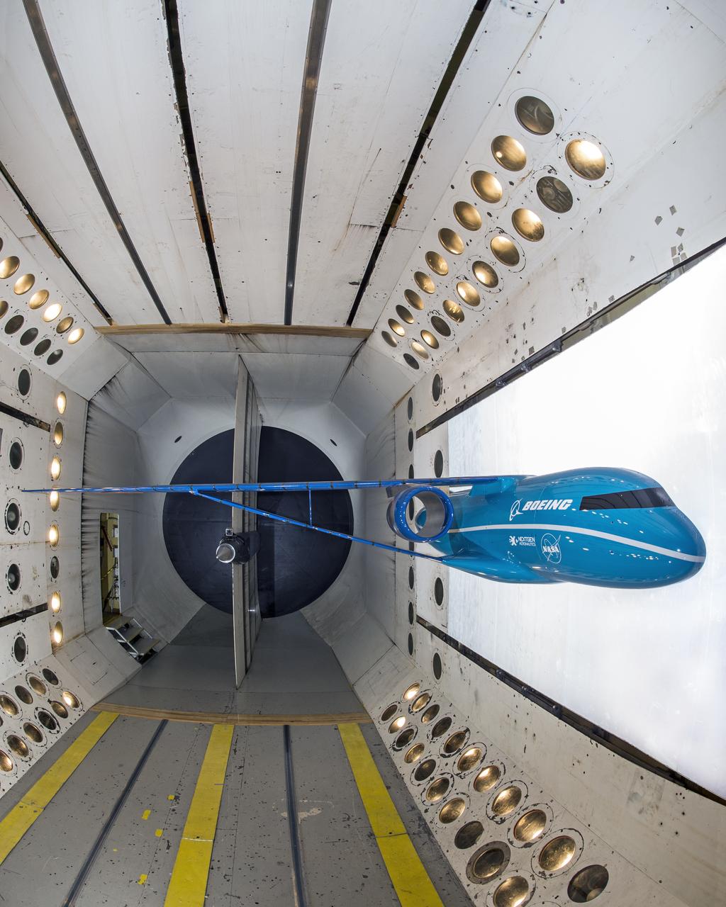
Boeing Subsonic Ultra Green Aircraft Research (SUGAR) Subsonic Fixed Wing in the (TDT) 16 Foot Transonic Dynamics Tunnel facility 648
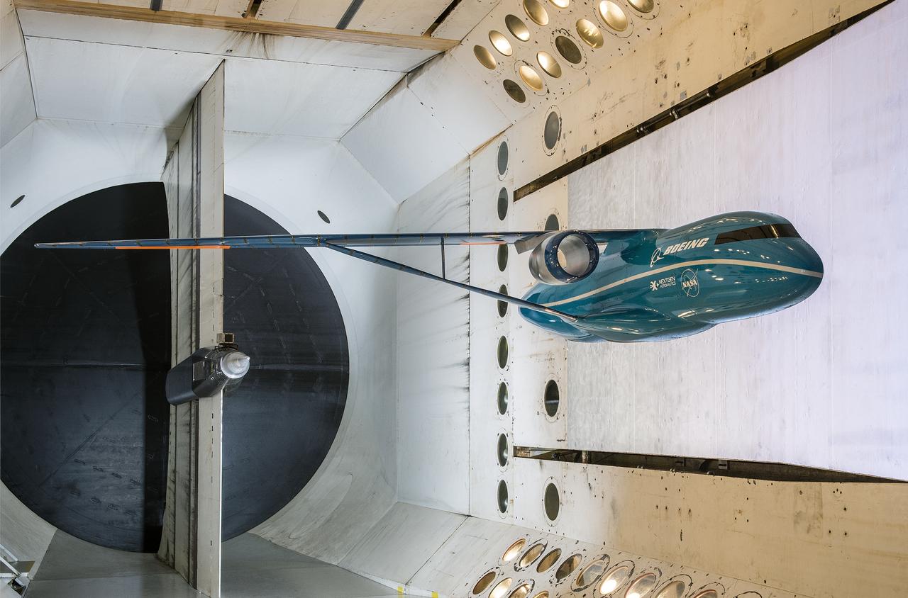
Boeing Subsonic Ultra Green Aircraft Research (SUGAR) Subsonic Fixed Wing in the (TDT) 16 Foot Transonic Dynamics Tunnel facility 648
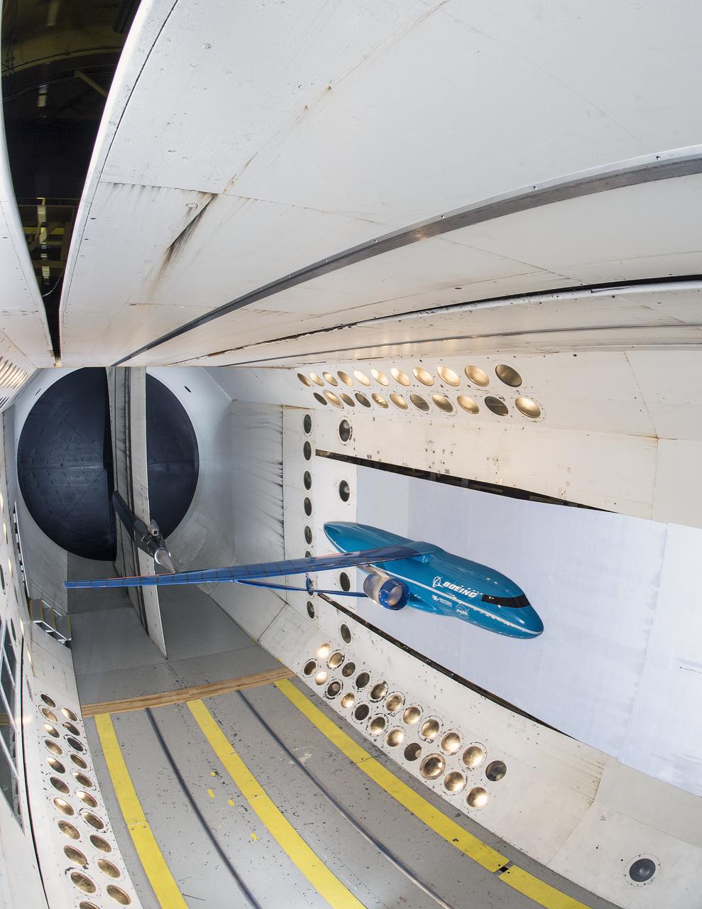
Boeing Subsonic Ultra Green Aircraft Research (SUGAR) Subsonic Fixed Wing in the (TDT) 16 Foot Transonic Dynamics Tunnel facility 648
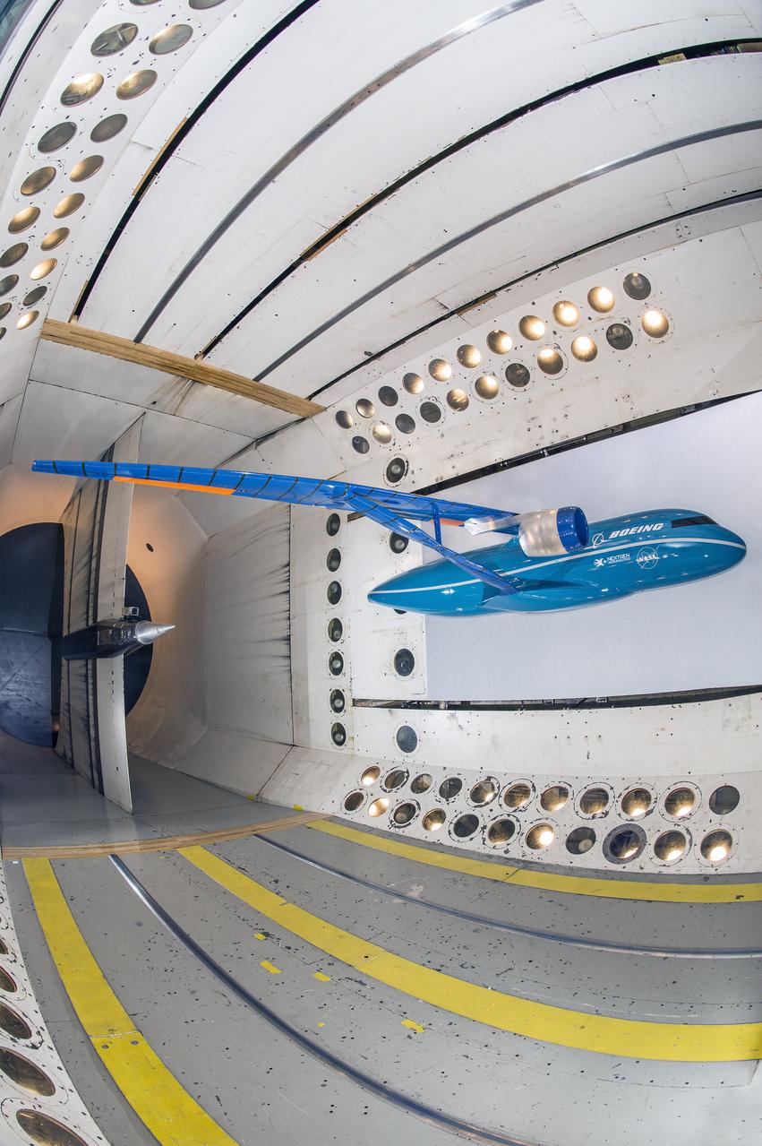
Boeing Subsonic Ultra Green Aircraft Research (SUGAR) Subsonic Fixed Wing in the (TDT) 16 Foot Transonic Dynamics Tunnel facility 648
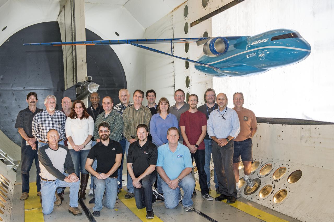
Boeing Subsonic Ultra Green Aircraft Research (SUGAR) Subsonic Fixed Wing in the (TDT) 16 Foot Transonic Dynamics Tunnel facility 648
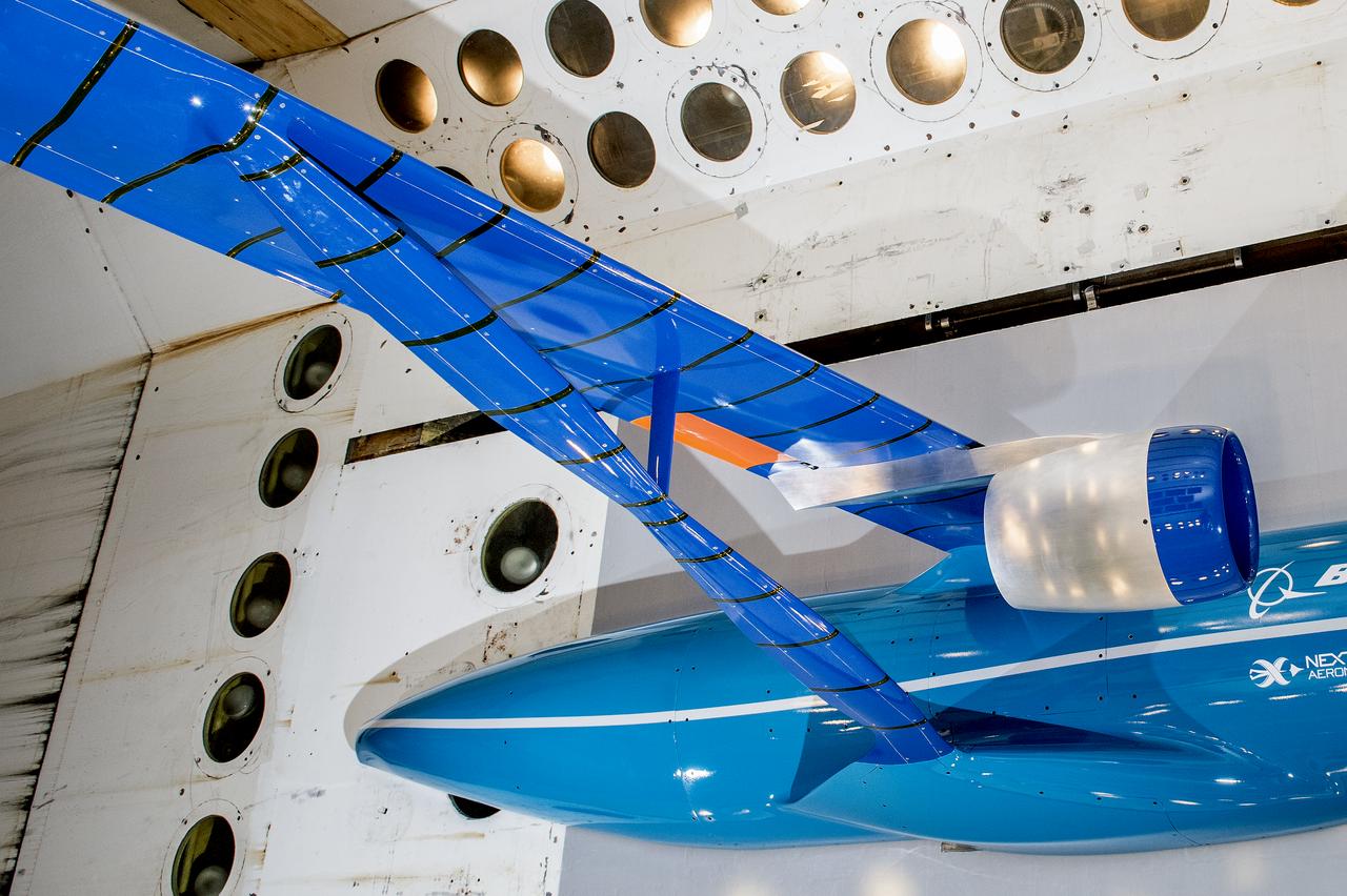
Boeing Subsonic Ultra Green Aircraft Research (SUGAR) Subsonic Fixed Wing in the (TDT) 16 Foot Transonic Dynamics Tunnel facility 648
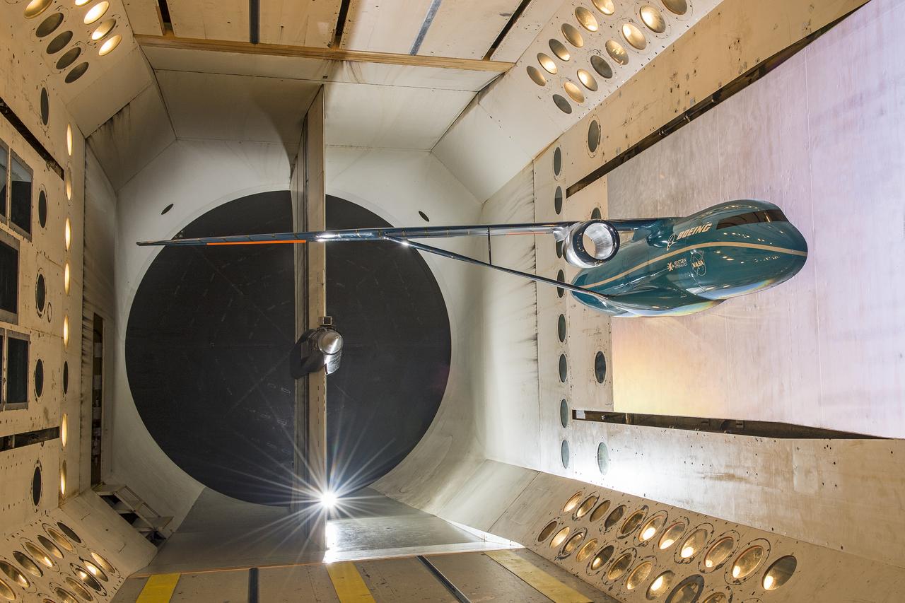
Boeing Subsonic Ultra Green Aircraft Research (SUGAR) Subsonic Fixed Wing in the (TDT) 16 Foot Transonic Dynamics Tunnel facility 648
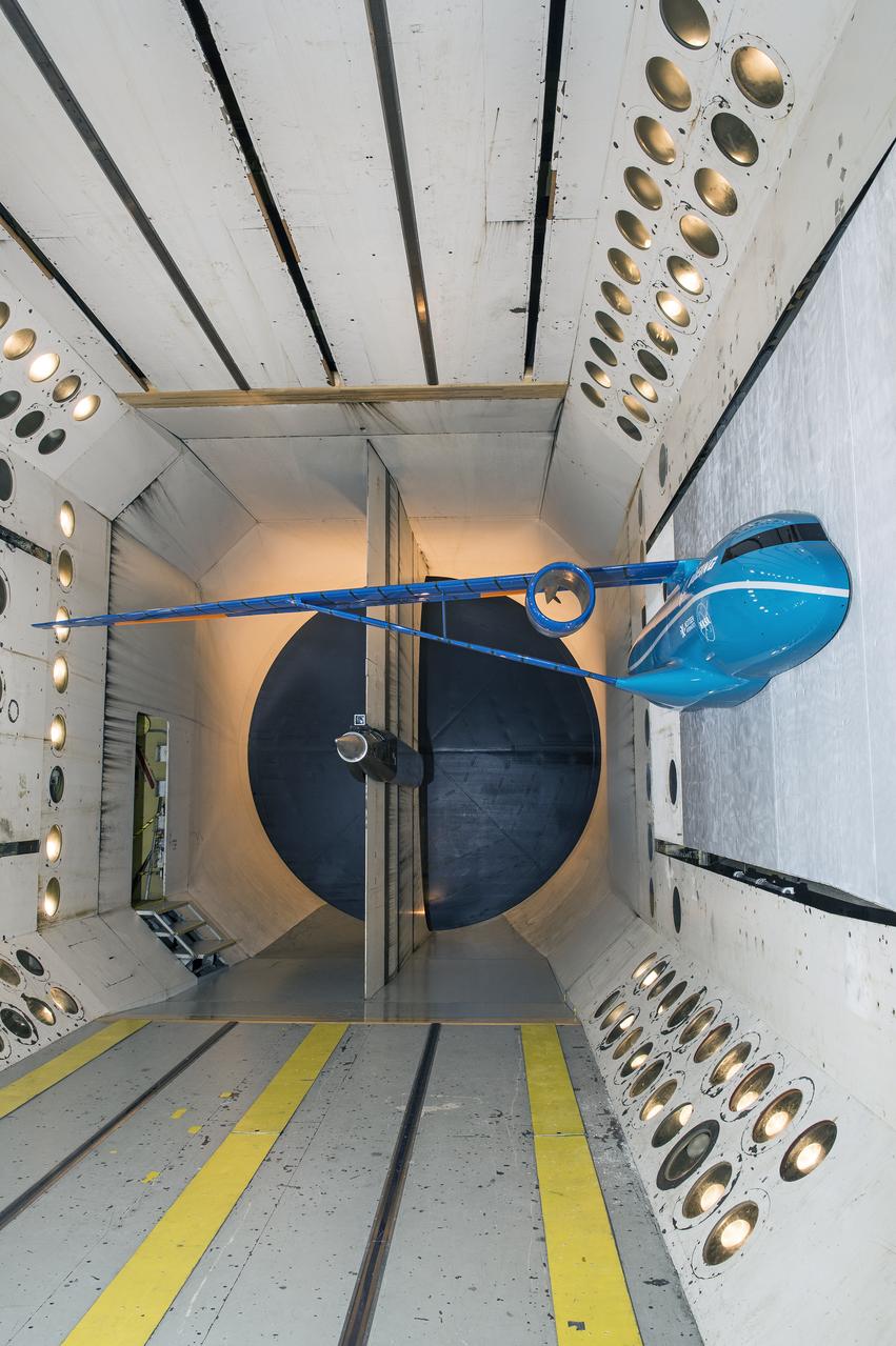
Boeing Subsonic Ultra Green Aircraft Research (SUGAR) Subsonic Fixed Wing in the (TDT) 16 Foot Transonic Dynamics Tunnel facility 648
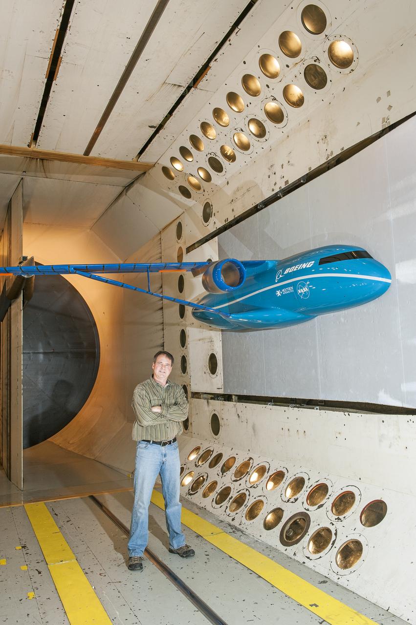
Boeing Subsonic Ultra Green Aircraft Research (SUGAR) Subsonic Fixed Wing in the (TDT) 16 Foot Transonic Dynamics Tunnel facility 648
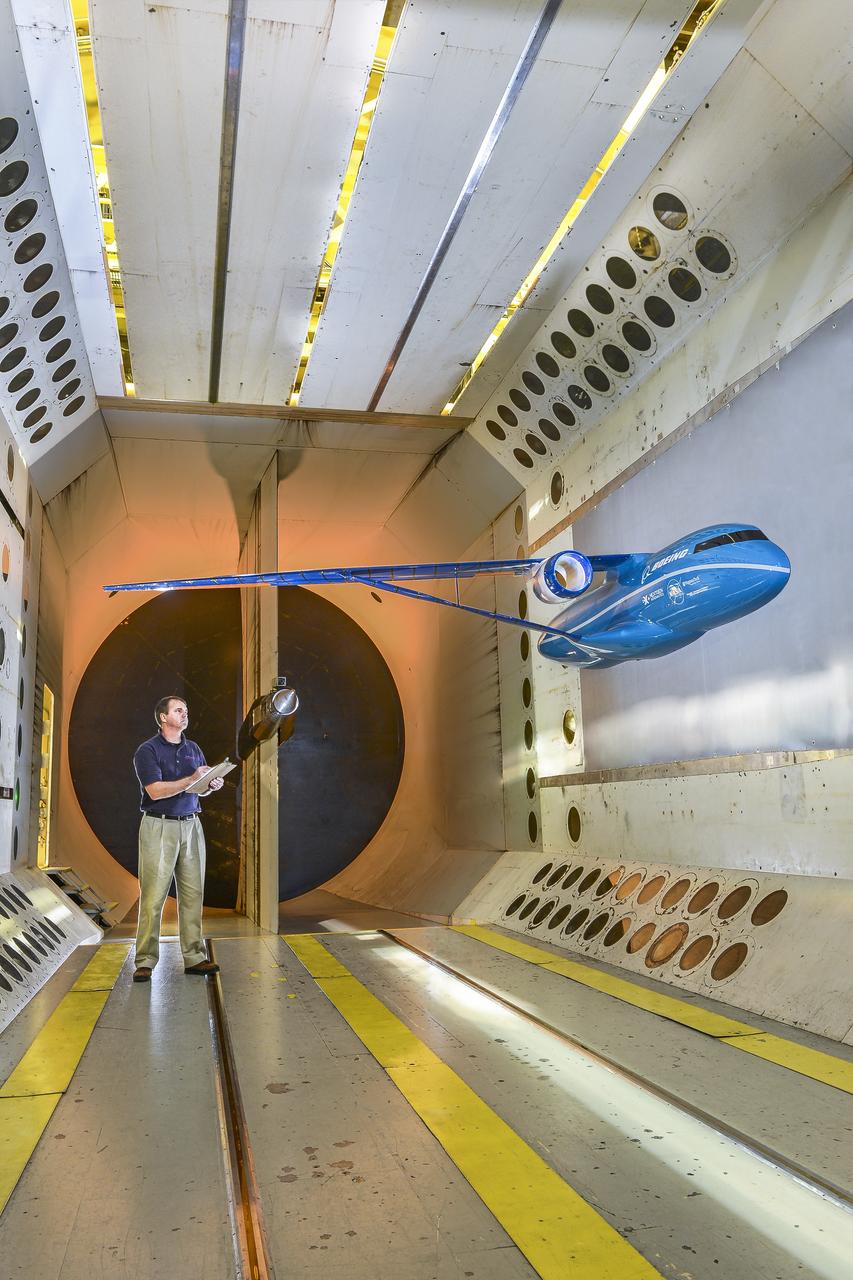
Boeing Subsonic Ultra Green Aircraft Research (SUGAR) Subsonic Fixed Wing in the (TDT) 16 Foot Transonic Dynamics Tunnel facility 648
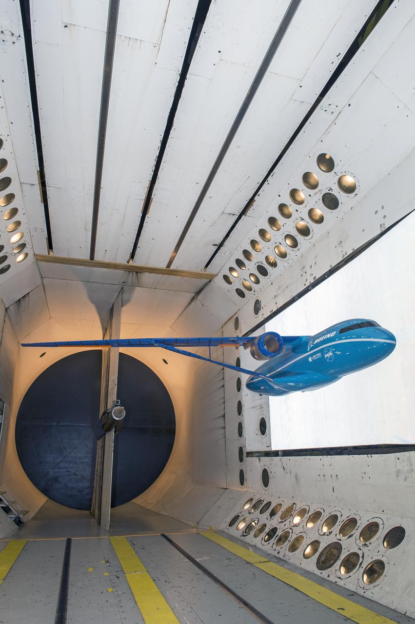
Boeing Subsonic Ultra Green Aircraft Research (SUGAR) Subsonic Fixed Wing in the (TDT) 16 Foot Transonic Dynamics Tunnel facility 648
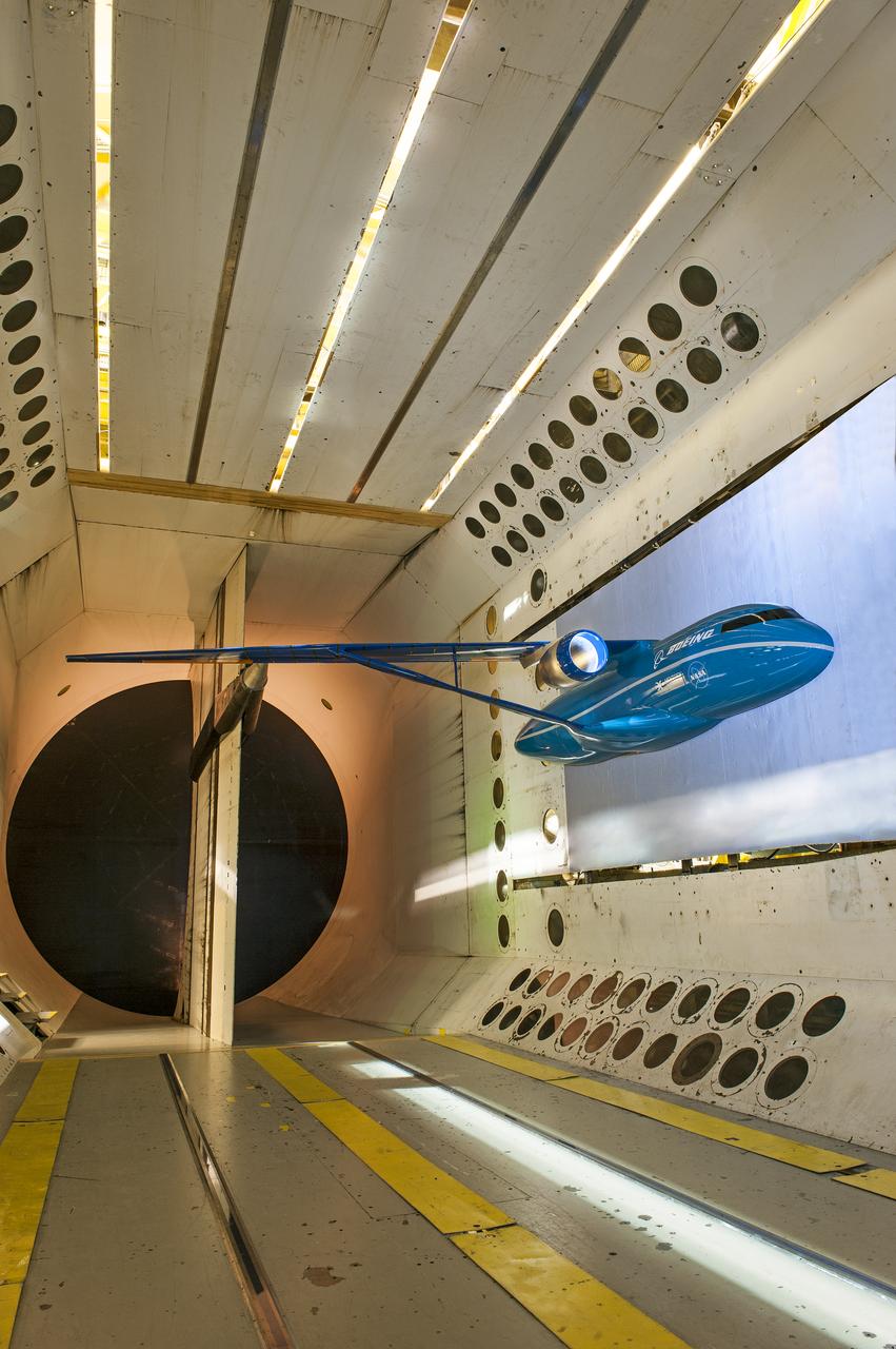
Boeing Subsonic Ultra Green Aircraft Research (SUGAR) Subsonic Fixed Wing in the (TDT) 16 Foot Transonic Dynamics Tunnel facility 648
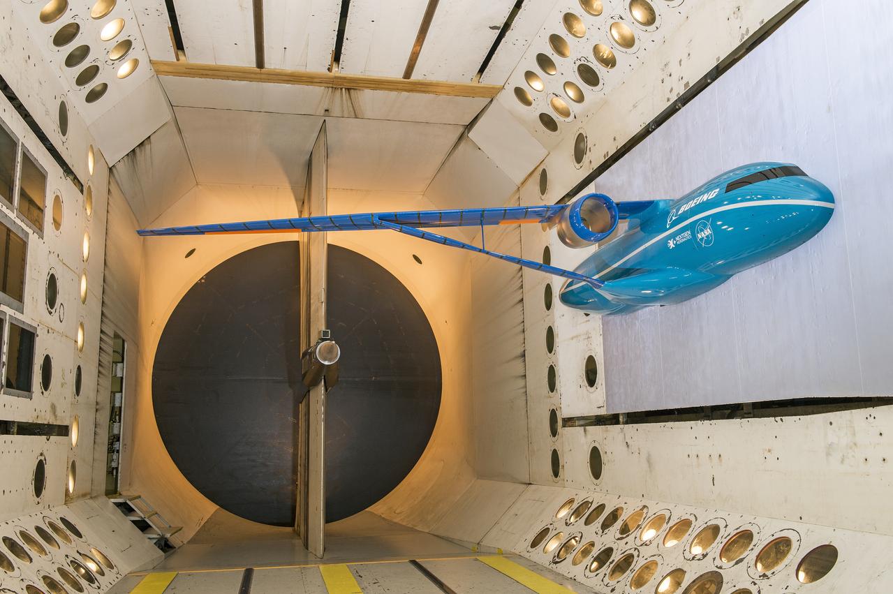
Boeing Subsonic Ultra Green Aircraft Research (SUGAR) Subsonic Fixed Wing in the (TDT) 16 Foot Transonic Dynamics Tunnel facility 648
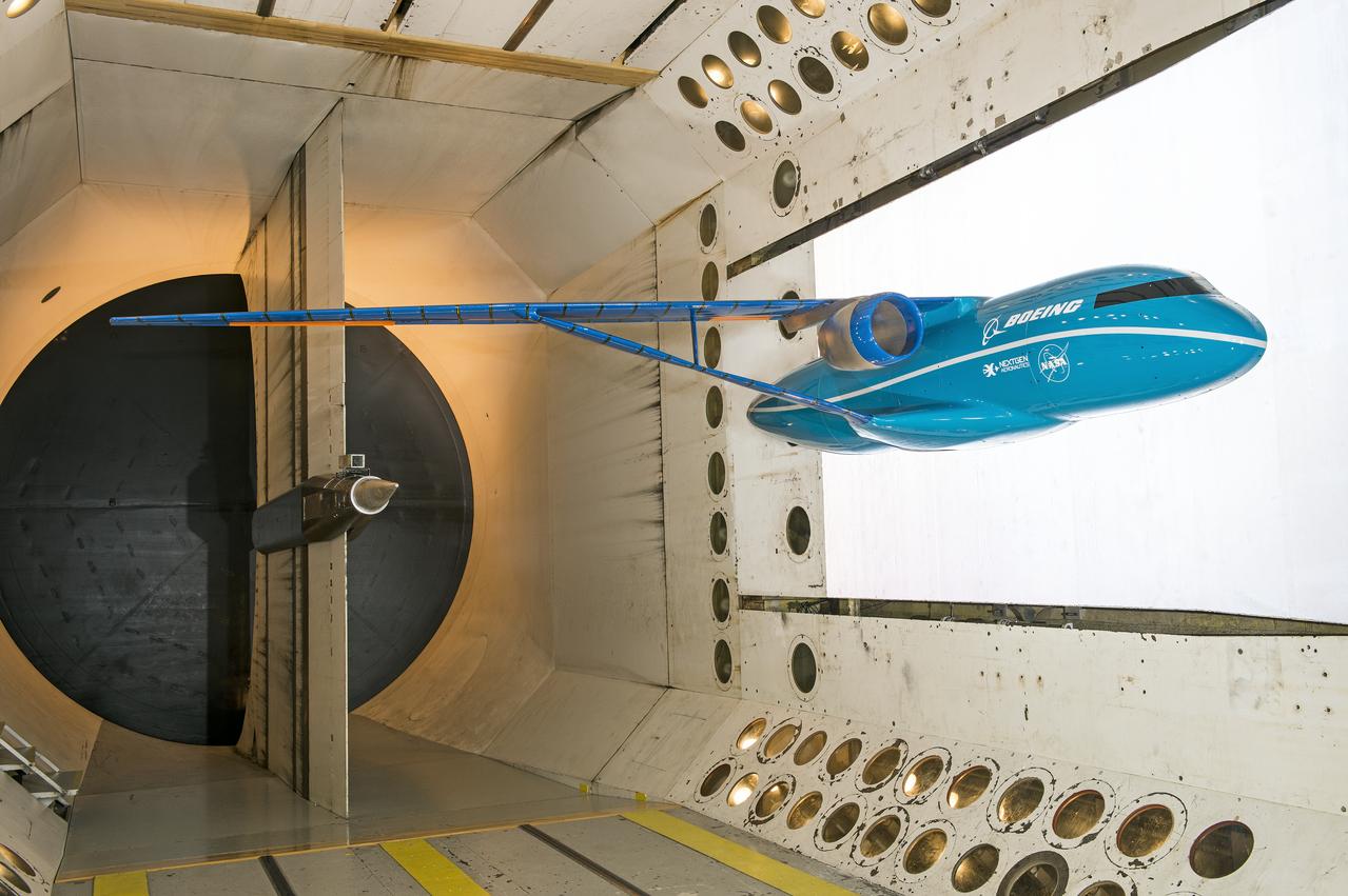
Boeing Subsonic Ultra Green Aircraft Research (SUGAR) Subsonic Fixed Wing in the (TDT) 16 Foot Transonic Dynamics Tunnel facility 648
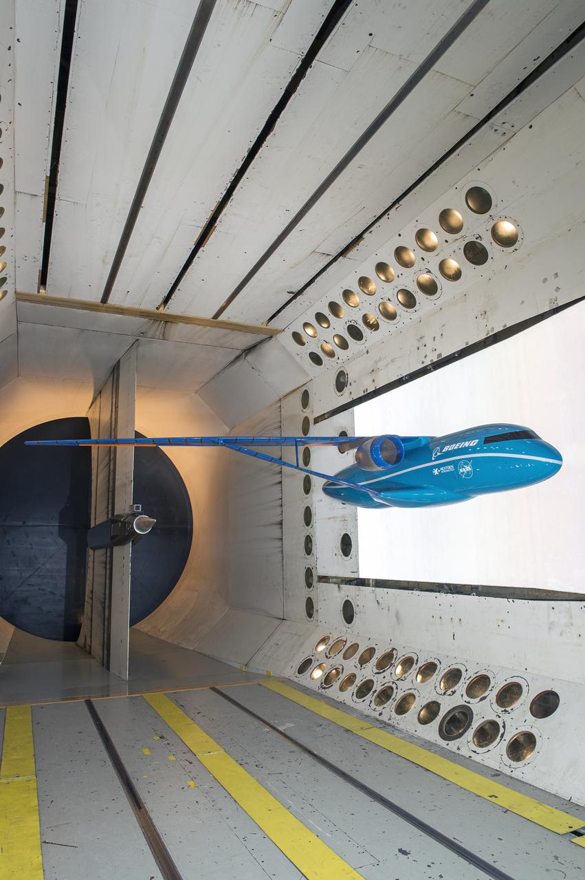
Boeing Subsonic Ultra Green Aircraft Research (SUGAR) Subsonic Fixed Wing in the (TDT) 16 Foot Transonic Dynamics Tunnel facility 648
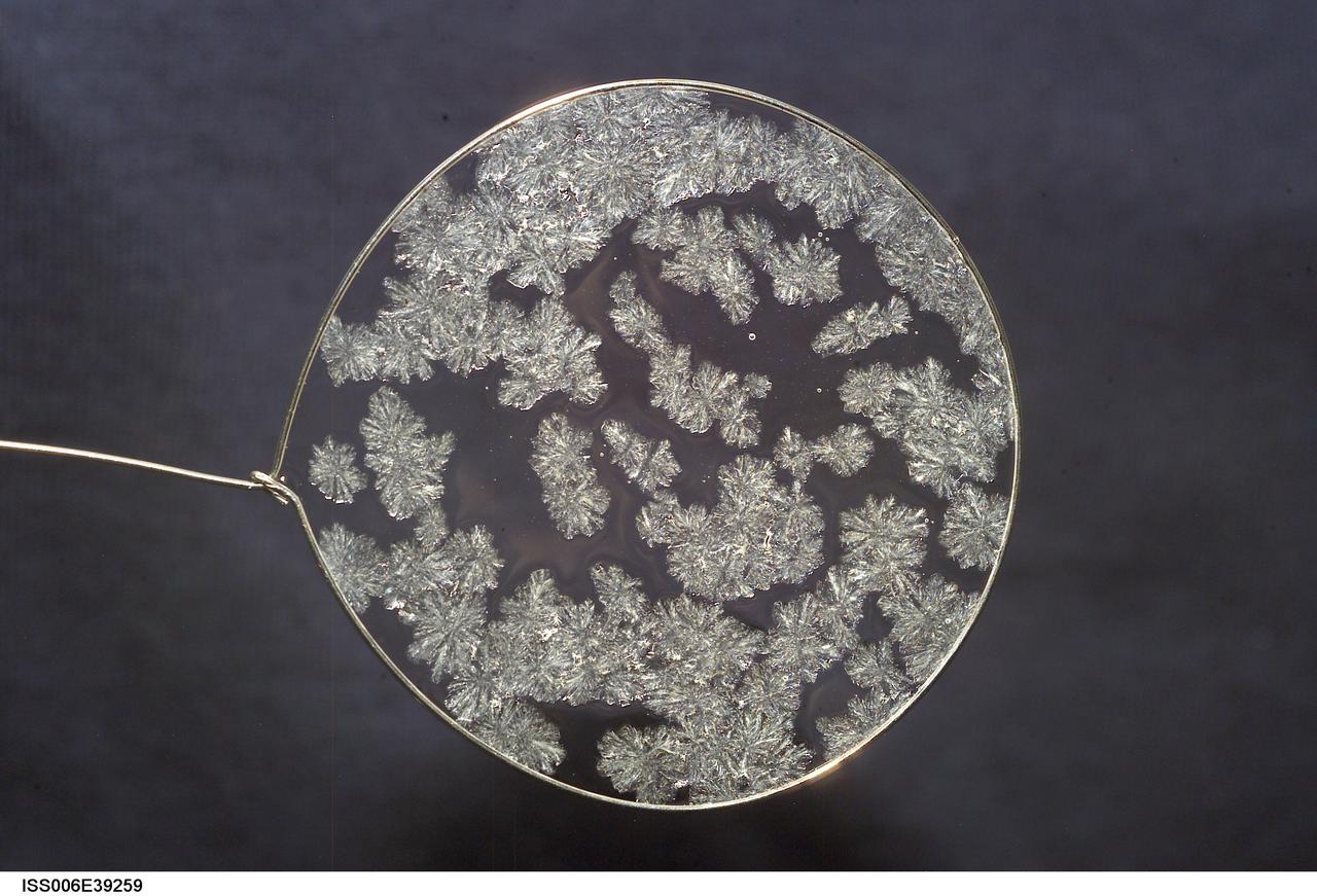
ISS006-E-39259 (14 March 2003) --- A view of sugar crystals in a water bubble within a 50-millimeter (mm) metal loop was photographed by an Expedition Six crewmember. The experiment took place in the Destiny laboratory on the International Space Station (ISS).
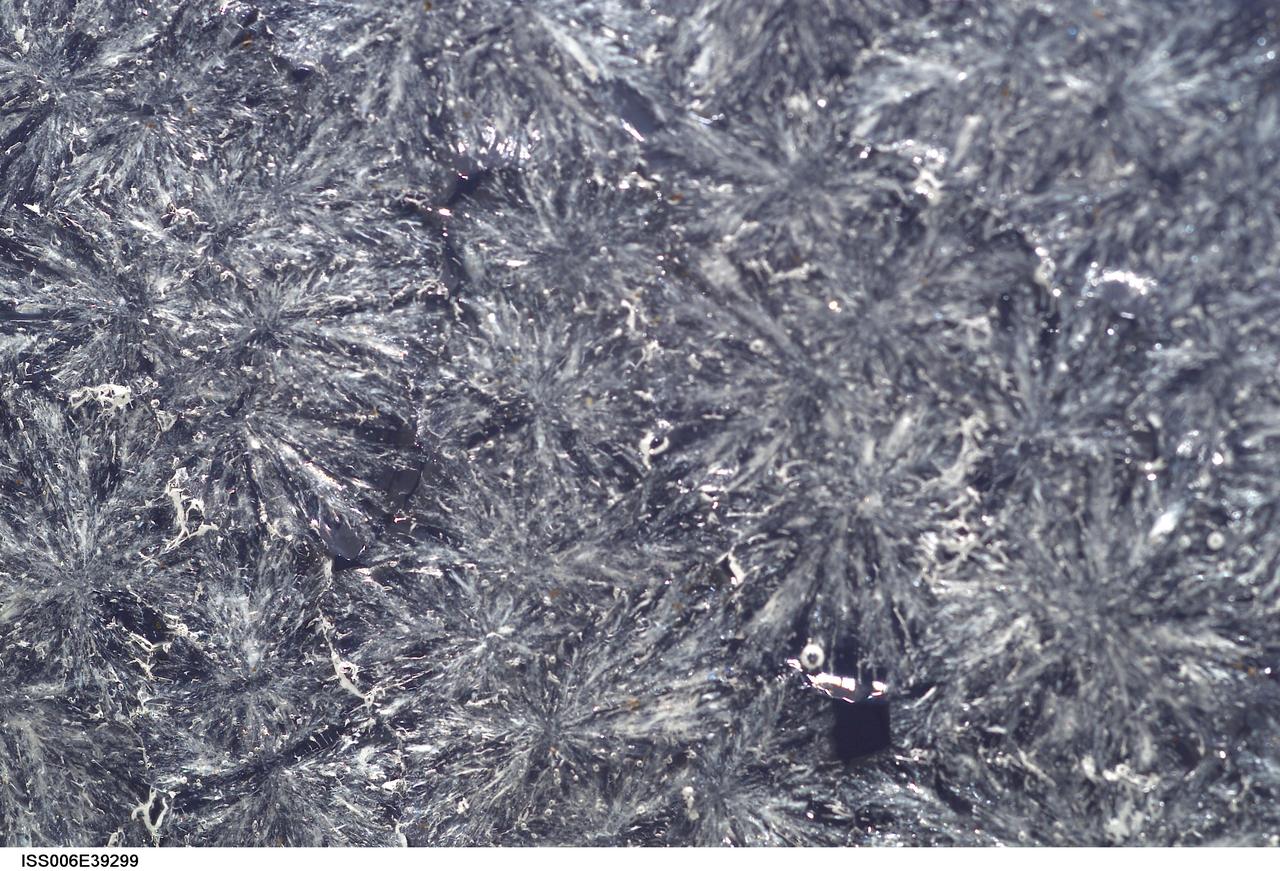
ISS006-E-39299 (15 March 2003) --- A close up view of sugar crystals in a water bubble within a 50-millimeter (mm) metal loop was photographed by an Expedition Six crewmember. The experiment took place in the Destiny laboratory on the International Space Station (ISS).
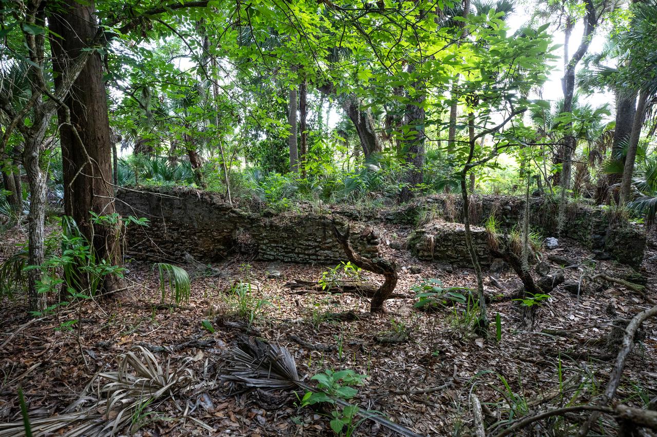
Archeological ruins of the Elliot Plantation sugar mill are revealed through the oak hammock at NASA’s Kennedy Space Center in Florida on May 26, 2022. The plantation’s enslaved community built the sugar mill structure, or sugar train, where sugar cane juice would be boiled during processing in graduated copper kettles until the liquid reduced into a thick syrup. The ruins of Elliot Plantation date from the 1760s and represent the largest, earliest, and southernmost British period sugar plantation in the U.S., as well as one of the most intact and best examples of a completely preserved enslaved landscape. The archeological site is managed through interagency cooperation between the National Park Service, the U.S. Fish and Wildlife Service, and NASA.
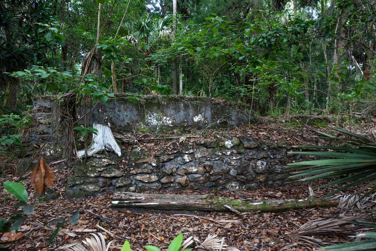
Archeological ruins of the Elliot Plantation sugar mill are revealed through the oak hammock at NASA’s Kennedy Space Center in Florida on May 26, 2022. The plantation’s enslaved community built the sugar mill structure, or sugar train, where sugar cane juice would be boiled during processing in graduated copper kettles until the liquid reduced into a thick syrup. The ruins of Elliot Plantation date from the 1760s and represent the largest, earliest, and southernmost British period sugar plantation in the U.S., as well as one of the most intact and best examples of a completely preserved enslaved landscape. The archeological site is managed through interagency cooperation between the National Park Service, the U.S. Fish and Wildlife Service, and NASA.
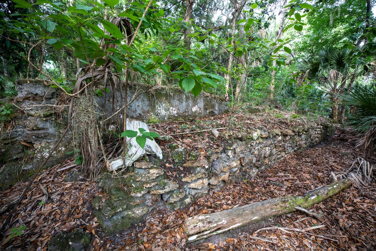
Archeological ruins of the Elliot Plantation sugar mill are revealed through the oak hammock at NASA’s Kennedy Space Center in Florida on May 26, 2022. The plantation’s enslaved community built the sugar mill structure, or sugar train, where sugar cane juice would be boiled during processing in graduated copper kettles until the liquid reduced into a thick syrup. The ruins of Elliot Plantation date from the 1760s and represent the largest, earliest, and southernmost British period sugar plantation in the U.S., as well as one of the most intact and best examples of a completely preserved enslaved landscape. The archeological site is managed through interagency cooperation between the National Park Service, the U.S. Fish and Wildlife Service, and NASA.
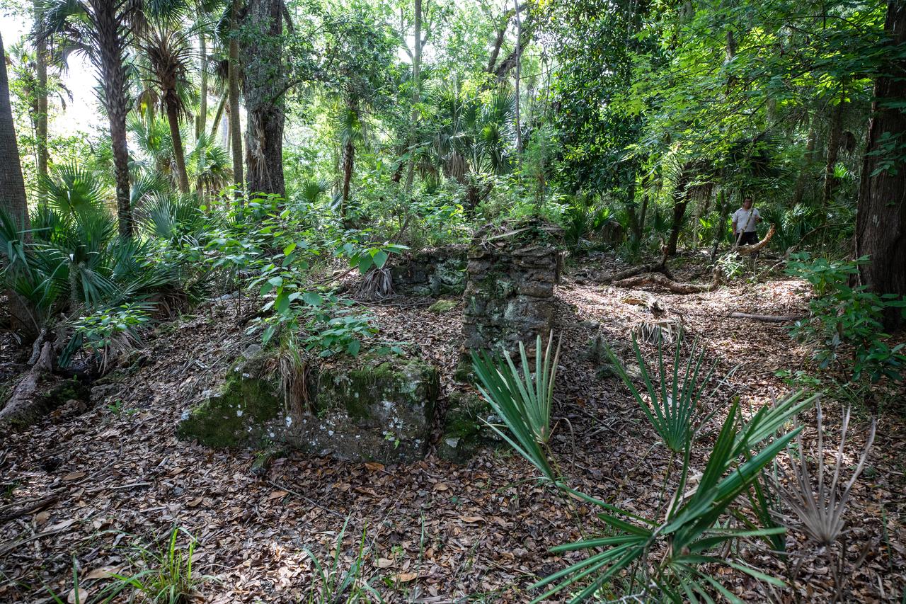
Archeological ruins of the Elliot Plantation sugar mill are revealed through the oak hammock at NASA’s Kennedy Space Center in Florida on May 26, 2022. The plantation’s enslaved community built the sugar mill structure, or sugar train, where sugar cane juice would be boiled during processing in graduated copper kettles until the liquid reduced into a thick syrup. The ruins of Elliot Plantation date from the 1760s and represent the largest, earliest, and southernmost British period sugar plantation in the U.S., as well as one of the most intact and best examples of a completely preserved enslaved landscape. The archeological site is managed through interagency cooperation between the National Park Service, the U.S. Fish and Wildlife Service, and NASA.
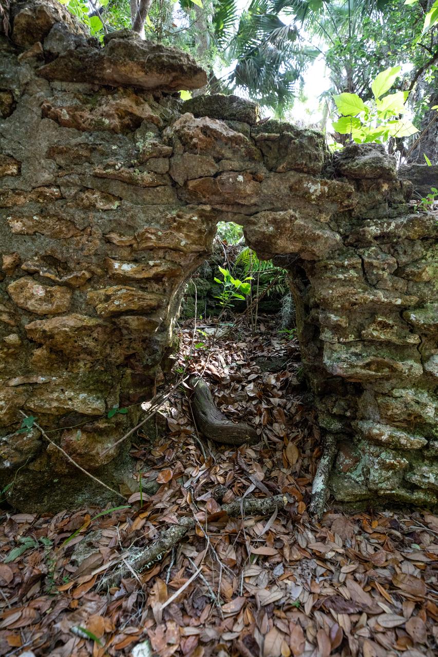
Archeological ruins of the Elliot Plantation sugar mill are revealed through the oak hammock at NASA’s Kennedy Space Center in Florida on May 26, 2022. The plantation’s enslaved community built the sugar mill structure, or sugar train, where sugar cane juice would be boiled during processing in graduated copper kettles until the liquid reduced into a thick syrup. The ruins of Elliot Plantation date from the 1760s and represent the largest, earliest, and southernmost British period sugar plantation in the U.S., as well as one of the most intact and best examples of a completely preserved enslaved landscape. The archeological site is managed through interagency cooperation between the National Park Service, the U.S. Fish and Wildlife Service, and NASA.
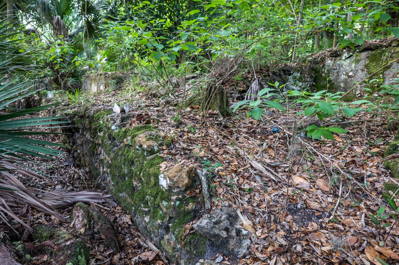
Archeological ruins of the Elliot Plantation sugar mill are revealed through the oak hammock at NASA’s Kennedy Space Center in Florida on May 26, 2022. The plantation’s enslaved community built the sugar mill structure, or sugar train, where sugar cane juice would be boiled during processing in graduated copper kettles until the liquid reduced into a thick syrup. The ruins of Elliot Plantation date from the 1760s and represent the largest, earliest, and southernmost British period sugar plantation in the U.S., as well as one of the most intact and best examples of a completely preserved enslaved landscape. The archeological site is managed through interagency cooperation between the National Park Service, the U.S. Fish and Wildlife Service, and NASA.
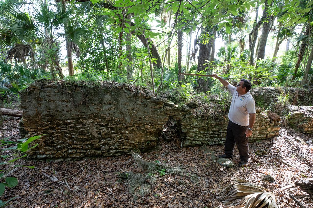
Near the archeological ruins of the Elliot Plantation sugar mill at NASA’s Kennedy Space Center in Florida, Michael Legare, of the U.S. Fish and Wildlife Service, recreates the original wall height of the structure on May 26, 2022. The plantation’s enslaved community built the sugar mill structure, or sugar train, where sugar cane juice would be boiled during processing in graduated copper kettles until the liquid reduced into a thick syrup. The ruins of Elliot Plantation date from the 1760s and represent the largest, earliest, and southernmost British period sugar plantation in the U.S., as well as one of the most intact and best examples of a completely preserved enslaved landscape. The archeological site is managed through interagency cooperation between the National Park Service, the U.S. Fish and Wildlife Service, and NASA.
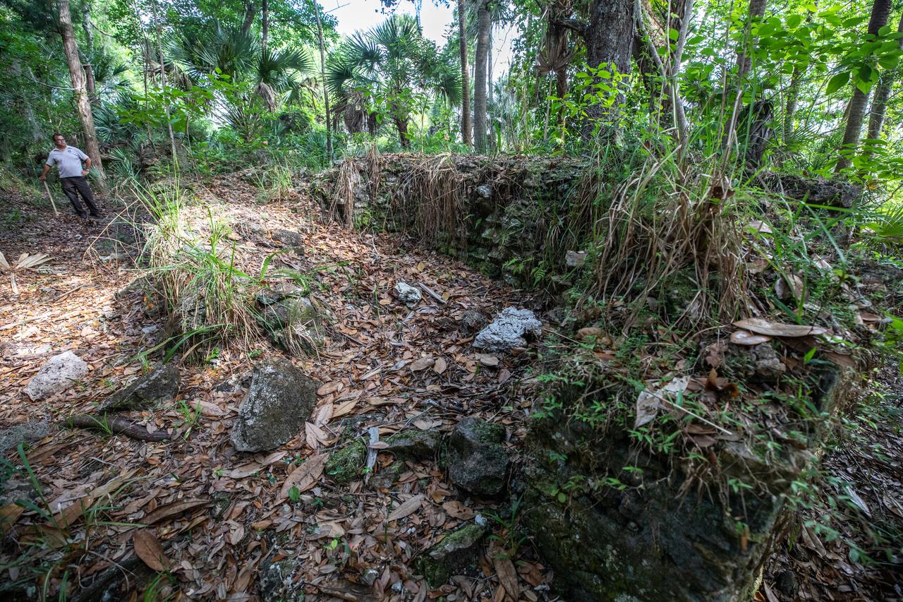
Michael Legare, of the U.S. Fish and Wildlife Service, stands near the archeological ruins of the Elliot Plantation sugar mill at NASA’s Kennedy Space Center in Florida on May 26, 2022. The plantation’s enslaved community built the sugar mill structure, or sugar train, where sugar cane juice would be boiled during processing in graduated copper kettles until the liquid reduced into a thick syrup. The ruins of Elliot Plantation date from the 1760s and represent the largest, earliest, and southernmost British period sugar plantation in the U.S., as well as one of the most intact and best examples of a completely preserved enslaved landscape. The archeological site is managed through interagency cooperation between the National Park Service, the U.S. Fish and Wildlife Service, and NASA.
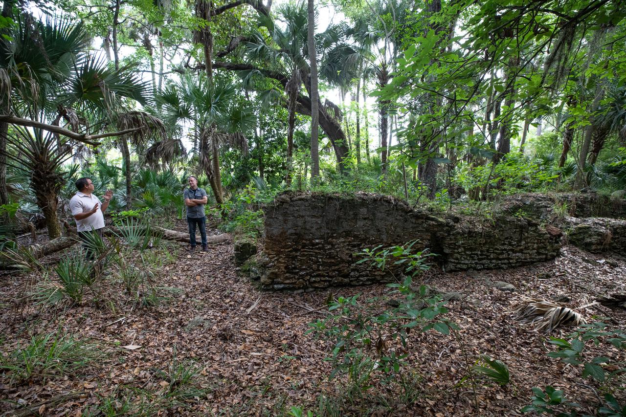
Members of U.S. Fish and Wildlife Service and NASA Communications visit the archeological ruins of the Elliot Plantation sugar mill at NASA’s Kennedy Space Center in Florida on May 26, 2022. The plantation’s enslaved community built the sugar mill structure, or sugar train, where sugar cane juice would be boiled during processing in graduated copper kettles until the liquid reduced into a thick syrup. The ruins of Elliot Plantation date from the 1760s and represent the largest, earliest, and southernmost British period sugar plantation in the U.S., as well as one of the most intact and best examples of a completely preserved enslaved landscape. The archeological site is managed through interagency cooperation between the National Park Service, the U.S. Fish and Wildlife Service, and NASA.
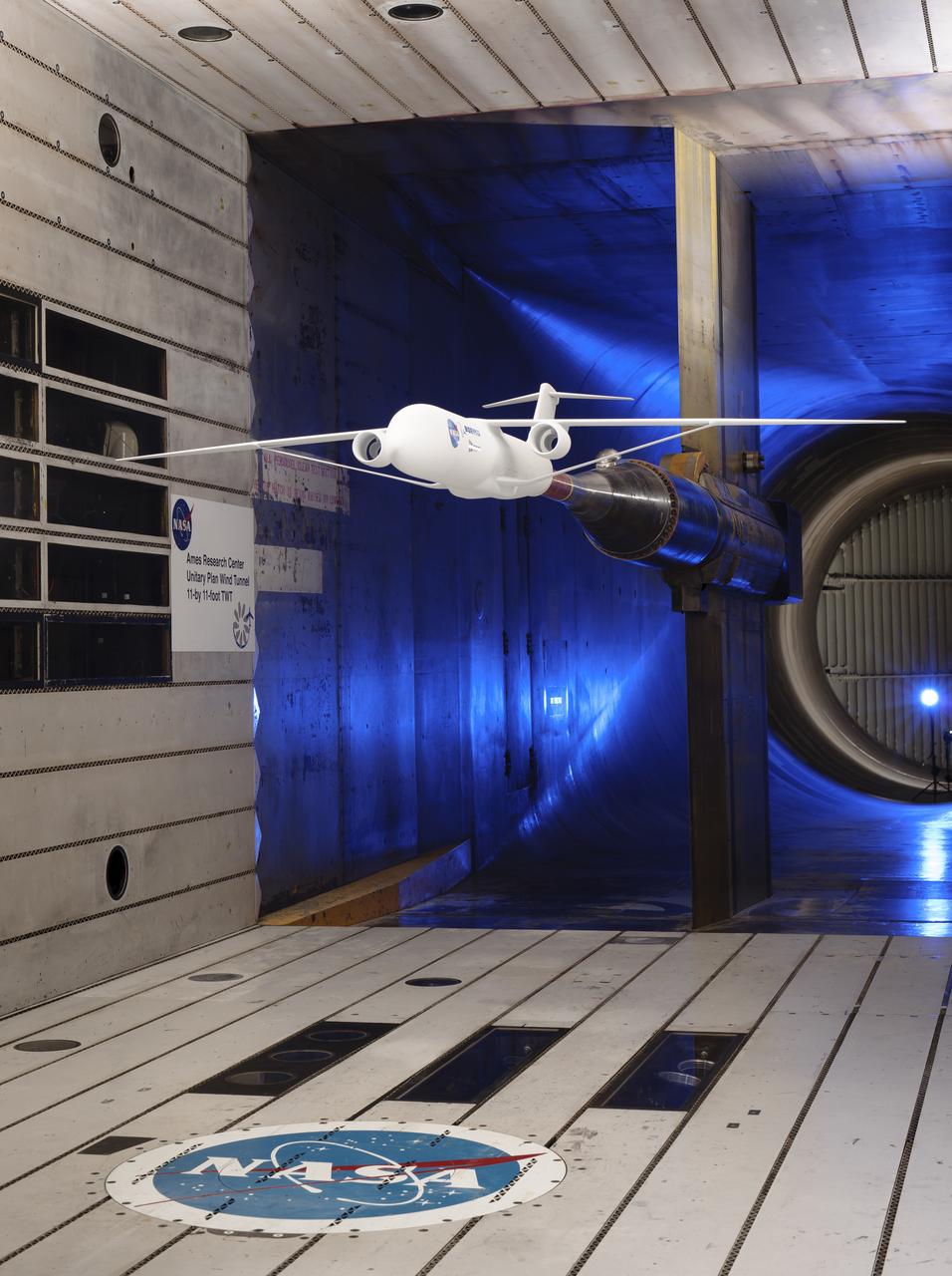
Truss-braced wind model installed in the Ames 11x11 Foot Wind Tunnel for testing as part of the Subsonic Ultra Green Aircraft Research Project (SUGAR)
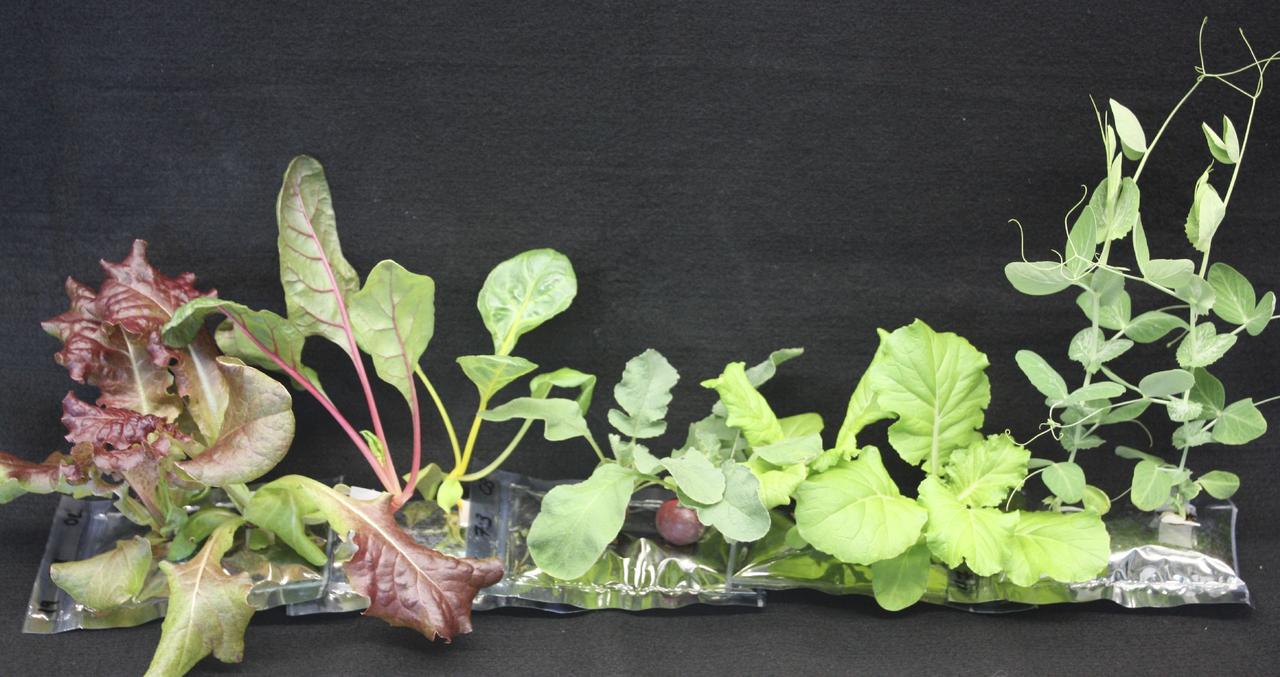
CAPE CANAVERAL, Fla. – Several different types of 21-day-old plants grow in analog VEGGIE pillows include, from right, Outredgeous red romaine lettuce, Bright Lights Swiss chard, Cherry Bomb II radish, Tokyo Bekana Chinese cabbage and Sugar Pod II snow pea. U.S. astronauts living and working aboard the International Space Station are going to receive a newly developed Vegetable Production System VEGGIE. VEGGIE is set to launch aboard SpaceX's Dragon capsule on NASA's third Commercial Resupply Services mission targeted to launch Dec. 9 from Space Launch Complex 40 at Cape Canaveral Air Force Station in Florida. Photo credit: NASA/Gioia Massa
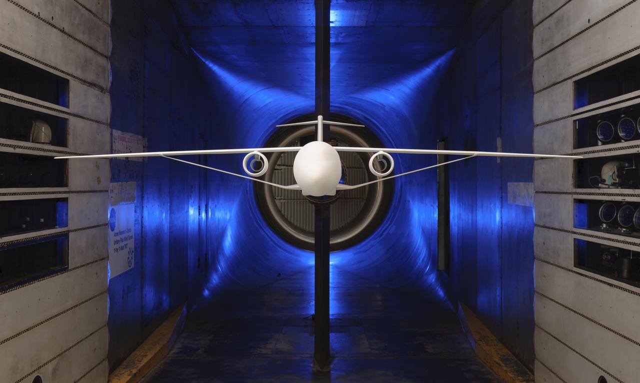
Truss-Braced Wind Model installed in the Ames 11x11 Foot Wind Tunnel for testing. The Truss-Braced model is part of the Subsonic Ultra Green Aircraft Research Project (SUGAR)
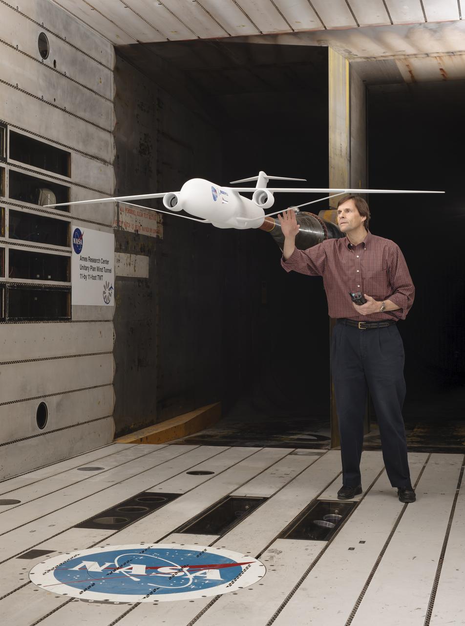
Truss-braced wind model installed in the Ames 11x11 Foot Wind Tunnel for testing as part of the Subsonic Ultra Green Aircraft Research Project (SUGAR) Shown here with test engineer Greg Gatlin, Langley Research Center.
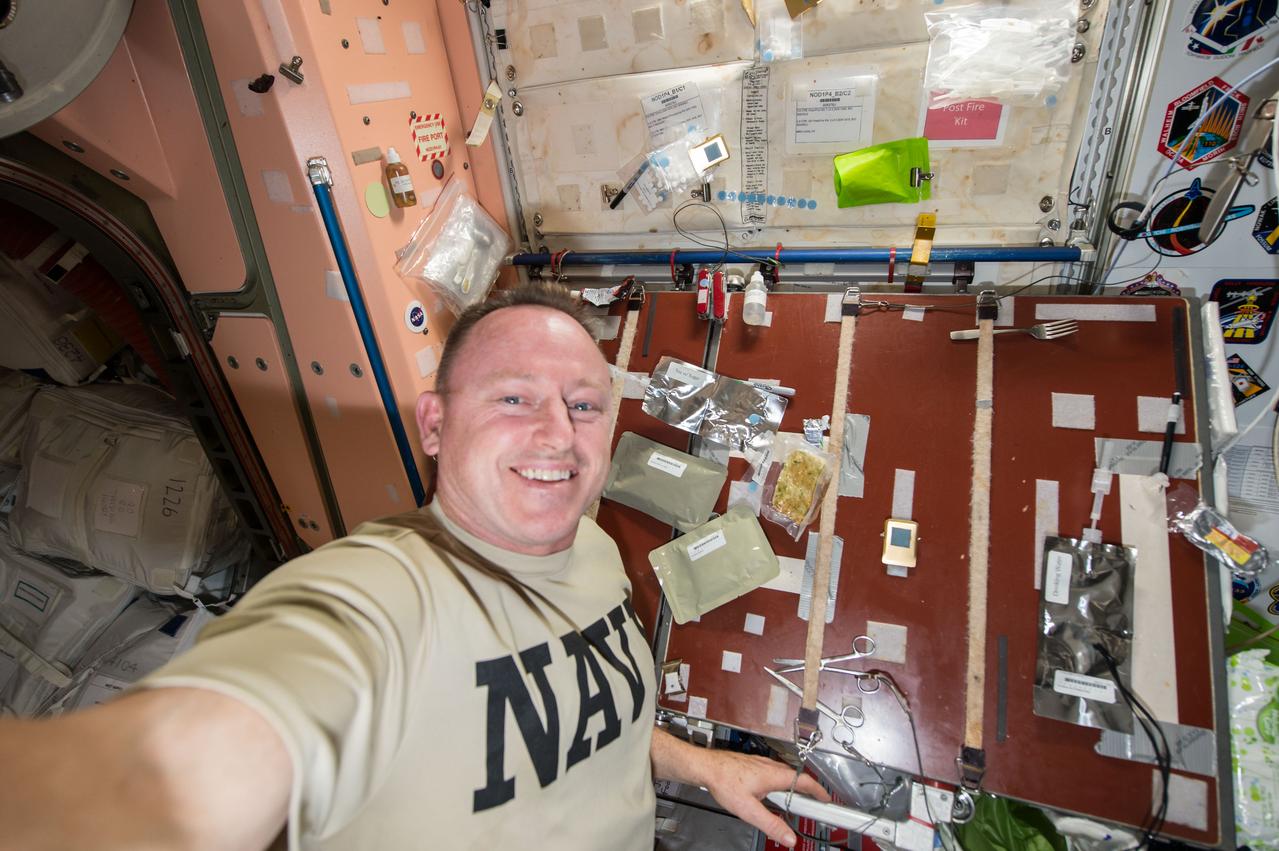
Commander Barry Wilmore takes a self-portrait with food packages (smoked turkey, cranapple dessert, cornbread dressing, and tea with sugar) planned for his Thanksgiving meal. Image was taken near the galley table in the Unity Node 1, and released by Wilmore on Instagram.
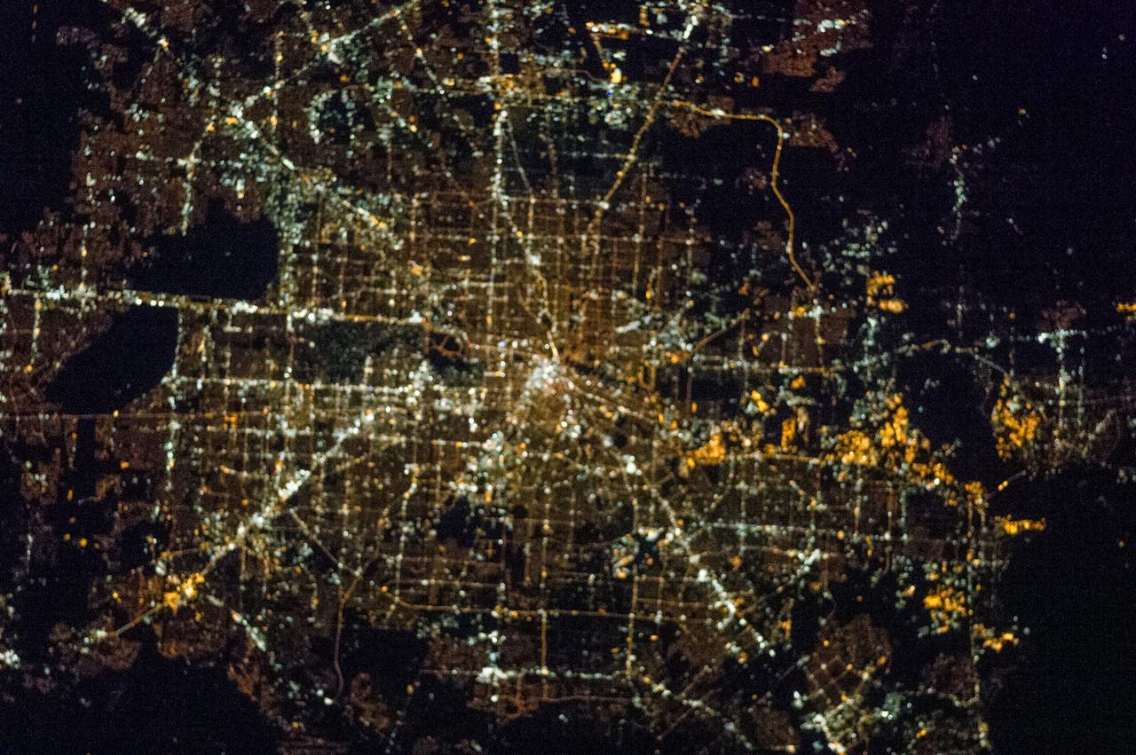
ISS038-E-015162 (12 Dec. 2013) --- One of the Expedition 38 crew members took this brightly lit night picture featuring much of the Houston metropolitan area. The central business district is in the exact center of the photo, with the Galleria area and uptown being in the lower left with Sugar Land being closer to the lower left corner. The 610 Loop and Beltway 8 encircle the city. The southeast sections extend past Hobby Airport to the NASA/Clear Lake area.

STS073-745-055 (2 November 1995) --- This photograph in color infrared highlights the different vegetation zones on the island of Maui, Hawaii. The dark red tropical forests live on the steep volcanic slopes on the north side of the island, and the fertile lowlands support large sugar cane plantations, which are the red and black checkered pattern. The Wailuku and Kahului area near the center on the north shore of the island was formerly a whaling center. Much of the eastern part of the island is Haleakala National Park, including the spectacular Haleakala Crater (under clouds).
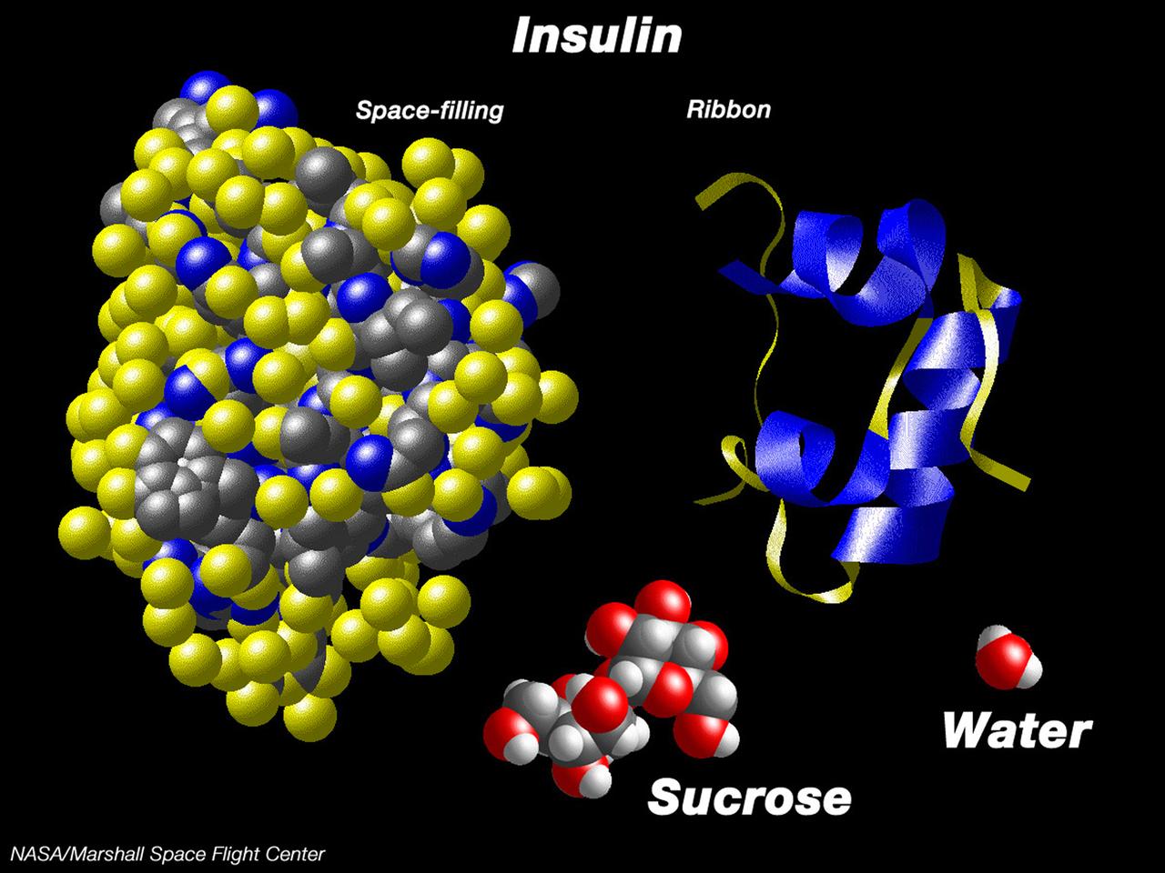
This computer graphic depicts the relative complexity of crystallizing large proteins in order to study their structures through x-ray crystallography. Insulin is a vital protein whose structure has several subtle points that scientists are still trying to determine. Large molecules such as insuline are complex with structures that are comparatively difficult to understand. For comparison, a sugar molecule (which many people have grown as hard crystals in science glass) and a water molecule are shown. These images were produced with the Macmolecule program. Photo credit: NASA/Marshall Space Flight Center (MSFC)

ISS038-E-015160 (12 Dec. 2013) --- One of the Expedition 38 crew members took this brightly lit night picture featuring much of the Houston metropolitan area. The central business district is in the exact center of the photo, with the Galleria area and uptown being in the lower left with Sugar Land being closer to the lower left corner. The 610 Loop and Beltway 8 encircle the city. The southeast sections extend past Hobby Airport to the NASA/Clear Lake area.
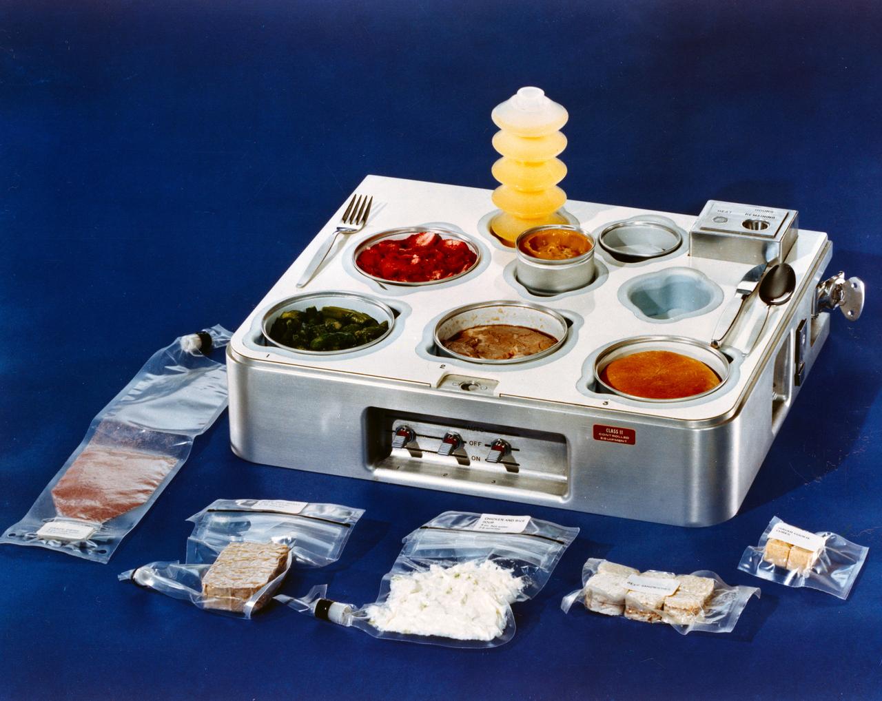
S72-15409 (1972) --- A close-up view of a food tray which is scheduled to be used in the Skylab program. Several packages of space food lie beside the tray. The food in the tray is ready to eat. Out of tray, starting from bottom left: grape drink, beef pot roast, chicken and rice, beef sandwiches and sugar cookie cubes. In tray, from back left: orange drink, strawberries, asparagus, prime rib, dinner roll and butterscotch pudding in the center. Photo credit: NASA
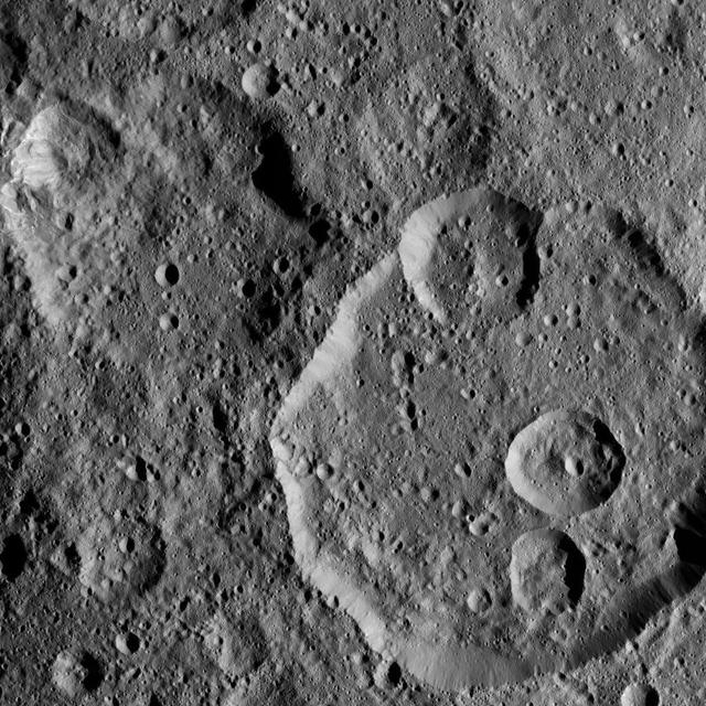
Meanderi Crater on Ceres is seen at lower right in this image from NASA's Dawn spacecraft. Meanderi -- named for the Ngaing goddess (New Guinea) of taro, sugar cane and other foods -- hosts several medium-sized craters within its walls. Meanderi measures 64 miles (103 kilometers) in diameter. The crater is centered at 41 degrees south, 194 degrees east. Dawn took this image on Oct. 26, 2016, during its second extended-mission science orbit (XMO2), from a distance of about 920 miles (1,480 kilometers) above the surface of Ceres. The image resolution is about 460 feet (140 meters) per pixel. http://photojournal.jpl.nasa.gov/catalog/PIA21248
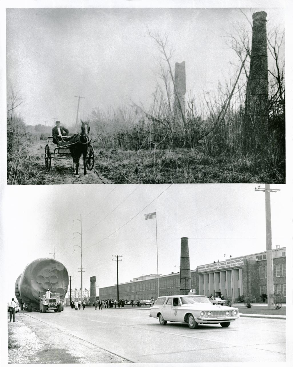
NASA's Michoud Assembly Facility, located in eastern New Orleans, Louisiana, is an 832 acre site that is a government-owned, contractor-operated component of the George C. Marshall Space Flight Center (MSFC). The facility was acquired by NASA in 1961 at the recommendation of Dr. Wernher von Braun and his rocket team in Huntsville Alabama. The cavernous plant served as the assembly facility for the Saturn launch vehicles and most recently the external tank (ET) used for the Space Shuttle Program. The facility features one of the world's biggest manufacturing plants with 43 acres under one roof and a port with deep-water access for the transportation of large space structures. When completed, space hardware is towed on a barge across the Gulf of Mexico, around Florida and up to Kennedy Space Center. The original tract of land was part of a 34,500 acre French Royal land grant to local merchant, Gilbert Antoine de St. Maxent in 1763. Later, the land was acquired by French transplant Antoine Michoud, the son of Napoleon's Administrator of Domains, who moved to the city in 1827. Michoud operated a sugar cane plantation and refinery on the site until his death in 1863. His heirs continued operating the refinery and kept the original St. Maxent estate intact into the 20th century. Two brick smokestacks from the original refinery still stand before the Michoud facility today as seen in the lower half of this photograph taken in the 1960's, while the upper half reflects the area during the time of the sugar cane plantation workers.
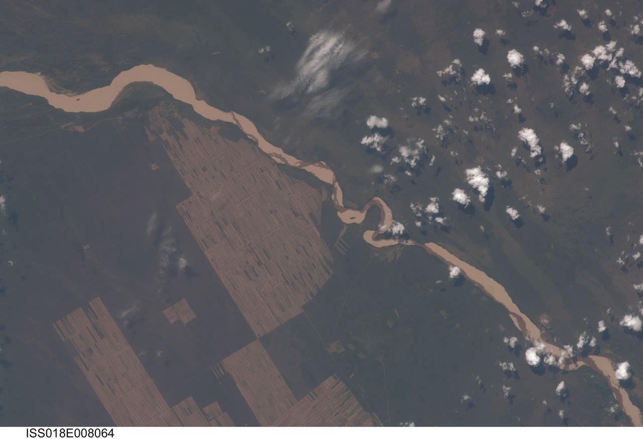
ISS018-E-008064 (9 Nov. 2008) --- Progressive forest clearing in Bolivia is featured in this image photographed by an Expedition 18 crewmember on the International Space Station. The eastern half of Bolivia is covered with tropical rainforest. In the 1990s, Bolivia initiated a large-scale effort to increase the rate of logging and create tracts of land for commercial agriculture (primarily soy and sugar cane, but also coca) on the Amazon Basin side of the Andean highlands. Today, the commercial fields are well-established and easily mapped from space as large, rectangular clearings in the forest. The agricultural developments are still growing today. The clearings start off as small rectangles arranged perpendicular to an access road; early clearings take on a herring-bone pattern when viewed from above. The uncleared (dark forest) areas are gradually logged and cultivated, filling in the pattern to make a larger cleared area. Astronauts aboard the space station routinely observe intensive land use and document their observations through imagery so that changes can be identified.
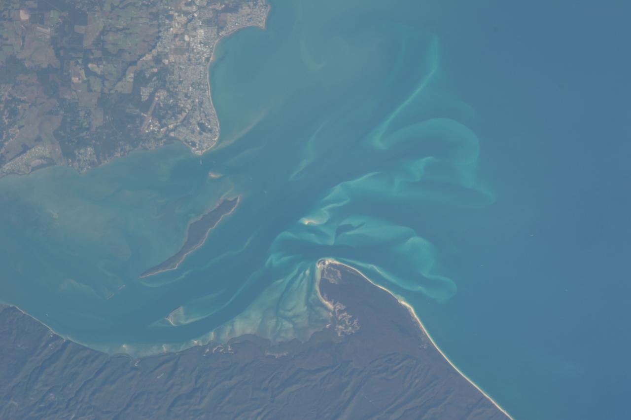
ISS036-E-028444 (3 Aug. 2013) --- Hervey Bay, Queensland, Australia is featured in this image photographed by an Expedition 36 crew member on the International Space Station. The northern end of the Great Sandy Strait and Hervey Bay are highlighted in this photograph. The Strait is an estuary that separates the mainland coastline of the state of Queensland, Australia from neighboring Fraser Island. The mainland side of the Strait includes the city of Hervey Bay, visible at top center. Other communities that have become part of the larger metropolitan area include Scarness, Booral, and Urangan. A small vegetated island and shallow sand bars of the Great Sandy Strait are visible at center left, while submerged sands appear as bright blue flowing ribbons at center. A small, bright white exposure of sand is visible above the water level near the center point of the image. While once a major freighting center for the sugar cane industry, the local economy is now largely based on tourism, with whale watching tours a popular attraction. The Great Sandy Strait estuary provides habitat for breeding fish, crustaceans, turtles, and other sea life, as well as a wide variety of birds. Nearby Fraser Island is the world?s largest sand island and a World Heritage site.
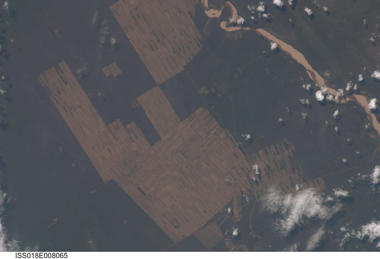
ISS018-E-008065 (9 Nov. 2008) --- Progressive forest clearing in Bolivia is featured in this image photographed by an Expedition 18 crewmember on the International Space Station. The eastern half of Bolivia is covered with tropical rainforest. In the 1990s, Bolivia initiated a large-scale effort to increase the rate of logging and create tracts of land for commercial agriculture (primarily soy and sugar cane, but also coca) on the Amazon Basin side of the Andean highlands. Today, the commercial fields are well-established and easily mapped from space as large, rectangular clearings in the forest. The agricultural developments are still growing today. The clearings start off as small rectangles arranged perpendicular to an access road; early clearings take on a herring-bone pattern when viewed from above. The uncleared (dark forest) areas are gradually logged and cultivated, filling in the pattern to make a larger cleared area. Astronauts aboard the space station routinely observe intensive land use and document their observations through imagery so that changes can be identified.
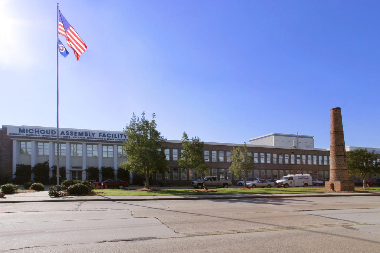
NASA's Michoud Assembly Facility, located in eastern New Orleans, Louisiana, is an 832 acre site that is a government-owned, contractor-operated component of the George C. Marshall Space Flight Center (MSFC). The facility was acquired by NASA in 1961 at the recommendation of Dr. Wernher von Braun and his rocket team in Huntsville Alabama. The cavernous plant served as the assembly facility for the Saturn launch vehicles and most recently the external tank (ET) used for the Space Shuttle Program. The facility features one of the world's biggest manufacturing plants with 43 acres under one roof and a port with deep-water access for the transportation of large space structures. When completed, space hardware is towed on a barge across the Gulf of Mexico, around Florida and up to Kennedy Space Center. The original tract of land was part of a 34,500 acre French Royal land grant to local merchant, Gilbert Antoine de St. Maxent in 1763. Later, the land was acquired by French transplant Antoine Michoud, the son of Napoleon's Administrator of Domains, who moved to the city in 1827. Michoud operated a sugar cane plantation and refinery on the site until his death in 1863. His heirs continued operating the refinery and kept the original St. Maxent estate intact into the 20th century. Visible on the right, is one of two brick smokestacks from the original refinery that still stand before the Michoud facility today.
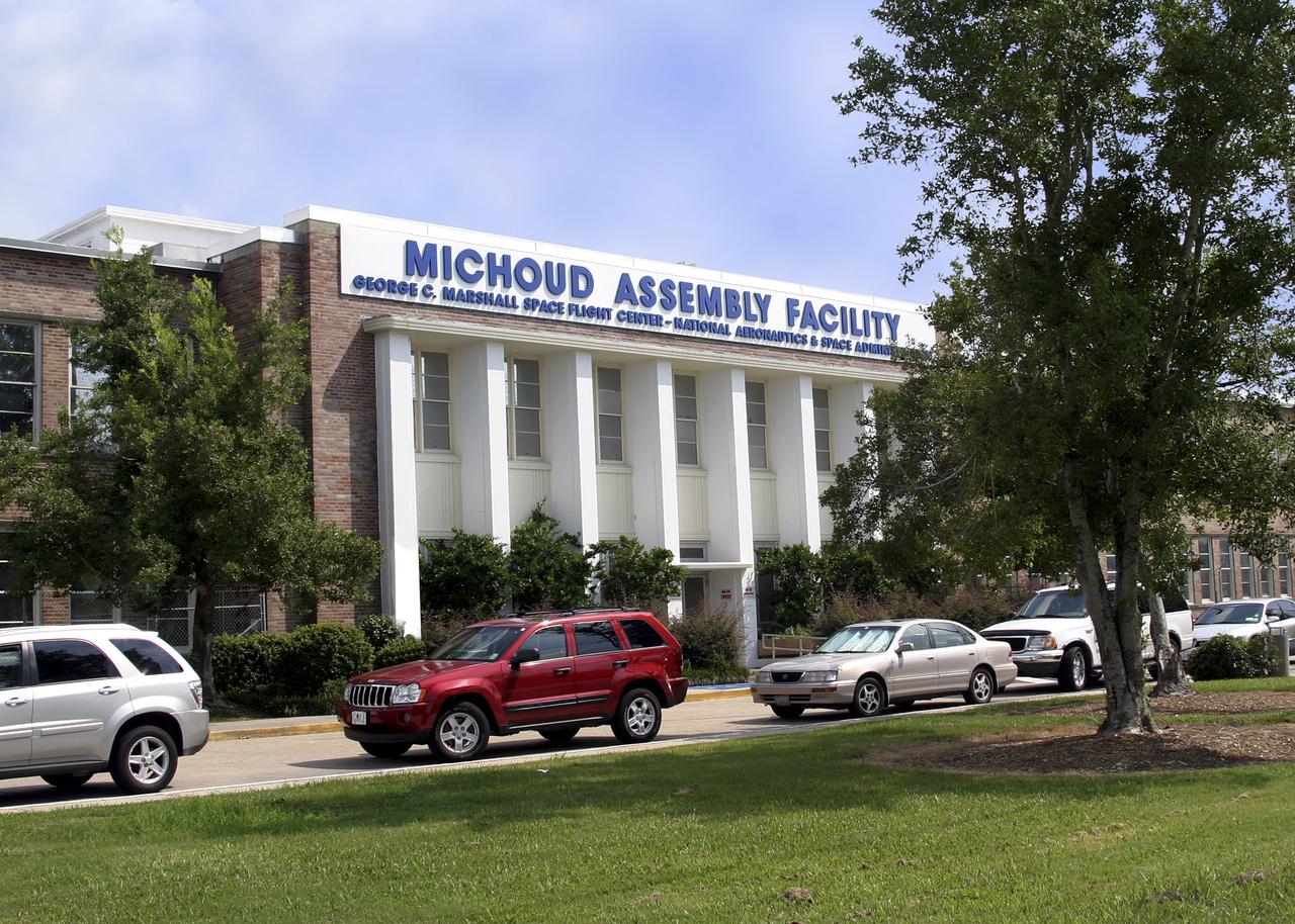
NASA's Michoud Assembly Facility, located in eastern New Orleans, Louisiana, is an 832 acre site that is a government-owned, contractor-operated component of the George C. Marshall Space Flight Center (MSFC). The facility was acquired by NASA in 1961 at the recommendation of Dr. Wernher von Braun and his rocket team in Huntsville Alabama. The cavernous plant served as the assembly facility for the Saturn launch vehicles and most recently the external tank (ET) used for the Space Shuttle Program. The facility features one of the world's biggest manufacturing plants with 43 acres under one roof and a port with deep-water access for the transportation of large space structures. When completed, space hardware is towed on a barge across the Gulf of Mexico, around Florida and up to Kennedy Space Center. The original tract of land was part of a 34,500 acre French Royal land grant to local merchant, Gilbert Antoine de St. Maxent in 1763. Later, the land was acquired by French transplant Antoine Michoud, the son of Napoleon's Administrator of Domains, who moved to the city in 1827. Michoud operated a sugar cane plantation and refinery on the site until his death in 1863. His heirs continued operating the refinery and kept the original St. Maxent estate intact into the 20th century. Two brick smokestacks from the original refinery still stand before the Michoud facility today.
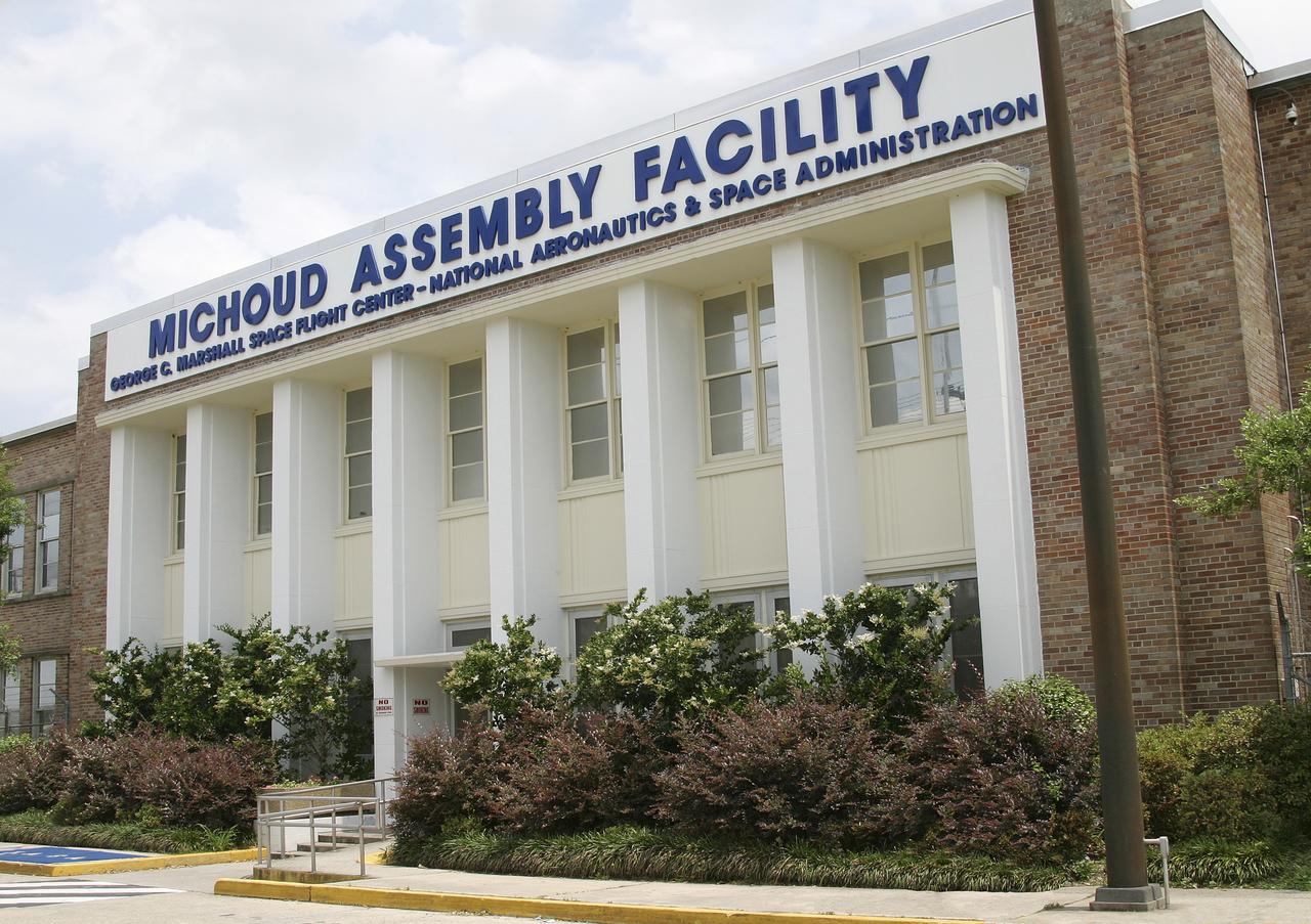
NASA's Michoud Assembly Facility, located in eastern New Orleans, Louisiana, is an 832 acre site that is a government-owned, contractor-operated component of the George C. Marshall Space Flight Center (MSFC). The facility was acquired by NASA in 1961 at the recommendation of Dr. Wernher von Braun and his rocket team in Huntsville Alabama. The cavernous plant served as the assembly facility for the Saturn launch vehicles and most recently the external tank (ET) used for the Space Shuttle Program. The facility features one of the world's biggest manufacturing plants with 43 acres under one roof and a port with deep-water access for the transportation of large space structures. When completed, space hardware is towed on a barge across the Gulf of Mexico, around Florida and up to Kennedy Space Center. The original tract of land was part of a 34,500 acre French Royal land grant to local merchant, Gilbert Antoine de St. Maxent in 1763. Later, the land was acquired by French transplant Antoine Michoud, the son of Napoleon's Administrator of Domains, who moved to the city in 1827. Michoud operated a sugar cane plantation and refinery on the site until his death in 1863. His heirs continued operating the refinery and kept the original St. Maxent estate intact into the 20th century. Two brick smokestacks from the original refinery still stand before the Michoud facility today.
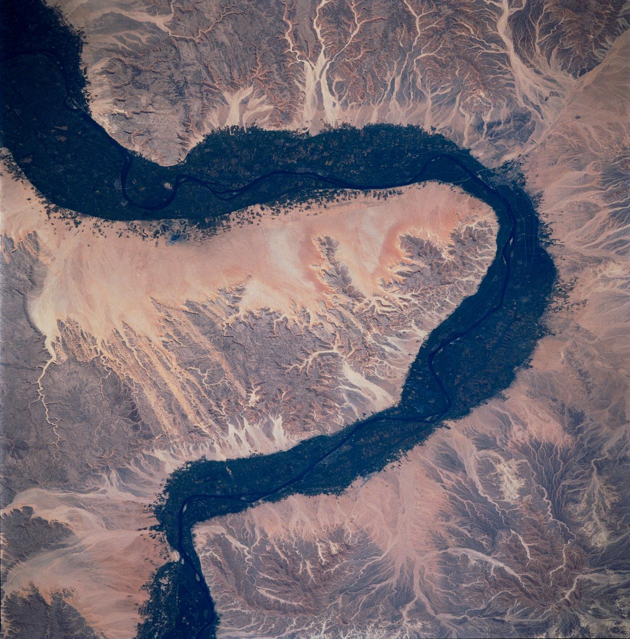
STS083-748-066 (4-8 April 1997) --- Luxor, Qus, and Qina, Egypt on the Nile. The Nile, which is about 4,132 miles long, is the longest river in the world. This photo demonstrates the dependency of the local agriculture on the River. This area is the historic area of ancient Thebes. Luxor, also called EL-AKSUR, or AL-UQSUR, a market town along the southern part of the Nile's curve, is located on the southern half of the ruins of Thebes. Ancient Thebes was about six miles square; the main part of the city was situated along the Nile's east bank; along the west bank was "the city of the dead" -- an area containing the Egyptian kings' mortuary temples and the houses of those priests, soldiers, craftsmen, and laborers who were devoted to their service. Qina, extending 3 - 4 miles (5 - 6 kilometers) on each side of the Nile River between the Arabian and Libyan deserts, is seen on the northeast part of the rivers curve. Occupying the great bend in the Nile Valley, it has an area of 715 square miles (1,851 square kilometers) and contains the celebrated ruins of Thebes and the Valley of the Tombs of the Kings. Qina has a dense agricultural population (more than 3,000 persons per square mile), and most of its land is under basin irrigation, yielding only one crop annually. Main crops are sugar (about three-fifths of the nation's production), lentils, and grains.
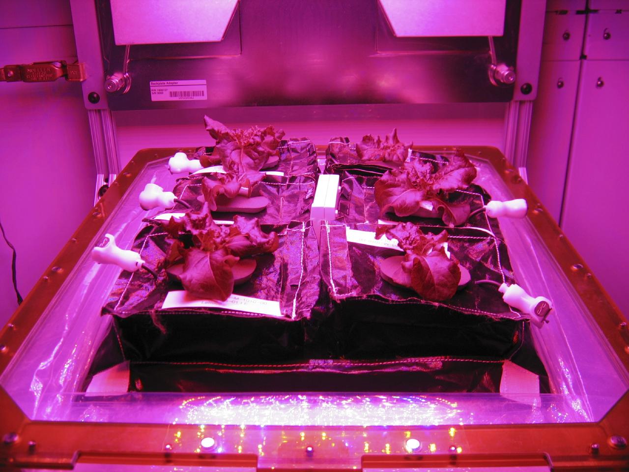
CAPE CANAVERAL, Fla. –Outredgeous red romaine lettuce plants grow inside in a prototype VEGGIE flight pillow. The bellows of the hardware have been lowered to better observe the plants. A small temperature and relative humidity data logger is placed between the pillows small white box, central. U.S. astronauts living and working aboard the International Space Station are going to receive a newly developed Vegetable Production System VEGGIE. VEGGIE is set to launch aboard SpaceX's Dragon capsule on NASA's third Commercial Resupply Services mission targeted to launch Dec. 9 from Space Launch Complex 40 at Cape Canaveral Air Force Station in Florida. Photo credit: NASA/Gioia Massa
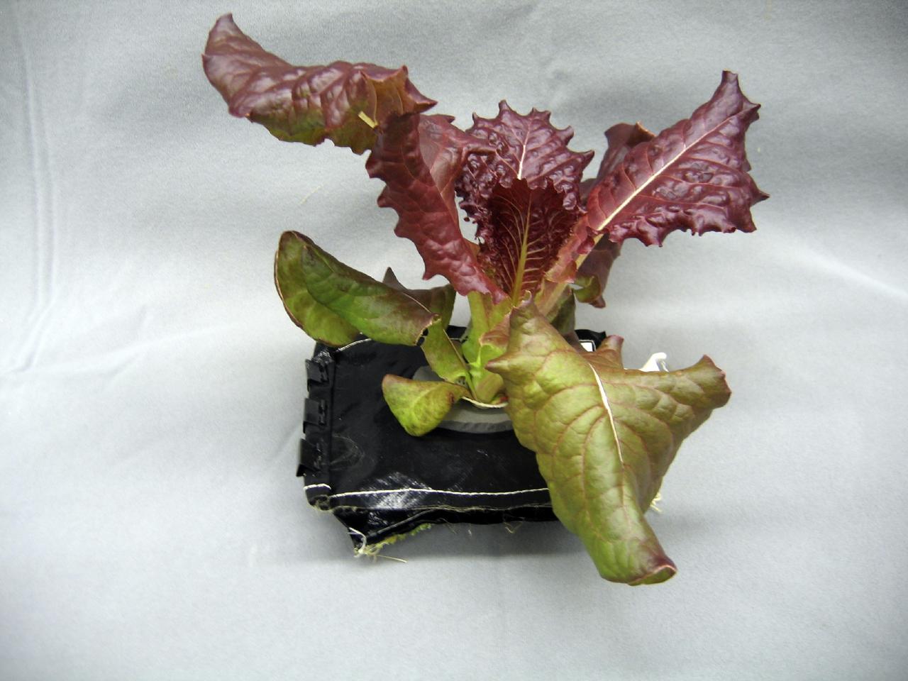
CAPE CANAVERAL, Fla. – A 28-day-old Outredgeous red romaine lettuce plant grows in a prototype VEGGIE flight pillow. U.S. astronauts living and working aboard the International Space Station are going to receive a newly developed Vegetable Production System VEGGIE. VEGGIE is set to launch aboard SpaceX's Dragon capsule on NASA's third Commercial Resupply Services mission targeted to launch Dec. 9 from Space Launch Complex 40 at Cape Canaveral Air Force Station in Florida. Photo credit: NASA/Gioia Massa
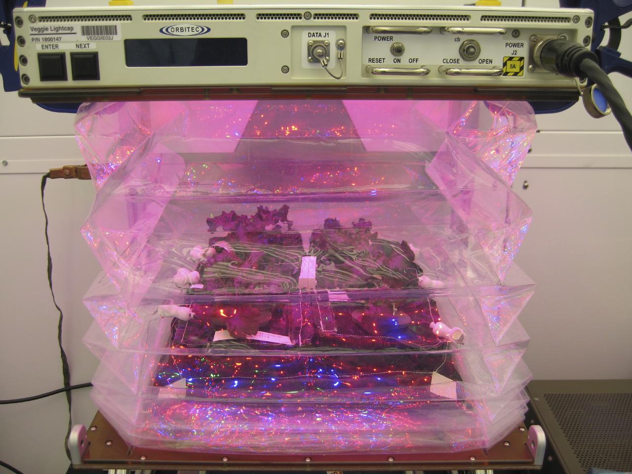
CAPE CANAVERAL, Fla. – Outredgeous red romaine lettuce plants grow inside the bellows of a prototype VEGGIE flight pillow. U.S. astronauts living and working aboard the International Space Station are going to receive a newly developed Vegetable Production System VEGGIE. VEGGIE is set to launch aboard SpaceX's Dragon capsule on NASA's third Commercial Resupply Services mission targeted to launch Dec. 9 from Space Launch Complex 40 at Cape Canaveral Air Force Station in Florida. Photo credit: NASA/Bryan Onate
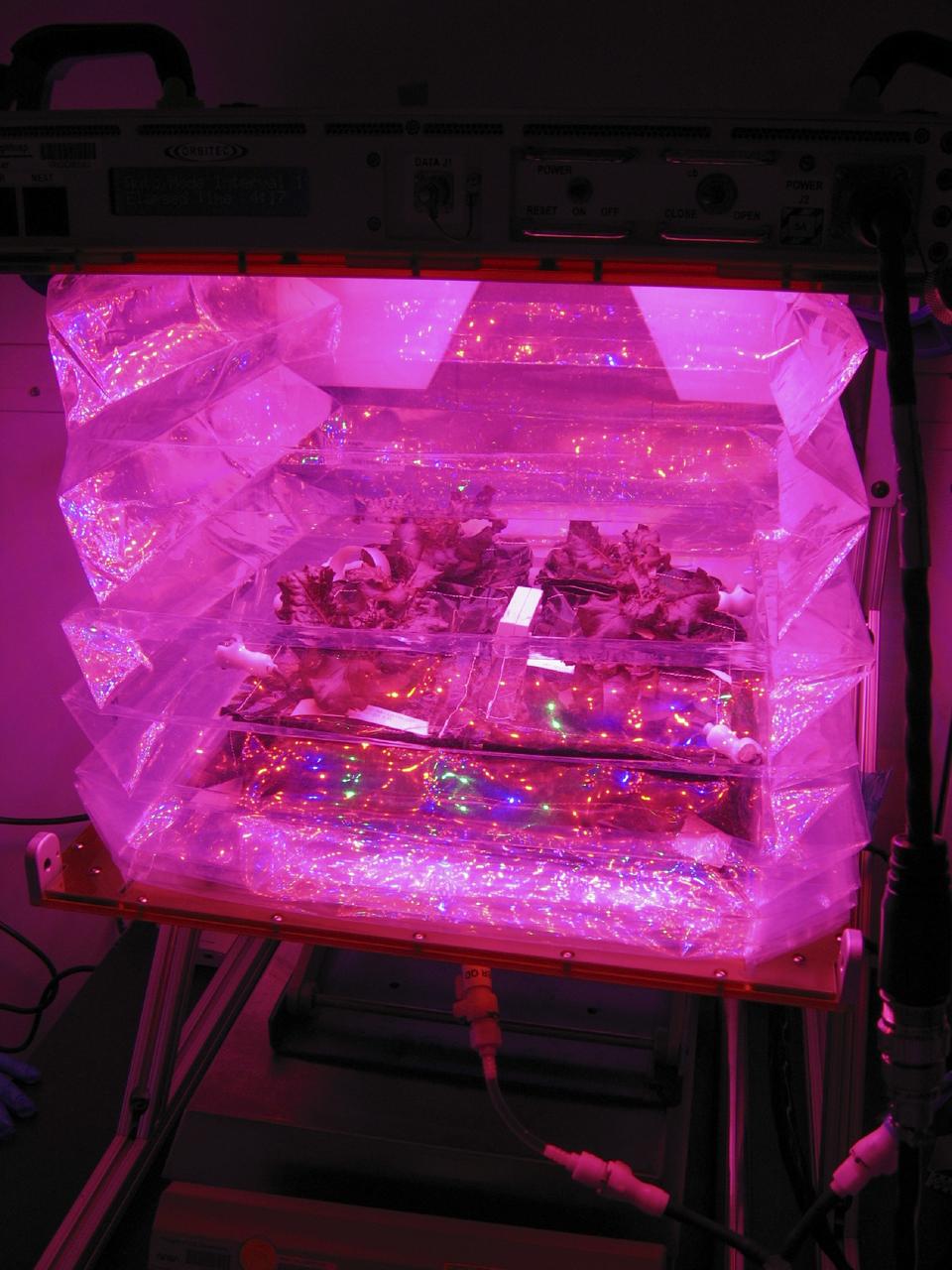
CAPE CANAVERAL, Fla. –Outredgeous red romaine lettuce plants grow inside the bellows of a prototype VEGGIE flight pillow. U.S. astronauts living and working aboard the International Space Station are going to receive a newly developed Vegetable Production System VEGGIE. VEGGIE is set to launch aboard SpaceX's Dragon capsule on NASA's third Commercial Resupply Services mission targeted to launch Dec. 9 from Space Launch Complex 40 at Cape Canaveral Air Force Station in Florida. Photo credit: NASA/Gioia Massa
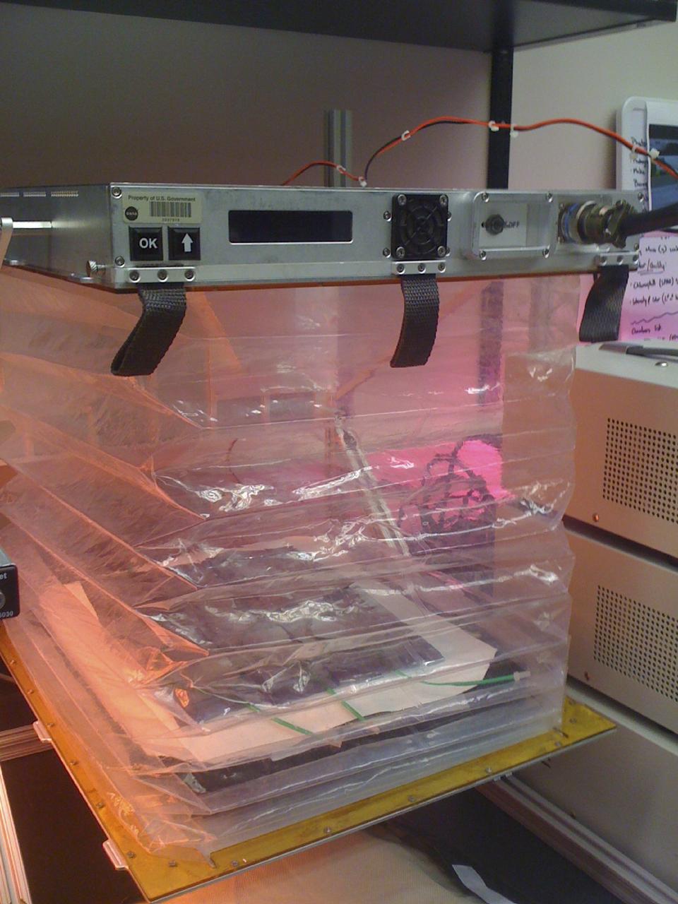
CAPE CANAVERAL, Fla. – This prototype VEGGIE hardware was designed and built by Orbital Technologies Corp. of Madison, Wisc. U.S. astronauts living and working aboard the International Space Station are going to receive a newly developed Vegetable Production System VEGGIE. VEGGIE is set to launch aboard SpaceX's Dragon capsule on NASA's third Commercial Resupply Services mission targeted to launch Dec. 9 from Space Launch Complex 40 at Cape Canaveral Air Force Station in Florida. Photo credit: NASA/Gioia Massa
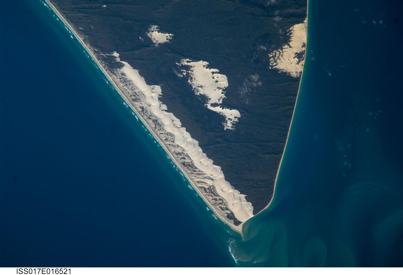
ISS017-E-016521 (15 Sept. 2008) --- Sandy Cape and Fraser Island, Australia are featured in this image photographed by an Expedition 17 crewmember on the International Space Station. Fraser Island, the world's largest sand island, includes Great Sandy National Park and is located along the coastline of Queensland, Australia. The island was designated a World Heritage site in 1992, in part due to its outstanding preservation of geological processes related to sand dune formation. According to scientists, the island's dune fields preserve a record of sand deposition and movement related to sea level rise and fall extending back over 700,000 years. In addition to sand dunes, the island also preserves an interesting range of vegetation -- including vine rainforest, stands of eucalypt trees, and mangroves -- and diverse fauna including crabs, parrots, sugar gliders and flying foxes. This view highlights the northernmost portion of the island, known as Sandy Cape. Active white sand dunes contrast with dark green vegetation that anchors older dune sets. Irregular patches of sand dunes surrounded by vegetation are known as sand blows (or blowouts), formed when the vegetation cover is disturbed -- by wind, fire, or human activities. The exposed underlying sand can then move and form new dunes, sometimes at rates of up to one meter per year. Coastal sand dune fields -- such as the one located along the eastern side of Sandy Cape (center) -- will remain active until anchored by vegetation, or until no more sand is available to form new dunes.

"About 10 years ago, I started taking improv comedy classes when I lived back in Atlanta. It really teaches you how to go with the flow, to be present in a situation, to be ready for things to go wrong, and to be able to jump in and save a conversation or help somebody who is struggling to find the right words. These are things we do in our everyday lives that we can also do on stage, and I love that aspect of it. "I started using the tools of comedy to rewrite popular songs – such as from the musical Hamilton – to be about space. I love making people laugh and smile and think there’s something really special about finding things funny or amusing in a respectful way. It is a different level of connection than, ‘Oh, that's interesting.’ It ignites a different emotional response in you, and I think there’s a place for that in science communication as well. "Often in popular culture, there’s a bit of a stigma around people who enjoy learning about space and science; that it’s only for nerds. But if you insert it into a genre that you wouldn't normally find it in, like music or comedy, then suddenly you’re connecting with people on a different level. They might not go out and read a textbook, but they might come away from a song or a comedy show thinking, ‘Huh, I thought I was just going to this event for entertainment, but I actually learned something.’ That’s cool! It’s like you’re seasoning it or putting a little sugar in it. "Something improv comedy taught me is: When you start to let go and not take yourself too seriously and embrace the spontaneity of a situation, that’s really freeing, and people respond well to that." Elizabeth Landau, Senior Communications Specialist for NASA’s Science Mission Directorate, poses for a portrait, Friday, July 30, 2021, in Washington. Photo Credit: (NASA/Bill Ingalls)

This is the 3rd entry of the TTBW model in 14x22. This test specifically is a lateral-directional test looking at the effects of 3D printed ventral, keel, and dorsal strakes on the stability and control characteristics of the model. Cooperative agreement between Boeing and NASA.
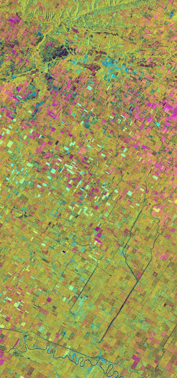
This is an X-band seasonal image of the Altona test site in Manitoba, Canada, about 80 kilometers (50 miles) south of Winnipeg. The image is centered at approximately 49 degrees north latitude and 97.5 degrees west longitude. This image was acquired by the Spaceborne Imaging Radar-C and X-band Synthetic Aperture Radar (SIR-C/X-SAR) aboard the space shuttle Endeavour on April 11, 1994, during the first flight of the radar system, and on October 2, 1994, during the second flight of SIR-C/X-SAR. The image channels have the following color assignments: red represents data acquired on April 11, 1994; green represents data acquired on October 2, 1994; blue represents the ratio of the two data sets. The test site is located in the Red River Basin and is characterized by rich farmland where a variety of crops are grown, including wheat, barley, canola, corn, sunflowers and sugar beets. This SIR-C/X-SAR research site is applying radar remote sensing to study the characteristics of vegetation and soil moisture. The seasonal comparison between the April and October 1994 data show the dramatic differences between surface conditions on the two dates. At the time of the April acquisition, almost all agricultural fields were bare and soil moisture levels were high. In October, however, soils were drier and while most crops had been harvested, some standing vegetation was still present. The areas which are cyan in color are dark in April and bright in October. These represent fields of standing biomass (amount of vegetation in a specified area) and the differences in brightness within these cyan fields represent differences in vegetation type. The very bright fields in October represent standing broadleaf crops such as corn, which had not yet been harvested. Other standing vegetation which has less biomass, such as hay and grain fields, are less bright. The magenta indicates bare soil surfaces which were wetter (brighter) in April than in October. The variations in brightness of the magenta indicate differences in the degree of soil moisture change and differences in surface roughness. This seasonal composite demonstrates the sensitivity of radar to changes in agricultural surface conditions such as soil moisture, tillage, cropping and harvesting. http://photojournal.jpl.nasa.gov/catalog/PIA01742
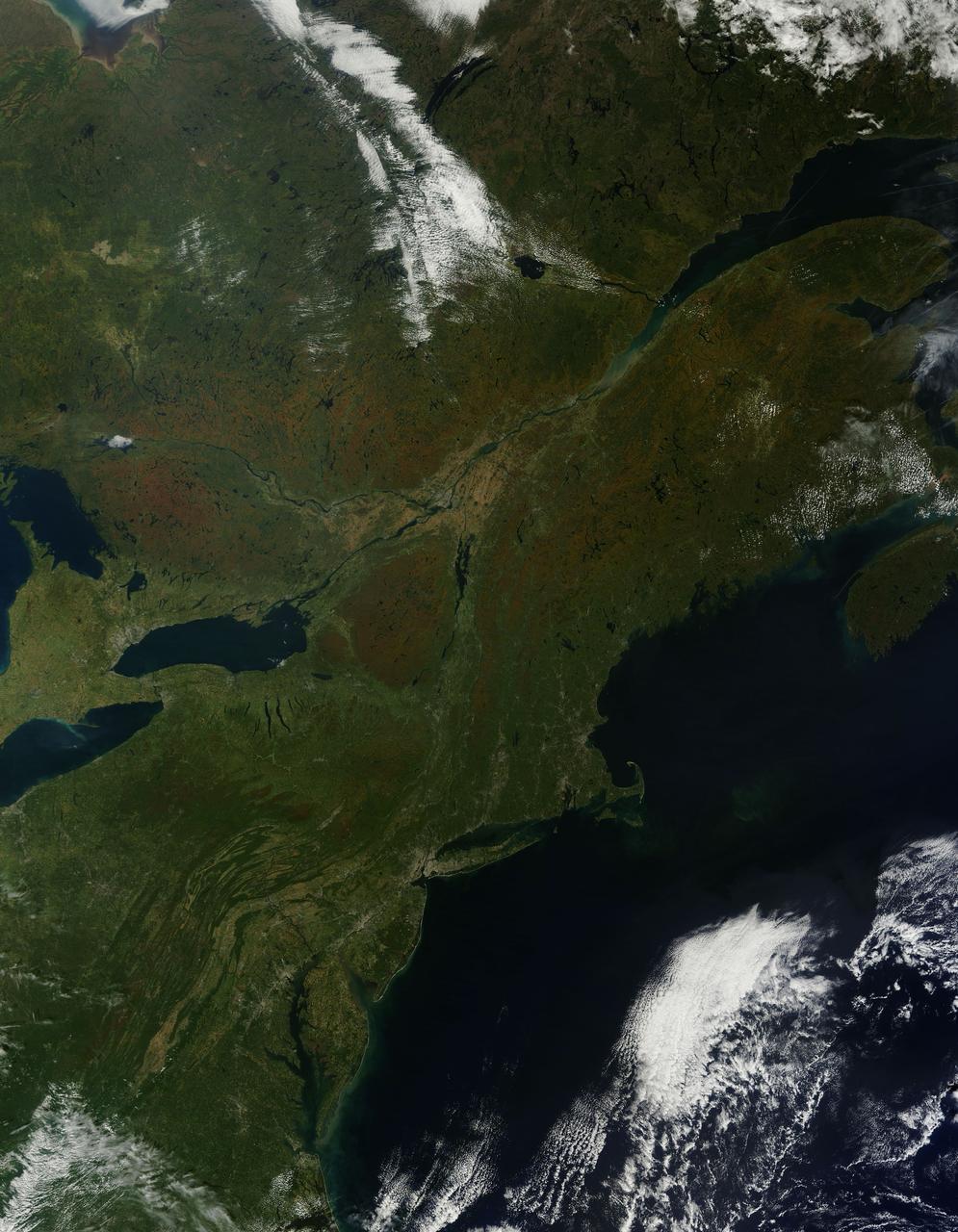
As temperatures dropped and daylight began to shorten, autumn colors began to wash over the deciduous forests of North America. The Moderate Resolution Imaging Spectroradiometer (MODIS) aboard NASA’s Terra satellite captured this true-color image of the northeastern United States and Canada on September 27, 2014. Washes of orange, brown and yellow are brightest in the Upper Peninsula of Michigan, upstate New York, New Hampshire, Vermont, Maine, and southern Quebec and Ontario. Also, faint traces of phytoplankton blooms can be seen in the offshore waters of the Atlantic Ocean. The transition of autumn leaves from green, to glowing with colors, to browning and dropping to the ground, involve several complex interactions and reactions. However, length of sunlight and the temperature changes are dominant factors. Topography also plays a role, as does latitude. Temperature tends to drop faster at higher elevations and at higher latitudes, and day length shortens more quickly at higher latitudes. Color change tends to begin in the north and sweep southward, and change begins at mountain tops then moves into valleys. As explained by the U.S. Forest Service, certain species of trees produce certain colors. Oaks generally turn red, brown, or russet; hickories become golden bronze; aspen and yellow-poplar turn golden. Maples differ by species. Red maple turns brilliant scarlet; sugar maple, orange-red; and black maple, yellow. Leaves of some trees, such as elms, simply become brown. Credit: NASA/GSFC/Jeff Schmaltz/MODIS Land Rapid Response Team <b><a href="http://www.nasa.gov/audience/formedia/features/MP_Photo_Guidelines.html" rel="nofollow">NASA image use policy.</a></b> <b><a href="http://www.nasa.gov/centers/goddard/home/index.html" rel="nofollow">NASA Goddard Space Flight Center</a></b> enables NASA’s mission through four scientific endeavors: Earth Science, Heliophysics, Solar System Exploration, and Astrophysics. Goddard plays a leading role in NASA’s accomplishments by contributing compelling scientific knowledge to advance the Agency’s mission. <b>Follow us on <a href="http://twitter.com/NASAGoddardPix" rel="nofollow">Twitter</a></b> <b>Like us on <a href="http://www.facebook.com/pages/Greenbelt-MD/NASA-Goddard/395013845897?ref=tsd" rel="nofollow">Facebook</a></b> <b>Find us on <a href="http://instagram.com/nasagoddard?vm=grid" rel="nofollow">Instagram</a></b>
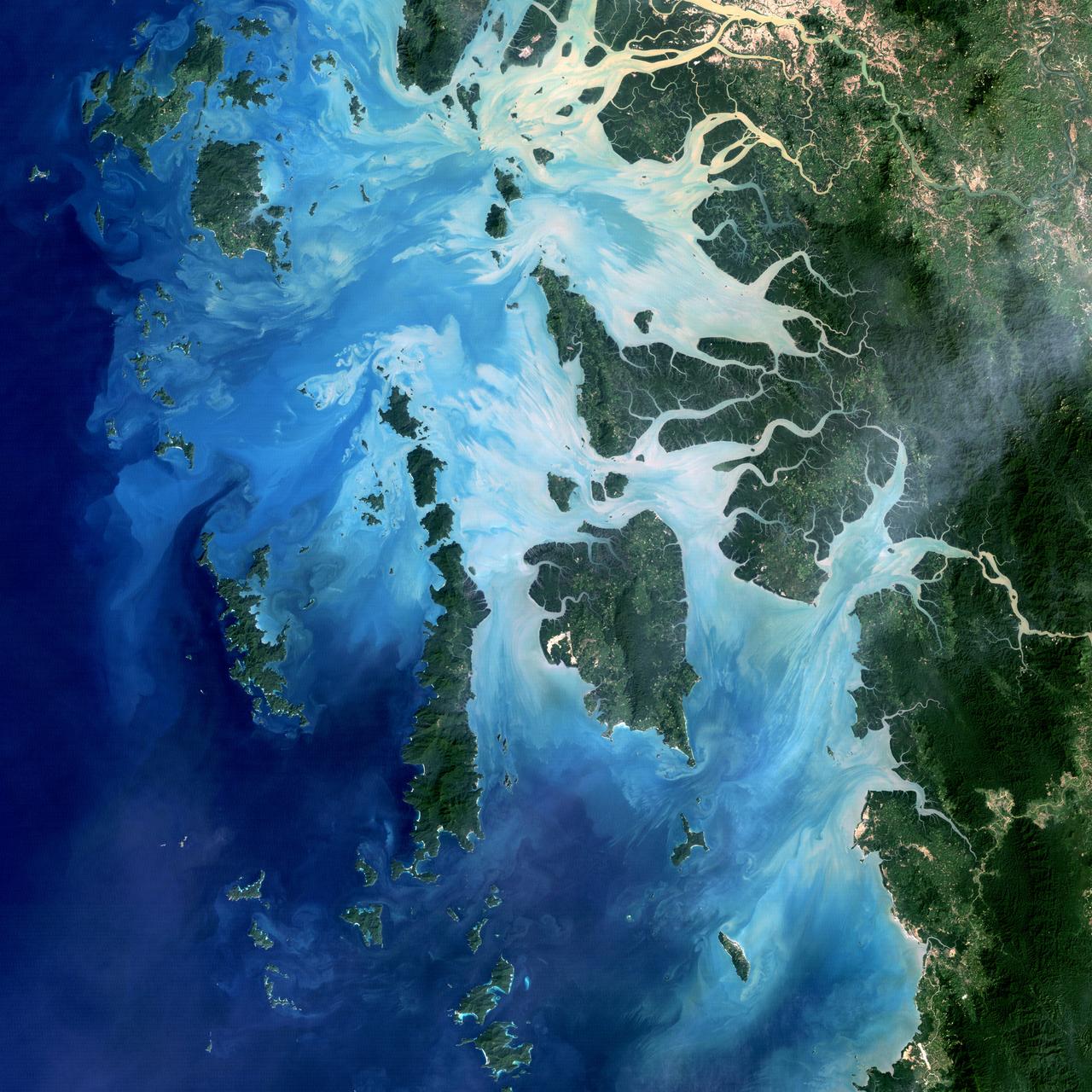
NASA image acquired December 14, 2004 In the southernmost reaches of Burma (Myanmar), along the border with Thailand, lies the Mergui Archipelago. The archipelago in the Andaman Sea is made up of more than 800 islands surrounded by extensive coral reefs. This natural color image acquired by Landsat 5 on Dec. 14, 2004, shows the middle portion of the archipelago, including Auckland and Whale Bays. Swirling patterns are visible in the near-shore waters as sediments carried by rivers slowly settle out and are deposited on the seafloor. The heavy sediment loads make the river appear nearly white. As those sediments settle out, the seawater appears deeper shades of blue. The tropical rainforests of the region appear deep green. Captain Thomas Forrest of the East India Company first described the region to Europeans after a 1782 expedition in search of potential sugar-growing lands. At that time, the islands were mainly inhabited by a nomadic fishing culture. These people, known as the Moken, still call the archipelago home and mostly live a hunter-gatherer lifestyle. As of 2006, 2,000 Moken were known to inhabit the Burmese portion of Mergui. The small population of the archipelago has helped preserve its high diversity of plants and animals. In 1997, Burma opened the region to foreign tourism and in the years since it has become a major diving destination. A valued species of pearl oyster (Pinctada maxima) are found in nearby waters. Today, overfishing is emerging as a regional problem. Landsat image created by Michael Taylor, Landsat Project Science Office. Caption by Laura Rocchio. Instrument: Landsat 5 - TM To read more go to: <a href="http://1.usa.gov/TDmjsk" rel="nofollow">1.usa.gov/TDmjsk</a> Credit: <b><a href="http://www.earthobservatory.nasa.gov/" rel="nofollow"> NASA Earth Observatory</a></b> <b><a href="http://www.nasa.gov/audience/formedia/features/MP_Photo_Guidelines.html" rel="nofollow">NASA image use policy.</a></b> <b><a href="http://www.nasa.gov/centers/goddard/home/index.html" rel="nofollow">NASA Goddard Space Flight Center</a></b> enables NASA’s mission through four scientific endeavors: Earth Science, Heliophysics, Solar System Exploration, and Astrophysics. Goddard plays a leading role in NASA’s accomplishments by contributing compelling scientific knowledge to advance the Agency’s mission. <b>Follow us on <a href="http://twitter.com/NASA_GoddardPix" rel="nofollow">Twitter</a></b> <b>Like us on <a href="http://www.facebook.com/pages/Greenbelt-MD/NASA-Goddard/395013845897?ref=tsd" rel="nofollow">Facebook</a></b> <b>Find us on <a href="http://instagram.com/nasagoddard?vm=grid" rel="nofollow">Instagram</a></b>
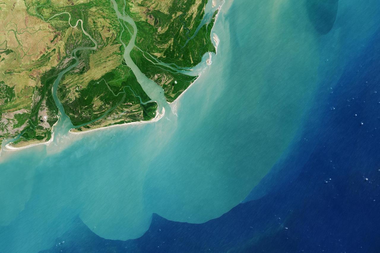
It drains a watershed that spans eight countries and nearly 1.6 million square kilometers 600,000 square miles. The Zambezi also Zambeze is the fourth largest river in Africa, and the largest east-flowing waterway. The Operational Land Imager on the Landsat 8 satellite acquired this natural-color image of the Zambezi Delta on August 29, 2013. Sandbars and barrier spits stretch across the mouths of the delta, and suspended sediment extends tens of kilometers out into the sea. The sandy outflow turns the coastal waters to a milky blue-green compared to the deep blue of open water in the Indian Ocean. The Zambezi Delta includes 230 kilometers of coastline fronting 18,000 square kilometers (7,00 square miles) of swamps, floodplains, and even savannahs (inland). The area has long been prized by subsistence fishermen and farmers, who find fertile ground for crops like sugar and fertile waters for prawns and fish. Two species of endangered cranes and one of the largest concentration of buffalo in Africa -- among many other species of wildlife -- have found a haven in this internationally recognized wetland. However, the past six decades have brought great changes to the Zambezi Delta, which used to pour more water and sediment off of the continent. Hydropower dams upstream-most prominently, the Kariba and the Cahora Bassa-greatly reduce river flows during the wet season; they also trap sediments that would otherwise flow downstream. The result has been less water reaching the delta and the floodplains, which rely on pulses of nutrients and sediments from annual (and mostly benign) natural flooding. The change in the flow of the river affects freshwater availability and quality in the delta. Strong flows push fresh water further out into the sea and naturally keep most of a delta full of fresh (or mostly fresh) water. When that fresh flow eases, the wetlands become drier and more prone to fire. Salt water from the Indian Ocean also can penetrate further into the marsh, upsetting the ecological balance for aquatic plant and animal species. Researchers have found that the freshwater table in the delta has dropped as much as five meters in the 50 years since dams were placed on the river. Less river flow also affects the shape and extent of the delta. Today there is less sediment replenishing the marshes and beaches as they are scoured by ocean waves and tides. "What strikes me in this image is the suspended sediment offshore," said Liviu Giosan, a delta geologist at the Woods Hole Oceanographic Institution. "Sediment appears to be transferred from the delta offshore in plumes that not only originate in active river mouths but also from deactivated former mouths, now tidal channels. This shows the power of tidal scouring contributing to the slow but relentless erosion of the delta." http://photojournal.jpl.nasa.gov/catalog/PIA18155