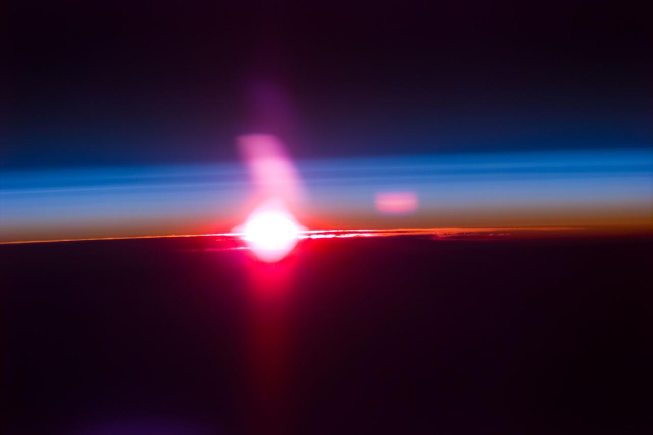
S77-E-5073 (22 May 1996) --- From its position at 175 statute miles above Earth, the Space Shuttle Endeavour has encountered some colorful and attractive scenes heading into sunsets and sunrises. This particular encounter, captured with an Electronic Still Camera (ESC), occurred on flight day four, during which the six-member crew deployed the Passive Aerodynamically Stabilized Magnetically Damped Satellite (PAMS) - Satellite Test Unit (STU).
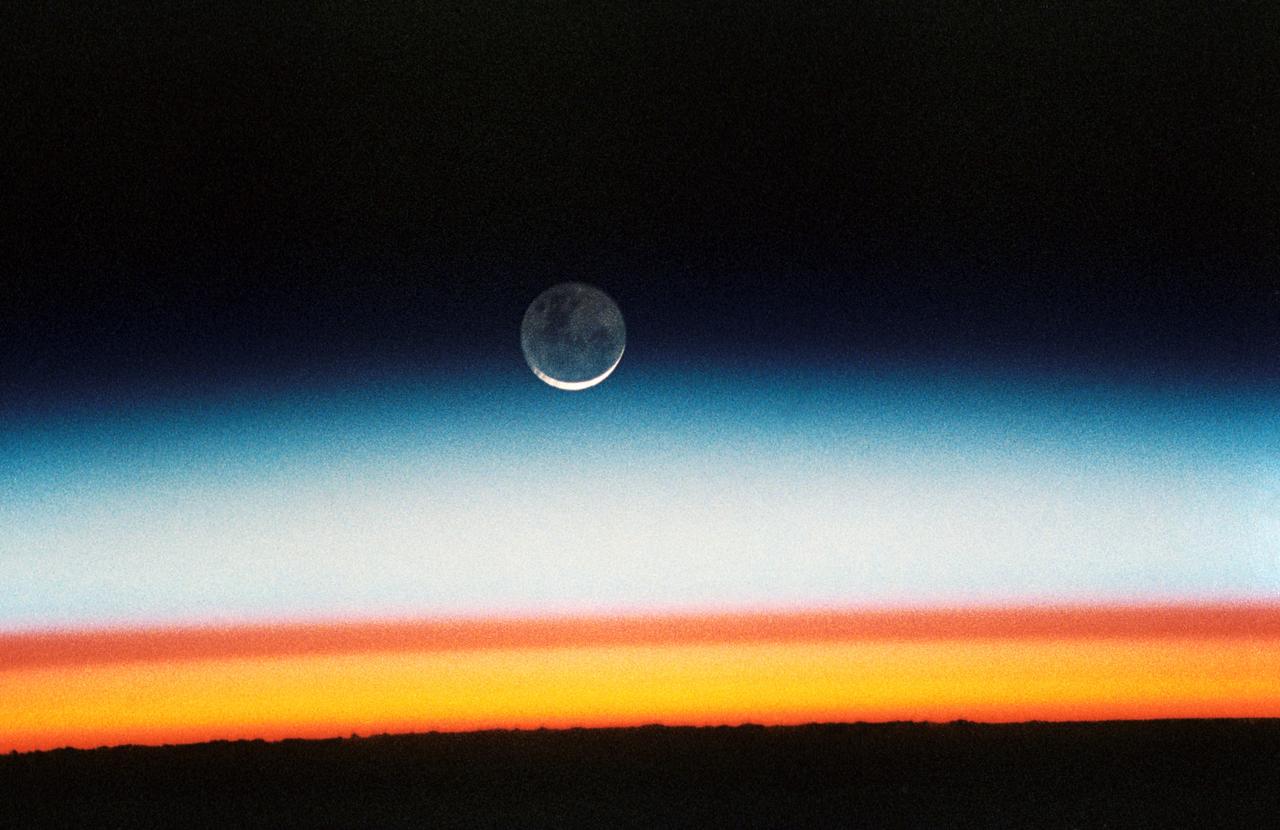
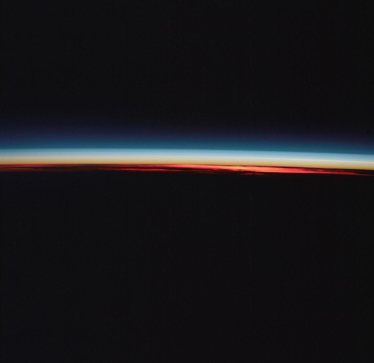
STS052-23-022 (22 Oct.-1 Nov. 1992) --- As the Space Shuttle Columbia orbited Earth in an easterly direction over the Indian Ocean, moonrise was followed quickly by sunrise. The photograph was taken from an altitude of 285 kilometers (154 nautical miles), over Lake Tanganyika in central Africa. The Sun was still 28 degrees below the horizon and not yet illuminating the dark band of low-level clouds on the limb 1,850 kilometers (l,000 nautical miles) away. Ranging from 13--18 kilometers above these low-level clouds is a brown layer at the tropical tropopause. A tropopause is a major atmospheric temperature inversion which isolates the troposphere from the stratosphere and effectively concentrates particulate from both above and below this level.
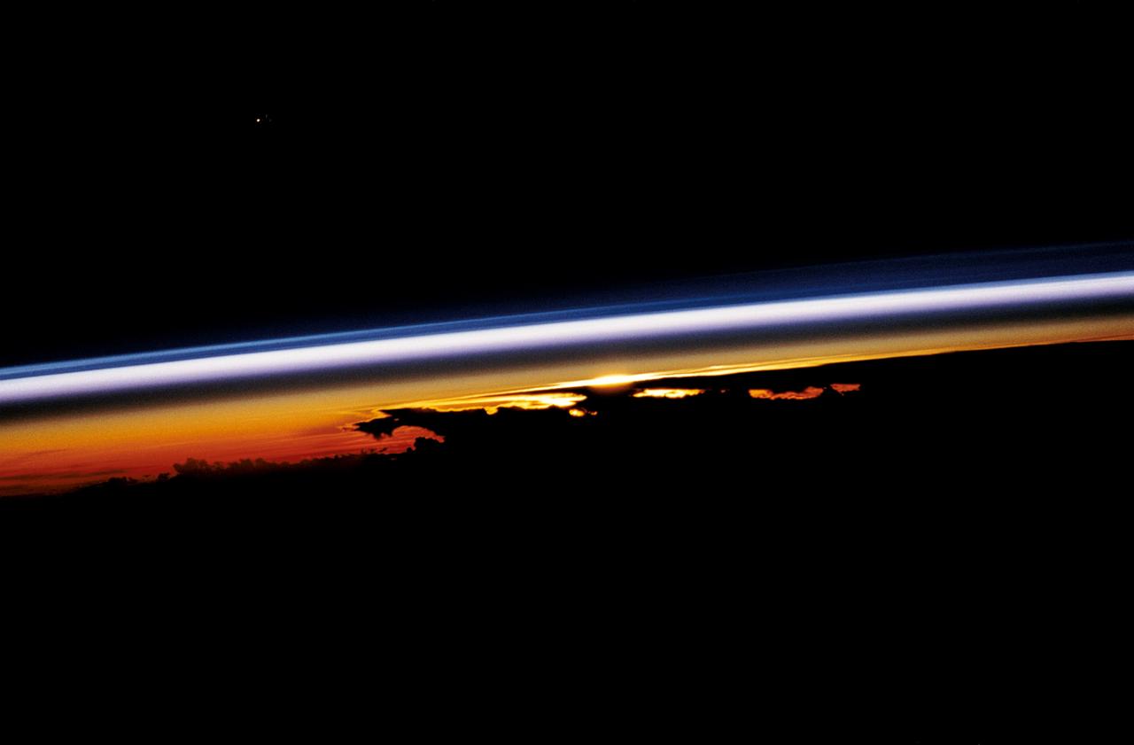
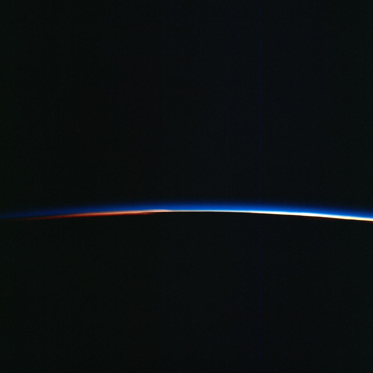
STS047-54-018 (12-20 Sept. 1992) --- The colors in this photograph provide insight into the relative density of the atmosphere. The crew members had many opportunities to witness sunrises and sunsets, considering they orbit the Earth every 90 minutes, but few, they said, compared to this scene. It captures the silhouette of several mature thunderstorms with their cirrus anvil tops spreading out against the tropopause (the top of the lowest layer of Earth's atmosphere) at sunset. The lowest layer (troposphere) is the densest and refracts light at the red end of the visible spectrum (7,400 Angstroms), while the blues (4,000 Angstroms) are separated in the least dense portion of the atmosphere (middle and upper atmosphere, or stratosphere and mesosphere). Several layers of blue can be seen. NASA scientists studying the photos believe this stratification to be caused by the scattering of light by particulate trapped in the stratosphere and mesosphere particulate that generally originate from volcanic eruptions, such as those of Mt. Pinatubo in the Philippines and, most recently, Mt. Spurr in Alaska.
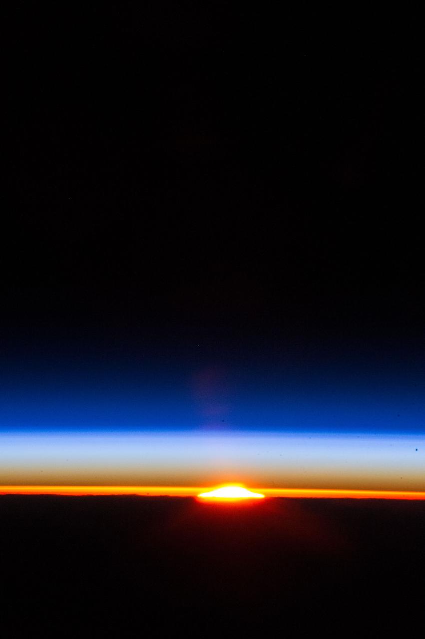
STS-43 Earth observation taken aboard Atlantis, Orbiter Vehicle (OV) 104, captures the Earth's limb at sunrise with unusual cloud patterns silhouetted by the sunlight and rising into the terminator lines.
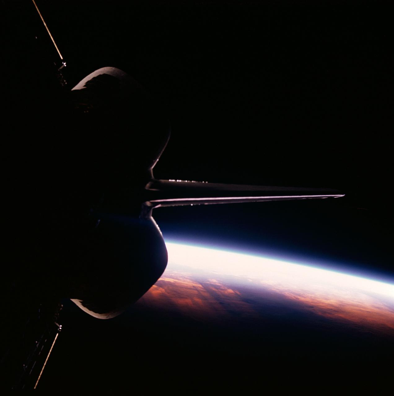
Discovery's, Orbiter Vehicle (OV) 103's, vertical stabilizer and orbital maneuvering system (OMS) pods are backdropped against the contrasted blackness of space illuminated by a colorful Earth / sunrise panorama. View was taken through the aft flight deck viewing windows during STS-26.

STS009-11-675 (December 1983) --- The Space Shuttle Columbia passes into a brilliant sunrise scene during the STS-9\Spacelab 1 mission. The photograph was taken with a 35mm camera aimed through Columbia's aft flight deck windows. Part of the science module, which hosted more than a week's scientific experimentation, is silhouetted against the scene.
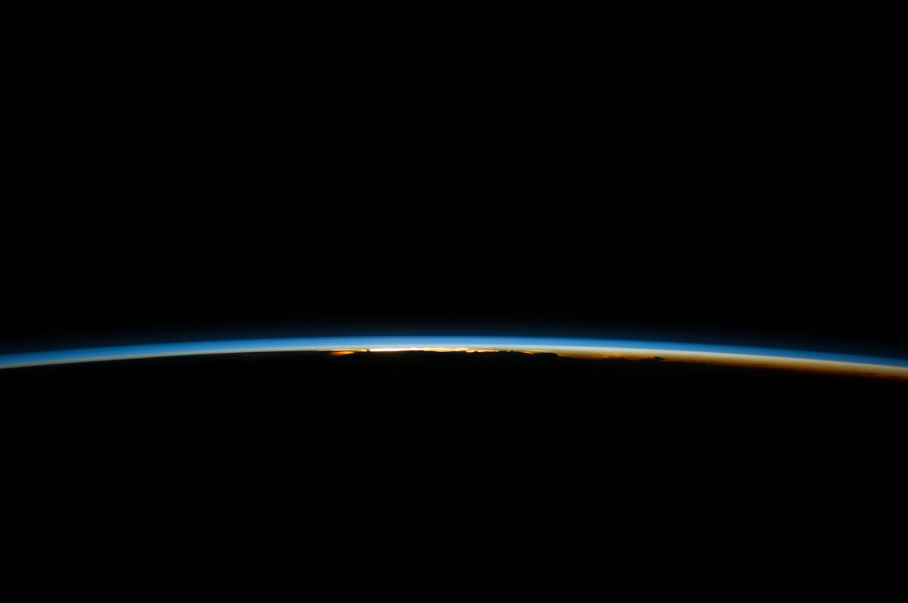
ISS040-E-008344 (8 June 2014) --- The thin line of Earth's atmosphere and the blackness of space are featured in this image photographed by an Expedition 40 crew member on the International Space Station.
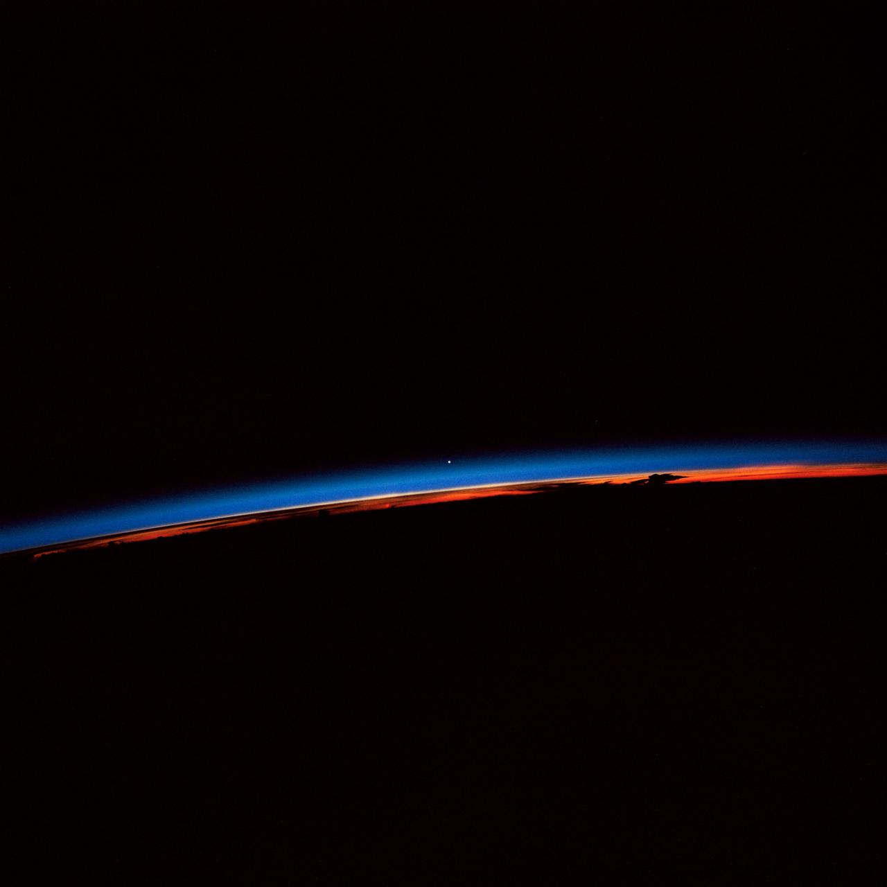
STS-30 Earth observation captured by crewmembers onboard Atlantis, Orbiter Vehicle (OV) 104, shows the sunset over the Earth as well as the planet Venus near the center of the frame. Jutting clouds are seen on the horizon, just beneath the blue strip of airglow.
ISS034-E-029363 (12 Jan. 2013) --- Earth's atmosphere has a distorting effect of the sun in this scenic panorama photographed by one of the Expedition 34 crew members aboard the International Space Station.
S66-38275 (3-6 June 1966) --- Earth's limb at sunrise as seen from the orbiting Gemini-9 spacecraft during its three-day mission in space. Taken with a modified 70mm Hasselblad camera, using Eastman Kodak, Ektachrome MS (S.O. 217) color film. Photo credit: NASA
AST-27-2339 (20 July 1975) --- The Earth’s limb at sunrise and cloud silhouettes in the Southern Hemisphere, as photographed from the Apollo spacecraft during the joint U.S.-USSR Apollo-Soyuz Test Project mission. The photograph was taken at an altitude of 230 kilometers (143 statute miles) with a 70mm Hasselblad camera using medium-speed Ektachrome QX-807 type film.
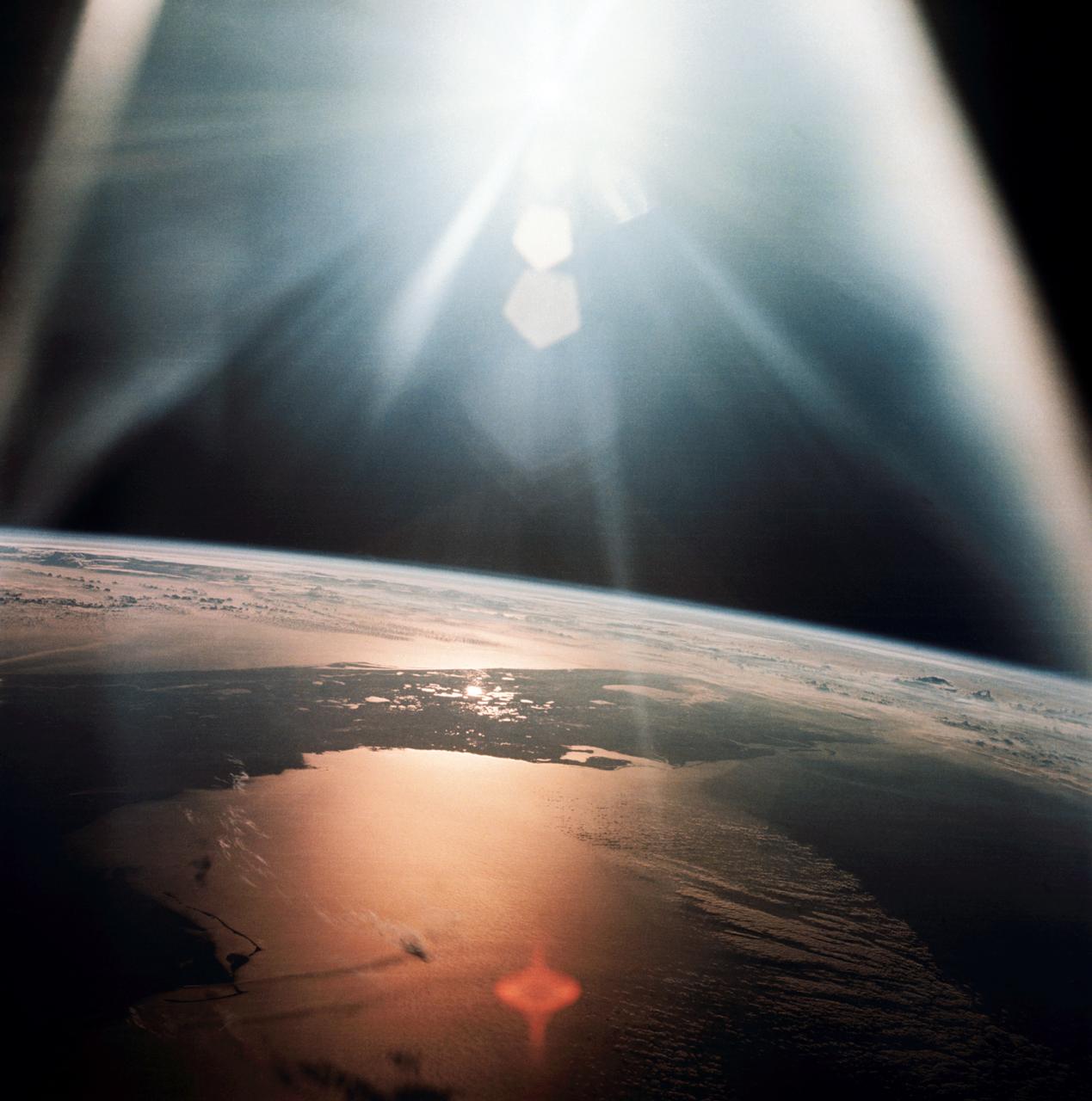
AS07-08-1933 (20 Oct. 1968) --- The morning sun reflects on the Gulf of Mexico and the Atlantic Ocean as seen from the Apollo 7 spacecraft at an altitude of 120 nautical miles above Earth. Most of Florida peninsula appears as a dark silhouette. This photograph was made during the spacecraft's 134th revolution of Earth, some 213 hours and 19 minutes after liftoff.

ISS024-E-006136 (16 June 2010) --- Polar mesospheric clouds, illuminated by an orbital sunrise, are featured in this image photographed by an Expedition 24 crew member on the International Space Station. Polar mesospheric, or noctilucent (?night shining?), clouds are observed from both Earth?s surface and in orbit by crew members aboard the space station. They are called night-shining clouds as they are usually seen at twilight. Following the setting of the sun below the horizon and darkening of Earth?s surface, these high clouds are still briefly illuminated by sunlight. Occasionally the ISS orbital track becomes nearly parallel to Earth?s day/night terminator for a time, allowing polar mesospheric clouds to be visible to the crew at times other than the usual twilight due to the space station altitude. This unusual photograph shows polar mesospheric clouds illuminated by the rising, rather than setting, sun at center right. Low clouds on the horizon appear yellow and orange, while higher clouds and aerosols are illuminated a brilliant white. Polar mesospheric clouds appear as light blue ribbons extending across the top of the image. These clouds typically occur at high latitudes of both the Northern and Southern Hemispheres, and at fairly high altitudes of 76?85 kilometers (near the boundary between the mesosphere and thermosphere atmospheric layers). The ISS was located over the Greek island of Kos in the Aegean Sea (near the southwestern coastline of Turkey) when the image was taken at approximately midnight local time. The orbital complex was tracking northeastward, nearly parallel to the terminator, making it possible to observe an apparent ?sunrise? located almost due north. A similar unusual alignment of the ISS orbit track, terminator position, and seasonal position of Earth?s orbit around the sun allowed for striking imagery of polar mesospheric clouds over the Southern Hemisphere earlier this year.
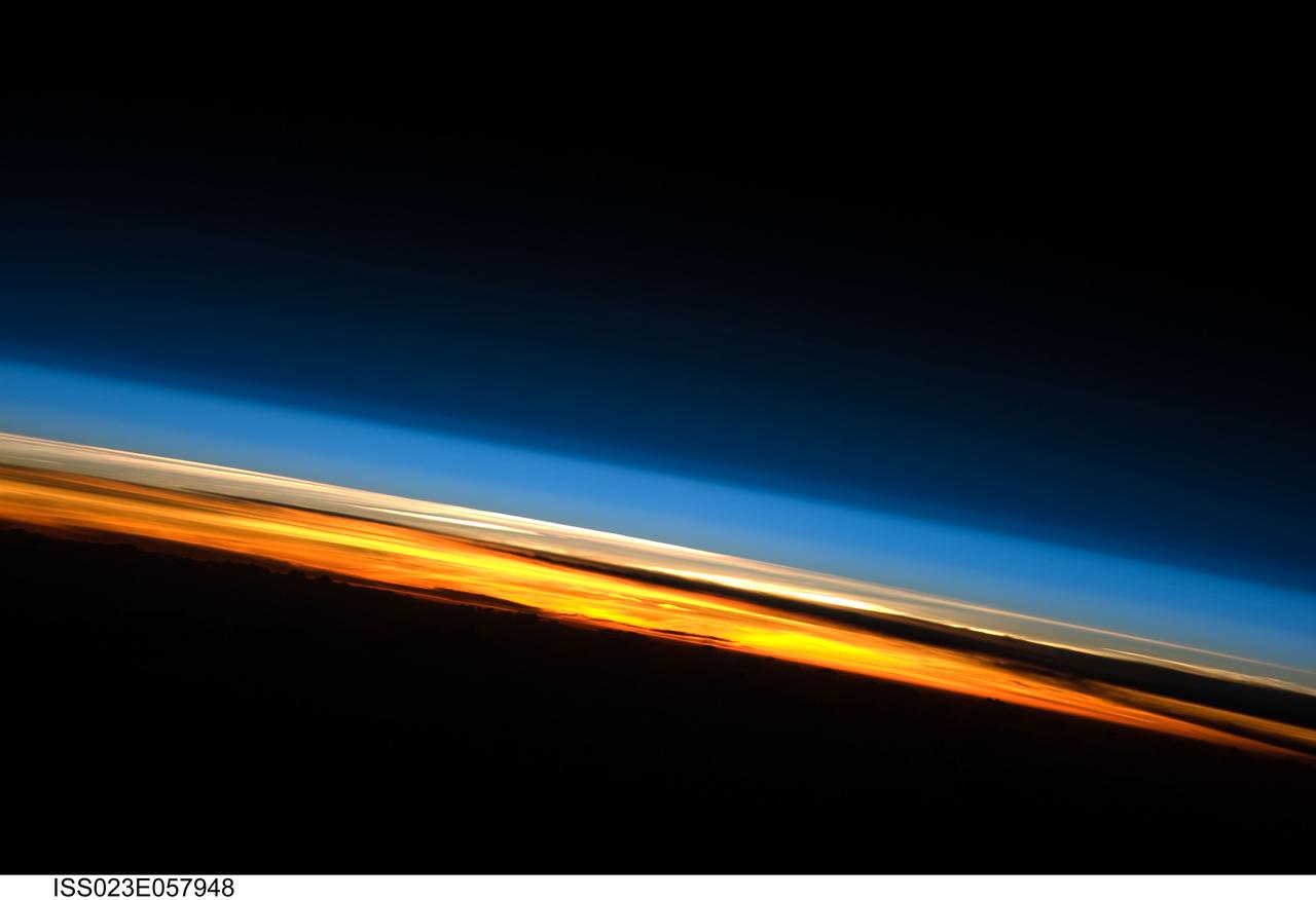
ISS023-E-057948 (25 May 2010) --- A sunset on the Indian Ocean is featured in this image photographed by an Expedition 23 crew member on the International Space Station (ISS). The image presents an edge-on, or limb view, of Earth’s atmosphere as seen from orbit. The Earth’s curvature is visible along the horizon line, or limb, that extends across the image from center left to lower right. Above the darkened surface of Earth, a brilliant sequence of colors roughly denotes several layers of the atmosphere. Deep oranges and yellows are visible in the troposphere that extends from Earth’s surface to 6-20 kilometers high. This layer contains over 80 percent of the mass of the atmosphere and almost all of the water vapor, clouds, and precipitation – several dark cloud layers are visible within this layer. Variations in the colors are due mainly to varying concentrations of either clouds or aerosols (airborne particles or droplets). The pink to white region above the clouds appears to be the stratosphere; this atmospheric layer generally has little or no clouds and extends up to approximately 50 kilometers above Earth’s surface. Above the stratosphere blue layers mark the upper atmosphere (including the mesosphere, thermosphere, ionosphere, and exosphere) as it gradually fades into the blackness of outer space. The ISS was located over the southern Indian Ocean when this image was taken, with the observer looking towards the west. Crew members aboard the space station see 16 sunrises and sunsets per day due to their high orbital velocity (greater than 28,000 kilometers per hour). The multiple chances for photography are fortunate, as at that speed each sunrise/sunset event only lasts a few seconds.
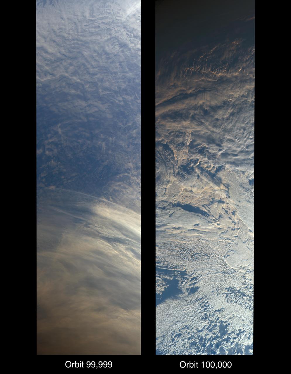
On Oct. 6, 2018, NASA's Terra satellite became one of a handful of NASA satellite ever to complete 100,000 orbits. Launched in 1999, Terra and its five scientific instruments were originally slated to last six years. More than 18 years later, the Multi-angle Imaging SpectroRadiometer (MISR), built by NASA's Jet Propulsion Laboratory in Pasadena, California, and other instruments on Terra are still collecting data and are expected to continue into the 2020s, limited only by the amount of fuel in the spacecraft. MISR carries nine cameras that view the sunlit Earth simultaneously at widely spaced angles, providing global coverage with high spatial detail. The left image shows dusk falling over snowy Queen Maud Land, Antarctica, at the end of orbit 99,999, as captured by MISR's 70-degree backward-looking camera. On the right is MISR's first view from orbit 100,000, taken by its 70-degree forward-looking camera as sunrise illuminated clouds over the Kara Sea, north of Siberia. Over the years, researchers have used MISR's observations to construct a variety of global data sets that have advanced our understanding of Earth. These include the heights of clouds and wildfire smoke, the amounts of dangerous pollutants in the atmosphere, the movements of global wind systems, and the health of vegetation. The instrument remains as healthy as it was in 1999. https://photojournal.jpl.nasa.gov/catalog/PIA22836