Scenic Overlook
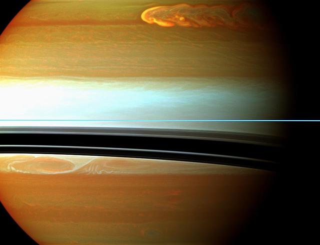
Saturn northern storm marches through the planet atmosphere in the top right of this false-color mosaic from NASA Cassini spacecraft.

Modeling Simulation and Analysis, National Aeronautics and Space Administration, NASA, Space Communications and Navigation, SCaN, SCENIC Laboratory

Winter Season Weather Scenic Photos of NASA Glenn Research Center, GRC, Acoustic Dome for Archive and Instagram; Aero-Acoustic Propulsion Laboratory, AAPL, Exterior
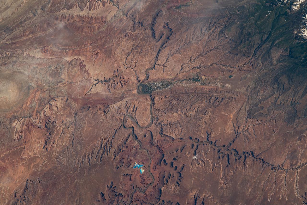
iss069e020294 (June 12, 2023) --- Moab, Utah, near the scenic Arches and Canyonlands National Parks, is pictured from the International Space Station as it orbited 258 miles above.
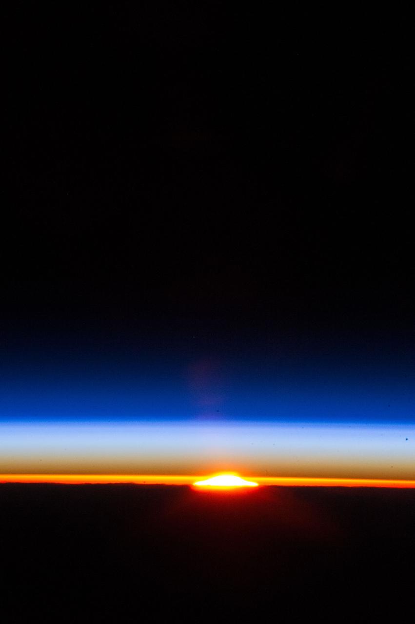
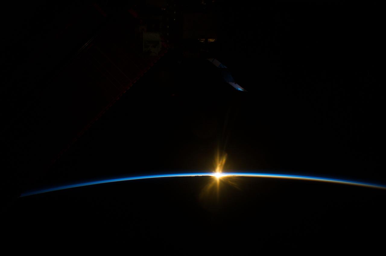
ISS034-E-029363 (12 Jan. 2013) --- Earth's atmosphere has a distorting effect of the sun in this scenic panorama photographed by one of the Expedition 34 crew members aboard the International Space Station.

jsc2022e087161 (11/16/2022) --- The Space Test Program - Houston 9 - SpaceCube Edge-Node Intelligent Collaboration (STP-H9-SCENIC) investigation mechanical closure and labeled components. Image courtesy of NASA
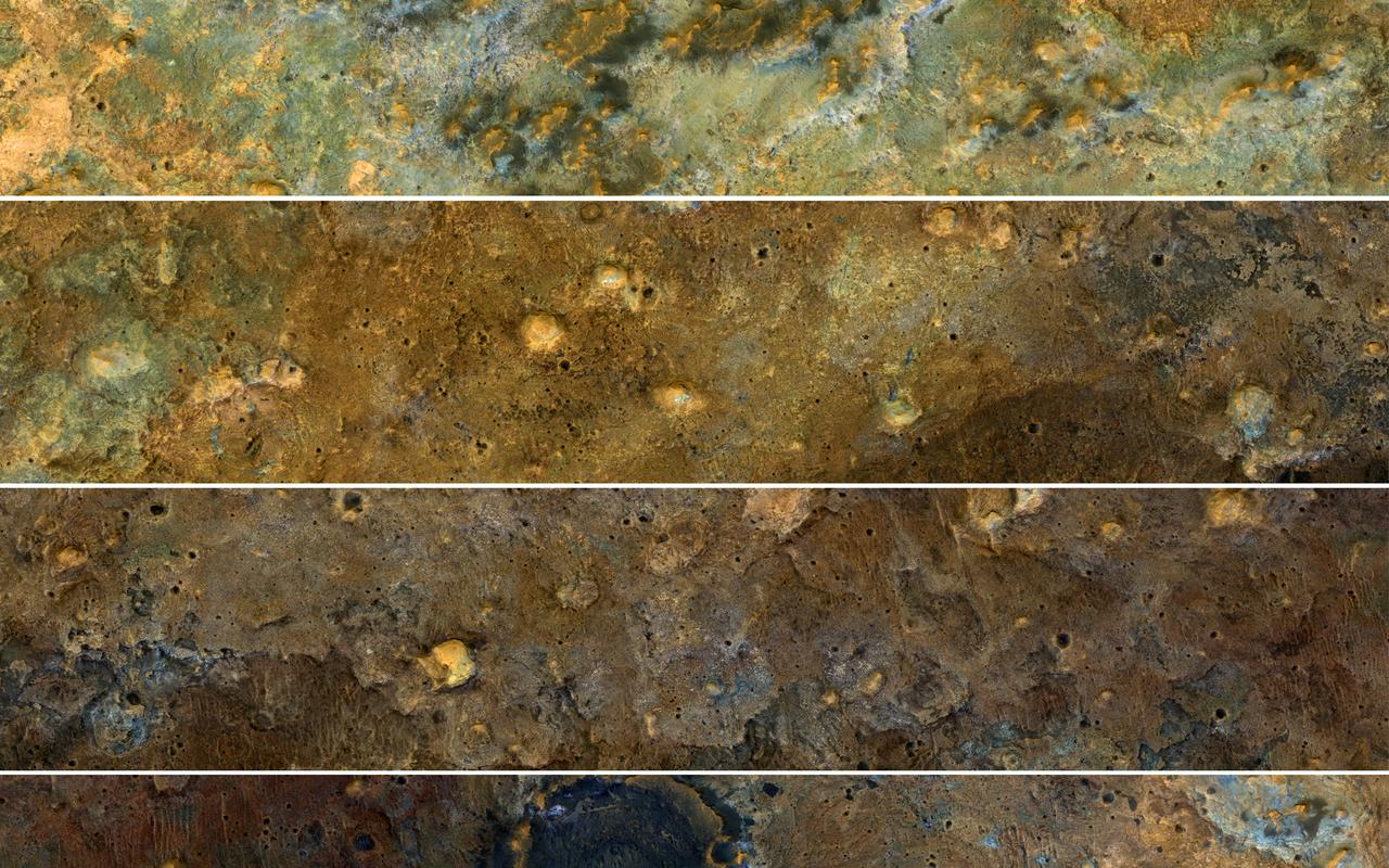
The clay-rich terrain surrounding Mawrth Vallis is one of the most scenic regions of Mars, a future interplanetary park, as seen by NASA's Mars Reconnaissance Orbiter. Here, we cut a long, oblique view into strips to see the full color coverage in more compact form. The origin of these altered layers is the subject of continued debates, perhaps to be resolved by a future rover on the surface. We do know that these layers are very ancient, dating back to a time when the environment of Mars was wetter and more habitable, if there were any inhabitants. https://photojournal.jpl.nasa.gov/catalog/PIA21871
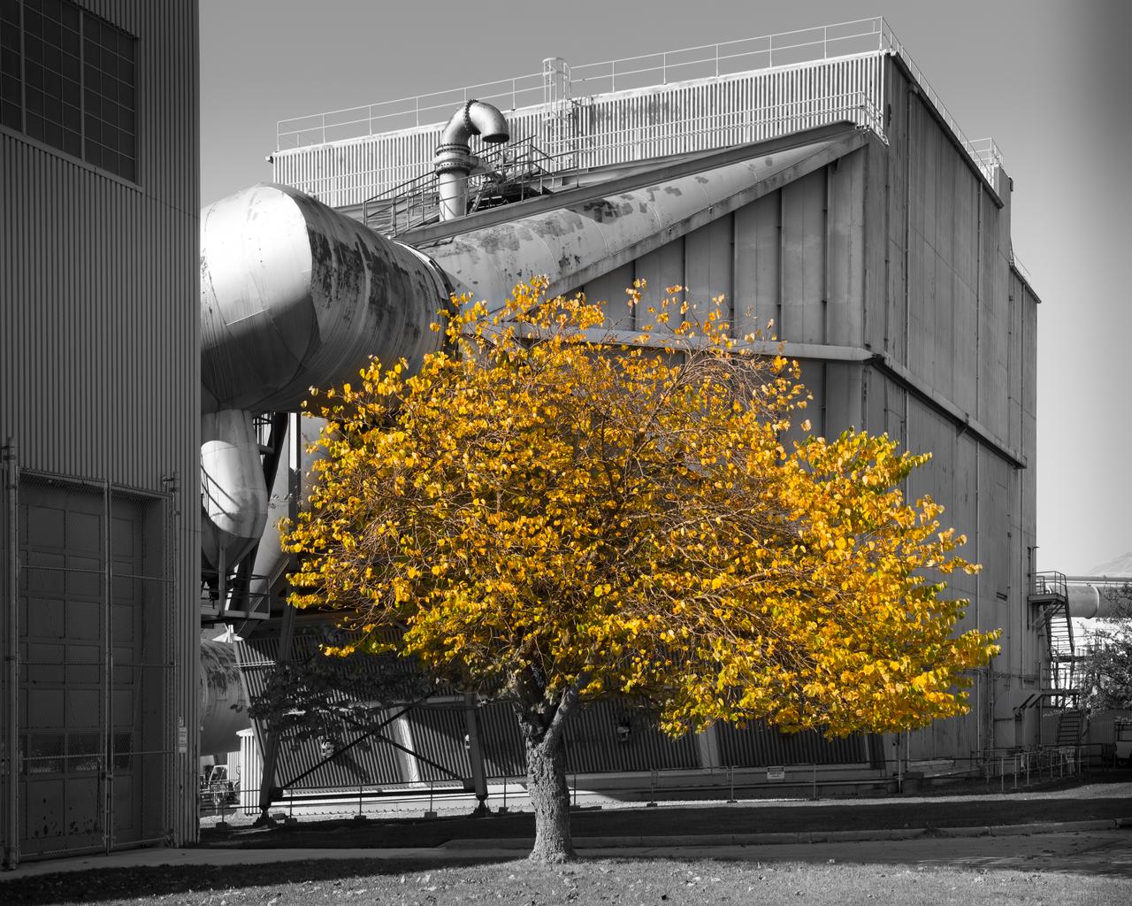
Fall Colored Tree on the Lawn of the 10x10 SWT Air Dryer Building
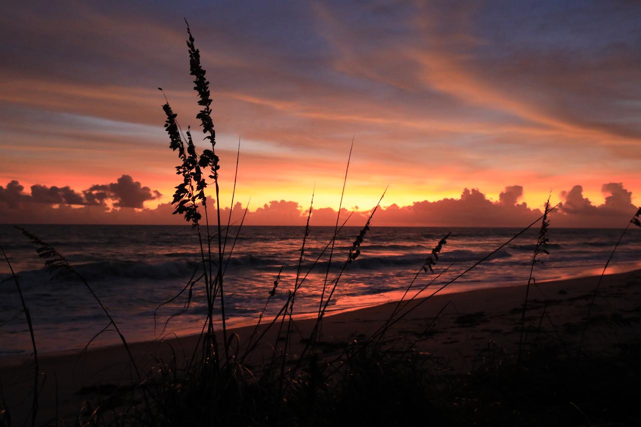
NASA’s Kennedy Space Center occupies a scenic stretch of land along Florida’s east coast, including miles of pristine beaches on the Atlantic Ocean. The agency is nearing completion on a restoration project to shore up the dunes that create a natural barrier from the waves. Once the dune is built up, native coastal vegetation will be replanted, helping to stabilize the dune and offer a habitat for Kennedy’s coastal wildlife.
SL2-81-157 (22 June 1973) --- This view of the Black Hills Region, SD (44.0N, 104.0W) shows the scenic Black Hills where Mt. Rushmore and other monuments are located. Cities and towns in this view include: Rapid City, Deadwood, and Belle Fourche with the nearby Belle Fourche Reservoir. Notable in this scene are the recovering burn scars (seen as irregular shaped light toned patches) from a 1959 forest fire in the Black Hills National Forest near the edge of the photo. Photo credit: NASA

With St. Basil’s Cathedral providing a scenic backdrop, Expedition 33/34 Flight Engineer Kevin Ford of NASA (left), Soyuz Commander Oleg Novitskiy (center) and Flight Engineer Evgeny Tarelkin (right) pose for pictures September 25, 2012 at the Kremlin Wall in Moscow as they participated in traditional ceremonies leading to their launch to the International Space Station October 23 in the Soyuz TMA-06M spacecraft from the Baikonur Cosmodrome in Kazakhstan for a five-month mission. NASA/Stephanie Stoll
ISS040-E-008351 (8 June 2014) --- During a crew member's typical stay time aboard the Earth-orbiting International Space Station, he or she will see thousands of sunsets and sunrises aboard the orbital outpost, which moves at 17,500 miles per hour. Not all of them get photographed and not all of the photographed ones are as scenic as this image, photographed by one of the Expedition 40 crew members on June 8, 2014. The image shows the sun in the center of the blue line of atmosphere on the home planet.
NASA’s Kennedy Space Center occupies a scenic stretch of land along Florida’s east coast, including miles of pristine beaches on the Atlantic Ocean. The agency is nearing completion on a restoration project to shore up the dunes that create a natural barrier from the waves. Once the dune is built up, native coastal vegetation will be replanted, helping to stabilize the dune and offer a habitat for Kennedy’s coastal wildlife.

With St. Basil’s Cathedral serving as a scenic backdrop, Expedition 33/34 Flight Engineer Evgeny Tarelkin (left), Soyuz Commander Oleg Novitskiy (center) and NASA Flight Engineer Kevin Ford (right) walk through Red Square in Moscow September 25, 2012 to participate in traditional ceremonies and the laying of flowers at the Kremlin Wall where Russian space icons are interred. The trio are scheduled to launch October 23 to the International Space Station from the Baikonur Cosmodrome in Kazakhstan on their Soyuz TMA-06M spacecraft for a five-month mission. NASA/Stephanie Stoll
S84-26294 (3 Feb 1984) --- This scenic panorama of billowy clouds over the Atlantic and Florida and the contrasting addition of mankind's technology into the picture was provided by astronaut John W. Young and a handheld camera in the cockpit of NASA's Shuttle Training Aircraft (STA) moments after the 226 tons of spacecraft hardware were lifted off Kennedy Space Center's (KSC) Launch Pad 39A. Inside the Space Shuttle Challenger (STS 41-B), attached here to its two Solid Rocket Boosters (SRB) and External Fuel Tank (ET), were astronauts Vance D. Brand, Robert L. Gibson, Ronald E. McNair, Bruce McCandless II and Robert L. Stewart.
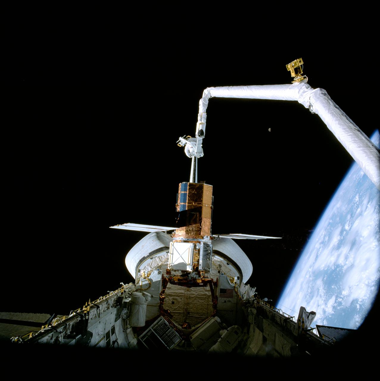
41C-37-1715 (11 April 1984) --- A scenic panorama is captured by an onboard 70mm handheld camera during the April 11, 1984, Solar Maximum Mission Satellite (SMMS) repair job aboard the Earth-orbiting Space Shuttle Challenger. The SMMS is temporarily docked at the Challenger's Flight Support System (FSS) so that astronauts George D. Nelson and James D. van Hoften could perform a series of repair tasks. The Remote Manipulator System (RMS) arm was used to move the astronauts into position for their series of chores. Note the gibbous Moon to the right of center and the horizon of the blue and white Earth in the lower right quadrant.
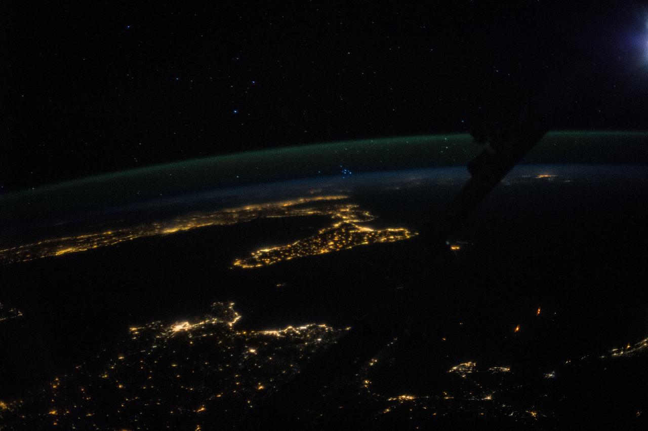
ISS036-E-025908 (29 July 2013) --- One of the Expedition 36 crew members aboard the Earth-orbiting International Space Station, as it was passing over Africa, took this night picture of Sicily (center frame) and much of Italy (frame left to frame center) on July 29, 2013. The Stretto de Messina, which separates Sicily from Italy, is near frame center. The high oblique 50mm lens shot includes a scenic horizon with a number of stars in the late July sky. Barely visible in the darkness, part of the long arm of the Space Station Remote Manipulator System or Canadarm2 runs diagonally through the right one-third of the image.
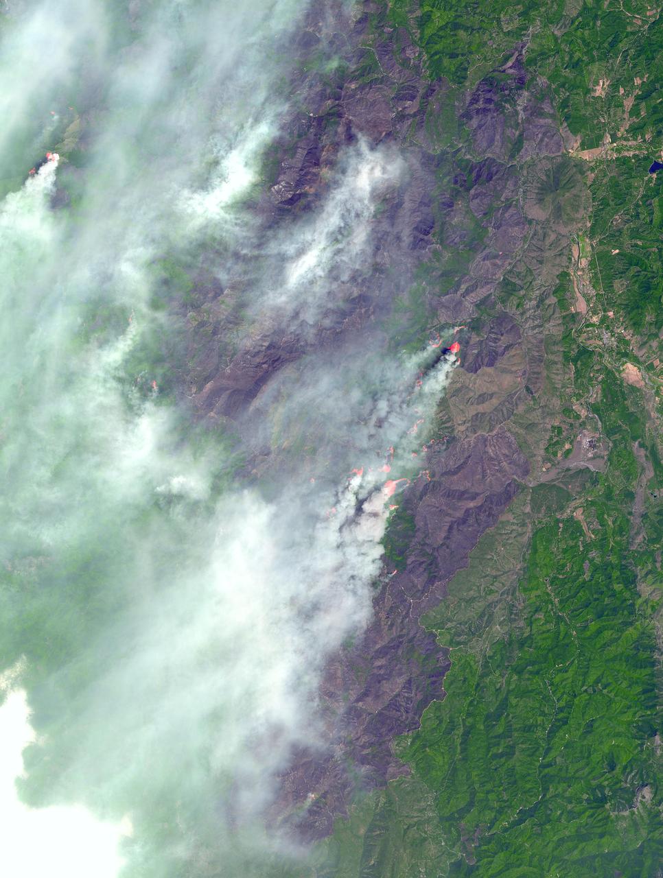
In southwest Oregon, the Biscuit Fire continues to grow. This image, acquired from the Advanced Spaceborne Thermal Emission and Reflection Radiometer (ASTER) on NASA's Terra satellite on August 14, 2002, shows the pillars of smoke arising from the fires. Active fire areas are in red. More than 6,000 fire personnel are assigned to the Biscuit Fire alone, which was 390,276 acres as of Thursday morning, August 15, and only 26 percent contained. Among the resources threatened are thousands of homes, three nationally designated wild and scenic rivers, and habitat for several categories of plants and animals at risk of extinction. Firefighters currently have no estimate as to when the fire might be contained. http://photojournal.jpl.nasa.gov/catalog/PIA03856
![This image from NASA's Mars Reconnaissance Orbiter (MRO) shows blocks of layered terrain within the Olympus Mons aureole. The aureole is a giant apron of chaotic material around the volcano, perhaps formed by enormous landslides off the flanks of the giant volcano. These blocks of layered material have been eroded by the wind into the scenic landscape we see here. The map is projected here at a scale of 25 centimeters (9.8 inches) per pixel. [The original image scale is 28.3 centimeters (11.1 inches) per pixel (with 1 x 1 binning); objects on the order of 85 centimeters (33.5 inches) across are resolved.] North is up. https://photojournal.jpl.nasa.gov/catalog/PIA22181](https://images-assets.nasa.gov/image/PIA22181/PIA22181~medium.jpg)
This image from NASA's Mars Reconnaissance Orbiter (MRO) shows blocks of layered terrain within the Olympus Mons aureole. The aureole is a giant apron of chaotic material around the volcano, perhaps formed by enormous landslides off the flanks of the giant volcano. These blocks of layered material have been eroded by the wind into the scenic landscape we see here. The map is projected here at a scale of 25 centimeters (9.8 inches) per pixel. [The original image scale is 28.3 centimeters (11.1 inches) per pixel (with 1 x 1 binning); objects on the order of 85 centimeters (33.5 inches) across are resolved.] North is up. https://photojournal.jpl.nasa.gov/catalog/PIA22181

Glenn Research Center 75th Anniversary Sign
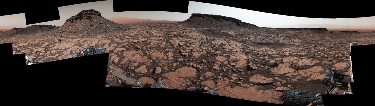
Original Caption Released with Image: This 360-degree panorama was acquired by the Mast Camera (Mastcam) on NASA's Curiosity Mars rover while the rover was in an area called "Murray Buttes" on lower Mount Sharp, one of the most scenic landscapes yet visited by any Mars rover. The view stitches together many individual images taken by Mastcam's left-eye camera on Sept. 4, 2016, during the 1,451st Martian day, or sol, of the mission. North is at both ends and south is in the center. The rover's location when it recorded this scene was the site it reached in its Sol 1448 drive. (See map at http://mars.nasa.gov/msl/multimedia/images/?ImageID=8015.) The dark, flat-topped mesa near the center of the scene rises to about 39 feet (about 12 meters) above the surrounding plain. From the rover's position, the top of this mesa is about 131 feet (about 40 meters) away, and the beginning of the debris apron at the base of the mesa is about 98 feet (about 30 meters) away. In the left half of the image, the dark butte that appears largest sits eastward from the rover and about 33 feet (about 10 meters) high. From the rover's position, the top of this butte is about 85 feet (about 26 meters) away, and the beginning of the debris apron at its base is about 33 feet (about 10 meters) away. An upper portion of Mount Sharp appears on the horizon to the right of it. The relatively flat foreground is part of a geological layer called the Murray formation, which includes lakebed mud deposits. The buttes and mesas rising above this surface are eroded remnants of ancient sandstone that originated when winds deposited sand after lower Mount Sharp had formed. They are capped by material that is relatively resistant to erosion, just as is the case with many similarly shaped buttes and mesas on Earth. The area's informal naming honors Bruce Murray (1931-2013), a Caltech planetary scientist and director of NASA's Jet Propulsion Laboratory, Pasadena, California. The scene is presented with a color adjustment that approximates white balancing, to resemble how the rocks and sand would appear under daytime lighting conditions on Earth. http://photojournal.jpl.nasa.gov/catalog/PIA20840

Flowering Crab Apple Tree in full Bloom in front of the Propulsion Systems Laboratory, PSL Cooling Tower #6 on a Foggy Day in Early Spring
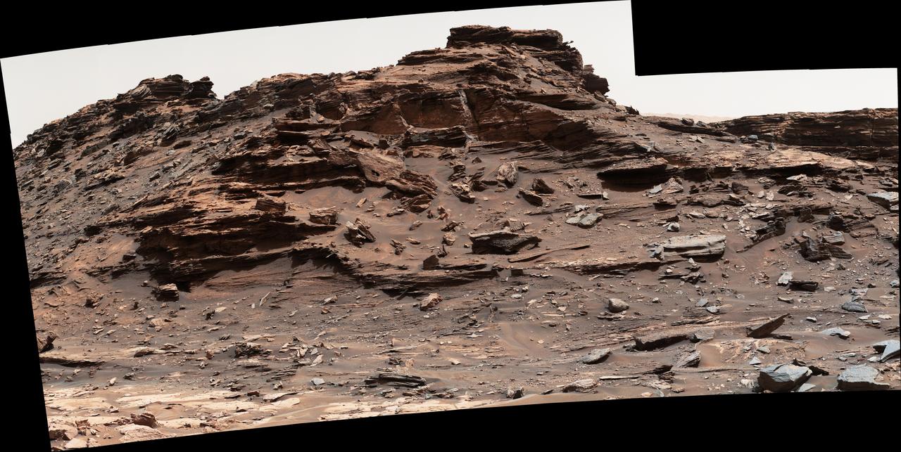
The top of the butte in this scene from the Mast Camera (Mastcam) on NASA's Curiosity Mars rover stands about 16 feet (about 5 meters) above the rover and about 82 feet (about 25 meters) east-southeast of the rover. Mastcam's right-eye (telephoto-lens) camera took the component images of this mosaic on Sept. 1, 2016, during the 1,448th Martian day, or sol, of Curiosity's work on Mars. The site is in the scenic "Murray Buttes" area, where individual buttes and mesas were assigned numbers. This one is "M9a." The average slope on the prominent ridge on the left side is more than 40 degrees, while the average slope on the right side of the highest point is about 30 degrees. The rover's location when it recorded this scene was the site it reached in its Sol 1446 drive. (See map at http://mars.nasa.gov/msl/multimedia/images/?ImageID=8009.) The scene is presented with a color adjustment that approximates white balancing, to resemble how the rocks and sand would appear under daytime lighting conditions on Earth. http://photojournal.jpl.nasa.gov/catalog/PIA20843

Aerial view cityscape from airplane at summer