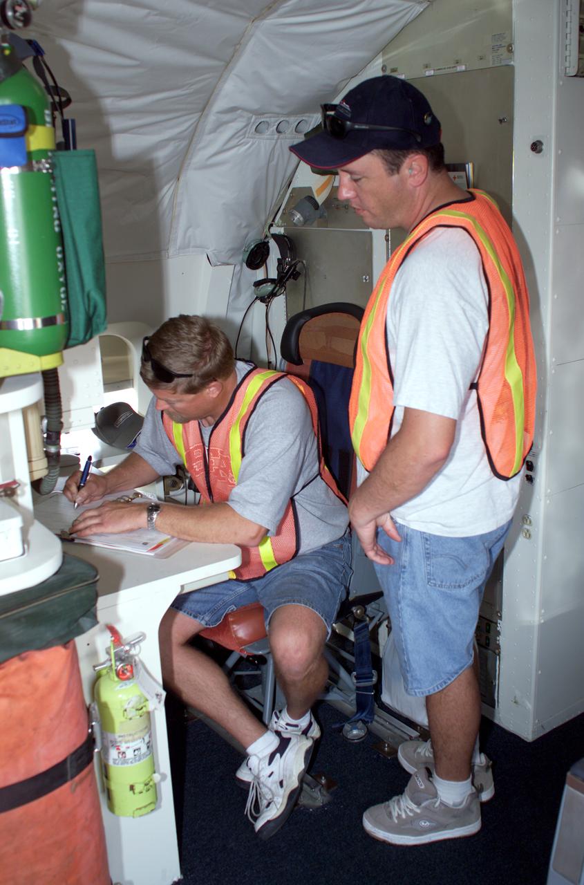
DC-8 Quality Inspector Scott Silver signs documents while Acting Crew Chief Mike Bereda looks on prior to a DC-8 AirSAR flight in Costa Rica. AirSAR 2004 Mesoamerica is a three-week expedition by an international team of scientists that uses an all-weather imaging tool, called the Airborne Synthetic Aperture Radar (AirSAR) which is located onboard NASA's DC-8 airborne laboratory. Scientists from many parts of the world including NASA's Jet Propulsion Laboratory are combining ground research done in several areas in Central America with NASA's AirSAR technology to improve and expand on the quality of research they are able to conduct. The radar, developed by NASA's Jet Propulsion Laboratory, can penetrate clouds and also collect data at night. Its high-resolution sensors operate at multiple wavelengths and modes, allowing AirSAR to see beneath treetops, through thin sand, and dry snow pack. AirSAR's 2004 campaign is a collaboration of many U.S. and Central American institutions and scientists, including NASA; the National Science Foundation; the Smithsonian Institution; National Geographic; Conservation International; the Organization of Tropical Studies; the Central American Commission for Environment and Development; and the Inter-American Development Bank.

jsc2025e044834 (7/16/2016) --- The NanoRacks-Crystallization Of Silver Nitrate in Microgravity On a Silver Cathode (NanoRacks-COSMOS) research team from Eaglecrest High School in Centennial, Colorado is photographed at Kennedy Space Center on July 18, 2016. This investigation assesses the 3D structure of silver nitrate crystals formed by electrolysis in microgravity. From Left: Dave Schlichting, Gavin Morgenneg, Scott Crowner, Lars Drieth, Ben Sheffer. Image courtesy of Dave Schlichting.
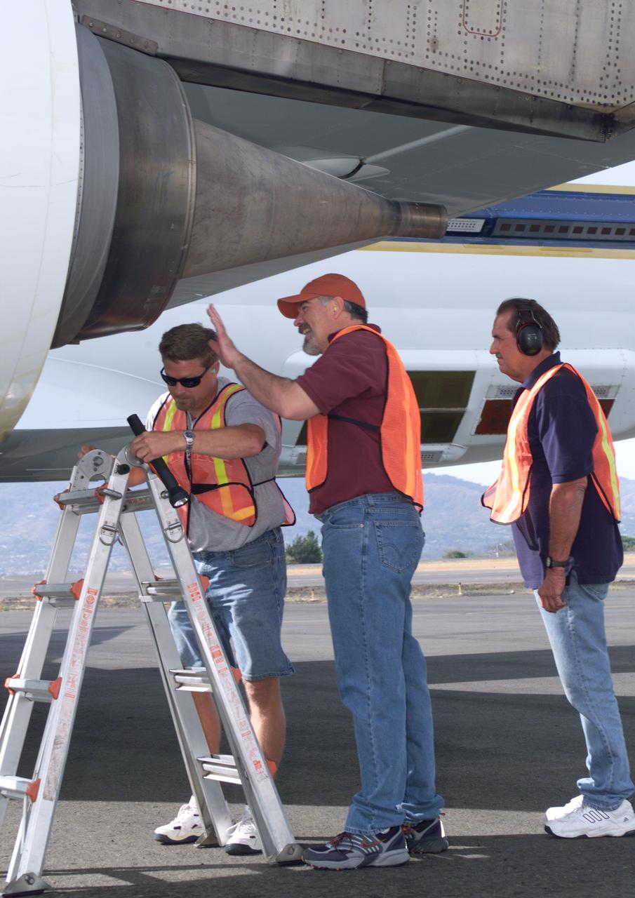
NASA Dryden DC-8 maintenance crew members inspect the aircraft prior to take-off. L-R; Scott Silver, Paul Ristrim and Mike Lakowski. AirSAR 2004 Mesoamerica is a three-week expedition by an international team of scientists that uses an all-weather imaging tool, called the Airborne Synthetic Aperture Radar (AirSAR) which is located onboard NASA's DC-8 airborne laboratory. Scientists from many parts of the world including NASA's Jet Propulsion Laboratory are combining ground research done in several areas in Central America with NASA's AirSAR technology to improve and expand on the quality of research they are able to conduct. The radar, developed by NASA's Jet Propulsion Laboratory, can penetrate clouds and also collect data at night. Its high-resolution sensors operate at multiple wavelengths and modes, allowing AirSAR to see beneath treetops, through thin sand, and dry snow pack. AirSAR's 2004 campaign is a collaboration of many U.S. and Central American institutions and scientists, including NASA; the National Science Foundation; the Smithsonian Institution; National Geographic; Conservation International; the Organization of Tropical Studies; the Central American Commission for Environment and Development; and the Inter-American Development Bank.

NASA Ames Robotics Academy Interns at the Lunar Science Institute (LSI) building 17 Interns: David Black, Michael Zwach, Guy Chriqui, Mark Mordarski Jr., Katy Levinson, Daniela Buchman, Scott Strutner, Patrick Crownover, Neil Bhateja, Michael Buchman, John Mueller, Michelle Grau, Ben Silver, Jacques Dolan, Alex Golec Windell Jones, Colin Wilson, Joe DeBlasio, Nick Hayes, Jordan Olive, William Shaw, Ames Education Dept., Mark Leon, Ames Robotics, Josh Weiner, jack Biesiadecki, Andrew Pilloud

NASA’s B200 King Air team includes, from left, principal engineer Cory Hill, operations engineer KC Sujan, pilot Tracy Phelps, crew chief Mario Soto, aircraft technician Ruben Saiza, quality assurance technician Scott Silver, and senior engineer Alexander Soibel. The compact Fire Infrared Radiance Spectral Tracker (c-FIRST) instrument was tested on the B200 aircraft – based at NASA’s Armstrong Flight Research Center in Edwards, California – over the wildfires in the Pacific Palisades and Altadena, California, on November 21, 2024.
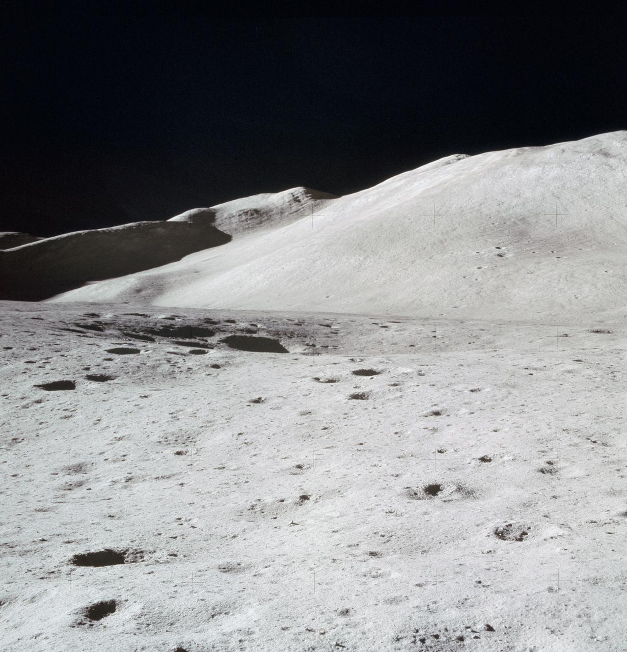
AS15-87-11748 (31 July 1971) --- A view of Hadley Delta, looking southeasterly, as photographed from the top hatch of the Apollo 15 Lunar Module (LM) by astronaut David R. Scott, commander, during his stand-up extravehicular activity (EVA) just after the LM "Falcon" touched down at the Hadley-Apennine landing site. The prominent feature on the horizon in the center of the picture was called Silver Spur by the Apollo 15 crew men. Hadley Delta Mountain rises approximately 4,000 meters (about 13,124 feet) above the plain. While astronauts Scott and James B. Irwin, lunar module pilot, descended in the LM to explore the moon, astronaut Alfred M. Worden, command module pilot, remained with the Command and Service Module's (CSM) in lunar orbit.
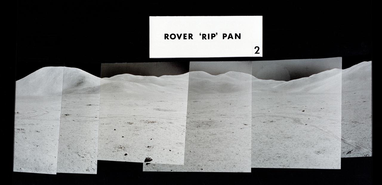
S71-43943 (2 Aug. 1971) --- Mosaic photographs which compose a 360-degree panoramic view of the Apollo 15 Hadley-Apennine landing site, taken near the close of the third lunar surface extravehicular activity (EVA) by astronauts David Scott and James Irwin. This group of photographs was designated the Rover "RIP" Pan because the Lunar Roving Vehicle was parked in its final position prior to the two crewmen returning to the Lunar Module. The astronaut taking the pan was standing 325 feet east of the Lunar Module (LM). The Rover was parked about 300 feet east of the LM. This mosaic covers a field of view from about north-northeast to about south. Visible on the horizon from left to right are: Mount Hadley; high peaks of the Apennine Mountains which are farther in the distance than either Mount Hadley or Hadley Delta Mountain; Silver Spur on the Apennine Front; and the eastern portion of Hadley Delta. Note Rover tracks in the foreground. The numbers of the other two views composing the 360-degree pan are S71-43940 and S71-43942.