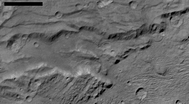
Scientists from NASA's New Horizons mission have spotted signs of long run-out landslides on Pluto's largest moon, Charon. This image of Charon's informally named "Serenity Chasma" was taken by New Horizons' Long Range Reconnaissance Imager (LORRI) on July 14, 2015, from a distance of 48,912 miles (78,717 kilometers). An annotated image shows arrows in the annotated figure mark indications of landslide activity at http://photojournal.jpl.nasa.gov/catalog/PIA21128
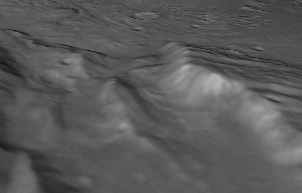
perspective view of Charon's informally named "Serenity Chasm" consists of topography generated from stereo reconstruction of images taken by New Horizons' Long Range Reconnaissance Imager (LORRI) and Multispectral Visible Imaging Camera (MVIC), supplemented by a "shape-from-shading" algorithm. The topography is then overlain with the PIA21128 image mosaic and the perspective view is rendered. The MVIC image was taken from a distance of 45,458 miles (73,159 kilometers) while the LORRI picture was taken from 19,511 miles (31,401 kilometers) away, both on July 14, 2015. http://photojournal.jpl.nasa.gov/catalog/PIA21129
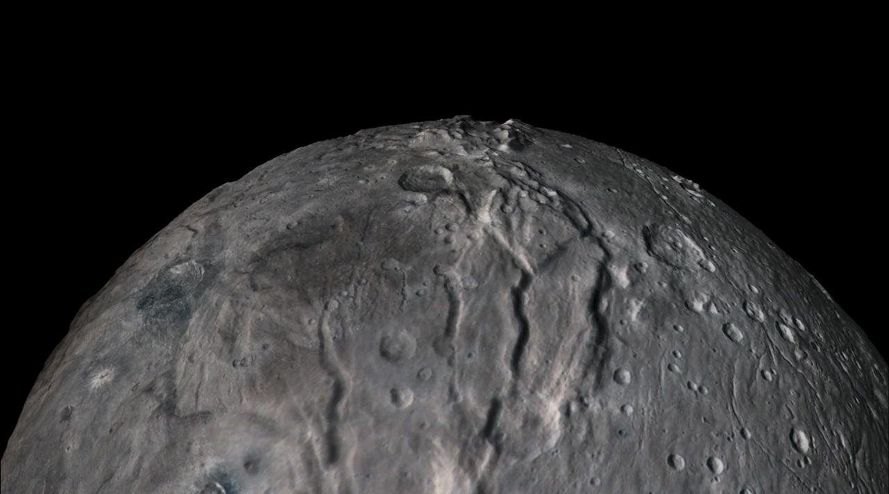
In July 2015, NASA's New Horizons spacecraft sent home the first close-up pictures of Pluto and its moons. Using actual New Horizons data and digital elevation models of Pluto and its largest moon, Charon, mission scientists created flyover movies that offer spectacular new perspectives of the many unusual features that were discovered and which have reshaped our views of the Pluto system -- from a vantage point even closer than a ride on New Horizons itself. The flight over Charon begins high over the hemisphere New Horizons saw on its closest approach, then descends over the deep, wide canyon of Serenity Chasma. The view moves north, passing over Dorothy Gale crater and the dark polar hood of Mordor Macula. The flight then turns back south, covering the northern terrain of Oz Terra before ending over the relatively flat equatorial plains of Vulcan Planum and the "moated mountains" of Clarke Montes. (Note that all feature names are informal.) The topographic relief is exaggerated by a factor of 2 to 3 in these movies to emphasize topography; the surface colors have also been enhanced to bring out detail. Digital mapping and rendering were performed by Paul Schenk and John Blackwell of the Lunar and Planetary Institute in Houston. A video is available at https://photojournal.jpl.nasa.gov/catalog/PIA21864