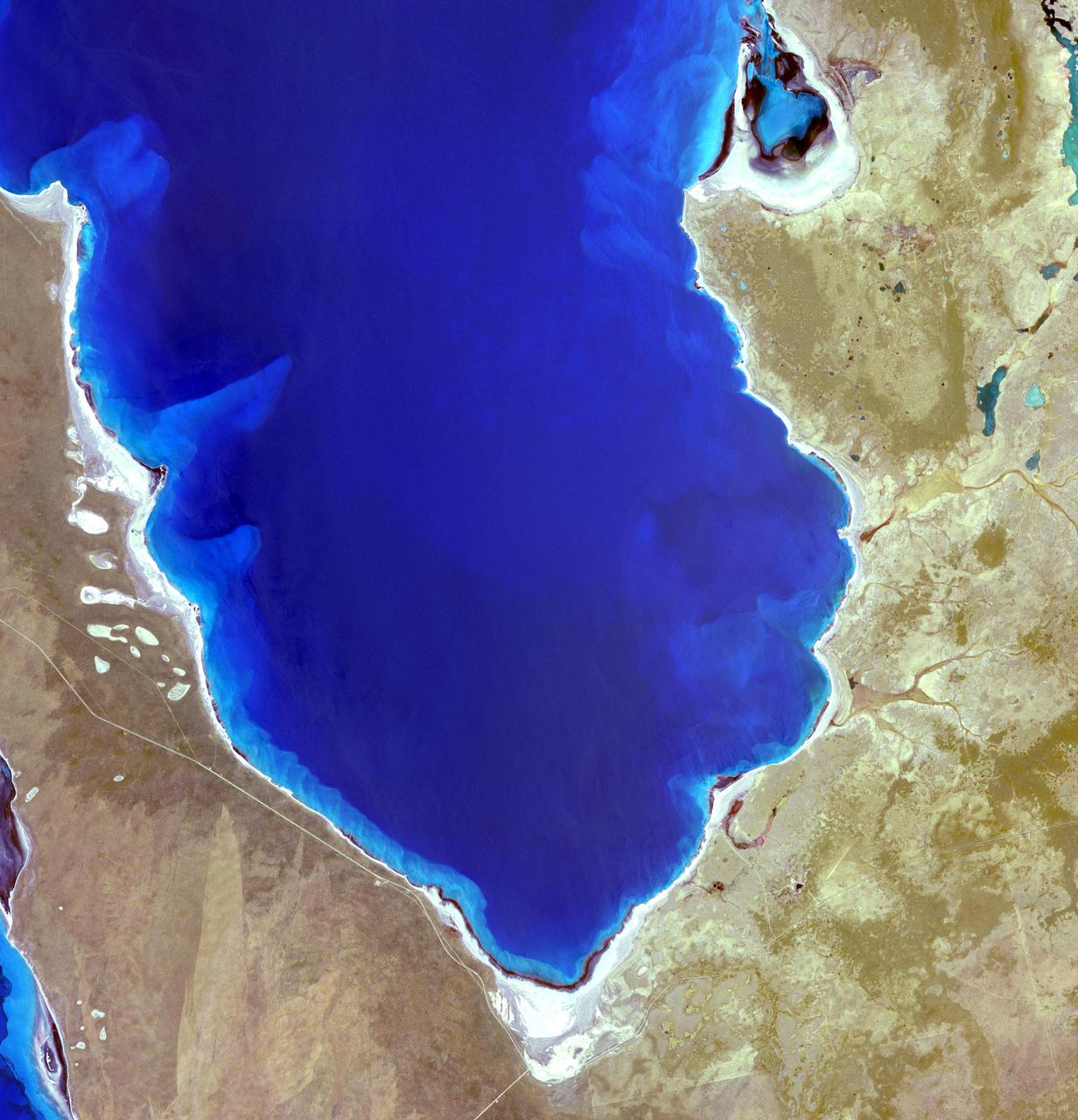
Hamelin Pool Marine Nature Reserve is located in the Shark Bay World Heritage Site in Western Australia. It is one of the very few places in the world where living stromatolites can be found. These are the first living examples of structures built by cyanobacteria. These bacteria are direct descendants of the oldest form of photosynthetic life on earth, dating back 3,500 million years (Wikipedia). The image was acquired December 30, 2010, covers an area of 34 x 46 km, and is located at 26.4 degrees south latitude, 114.1 degrees east longitude. With its 14 spectral bands from the visible to the thermal infrared wavelength region and its high spatial resolution of 15 to 90 meters (about 50 to 300 feet), ASTER images Earth to map and monitor the changing surface of our planet. ASTER is one of five Earth-observing instruments launched Dec. 18, 1999, on Terra. The instrument was built by Japan's Ministry of Economy, Trade and Industry. A joint U.S./Japan science team is responsible for validation and calibration of the instrument and data products. The broad spectral coverage and high spectral resolution of ASTER provides scientists in numerous disciplines with critical information for surface mapping and monitoring of dynamic conditions and temporal change. Example applications are: monitoring glacial advances and retreats; monitoring potentially active volcanoes; identifying crop stress; determining cloud morphology and physical properties; wetlands evaluation; thermal pollution monitoring; coral reef degradation; surface temperature mapping of soils and geology; and measuring surface heat balance. The U.S. science team is located at NASA's Jet Propulsion Laboratory, Pasadena, Calif. The Terra mission is part of NASA's Science Mission Directorate, Washington, D.C. More information about ASTER is available at <a href="http://asterweb.jpl.nasa.gov/" rel="nofollow">asterweb.jpl.nasa.gov/</a>. Credit: NASA/GSFC/METI/ERSDAC/JAROS, and U.S./Japan ASTER Science Team Image Addition Date: 2013-03-15 <b><a href="http://www.nasa.gov/audience/formedia/features/MP_Photo_Guidelines.html" rel="nofollow">NASA image use policy.</a></b> <b><a href="http://www.nasa.gov/centers/goddard/home/index.html" rel="nofollow">NASA Goddard Space Flight Center</a></b> enables NASA’s mission through four scientific endeavors: Earth Science, Heliophysics, Solar System Exploration, and Astrophysics. Goddard plays a leading role in NASA’s accomplishments by contributing compelling scientific knowledge to advance the Agency’s mission. <b>Follow us on <a href="http://twitter.com/NASA_GoddardPix" rel="nofollow">Twitter</a></b> <b>Like us on <a href="http://www.facebook.com/pages/Greenbelt-MD/NASA-Goddard/395013845897?ref=tsd" rel="nofollow">Facebook</a></b> <b>Find us on <a href="http://instagram.com/nasagoddard?vm=grid" rel="nofollow">Instagram</a></b>

Acquired by NASA Terra spacecraft, this image shows Hamelin Pool Marine Nature Reserve, located in the Shark Bay World Heritage Site in Western Australia.
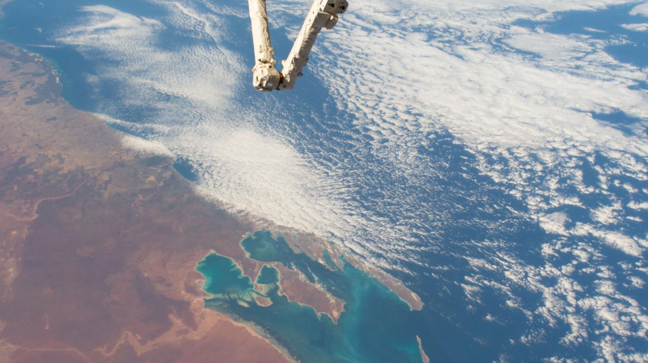
iss058e002638 (Jan. 14, 2019) --- Australia's Shark Bay, the Indian Ocean and the elbow of the Canadarm2 robotic arm are pictured as the International Space Station orbited nearly 256 miles above the state of Western Australia.
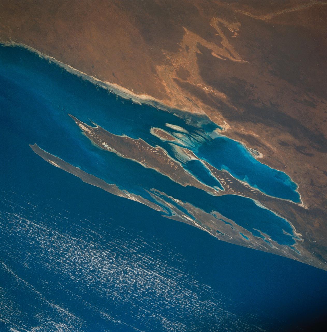
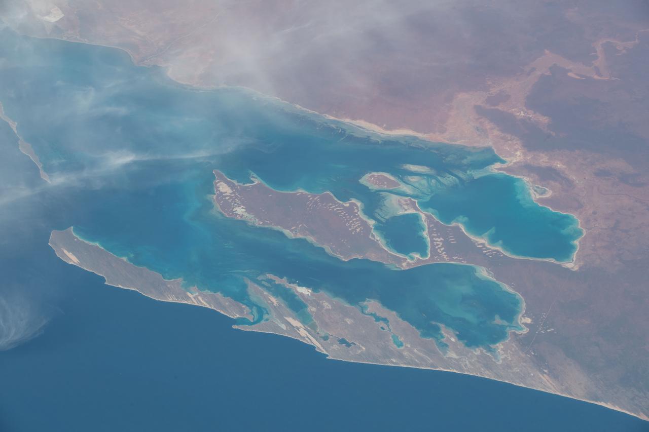
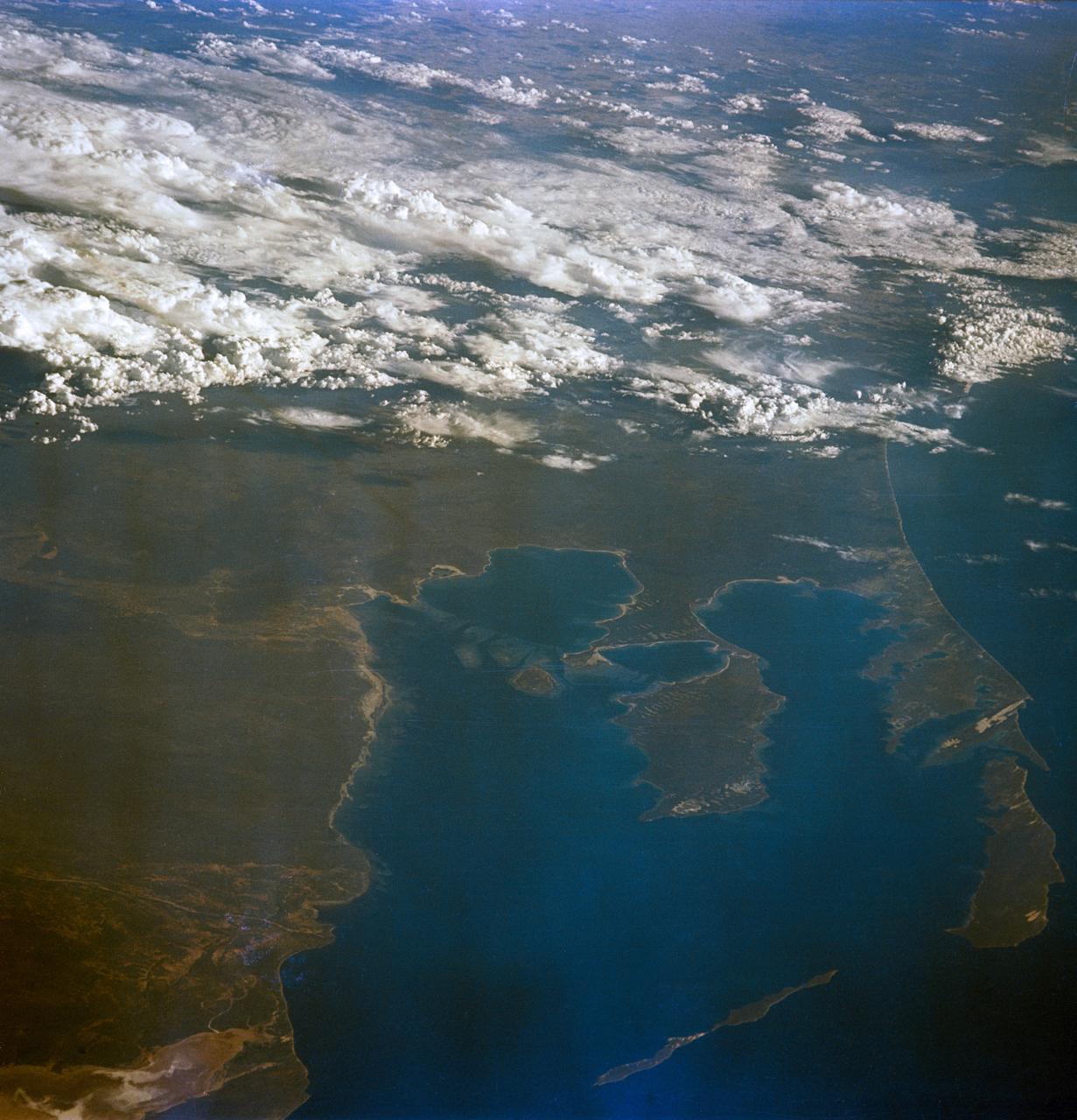
STS035-81-040 (2-10 Dec 1990) --- Numerous algae reefs are seen in Shark Bay, Western Australia, Australia (26.0S, 113.5E) especially in the southern portions of the bay. The south end is more saline because tidal flow in and out of the bay is restricted by sediment deposited at the north and central end of the bay opposite the mouth of the Wooramel River. This extremely arid region produces little sediment runoff so that the waters are very clear, saline and rich in algae.
iss064e003722 (Nov. 7, 2020) --- Shark Bay on the coast of Western Australia is pictured from the International Space Station as it orbited 264 miles above the Indian Ocean.
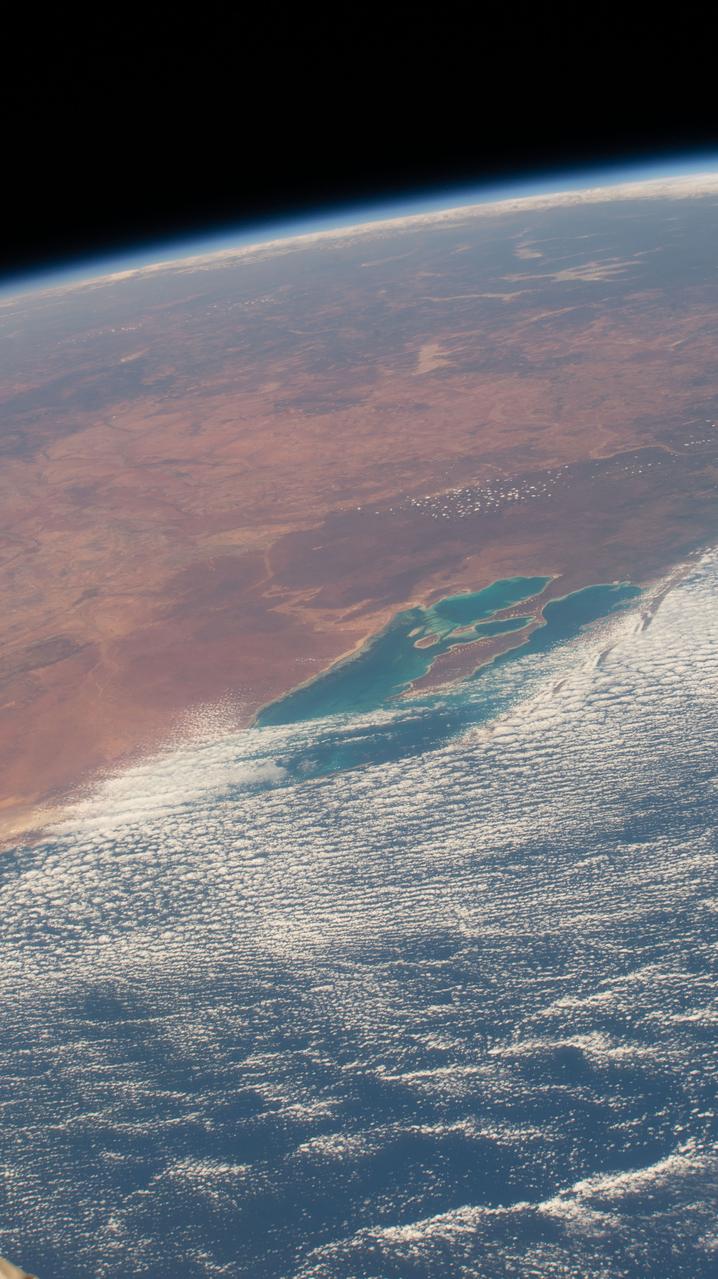
iss057e105411 (Nov. 24, 2018) --- The International Space Station was flying 257 miles above Western Australia when an Expedition 57 crew member photographed Shark Bay and Sedimentary Deposits Reserve on the west coast of the continent.
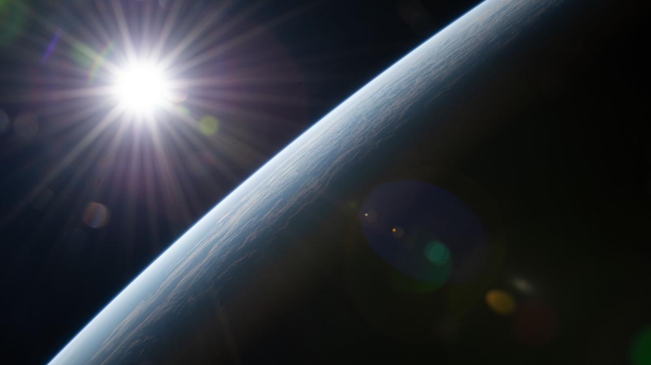
iss067e124177 (June 15, 2022) --- The sun's rays burst above Earth's horizon as the International Space Station orbited 264 miles above Western Australia on the coast of Shark Bay.
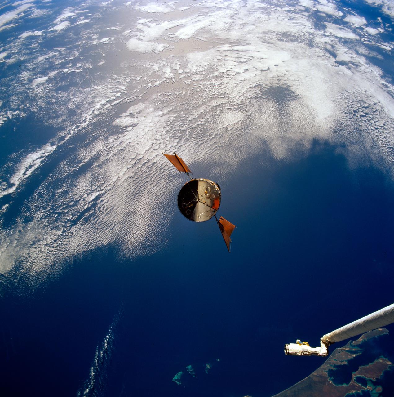
STS061-93-031 (4 Dec 1993) --- Part of the vast Indian Ocean forms the backdrop for this scene of the Hubble Space Telescope (HST) as it approaches the Space Shuttle Endeavour. Denham Sound and Shark Bay, on Australia's west coast, are just below the waiting mechanical arm at lower right corner.

ISS010-E-06681 (12 November 2004) --- Shark Bay, Australia is featured in this image photographed by an Expedition 10 crewmember on the International Space Station (ISS). This image shows large solar salt works developed in Useless Loop and Useless Inlet, Shark Bay, Western Australia. The salt (sodium chloride) is produced when ponds are repeatedly flooded with seawater, which is progressively concentrated by evaporation. This particular salt farm opened in 1967 and expanded operations in the 1990s. Today, this salt farm comprises over 50 ponds, the newest pond in the outermost pond in Useless Inlet, which provides the first evaporation cycle to increase the salinity of the water prior to entering the next pond. Complex chemical and biological adjustments occur in the system each time the configuration of ponds is changed.
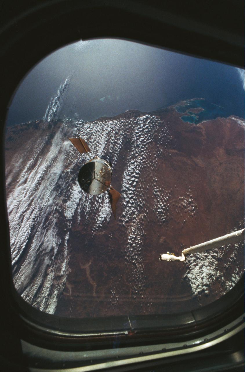
STS061-53-026 (4 Dec 1993) --- One of the Space Shuttle Endeavour's aft flight deck windows frames this view of the Hubble Space Telescope (HST) as it approaches the Endeavour. Backdropped against western Australia, the Remote Manipulator System (RMS) arm awaits the arrival of the telescope. Once berthed in Endeavour's cargo bay, HST underwent five days of servicing provided by four space walking crew members. Shark Bay (upper left) and Perth (lower left) are visible in the frame.
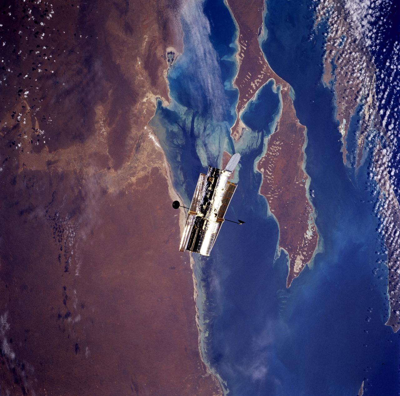
STS082-746-071 (11-21 Feb. 1997) --- This nearly-vertical view, photographed from the Space Shuttle Discovery, shows the Hubble Space Telescope (HST) over Shark Bay. Shallowest parts of the bay appear light blue. In this view of Australia's arid west, sets of sand dunes are clearly visible on Peron Peninsula (lower center) from southwest to northeast (bottom left to top right), blown by the prevailing wind. Hartog Island lies bottom right.
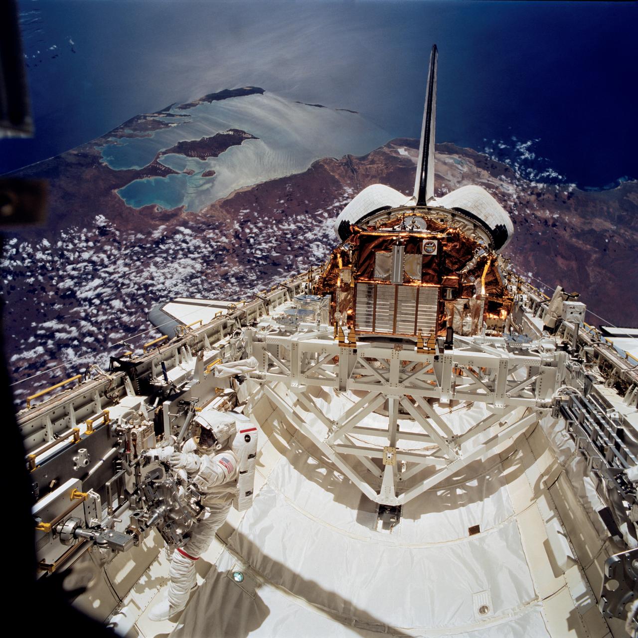
STS072-740-044 (17 Jan. 1996) --- Backdropped against Australia's Shark Bay, this panoramic scene of the Space Shuttle Endeavour in Earth-orbit was recorded during the mission's second Extravehicular Activity (EVA-2) on January 17, 1996. Astronaut Leroy Chiao works with a Mobile Foot Restraint (MFR) at bottom left. The Japanese Space Flyer Unit (SFU) satellite and the Office of Aeronautics and Space Technology (OAST) Flyer satellite are seen in their stowed positions in the aft cargo bay.
S65-63136 (16 Dec. 1965) --- Shark Bay area on the western coast of Western Australia as seen from the Gemini-6 spacecraft during its 16th revolution of Earth. City of Carnarven, where NASA has a tracking station, is located near the bottom of picture in lower left corner, near mouth of stream. Indian Ocean is body of water at upper right. South is toward top of picture. Photo credit: NASA or National Aeronautics and Space Administration
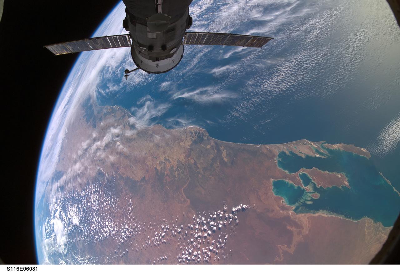
S116-E-06081 (13 Dec. 2006) -- Backdropped against a colorful part of Earth, Progress 23 supply vehicle docked to the Zvezda Service Module's aft port of International Space Station, is featured in this image photographed by a STS-116 crewmember while Space Shuttle Discovery was docked with the station. Shark Bay, Australia is visible at lower right.