Shoreline on Titan?
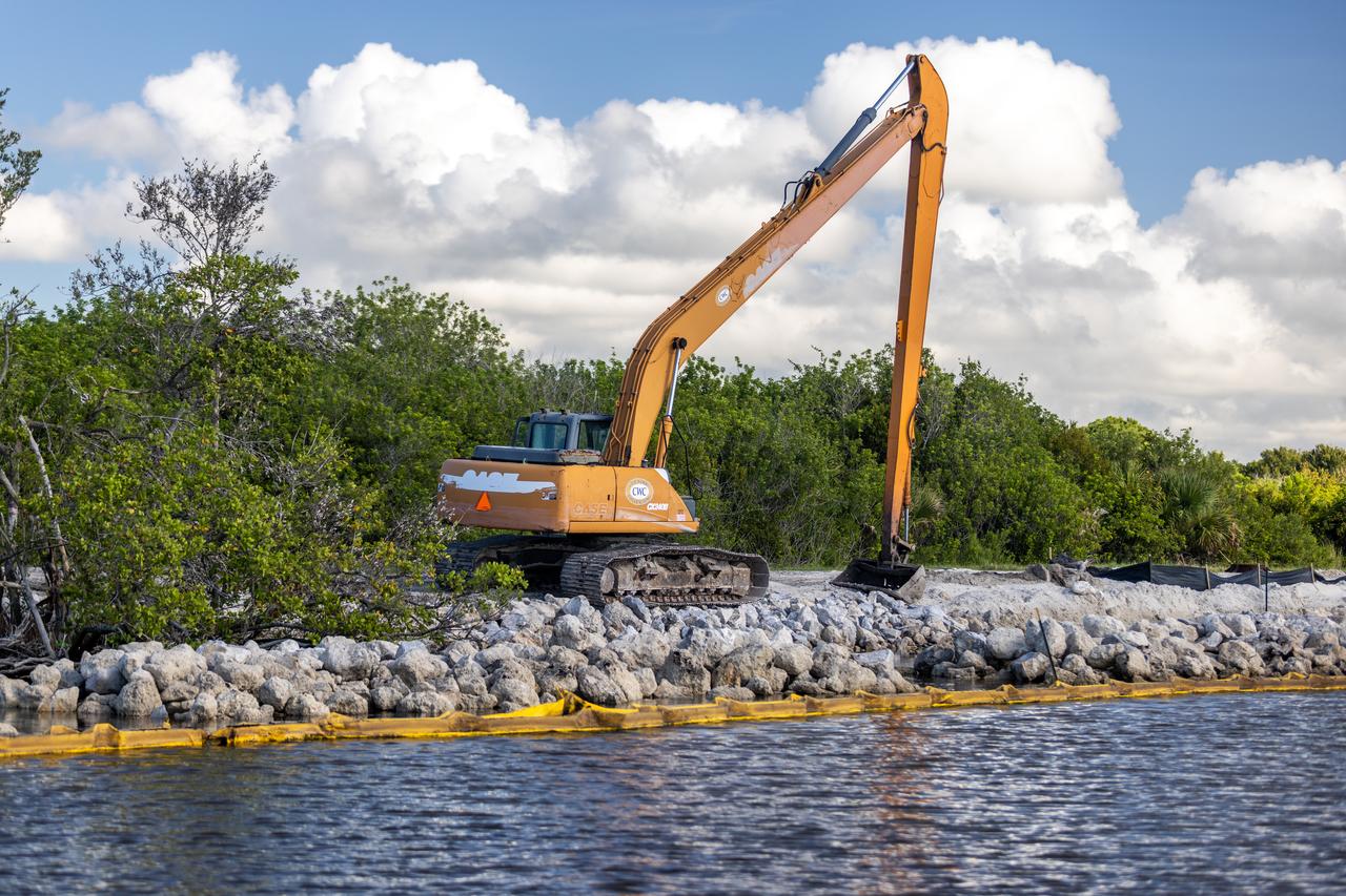
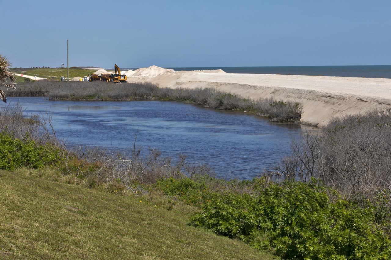
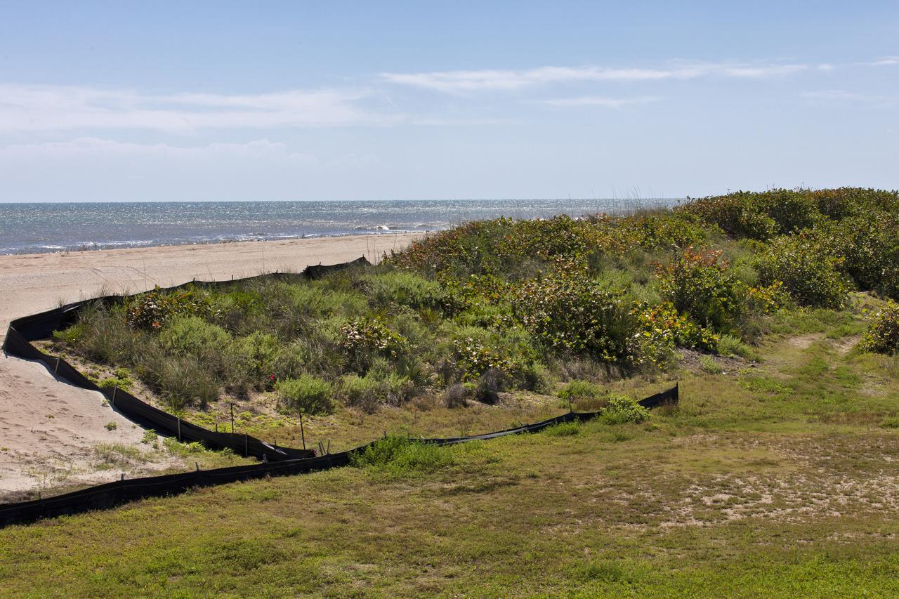
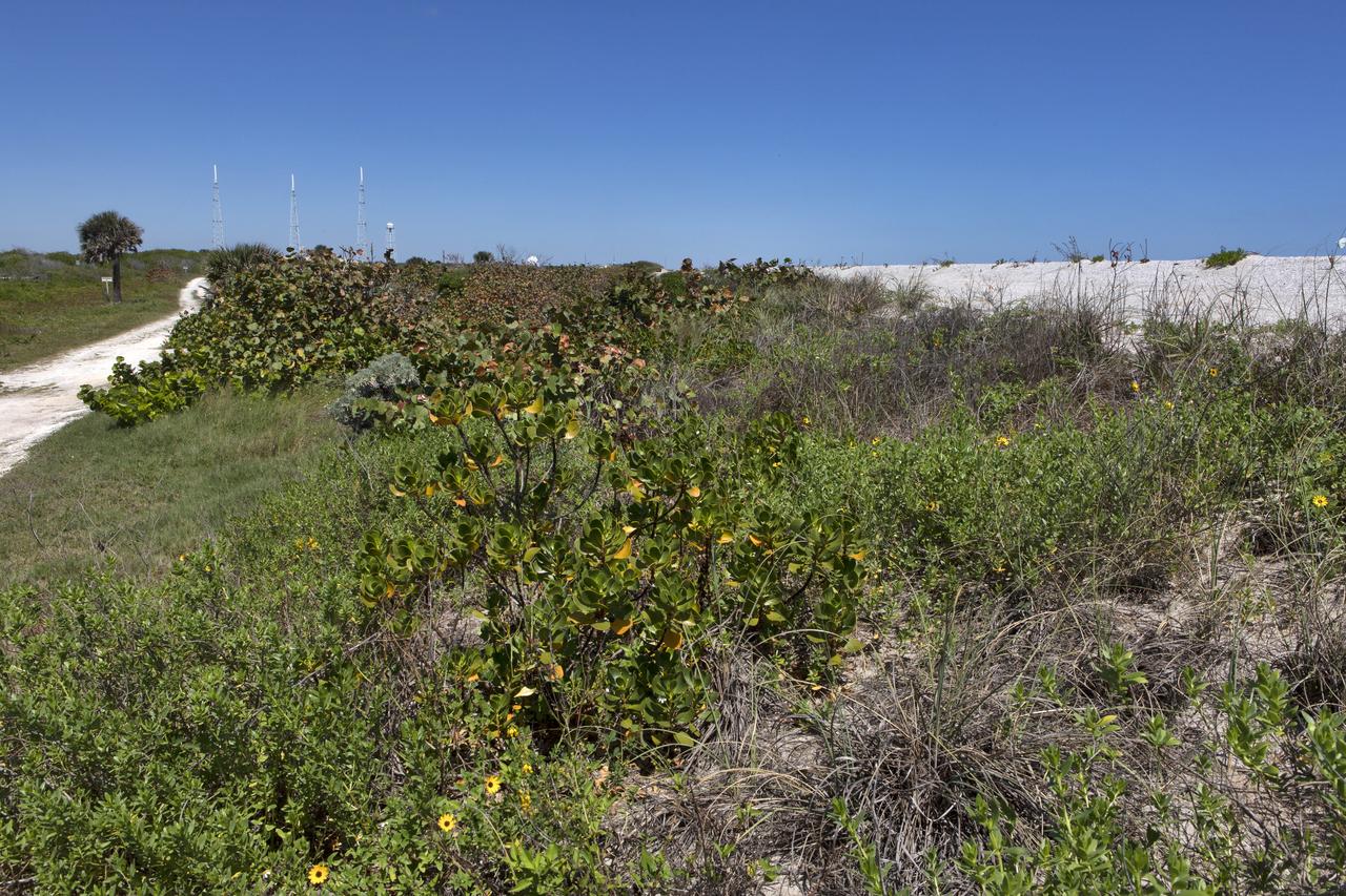
NASA Kennedy Space Center’s Spaceport Integration and Services organization is leading a restoration project at KARS Park on Hall Road in Merritt Island, Florida. As part of this project, a wavebreak is being created about 20 feet offshore to allow mangroves and other plants to propagate into the gap, providing protection for the shoreline.
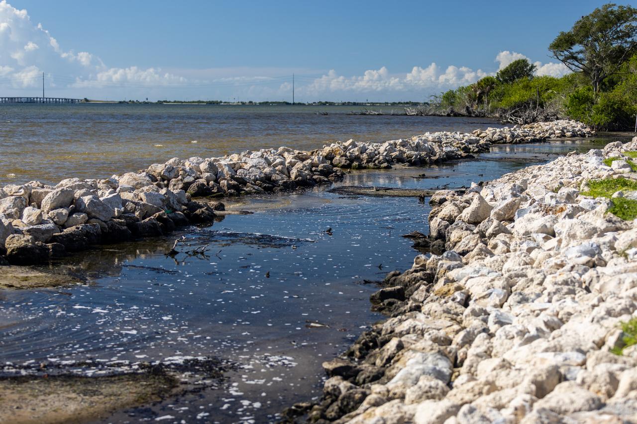
NASA Kennedy Space Center’s Spaceport Integration and Services organization is leading a restoration project at KARS Park on Hall Road in Merritt Island, Florida. As part of this project, a wavebreak is being created about 20 feet offshore to allow mangroves and other plants to propagate into the gap, providing protection for the shoreline.
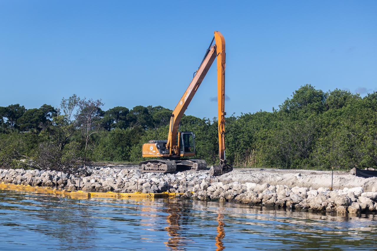
NASA Kennedy Space Center’s Spaceport Integration and Services organization is leading a restoration project at KARS Park on Hall Road in Merritt Island, Florida. As part of this project, a wavebreak is being created about 20 feet offshore to allow mangroves and other plants to propagate into the gap, providing protection for the shoreline.
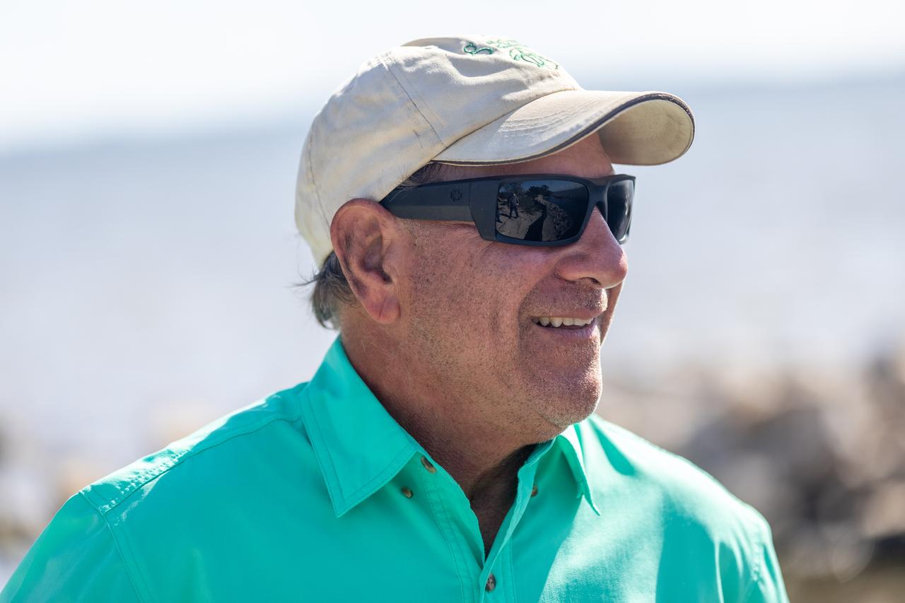
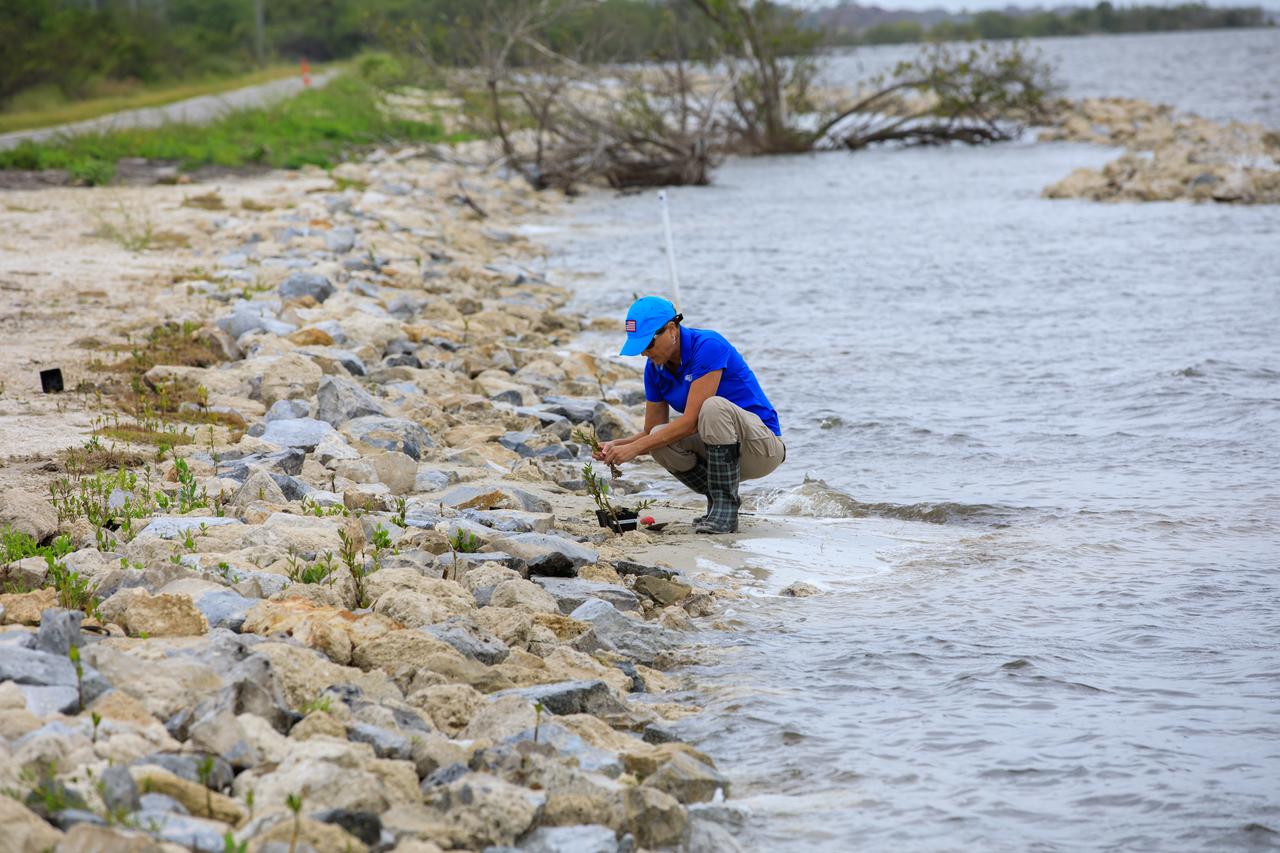
NASA Kennedy Space Center’s Spaceport Integration and Services organization is leading a restoration project at KARS Park on Hall Road in Merritt Island, Florida. As part of this project, a wavebreak is being created about 20 feet offshore to allow mangroves and other plants to propagate into the gap, providing protection for the shoreline. Shown here is Mark Mercadante, an environmental scientist at Kennedy.
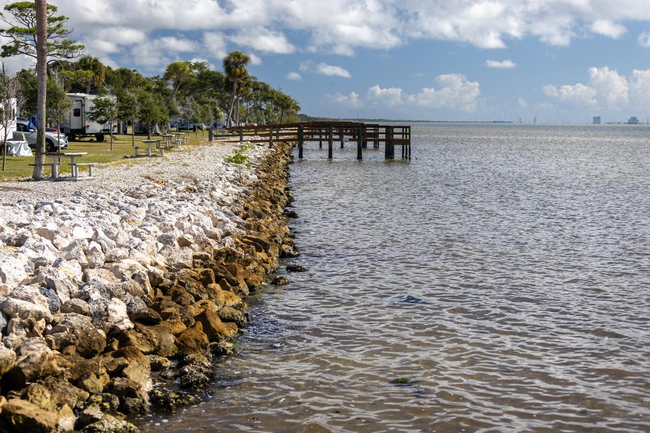
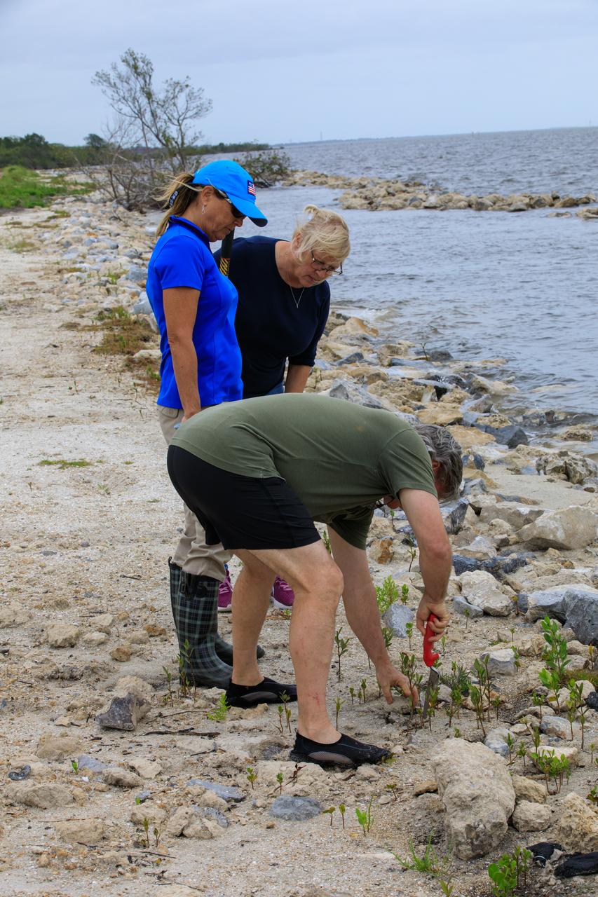
NASA Kennedy Space Center’s Spaceport Integration and Services organization is leading a restoration project at KARS Park on Hall Road in Merritt Island, Florida. As part of this project, a wavebreak is being created about 20 feet offshore to allow mangroves and other plants to propagate into the gap, providing protection for the shoreline. Shown here is the section of KARS park that was first completed during the project.
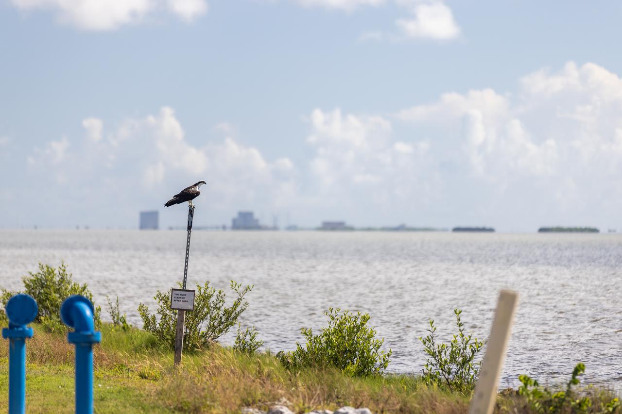
NASA Kennedy Space Center’s Spaceport Integration and Services organization is leading a restoration project at KARS Park on Hall Road in Merritt Island, Florida. As part of this project, a wavebreak is being created about 20 feet offshore to allow mangroves and other plants to propagate into the gap, providing protection for the shoreline. Shown here is an osprey overlooking the water.
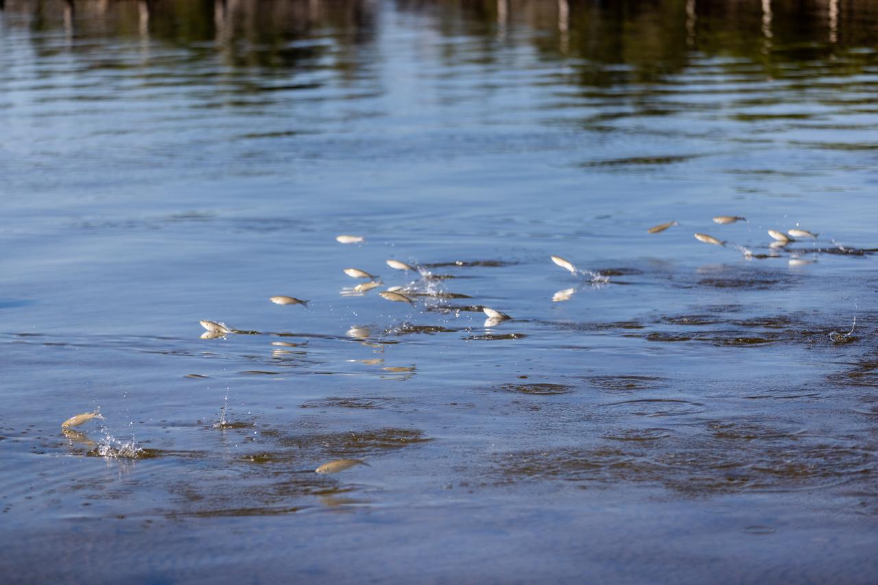
NASA Kennedy Space Center’s Spaceport Integration and Services organization is leading a restoration project at KARS Park on Hall Road in Merritt Island, Florida. As part of this project, a wavebreak is being created about 20 feet offshore to allow mangroves and other plants to propagate into the gap, providing protection for the shoreline. Shown here are mullet swimming at the location.
NASA Kennedy Space Center’s Spaceport Integration and Services organization is leading a restoration project at KARS Park on Hall Road in Merritt Island, Florida. As part of this project, a wavebreak is being created about 20 feet offshore to allow mangroves and other plants to propagate into the gap, providing protection for the shoreline. Shown in this photo is red mangrove starting to grow in the restoration area.
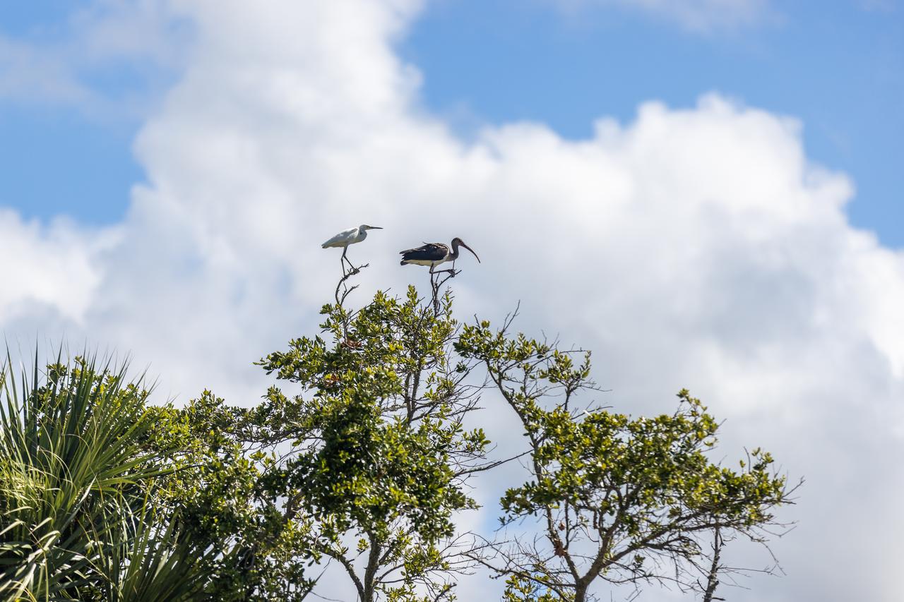
NASA Kennedy Space Center’s Spaceport Integration and Services organization is leading a restoration project at KARS Park on Hall Road in Merritt Island, Florida. As part of this project, a wavebreak is being created about 20 feet offshore to allow mangroves and other plants to propagate into the gap, providing protection for the shoreline. Show here in a tree are a snowy egret, left, and a limpkin.
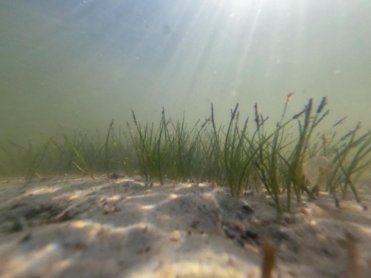
NASA Kennedy Space Center’s Spaceport Integration and Services organization is leading a restoration project at KARS Park on Hall Road in Merritt Island, Florida. As part of this project, a wavebreak is being created about 20 feet offshore to allow mangroves and other plants to propagate into the gap, providing protection for the shoreline. Shown here is shoalgrass taking hold in the restoration area.
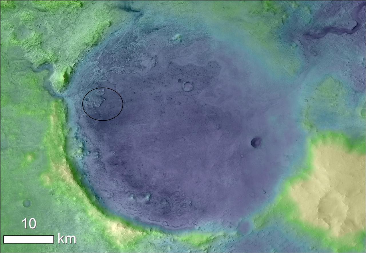
Mars Shoreline Tests: Contact between Lycus Sulci and Amazonis Planitia

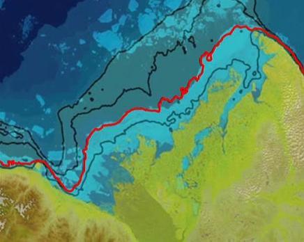
This area seen by NASA Mars Reconnaissance Orbiter is known as the Deuteronilus contact of the Isidis Basin; it has been interpreted as a possible ancient shoreline. There are also suggestions that this contact is of volcanic origin.

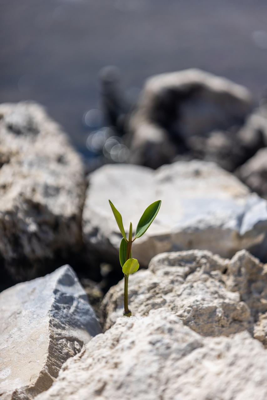
A mangrove seedling grows amidst the rocks on the shoreline of Kennedy Athletic, Recreation, and Social (KARS) Park at Kennedy Space Center in Florida on April 12, 2023. Employees from Kennedy’s Environmental Management Branch removed over 100 mangrove seedlings from the shoreline and repotted them for protection during the final stages of a shoreline restoration project inside KARS Park. The mangrove seedlings will be replanted upon completion of the project to create a living shoreline better able to counter the effects of erosion caused by storm waves and rising sea levels.
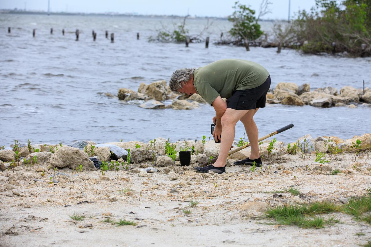
A team member from Kennedy’s Environmental Management Branch works to remove a mangrove seedling on the shoreline of Kennedy Athletic, Recreation, and Social (KARS) Park at Kennedy Space Center in Florida on April 12, 2023. Employees from Kennedy’s Environmental Management Branch removed over 100 mangrove seedlings from the shoreline and repotted them for protection during the final stages of a shoreline restoration project inside KARS Park. The mangrove seedlings will be replanted upon completion of the project to create a living shoreline better able to counter the effects of erosion caused by storm waves and rising sea levels.
A team from Kennedy’s Environmental Management Branch works to remove a mangrove seedling on the shoreline of Kennedy Athletic, Recreation, and Social (KARS) Park at Kennedy Space Center in Florida on April 12, 2023. Employees from Kennedy’s Environmental Management Branch removed over 100 mangrove seedlings from the shoreline and repotted them for protection during the final stages of a shoreline restoration project inside KARS Park. The mangrove seedlings will be replanted upon completion of the project to create a living shoreline better able to counter the effects of erosion caused by storm waves and rising sea levels.
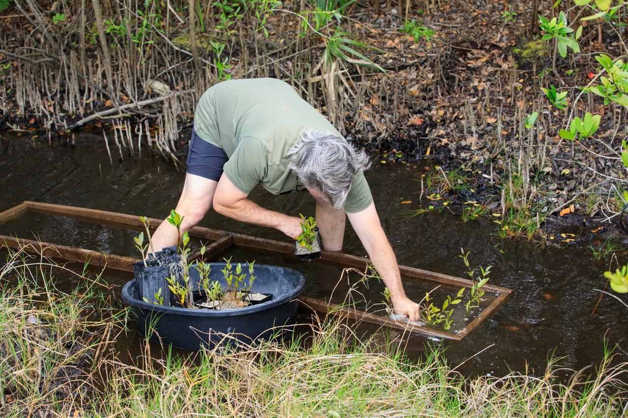
A team member from Kennedy’s Environmental Management Branch deposits repotted mangrove seedlings into a marshy channel near the shoreline of Kennedy Athletic, Recreation, and Social (KARS) Park at Kennedy Space Center in Florida on April 12, 2023. Employees from Kennedy’s Environmental Management Branch removed over 100 mangrove seedlings from the shoreline and repotted them for protection during the final stages of a shoreline restoration project inside KARS Park. The mangrove seedlings will be replanted upon completion of the project to create a living shoreline better able to counter the effects of erosion caused by storm waves and rising sea levels.
A team member from Kennedy’s Environmental Management Branch works to remove a mangrove seedling on the shoreline of Kennedy Athletic, Recreation, and Social (KARS) Park at Kennedy Space Center in Florida on April 12, 2023. Employees from Kennedy’s Environmental Management Branch removed over 100 mangrove seedlings from the shoreline and repotted them for protection during the final stages of a shoreline restoration project inside KARS Park. The mangrove seedlings will be replanted upon completion of the project to create a living shoreline better able to counter the effects of erosion caused by storm waves and rising sea levels.
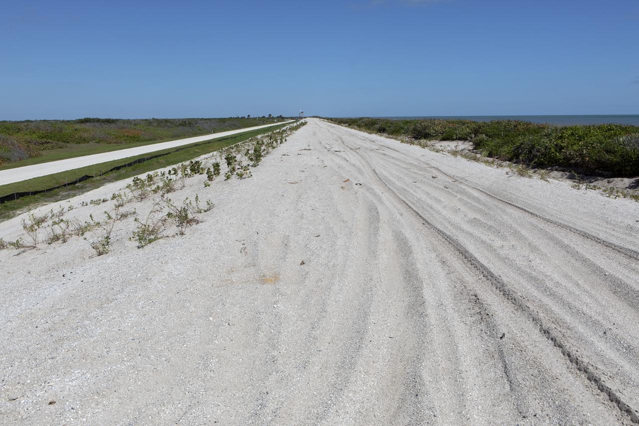
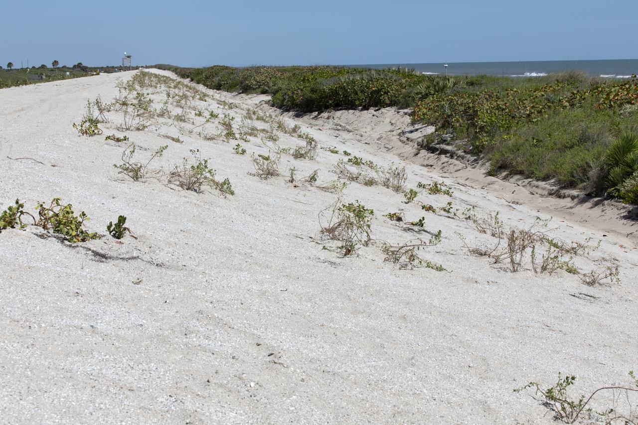
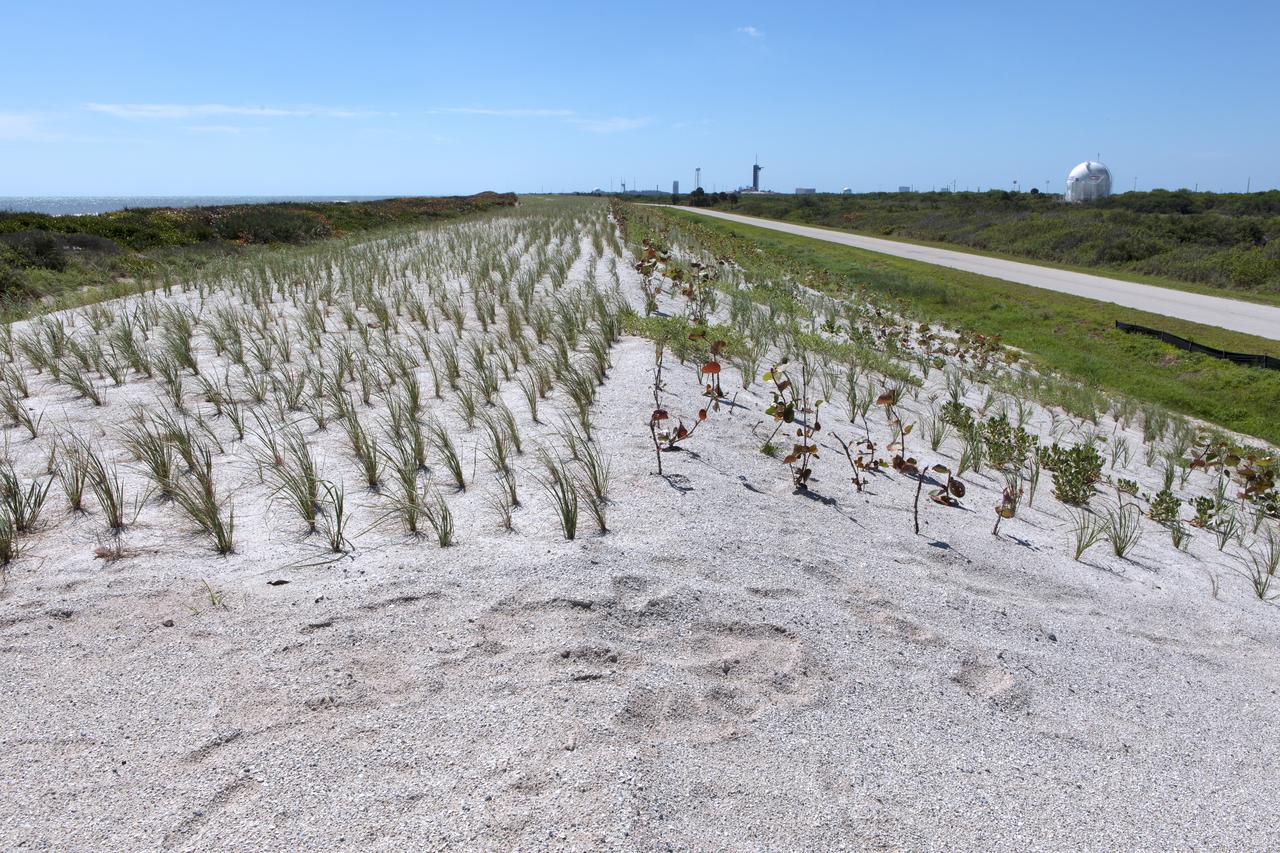
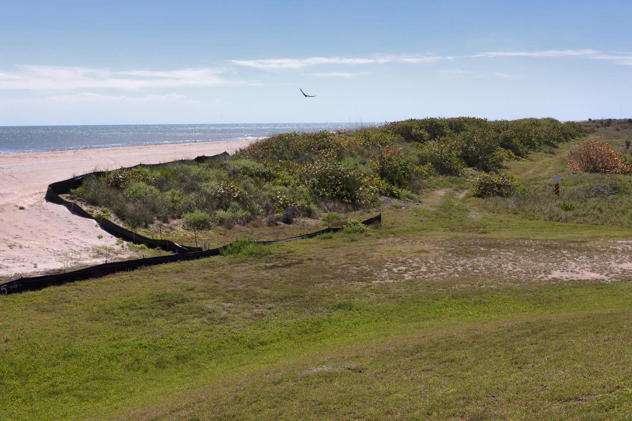
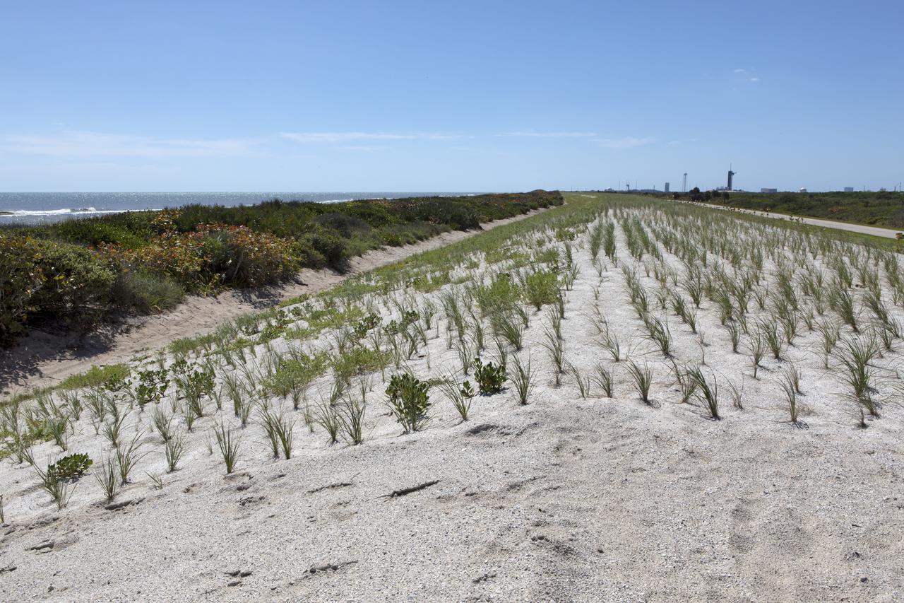
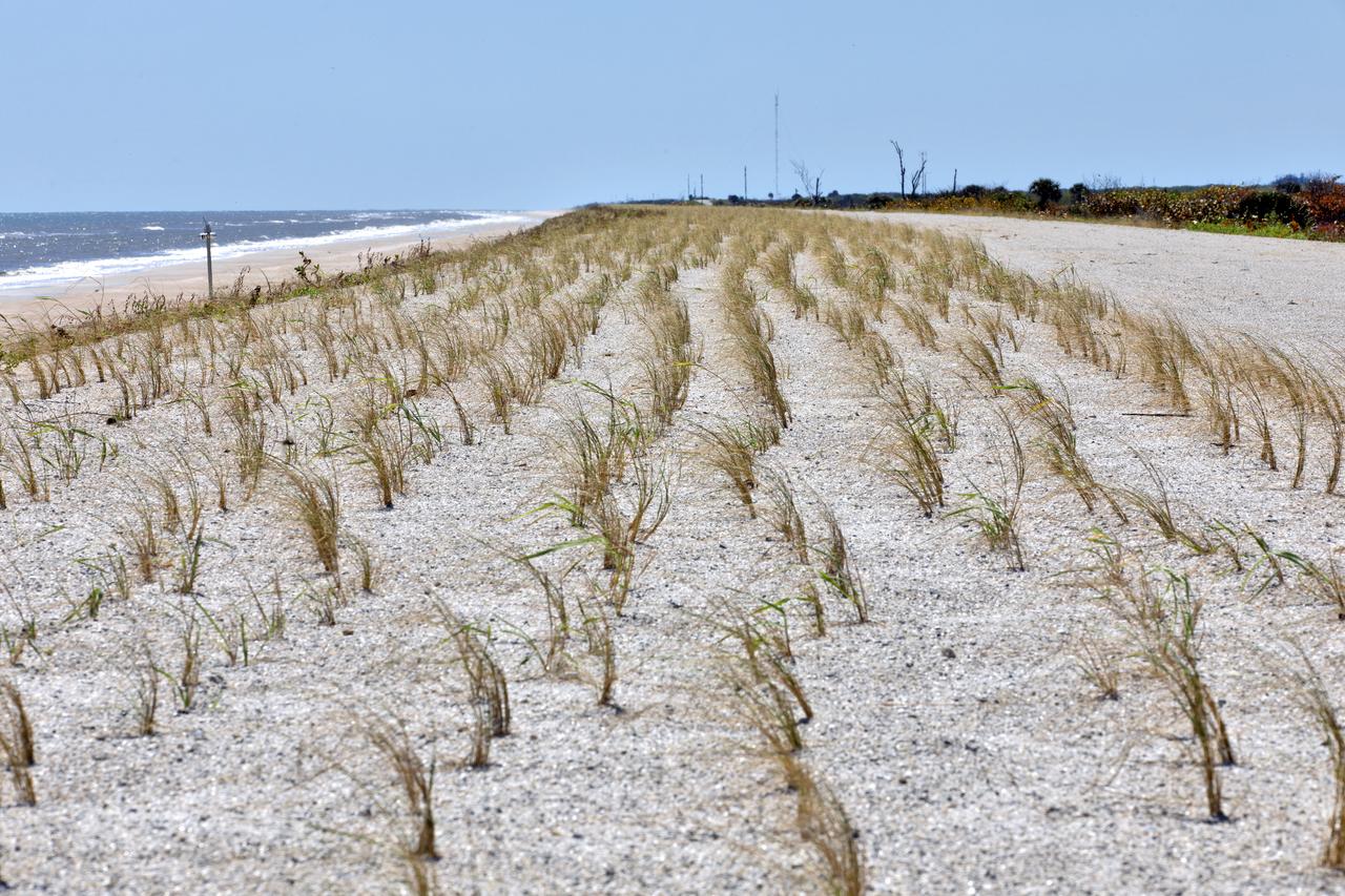
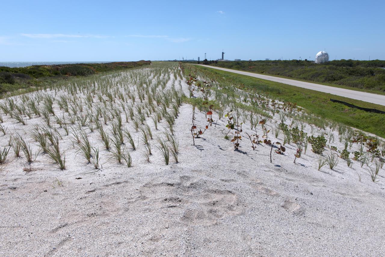
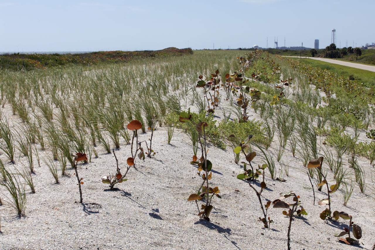
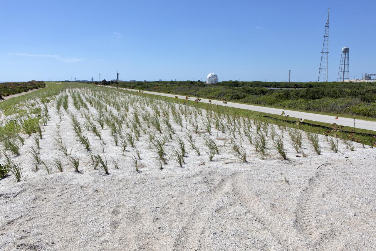
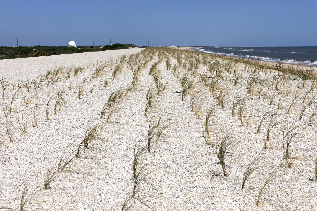
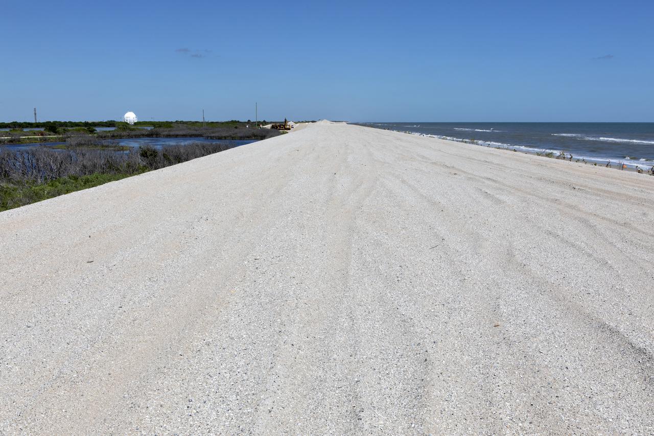
Restoration efforts are underway to the dunes at the north beaches at NASA’s Kennedy Space Center in Florida in this view on April 15, 2019. About 450,000 cubic yards of beach-quality sand, tested for compatibility, was transported to the space center’s beaches. Once the dune is built up, native coastal vegetation will be replanted, helping to stabilize the dune and offer a habitat for Kennedy’s coastal wildlife. Dunes are affected by beach erosion and storm surge from tropical events, such as hurricanes. Restoration began in spring 2018 and was targeted to be completed by April 2019.
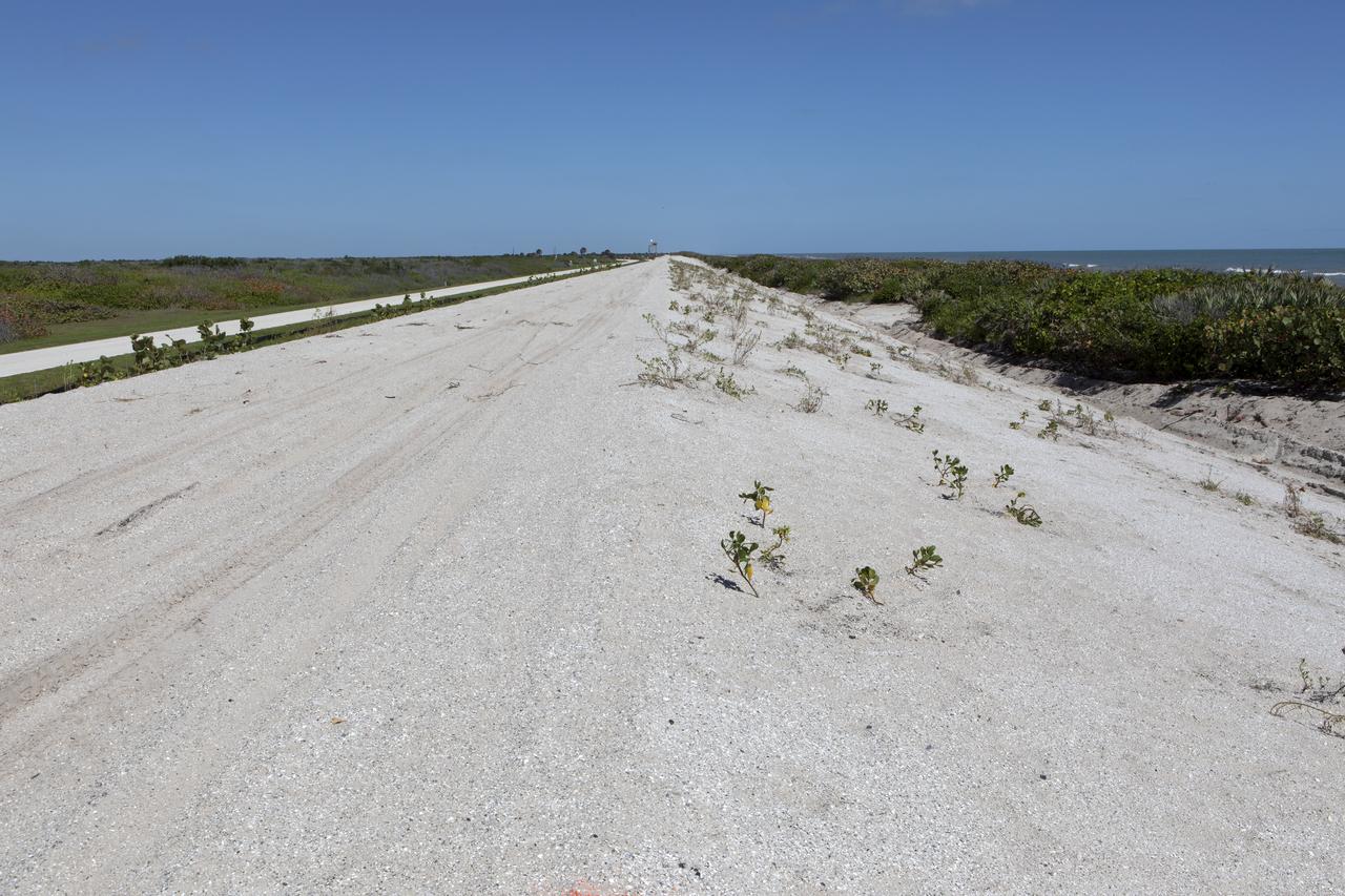
Restoration efforts are underway to the dunes at the north beaches at NASA’s Kennedy Space Center in Florida in this view on April 15, 2019. About 450,000 cubic yards of beach-quality sand, tested for compatibility, was transported to the space center’s beaches. Once the dune is built up, native coastal vegetation will be replanted, helping to stabilize the dune and offer a habitat for Kennedy’s coastal wildlife. Dunes are affected by beach erosion and storm surge from tropical events, such as hurricanes. Restoration began in spring 2018 and was targeted to be completed by April 2019.
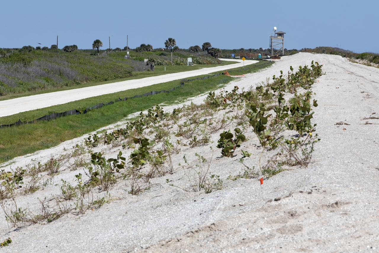
Restoration efforts are underway to the dunes at the north beaches at NASA’s Kennedy Space Center in Florida in this view on April 15, 2019. About 450,000 cubic yards of beach-quality sand, tested for compatibility, was transported to the space center’s beaches. After the dune was built up, native coastal vegetation was replanted, helping to stabilize the dune and offer a habitat for Kennedy’s coastal wildlife. Dunes are affected by beach erosion and storm surge from tropical events, such as hurricanes. Restoration began in spring 2018 and was targeted to be completed by April 2019.

Native vegetation has been planted in the restored dunes at the north beaches at NASA’s Kennedy Space Center in Florida in this view on April 15, 2019. About 450,000 cubic yards of beach-quality sand, tested for compatibility, was transported to the space center’s beaches. After the dune was built up, native vegetation was replanted, helping to stabilize the dune and offer a habitat for Kennedy’s coastal wildlife. Dunes are affected by beach erosion and storm surge from tropical events, such as hurricanes. Restoration began in spring 2018 and was targeted to be completed by April 2019.

Restoration efforts are underway to the dunes at the north beaches at NASA’s Kennedy Space Center in Florida in this view on April 15, 2019. About 450,000 cubic yards of beach-quality sand, tested for compatibility, was transported to the space center’s beaches. Once the dune is built up, native coastal vegetation will be replanted, helping to stabilize the dune and offer a habitat for Kennedy’s coastal wildlife. Dunes are affected by beach erosion and storm surge from tropical events, such as hurricanes. Restoration began in spring 2018 and was targeted to be completed by April 2019.
Restoration efforts are underway to the dunes at the north beaches at NASA’s Kennedy Space Center in Florida in this view on April 15, 2019. About 450,000 cubic yards of beach-quality sand, tested for compatibility, was transported to the space center’s beaches. After the dune was built up, native coastal vegetation was replanted, helping to stabilize the dune and offer a habitat for Kennedy’s coastal wildlife. Dunes are affected by beach erosion and storm surge from tropical events, such as hurricanes. Restoration began in spring 2018 and was targeted to be completed by April 2019.
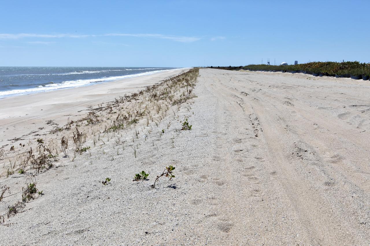
Restoration efforts are underway to the dunes at the north beaches at NASA’s Kennedy Space Center in Florida in this view on April 15, 2019. About 450,000 cubic yards of beach-quality sand, tested for compatibility, was transported to the space center’s beaches. After the dune was built up, native coastal vegetation was replanted, helping to stabilize the dune and offer a habitat for Kennedy’s coast wildlife. Dunes are affected by beach erosion and storm surge from tropical events, such as hurricanes. Restoration began in spring 2018 and was targeted to be completed by April 2019.
Restoration efforts are underway to the dunes at the north beaches at NASA’s Kennedy Space Center in Florida in this view on April 15, 2019. About 450,000 cubic yards of beach-quality sand, tested for compatibility, was transported to the space center’s beaches. Once the dune is built up, native coastal vegetation will be replanted, helping to stabilize the dune and offer a habitat for Kennedy’s coastal wildlife. Dunes are affected by beach erosion and storm surge from tropical events, such as hurricanes. Restoration began in spring 2018 and was targeted to be completed by April 2019.
Restoration efforts are underway to the dunes at the north beaches at NASA’s Kennedy Space Center in Florida in this view on April 15, 2019. The existing dunes with the Atlantic Ocean in the background are a contrast to a small portion of the dune restoration in view. About 450,000 cubic yards of beach-quality sand, tested for compatibility, was transported to the space center’s beaches. Once the dune is built up, native coastal vegetation will be replanted, helping to stabilize the dune and offer a habitat for Kennedy’s coastal wildlife. Dunes are affected by beach erosion and storm surge from tropical events, such as hurricanes. Restoration began in spring 2018 and was targeted to be completed by April 2019.
Restoration efforts are underway to the dunes at the north beaches at NASA’s Kennedy Space Center in Florida in this view on April 15, 2019. The existing dunes in the foreground are a contrast to a small portion of the dune restoration in view at far right. About 450,000 cubic yards of beach-quality sand, tested for compatibility, was transported to the space center’s beaches. Once the dune is built up, native coastal vegetation will be replanted, helping to stabilize the dune and offer a habitat for Kennedy’s coast wildlife. Dunes are affected by beach erosion and storm surge from tropical events, such as hurricanes. Restoration began in spring 2018 and was targeted to be completed by April 2019.
Restoration efforts are underway to the dunes at the north beaches at NASA’s Kennedy Space Center in Florida in this view on April 15, 2019. About 450,000 cubic yards of beach-quality sand, tested for compatibility, was transported to the space center’s beaches. After the dune was built up, native coastal vegetation was replanted, helping to stabilize the dune and offer a habitat for Kennedy’s coastal wildlife. Dunes are affected by beach erosion and storm surge from tropical events, such as hurricanes. Restoration began in spring 2018 and was targeted to be completed by April 2019.
Restoration efforts are underway to the dunes at the north beaches at NASA’s Kennedy Space Center in Florida in this view on April 15, 2019. The existing dunes with the Atlantic Ocean in the background are a contrast to a small portion of the dune restoration in view. About 450,000 cubic yards of beach-quality sand, tested for compatibility, was transported to the space center’s beaches. Once the dune is built up, native coastal vegetation will be replanted, helping to stabilize the dune and offer a habitat for Kennedy’s coastal wildlife. Dunes are affected by beach erosion and storm surge from tropical events, such as hurricanes. Restoration began in spring 2018 and was targeted to be completed by April 2019.
Restoration efforts are underway to the dunes at the north beaches at NASA’s Kennedy Space Center in Florida in this view on April 15, 2019. About 450,000 cubic yards of beach-quality sand, tested for compatibility, was transported to the space center’s beaches. After the dune was built up, native coastal vegetation was replanted, helping to stabilize the dune and offer a habitat for Kennedy’s coastal wildlife. Dunes are affected by beach erosion and storm surge from tropical events, such as hurricanes. Restoration began in spring 2018 and was targeted to be completed by April 2019.
Restoration efforts are underway to the dunes at the north beaches at NASA’s Kennedy Space Center in Florida in this view on April 15, 2019. About 450,000 cubic yards of beach-quality sand, tested for compatibility, was transported to the space center’s beaches. After the dune was built up, native coastal vegetation was replanted, helping to stabilize the dune and offer a habitat for Kennedy’s coast wildlife. Dunes are affected by beach erosion and storm surge from tropical events, such as hurricanes. Restoration began in spring 2018 and was targeted to be completed by April 2019.
Restoration efforts are underway to the dunes at the north beaches at NASA’s Kennedy Space Center in Florida in this view on April 15, 2019. About 450,000 cubic yards of beach-quality sand, tested for compatibility, was transported to the space center’s beaches. After the dune was built up, native coastal vegetation was replanted, helping to stabilize the dune and offer a habitat for Kennedy’s coastal wildlife. Dunes are affected by beach erosion and storm surge from tropical events, such as hurricanes. Restoration began in spring 2018 and was targeted to be completed by April 2019.
Native vegetation has been planted in the restored dunes at the north beaches at NASA’s Kennedy Space Center in Florida in this view on April 15, 2019. About 450,000 cubic yards of beach-quality sand, tested for compatibility, was transported to the space center’s beaches. After the dune was built up, native vegetation was replanted, helping to stabilize the dune and offer a habitat for Kennedy’s coastal wildlife. Dunes are affected by beach erosion and storm surge from tropical events, such as hurricanes. Restoration began in spring 2018 and was targeted to be completed by April 2019.
Restoration efforts are underway to the dunes at the north beaches at NASA’s Kennedy Space Center in Florida in this view on April 15, 2019. About 450,000 cubic yards of beach-quality sand, tested for compatibility, was transported to the space center’s beaches. After the dune was built up, native coastal vegetation was replanted, helping to stabilize the dune and offer a habitat for Kennedy’s coastal wildlife. Dunes are affected by beach erosion and storm surge from tropical events, such as hurricanes. Restoration began in spring 2018 and was targeted to be completed by April 2019.
Restoration efforts are underway to the dunes at the north beaches at NASA’s Kennedy Space Center in Florida in this view on April 15, 2019. About 450,000 cubic yards of beach-quality sand, tested for compatibility, was transported to the space center’s beaches. After the dune was built up, native coastal vegetation was replanted, helping to stabilize the dune and offer a habitat for Kennedy’s coast wildlife. Dunes are affected by beach erosion and storm surge from tropical events, such as hurricanes. Restoration began in spring 2018 and was targeted to be completed by April 2019.
Restoration efforts are underway to the dunes at the north beaches at NASA’s Kennedy Space Center in Florida in this view on April 15, 2019. About 450,000 cubic yards of beach-quality sand, tested for compatibility, was transported to the space center’s beaches. Once the dune is built up, native coastal vegetation will be replanted, helping to stabilize the dune and offer a habitat for Kennedy’s coastal wildlife. Dunes are affected by beach erosion and storm surge from tropical events, such as hurricanes. Restoration began in spring 2018 and was targeted to be completed by April 2019.
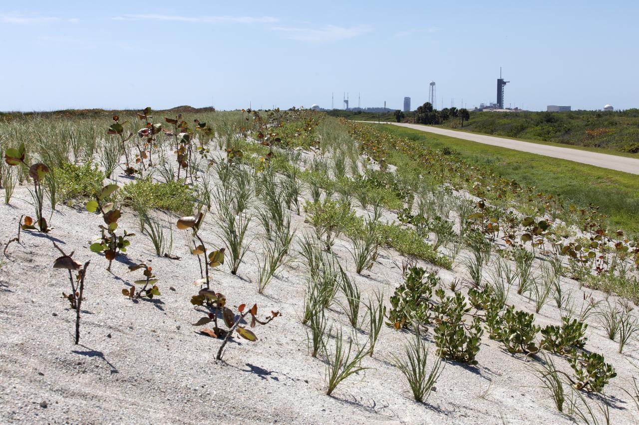
Native vegetation has been planted in the restored dunes at the north beaches at NASA’s Kennedy Space Center in Florida in this view on April 15, 2019. About 450,000 cubic yards of beach-quality sand, tested for compatibility, was transported to the space center’s beaches. After the dune was built up, native vegetation was replanted, helping to stabilize the dune and offer a habitat for Kennedy’s coastal wildlife. Dunes are affected by beach erosion and storm surge from tropical events, such as hurricanes. Restoration began in spring 2018 and was targeted to be completed by April 2019.
iss074e0672348 (June 5, 2026) --- Kazakhstan’s Munaily District, near the Caspian Sea shoreline, is a sparsely populated region with exposed flats and a rapid decline in water level due to evaporation and reduced input from the Volga River. Ports along the Caspian shoreline support the petroleum, chemical, and agriculture industries. The International Space Station was orbiting 263 miles above eastern Kazakhstan at the time of this photograph. Credit: ESA/Sophie Adenot
Beach erosion caused by Hurricane Matthew is visible along the Atlantic shoreline at NASA’s Kennedy Space Center in Florida. Although some sections of shoreline suffered erosion, recently restored portions of beach fared well. Hurricane Matthew, a Category 3 storm, passed to the east of Kennedy on Oct. 6 and 7, 2016. The center received some isolated roof damage, damaged support buildings, a few downed power lines, and limited water intrusion.
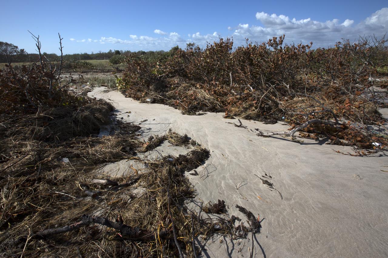
Plant debris caused by Hurricane Matthew is strewn across the dune line along the Atlantic shoreline at NASA’s Kennedy Space Center in Florida. Although some sections of shoreline suffered erosion, recently restored portions of beach fared well. Hurricane Matthew, a Category 3 storm, passed to the east of Kennedy on Oct. 6 and 7, 2016. The center received some isolated roof damage, damaged support buildings, a few downed power lines, and limited water intrusion.
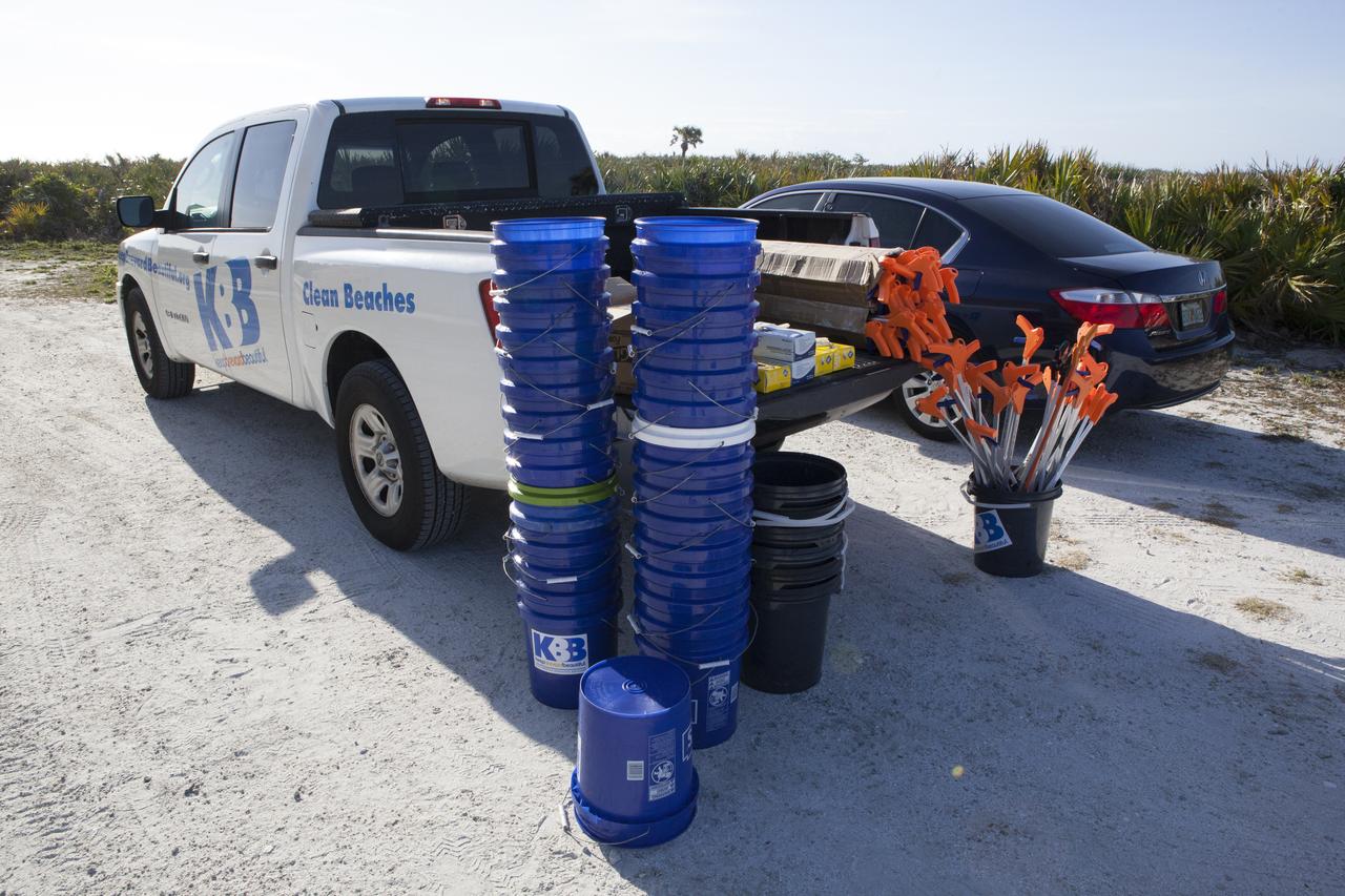
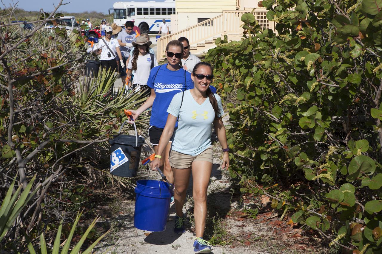
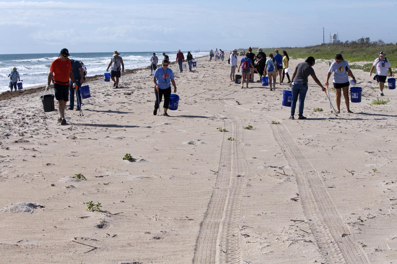
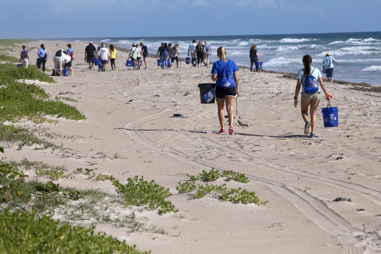
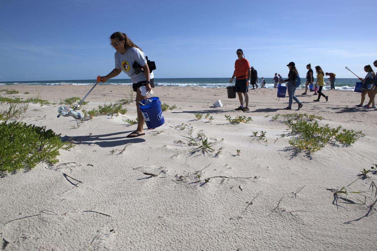
About 50 participants led by NASA Kennedy Space Center's Employee Resource Groups picked up about 20 bags of trash and other large debris along the center's shoreline before turtle-nesting season as a community service. Sea turtle-nesting season begins in about one month. Unlike what might be found along a public beach, all of the debris that litters Kennedy’s restricted beaches washes ashore after being discarded at sea. Of the 72 miles of beach that form the eastern boundary of Brevard County, Florida, about six of those miles line Kennedy.
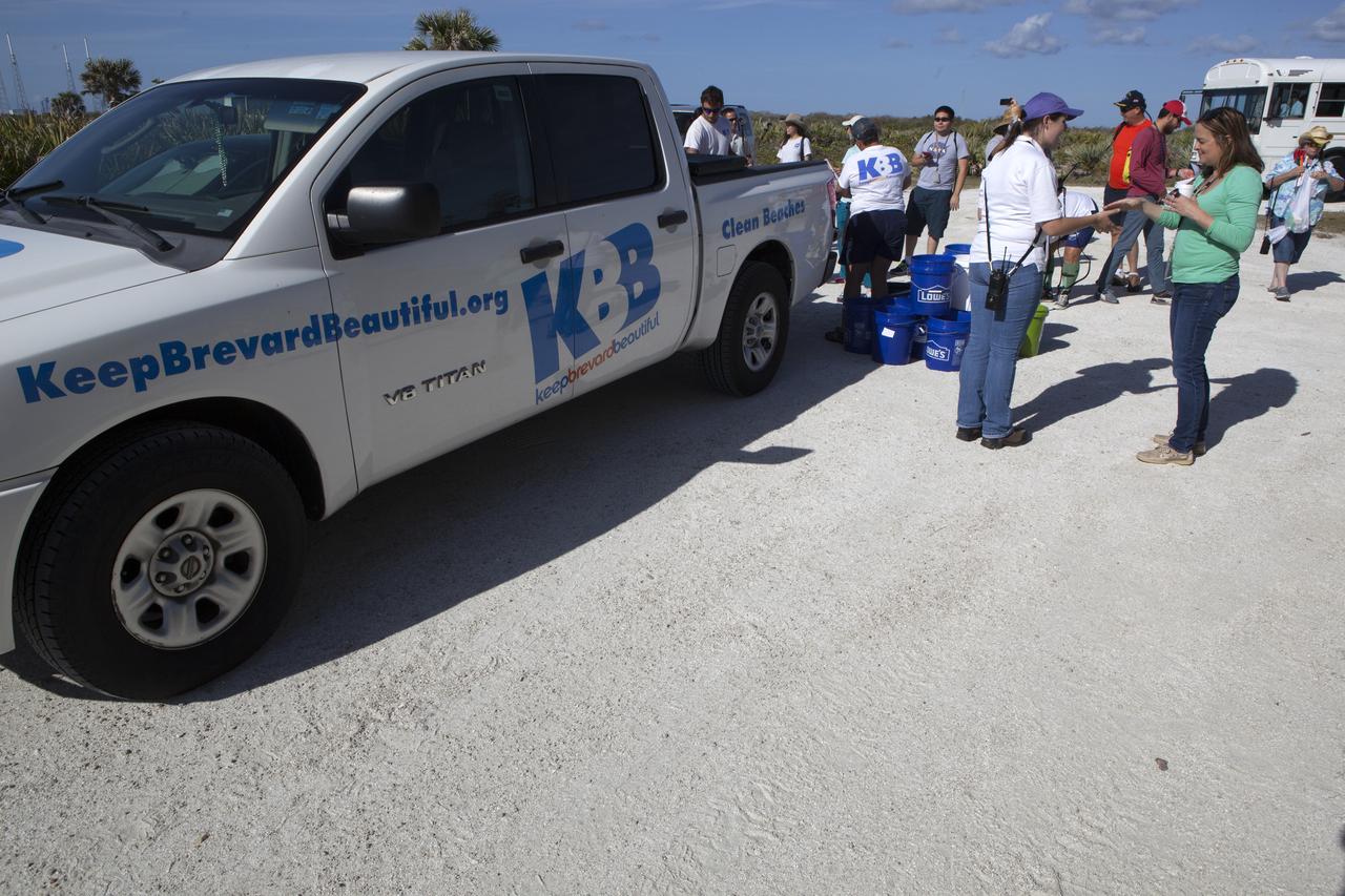
About 50 participants led by NASA Kennedy Space Center's Employee Resource Groups picked up about 20 bags of trash and other large debris along the center's shoreline before turtle-nesting season as a community service. Sea turtle-nesting season begins in about one month. Unlike what might be found along a public beach, all of the debris that litters Kennedy’s restricted beaches washes ashore after being discarded at sea. Of the 72 miles of beach that form the eastern boundary of Brevard County, Florida, about six of those miles line Kennedy.
About 50 participants led by NASA Kennedy Space Center's Employee Resource Groups picked up about 20 bags of trash and other large debris along the center's shoreline before turtle-nesting season as a community service. Sea turtle-nesting season begins in about one month. Unlike what might be found along a public beach, all of the debris that litters Kennedy’s restricted beaches washes ashore after being discarded at sea. Of the 72 miles of beach that form the eastern boundary of Brevard County, Florida, about six of those miles line Kennedy.
About 50 participants led by NASA Kennedy Space Center's Employee Resource Groups picked up about 20 bags of trash and other large debris along the center's shoreline before turtle-nesting season as a community service. Sea turtle-nesting season begins in about one month. Unlike what might be found along a public beach, all of the debris that litters Kennedy’s restricted beaches washes ashore after being discarded at sea. Of the 72 miles of beach that form the eastern boundary of Brevard County, Florida, about six of those miles line Kennedy.
About 50 participants led by NASA Kennedy Space Center's Employee Resource Groups picked up about 20 bags of trash and other large debris along the center's shoreline before turtle-nesting season as a community service. Sea turtle-nesting season begins in about one month. Unlike what might be found along a public beach, all of the debris that litters Kennedy’s restricted beaches washes ashore after being discarded at sea. Of the 72 miles of beach that form the eastern boundary of Brevard County, Florida, about six of those miles line Kennedy.
About 50 participants led by NASA Kennedy Space Center's Employee Resource Groups picked up about 20 bags of trash and other large debris along the center's shoreline before turtle-nesting season as a community service. Sea turtle-nesting season begins in about one month. Unlike what might be found along a public beach, all of the debris that litters Kennedy’s restricted beaches washes ashore after being discarded at sea. Of the 72 miles of beach that form the eastern boundary of Brevard County, Florida, about six of those miles line Kennedy.
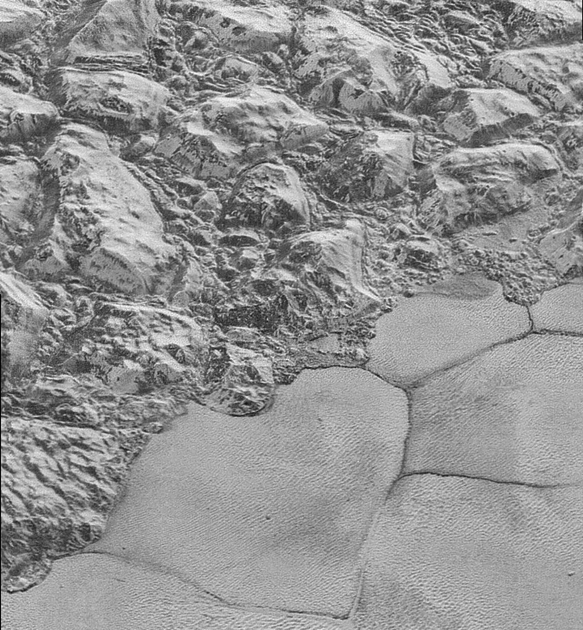
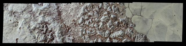
In this highest-resolution image from NASA's New Horizons spacecraft, great blocks of Pluto's water-ice crust appear jammed together in the informally named al-Idrisi mountains. Some mountain sides appear coated in dark material, while other sides are bright. Several sheer faces appear to show crustal layering, perhaps related to the layers seen in some of Pluto's crater walls. Other materials appear crushed between the mountains, as if these great blocks of water ice, some standing as much as 1.5 miles high, were jostled back and forth. The mountains end abruptly at the shoreline of the informally named Sputnik Planum, where the soft, nitrogen-rich ices of the plain form a nearly level surface, broken only by the fine trace work of striking, cellular boundaries and the textured surface of the plain's ices (which is possibly related to sunlight-driven ice sublimation). This view is about 50 miles wide. The top of the image is to Pluto's northwest. These images were made with the telescopic Long Range Reconnaissance Imager (LORRI) aboard New Horizons, in a timespan of about a minute centered on 11:36 UT on July 14 -- just about 15 minutes before New Horizons' closest approach to Pluto -- from a range of just 10,000 miles (17,000 kilometers). They were obtained with an unusual observing mode; instead of working in the usual "point and shoot," LORRI snapped pictures every three seconds while the Ralph/Multispectral Visual Imaging Camera (MVIC) aboard New Horizons was scanning the surface. This mode requires unusually short exposures to avoid blurring the images. http://photojournal.jpl.nasa.gov/catalog/PIA20198
This image acquired by NASA Terra spacecraft shows the Sochi Olympic Park Coastal Cluster, the circular area on the shoreline in the bottom center of the image, which was built for Olympic indoor sports.
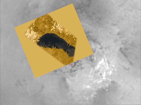
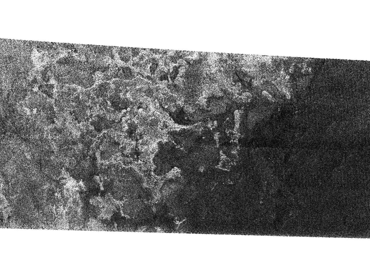
This image is from an animation that glides along the shoreline of Ontario Lacus, the largest lake on the southern hemisphere of Saturn moon Titan. The animation is based on overlapping radar images obtained by NASA Cassini spacecraft.
This radar image, obtained by Cassini radar instrument during a near-polar flyby on Sept. 23, 2006, is the second scene that shows clear shorelines reminiscent of terrestrial lakes
This image of Titan shows clear shorelines that are reminiscent of terrestrial lakes. With Titan colder temperatures and hydrocarbon-rich atmosphere, however, the lakes likely contain a combination of methane and ethane, not water

C-130 aircraft Shoreline Amphitheater: Thermal IR Imagery

C-130 aircraft Shoreline Amphitheater: Thermal IR Imagery

C-130 aircraft Shoreline Amphitheater: Thermal IR Imagery

C-130 aircraft Shoreline Amphitheater: Thermal IR Imagery
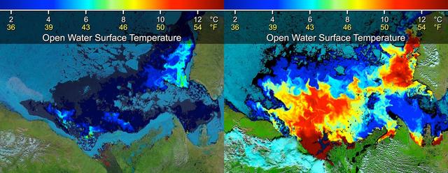
Beaufort Sea surface temperatures where Canada Mackenzie River discharges into the Arctic Ocean, measured by NASA MODIS instrument; warm river waters had broken through a shoreline sea ice barrier to enhance sea ice melt.
This frame from a NASA MODIS animation depicts warming sea surface temperatures in the Arctic Beaufort Sea after warm waters from Canada Mackenzie River broke through a shoreline sea ice barrier in summer 2012, enhancing the melting of sea ice.
S62-01285 (13 Sept. 1961) --- Earth observations of a shoreline taken from the Mercury-Atlas 4 (MA-4) spacecraft. Photo credit: NASA
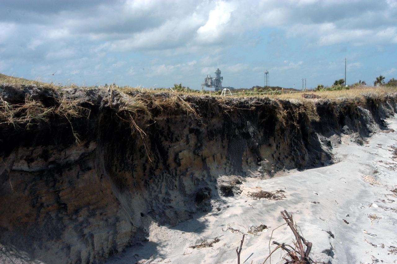
KENNEDY SPACE CENTER, FLA. - This view of the shoreline east of the launch pads at KSC shows the ocean lapping at the base of what appears to be a cliff. The storm surge and raging winds from Hurricane Jeanne eroded the dunes and shoreline. The category 3 storm barreled through Central Florida Sept. 25-26 from the southeast. It was the fourth hurricane in 6 weeks to batter the state.
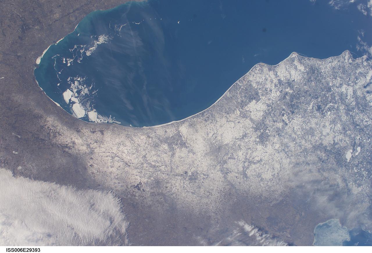
ISS006-E-29393 (21 February 2003) --- A number of large pieces of ice collected along and just off the shoreline southwest of Benton Harbor, Michigan and smaller pieces trailing northward offshore from Chicago, Illinois were captured with a digital still camera by one of the Expedition Six crewmembers on board the International Space Station (ISS). Note the ice accumulation along the entire eastern shoreline of Lake Michigan as well as the wind-drive lake-effect snow cover over the western half of the Lower Michigan Peninsula.
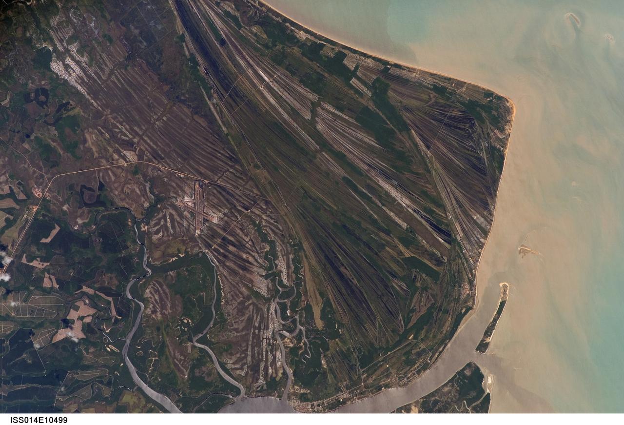
ISS014-E-10499 (23 Dec. 2006) --- Caravelas strandplain, Bahia Province, Brazil is featured in this image photographed by an Expedition 14 crewmember on the International Space Station. This view highlights a flat coastal landform known as a strandplain, or ancient shoreline. The image is dominated by numerous, fine parallel lines (trending diagonally from upper left to lower right), each of which is an ancient shoreline made up of sand transported from rivers to the north. The strandplain has been generated by these narrow shorelines accumulating against one another, line by line in their dozens or even hundreds, over thousands of years. The shorelines can be grouped into at least four packets depending on the crosscutting relationships - younger packets will cut into or stratigraphically overlay older packets. These relationships indicate that the youngest packet lies nearest the coast (furthest right) and the oldest packet lies north of the city of Caravelas (bottom). The Caravelas River flows into the Atlantic Ocean at the bottom of the view. Sediment from this river, and from the current shoreline, produces the light browns and dun colors visible offshore. On the day this image was taken the river water was relatively clear; clear water (gray) is visible flowing out of the main river mouth, and also off to one side to the south over a levee. The Caravelas airport appears near the middle of the view, and is built on one of the ancient shoreline packets. Caravelas itself, a fishing town of about 20,000 inhabitants, lies on an estuary and was once a flourishing whaling center--the prominent cape at top right is known as Ponta da Baleia (Whale Point).
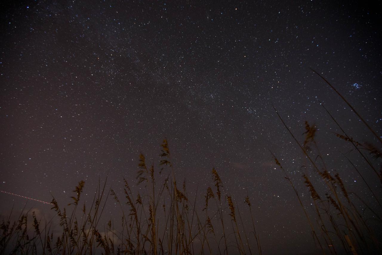
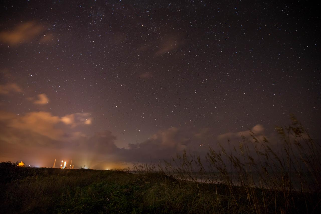
Sea oats frame the night sky, bisected by the Milky Way, in this view from the Atlantic shoreline at NASA’s Kennedy Space Center in Florida on Oct. 31, 2019. The lights of an aircraft create an illuminated streak in the lower left corner.
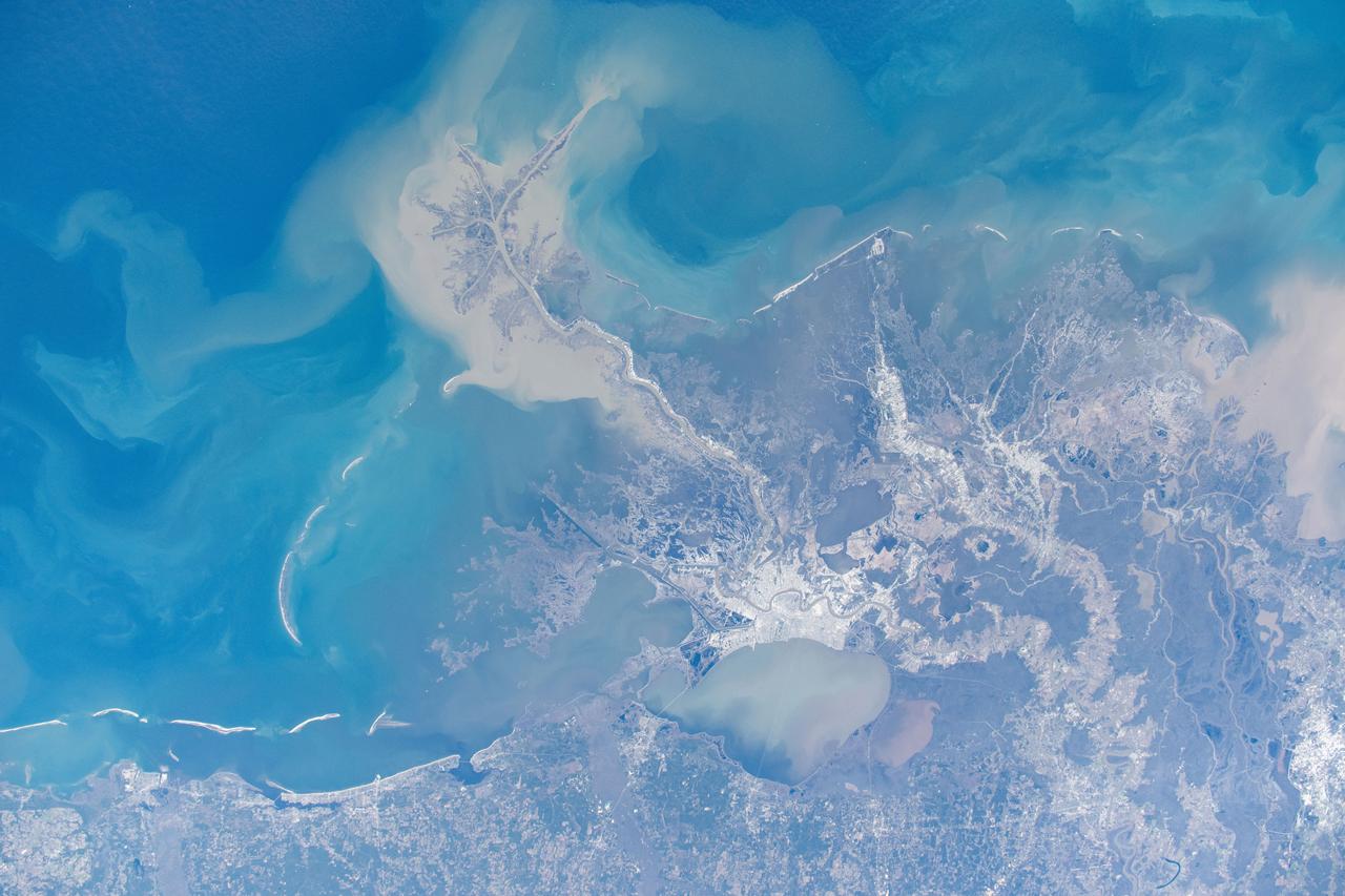
iss072e575684 (Jan. 24, 2025) --- New Orleans, Louisiana, and its suburbs along the Mississippi River and on the shoreline of Lake Pontchartrain are pictured from the International Space Station as it orbited above.
Lights from Launch Complexes 39A and B, left, glow against the night sky in this view from the Atlantic shoreline at NASA’s Kennedy Space Center in Florida on Oct. 31, 2019.
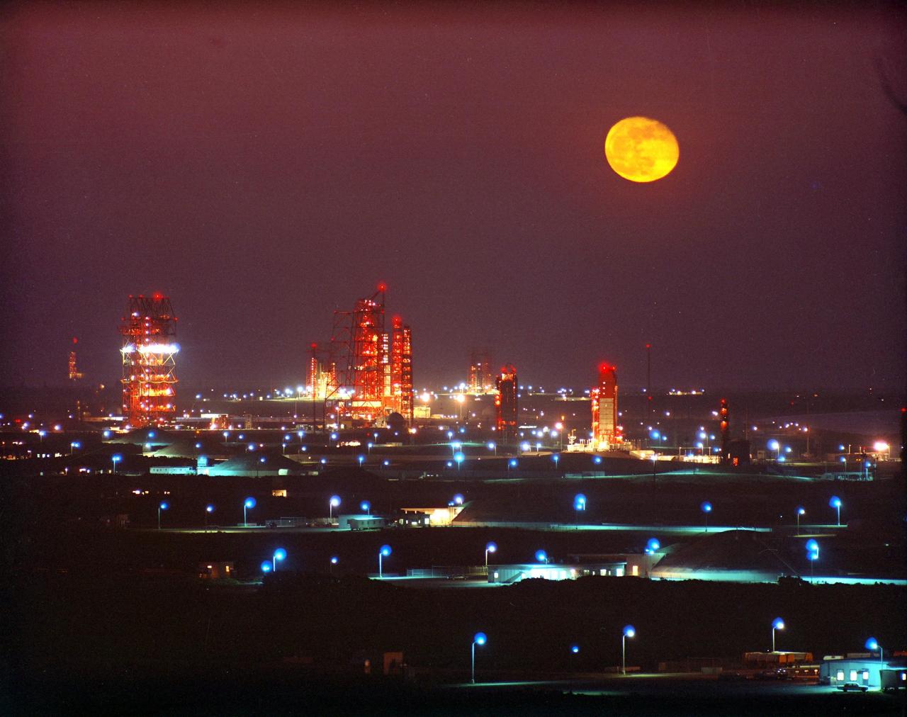
KENNEDY SPACE CENTER, FLA. -- A full moon is outdazzled by the liglhts of the gantries below on "Missile Row" as they stretch north along the shoreline of Cape Canaveral Air Force Station.
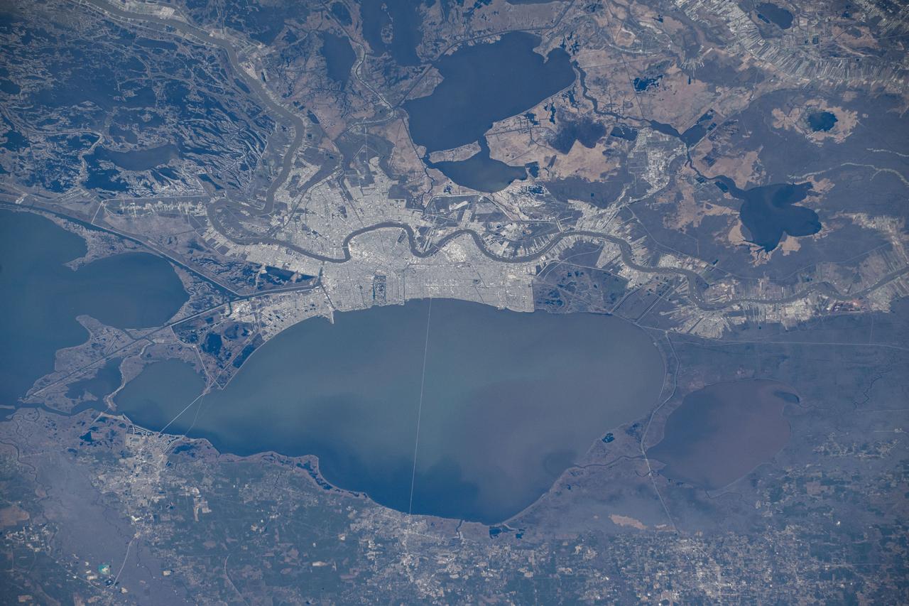
iss072e575658 (Jan. 24, 2025) --- New Orleans, Louisiana, and its suburbs along the Mississippi River and on the shoreline of Lake Pontchartrain are pictured from the International Space Station as it orbited above.
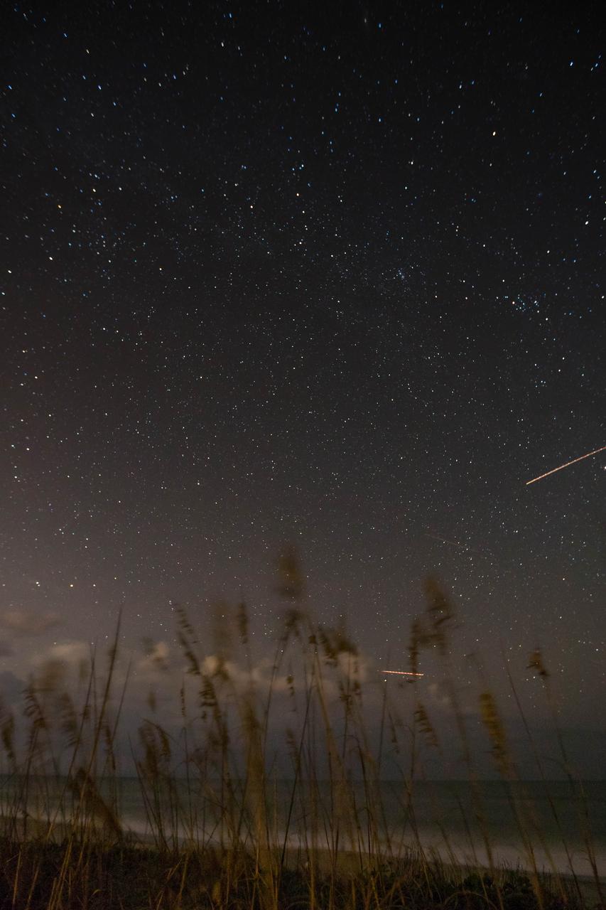
Sea oats are backdropped by the night sky and the Milky Way in this view from the Atlantic shoreline at NASA’s Kennedy Space Center in Florida on Oct. 31, 2019. Lights from aircraft create illuminated streaks above the horizon and at right.
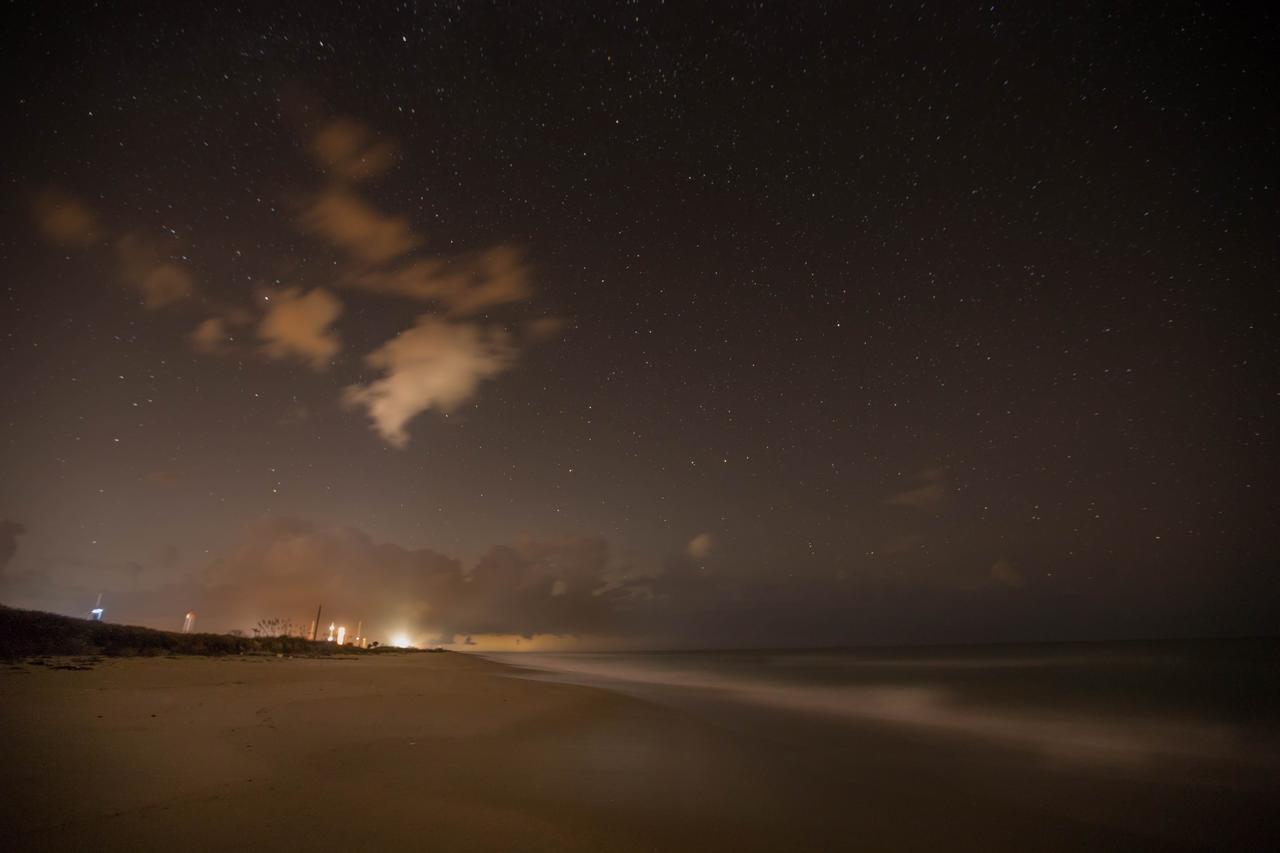
Lights from Launch Complexes 39A and B, left, glow against the night sky in this view from the Atlantic shoreline at NASA’s Kennedy Space Center in Florida on Oct. 31, 2019.
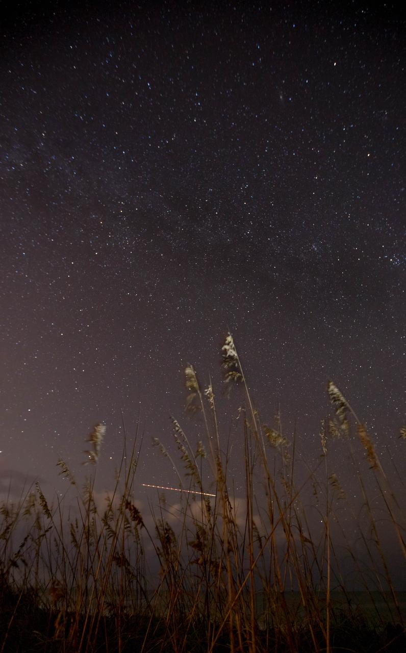
Sea oats are backdropped by the night sky and the Milky Way in this view from the Atlantic shoreline at NASA’s Kennedy Space Center in Florida on Oct. 31, 2019. The lights of an aircraft create an illuminated streak above the horizon.
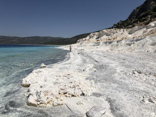
The eastern shore of Lake Salda in Turkey is a good analog for what an ancient lake may have looked like at Jezero Carter on Mars. The white sands and rocks are carbonate minerals that precipitated in the lake. The terraces on the right are old shorelines from when the lake levels were higher, where dried-out sediments have now cemented. These types of deposits might be present along the former shorelines at Jezero. What's more, these deposits might contain signs of microbes, if they ever existed on the Red Planet. NASA's Mars 2020 Perseverance mission will search for signs of ancient life in an dried-up lakebed on the surface of Mars. https://photojournal.jpl.nasa.gov/catalog/PIA24375
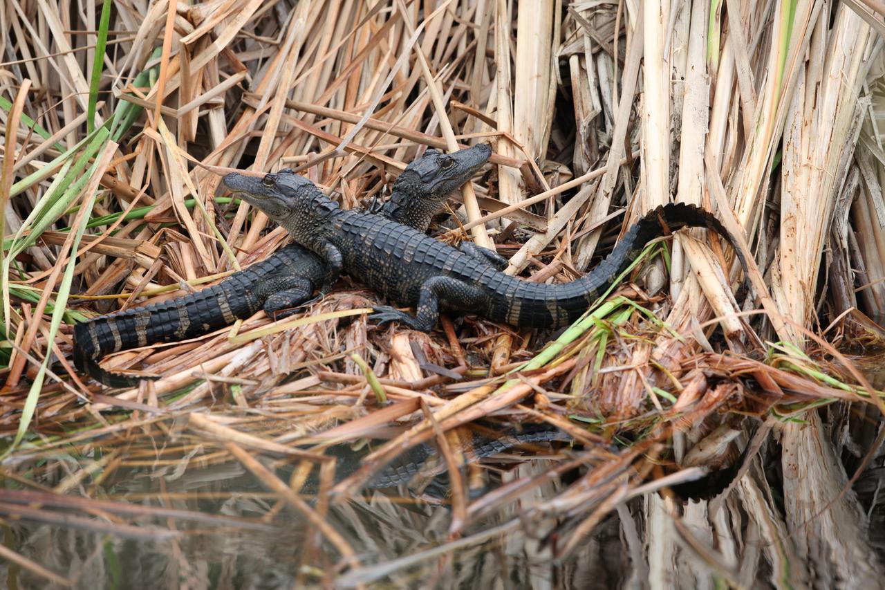
Juvenile alligators sit at the shoreline of a marshy waterway at NASA's Kennedy Space Center in Florida. The center shares a border with the Merritt Island National Wildlife Refuge. More than 330 native and migratory bird species, 25 mammals, 117 fishes and 65 amphibians and reptiles call Kennedy and the wildlife refuge home.
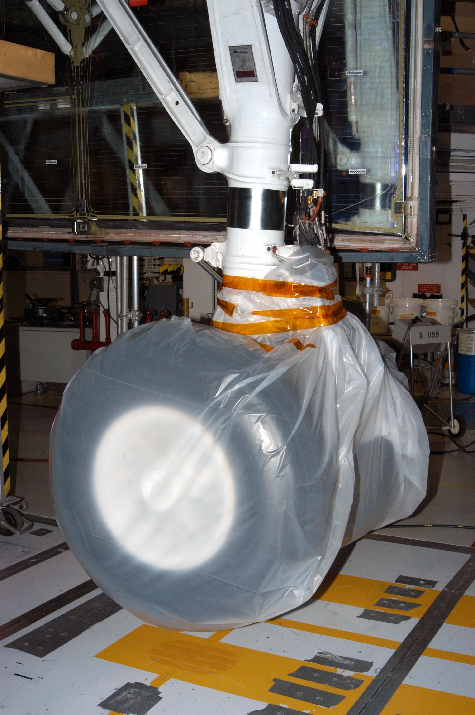
KENNEDY SPACE CENTER, FLA. - In the Orbiter Processing Facility, the wheel on Atlantis is covered in plastic that protected it from possible damage by Hurricane Jeanne. The storm ravaged Central Florida for 21 hours as it crossed the shoreline on the east coast Sept. 25-26. This was the fourth hurricane in 6 weeks to batter the state.
STS073-E-5096 (30 Oct. 1995) --- Central Chesapeake Bay. The lower Potomac River and Patuxent River join the Bay, whose eastern side is muddy from sediment eroded from the shoreline. The image is centered on the Patuxent River Naval Air Station. The frame was exposed with the Electronic Still Camera (ESC).
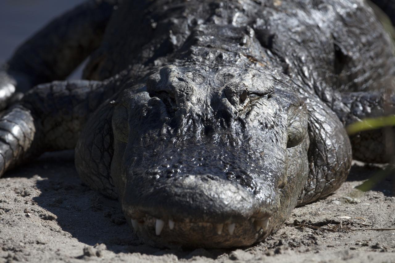
An adult alligator suns himself along the shoreline of a waterway at NASA's Kennedy Space Center in Florida. The center shares a border with the Merritt Island National Wildlife Refuge. More than 330 native and migratory bird species, 25 mammals, 117 fishes and 65 amphibians and reptiles call Kennedy and the wildlife refuge home.
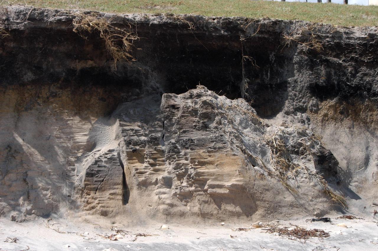
KENNEDY SPACE CENTER, FLA. - The storm surge and high winds of Hurricane Jeanne have replaced the rolling sand dunes on the KSC shoreline with cliffs of sand, shown here. A category 3 storm, Jeanne barreled through Central Florida Sept. 25-26, the fourth hurricane in 6 weeks to batter the state.

Juvenile alligators gather at the shoreline of a marshy waterway at NASA's Kennedy Space Center in Florida. The center shares a border with the Merritt Island National Wildlife Refuge. More than 330 native and migratory bird species, 25 mammals, 117 fishes and 65 amphibians and reptiles call Kennedy and the wildlife refuge home.
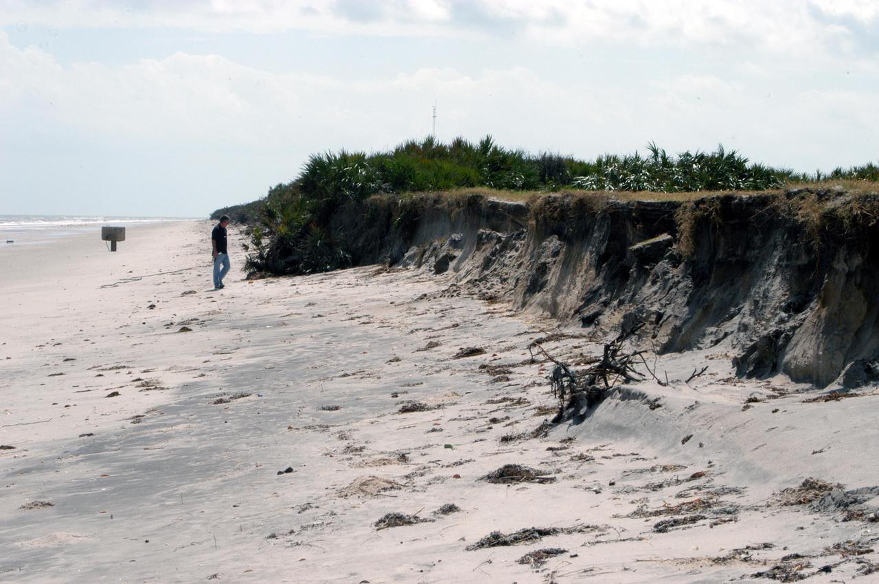
KENNEDY SPACE CENTER, FLA. - The storm surge and high winds of Hurricane Jeanne have replaced the rolling sand dunes on the KSC shoreline with cliffs of sand, shown here. A category 3 storm, Jeanne barreled through Central Florida Sept. 25-26, the fourth hurricane in 6 weeks to batter the state.
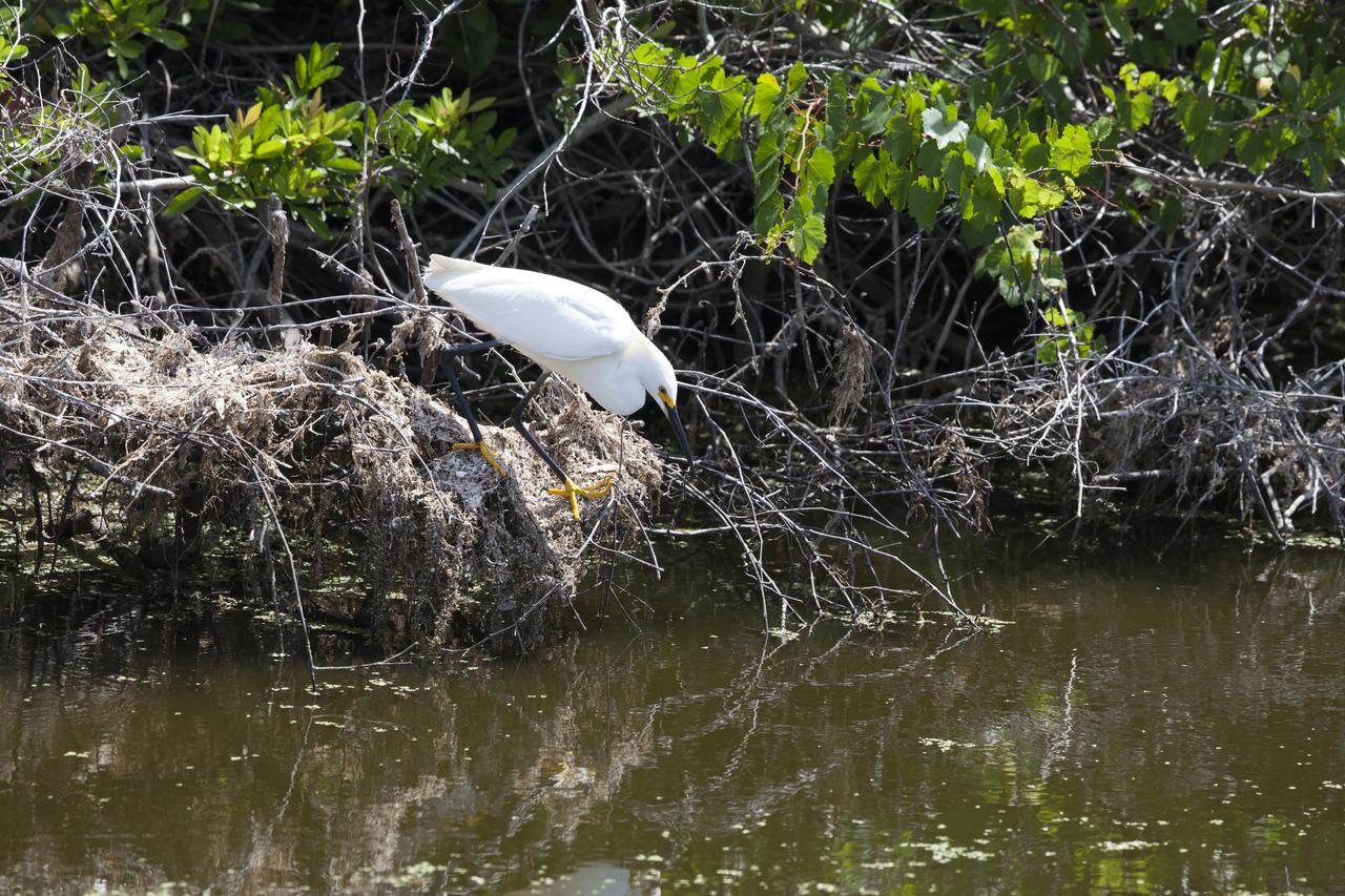
A snowy egret perches on a branch at the shoreline of a waterway at NASA's Kennedy Space Center in Florida. The center shares a border with the Merritt Island National Wildlife Refuge. More than 330 native and migratory bird species, 25 mammals, 117 fishes and 65 amphibians and reptiles call Kennedy and the wildlife refuge home.
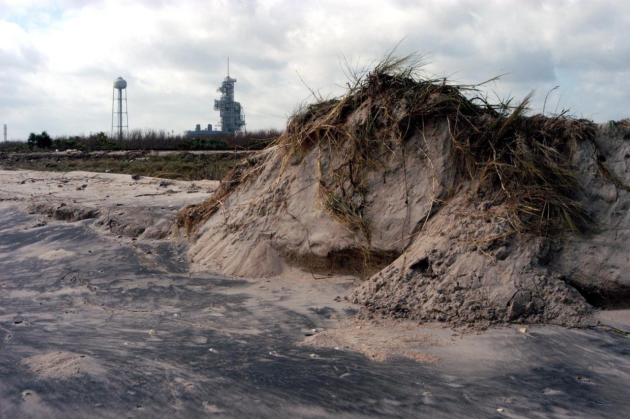
KENNEDY SPACE CENTER, FLA. - Demolished dunes along the shoreline of KSC east of the launch pads are part of the aftermath of Hurricane Jeanne. The category 3 storm barreled through Central Florida Sept. 25-26, the fourth hurricane in 6 weeks to batter the state.
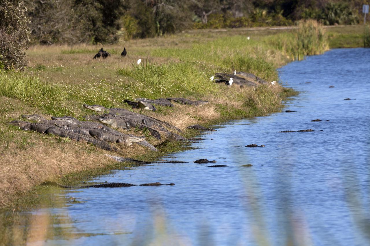
Alligators sun themselves along the shoreline of waterway at NASA's Kennedy Space Center in Florida. The center shares a border with the Merritt Island National Wildlife Refuge. More than 330 native and migratory bird species, 25 mammals, 117 fishes and 65 amphibians and reptiles call Kennedy and the wildlife refuge home.
Lighter colors represent higher elevation in this image of Jezero Crater on Mars, the landing site for NASA's Mars 2020 mission. The oval indicates the landing ellipse, where the rover will be touching down on Mars. The color added to this image helps the crater rim stand out clearly, and makes it easier to spot the shoreline of a lake that dried up billions of years ago. Scientists want to visit this shoreline because it may have preserved fossilized microbial life, if any ever formed on Mars. The image was created using data from a combination of instruments and spacecraft: NASA's Mars Global Surveyor and its Mars Orbiter Laser Altimeter (MOLA); NASA's Mars Reconnaissance Orbiter and its Compact Reconnaissance Imaging Spectrometer for Mars (CRISM) and Context Camera (CTX); and the European Space Agency's Mars Express and its High Resolution Stereo Camera (HRSC). https://photojournal.jpl.nasa.gov/catalog/PIA23511
STS099-706-090 (11-22 February 2000) ---One of the astronauts aboard the Space Shuttle Endeavour for the STS-99 mission recorded this 70mm image of Hannah Bay, in the southern part of St. James Bay. The river is the Harricanaw River. Numerous shorelines around Hudson and St. James Bays are distinctive in winter because of snow cover. According to NASA scientists, shorelines were created when the overlying glaciers retreated and the land underneath rebounded causing the Hudson and St. James Bay waters to retreat northward. These ridges are 100 to 200 meters in width and heights can reach up to 7 meters. The land along St. James Bay consists mainly of tidal flats and salt marshes.
This enhanced color mosaic combines some of the sharpest views of Pluto that NASA's New Horizons spacecraft obtained during its July 14 flyby. The pictures are part of a sequence taken near New Horizons' closest approach to Pluto, with resolutions of about 250-280 feet (77-85 meters) per pixel -- revealing features smaller than half a city block on Pluto's surface. Lower resolution color data (at about 2,066 feet, or 630 meters, per pixel) were added to create this new image. The images form a strip 50 miles (80 kilometers) wide, trending (top to bottom) from the edge of "badlands" northwest of the informally named Sputnik Planum, across the al-Idrisi mountains, onto the shoreline of Pluto's "heart" feature, and just into its icy plains. They combine pictures from the telescopic Long Range Reconnaissance Imager (LORRI) taken approximately 15 minutes before New Horizons' closest approach to Pluto, with -- from a range of only 10,000 miles (17,000 kilometers) -- with color data (in near-infrared, red and blue) gathered by the Ralph/Multispectral Visible Imaging Camera (MVIC) 25 minutes before the LORRI pictures. The wide variety of cratered, mountainous and glacial terrains seen here gives scientists and the public alike a breathtaking, super-high-resolution color window into Pluto's geology. e border between the relatively smooth Sputnik Planum ice sheet and the pitted area, with a series of hills forming slightly inside this unusual "shoreline." http://photojournal.jpl.nasa.gov/catalog/PIA20213
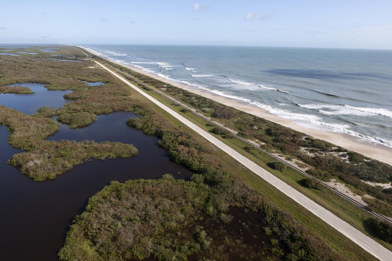
The shoreline is seen during an aerial survey of NASA's Kennedy Space Center in Florida on September 12, 2017. The survey was performed to identify structures and facilities that may have sustained damage from Hurricane Irma as the storm passed Kennedy on September 10, 2017. NASA closed the center ahead of the storm's onset and only a small team of specialists known as the Rideout Team was on the center as the storm approached and passed.
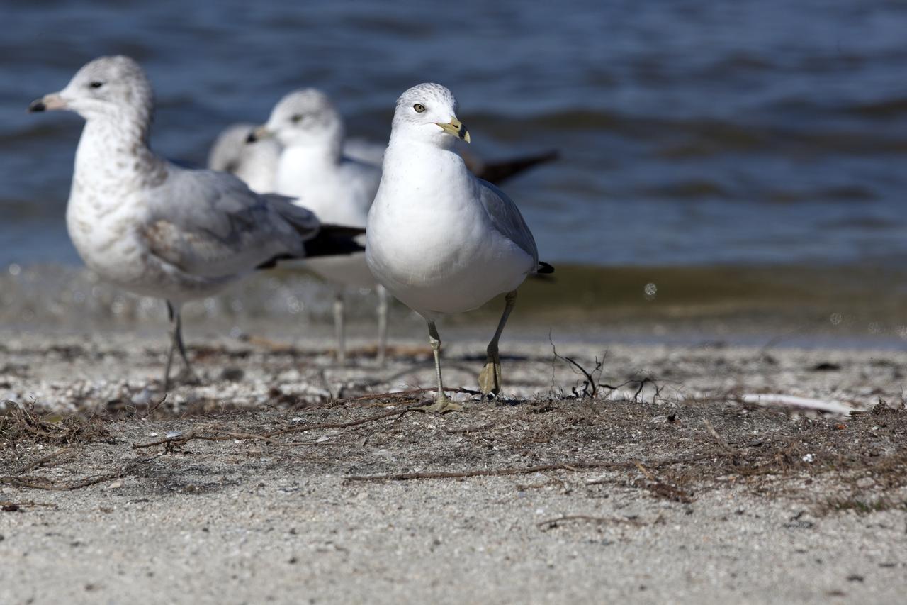
Seagulls gather along a shoreline at NASA's Kennedy Space Center in Florida. Kennedy shares a boundary with the Merritt Island National Wildlife Refuge. The refuge encompasses 140,000 acres that are a habitat for more than 331 species of birds, 31 mammals, 117 fish, and 65 amphibians and reptiles. The marshes and open water of the refuge provide wintering areas for 23 species of migratory waterfowl, as well as a year-round home for great blue herons, great egrets, wood storks, cormorants, brown pelicans and other species of marsh and shore birds.
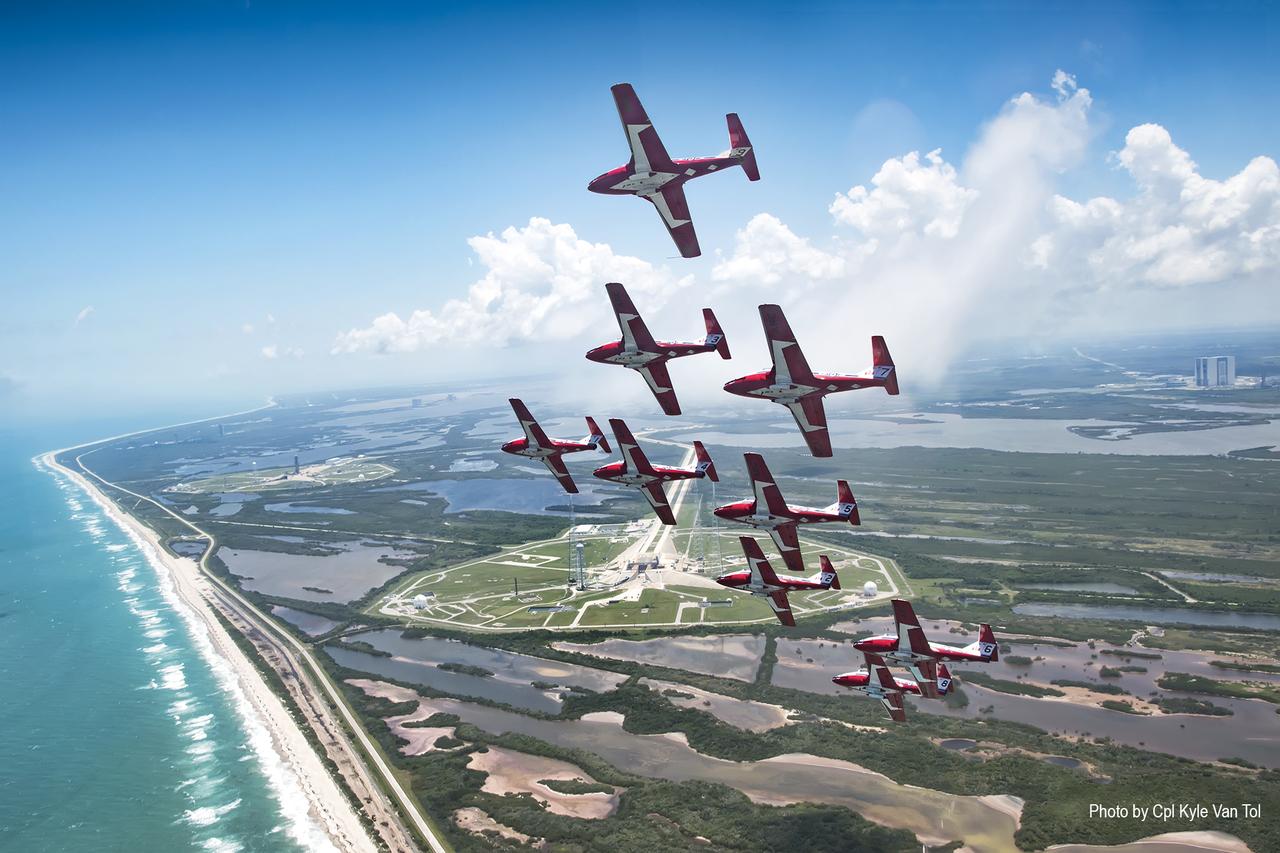
The Canadian Forces Snowbirds fly in Concorde formation over Launch Complex 39B and the Space Coast shoreline at NASA’s Kennedy Space Center in Florida. The Snowbirds, Canada’s air demonstration team, carried out a practice flight over Kennedy and nearby Cape Canaveral Air Force Station in Florida on Wednesday, May 9, 2018, between their scheduled U.S. air shows.
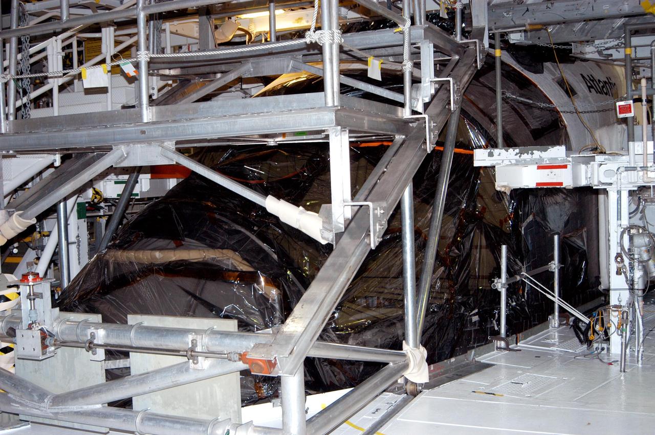
KENNEDY SPACE CENTER, FLA. - In the Orbiter Processing Facility, the nose of orbiter Atlantis is covered in plastic, part of the preparation to protect the vehicles from possible damage by Hurricane Jeanne. The storm ravaged Central Florida for 21 hours as it crossed the shoreline on the east coast Sept. 25-26. Hurricane Jeanne was the fourth hurricane in 6 weeks to batter the state.
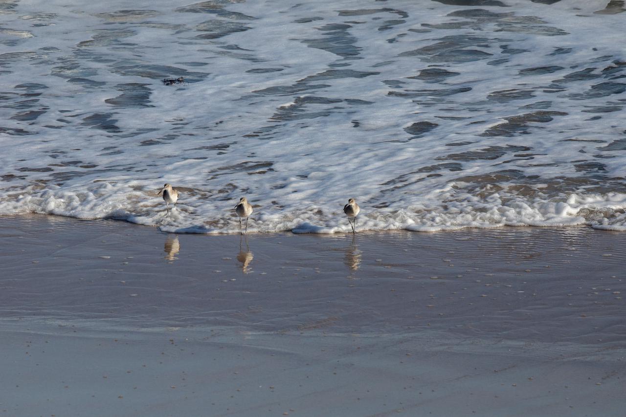
Several sandpipers wade in the shoreline of the Atlantic Ocean near NASA's Kennedy Space Center in Florida on Jan. 11, 2021. The center shares a border with the Merritt Island National Wildlife Refuge. More than 330 native and migratory bird species, 25 mammal, 117 fish and 65 amphibian and reptile species call Kennedy and the wildlife refuge home.
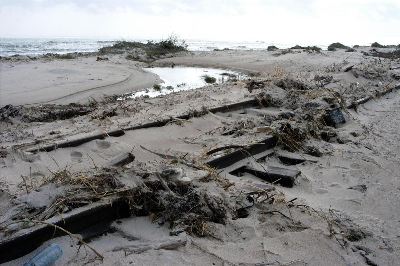
KENNEDY SPACE CENTER, FLA. - The railroad tracks north of Launch Pad 39A are covered with sand and debris left behind by the storm surge and winds of category 3 Hurricane Jeanne. The storm ravaged Central Florida for 21 hours as it crossed the shoreline on the east coast Sept. 25-26. Hurricane Jeanne was the fourth hurricane in 6 weeks to batter the state.
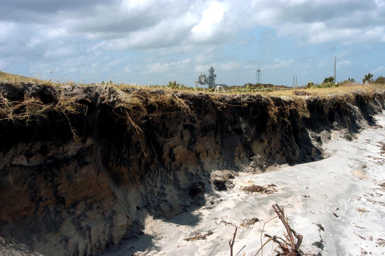
KENNEDY SPACE CENTER, FLA. - The storm surge and high winds of Hurricane Jeanne have replaced the rolling sand dunes on the KSC shoreline east of the launch pads with cliffs of sand, shown here. A category 3 storm, Jeanne barreled through Central Florida Sept. 25-26, the fourth hurricane in 6 weeks to batter the state.
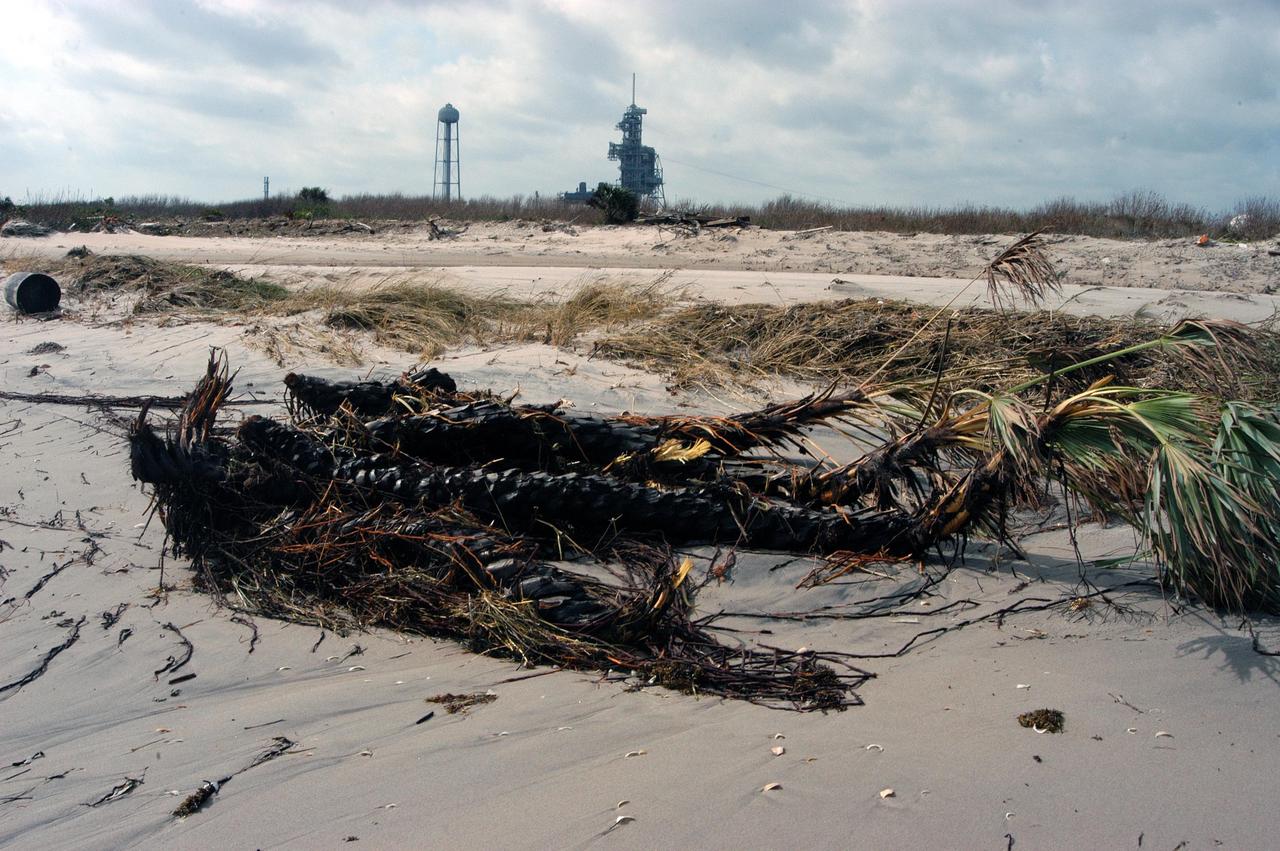
KENNEDY SPACE CENTER, FLA. - Palm trees and other debris litter the shoreline near Launch Pad 39A (in the background) following Hurricane Jeanne. The storm surge and category 3 winds battered the coastline, destroy dunes and beaches. Jeanne barreled through Central Florida Sept. 25-26, the fourth hurricane in 6 weeks to batter the state.
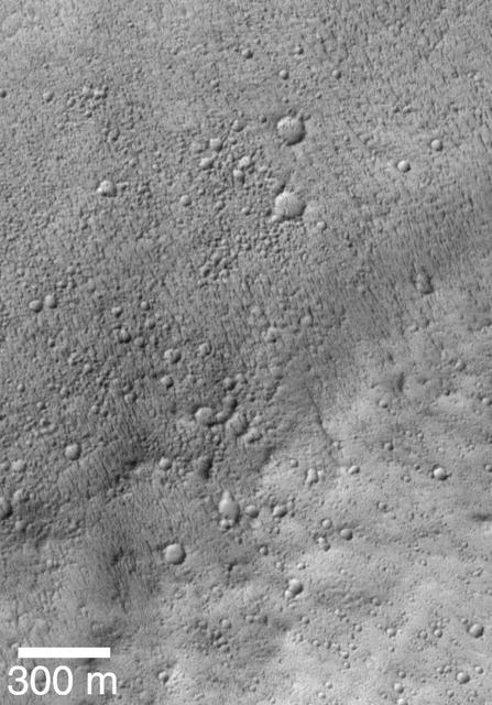
On this part of Mars there is an extensive surface brightness (albedo) boundary. One hypothesis is that this boundary marks a shoreline, from a time long ago when liquid water could have been stable on the surface of Mars. With the resolution of HiRISE we can see that the reason one side of the boundary is darker than the other is due to the many boulders strewn across the darker side. https://photojournal.jpl.nasa.gov/catalog/PIA25183
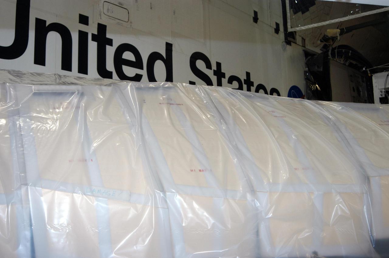
KENNEDY SPACE CENTER, FLA. - In the Orbiter Processing Facility, the wing of the orbiter Atlantis is covered in plastic, part of the preparation to protect the vehicles from possible damage by Hurricane Jeanne. The storm ravaged Central Florida for 21 hours as it crossed the shoreline on the east coast Sept. 25-26. Hurricane Jeanne was the fourth hurricane in 6 weeks to batter the state.
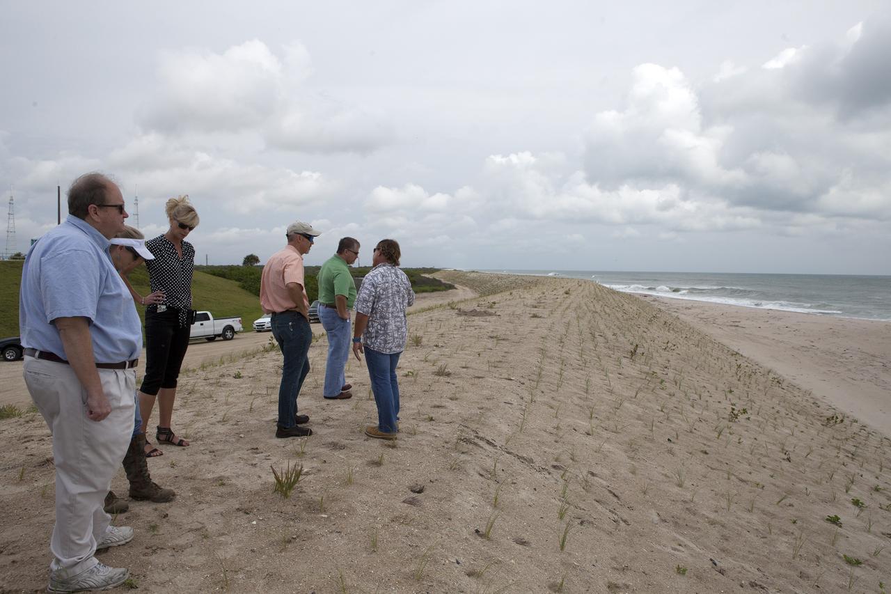
CAPE CANAVERAL, Fla. -- At the Kennedy Space Center in Florida, Burton Summerfield, senior advisor for Institutional Management in the office of the associate director of Kennedy, far left, and others survey restored sand dunes along a 1.2-mile stretch of shoreline near Launch Pads 39A and B. Constant pounding from tropical storms, such as Hurricane Sandy in October of 2012, other weather systems and higher than usual tides, destroyed sand dunes protecting infrastructure at the spaceport. Photo credit: NASA/Dan Casper
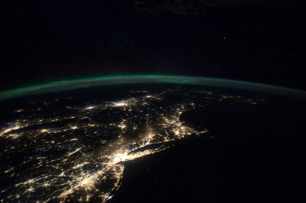
ISS030-E-055791 (29 Jan. 2012) --- This Jan. 29 panorama of much of the East Coast, photographed by one of the Expedition 30 crew members aboard the International Space Station, provides a look generally northeastward: Philadelphia-New York City-Boston corridor (bottom-center); western Lake Ontario shoreline with Toronto (left edge); Montreal (near center). An optical illusion in the photo makes the atmospheric limb and light activity from Aurora Borealis appear “intertwined.”

A group of sandpipers wades in the shoreline of the Atlantic Ocean near NASA's Kennedy Space Center in Florida on Jan. 11, 2021. The center shares a border with the Merritt Island National Wildlife Refuge. More than 330 native and migratory bird species, 25 mammal, 117 fish and 65 amphibian and reptile species call Kennedy and the wildlife refuge home.
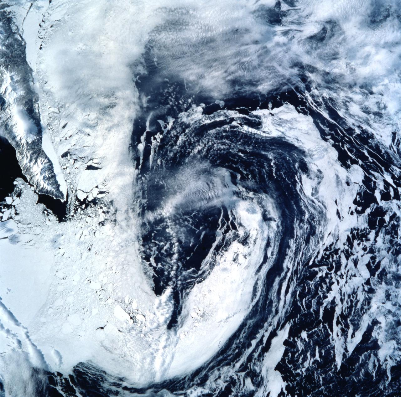
STS099-722-077 (11-22 February 2000) ---Both topography and bathymetry combine with wind and sea currents to produce a pattern of sea ice in the extreme southern Sea of Okhotsk, in this scene photographed by one of the STS-99 crew members aboard the Space Shuttle Endeavour. The rugged shoreline of north Hokkaido and the Kurile Archipelago have channeled northerly winds and surface waters into a gyre here, clearly depicted in the pattern of sea ice.
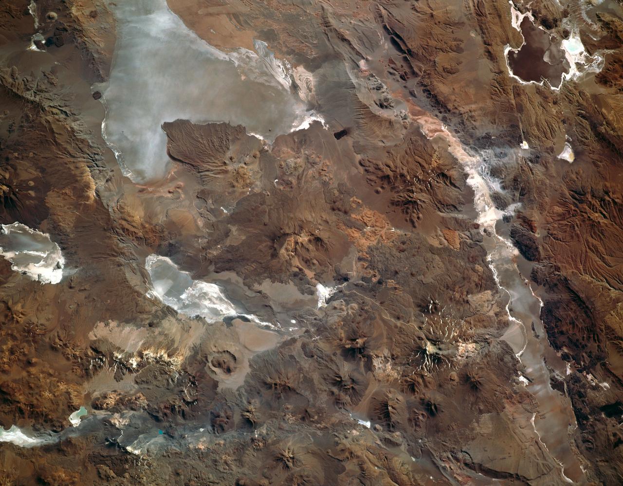
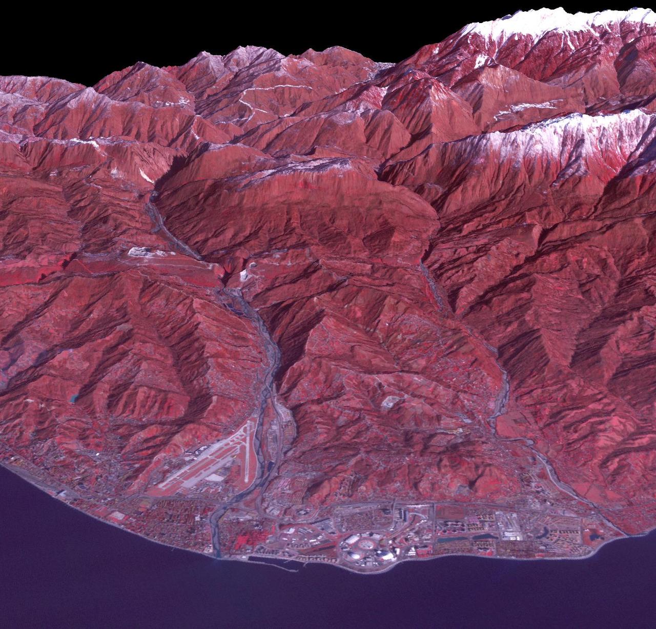
This photograph captures the exotic volcanic terrain of the Altiplano of the Central Andes. Some of the remarkable details include the west-pointing wind streaks, resulting from fine dust being transported across the Andes by high winds; paleto (old) shorelines along the margins of the salars (or dry lake beds), recording the changes in water levels on the high Altiplano; beautiful alluvial fans emptying onto some of the salars; and the hundreds of volcanic land forms which can be mapped and interpreted to help decipher the volcanic history of the region.
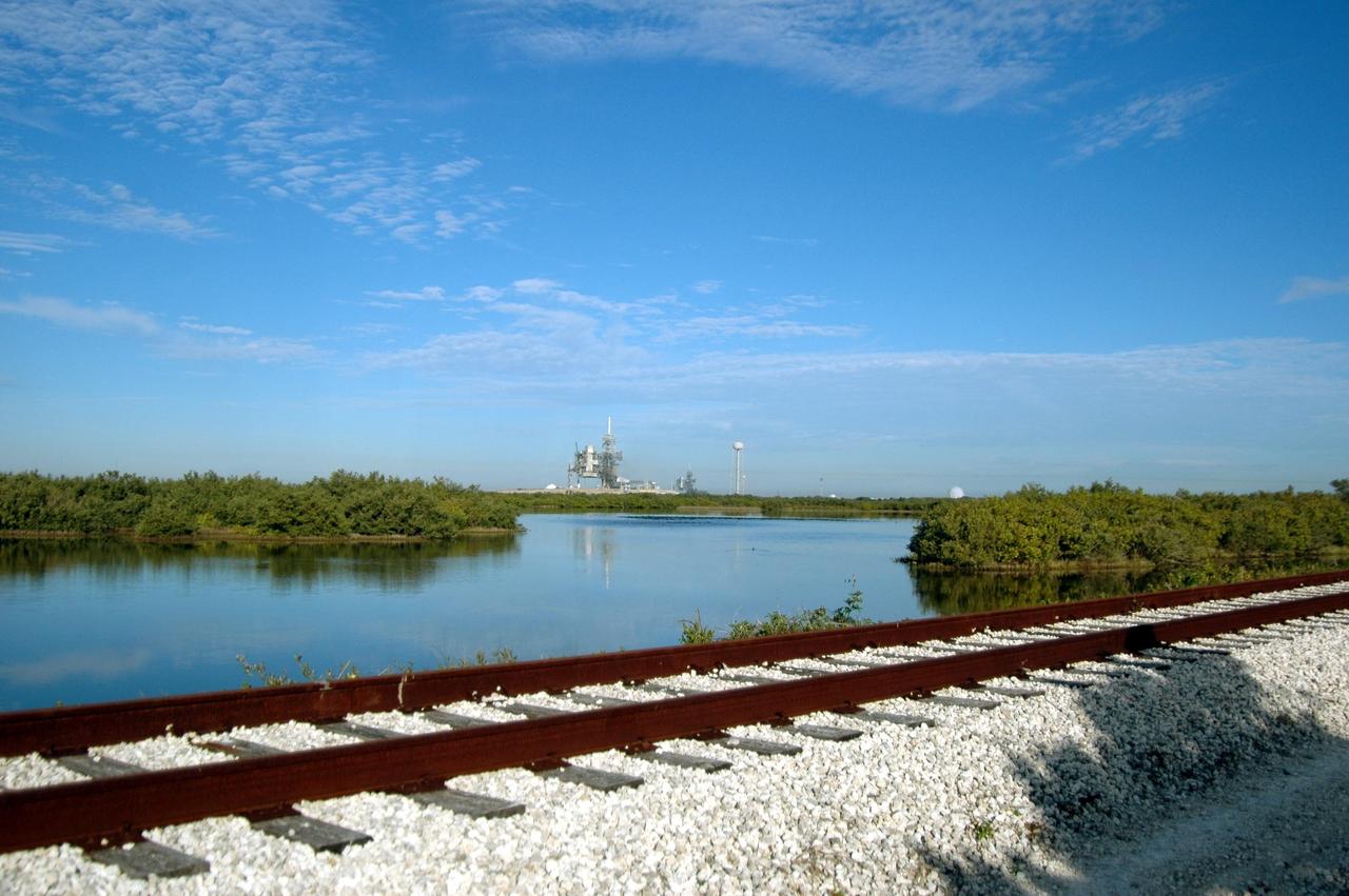
KENNEDY SPACE CENTER, FLA. - Railroad tracks run along the shoreline east of Launch Pads 39A and 39B, seen in the background. North of Launch Pad 39B, the tracks turn west, passing the KSC Shuttle Landing Facility and heading through the Merritt Island National Wildlife Refuge until joining the East Coast Railway north of Titusville, Fla.