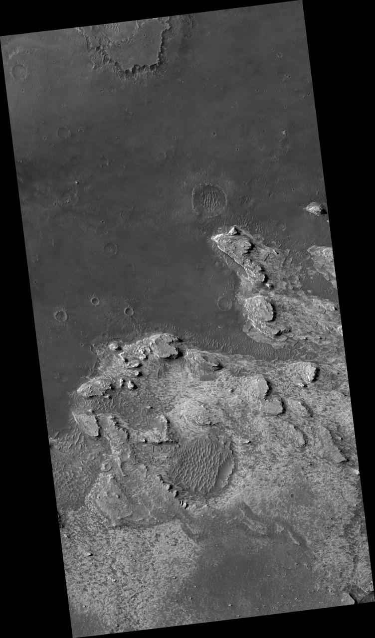
Northeast Sinus Meridiani Landforms
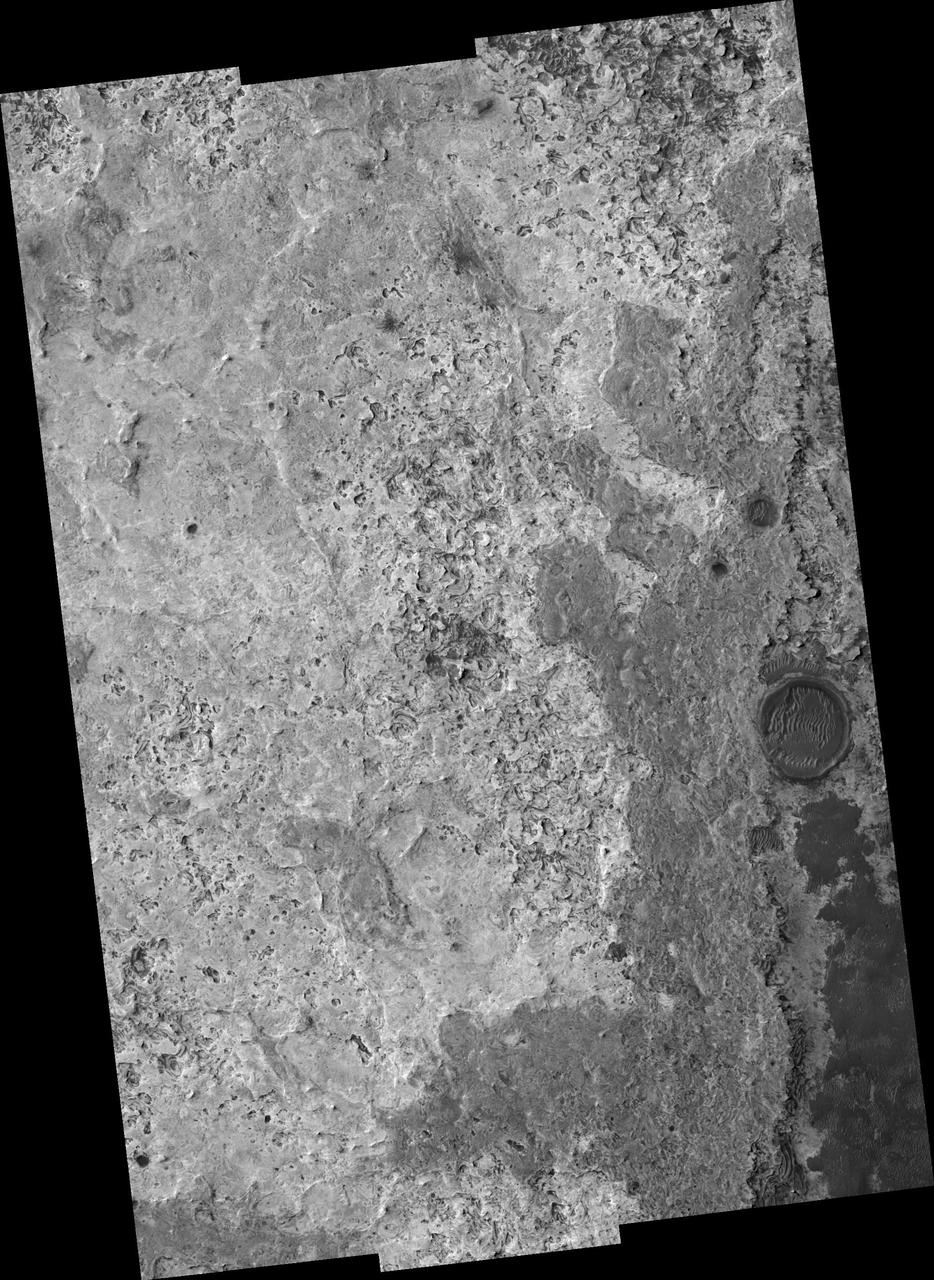
North Sinus Meridiani Landforms
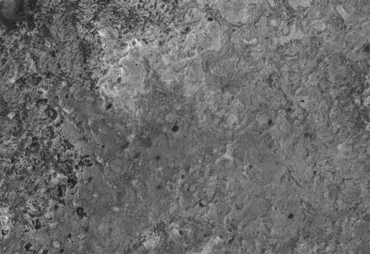
This Mars Global Surveyor (MGS) Mars Orbiter Camera (MOC) image shows a high resolution view of a surface composed almost entirely of eroded, exposed sedimentary rock in the Sinus Meridiani region of Mars. If one could vacuum up all of the dark sand and dust that covers the rocks at the Mars Exploration Rover, Opportunity, site, one might find a surface similar to that shown here. Note, just right of center, the occurrence of a circular feature. This is the site of a filled and buried meteor impact crater. Filled and buried craters are common among the sedimentary rocks of the Meridiani region. Location near: 1.5°N, 359.4°W Image width: ~3 km (~1.9 mi) Illumination from: upper left Season: Northern Summer http://photojournal.jpl.nasa.gov/catalog/PIA07887
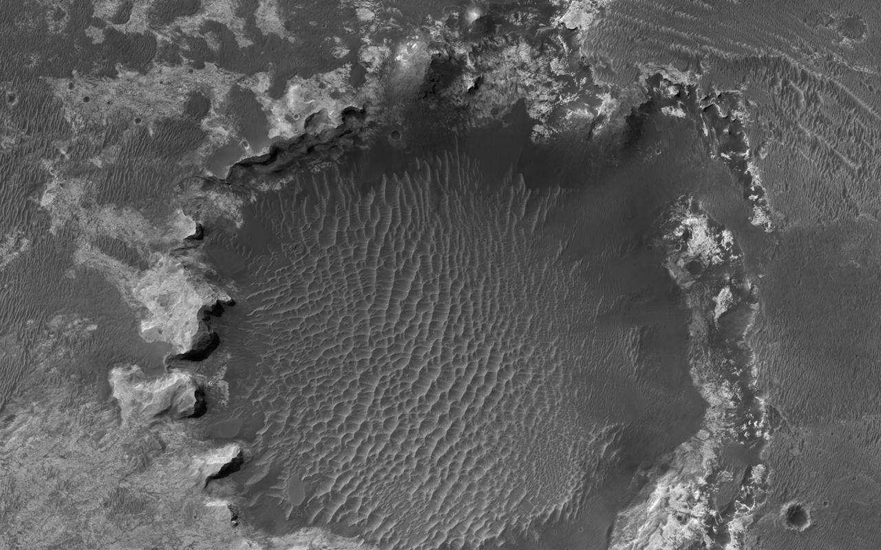
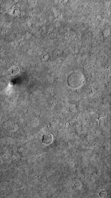
NASA Mars Reconnaissance Orbiter spies an impact crater located in northern Sinus Meridiani has formed along the boundary of two different terrain units.
This MOC image shows a dust devil traveling across a plain west-southwest of Schiaparelli Crater, in far eastern Sinus Meridiani. The dust devil is casting a shadow toward the northeast, just south below of an egg-shaped crater
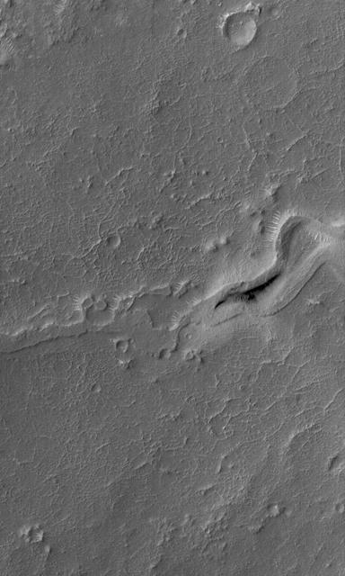
This MOC image shows the inverted, eroded remains of a channel, now standing as a complex ridge that runs across the middle of this scene, in dust-mantled terrain west of Sinus Meridiani, Mars
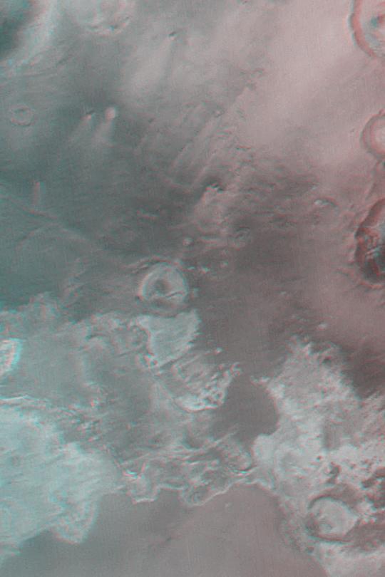
The light-toned materials at the bottom end of this anaglyph fomr NASA Mars Global Surveyor are considered to be thick exposures of sedimentary rock. 3D glasses are necessary to view this image.
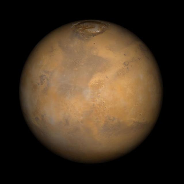
Somewhere down there sits the Mars Pathfinder lander and Sojourner rover. This Mars Global Surveyor Mars Orbiter Camera view of the red planet shows the region that includes Ares Vallis and the Chryse Plains upon which both Mars Pathfinder and the Viking 1 landed in 1997 and 1976, respectively. Acidalia Planitia is the dark surface that dominates the center left. The Pathfinder site is immediately south of Acidalia, just left of center in this view. Also shown--the north polar cap is at the top, and Arabia Terra and Sinus Meridiani are to the right. The bluish-white features are clouds. This is a color composite of 9 red and 9 blue image strips taken by the Mars Global Surveyor Mars Orbiter Camera on 9 successive orbits from pole-to-pole during the calibration phase of the mission in March 1999. The color is computer-enhanced and is not shown as it would actually appear to the human eye. http://photojournal.jpl.nasa.gov/catalog/PIA02000
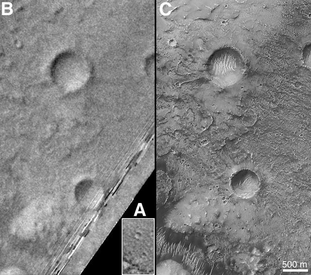
On Earth, the longitude of the Royal Observatory in Greenwich, England is defined as the "prime meridian," or the zero point of longitude. Locations on Earth are measured in degrees east or west from this position. The prime meridian was defined by international agreement in 1884 as the position of the large "transit circle," a telescope in the Observatory's Meridian Building. The transit circle was built by Sir George Biddell Airy, the 7th Astronomer Royal, in 1850. (While visual observations with transits were the basis of navigation until the space age, it is interesting to note that the current definition of the prime meridian is in reference to orbiting satellites and Very Long Baseline Interferometry (VLBI) measurements of distant radio sources such as quasars. This "International Reference Meridian" is now about 100 meters east of the Airy Transit at Greenwich.) For Mars, the prime meridian was first defined by the German astronomers W. Beer and J. H. Mädler in 1830-32. They used a small circular feature, which they designated "a," as a reference point to determine the rotation period of the planet. The Italian astronomer G. V. Schiaparelli, in his 1877 map of Mars, used this feature as the zero point of longitude. It was subsequently named Sinus Meridiani ("Middle Bay") by Camille Flammarion. When Mariner 9 mapped the planet at about 1 kilometer (0.62 mile) resolution in 1972, an extensive "control net" of locations was computed by Merton Davies of the RAND Corporation. Davies designated a 0.5-kilometer-wide crater (0.3 miles wide), subsequently named "Airy-0" (within the large crater Airy in Sinus Meridiani) as the longitude zero point. (Airy, of course, was named to commemorate the builder of the Greenwich transit.) This crater was imaged once by Mariner 9 (the 3rd picture taken on its 533rd orbit, 533B03) and once by the Viking 1 orbiter in 1978 (the 46th image on that spacecraft's 746th orbit, 746A46), and these two images were the basis of the martian longitude system for the rest of the 20th Century. The Mars Global Surveyor (MGS) Mars Orbiter Camera (MOC) has attempted to take a picture of Airy-0 on every close overflight since the beginning of the MGS mapping mission. It is a measure of the difficulty of hitting such a small target that nine attempts were required, since the spacecraft did not pass directly over Airy-0 until almost the end of the MGS primary mission, on orbit 8280 (January 13, 2001). In the left figure above, the outlines of the Mariner 9, Viking, and Mars Global Surveyor images are shown on a MOC wide angle context image, M23-00924. In the right figure, sections of each of the three images showing the crater Airy-0 are presented. A is a piece of the Mariner 9 image, B is from the Viking image, and C is from the MGS image. Airy-0 is the larger crater toward the top-center in each frame. The MOC observations of Airy-0 not only provide a detailed geological close-up of this historic reference feature, they will be used to improve our knowledge of the locations of all features on Mars, which will in turn enable more precise landings on the Red Planet by future spacecraft and explorers. http://photojournal.jpl.nasa.gov/catalog/PIA03207